Click Me for my Online Gallery
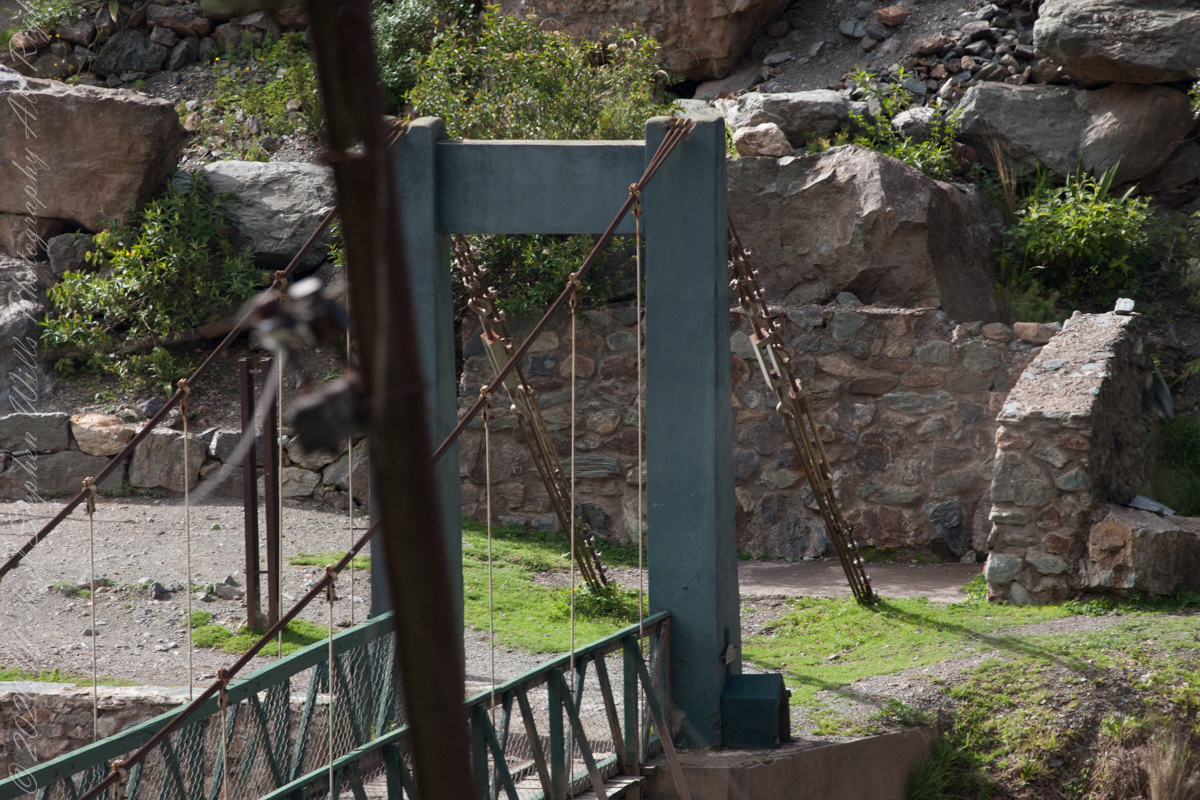
For some Inca Trail routes this bridge is the beginning. Our guide mentioned this crossing was used by Inca kings though this is a modern bridge.

Crossing of Kings
For some Inca Trail routes this bridge is the beginning. Our guide mentioned this crossing was used by Inca kings though this is a modern bridge.
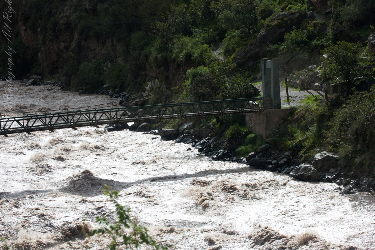
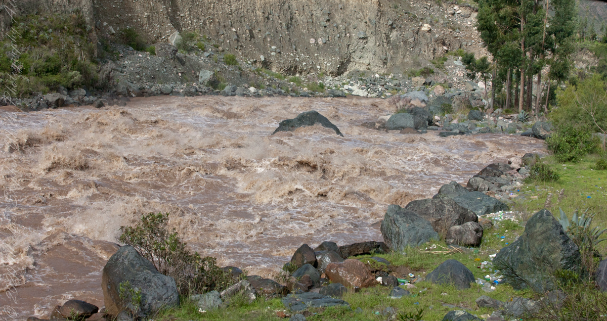
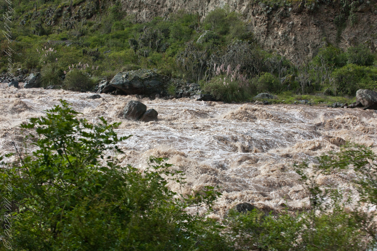
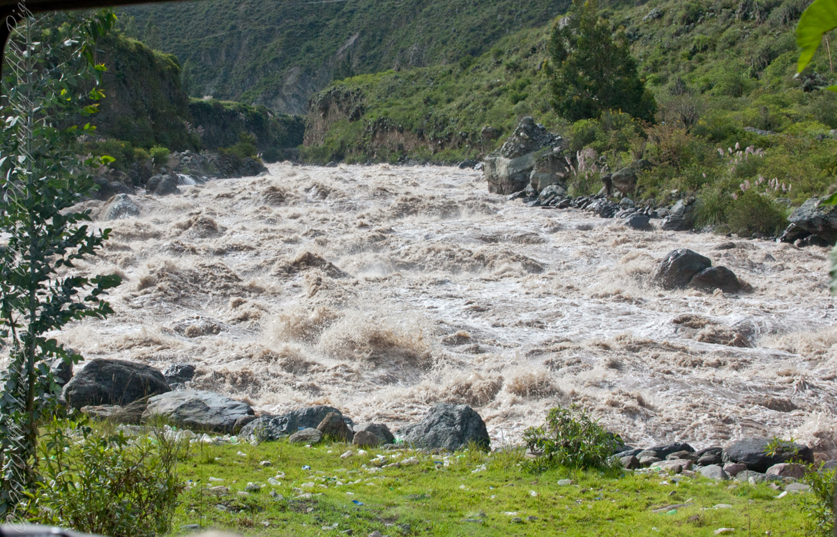
Urubamba River or Vilcamayo River (possibly from Quechua Willkamayu, for “sacred river”)
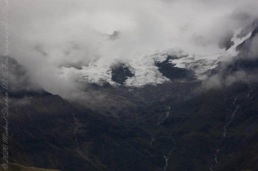
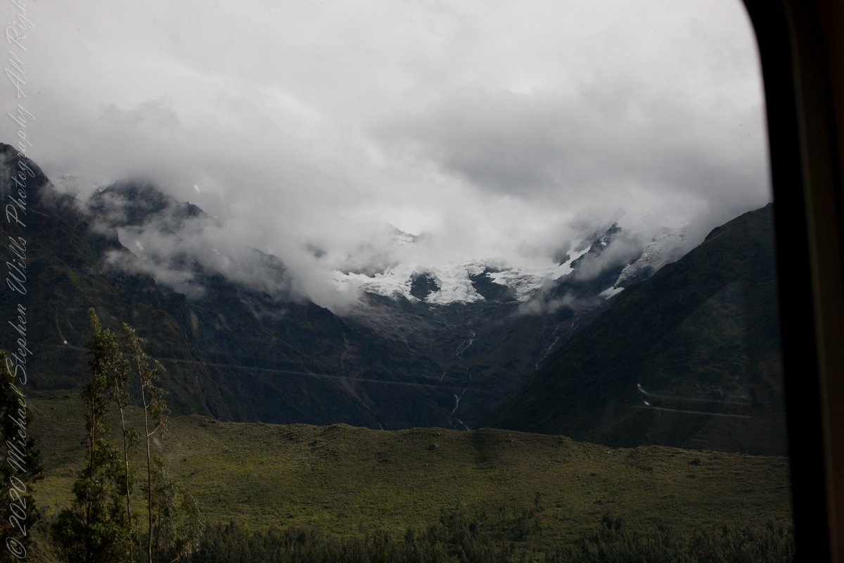
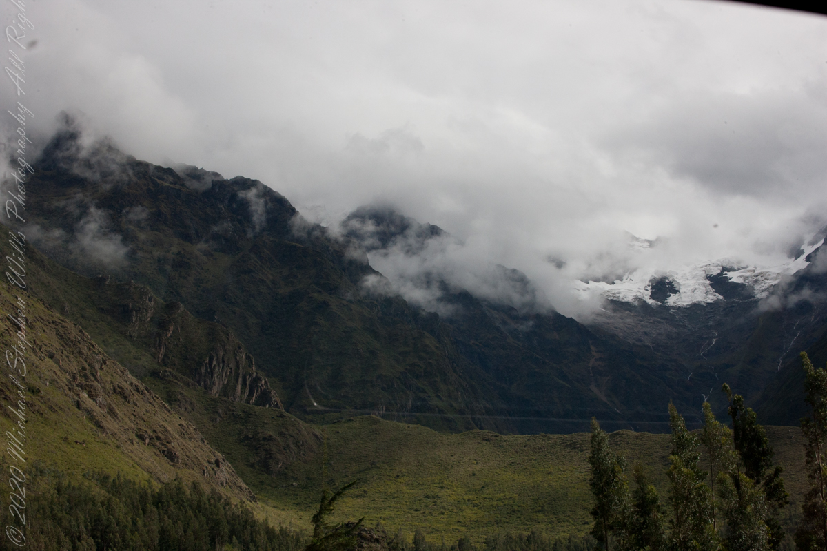
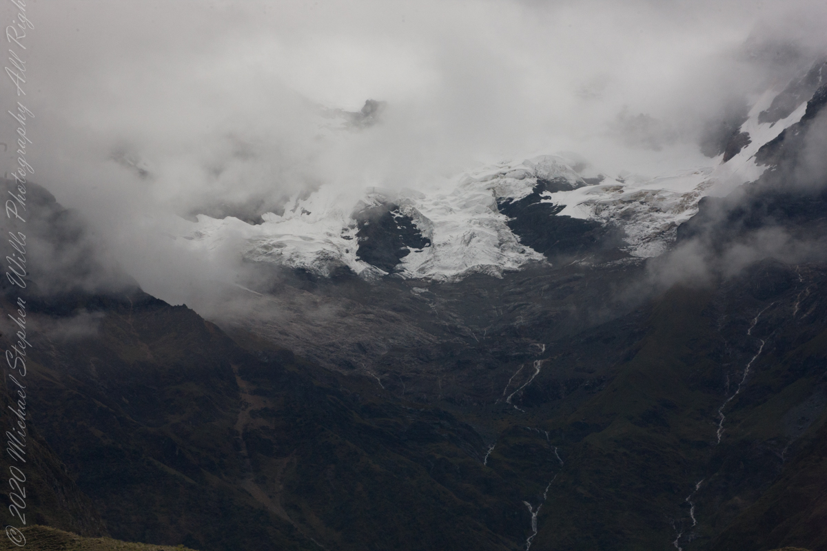
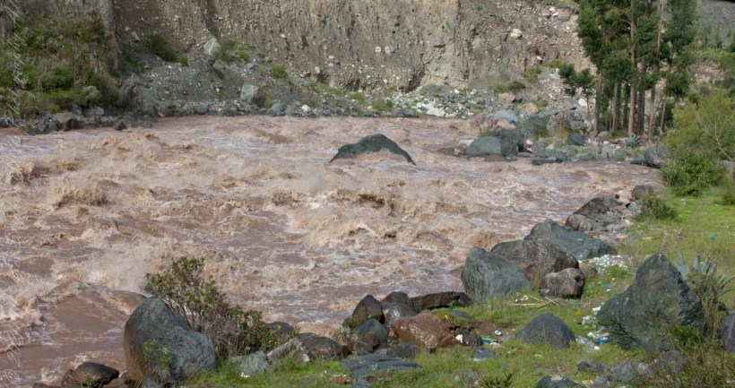
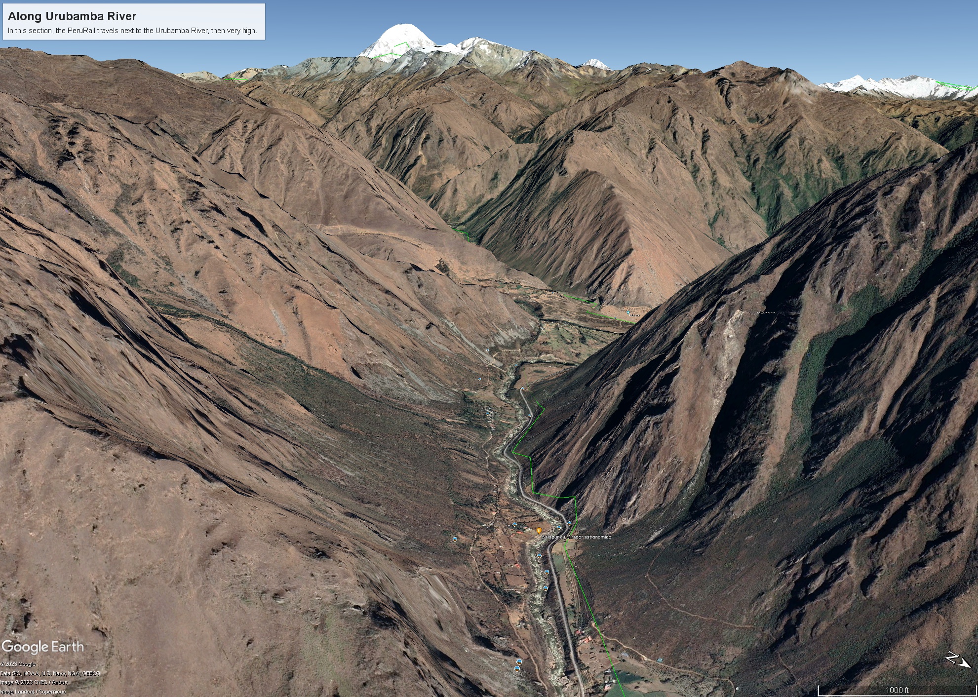
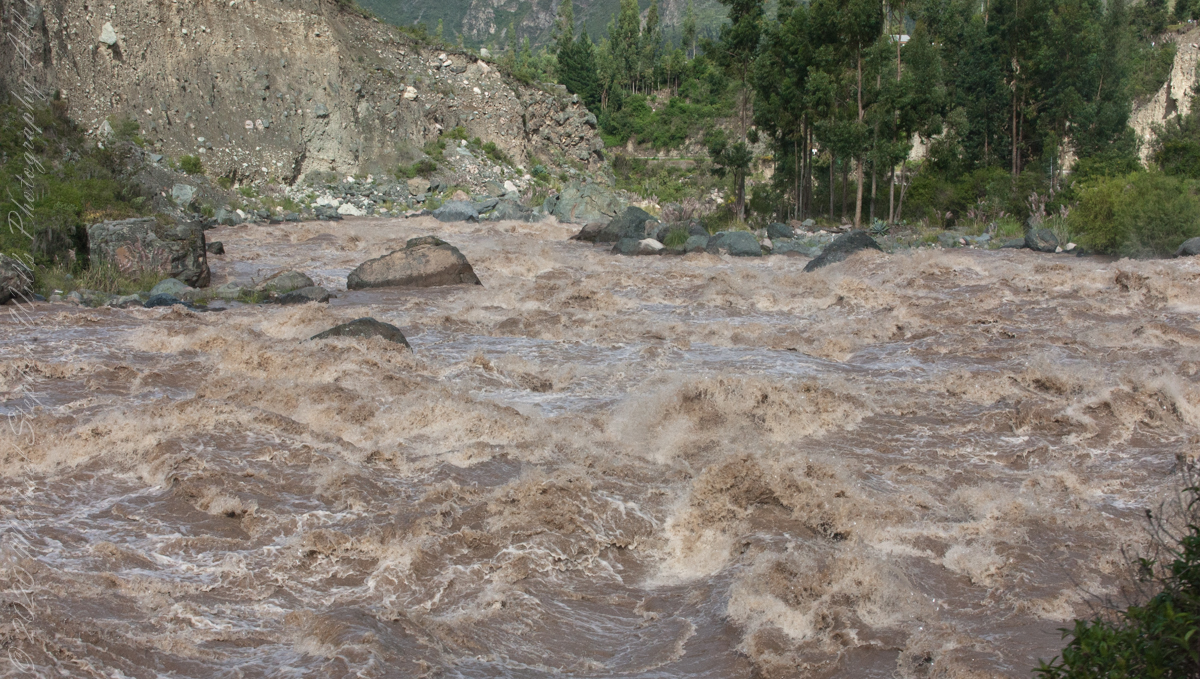
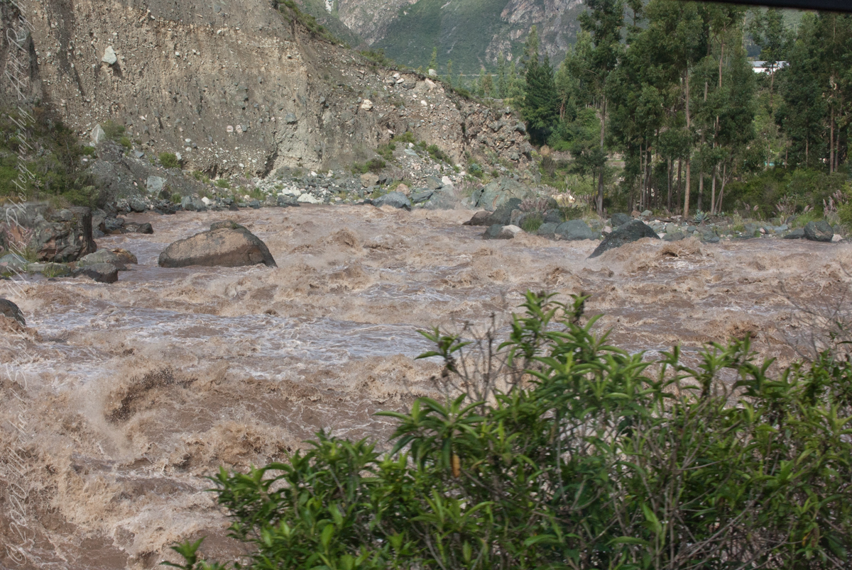
Our guide distracted us from the river by pointing out this glacier nestled among clouds. The following image from GoogleEarth features the peak, named Huayanay, on the upper left. PeruRail track follows the Sacred Valley floor at the foot of the cliff seen lower left and proceeding to the lower right. Another valley starts from Sacred Valley and goes south, carved by the Cusichaca river. Look closely to see the Patallacta Inca ruins above that same river. These were not visible from the train. A few minutes later we viewed another Inca ruin site.
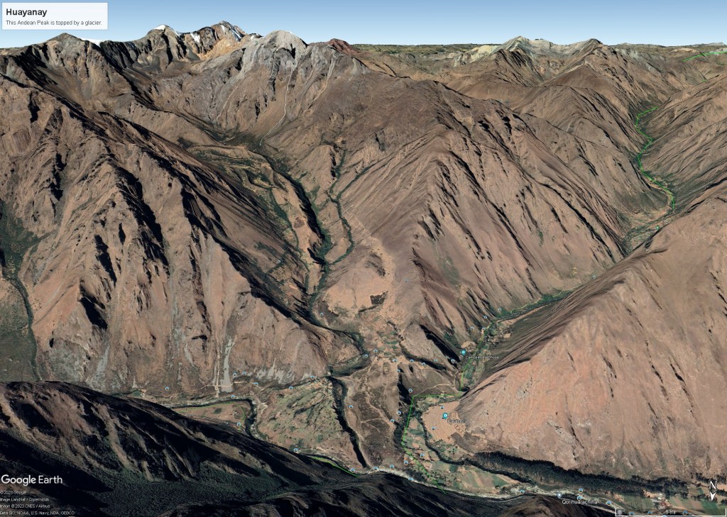
“Huayanay (Quechua for swallow) is a mountain and a massif in the Vilcabamba mountain range in the Andes of Peru, about 5,464 metres (17,927 ft) high.”
“The massif is located in the Cusco Region, Anta Province, Huarocondo District and in the Urubamba Province, Ollantaytambo District. Huayanay lies east of the Andean peaks Salcantay and Paljay.“
Urubamba River or Vilcamayo River (possibly from Quechua Willkamayu, for “sacred river”)
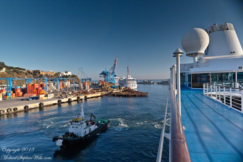
Next, PeruRail traversed a narrow valley carved by the Urubamba River. Here is an overview for our course taken from Google Earth.
“The Urubamba River or Vilcamayo River (possibly from Quechua Willkamayu, for “sacred river”) is a river in Peru. Upstream it is called Vilcanota River (possibly from Aymara Willkanuta, for “house of the sun”). Within the La Convención Province the naming changes to Urubamba. A partially navigable headwater of the Amazon River, it rise in the Andes to the southeast of Cuzco. It originates on the slopes of Khunurana in the Puno Region, Melgar Province, near the La Raya pass. It flows north-north-west for 724 kilometers before coalescing with the Tambo River to form the Ucayali River.”
“The Urubamba is divided into Upper Urubamba and Lower Urubamba, the dividing feature being the Pongo de Mainique, an infamous whitewater canyon.“
“The Upper Urubamba (Alto Urubamba) valley features a high population and extensive irrigation works. A number of ruins of the Inca Empire lie in the Sacred Valley, including the Incan city of Machu Picchu, Patallaqta, Pikillaqta and Raqch’i. The Salcca-Pucara hydroelectric project is associated with the river as well.“
“The Lower Urubamba (Bajo Urubamba) is relatively undeveloped and features a significant indigenous population consisting of the Campa tribes, principally the Machiguenga (Matsigenka) and Asháninka. The economy is based on forestry and the nearby Camisea Gas Project. The main settlement in the region is the town of Sepahua.“
“The lower Urubamba River was mapped for the first time in 1934 by Edward Kellog Strong III. He and two friends from Palo Alto, California, Art Post and Gain Allan John, navigated the river with its ferocious rapids by canoe and balsa rafts provided by the indigenous people. The mapping was done at the request of the Peruvian military when they heard of the expedition planned by the three 18-year-olds.”
“John Walter Gregory, a British geologist, drowned in the river on June 2, 1932 while on a geological expedition to the Andes“
“It was turned over to the military when the boys arrived in Iquitos. It was the only map of the river until it was mapped by satellite many years later. The names and places on the latest map came from the original map drawn by Edward Strong.“
at the roundabout
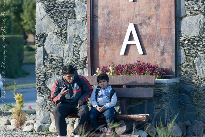
On our way back from “The Train at the End of the World” and sailing the Beagle Channel, these two young people came into view. Sitting at the foot of the a tower welcoming airport arrivals, who must transit this roundabout, is a pair of young people. In my imagination they were brothers waiting for a ride. In the first long wide shot the older is taking their selfie with the Ushuaia.
Here we at at the “center” of this city set spectacularly against the Fuegian Andes, the southern continuation of the Andes mountain range immediately south of the Strait of Magellan. with a West-East orientation. They occupy the mountainous and mountainous portion of the southern archipelago of Tierra del Fuego.
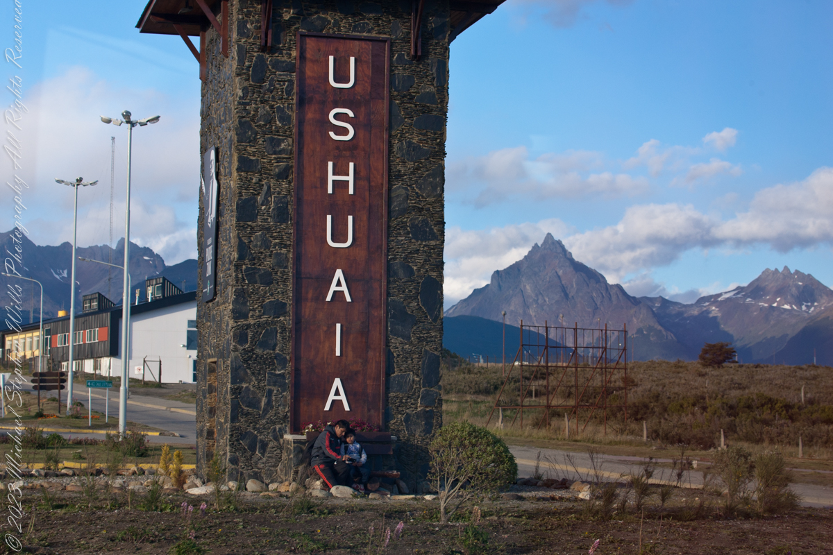
In this second, close photo, he is talking to the ride on his smart phone, after sending the selfie. The roundabout is named “Hipólito Yrigoyen” after an Argentine politician twice elected President.

Here is more information about the man:
Juan Hipólito del Sagrado Corazón de Jesús Yrigoyen (Spanish pronunciation: [iˈpolito iɾiˈɣoʝen]; 12 July 1852 – 3 July 1933) was an Argentine politician of the Radical Civic Union and two-time President of Argentina, who served his first term from 1916 to 1922 and his second term from 1928 to 1930. He was the first president elected democratically by means of the secret and mandatory male suffrage established by the Sáenz Peña Law of 1912. His activism was the prime impetus behind the passage of that law in Argentina.
Known as “the father of the poor”, Yrigoyen presided over a rise in the standard of living of Argentina’s working class together with the passage of a number of progressive social reforms, including improvements in factory conditions, regulation of working hours, compulsory pensions, and the introduction of a universally accessible public education system.
Yrigoyen was the first nationalist president, convinced that the country had to manage its own currency and, above all, it should have control of its transportation and its energy and oil exploitation networks.
Between the 1916 general election and the 1930 coup d’etat, political polarization was on the rise. Personalist radicalism was presented as the “authentic expression of the nation and the people” against the “oligarchic and conservative regime”. For the ruling party, the will of the majorities prevailed over the division of powers. The opposition, on the other hand, accused the Executive Branch of being arrogant and demanded greater participation from Congress, especially in matters such as the conflictive federal interventions.
….and a photographic gallery.
As of April 5th 1181 is the count of subscribers to this blog, an interesting number. The individual numerals sum to a prime number, 11. I appreciate each and every “1” added together, you readers. Thank You.
Coincidentally, yesterday 1,200 of my blogs are published….Here is a selection of images from these posts.


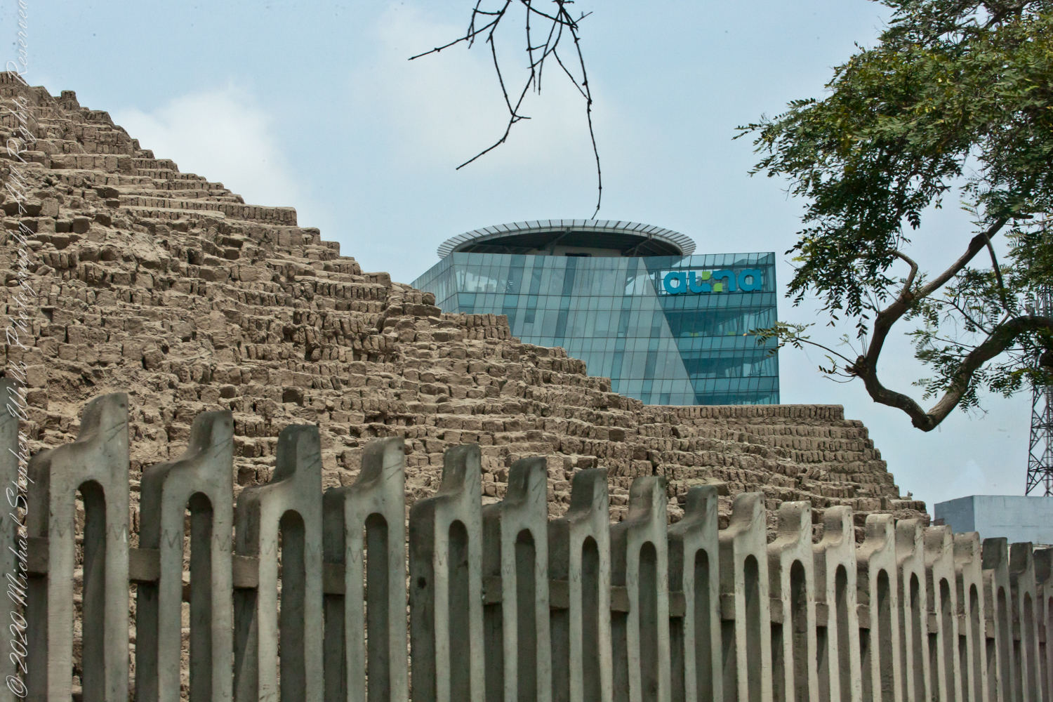
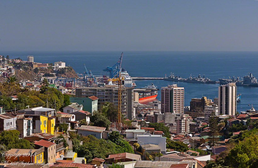
Lima is home to 10 million Peruvians and over 1000 historical sites.
View of Clinica Delgado (hospital) from Lima Peru’s Elias Aguirre (street), Huaca Pucllana filling the foreground. Huacas are commonly located in nearly all regions of Peru outside the deepest parts of the Amazon basin in correlation with the regions populated by the pre-Inca and Inca early civilizations. They can be found in downtown Lima today in almost every district, the city having been built around them. Huaca Pucllana, located in Miraflores district, is an adobe and clay pyramid built from seven staggered platforms. It served as an important ceremonial and administrative center for the advancement of the Lima Culture, a society which developed in the Peruvian Central Coast between the years of 200 AD and 700 AD.
This is the New York Times article that inspired me to remember visiting Huaca Pucllana during our February 2016 tour of Lima, Peru. “3,000 Years of History Are Literally Just Beneath Our Feet.”

Booking our February/March 2016 passage on the Oceania Regatta from Lima, Peru to Buenos Aires, Argentina we started early, Spring 2017. We made two excellent choices: a stateroom with balcony on the port side. Waking each morning we were treated to views of the shoreline. On the morning of February 15, 2016 as we sailed the Chacao Channel toward Puerto Montt I was up 4:15 am before the sun rose to photograph our approach to the city.
I knew a classic 8,701 foot high stratovolcano topped with glaciers, named Orsorno, was out there and, amazingly, appeared on the horizon, seventy five miles distant to the northeast outlined by the gathering dawn. The sky was just brightening from total darkness at this time.

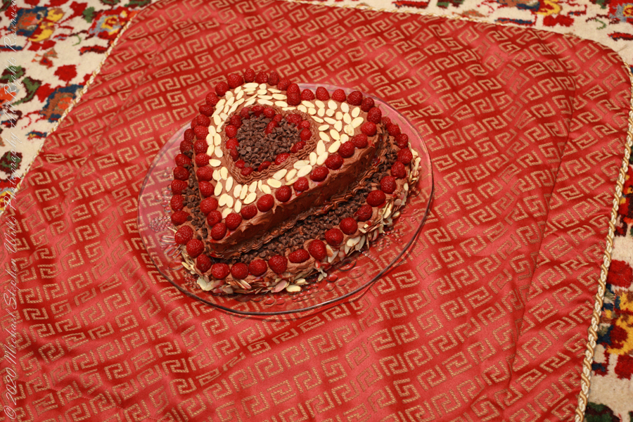
Happy Valentine’s Day with the original Moby Dick
Thinking about the Aran Islands for my posts, “Killeany Bouy” and “Inisheer Welcomes the 2014 Gaeltacht Irish Football champions” brought me back to Isla Mocha.
Herman Melville’s thoughts were in and around this island off the central Chilean coast when he penned “Moby Dick” in the mid-nineteenth century while sitting in the city of Boston. He was brought Moby Dick not only by his own experiences on a whaling ship, almost certainly Melville owned a copy of Jeremiah N. Reynolds’ “Mocha Dick: Or The White Whale of the Pacific: A Leaf from a Manuscript Journal,” an true-life account of adventures around Isla Mocha. Sometime around 1810 Reynolds personally experienced encounters with Mocha Dick after the crew of an Antarctic expedition mutinied, stranding him at Valparaíso, Chile where he remained for two years.
Located 38°21’45.62″S, 73°55’6.91″W, around 8 miles in size north to south, 3.5 miles east to west Isla Mocha is surprisingly simple to find. A ridge of mountains run the north south axis, just 20 miles off the coast, a ship following the coast will find it easily, as I did from the balcony of the Oceania Regatta during a “sea day” of travel between Valparaiso and Puerto Montt.
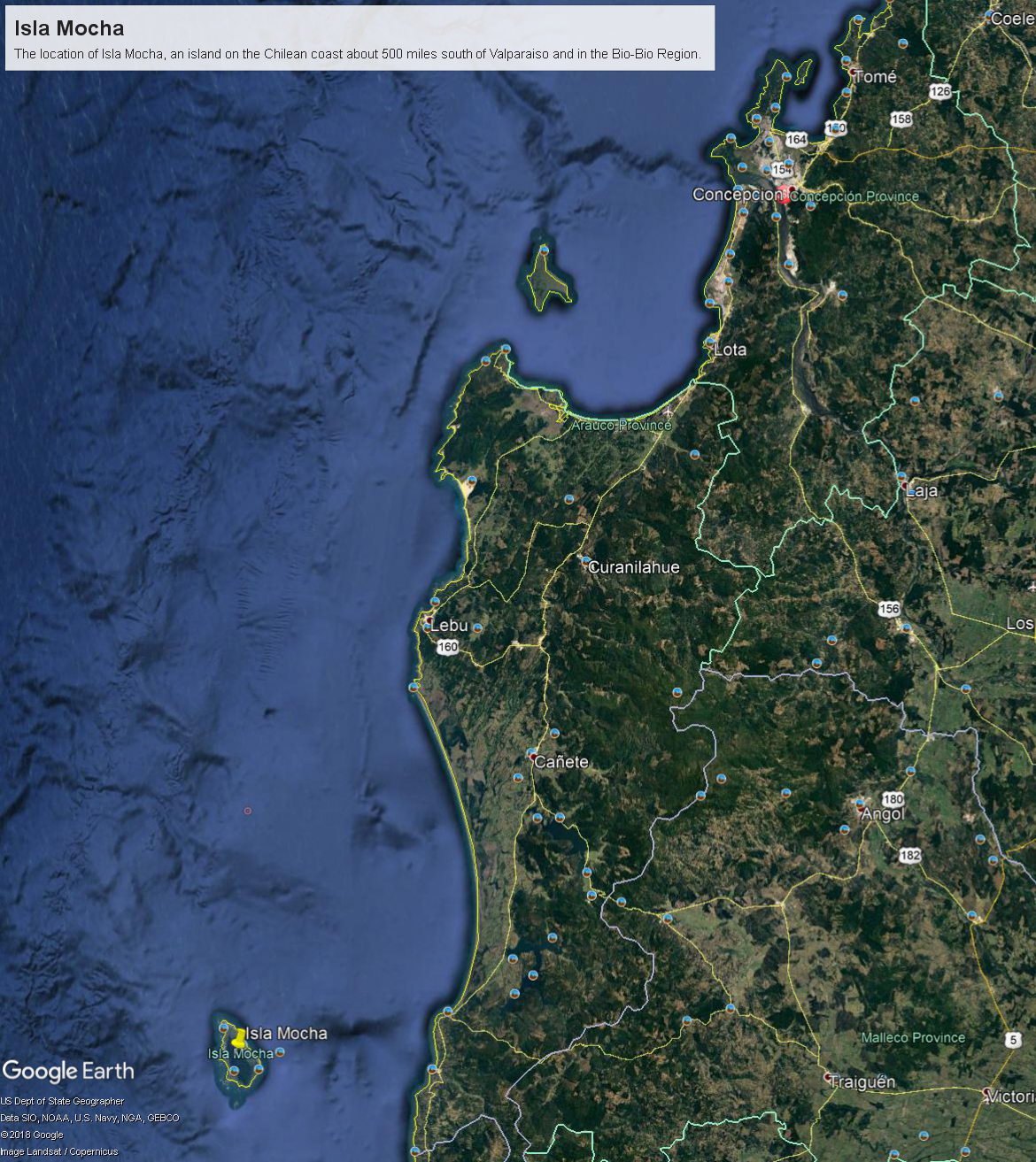
Since waking that day I was on the lookout for Isla Mocha. In preparation for our month-long cruise around South America every mile of our itinerary was scoured for interesting sights, experiences and information. When I first learned of Isla Mocha (Mocha Island in English) and the connection with Melville reading about it in Boston, just as I was in Ithaca, one of my goals for that day was to catch sight of Isla Mocha as it rose from the horizon.
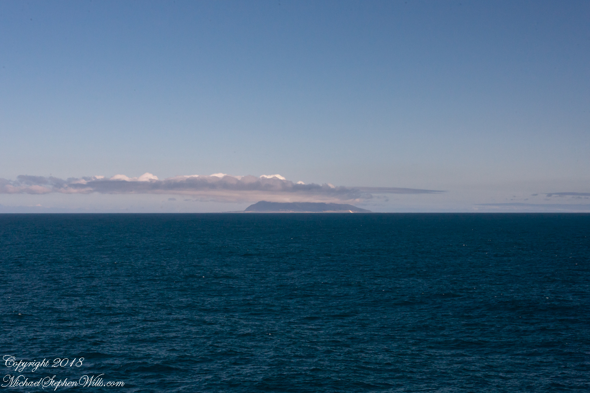
My goal was made easier for the cloud formation from the island mountains. Here is my first photograph, taken from our balcony on the port side. I chose the port side just for the landward view as the ship progressed southward on the western coast of South America. The Canon EOS-1Ds Mark III was tripod mounted with an EF 70-300 f4-5.6L variable lens set to 70 mm. We are northwest of the island with the coast just visible.
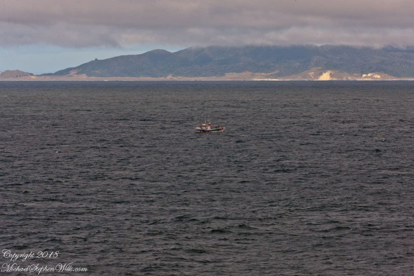
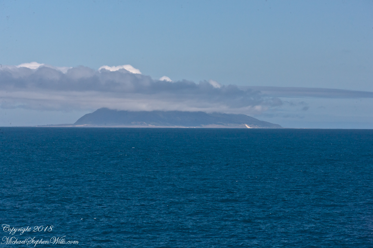
Another view with 188 mm focal length. The ship must have turned eastward, as the view progressed the island came closer. It was a fantastic thought to cruise above the subduction zone where the Nazca plate dives beneath the South American Plate. In the distance, on a clear day, the volcanic cones Villarrea and Quertrupillan are visible.
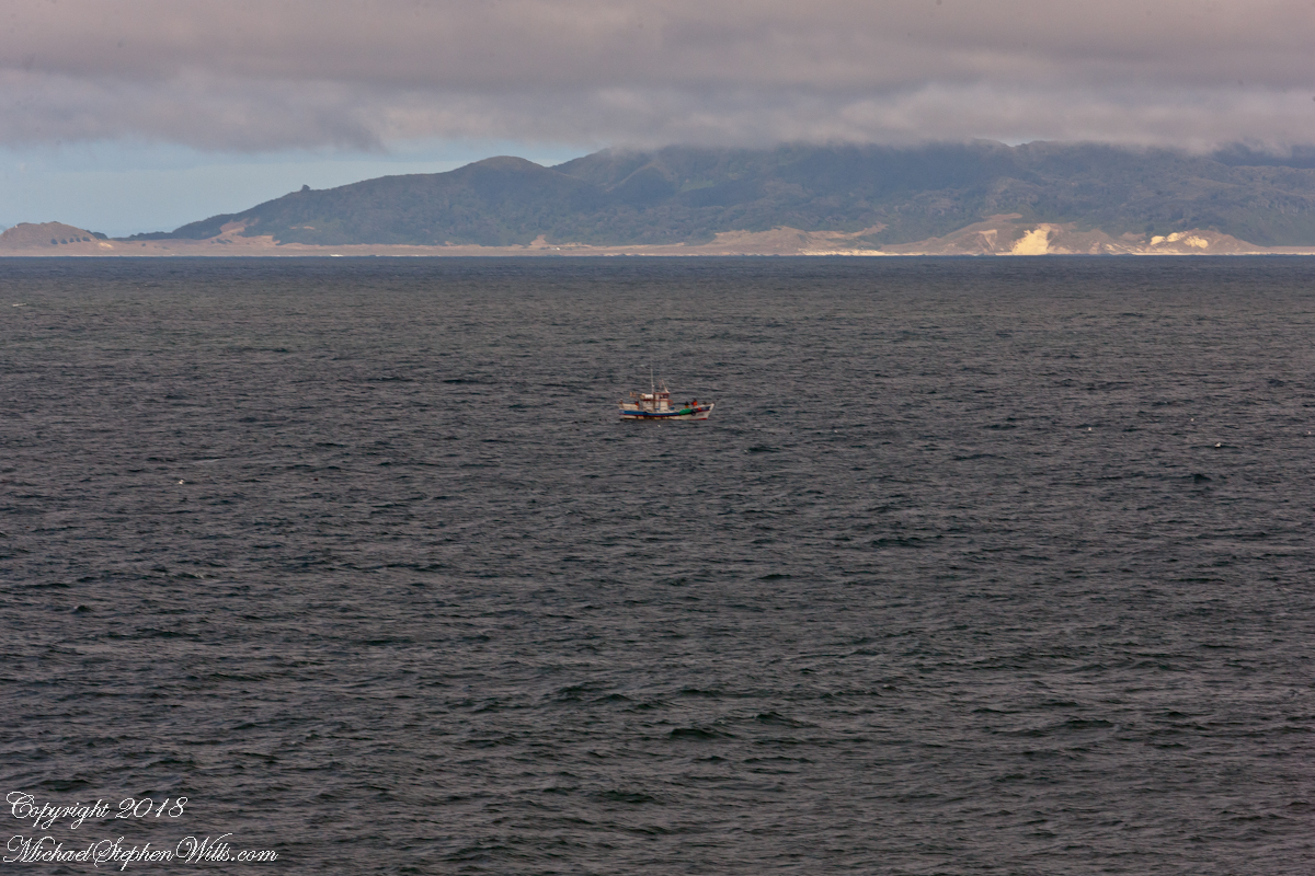
With the island due east, only a few miles away, the lens at 221 mm focal length. A fisherman is having an easier day in a calm sea. The indigenous people told stories of the souls of the dead travelling west to Isla Mocha. Pirates used the island as a resupply base. The fishing boat was the only sign of life.
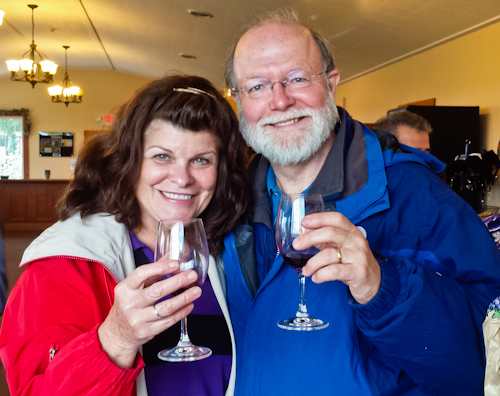
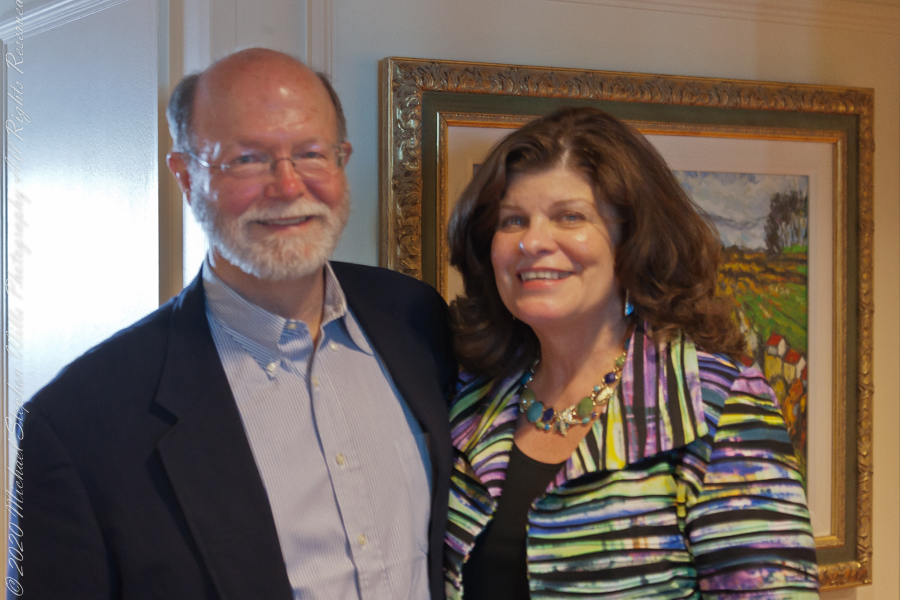
That was February 14th Valentine’s Day. With Isla Mocha passing into the distance I changed for an evening with Pam. Here we are headed to dinner, somewhere off the coast of Chile’s Lakes (and volcano) region.


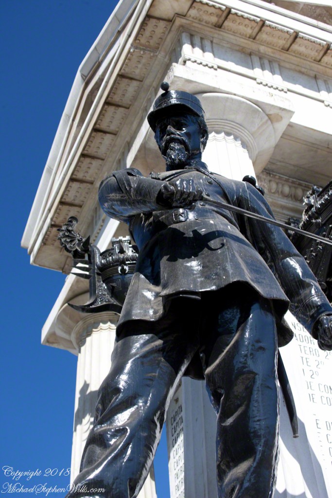
Captain Arturo Prat and Chilean Naval Tradition
After reading my last post “Valparaiso Connections VII” why Captain Pratt was so honored by the nation?
On that morning, May 21, 1879 the two Chilean ships blockading Iquique port were surprised by two Peruvian warships from the port of Callao, the monitor Huáscar and armored frigate Independencia.
Arturo Prat commanded the Chilean corvette Esmeralda.
Carlos Condell de la Haza was Covadonga’s commander.
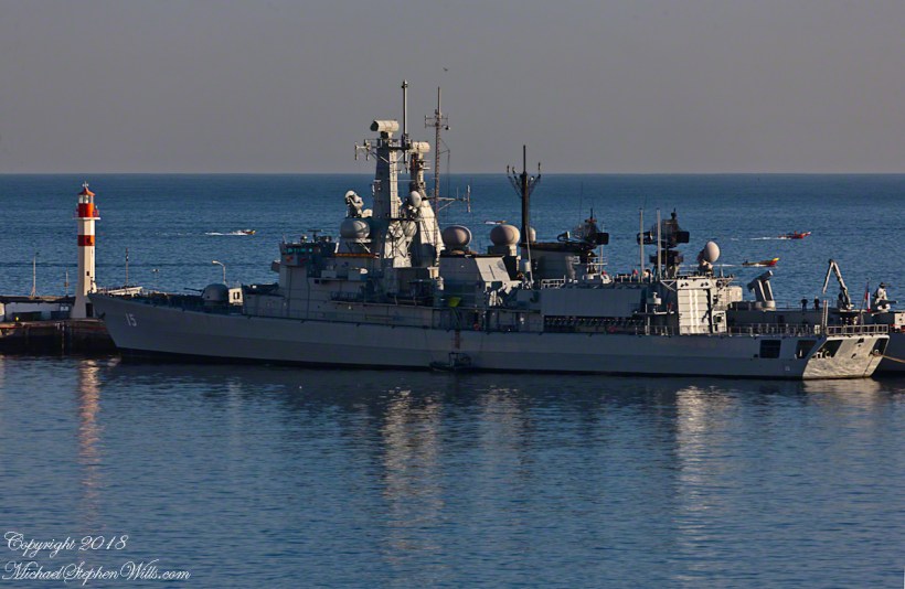
The Chileans are outgunned by the Peruvians in armored ships. Condell fled in the Convadonga, pursued by the Independencia. This was the wiser course and most militarily effective because, following the Convadonga into shallow waters the deeper draft Independencia lost advantage when it ran aground and was lost.
Prat stood ground in the middle of the bay, any canon shots simply bounced off the heavily armored Huascar. The Esmeralda suffered shot after shot until the command of the Huascar, Captain Graf, decided to ram the Esmeralda to force a surrender and safe useless death.
At the first ram to the stern, as the ships were in contact, Prat ordered an attack, “Let’s board, boys.” In the confusion only two seamen joined Prat. One failed to board, Prat and Petty Officer Juan de Dios Aldea attacked. Dios Aldea was mortally wounded. Prat continued to advance alone, to the amazement of the Peruvians, awed at his courage. Prat was gunned down on the deck of the Huascar.
He crew watched in horror. When the Esmeralda was rammed again, this time in the bow, Sublieutenant Ignacio Serrano lead of 10 Chileans to board for an attack with machetes and rifles. They were massacred by the mounted Gatling gun, only Serrano survived.
The example of Prat and his crew is taught today. Arturo Pratt is the most common street name, as well as plazas, buildings. Four major warships were named after him. The current active ship is the frigate FFG 11, the Capitan Prat. The Chilean naval academy is named
Escuela Naval Arturo Prat. His portrait is on the 10,000 peso Chilean note.