Our Fifteen Minutes of Fame on Conception Hill

A modest dose of history with wine and empanada

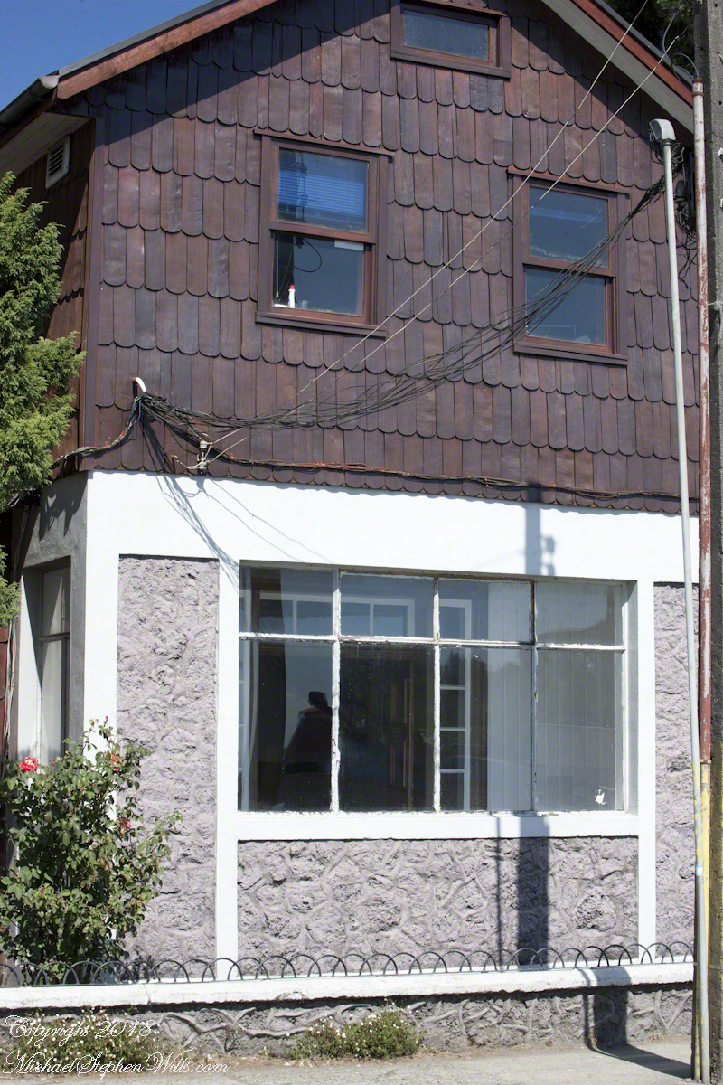
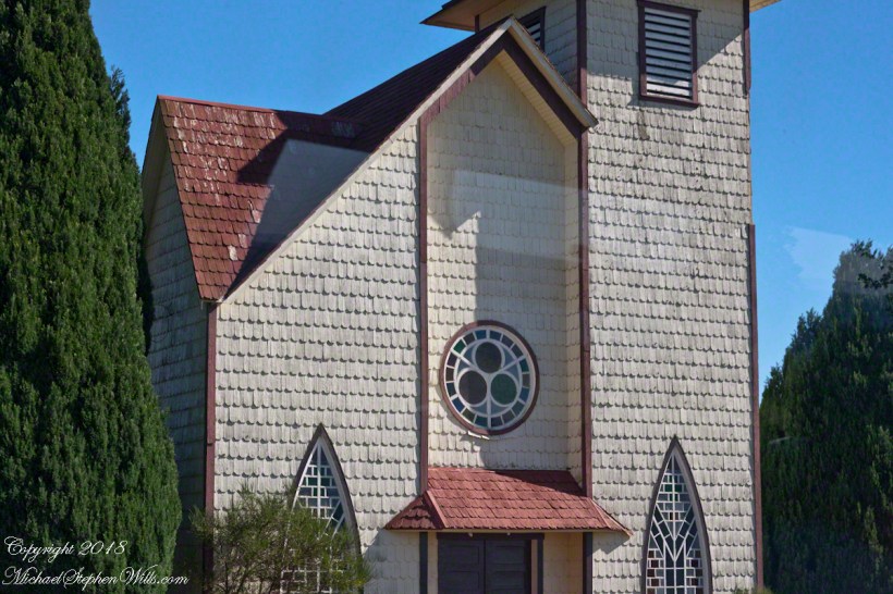
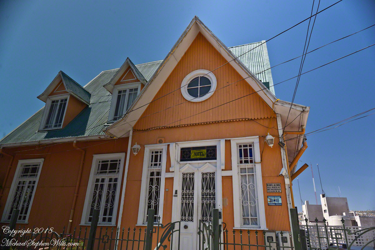
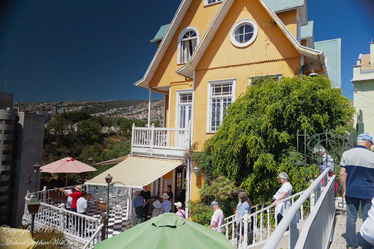
Posting about our departure from Valparaiso, Chile (see Valparaiso Departure III “The Sunset”) brings us to the time spent wandering this World Heritage Site, added to the UNESCO list in 2003.  Within the amphitheater of hills is Cerro Conception (Conception Hill), historically settled by English and German immigrants.  The façade of the Hotel Brighton, a building from the 19th century heyday of Valparaiso when it was a stopping point for shipping through the Straits of Magellan, reveals why so many of the buildings are alike: all are constructed from materials dropped off from sailing ships.

Hotel BrightonThe theme of the Hotel Brighton evokes thoughts of immigrants remembering their origins, emigres claiming a spot of real estate to mold a sense of place for themselves.  This goes both ways, Valparaiso, Indiana was formerly Porterville of Porter County.  The motive force behind the renaming were the memories of the retired Captain David Porter, the sole survivor of an attack on his ship USS Essex by the British frigates Phoebe and Cherub in the War of 1812, within sight of Valparaiso. Fifty eight (58) United States Marines lost their lives in that sea battle.  To point out the obvious, Captain Porter is the namesake of Porter County.  

Pam corrects me when I say we “stopped for lunch” at the Hotel Brighton, pointing out we “only” had a glass of red wine and an empanada.  Both were tasty, even more so with this marvelous view looking north into the other hills of the city.  The yellow umbrella is on the hotel restaurant terrace.  

Hotel Brighton

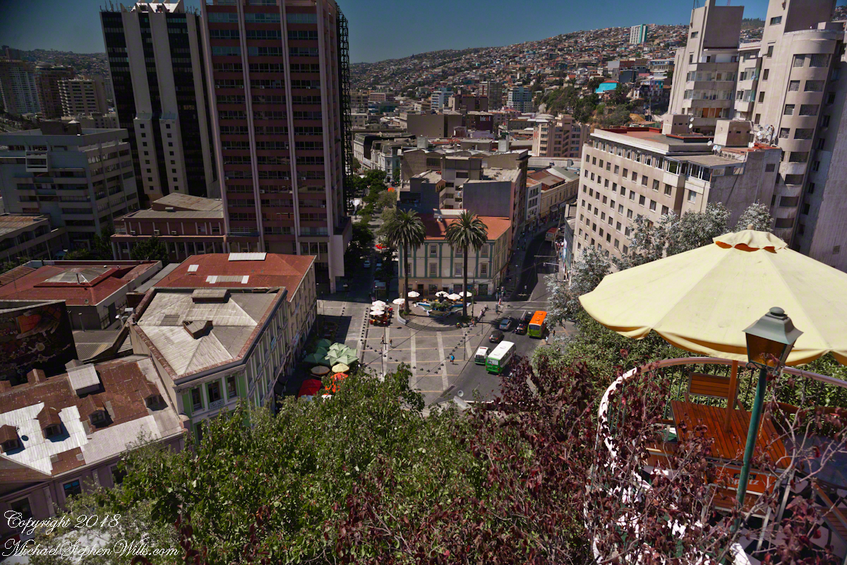
I missed capturing the signature wrought iron gate forming the word “Brighton” among decorative scrolls.  Built on the edge of Conception Hill it overlooks the coastal plain almost all of which is man-made.

Hotel Brighton

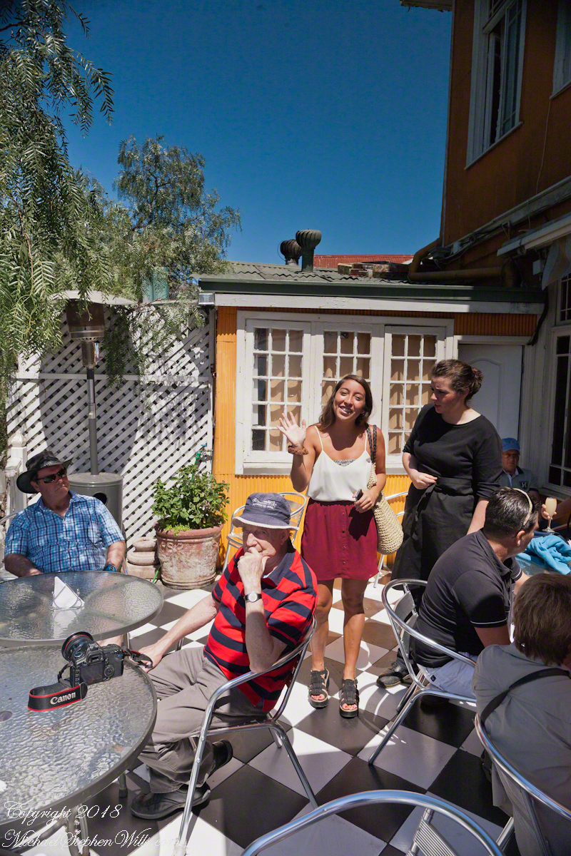
During our refreshment, this young lady (see photograph below) introduced herself as a reporter for El Mercurio.  Accompanied by a photographer, she interviewed us and we had our photograph taken, I returned the favor with the following photograph saying the story might appear in the next edition.  Standing next to her, with a puzzled look, is our waitress who was from the States.

Hotel Brighton

El Mercurio de Valparaiso is the oldest continuously published Spanish language newspaper in the world.  In my research for these photographs I discovered the newpaper officers were a short walk from the landing of the Ascensor Conception.

Valparaiso Departure III “The Sunset”

The Sun’s Progress

Two minutes after capturing the last light on Concon Point, see “Valparaiso Departure II”, turning the camera 180 degrees, to the south, looking along the Chilean coast, to capture birds on the wing headed toward shore at day’s end.
ValparaisoDeparture-22
Remembering other times,

ValparaisoDeparture-23

waiting for darkness

ValparaisoDeparture-24

with a sky map, studying it to make sense of the stars.

ValparaisoDeparture-25

How far?  How large?

ValparaisoDeparture-26

Light from our star, eight minutes old,

ValparaisoDeparture-27

grazed the earth’s rim the breath of a moth wing ago.

ValparaisoDeparture-28

Connect the dots, stories of heroes, monsters.

Our star, as we know it now

ValparaisoDeparture-31

Singular, alone,

Progress, an illusion to be understood

No less mysterious for that

ValparaisoDeparture-45

Look back to the sheltering headland of Valparaiso, glowing.

ValparaisoDeparture-47

Valparaiso Departure II

View of Aconcagua Mountain at Sunset

After the Ocean Princess sailed off toward its destiny in my last posting, “Valparaiso Departure I,” Pam and I left the deck for dinner to return two hours later for the Regatta’s departure in the magic sunset hour.

This first photograph is 22 minutes before sunset as the ship swung into a course along the northern shore of Valparaiso Bay.  The city grew along the bay shore, starting from the city center in the southern cup and into the north.  We are looking southeast across a lighthouse named “Club de Yates”, identified from the red fiberglass tower, a triangular daymark, toward the north end of Valparaiso.

Click this link for my Fine Art Photography gallery.

ValparaisoDeparture-17

Here we see a different city altogether, the fourth largest of Chile and also within the Valparaiso Region and the Greater Valparaiso Area, named Vina Del Mar (Vineyard of the Sea).  The view is almost due east and, from here, it is difficult to discern why it is also called “La Ciudad Jardin” (Garden City), it is do densely populated.  North Valparaiso ends with a ridge with Vina Del Mar the next valley.  Look carefully along the shore to find the Punta Gruesa lighthouse with a red band on a white metal tower daymark.  By way of scale the tower is 56 feet high.  Follow Punta Gruesa to the right for the ridge separating Vina Del Mar (the taller apartment buildings, from Valparaiso.

The distant mountain is huge, visible from 95 miles away.  More about it later.  

ValparaisoDeparture-18

The previous photographs were using a tripod mounted Canon EOS-1Ds Mark III with the Canon 70 – 300 mm f4-5.6 L IS USM lens set to 108 mm focal length, taken 15 seconds apart.  I then swapped  the EF 24 mm f 1.4 L USM lens for the following photograph of the pilot boat heading to a rendezvous with the Regatta, having dropped off “our” harbor pilot.  It will wait beyond the harbor to bring the pilot back home.  The photograph is 7 minutes after the previous.  Punta Gruesa and the lighthouse and the Vina Del Mar apartment towers are just visible, having lost the sun.

Click this link for my Fine Art Photography gallery.

ValparaisoDeparture-19

On the northern tip of Valparaiso Bay Punta Concon, the City of Concon and tall sand dunes also called Concon reflect the sun’s light 10 minutes before sunset.  The city is the fastest growing in Chile, 106% between 1992 and 2010 (28,157 to 50,000).  The Regatta is now well underway and I returned to the “long” lens here set to the 3oo mm focal length maximum.

On the other side of Punta Concon (Concon Point) the Aconcagua River flows into the Pacific.  Although the river has the same name as Aconcagua Mountain, the head waters are in Chile, 12 miles from the slopes of the mountain in Argentina.

ValparaisoDeparture-20

A swivel of the camera brings Aconcagua Mountain into view.  This former volcano, dead now for 8 – 10 million years is the highest mountain in North and South America.  The next highest peak is in the Hindu Kush, 10,000 miles to the northeast.  That said, Aconcagua is less challenging than Denali of Alaska and so many people attempt it each year human excrement is a major pollutant there.  We are looking here over the Vina Del Mar Valley 95 miles to Aconcagua Mountain in Argentina.

Click this link for my Fine Art Photography gallery.

ValparaisoDeparture-21

Copyright 2022 Michael Stephen Wills All Rights Reserved

Valparaiso Departure I

Thoughts on Departures

Late afternoon of our departure from the Chilean port city Valparaiso,  Pam and I enjoyed entertainments on the Regatta.  This painting of a ship under sail brings to mind the history of Valparaiso, as a place only reachable by ship, clinging to a narrow ledge on the Andes, barely existing for centuries, repeatedly destroyed by earthquakes until the 19th century brought sailing vessels such as this, growth and prosperity.  Major earthquakes hit the years 1730, 1822, 1839, 1873, 1906, 1907.  After 1907, the city was rebuilt anew in the modern form.  The inhabitants must enjoy spot, naming it “Vale of Paradise.”

Click this link for my Fine Art Photography gallery.

ValparaisoDeparture-1

While, in the 21st century the city enjoys a refreshment of an influx of artists and visitors such as the Regatta, the danger of the next massive quake is ever present and unpredictable.

As we enjoyed the artwork….

ValparaisoDeparture-13

….a pianist entertained us.

ValparaisoDeparture-14

As usual, I was carting photography equipment to capture the moments as the afternoon moved towards…

ValparaisoDeparture-15

….the scheduled departure among still life painting in the style of the Dutch masters.

Click this link for my Fine Art Photography gallery.

ValparaisoDeparture-16

That day I chose the upper decks as the best vantage point.  From there, Pam and I viewed the departure of a similar ship to the Regatta, the “Ocean Princess.”  It must have been the last voyage of the Princess under that name as, the same year, it was acquired by the Oceania line, refurbished, relaunched as the “Sirena”.

The Chilean navy base and Naval Academy is there.  The Ocean Princess navigated around this docked destroyer…..

ValparaisoDeparture-2

…with the assistance of the tugboat Alcatraz, a name derived from the Spanish word for pelican as in “La Isla de los Alcatraces” (Island of the Pelicans) where the former Alcatraz prison was built in San Francisco Harbor.  Spanish speakers think of birds when viewing the tub boat.  Americans think of prisoners (escaping) and San Francisco.  Unlike San Francisco Harbor, Valparaiso Bay is a semi-circle open to the ocean, the harbor is on the southern, north facing (away from the ocean) shore, protected by a long (3,000 foot) breakwater along which the Chilean war ships dock.  We are viewing the Alcatraz after most of the work for the Ocean Princess departure was done.

ValparaisoDeparture-3

The north end of the bay is residential, behind the towers are homes arrayed on the hillside, the only land available.

Click this link for my Fine Art Photography gallery.

ValparaisoDeparture-4a

Much of the harbor and city business district, in the foreground (below), on the south side is on land reclaimed from the sea.

ValparaisoDeparture-5

All around the Regatta was a working port.  Here rolls of cable (wire?) are prepared for hoisting onto a cargo ship.  Note the hawsers, taught under the strain, between the workmen and the ship hull.

ValparaisoDeparture-6

Passengers board the Regatta from the last tours.  I expect this is the trip to Santiago.  Most of the dockings the Regatta was surrounded by the port, the only way to access the city was on a tour bus as the port activity made walking too dangerous.

Click this link for my Fine Art Photography gallery.

ValparaisoDeparture-7

I can only guess the role the Alcatraz is playing here…..

ValparaisoDeparture-8

…. probably it is positioned to give the Ocean Princess a nudge if the harbor pilot misjudges the turn around the breakwater and warships.  In a harbor, a ship’s crew passes control to a harbor pilot who knows the navigation challenges much better than is possible for them.

ValparaisoDeparture-9

Today, as 99.9% of all days, the pilot makes the turn safely.  Here is a better view of the warship.

ValparaisoDeparture-10

Looking back toward the harbor, the crane is hoisting those rolls, the tug boat “Lauca” framed by the superstructure of (I think) the crane.

ValparaisoDeparture-11

The Ocean Princess is will under way, as shown by the long wake.  As luck will have it, When the Regatta follows the sun will be much lower, the light better for photography.  At the stern of the warship, the masted vessel is a training ship for the Chilean Naval Academy.

Click this link for my Fine Art Photography gallery.

ValparaisoDeparture-12

Copyright 2022 Michael Stephen Wills All Rights Reserved 

Maritime Pilots, Scout Island, Scout Canal

About maritime pilots and the Chilean Fjords

Want More? Visit my Online Gallery

On our way to Fjord Tempanos and the Iceberg Glacier…..

Background: on a ship, facing the bow (front), starboard is right and port is left).

In the 8 miles from Tarn Bay and Sombrero Island lands press closer, higher, islands increase in number.  This is a listing of some of the islands we passed. These names reflect the history of Chile, the waves of immigrants touch the land with memories. After some of the names, below, I provide in parentheses the derivation.

On starboard was the northern Wellington Archipelago (English General): Pinochet (the Chilean dictator), Penguin, Juan Stuven (Spanish and German), Chang (the far east), Millar (German).

On port, the names have a military flavor: Zealous, Scout, Scylla (Sea Monster of Greek mythology), Alert, Orlebar (British Officer Augustus Orlebar).

These port side island names reflect what is on the minds of mariners as navigational options narrow with the channel.  Innumerable channels, points, mid-channel islets, all looking very much the same, a potentially confusing jumble.  Chilean maritime law demands ships have on board, working from the bridge, a certified Chilean maritime pilot to transverse the country’s dangerous channels and fjords.  The combination of stopping distance (multiple nautical miles) and the loss of steering when a ship moves slowly make it essential to know, exactly, the route ahead.  It was a Chilean maritime pilot who help keep us safe.

A great personal hazard for pilots is boarding the ship from the pilot boat.  From our stateroom terrace we observed fast pilot boats in all seas approach the Regatta miles from port, the pilot on the bow, pull up alongside.  Without a harness, the pilot transfers from boat to ship.  We observed this several times from our stateroom veranda.

Here are shots of the pilot boat approaching the Regatta off the Peruvian port of Matarani. The boat was mirrored by the colorfully painted houses of Peru.

Don Roberto Approaches the Regatta
A fast pilot boat from Matarani approaches the Oceania Regatta. On the bow, the pilot will transfer from boat to ship. On board he will work with the Regatta crew to safely navigate the approach to the Matarani harbor and dock. The whiteness on the land is diatomaceous earth.
Don Roberto, Maritime pilot, approaches the Regatta
The whiteness on the land is diatomaceous earth.

A cautious approach. In the third shot the boat turns to slowly approach the Regatta.

Alongside, boat crewmembers joint Don Roberto on the bow to assist in the transfer. I am not sure which of the two blue uniformed persons was “our” pilot.

I did not capture the boarding of the pilot who served the Regatta through the Chilean Fjords.  Was is at Puerto Montt?  Puerto Chacobuco?  I am not sure.  I do know a maritime pilot was on board as the channel narrowed to 2 miles, named Scout Channel were we passed Scout Island.  I was facing generally east from our port side stateroom veranda while capturing these photographs as the Regatta headed south.

Scout Island and Canal
Scout Island. The water is Scout Channel

The peak on Scout Island is about 2,100 feet. The smaller peaks in front are about 1,200 and 1,500 feet. All rise straight up from Scout channel.

Scout Island
Scout Island lies on the Scout Canal
Scylla Island
Lying just south of Scout Island, Scylla Island is between our ship, in the Scout Canal, and the Kruger Canal. The Kruger is short, between Islands Scout, Orebar, Zealous, Porcia and Tito.
Islet Alert and Orebar Island
Islet Alert is between Canal Scout and Canal Kruger. On the far left there are waves breaking on Pilot Point of Orebar Island, marking the northern end of a small bay, named Hale. You can see the bay behind Islet Alert. On the far left there are waves breaking on Pilot Point

Want More? Visit my Online Gallery

Views of Larenas and Fresia Peninsulas

mountainous crags over the Pacific Ocean

In English the Gulf of Penas means “Gulf of Distress.”  Open to the storms of the western pacific ocean, ships seeking refuge sail this body of water to reach the shelter of the bays around the entrance of the Messier Channel.

Stargazing Chileans named the channel after Charles Messier (1730 – 1870), author of a catalog of 110 visually diffuse celestial objects such as the Great Cluster of Hercules, the Crab Nebula of Taurus, the Ring Nebula of Lyra.  As Messier catalog objects these are listed on star charts as M13,M1,M57.

The Larenas and Fresia peninsulas of Aisen Province, Chile, on the southeastern shores of the gulf are seen here as we approach the Messier Channel.  The shore is dotted with islets and islands.  The Chilean pilot who came aboard at Puerto Chacobuco is earning his salary, keeping us safe.  To reach the channel we pass through Tarn Bay, generally north to south.  The southern margin of the bay is marked by Sombrero Island, the subject of my next blog.

Want more? Visit my on-line gallery.

Larenas Peninsula and Merino Islets
Close-up of the Merino Islets
Ayautau Isles
Ayautau Isles
Larenas Peninsula from Gulf of Penas
The Northern Patagonian Ice Fields lay to the east and north of these mountains of the Larenas Peninsula.
High Ridge of the Larenas Peninsula
Larenas Peninsula High Ridge
Larenas Peninsula High Ridge 2
Larenas Peninsula High Ridge Close 3
The craggy heights of the Larenas Peninsula
The craggy heights of the Larenas Peninsula are in the rear. On the right are Fresia Point (of the eponymous peninsula) and the entrance to Fjord Eloisa.
Larenas Peninsula High Ridge Closer 5

Where Are The Alerces?

Chipped into Shingles?

A user commented on a Chile Lake District post of mine asking for more photos of Germany. This is striking, because German traveler who visited have made note of parallels between this area and Europe. In this series I will share photography taken from the tour bus window as we traveled to the Lake District and returned to Puerto Montt. I used a handheld Canon EOS 1Ds Mark III SLR with the Canon lens EF 70-300 f 4-5.6LIS. This is the second post of this series.

Click any photograph for a larger view.

Chipped into Shingles?

Wood is a building material the German pioneers had in abundance. They went to work clearing the forests, tilling the land and building structures such as this, a house in the town of Puento Varas on Lake Llanquihue. In face, those windows face the lake. I have our guide to thank for these photographs of the houses, early on as we drove through Puerto Montt she shared the significance of the shingles with us.

The shape is identical to that used in Germany and Switzerland wooden frame homes. It was the wood of a tree native to Chile and western Argentina that made these possible and in the course of surviving in a new land, a good portion of their natural patrimony was spent. Since the late 1960’s Chile has backed away from this and conservation of the slow growing Alerce is now paramount.

We can intuit how difficult the winters are from the view into this house provided by the window. There is a room outside the living area, sealed by a second door to prevent the escape of warmth. The use of metal embedded into the low concrete wall is common in the South American countries we visited.

Close by, also facing the lake in Puerto Varas, is this police station, the “Civil Police,” whatever than means. It is a small, apparently historic, building. Rising around it are modern hotels.

This large rural shed, on the outskirts of the town, appears to be a structure from the original 19th century settlers, a testimony to the durability of Alerce shingles covering the siding and the large, steeply sloped roof.

Open Country

Suddenly we were graced with these cleared farm fields, here and there large modern homes high on the hill for a sweeping view of the lake.

In the distance is Calbuco, the volcano whose eruption broke the peace ten months before our trip. The wind spared these lands the destructive effect of falling ash.

“We’re not in Kansas Anymore, Toto”

Fertile land

A user commented on a Chile Lake District post of mine asking for more photos of Germany. This is striking, because German traveler who visited have made note of parallels between this area and Europe. In this series I will share photography taken from the tour bus window as we traveled to the Lake District and returned to Puerto Montt. I used a handheld Canon EOS 1Ds Mark III SLR with the Canon lens EF 70-300 f 4-5.6LIS. This is the third post of this series.

Click photograph for a larger view.
Orsorno Volcano, Lakes
District, Chile

So much depends……

an accumulation of things

A user commented on a Chile Lake District post of mine asking for more photos of Germany. This is striking, because German traveler who visited have made note of parallels between this area and Europe. In this series I will share photography taken from the tour bus window as we traveled to the Lake District and returned to Puerto Montt. I used a handheld Canon EOS 1Ds Mark III SLR with the Canon lens EF 70-300 f 4-5.6LIS. This is the fourth post of this series. Click me for “Swiss Chalet,” the first post in this series.

Click any photograph for a larger view.

……on cut grass rolled into hay below the volcano

Here is a comforting sight for a dairy farmer: well cured fodder ready for the winter. Apologies to William Carlos Williams. “So much/ depends/upon a red wheel /barrow/glazed with rain/water/besides the white /chickens.” (XXII, “Spring and All”, 1923).

A home surrounded by carefully tended gardens. Flowers and sweet corn, yum! Compare the style of the house this that of my first post. The lighting was better and this photograph captures the detail of the Alerce shingles.

On one side was Calbuco Volcano, seen across hay fields and hills……

……on the other is the lower slopes of Osorno, the cone hidden by clouds.

On the east side of where the waters of Rio Pescado flow into Lake Llanquihue the Holy Cross Chapel serves silent testimony to the influence of German immigrants who, fleeing war and chaos, settled these lands.

Swiss Chalet?

cone under the moon

A user commented on a Chile Lake District post of mine asking for more photos of Germany. This is striking, because German traveler who visited have made note of parallels between this area and Europe. In this series I will share photography taken from the tour bus window as we traveled to the Lake District and returned to Puerto Montt. I used a handheld Canon EOS 1Ds Mark III SLR with the Canon lens EF 70-300 f 4-5.6LIS. This is the first post of this series. Click me for “Orsorno Volcano and Tourists,” the first post in that series.

Click any photograph for a larger view.

House on a Hill

Wood is a building material the German pioneers had in abundance. They went to work clearing the forests, tilling the land and building structures such as this, the steeply sloping roof to shed snow, gabled dormers for more living space on the top floor.

This has a tin roof, but many roofs are shingles made from magnificent Alerce trees. The government banned the export of Alerce wood in 1976. It is a slow growing tree, the fine grained wood is in demand. I believe the tall tree towering over the roof is a Monkey Puzzle, scientific name Araucaria araucana, an ancient evergreen, the national tree of Chile and one of the unique differences the early Germans came to recognize and love as their own South American identify.

I will have some great examples of shingled homes in a later post. The roof of this restaurant is Alerce shingles.

The Orsorno Volcano, somehow reminiscent of the Alps and very different. Here a half moon, high above and shining brightly on a summer evening, February 2016. These are some of the touches European travelers name “Chilean Swiss.”