Dragoon Mountains of southeastern Arizona are named, not for the resemblance of this ridge to the back of a Dragon, but for a type of soldier trained for horseback riding and infantry. These were the U.S. troops sent to “pacify” the Chiricahua Apache homeland.
Understanding location lighting is a matter of experience and luck.
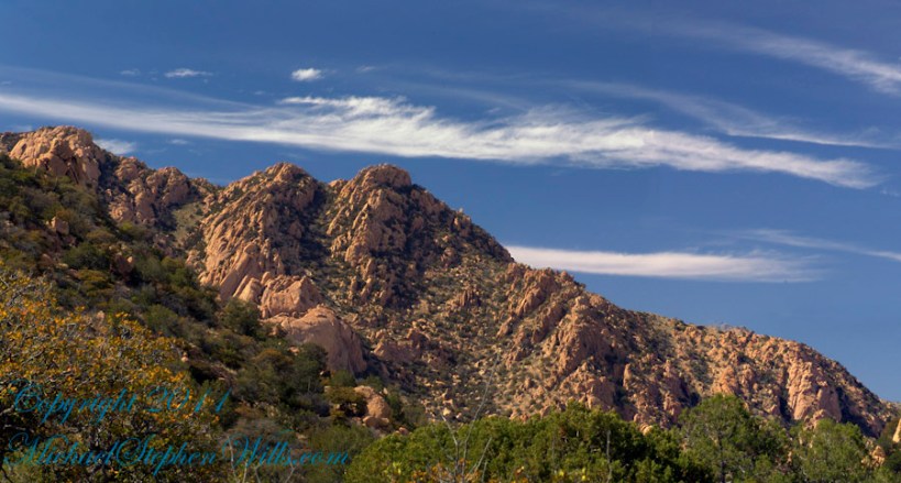
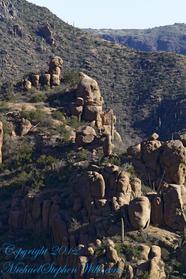
Cochise Stronghold campsites are on the eastern slope of the Dragoons, sheltering them from the late afternoon sun.
One this day in April I explored the trails until sunset and was lucky enough to be setup for the 14 minutes of that day when the light was absolutely perfect.
Copyright 2023 Michael Stephen Wills All Rights Reserved
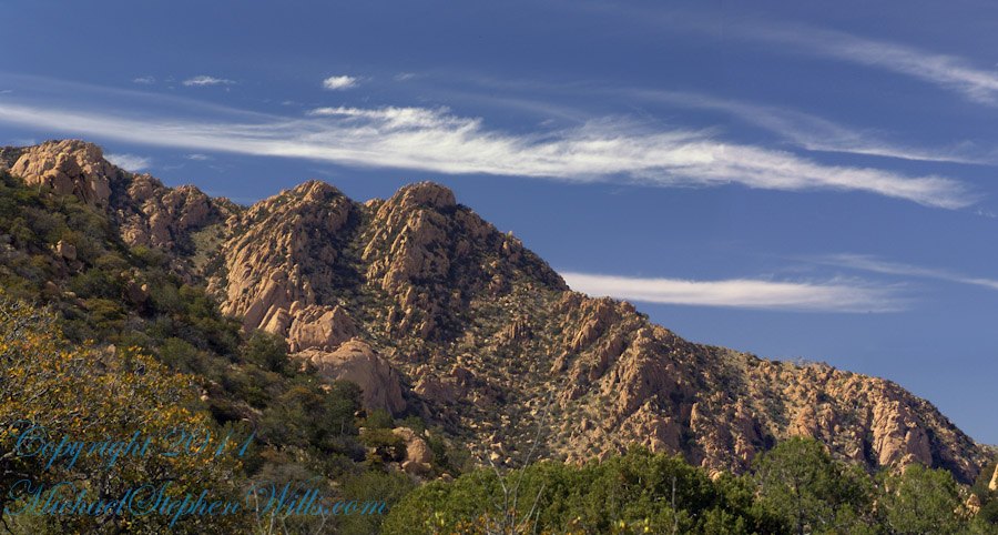
Understanding location lighting is a matter of experience and luck.
Cochise Stronghold campsites are on the eastern slope of the Dragoons, sheltering them from the late afternoon sun.
One this day in April I explored the trails until sunset and was lucky enough to be setup for the 14 minutes of that day when the light was absolutely perfect.
“Dragoon Spires in Afternoon Light”
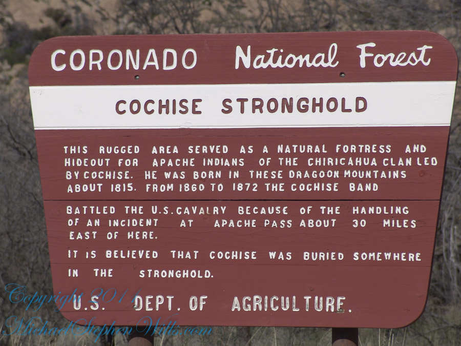
These photographs are from two days spent at Cochise Stronghold, a part of the U.S. Forest Service Coronado Forest managed by Arizona State Parks located off the Interstate 10 East of Tucson between Benson and Wilcox.
This rugged natural fortress was, for some 15 years, the home and base of operations for the famed Chiricahua Apache Chief, Cochise. Cochise and about 1,000 of his followers, of whom some 250 were warriors, located here.
Born in present-day Arizona, Cochise led the Chiricahua band of the Apache tribe during a period of violent social upheaval. In 1850, the United States took control over the territory that today comprises Arizona and New Mexico. Not hostile to the whites at first, he kept peace with the Anglo-Americans until 1861, when he became their implacable foe because of the blunder of a young U.S. Army officer, Lt. George Bascom. In that year, Cochise and several of his relatives had gone to an encampment of soldiers in order to deny the accusation that they had abducted a child from a ranch. The boy was later proved to have been kidnapped by another band of Apaches.
During the parley, Cochise and his followers were ordered held as hostages by Bascom, but Cochise managed to escape almost immediately by cutting a hole in a tent. Bascom later ordered the other Apache hostages hanged, and the embittered Cochise joined forces with Mangas Coloradas, his father-in-law, in a guerrilla struggle against the American army and settlers. The capture and murder of Mangas Coloradas in 1863 left Cochise as the Apache war chief. The U.S. Army captured him in 1871 and prepared to transfer the Chiricahua to a reservation hundreds of miles away, but he escaped again and renewed the resistance campaign. The following year after negotiating a new treaty with the help of Thomas Jeffords, the band was allowed to stay in their homeland.
Cochise is reputed to have been a master strategist and leader who was never conquered in battle. He died peacefully on the newly formed Chiricahua reservation in 1874. His son, Taza succeeded him as chief. Upon his death, he was secretly buried somewhere in or near his impregnable fortress. The exact location has never been revealed or determined.
The town of Cochise, Cochise County, the renowned geological feature known as Cochise’s Head in the Chiricahua Mountains, and the Stronghold are all named in tribute to him.
Copyright 2023 Michael Stephen Wills All Rights Reserved
These photographs are from two days spent at Cochise Stronghold, a part of the U.S. Forest Service Coronado Forest managed by Arizona State Parks located off the Interstate 10 East of Tucson between Benson and Wilcox.
Here is the Cochise Stronghold information sign from the Douglas Ranger District of the Coronado National Forest.
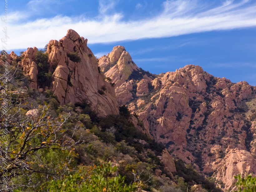
The Dragoon Mountains are a low range that barely rises above the surrounding desert floor. Nevertheless, the granite boulders are spectacular and well worth visiting for the scenery alone. This mountain range is remote from cities or even any large towns, so visitation is light. Late fall, winter, and early spring are the best times to visit. Temperatures exceeding 100 degrees are common even in spring and fall. Cochise Stronghold Campground is closed in June, July, and August due to the often-extreme heat.
Safety First: Heat and low humidity are real hazards for people unfamiliar with desert climates. A person can loose up to 5 quarts of fluid a day and it is easy to become seriously dehydrated without realizing it, so drink plenty of fluids even if you do not feel very thirsty. Always carry extra water in your car. When going on a hike, even if a short one, take a day pack with water, snack foods, protective clothing, flashlight, first aid kit, compass, and map. To avoid sun in
Copyright 2023 Michael Stephen Wills All Rights Reserved
Interstate 10 between Benson and Wilcox ascends through a field of enormous, eroded granite boulders. Off to the west are the Dragoon Mountains, otherwise known as “Cochise Stronghold.”
Informative sign at campsite
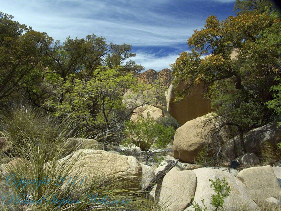
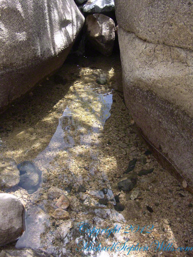
Starting from the campsite is the “Sky Islands Traverse” hiking trail, leading up into the mountains. I wandered from the trail to follow a dry streambed to this residual pool of water, the time being early spring, and this is what remained from the winter rains.
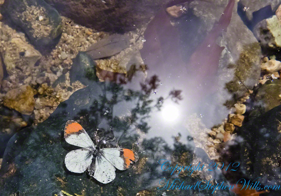
A single butterfly of the genus Anthocharis generally called “Orangetip” for the colorful upper wing tips. These exist throughout the world, here in Arizona they migrate across the desert, obtaining refuge and nourishment from “Sky Islands” such as the Dragoon Mountains
Copyright 2022 Michael Stephen Wills All Rights Reserved
The canyon below 110 foot Reavis Falls is a wild place of transcendent beauty.
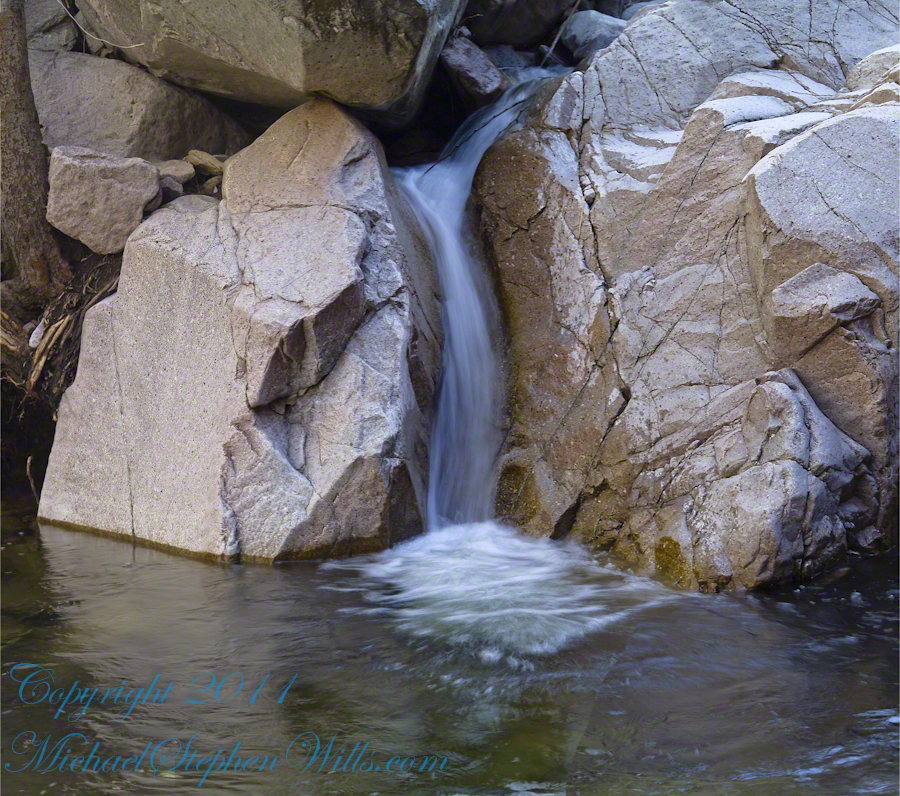
With the afternoon in front of me, the trip back to camp was a slow pleasure. On the way in, I noted several stopping points to capture photographs. Here a natural rock sluice offers a foot tall waterfall, mirroring Reavis Falls, bracketed by white igneous stone.
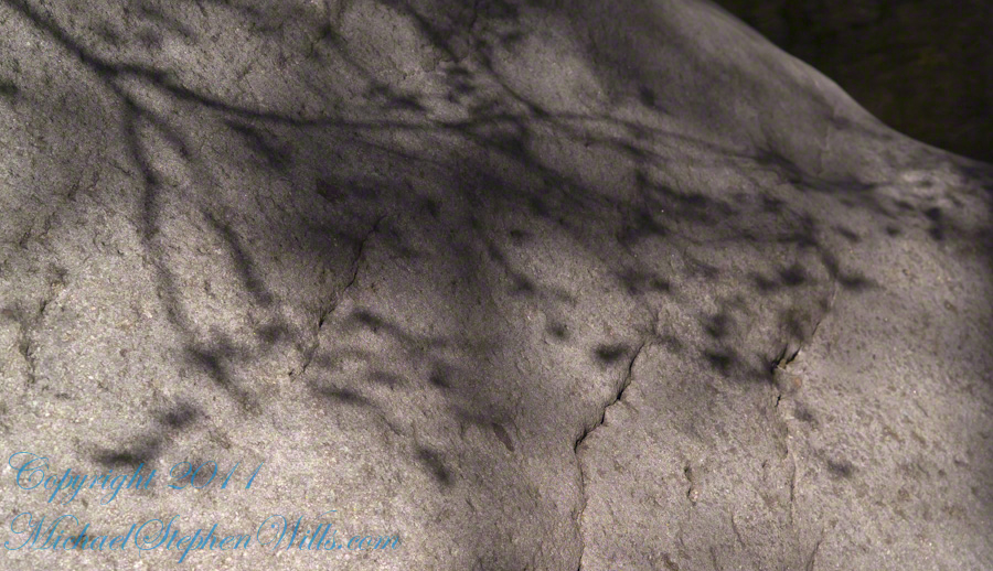
This same stone offers a screen, the bright spring sun throwing the sparse leaves into sharp relief.
In my previous posting “Hoodoos on the Descent to Reavis Falls” I describe how I came to find these strange rock formations during a solo expedition to Reavis Falls in the remote eastern Superstition Wilderness.
Here I present several photographs captured from my tripod mounted Kodak DCS pro slr/c and a Canon EF 200 mm f2.8 L telephoto lens. These provide a better understanding of the strange, wonderful and possibly frightening impressions these formations make when discovered in a deserted location such as Cedar Basin.
Here is the highest point of the ridge….
Hoodoo Ridge
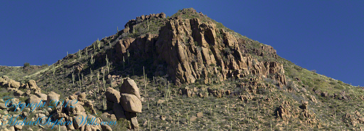
…..and from a portion of the ridge that projects closer to my observation point above the canyon mouth of Reavis Falls. The numerous green poles are young Saguaro cactus. In the distance are mature Saguaros with lateral arms.
Hoodoos of Cedar Basin
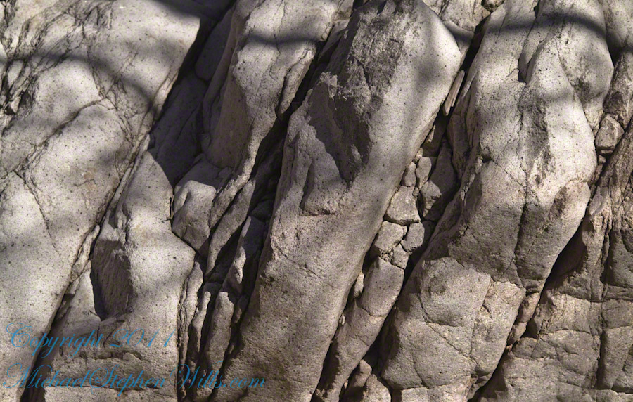
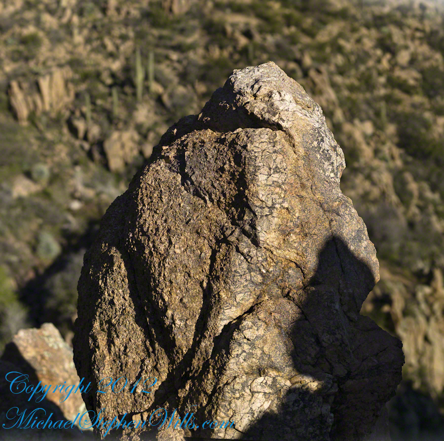
..and even closer than this were the rocks standing around me. This specimen I captured with the 50 mm 1.4 Canon lens. I believe it is a different rock type than the above, rounded, hoodoos. Those look like rock from ash of a volcanic eruption. This rock seems to be igneous, formed deep inside the earth.
Cedar Basin Rock Closeup
My next posting will describe the surroundings of the campsite from which I explored the canyon and Reavis Falls.
Copyright 2023 Michael Stephen Wills All Rights Reserved
Interstate 10 between Benson and Wilcox ascends through a field of enormous, eroded granite boulders. Off to the west are the Dragoon Mountains, otherwise known as “Cochise Stronghold.” This rugged area served as a natural fortress and hideout for Apache Indians of the Chiricahua clan led by Cochise. He was born in this Dragoon Mountains about 1815. From 1869 to 1872 the Cochise band battled the U.S. Calvary because of the handling of an incident at Apache Pass about 30 miles east of here. It is believed that Cochise was buried somewhere in the Stronghold.
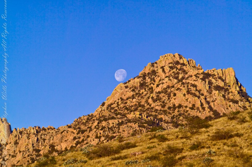
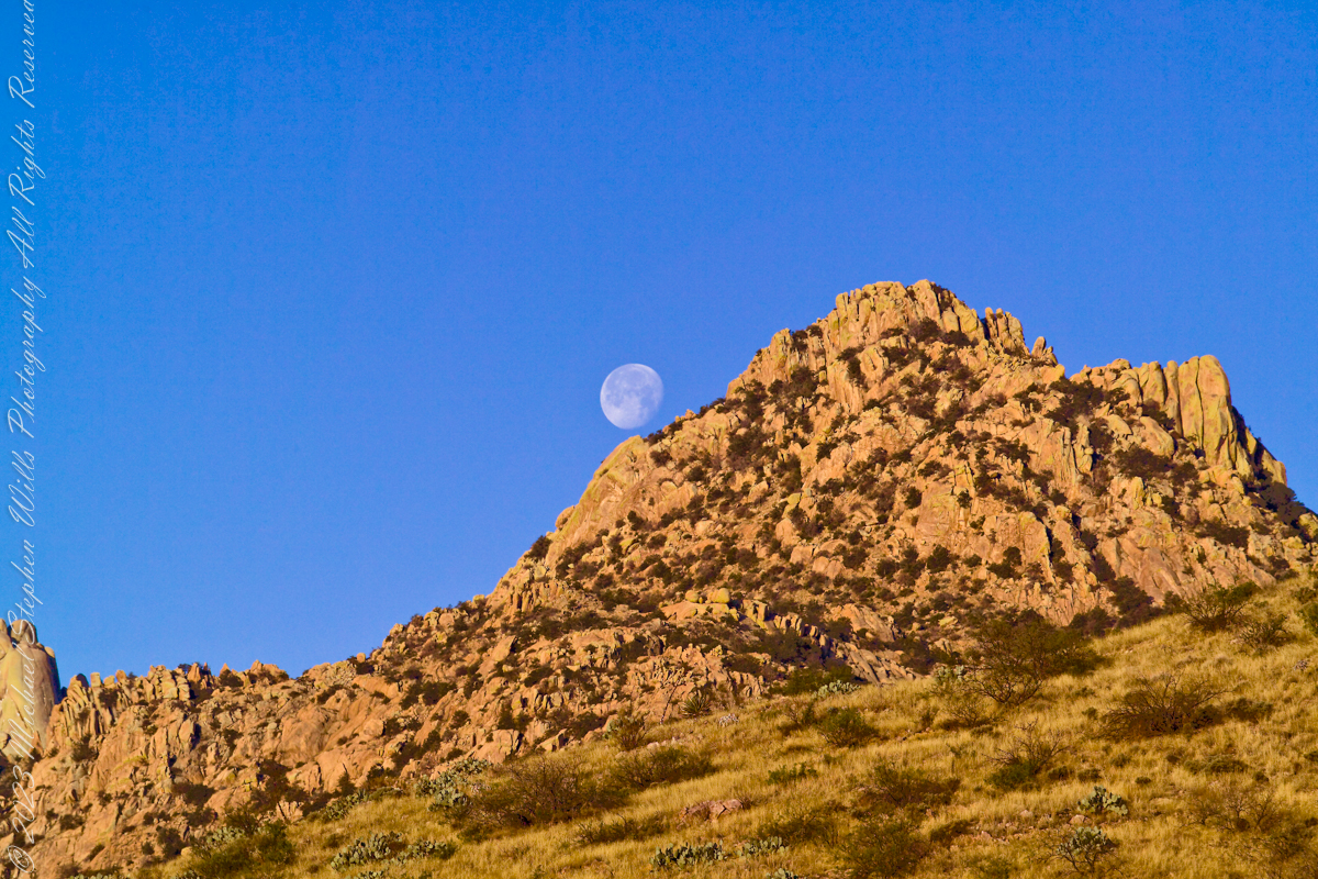
One April morning, very early, on the road to Cochise Stronghold. We stopped everything for me to unload the equipment to capture a gibbous moon low in the west, grazing a hoodoo ridge of Cochise Stronghold of the Dragoon Mountains. Near Dragoon, Cochise County, Arizona
Copyright 2023 Michael Stephen Wills All Rights Reserved
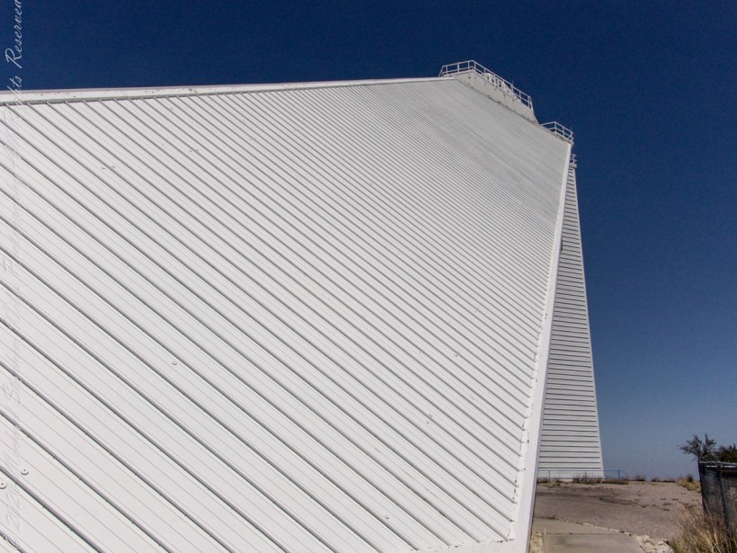
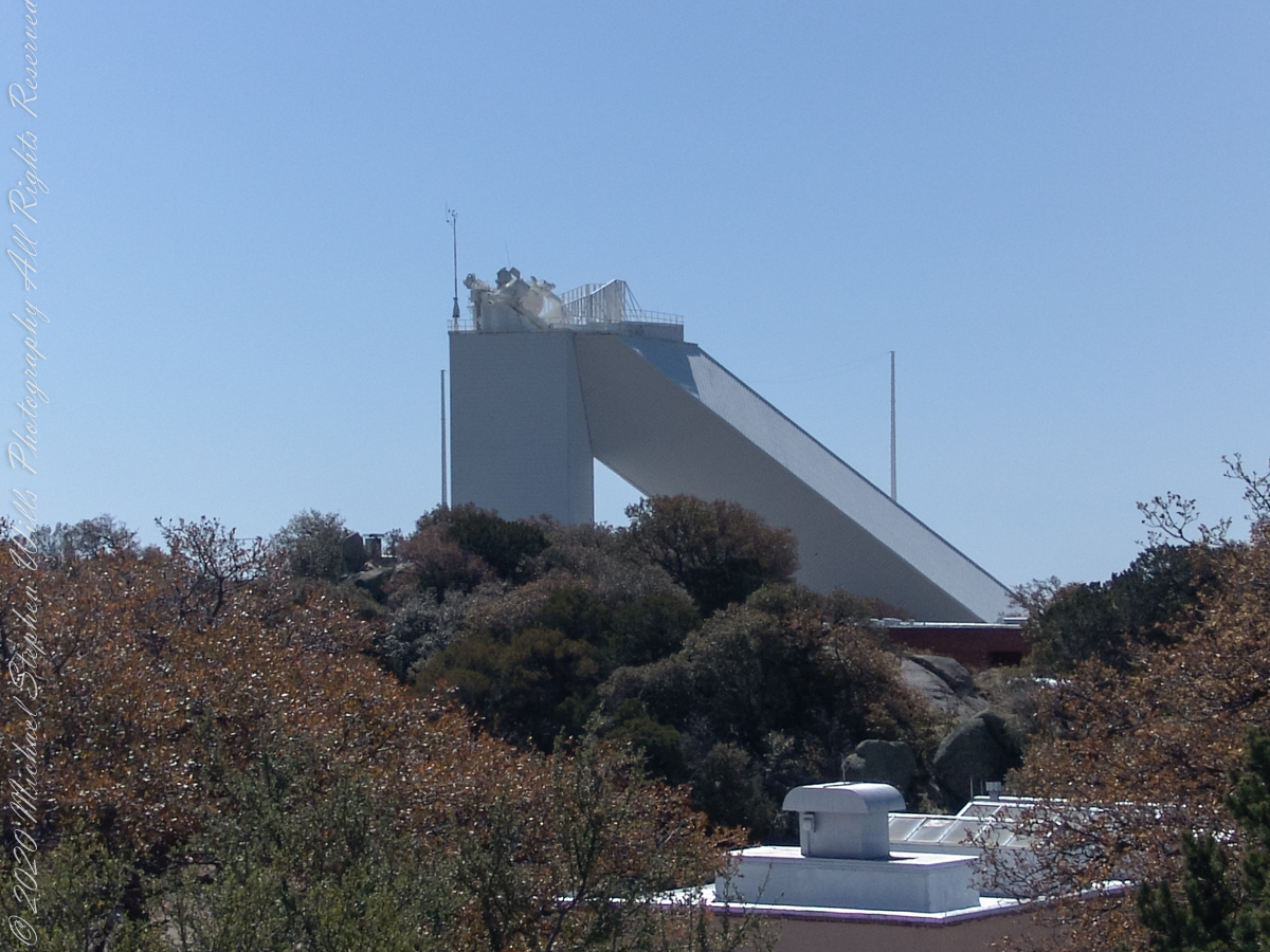
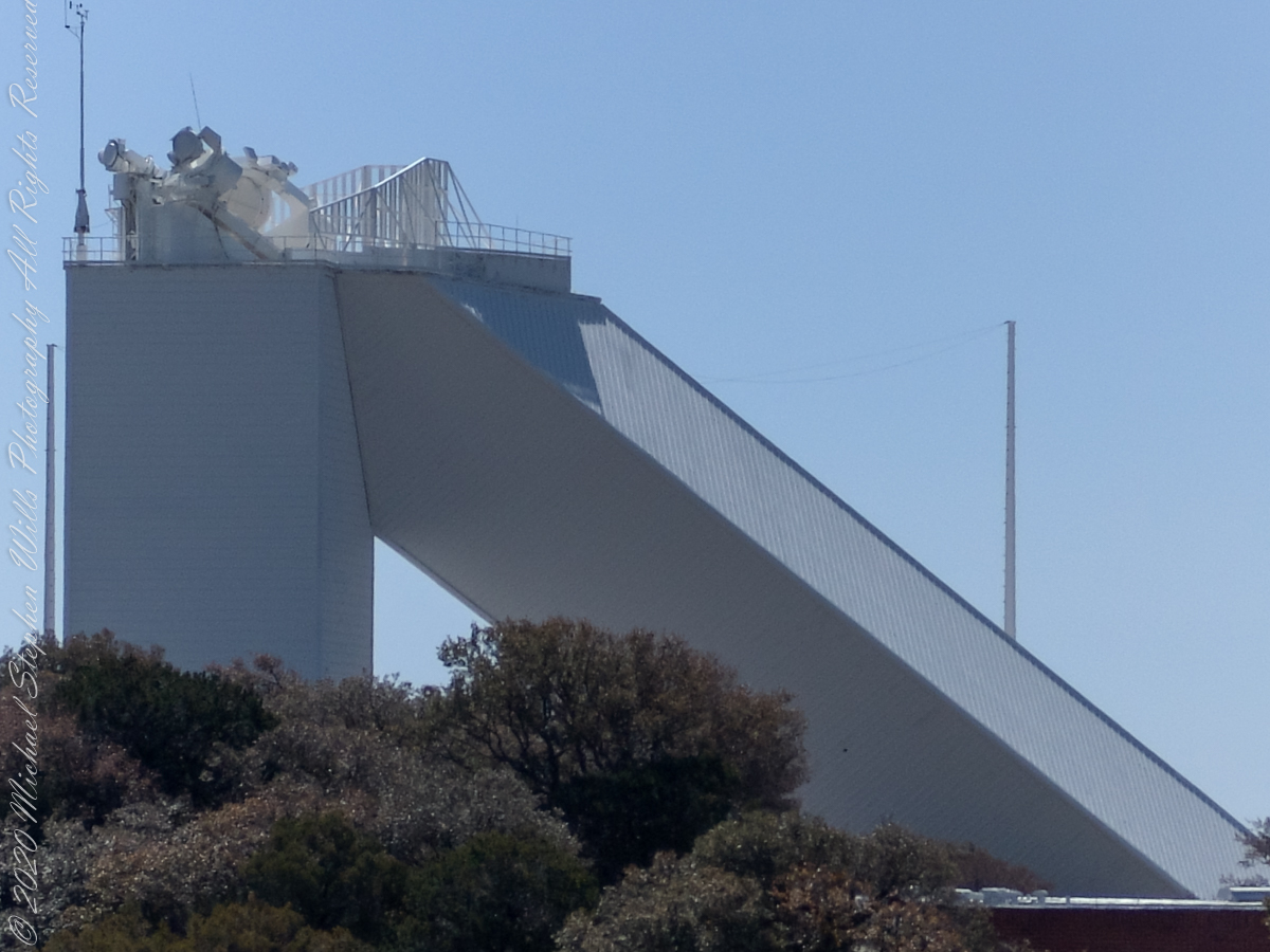
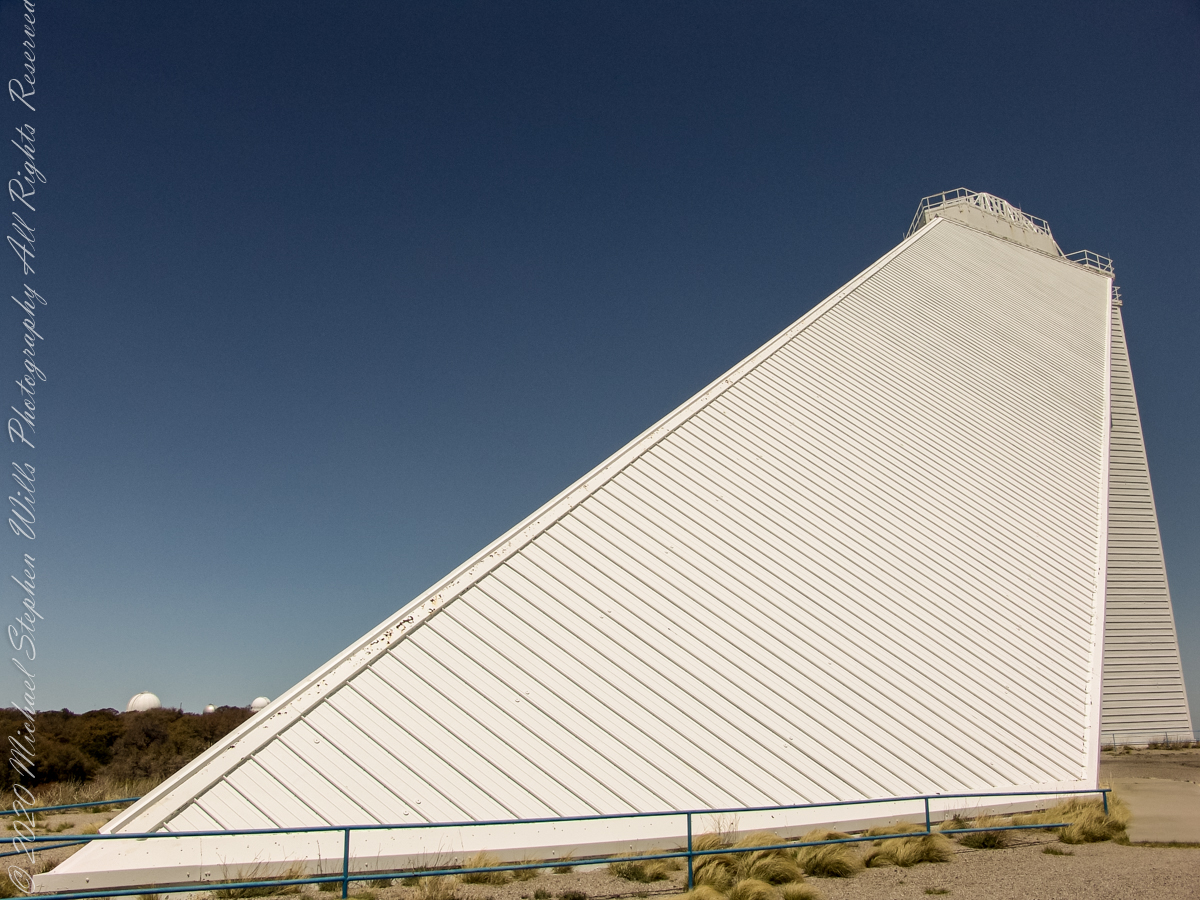
These views of the McMath–Pierce solar telescope enclosure are the preliminary to a guided tour of the instrument, April 20, 2005.
On the tower are three heliostats, plane (flat) mirrors mounted on computer-controlled platforms to follow the sun across the sky to direct sunlight to primary mirrors underground, beneath the base of the slanted shaft
Built in 1962, the building was designed by American architect Myron Goldsmith and Bangladeshi-American structural engineer Fazlur Rahman Khan. It was the largest solar telescope and the largest unobstructed aperture telescope in the world. It is named after the astronomers Robert Raynolds McMath and Keith Pierce.
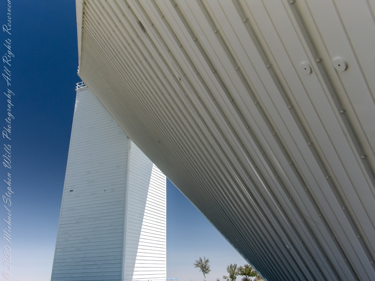
The slanted shaft, looking toward the tower.View of the slanted shaft, looking toward the tower.View from underneath the slanted shaft, looking toward the tower.
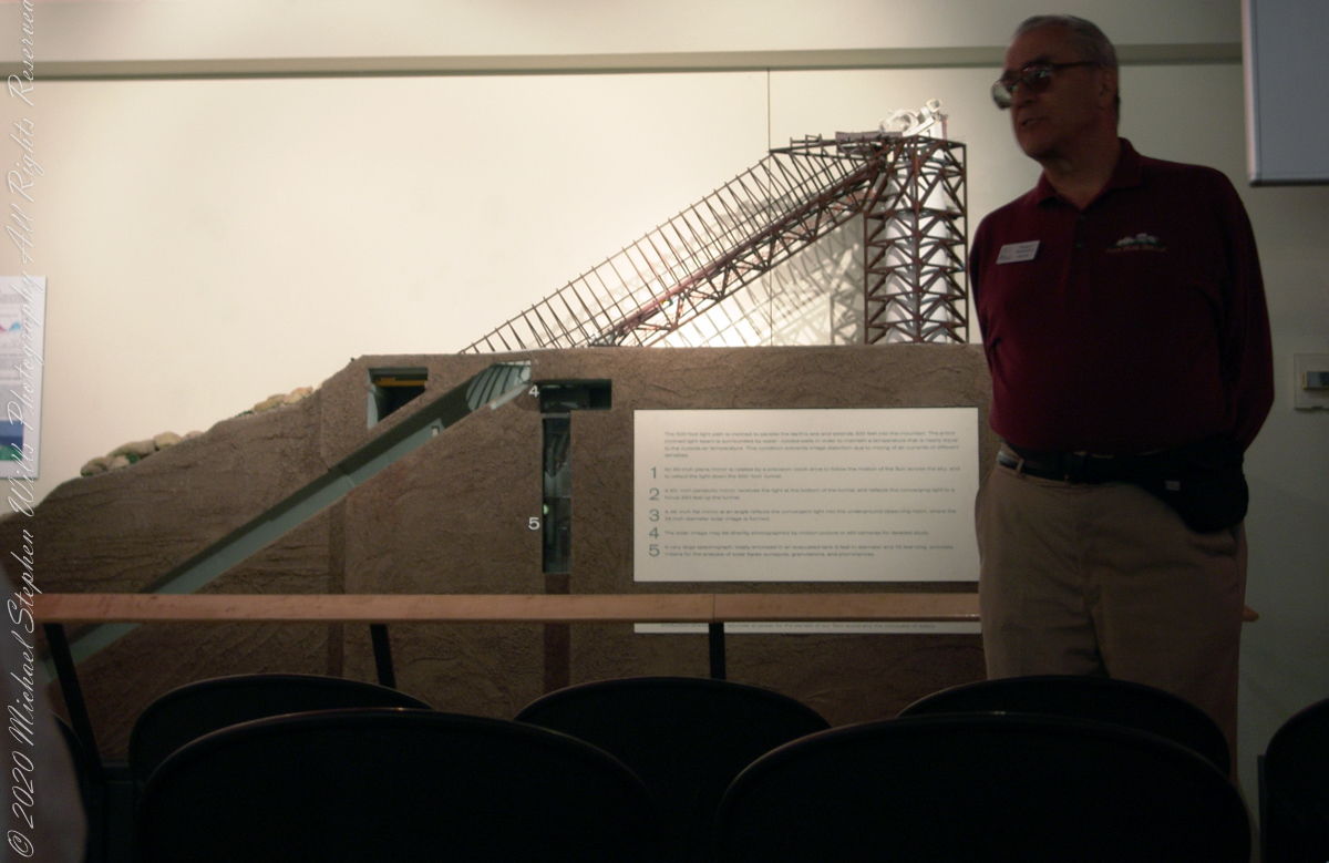
Inside the McMath–Pierce solar telescope is this keyed model of the observatory. Our docent for the morning tour stands alongside.
Reference: Wikipedia “McMath–Pierce solar telescope”
Copyright 2022 Michael Stephen Wills All Rights Reserved
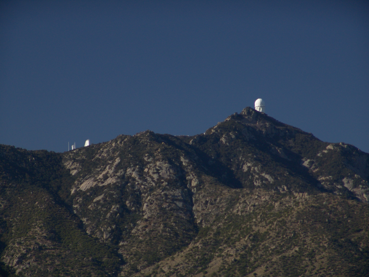
“When George J. Roskruge created the official map of Pima County in 1893, he named the range after James Quinlin, who had opened a stagecoach station in the nearby town of Quinlin in 1884.” — Wikipedia article for “Quinlan Mountains.”
Kitt Peak is the highest point of the Quinlan Mountains, one of a series of ranges starting near the border with Mexico, the Baboquivari Mountains. Pan Tak pass separates Coyote Mountains from the Quinlans. Farther north there is even the Roskruge Mountains and a range named for a silver mine, the Silver Bells. Roskruge originally named “Kit’s Peak” for his sister, Phillippa, married to William F. Kitt. The peak was renamed to Kitt Peak William’s request.
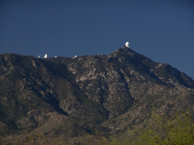
Here we see a dramatic view of Quinlan Ridge with Kitt Peak observatories, taken from the access road Arizona Routh 386. The instruments I recognize are, from left to right, McMath-Pierce Solar Telescope (second in line) and, on the end, Mayall Telescope.
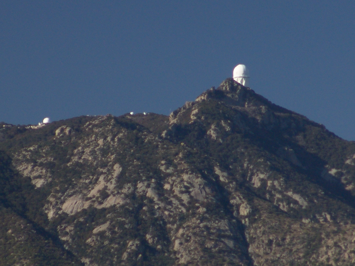
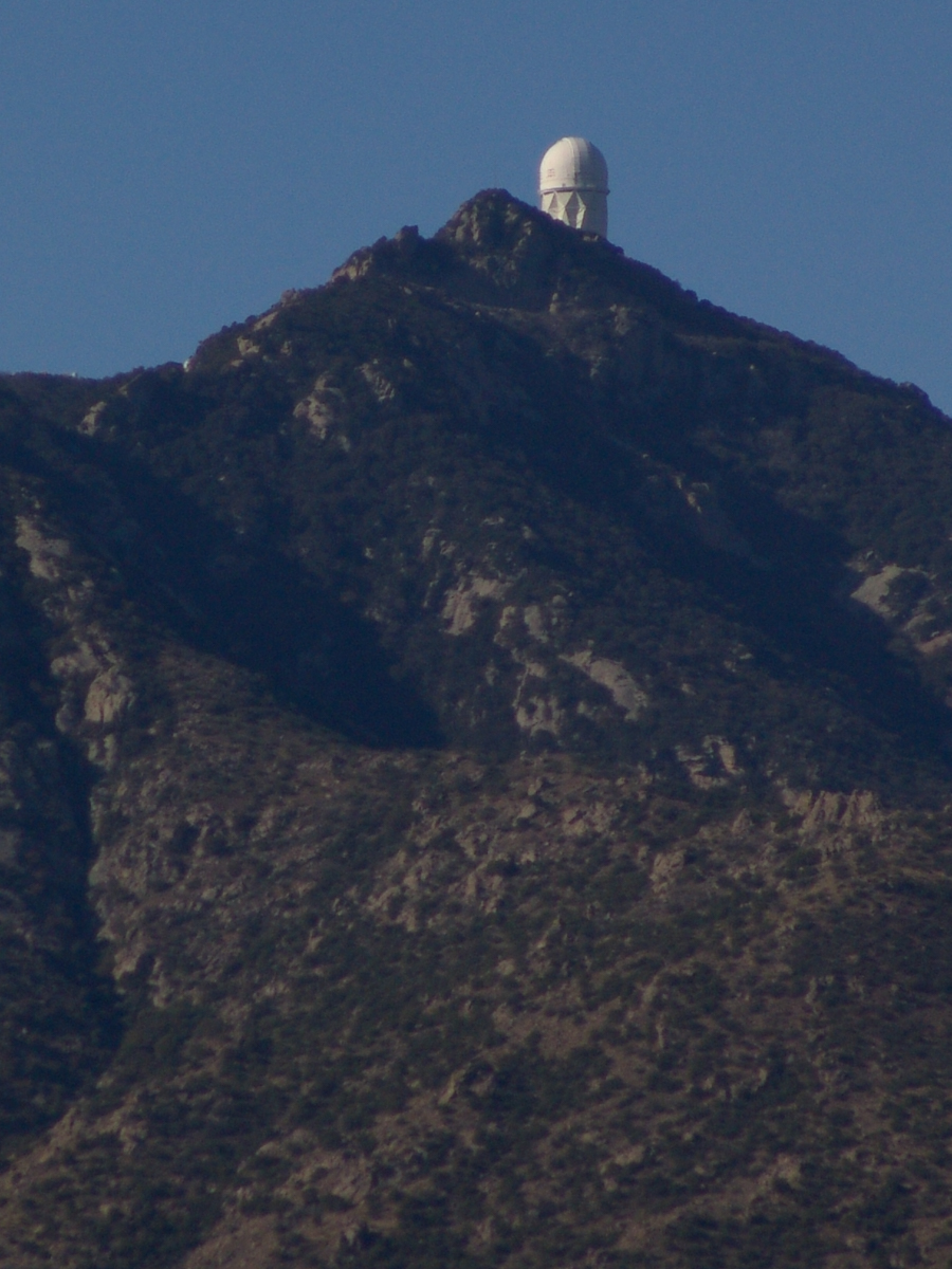
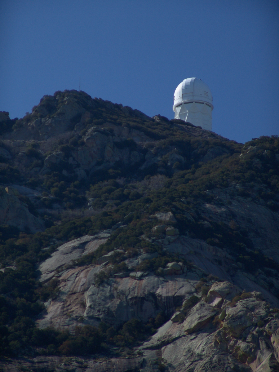
And more views as I progressed toward the top.
.
The dramatic peaks are hypothesized to be igneous intrusions into metamorphic rock, these are called “Sky Islands” for the environments supported on them, radically different from surrounding lowlands. Kitt Peak is known for the stands of Manzanita Bushes
A mature Manzanita growing along the Miller Trail of the Rincon Mountain Wilderness. There is an enlargement of the flowers, to the right.
Copyright 2022 Michael Stephen Wills All Rights Reserved
Sky islands are isolated mountains surrounded by radically different lowland environments. The term originally referred to those found near the southern borders of the U.S. states of Arizona and New Mexico with the northern borders of the Mexican States of Chihuahua and Sonora such as the Dragoon Mountains featured in this post. The isolation has significant implications for these natural habitats. The American Southwest region began warming up between ∼20,000–10,000 years before the present-day and atmospheric temperatures increased substantially, resulting in the formation of vast deserts that isolated the sky islands.
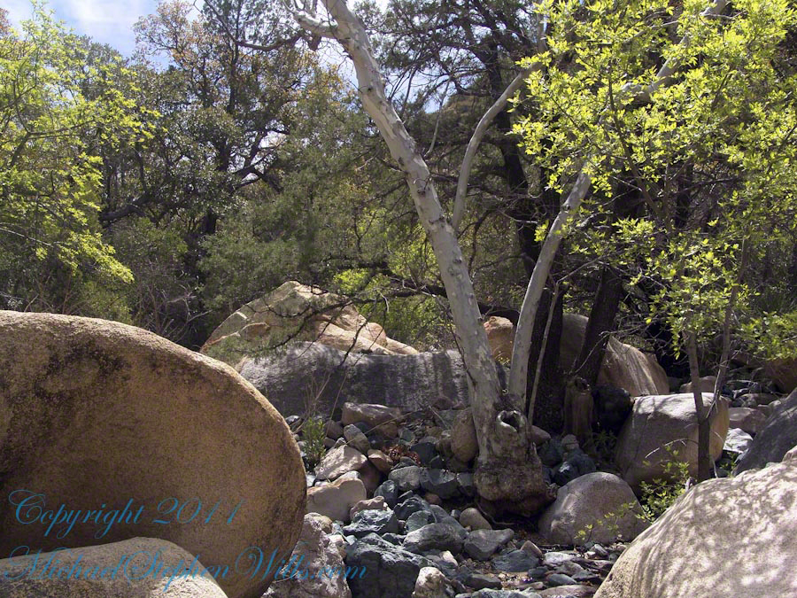
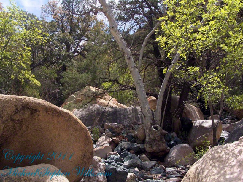
This sycamore tree survives life in this ephemeral stream of an Arizona “Sky Island” by allowing entire trunks to die off during extended dry spells. The tree is an Arizona Sycamore (Platanus wrightii).
Informative sign at campsite
Reference: wikipedia article “Sky Islands.”
Copyright 2022 Michael Stephen Wills All Rights Reserved