Blog

Keep Your Pants On

Dutchman’s breeches

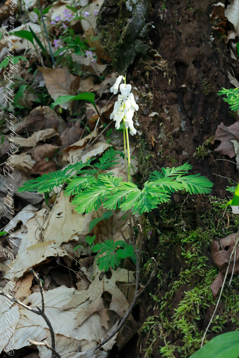
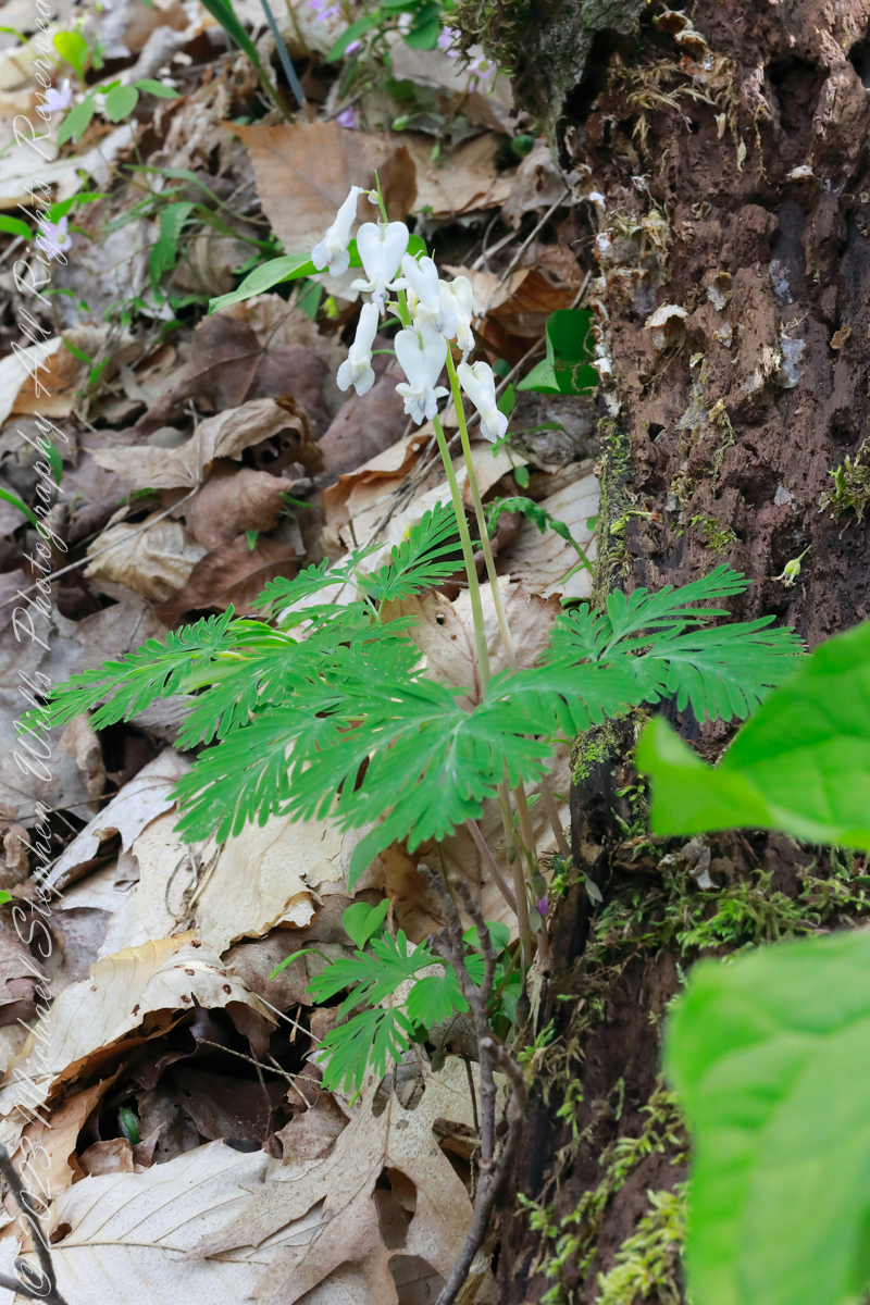
Dutchman’s Breeches (scientific name: Dicentra cucullaria). Dicentra cucullaria is dependent on bumblebees (especially Bombus bimaculatus, a common eastern North American species) for cross-pollination. In fact, the flower structure and mechanism by which it is pollinated indicate that it is adapted for bumblebees, which can separate the outer and inner petals of the flower. They will then use their front legs to expose the stigma, stamen, and anthers. Shortly afterwards, they will sweep pollen in a forward stroke by utilizing their middle legs, before leaving the flower to return to the colony with the pollen. In this way, Dicentra cucullaria is pollinated as the bees move from plant to plant, and the bumblebee meets its dietary needs. The effect of a hallucinogenic compound contained in the plant on livestock has led ranchers to refer to it as ‘Staggerweed’.

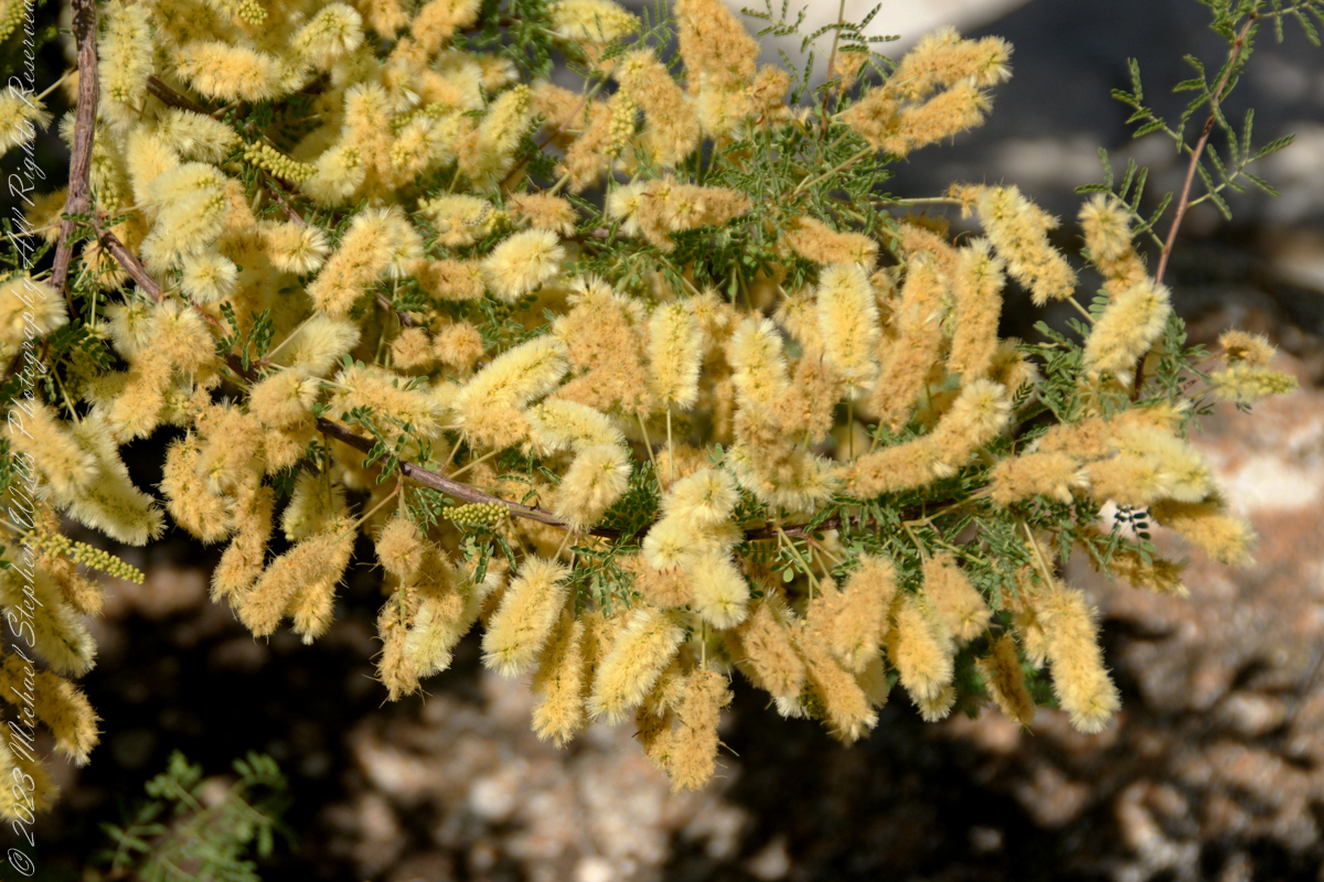
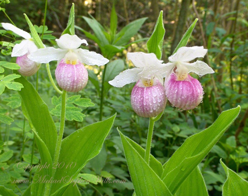
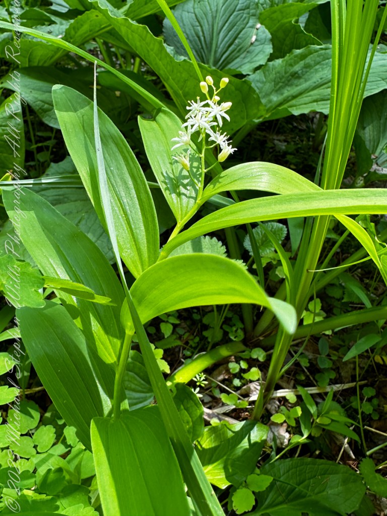
Click for my Fine Art Photography Gallery.

Dutchman’s breeches were likely introduced to cultivation in England when Philip Miller introduced it to the Chelsea Physic Garden. Miller likely received it from John Bartram. The species was, however, not mentioned in American horticultural literature until the early 19th century. Two clones with pink flowers have received cultivar names: ‘Pittsburg’, which turns pink under certain conditions, and ‘Pink Punk’, collected by Henrik Zetterlund on Saddle Mountain in Oregon, is more consistently pink.

Native Americans and early white practitioners considered this plant useful for syphilis, skin conditions and as a blood purifier. Dutchman’s breeches contain several alkaloids that may have effects on the brain and heart. However, Dicentra cucullaria may be toxic and causes contact dermatitis in some people.

Reference: Wikipedia “Dicentra cucullaria

Copyright 2023 All Rights Reserved Michael Stephen Wills

Dragoon Ridge

Dragoon, not dragon

Dragoon Mountains of southeastern Arizona are named, not for the resemblance of this ridge to the back of a Dragon, but for a type of soldier trained for horseback riding and infantry.  These were the U.S. troops sent to “pacify” the Chiricahua Apache homeland.

Understanding location lighting is a matter of experience and luck.

Cochise Stronghold campsites are on the eastern slope of the Dragoons, sheltering them from the late afternoon sun.

One this day in April I explored the trails until sunset and was lucky enough to be setup for the 14 minutes of that day when the light was absolutely perfect.

Copyright 2023 Michael Stephen Wills All Rights Reserved

Dragoon Spires

Lucky enough

Understanding location lighting is a matter of experience and luck.

Cochise Stronghold campsites are on the eastern slope of the Dragoons, sheltering them from the late afternoon sun.

One this day in April I explored the trails until sunset and was lucky enough to be setup for the 14 minutes of that day when the light was absolutely perfect.

“Dragoon Spires in Afternoon Light”

These photographs are from two days spent at Cochise Stronghold, a part of the U.S. Forest Service Coronado Forest managed by Arizona State Parks located off the Interstate 10 East of Tucson between Benson and Wilcox.

This rugged natural fortress was, for some 15 years, the home and base of operations for the famed Chiricahua Apache Chief, Cochise.  Cochise and about 1,000 of his followers, of whom some 250 were warriors, located here.

Click Me for my OnLine Gallery

Born in present-day Arizona, Cochise led the Chiricahua band of the Apache tribe during a period of violent social upheaval. In 1850, the United States took control over the territory that today comprises Arizona and New Mexico.  Not hostile to the whites at first, he kept peace with the Anglo-Americans until 1861, when he became their implacable foe because of the blunder of a young U.S. Army officer, Lt. George Bascom.   In that year, Cochise and several of his relatives had gone to an encampment of soldiers in order to deny the accusation that they had abducted a child from a ranch. The boy was later proved to have been kidnapped by another band of Apaches.

During the parley, Cochise and his followers were ordered held as hostages by Bascom, but Cochise managed to escape almost immediately by cutting a hole in a tent. Bascom later ordered the other Apache hostages hanged, and the embittered Cochise joined forces with Mangas Coloradas, his father-in-law, in a guerrilla struggle against the American army and settlers. The capture and murder of Mangas Coloradas in 1863 left Cochise as the Apache war chief.   The U.S. Army captured him in 1871 and prepared to transfer the Chiricahua to a reservation hundreds of miles away, but he escaped again and renewed the resistance campaign. The following year after negotiating a new treaty with the help of Thomas Jeffords, the band was allowed  to stay in their homeland.

Cochise is reputed to have been a master strategist and leader who was never conquered in battle.  He died peacefully on the newly formed Chiricahua  reservation in 1874.  His son, Taza succeeded him as chief.   Upon his death, he was secretly buried somewhere in or near his impregnable fortress.  The exact location has never been revealed or determined.

The town of Cochise, Cochise County, the renowned geological feature known as Cochise’s Head in the Chiricahua Mountains, and the Stronghold are all named in tribute to him.

Copyright 2023 Michael Stephen Wills All Rights Reserved

Cochise Stronghold Introduction

Campground is closed in June, July, and August due to the often-extreme heat

These photographs are from two days spent at Cochise Stronghold, a part of the U.S. Forest Service Coronado Forest managed by Arizona State Parks located off the Interstate 10 East of Tucson between Benson and Wilcox.

“Idyllic Desert Landscape with Boulders”


Click Me for my OnLine Gallery

“Generations”


Here is the Cochise Stronghold information sign from the Douglas Ranger District of the Coronado National Forest.

The Dragoon Mountains are a low range that barely rises above the surrounding desert floor. Nevertheless, the granite boulders are spectacular and well worth visiting for the scenery alone. This mountain range is remote from cities or even any large towns, so visitation is light. Late fall, winter, and early spring are the best times to visit. Temperatures exceeding 100 degrees are common even in spring and fall. Cochise Stronghold Campground is closed in June, July, and August due to the often-extreme heat.

Safety First: Heat and low humidity are real hazards for people unfamiliar with desert climates. A person can loose up to 5 quarts of fluid a day and it is easy to become seriously dehydrated without realizing it, so drink plenty of fluids even if you do not feel very thirsty. Always carry extra water in your car. When going on a hike, even if a short one, take a day pack with water, snack foods, protective clothing, flashlight, first aid kit, compass, and map. To avoid sun in

Copyright 2023 Michael Stephen Wills All Rights Reserved

Oak Creek Mandala

early one still morning

This quiet nook is hidden along the Oak Creek Canyon trail, though easy enough to find.

I visited there just at dawn when the air was still and the usually busy site deserted.

Oak Creek Canyon is named for the native, evergreen oak species unique to desert environments.  The leaves conserve moisture: small, thick.  I remember camping at the Chiricahua National Monument on November.  All night the acorns fell onto the metal picnic tables, a loud metallic thunk.  

The post header is a primrose flower growing on the bank of Oak Creek.

Recognize the rock from “Oak Creek Mandala”?  This is farther up the Oak Creek Canyon trail, “photograph by Pam Wills.”  I am in my warm weather photography kit of the time having passed the camera to Pam for the shot.

Click this link for my Fine Art Photography gallery. You can find Oak Creek Mandala in the Arizona gallery.  The gallery description gives more information about the site.

Click this link for another Arizona post, “Cochise Dawn.”

Cochise Spring

ancestral Apache land

Interstate 10 between Benson and Wilcox ascends through a field of enormous, eroded granite boulders. Off to the west are the Dragoon Mountains, otherwise known as “Cochise Stronghold.”

Informative sign at campsite

Starting from the campsite is the “Sky Islands Traverse” hiking trail, leading up into the mountains. I wandered from the trail to follow a dry streambed to this residual pool of water, the time being early spring, and this is what remained from the winter rains.

Click Me for my Online Galleries

A single butterfly of the genus Anthocharis generally called “Orangetip” for the colorful upper wing tips. These exist throughout the world, here in Arizona they migrate across the desert, obtaining refuge and nourishment from “Sky Islands” such as the Dragoon Mountains

Copyright 2022 Michael Stephen Wills All Rights Reserved

Mesquite Flowers and Seeds

desert survival

Mesquite is the Sonoran Desert smell carried by distant rain, omnipresent and humble, a survivor with tap root extending 190 feet down to draw on the water table.

Click Me for my Online Gallery

Prosopis is the scientific name for about 40 species of leguminous trees. Present in North America since the Pliocene era, mesquite wood has been dated to 1300 BC.

I found this flowering mesquite bush in Finger Rock Canyon of the Catalina Mountains outside Tucson, Arizona.

They are thought to have evolved with megafauna in the New World. The loss of North American megafauna at the end of the Pleistocene era gave way to one theory of how the Prosopis spp. were able to survive.

One theory is that the loss of the megafauna allowed Prosopis spp. to use their fruit pods to attract other organisms to spread their seeds; then, with the introduction of livestock, they were able to spread into grasslands.

The plentiful legumes that develop from these flowers are edible when cooked. The shape and color of the seeds can be understood from this empty seed pod that happens to lie near a tarantula burrow.

Click me to read more about the uses of mesquite.

References:
“Mesquite,” Wikipedia

Copyright 2023 Michael Stephen Wills All Rights Reserved

Disappeared

Very Rare

I was lucky enough to live near the site of these wild orchids back in the early 2000’s, close enough to enjoy serial visits, enough to find this perfect moment titled “After the Rain.” In recent visits there were no specimens to be found. The reasons for the disappearance are not clear.

Click me to view “After the Rain” from my Online gallery.

Showy lady’s slipper, scientific name Cypripedium reginae, is also known as pink-and-white lady’s-slipper, and queen’s lady’s-slipper, is a rare lady’s-slipper orchid native to northern North America. Although never common, this plant has vanished from much of its historical range due to habitat loss. It is the state flower of Minnesota.

Cypripedium reginae grows in wetlands such as fens, wooded swamps, and riverbanks.  Cypripedium reginae thrives in neutral to basic soils but can be found in slightly acidic conditions. The plants often form in clumps by branching of the underground rhizomes. Its roots are typically within a few inches of the top of the soil. It prefers very loose soil and when growing in fens it will most often be found in mossy hummocks.

It can tolerate full sun but prefers partial shade for some part of the day. When exposed to full sun, the flower lip is somewhat bleached and less deeply colored. It is occasionally eaten by white-tailed deer.

Cypripedium reginae can be found in Canada from Saskatchewan east to Atlantic Canada, and the United States from North Dakota east to the Atlantic and south to Arkansas and Tennessee.

Cypripedium reginae is quite rare. Its increasing rarity is attributable to destruction of a suitable alkaline habitat; it is sensitive to hydrologic disturbances, and is threatened by wetland draining, water contamination, habitat destruction and horticultural collectors. Browsing by an exploding deer population stunts or eliminates the plant’s growth.

Cypripedium reginae contains an irritant, cypripedin, a phenanthrenequinone. The plant is known to cause dermatitis on the hands and face. The first report of the allergy reaction was in 1875 by H. H. Babcock in the United States, 35 years before the term “allergy” was coined. The allergen was later isolated in West Germany by Bjorn M. Hausen and associates.

Reference: “Cypripedium reginae” wikipedia

Images and captions Copyright 2023 Michael Stephen Wills All Rights Reserved

Common and Beautiful

Happy June First!!

False Solomon’s Seal, scientific name Maianthemum racemosum, is common in the Finger Lakes Region. I found this specimen during a walk with the grandchildren in a local fen among the post-glacial terrain of the Finger Lakes Region.

False Solomon’s Seal is a common, widespread plant with numerous common names and synonyms, known from every US state except Hawaii, and from every Canadian province and territory (except Nunavut and the Yukon), as well as from Mexico. What name do YOU know it by?

Because it resembles plants of the highly toxic Veratrum genus, this species should not be consumed unless identification is positive. The plant becomes fibrous and bitter after it completes flowering and seed-setting, but the tender young shoots can be stripped of their leaves, simmered in water and eaten. Their delicate flavor is somewhat reminiscent of asparagus. The ripe fruits are edible raw or cooked but may be poor in taste. They can be laxative if consumed in large quantities.

Ojibwa harvested the roots of this plant and cooked them in lye water overnight to remove the bitterness and neutralize their strong laxative qualities. Native Americans boiled the roots to make tea for medicinal purposes, including to treat rheumatism, kidney issues, and wounds and back injuries.

Reference: “Maianthemum racemosum” wikipedia

Images and captions Copyright 2023 Michael Stephen Wills All Rights Reserved

For Tiny Feet

Happy June First!!

Yellow Lady’s Slipper, scientific name Cypripedium parviflorum, is also known as “Moccasin Flower.” I found these on a walk with the grandchildren in a local fen among post-glacial terrain. “All this swamp cabbage, phew!!,” said the youngest.

This is a wild orchid that grows all over, though picky as to habitat.

–Newfoundland to British-Columbia, south to Georgia, Arizona, and Washington; Europe.
–Newfoundland to Alaska and south to Oregon in the West.
–In the East along the Atlantic Coast, it is in every state except Florida and extends across to Louisiana and eastern Texas.
–New Mexico state: Catron, Colfax, Grant, Los Alamos, Otero, San Miguel, San Juan and Santa Fe Counties.
–Arizona state: Apache, Graham, and Greenlee Counties.

Habitats and requirements: A more upland plant preferring subacidic to neutral soils. Primarily in mesic to dry-mesic upland forests, woodlands with deep humus or layers of leaf litter, shaded boggy habitats, but also in hill prairies and occasionally in wetlands with organic, well-drained, sandy soils. Moderate shade to nearly full sun in fir, pine, and aspen forest between 6000 and 9500 feet (1830 and 2900 meters). Mountain meadows and on timbered slopes. Dripping seeps on steep to moderately sloped canyon walls.

Reference: “Cypripedium parviflorum” wikipedia

Images and captions Copyright 2023 Michael Stephen Wills All Rights Reserved