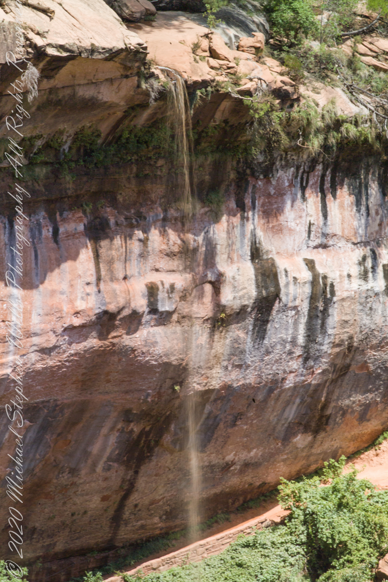
“Water seeping out of the Navajo sandstone creates tranquil springs and the unique “hanging gardens” for which Zion is famous, full of ferns, wildflowers, and mosses.”
ISO 250, 1/6 sec at f/22
Here are three exposures of the same scene.
ISO 250, 1/4 sec at f/22
Click on an image for a closer view.
ISO 250, 1/13 sec at f/22
Can you spot the foot path?
Here is a gallery of the three photographs, to flip back and forth. the primary difference is the exposure within the shadow under the projecting cliff face.
ISO 250, 1/6 sec at f/22
ISO 250, 1/4 sec at f/22
ISO 250, 1/13 sec at f/22
Copyright 2021 Michael Stephen Wills All Rights Reserved
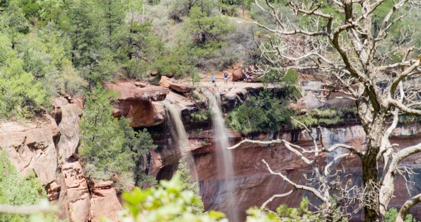
Wandering Zion canyon I spied three visitors seemingly trying their luck on the cliff edge, where the water drops.
ISO 250, 1/8 sec at f/22
Look closely and the rope barrier can be picked out. Can you see the three figures? Click on the image for a larger view.
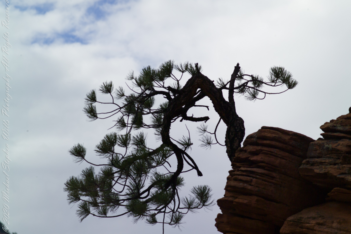
Captured with a Kodak DCS Pro SLE/c dslr and a Canon lens EF 200 mm 1:2.8 L II stabilized with the Manfrotto Studio Tripod model 475 and the 468 Hydrostatic ball head. This series explores the possibility of the iconic “Lone Pine.”
Copyright 2021 Michael Stephen Wills All Rights Reserved
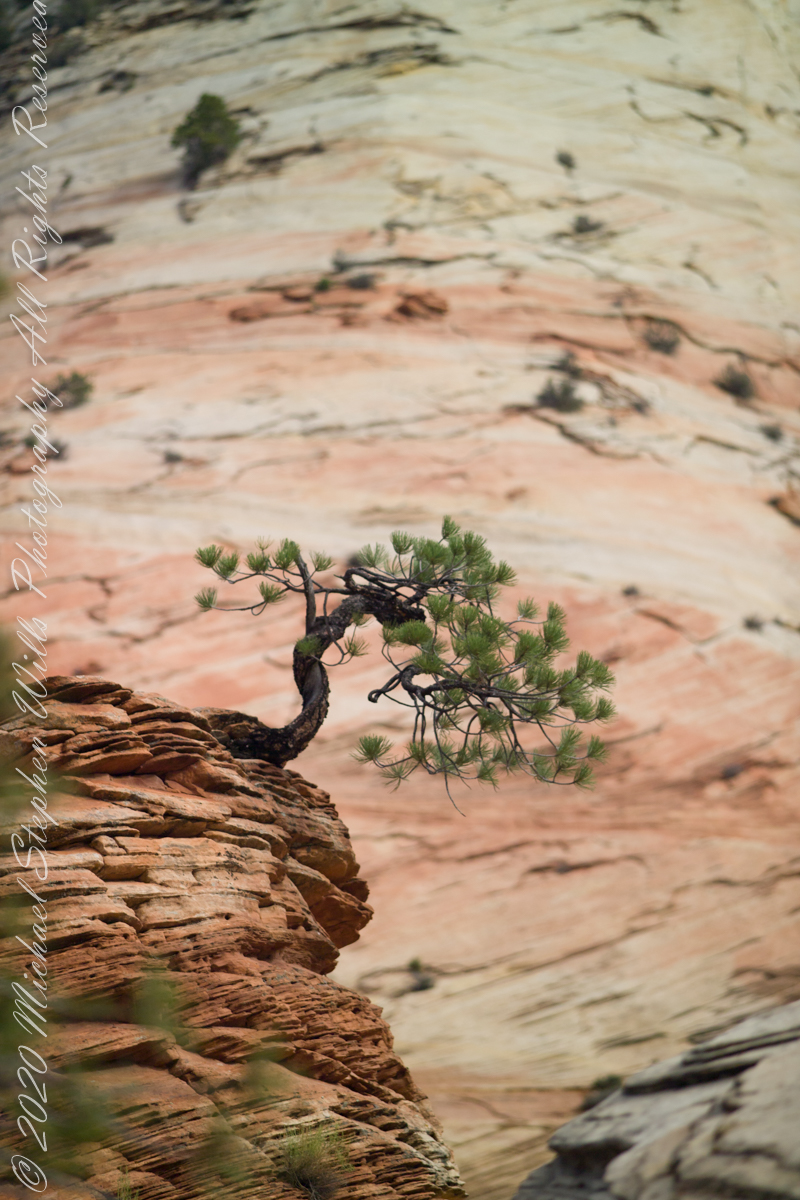
From this angle the Pinyon Pine is backed by Checkerboard Mesa slickrock.
ISO 250 1/800 sec at f/2.8
For humans travelling on foot this weather worn sandstone is anything but slippery, If we wore iron horseshoes the sense of slippery, or slick, rock becomes apparent. It was ranchers mounted on horses who coined the name slickrock.
For this shot we approached Zion National Park from the east, via route 9, past Checkerboard Mesa.
Captured with a Kodak DCS Pro SLE/c dslr and a Canon lens EF 200 mm 1:2.8 L II stabilized with the Manfrotto Studio Tripod model 475 and the 468 Hydrostatic ball head. This series explores the possibility of the iconic “Lone Pine.”
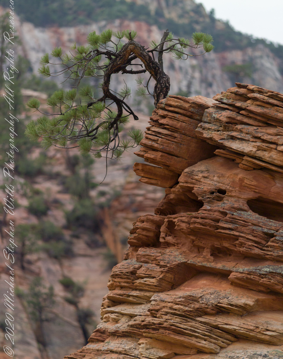
Here is a gallery of the four Lone Pine images.
Copyright 2021 Michael Stephen Wills All Rights Reserved
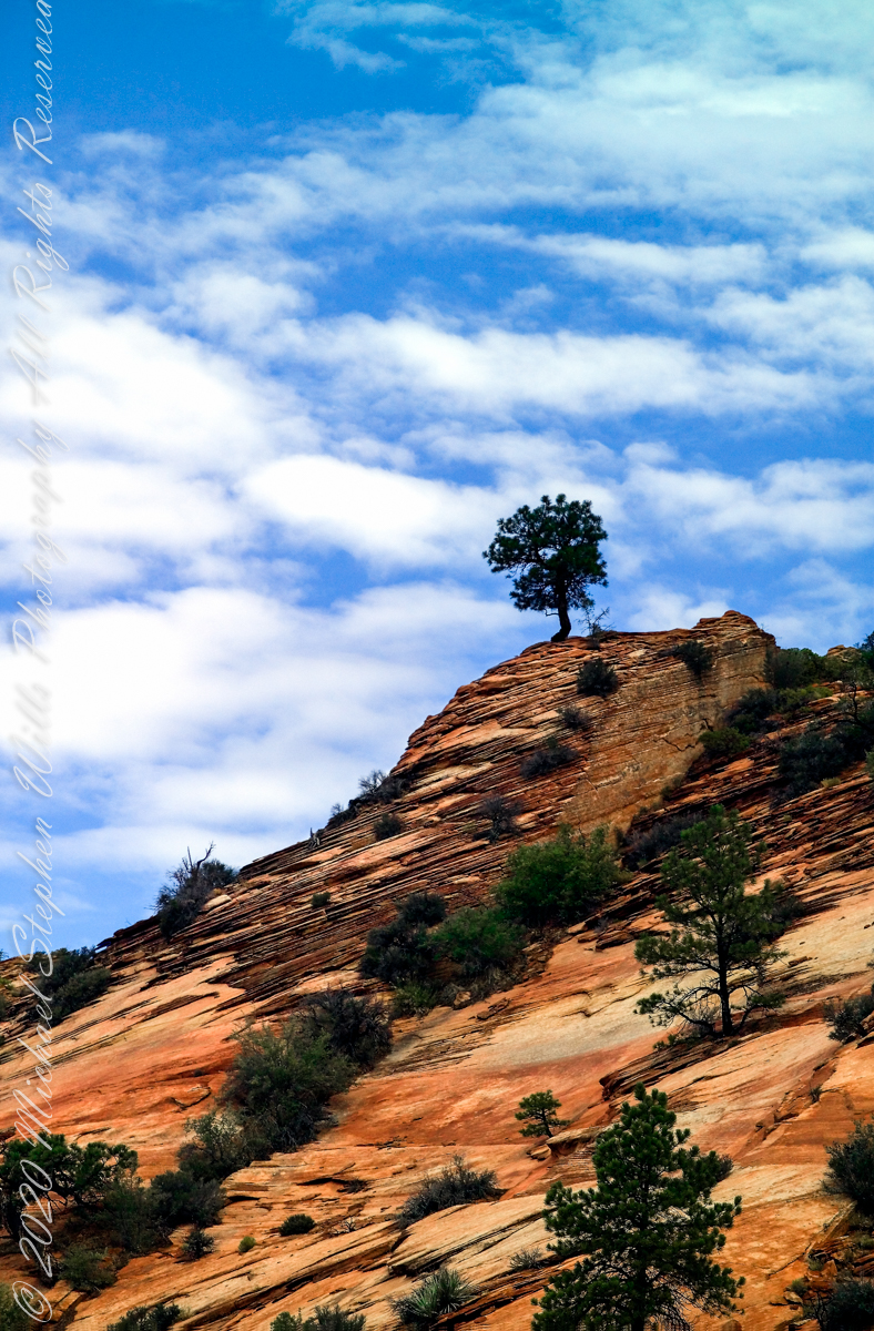
What is a Lone Pine without the sky? This specimen somewhat less gnarled than numbers 1 and 2. Here we see more of the beetling crag, layered up sediment of eons.
ISO 250 1/400 sec at f/4.0
For this shot we approached Zion National Park from the east, via route 9, past Checkerboard Mesa. Our lodging was to the east, probably the Best Western in Mt. Carmel on Rt 89. Meaning there were four opportunities for capturing memorable East Zion images over two days.
Captured with a Kodak DCS Pro SLE/c dslr and a Canon lens EF 200 mm 1:2.8 L II stabilized with the Manfrotto Studio Tripod model 475 and the 468 Hydrostatic ball head. This series explores the possibility of the iconic “Lone Pine.”
Copyright 2021 Michael Stephen Wills All Rights Reserved
Here is the same gnarled pinyon pine of the previous post, with a sky centered exposure revealing the silhouetted wonder.
ISO 250 1/1000 sec at f/7.1
Captured with a Kodak DCS Pro SLE/c dslr and a Canon lens EF 200 mm 1:2.8 L II stabilized with the Manfrotto Studio Tripod model 475 and the 468 Hydrostatic ball head. This series explores the possibility of the iconic “Lone Pine.”
Copyright 2021 Michael Stephen Wills All Rights Reserved
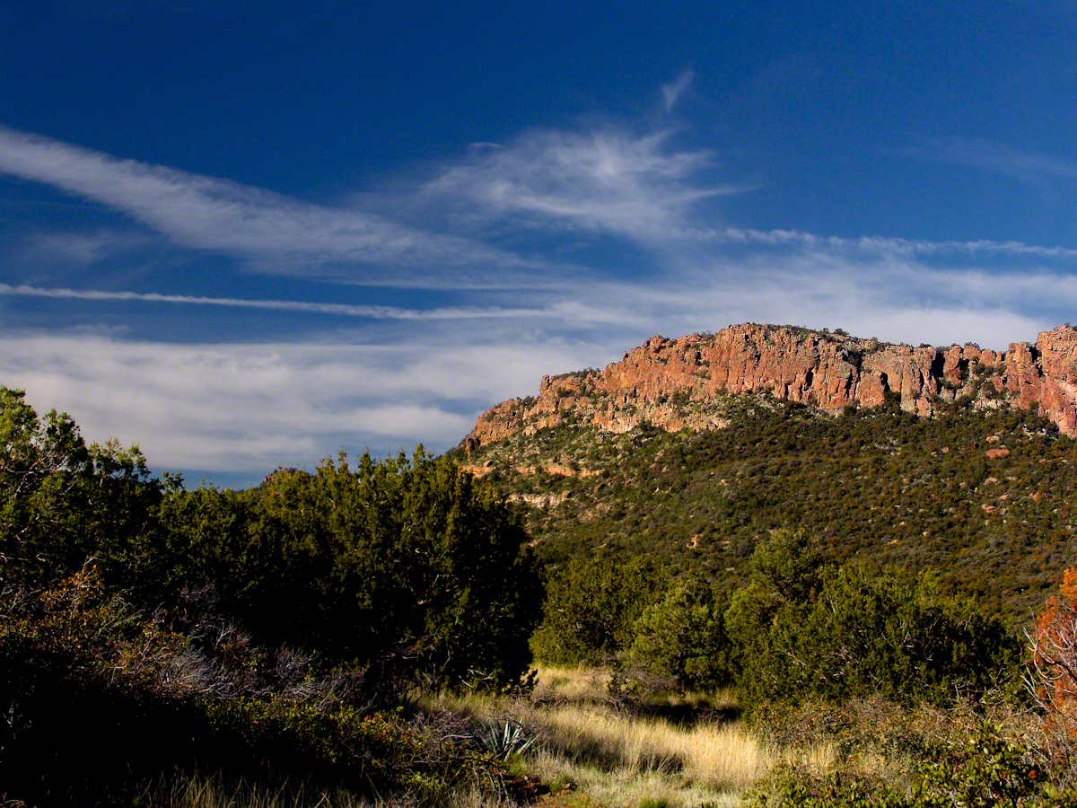
The eastern approach Zion Canyon is a national park unto itself, route 9 passes through otherworldly landscapes.
ISO 250 1/1000 sec at f/2.8
Captured with a Kodak DCS Pro SLE/c dslr and a Canon lens EF 200 mm 1:2.8 L II stabilized with the Manfrotto Studio Tripod model 475 and the 468 Hydrostatic ball head. This series explores the possibility of the iconis “Lone Pine.” Here the tortured existence of this organism is rendered plain.
Copyright 2021 Michael Stephen Wills All Rights Reserved
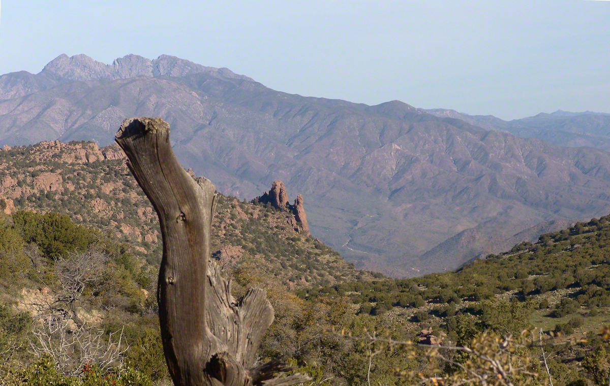
Imagine walking across the ranch house ruin towards where I described the former pond. Looking to the east and north from the elevation you see this sight.
In the near distance a grass pasture slopes into Reavis Creek. The creek has flowing water in all but the longest dry seasons. By the way, the trail from Pine Creek is on the slopes of that conical feature in the distance, to the left.
Click any photograph for a larger version.
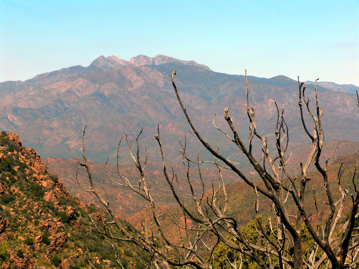
Looking from the former house site towards the Arizona Trail running beneath the distant red rock ridge. Not the fence rails on the left and apple trees in bloom.
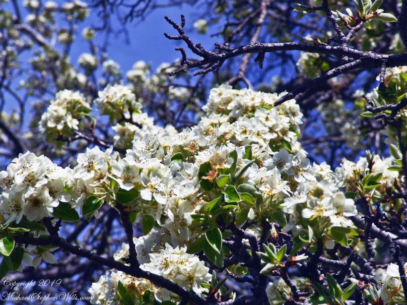
From the ruin, walk down the Arizona Trail, south, for a few hundred feet and turn left into the fields to encounter the same apple tree, and a close up of pure white apple blossoms.
Portrait of a Blooming Apple Tree
At Rest and History
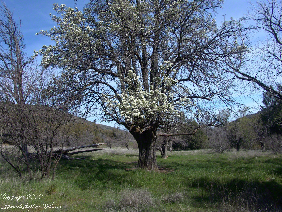
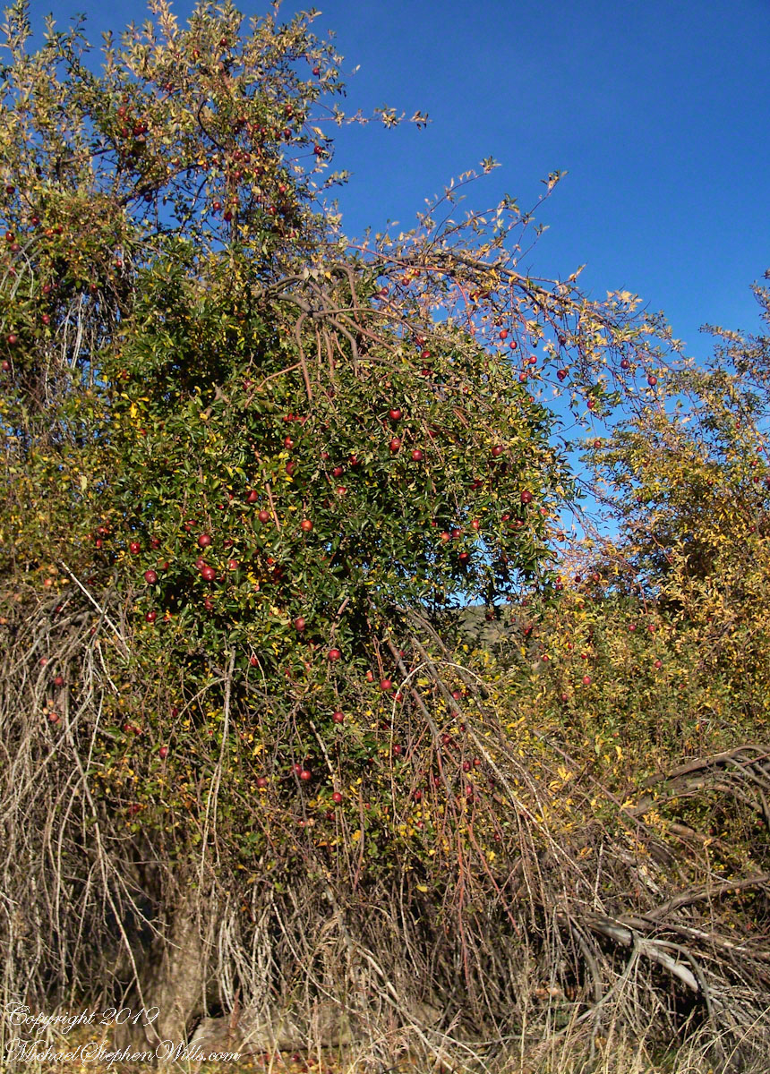
This tree is an outlier of a thick stand of several hundred trees to the north. The Searcher and I rode into the middle of the grove for a rest and chat. The horses were allowed to graze in the abundant new grass brought on by the winter rains.
The Searcher told me the story of the valley and that it was a man named Clemans who planted 600+ apple trees, trees in bloom all around us. The Reavis Valley was long a site of agriculture, starting in the 19th century with Elisha Reavis, who passed away in 1896 and is buried on the slopes of White Mountain, and continued with a series of ranchers and entrepreneurs in the 20th: John Fraser, William Clemans, who planted the trees, and John A. “Hoolie” Bacon, then Bacon’s son-in-law Floyd Stone who sold the land to the U.S. Department of Agriculture in 1967.
We talked about some earthwork I noticed, in the southern part of the valley. It was part of a water system that diverted Reavis creek flow at the head of the valley to the ranch house. We decided that strange hexogonal structure on the elevation above the house ruin was the site of water storage. At that location the structure would provide a pressure feed for the house and much else.
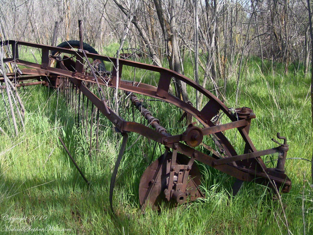
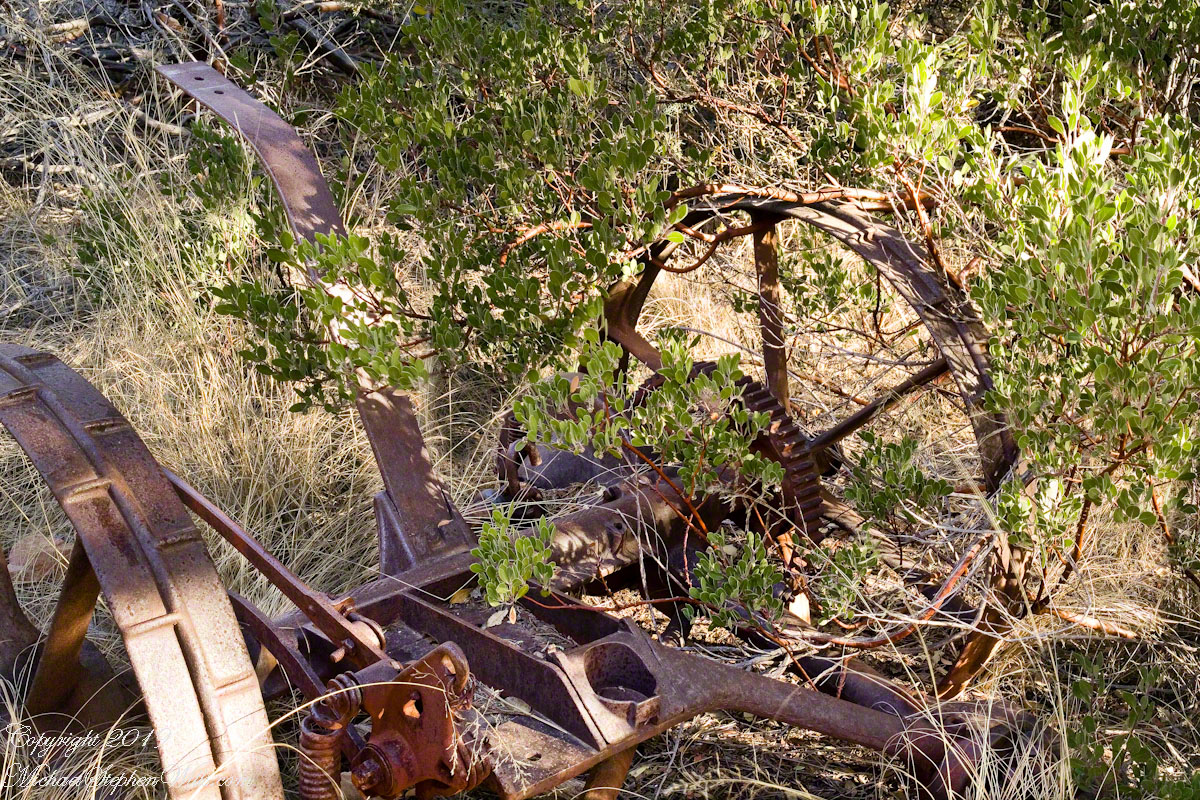
Abandoned Hay Rake
A mix of winter rains and fertile soil were exploited in the Reavis Valley for a handful of decades, the enterprise now is set aside. This abandoned hay rake and chassis, used to harvest grass in seasons past, is evidence of the work. The apple trees produce to this day without irrigation.
The Searcher touched upon the subject of the “Circlestone” ruin he mentioned on our morning ride. He had never been there, but mentioned some books on the subject. It is a wide circle of rough stone wall enclosing mysterious structures. At this point, I was hooked, and decided to check Circlestone on a later trip. Here are some photographs from one of those trips, in November 2006.
Reavis Ranch Apple Orchard Tree
Reavis Ranch Apples Yellow
Reavis Ranch Apples Red
In my next post The Searcher and I return to Pine Creek, Colorado gives me some trouble and we visit a stand of wild oats in the Reavis Gap.
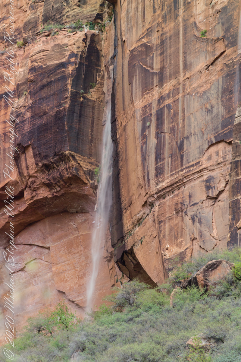
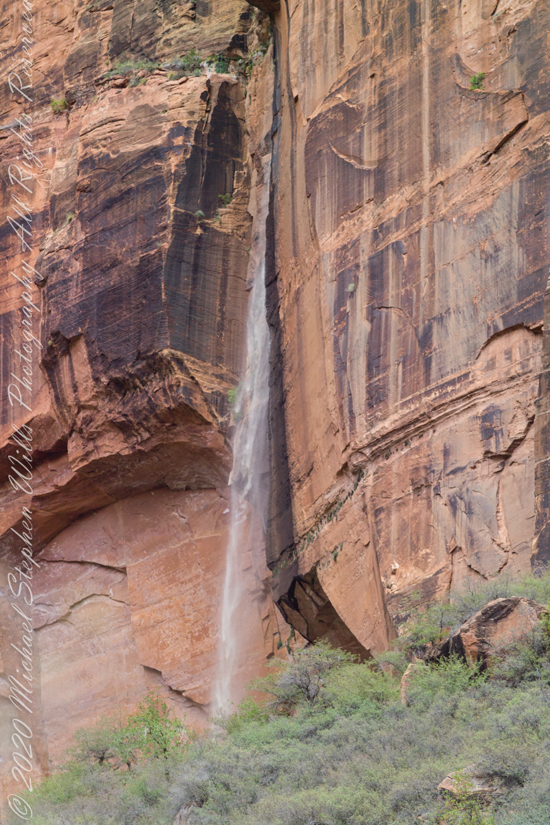
Rainwater from distant thunderstorms on the vast Colorado Plateau emerge from a cliff wall, Zion Canyon. The fall will last for a few hours, we bore lucky witness as do my images shared below.
1/15 sec at f/8.0 ISO 160
Captured with a Kodak DCS Pro SLE/c dslr and a Canon lens EF 200 mm 1:2.8 L II stabilized with the Manfrotto Studio Tripod model 475 and the 468 Hydrostatic ball head. I prefer the details of misting water at the widest lens aperture, focus is clear throughout the plane, excepting some foreground brush.
1/125 sec at f/2.8 ISO 160
Copyright 2021 Michael Stephen Wills All Rights Reserved
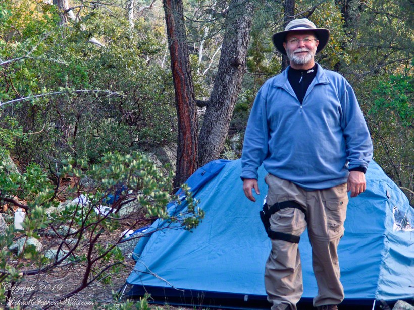
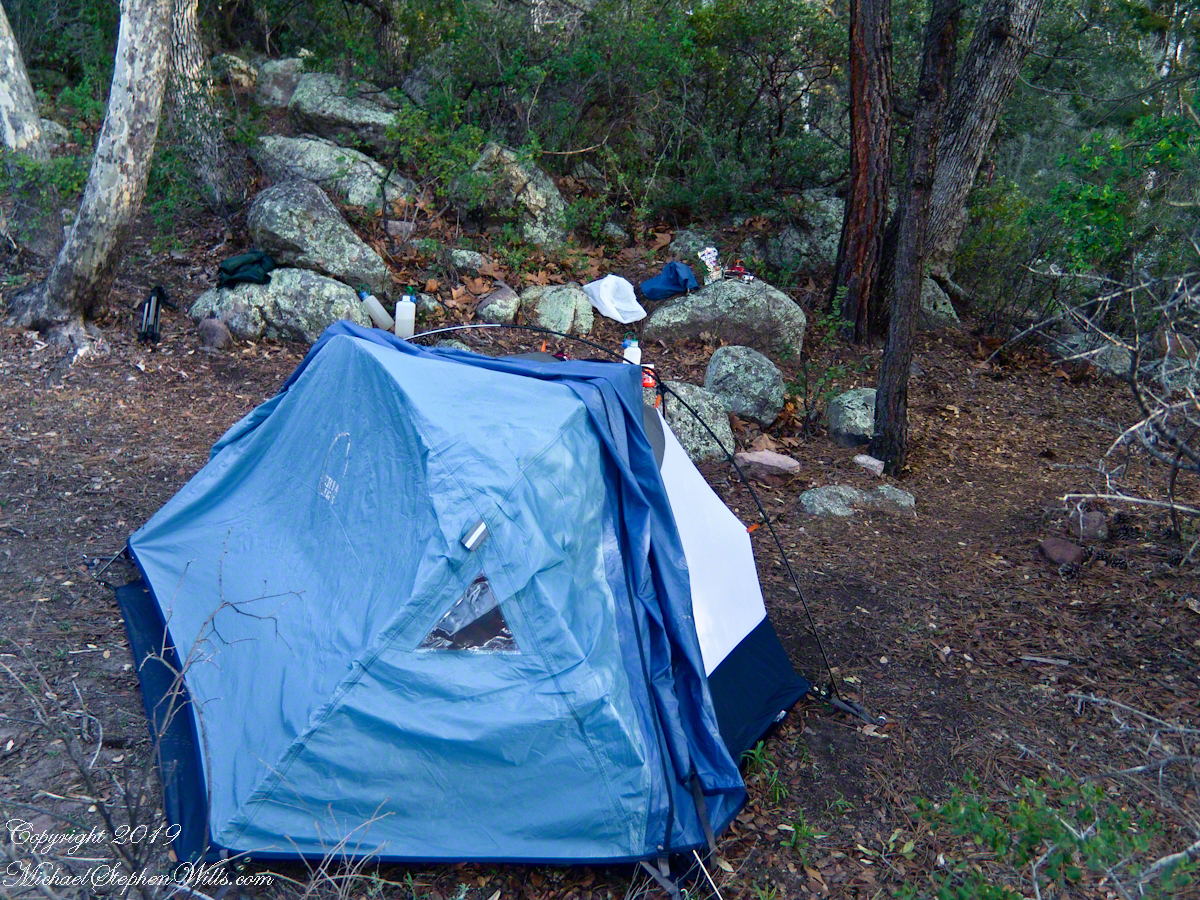
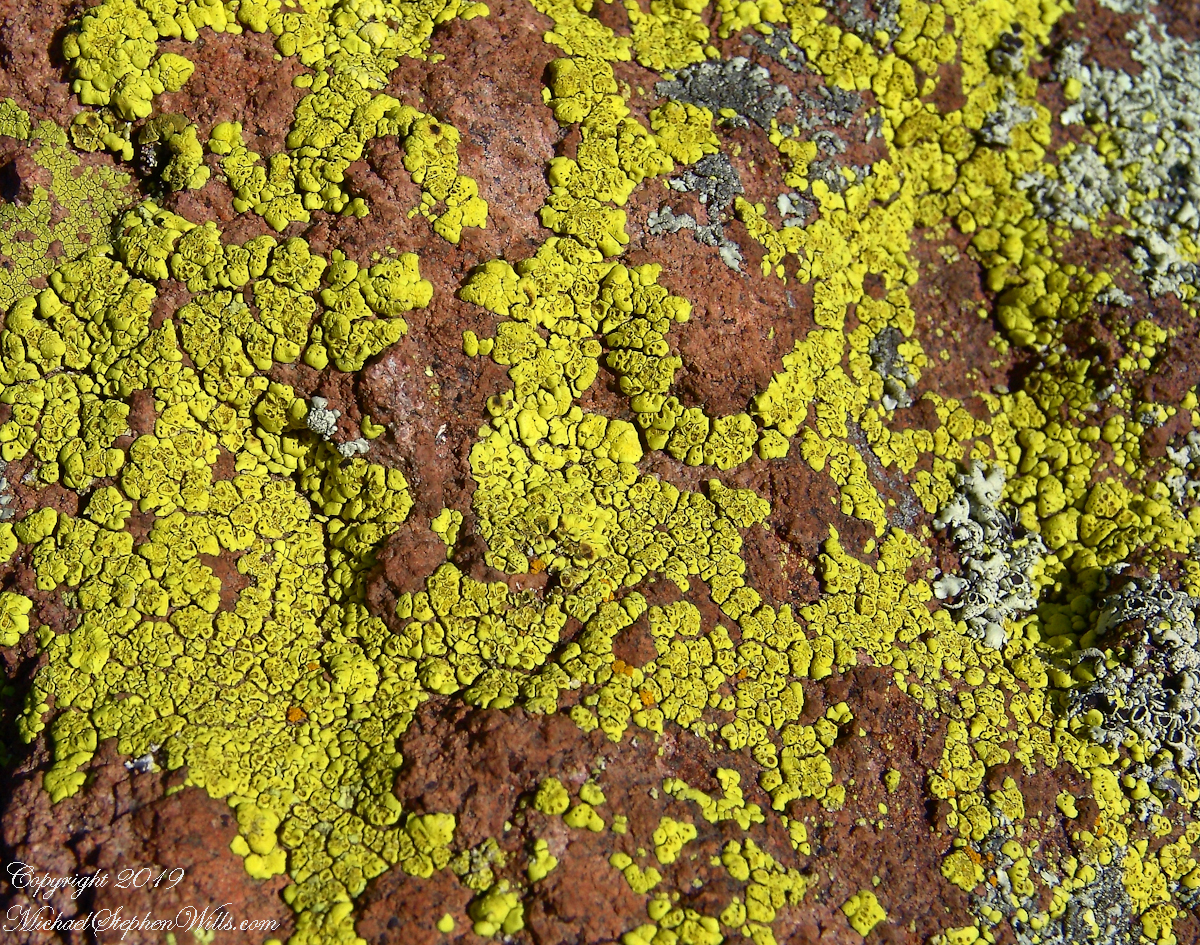
My third wilderness evening was unlike the others. I rested with an unhurried exploration of the camp area. Underfoot was a scatter of dry oak leaves, acorns on hardened desert soil not much softer than the numerous lichen encrusted boulders, all of which formed a bench above Pine Creek.
Pine Creek Camp Overview from a large lichen encrusted boulder
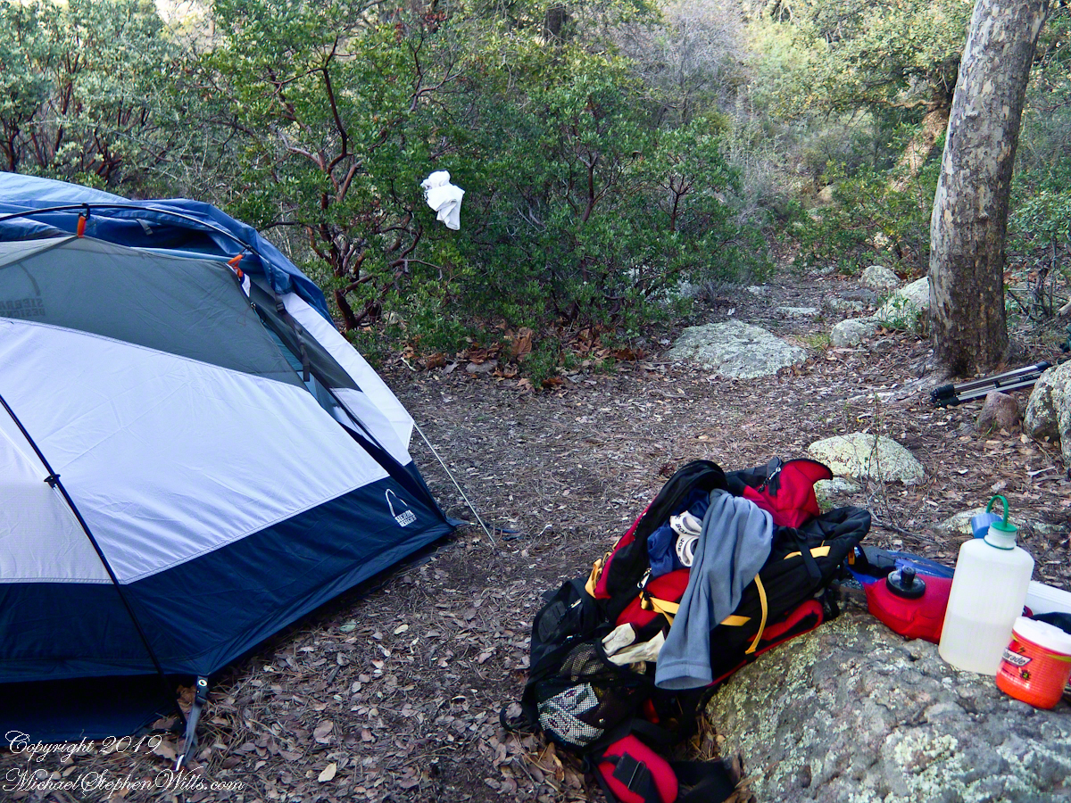
Pumping a gallon of drinking water though the ceramic filter takes more time than meal preparation. The four gallons I packed up were almost used and I enjoyed the luxury of pumping two days supply, 3 gallons in all and planned to down a quart or two of “gator aid” before dinner with the luxurious enjoyment of a flowing Pine Creek for company.
Pine Creek is the most common type for Arizona, recurring. To recur means to happen periodically or repeatedly and, for streams, this means for part of the year no water flows. For these days the flow was low, the water clear, what was left from the plentiful winter rains of 2004/2005.
Looking east toward Manzanita thickets with the unpacked backpack foreground
The wind gently rustled the manzanita and the sun just above the western cliffs as I settled on a boulder to enjoy a quart of fluid. I mulled over my next steps.
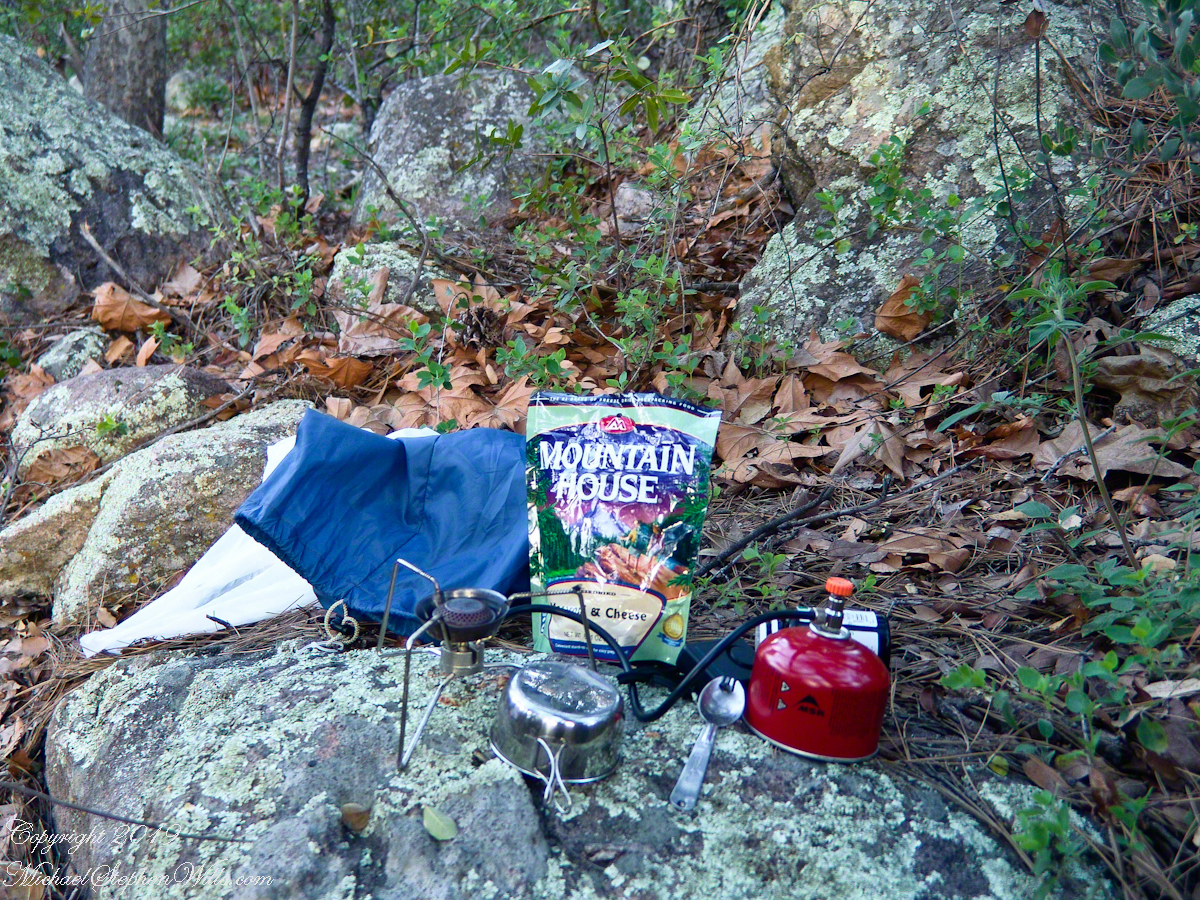
The kitchen: a very light gas burner, spork, dehydrated food with cup for beverages
Initially, the plan was to walk across the Superstition Wilderness, starting on the remote eastern end and emerging on the populated west side, in the Lost Dutchman State Park. My sister expected me there on day 10, but today was the end of day three. I didn’t know at that time the climb on my second day was the steepest of the wilderness and the way forward was much, much easier.
Looking west toward pine creek, manzanita branch foreground and thickets all round, young Ponderosa Pine, Arizona Oak behind tent.
Before a decision could be reach, my thoughts were broken by a different sound from the manzanita: several horses approaching on the trail.
Here is a photographic recap of the previous Superstition Wilderness postings as a gallery. You can page through the photographs.
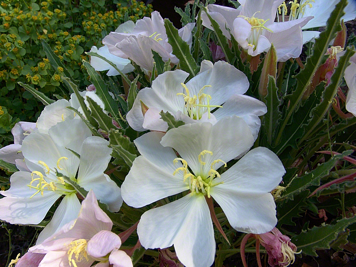
View to the southwest on the Arizona Trail above Pine Creek.Pine Creek of the remote eastern Superstition Wilderness hosts this wild Tufted Evening Primrose.The Arizona Trail passes this spot in the remote eastern Superstition Wilderness. This is the view of my path up from Nameless Canyon. In the distance is the Four Peaks Wilderness Area.Superstition Wilderness, Arizona
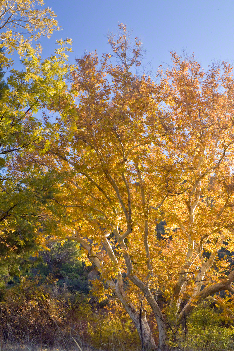
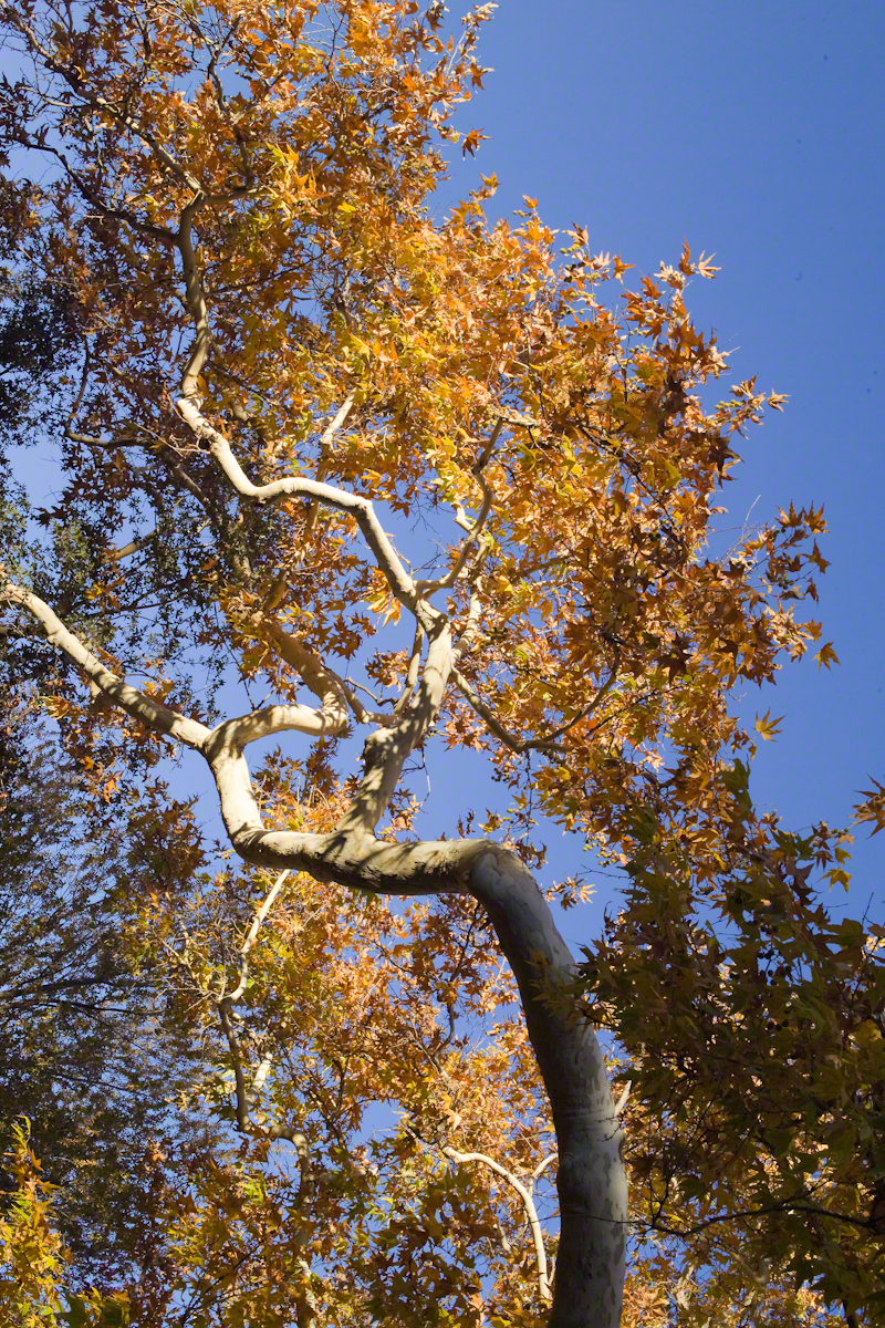
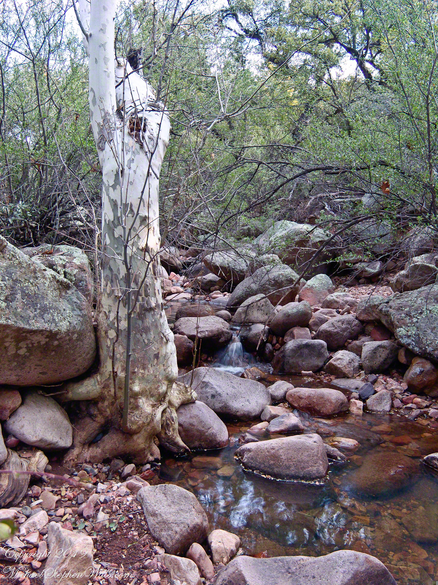
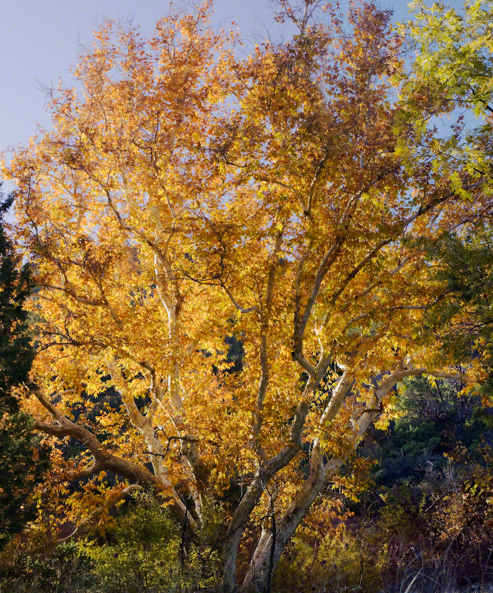
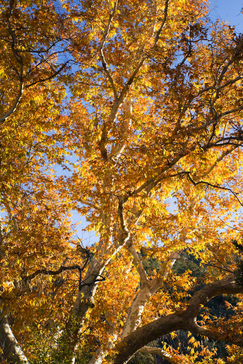
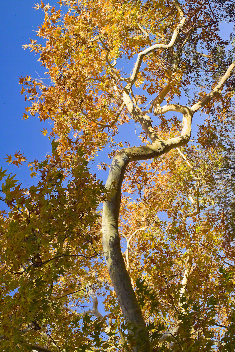
Compare these Arizona Sycamores with the struggling specimen from the last chapter, “A Peaceful Day at Pine Creek.” Many Sycamores such as this one flourish along Reavis Creek, a perennial stream of the eastern Superstition Wilderness. The drainage that feeds Pine Creek is far less acreage than that of Reavis Creek and, when the Pine Creek flow fades in the driest seasons, plants go into survival mode and halt growth and may even slough off limbs to conserve water.
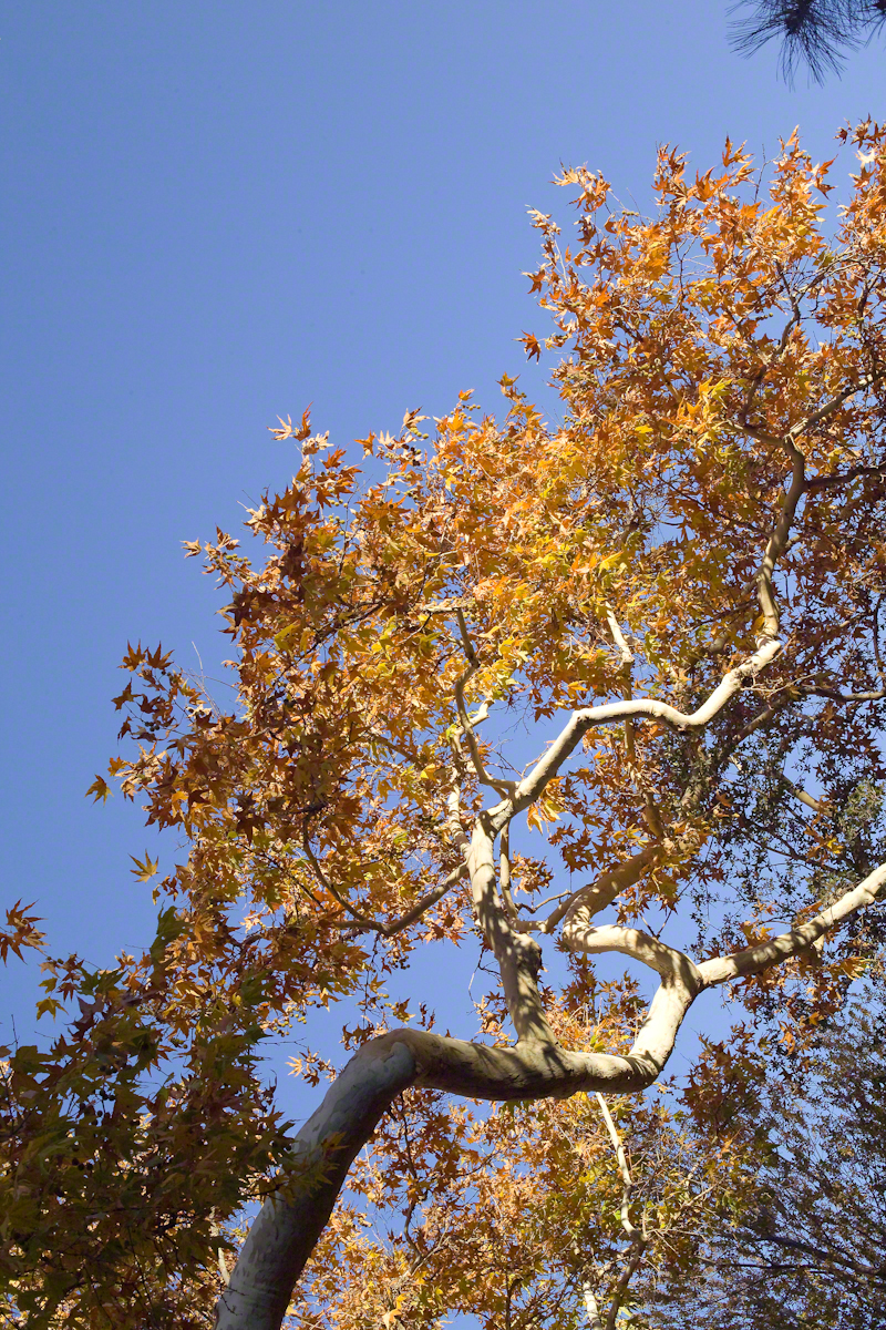
These Sycamores grace a stream that seldom stops flowing, even in the driest of seasons. I had the good fortune to visit the Reavis valley of the Superstition Wilderness in November 2007, when these trees were at peak autumn foliage.
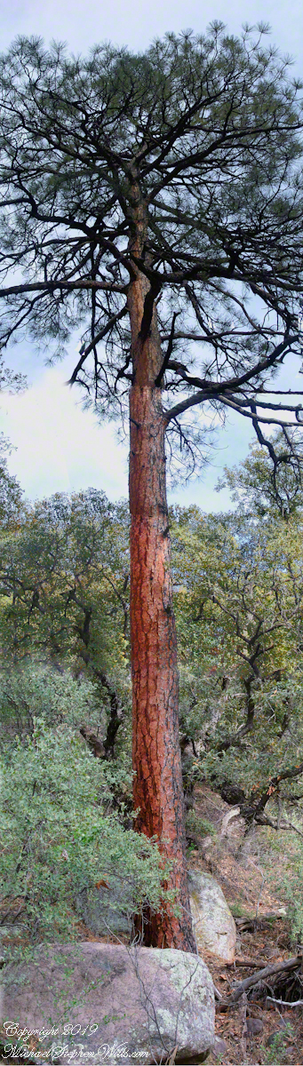
The tree requires a supply of water to thrive. This specimen demonstrates the species growth habit growing multiple trunks with a shape driven by water availability and the environmental context. The multiple trunks may be a desert survival mechanism. In dry periods a trunk or trunks are sloughed off to reduce moisture loss. This is why the Sycamore of “A Peaceful Day at Pine Creek” has a single trunk.”
To encounter a riparian space of the Arizona desert is a revelation, to progress from Sonoran desert spaces assailed by the breath of dry wind, to see the first signs of water in the distance as a welcome fluttering of leaves, to feel a welcome odor of water.
Yes, the first effect of a riparian space on the senses is the smell of water. Let’s finish this post with limbs of the Reavis Creek Arizona Sycamore reaching for the sky.