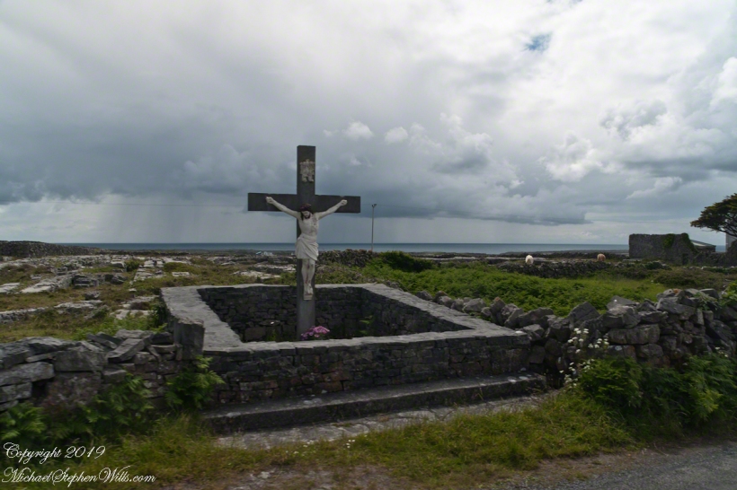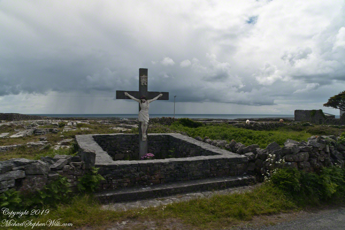
A roadside shrine on Cottage Road, Inishmore. The faith brought by the saints has deep roots here.
A large crucifix set with wet stone walls with cut flowers. The walls are the native limestone.
It is a spring (early June) afternoon and there are fern and wildflowers. The white flowers are Greater Burnet saxifrage (Scientific Name: Pimpinella major).
The existing dry stone wall was interrupted by the shrine. In the distance are dry stone walls around fields, a stone shed, feeding horses and the sea, being Galway Bay, storm clouds with distant rain.
Aran Islands, County Galway, Ireland.
Roadside Shrine and Island Landscape, Inishmore, Aran Islands, County Galway, Ireland
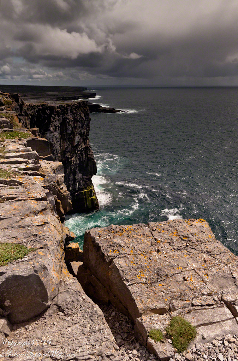
From the commanding location of Dun Aonghasa, looking northeast across Inishmore island, we can understand why the ancient builders chose this location.
We also see the transition from exposed limestone to the fields built literally from the ground up (see my post “The How of Soil”). For a closer view of island houses see my posts “Settled In” and “Cottage Road Cottage.”
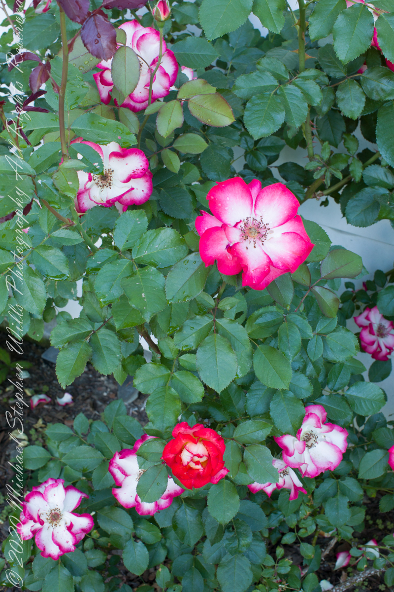
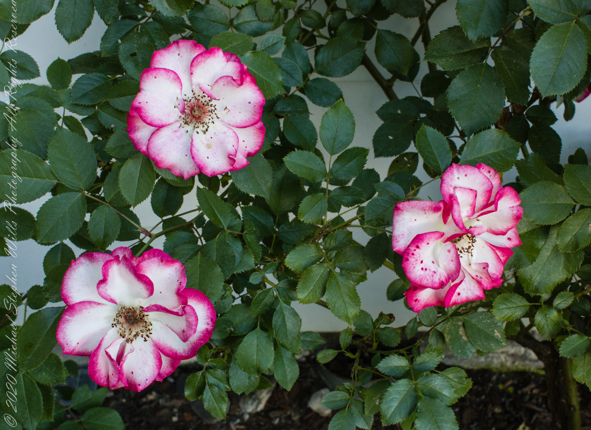
These Floribunda, semi-double petaled blooms were captured along with the yellow double cluster roses of the previous post, in the evening shade of a late spring day, June 23rd.
ISO 800, 1/13 sec at f/16
Above is a mix of just opened (the dark red, center bottom), fully opened new (just to right of center) and aging (all the rest).
ISO 800, 1/30 sec at f/16
Throughout this set I used the Canon EOS 5D Mark IV dslr with the EF 50 mm f/1.2L USM stabilized with a Manfrotto 468MG tripod with Hydrostatic Ball Head.
Floribundas, sometimes called cluster flowered roses, originated with Poulsen’s nursery in Denmark from crossed with Hybrid Teas with Polyantha Roses, themselves crosses between dwarf Chinas and a dwarf, repeat-flowering form of R. multiflora. Texas-based rose hybridizer Tom Carruth released Betty Boop in 1999, naming it after a cartoon character from the 1930’s. Pam found this plant around 2008 offered by the K-mart store in Cortland. She is amazed by the beauty of the Betty Boops.
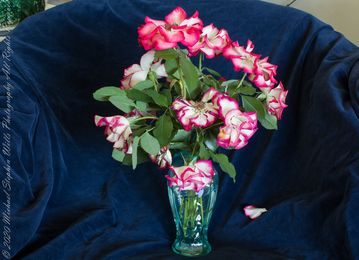
Another beloved characteristic is the longevity of the blooms. Pam collected and arranged this vase last week, for Father’s Day. I provided the setting. In this controlled environment the low ISO provides better colors and contrast with minimal digital noise.
ISO 100, 2.5 sec at f/16.
References
“The Botanical Garden” Vol 1, Roger Phillips and Martyn Rix, Firefly Books, Buffalo, N.Y. 2002 pp 228 – 233.
Wikipedia search for “Betty Boop rose” and ” Tom Carruth rose.”
Copyright 2022 Michael Stephen Wills All Rights Reserved
From the commanding location of Dun Aonghasa, looking northeast across Inishmore island, we can understand why the ancient builders chose this location.
We also see the transition from exposed limestone to the fields built literally from the ground up (see my post “The How of Soil”). For a closer view of island houses see my posts “Settled In” and “Cottage Road Cottage.”
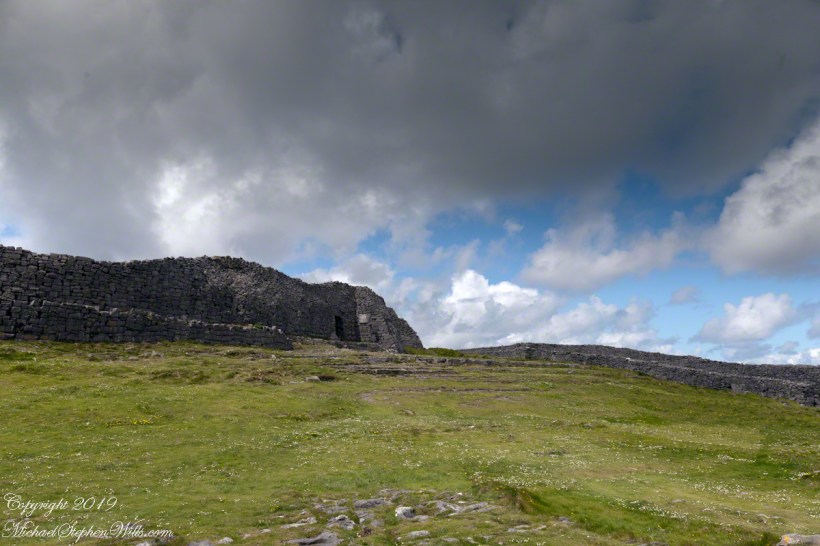
In a previous post, “Inner Ring, at last” we passed over the entrance to the inner enclosure.
A long path through fields, karst landscapes and outer walls leads to this entrance to the inner ring of Dun Aonghasa (Dun Aengus) of Inishmore, Aran Islands, County Galway, Ireland. The image composition is as a dramatic landscape with the surrounding walls and the cloudscape of an approaching storm.
My previous post, “Inner Ring, at last”, lowered the horizon. Here, we study the base of the inner wall.
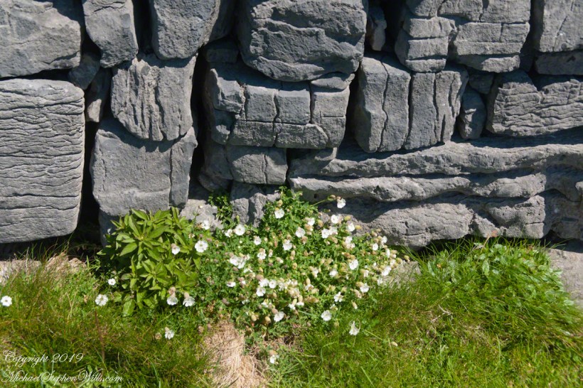
A detail of the interior wall of Dun Aonghasa (Dun Aengus) in springtime. White flowers of Sea Campion (Scientific Name: Silene uniflora) (Irish Name: Coireán mara) set against the ancient dry stone wall. Inishmore, Aran Islands, County Galway, Ireland.
We found Sea Campion throughout the west Ireland coast.
Detail of Dun Aonghasa Dry Stone Wall with White Flowers of Sea
Wishing a blessed All Saints Day (November 1st) for all my readers.
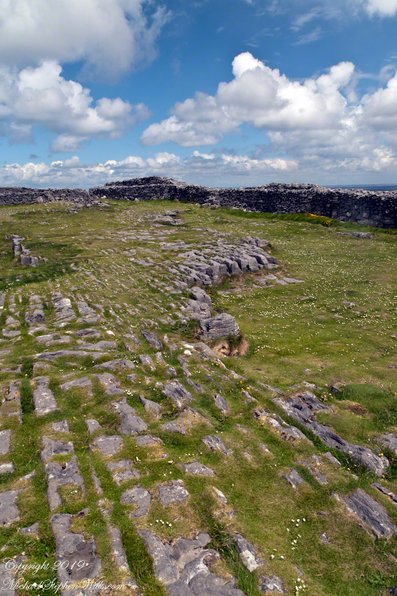
A view to the northwest from within Dun Aonghasa in springtime. The interior a karst formation (see my post, ” Galway Bay View from Dún Aonghasa”), the grikes filled with grass and a sprinkling of white and yellow flowers, a cloudscape rising over the walls. Inishmore, Aran Islands, County Galway, Ireland.
Karst Landscape with Interior Walls of Dun Aonghasa
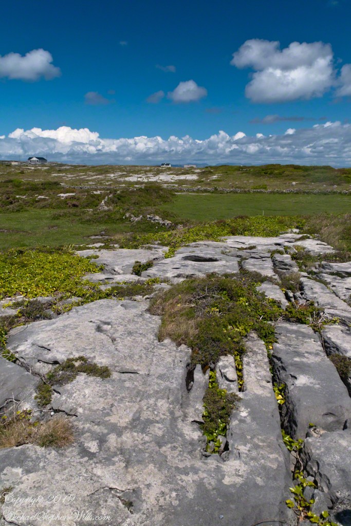
The exposed limestone of the Aran Islands here transitions to a fertile field of grass, husbanded by generations of islanders. Photograph was taken from the path on Inishmore leading up to Dun Aonghasa.
The Aran Islands are an extension of The Burren of Ireland’s Counties Claire and Galway. The word burren is from the Irish Boireann, meaning “great rock.” The glaciers that covered Ireland, retreating about 10,000 years ago, scraped down to the bedrock, exposing wide areas of limestone and dropping, here and there, large rocks. When people came along the foreign nature of the large rocks was recognized, all the more obvious for lying on the horizontally bedded, exposed limestone. We call the foreign rocks erratics. The underlying scoured rock is a pavement for a resemblance to a cobbled roadway.
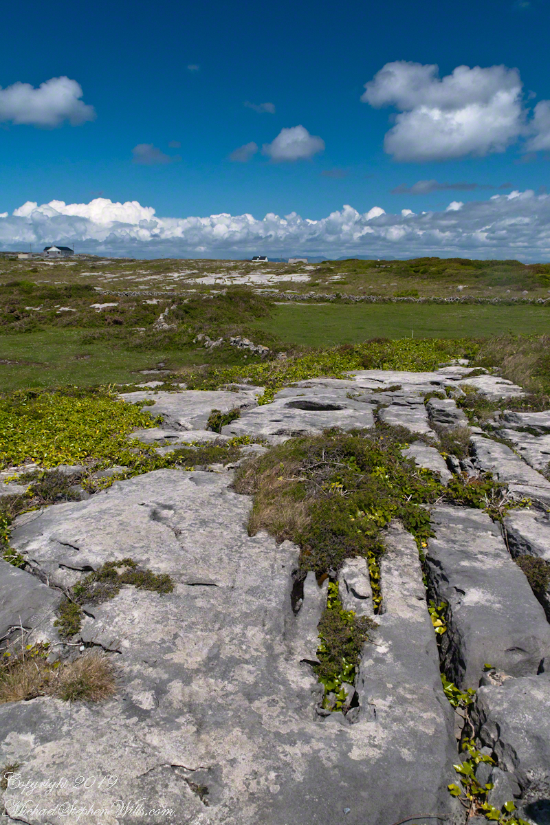
The incised line, filled with grass and wildflowers, in the following photograph is called a gryke. The body of stone between the grykes are clints. Sometimes, the grykes are cross hatched and the clints resemble cobblestones or flat paving stones.
The view is northeast toward the 12 Bens of Connemara. Inishmore, Aran Islands, County Galway, Ireland
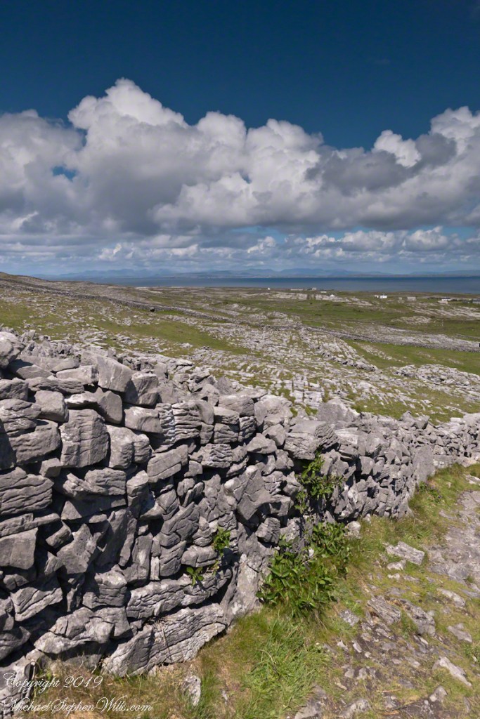
Modern stonework borders the 1/2 mile path to the inner Dún Aonghasa walls, keeping tourists off delicate plants, maintaining the integrity of this ancient site.
The view north, northwest over the walled path to Dun Aonghasa (Dun Aengus) looking across karst landscape, walled fields, farms, the North Atlantic Ocean, coast of Connemara and the 12 Bens (12 Pins) mountains. Aran Islands, County Galway, Ireland.
June 2018 I shed a 53 year old habit of working for a living for new habits in retirement. Instead of waking at 5 am to work for someone else, my routine became to wake at 5 am for personal projects. From June into September 2018 my morning time was spent researching and documenting family history, also known as genealogy: my own and Pam’s.
It was fitting Pam and I spent the last days of that year (June 2018 through May 2019) harvesting our newly acquired knowledge on the ground, a 3 hour drive from our home, to the site of Pam’s earliest ancestor in the New World, at that time Colonial America. Our visit will be book-ended by another this September to Burlington, New Jersey, on the eastern short of the Delaware river, founded by my earliest ancestor, also in Colonial America and 4 hours from our present day home.
A river setting is a link between our ancestors and the two rivers associated in a number of ways. In driving to Athens, New York, a village on the west bank of the Hudson River 31 miles from the state capital, Albany. Our route from Ithaca to Athens included route 23 that passes through the Catskill Mountain, Delaware County, village of Stamford. The headwaters of the west branch of the Delaware River passes through Stamford.
Founded as Loonenberg, named after the first settler Jan Van Loon. Today, Athens is a lovely destination, a historic village on the Hudson River. The rear of the Jan Van Loon house is in the background.
Henry Hudson and the crew of the Half Moon were the first recorded Europeans to visit both the Delaware and Hudson rivers. The Half Moon dropped anchor in Delaware Bay late August, 1609. They reached the estuary of the Hudson (then called the North or the Mauritius). The goal of Hudson was a route to China. Luring him up was the flow and width of the river, Hudson suspected this land was a island, behind which lay the route to the Orient. He navigated up the river for ten days, passing the future site of Athens.
Historical signage with house. One wall remains of the original house, this is a loving restoration on the original site.
Beaver!!
Hudson was in the employ of the Dutch East India Company and it was the Dutch who laid claim to the length of the Hudson for the purpose of trade. In summary, when Swedish/Finnish colonists on the Delaware proved successful in shipping huge numbers of beaver pelts and tobacco the Dutch took control of the Delaware under force of arms in the interest of controlling this trade.
The Dutch, AKA the Dutch East/West India Companies, had little interest in establishing colonies. Instead huge areas of land, “patents”, were granted to individuals with the underlying goal of providing a flow of shippable goods. It remained as such for many years, until 1664 when England, under the king Charles II, took control of New Amsterdam and, by extension, trade flowing on the Hudson River.
Overview of the Jan Van Loon House, 39 South Washington Street, Athens New York from the Athens Veterans Memorial Park with view of the Hudson River and the lighthouse. Phlox are in bloom!!
“Stayed for the Corn“
Jan Van Loon (pronounced Van Loan) comes into the picture with a 1676 marriage to Maria in New Amsterdam. When Jan acquired a major interest in the 1688 Loonenburg patent the land was just opening to European settlers and their tenancy was less than secure. Threatened by incursions of Native Americans and animosities between the French and English. They had eight children who reached adulthood, the house of one of them, Albertus, is one of the oldest continually inhabited residences in New York State.
Athens, New York is the present day name of this town on the Hudson River first settled by Pam’s ancestor in the 17th Century. Pam is pointing to the modern window restoration (aluminum double-hung), the roof is cedar shingle (I believe).
Tradition has it Jan Van Loon acquired the land through a payment of 50 beaver pelts and provided services as a blacksmith, though that had to be after a number of years of residence, since he was a first settler. Pam and I are learning more about those early years, but we know Jan and Maria’s interest in the land was not trade. It was to live peacefully and prosper which they, somehow, did to the benefit of all the people around them.
Detail of the modern restoration of the east foundation wall, Jan Van Loon house, Athens, New York, at the juncture of the field stone/brick joint. The front of the house is to the right.
The lighthouse as viewed from the Jan Van Loon House site. Build 1874, the lighthouse was not part of the environment of Jan and Maria Van Loon.