A Glimpse into Steamboat Landing, Ithaca, New York

Discover the enchanting beauty of Steamboat Landing in Ithaca, New York. From the quiet winter majesty to the vibrant warmth of spring, this historical waterfront is a testament to the city’s rich past and evolving present.


Historical Significance and Transformation


Steamboat Landing in Ithaca, New York, is steeped in historical significance, serving as a testament to the city’s rich past and its evolving present. At the dawn of the 20th century, it was a bustling hub where steamboats carried passengers and freight, linking Ithaca to an ever-growing nation. These vessels were vital for the development of commerce, aiding travelers as they embarked and disembarked on their journeys that continued by stagecoach or later, by train.

In 1790, this spot marked the beginnings of commerce in the area, with the establishment of Ithaca’s first store. Over the years, Steamboat Landing has transformed from a pivotal commerce point to a recreational area, housing Ithaca’s Farmers Market—a vibrant hub that mirrors the liveliness of its heyday.

The Evolving Landscape


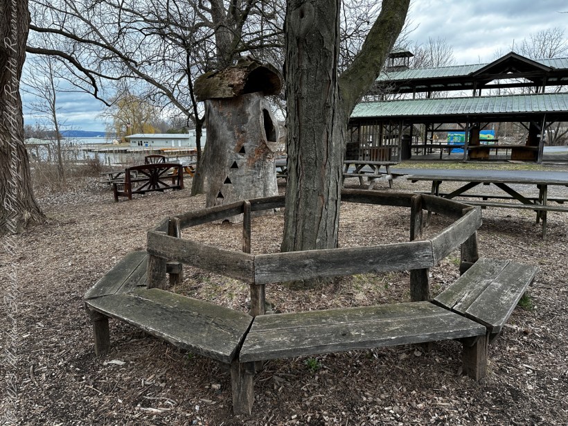
Today, Steamboat Landing is a place of gathering and serenity. My photographs showcase a tranquil setting moving through winter. In one scene, the rustic benches encircle a barren tree, standing as silent guardians of the land. It’s a still image, almost reminiscent of a painting, where the leafless trees stand vigil over the quiet benches.

A circular bench that has seen better days, a hollowed out tree trunk repurposed as a children’s playgound house, picnic benches and, in background, a portion of the Farmer’s Market pavilion, to the right is Johnson Boatyard, Cayuga Inlet and lake. This is the Steamboat Landing, historically the southern port on Cayuga Lake. Cayuga Waterfront Trail, Ithaca, Tompkins County, Finger Lakes Region, New York State.

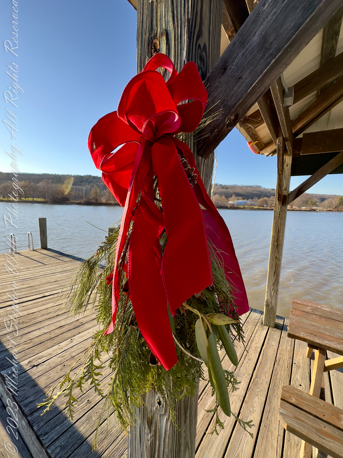
Switching seasons, we see the docks adorned with festive wreaths, injecting life and celebration into the scenery. The bright red ribbons stand out against the crisp blue of the water and the sky, suggesting a community that embraces tradition and the joy of the moment.

Connection with Nature and Community


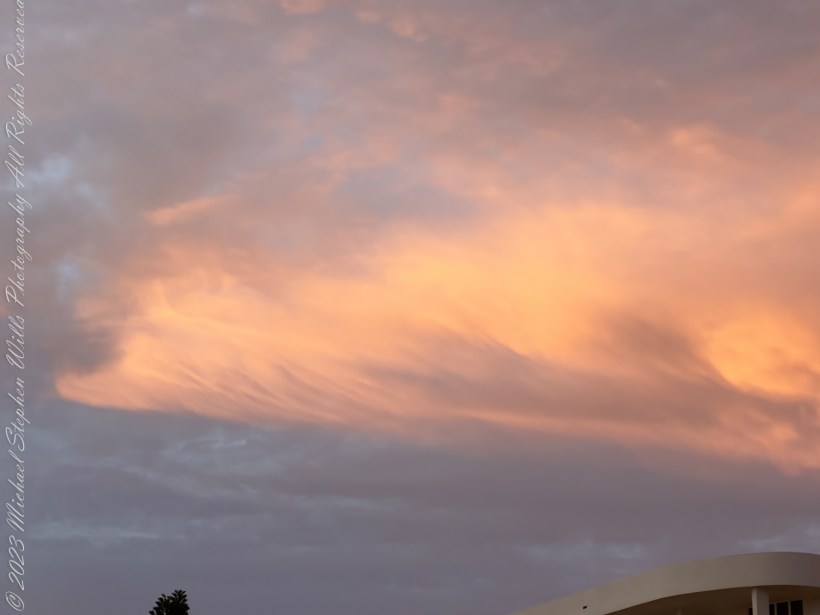
The pictures depict how the landing is woven into the natural tapestry of the area. It is a place where one can sit and watch the placid waters of Cayuga Lake or stroll along the docks, feeling the crisp air against their skin. The images of the clear skies, the open waters, and the flight of birds in the distance are a subtle reminder of nature’s continuous presence.

Steamboad Landing on the Cayuga Waterfront Trail, Farmers Market, Ithaca, Finger Lakes Region, New York State

The waterfront trail exemplifies the community’s efforts to merge history with modernity, providing a space where people can connect with the environment and each other. The docks, once a stage for industrial exchange, now serve as a peaceful retreat, hinting at the deep-seated human desire for connection—not only to each other but also to the very essence of the environment we inhabit.

Seasonal Beauty and Reflection


The change in seasons at Steamboat Landing brings a unique beauty, which the photographs showcase poignantly. From the barren coldness of winter to the lush warmth of spring, each season imbues the landing with a distinct character. The winter images reveal a quiet majesty, with the bare branches and gray skies reflecting the introspective nature of the season. The springtime shots, however, burst with promise and vitality, as greenery begins to cloak the landscape and the water shimmers under the strengthening sun.

Enduring Legacy and Future Prospects


Steamboat Landing’s legacy as a historical transport hub has set the stage for its future as a cherished community locale. The images and historical texts paint a picture of a place that has embraced its past while looking forward to a vibrant and inclusive future. It is a locale that pays homage to its roots through the Farmers Market and other community events, ensuring that the spirit of the old steamboats continues to thrive in the hearts of Ithacans.

In conclusion, Steamboat Landing is a geographic location and a chronicle of Ithaca’s journey through time. Through its transformation, it has become a place where history breathes, nature speaks, and the community finds its heartbeat. It stands as a beacon of heritage, recreation, and beauty—a corner of the world where past and present dance together in harmony.

Copyright 2024 Michael Stephen Wills All Rights Reserved

Quaker Settlement Series 1

Discover the solemn beauty of Quaker Settlement Cemetery through my lens, where intricate slate headstones whisper tales of early settlers, intertwining family lore with the artistry of marble willows

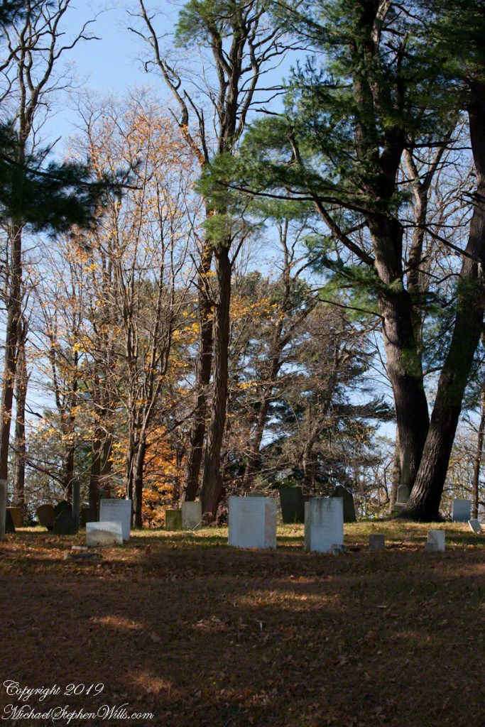
On my way to Taughannock Falls, November 6, 2019 (see my post “Cuteness Break”, the first of that series) I explored a different route and came up this cemetery set among an appealing pine grove.

Click photograph for a larger view. To do this from WordPress Reader, you need to first click the title of this post to open a new page.

Located in the town of Ulysses, New York there is a Quaker Settlement church a few feet further west on Perry City Road. I have Quaker ancestors, so took the opportunity to peruse the family names. The stones were unusually beautiful and touching, mostly local slate, some with intricate carvings.

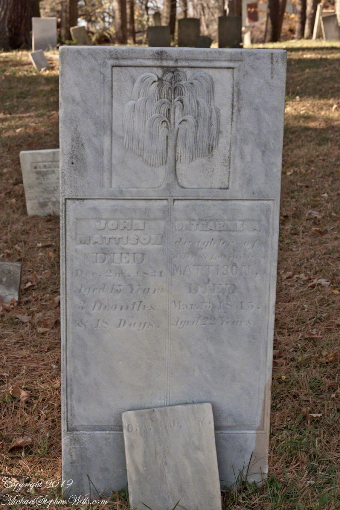
Here is a headstone for two young people of the same family name. The white marble carved in the form of a willow, from the flowing lines and, knowing how our willows green up springtime, it calls to mind the same youthful greening as appropriate for two young people who lived 22 and 15 years.

Analysis of the dates, given in the following capture, tells the story of an young woman, a baby born 5 months after her death and who followed his aunt 15 years later.

I have a great aunt who also died young with a headstone naming her mother and father. Here is the granite headstone of Mary R. Daughter of George & Margarett Wills Died Oct. 3, 1886 Aged 20 years. Saint Mary of Assumption Cemetery, Sweetwater, New Jersey. My grandfather James Edward Wills was 9 years old at his sister Mary’s passing. He must have attended her church service and internment, standing at this spot.

Copyright 2024 All Rights Reserved Michael Stephen Wills

Spring Renewal and the Buoys of Change

As you glimpse the strewn buoys at Cayuga’s shore, consider the tales they hold—witnesses to history, guiding vessels through New York’s storied waters. Delve into their journey from the Erie Canal’s birth to today’s spring awakening.

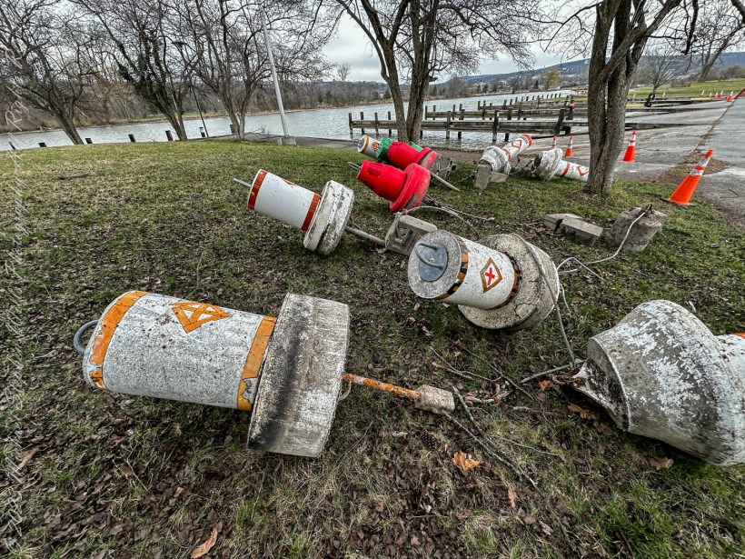
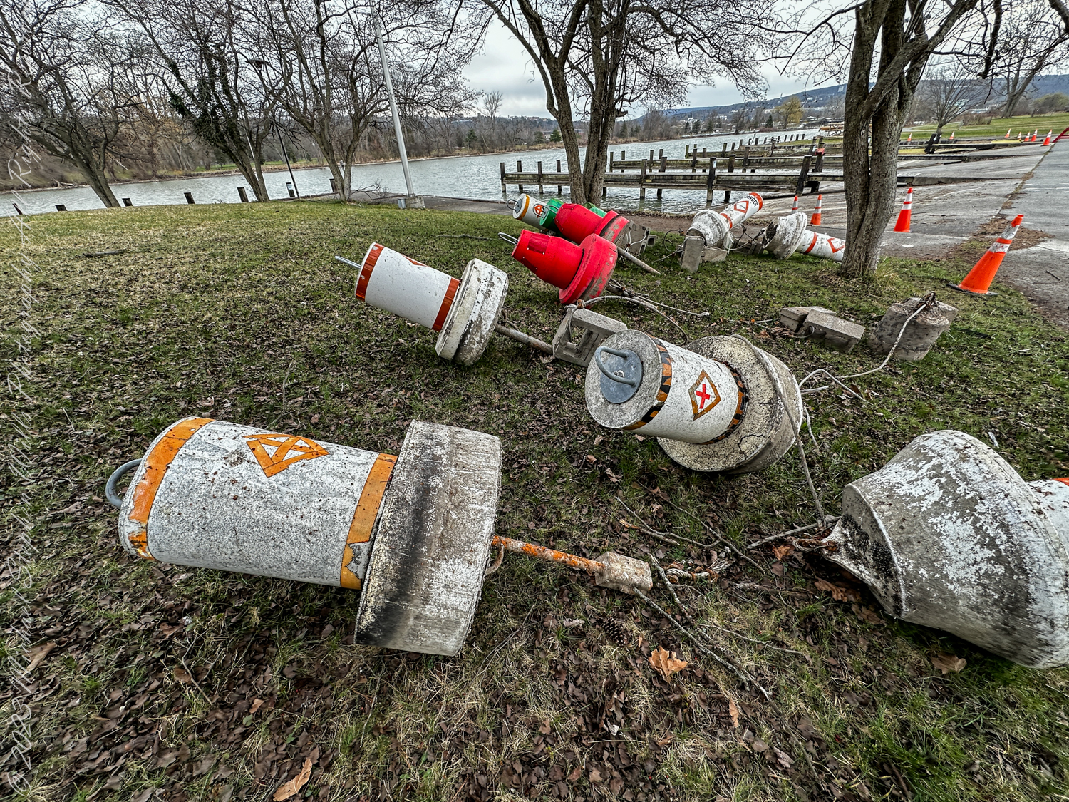
As the crisp air of spring begins to soften and the last remnants of winter recede, you might find yourself drawn to the outdoors, eager to participate in the age-old tradition of spring cleaning. It is a time of renewal, of clearing away the old to make way for the new. In Ithaca, this period of rejuvenation extends beyond the confines of cluttered homes and into the expansive natural landscape, as shown in the photograph before you.

Spring cleaning and repair at the Alan H. Treman Marine Boat Park. Ithaca, New York, Tompkins County

Tidying the Shores


There, on the shores of Cayuga Lake, the scene is a stark contrast to the neat rows of daffodils you admired yesterday. Instead, navigation buoys, those steadfast guides of the waterways, lie upended and scattered – casualties of the winter’s harshness or perhaps the diligent work of park employees preparing for the upcoming boating season. These buoys, usually afloat, marking safe passage for vessels, are now being tended to, maintained, and readied. It is an essential process, akin to the annual spring clean, ensuring the safety and smooth sailing in the months to come.

Guardians of the Waterways


Let’s delve into the history these buoys are part of. You, as a curious observer, are witnessing a fragment of a narrative that stretches back over a century. These navigational buoys are descendants of the earliest markers that adorned the inland waters of New York State and the Erie Canal, of which Cayuga Lake is an integral part.

The Erie Canal and Cayuga’s Connection


The Erie Canal, an engineering marvel of the 19th century, opened in 1825, transforming New York and the entire Great Lakes region. It was the superhighway of its time, connecting the Atlantic Ocean to the Great Lakes, and thereby shaping the course of economic and social history in the United States. Cayuga Lake, connected to this system via the Cayuga-Seneca Canal, was part of this vast network of navigable waters.

Navigation Buoys: Beacons of Progress


As commerce flourished, so too did the need for reliable navigation. The buoys, then as now, served as critical signposts, ensuring that vessels could traverse these waterways safely. Imagine the countless boats that relied on these markers – from the large freighters carrying goods to the smaller craft bearing passengers – each buoy a sentinel ensuring their safe passage.

Modern Sentinels


Today, the navigation buoys on Cayuga Lake and other inland waters continue this legacy. They are the modern sentinels of the deep, equipped with the latest technology to guide the way. Just as the Erie Canal once heralded a new era of travel and trade, these buoys now symbolize the enduring importance of safe and efficient water transportation.

The Future of Inland Navigation


As you reflect upon the photograph, consider the ongoing narrative of these buoys and the waterways they mark. In a world increasingly concerned with sustainable modes of transportation, the historical importance of these channels resurfaces. The waterways that once fueled the expansion of a nation may once again play a pivotal role, this time in the quest for greener alternatives to overland routes.

Conclusion: A Cycle of Renewal


The upturned buoys in Cass Park, ready for their spring cleaning, are a microcosm of the cyclical nature of life and progress. They remind you that renewal is not just about beauty; it is also about preserving the functionality and safety that allow society to move forward. Just as the spring cleaning in your home ushers in a new season of clarity and freshness, the maintenance of these navigational aids renews the commitment to a legacy of safe passage – a promise made by the generations that have sailed these waters since the days of the Erie Canal.

Behind the Scenes of the Final Frontier: Our Tour with NASA’s “Launch Director” – 6

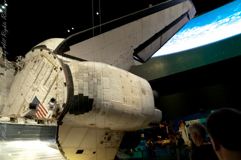
Step behind the scenes of space exploration with this dive into the awe-inspiring details of the Space Shuttle Atlantis, its thermal-protected wings to the onboard engines.

Imagine, if you will, stepping onto the grounds of NASA, where the air buzzes with the legacy of space exploration and the spirit of human achievement. It’s a place where dreams of the cosmos turn into reality. Our 2017 Launch Director tour not only brought us face-to-face with the marvels of space travel but allowed me to delve into the intricate details of one of NASA’s most iconic spacecraft: the Space Shuttle Atlantis. In this episode 6 of our adventure, we continue exploring the engineering marvel that is Atlantis, focusing on its wings, rear stabilizer, and onboard engines—elements critical to its legendary missions.

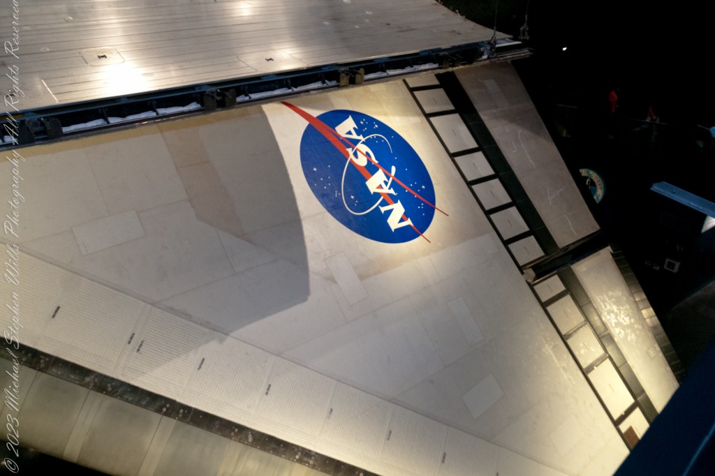
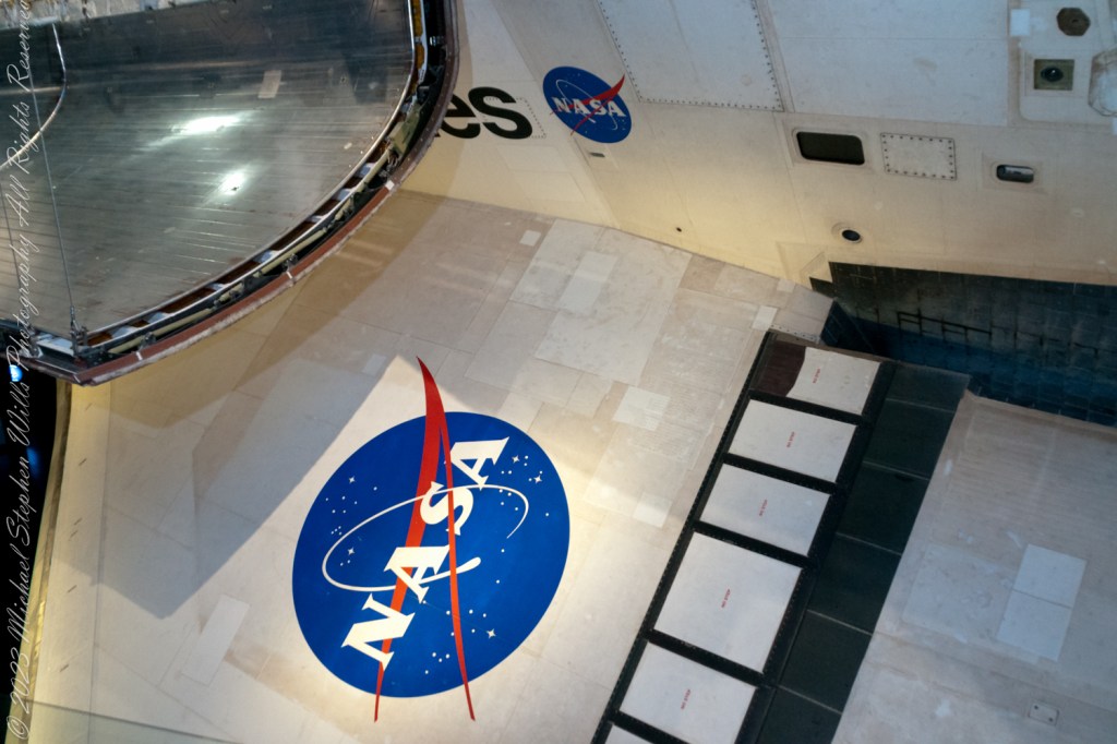
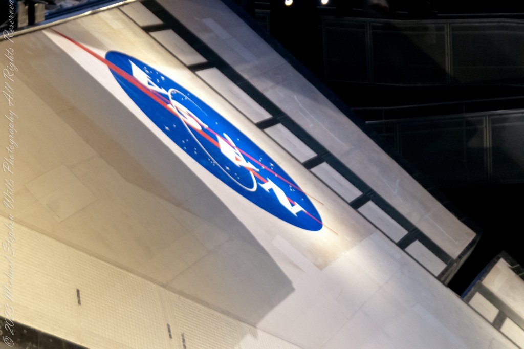
The Space Shuttle Atlantis, a name synonymous with discovery and exploration, represents a pinnacle of human ingenuity. As you walk around the Atlantis exhibit, you can’t help but be awed by the shuttle’s design, particularly its wings. The wings of Atlantis, with a wingspan of about 78 feet, are not just structures of metal and composite materials; they are the shuttle’s lifeline during re-entry into Earth’s atmosphere. These delta-shaped wings are designed to withstand the scorching temperatures of re-entry, allowing Atlantis to glide back to Earth with grace and precision. The material covering the wings, known as the Thermal Protection System (TPS), consists of thousands of heat-resistant tiles and reinforced carbon-carbon panels, safeguarding the shuttle and its crew from temperatures exceeding 1,650 degrees Celsius.

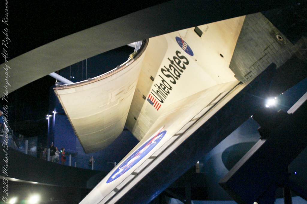
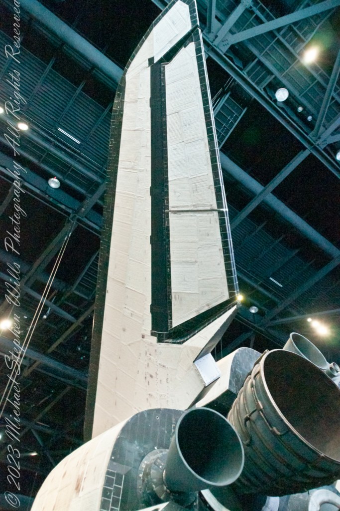
As your gaze shifts towards the rear of Atlantis, the vertical tail fin, or the rear stabilizer, commands attention. Standing about 17 feet tall, this stabilizer is more than just a rudder; it’s a critical component for maintaining the shuttle’s stability during the different phases of its mission. During the launch, it helps keep the shuttle on course as it ascends through the atmosphere. In space, it plays a minimal role, but upon re-entry, it becomes vital again, ensuring the shuttle remains stable and oriented correctly as it descends through the atmosphere, allowing for a safe landing.

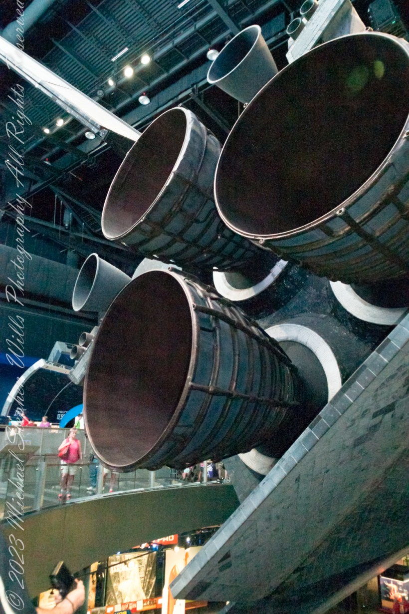
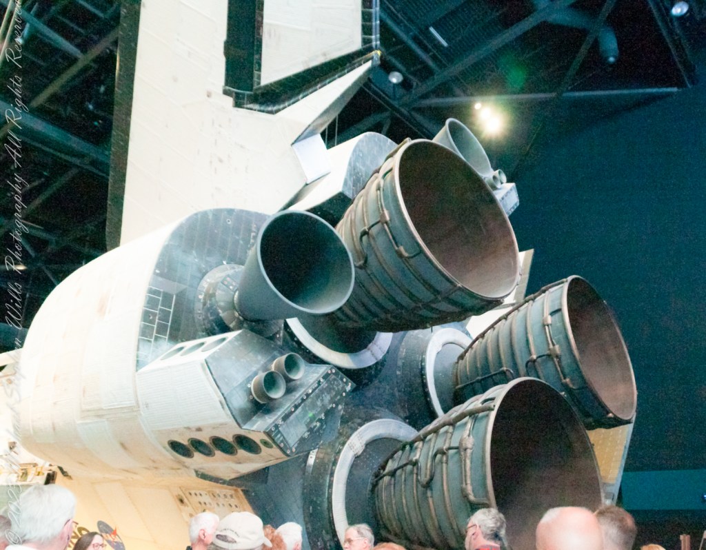
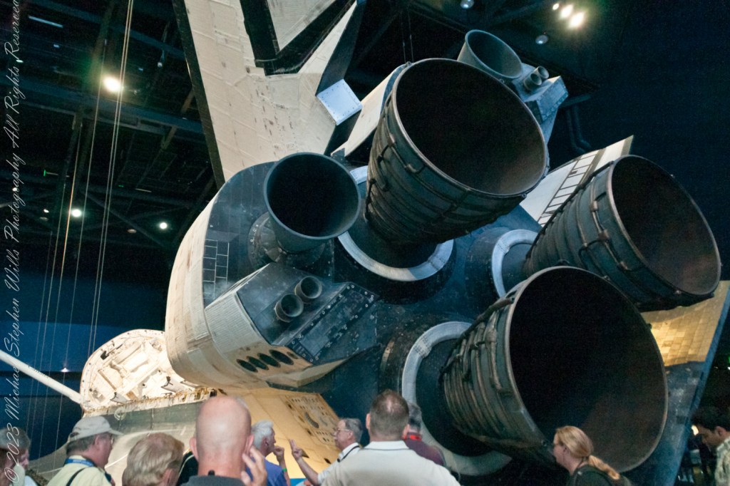
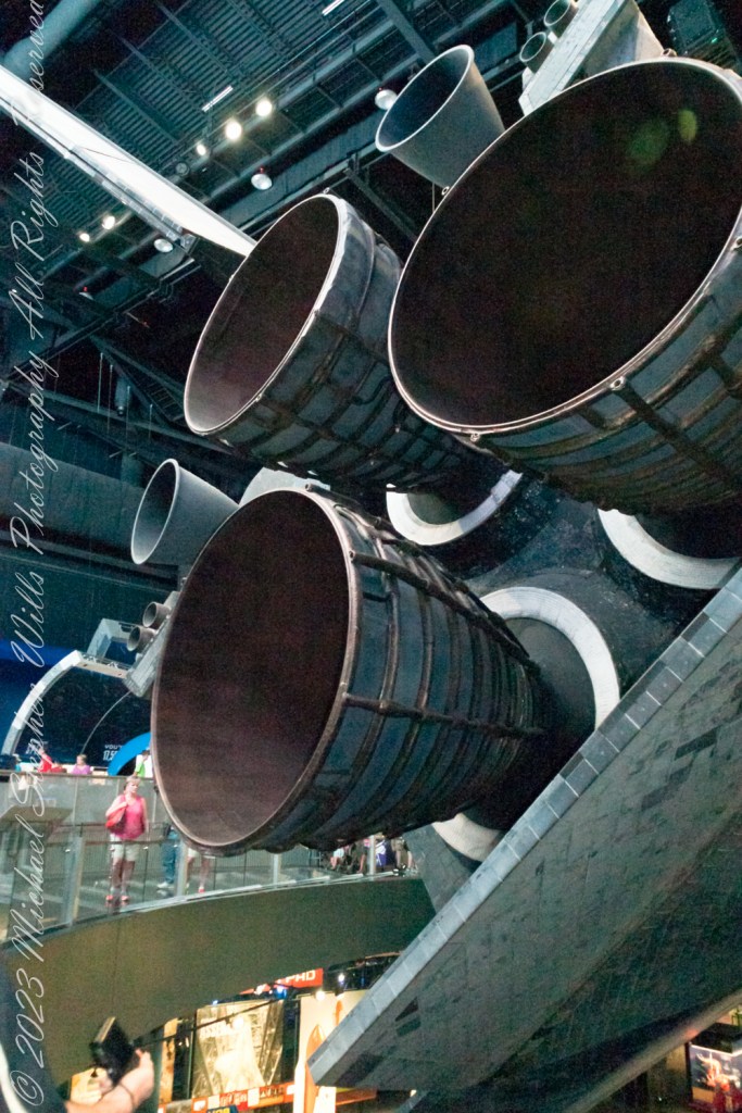
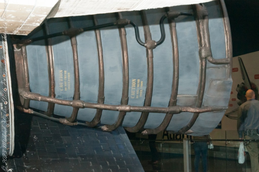
In this exploration of Atlantis, after the wings and stabilizer, we encounter the heart of the shuttle’s propulsion system: its onboard engines. The Space Shuttle Main Engines (SSMEs), three in total, are marvels of engineering, capable of producing a combined thrust of over 1.2 million pounds. These liquid-fueled engines play a crucial role in propelling the shuttle from the launch pad into orbit. What’s fascinating is their ability to throttle up or down depending on the phase of the launch, providing the precise amount of power needed at any given moment. The engines are fed by the External Tank, the only part of the shuttle not reused, which carries the liquid hydrogen and liquid oxygen needed for combustion. Upon reaching orbit, the Orbital Maneuvering System (OMS) engines take over, allowing Atlantis to navigate the vacuum of space with finesse, adjusting its orbit and facilitating the meticulous maneuvers required for satellite deployment or docking with the International Space Station.

Walking away from the Atlantis exhibit, what stays with you is not just the sight of this magnificent spacecraft but an appreciation for the ingenuity and dedication that went into its design. Every wing, every tile on the stabilizer, and every roar from the engines tell a story of human curiosity, the drive to explore beyond our confines, and the relentless pursuit of knowledge. The Space Shuttle Atlantis is more than a machine; it’s a symbol of what humanity can achieve when we dare to dream big and work tirelessly towards those dreams. So, as you look up at the night sky, remember the wings that carried our dreams, the stabilizer that kept us on course, and the engines that propelled us into the unknown, reminding us that the final frontier is not so final after all.

Copyright 2024 Michael Stephen Wills All Rights Reserved

Behind the Scenes of the Final Frontier: Our Tour with NASA’s “Launch Director” – 5

Ever wondered about the iconic robotic arms that gracefully danced in space, tethered to the Space Shuttle? Meet Canadarm, a marvel of engineering that transformed space missions. Born from a NASA invitation to Canada in 1969, this robotic arm did more than just move payloads; it became a symbol of international collaboration in space exploration. After the Columbia disaster, its role expanded, ensuring the safety of astronauts with critical inspections. Dive into the captivating journey of Canadarm, where technology meets the stars. Click to discover how a Canadian innovation became a pivotal part of space history.

The Canadarm

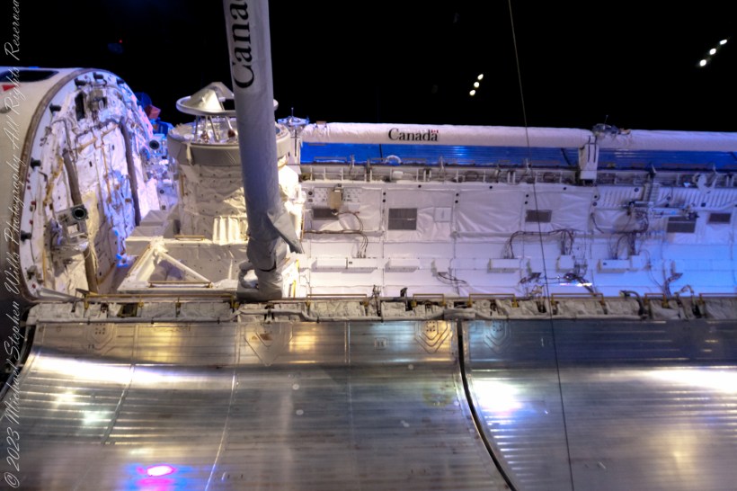
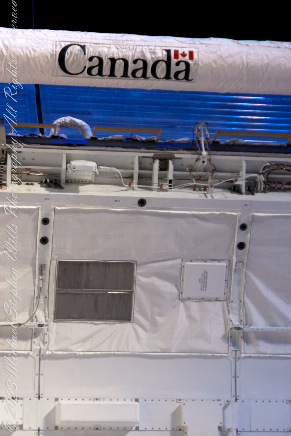
The Canadarm is here extended in the foreground and docked in background

The Canadarm, or Canadarm1, officially known as the Shuttle Remote Manipulator System (SRMS) and sometimes referred to as the SSRMS, represents a series of robotic arms utilized aboard the Space Shuttle orbiters. These arms were instrumental in deploying, manipulating, and retrieving payloads. Following the tragic Space Shuttle Columbia disaster, the use of Canadarm became invariably linked with the Orbiter Boom Sensor System (OBSS). The OBSS played a crucial role in examining the shuttle’s exterior for any damages to its thermal protection system, enhancing the safety of subsequent missions.

The genesis of Canada’s involvement in the Space Shuttle program dates back to 1969 when the National Aeronautics and Space Administration (NASA) extended an invitation to Canada. At the outset, the specifics of Canada’s role were unclear, though the need for a manipulator system was immediately recognized as vital. The Canadian firm DSMA ATCON had previously made strides in robotics with the development of a robot designed to load fuel into CANDU nuclear reactors, capturing NASA’s interest. By 1975, a formal agreement was reached between NASA and the Canadian National Research Council (NRC), under which Canada would undertake the development and construction of the Canadarm.

The NRC subsequently awarded the contract for the manipulator to Spar Aerospace (currently known as MDA), under which three distinct systems were to be developed: an engineering model to aid in design and testing, a qualification model for environmental testing to ensure the design’s suitability for space, and a flight unit destined for use in missions. This collaborative effort marked a significant milestone in the use of robotics in space exploration, showcasing international cooperation in advancing space technology.

Copyright 2024 Michael Stephen Wills All Rights Reserved

Post WWII Launch Complexes on Cape Canaveral

Ghosts from the future?

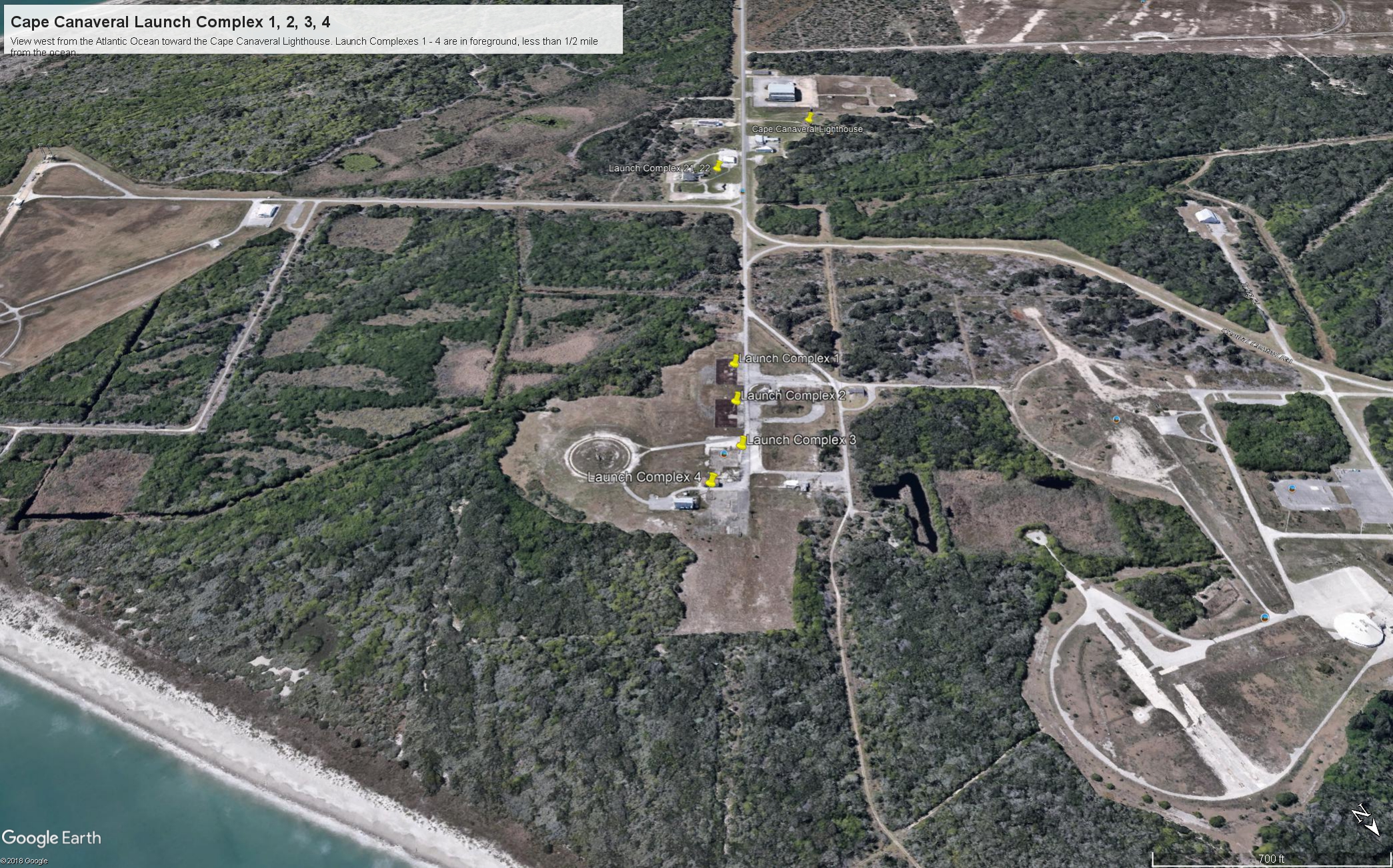
Here is the fifth in a series of photographs centered on the early history of space flight on Cape Canaveral mostly taken during a tour organized by the Cape Canaveral Lighthouse Foundation. “Google” the foundation for details of future tours. Here we explore the sites of the first launches on the Cape, Launch Complexes 1, 2, 3, 4. (LC 1 – 4).

From Vengeance To Space

Our bus proceeded east on Lighthouse Road past Launch Complexes 21 and 22 in less than half a mile we were within the first sites of the United States Space age, sites with the lowest numbers, LC 1 – 4.

Click Any Image for a larger viewe

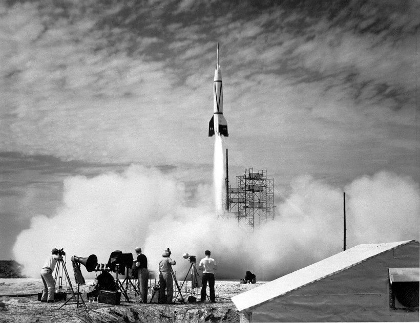
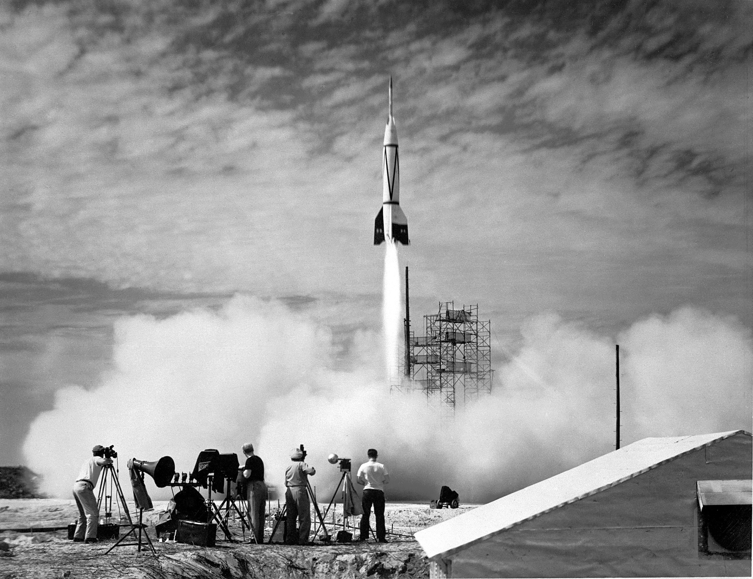
If, instead of distance, the bus traveled back in time 68 years to July, 1950 we would be witness to the first United States space launch of the two-stage “Bumper 8”, a former “V2” missile topped by a WAC Corporal that reached 248 miles above the earth, about where the International Space Station circles now.

July 1950 Bumper 8 Launch
By NASA/U.S. Army – NIX 66P-0631, GPN-2000-000613; http://solarsystem.nasa.gov/multimedia/display.cfm?IM_ID=385, Public Domain, https://commons.wikimedia.org/w/index.php?curid=2892820

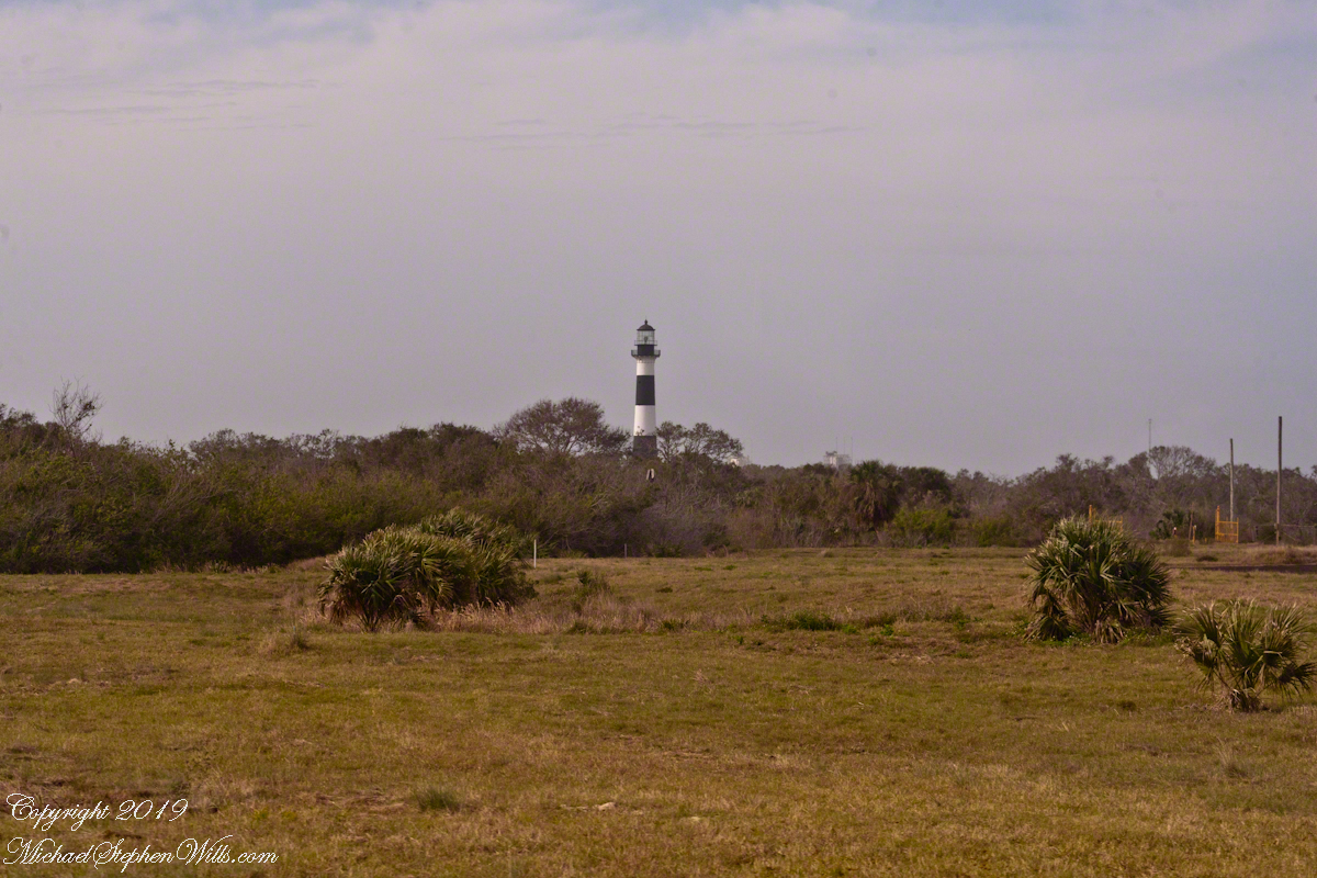
Almost certainly, the man who designed and directed the production of the Nazi V2, Werner vonBraun, was perched on the lighthouse a half-mile distant.

Cape Canaveral Lighthouse from Launch Complex 3

The Nazi “vengeance weapon 2”, the V2, a device so horrifying British authorities claimed the first V2 attacks to be “gas explosions” rather than admit a Nazi weapon descended without warning. Beginning September, 1944, over 3,000 V2’s landed on London, Antwerp and Liège resulting in an estimated 9,000 deaths, mostly civilians. 12,000 forced labor and concentration camp slaves died in the construction of the production facilities captured by the Soviet Union during the collapse of the Nazis. These victims, arms linked, will form a circle 15.9 miles in circumference around the Bumper 2 launch.

The 21,000 V2 victims, linked arm in arm, make a circle 15.9 miles in circumference.

von Braun and key V2 personnel surrendered to the Americans and, along with enough parts to construct 80 V2s, were taken to the United States. His direction of US missile development lead eventually to the enormous Saturn rocket that lifted three men to the moon, so good came from our bet on vonBraun and the V2.

Observation Bunker

In January, 2018, firmly in the present, our bus approached these now “deactivated” sites driving down Lighthouse Road. Confined to the bus, I used my Canon EOS 1Ds Mark III and the EF 70-300mm f/4-5.6 IS USM lens to capture these scenes.

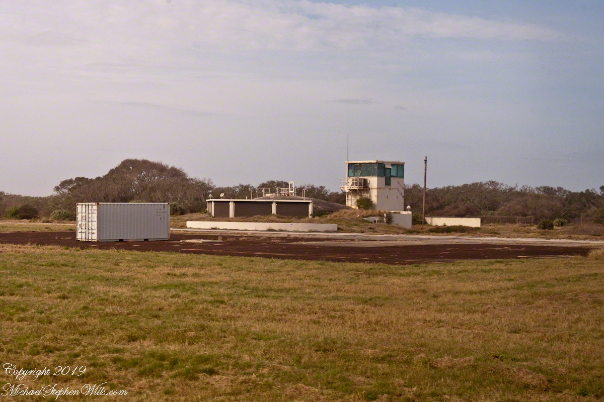
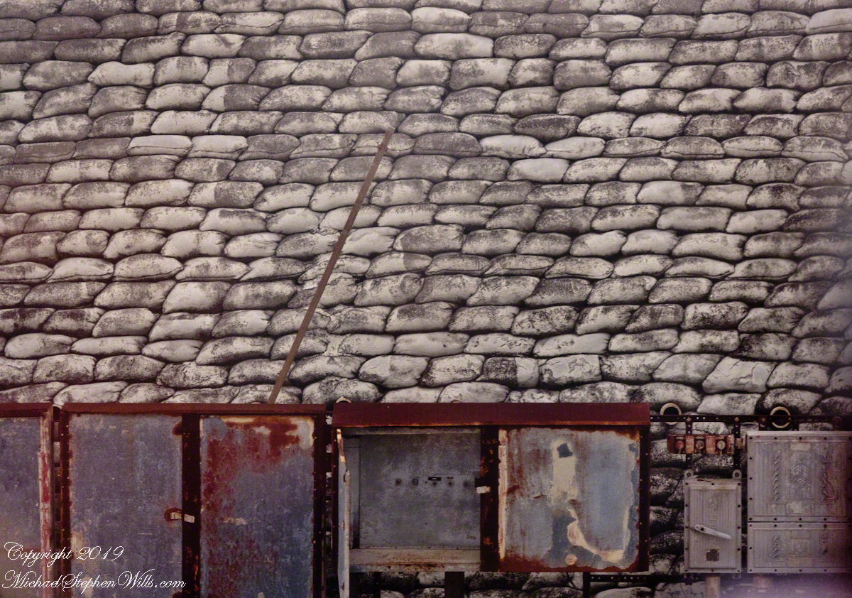
Looking across Launch Complexes 1 and 2 to Lighthouse Road and the tower. An observation bunker
Observation Bunker from Launch Complex 3, looking across Launch Complex 1.

I can almost see someone behind the glass, enjoying a blast of air-conditioned air, dry and cool.

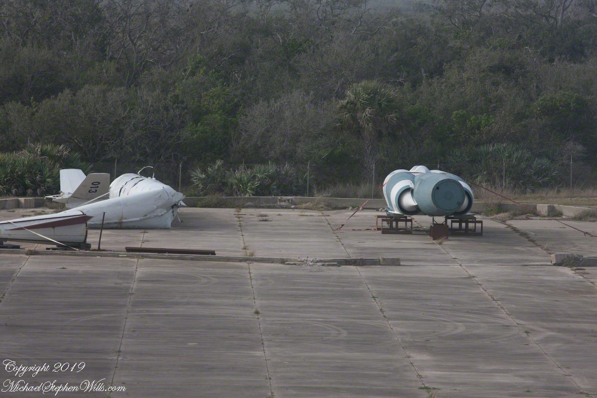
Litter on and around Launch Complex 4

Missile Housing without Engine
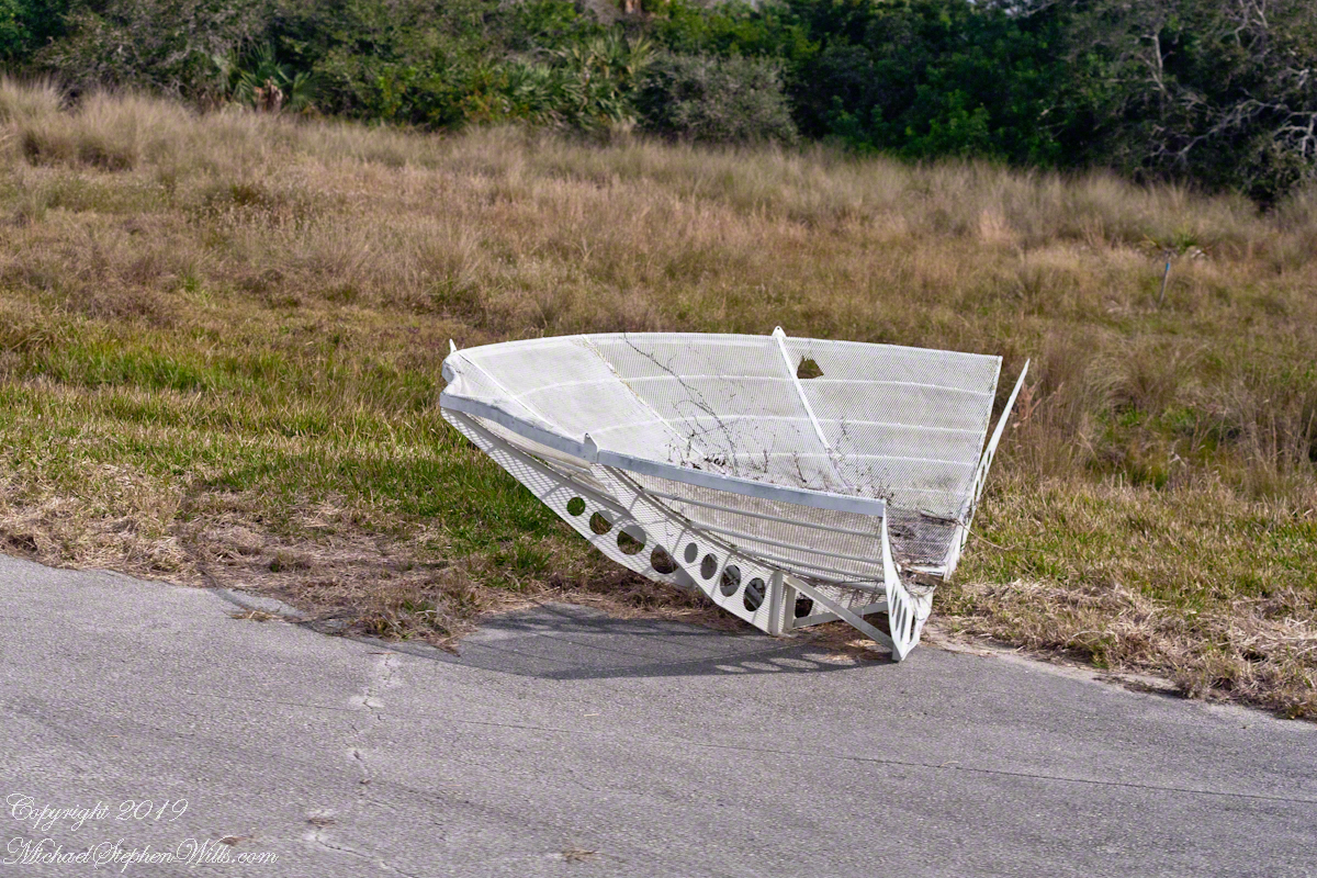
Radar Parabola Fragment
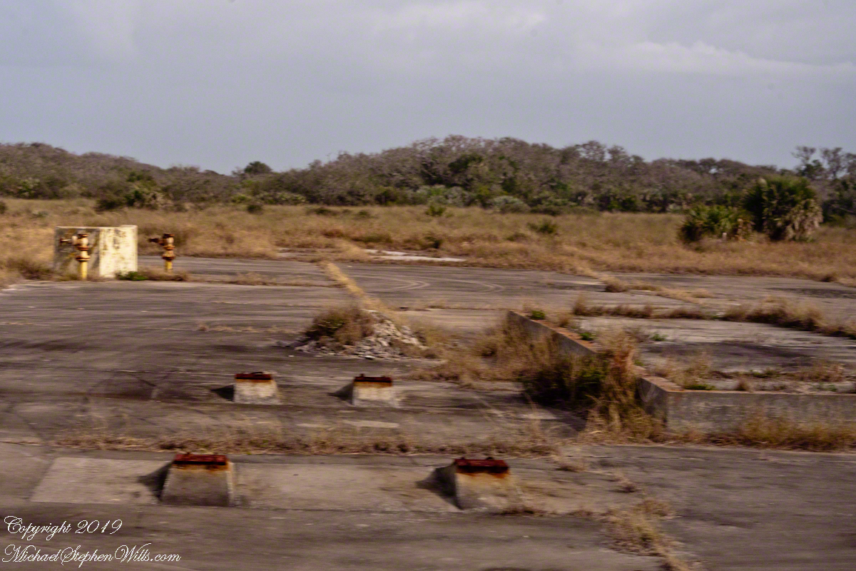
Cement Blacked by Rocket Launch Blasts

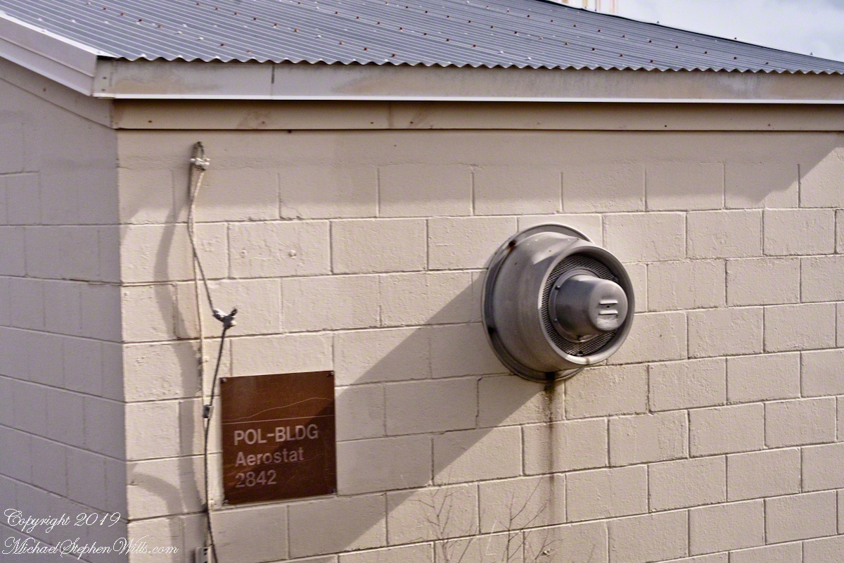
Aerostat

From 1950 into the 1960’s LC 1-4 saw launches of cruise missiles, some of which were able to maneuver and land on the “skid strip” you can pick out on the “21,000 V2 Victims” image, above. A positive discovery from my research on wikipedia the weapon systems tested here were not fired in anger. Continued development in other places lead to production of generations of cruise missiles launched by Presidents Clinton and Bush against Afghanistan, Iraq and (??) other targets. What victim ghosts, arms linked in ever growing circles, are lurking in our future?

A building on LC 4 has the designation “Aerostat”, one of the last projects supported. I saw an aerostat in action in the early 2000’s over Fort Huachuca, Arizona near the border with Mexico. An aerostat is a flying craft that does not rely on moving air to achieve lift, balloons for example.

The Goodyear blimp is a memory from my childhood on Long Island, the Fort Huachuca aerostat was a smaller version, outfitted with advanced technology for monitoring the surrounding environment. “Google” aerostat mexican border to learn more about the current deployment.

Another view of the abandoned aerostat building on LC 4

With the development of Intercontinental Ballistic Missiles (ICBMs) the facilities of LC 1 – 4 became obsolete. ICBMs are a theme of the next installment of this series.

ClickMe for another post in this series, “Mercury 7 Pre-Launch Facilities.”

ClickMe for the first post in this series, “Cape Canaveral Lighthouse.”

Sources of information for this post: I used information from the Wikipedia site for the key words V-2, Launch Complex 1, Launch Complex 2, Launch Complex 3, Launch Complex 4. The Bumper 8 launch photograph caption includes a source citation.

Copyright 2024 Michael Stephen Wills All Rights Reserved.

Cruise Missiles

Decoys and Cruise Control

Here is the fourth in a series of photographs centered on the early history of space flight on Cape Canaveral mostly taken during a tour organized by the Cape Canaveral Lighthouse Foundation. Google the foundation for details of future tours. Here we explore the sites closests to the Lighthouse: Launch Complex 21 and 22.

“Vengance Weapons” re-purposed

Vergeltungswaffe 1 (Vengance Weapon 1 AKA V-1), produced at Peenemünde on the Baltic Sea was first used against Great Britan by Germany one week after the D-day landings. 8,025 of these flying bombs, the first cruise missles, caused the death of 22,892 people, mostly civilians. The first cruise missles for the USA were developed less than 1,000 feet away from the lighthouse. After touring the lighthouse we boarded the bus to visit these sites, Launch Complex 21 and 22.
Click Any Image for a larger viewe
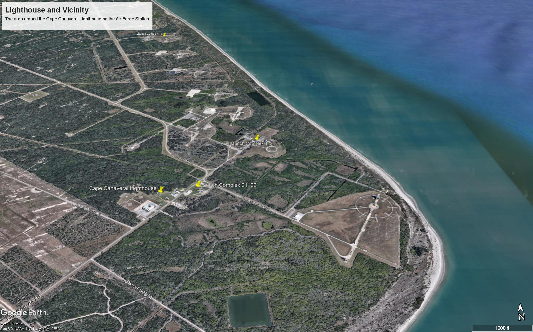
Launch Complex 21 and 22 are marked with a labled “pin” on this image from Google Earth.

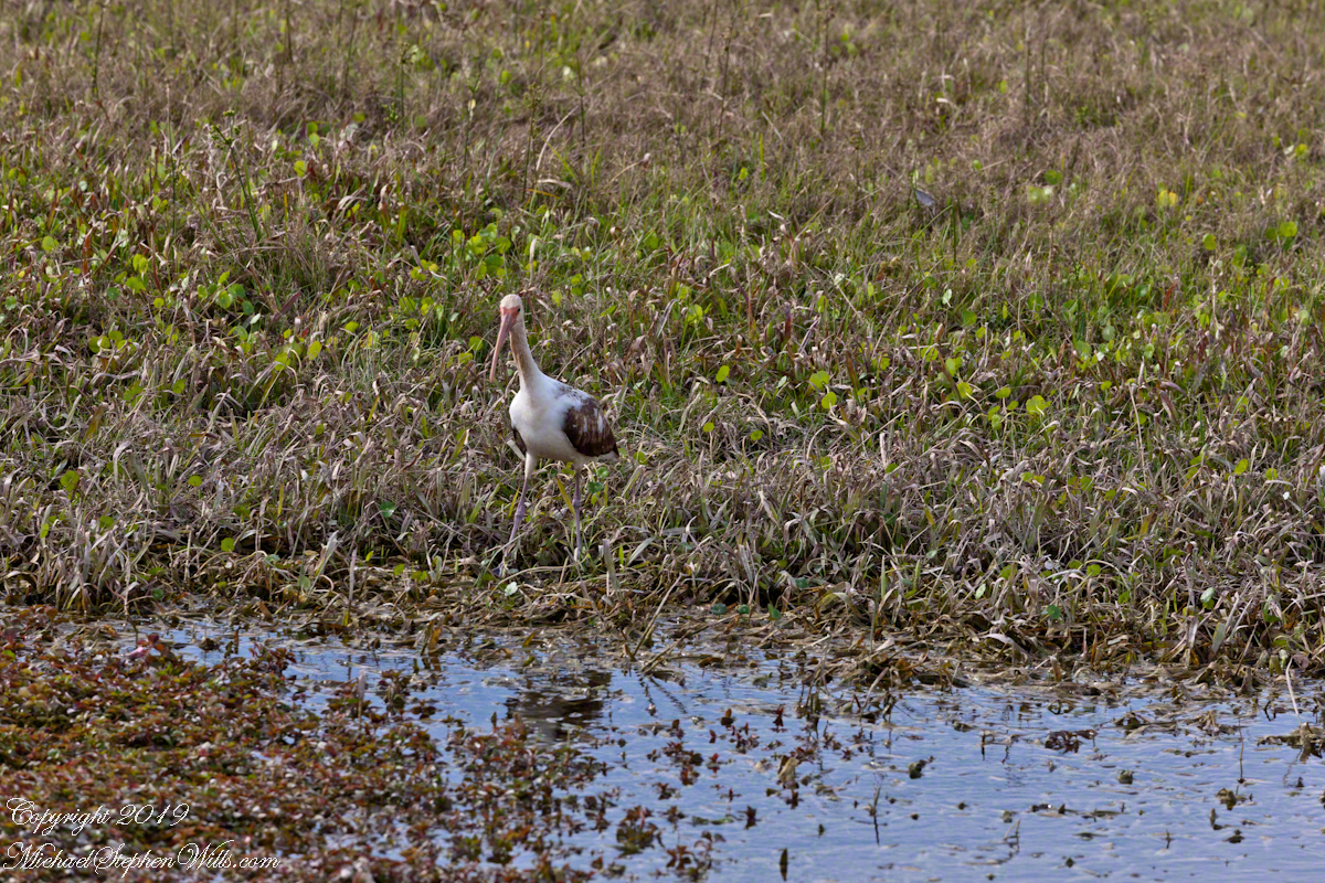
Nature abounds in Cape Canaveral Air Force Station. This ibis hunted near the lighthouse on our way to Launch Complexes 21,22.

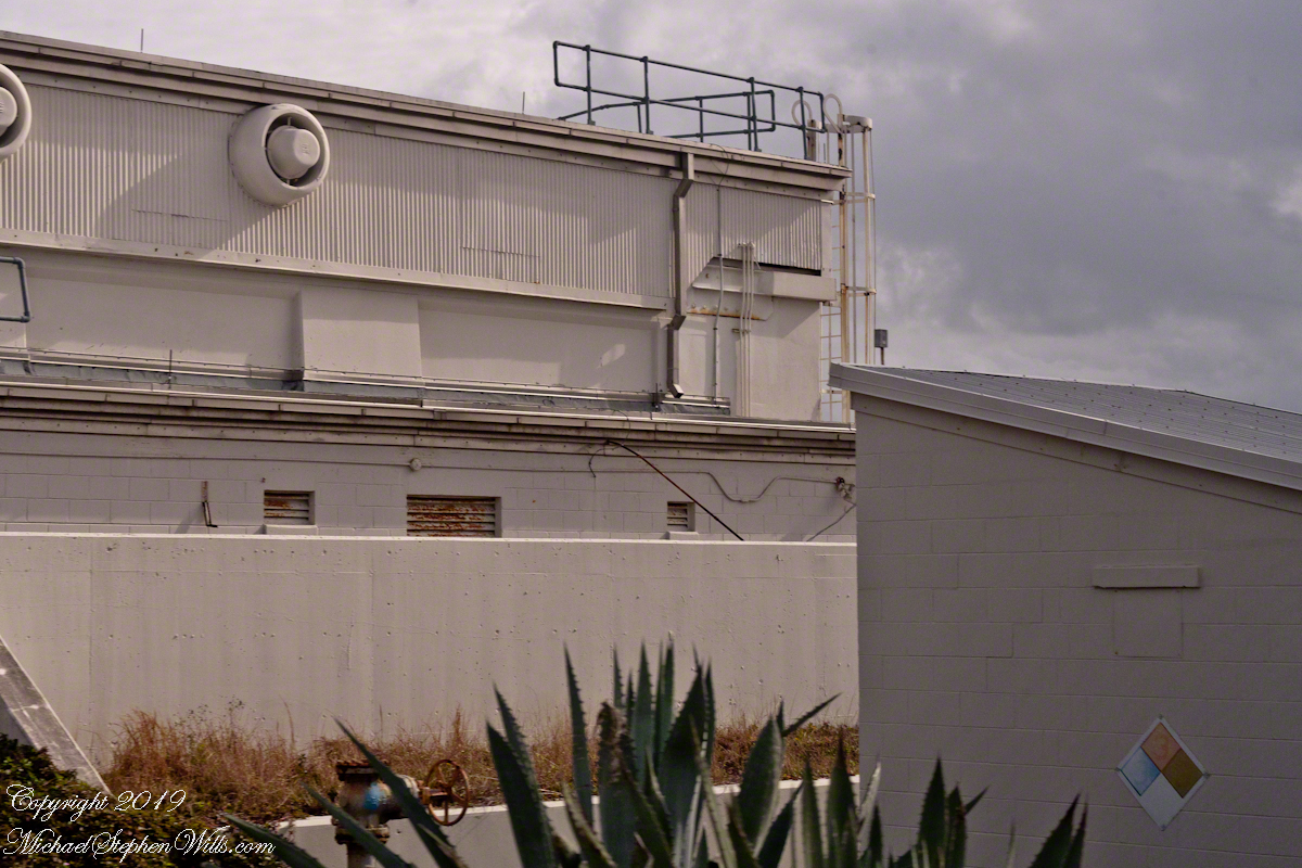
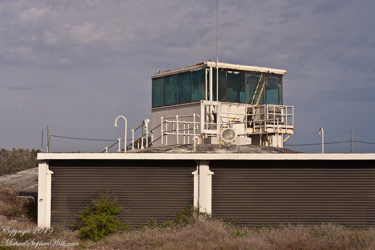
We passed close to the blockhouse first viewed in my post, “Lighthouse and Rockets,” and I captured this detail of the long abandoned structure. The last test launch of a Mace missle was June, 1960.
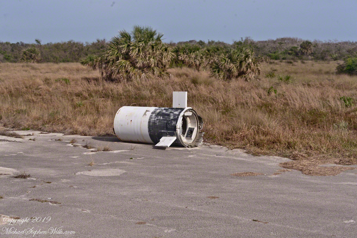
This wreckage photograph was part of my,“Lighthouse and Rockets” post. It was taken from a lighthouse portal. It is a type of cruise missle, although I cannot identify the exact type, comparing the engine, on the right, with available photographs of the “Bull Goose” and “Mace” missles developed here.

Bull Goose and Mace

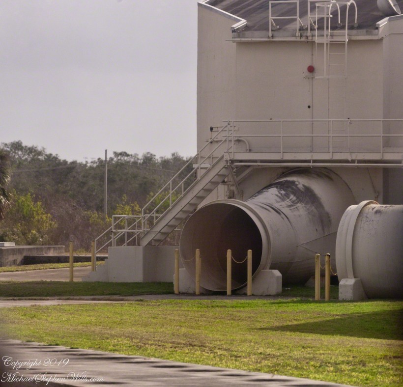
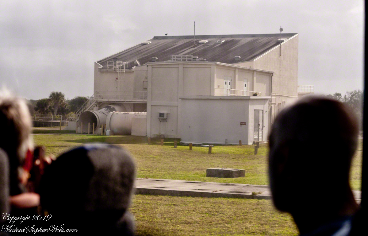
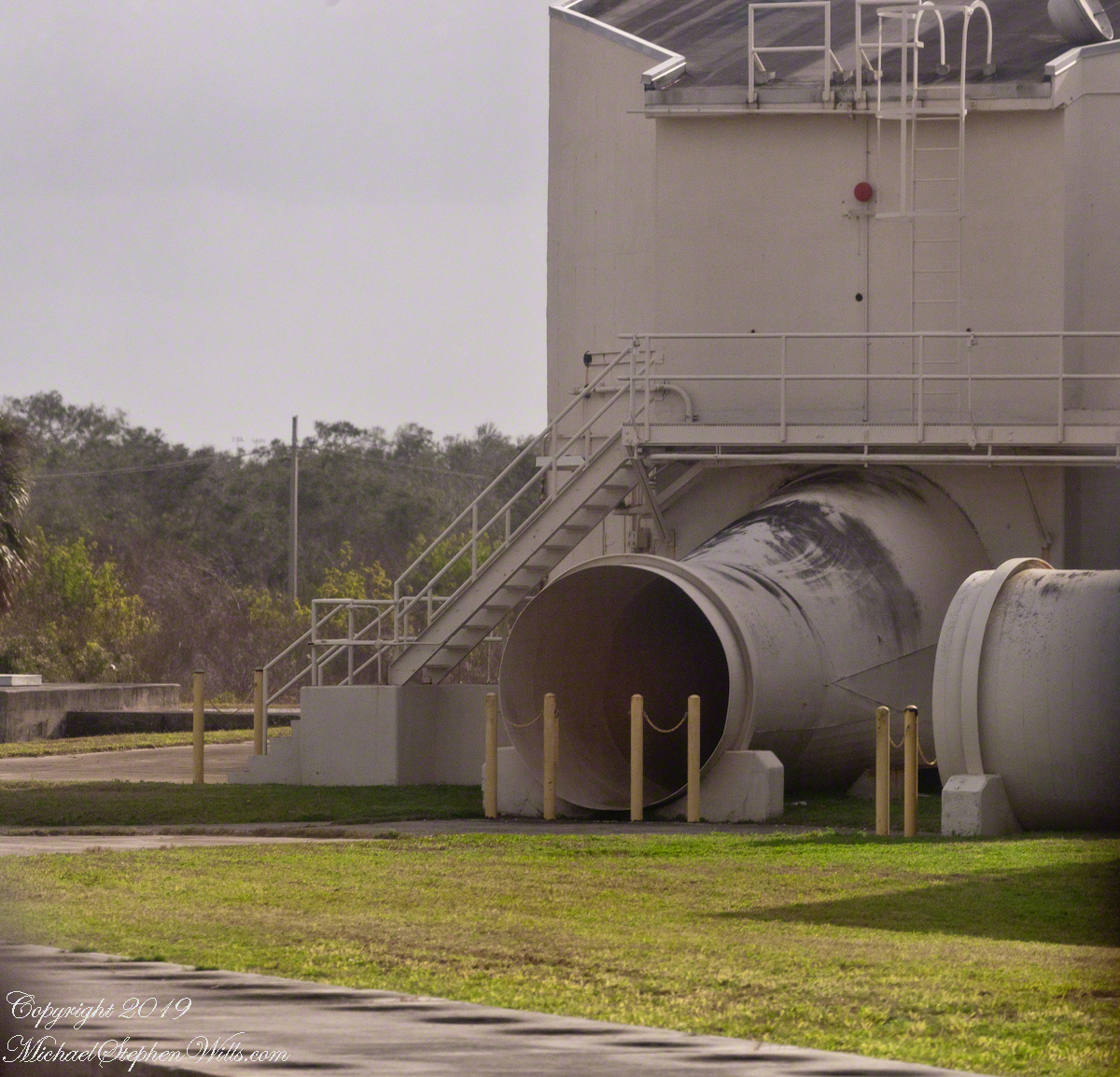
Rail launched, as was the German V-1, the missles developed here were called “Bull Goose” and “Mace.” Bull Goose was a delta winged craft intended as a decoy, to appear on radar as a strategic bomber during a nuclear attack. At that time, the rails were in the open. The building here was a revampment of the site for development of the Mace. The other side of this structure is open, the launch rail pointed up from the rear. There are two launch rails, numbered 1 and 2. The building placard is “05961,” the numeral “1” designates site 1. The use of numbers of designate a site is unusual. Letters are used elsewhere on Cape Canaveral and Kennedy Space Center.

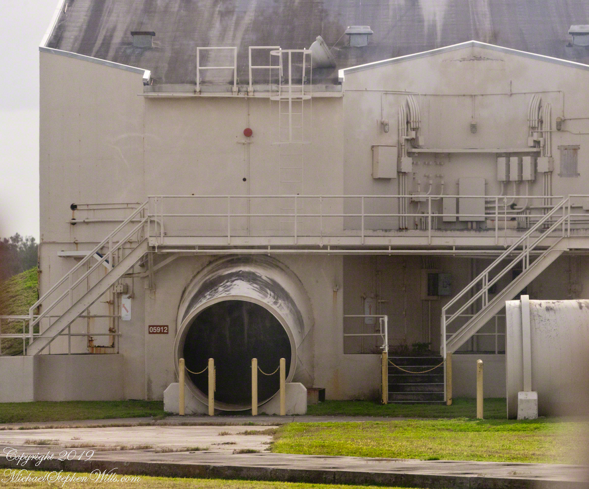
The powerful rocket exhause was directed though these pipes. Site 1 is on the right.

Guidance or “Cruise Control”

Navigation is a crucial requirement for cruise missles. The Bull Goose used a gyroscope with no reference to surroundings. The guidance system held the launch bearings, a successful flight was completed within 115 nautical miles of the target.

If deployed, the plan was for thousands of these missles to launch 1 hour before the attack craft set out and 1 hour after. The missles were not armed, but would descend in the thousands around the targets. Similar to what the Germans did to civilians in England.

After three years and 136.5 million dollars the Bull Goose was cancelled because it could not simulate either the B-47 Stratojet or B-52 Stratofortress nuclear bomb delivery aircraft. Not a single decoy was fired in anger.

The building sign “05912” identifies this exhaust tube as being launch site 2.

The Mace, for which this building was created, used a guidance ATRAN (Automatic Terrain Recognition And Navigation, a radar map-matching system). The map was produced on a 35 mm film strip carried on the missle, the live radar returns were “matched” against the film with course correction made for differences. The Mace was of limited usefulness due to the lack of radar maps for target areas within the Soviet Union. The Mace was deployed to Germany and South Korea until phase out in 1969.

ClickMe for the first post in this series, “Cape Canaveral Lighthouse.”

Sources of information for this post: I used information from the Wikipedia site for the key words V-1, Launch Complex 21, Launch Complex 22, Mace, Bull Goose.

Copyright 2024 Michael Stephen Wills All Rights Reserved.

Lighthouse and Rockets

from Roman Numerals to Rockets

Here is the third in a series of photographs centered on the early history of space flight on Cape Canaveral mostly taken during a tour organized by the Cape Canaveral Lighthouse Foundation. Google the foundation for details of future tours. Here we start with Roman Numerals and end with Rocket Research.

Inscribed Roman Numerals

We were lucky to be on this tour, for a period of time the Air Force closed off the Lighthouse. The Lighthouse Foundation obtained permission to start this tour in 2016 (this was January 2018) and I happened to discover it while poking around in preparation for the SpaceX “Falcon Heavy” launch in early February 2018.

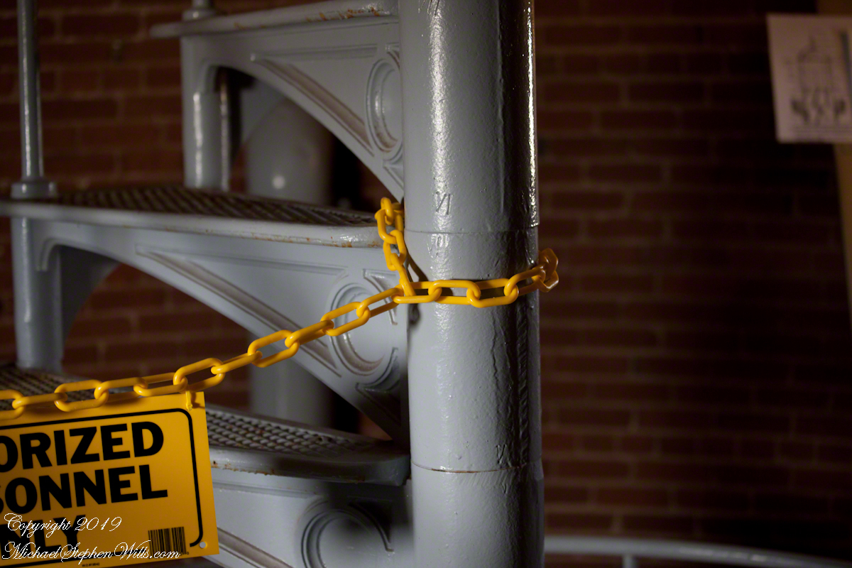
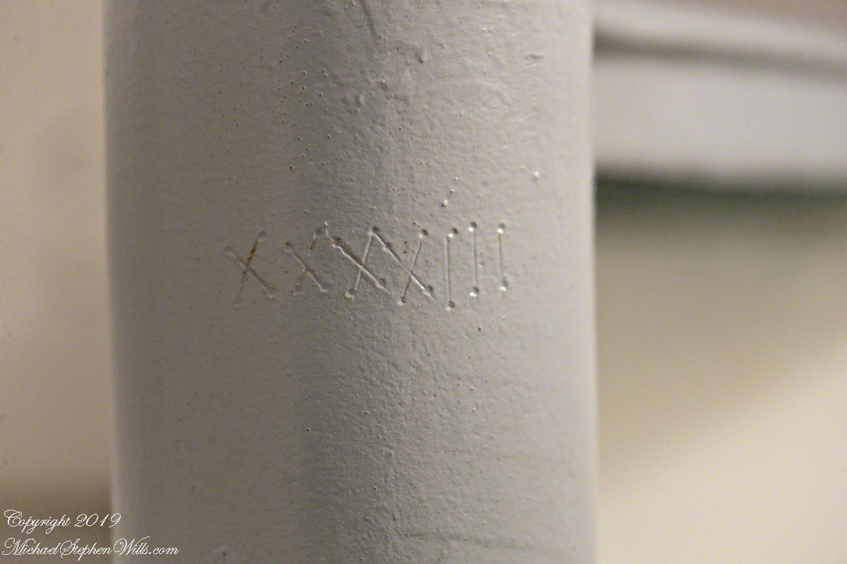
As Pam and I climbed, each floor docent (volunteer guide) was so helpful with information and hospitality. At the last floor, the stairway to the upper floors was roped off. Top levels were closed, Cape Canaveral Lighthouse is operational. Here is a photograph of the closed off staircase. There is a roman numeral “6” (VI) inscribed in the staircase column. This is the numbering system described in the first post, “Cape Canaveral Lighthouse,” by which the entire 151-foot lighthouse can be disassembled/reassembled as was done in the 19th century.

Stairway to Upper Floors

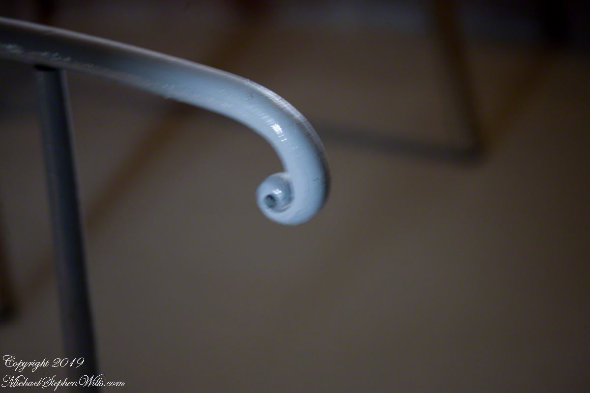
The fine finish of the handrail termination for the stairs to upper floors is an example of 19th century attention to detail.

Macro of numeral inscription on a lower floor stairway column.

Roman Numeral 43 on staircase column of lower floor

View of Space History from the Portals

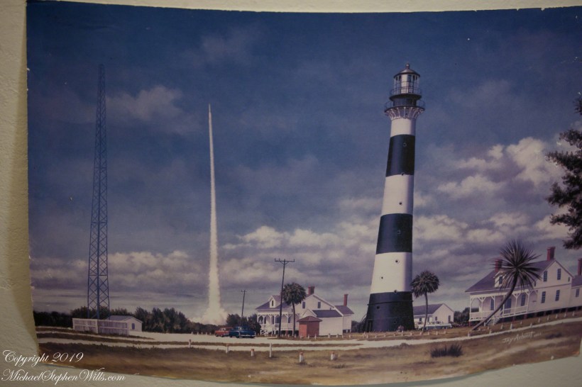
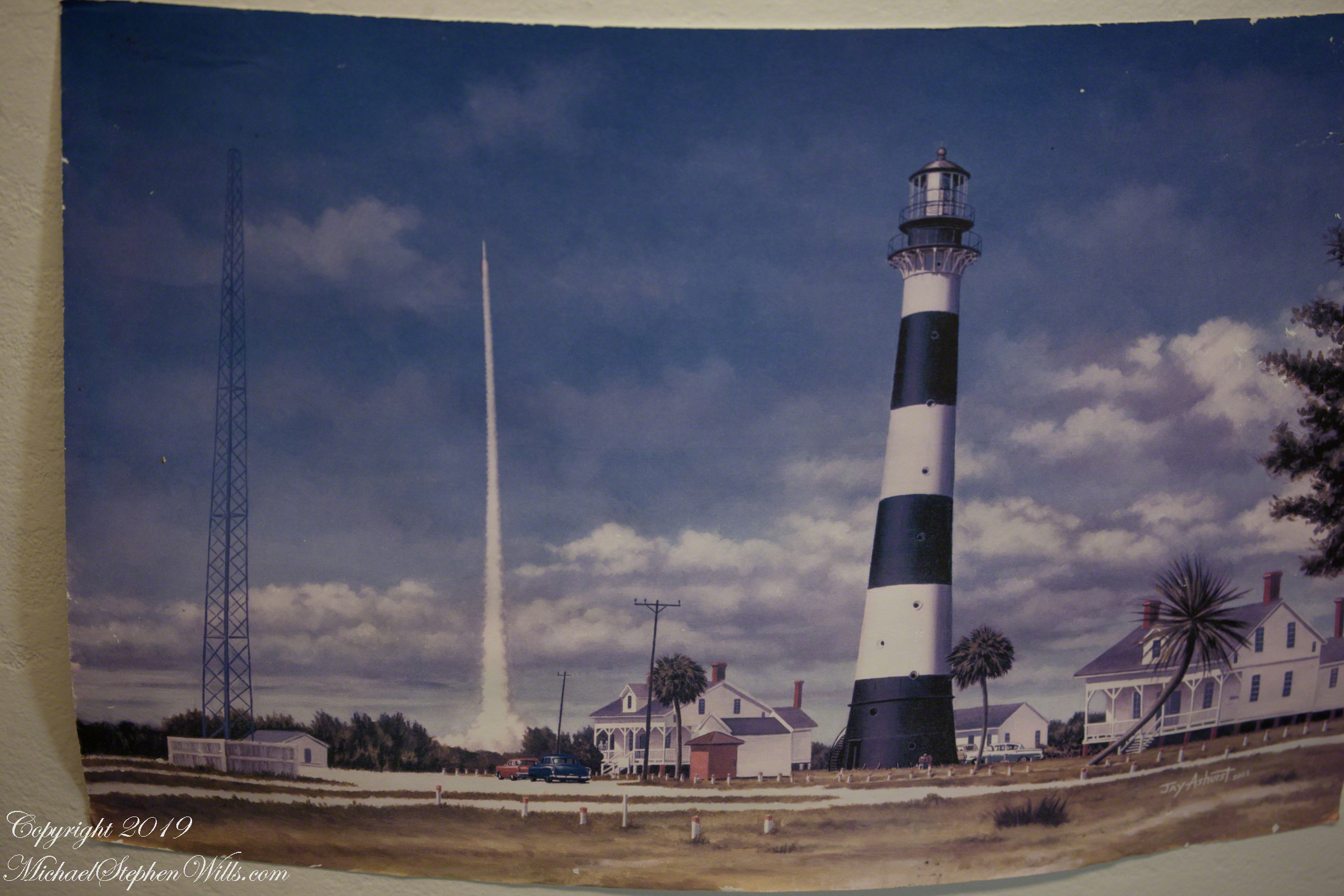
The lower staircase support column was much wider with space for illustrations and displays. Here is a reproduction of a watercolor of the lighthouse from the earliest days of rocketry on the cape. The lighthouse keeper, assistant and their families lived alongside the tower. The housing was later razed. The Lighthouse Foundation is raising money to build reproductions of the housing.

I put my copyright on the photograph to control copying. The copyright does NOT refer to the artwork.

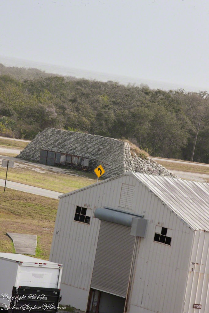
The painting is an accurate representation of the tower. The dark spots are the windows, or portals, captured in my last post, “Lighthouse Details.” Every portal offered a view of historical or current rocketry. In the following photograph, beyond the outbuilding, is a blockhouse, protection for the early rocket scientists, now abandoned. The structure services launch complex 21 and 22. More in a later post.

Wreckage with Recollections of Werner von Braun

Depending on your viewpoint, the landscape around the tower is either littered with or graced by relics such as the wreckage in the following photograph.

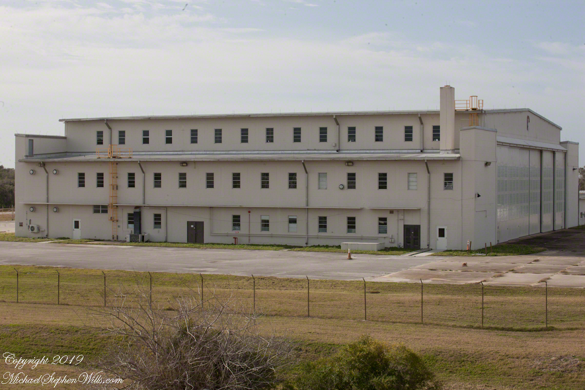
As we stood on the exterior staircase, looking toward the building in the following photograph, the docent told a story of Werner von Braun, how he loved to smoke cigarettes and watch rocket tests from the top of the lighthouse. After some spectacular failures, for reasons of personal safety he was excluded from the tower. His office during the development of the Minute Man and Persing missiles was in this building.

Building next to the lighthouse where Werner VonBraun had an office during the early days of USA rocket research.

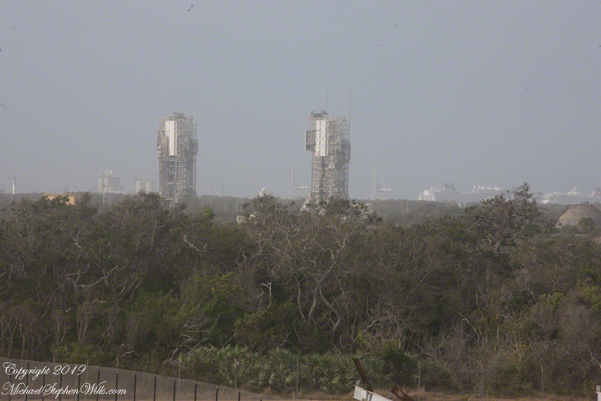
This view overlooks the former sites of Minute Man and Persing rocket development. Beyond the launch towers is Port Cape Canaveral, visible to the right are large cruise ships.

Viewed from the Cape Canaveral lighthouse, the port i is in the distance with cruise ships.

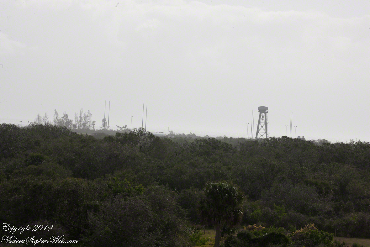
Looking from portals facing northeast is this view across ICBM road and its many launch sites. We will visit these in a future post.

Viewed from the Cape Canaveral lighthouse, these are active launch sites.
ClickMe for the first post in this series, “Cape Canaveral Lighthouse.”

Copyright 2024 Michael Stephen Wills All Rights Reserved.

Behind the Scenes of the Final Frontier: Our Tour with NASA’s “Launch Director” – 4

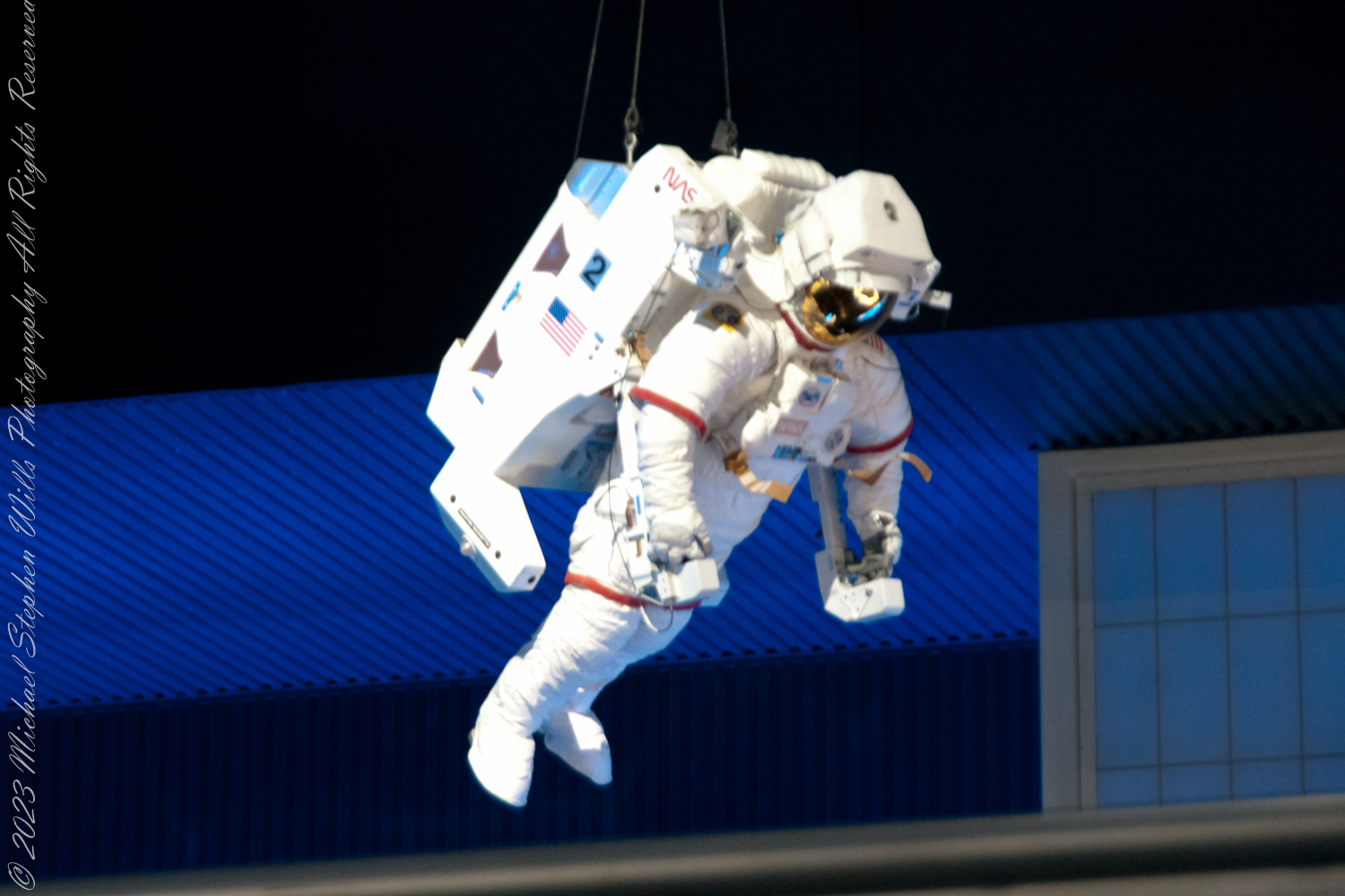
Imagine yourself floating in the vast cargo bay of the Space Shuttle Atlantis, surrounded by the essentials of space exploration. Here, in this dynamic space, the dreams of astronauts and scientists converge, where each mission reshapes our understanding of the universe. Curious? Discover more inside.

Atlantis Cargo Bay


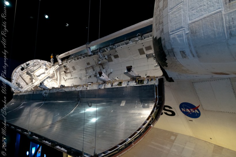
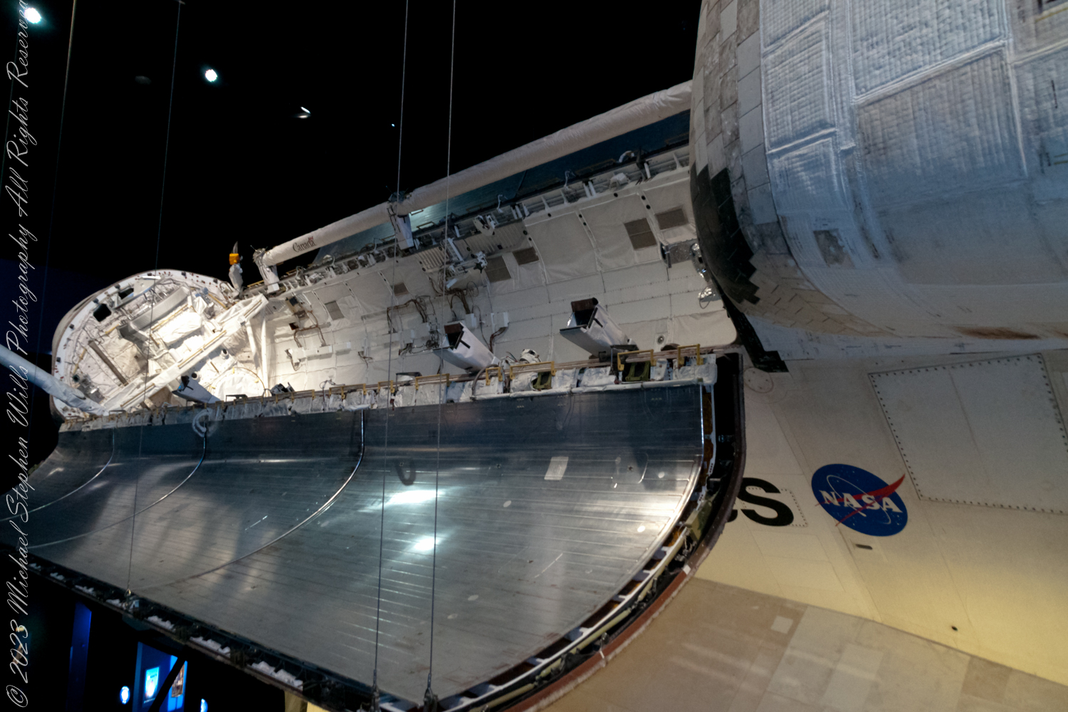
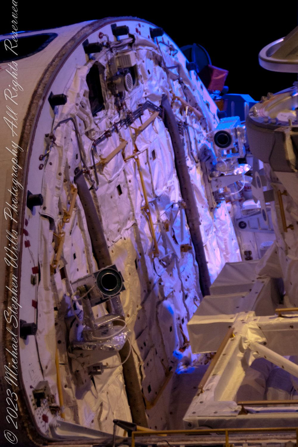
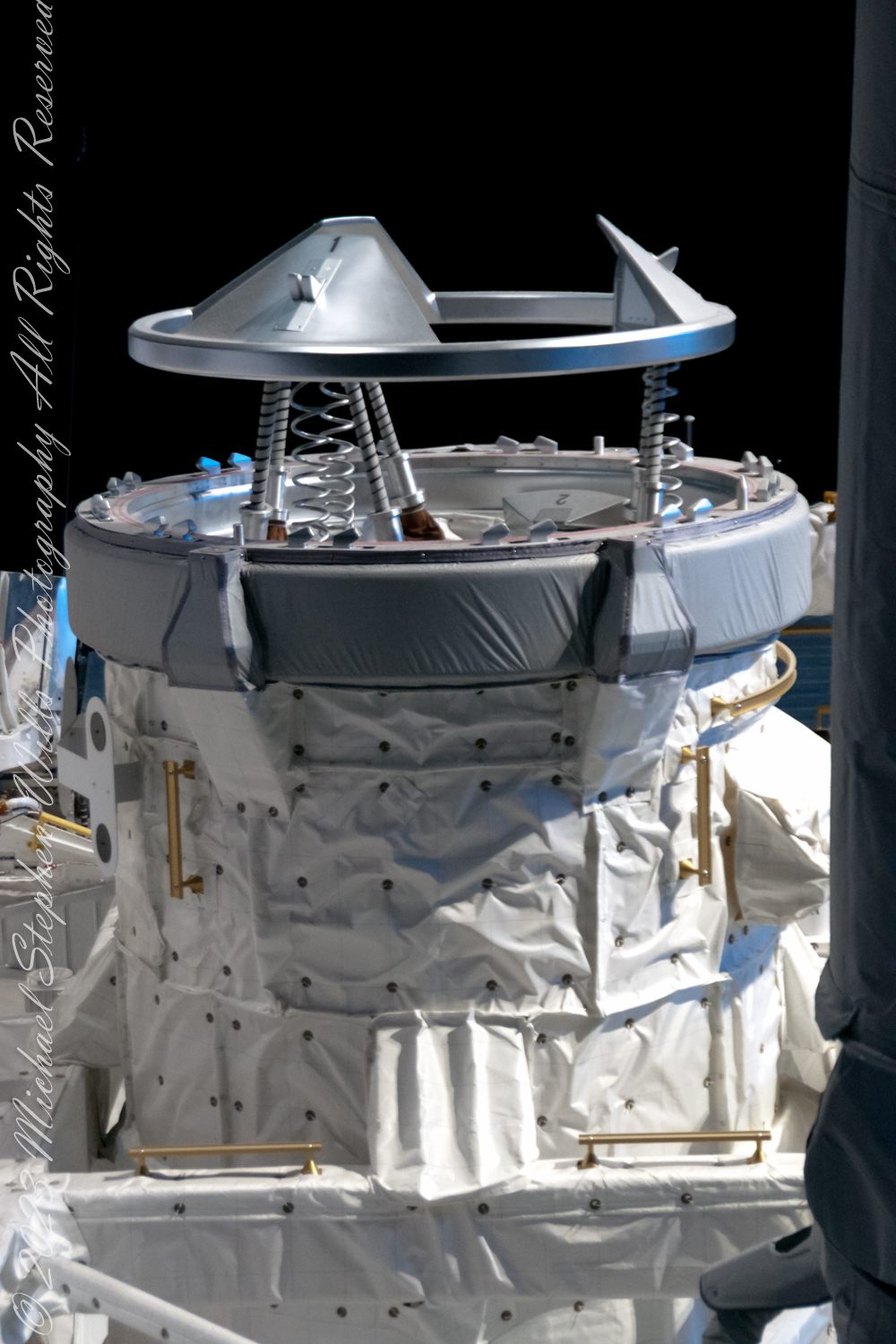
The cargo bay of the Space Shuttle Atlantis was an extensive, empty compartment located at the shuttle’s aft end, acting as the main storage area for mission payloads. A significant portion of the cargo was housed within a sizable cylindrical module named Raffaello, which contained a year’s supply of necessities—food, clothing, water, replacement parts, and scientific gear.


The dimensions of the payload area were roughly 4.6 meters (15 feet) in width and 18 meters (60 feet) in length. This spacious area enabled the shuttle to transport a diverse array of payloads, ranging from satellites to complex scientific experiments.

Exploring the Cargo Bay


Envision yourself drifting through the cargo bay of Atlantis, encircled by a maze of wires, equipment, and neatly arranged payloads. Astronauts, tethered securely and clad in their voluminous space suits, would navigate this area, ensuring the payloads were fastened correctly for either launch or retrieval operations.


The cargo bay’s configuration was highly adaptable, tailored to meet the specific needs of each mission. It played a pivotal role in the deployment of satellites, execution of repairs, or the transportation of scientific apparatus, adapting its setup as necessary.

The Hubble Servicing Mission


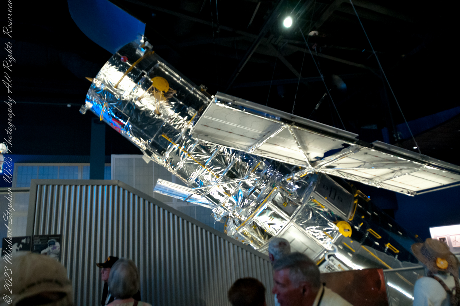
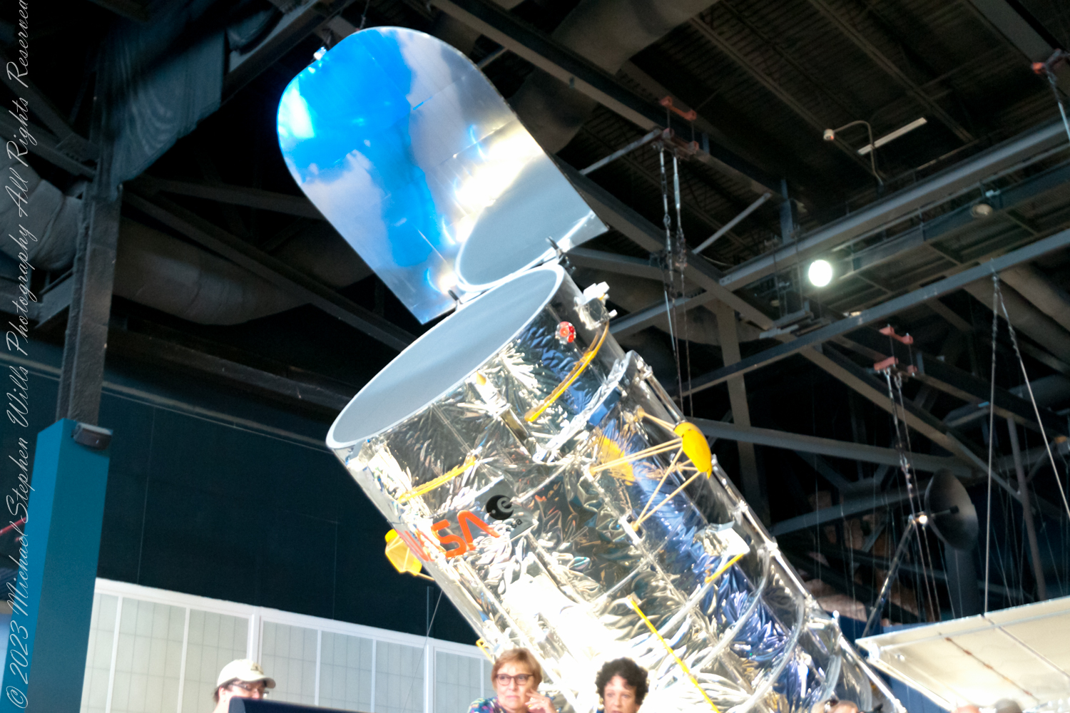
One of the most notable missions involving Atlantis was the Hubble Space Telescope Servicing Mission 4 (SM4). For this mission, Atlantis was loaded with essential items for the Hubble, including new instruments, batteries, and gyroscopes, all carefully organized within the cargo bay for safe transport to and into orbit.

Legacy

The cargo bay of Atlantis bore witness to a myriad of significant events: the release of satellites, the construction of the International Space Station, and numerous scientific investigations. Its design and flexibility were instrumental to the Space Shuttle program’s achievements.

Copyright 2024 Michael Stephen Wills All Rights Reserved

Saint Patrick’s Return to the Hill of Tara

The year 2000 AD return of Saint Patrick to the Hill of Tara. Happy Saint Patrick’s Day

To continue my posting “Climb Hill of Tara” my first submission of three Hill of Tara photographs to Getty Istock had two of the photographs returned for revision.

A statue of Saint Patrick fittingly welcomes visitors to the Hill of Tara, County Meath, Ireland. This statue of cast concrete was an existing statue donated by the Sisters of Charity, moved from an existing installation to the Hill of Tara in the year 2000 AD. The creator is anonymous, the is no plaque or other attribution on or around the statue.

The original statue was erected on the summit of the Hill of Tara shortly after Catholic emancipation in 1829, commemorated the events of 433AD when St. Patrick lit a bonfire on the nearby hill of Slane on the eve of Easter Sunday.

Lighting such a fire was contrary to the pagan laws of the time which dictated that the first fire lit that night be in Tara. Observing St. Patrick’s bonfire from afar, the chief druid of the ancient Gaelic capital predicted that if the flame were not extinguished that night, Christianity would never be extinguished in Ireland.
The saint’s bonfire continued burning and the next morning, Easter Sunday, St. Patrick entered Tara to convert the king and his followers to Christianity.

For the fenced statue of Saint Patrick the revieweR wrote:

Please provide a full description for the work of art featured in this image. Include the artist, date of creation, location, etc. Works of art created by someone other than yourself must be free of copyright protection to be considered. If this work of art is indeed under copyright protection, a property release signed by the copyright holder will need to be provided.

Hmmmm….What I do while capturing a photograph of a statue is take photos of any plaque, sign, whatever to acquire the name of the creator, how it came to be there, community connections. There was nothing around the statue nor the very informative Office of Public Works placards at the entrance.  I was proud to submit the statue photograph, as it turned out so well, and hoped for the best.

Last week, I put in a query to Ireland’s Office of Public Works (OPW), the agency responsible for the Hill of Tara, and did not receive a response when, for other queries, they were helpful.  This Saturday and Monday mornings, several hours of internet research revealed this history.

The original statue was placed on Tara sometime after the 1829 Catholic emancipation.  It was molded concrete, created by Thomas Curry of Navan at his own expense to honor the connection of Saint Patrick to Tara.

The OPW removed Curry’s statue 1992 for repair of a century of wear.  During the removal the statue was damaged beyond repair and, afterwards, was further damaged by vandals who decapitated and used it for target practice.

Initially, the OWP decided not to replace Saint Patrick citing the “pagan” nature of the place. After an angry meeting of local people at the Skryne Parish Hall.  In this meeting the local Rathfeigh Historical Society formed the “Committee to Restore St. Patrick to Tara.”  In turn, pressure was put on Michael D. Higgins, Minister for Arts, Culture and the Gaeltacht (and the OPW). It was decided a new statue was to be created, based on a competition, and instead of it former place at the hill summit (called Rath na Rí), it was to be near the entrance, outside the Interpretative Center, to offer a Céad Míle Fáilte to visitors and be seen on departure.

The outcome was the competition winner was rejected by locals.  The winning entry, by sculptor Annette Hennessy, did not follow competition rules that specified the statue incorporate traditional features to include shamrocks, harp, miter, a crozier and, perhaps, fleeing snakes. Hennessy’s design was of a shaven headed teenage boy in a short (“mini-skirt”) kilt, a handbag-shaped bell in hand.  She agreed hers was “not a traditional style statue” saying it “acknowledges our Pagan Celtic history.”

The rejection included a statement from Dr. Leo Curran, chairman of the Rathfeigh Historical Society, “We agreed that most of the monuments in Tara are from the pre-Christian era, but St. Patrick should be at the uppermost layer, representing Christian tradition extinguishing paganism.”

By this time, a new government and minister were in place.  The decision was made to search Ireland to find a suitable, existing, replacement statue.  By 2000 the present statue, donated by the Sisters of Charity, was in place at the Hill of Tara entrance.

At the end of this post I provide the two references from my internet research and from which many facts and all the quotes were used here.  I concluded the statue author was anonymous without copyright protection and submitted a revised image description, attaching a copy of my research.

What happened to my IStock photograph of Saint Patrick on the Hill of Tara? Getty accepted my application, published the photo and it is one of my top downloads, and earners.

Please browse my reasonably priced stock photography.  License a photograph, download and use it for your website or blog.  Click this link to browse all my Getty IStock Photography offerings.

Or click this link or any photograph or this link to select a print with custom framing from my “Ireland” Fine Art Gallery.

References :
“Should St Patrick stand again on Tara?” Independent, Dublin, Ireland March 17, 1999.
“Statue of Saint Patrick”, Meath Roots web site. The page includes photograph of the Thomas Curry statue.

Copyright 2024 Michael Stephen Wills All Rights Reserved