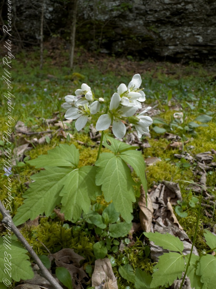
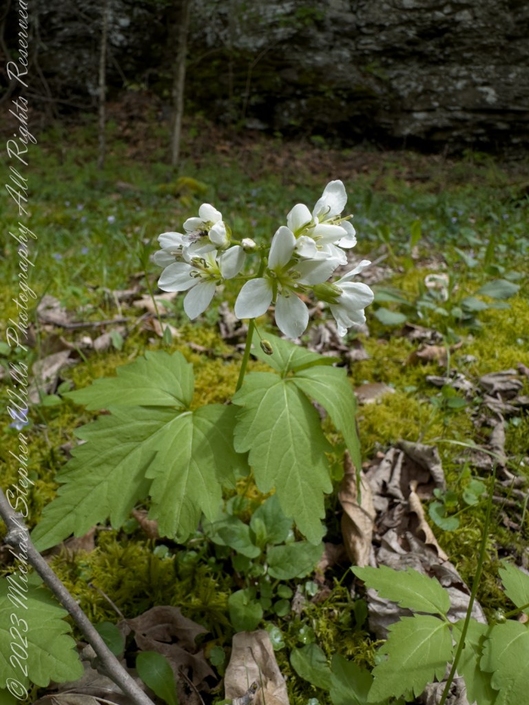
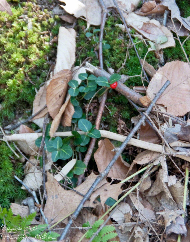
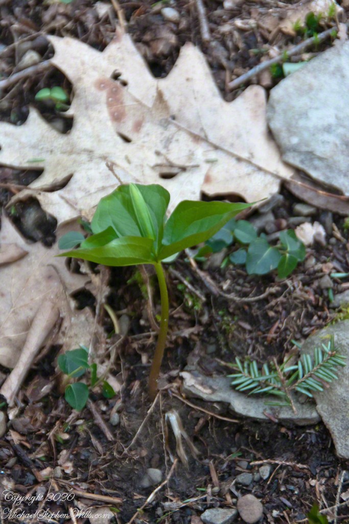
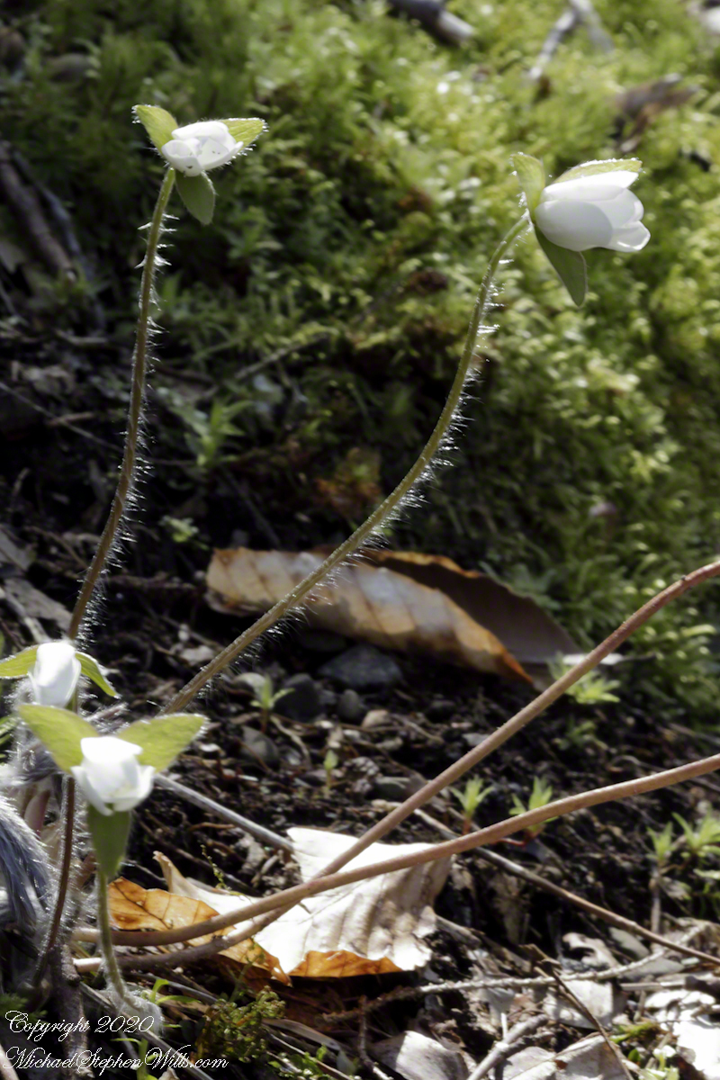
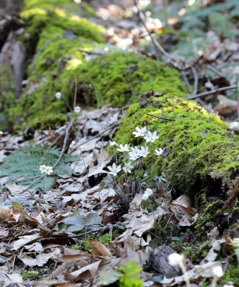
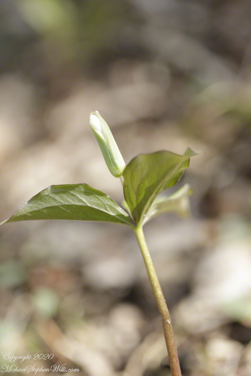
Step into the spring woods and discover the broadleaf toothwort, Cardamine diphylla. Marvel at its white blossoms and deep-lobed leaves, and uncover its vital role in both early pollination and traditional medicinal practices.
Broadleaf toothwort, Cardamine diphylla, plays a charming role in the ecosystem of deciduous forests, often carpeting the forest floor with its distinctive greenery and white blossoms during the spring. This plant is particularly noted for its broad, compound leaves that usually consist of two or three leaflets, each characterized by deep lobes and a somewhat wrinkled appearance, lending it the name “crinkle root.”
The flowers of the broadleaf toothwort are a notable feature, emerging in clusters atop slender, upright stems. Each bloom presents four white petals that form a delicate cross, a typical trait of the Brassicaceae family, to which it belongs. The flowering period spans early to mid-spring, making it one of the earlier blooms in woodland areas, which plays a critical role in the local ecology. These flowers are not just a visual treat but are also vital for early-season pollinators such as bees and butterflies, providing them with necessary nectar.
Moreover, Cardamine diphylla is more than just a visual and ecological gem. It has historical uses in traditional medicine and cuisine. Native American tribes utilized the peppery roots of the toothwort as a seasoning and as a medicinal herb to treat various ailments.
The presence of Cardamine diphylla is also an indicator of the health of the forest ecosystem. Thriving populations of this plant suggest a well-preserved habitat, which is crucial for biodiversity conservation.
In summary, Cardamine diphylla, with its ecological significance and historical uses, represents a small but vital part of North America’s natural heritage, highlighting the intricate connections within woodland ecosystems and the importance of preserving these natural environments.
Copyright 2024 Michael Stephen Wills All Rights Reserved
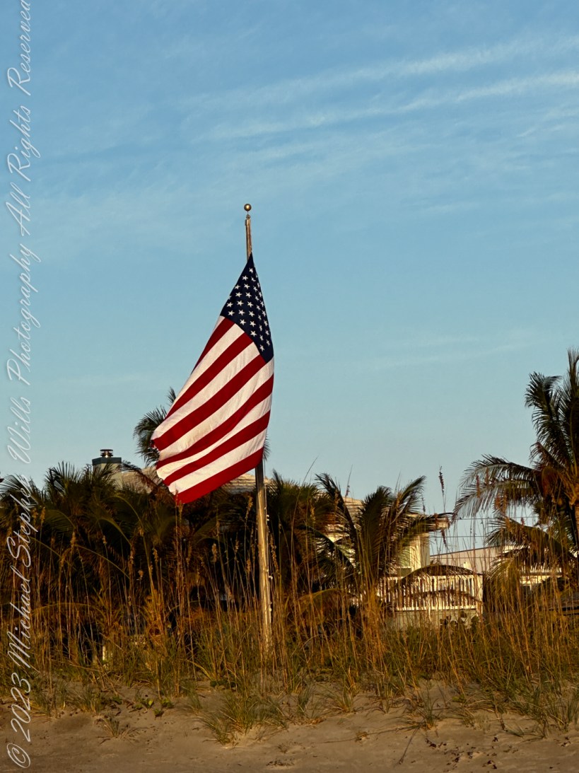
The sun has barely risen over the horizon, casting a golden hue on the edges of the swaying palm trees. I’ve found my favorite spot on Cocoa Beach, where the sand meets the sea oats, and the Atlantic waves crash endlessly. It’s a windy winter’s morning, with the gusts howling, pulling at my shirt, tugging at the American flag standing tall amidst the dunes.
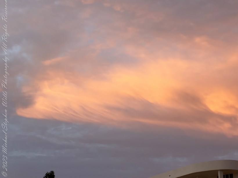
The early light of dawn illuminates clouds with a pink hue on a windy winter’s morning. Cocoa Beach, Brevard County, Florida. The Space Coast.
The flag is massive, its stars and stripes fluttering with conviction against the backdrop of an endless blue sky. Its red, white, and blue are a reminder of the freedom it represents. A symbol of history woven into every thread. In the wind, its fabric dances gracefully, in sync with the whispering leaves and the sea’s rhythm.
This particular flag has been around for years, steadfast on this patch of the Florida coast. The pole, firm and weathered, stands as a sentinel. It’s not just a symbol of patriotism but a beacon for those who wander these shores, a guiding point that has witnessed countless sunrises and sunsets, serving as a reminder of the ideals this country strives for.
Near the end of my video a squad of pelicans glides through, slicing the sky in a perfect formation. They using the wind to their advantage, and their synchronized flight is mesmerizing. Their journey is a testament to the beauty of nature’s choreography, moving with grace and purpose, guided by the same winds that ripple through the flag and carry them along the coast.
The wind is fierce today, blowing sand like fine snow across the beach. It stings my face as I watch the waves roar, driven by the same winds that make the flag soar. These are the south winds, warm and constant, flowing over the Atlantic. They pick up speed across the open waters before reaching the coast, shaping the dunes, bending the palm fronds, and reminding me of the unyielding force of nature.
The south wind is not just a whim of nature; it’s shaped by the currents that flow from the equator, by the rotation of the Earth, and by the heated lands further south. It’s nature’s breath, shifting sands and altering landscapes. This breeze carries with it a hint of salt, a whisper of the tropical climates from which it comes, and a false promise of more warmth on this winter morning.
There’s a certain serenity in being here, watching the elements play. The sea is restless, much like my thoughts. I can’t help but contemplate the forces that have shaped this land, from the explorers who first set foot here to the astronauts who launched themselves to the moon from just a few miles away. This place is steeped in history, and the flag embodies that.
As I look towards the flag again, its fabric shimmering under the sun’s rays, I think about all that it has seen. The gentle lapping of the waves reminds me of the constant change that’s part of life. The flag, though, is a steadfast sentinel, standing tall through it all, enduring the same winds and elements that buffeted it years ago. It speaks of resilience and hope, of standing tall no matter what comes your way.
I pull out my camera, capturing the flag as it flutters in the wind, its stripes rippling like waves on the sea. In a moment, I take a video, recording not just the flag but the beach around it, the sand swirling around my feet, creating transient patterns that the wind will soon erase. The video captures the essence of this place, where the wind and waves weave their own stories.
This morning, like so many before, the wind brings with it a sense of purpose. It whispers tales of the past and hints at the future, pushing me to continue exploring, to keep seeking, and to always remember what this place represents. The American flag, in its majestic flight, is more than fabric; it’s a reminder of the journey and the ideals that guide us, just like this wind pushing along the coast, unrelenting and full of promise.
Copyright 2024 Michael Stephen Wills All Rights Reserved
Embark on a journey with kiteboarders who harness the wind and surf, mastering both beach and ocean. Witness the evolution of this thrilling sport over seven years, from the sandy shore to the open waves.
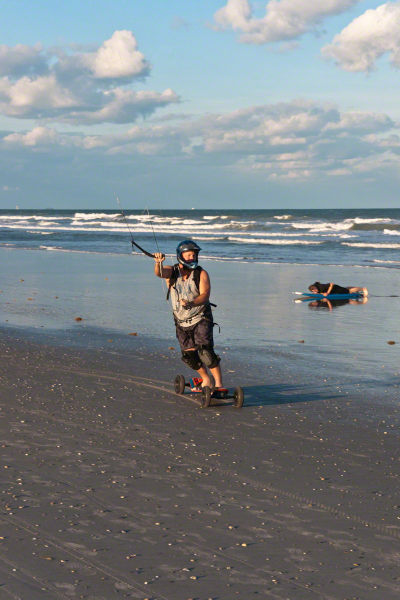
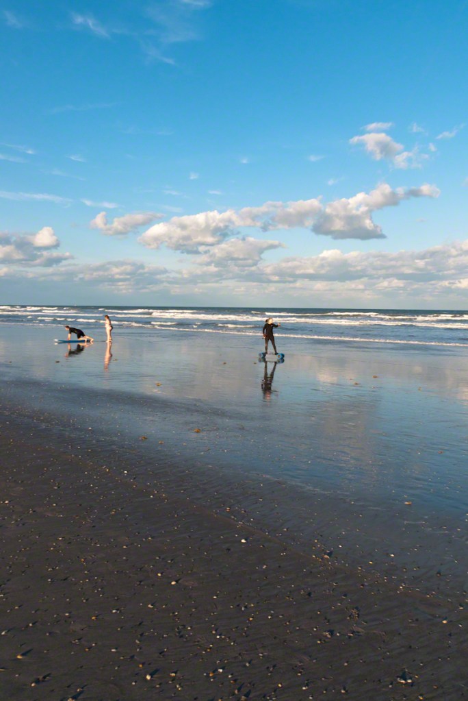
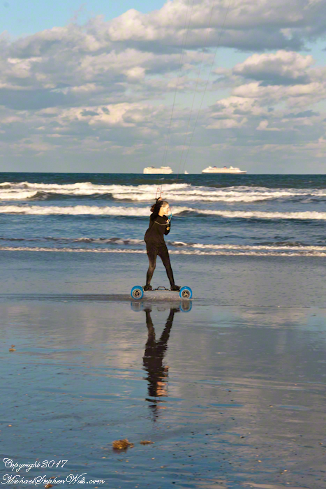
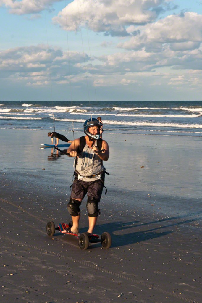
Cocoa Beach, with its rhythmic waves, is a destination that stirs a sense of adventure. Seven years ago, March 2017, as I strolled along its sandy shores, my attention was captured by a curious sight: several people gliding effortlessly across the beach, seemingly with the wind at their command. These weren’t your typical surfers or skateboarders—they were kiteboarders, harnessing the power of the wind with large kites that stretched high into the sky. I was transfixed by the sight of their wheels skimming along the wet sand, leaving tracks like an artist’s brushstroke on a canvas.
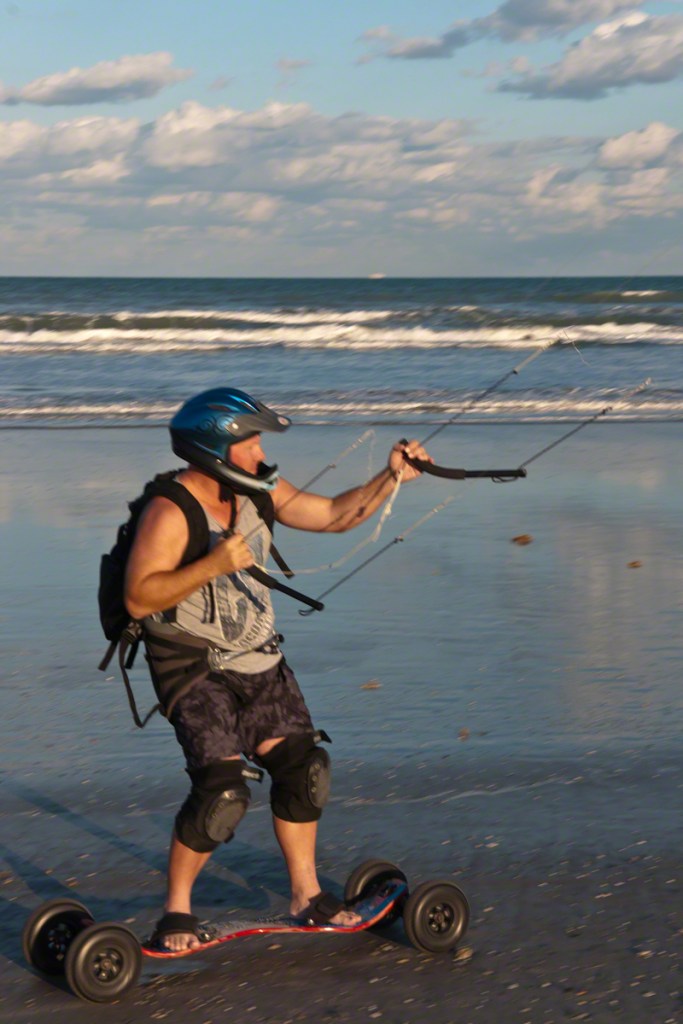
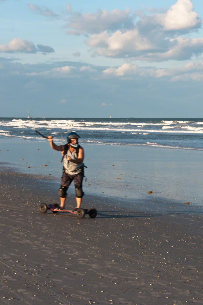
The beach was alive with energy. The wind, the driving force behind the kiteboarders, was gusty, rippling the surface of the ocean and creating perfect waves for surfers. But the kiteboarders were on a different mission. They had wheels attached to large boards, akin to skateboards but bulkier. They wore helmets and pads, visibly prepared for a sport that seemed to demand not just skill but a dose of courage.
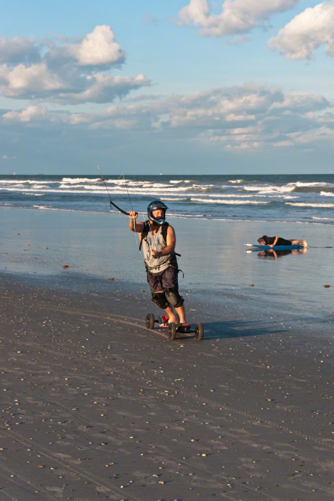
One rider caught my eye, with his bright blue helmet and focused gaze. He adjusted the lines of his kite like a master puppeteer, maneuvering himself with precision as he glided along the shore. The kite seemed an extension of his own limbs, responding seamlessly to his every movement. It was exhilarating to watch, the kite’s taut lines tracing invisible patterns in the sky as he shifted his weight, steering the board with expertise. With each gust of wind, he picked up speed, racing along the shore with a grin that spoke of pure joy.
Not far from him, a second kiteboarder, a woman, was testing her skills. Her kite had a distinct red pattern, vibrant against the backdrop of the sky. She handled it with ease, her body swaying in rhythm with the kite’s movements. It was like a dance, where the wind was both partner and lead, guiding her across the beach in wide arcs. Occasionally, she would glance over at the other riders, sharing nods of camaraderie that suggested a tight-knit community.
The sight reminded me of the joy of childhood, of riding bicycles down a hill, the wind whipping through your hair, feeling like you could conquer anything. But this was a more refined thrill, one that demanded an intimate understanding of nature’s forces. The kiteboarders were more than just athletes; they were artists painting their own masterpieces against the sky.
In the distance, I noticed a third rider. He was still finding his rhythm, his movements a little less sure, but the determination on his face was unmistakable. He kept his focus on the kite, battling the wind to gain control. Even as he stumbled a few times, his spirit didn’t falter. Each time he fell, he would rise, dust off the sand, and try again. It was a scene of persistence that spoke to the spirit of the sport—a reminder that mastery is not achieved without effort.
The sun began to dip toward the horizon, casting long shadows on the sand. The wind grew cooler, and the kiteboarders began to pack up their equipment. I found myself lingering a little longer, reflecting on what I had just witnessed. Kiteboarding seemed to embody the spirit of Cocoa Beach itself—a blend of adventure, community, and a deep connection with nature.
Walking away, I couldn’t help but feel inspired by their spirit of adventure. The kiteboarders had painted a vivid picture of resilience, joy, and the thrill of chasing the wind. They were, in a way, explorers charting a path on the very edge of land and sea, powered by nothing but wind and will.
Seven years later, this past winter of 2024, there was a kicking wind powering a group of three kiteboarders tackling the waves offshore, embracing the ocean waves in a spectacular display of skill.
Their kites stretched high against a steely sky, creating vibrant contrasts with their colorful patterns. One kiteboarder had a kite adorned in shades of turquoise, like a burst of sunlight riding the wind. He maneuvered deftly on the waves, rising high on the crest of each swell before swooping down into the troughs. His movements were fluid, and he rode each wave with a mastery that suggested years of experience.
The second rider, with a vivid blue kite, showed off his own skill set, to ride the waves with finesse, carving arcs through the water, creating a wake of white foam. He seemed almost weightless, gliding effortlessly, catching air whenever he hit a particularly high crest.
The third kiteboarder was the most daring of the trio, his kite blending with the overcast skt. He launched himself off the waves, soaring high into the air before coming down with a splash. Each leap seemed to defy gravity, and he twisted and turned in mid-air like an acrobat, displaying a level of athleticism that left the onlookers on the beach in awe. The wind and waves provided the perfect playground for his tricks, and he used every bit of it to his advantage.
The three kiteboarders moved in sync, communicating through gestures and nods, sometimes even shouting encouragement to each other over the sound of the crashing waves. They pushed one another to reach greater heights, to attempt more daring moves, and to revel in the shared joy of their sport. It was as if they were performing a choreographed routine, set to the rhythm of the sea.
Onlookers gathered along the shore, drawn by the mesmerizing sight of these kiteboarders taking on the ocean waves. The kiteboarders, with their vivid kites and breathtaking maneuvers, were like seagulls riding the wind, an exhilarating reminder of the power of nature and the joy of embracing it.
As the day wore on, the kiteboarders continued to ride the waves, their energy seemingly endless. The sea and sky were their canvas, and they painted across it in broad, sweeping strokes. Watching them was a thrilling reminder of the freedom and adventure that the ocean brings.
Copyright 2024 Michael Stephen Wills All Rights Reserved
A shark’s fin slicing through the waves at Cocoa Beach reminds me of a life-changing encounter I had with the ocean’s wild inhabitants, transforming my relationship with the sea and its hidden mysteries.
During winter vacations to Cocoa Beach, Florida, I spent tiome relishing in the salty embrace of the Atlantic, and my love for the water extended beyond the ocean to poolside swims year-round. However, a few years ago, my carefree splashing in the waves took a drastic turn after an unexpected encounter with a creature lurking beneath the surface.
It was a warm, sunlit day, and the ocean seemed welcoming. I had just waded into waist-deep water when I felt it—a strong, unexpected bump against my side. I turned quickly, expecting to see a fellow swimmer, but there was no one nearby. My heart pounded as the realization dawned that I had been bumped by a large sea animal, most likely a shark. Although I didn’t see the creature clearly, the experience left an indelible mark on me.
From that day on, the ocean was no longer a place of carefree enjoyment. The once thrilling waves now seemed menacing. I found solace in swimming in pools, where the water was clear, and the risks were few. The ocean, with its unseen mysteries, became a distant memory.
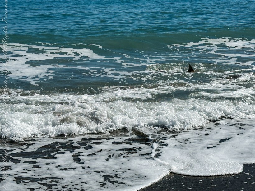
On January 30, 2024, I was back at Cocoa Beach, but this time I stood firmly on the shore. It was noon, and the sun shone brightly over the shimmering waters. As I scanned the horizon, my eyes fell on a telltale fin slicing through shoreside foam of breaking wavews. A shark was feeding just three feet from the shore. I watched in a mix of awe and trepidation as the creature moved with effortless grace through the surf.
Shark feeding a few feet from shore, Cocoa Beach, January 30, 2024 around noon.
As I stood there, capturing the moment, a woman approached me. She had observed my intent gaze and sensed my apprehension. She introduced herself and then began to share an unsettling story about her daughter. She told me that her daughter had been bitten by a shark on her foot the previous year while swimming off the same beach. The young girl was still recovering from the ordeal, both physically and emotionally.
Her story, coupled with my own experience, solidified my decision to stay out of the ocean. I understood that the beach was the shark’s domain, a place where humans are merely visitors. The encounter reminded me that even in our pursuit of leisure, we must respect the natural world and its unpredictable inhabitants.
These days, I content myself with the safety of pools, where I can swim without fear of what lies beneath. But I still cherish the ocean from a distance. I understand its beauty and power, and I respect the creatures that call it home. I may not wade into the waves anymore, but I will always hold a deep appreciation for the vast, enigmatic sea.
Copyright 2024 Michael Stephen Wills All Rights Reserved
Nature’s artistry unfolds on the shores of Cocoa Beach, where the ever-changing tides leave intricate patterns in the sand. This captivating display of erosion hints at a fragile coastline, urging us to act for its preservation.
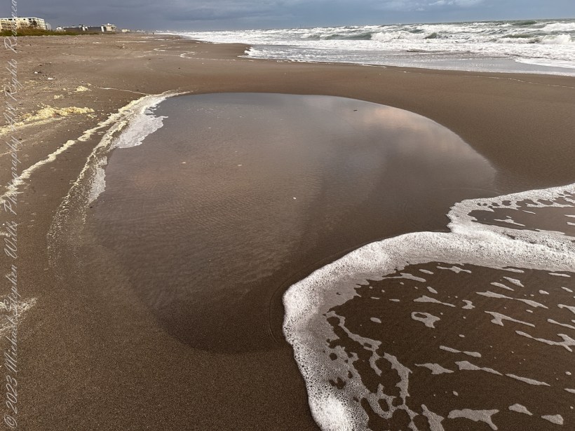
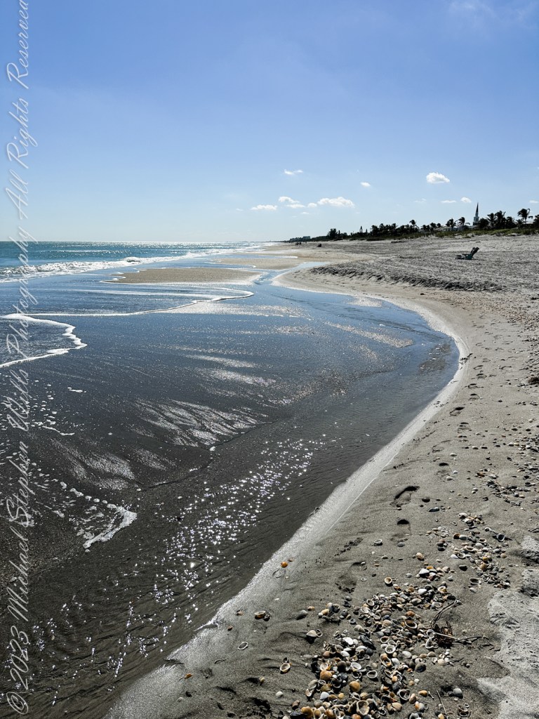
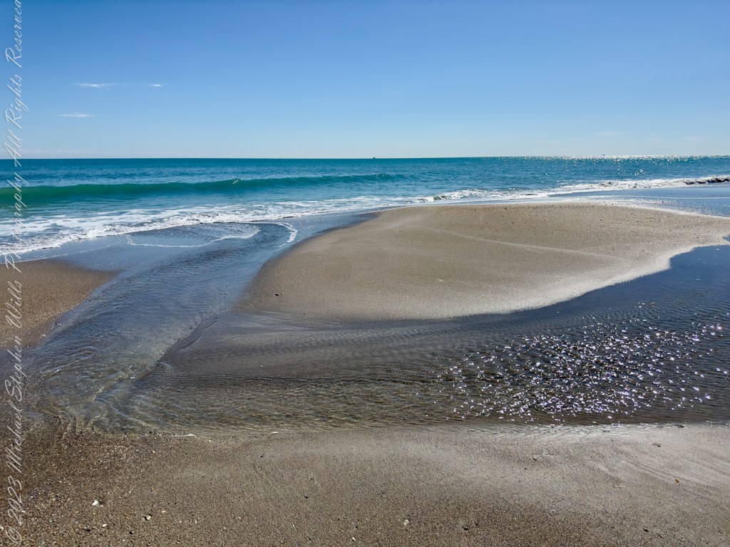
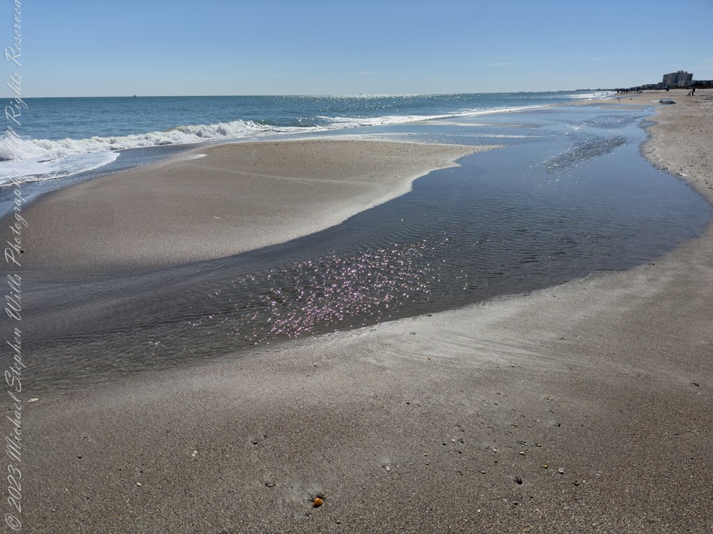
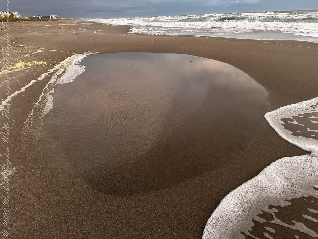
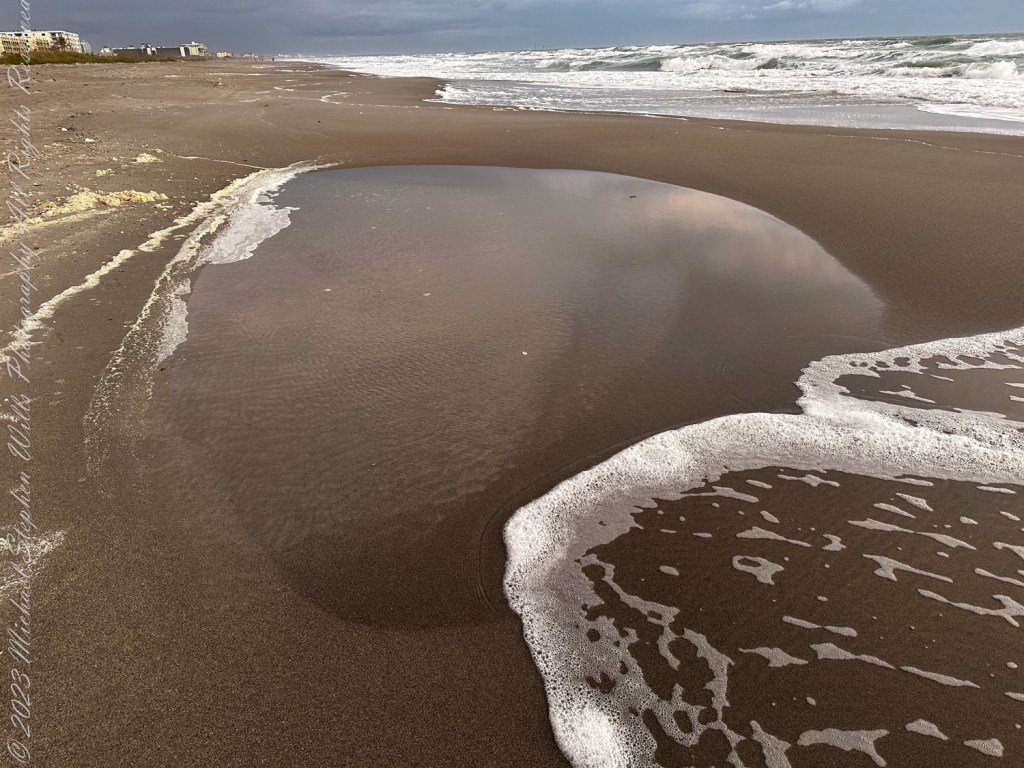
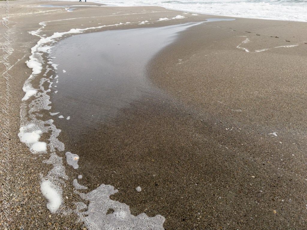
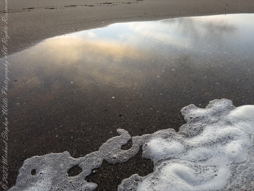
Standing on the sandy shore of Cocoa Beach in January 2024, I observe firsthand the effects of erosion along this stretch of Florida’s coastline. The scenes captured in my photographs show significant changes to the beach’s contours and composition. The shimmering foam, soft sand ripples, and exposed shells are testament to the relentless activity of the sea. Each wave carves away at the beach, leaving patterns in the sand that tell the story of erosion.
Erosion Patterns and Sea-Level Rise
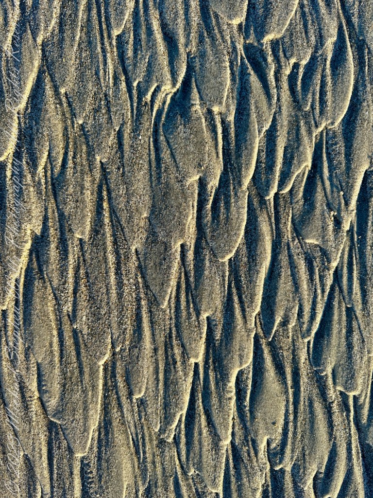
The photographs vividly display the intricate, almost artistic designs formed by erosion. In one, the ripples in the sand reflect the movement of the water, indicating the direction and flow of the tides. The sea has steadily eaten away at the shoreline, pulling the sand away with each ebb and flow.
Macro, erosion patterns in beach sand.
Studies show that Florida’s Atlantic coast is particularly susceptible to rising sea levels due to its low-lying nature. The Florida Climate Center notes that sea levels have been rising at an average rate of about 1 inch per decade, with projections estimating further acceleration. April 27, 2024 The Washington Post published, “Where Seas are Rising with Alarming Speed,” showing a map with Cape Canaveral / Cocoa Beach showing a 6 – 9 inch sea rise since 2010. This rise compounds the effects of erosion, causing beaches like Cocoa Beach to recede.
Impact on the Beach
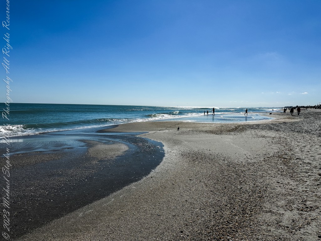
I notice shelves of beach sand formerly above the tide now washed over by high tide. New channels forming, cutting across the sand with each tidal cycle. The erosion reveals underlying shell beds and deposits, hinting at the rapid loss of the finer, upper layers of sand. This accelerated erosion poses a significant risk to the stability of the coastal area.
The erosion is not just cosmetic. It impacts local ecosystems and property lines, potentially leading to habitat loss and increased vulnerability to storm surges. Coastal development also exacerbates the problem by interfering with natural sediment replenishment.
Reflections and Future Prospects
The view across the horizon, where the deep blue sea meets the sky, is a stark reminder of nature’s power and the urgent need for mitigation. As Florida’s beaches face the twin challenges of rising seas and intensifying storms, the communities here must find ways to adapt. Cocoa Beach is a vivid reminder of the coastal fragility and the importance of sustainable management practices.
From a personal perspective, seeing this change compels a deeper reflection on our relationship with nature. The beaches we walk on today may not be here for future generations unless we act decisively to combat climate change. Efforts to build resilience into coastal infrastructure and adopt environmentally friendly practices will play a critical role in preserving this natural beauty.
Conclusion
In summary, Cocoa Beach’s erosion is a direct consequence of rising sea levels and changing environmental conditions. The patterns etched in the sand speak of nature’s resilience and power, while also sounding an alarm about the future. As stewards of the coast, it is our responsibility to take meaningful actions that preserve these shores for generations to come.
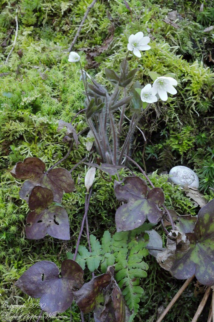
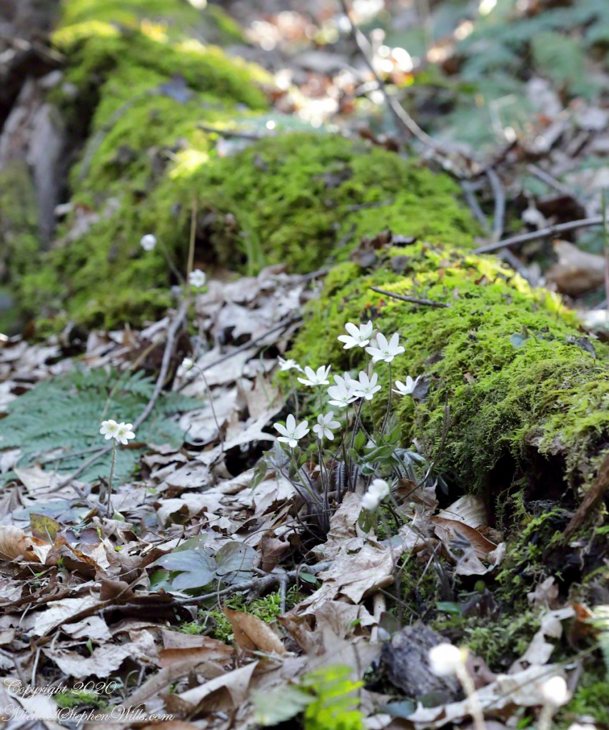
Hepatica positioned perfectly above the trail, sprouting from moss, a grouping of the plant and flowers.
Scientific Name: Hepatica nobilis var. obtusa. I found the two land snail shells this session, I identified it as Neohelix albolabris, and positioned it in this shot to lend interest. In a future posting you will see the shell where it was found.
Click photograph for a larger view. To do this from WordPress Reader, you need to first click the title of this post to open a new page.
Hepatica Blossoms
Six unrelated young adults, all female and without masks, not following social distancing guidelines, passed as a group just before I set up for this shot. I heard them coming and made plenty of space between them and me. COVID-19 testing in Tompkins continues to find several positive cases each week.
Finding an appropriate combination of settings for this grouping was a puzzle. My goal was to bring the flowers and surrounding into focus with intermittent breezes. The f-stop needed to be high to accommodate the depth with minimal exposure duration as the flowers moved in the slightest breeze. The solution was a high ISO (2500) and f-stop (32), yielding a 1/3 second exposure (Not fast). The compromise was patiently waiting for a break in the breezes.
Gallery of Flowers in this series
Copyright 2024 All Rights Reserved Michael Stephen Wills
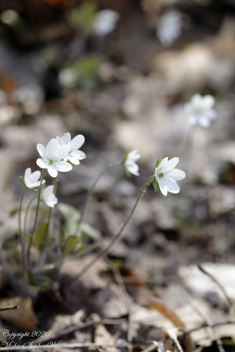
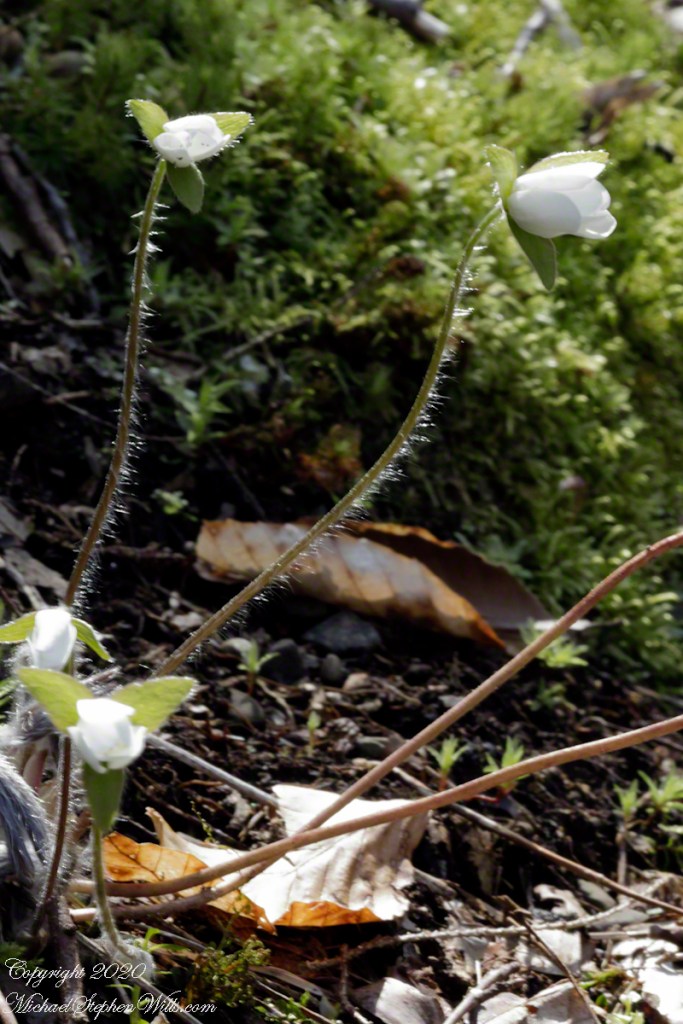
Just opened flowers on long hairy stems, tiny anemones. A crawl and tripod we needed to capture these. The scene scale is revealed by the dried leaves from last autumn.
Click photograph for a larger view. To do this from WordPress Reader, you need to first click the title of this post to open a new page.
Hepatica Blossoms
I call these anemones from the disputations among taxonomists. All agree there is some relationship and differ in the degree. Classifications add a designation “tribe” before genus (hepatica). Alternatively, the genus is designated Anemone instead of Hepatica . A common name for anemones is “wind-flower” for how the flower is sensitive to a slight breeze, on these long stems.
This is the first hepatica capture of the session. There was no breeze at this time and the ISO is 800, f-stop 29 (lending some definition of the background, less than I’d expect) and a relatively slow exposure of 1/4 second. The 100 mm macro lens on a tripod mounted camera.
Gallery of Flowers in this series
Reference: Wikipedia article, “Hepatica.”
Copyright 2024 All Rights Reserved Michael Stephen Wills
Here we have two photographs from the end of the April 20, 2020 session. I finished a series of macro Hepatica and, tired (emotionally, not physically) and not wanting to step up the slope, captured the following grouping of a single Red Trillium, lit by a bolt of sunlight, White Hepatica, fern and the budding White Trillim from yesterday’s post. Not the same trillium, a continuation of all the individuals in bud.
Click photograph for a larger view. To do this from WordPress Reader, you need to first click the title of this post to open a new page.
On the South Rim Trail of Robert H. Treman New York State Park. April 19, 2020.Wildflower Grouping
These were 15 feet or so up the slope above the South Rim Trail. I used the 100 mm macro lens, with the spring breezes ISO set to 2500, f/5.6 for a 1/200 exposure.
Not far away, also upslope, was this flower grouping against a moss covered log. Park forestry leaves fallen trees in place to return to the soil. Camera settings are the same.
Lobe leaved Hepatica
Both photographs were handheld.
Copyright 2024 All Rights Reserved Michael Stephen Wills
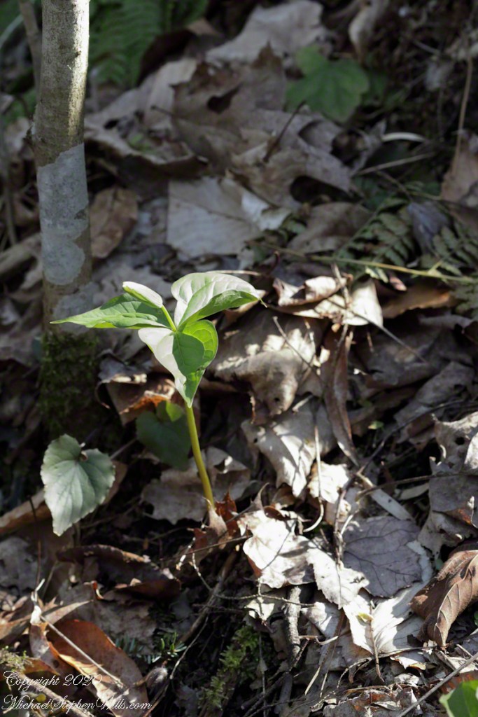
Wildflowers flourished where the slope turned to the north and late afternoon light spread across the small ravine created by a small stream. This early in the season White Trillium buds were forming between three green bracts.
Click photograph for a larger view. To do this from WordPress Reader, you need to first click the title of this post to open a new page.
Trillium Grandiflorium
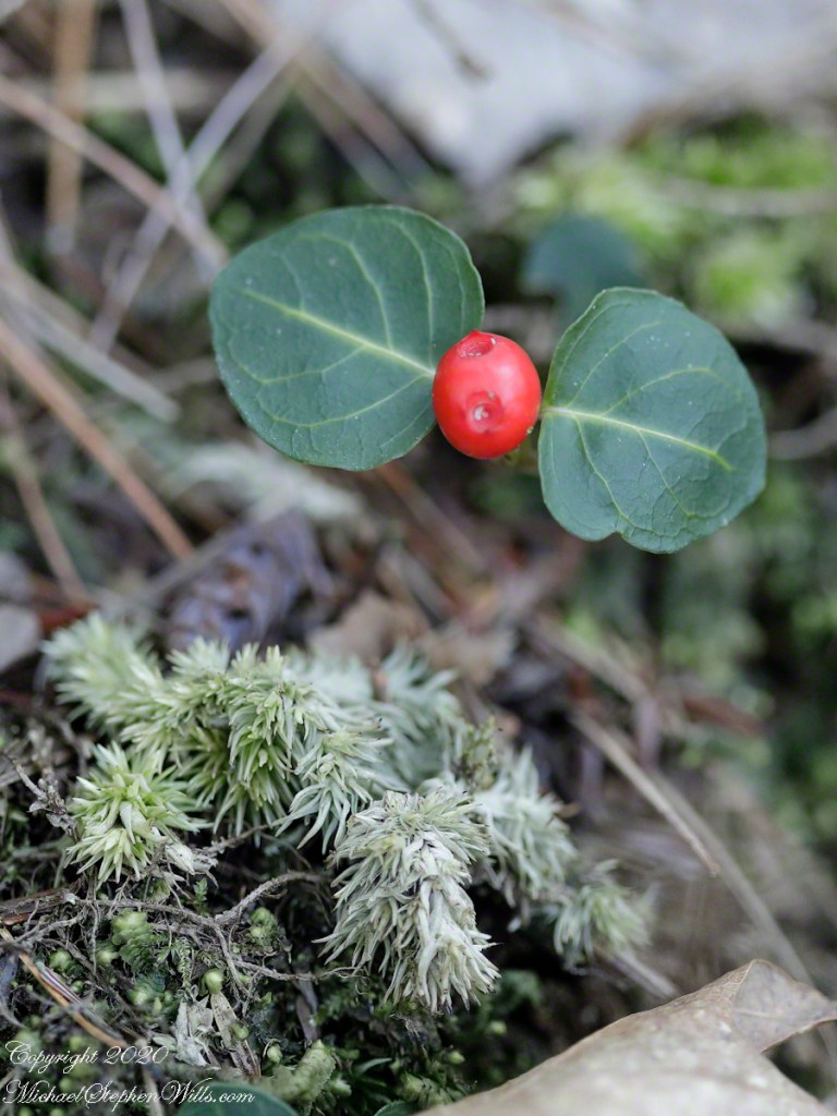
The above photograph taken handheld with a variable zoom lens captures the plant and environment. On the forest floor is twig of hemlock, probably knocked off by squirrels feeding on the tiny cones. Oak leaves from last season frame the dark green bracts. We also see a few wintergreen leaves and the rich soil.
With the low light ISO is 2000, the f-stop of 5.6 allowed crisp details of the hemlock and wintergreen, the focus is soft on the oak leaves. Where is topography allowed sunlight, the White Trillium were a bit further along. Here is a bud opening.
Trillium Grandiflorium
Here I used a travel tripod and a macro lens with f-stop opened up to 3.2, not lens maximum, and all but the forward bract tip are in focus. A lower camera angle places surroundings in distance, allowing all to be blurred unrecognizable: the plant is the star of this shot. ISO 800 with the ample light. I was struggling with the spring breezes, having to wait for a break to take each exposure.
Copyright 2024 All Rights Reserved Michael Stephen Wills