Memorial Day Weekend 2019 Pam and I visited Athens, first settled in the 17th Century by an ancestor through her maternal grandmother. Click me for more about the Van Loons. Jan Van Loon is 10 generations removed from Pam and her siblings and is one of 1024 (512 pairs) of ancestors. Whatever became of the other 1022 people (and all those in between) Pam was there with me that day to enjoy the experience of walking around town and talking about Jan Van Loon’s connection to herself.
Click any photograph for a larger version
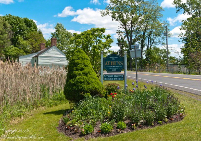
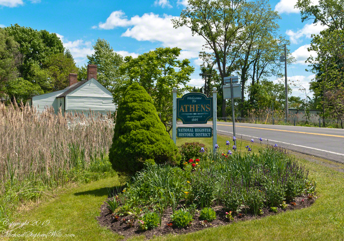
Founded as Loonenberg, named after the first settler Jan Van Loon. today,Athens is a lovely destination, a historic village on the Hudson River.
We stopped for a very enjoyable latte at Bonfiglio and Bread on 2nd street. As we ambled south on 2nd street Pam spotted someone to talk to and I proceeded with the goal of the Hudson River, visible at the bottom of the street.
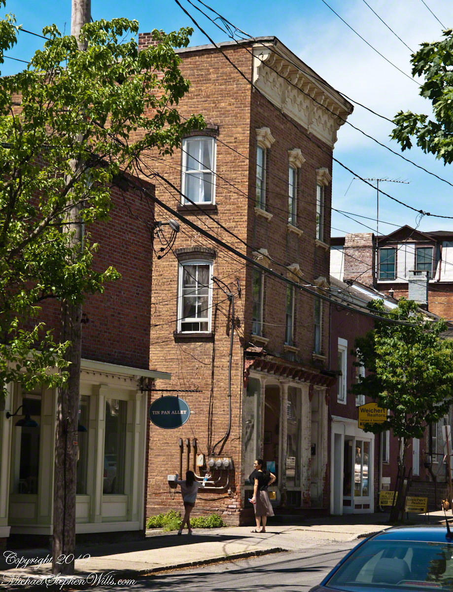
I noticed this architectural specimen and turned to capture this side in a good light and was lucky to capture a young co-admirer of its style with whom I assume is her Mother. Athens, developed as a “National Register Historic Site,” is a charming place to stroll and admire.
Southeast view on 2nd Street between Water and Washington streets. Athens, New York
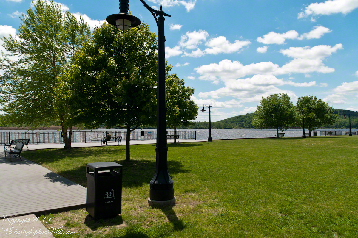
Hudson Riverfront
Yesterday I did a Red Cross blood donation at an elementary school on Hudson Street here in Ithaca. Henry Hudson, the first European to sail up the river that now bears his name, is memorialized this way across New York State so much so it is unusual to find the “Riverfront Park” named as such.
The city of Hudson, in Columbia County directly across the river named its park “Henry Hudson Riverfront Park.”
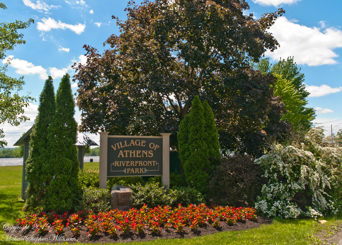
Looking east toward the entrance of the Riverfront Park, Athens, New York. Found at the east end of 2nd Street.
“Peace and Quiet“
The Athens Park is a gathering place for the village with a large swath of grass, a short boardwalk, benches and generous shade trees along with river…….
The photograph captions will speak for themselves for the rest of today’s post. Enjoy!!
A sole reader enjoys the solitude and view across the Hudson. A large mid-stream island, Middle Ground Flats, provides a swath of green instead of a view of the city Hudson.
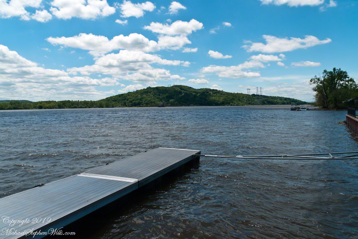
…and a dock.
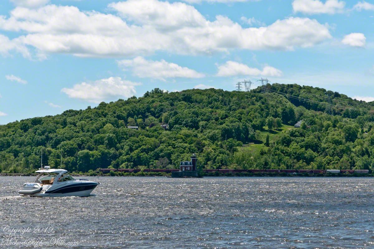
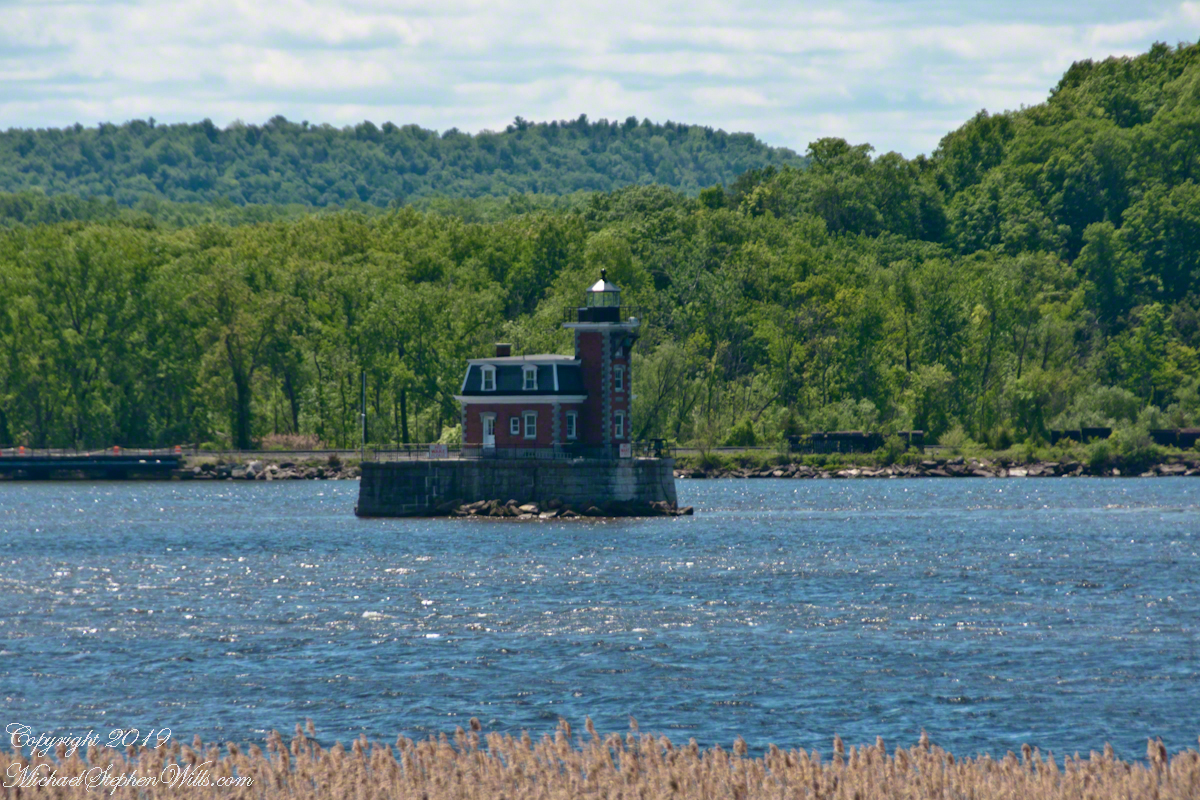
The map shows a dotted line between this dock in the Athens Riverside Park and the Henry Hudson Riverside park of the city of Hudson. Barely visible in front of the wooded hills is the Hudson-Athens lighthouse.A pleasure craft motoring south on the Hudson River passes in front of the Hudson-Athens Lighthouse. On the eastern shore is a line of freight cars. Amtrack uses this line for service between New York City, Albany and beyond. We have enjoyed this Hudson River view from the train and highly recommend that trip.Built 1874, the Hudson-Athens lighthouse guides traffics around the island named “Middle Ground Flats.”
Admittedly, I over-planned the Ireland trip. For every day possible the venues were pre-booked and paid. In theory planning provides more flexibility when life interrupts.
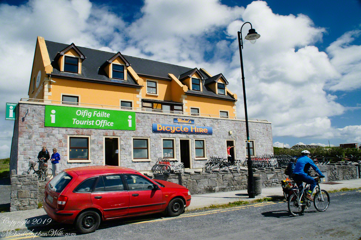
For the Inishmore planning, a perfect day, for me, was tooling around on a bicycle stopping where we pleased with welcome exercise in between. That was unrealistic, the day worked out otherwise.
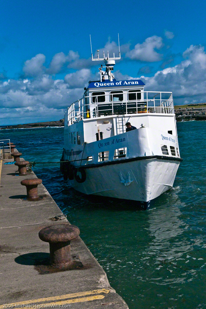
Upon disembarking from Queen of Aran, our ferry out of Doolin, onto the Kilronan quay we walked toward the bicycle rental and Pam refused to bicycle. Her objections were many, safety, impending rain, time. She did have a point about time, the ferry leaves at a set time leaving errant tourists to fend for themselves. We were unused to cycling, still Dun Aonghasa is just over 5 miles from Kilronan, less than an hour round trip. With our starting time of 11:30 am there was 3.5 hours slack for returning to the quay before the 4 pm departure. Plenty of time for wandering the ruins and stopping along the way.
We followed Pam’s advice. Still there were the many bicyclists. Perched on our horse drawn carriage, on the uphill runs, each bicyclist we passed was proof positive to Pam of the wisdom of our choice. I was silently envious of their freedom and overlooked the many mini-buses on the narrow road.
When the day comes to mind, not often, I am left with the guilty feeling of not stopping into the bicycle rental office to cancel the reservation. An email was waiting for me the next day, asking where we were. Thus, the title of this post, “Stiffed.”
Pam’s Response to this post.
Pam’s reasons for not wanting to ride a bicycle around Inishmore: “I hadn’t been on a bike for approximately 20 years. However, if it wasn’t going to rain (it did), if the narrow road was larger, if there weren’t any minibuses loaded to the gills or horse traps sharing the same single lane, I would have considered it. Sitting back and enjoying the beautiful view on our private horse trap and listening to our very knowledgeable tour guide/driver was the highlight of this adventure for me. I am sorry you felt like you didn’t have a choice.”
Pam’s correction of my statement about her being concerned about time: “Time wasn’t a factor in my decision making. I also didn’t have a problem with you biking but there was no way I was going to do that.”
Copyright 2022 Michael Stephen Wills All Rights Reserved
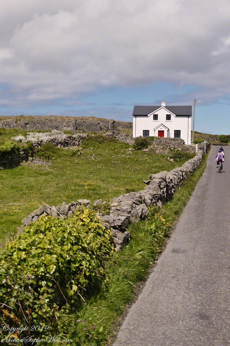
Enjoying travel on a horse trap, a type of carriage, on Inishmore , the largest Aran Island in Galway bay, we headed up Cottage Road from Kilronan, the main island settlement. It was from Kilronan we disembarked from the ferry, hired the driver and trap. Our destination an Iron Age fort, Dun Aengus, and sights along the way.
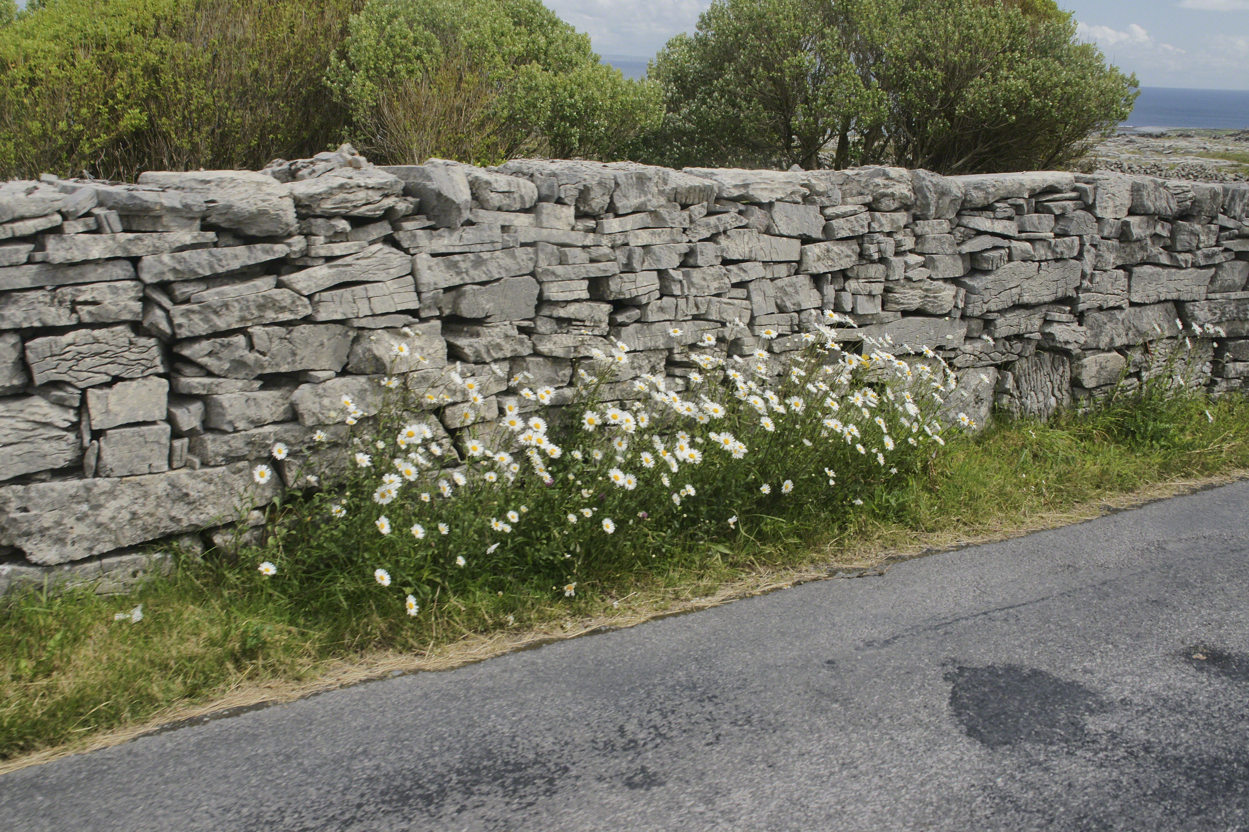
Dry Stone walls abound throughout Ireland. Ancient walls, buried in peat, were discovered in County Mayo and dated to 3,800 BC. This is a field wall on Cottage Road with daisies growing at the wall base.
The wall is composed of stones, not rocks. I have read in places a stone is a rock put to use or shaped by human hands. Other usages have rock and stone used interchangeably. For example, an internet search on “Dry Rock Wall” will return hits on the same. “You pays your money and takes your choice.”
Sources for this post: search Wikipedia for “Dry Stone”.
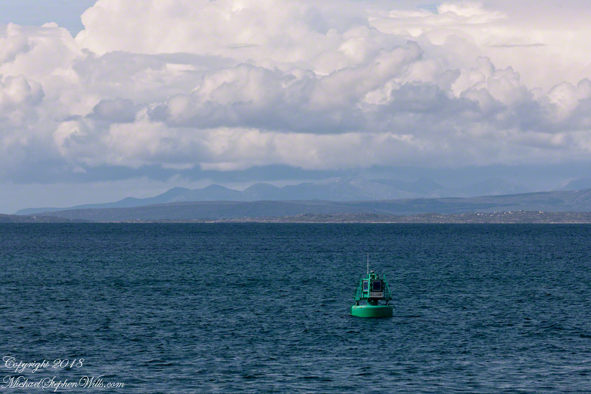
The approach to Killeany Bay of the Aran Island Inishmore is very dangerous, guarded by a Lighthouse on Straw Island to the South and the Killeany buoy to the North.
This view is to the north, northwest from a ferry en route to Inishmaan through Galway Bay. In the distance is the Connemara and the 12 Bens (12 Pins) mountains. Aran Islands, County Galway, Ireland.
There of stories of this buoy coming unmoored. October 27th 2012 it went adrift. An Aran fisherman, Micheál Seóighe (Ml Joyce) and his boat Naomh Beanán tracked it down, hauled it back to the harbor. The buoy was back in service shortly after.
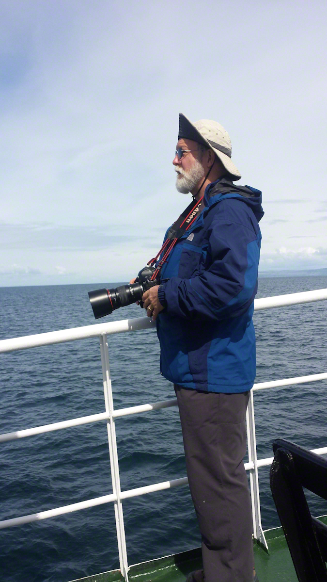
Here is a photograph of me with the camera used. It is a Canon EOS 1Ds Mark III with a Canon lens 200 mm f2.8/L. I am standing on the deck of the Queen of Aran ferry out of Doolin next to the Cliffs of Mohr.
Pam Wills took this photograph with her Samsung Galaxy 4 smart phone.
Each of the 603 steps between the Skellig Michael dock and the monastery evoked contemplation, caution, wonder and gratitude.
Contemplation: how did the monks manage to survive while placing the steps? It can only be by a careful division of labor once a survival tripod was build. By tripod I mean the basics food, shelter, warmth.
Caution: as with any steps, for a 60+ person I have learned the hard way falls take a long time to recover from.
Gratitude: for the opportunity, growth and knowledge afforded by travel.
Wonder: every step offered a new vantage and discovery.
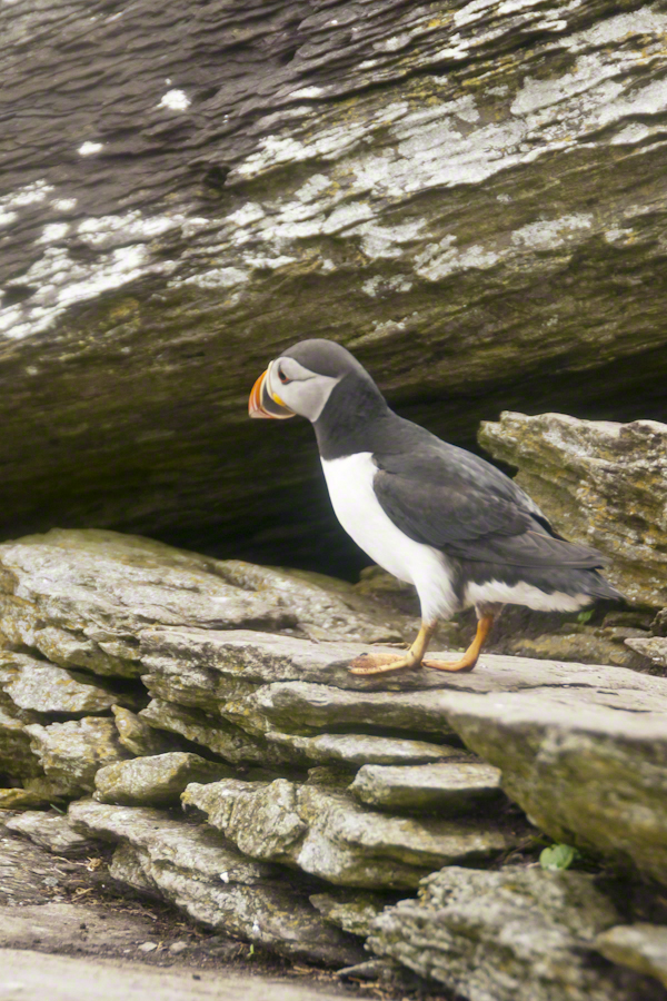
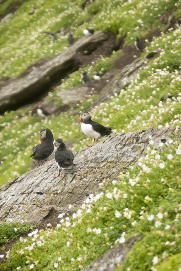
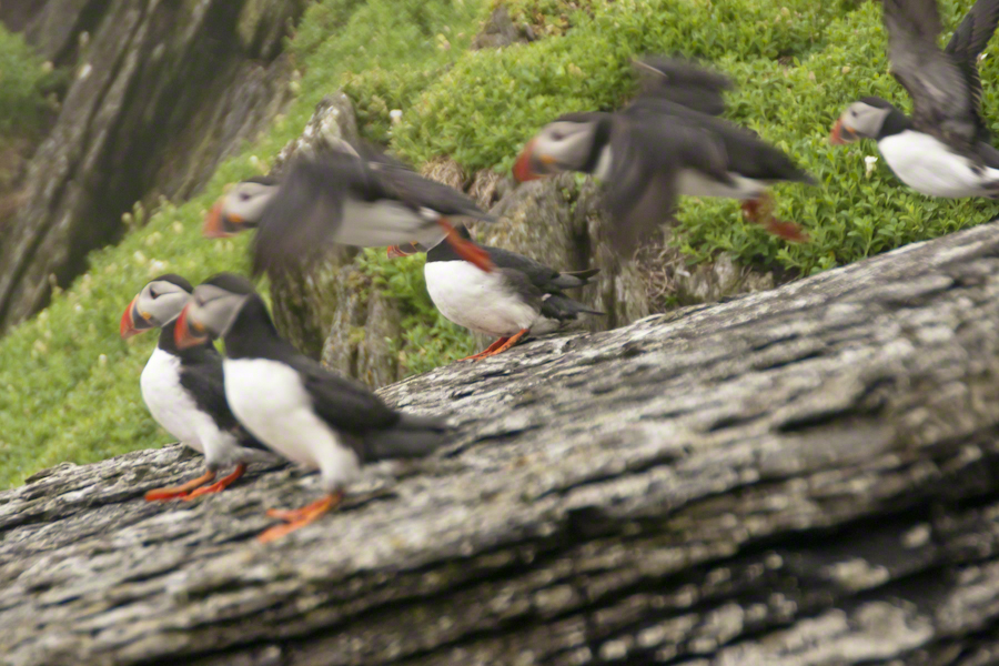
Puffins were on my mind for most of the lower steps being immediately at hand, almost underfoot, constantly. Underfoot, not in a obnoxious way. Underfoot in being right there, unabashed, going about the business of life. Pam and I were lucky, Puffin wise, for the weather. Sensible birds, when the visibility is low Puffins stay close to the burrow, making improvements and socialize with neighbors.
Click any photograph for my Online gallery.
Bad News: Atlantic Puffin populations are on a precipitous decline across Ireland and British Islands. There are talks of a population collapse. Researchers enlisted assistance from wildlife photography enthusiasts with outstanding results released in 2017. The photographs showed parents returning with less nutritious fish. The stress on Puffin populations follows the decline of fish stocks from over fishing. I listed two references at the end of this post.
The disturbing element to our experience was not one of the birds flew in with a catch. On second thought, this is not unexpected. Late May the eggs are laid and under incubation. The individuals in these photographs were feeding only themselves. If we returned mid-June there would be chicks to feed.
Click any photograph for my Online gallery.
Puffin with an inquisitive attitude
Why do we love Puffins? We see reminders of ourselves. The expressive large eyes, over a striking beak and there is something expressive about the birds’ body movements. Don’t you almost know what’s on the mind of this fellow? “What’s going on, over there?”
Click any photograph for my Online gallery.
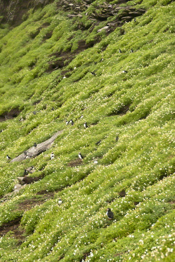
A colony of nesting puffins on a flowering cliff of green.
Puffins are small birds, the size of a human hand. This colony returned in late March or early April, each breeding pair claiming a nesting site. The coloring of the beak happens during breeding. The bird molts while at sea during the winter, the beak and other brightly colored facial characteristics are lost.
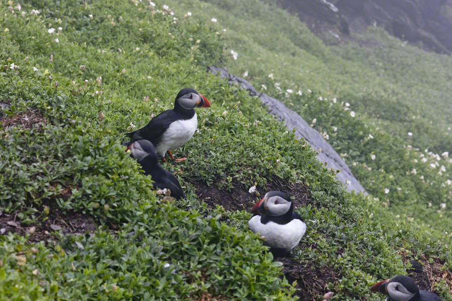
Michael Skellig puffins in social setting on cliff with burrows and flowers.
Puffin sexual differentiation is unique among birds. The coloring and markings are identical between males and females. Males are somewhat larger than females is all.
Click any photograph for my Online gallery.
Soft soil covering the flanks of Skellig Michael is the site of age old Puffin colonies.
Here is Puffin nesting behavior up close. I did some research on the flowering plants surrounding the burrows and am not sure. I believe the white flowers are a mixture of Sea Campion and Sea Mayweed.
As far as my photographic technique. There are two sets of Puffin shots from Skellig Michael. For the the walk to the top, the monastery site, I used the lighter Sony Alpha A700 dslr with a Sony variable lens, DT 18-200 mm F3.5 – 6.3. On top, I switched to the Canon EOS 1Ds Mark III and, for the descent, fitted a Canon EF 200mm f/2.8L USM lens.
The shot above and following are the Canon, taken on descent. Prior shots are the Sony, taken on ascent.
Click any photograph for my Online gallery.
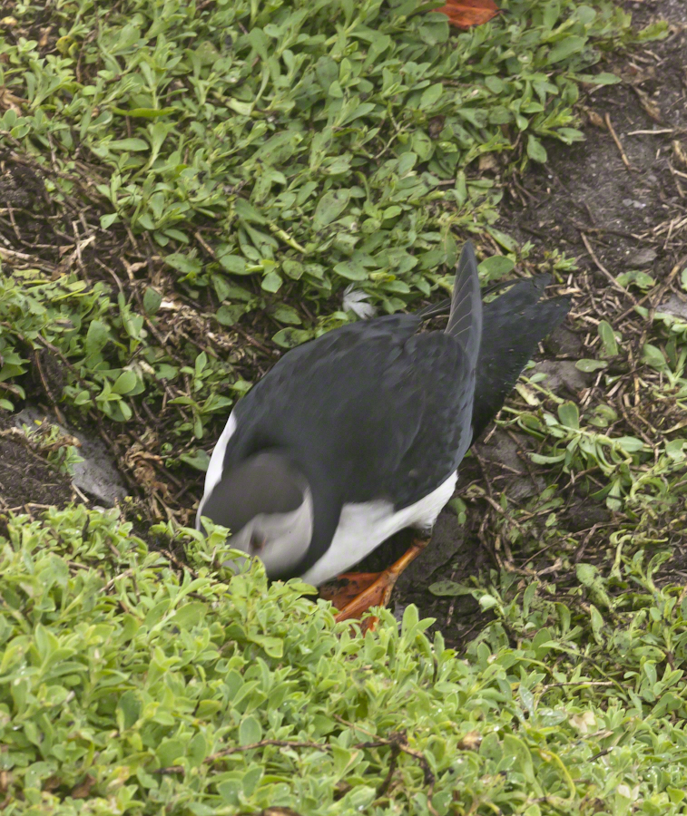
Puffin Entering Burrow
Puffins have striking black and white plumage and leg color some describe as “tangerine.” Tangerine? I guess. Here an individual ducks into the burrow.
Click any photograph for my Online gallery.
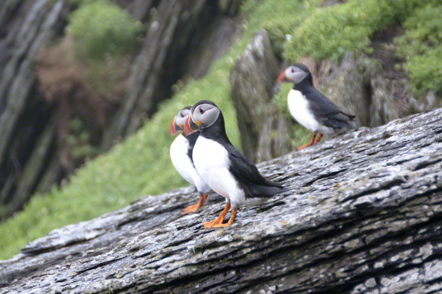
A grouping of Michael Skellig puffins, the foremost with an attitude of regard.
I did not spend a great deal of time in any one spot, being time limited and needing to get back to the boat. Don’t recall very much social interactions between individuals, other than this perching together on the rocks. The foreground Puffin seems to take the behavior of another bird to task.
Thinking about the Aran Islands for my posts, “Killeany Bouy” and “Inisheer Welcomes the 2014 Gaeltacht Irish Football champions” brought me back to Isla Mocha.
Herman Melville’s thoughts were in and around this island off the central Chilean coast when he penned “Moby Dick” in the mid-nineteenth century while sitting in the city of Boston. He was brought Moby Dick not only by his own experiences on a whaling ship, almost certainly Melville owned a copy of Jeremiah N. Reynolds’ “Mocha Dick: Or The White Whale of the Pacific: A Leaf from a Manuscript Journal,” an true-life account of adventures around Isla Mocha. Sometime around 1810 Reynolds personally experienced encounters with Mocha Dick after the crew of an Antarctic expedition mutinied, stranding him at Valparaíso, Chile where he remained for two years.
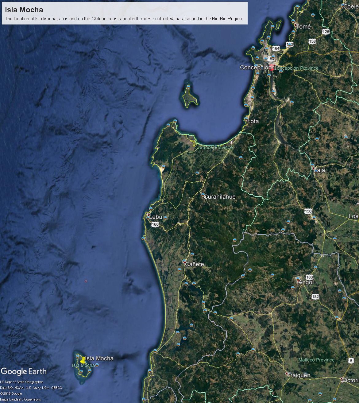
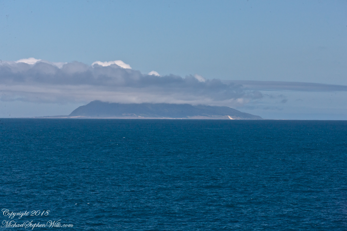
Located 38°21’45.62″S, 73°55’6.91″W, around 8 miles in size north to south, 3.5 miles east to west Isla Mocha is surprisingly simple to find. A ridge of mountains run the north south axis, just 20 miles off the coast, a ship following the coast will find it easily, as I did from the balcony of the Oceania Regatta during a “sea day” of travel between Valparaiso and Puerto Montt.
Since waking that day I was on the lookout for Isla Mocha. In preparation for our month-long cruise around South America every mile of our itinerary was scoured for interesting sights, experiences and information. When I first learned of Isla Mocha (Mocha Island in English) and the connection with Melville reading about it in Boston, just as I was in Ithaca, one of my goals for that day was to catch sight of Isla Mocha as it rose from the horizon.
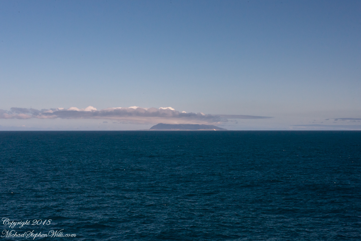
My goal was made easier for the cloud formation from the island mountains. Here is my first photograph, taken from our balcony on the port side. I chose the port side just for the landward view as the ship progressed southward on the western coast of South America. The Canon EOS-1Ds Mark III was tripod mounted with an EF 70-300 f4-5.6L variable lens set to 70 mm. We are northwest of the island with the coast just visible.
Another view with 188 mm focal length. The ship must have turned eastward, as the view progressed the island came closer. It was a fantastic thought to cruise above the subduction zone where the Nazca plate dives beneath the South American Plate. In the distance, on a clear day, the volcanic cones Villarrea and Quertrupillan are visible.
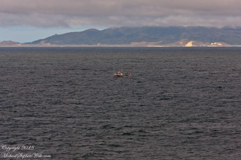
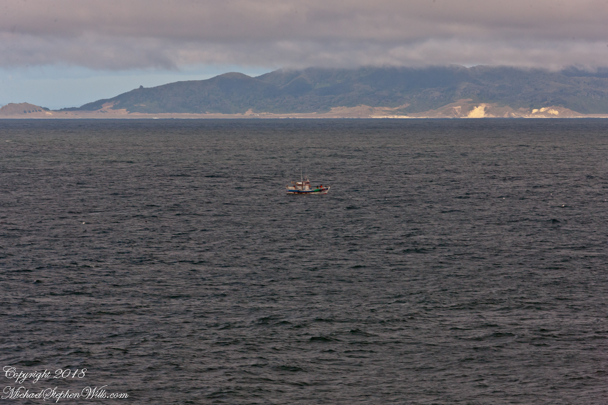
With the island due east, only a few miles away, the lens at 221 mm focal length. A fisherman is having an easier day in a calm sea. The indigenous people told stories of the souls of the dead travelling west to Isla Mocha. Pirates used the island as a resupply base. The fishing boat was the only sign of life.
That was February 14th Valentine’s Day. With Isla Mocha passing into the distance I changed for an evening with Pam. Here we are headed to dinner, somewhere off the coast of Chile’s Lakes (and volcano) region.
The resolution of the Canon EF 24mm f/1.4L II USM makes this lens a favorite of mine for landscape work. Let me show you why.
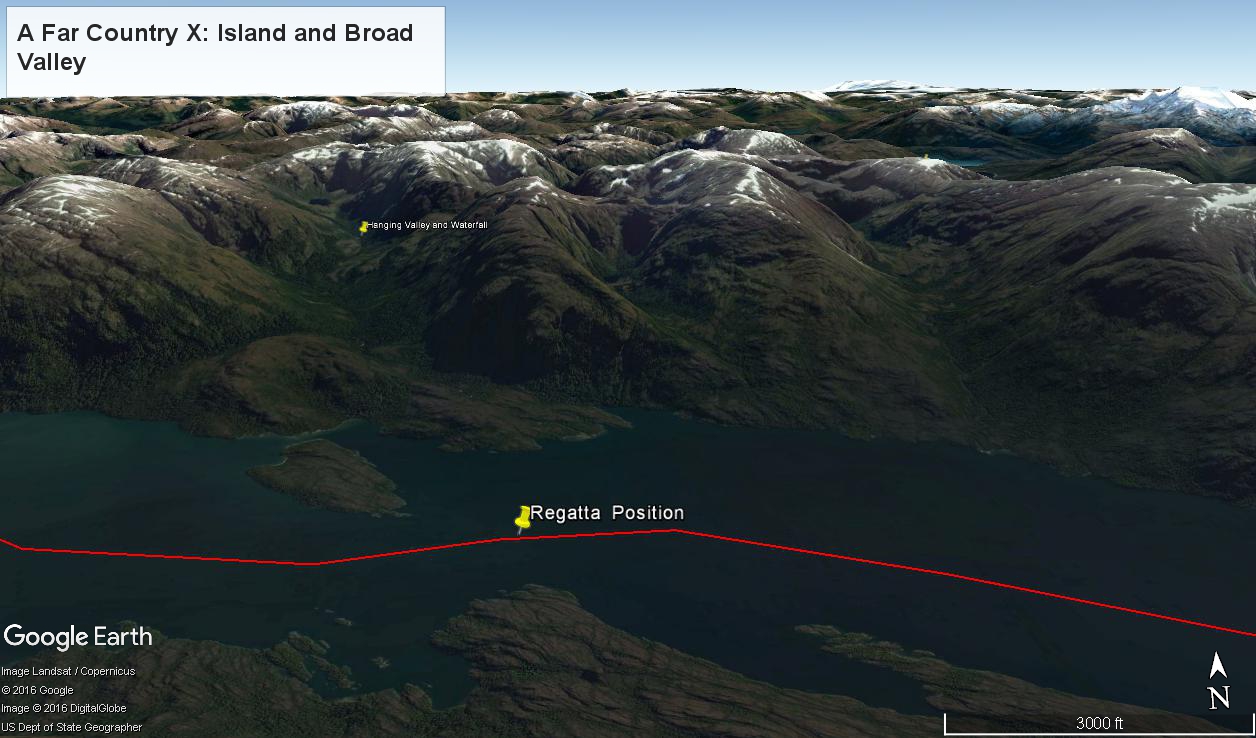
The valley today’s posting lies behind the tree. It is a broad valley shaped by ancient glaciers.
Here is the Google Earth view, from an elevation of 9,400 feet, with the ship position marked. Northwest is a pushpin titled, “Hanging Valley and Waterfall.”
The waterfall marking the hanging valley is visible in the following photograph. All photographs in this posting are from a Canon EOS-1Ds MarkIII, 24 mm lens (see above for complete name), on a Manfrotto travel tripod. ISO 500, f5.6 or f6.3.
With a point of view about 50 feet above the water the valley bottom is hidden behind an 800 foot hill and the water fall is just above the hill. See it? …..I didn’t think so.
There is the island with the tree, to the left. The following image is the same photograph, with the central section enlarged.
The enlargement brings out the play of light, the low clouds, deep in the valley. To provide scale, know those are full sized pines on the hillside, foreground. The waterfall is just about visible. I will enlarge the image one more time.
There it is!! I stepped up contrast, as well.
Here is another version of the original view. That patch of sky had opened up seconds after the first shot and, as a result, the 3,000 door mountain and waterfalls, on right, are better lit. Notice the bare rock face on the mountain slope, marking a landslide.
Click this image for a high resolution version, in your browser.
A different landslide Scar is featured in two previous blogs,
The resolution of the Canon EF 24mm f/1.4L II USM makes this lens a favorite of mine for landscape work. Let me show you why.
The valley today’s posting lies behind the tree. It is a broad valley shaped by ancient glaciers.
Here is the Google Earth view, from an elevation of 9,400 feet, with the ship position marked. Northwest is a pushpin titled, “Hanging Valley and Waterfall.”
The waterfall marking the hanging valley is visible in the following photograph. All photographs in this posting are from a Canon EOS-1Ds MarkIII, 24 mm lens (see above for complete name), on a Manfrotto travel tripod. ISO 500, f5.6 or f6.3.
With a point of view about 50 feet above the water the valley bottom is hidden behind an 800 foot hill and the water fall is just above the hill. See it? …..I didn’t think so.
There is the island with the tree, to the left. The following image is the same photograph, with the central section enlarged.
The enlargement brings out the play of light, the low clouds, deep in the valley. To provide scale, know those are full sized pines on the hillside, foreground. The waterfall is just about visible. I will enlarge the image one more time.
There it is!! I stepped up contrast, as well.
Here is another version of the original view. That patch of sky had opened up seconds after the first shot and, as a result, the 3,000 door mountain and waterfalls, on right, are better lit. Notice the bare rock face on the mountain slope, marking a landslide.
Click this image for a high resolution version, in your browser.
The Regatta’s course brought us closer for the two following shots.
The lovely sky is still visible…..
….one minute later the clouds gather and relative darkness returns.
(Click any photograph to visit my online gallery)
Copyright 2022 Michael Stephen Wills All Rights Reserved
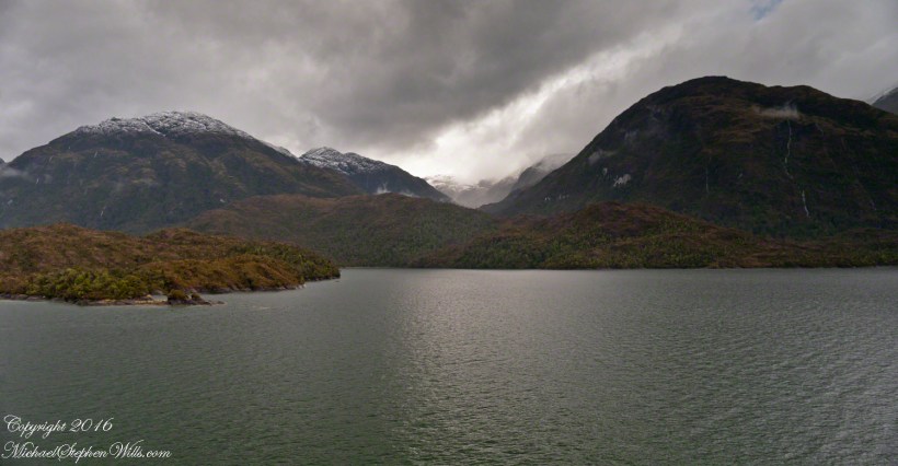
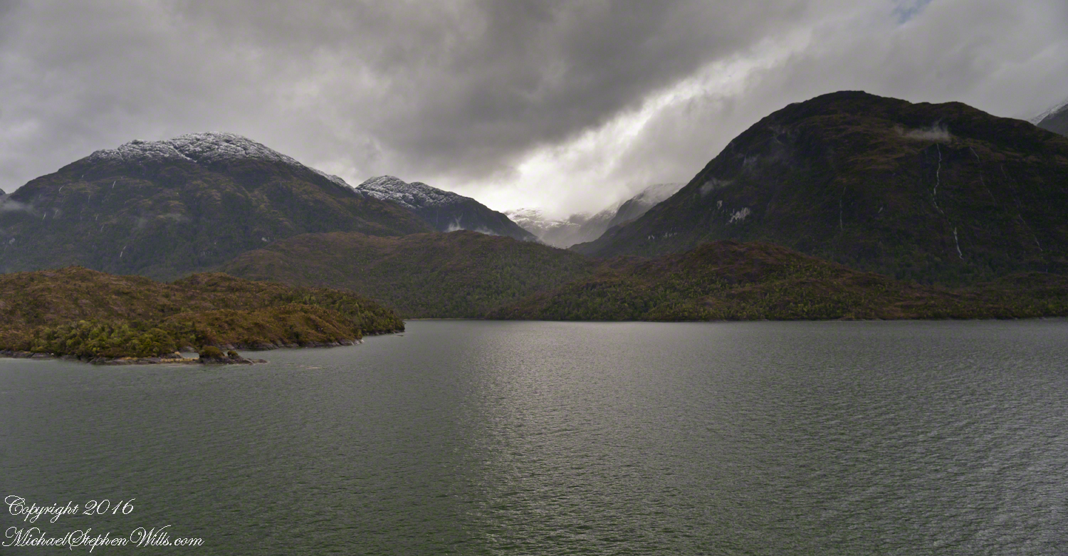
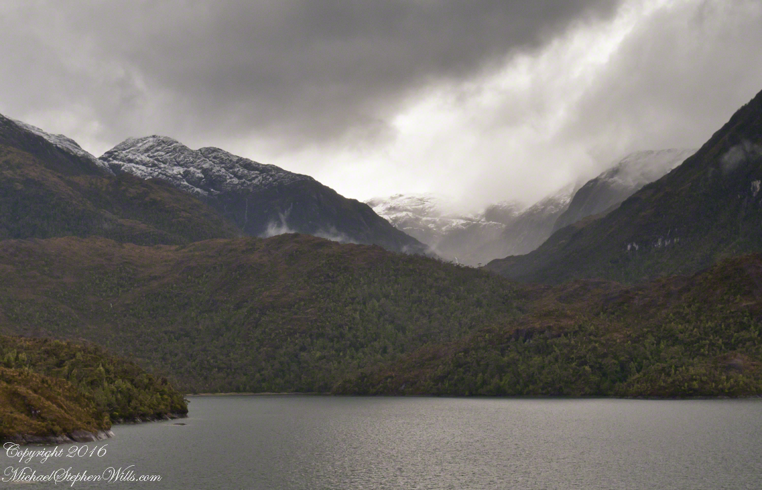
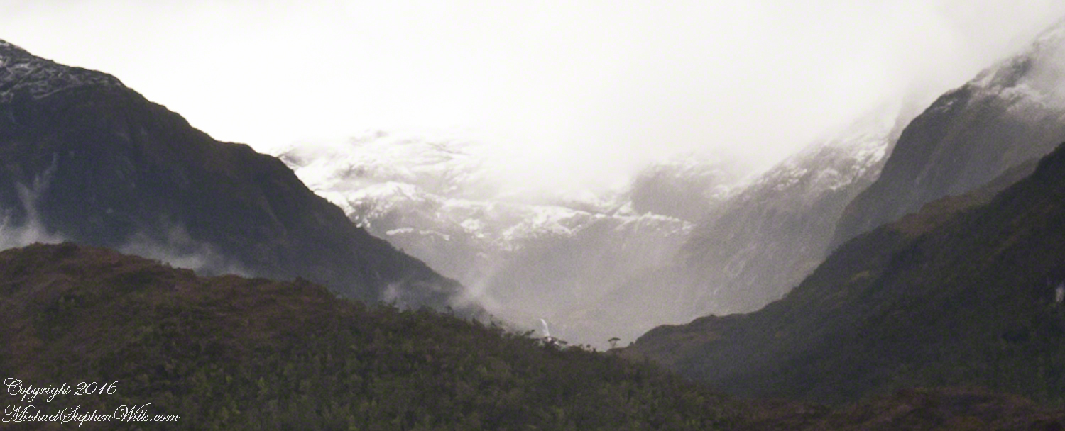
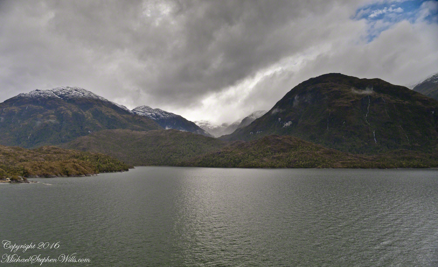
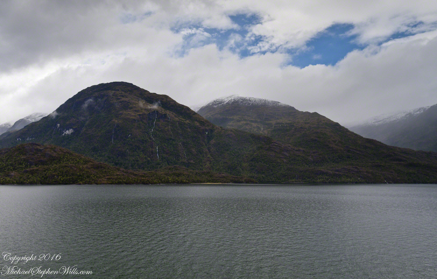
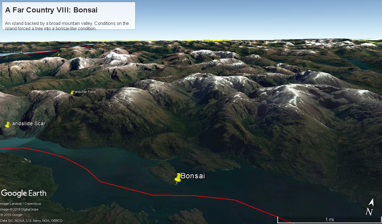
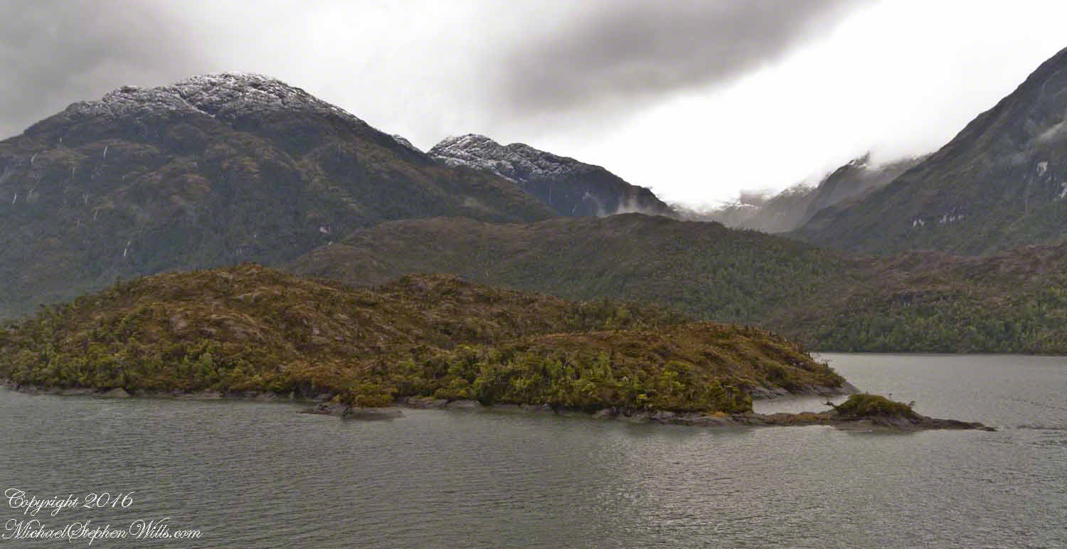
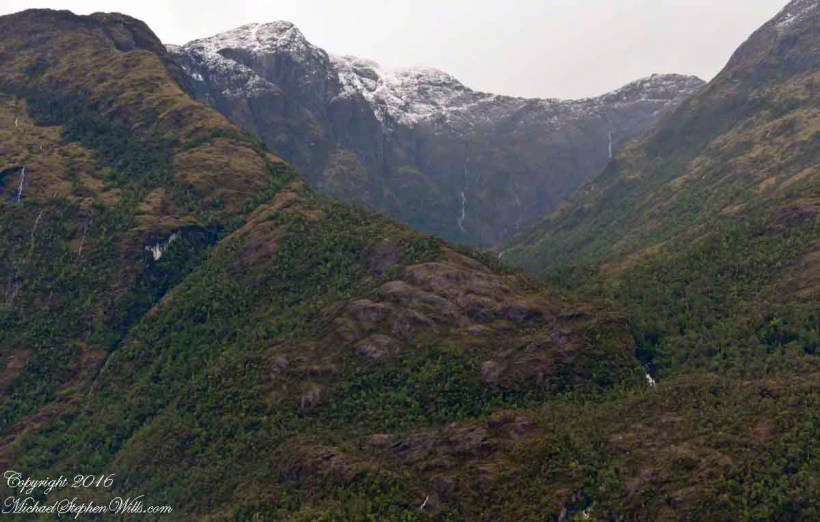
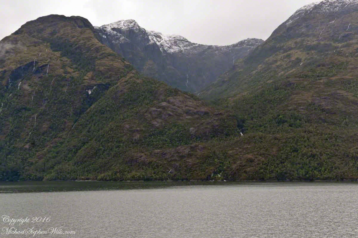
Here is a Google Earth view of Tempanos Fjord from 9,400 feet, looking north, northwest over a point on the fjord 6.5 miles from Iceberg Glacier, at 4 pm local time on February 17, 2016. This view is interesting for the insignificant island, .75 mile long, and broad mountain valley to the north fringed with waterfalls.
Marked is the location of a tree, “bonsai”, a feature of the fjord cliffs, “Landslide Scar” and a neighboring Fjord, “Farquhar Fjord.”
This blog features the tree.
The Farquhar Fjord entrance opens onto the entrance of Tempanos Fjord and is the last photograph.
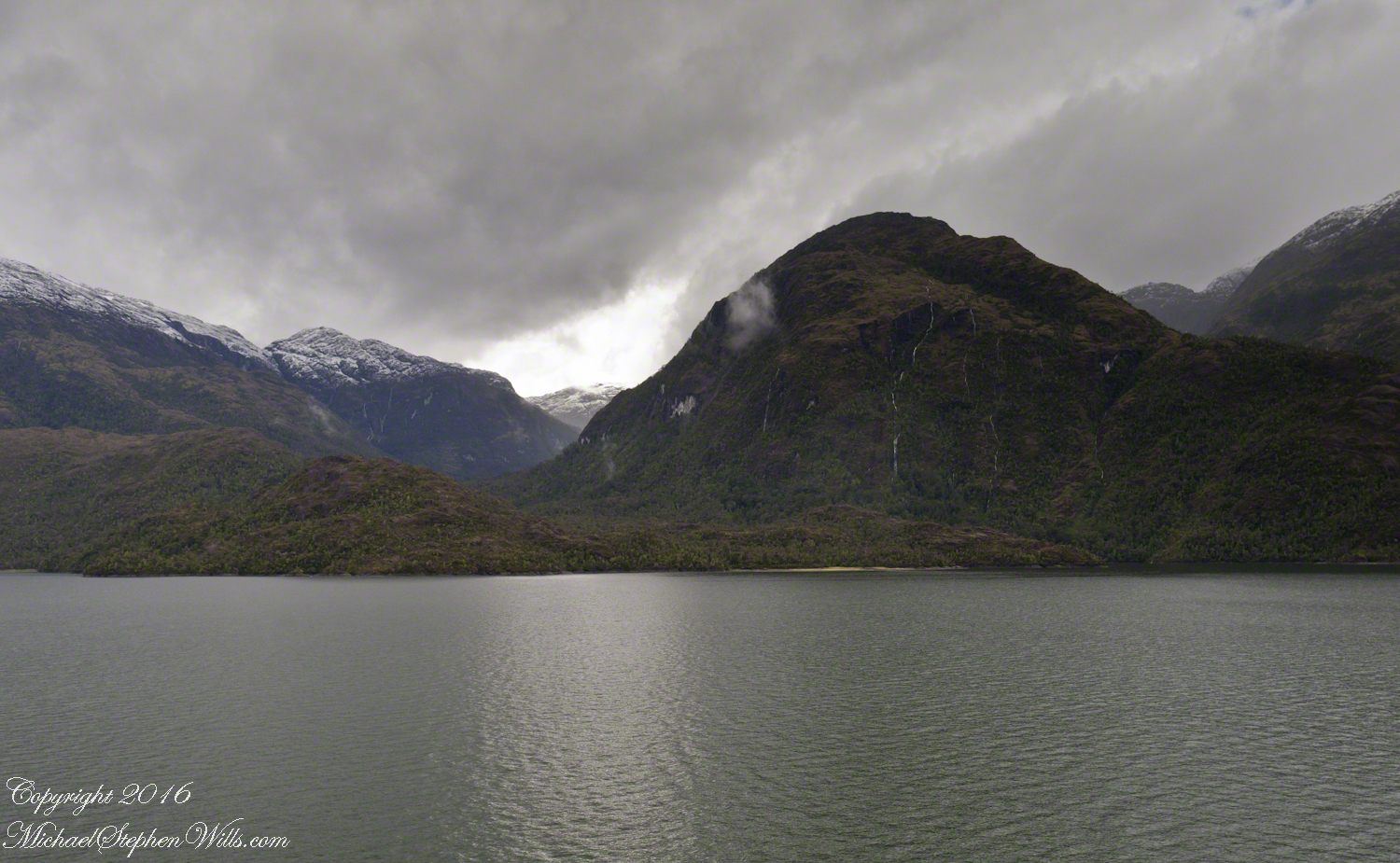
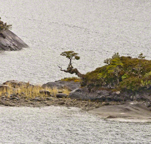
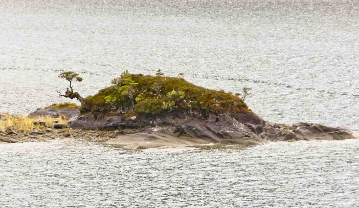
A photograph from our port side stateroom deck includes both the island and broad valley. The misshapen tree, the “bonsai”, is on an islet to the right and in front of the island. It is the small stump backlit by water reflection. The stump is more interesting than can be seen in this image from a handheld camera, at 24 mm. I used the variable lens for a closer look.
From this 133 mm, f8.0, 1/250 sec and ISO 800, still handheld, interesting details come into view. The islet is a rock on which clings a bed of moss. Several ferns, a sapling (on the far side) and a stump, on the right, are surviving. The stump presumably supported a small tree of which a “bonsai-like” twig remains.
Bonsai are fascinating, created through the art and skill of emulating pleasing natural forms. Here the moss encrusted twists and miniature tree crown were formed from a difficult environment. Bonsai of Japan originated from an ancient Chinese tradition of penjing (“tray plant”). The inspiration for this are, at origin and now, must be, in part, from admiration of the tenacity and beauty of these plants.
At the 200 mm maximum my Sony Alpha 770 (1/400, f9, ISO 800) image is a little fuzzy, still with great details.
From my interest in bonsai I am on the lookout for shapes such as this. Travelling the challenging environment of the Chilean Fjords I found examples here and there.
Click any photograph to visit my online gallery)
Copyright 2022 Michael Stephen Wills All Rights Reserved
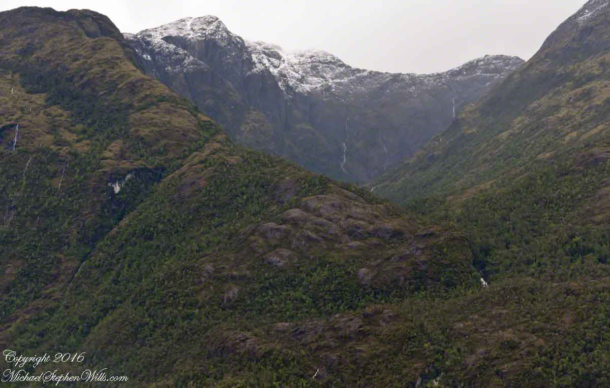
4:00 pm local time the Oceania was approximately 5 miles from the Iceberg Glacier, moving forward at a slow rate of speed, 4.6 knots. Here are more views of the mountain-ringed bowl behind a 1,000 foot cliff.
Both photographs are handheld using my Sony Alpha700, ISO 800, variable lens set to 45mm, 1/250 f13. At the same time I shot from a tripod mounted Cannon, 24 mm wide angle fixed focus lens.
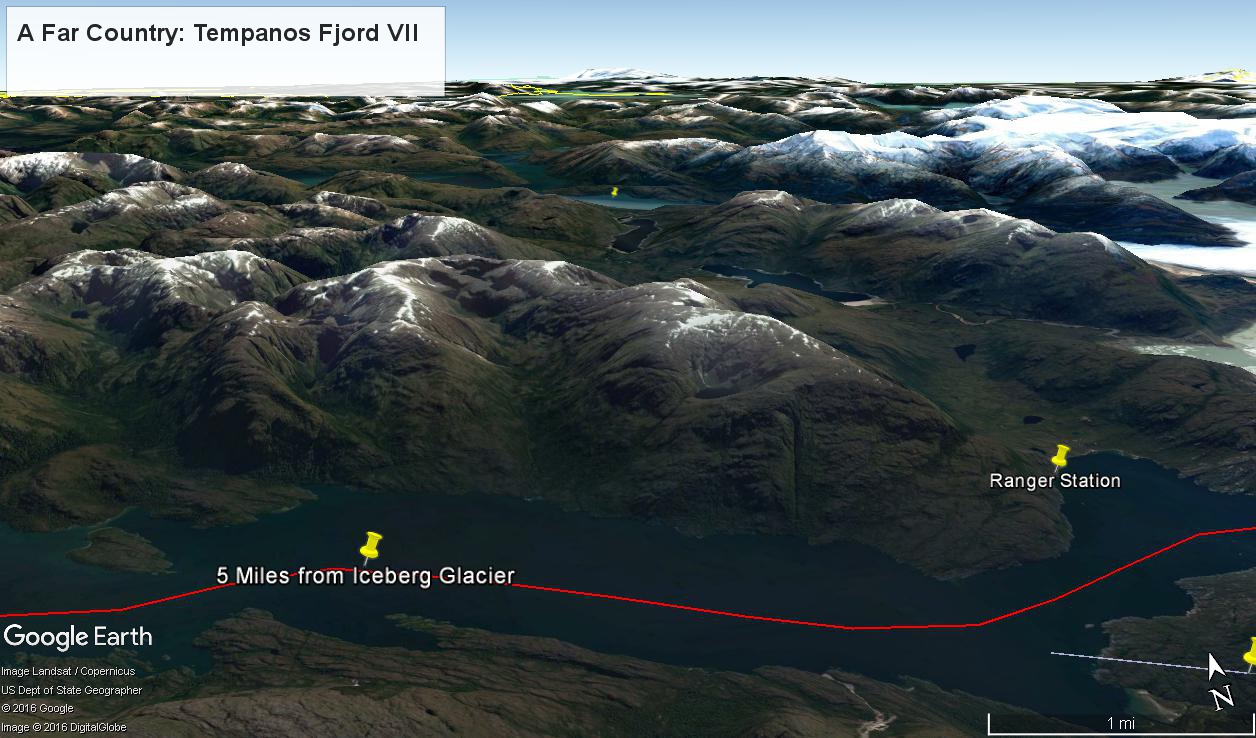
The following capture from Google Earth is the view from 12,200 feet. Regatta’s position is the “5 miles from Iceberg Glacier” pushpin. The formation is almost due north. We were surprised to see a ranger station in this uninhabited area, not yet in view. The white line, lower right, is the border between the Aisen (north) and Magellanic (south) Chilean regions.
(Click any photograph to visit my online gallery)
Copyright 2022 Michael Stephen Wills All Rights Reserved