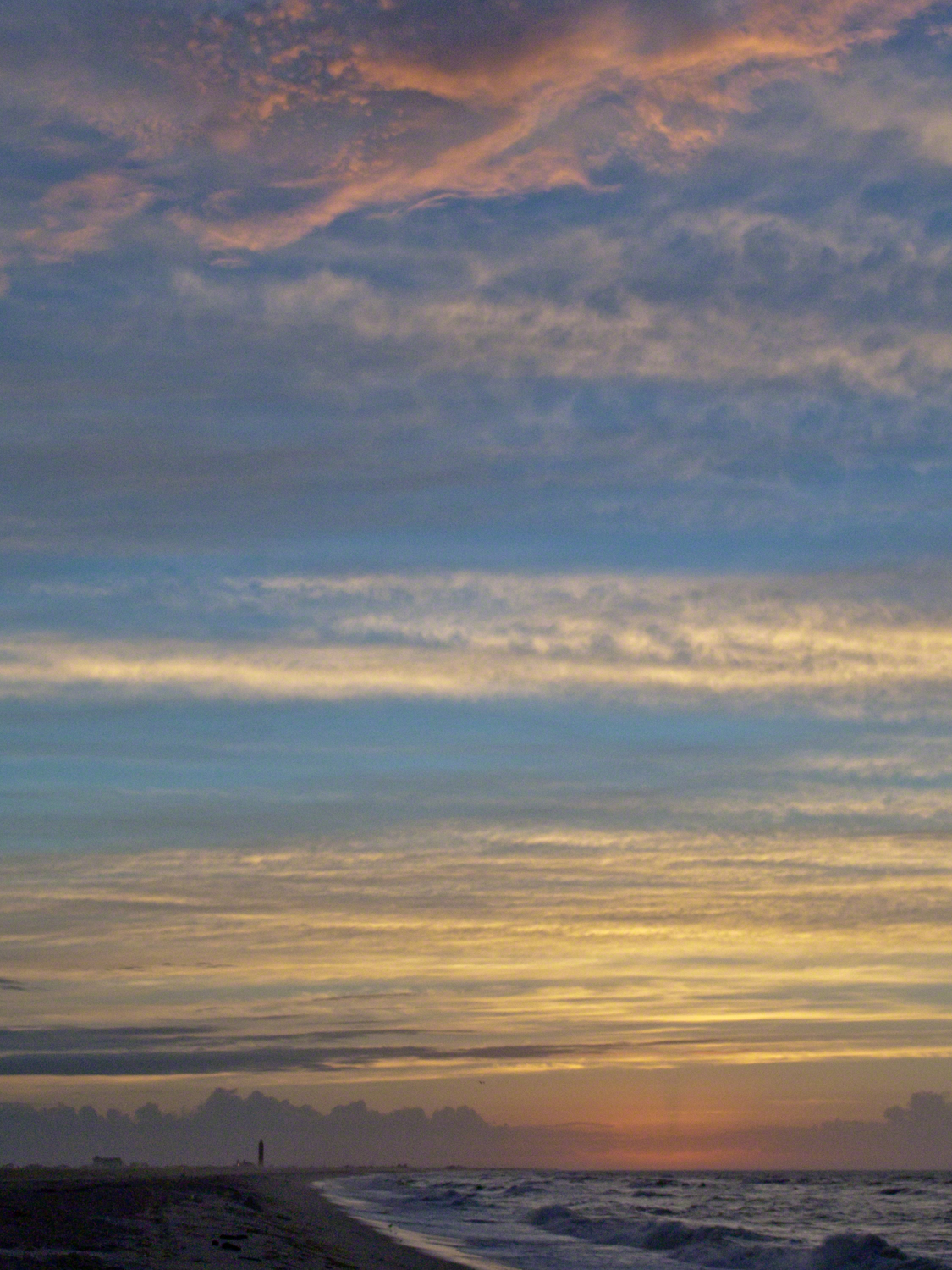
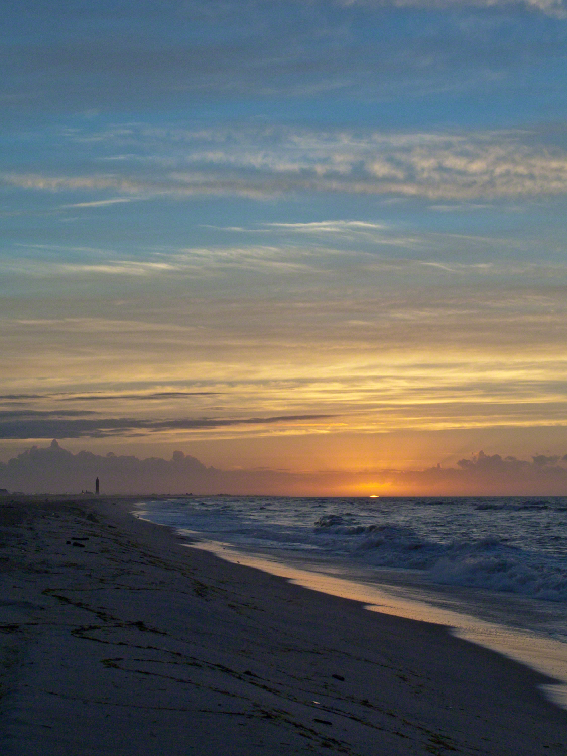
Hurricane Katrina approached the Gulf Coast and New Orleans as the sun rose on the West End of Jones Beach on Long Island, August 28, 2005. This amazing sunrise was an element of the unusual atmospheric effects that are evidence of the power of this storm.
The featured image (heading this blog) is my print, “Katrina Sunrise”. This work is enjoyed by hundreds of my clients. Use the link, below, to acquire your own. Custom framing is available.
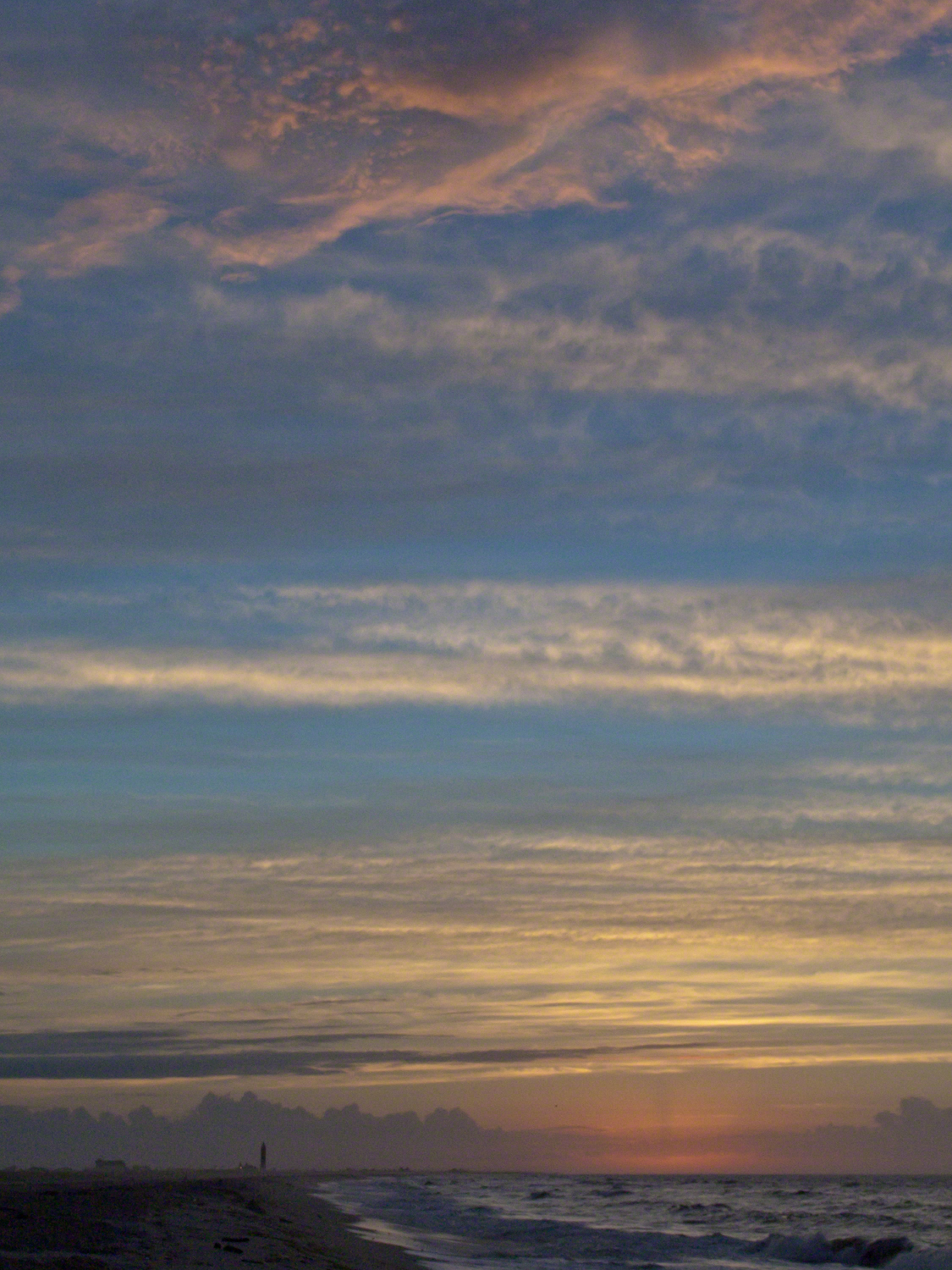
The following images are the rough drafts taken in the early morning hours. The beach was literally deserted as I mounted the camera and framed the view for this series. Many image captions include the file time stamp, for example 6:07:13 is 6 am and 7 minutes 13 seconds.
6:07:13 First image of the set. Below the horizon the sun lights the upper atmosphere.6:07:34 As the sun approaches the horizon the lower clouds catch light. My Camera was a Sony DSC-F828 tripod mounted with a polarizing filter.6:07:56 I panned slightly to the east. ISO was set to 64 throughout.6:08:16 Gradual brightening. The lens is 7.1 – 51.0 mm f/2.0-2.8.6:08:38 All levels are brighter. It seems those low clouds will block the horizon. That was not the case. The variable focal length is 15.6 mm.6:09:05 It is happening!!!! Exposure was set to automatic on a f stop of 8.0. It was 1/3 second for this image.6:14:34 The view is panned west. That is the Robert Moses water tower of Jones Beach State Park looking like a rocket ready to blast off.6:15:15 Will those low clouds block the sun? Looks promising.6:16:11 Clouds on the upper margin catching the sun. Horizon brightening….. Exposure 1/20 second.6:14:39 This will be a disappointment if that sun does not show. Exposure 1/25 second.6:18:27 Almost there….1/15 second exposure….6:19:07 Quick framing adjustment to bring the lighting of shore margin into the composition. The final version was created from two images captured seconds after this.As the sun rose a rainbow formed in the western sky.
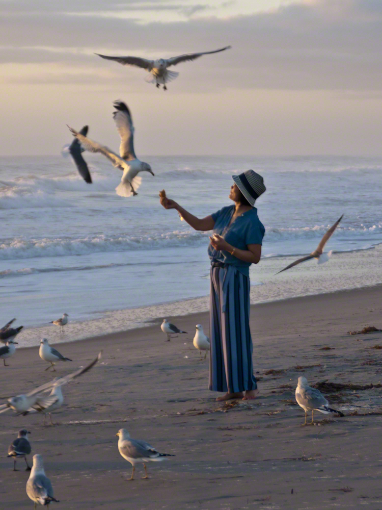
Gulls, an omnipresent element of any beach stroll. Pestiferous, abounding and incessant the gull is simple to deal with. Keep any and all foodstuffs under wraps.
Conversely, for those who adore a crowd of raucous opportunists simply pull out the food and offer it to the air. There is more about this photograph at this post, “Lady Feeding Gulls, Cocoa Beach Dawn.”
Click any photograph for a larger view.
Beach Walking
Pam and I developed a habit of hanging out in Florida during Finger Lakes Winters when the gorges are closed for safety and even walking the streets is perilous, stray black ice encounters abound. We trade icy falls for beach walks.
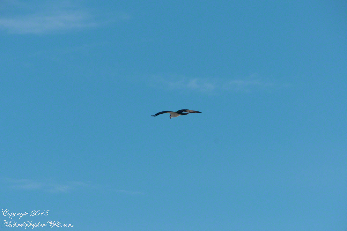
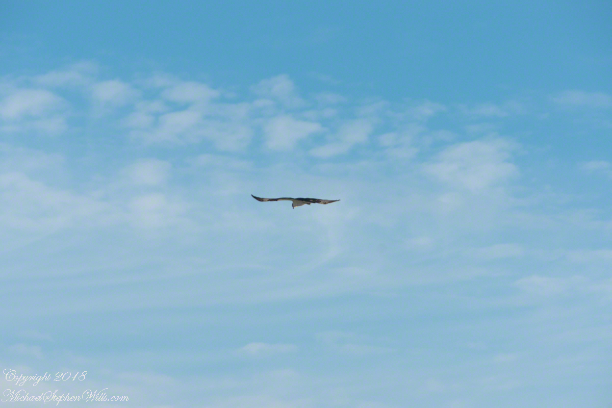
It is natural to become inured to the flight of gulls along the shore. For all my carting along the Sony Alpha 700 with a variable lens ( 18 – 200 mm) there is not a single photograph of a gull in flight. Yet, I have my eye on them until my blindness was lifted by a peculiar individual. It seemed to be a white gull, yet it had a watchful eye.
Gliding shoreline parallel with head down, how could I have mistaken it for a gull?
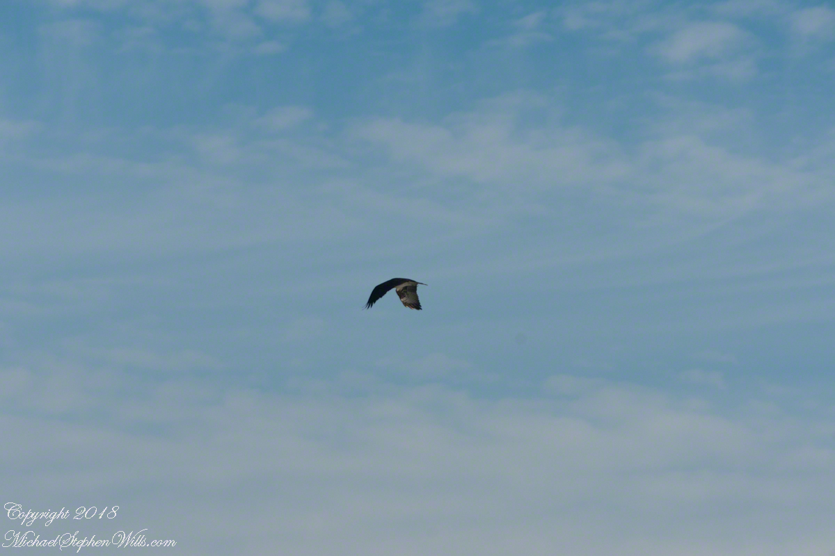
Osprey occupy an environmental niche along 700,000+ shoreline miles worldwide as a single species Pandion haliaetus. A unique bird with its own family, Pandionidae, and genus, Pandion, some experts recognize sub-species in geographic regions. Ours is the Western Osprey.
The following photograph is of a wing shape very different from the gull.
Osprey Stalking Behavior
IPhone 8 always in my pocket, I captured this clip of an Osprey stalking fish in the Atlantic Ocean surf. You will have a better viewing experience by clicking on the title of the embedded YouTube, then click on the Full Screen icon at the lower right.
Enter your email to receive notification of future postings. I will not sell or share your email address.
Copyright 2025 All Rights Reserved Michael Stephen Wills
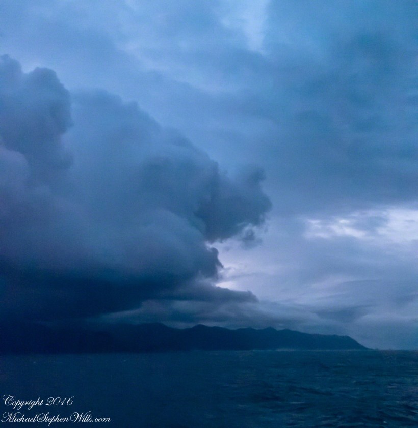
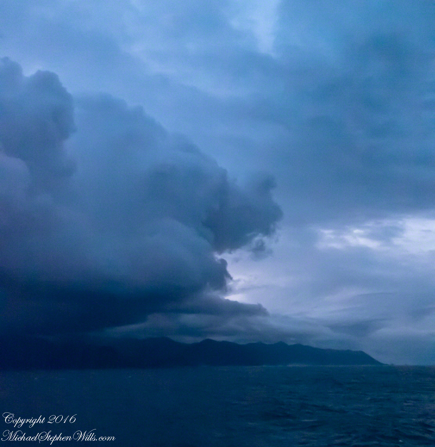
Rounding the Aysen Region headland of the Penas Gulf. Next land will be the Magellian Region extending to Cape Horn. In the Penas Gulf we will enter the Messier Channel and the fjords.
Taken with a tripod mounted Sony DSLR A 700 DT 18-200 variable lens set to 18 mm. 1/40 second at f4.5 ISO 6400. The sun was still low, after sunrise with gathering storm clouds from the terrace of our state room (a moving ship).
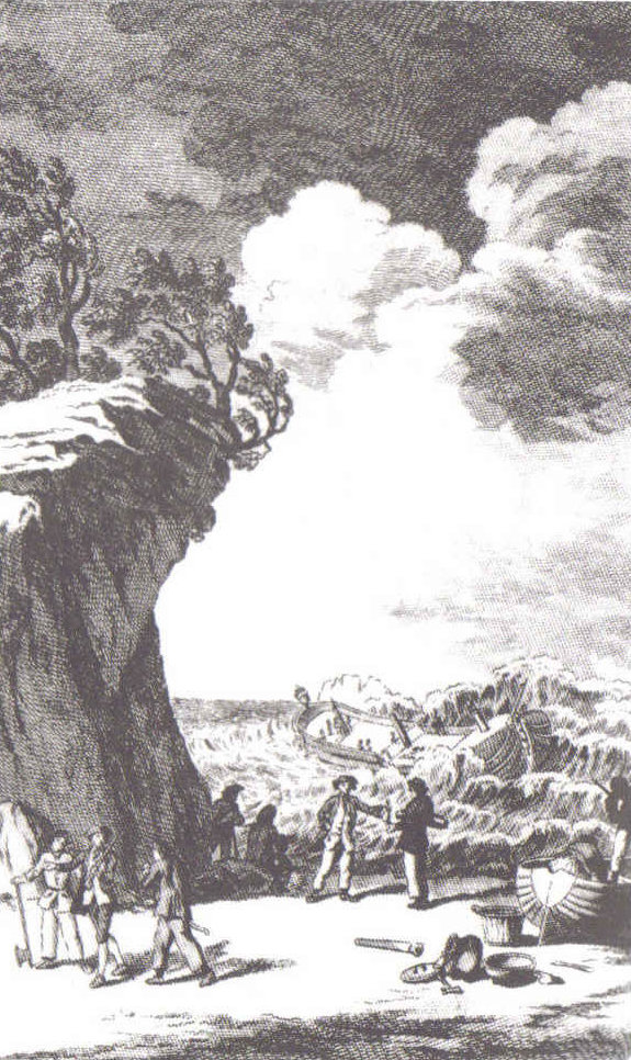
Our early morning traverse of the Penas Gulf was smooth sailing in route for Tarn Bar, entrance to the Messier Channel. We’ll pass Wager Isle where May 14, 1741 the H.M.S. Wager wrecked, stranding the crew. Speaking to the conditions on board, immediately some of the crew broke into the “Spirit Room, got drunk, armed themselves and began looting, dressing up in officers’ clothes and fighting,” many drowning the next day when the Wager flooded and sank.
The original fronts piece to Byron’s Narrative; “Being an Account of the Shipwreck of The Wager and the Subsequent Adventures of Her Crew.”
The remaining 140 officers and crew manned the boat to make for shore in the Patagonian winter. Five years later, midshipman John Byron, grandfather to the poet Lord Byron, made it back to England with the Captain David Cheap. Just west of Wager Isle is the larger Byron Isle, named in his honor.
On this south heading our cabin on the port side faced east. In these early morning hours, I set up on the stateroom balcony, so for better or worse there is no views of either Wager or Byron Isle.
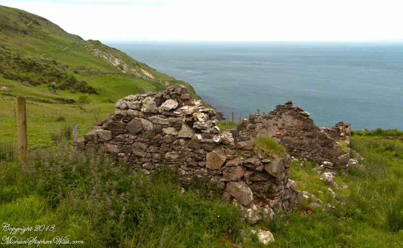
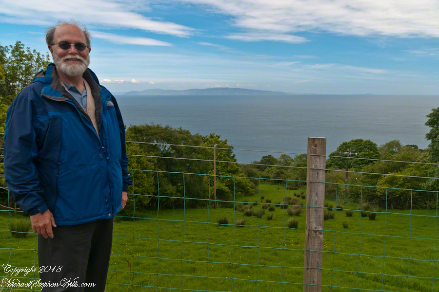
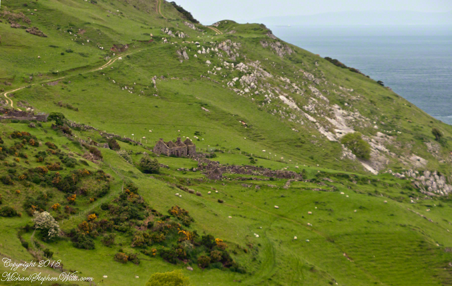
We pulled off the side of Torr Road for this fine view on the way to Torr Head to take in this view of the Irish Sea. The steeply rising distant headland is the Mull of Kintyre. Loughan an Lochan, County Antrim, Northern Ireland.
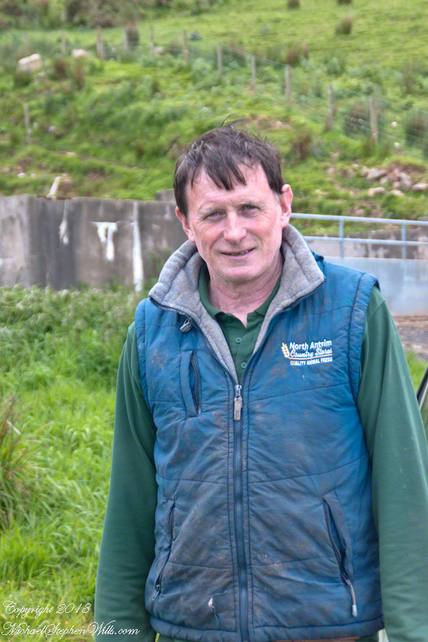
We parked on a turnout above the Loughan Cottages, near this farmer’s sheep pen. He drove up in a huge tractor and conversed with Pam while I was below shooting the cottages. He made a good impression.
Roofless walls of a cottage more substantial than the other deserted ruins above Loughan Bay, with two fireplaces a walled porch with a view. A number of outbuilding foundations lay around. The integrity of the walls, chimneys and gables speaks to the quality of construction. A freighter in the North Channel of the Irish Sea is visible in the distance above the upper ridge. Beyond is the island of Islay, Scotland, about 30 miles distant. Loughan an Lochan, County Antrim, Northern Ireland.
I am happy to report a series of thirteen (13) photographs of these ruins were accepted for publication by Getty. You can click any of the photographs in this posting for my Getty portfolio.
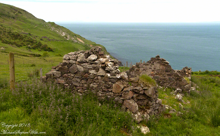
The land slopes steeply to a rocky beach.
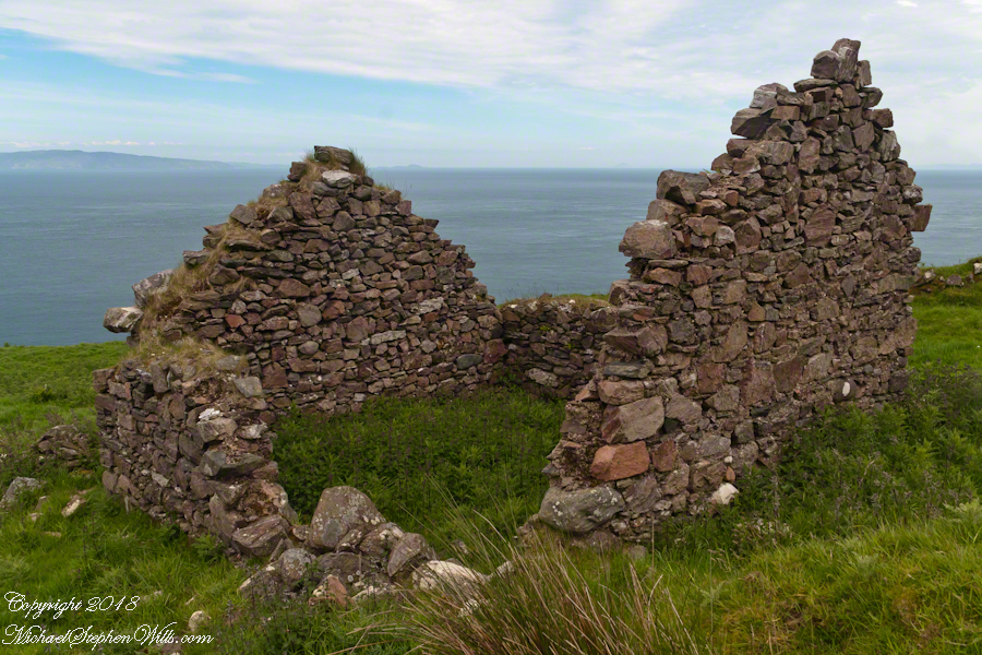
A thick growth of ferns, grass on the gable was once a home with a view of Scotland’s Mull of Kintyre 13 miles across the North Channel of the Irish Sea. The Isle of Sanda just visible on the right of the far gable. A landform named Alisa Crag is just visible in the distance, to the left of the nearest gable.
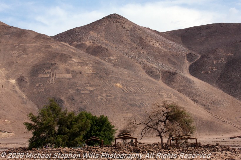
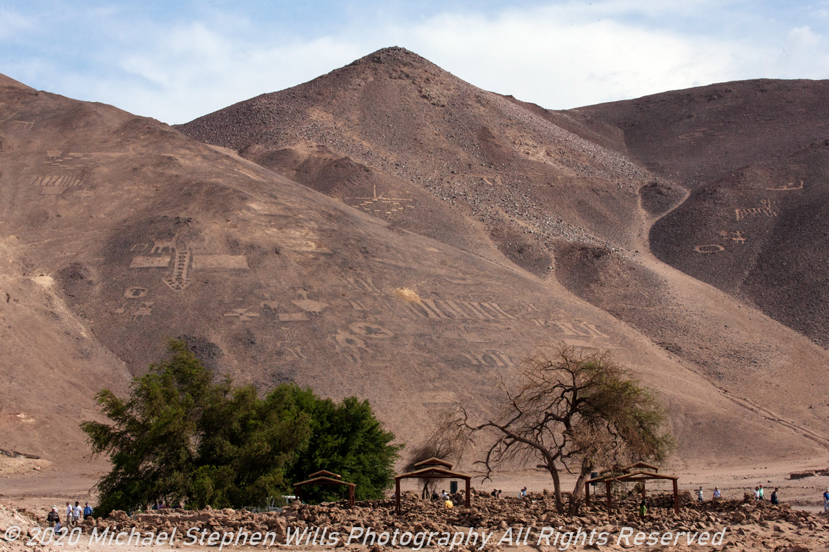
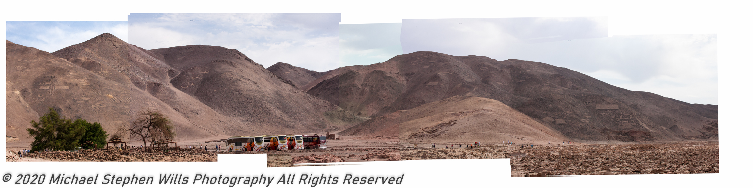
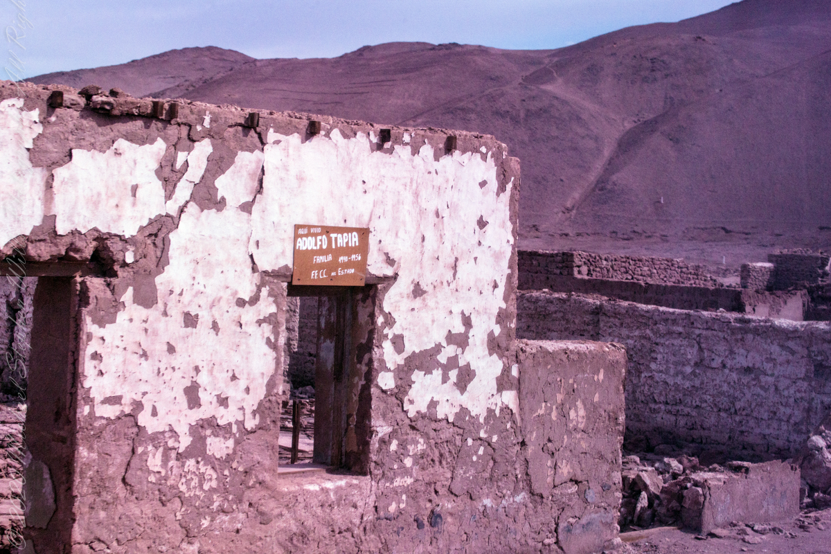
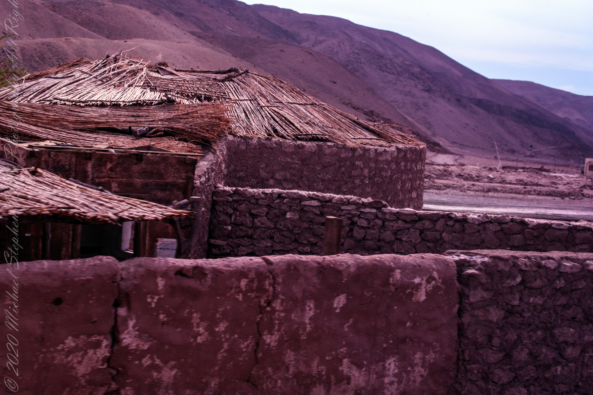
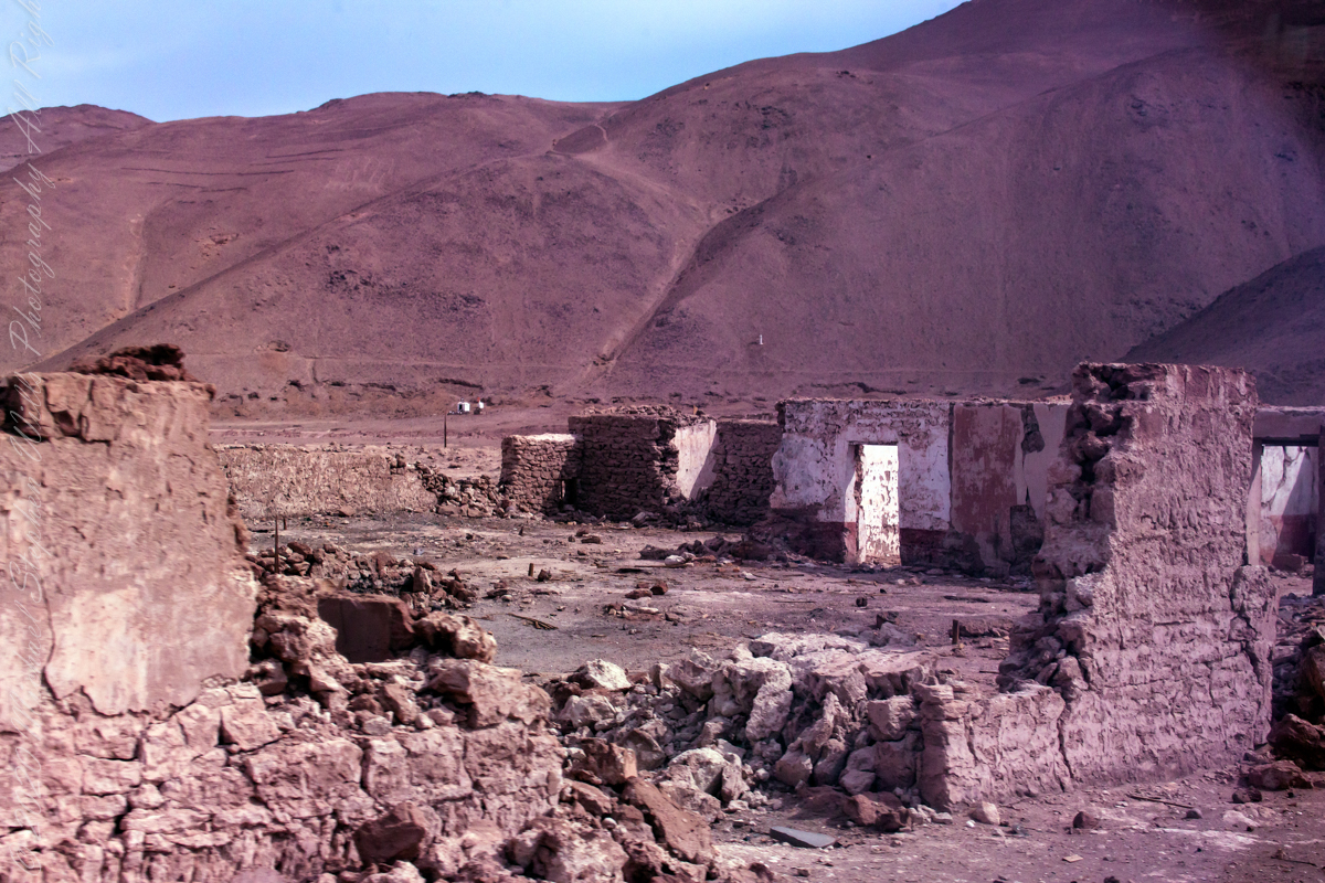
The Spanish word pintados translates to painted in English. There are many references to the word, in one it is a war loving tribe known for tattoos. Here, it is the name of a deserted town on an abandoned railroad running roughly parallel to the Pan American highway. As we passed through en route to Geoglifos de Pintados, I captured these shots of the ruined town.
The handprinted sign above the window, top photograph, says in translation, “Here lived the Adolfo Tapia Family, 1940-1956, F.F C.C. del Estado.” Searches on Adolfo Tapia turned up nothing, all we know is the sign attributes the designation to the state government.
The hill of the geoglyphs are the background, some of the figures are visible. There will be more in later posts.
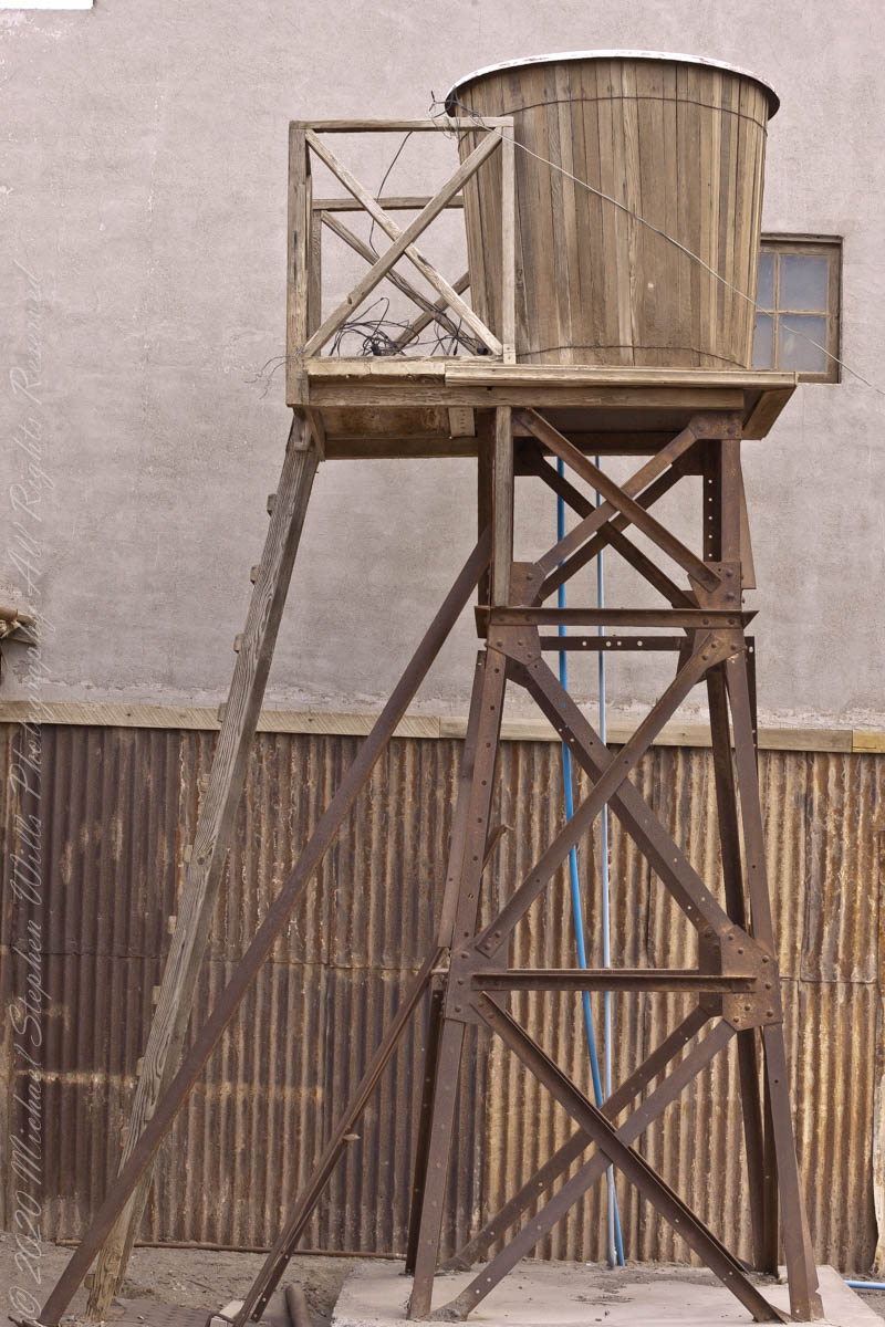
The railroad served the many Saltpeter factories dotting the Tarapacá region. To my knowledge all were closed in the mid-20th century.
Click any photograph for a larger view and use Ctrl-x to zoom in closer.
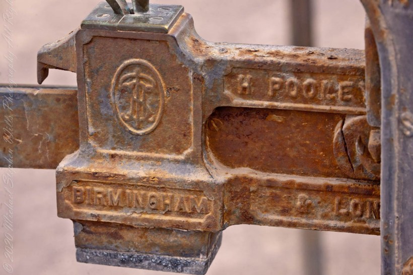
Pooleys were a firm of mechanical engineers, founded in Liverpool 1790. Shown as Pooley of Liverpool in Heath Mill Lane, Birmingham, the company originally made scale beams, such as shown here, a reminder of the origins of Humberstone.
A demand of the workers was access to a scale to verify company store weights. With this post I close this series of photographs from the Humberstone UNESCO World Heritage Site.
Click any photograph for a larger view and use Ctrl-x to zoom in closer.
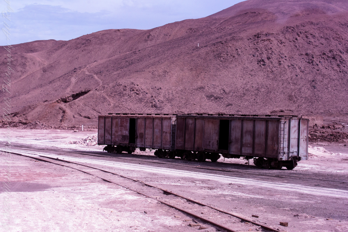
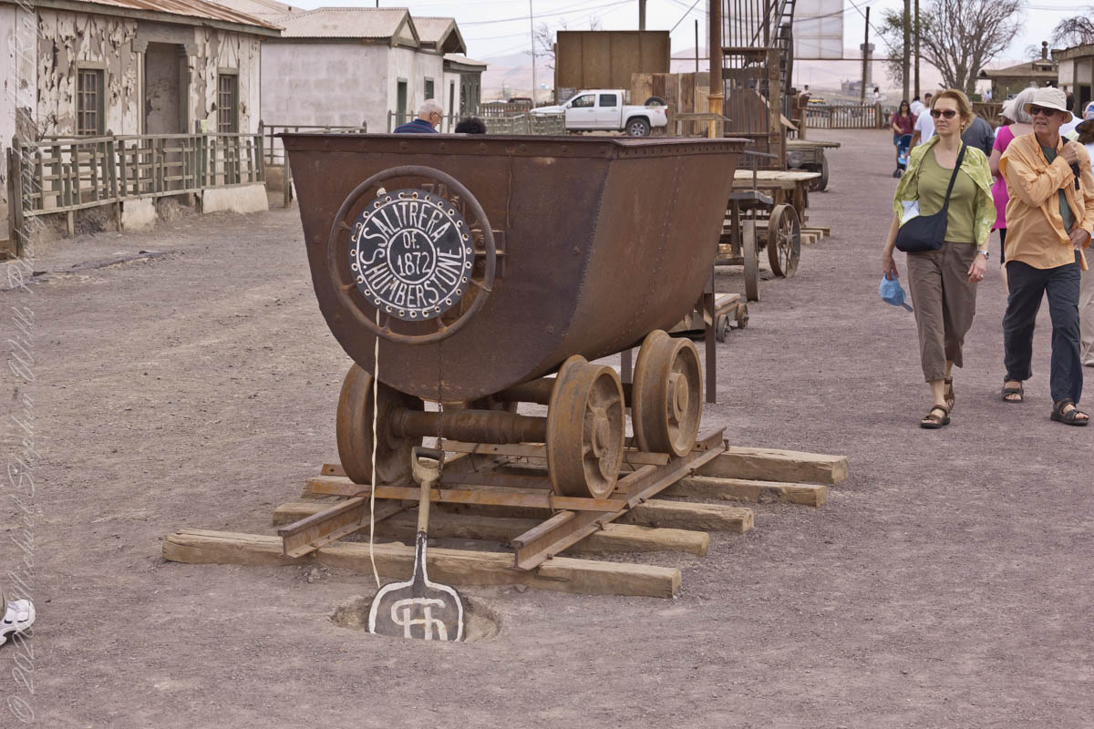
1872 James Thomas Humberstone founded the Peru Nitrate Company. No, is geography was not deficient, this land was won by Chile from Peru in the War of the Pacific. This rolling stock was delivered from England, where Humberstone was born, in Dover, and worked his early years on railroads, London. At the age of 25, hired by the Tarapaca Nitrate Company, he moved to South American.
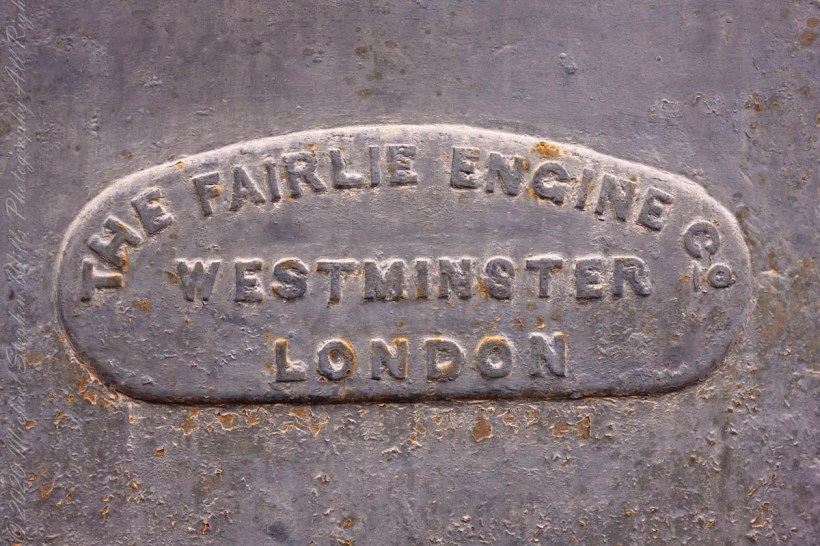
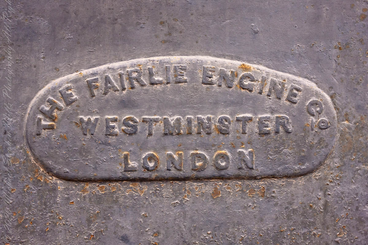
Robert Francis Fairlie developed the Fairlie Locomotive.
Click any photograph for a larger view and use Ctrl-x to zoom in closer.