Pam and I visited Treman for our last visit of 2017. It was a bright, warm October afternoon. Here is a slide show of our experience, the details shared in recent postings. Enjoy!!
Click photograph for a larger view. To do this from WordPress Reader, you need to first click the title of this post to open a new page.
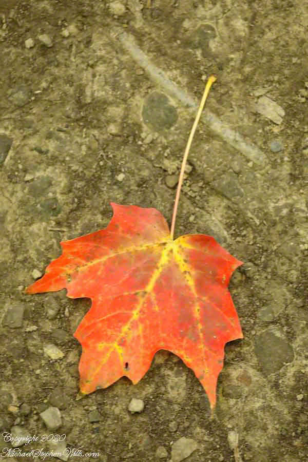
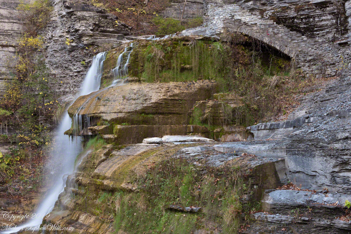
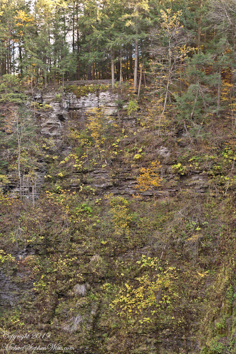
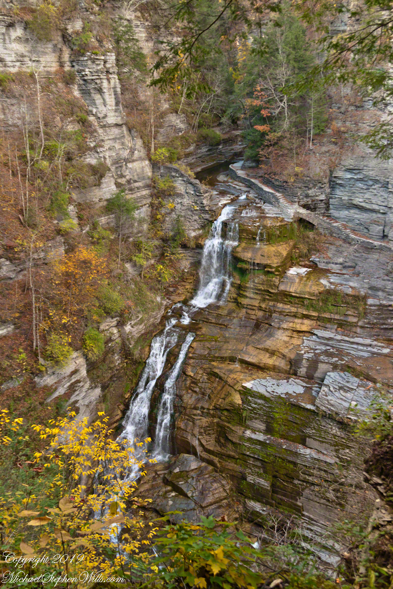
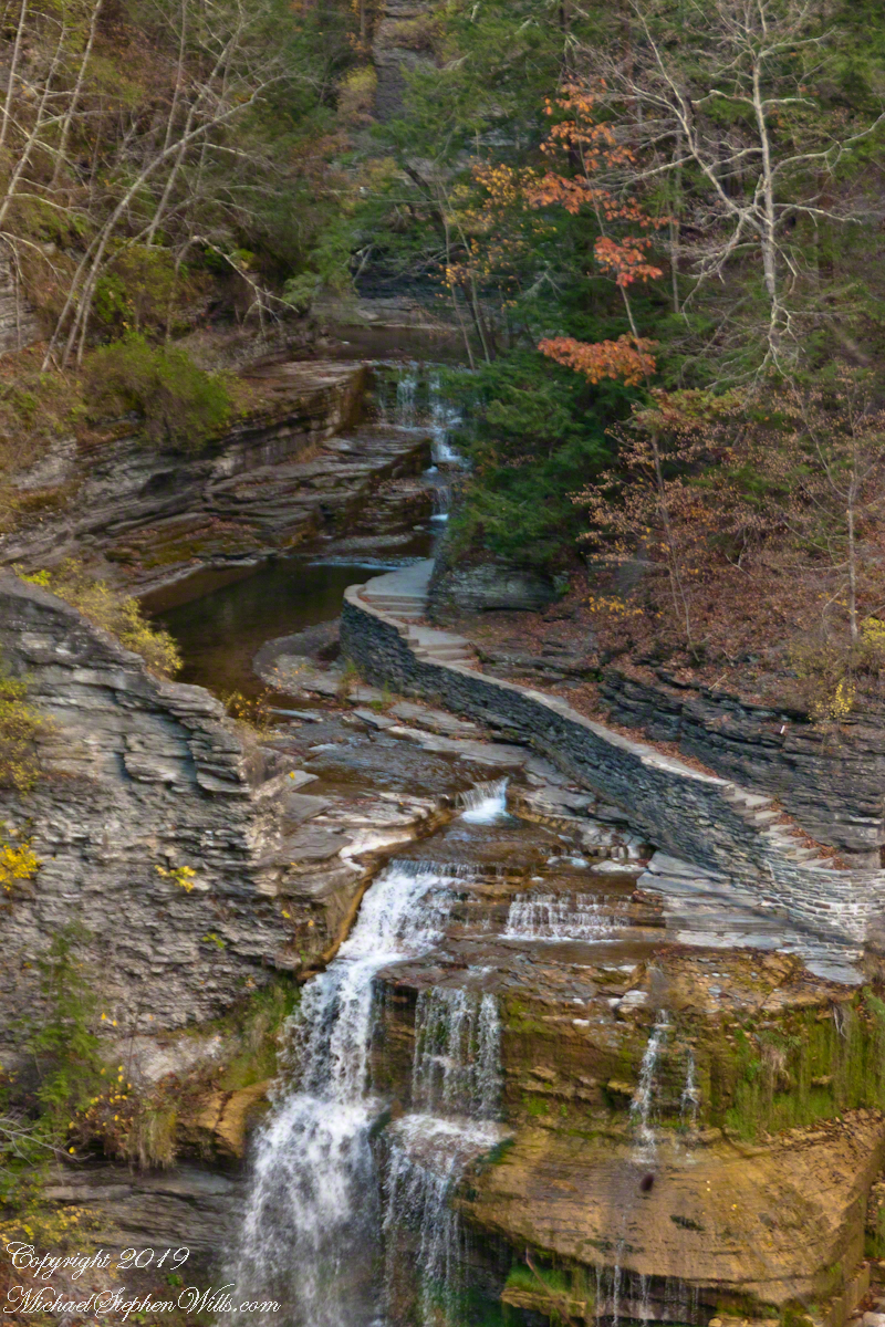
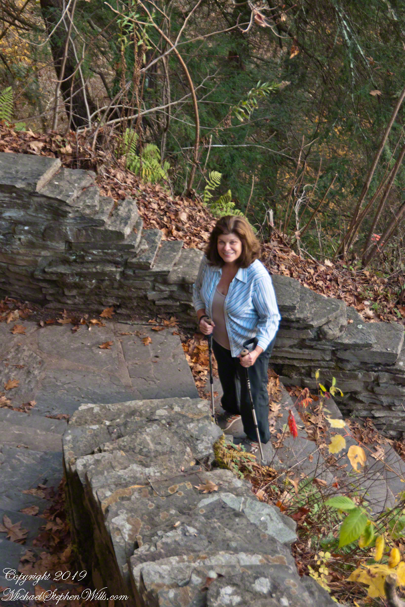
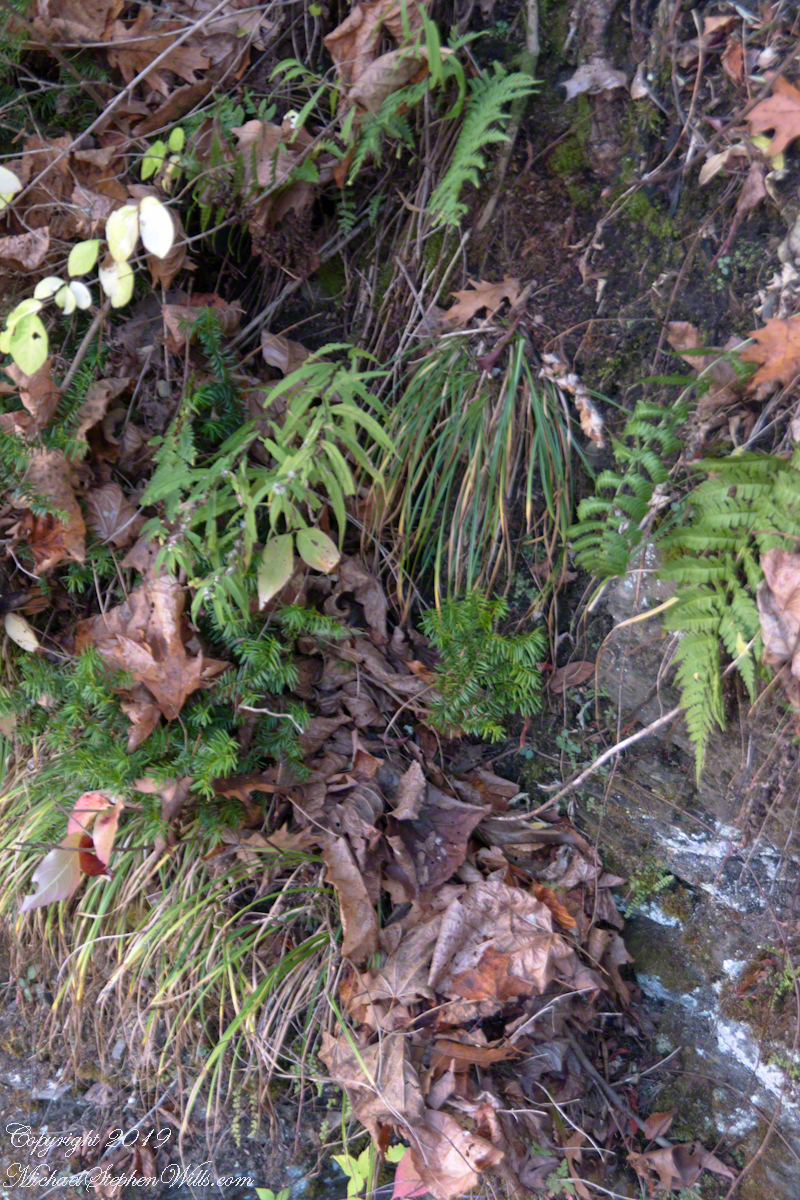
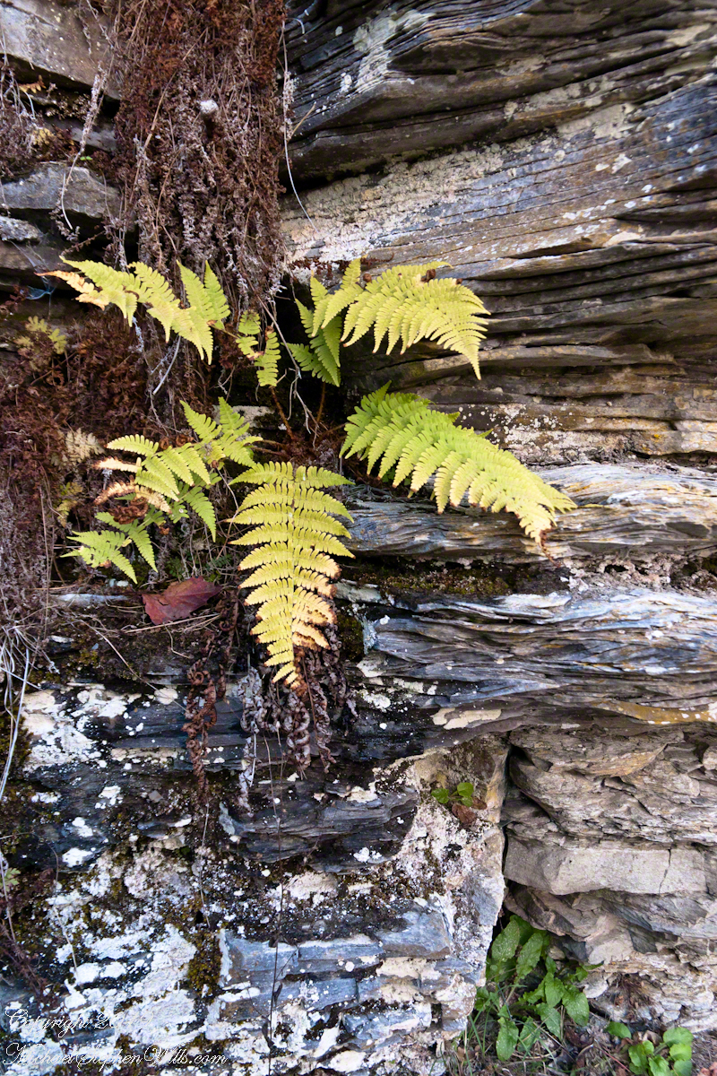
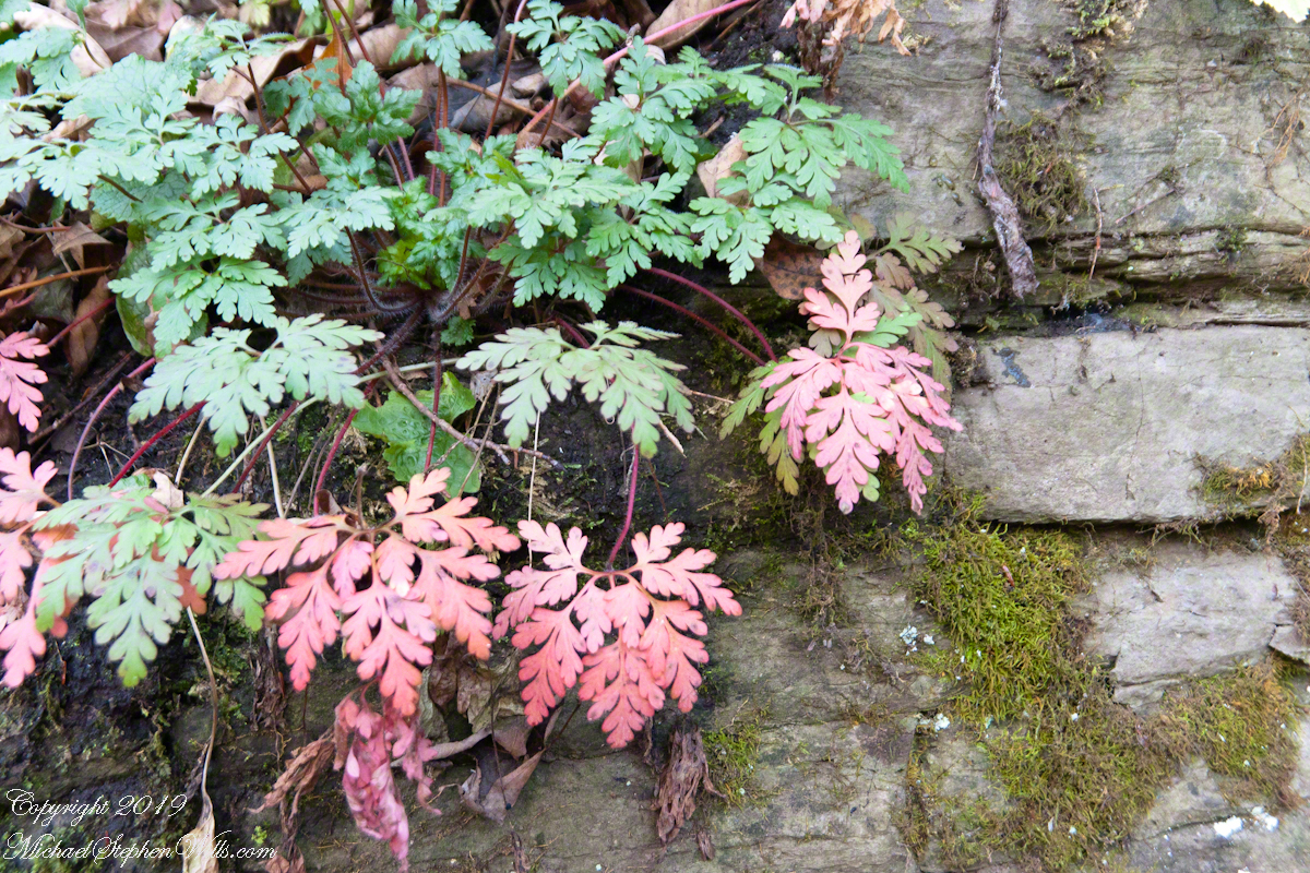
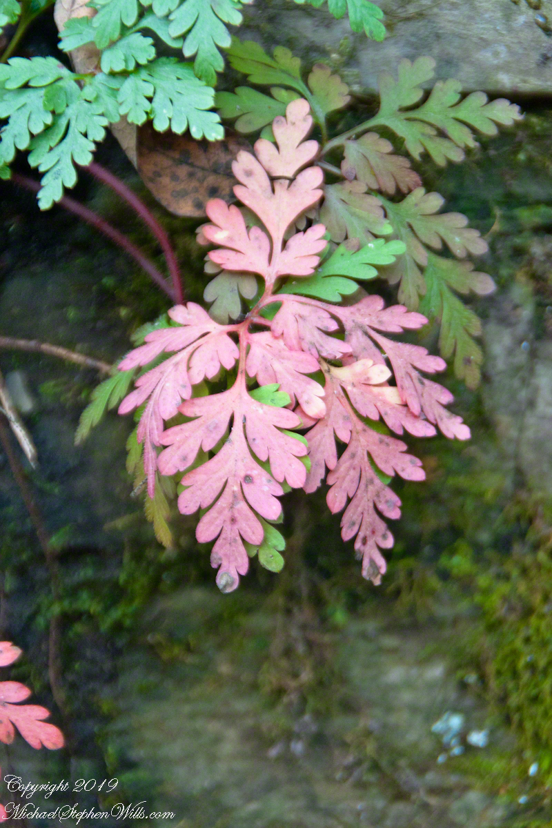
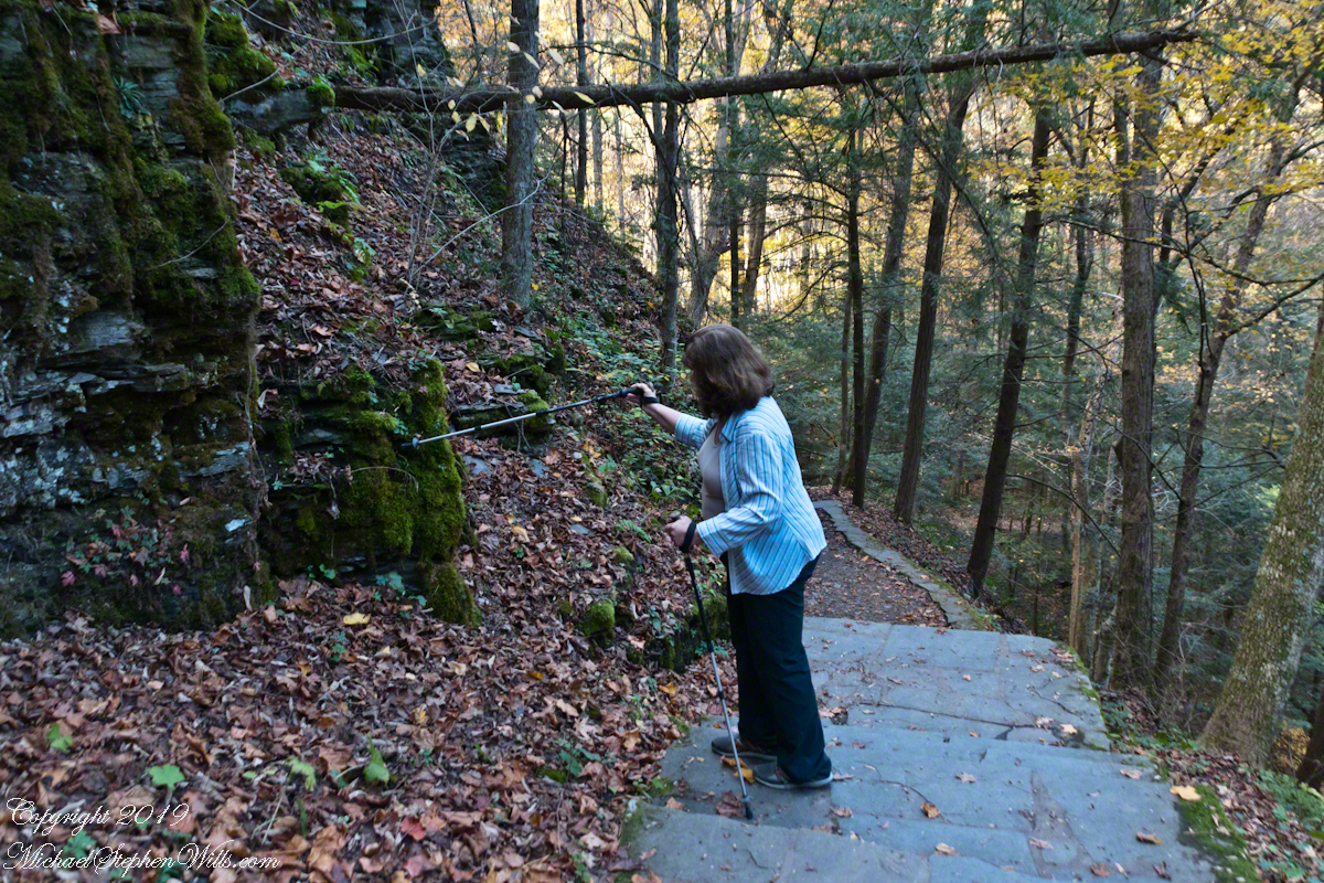
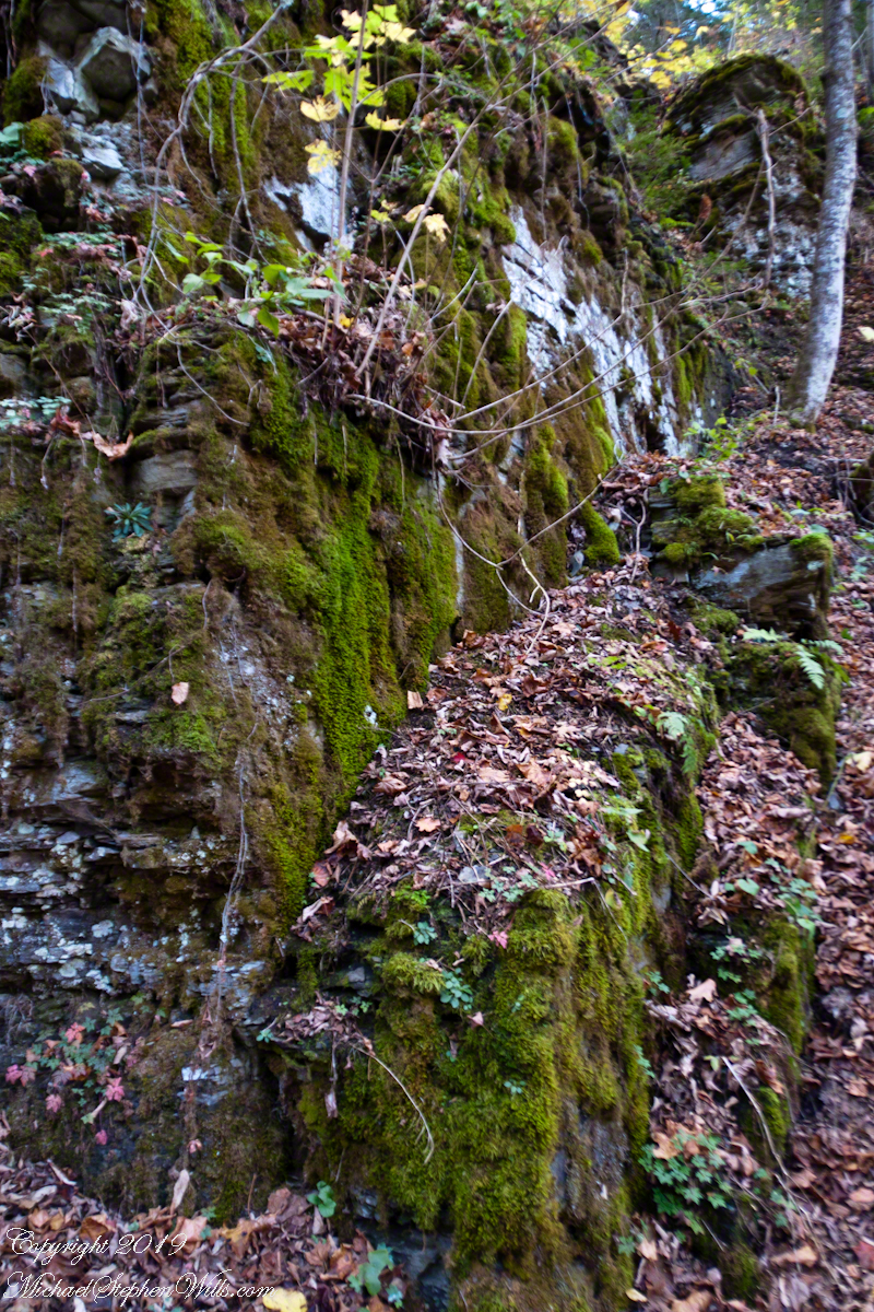
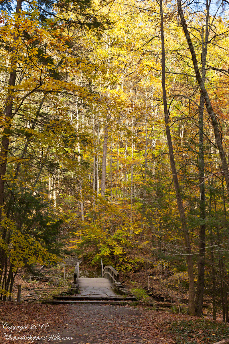
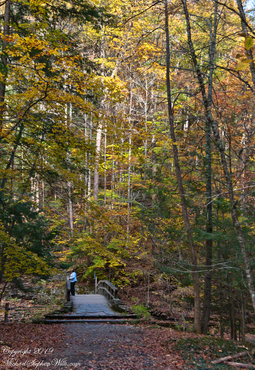
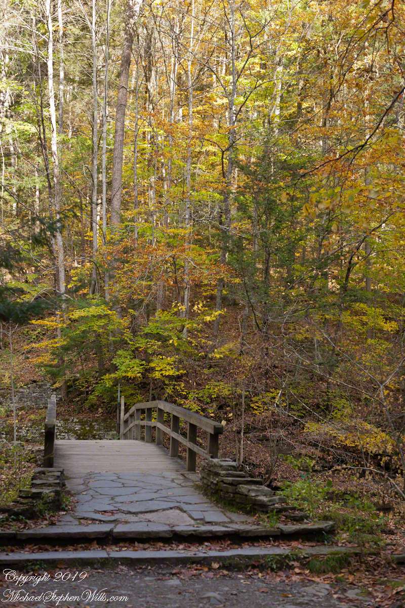
Brink of Lucifer FallsLucifer Falls Overlook from the Gorge TrailLucifer Falls from Rim Trail OverlookLucifer Falls from Rim Trail OverlookPam on the Cliff StaircaseUnidentified TreeLuficer Falls Overlook, northeastCliff Stair Wall, autumn with hemlockCliff Stair Wall, autumn with fern generationsCliff Stair Wall, autumn Geranium and mossesThis geranium species (scientific name Geranium robertianum) are also called “Herb-Robert” for a reputed ability to ward off disease and, in the Scottish Highlands, “red-shanks” for the deep red color of the stalks, seen in this photograph. Robert H. Treman New York State Park. Source, “How to Know the Wildflowers” by Mrs. William Star Dana, 1989, Houghton Mifflin, Boston.Pam examines the mossCliff Stair Wall, autumn MossAutumn foot BridgeWoman on Footbridge, ContemplationOver the bridge
In November the gorge is closed for the winter due to dangerous conditions under the steep, crumbling walls. Robert H. Treman New York State Park.
Copyright 2019 All Rights Reserved Michael Stephen Wills
In my Homecoming Parade 2003, I described my initial reconnection with the University of Arizona (U of A) as a 1975 graduate and alumnus. This personal project of involvement with U of A and Arizona continued through 2011 with annual autumn trips to coincide with Homecoming. The travel was as a CALS (College of Agriculture and Life Sciences) Alumni Board of Directors member, a primary responsibility was raising funds for scholarships.
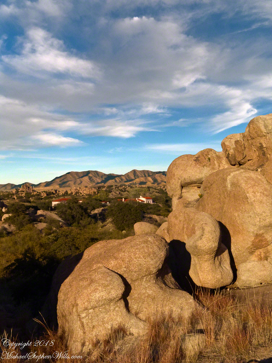
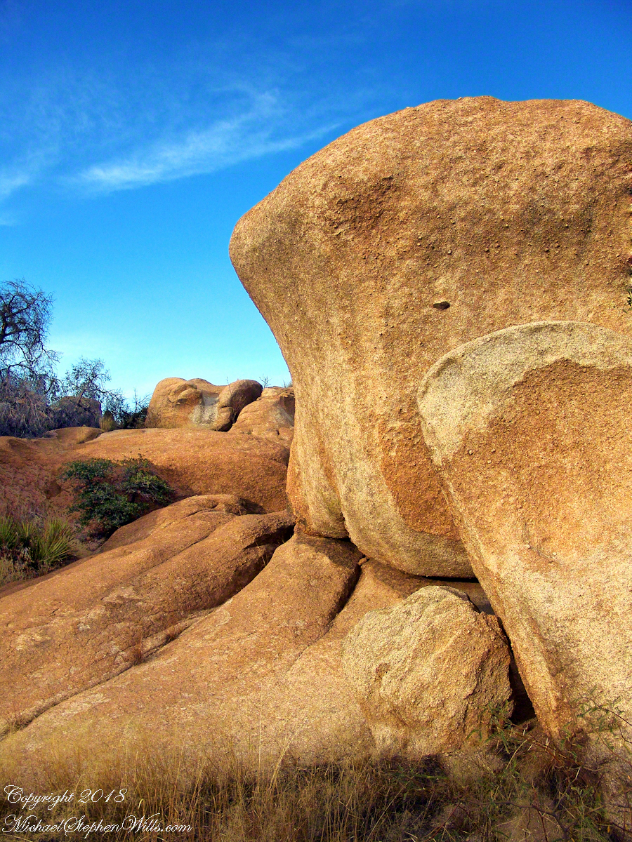
The Amerind Foundation and weathered boulders of Texas Canyon granite. Beyond are the Dragoon Mountains
I met, Linda Kelly, the owner of the Triangle T Guest Ranch, while camping in the Chiricahua Mountains. I arrived a week before homecoming to photograph the landscape, nature and rock formations of the Chiricahua National Monument. Click this link for my Arizona Online gallery, including some work from that time. Linda and a friend were visiting that day and we struck up a conversation about the area and her Triangle T Guest ranch. The next day I was scheduled to guest lecture a class at the U of A, as an alumnus of CALS. The ranch was on the way and I needed a place to stay, so Linda gave me directions and I checked in.
She gave me a tour of the incredible weather granite rock formations of Texas Canyon and, meanwhile, shared stories of the history of Texas Canyon. It is appropriate for the Amerind Foundation to be here (see first photograph), the winter camp of an Apache tribe for generations.
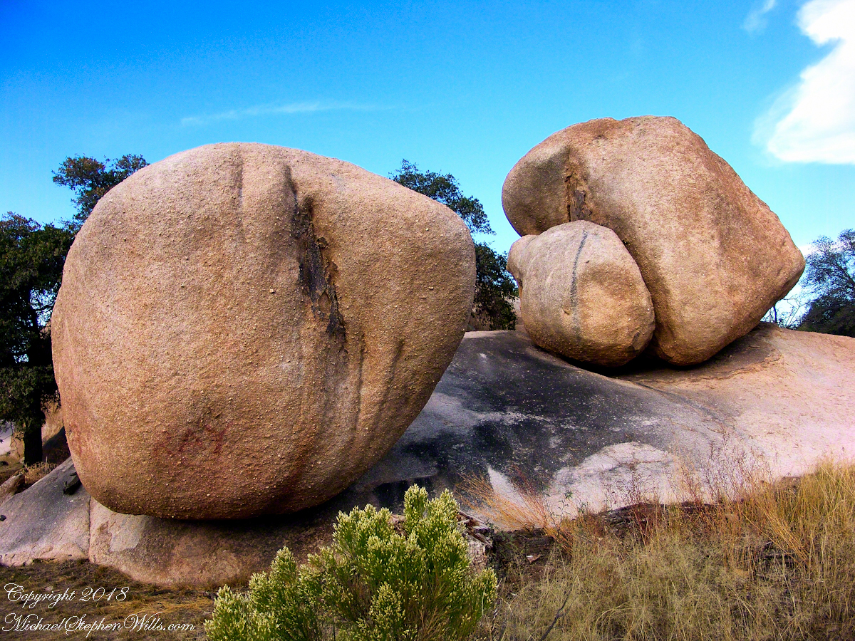
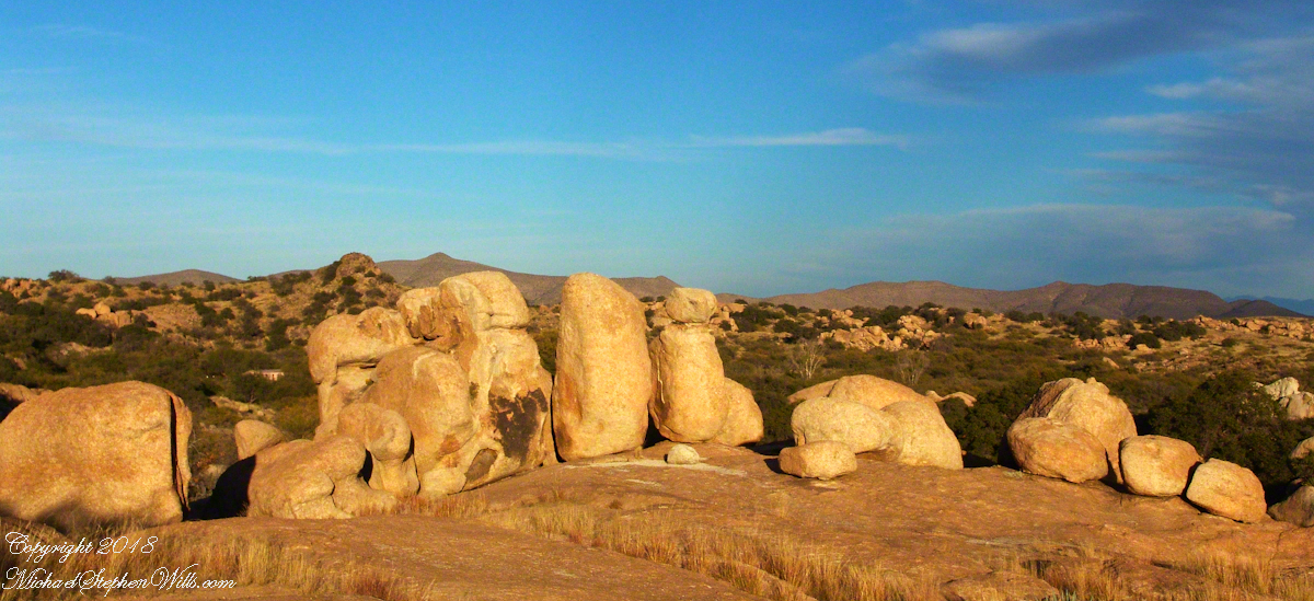
Weathered granite boulders greet visitors to the Triangle T Ranch.
That night, my request was for a room storied to be haunted by a spirit they call “Grandma,” as in when her footsteps wake you from a sound sleep you say, “It’s all right, Grandmother.” She woke me that night, footsteps in the dark, hollow on the wood floor, the room filled with a hard cold. I talked to her, without a response, while swinging my legs out of bed to reach the gas heater in the wall. I turned on the heat and the sound of expanding metal heat fins lulled me to sleep.
I call this pair, “Father and Son.” The restaurant is built around a round boulder.
It made a good story for the students. They were surprised I could fall back asleep, but after all I had to be there the following morning.
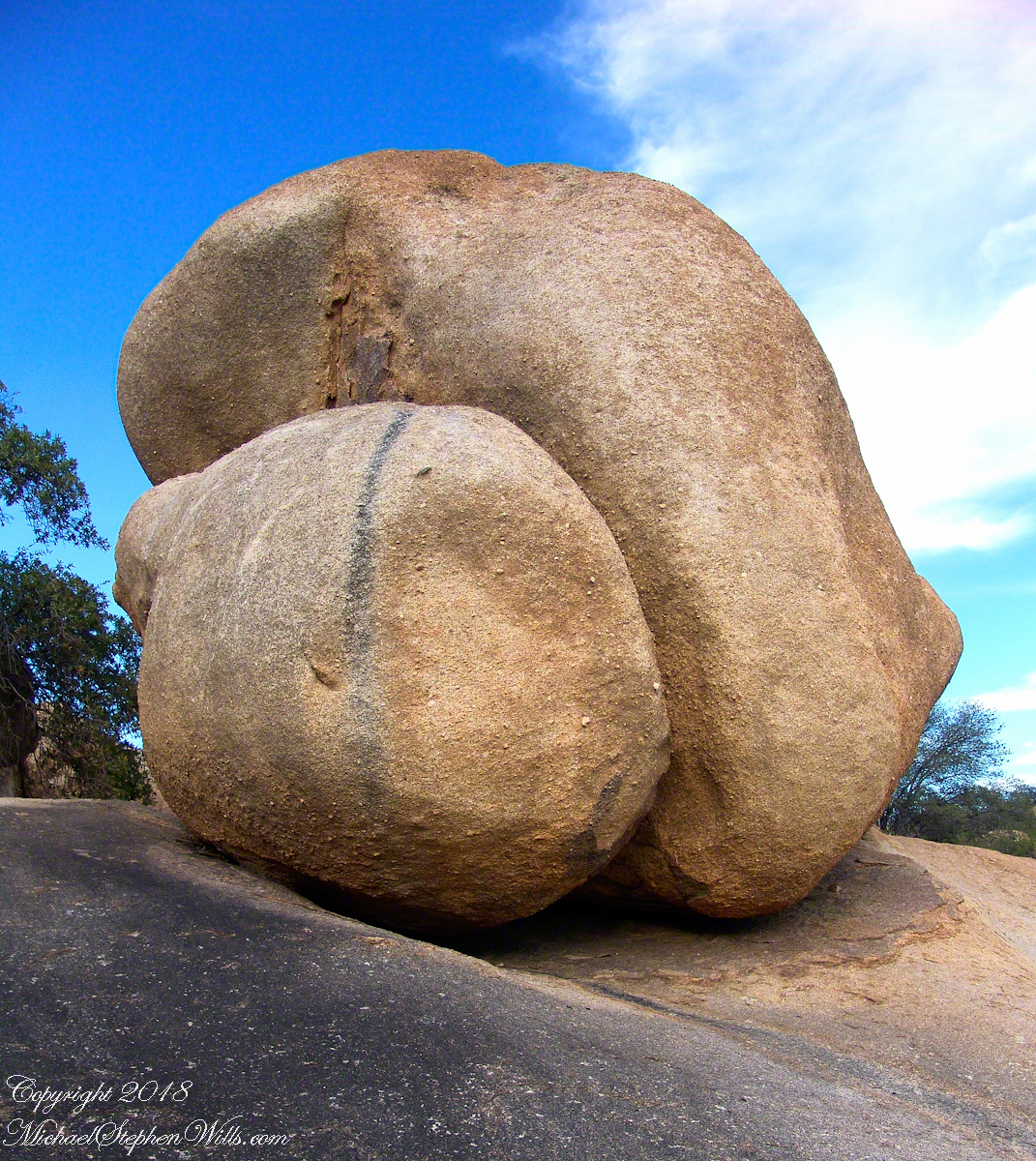
Your imagination roams among the natural forms.
I gave Linda a few of my photographs from that day and we made arrangements for the Triangle T to supply a two night package for the CALS “Dean’s Almost World Famous Burrito Breakfast” silent auction during 2008 homecoming.
A tableau of figures keep silent watch with the ghosts of Texas Canyon.
Copyright 2023 Michael Stephen Wills All Rights Reserved
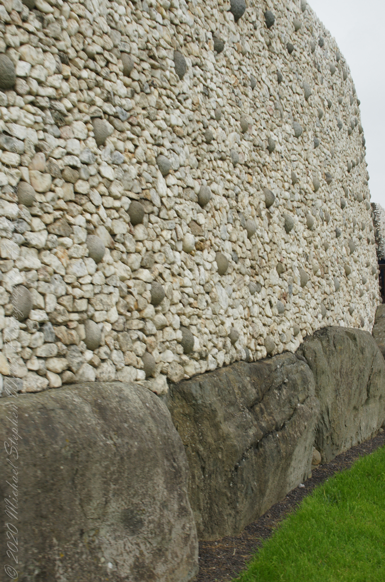
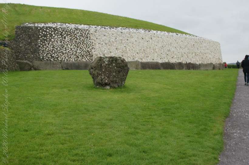
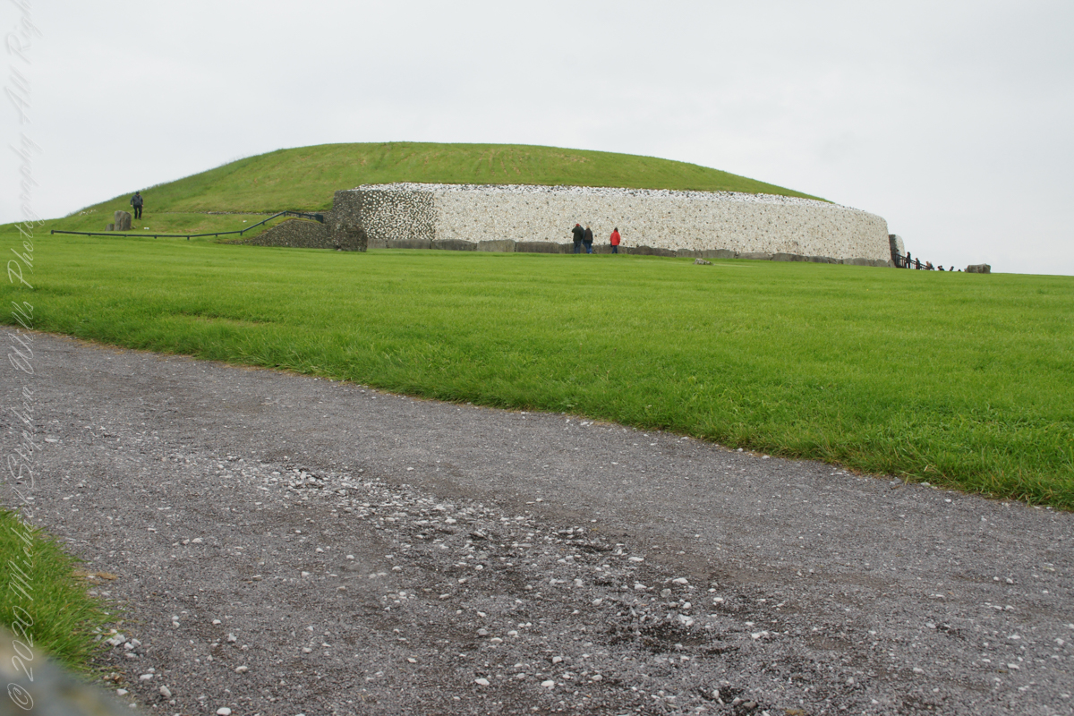
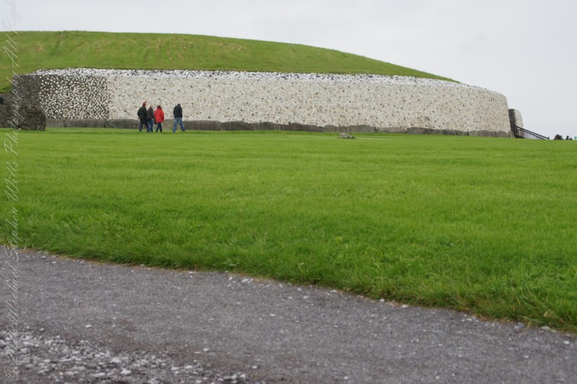
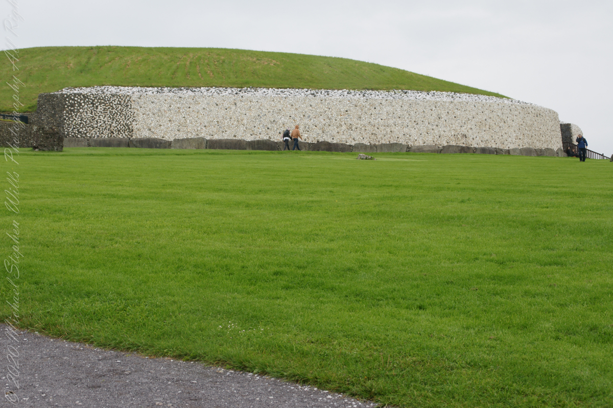
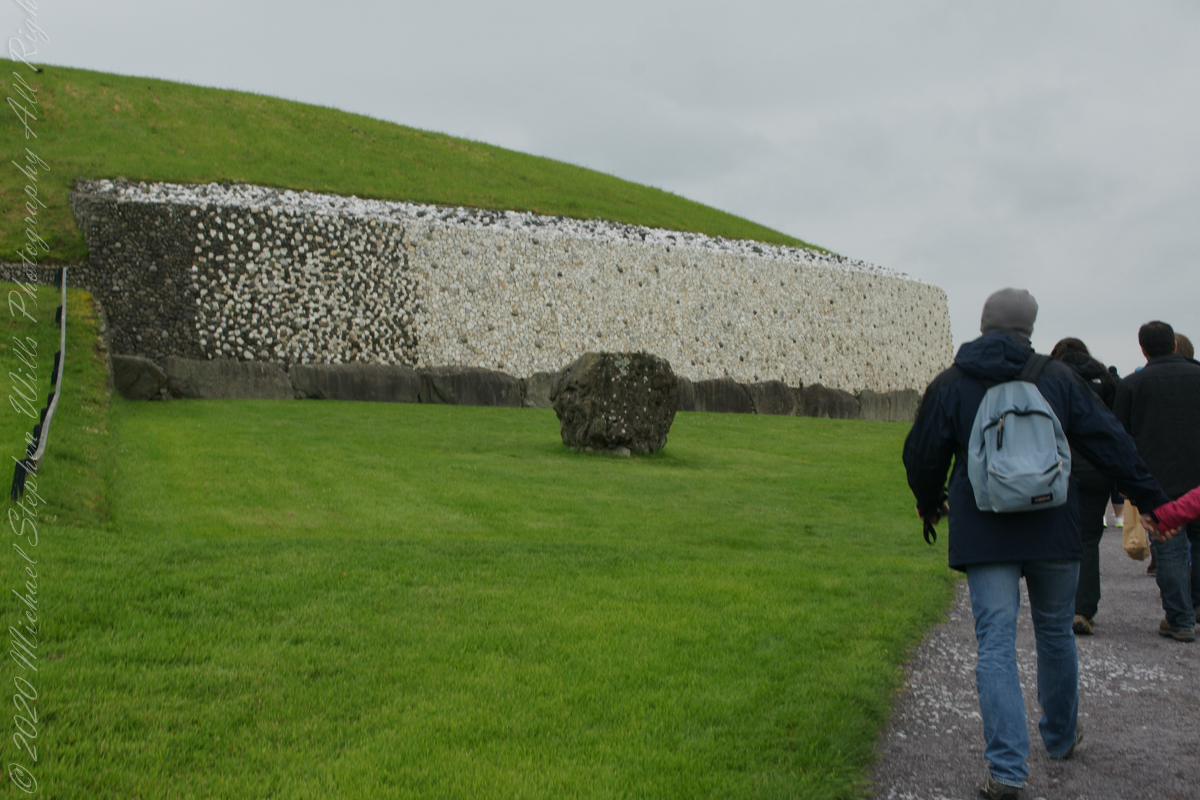
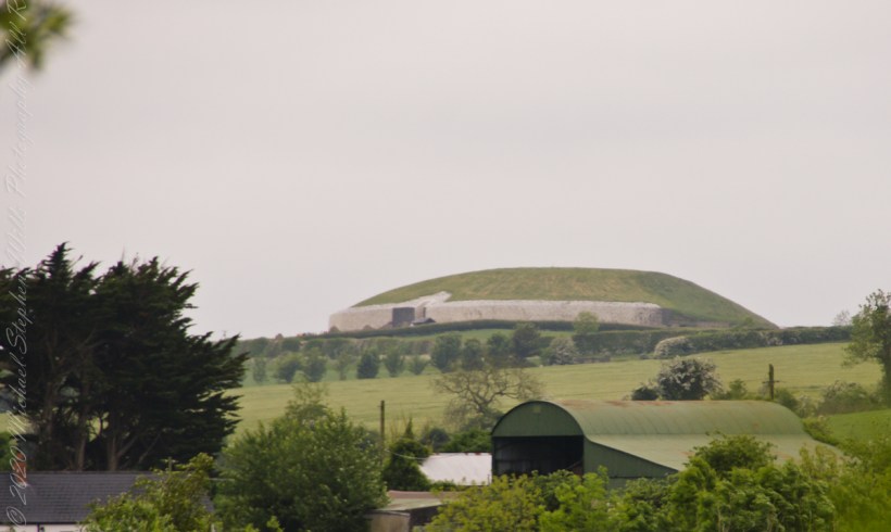
The Newgrange façade and entrance of today is a creation from the large quantity of small stones unearthed and conserved during excavation given form by a steel-reinforced concrete retention wall.
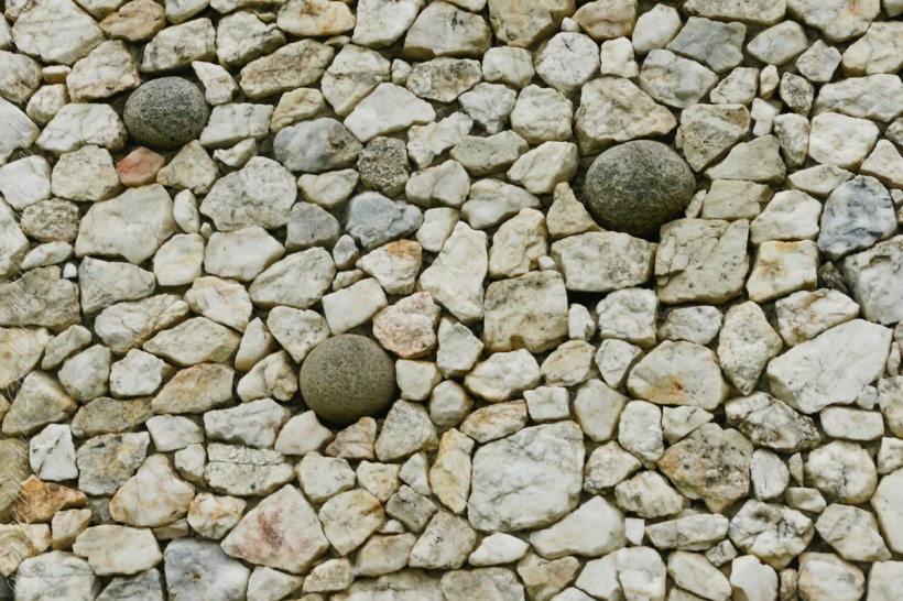
The brilliant white quartz cobblestones were collected from the Wicklow Mountains, 31 miles to the south. Our guide called them “sunstones” for the way they reflect sunlight. In the following photograph is white quartz, the same excavated 1967-1975 from the Newgrange site and incorporated into the facade, I collected from “Miners Way” along R756 (above Glendalough).
You can also see in these photographs dark rounded granodiorite cobbles from the Mourne Mountains, 31 miles to the north. Dark gabbro cobbles from the Cooley Mountains and banded siltstone from the shore at Carlingford Lough both locations on the Cooley Peninsula where my mother’s family still has farms.
The stones may have been transported to Newgrange by sea and up the River Boyne by fastening them to the underside of boats at low tide. None of the structural slabs were quarried, for they show signs of having been weathered naturally, so they must have been collected and then transported, largely uphill, to the Newgrange site. The granite basins found inside the chambers also came from the Mournes.
Geological analysis indicates that the thousands of pebbles that make up the cairn, which together would have weighed about 200,000 tons, came from the nearby river terraces of the Boyne. There is a large pond in this area that is believed to be the site quarried for the pebbles by the builders of Newgrange.
Facade and Kerbstones
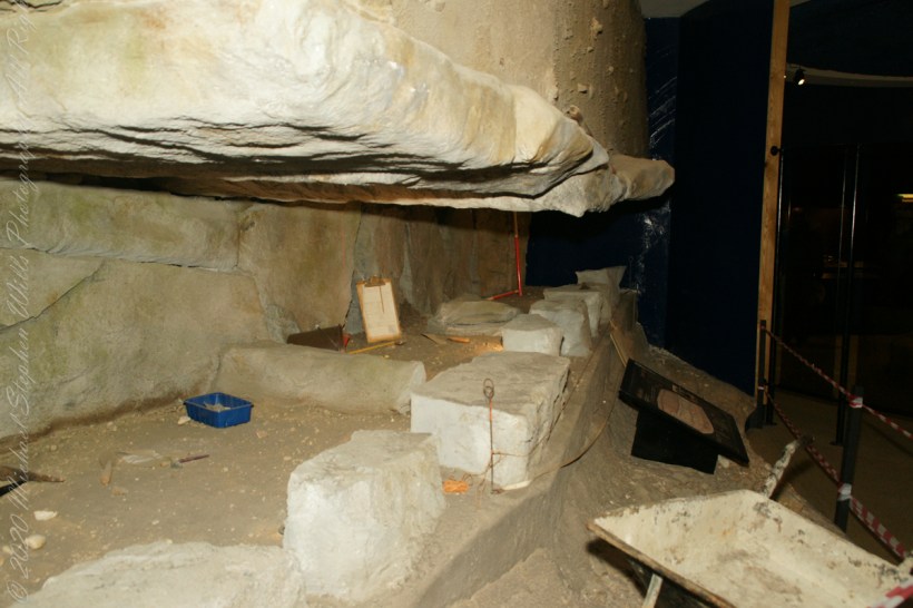
Most of the 547 slabs that make up the inner passage, chambers, and the outer kerbstones are greywacke. Some or all of them may have been brought from sites either 3 miles away or from the rocky beach at Clogherhead, County Louth, about 12 miles to the northeast.
Michael Joseph “Brian” O’Kelly was selected to undertake the direction of the excavation of Newgrange during a 1961 meeting of “those who had a professional interest in the monument” organized by PJ Hartnett, the archaeological officer with Bord Fáilte Eireann (Irish Tourist Board) and a former pupil of Professor O’Kelly’s. Excavation commenced in 1962 and continued every summer for a four-month season up to and including 1975.
The aim of the excavation was to discover as much as possible about the archaeological and historical context of Newgrange and the people who built it and to discover what its original finished appearance was so as to direct a reconstruction, conservation and restoration of the structure to its former condition and appearance.
The last year of excavation was 1975, Michael J. wrote “We determined in 1975 that that should be our last season of excavation at Newgrange. We had investigated approximately one third of the structure and we had discovered much about it that was new, both in its structure and in its ornament, while radiocarbon had pushed its date back by 1,000 years……”
“…We felt that the other two thirds should be left for a future excavator, who, working with new knowledge and perhaps with better methods and new scientific approaches, should have large areas untouched by us in which to test, check and re-evaluate our findings.” From The Restoration of Newgrange by Michael J.O’Kelly. Antiquity LIII, 1979.
“Between the bright sky and the long glittering silver ribbon of the Boyne the land looks black and featureless. Great flocks of starlings are flying across the sky from their nighttime roosts to their daytime feeding places. The effect is very dramatic as the direct light of the sun brightens and casts a glow of light all over the chamber. I can even see parts of the roof and a reflected light shines right back into the back of the end chamber.” The recorded words of Prof O’Kelly spoken in the tomb of Newgrange on the 21st December 1969.
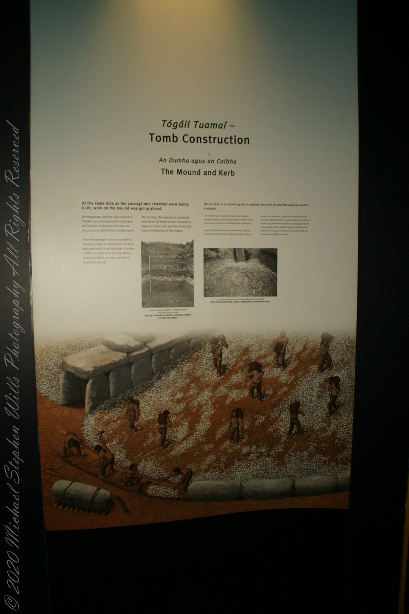
At the same time as the passage and chamber were being built, work on the mound was going ahead.
Brú na Bóinne Visitor Center, Dunleek Lower, County Meath, Republic of Ireland
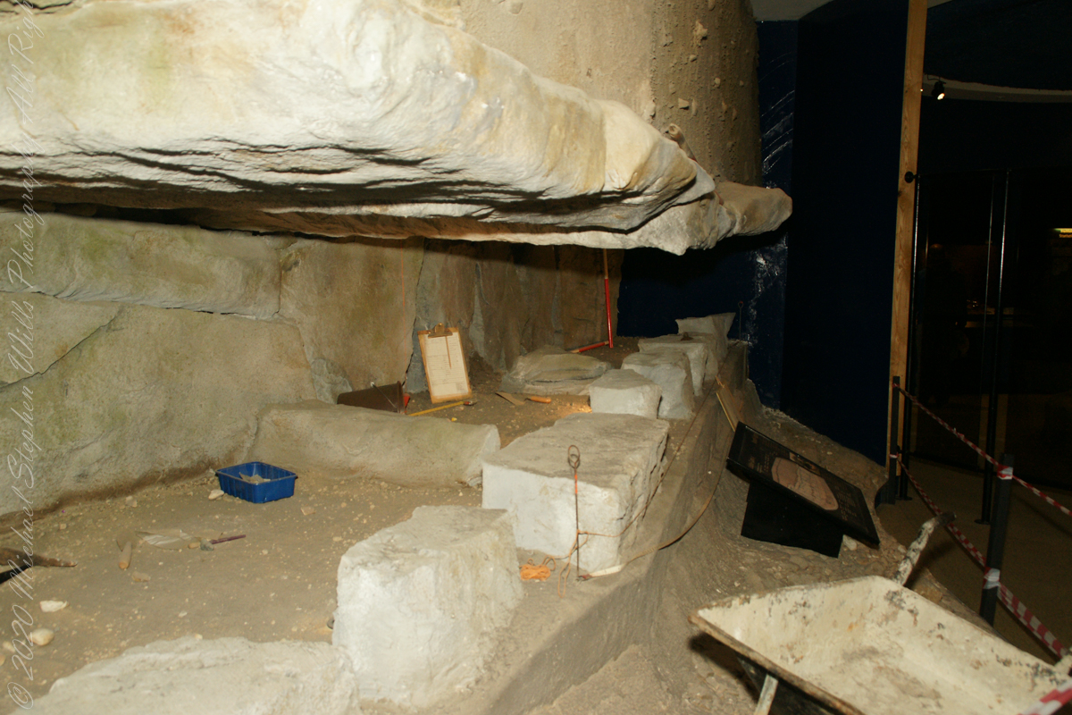
At Newgrange, and the main mound at Knowth, an area around the tomb was left clear for a platform of stones to encase and stabilize the chamber roofs.
Brú na Bóinne Visitor Center, Dunleek Lower, County Meath, Republic of Ireland
Once the passage roof was complete, structural experts returned to the kerb and continued to set the slabs in place — either in sockets or on prop stones, so as to achieve an even top-line all-round the mound.
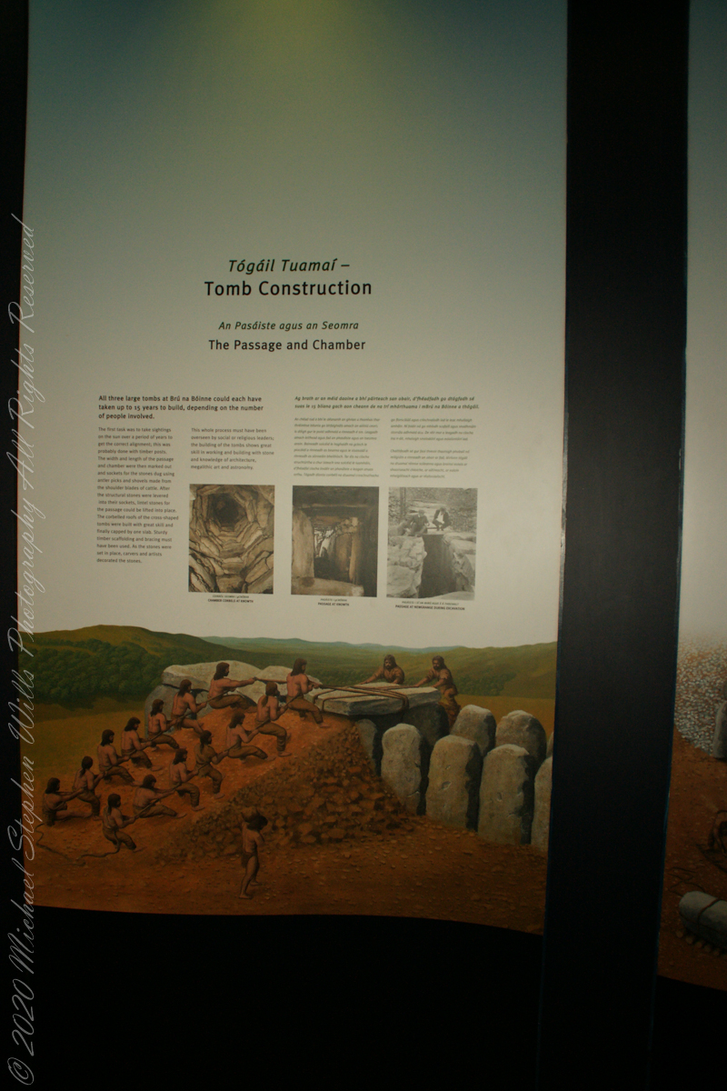
The initial task for the builders of Newgrange involved recording the annual alignment of the rising sun over several years, which was likely achieved using timber posts as markers. Subsequently, the dimensions of the passage and chamber were determined, and the groundwork was prepared by digging sockets for the structural stones. This excavation process was carried out using antler picks and shovels crafted from cattle shoulder blades.
Brú na Bóinne Visitor Center, Dunleek Lower, County Meath, Republic of Ireland
After the structural stones were carefully positioned and levered into their sockets, lintel stones for the passage could be lifted into place. The corbelled roofs of the cross-shaped tombs were built with great skill and finally capped by one slab. Sturdy timber scaffolding and bracing must have been used. As the stones were set in place, carvers and artists decorated the stones.
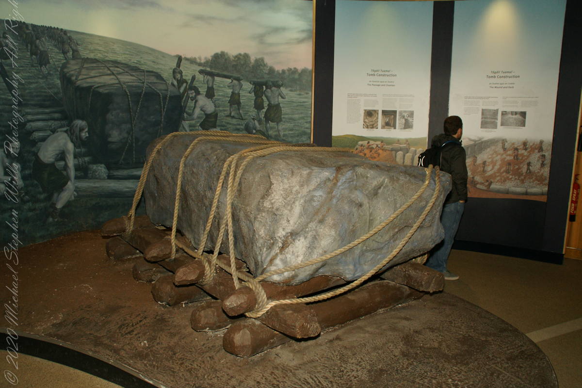
Brú na Bóinne Visitor Center display of envisioned technique for moving heavy stones during construction of Newgrange.
The whole process must have been overseen by social or religious leaders; the building of the tombs shows great skill in working and building with stone and knowledge of architecture, megalithic art and astronomy.
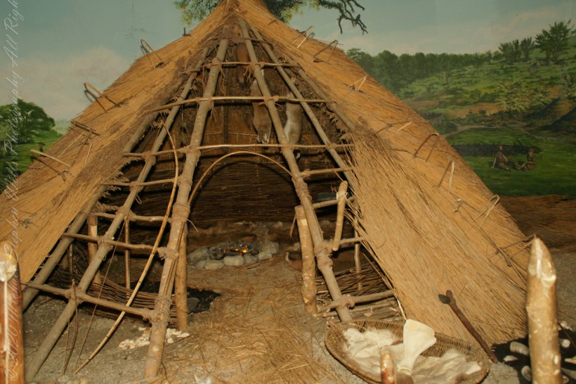
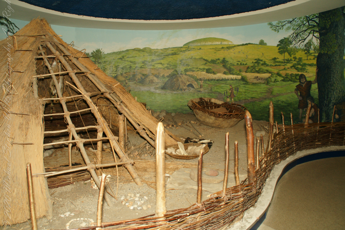
The Brú na Bóinne Visitor Center includes this tableau of the shelter of the ancient farmers who constructed Newgrange: the monument is in the background.
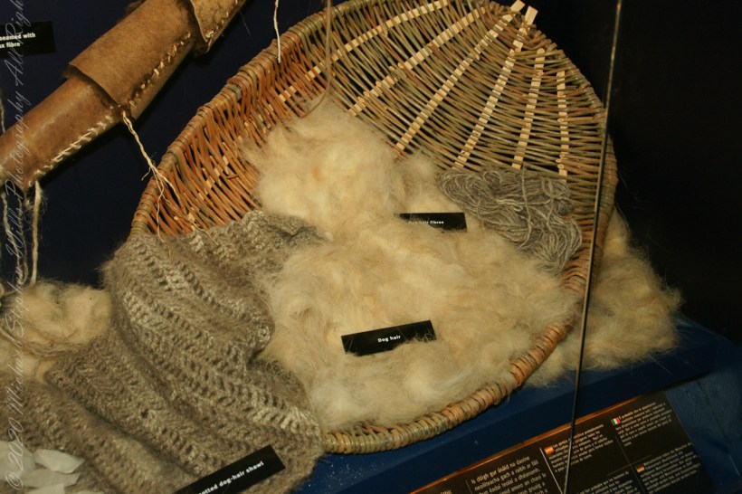
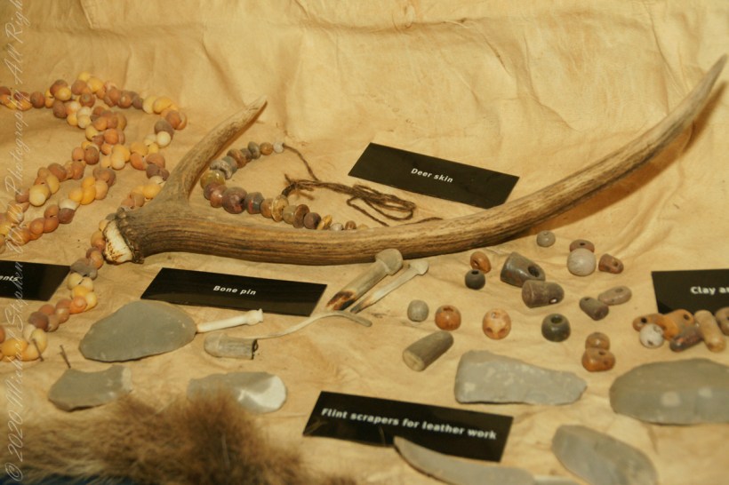
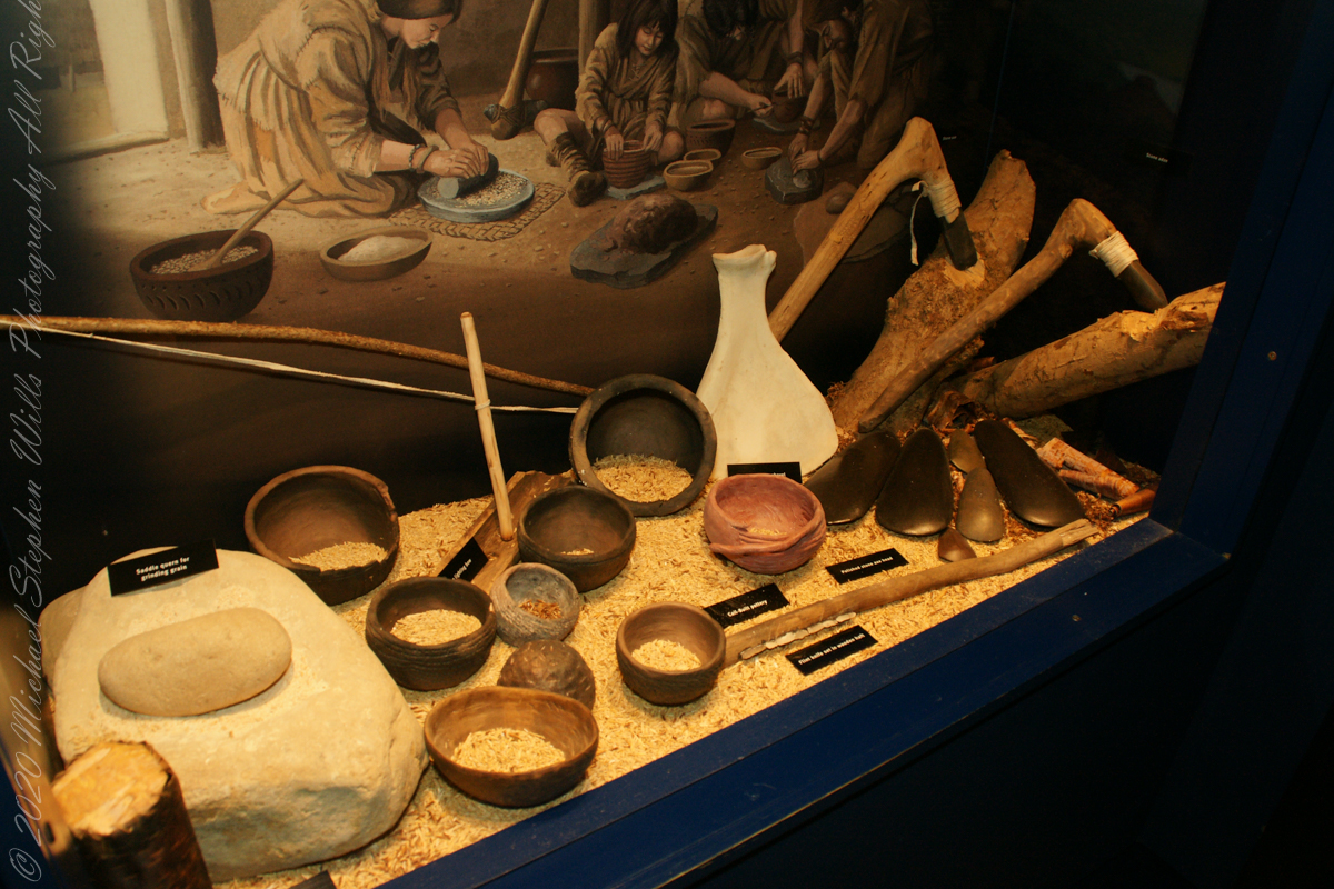
The people who built the passage tombs at Brú na Bóinne and elsewhere in Ireland were farmers, a way of life which by this time had become well established in Ireland. All the mainstays of early farming life — cereals such as wheat and barley, and domesticated animals such as cattle, pigs, sheep and goats — were introduced to Ireland by early farmers. T
he climate was warmer and drier than it is today which meant that the growing season was longer and winter was shorter and milder. The main crops grown appear to have been emmer wheat and naked barley. Flint knives and blades were used for cutting meat. Simple wooden ploughs with stone tips were probably used.
The cattle were Bos taurus longifrans, large animals with forward facing horns which were kept primarily for farm work and meat. Cattle may also have been important in a ceremonial sense; cattle bones were sometimes placed in a very deliberate way in the ground. Sheep were probably like Soay sheep today, without a woolly fleece and probably used mainly for their meat. Dog and pig bones have also been found.
Copyright 2023 Michael Stephen Wills All Rights Reserved
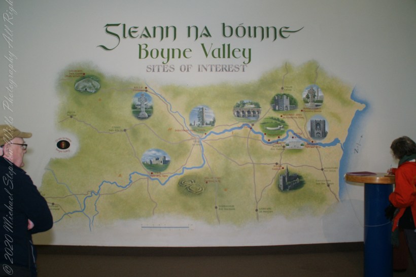
Thirty minutes headed up the M1 from Dublin Airport Pam and I arrived at Brú na Bóinne Visitor Center, gateway to Newgrange. Archaeologists classified Newgrange as a passage tomb, however Newgrange is now recognized to be much more than a passage tomb. Ancient Temple is a more fitting classification, a place of astrological, spiritual, religious and ceremonial importance, much as present day cathedrals are places of prestige and worship where dignitaries may be laid to rest.
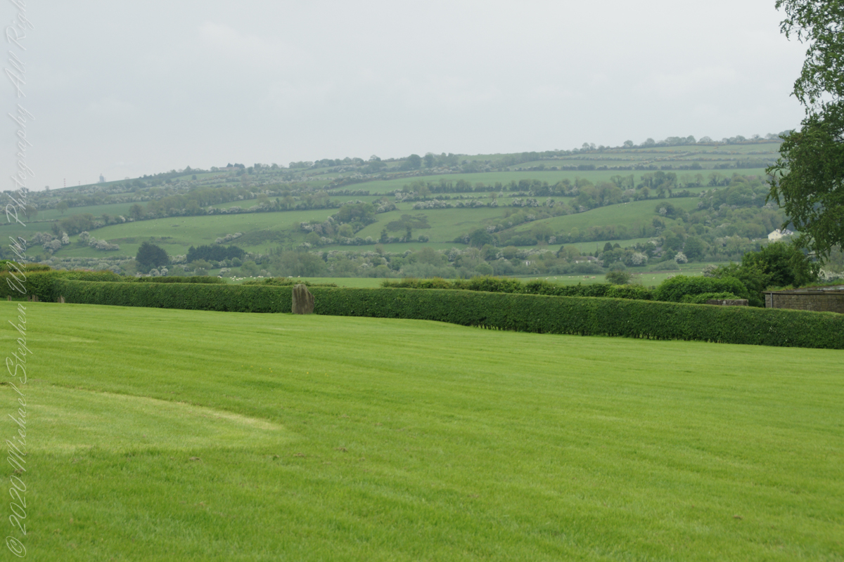
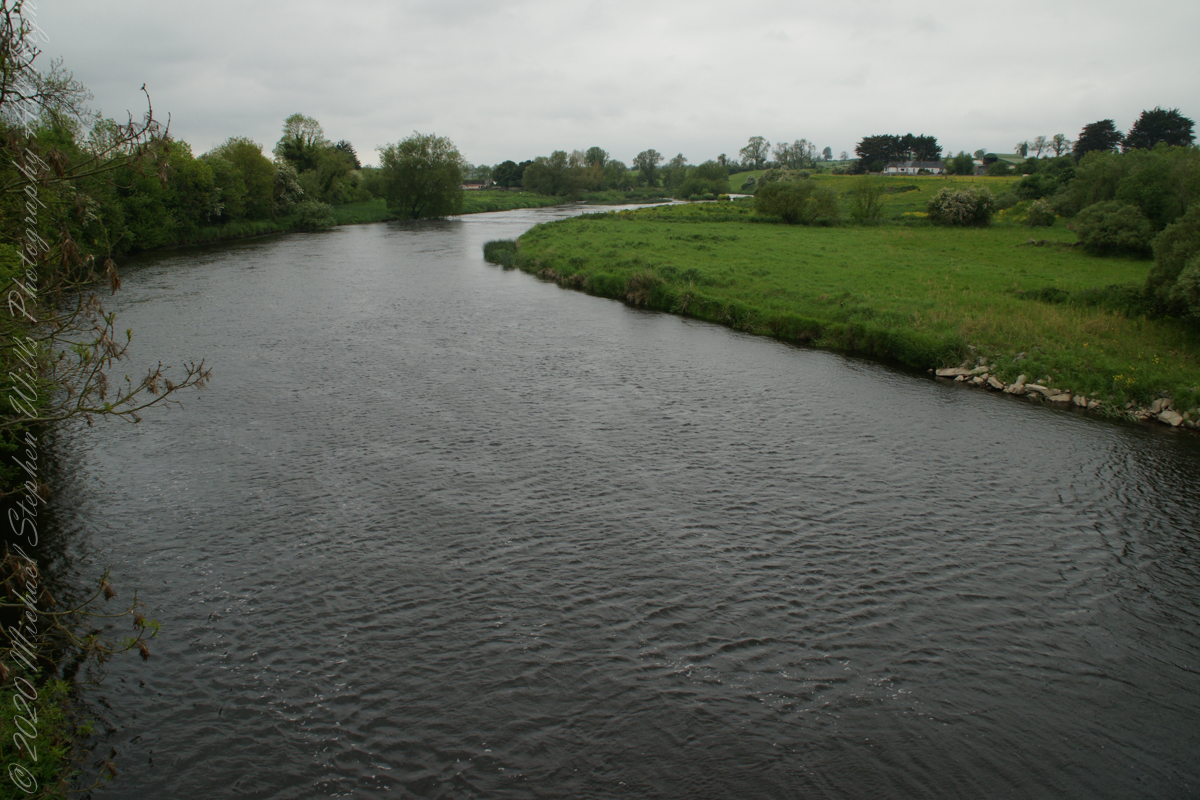
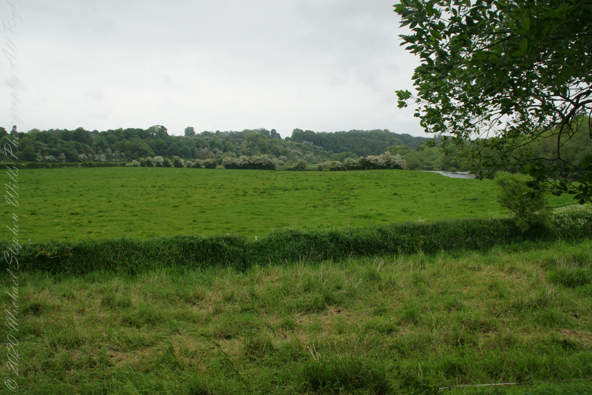
Walking on the south bank of River Boyne we first glimpsed Newgrange on the hill above.
Bounded on the south by a bend in the River Boyne, the prehistoric site of Brú na Bóinne is dominated by the three great burial mounds of Knowth, Newgrange and Dowth. Surrounded by about forty satellite passage graves, they constitute a funerary landscape recognized as having great ritual significance, subsequently attracting later monuments of the Iron Age, early Christian and medieval periods.
Newgrange was built by Stone Age farmers, the mound is 85m (279ft) in diameter and 13m (43ft) high, an area of about 1 acre. Newgrange was constructed about 5,200 years ago (3,200 B.C.) which makes it older than Stonehenge and the Great Pyramids of Giza.
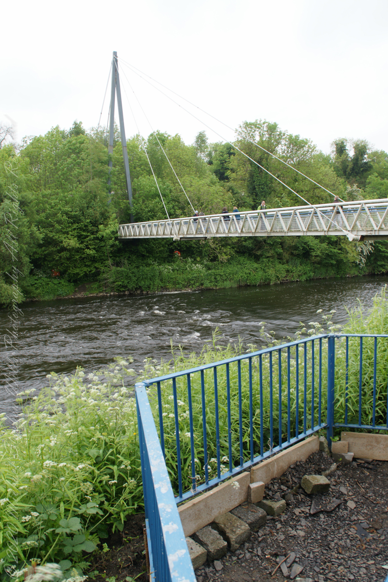
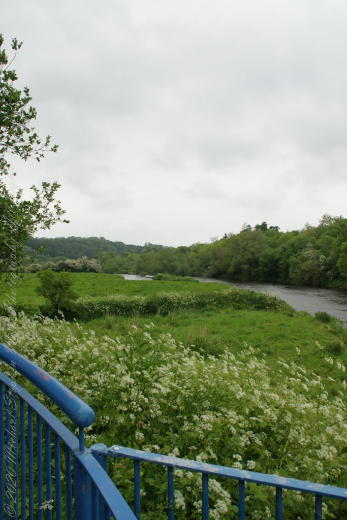
A overlook in Brú na Bóinne Visitor Center provides a view of River Boyne from the south bank. Here we are looking west.
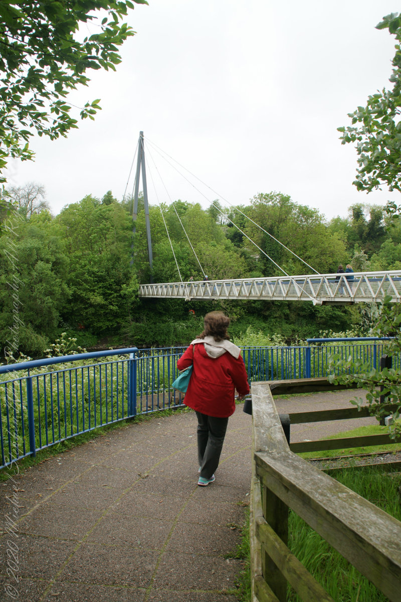
Footbridge over River Boyne
We are on the south bank.
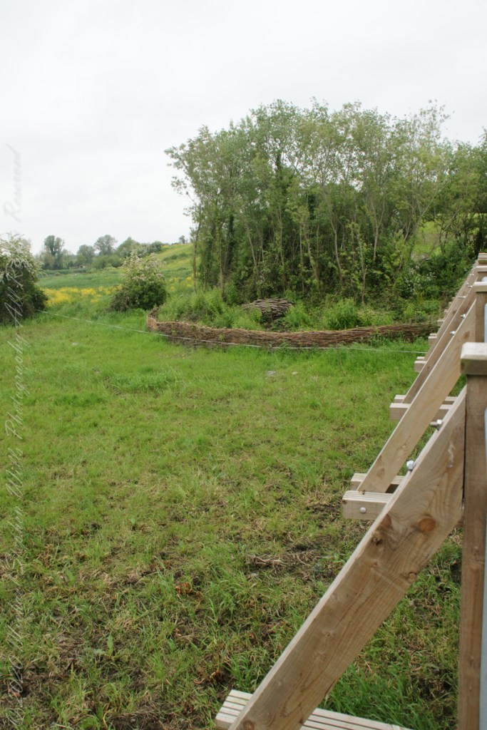
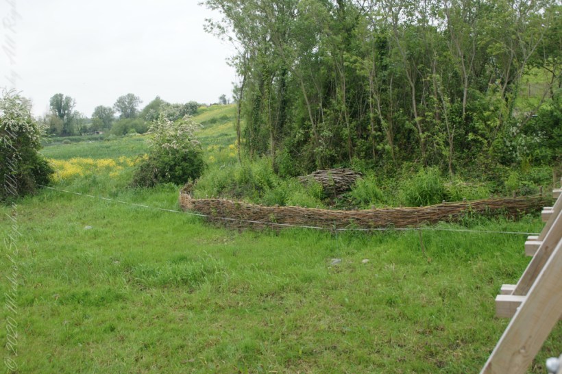
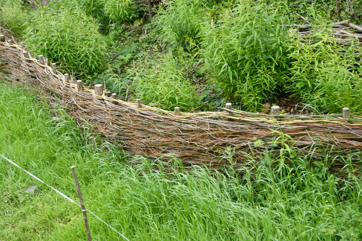
Queen Ann’s Lace on the south bank of River BoyneOh my gosh!! A wattle fence, an ancient technique.
Wattle is made by weaving flexible branches around upright stakes to form a woven lattice. The wattle may be made into an individual panel, commonly called a hurdle, or it may be formed into a continuous fence. Wattles also form the basic structure for wattle and daub wall construction, where wattling is daubed with a plaster-like substance to make a weather-resistant wall.
Copyright 2023 Michael Stephen Wills All Rights Reserved