Killeany Bouy

a dangerous channel

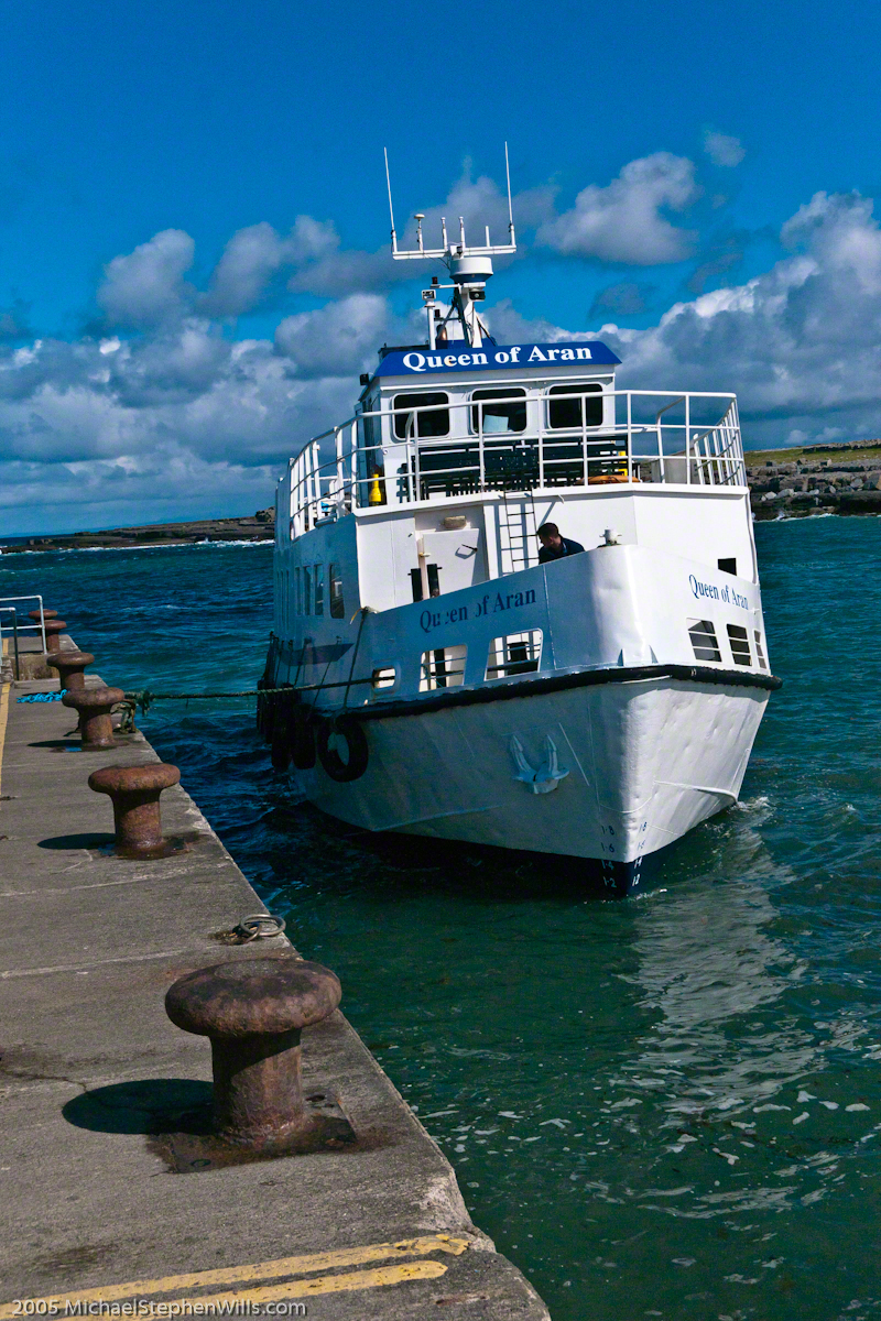
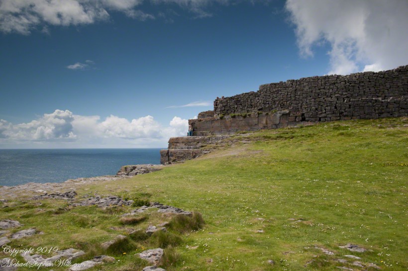
The approach to Killeany Bay of the Aran Island Inishmore is very dangerous, guarded by a Lighthouse on Straw Island to the South and the Killeany buoy to the North.

Click the link for my Getty IStock photography of the Aran Islands
KilleanyBouyINishmore2014-8

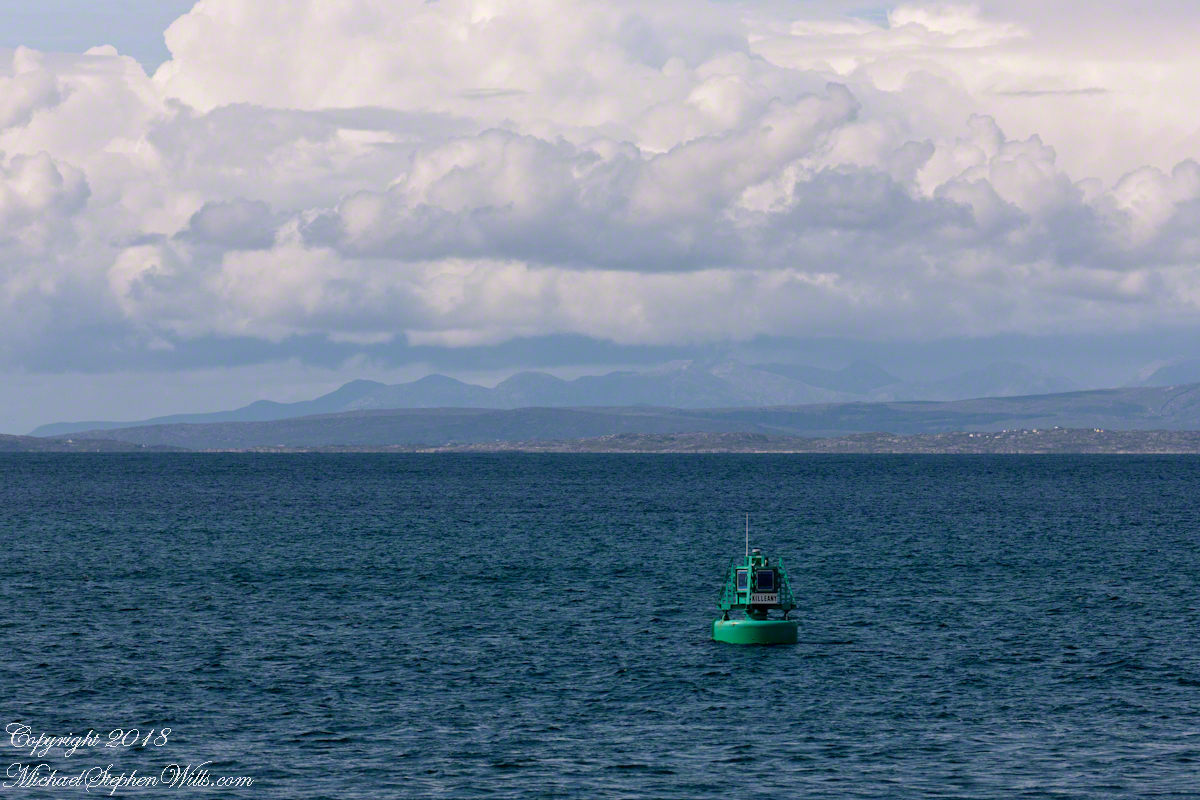
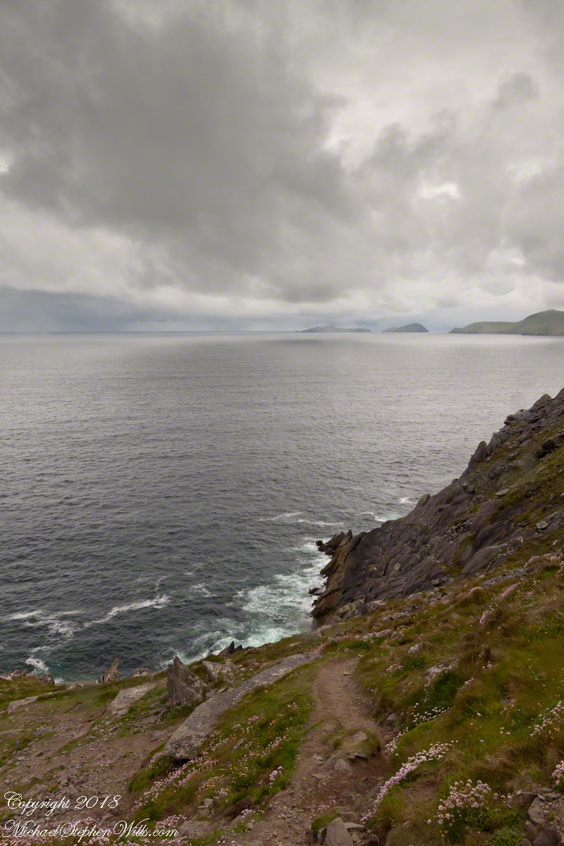
This view is to the north, northwest from a ferry en route to Inishmaan through Galway Bay.  In the distance is the Connemara and the 12 Bens (12 Pins) mountains. Aran Islands, County Galway, Ireland.

There of stories of this buoy coming unmoored.  October 27th 2012 it went adrift.  An Aran fisherman, Micheál Seóighe (Ml Joyce) and his boat Naomh Beanán tracked  it down, hauled it back to the harbor.  The buoy was back in service shortly after.

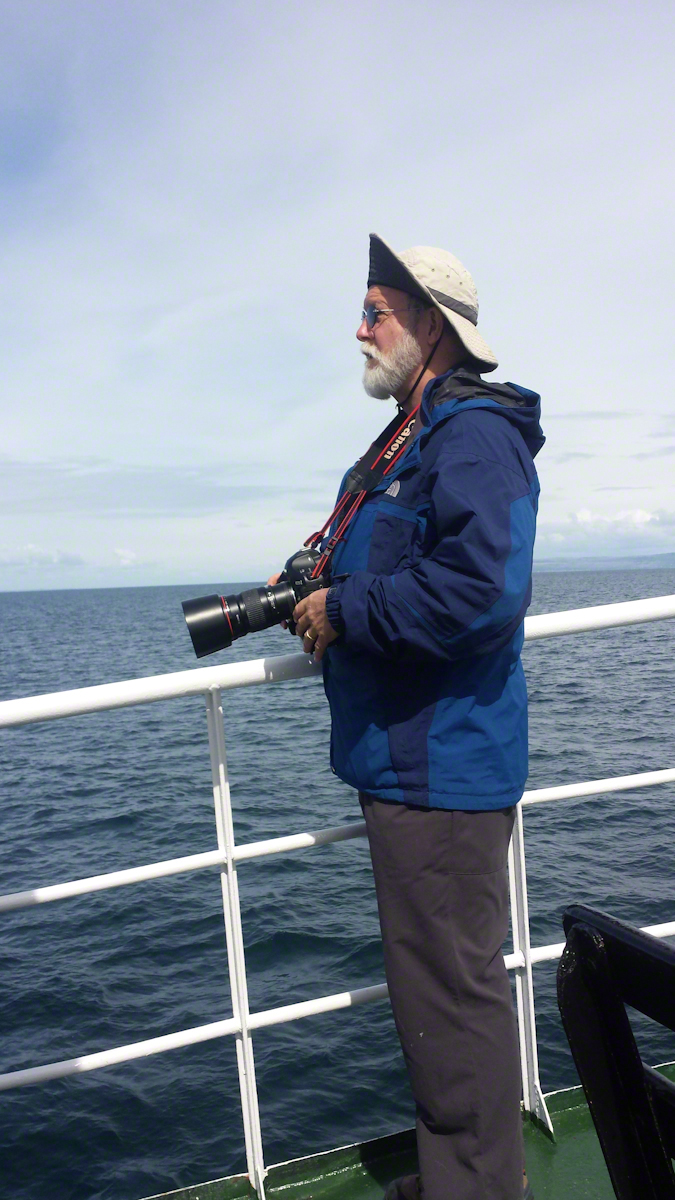
Here is a photograph of me with the camera used.  It is a Canon EOS 1Ds Mark III with a Canon lens 200 mm f2.8/L.  I am standing on the deck of the Queen of Aran ferry out of Doolin next to the Cliffs of Mohr.

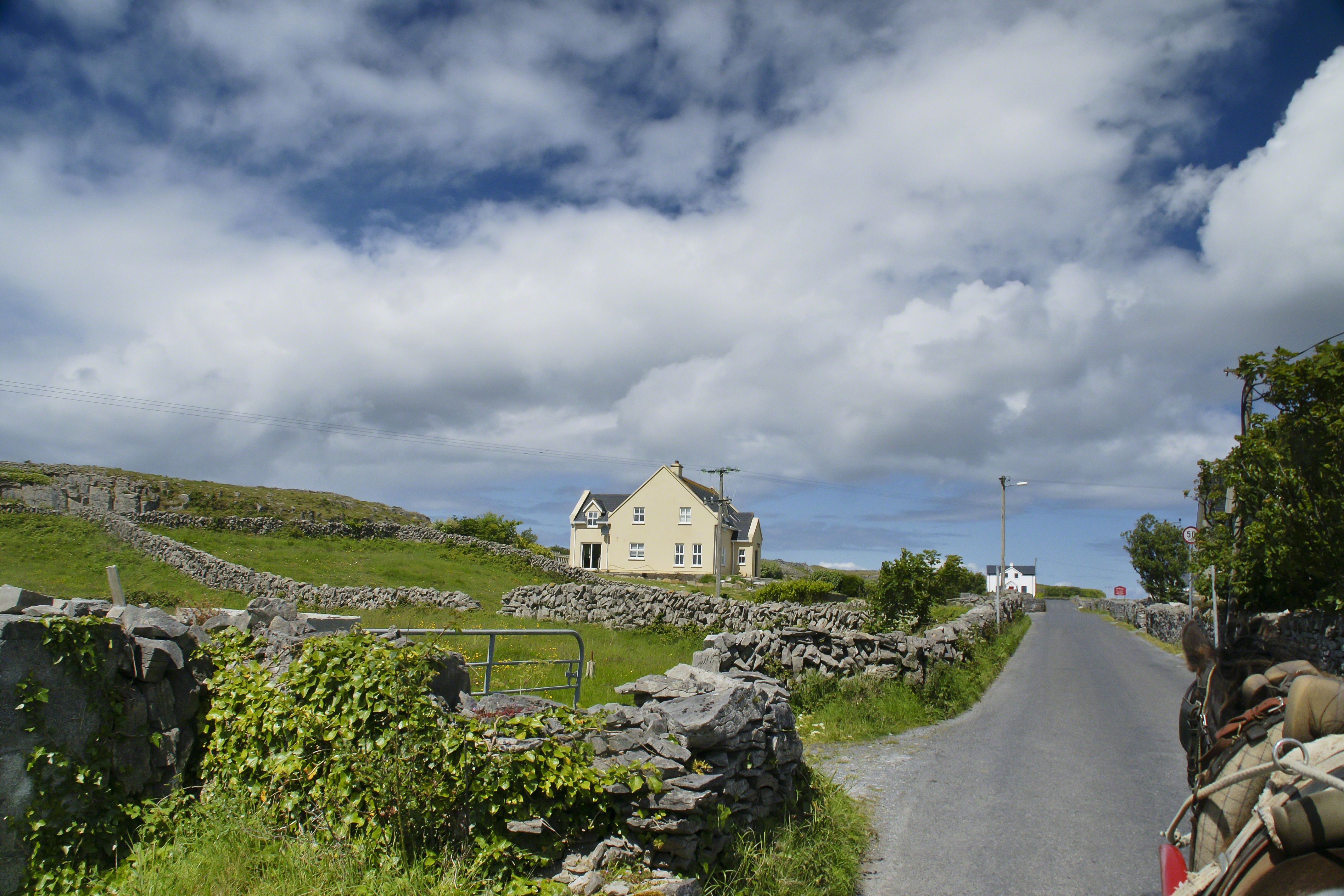
Pam Wills took this photograph with her Samsung Galaxy 4 smart phone.

WillsMichaelGalwayBay2014
Click the link for my Getty IStock photography of the Aran Islands
SONY DSC
Copyright 2022 All Rights Reserved Michael Stephen Wills

Blasket Islands with Clouds

a road like no other

On the Dingle Peninsula, County Kerry, Ireland photograph taken from Slea Head Drive (R559), looking west down the cliff toward the North Atlantic Ocean breaking on the rocks. In the distance, Slea Head and the Blasket Islands. In the forground, the wildflower of Red Clover (Scientific Name: Trifolium pretense) (Irish Name: Seamair dhearg).

Click the links for my offerings on Getty Istock.

Blasket Islands with Clouds I

Blasket Islands with Clouds II

BlasketsFromSleaHead2014-1

Headed Up Cottage Road, Inishmore

View from a horse trap on the Aran Islands, Galway Bay, Ireland

Enjoying travel on a horse trap, a type of carriage, on Inishmore (Inis Mór), the largest Aran Island in Galway Bay we headed up Cottage Road from Kilronan, the main island settlement.  It was there we embarked from the ferry, hired the driver, his horse drawn trap.  Our destination an iron age fort, Dun Aengus (Dún Aonghasa, the Irish language name) and the sights along the way. 

Headed up Cottage Road, I captured this view of dry stone walls and homes against the May sky over the shoulder of our horse.

Click the link for my Getty IStock photography of the Aran Islands
Headed up Cottage Road

Copyright 2019 All Rights Reserved Michael Stephen Wills

Copyright 2021 Michael Stephen Wills All Rights Reserved

Horse Trap on Inishmore

Travel at its best

Enjoying travel on a horse trap, a type of carriage, on Inishmore (Inis Mór), the largest Aran Island in Galway Bay.

Click the link for my Getty IStock photography of the Aran Islands
View from Horse Drawn Trap on Cottage Road headed into Kilronan

Copyright 2019 All Rights Reserved Michael Stephen Wills

Galway Bay View from Dún Aonghasa

a season of wildflowers across a karst landscape

Another aspect of the gradual 1/2 mile inclined path to the central ring of the prehistoric Dun Aonghasa ruins of County Galway, Ireland.

The view north, northwest from this way to Dun Aonghasa (Dun Aengus).  In early June, looking across wildflowers, karst landscape, walled fields, farms, the North Atlantic Ocean, coast of Connemara and the 12 Bens (12 Pins) mountains. 

Note the doorway (with long lintel) in the surrounding wall, to left of center in middle distance.

Click the photograph for a larger view.

Click the link for my Getty IStock photography of the Aran Islands
Click me for the first post of this series, “Horse Trap on Inishmore.”

References: search wikipedia “Dún Aonghasa.”

Copyright 2021 Michael Stephen Wills All Rights Reserved

Where a fort falls away

An abrupt emptiness

Here is the east side of the inner enclosure wall of Dun Aonghasa (Dun Aengus) where it ends at a cliff edge over the Atlantic ocean.

Visible are the last 60 feet or so of the limestone strata supporting the inner ring.

When first constructed, the inner ring was complete, the western side 1,000 feet from the cliff.. Today’s form of a semi-circle was created by nature when the force of Atlantic Ocean waves eroded the cliff, undercutting the strata.

Look close to see a fracture where the next block of limestone will fall into the waves.

Wishing a blessed All Saints Day (November 1st) for all my readers.

Click me for the first post of this series, “Horse Trap on Inishmore.”

Reference: wikipedia Dún Aonghasa, Sea Campion

Copyright 2019 Michael Stephen Wills All Rights Reserved