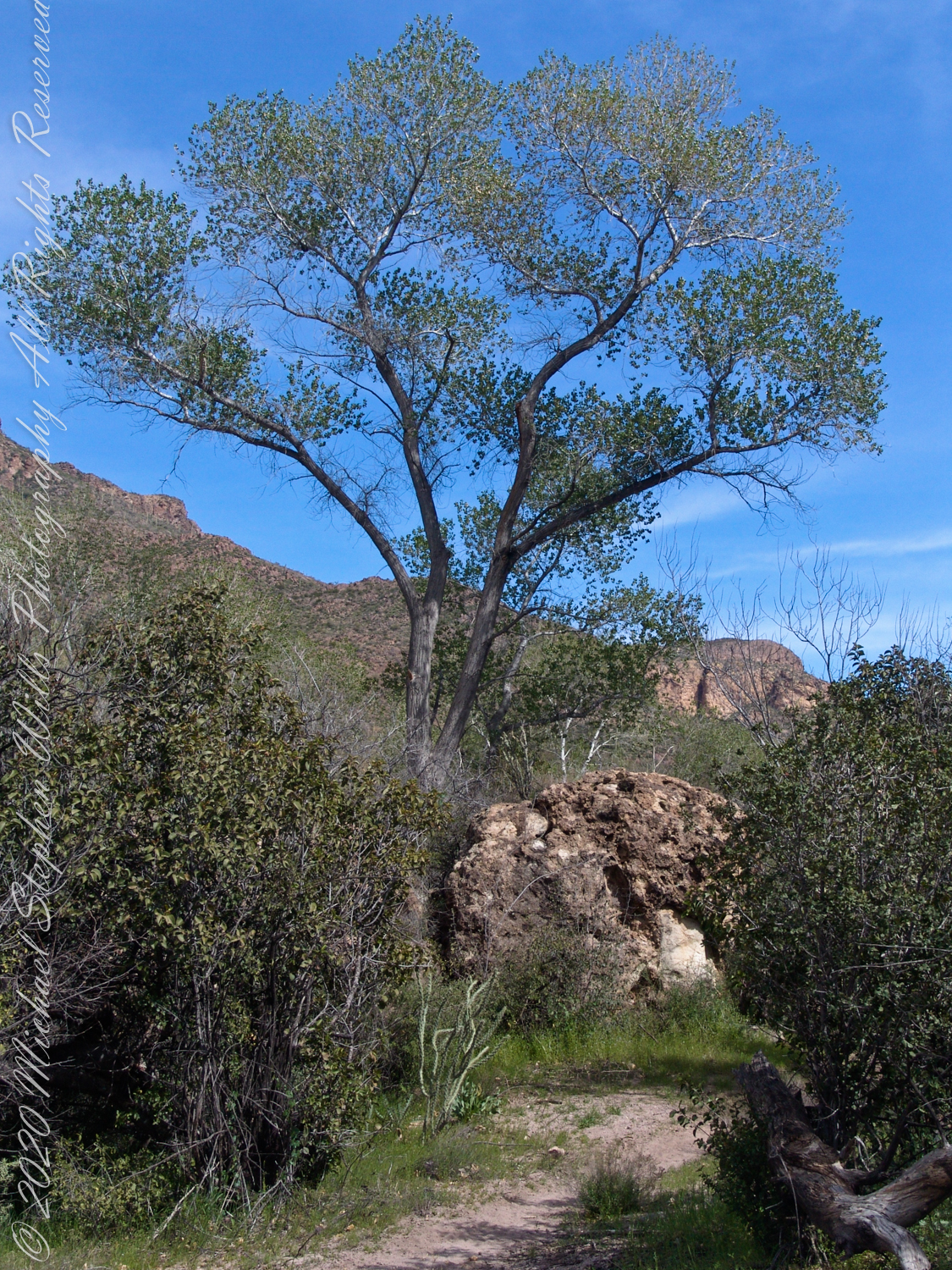
A view to west on Dutchman Trail between Bluff Spring Mountain and Peter’s Mesa. The creek flowing from Charlebois, Music Mountain and LaBarge springs nourishes this Fremont’s Cottonwood (Populus fremontii) and other riparian flora. The tree is flanked by volcanic rock from an ancient eruption.
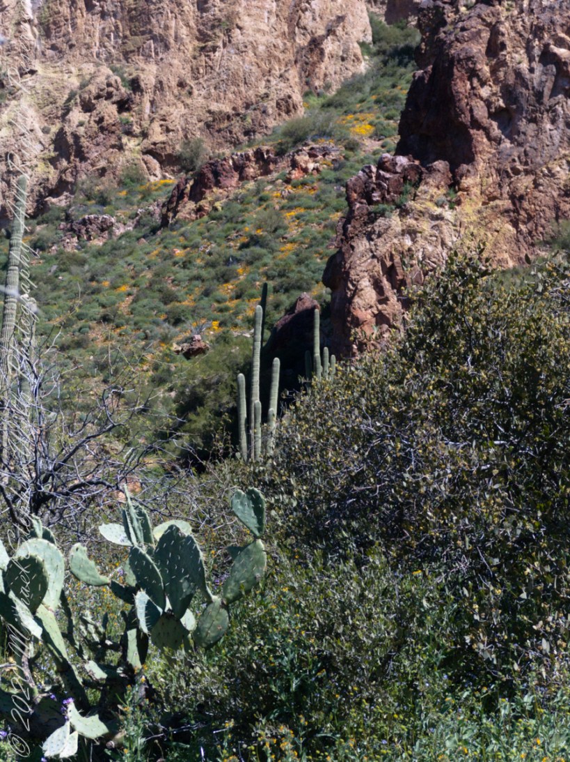
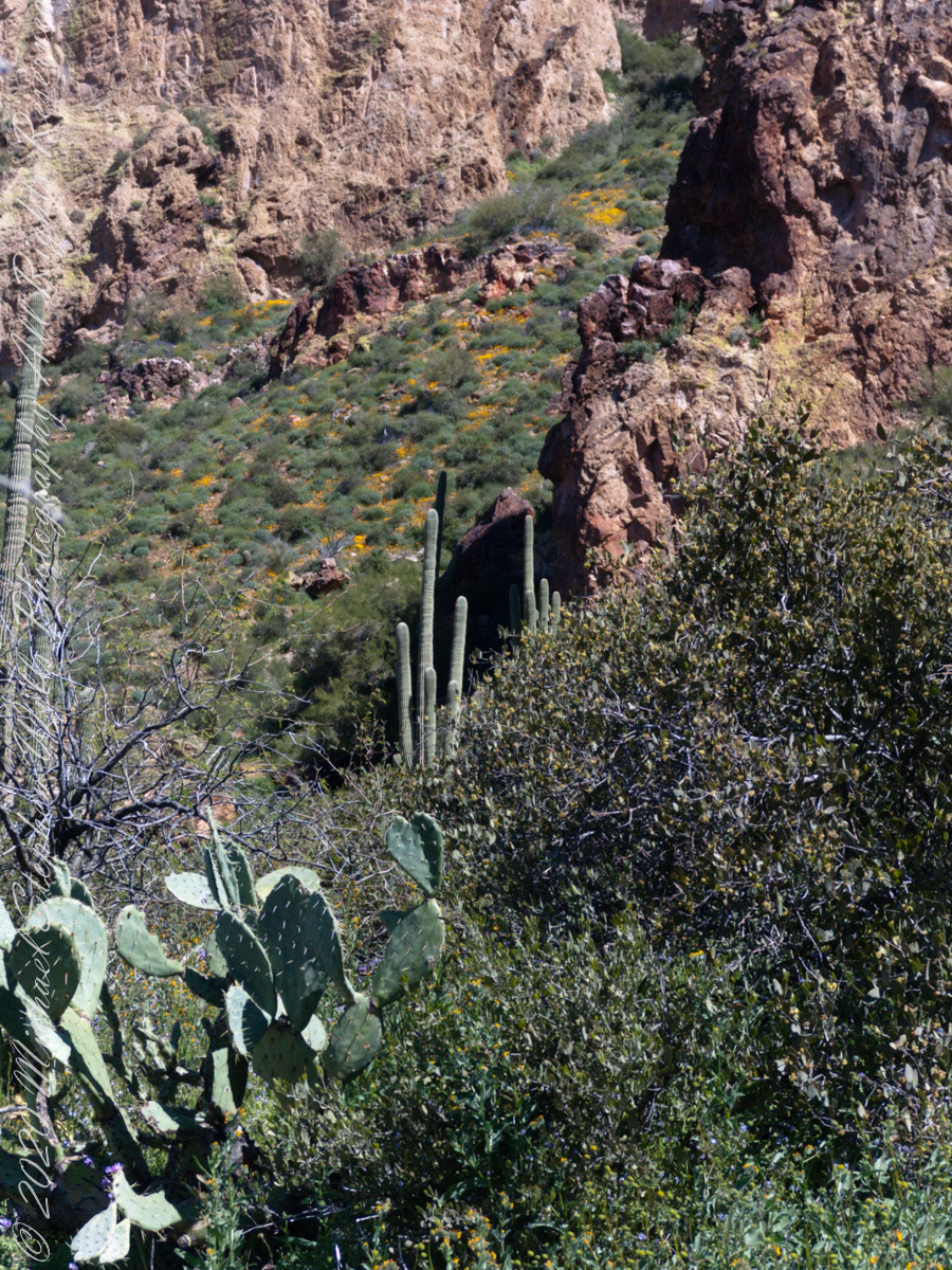
Lost gold mine legends tell of Saguaros bearing secret markings leading to the hidden location of rich gold mines. This specimen, perched on an ancient volcanic boulder, lives in LaBarge Canyon along the Dutchman trail.
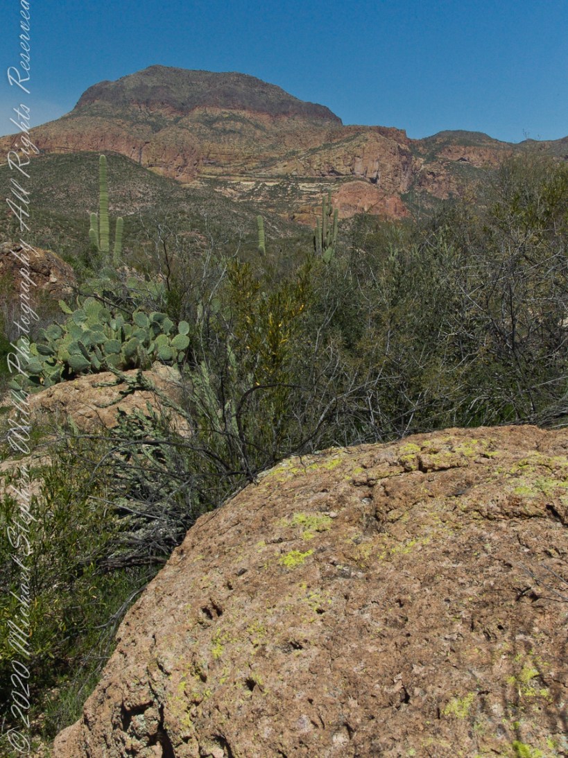
This view from Dutchman Trail was taken on the red line trail (below) between Black Top Mesa (out of view, on left) and Bluff Springs Mountain (right), on the approach to White Rock Spring and LaBarge canyon (the large canyon at the north end (left) of the red line.
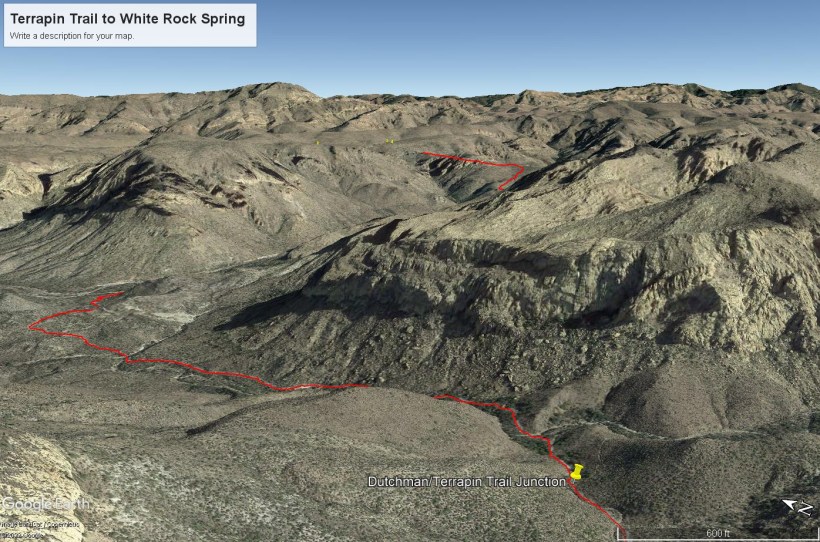
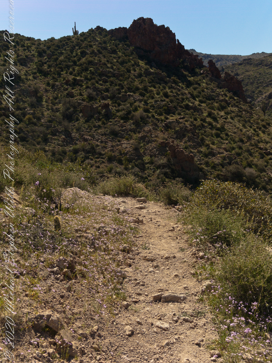
Terrapin Trail to White Rock Spring on Dutchman Trail
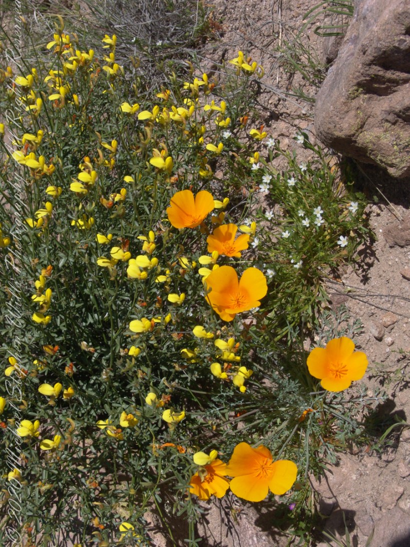
Those cliffs above the Dutchman Trail (in red from the push pin “Dutchman Terrapin Trail Junction”) climb 670 feet in 0.2 mile. Fifteen minutes after starting I stopped to photograph a group of wildflowers.
Terrapin Trail to White Rock Spring on Dutchman Trail
The bright yellow flowers on right are a member of the pea (Fabaceae) family named Wright’s Deervetch (Acmispon wrightii) I am able to pick it out from many similar flowers due to the characteristic narrow leaves with small hairs. These start out yellow, turning to red with age eventually forming brown seed pods. Mexican Poppy (Eschscholtzia californica) to the right.
The small white flowers are Chickweed (Minuartia macrantha) of the family Carnation (Caryophyllaceae).
Here is the topographic map with Terrapin Trail (yellow) meeting Dutchman Trail (orange) to the right of Upper Black Top Mesa Pass, bottom center
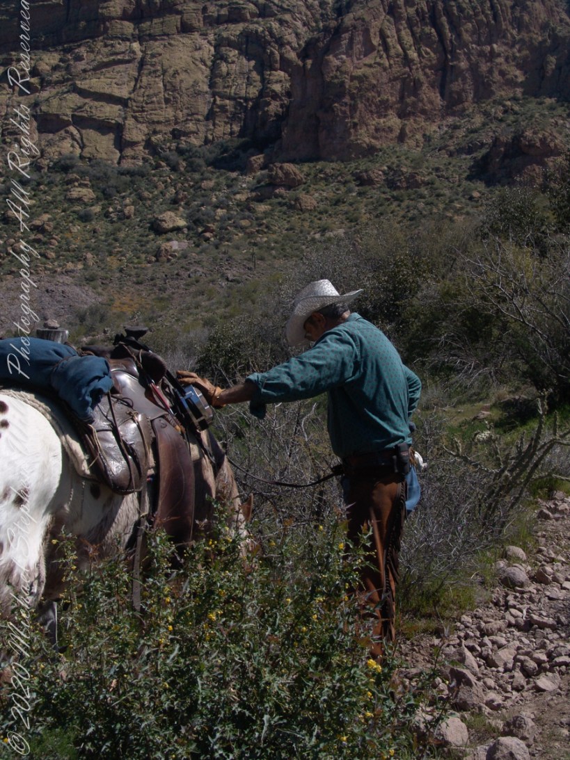
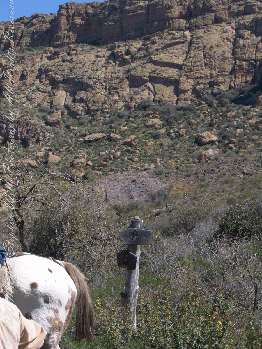
The beetling cliffs off Bluff Spring Mountain loom over where Terrapin and Dutchman trails meet. Patches of yellow are Mexican Poppies blooming on the talus slope. Terrapin Trail climbs the ridge, to right. Here is where I caught up with mounted expedition members, the spotted rump of an Appaloosa figures prominently next to the signpost.
Terrapin Trail almost immediately starts a climb up to an eponymous pass between Bluff Springs Mountain and Weavers Needle. From here, it is the best way into the mountain. The trail name is a misnomer, as terrapin (Malaclemys terrapin) turtle habitat is near the ocean. There is a desert tortoise (Gopherus agassizii) you might encounter during the rainy season as they are otherwise inactive.
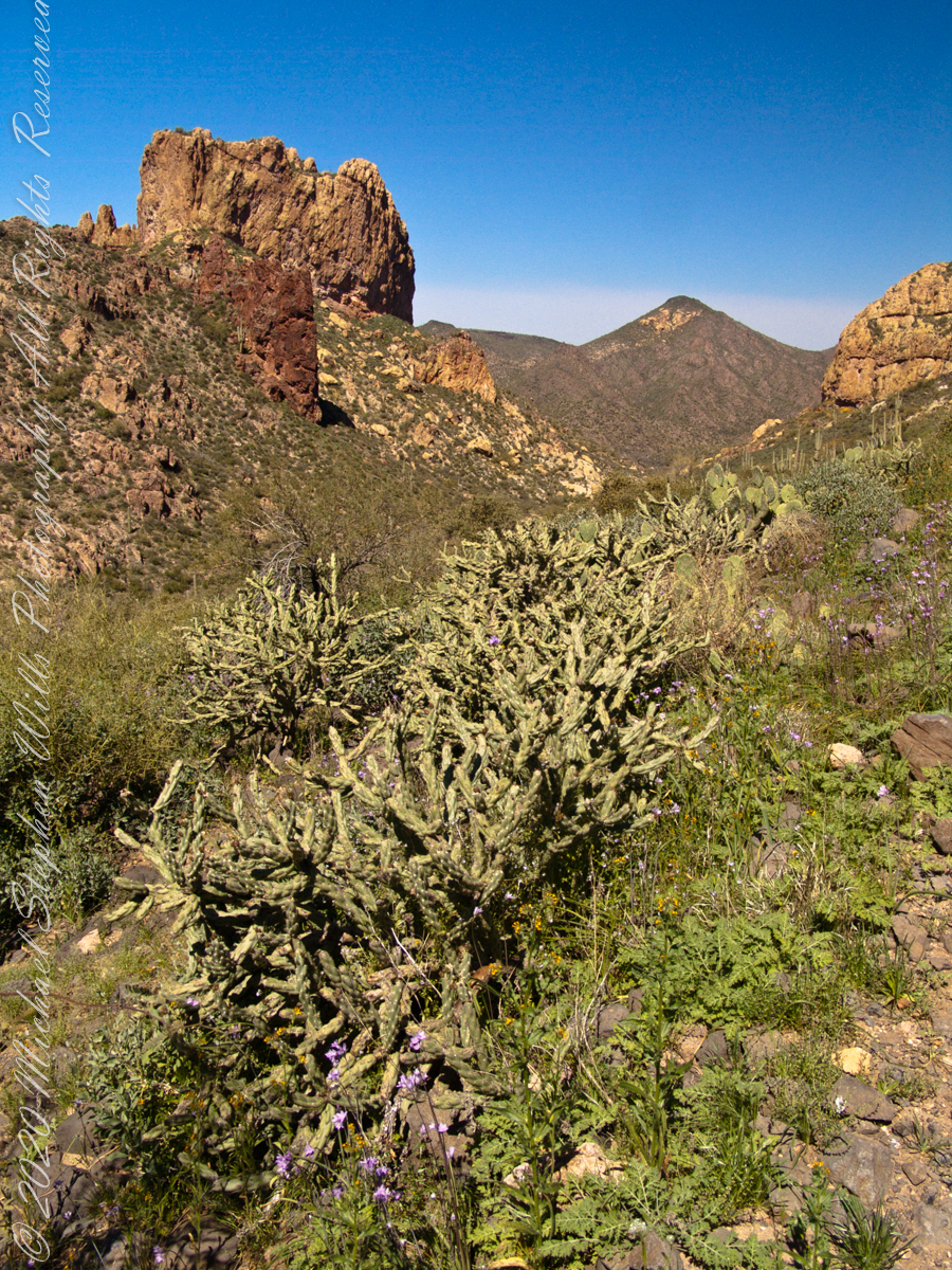
As we descended Upper Black Top Mesa Pass into Bluff Spring Mountain canyon we found, foreground, Palo Verde and brittle bush, and, midground, Saguaro. The presence of Palo Verde reveals water flows through this area intermittently though not enough to sustain a large tree. Palo Verde is in the pea family (Fabaceae), as evidenced by production of seeds in pods.
Calling it “Buff Mountain” some say the mountain is named for these buff-colored cliffs. Others, calling it “Bluff Spring Mountain” name it for the cliffs and the spring within a canyon on top.
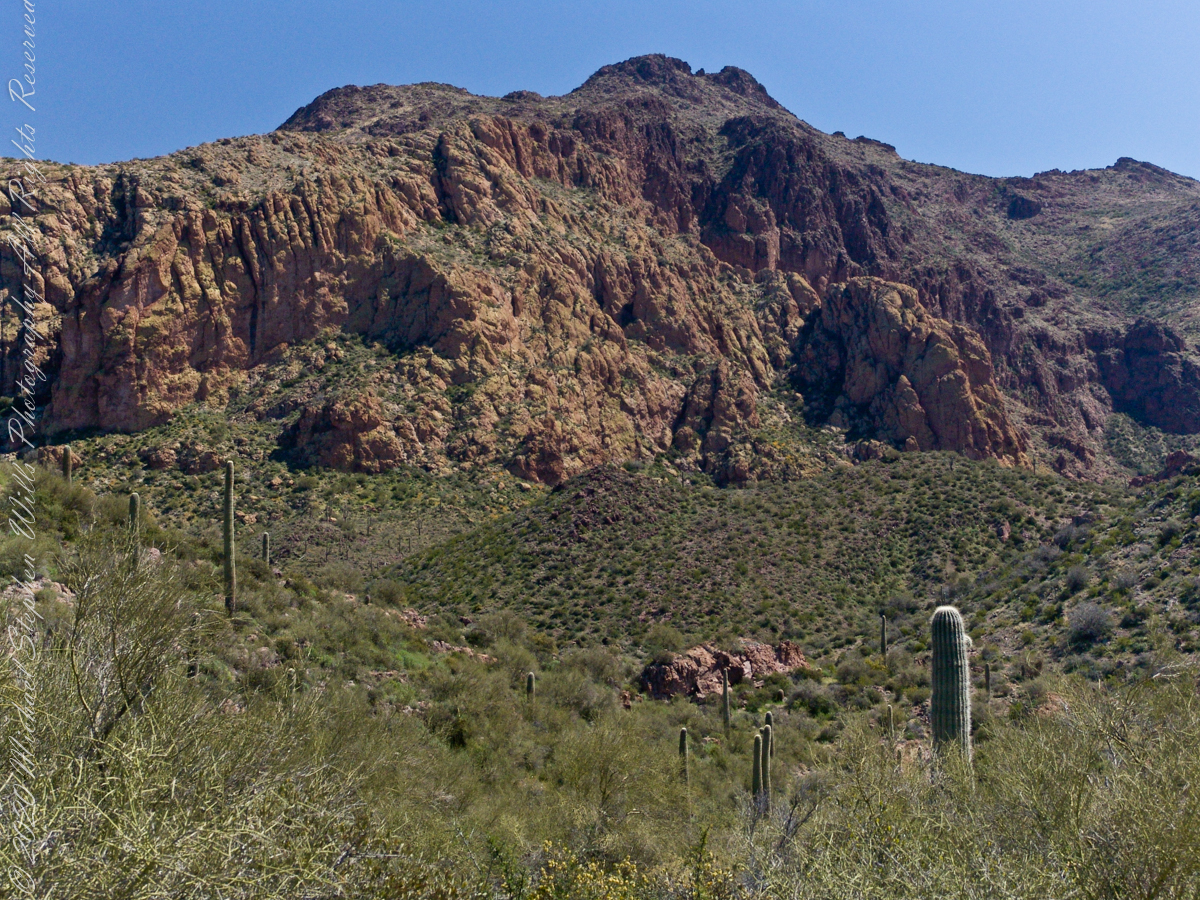
Bluff Spring Mountain from the slopes of Black Top Mesa
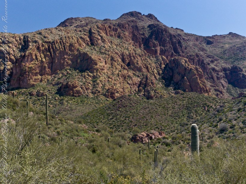
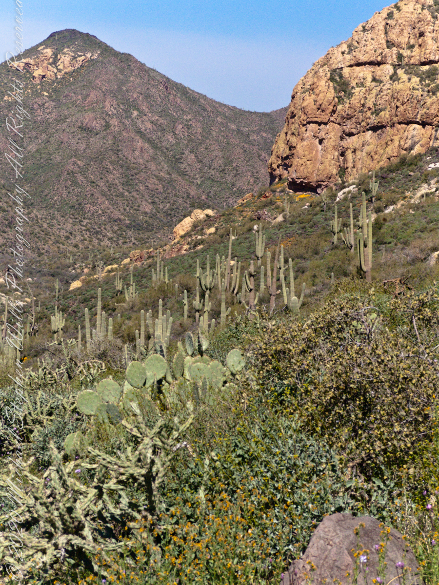
Closer to the junction with Terrapin Trail this Bluff Spring Mountain ridge rose above us. A fine specimen of mature Saguaro cactus is in midground.
Our second day began in East Boulder Canyon, in the following map it is at the foot of the “Z” of the orange line, the Dutchman Trail, lower left center. The shape is the signature of a switchback needed to negotiate a steep slope up to Upper Black Top Mesa pass. This day will see us traverse Dutchman Trail to the intersection with Peter’s Trail (yellow), another steep climb up Peter’s Mesa.
A topographic map including Yellow Peak with Dutchman Trail in orange. Upper Black Top Mesa Pass lower center.
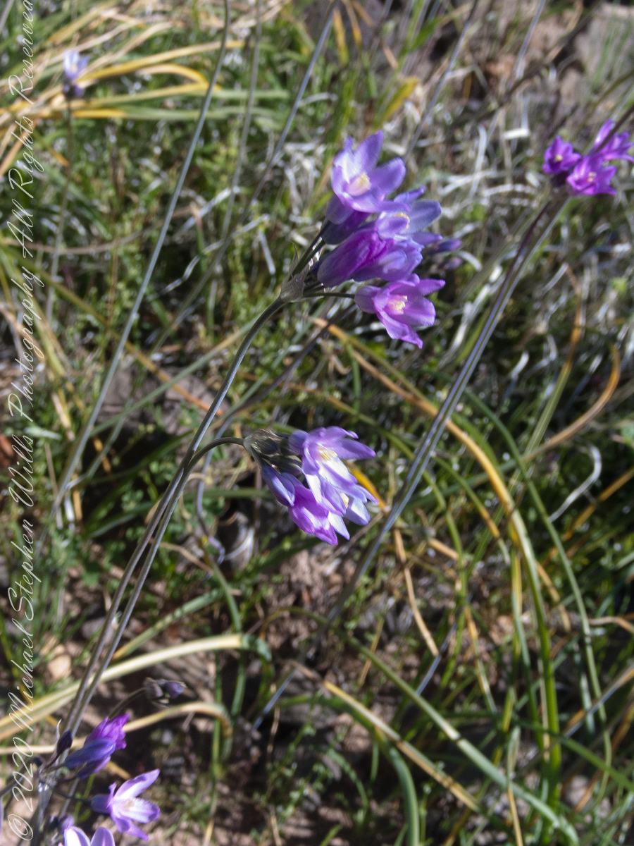
Today’s post features photographs of flourishing Sonoran Desert plants and landscape on the slopes of Black Top Mesa. Dipterostemon capitatus known by the common names blue dicks, purplehead and brodiaea is native to the Western United States (particularly Arizona, California, Oregon, Utah, New Mexico and northwest Mexico.
Dutchman Trail above East Boulder Canyon, Palamino Mountain left, Yellow Peak in distance. We are on the side of Black Top Mesa.
Here I used the “zoom” for a better view of distant Yellow Peak. In foreground is Brittlebush (Encelia farinosa) and Blue Dick. In the distance Saguaro Cactus. Below the cliff of Black Top Mesa, above East Boulder Canyon, is a patch of yellow, Mexican Poppy (Eschscholtzia californica).
Slope of Black Top Mesa above East Boulder Canyon with the distant Yellow Peak.
Here is camera, set to zoom, is swung toward the mesa cliffs. Prickly Pear and Brittlebush growing along the Upper Black Top Mesa Pass trail. I have not identified the shaggy shrub above the Brittlebush. In the distance Saguaro Cactus (Carnegiea gigantean) flourishes. Below the cliff are patches of “gold dust”, the Mexican Poppy.
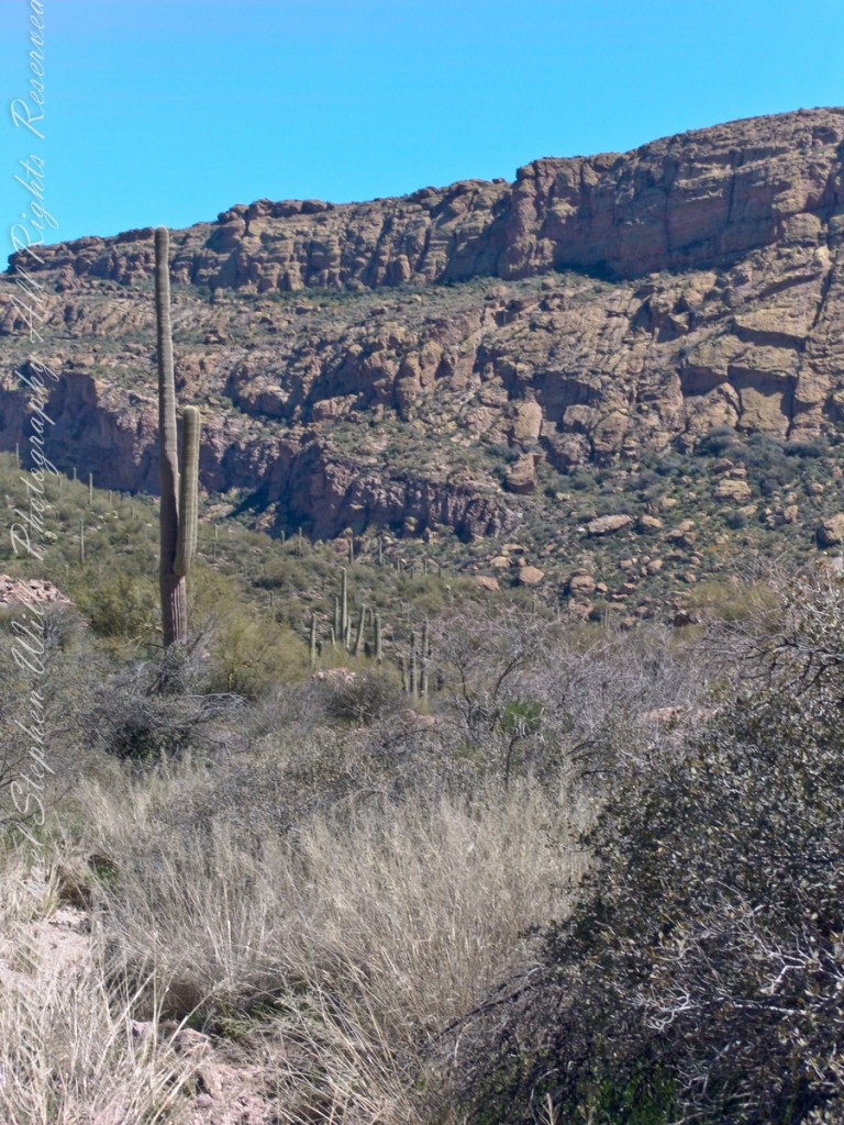
PCliffs of Black Top Mesa
Heading southeast climbing out of East Boulder Canyon with a very young Saguaro Cactus (Carnegiea gigantean) just off trail on left, a large specimen silhouetted on ridge ahead. Windmill Pink (AKA Common Catchfly) (Silene gallica) foreground, lower left. Brittlebush (Encelia farinosa) on both sides.
Upper Black Top Mesa Pass
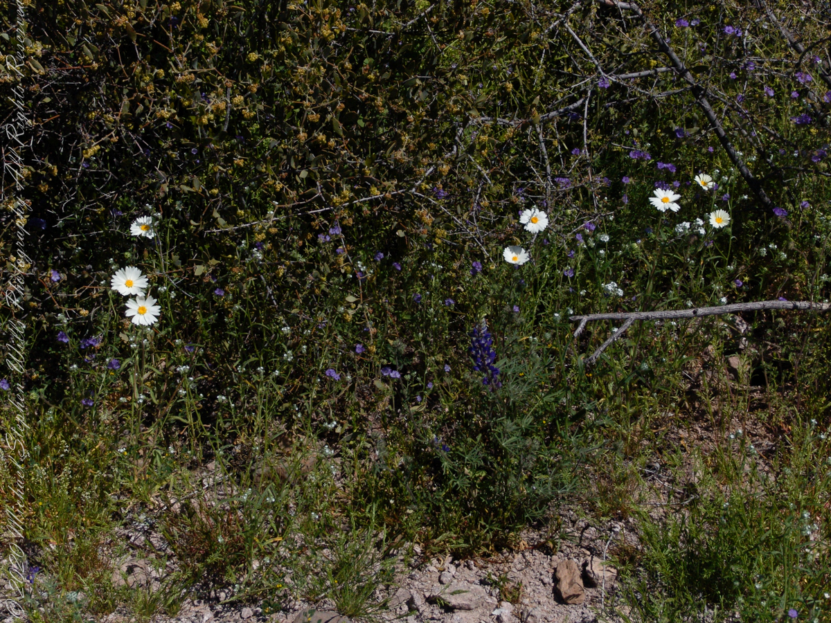
This post ends as it began, with wildflowers growing next to the trailon a March morning. Blue Dicks (AKA Purplehead) (Dipterostemon capitatus), Tidy Tips (Layia) — daisy like flower, Brittlebush flowers are yellow when not dried. The larger small white flowers are Desert Phlox (Phlox austromontana) — I have not identified the tiny white flowers sprinkled around.
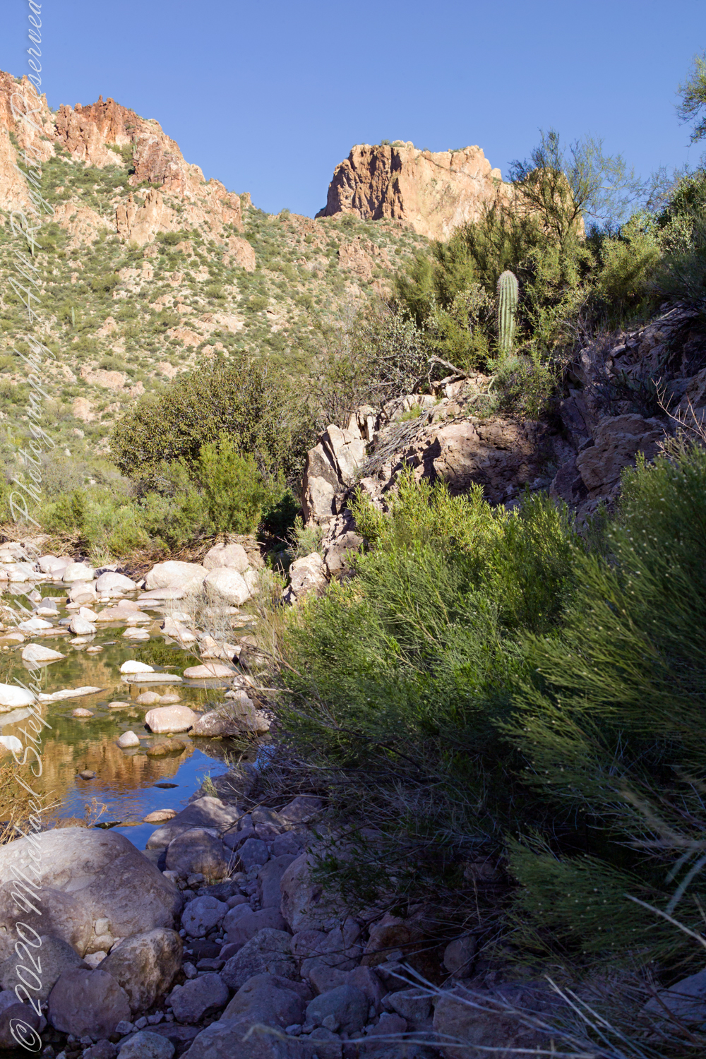
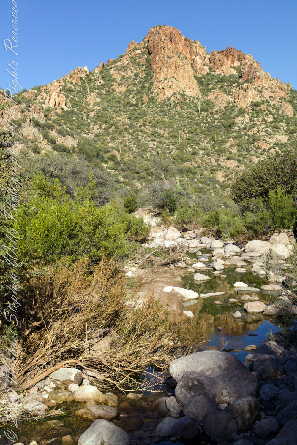
Our camp for the first night was East Boulder Canyon, between Black Top Mesa and Palamino mountain. On the topographic map, below. the bright orange line is Dutchman Trail. We are at the lower center, at the foot of the “Z” in trail, a switchback over Black Top Mesa pass we’ll traverse the next day.
A topographic map including Yellow Peak with Dutchman Trail in orange. Upper Black Top Mesa Pass lower center.
The map locates Yellow Peak, where the four Utah treasure hunters lost their lives Summer 2010, at the upper center next to Black Mesa Trail. The peak is framed by Black Top Mesa and Palamino Mountain in views to the northwest from Boulder Canyon, as you will see in a later posting.
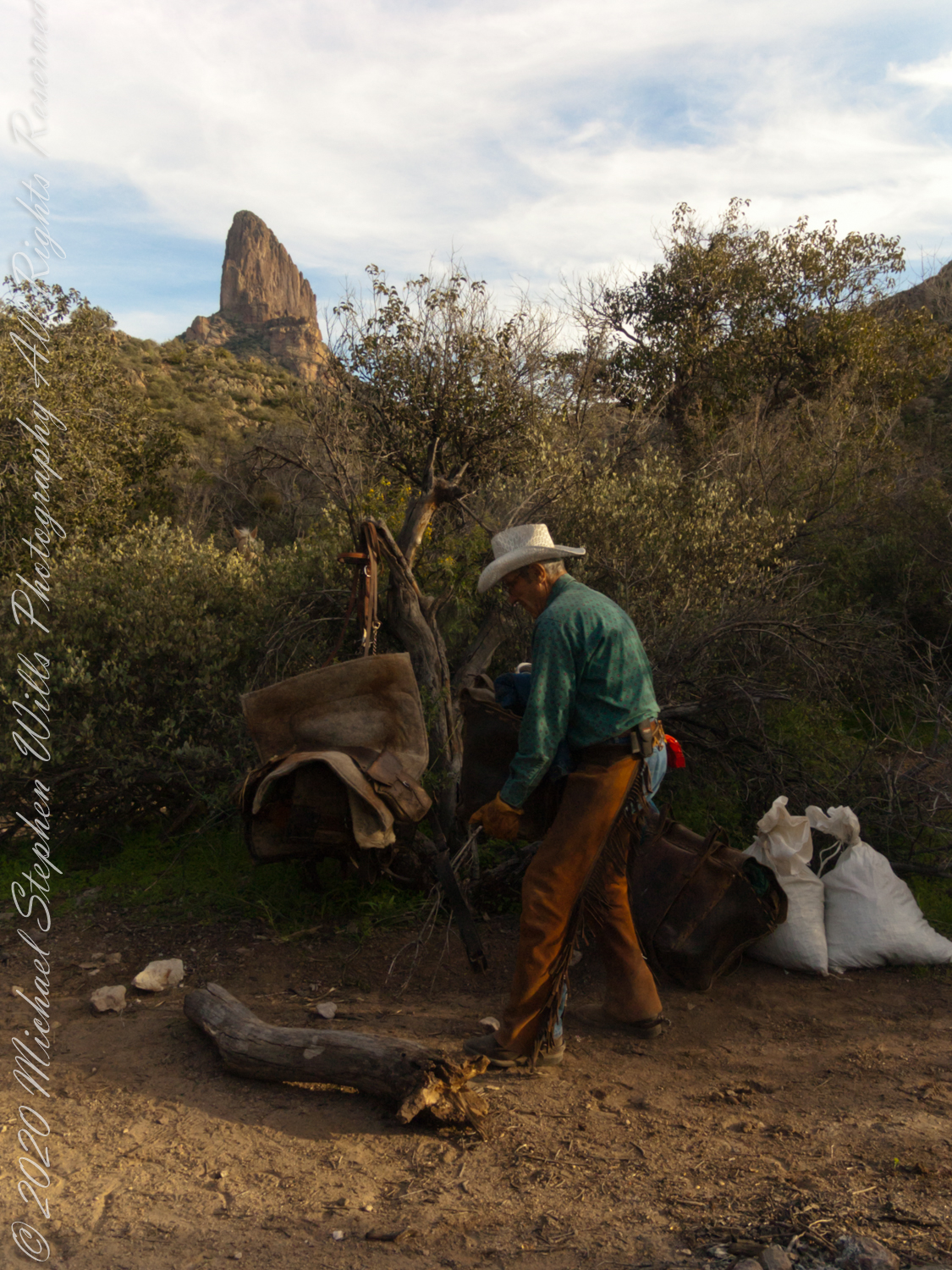
Our evening was a quiet one of camp chores, an enjoyable meal with homemade beef jerky, coffee and plenty of water to rehydrate. The horses chomped on grain from feed bags. They packed in the grain as grazing is not allowed in the wilderness. I gave each a treat of carrot and apple.
.
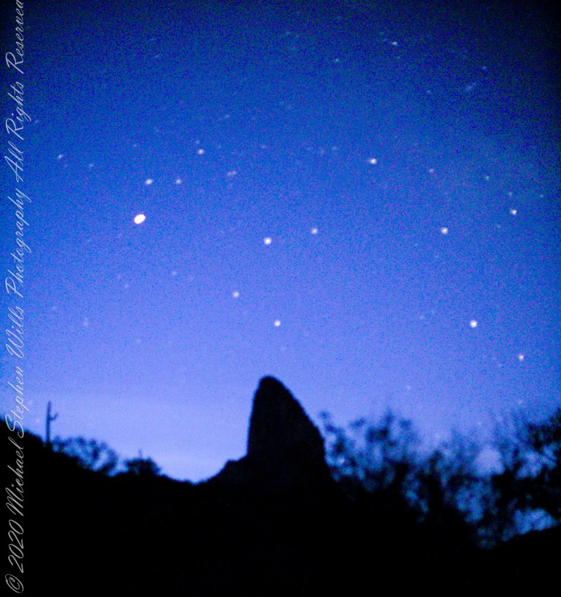
I was up well before dawn to capture the morning constellations over Weavers Needle: from the left, I believe I recognize Lyra with Vega accompanied by Epsilon Lyra, next the keystone of Hercules. The brightest object is Venus.
.
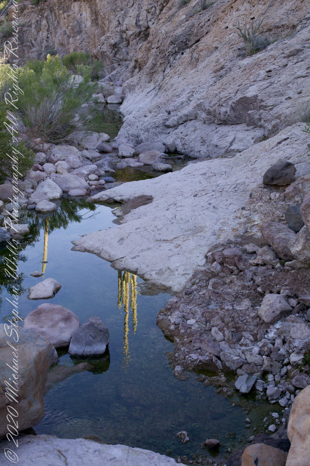
Taking a break from morning water gathering in East Boulder Canyon: saguaro cactuses reflected in a still pool, looking up to the northwest you can just about see the Peralta trail where it crosses a Palamino Mountain ridge. West/Northwest the Peralta trail crosses behind the same ridge.
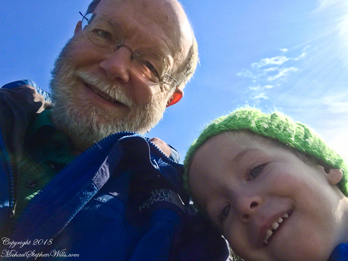
On a sunny autumn morning we set out, my soon to be three grandson Sam and I, to the Lime Hollow Nature Center near Cortland for an adventure. For the first time I brought a newly purchased iPhone 7 instead of the usual slr camera. The phone can be carried in a pocket and is simpler to us, to allow me to give full attention to Sam.
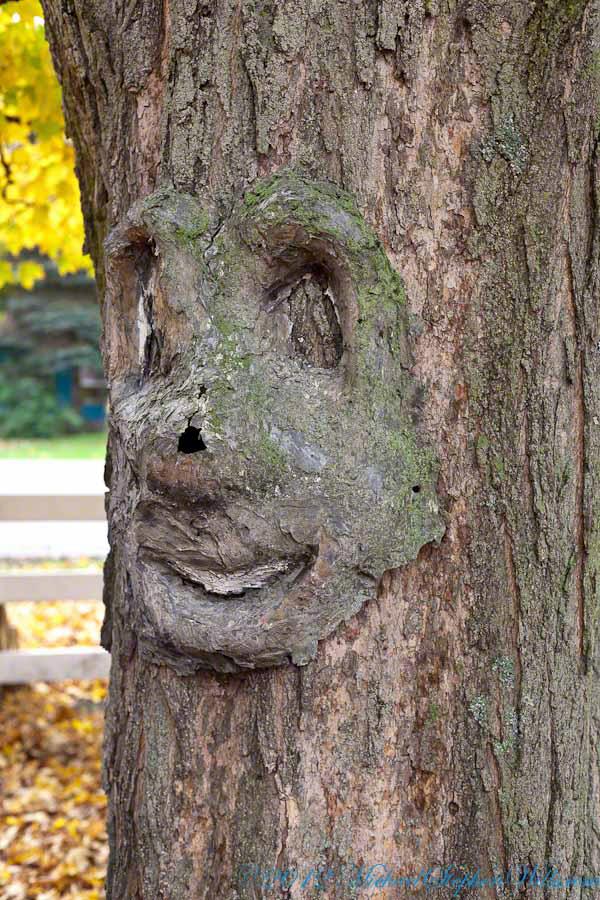
At the start is a large, today sunlit, field with an “art trail.” There are various anthropomorphic transformations on the trees and a very large sculpture of a blue face. Here is a tree from another place near here, to give you an idea.
I do not point out the tree faces to Sam. His Mom likes to say he enjoys being frightened and, when the blue face came into view, he turned back and said, “home.” Sam was mildly anxious, so I carried him and tried to turn him up the trail away from the face. He turned to keep an eye on it while I assured him it could not move. This and a climb up a 230 foot hill were the only times he didn’t walk the half mile to a open grassy knoll with a bench.
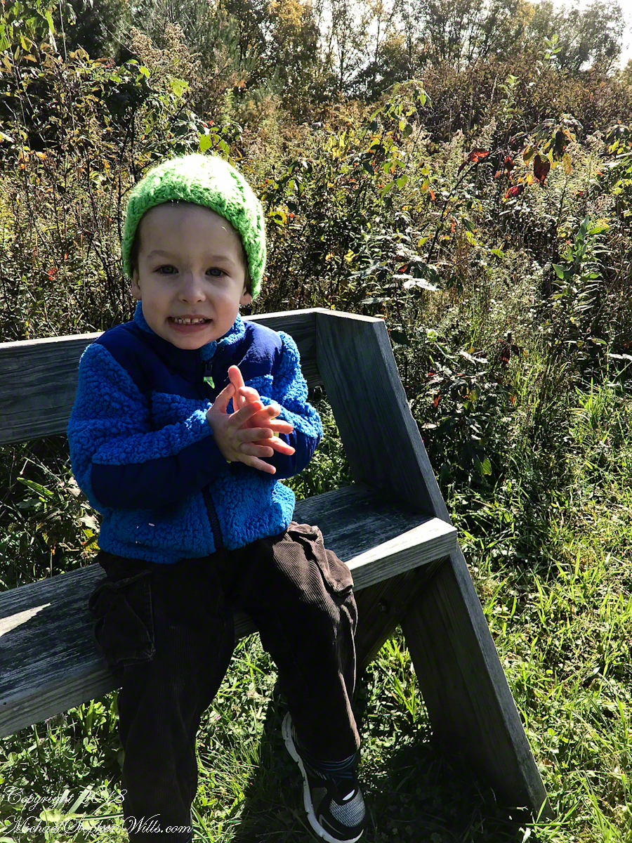
There we sat for 30 minutes, still and watching, Sam and I talked about our sightings: 1. The sunlit sky of clouds, from a milky blue towards the north to, overhead, a bright robins egg blue. 2. A circling hawk, shadow crossing over us. 3. One blue jay in a maple turning red, loudly calling over and over. 4. A little while after a second jay, landing in a tree turned yellow, drawn in and giving answer. 5. A monarch butterfly’s steady progress south. Such a strong gliding path. 6. A yellow butterfly who did not leave us, fluttering round and round. 7. Four honking Canadian geese flying north east, turned to check out a nearby pond, the returned to the original heading. 8. The sound of wind through the trees, listening to the sound made by each tree. 9. The late season golden rod, now dried gray. 10. A distant chittering red squirrel. 11. Distant peeper frogs in the swamps at the foot of the hill.
Sam did not want to leave the bench, eventually we headed on to the pond the geese checked out.
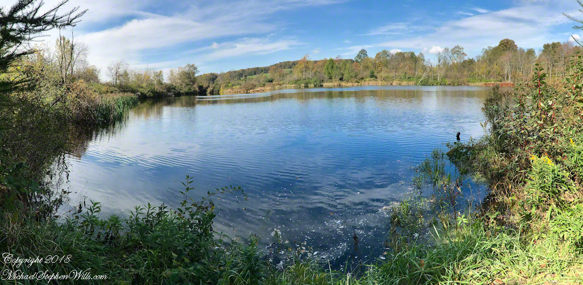
I used the “panoramic” feature of the iPhone 7 for this shot. On the hill we were sheltered by trees and bushes from the steady northeast wind. Here, on a bench by the pond, that direction was open to the wind. The sun kept us warm. It was clear why the geese did not land, the water surface was deserted, filled only by rippling wind driven waves.
On our walk back we sat on a bench on the edge of the art trail field, the blue face out of sight. A woman, the only other person encountered, emerged from one of the trails cut from the brush, camera in hand. She was collecting images for a Cortland Historical Society publication and asked to take our photograph. “OK,”, I said and gave the story of living here for 25 years in the house on Fall Creek where my son’s family lives now. She replied, “My daughter is in San Francisco. We don’t know who will have our house when we are gone.”