Our Shuttle Landing Facility side trip brought us twice by one of the five Bald Eagle nests around Kennedy Space Center. The entire Center land is part of the National Wildlife Refuge of Merrit Island. Rockets and wildlife coexist very well, in fact the Shuttle Landing Facility is also known as the Gator Tanning Facility. The reptiles crawl up from the canals surrounding the landing strip on all four sides to bask on the smooth concrete.
First Turn
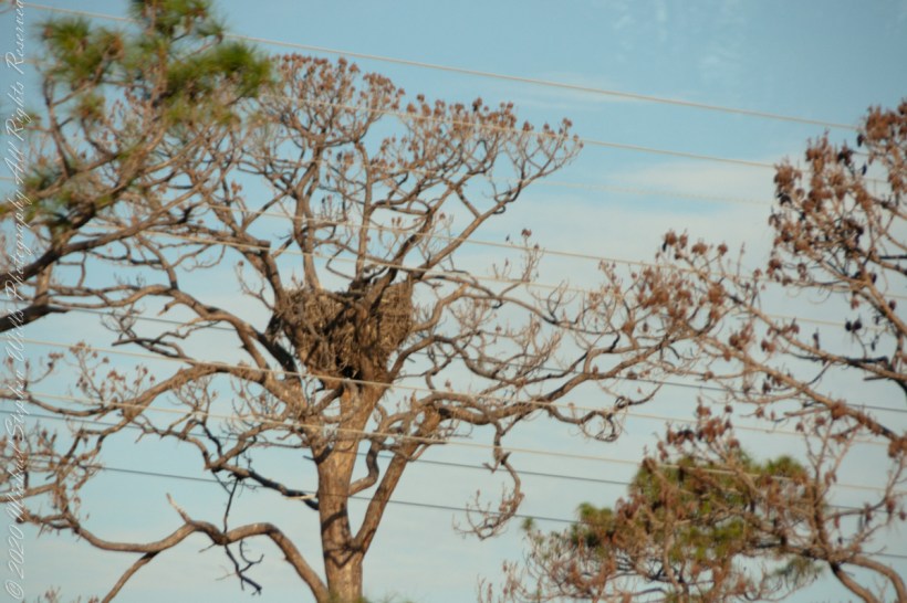
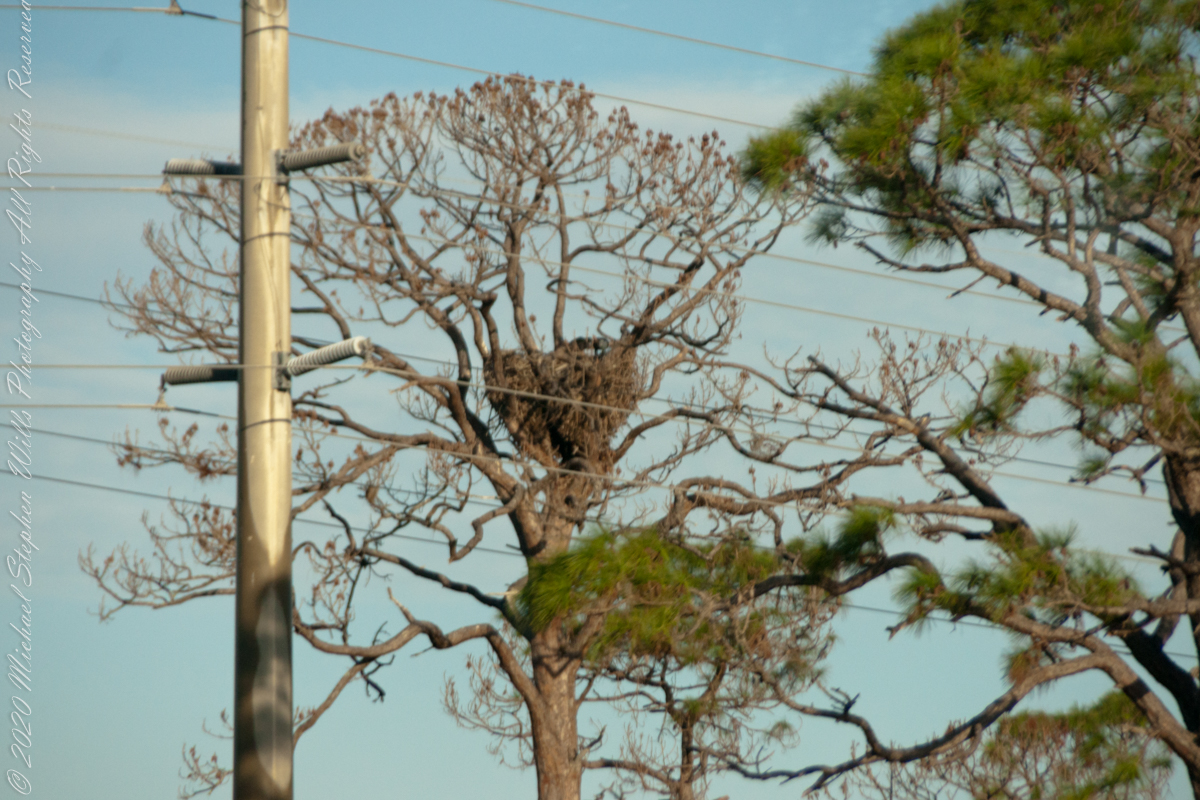
The nest tree is on the median of a divided highway. Driving into the Landing Facility the nest tree was to the east, brightly lit by the morning sun.
Click Any Image for a larger viewe
Second Turn
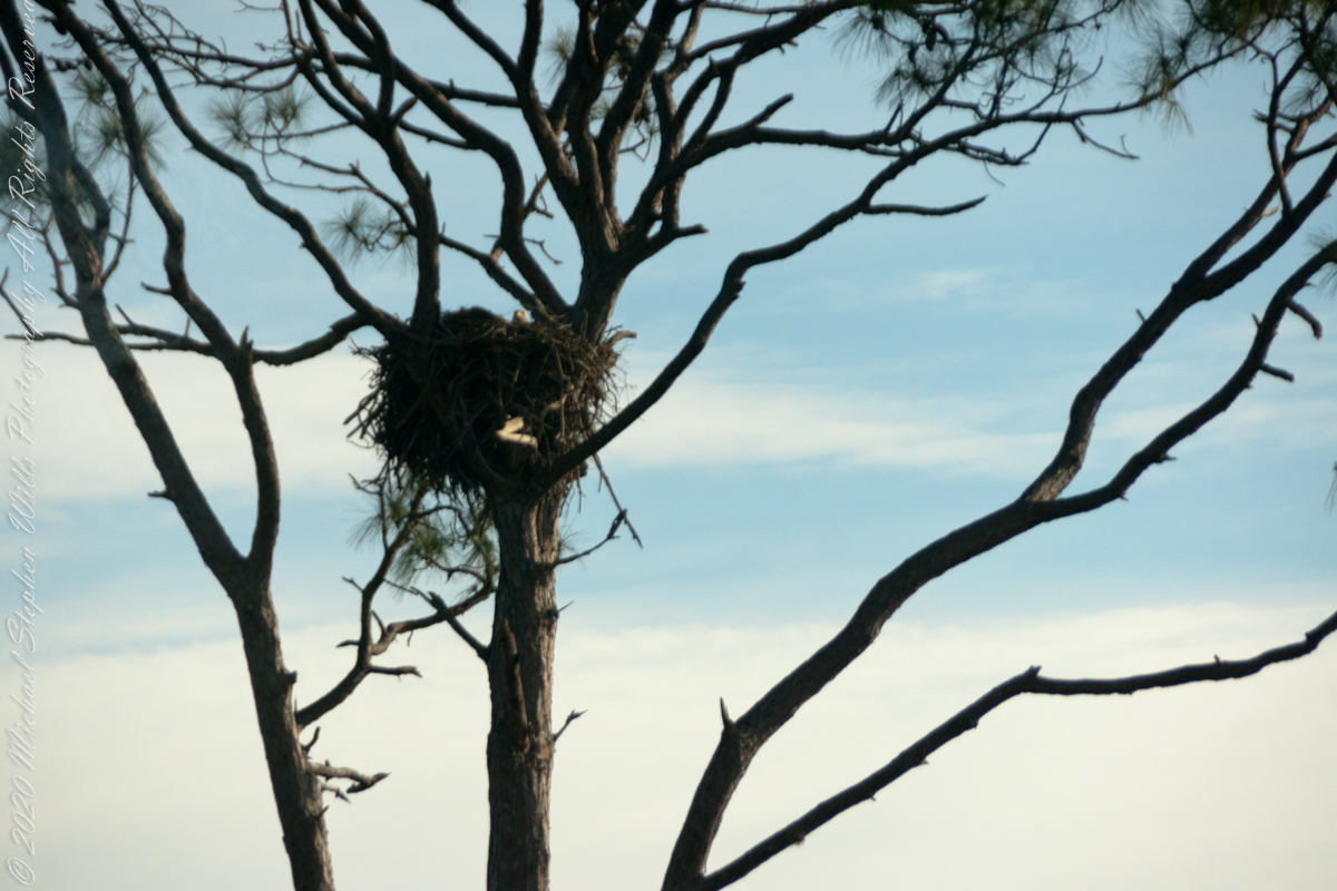
On the return trip the nest was backlit. Look closely: the head of an eaglet (?) is just visible above the nest rim.
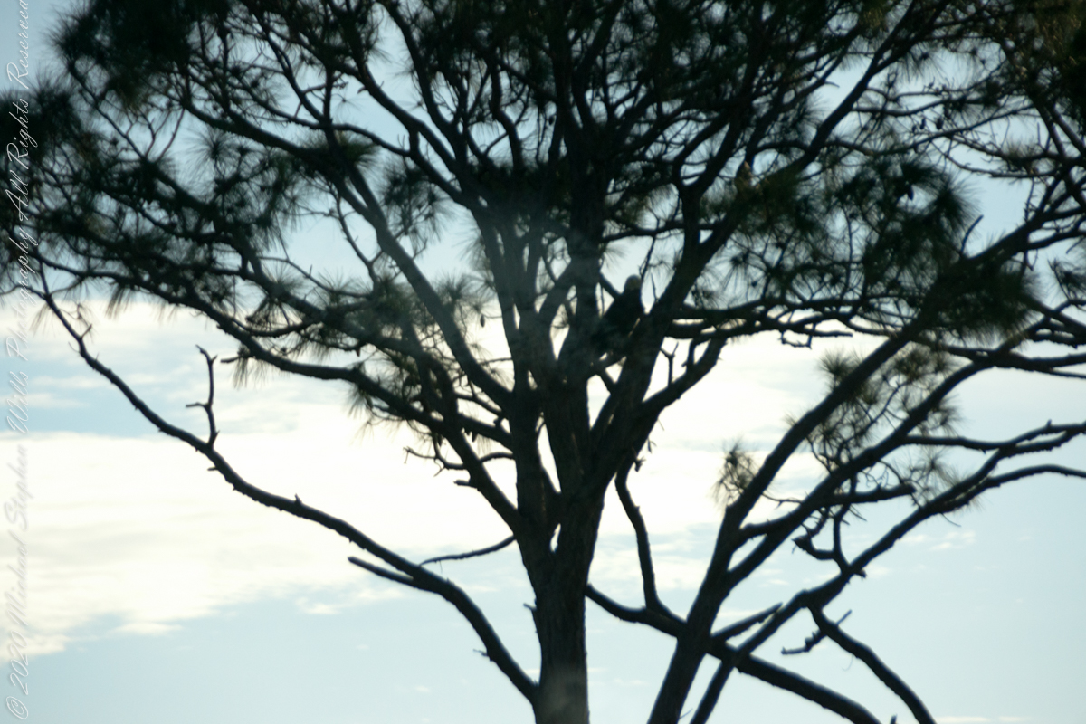
The parent eagle is silhouetted in the tree branches.
Sources of information for this post: I used information from the Wikipedia site for the key words “STS-107.”
Copyright 2022 Michael Stephen Wills All Rights Reserved.
We left our Cocoa Beach hotel in the pre-dawn hours of February 6, 2018 with our tickets in hand for the first launch of Space X’s “Falcon Heavy, our reward for arriving early was a spot on the third bus to the Apollo-Saturn V center. At 4 miles from Launch Complex 39a this is the prime location for “VIP” viewing.
The Columbia Disaster
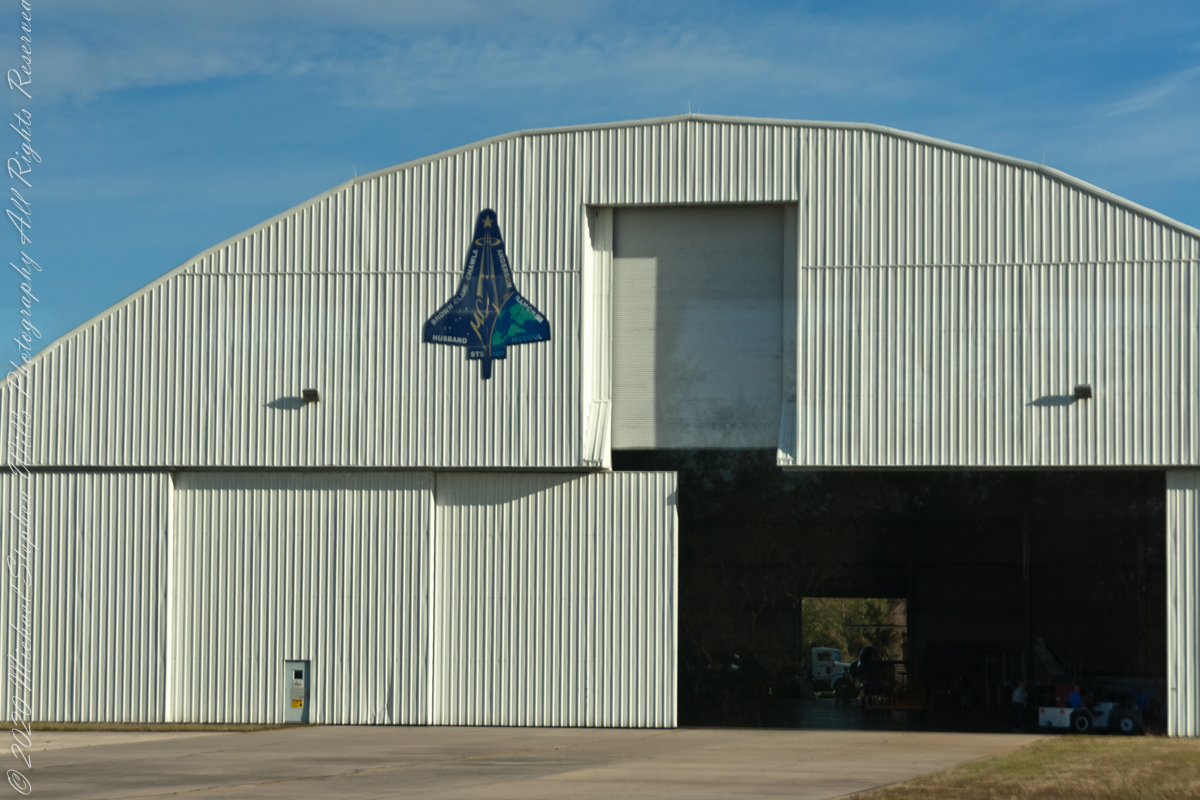
We were privileged to visit the Shuttle Landing Facility on the way, this hangar on the SLF access road was pointed out by the guide. Here was where the remains of Space Shuttle Columbia were collected after the disaster.
Click Any Image for a larger viewe
STS-107 was the 113th flight of the Space Shuttle program, and the 28th and final flight of Space Shuttle Columbia. The mission launched from Kennedy Space Center in Florida on January 16, 2003 and during its 15 days, 22 hours, 20 minutes, 32 seconds in orbit conducted a multitude of international scientific experiments. It was also the 88th post-Challenger disaster mission. An in-flight break up during reentry into the atmosphere on February 1 killed all seven crew members and disintegrated Columbia. — wikipedia
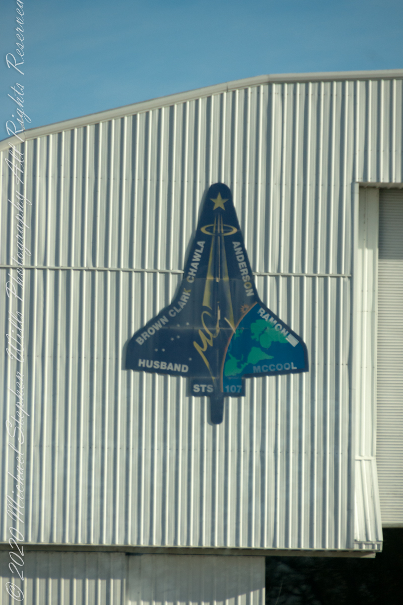
The logo is from the Columbia Accident Safety Board, the group that investigated the cause of the loss.
Immediately after the disaster, NASA convened the Columbia accident Investigation Board to determine the cause of the disintegration. The source of the failure was determined to have been caused by a piece of foam that broke off during launch and damaged the thermal protection system (reinforced carbon-carbon panels and thermal protection tiles) on the leading edge of the orbiter’s left wing. During re-entry the damaged wing slowly overheated and came apart, eventually leading to loss of control and disintegration of the vehicle. The cockpit window frame is now exhibited in a memorial inside the Space Shuttle Atlantis Pavilion at the Kennedy Space Center. — wikipedia
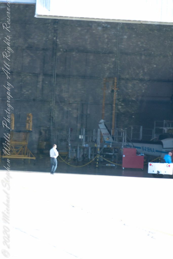
I zoomed in for a close look at the interior
The damage to the thermal protection system on the wing was similar to that Atlantis had sustained in 1988 during STS-27, the second mission after the Space Shuttle Challenger disaster. However, the damage on STS-27 occurred at a spot that had more robust metal (a thin steel plate near the landing gear), and that mission survived the re-entry. — wikipedia
Sources of information for this post: I used information from the Wikipedia site for the key words “STS-107.”
Copyright 2022 Michael Stephen Wills All Rights Reserved.
A roadside shrine on Cottage Road, Inishmore. The faith brought by the saints has deep roots here.
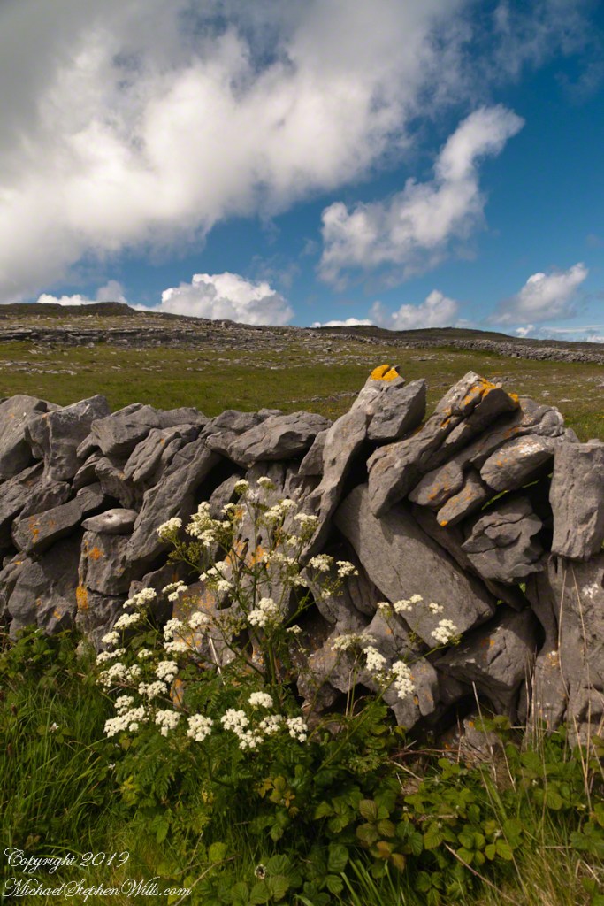
A large crucifix set with wet stone walls with cut flowers. The walls are the native limestone.
It is a spring (early June) afternoon and there are fern and wildflowers. The white flowers are Greater Burnet saxifrage (Scientific Name: Pimpinella major).
The existing dry stone wall was interrupted by the shrine. In the distance are dry stone walls around fields, a stone shed, feeding horses and the sea, being Galway Bay, storm clouds with distant rain.
Aran Islands, County Galway, Ireland.
Roadside Shrine and Island Landscape, Inishmore, Aran Islands, County Galway, Ireland
Imagine yourselves in an open cart exploring the island. Here are the photographs from my Inishmore exploration posts. Enjoy!!
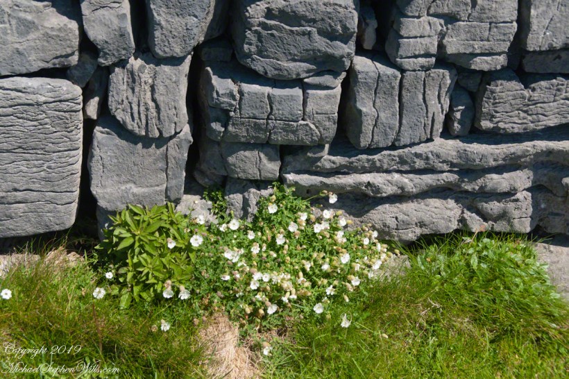
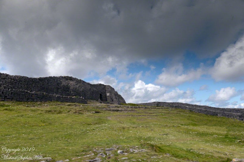
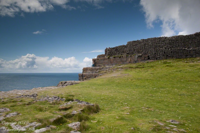
Kilronan bibycle hireView from a horse drawn trap headed down Cottage Road toward the village of Kilronan on a early June day, the island of Inishmore. On the right a stone ditch (wall), at the base the white flowers of Greater Burnet saxifrage (Scientific Name: Pimpinella saxifraga) (Irish Name: Ainís fhiáin). A steeple with bell and cross just visible. In the distance is the island of Inishmaan, the North Atlantic and Galway Bay. Aran islands, County Galway, Ireland.This ruined church is on the right side as you travel Cottage Road out of Kilronan Village, Inishmore, County Galway, Ireland. The distant highland is Inis Mann, across Galway Bay. A curious horse looks over a wrought metal gate set in a dry stacked limestone wall.Riding a horse and trap on Cottage Road from Kilronan village, Inishmore, Aran Islands, Country Galway, irelandThose bicyclists could have been us.This thatched cottage with matching child’s playhouse is on Cottage Road out of Kilronan Village on the Aran island, Inishmore, County Galway, Ireland.Roadside daisies on Cottage Road out of Kilronan village, Inishmore, Aran Islands, County Galway, IrelandNorth view from Cottage Road overlooks walled fields, karstNorth view from Cottage Road overlooks walled fields, karstAn island cottage among fields along the Galway Bay coast, the twelve pins of Connemara beyond.An island cottage among fields along the Galway Bay coast, the twelve pins of Connemara beyond.We stopped for lunch and a present for my son, a sweather purchased from the woman who knitted it.SONY DSCThe view is looking southwest from the path leading to Dun Aonghasa in springtime. We see here dry stone wall of limestone laid in a pattern suggestive of herringbone, splotches of orange lichen mark the stones. Against the wall is growing a variety of plants. The prominent white flowers are Greater Burnet saxifrage (Scientific Name: Pimpinella major) (Irish Name: Coll an dromáin). Beneath are leaves of Wild Strawberry (Scientific Name: Fragaria vesca) (Irish Name: Sú talún fiáin) as well as fern and grass. Beyond the wall is karst landscape rising to the ridge. Above the ridge, storm clouds gather. Inishmore, Aran Islands, County Galway, Ireland.This defensive structure called a Cheval de fries field surrounds Dun Aonghasa (Dun Aengus). This northwest view looks across the field and surrounding defensive walls. It is an early June day and, in the foreground, are colorful wildflowers among the limestone shards and blocks. Inishmore, Aran Islands, County Galway, Ireland.Looking North, Northwest across the slopes below Dun Aonghasa (Dun Aengus), InishmoreWalled Path to Dun Aonghasa (Dun Aengus) with Island Landscape, InishmoreKarst landscape with Green Field and Clouds, InishmoreInishmore LandscapeKarst Landscape with Interior Walls of Dun AonghasaDetail of Dun Aonghasa Dry Stone Wall with White Flowers of SeaAncient Fort Entrance, Dun Aonghasa (Dun Aengus)Ancient fort wall with tourists and Cliff Edge of Dun Aonghasa (Dun Aengus)View east, southeast from the Cliff Edge of the Ancient fort walView east, southeast from the Cliff Edge of the Ancient fort walRoadside Shrine and Island Landscape, Inishmore, Aran Islands, County Galway, Ireland
Copyright 2019 All Rights Reserved Michael Stephen Wills
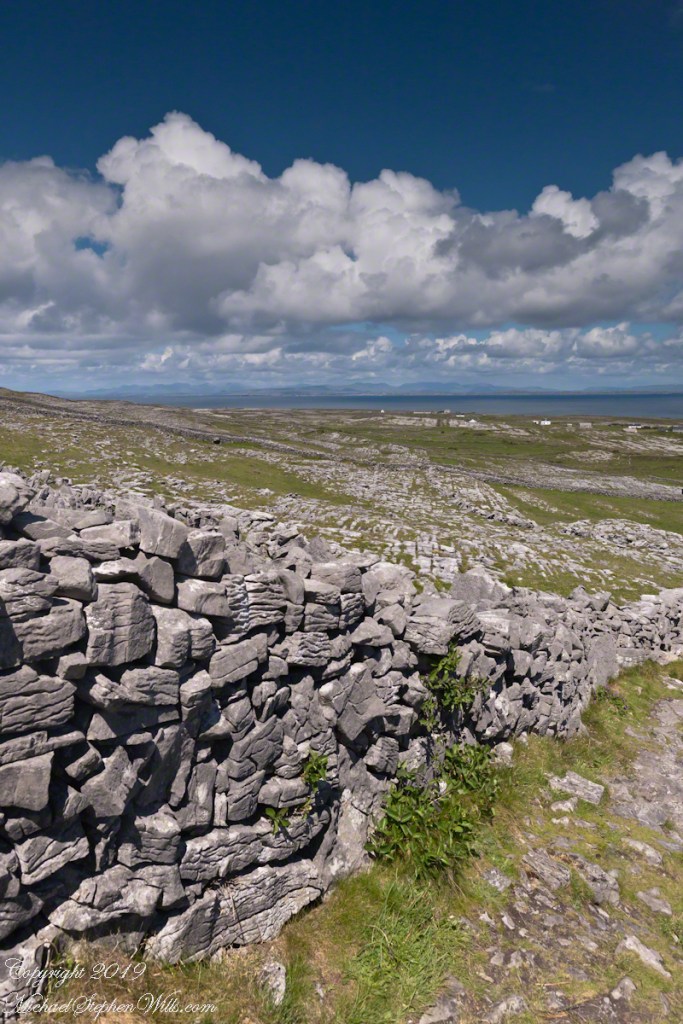
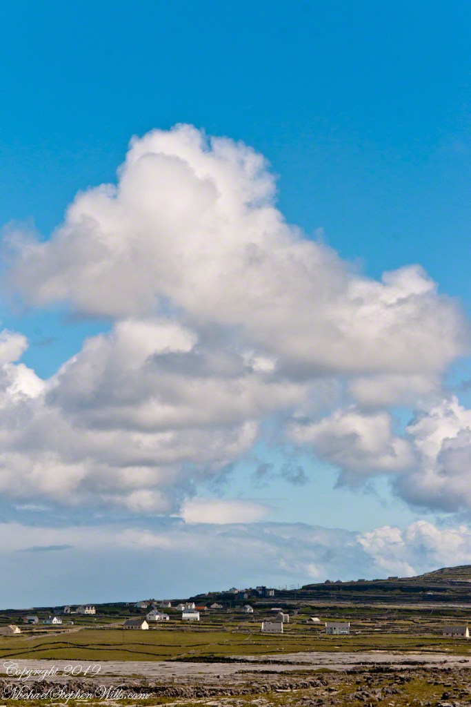
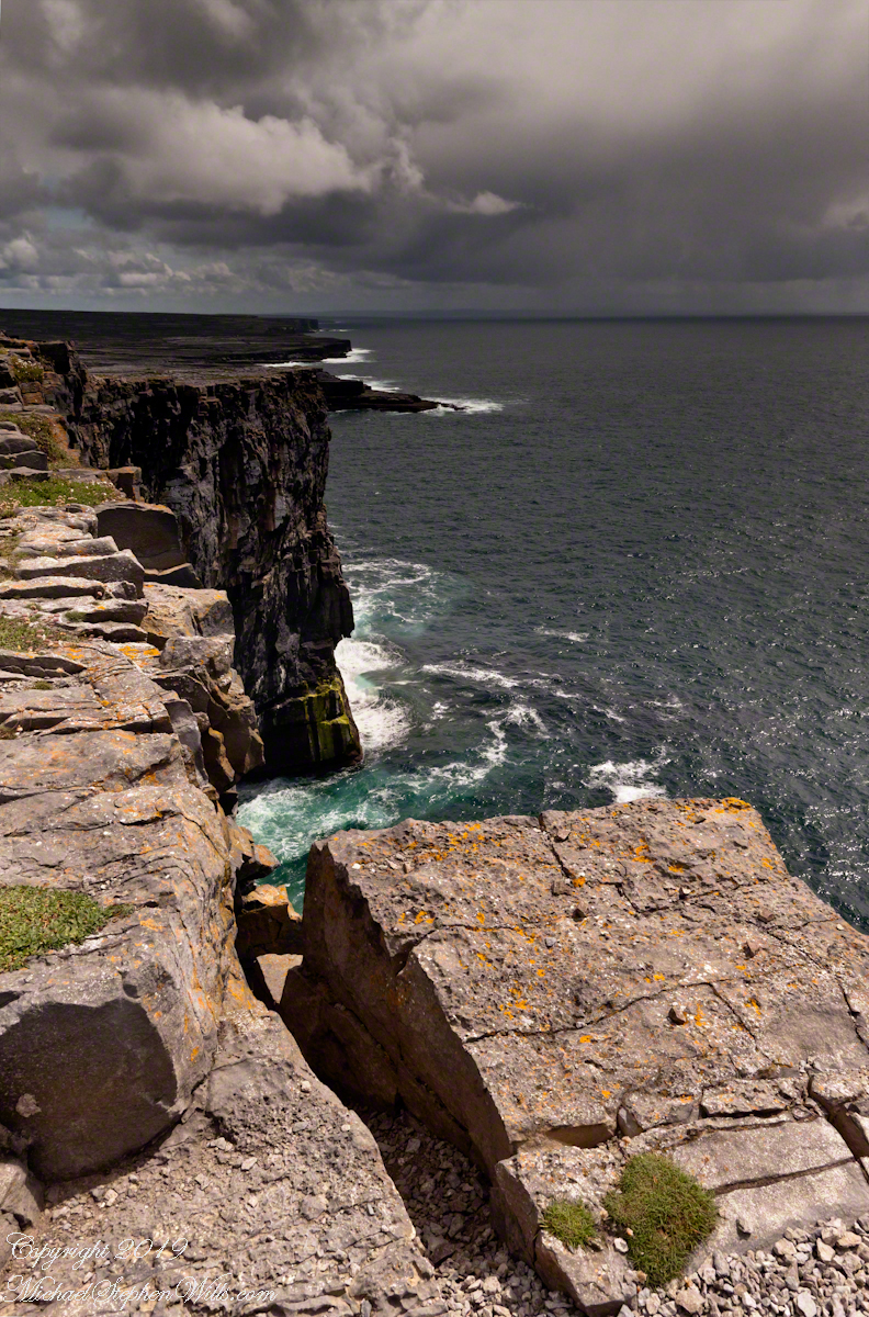
From the commanding location of Dun Aonghasa, looking northeast across Inishmore island, we can understand why the ancient builders chose this location.
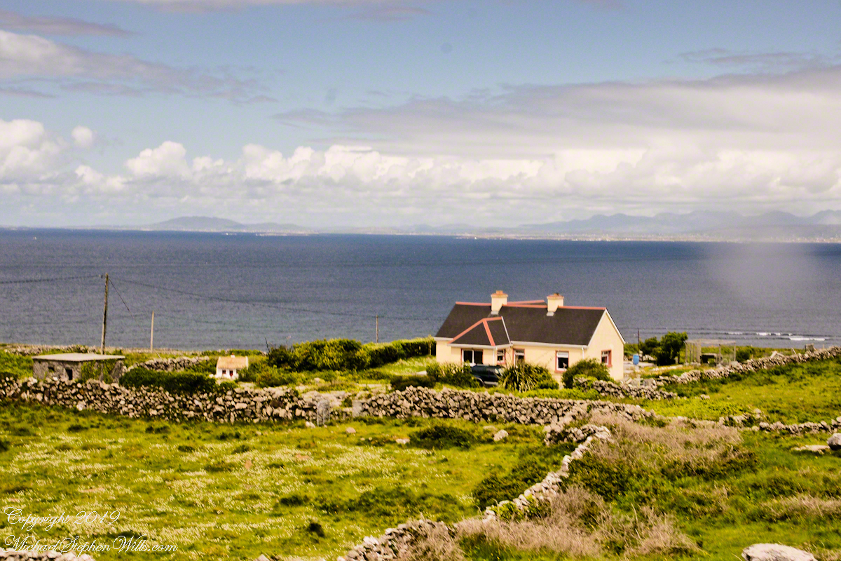
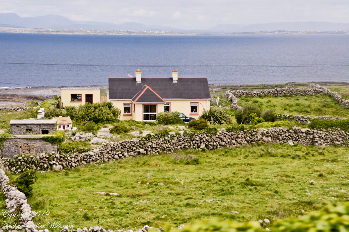
We also see the transition from exposed limestone to the fields built literally from the ground up (see my post “The How of Soil”). For a closer view of island houses see my posts “Settled In” and “Cottage Road Cottage.”
Enjoying travel on a horse trap, a type of carriage, on Inishmore (Inis Mór), the largest Aran Island in Galway Bay we headed up Cottage Road from Kilronan, the main island settlement. It was there we embarked from the Doolin ferry, hired the driver, his horse drawn trap. Our destination an iron age fort, Dun Aengus (Dún Aonghasa, the Irish language name) and the sights along the way.
The feeling of this blurry photograph is too good to let lie. I just kept snapping away from the moving carriage, here we are descending a hill and moving a bit faster, the elevation provides this view of Galway Bay, Connemara and the Twelve Pins beyond.
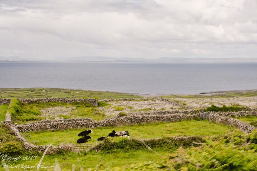
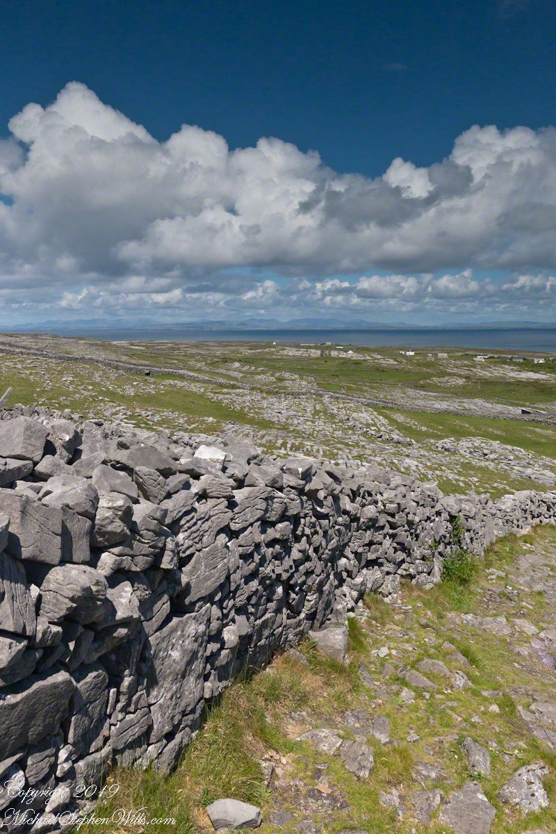
There’s a gate in the cow field, though some fields with cows were gateless. There is a simple answer to the mystery. At one point our driver stopped by his field and and demonstrated how the wall is pulled down to make an opening, the rocks stacked to make this easy. When the cows are in, the rocks go back up, a matter of 10 minutes or so to make a cow-width passage.
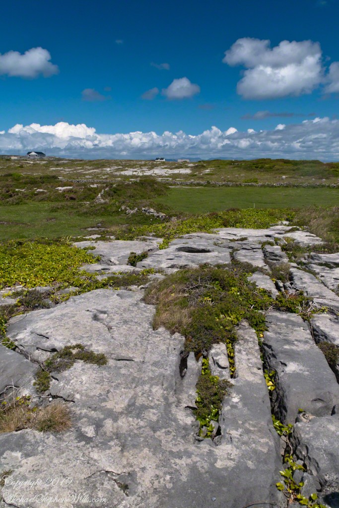
From the heights of Dun Aonghasa the karst, a type of limestone, of Inishmore falls away for the sight of the twelve pins against Galway Bay. These unworked, barren slopes have a pale green covering growing seemingly on air.
On approach to Dun Aonghasa, Cottage Road dips closer to the road for this view of a field with enough dense grass for five cows to feed, the rest on the cushioning green. Where did this come from?
The answer is simple hard work, hundreds, a thousand years of hauling seaweed and sand, mixing it on the barren limestone, allowing the rot of time to work. Hold it down with roots, till and refresh.
From the commanding location of Dun Aonghasa, looking northeast across Inishmore island, we can understand why the ancient builders chose this location.
We also see the transition from exposed limestone to the fields built literally from the ground up (see my post “The How of Soil”). For a closer view of island houses see my posts “Settled In” and “Cottage Road Cottage.”
In a previous post, “Inner Ring, at last” we passed over the entrance to the inner enclosure.
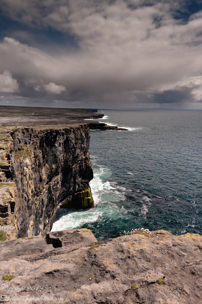
A long path through fields, karst landscapes and outer walls leads to this entrance to the inner ring of Dun Aonghasa (Dun Aengus) of Inishmore, Aran Islands, County Galway, Ireland. The image composition is as a dramatic landscape with the surrounding walls and the cloudscape of an approaching storm.