These are photographs from my Superstition Wilderness postings.
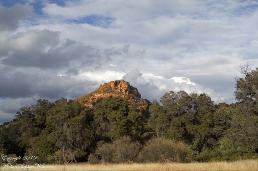
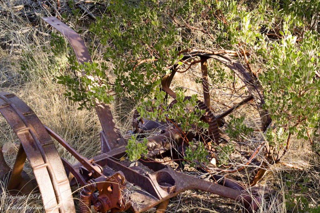
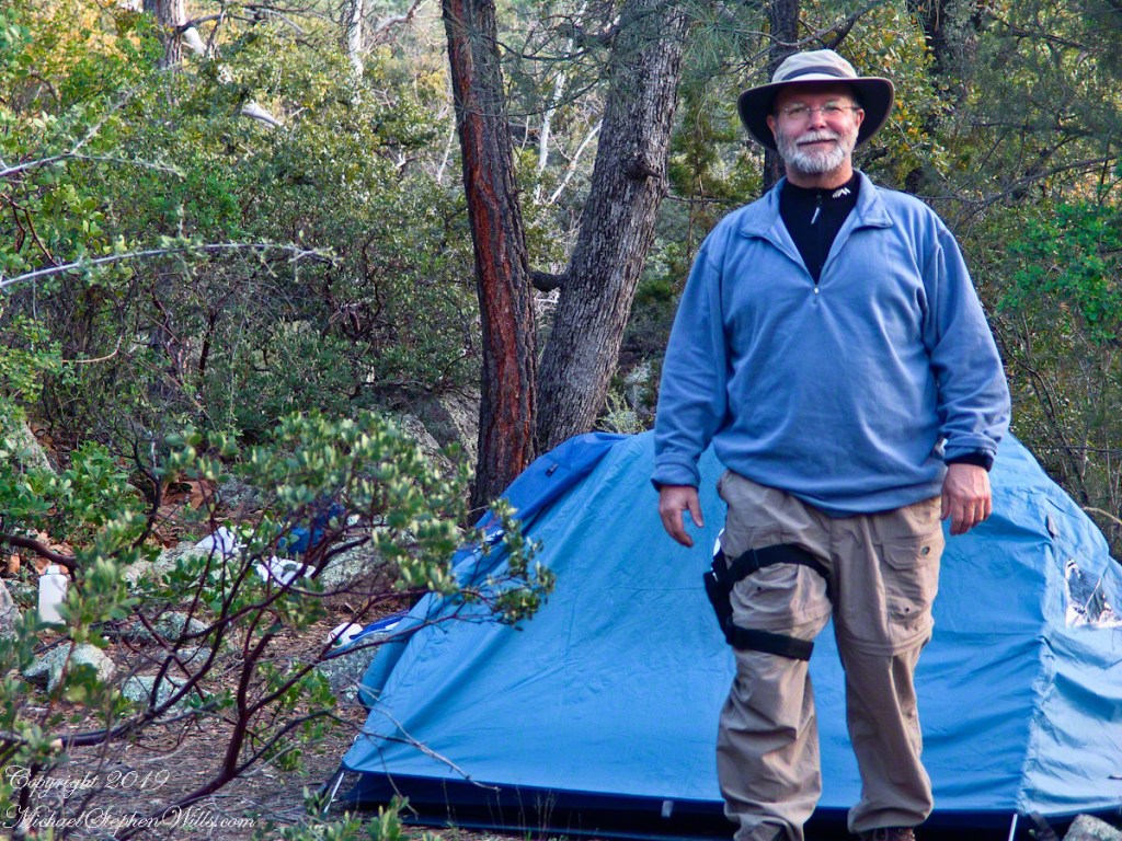
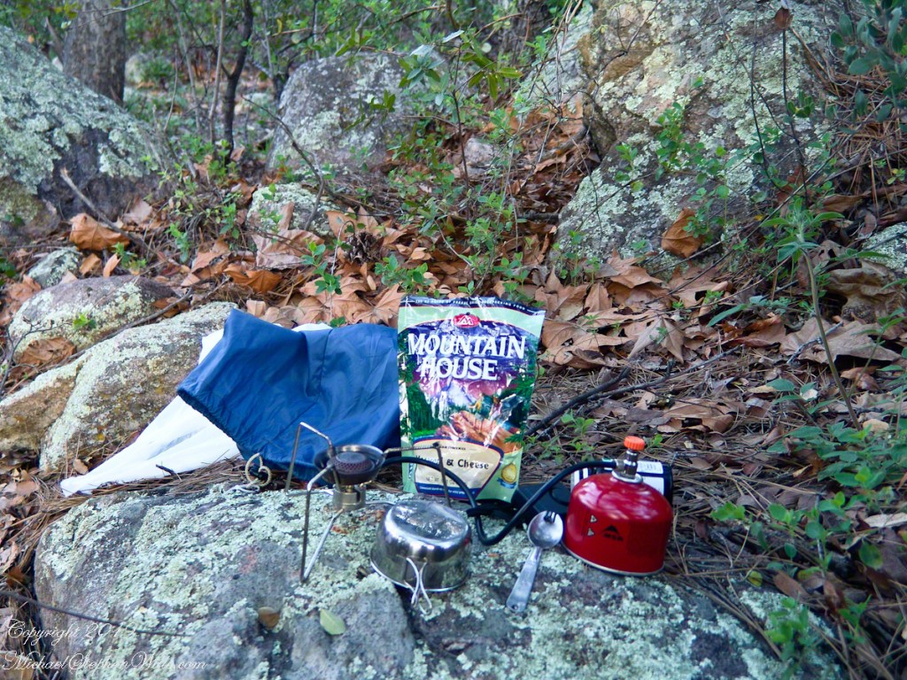
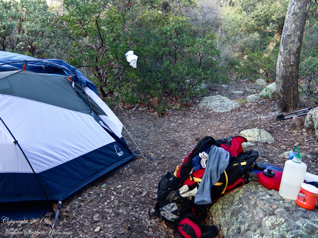
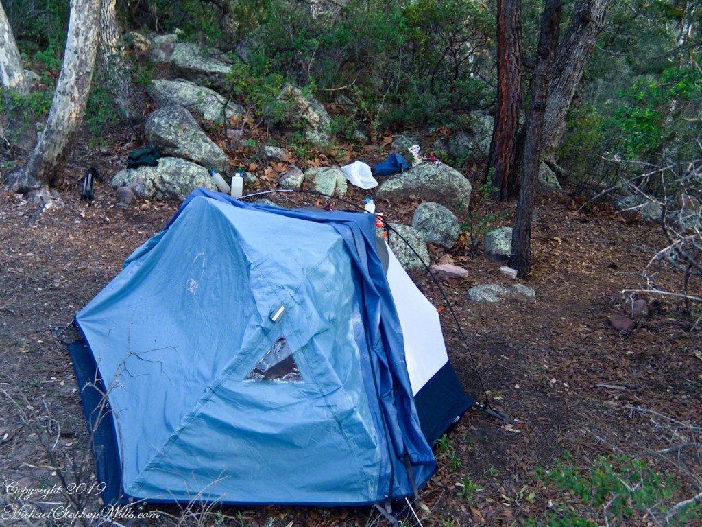
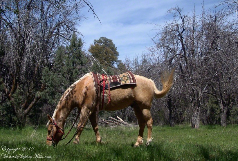
Taken early April, Reavis Ranch, Superstition Wilderness.Remnant of a twentieth century orchard, a dream husbanded using a perennial water source.Disused hayrake, Reavis Ranch, Superstition WildernessSuperstition Wilderness, Reavis Ranch, February, 2006From the slopes of Mound Mountain in the remote eastern Superstition Wilderness. View West-Northwest across the southern Reavis Valley (Reavis Ranch). Pinion Pine and Manzanite in the foreground.“The Searcher’s” horse, Nugget feating on early spring grass among the apple trees of Reavis Ranch.Northeast view across the site and the Reavis Valley.“The Searcher’s” horse, Nugget feating on early spring grass among the apple trees of Reavis Ranch.Colorado on the alert while Nugget grazes, typical of their personalities.Looking from the former house site towards the Arizona Trail running beneath the distant red rock ridge. Not the fence rails on the left and apple trees in bloom.Mike Wills at his Pine Creek Camp, April 2005.the kitchen: can of fuel, a light burner and dehydrated food. A metal cup and a spork.Looking east toward backpack, center, with unpacked supplies and tent. Tripod at rear.I climbed a large, lichen encrusted boulder for this view of the tent and equipment. Looking south.
The following year my sister Diane and I did two expeditions into the Superstitions, March and November 2006.
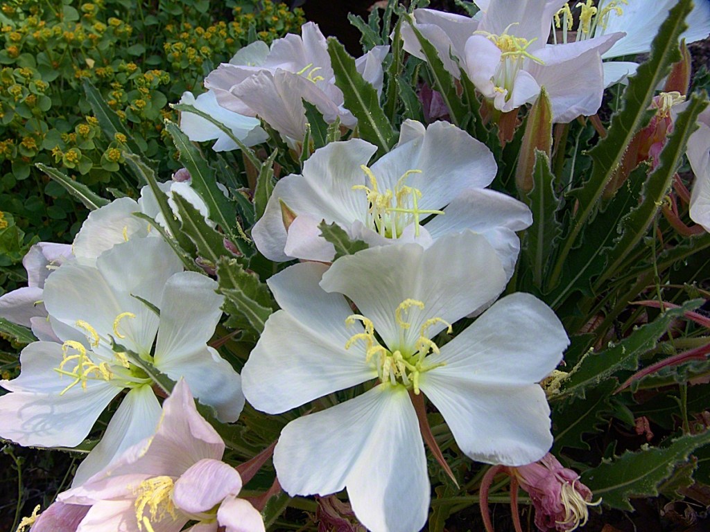
View of a saddle of the ridge to the west over Pine Creek. It is possible to climb over this ridge for a view of Reavis Falls. It is a day-trip bushwack from Pine Creek.View to the southwest on the Arizona Trail above Pine Creek.Pine Creek of the remote eastern Superstition Wilderness hosts this wild Tufted Evening Primrose.From a vantage point overlooking Reavis Gap tot he north. This is the view of Pine Creek, to the south.The Arizona Trail passes this spot in the remote eastern Superstition Wilderness. This is the view of my path up from Nameless Canyon. In the distance is the Four Peaks Wilderness Area.Superstition Wilderness, Arizona
“A This video is from the November backpack, taken from the hill above the Ranch Ruin (Click me for “A Ride to Reavis Ranch”) you will experience the peace of this wilderness valley.
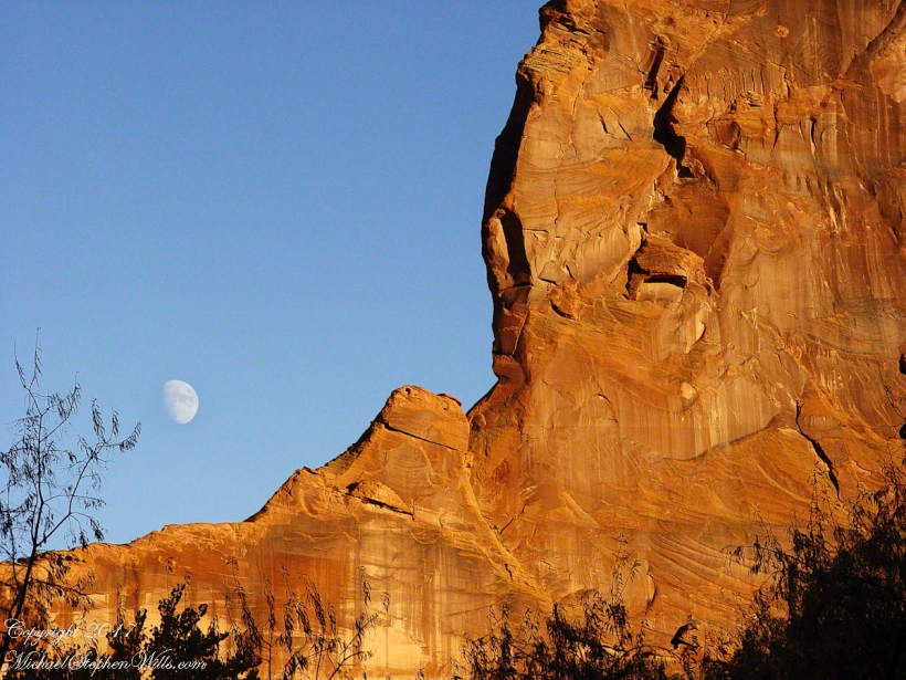
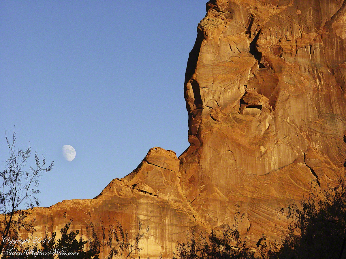
Although cold, the still dry air felt marvelous and even distant objects appeared absolutely clear. In this environment the spread of sun with its rising is a ritual. Here’s a photograph of the canyon walls a few minutes before the sun reached them.. Superstition Wilderness, ArizonaView from the western slope of Two Bar Mountain looking west toward Reavis Ranch Trail. Reavis Falls is in canyon on the far side of this ridge.Although cold, the still dry air felt marvelous and even distant objects appeared absolutely clear. In this environment the spread of sun with its rising is a ritual. Here’s a photograph of the canyon walls a few minutes after the sun reached them.. Superstition Wilderness, ArizonaSuperstition Wilderness, ArizonaView from the western slope of Two Bar Mountain looking west toward Reavis Ranch Trail. Castle Dome is behind the ridge on right.Fully mature agave surrounded by years of dried leaves against ddawn light in Pine Creen Canyon, Superstition Wilderness, Arizona.
The following year my sister Diane and I did two expeditions into the Superstitions, March and November 2006.
“A This video is from the November backpack, taken from the hill above the Ranch Ruin (Click me for “A Ride to Reavis Ranch”) you will experience the peace of this wilderness valley.
About that mysterious stone structure featured in this video. Over the years I have pieced together its purpose. When the ranch was active, a canal followed the contours from upper Reavis Creek to fill a pond down the hill from the house — I was shown the canal and walked it 2005. The structure was razed in the 1990’s, all that remains is the concrete foundation slab and, when I was there 2005 – 2008, scattered remains of the tile flooring. I am sure the pedestal above the house supported a water tank for a gravity water feed (“indoor plumbing”). Here is a link to more info about that site. The article does not discuss the water system.
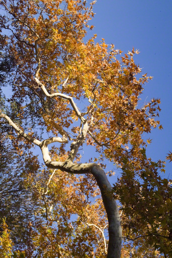
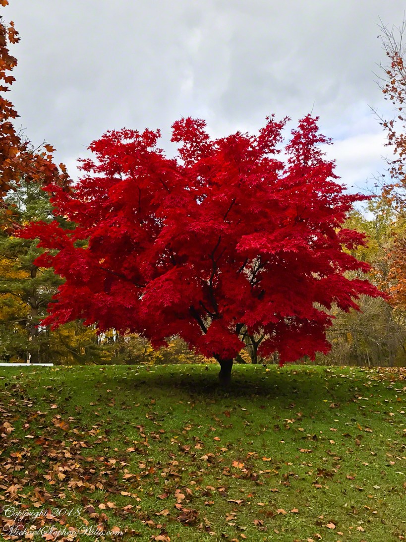
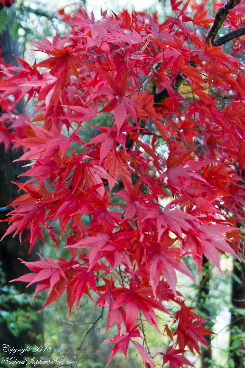
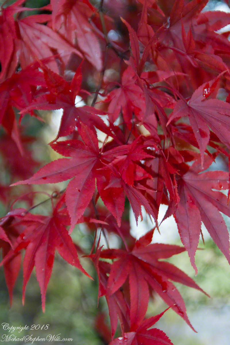
Yesterday, Pam and I headed to the peneplane behind our home to enjoy the Finger Lakes terrain graced by fall colors. The day before I noticed the Japanese Maple leaves had turned from maroon to vermillion. While waiting for Pam to get ready, I capture the following two shots.
This tree was planted by my father and mother in-laws. Developed over the centuries by the Japanese, specimens reached England in the 1820 and spread from there. It is not strictly accurate to call the color vermillion, since cinnabar finely ground produces the pigment for which the color is named, when the sun strikes the leaves vermillion is a metaphor for the impression made.
The scientific name for these trees is Acer palmatum with common names Palmate Maple (for the shape of the leaves “like a palm tree”, as for the scientific name), Japanese Maple or Smooth Japanese-Maple (for the bark).
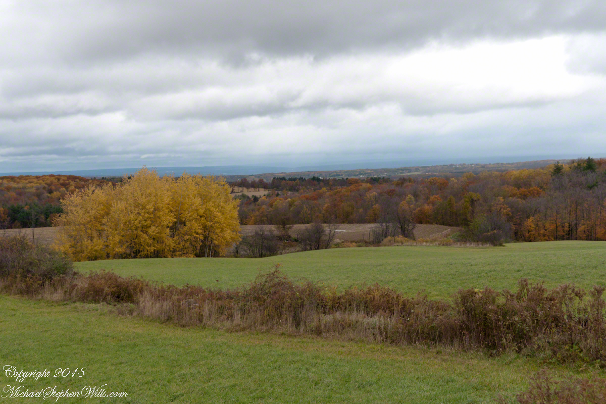
We drove under the clouds, enjoying the rare dramatic shafts of sunlight and I gave up, finally, tying to time my shots. Here is the view from Connecticut Hill.
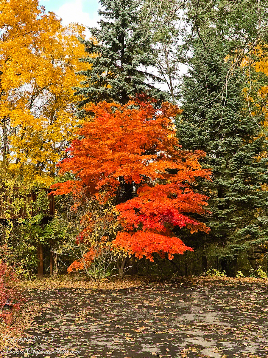
The previous photos were taken with a hand held Sony Alpha 700 with variable lens. The next two are with an Apple iPhone I had a hand when Pam and I returned home for a walk around the neighborhood to witness the transformations.
We were surprised by this orange maple, never recalling this shade before. Like our Japanese Maple were assume it is a non-native ornamental.
Our Japanese Maple is a challenge to capture photographically as it grows beneath a larger “nut” (don’t recall the kind at the moment) tree. We are working together to improve that, so I don’t have an overall photograph.
Here is our neighbor’s Japanese Maple. They have a story of carrying this tree, as a sapling, on the bus from Long Island. I love the impression of dark limbs among the clouds of red foliage.
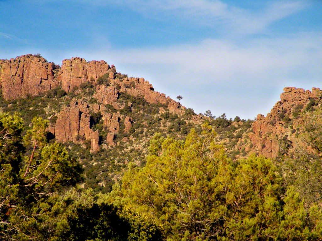
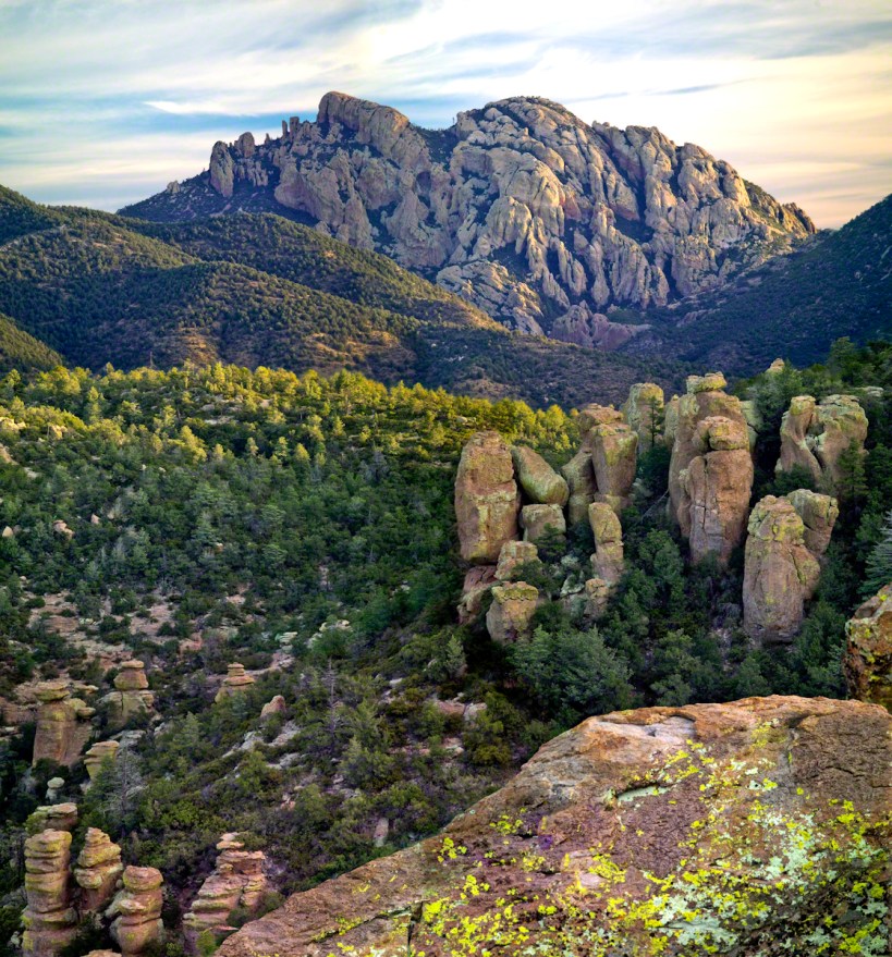
This photograph (the “far” of the “near and far”) is from a remote corner of Chiricahua National Monument, during the trip mentioned in my post, “History and Ghosts of the Triangle T Ranch”. To get there, I drove over a mountain pass to a location was featured in an “Arizona Highways” I read long ago.
I call this photograph “Red Dragon,” the formation is known as a “maple “
dragon”, from the long sinuous form of the tree limb. Known for this reddish orange autumn color, this is a Big Tooth Maple, AKA Canyon Maple. Scientific Name Acer grandidentatum (as in “big tooth”). It is a wild specimen, living along the north fork of Cave Creek. It is a area well know to avid bird watchers and ornithologists.
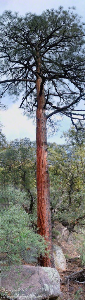
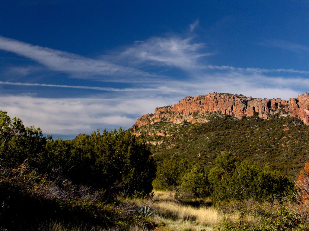
From 2004 through 2011 I visited Arizona every Autumn, October or November. As a University of Arizona Alumni Board member for the College of Agriculture and Life Sciences we had a meeting during “homecoming” and a fund raising event. I’d come early or stay later for getting acquainted with Arizona, more than was possible as an undergraduate. In 2007 I camped for several days Chiricahua National Monument of the remote south eastern corner of the state.
The park empties out this time of year, for some reason. The weather is perfection with clear skies, moderate daytime temperatures, cool nights. This time of year the Arizona White Oak acorns ripen and fall. The campground has aluminum picnic tables, the falling acorns made a loud plunks throughout the night. This would annoy some people. Me, it is a great memory.
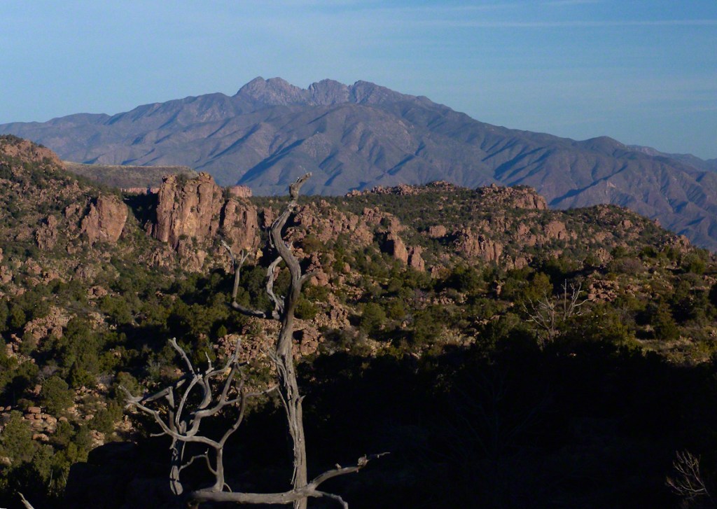
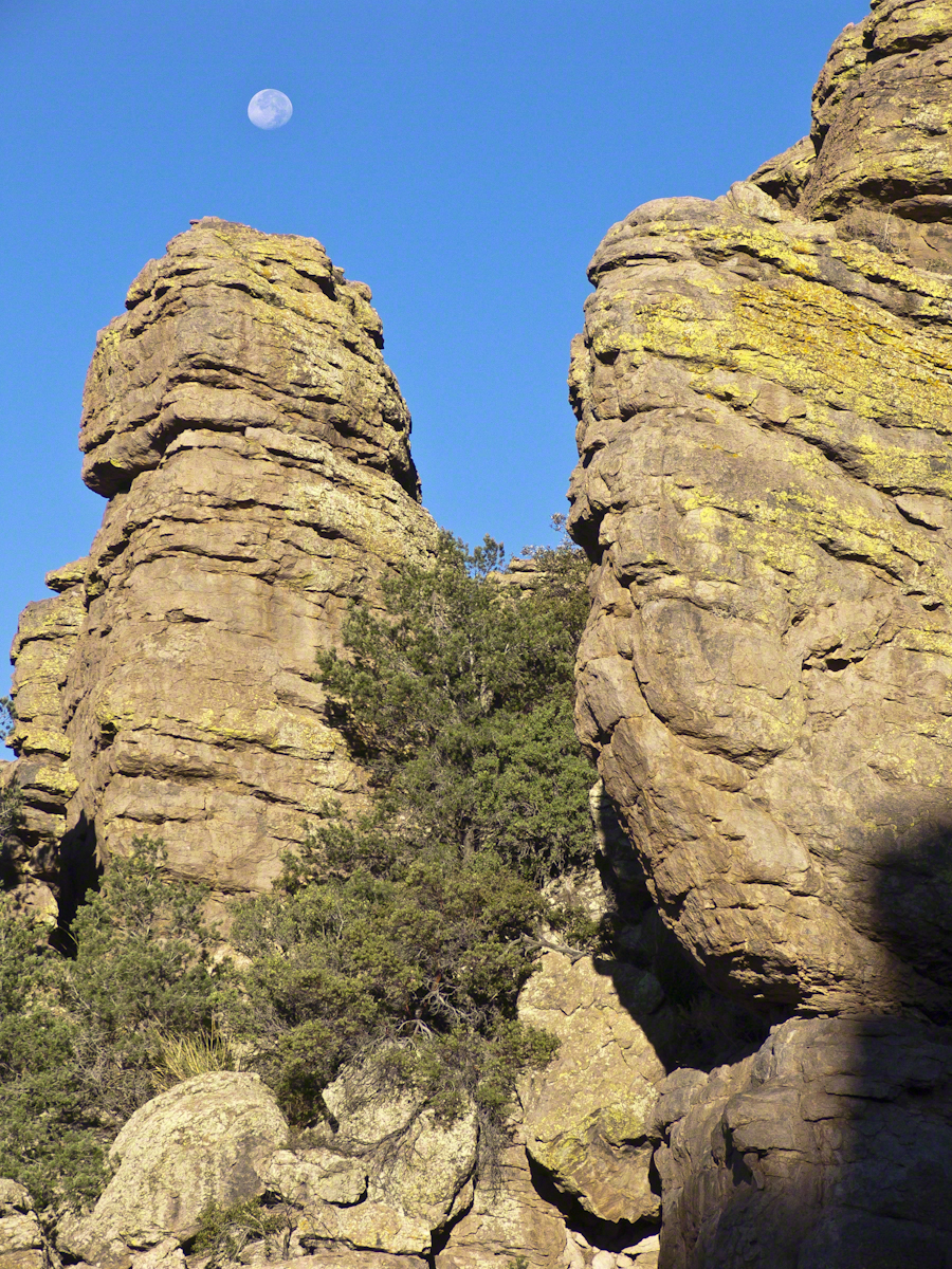
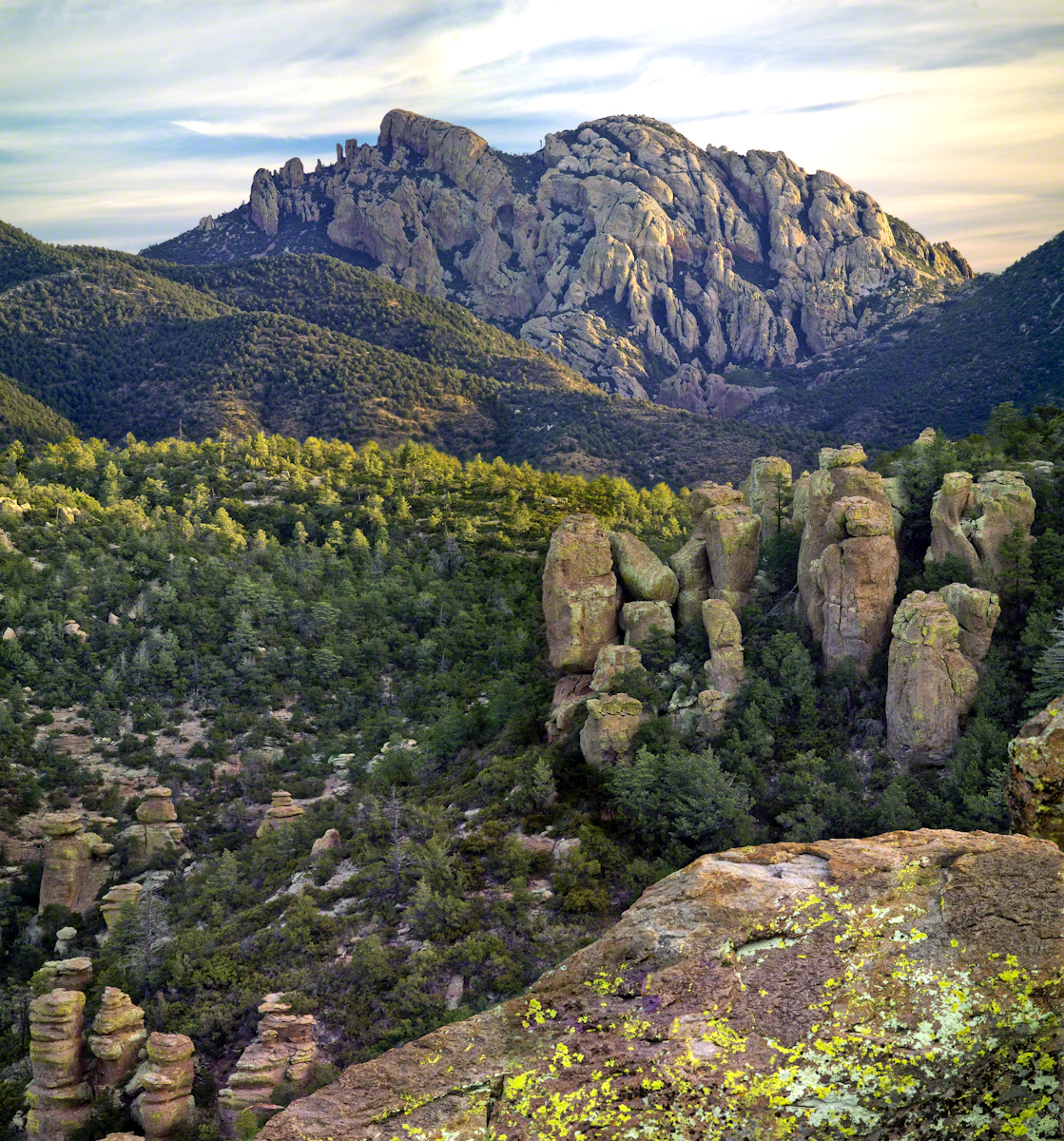
The following two images are great memories from my first morning.
Click any photograph for my Online gallery.
These formations hovered over the trail on my first morning. The rising full moon was an unplanned bonus.
I experimented this trip with a breakfast of granola with dried whole milk. It was delicious (for me) and got me out on the trail quickly. This first morning I clicked my hiking poles together to scare away bears as I walked in the pre-dawn dark. The preparation and extra effort paid off with this photograph.
Click any photograph for my Online gallery.
I met one hiker who was a harbor pilot from Hamburg, Germany. He came just to view a particular rock formation that was, literally, the rubber bath duck. It is several miles to the site, a moderate hike with significant elevation gain. He took his snapshot with a little camera and was on his way.
The following is my masterpiece from the trip. Imaging the effect of seeing this image on settlers. That same first day I turned a corner and there this was…it took a few minutes to comprehend what I saw, it was so incredible and, for me, unexpected. It first, the only perception is a huge rock dome of rough rock, then, slowly, the image of a native American profile forms in the mind. Cochise Dawn
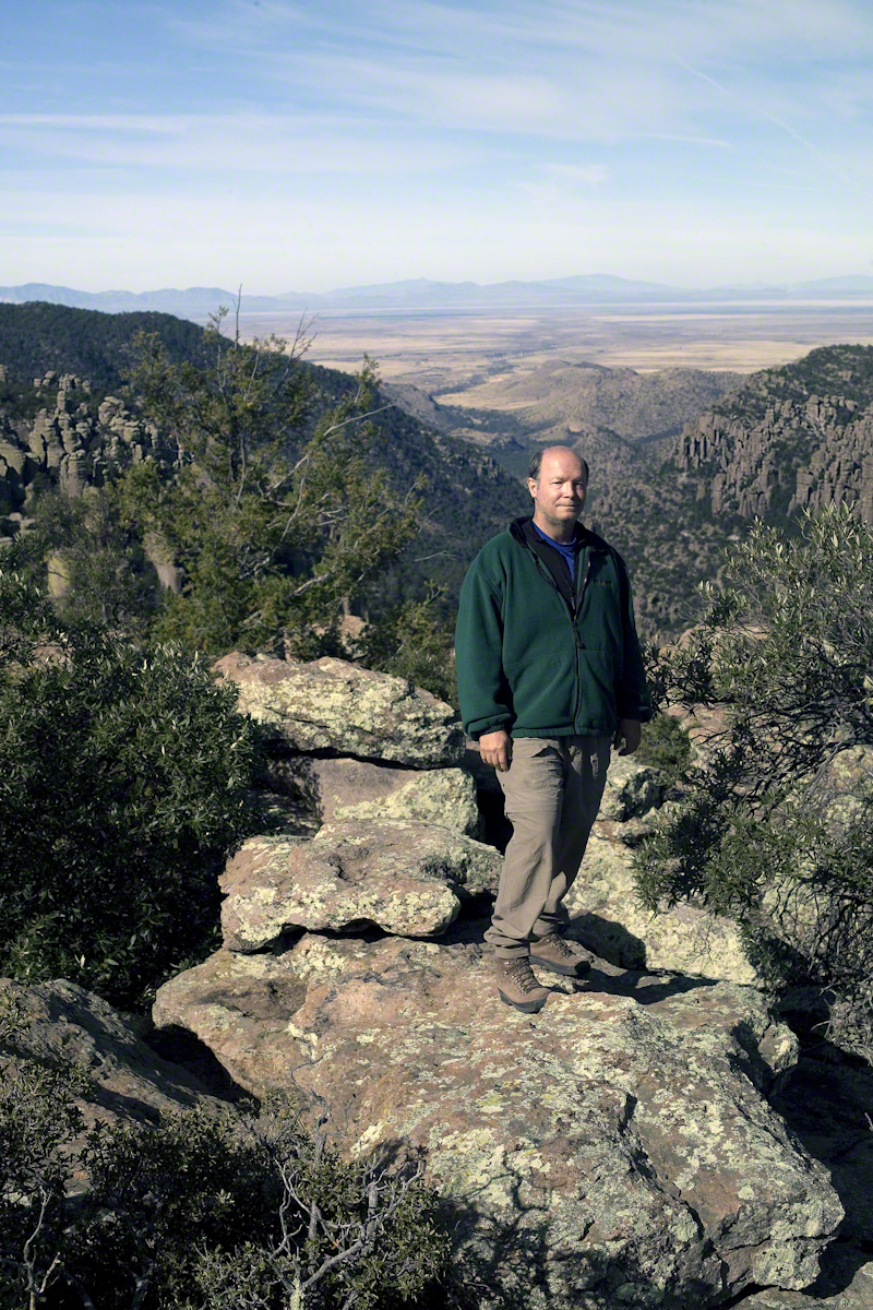
During the session for Cochise Dawn I turned the camera for the view northwest and did a self portrait. In the distance are the Galiuro Mountains and Wilderness. Tucked alongside is the Aravaipa Canyon Wilderness, hosting one of the few perennial streams of Arizona.
Copyright 2017 Michael Stephen Wills All Rights Reserved
In my post Canyon of Music, Wind, Light I shared a different photograph of this beetle crawling on sandstone, naming it as a “dung beetle”. I had assumed it was one from once having seen a beetle in an Arizona desert pushing a ball of dung around. This morning, to confirm my assumption, I searched for images of “Arizona Dung Beetle” and was dismayed to find this beetle shares no characteristics with the photographs. Absent smoking gun evidence, sadly lacking in this photograph, I have to admit my “dung beetle” attribution is in error.
Supporting the beetle, the luminous surface of the red sandstone named “de Chelly,” sunlight reflects from durable remnants of the ancestral Rocky Mountains wore to these bits of rock, piled to mountainous dunes by the winds of tens of thousands years, polished to smoothness each against the others.
Mysterious abrasion and grooves in a de Chelly sandstone cliff, Canyon de Chelly.
The above photograph is a detail from the brightly lit cliff of the following photograph. The desert varnish and underlying rock was weathered over thousands of years, the sand grains falling to the canyon floor.
The soil of the canyon is composed of these bits of the ancestral Rocky Mountains. What appears to be a white road in the above photograph is not man-made, it is the dried bed of a stream. When a waterway is dry like this, only flowing with rains, it is called a wash. When water fills the wash of the Canyon Del Muerto, the polished sand granules become a dangerous morass, sucking down horses, people, anything unlucky enough to step into it. Every movement, struggling for freedom, pulls the victim deeper down until the wet sand closes over the head and suffocation and death ensues.
Stairs cut into the sandstone cliff of Canyon de Chelly
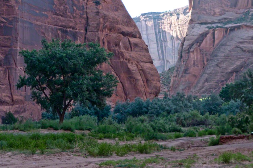
The waters Canyon De Chelly National Monument naturally form a vast Y into the Defiance Plateau, naturally because two major streams merge into one canyon a few miles above Chinle. On both our guided trips, heading east from Chinle there is a branch. On the right De Chelly canyon continues. On the left is Canyon Del Muerto. The photos in this post are all from “The Canyon of the Dead”, what the name means translated into English.
No, it is not named this because of the quicksand. Conditions for quicksand are present throughout canyons of the southwest. It is history of human occupation for which this canyon was named. I will cover it in a future posting. For now, I will say the above views are from the spot featured in “Family Trek.”
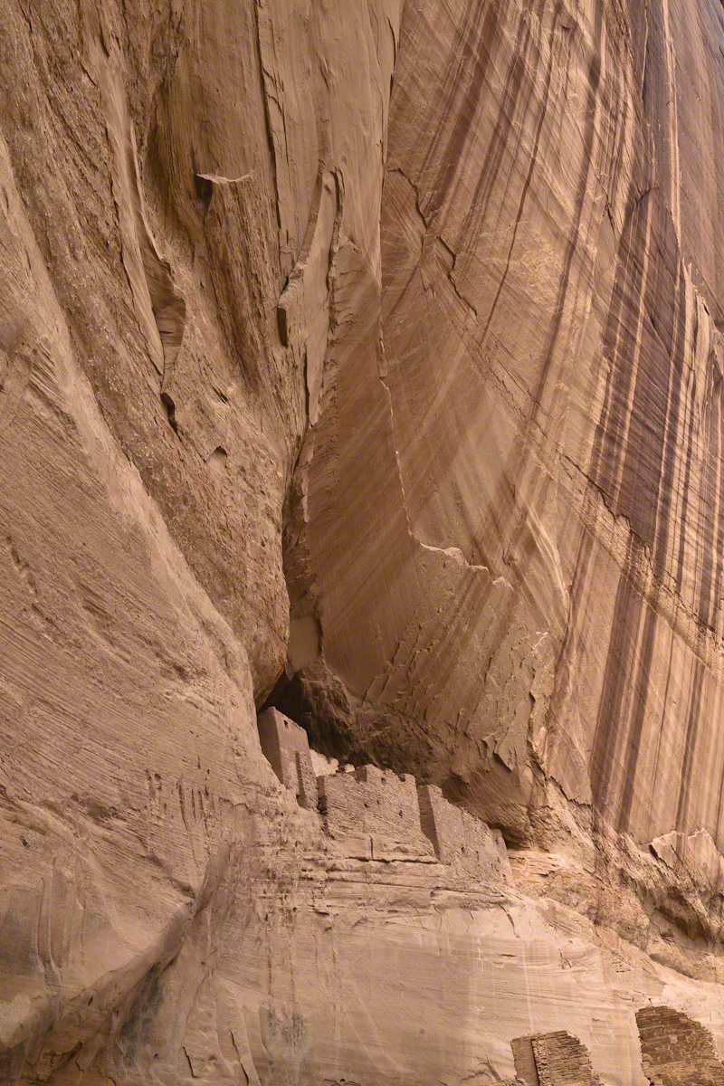
My first visit, in 2003, while my son Sean climbed the rocks with our guide, I was left to document the wondrous surroundings. The above shallow cave is reached by that stairway carved into the precipitous ledge. The access to the cave is via those naturally occurring ridges of the cross bedded sandstone. It is another example of De Chelly sandstone formed from the windblown edge of a monstrous ancient sand dune.
A solid block of De Chelly sandstone formed from the central bulk of a sand dune.
Here is another example of rock formed from the solid body of the sand dune, that unbroken and un-striated cliff. Below is the cross-bedded, windblown sand.
Autumn lights up the floor of Canyon De Chelly, the foliage rivals the cliffs for wonder at this time.
As we proceeded generally east from the climbing spot of “Family Trek”, driving by the golden cottonwood foliage I asked the guide to stop for these photographs.
Canyon walls
Soon the cliffs hid the sun.
Notice the modern water distribution system (pipe) at the foot of cliff on right. These vast tracks of shadow adjacent to bright sunlight are a fact of life for canyon dwellers, a source of joy and wonder.
The canyon here is rather like the Narrows of Zion, without the water.
November 2003 my son, Sean, and I drove up route 191 from the Petrified Forest National Part to arrived at Chinle on a November afternoon. In 2003 my photography kit included a Sony Point and Shoot 5 MP camera with filters, an over the shoulder (purse type) bag and an inexpensive “Kmart” tripod.
We found the White House trailhead, hiked down essentially alone as the sun set at 5:20 pm. At that time, a thick stand of Russian Olive trees choked the wash. We stopped at this point in the gathering dark. I took this distant shot of the White House Ruin against the Russian Olive autumn foliage. A stand of Cottonwoods growing near the canyon wall had yet to turn their brilliant yellow. At that time, the White House Ruin was painted white.
When Pam and I visited July 2008, in the intervening 4 years, 9 months the Russian Olives were removed as an invasive species, the ruin was no longer white.
There is one highway headed south in the Four Corners region of Northern Arizona, the same route 191 Sean and I took. In 2008 Pam and I came from Colorado south on 191, also arriving late afternoon.
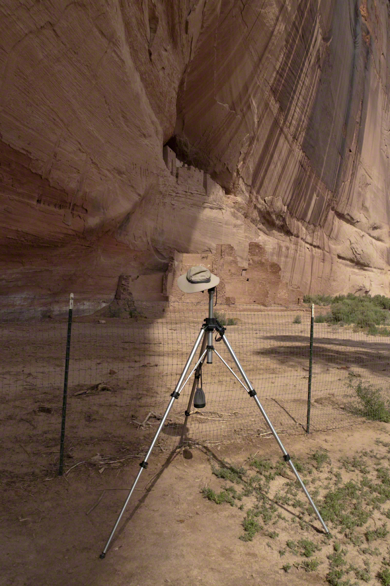
That July day the sun set 8:33 pm as the Navajo Reservation observes daylight savings time. My goal was to photograph the White House Ruin I missed in 2003. We arrived at the trail head. My photography kit was expanded from 2003, now included a Kodak DSC Pro slr/C, the “C” meaning “Canon” lens mounting, a Sony 700 alpha slr (I only use a variable lens), Manfrotto tripod with hydrostatic ball head, and the backpack style Lowe camera case. With the tripod it is over 25 pounds.
With this on my back I was prepared to boogie down the trail. At the height of tourist season there were many more people at the trailhead. Pam, being a friendly person, started a conversation while I ploughed ahead along the flat canyon rim. It is solid red sandstone, beautiful, generally level with enough unevenness to require attention. When Pam saw how far ahead I was she tried to catch up, tripped, fell hard.
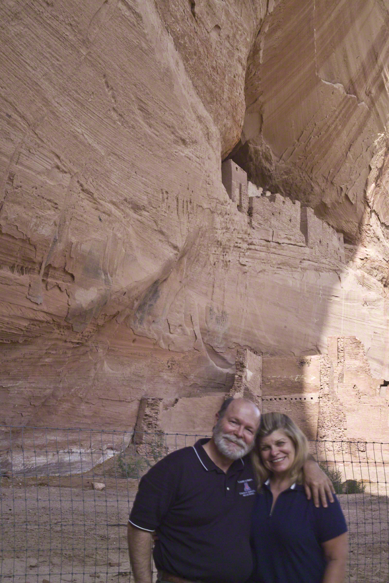
I backtracked to Pam and we pulled it together. She thought, maybe, the fall broke a rib. We descended, slowly, together. Here we are in front of the ruin. The sun, low in the sky, is moving below the south canyon wall. This is a perfect time and I used both cameras.
Mike and Pam Wills with the White House Ruin, Canyon de Chelly, July 2008
The sweep of cliff and desert varnish was my intent to capture. Here it is through the Canon 50 mm lens.
Imagine walking across the ranch house ruin towards where I described the former pond. Looking to the east and north from the elevation you see this sight.
In the near distance a grass pasture slopes into Reavis Creek. The creek has flowing water in all but the longest dry seasons. By the way, the trail from Pine Creek is on the slopes of that conical feature in the distance, to the left.
Click any photograph for a larger version.
Looking from the former house site towards the Arizona Trail running beneath the distant red rock ridge. Not the fence rails on the left and apple trees in bloom.
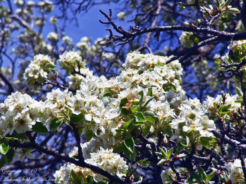
From the ruin, walk down the Arizona Trail, south, for a few hundred feet and turn left into the fields to encounter the same apple tree, and a close up of pure white apple blossoms.
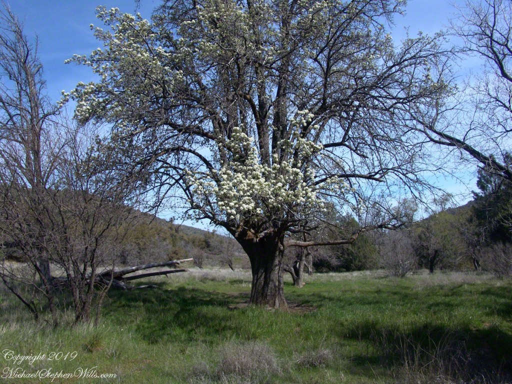
Portrait of a Blooming Apple Tree
At Rest and History
This tree is an outlier of a thick stand of several hundred trees to the north. The Searcher and I rode into the middle of the grove for a rest and chat. The horses were allowed to graze in the abundant new grass brought on by the winter rains.
The Searcher told me the story of the valley and that it was a man named Clemans who planted 600+ apple trees, trees in bloom all around us. The Reavis Valley was long a site of agriculture, starting in the 19th century with Elisha Reavis, who passed away in 1896 and is buried on the slopes of White Mountain, and continued with a series of ranchers and entrepreneurs in the 20th: John Fraser, William Clemans, who planted the trees, and John A. “Hoolie” Bacon, then Bacon’s son-in-law Floyd Stone who sold the land to the U.S. Department of Agriculture in 1967.
We talked about some earthwork I noticed, in the southern part of the valley. It was part of a water system that diverted Reavis creek flow at the head of the valley to the ranch house. We decided that strange hexogonal structure on the elevation above the house ruin was the site of water storage. At that location the structure would provide a pressure feed for the house and much else.
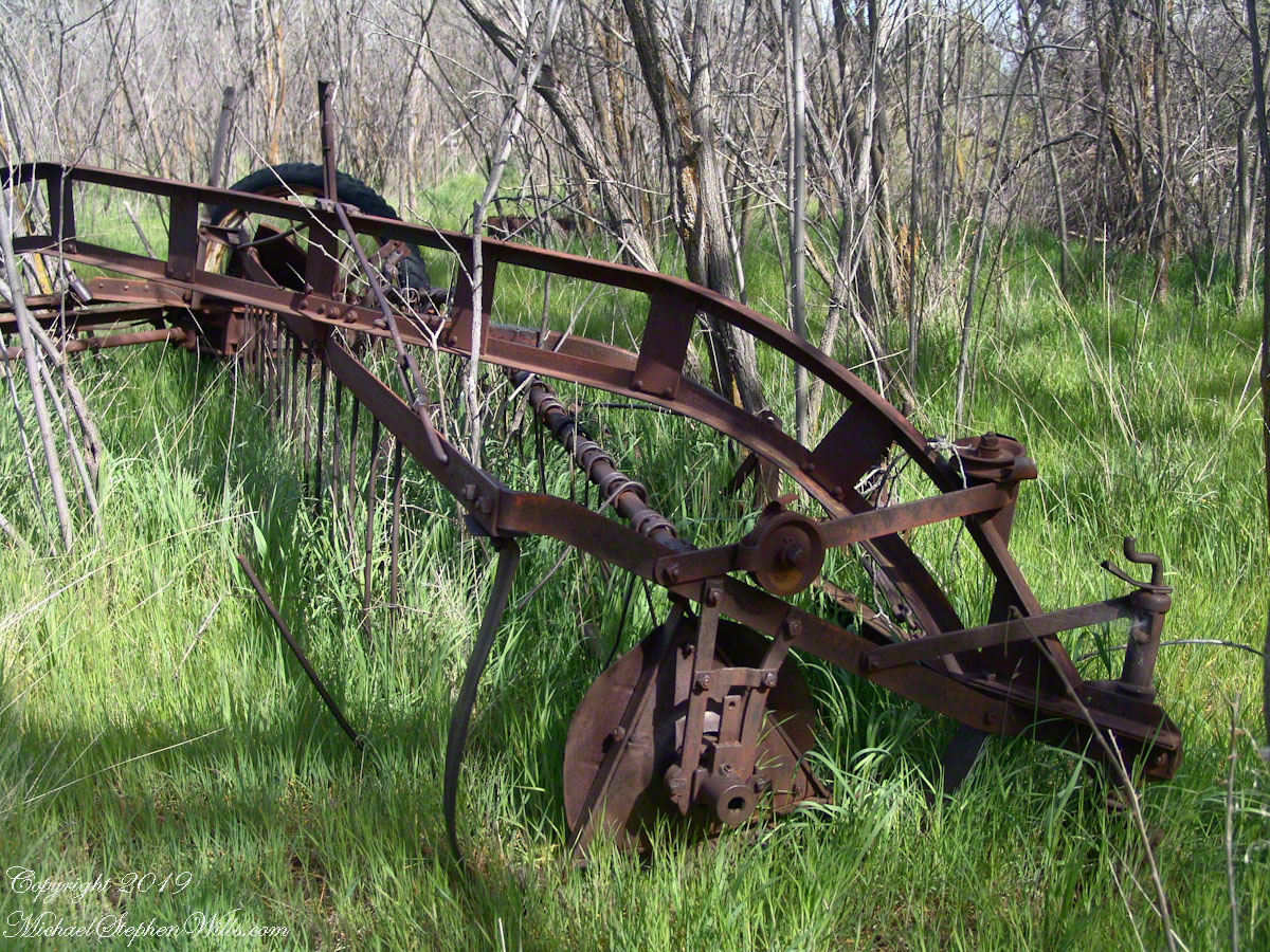
Abandoned Hay Rake
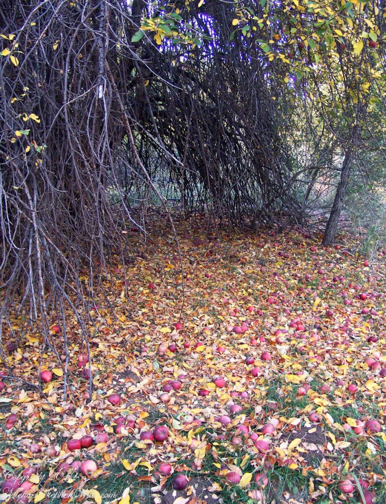
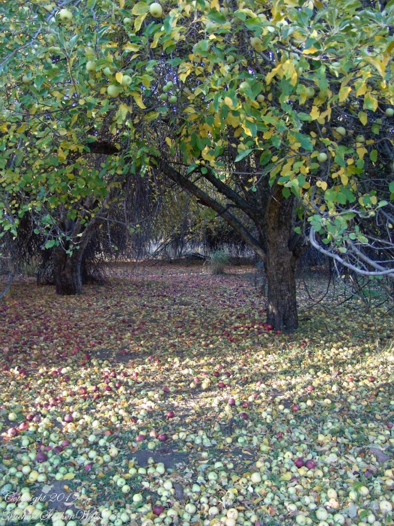
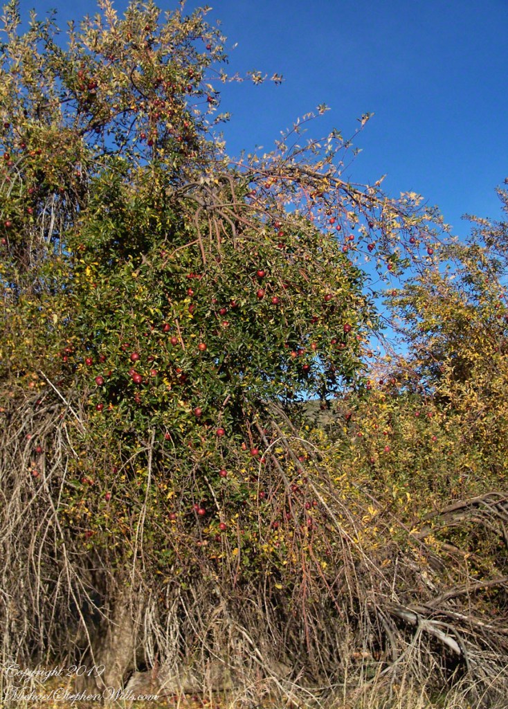
A mix of winter rains and fertile soil were exploited in the Reavis Valley for a handful of decades, the enterprise now is set aside. This abandoned hay rake and chassis, used to harvest grass in seasons past, is evidence of the work. The apple trees produce to this day without irrigation.
The Searcher touched upon the subject of the “Circlestone” ruin he mentioned on our morning ride. He had never been there, but mentioned some books on the subject. It is a wide circle of rough stone wall enclosing mysterious structures. At this point, I was hooked, and decided to check Circlestone on a later trip. Here are some photographs from one of those trips, in November 2006.
Reavis Ranch Apple Orchard Tree
Reavis Ranch Apples Yellow
Reavis Ranch Apples Red
In my next post The Searcher and I return to Pine Creek, Colorado gives me some trouble and we visit a stand of wild oats in the Reavis Gap.
Driving from the Petrified Forest National Park my son, Sean, and I arrived at Chinle, Arizona the evening of Monday, November 2, 2003. No time to rest or eat after checking into the Best Western he and I reached the White House overlook and trail head with the sun low in the sky, the sun sets 6:45 pm these last few days of Daylight Savings. The Navajo Reservation observes Daylight Savings, so the click jumps crossing the border from Arizona to Reservation.
I was 50 at the time and with Sean graduated from SUNY Maritime and fresh from a tour at sea we made good time to the canyon floor. I wanted to catch the White House in the setting sun.
One morning, 14 years later, I published a fine art photograph from that trip.
Looking along the canyon, over thick stands of Russian Olives, I caught the risen moon, in gibbous phase, against a mid-canyon freestanding fin of red sandstone of the southern canyon wall. Today, those trees are gone, removed as an invasive species.
Hitching the saddled buckskin and lightly packed pinto onto trees on the trail, The Searcher came up to my camp for a visit. I started water for tea and soon we were chatting. Right from the start The Searcher asked for privacy. Devoted to searching the Superstitions for the gold of the “Lost Dutchman Mine”, he assembles his expeditions from a staging point near Phoenix and spends about 60 days a year in the wilderness. Part of his preparation was a desert survival course provided by the Reavis Mountain School, conducted by Peter Bigfoot.
An Invitation from The Searcher
The Search described a place near Pine Creek, he called it “Circlestone,” a large almost perfect circle, of precisely constructed stone wall, on the slopes of Mound Mountain above the headwaters of Pine Creek. My sister, Diane, and I found Circlestone on backpack expeditions March and November 2006.
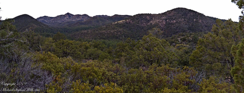
Here is a panorama from March 2006, southwest from the forests of juniper and pinion on the slopes of Mound Mountain.. The southern tip of Reavis Valley is to the right, from there Arizona Trail lead to White Mountain in the distance. It was taken on a later trip, in November of 2006 when my sister, Diane, and I visited Circlestone.
Click any photograph for a larger image.
The Searcher also told of Elisha Marcus Reavis, who settled the Valley west of Pine Creek in 1874. At one point, a band of Apaches planned to kill Reavis, but were respectful of his reputation as a rifle shot. They were waiting him out across from the his dugout, when Reavis stripped naked and with wild hair and a flaming red beard charge their camp, knives in both hands. The Apaches rode off, wary of his insane behavior, and never bothered him again.
We talked about my prospects and plans when The Searcher offered to take me to the Reavis Valley the next day, on horseback. There is a large apple orchard there and, this being April, we’d be treated to masses of apple blossoms. The day after Reavis Ranch, I could pack out with him down the Arizona Trail, past the Reavis Mountain School, over Campaign Creek and drive back to the Lost Dutchman Park. I readily agreed.
To Reavis Ranch on Horseback
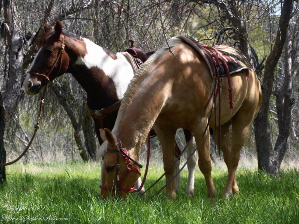
The following morning dawn rose from colorless darkness, thin birdsong and brightening high clouds. When the Searcher arrived around 8 am he was leading the pinto, introduced as Colorado, equipped with a western saddle instead of a pack. As an absolute novice trail rider, the Search would hold Colorado’s lead. The reins were wrapped around the saddle horn, leaving me to hang on and “enjoy the view” and swishing tail of the buckskin, named Nugget.
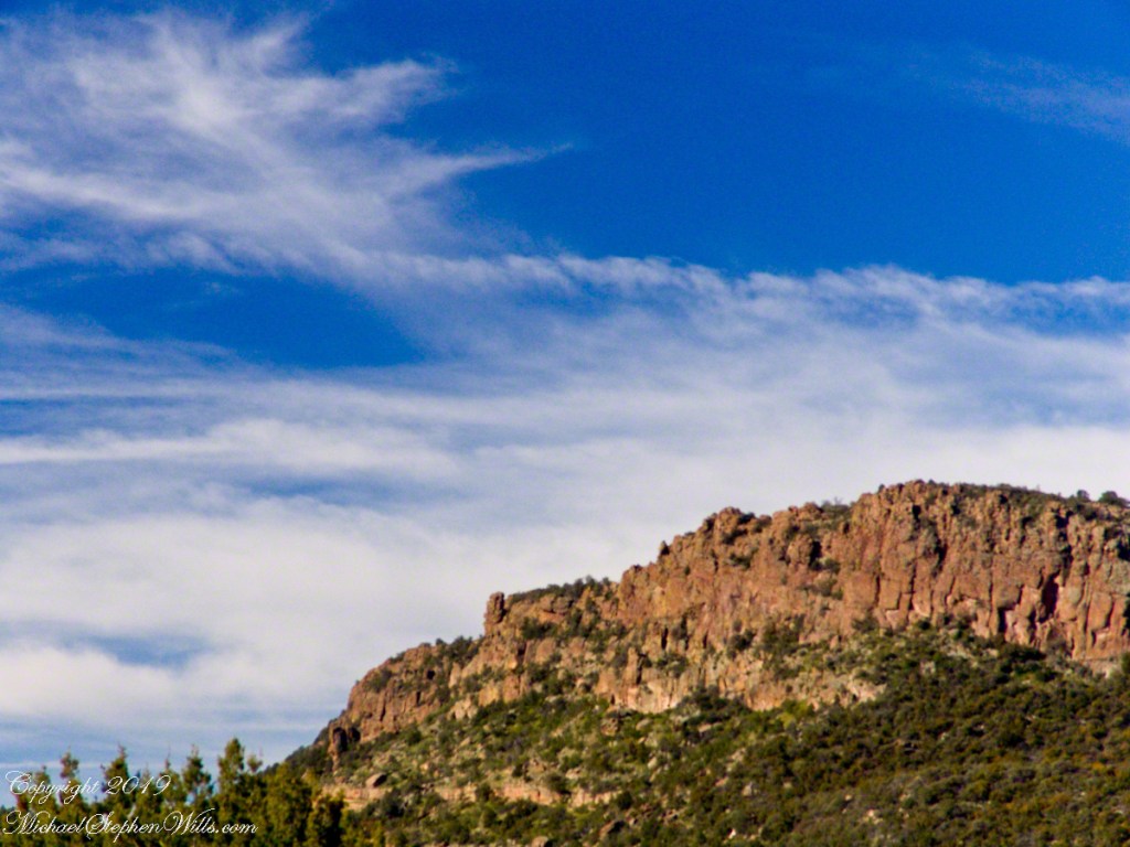
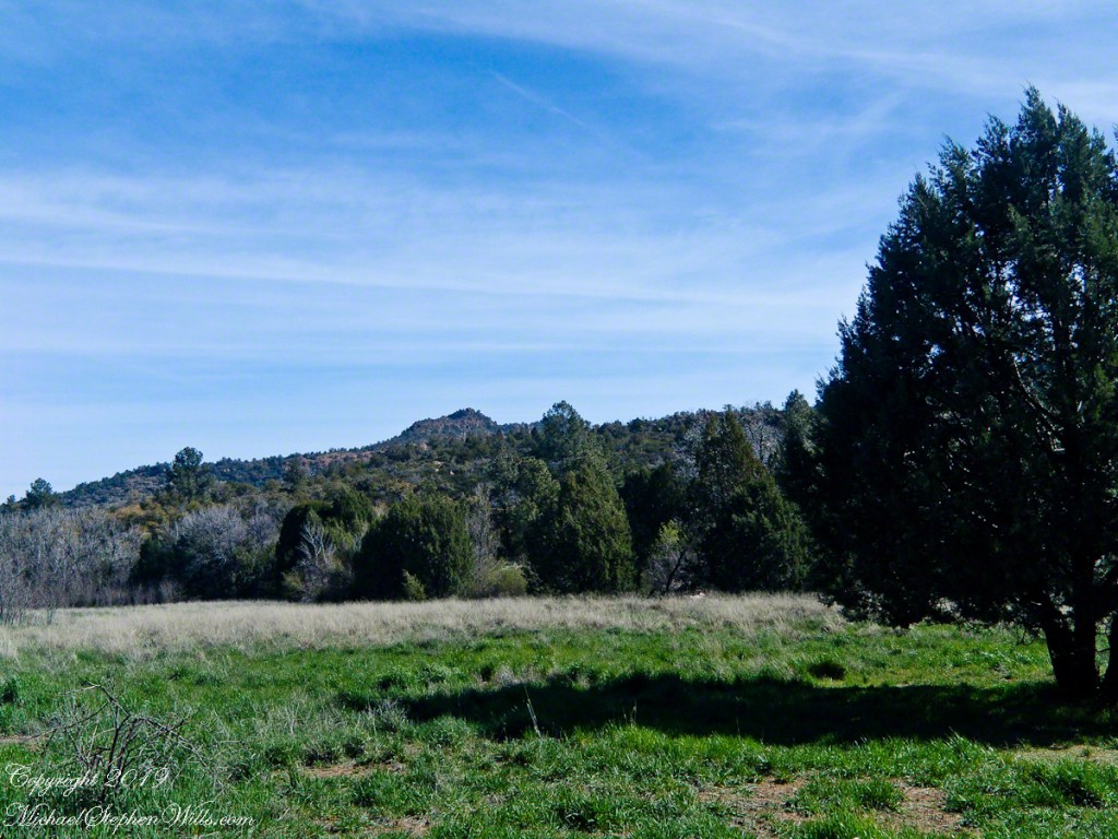
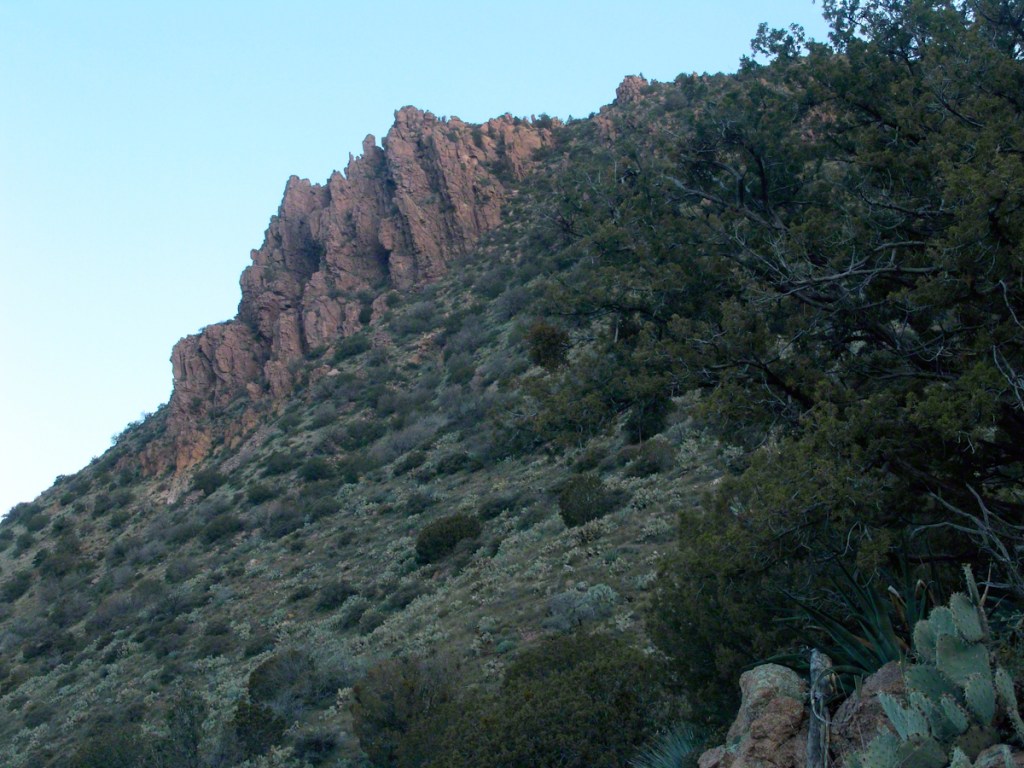
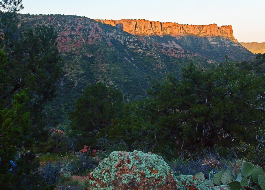
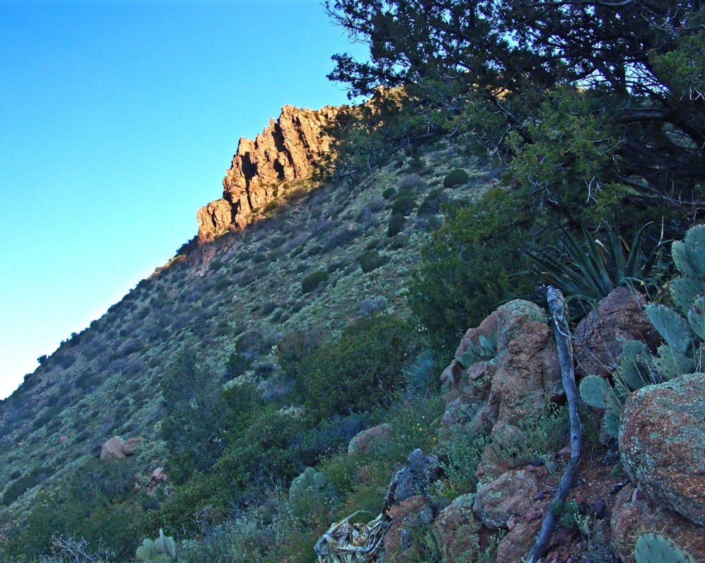
The 2.5 mile trail to Reavis from Pine Creek is typical of the eastern Superstitions, minimally improved, dramatically uneven with large and small boulders to navigate. From Pine Creek there’s a climb of a 631 feet to 5,278 foot elevation, where it meanders beneath a dramatic red cliff with a view of the pinyon/juniper forests on the slopes of Mound Mountain. As he picked our way, The Searcher pointed out the sights. “Circlestone is somewhere over there, a ring of stones overgrown with Alligator Juniper.” I was able to do little more than observe, photography was out of the question.
A cliff along the trail to Reavis Ranch offered cover and the flat perches preferred by cougars. It was not an issue for us in daytime and attacks against horses are very rare. The most either of us ever saw of the cat in all our time in Arizona was the tip of a tail slipping behind brush. This was a lush April after a “wet” winter, so small game was plentiful. Only a sick cat would be hungry. The worst case scenario is for a cougar to meet and become infected from a rabid animal at a water source and we did not linger on this thought.
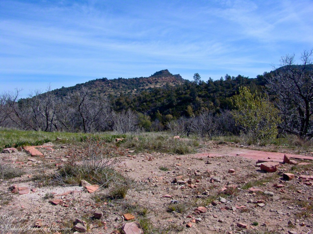
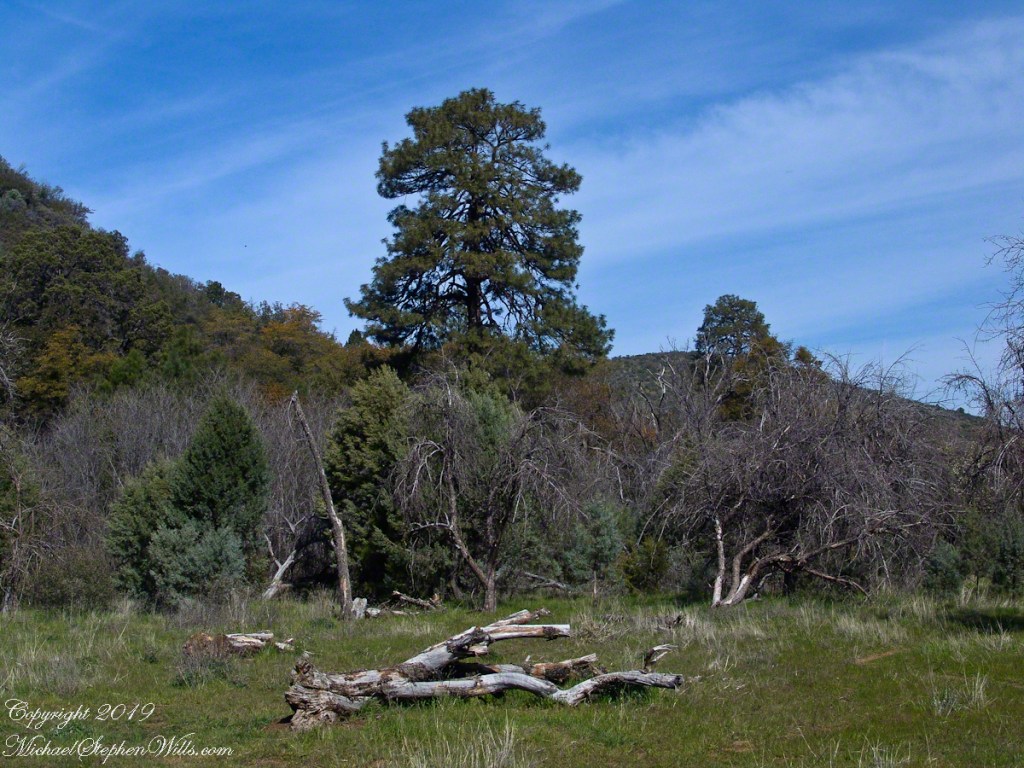
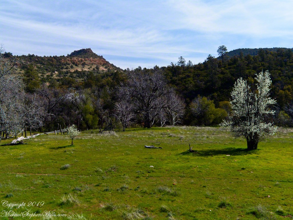
Eventually, the cliff descended with the path, steeply, to Reavis Creek, the valley floor and the intersection with the Reavis Ranch trail. Heading south the Reavis Ranch trail passes the site of a long abandoned ranch. What’s left of the adobe and stone ranch house is on a level valley elevation overlooking what used to be the corral and a large open expanse.
Open field at near the juncture of the trail from Pine Creek with the Reavis Ranch trail.
Apple trees in bloom from the former site of the ranch house. There used to be a pond near this spot. With a little imagination, the trail from Pine Creek can be seen on the far ridge.
Reavis Ranch Trail, foreground, traverses the valley length north to south. The Arizona Trail from Pine Creek following below the red rock cliffs in the distance.
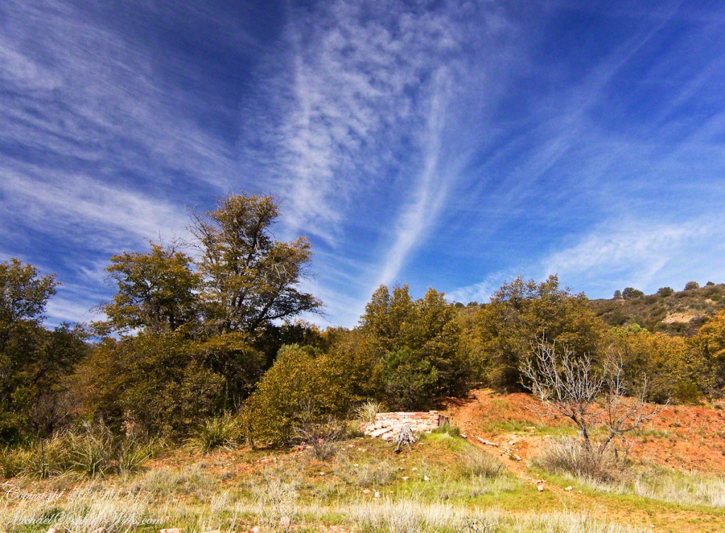
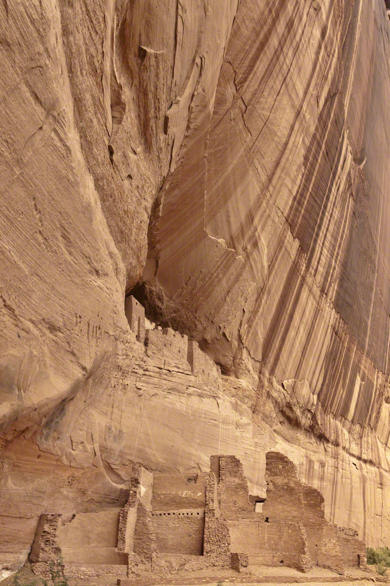
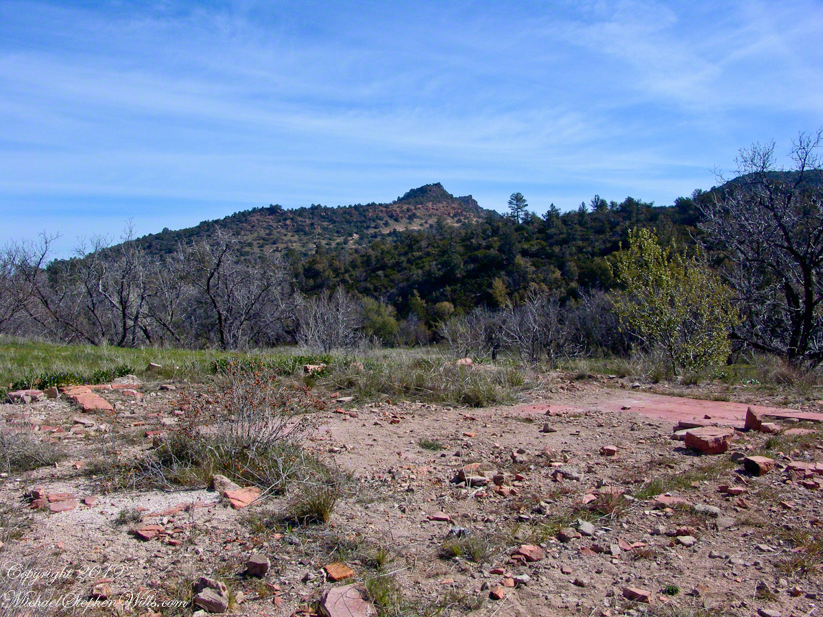
The US Forest Service razed the building after it “burned to the ground” around Thanksgiving 1991. I would not call what is left “a foundation,” it is a platform where the house stood. You can see for yourself in this photograph what was once was a homey tile floor. I’ve seen old photographs of the structure with a large pond to the left of this view, a door and simple porch face east and the pond used to hold irrigation water.
Turn around from this ruin and a platform comes into view. Built on the west valley slope, overlooking the ruined house is a hexagonal foundation of adobe bricks. We are looking here across the Reavis Ranch trail. My opinion about this structure rests on an examination of the land to the south, there is excavation of a shallow canal and this was the way water was captured from the upper Reavis Creek or tributary and directed to this catchment basin where it was then directed for storage or irrigation. The spot enjoys clear views of the central valley, an excellent place to enjoy the fall of evening.
The Searcher led me to a place a few hundred yards south, in a narrowing of the valley, where he let Colorado and Nugget roam free. The horses appreciated the level, open spaces and I enjoyed the Ponderosa pines on the west valley slope. We sat on the smooth trunks of fallen trees, 4 feet in diameter, near Reavis Creek.
Colorado took this opportunity to bolt, headed south. We took off after him into and through a thicket of locust trees where The Searcher cornered Colorado to regain control. “He was abused by his previous owner and is difficult at times,” was how The Searcher put it.
We were close to the end of Reavis Valley where Reavis Creek originates from the drainage of White Mountain, to the west.
We headed north here, back to the ranch house site, to the lush new grass of the apple orchard.
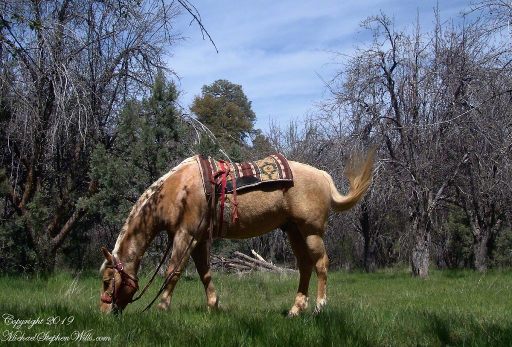
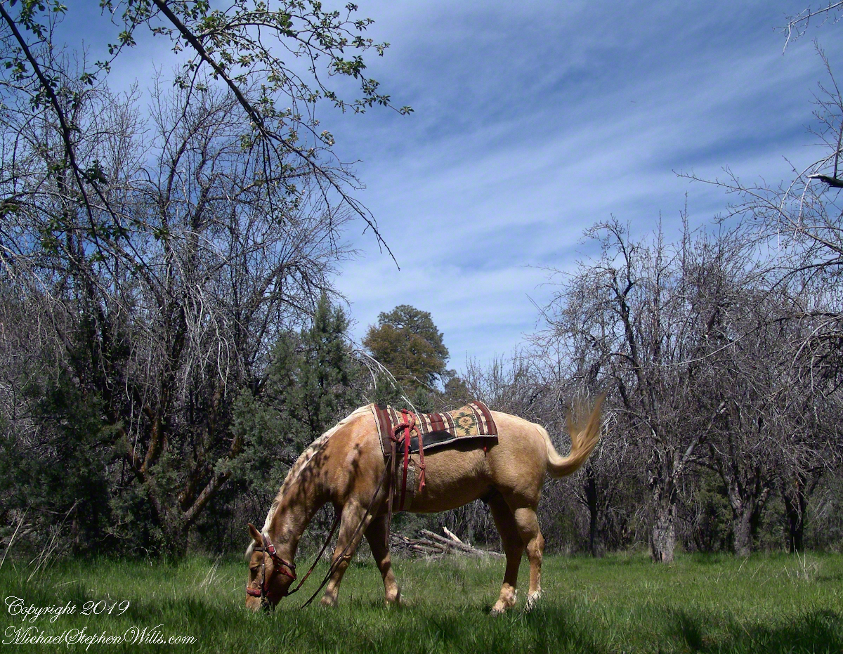
Nugget in Horse Heaven
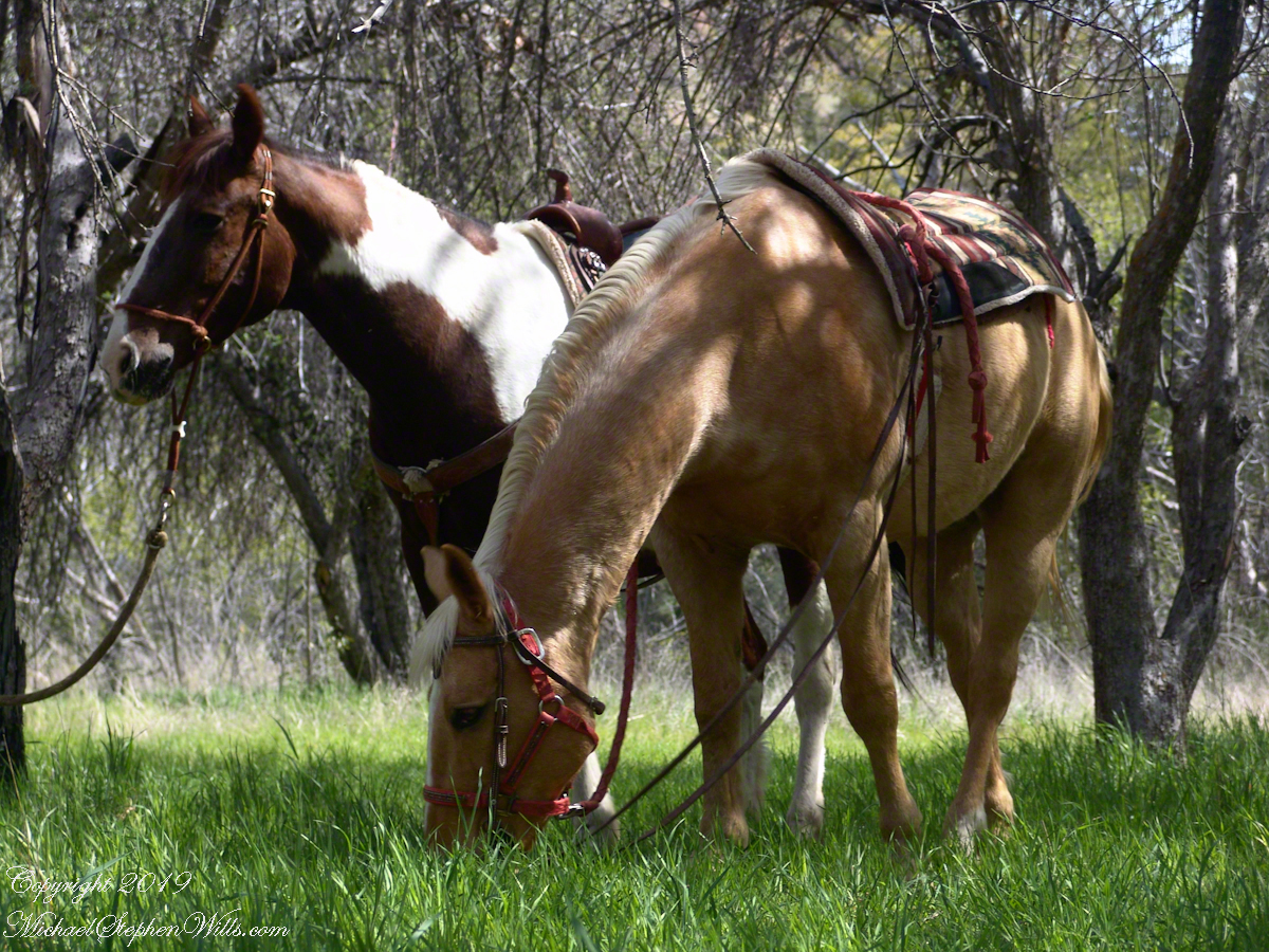
Nugget grazed unfettered. Colorado was tethered with plenty of slack for grazing. This photograph of the pair shows their personalities, Colorado edgy, Nugget content to feast while the grass is available.
Colorado on the alert while Nugget grazes, typical of their personalities.