Napoleonic Era Signal Tower

19th Century Technology

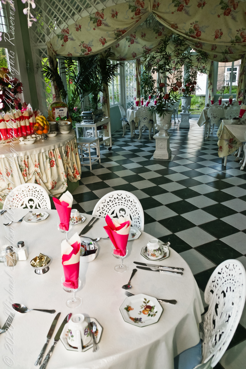
Our day of touring Kinsale and environs, the last day of May 2014, began with this elegant breakfast by Marantha House near Blarney, our base for County Cork.

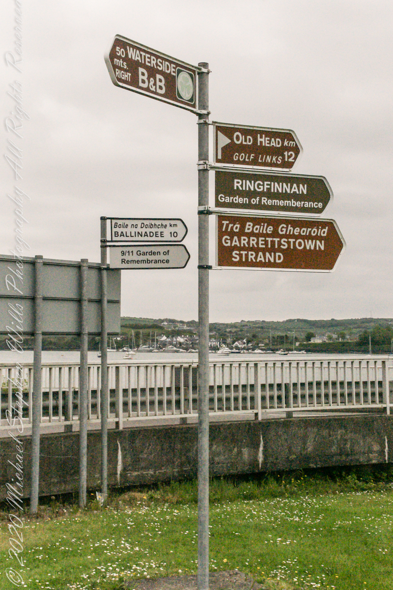
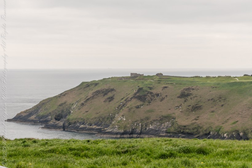
On the way to the Old Head of Kinsale. Located in Knocknacurra on the Kinsale side of Bridge Kinsale on R600. Looking toward the peninsula of Castle Park Village and James Fort. Coordinates 51°41’40.1″N 8°31’42.0″W

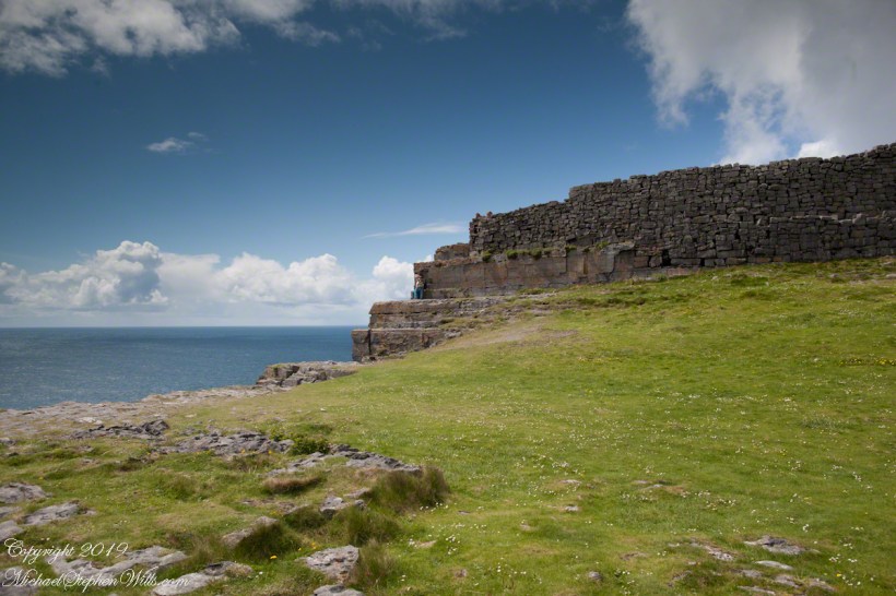
This tower, at the apex of the Old Head ring route, has extensive views. The next station at Seven Heads, to the southwest, is visible against the skyline on a clear day. These are two of the 81 stations planned for this signaling system implemented in the first years of the 19th century when a French naval invasion was a possibility.

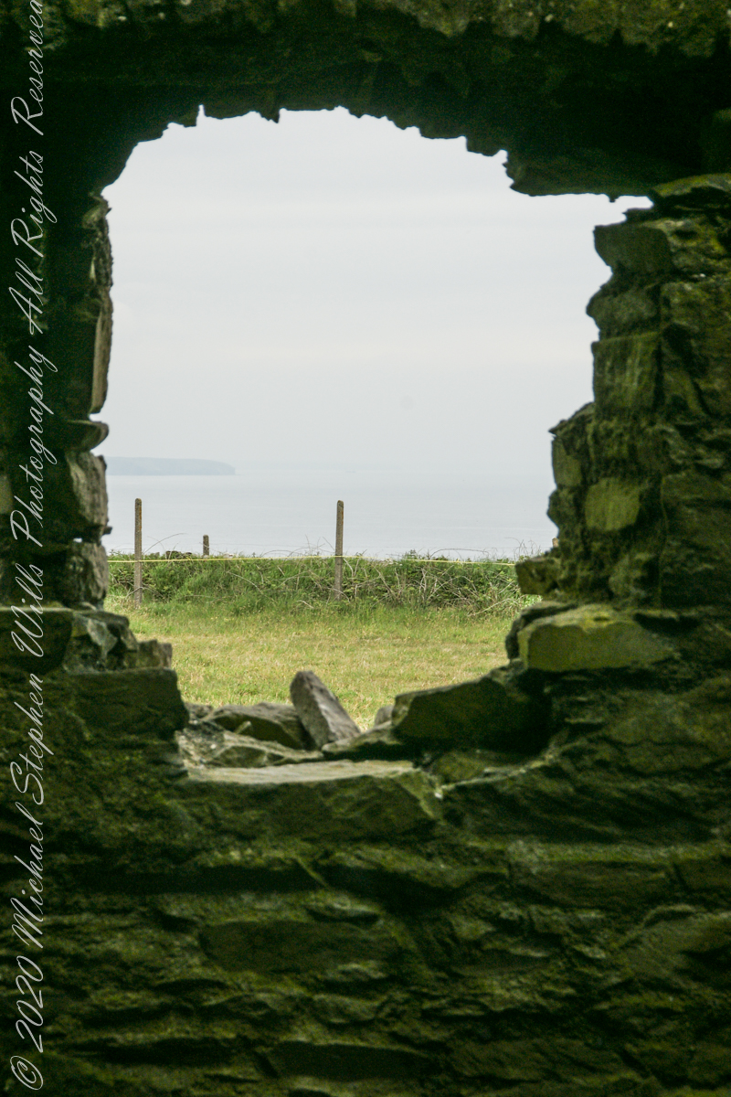
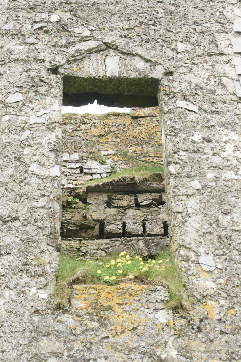
The Kinsale tower is just over nine meters high, with walls up to 80 cm thick. Records show a signal crew was in place in 1804 and the tower finished the following year, though severely affected by dampness. When Napoleon was defeated by Wellingtons forces at Waterloo, 1815. With the diminished threat these expensive installations were neglected. The 1899 Ordnance Survey map lists the site as being in ruins. During our 2014 visit the local community was renovating the tower and the work appears complete sometime before 2021.
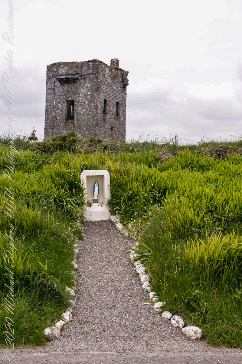

References
Click me for Irish Times 2013, “Ireland’s Napoleonic-era signal towers.”

Copyright 2021 Michael Stephen Wills All Rights Reserved

Leprechaun Rock along the Tain Way

The Last Leprechauns

Rocks such as this are a favorite perch for leprechauns to rest and contemplate the works of man who have invaded their world. Inhabitants of Carlingford who wander Slieve Foye have come upon them often enough, their stories and certitude in the existence of the Little People are resistant to manifold doubters with their reasons and arguments.

leprechaunRockCarlingford-02245
Click this link for my Ireland gallery of Fine Art Photography.

Kevin Woods, aka McCoillte, was a doubter until worked on a stone wall on property he owned on Ghan Road, Carlingford. His belief did not arise on the discovery of the leather purse, covered with ages of dust and lime, nor with the gold coins inside. McCoillte pocketed the coins for luck. As luck would have it, McCoillte loved to walk on Slieve Foye. It was on one such walk he and his dog encountered Little People who paralyzed them to escape. His unexplained absence led to troubles with the wife.

EuHabitatsDirective-02267
Click for Leprechaun Rock in my Fine Art Gallery. Enjoy!!

This experience brought McCoillte around to enough of a belief that he, with lots of help, succeeded in petitioning the E.U. European Habitats directive to recognize leprechauns a protected species.  According to a page on the Celtic Times web site, “The E.U. sent Madame Isobel Jeanne from Fecamp in Brittany France to Carlingford with the official letter declaring Carlingford Mountain (Note: otherwise known as Slieve Foye) protected, on the grounds that they could not prove or disprove their existence.”  The page is titled “The Carlingford Leprechaun.”  Google “Last Leprechauns” learn more about McCoillte’s stories.

I came upon this rock on June 9, 2014 on a day my cousin Sean Mills invited us to walk the Tain Way over Slieve Foye. It was such a finely shaped piece of what I suppose to be granite, the view of Carlingford, the lough and farmland so compelling, I spent time composing this landscape.

You can make out “King John’s Castle” just over the ridge and its yellow flowering gorse, on the margin of the blue lough. It is the boxy, grey structure; crenellations are visible on high resolution versions of the image. Carlingford is known for the castle, the popular name is for the English monarch who spent time there, although it was built by another.

Visit the opening chapter of our time on the Tain Way

Copyright 2021 Michael Stephen Wills All Rights Reserved

Farmland Southeast of Carlingford

Beauty of the Cooley Peninsula, County Louth, Ireland

I offer here a continuation of descriptions of a 2014 walk on the Tain Way, an appreciation of the lore and beauty of Ireland.

Descending the Tain Way from the ridge of Golyin Pass the sweep of Cooley Peninsula spread before us. Louth is the smallest of the Irish Republic counties, a peninsula which is mountainous where it is not farmland, one exception being Carlingford with the most people, population 1,405 in 2016.

Residential Carlingford continues along the Greenore Road, farmland adjoins then continues southeast along the Cooley Peninsula margin, the Irish Sea beyond. Greenore Town and deep water port on upper left.  These photographs are views from the Tain Way on the slopes of Slieve Foye, the highest mountain of County Louth.

Greenore Town and Deepwater Port
Click this link for my Ireland gallery of Fine Art Photography.

Wander through the place names: Chapel Hill, Liberties of Carlingford, Moneymore, Leminageh, Crossalaney, Mullatee, Millgrange, Ramparts, Muchgrange, Ballyamony, Mullabane, Petestown, Ballagane, Willville, Whites Town.


There is a deepwater port on Carlingford Lough adjacent to and part of Greenore Town. The port employed Cousin John Mills years ago, supplementing his farm income. Across the lough is Greenecastle, Newry in Northern Ireland.

Greenore Town and Deepwater Port

The Irish Sea opens on the far side of Greenore with the Isle of Man about 52 miles east and a little north.

Visit the opening chapter of our time on the Tain Way

Click link for the next posting of this series, “Leprechaun Rock along the Tain Way”

Copyright 2021 Michael Stephen Wills All Rights Reserved

Where a fort falls away

An abrupt emptiness

Here is the east side of the inner enclosure wall of Dun Aonghasa (Dun Aengus) where it ends at a cliff edge over the Atlantic ocean.

Visible are the last 60 feet or so of the limestone strata supporting the inner ring.

When first constructed, the inner ring was complete, the western side 1,000 feet from the cliff.. Today’s form of a semi-circle was created by nature when the force of Atlantic Ocean waves eroded the cliff, undercutting the strata.

Look close to see a fracture where the next block of limestone will fall into the waves.

Wishing a blessed All Saints Day (November 1st) for all my readers.

Click me for the first post of this series, “Horse Trap on Inishmore.”

Reference: wikipedia Dún Aonghasa, Sea Campion

Copyright 2019 Michael Stephen Wills All Rights Reserved