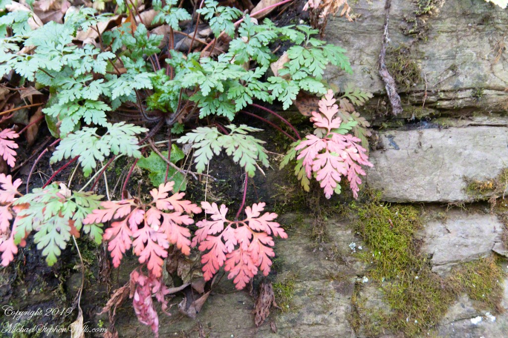
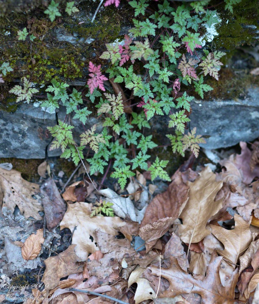
This geranium species (scientific name Geranium robertianum) are also called “Herb-Robert” for a reputed ability to ward off disease.
Click photograph for a larger view. To do this from WordPress Reader, you need to first click the title of this post to open a new page.
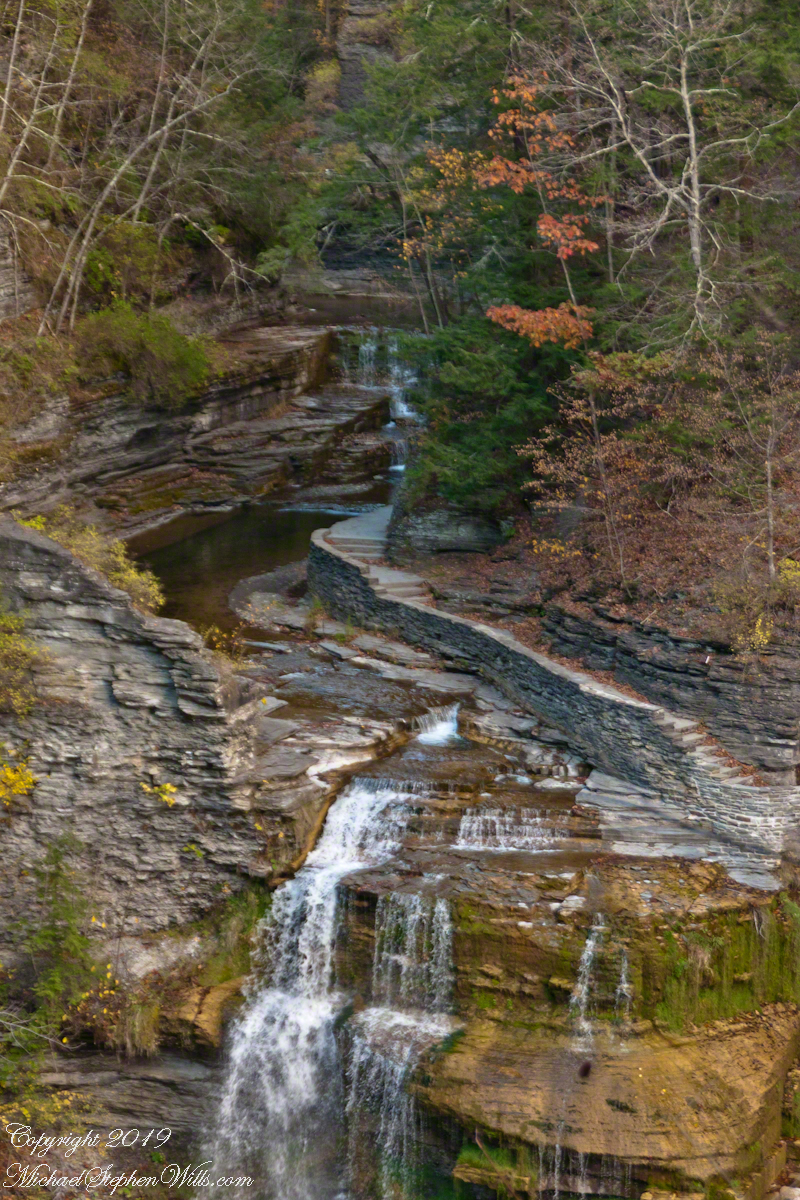
Cliff Stair Wall, autumn Geranium and mosses
Scottish Highlands residents call these wild geraniums “red-shanks” for the deep red color of the stalks, seen in both photographs.
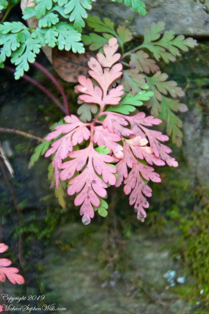
This geranium species (scientific name Geranium robertianum) are also called “Herb-Robert” for a reputed ability to ward off disease and, in the Scottish Highlands, “red-shanks” for the deep red color of the stalks, seen in this photograph. Robert H. Treman New York State Park. Source, “How to Know the Wildflowers” by Mrs. William Star Dana, 1989, Houghton Mifflin, Boston.
Robert H. Treman New York State Park.
Source, “How to Know the Wildflowers” by Mrs. William Star Dana, 1989, Houghton Mifflin, Boston.
Click for a slideshow of this sequence Cliff Stair Views
Lucifer Falls from Rim Trail OverlookLucifer Falls from Rim Trail OverlookUnidentified TreePam on the Cliff StaircaseCliff Stair Wall, autumn with fern generationsCliff Stair Wall, autumn Geranium and mossesThis geranium species (scientific name Geranium robertianum) are also called “Herb-Robert” for a reputed ability to ward off disease and, in the Scottish Highlands, “red-shanks” for the deep red color of the stalks, seen in this photograph. Robert H. Treman New York State Park. Source, “How to Know the Wildflowers” by Mrs. William Star Dana, 1989, Houghton Mifflin, Boston.Wild geranium leaves tinged with autumn color above a gathering of spent oak and elm leaves. Robert H. Treman New York State Park of the Finger Lakes Region.
Copyright 2023 All Rights Reserved Michael Stephen Wills
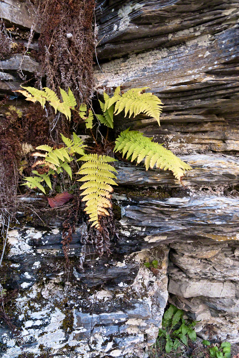
Each autumn, species of fern turns yellow towards a winter death. Here we see growing from Devonian shale, both the yellowed and desiccated fern fronds. Robert H. Treman New York State Park.
Click photograph for a larger view. To do this from WordPress Reader, you need to first click the title of this post to open a new page.
Cliff Stair Wall, autumn with fern generations
Click for a slideshow of this sequence Cliff Stair views
Lucifer Falls from Rim Trail OverlookPam on the Cliff StaircaseCliff Stair Wall, autumn with hemlock
Copyright 2023 All Rights Reserved Michael Stephen Wills
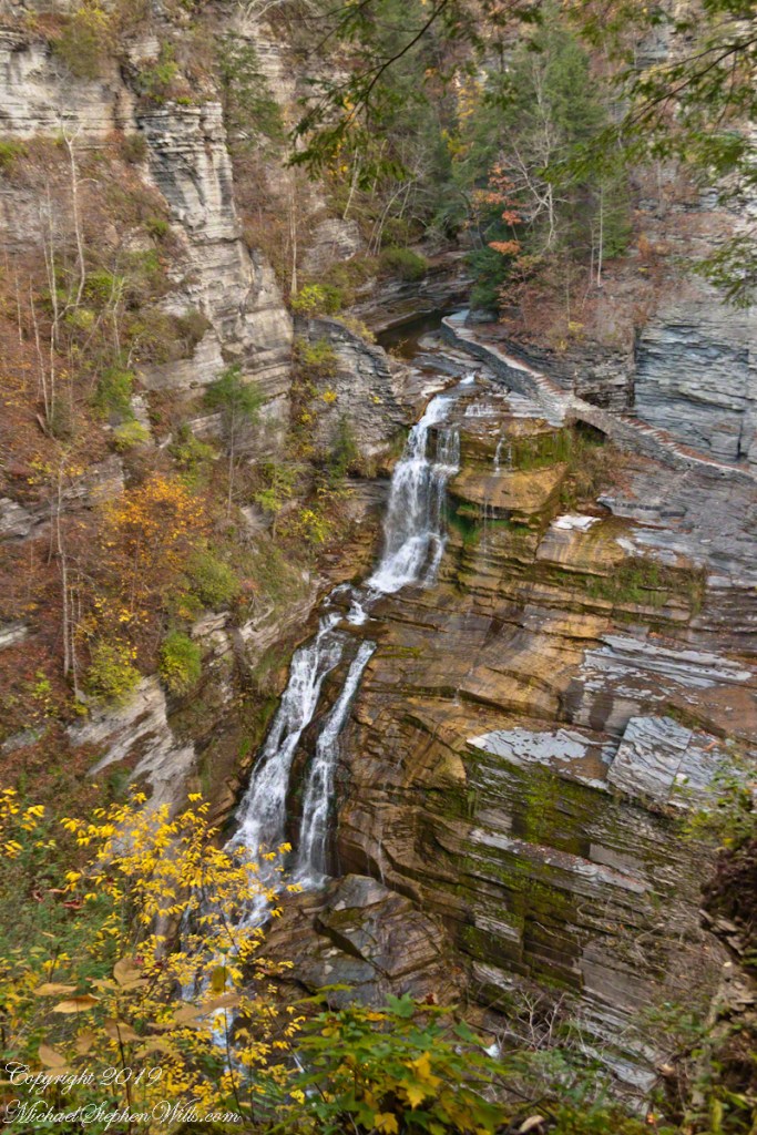
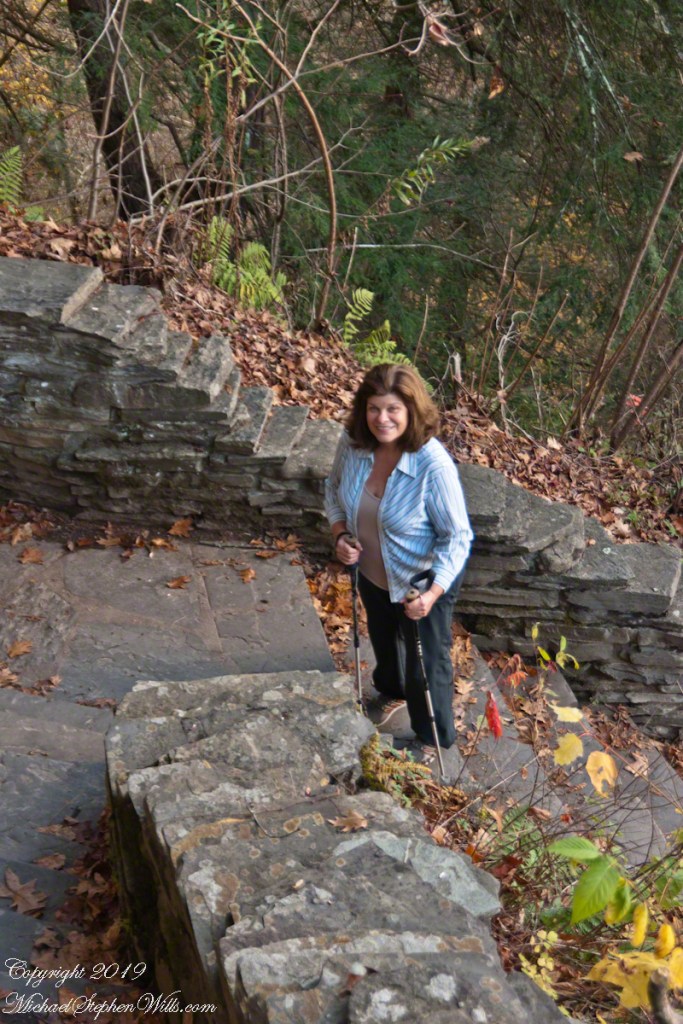
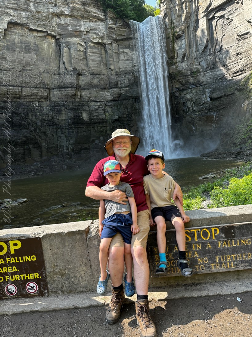
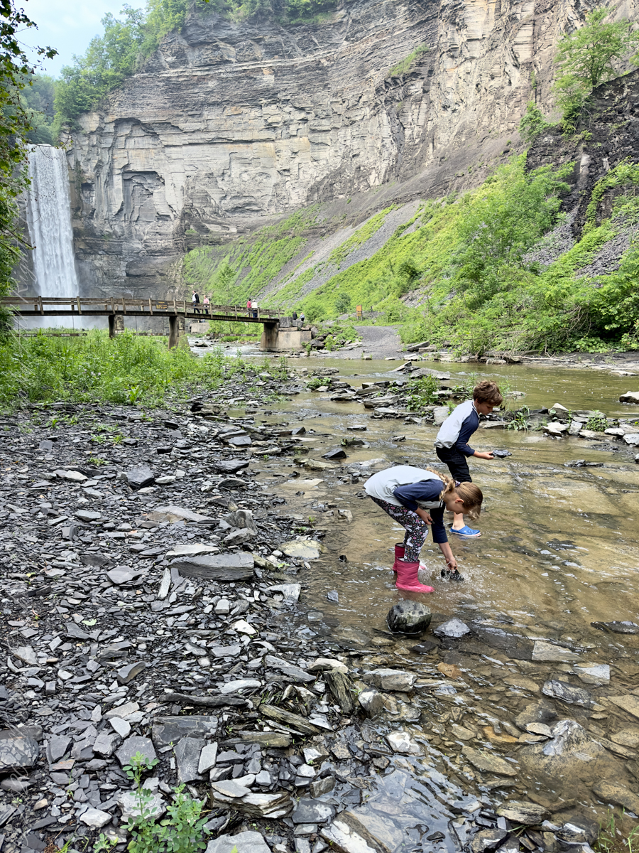
On a day in late October 2017 Pam and Mike did a photography walk. Here is Pam pausing to pose during a descent into the gorge on the cliff staircase after visiting the overlook high above Lucifer Falls, Robert H. Treman New York State Park in the Finger Lakes Region.
Click photograph for a larger view. To do this from WordPress Reader, you need to first click the title of this post to open a new page.
Pam on the Cliff Staircase
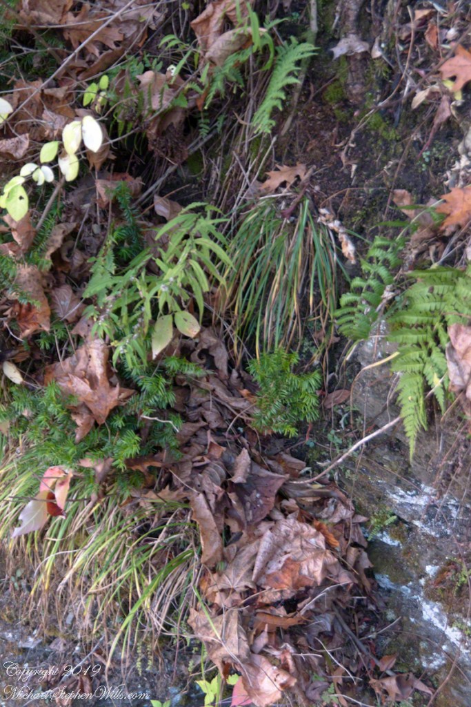
Grasses, hemlock saplings, goldenrod, spent leaves and ferns on the wall of the 223 Cliff Stair steps.
Cliff Stair Wall, autumn with hemlock
Click for a slideshow of this sequence of Lucifer Falls view from the overlook.
Pam on the Cliff StaircaseCliff Stair Wall, autumn with hemlock
Copyright 2023 All Rights Reserved Michael Stephen Wills
Several possible sources have been proposed for the name Taughannock, all of which describe Native American origins. One translation suggests that the name is derived from a combination of Iroquois and Algonquin terms meaning “great fall in the woods”. An alternate theory suggests that the name may refer to a Lenni Lenape (Delaware) chief named Taughannock who died near the falls during a battle.
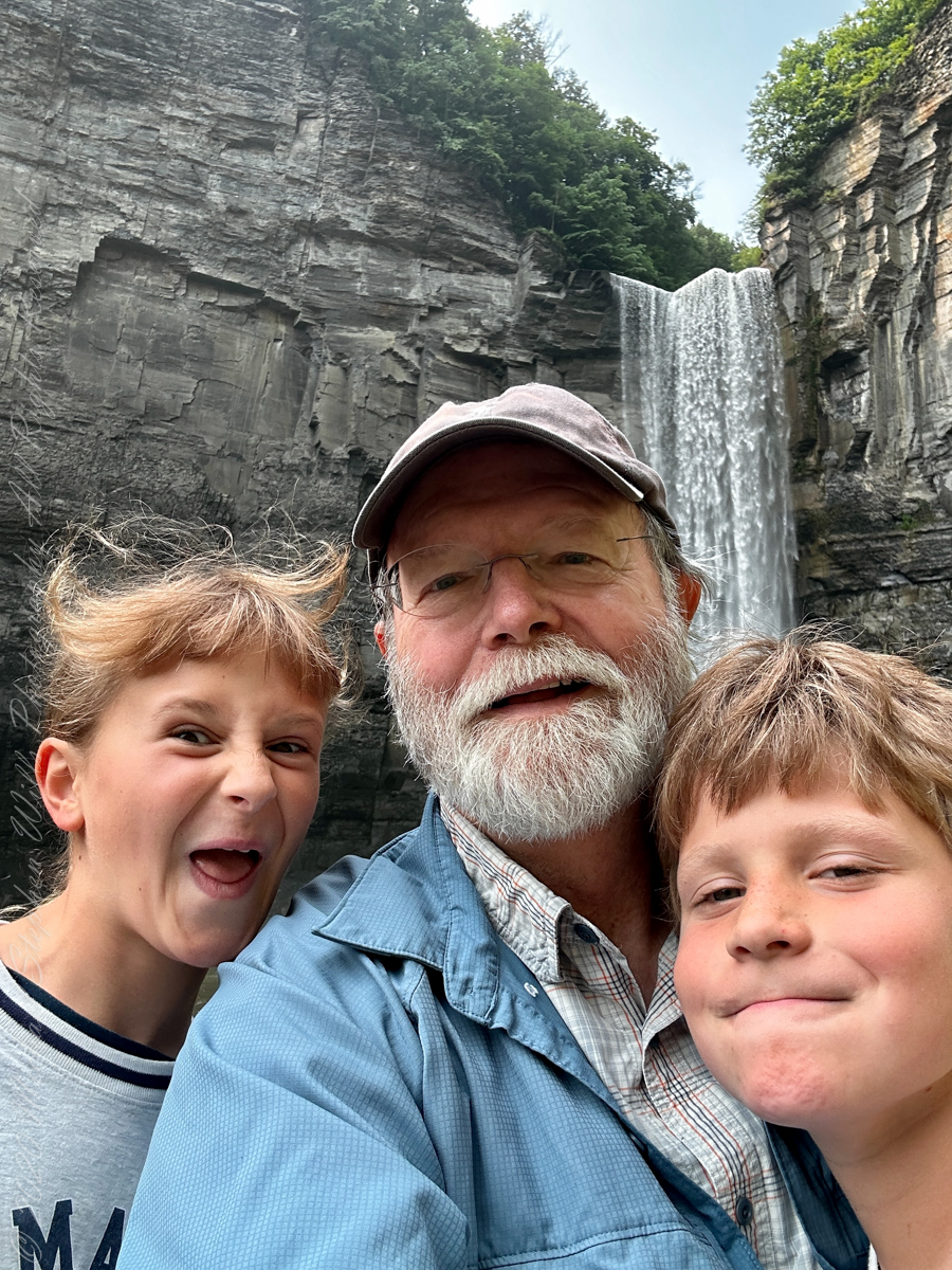
A nice lady offered to take the photo….challenged to keep it straight.
During the second half of the nineteenth century, steamboats, railroads and Victorian hotels were built in the region to serve tourists who traveled to view the falls. By 1925 the hotels were failing due to a decline in tourism, and New York State began acquiring land to form a park.
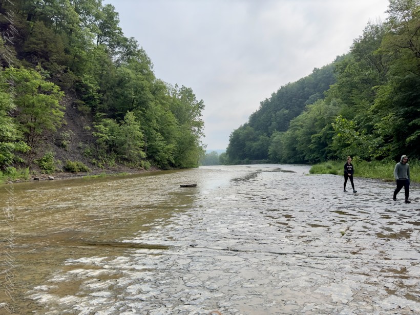
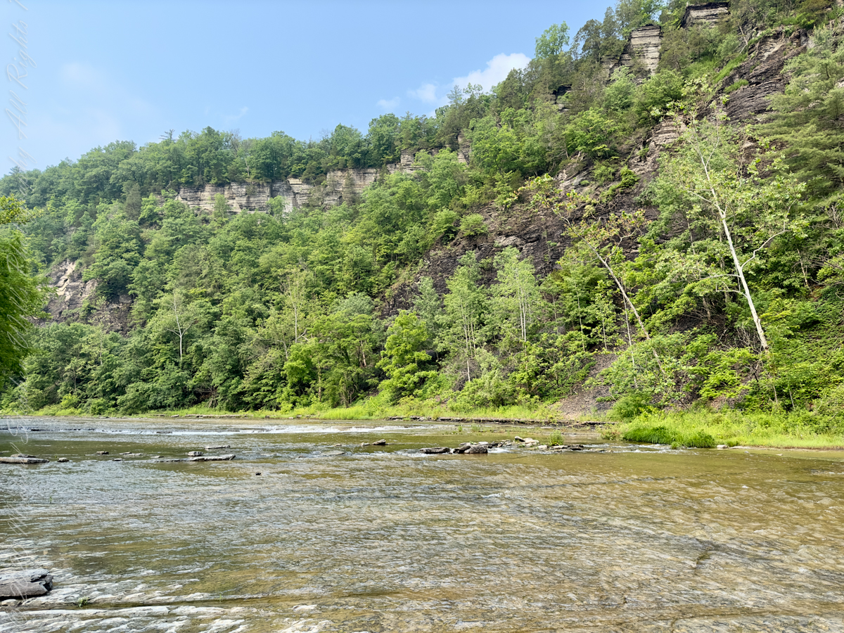
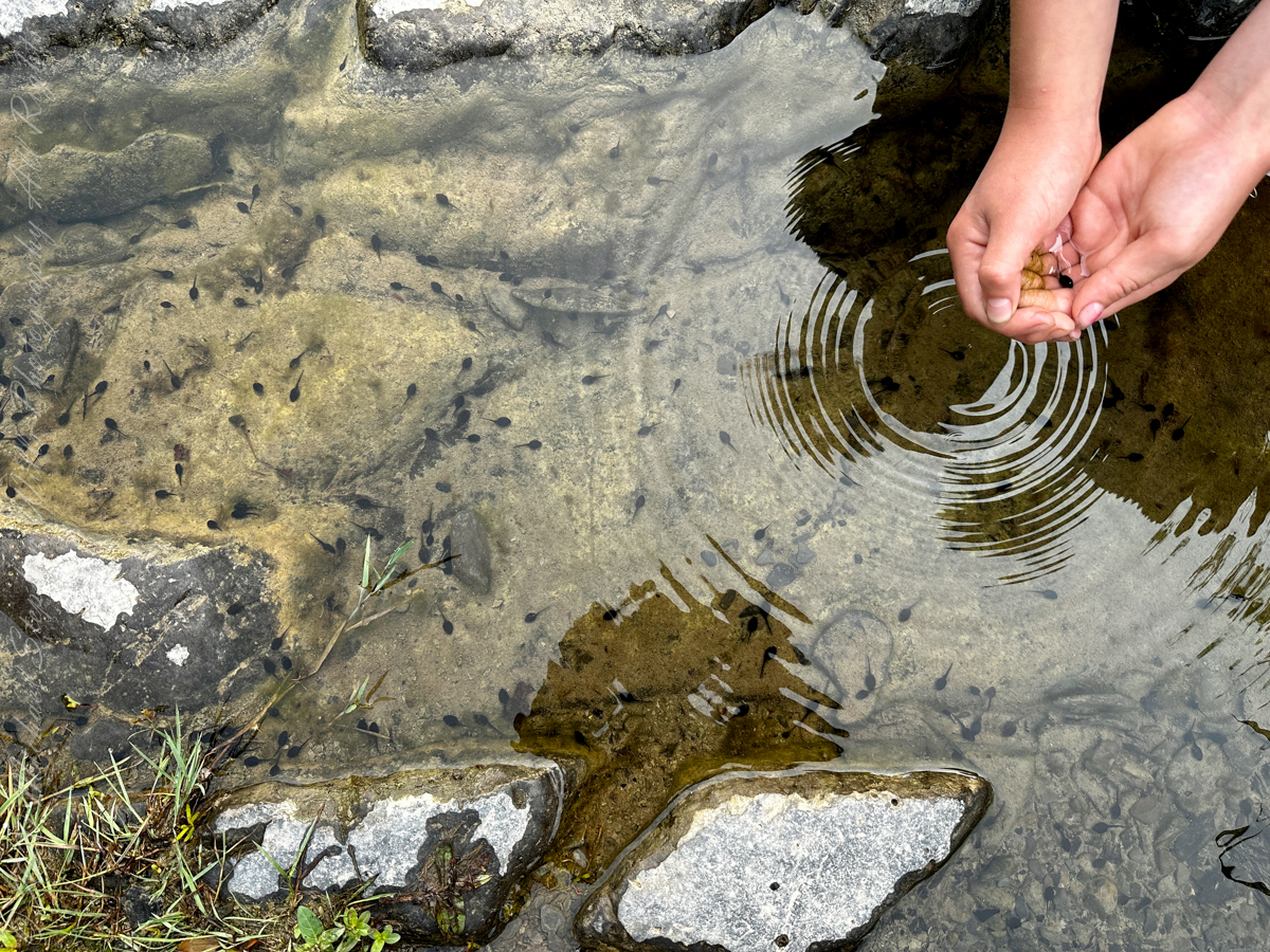
Pollywogs!! Catch and release
J.S. Halsey built a two and a half story hotel in 1850, known variously as the Cataract Hotel or Taughannock House (or simply as Halsey’s Hotel) at the Taughannock Falls Overlook.
Visitors could reach the hotel by taking a train to Cayuga Lake, take a steamboat across the lake to Goodwin’s Point, then finally board a stagecoach to reach the hotel. The hotel site today is the location of the park visitor center and parking lot.
Enjoy!!
Copyright 2023 Michael Stephen Wills All Rights Reserved
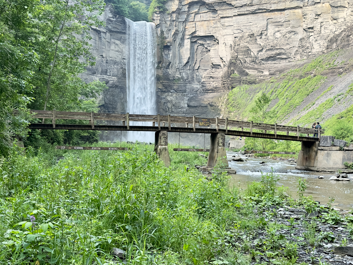
The waterfall and gorge comprise an example of a hanging valley, formed where Taughannock Creek’s stream-carved valley meets the deeper glacially carved valley that contains Cayuga Lake.
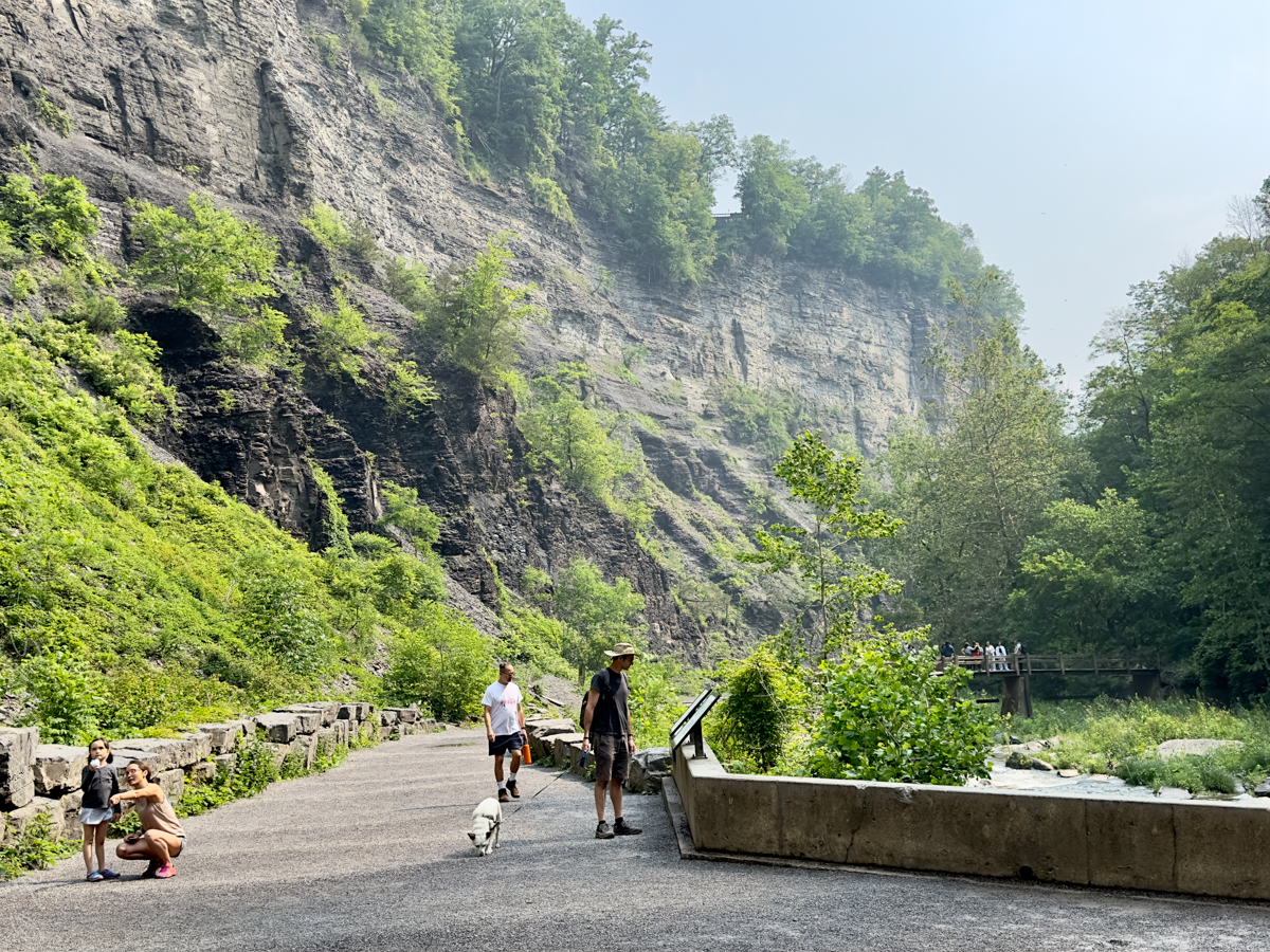
The gorge has continued to retreat westward from Cayuga Lake as easily eroded shale near the fall’s base is worn away by the stream, which supports erosion-resistant siltstone and sandstone found in the upper portions of the gorge.
Pollywogs!! Catch and release
Annual freeze and thaw cycles also act upon small faults in the rock, causing large sections to occasionally break away, further expanding the gorge.
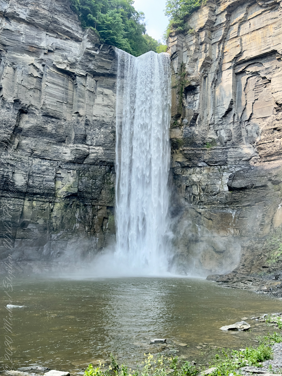
Taughannock Falls’ main cataract is a 215-foot drop (66 m), making it 33 feet (10 m) taller than Niagara Falls. It is the tallest single-drop waterfall east of the Rocky Mountains. The waterfall is located along Taughannock Creek, which flows through a long gorge with cliffs up to 400 feet (120 m) high.
Enjoy!!
Copyright 2023 Michael Stephen Wills All Rights Reserved
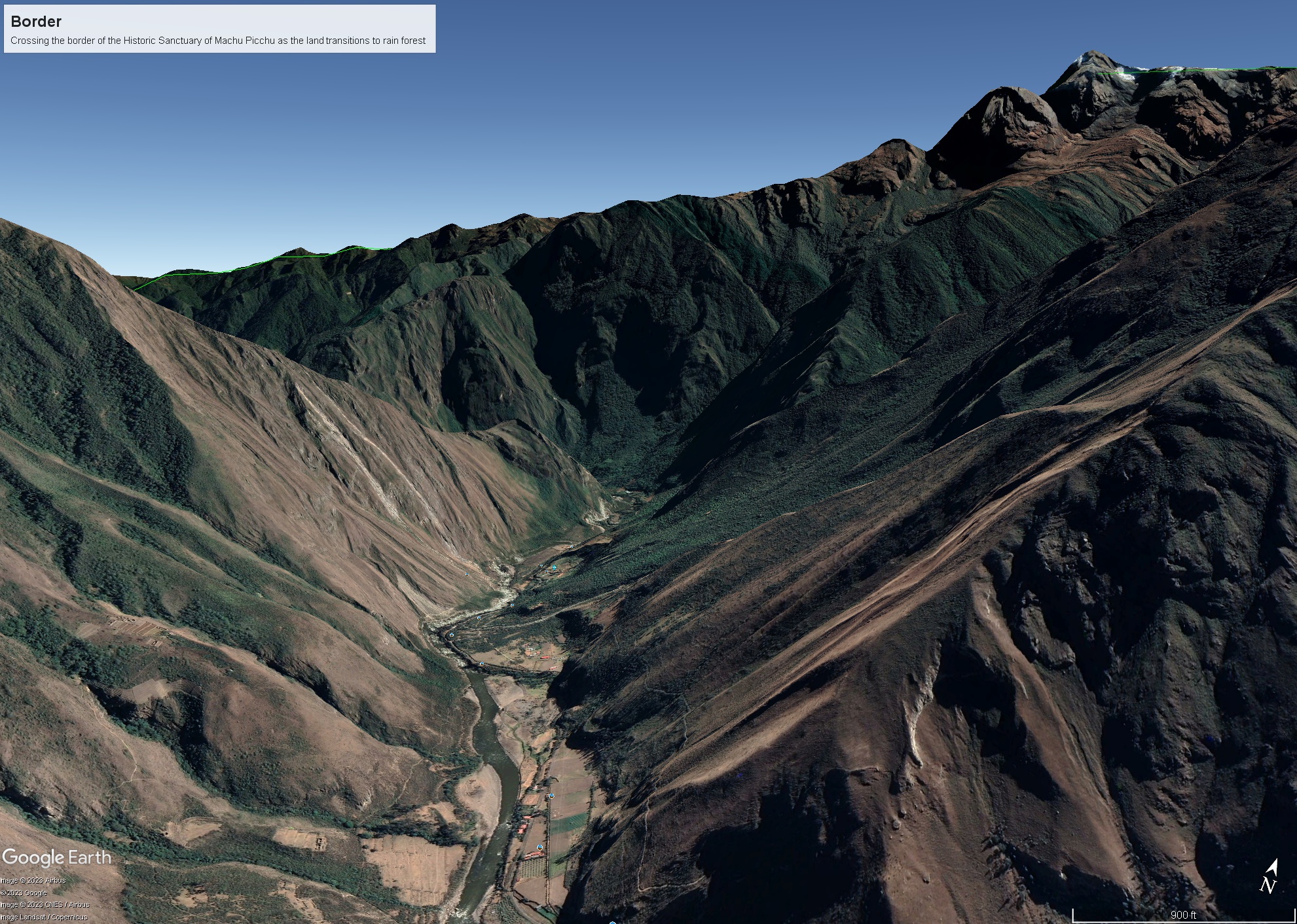
As we crossed the border of the Historic Sanctuary of Machu Picchu the valley walls rose steeply on either side, the land transitioning to rain forest.
Google Earth We approach the border of the Historic Sanctuary of Machu Picchu
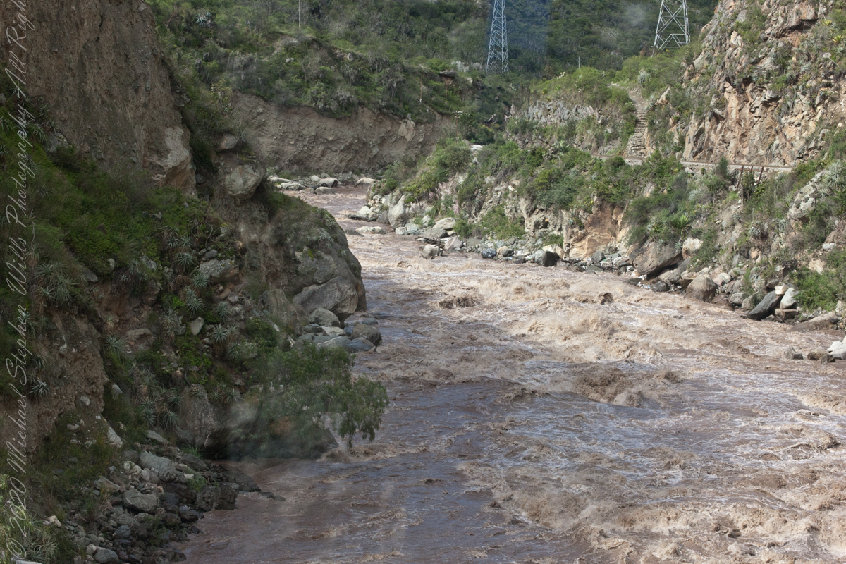
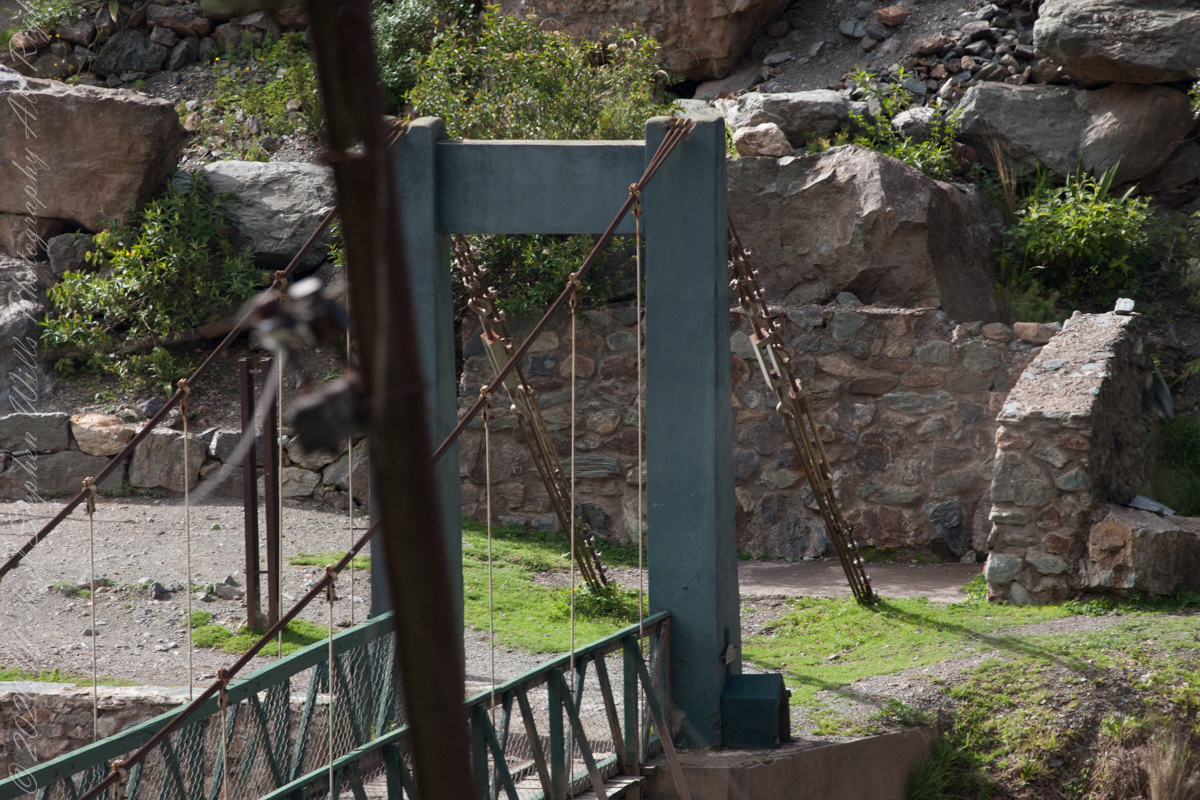
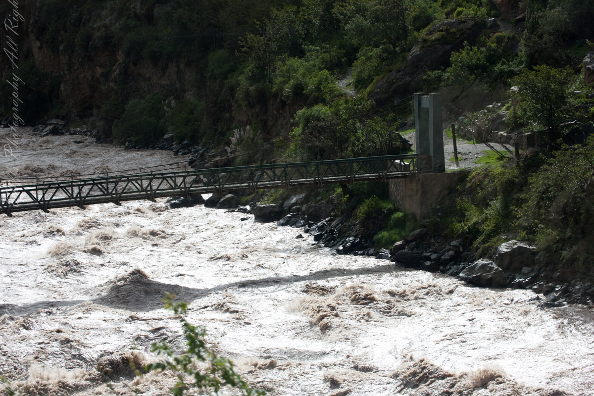
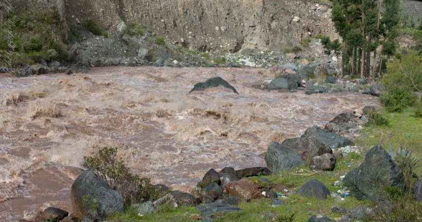
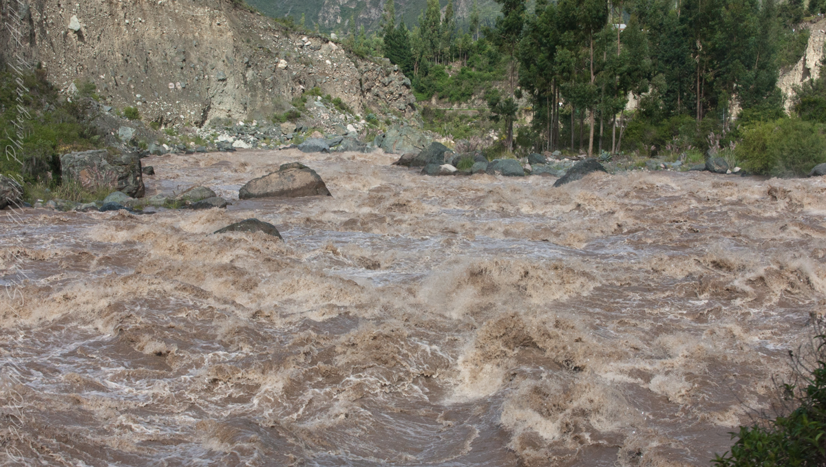
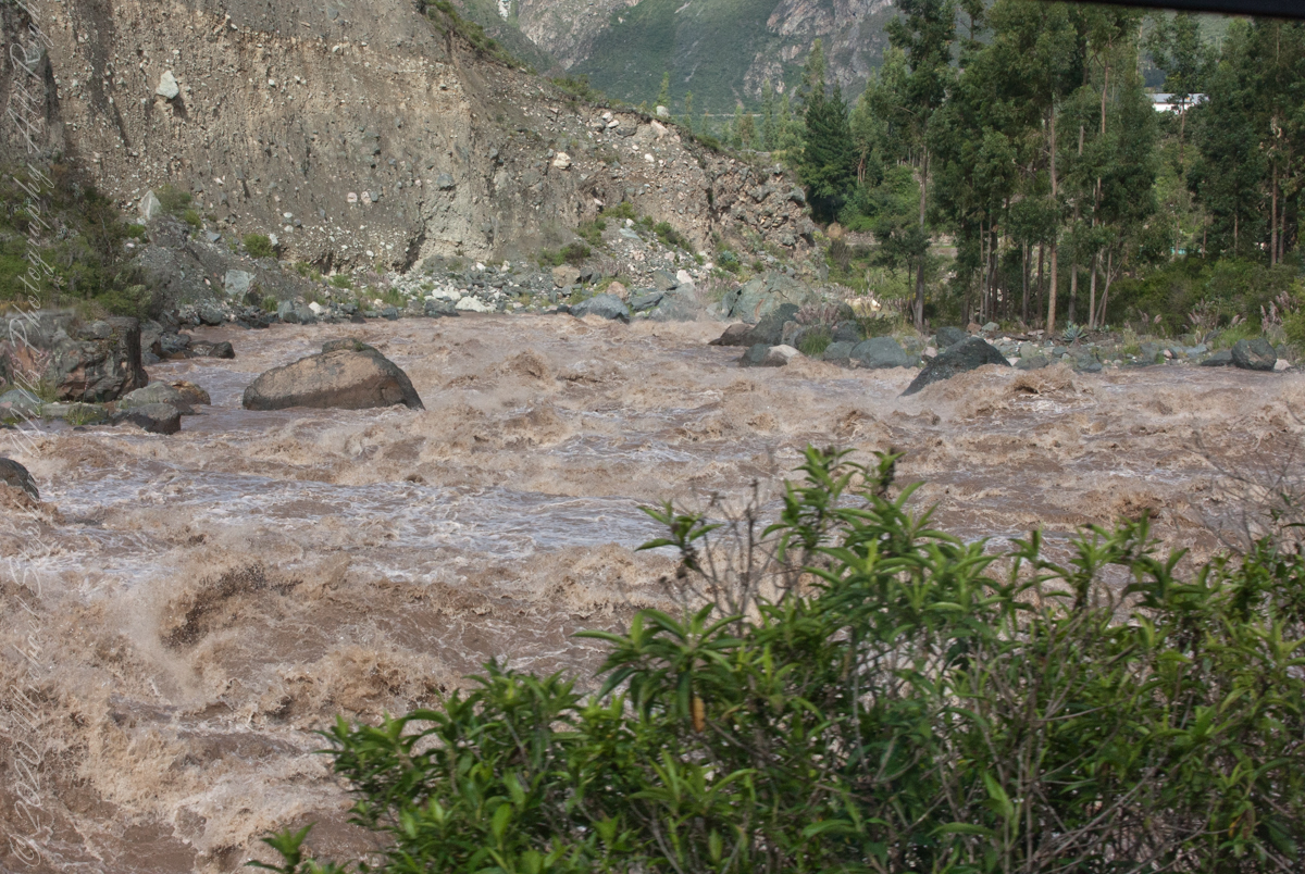
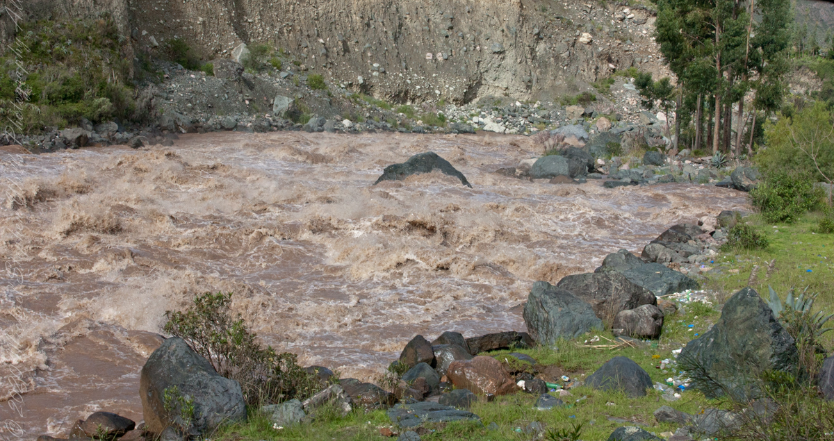
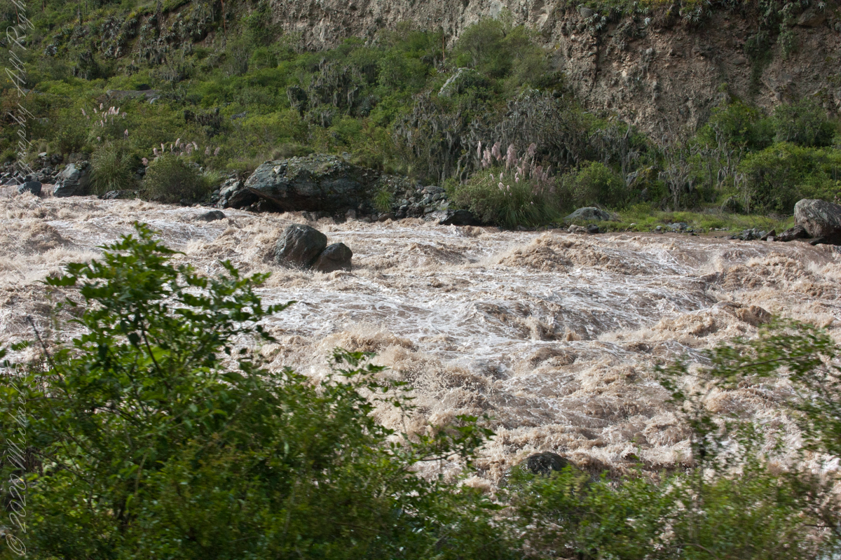
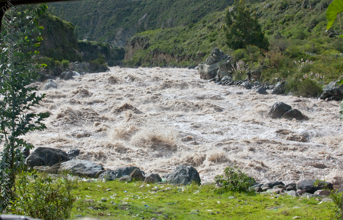
We entered a short tunnel through a mountain ridge, providing us this close view of the Urubamba River.
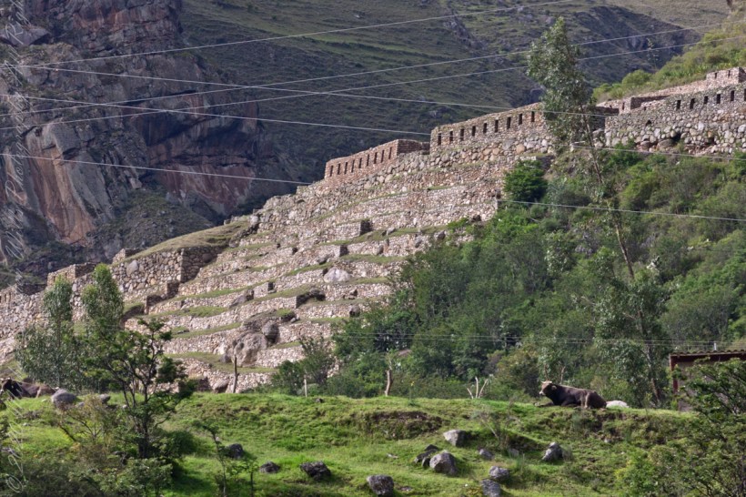
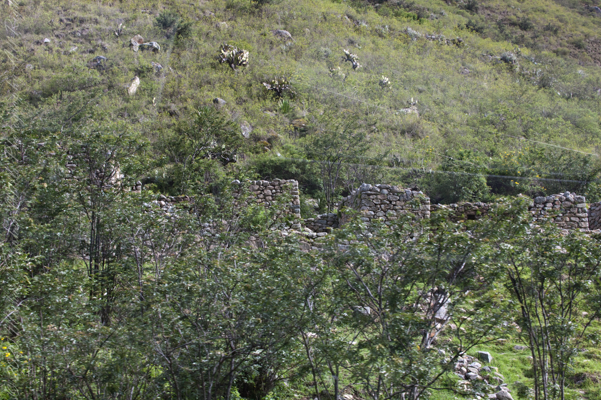
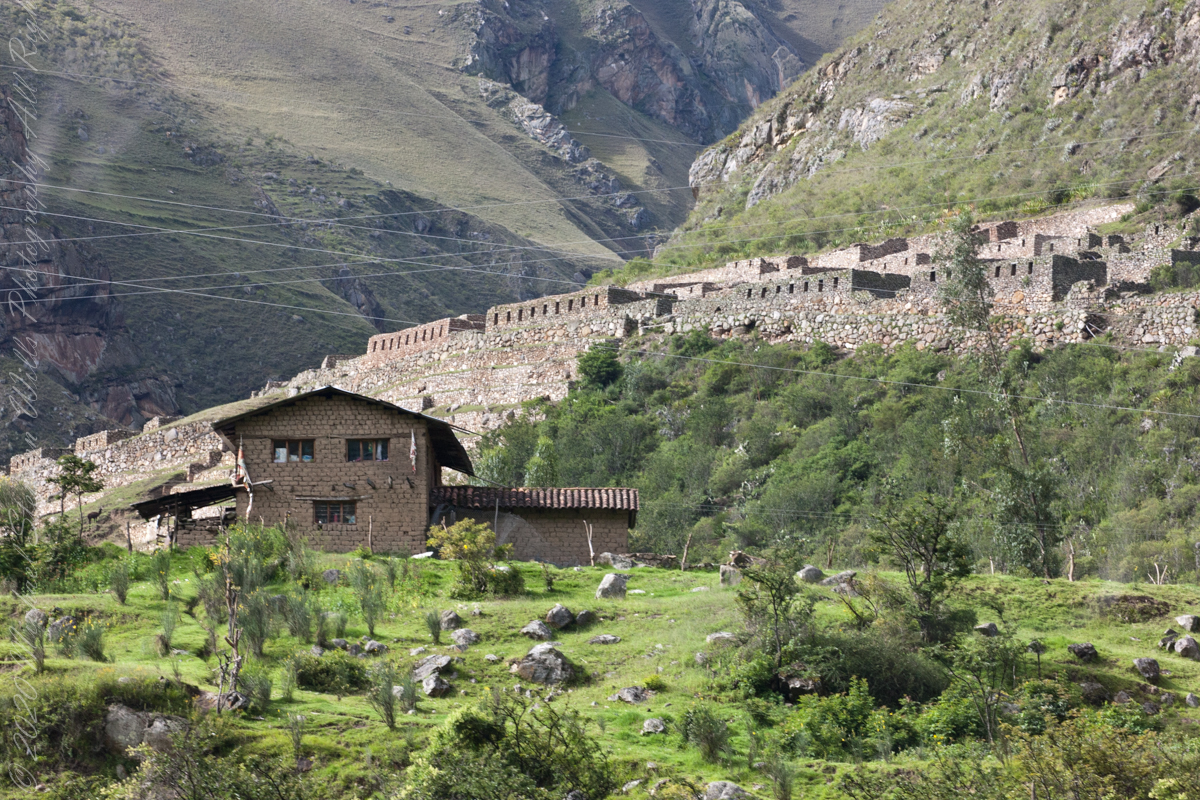
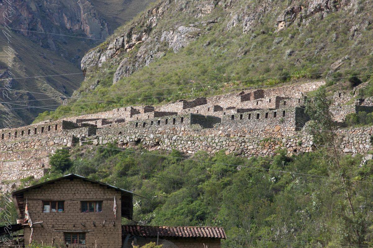
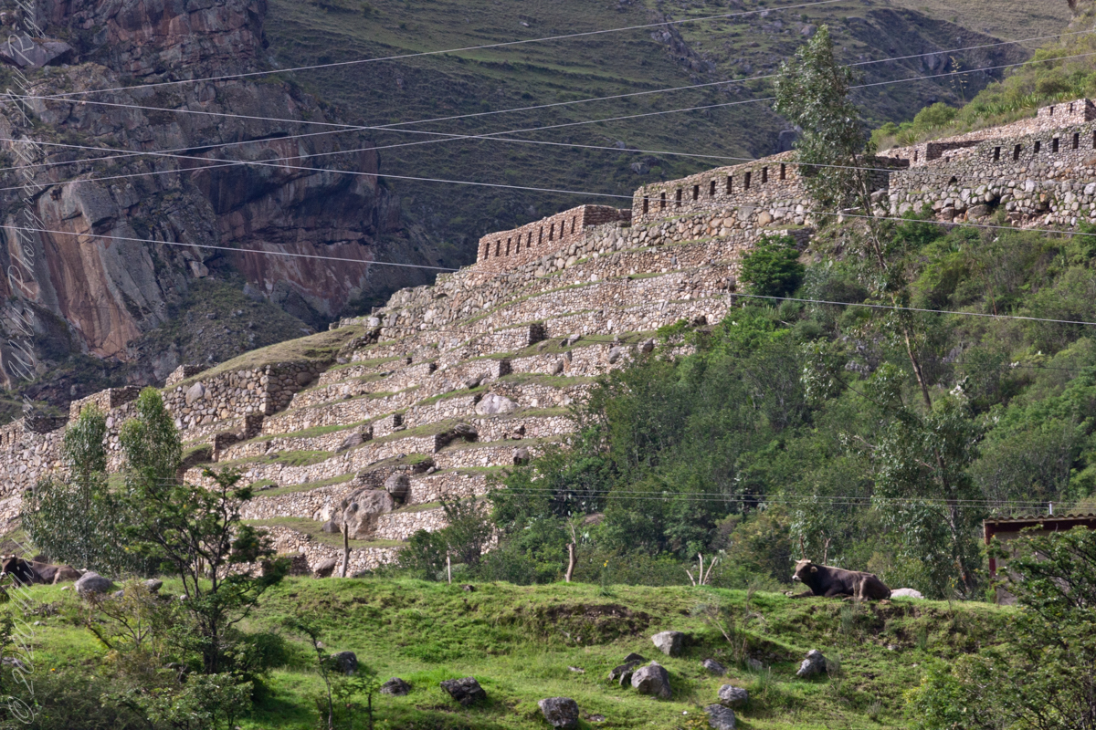
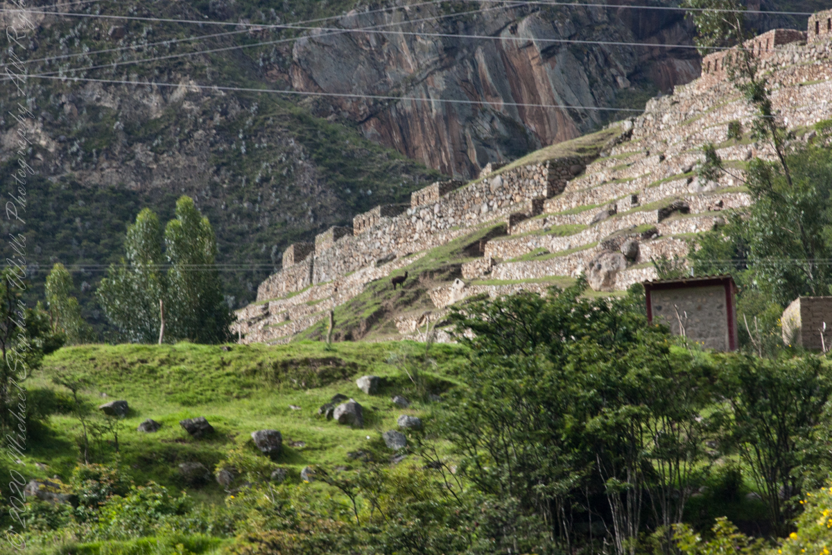
Next we came upon the Toronto Ruins.
The Toronto complex includes seven (7) archaeological groups and is in front of the Q’ente Complex, separated only by the Urubamba River, possibly they were independent chiefdoms with a strong economic bond.
The seven (7) archaeological groups are Torontoy: The local farmers call it Inkaperqa or Inca raqay, alluding to what they see. In this place we can find a main doorway, several groups of enclosures, patios or free areas separating the buildings, vestiges of a liturgical bath and a central enclosure with a lithic piece of more than 40 angles that joins other twenty-eight pieces with exact interlocking in the joints.
Salapunku: means hall door in the Inca language, because what is most obvious is a wide door that is on a platform that runs as a street in front of the wall. Behind the door we find cyclopean platforms and plains with remains of stairways, interior roads and remains of aqueducts. Qhanabamba translates to pampa where the grass “qhana” grows. It is at the height of Km. 85 of the railroad line. We can find a series of one-story buildings and a two-story building which is the largest. Wayrajpunku: meaning windy door (alluding to a windy place). In this group we find remains of buildings and a partially standing enclosure, there are vestiges of aqueducts, paths and overcrowding of canted stones that were part of constructions.
Pincha Unuyuj: Here were made the best hydraulic works of the zone, the crystalline waters that descend, appear channeled by wide lithic channels; also we find from the bank of the river a succession of parallel platforms, a road that leads to an adoratory carved in the rock insitu, ascending some houses and an observation tower. Qoriwayrachina It means gold winnowing. We can find the following: A huge staircase with more than one meter wide, semicircular ramparts, platforms as retaining walls and a vertical slope worked that is on the turbulent waters of the river.
Retamayuj, having a broom, in this group we can find long platforms with semi-cyclopean walls, tombs that are desecrated at the base of the mountain and others intact. In 2008 A team from Peru’s National Institute of Culture (INC) working on the ruins of Torontoy in the Historic Sanctuary of Machu Picchu, discovered the tomb of an Inca with full funerary regalia. The gender and age of the tomb’s owner has not yet been determined but found with the body were a number of decorated ceramics and two pins.
Copyright 2023 Michael Stephen Wills All Rights Reserved
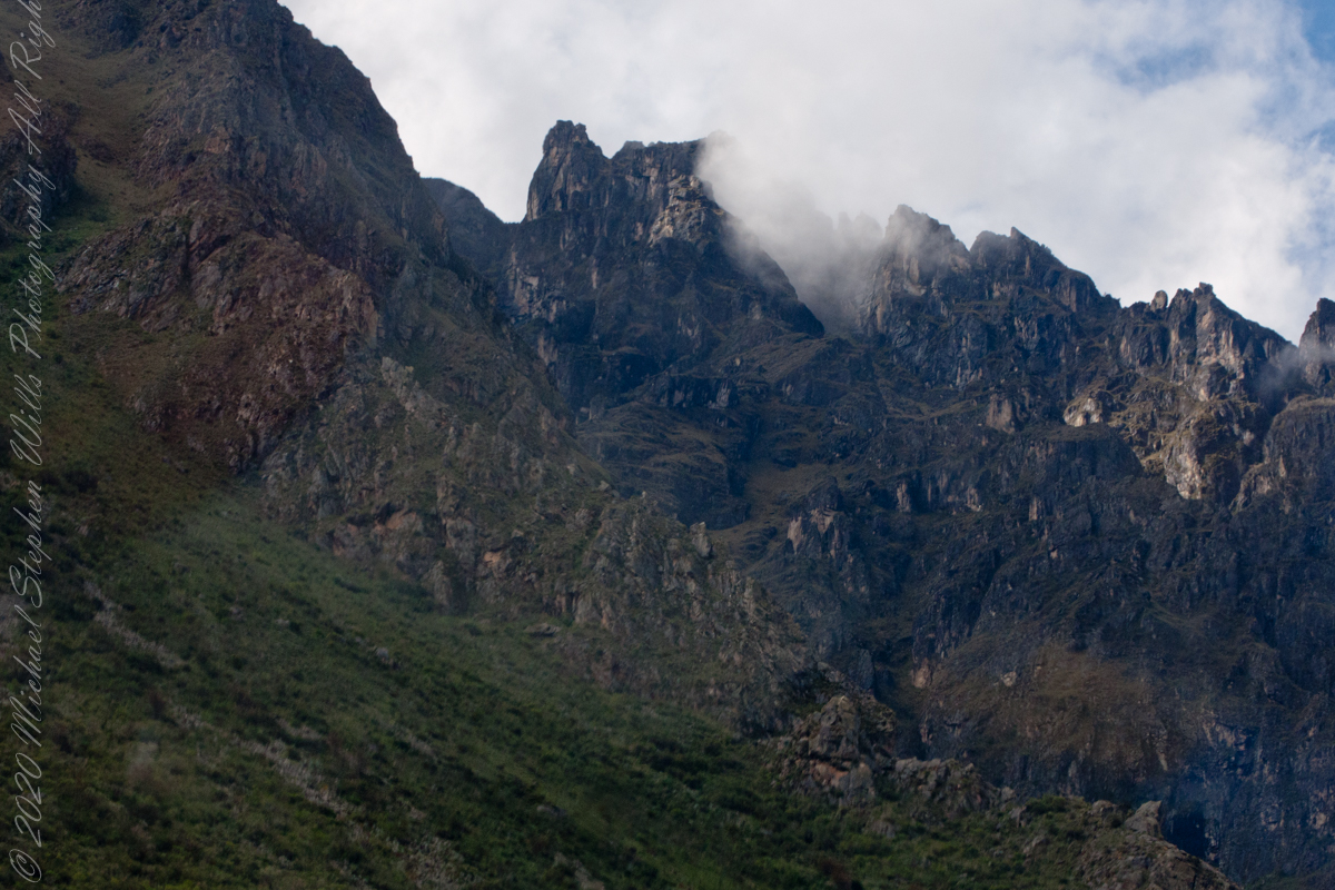
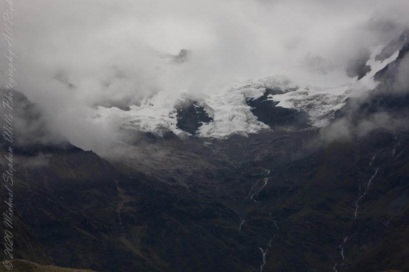
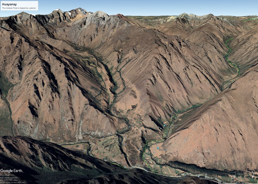
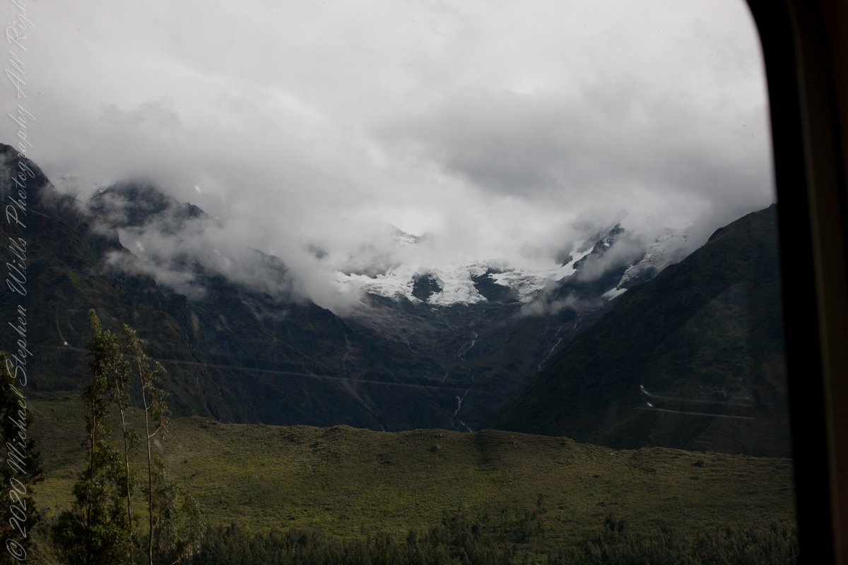
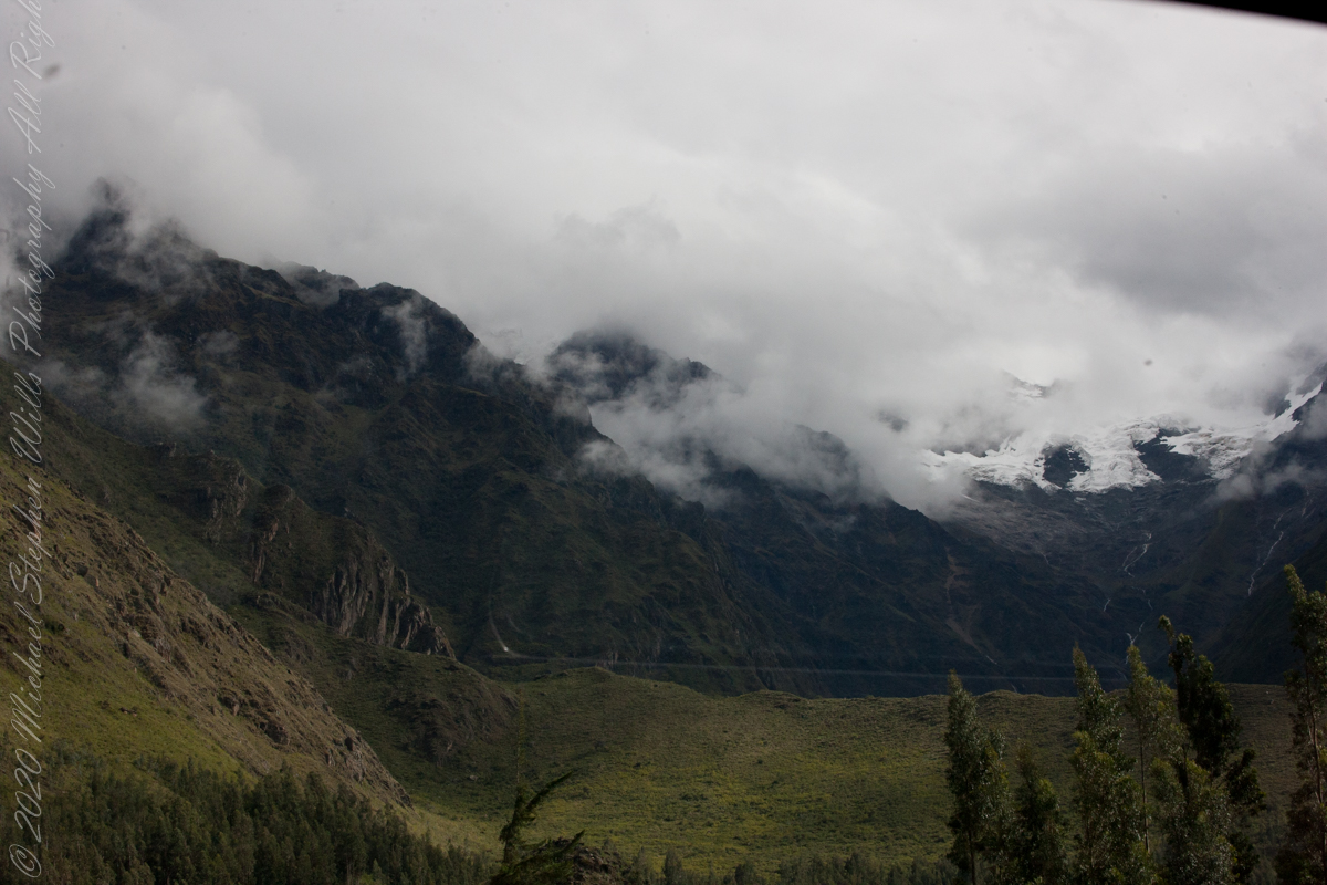
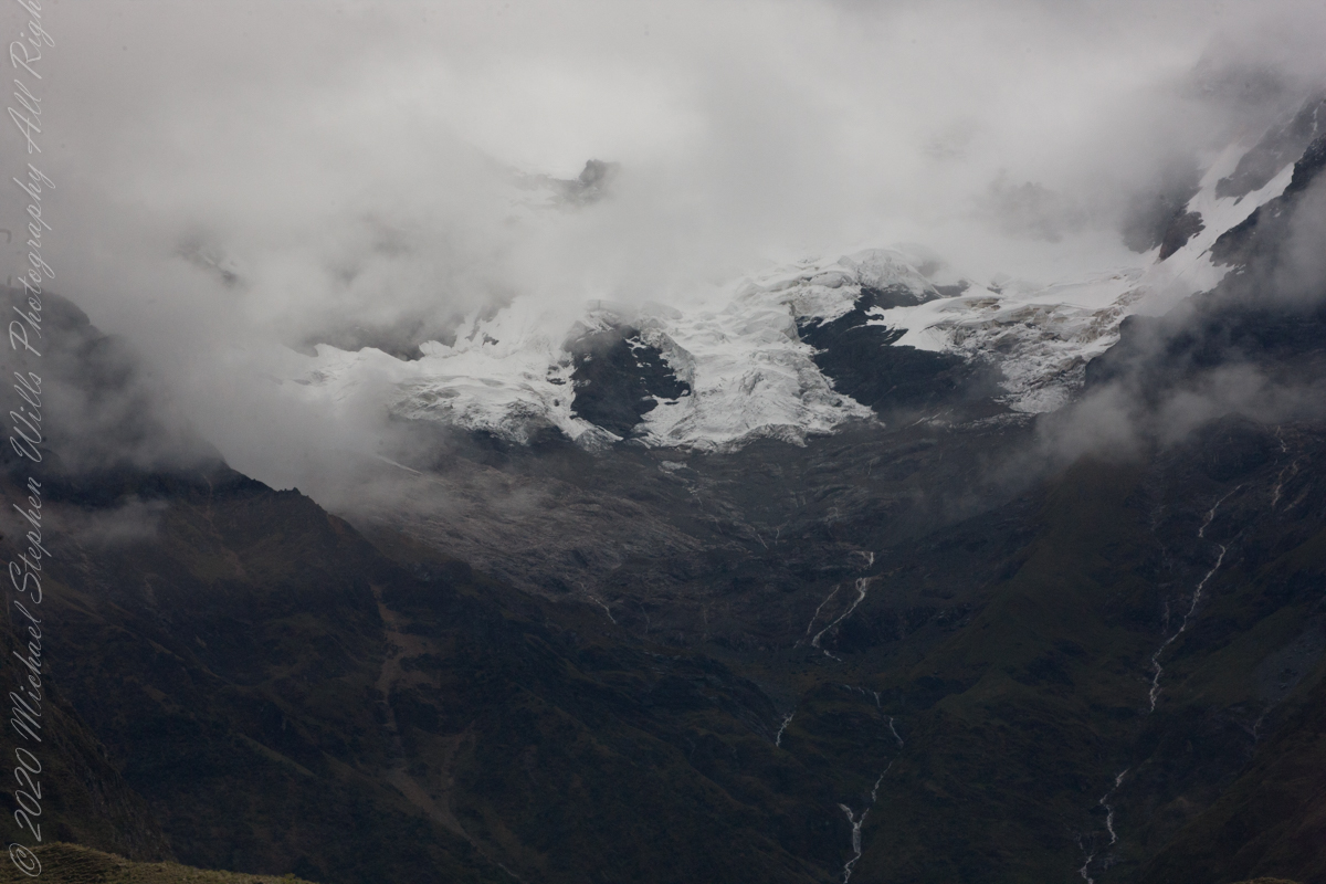
Our guide distracted us from the river by pointing out this glacier nestled among clouds. The following image from GoogleEarth features the peak, named Huayanay, on the upper left. PeruRail track follows the Sacred Valley floor at the foot of the cliff seen lower left and proceeding to the lower right. Another valley starts from Sacred Valley and goes south, carved by the Cusichaca river. Look closely to see the Patallacta Inca ruins above that same river. These were not visible from the train. A few minutes later we viewed another Inca ruin site.
Google Earth
“Huayanay (Quechua for swallow) is a mountain and a massif in the Vilcabamba mountain range in the Andes of Peru, about 5,464 metres (17,927 ft) high.”
“The massif is located in the Cusco Region, Anta Province, Huarocondo District and in the Urubamba Province, Ollantaytambo District. Huayanay lies east of the Andean peaks Salcantay and Paljay.“
Reference: Wikipedia, “Huayanay.”
Copyright 2023 Michael Stephen Wills All Rights Reserved
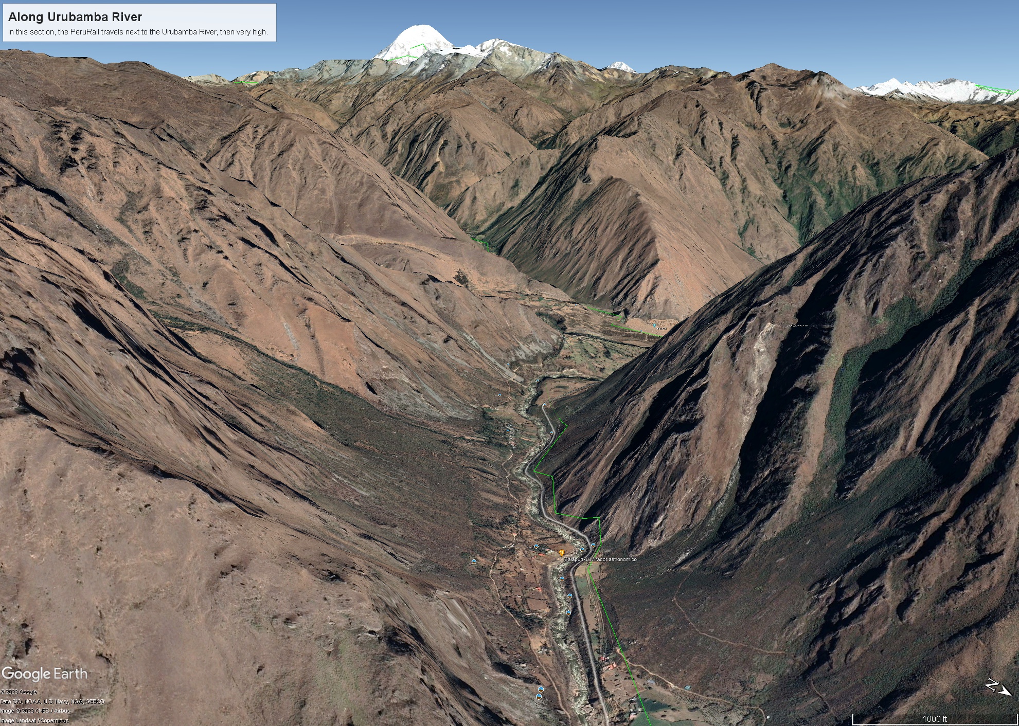
Next, PeruRail traversed a narrow valley carved by the Urubamba River. Here is an overview for our course taken from Google Earth.
Google Earth
“The Urubamba River or Vilcamayo River (possibly from Quechua Willkamayu, for “sacred river”) is a river in Peru. Upstream it is called Vilcanota River (possibly from Aymara Willkanuta, for “house of the sun”). Within the La Convención Province the naming changes to Urubamba. A partially navigable headwater of the Amazon River, it rise in the Andes to the southeast of Cuzco. It originates on the slopes of Khunurana in the Puno Region, Melgar Province, near the La Raya pass. It flows north-north-west for 724 kilometers before coalescing with the Tambo River to form the Ucayali River.”
“The Urubamba is divided into Upper Urubamba and Lower Urubamba, the dividing feature being the Pongo de Mainique, an infamous whitewater canyon.“
“The Upper Urubamba (Alto Urubamba) valley features a high population and extensive irrigation works. A number of ruins of the Inca Empire lie in the Sacred Valley, including the Incan city of Machu Picchu, Patallaqta, Pikillaqta and Raqch’i. The Salcca-Pucara hydroelectric project is associated with the river as well.“
“The Lower Urubamba (Bajo Urubamba) is relatively undeveloped and features a significant indigenous population consisting of the Campa tribes, principally the Machiguenga (Matsigenka) and Asháninka. The economy is based on forestry and the nearby Camisea Gas Project. The main settlement in the region is the town of Sepahua.“
“The lower Urubamba River was mapped for the first time in 1934 by Edward Kellog Strong III. He and two friends from Palo Alto, California, Art Post and Gain Allan John, navigated the river with its ferocious rapids by canoe and balsa rafts provided by the indigenous people. The mapping was done at the request of the Peruvian military when they heard of the expedition planned by the three 18-year-olds.”
“John Walter Gregory, a British geologist, drowned in the river on June 2, 1932 while on a geological expedition to the Andes“
“It was turned over to the military when the boys arrived in Iquitos. It was the only map of the river until it was mapped by satellite many years later. The names and places on the latest map came from the original map drawn by Edward Strong.“
Reference: Wikipedia, “Urubamba River.”
Copyright 2023 Michael Stephen Wills All Rights Reserved
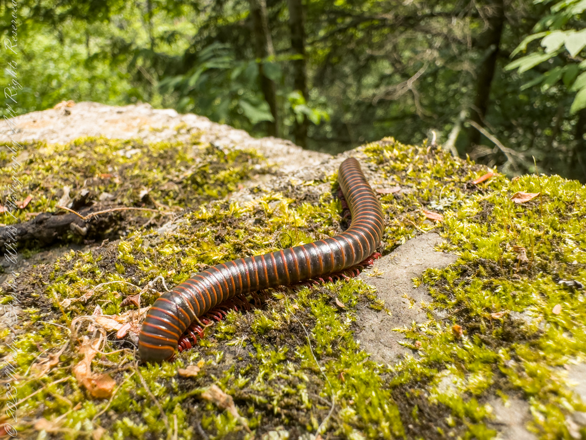
Visitors to Robert H. Treman park think nothing of crushing millipedes on the trail, it is concerning to encounter evidence of such disrespectful and boorish behavior. Here is an intact millipede I found last week. Millipedes are a group of arthropods that are characterized by having two pairs of jointed legs on most body segments; […]
Visitors to Robert H. Treman park think nothing of crushing millipedes on the trail, it is concerning to encounter evidence of such disrespectful and boorish behavior. Here is an intact millipede I found last week.
Millipedes are a group of arthropods that are characterized by having two pairs of jointed legs on most body segments; they are known scientifically as the class Diplopoda, the name derived from this feature. Each double-legged segment is a result of two single segments fused together. Most millipedes have very elongated cylindrical or flattened bodies with more than 20 segments, while pill millipedes are shorter and can roll into a tight ball. Although the name “millipede” derives from Latin for “thousand feet”, no species was known to have 1,000 or more until the discovery of Eumillipes persephone, which can have over 1,300 legs.
There are approximately 12,000 named species classified into 16 orders and around 140 families, making Diplopoda the largest class of myriapods, an arthropod group which also includes centipedes and other multi-legged creatures. Most millipedes are slow-moving detritivores, eating decaying leaves and other dead plant matter. Some eat fungi or drink plant fluids, and a small number are predatory.
Millipedes are generally harmless to humans, although some can become household or garden pests. Millipedes can be an unwanted nuisance particularly in greenhouses where they can potentially cause severe damage to emergent seedlings. Most millipedes defend themselves with a variety of chemicals secreted from pores along the body, although the tiny bristle millipedes are covered with tufts of detachable bristles. Its primary defense mechanism is to curl into a tight coil, thereby protecting its legs and other vital delicate areas on the body behind a hard exoskeleton. Reproduction in most species is carried out by modified male legs called gonopods, which transfer packets of sperm to females.
Millipedes are among the first animals to have colonized land during the Silurian period. Early forms probably ate mosses and primitive vascular plants. Millipedes also exhibit the earliest evidence of chemical defense, as some Devonian fossils have defensive gland openings called ozopores. Millipedes, centipedes, and other terrestrial arthropods attained very large sizes in comparison to modern species in the oxygen-rich environments of the Devonian and Carboniferous periods, and some could grow larger than one meter. As oxygen levels lowered through time, arthropods became smaller.
Most millipedes are detritivores and feed on decomposing vegetation, feces, or organic matter mixed with soil. They often play important roles in the breakdown and decomposition of plant litter: estimates of consumption rates for individual species range from 1 to 11 percent of all leaf litter, depending on species and region, and collectively millipedes may consume nearly all the leaf litter in a region. The leaf litter is fragmented in the millipede gut and excreted as pellets of leaf fragments, algae, fungi, and bacteria, which facilitates decomposition by the microorganisms.
Reference: “Millipede” Wikipedia
Copyright 2023 All Rights Reserved Michael Stephen Wills