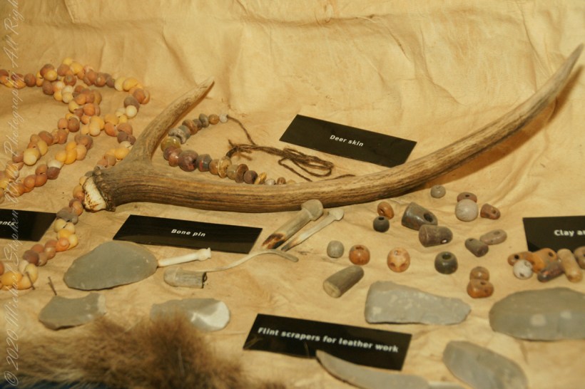
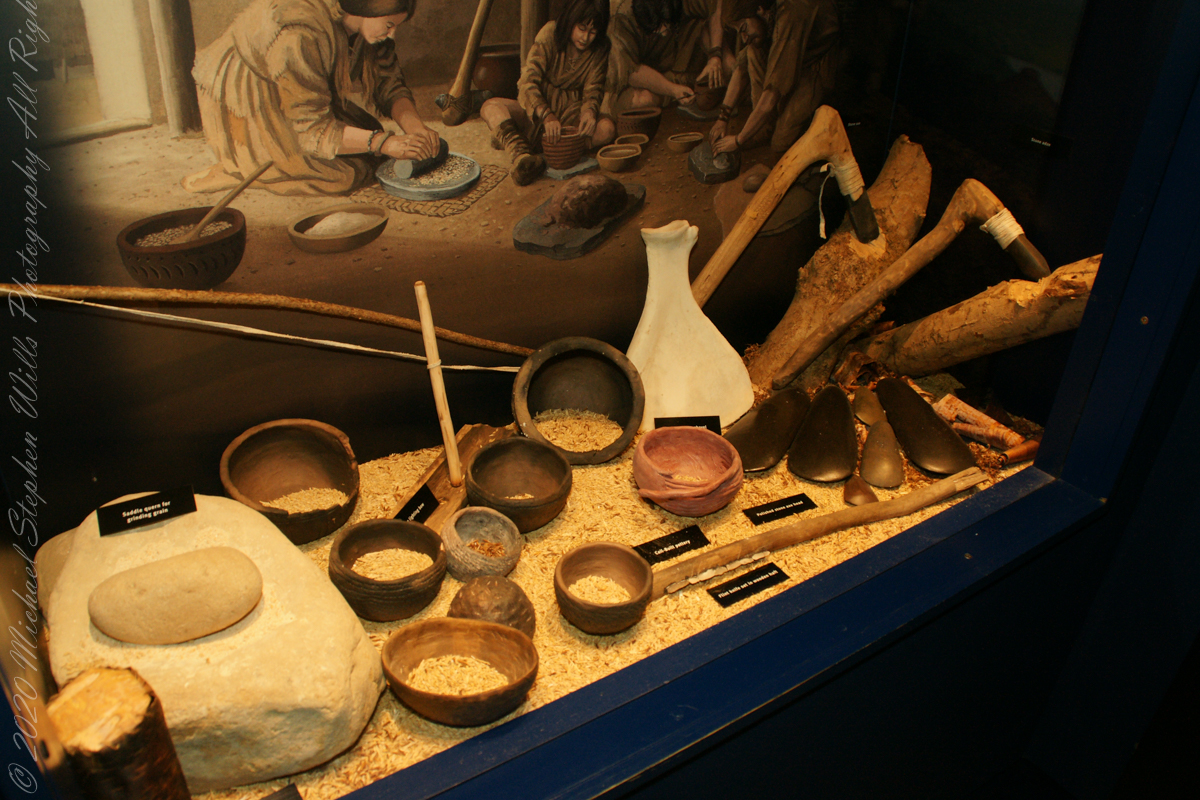
The people who built the passage tombs at Brú na Bóinne and elsewhere in Ireland were farmers, a way of life which by this time had become well established in Ireland. All the mainstays of early farming life — cereals such as wheat and barley, and domesticated animals such as cattle, pigs, sheep and goats — were introduced to Ireland by early farmers. T
he climate was warmer and drier than it is today which meant that the growing season was longer and winter was shorter and milder. The main crops grown appear to have been emmer wheat and naked barley. Flint knives and blades were used for cutting meat. Simple wooden ploughs with stone tips were probably used.
The cattle were Bos taurus longifrans, large animals with forward facing horns which were kept primarily for farm work and meat. Cattle may also have been important in a ceremonial sense; cattle bones were sometimes placed in a very deliberate way in the ground. Sheep were probably like Soay sheep today, without a woolly fleece and probably used mainly for their meat. Dog and pig bones have also been found.
Copyright 2023 Michael Stephen Wills All Rights Reserved
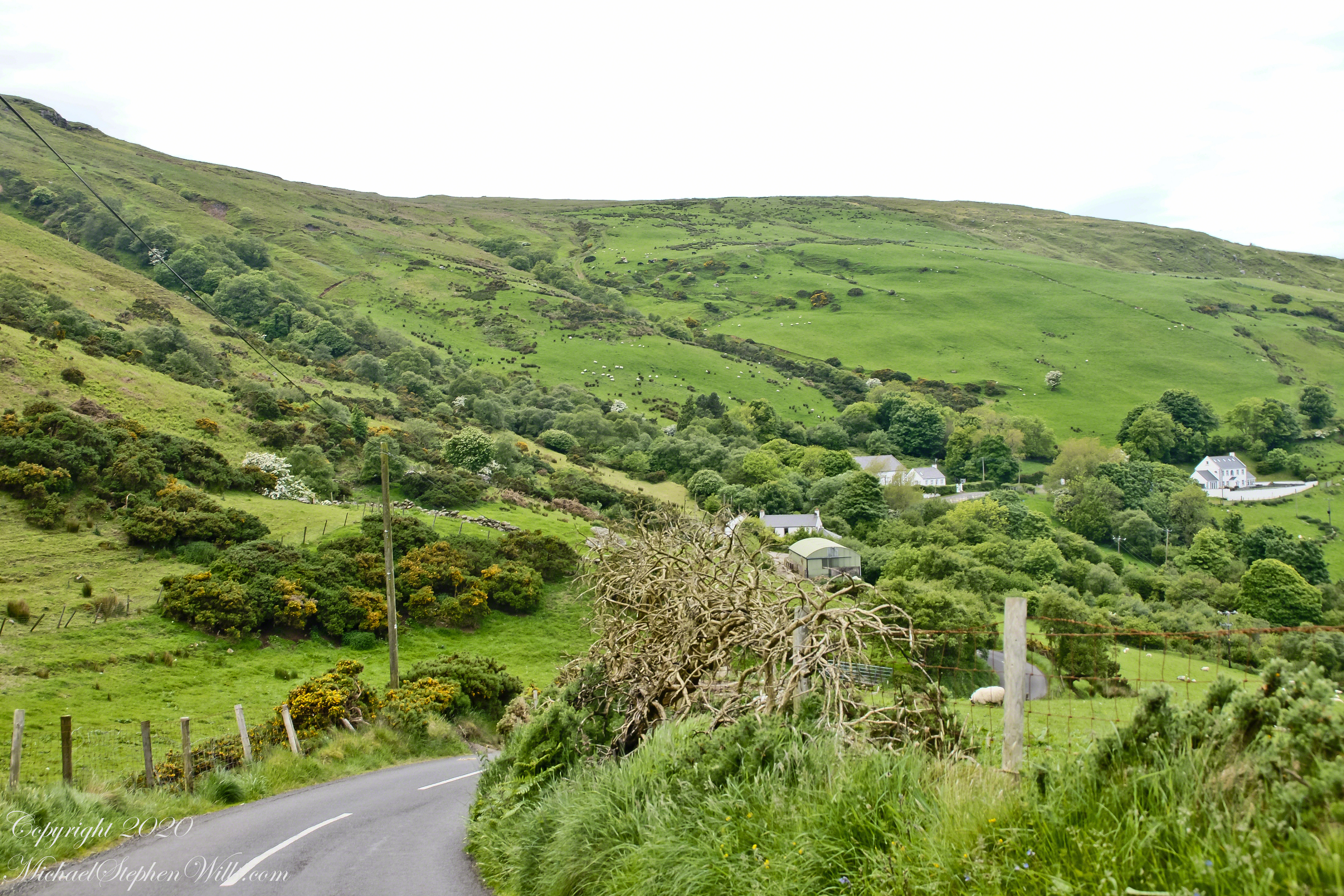
This photograph from the bottom of the Torr Road hill takes in Coolranny Townland. a slice of land running from the ridge to Loughan Bay. We see a number of hawthorne trees in flower, yellow flowering Whin Bush, houses and the Roman Catholic church Saint Mary’s Star of the Sea.
Tor in Irish is a steep rocky height. Likewise, Corr means odd, uneven, rounder, convex, curved, peaked, projecting, smooth. Combined Torcorr is the townland where we stopped on the Torr Road, halted by our wonder at this sight. In the distance, Torr Head projects into North Channel, the closest land to Scotland. Following the coast, the cliffs in front of Torr Head is home to numerous sea birds. The curved bay is named Loughan, the rocky sand beach are ruins of cottages emptied by Irish emigration. The white building is Saint Mary’s Star of the Sea Roman Catholic Church. County Antrim, Northern Ireland.
View of Coolranny townland with Saint Mary’s Star of the Sean Roman Catholic Church from Torcorr townland, Torr Road . County Antrim, Northern Ireland.
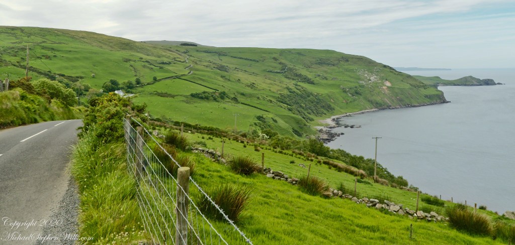
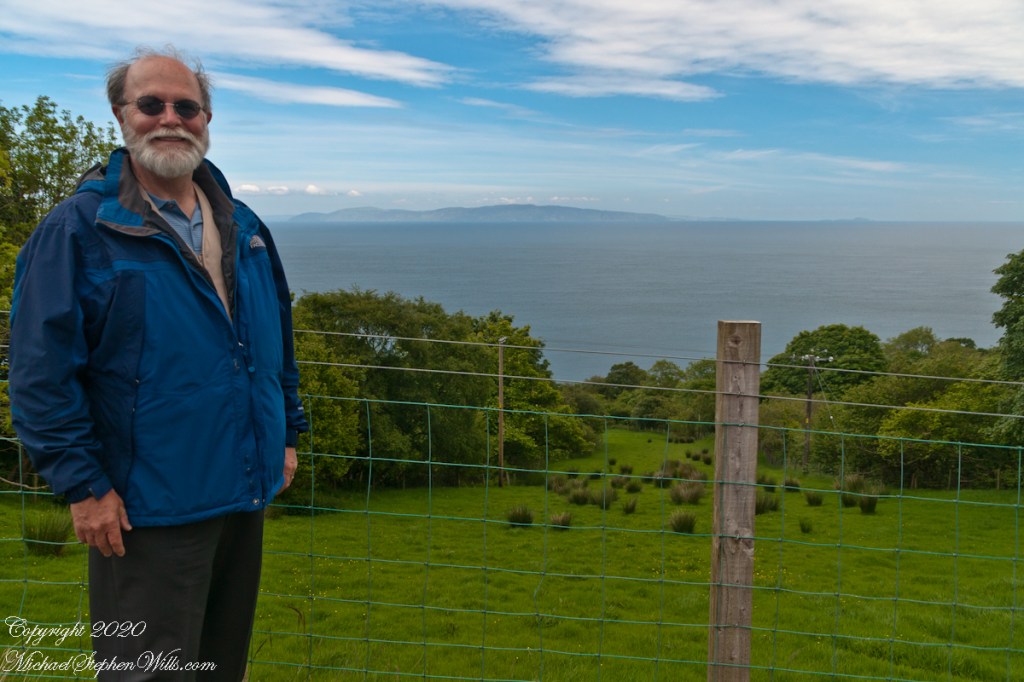
The photograph of the header, taken by Pam, is from either Coolranny or Loughan Townland, looking across a sheep pasture, the North Channel of the Irish Sea toward the Mull of Kintyre, Scotland just twelve miles distant.
Here is a slideshow of this post’s images. To visit from WordPress Reader, you need to first click the title of this post to open a new page.
Tor in Irish is a steep rocky height. Likewise, Corr means odd, uneven, rounder, convex, curved, peaked, projecting, smooth. Combined Torcorr is the townland where we stopped on the Torr Road, halted by our wonder at this sight. In the distance, Torr Head projects into North Channel, the closest land to Scotland. Following the coast, the cliffs in front of Torr Head is home to numerous sea birds. The curved bay is named Loughan, the rocky sand beach are ruins of cottages emptied by Irish emigration. The white building is Saint Mary’s Star of the Sea Roman Catholic Church. County Antrim, Northern Ireland.View of Coolranny townland with Saint Mary’s Star of the Sean Roman Catholic Church from Torcorr townland, Torr Road . County Antrim, Northern Ireland.On the way to Torr Head we stopped at this spot in Coolranny Townland to take in this view of the Irish Sea. The land overlooks Loughan Bay toward the Mull of Kintyre and Sanda Island, Scotland. County Antrim, Northern Ireland.
Copyright 2023 All Rights Reserved Michael Stephen Wills
Can you see the small difference between yesterday and today’s take on Devil’s Kitchen? Is the change and improvement, degradation or no difference? User Response Requested: respond in comments.
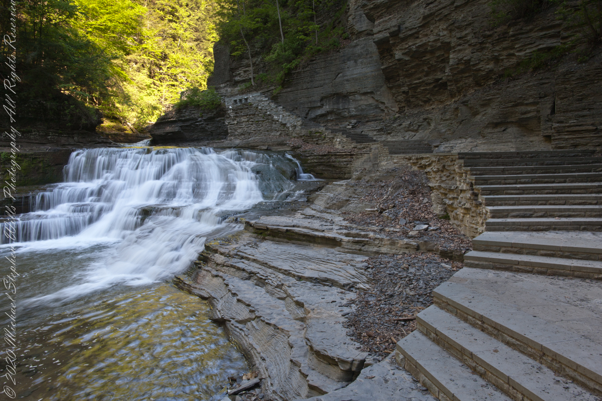
Aptly named Devil’s Kitchen is where Enfield Creek passes over these 20 foot falls before the Lucifer Falls 115 foot rock face cascade. Captured on a Memorial Day morning. Robert H. Treman State Park, Ithaca, Tompkins County, New York.
Here they are side by side.
YesterdayToday
It is 9:00am on a Memorial Daty morning Robert H. Treman Park, Ithaca, Tompkins County, Ithaca, New York,
Copyright 2023 All Rights Reserved Michael Stephen Wills
Aptly named Devil’s Kitchen is where Enfield Creek passes over these 20 foot falls before the Lucifer Falls 115 foot rock face cascade. We are occasionally appalled by families and adventure seekers climbing over these falls, wading in the water downstream and other insanities happening next to a waterfall so dangerous it is named after the Prince of Darkness and this very location “his” kitchen.
I am not one to talk, though. One winter on this very spot when the Gorge Trail was closed for winter, black ice brought me down almost into the water. All for a winter scene (photograph) of this marvel. Thankfully, I am wiser for the experience.
It is 9:00 am on a Memorial Daty morning Robert H. Treman Park, Ithaca, Tompkins County, Ithaca, New York,
Copyright 2023 All Rights Reserved Michael Stephen Wills
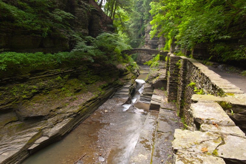
View shared by generations of newlyweds standing on a stone bridge across Enfield Creek. This is another version, taken a few years later and earlier in the season, Memorial Day morning.
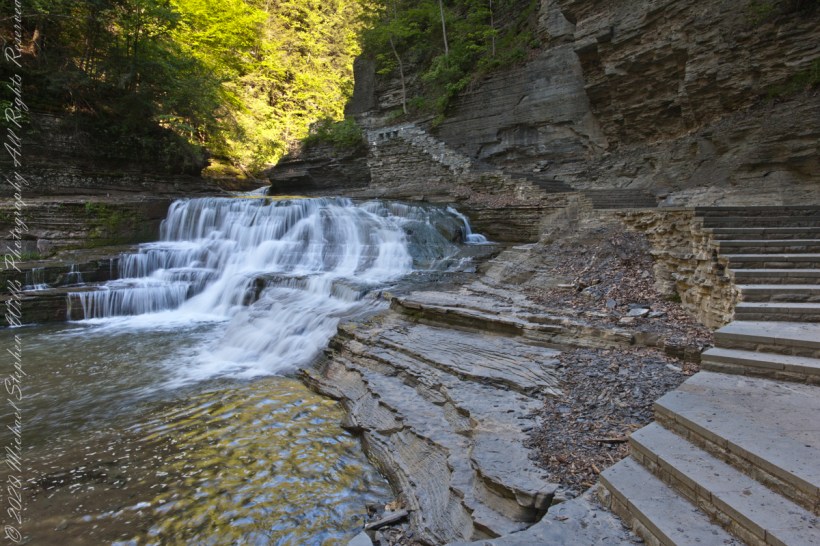
Here is an image having me rethinking my conclusions. Here, I combined two images and worked hours to make many adjustments. The resulting Tiff is four times the filesize of the Raw file from yesterday.
Here they are side by side. In this case IMHO the extra disk space and time are worth it.
It is 8:30 am on a Memorial Daty morning Robert H. Treman Park, Ithaca, Tompkins County, Ithaca, New York,
P.S. I mistakenly published this post with a repetition of III in the title. Today, I changed it to “IV.”
Copyright 2023 All Rights Reserved Michael Stephen Wills
View shared by generations of newlyweds standing on a stone bridge across Enfield Creek. This is another version, taken a few years later and earlier in the season, Memorial Day morning.
Here, I have taken the lessons learned from the last post: to run from the Raw file, open it in Photoshop, make Raw dialog adjustments conversed in an .XMP file written by Photoshop. Export from Lightroom using these adjustments.
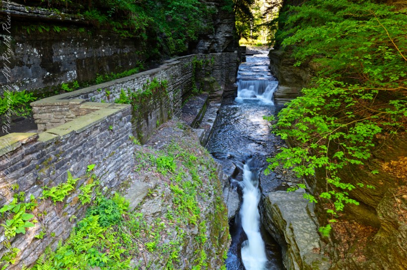
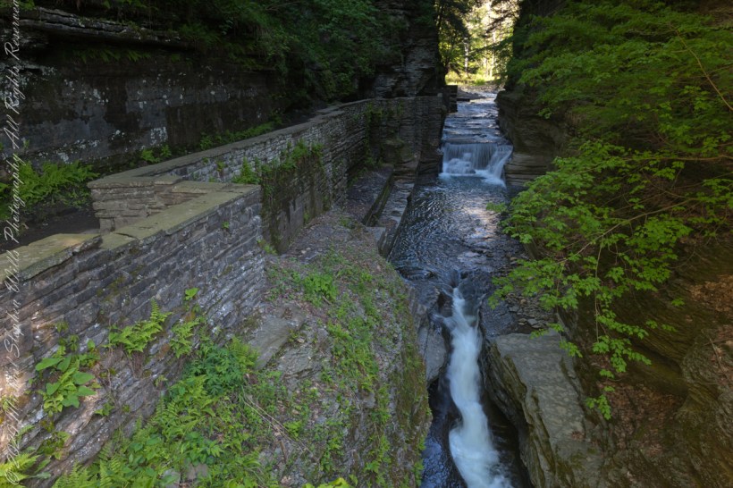
We are looking back on the place where Treman Gorge Trail from the Old Mill enters a narrow gallery looking here northwest along Enfield Creek.
It is 8:30 am on a Memorial Daty morning Robert H. Treman Park, Ithaca, Tompkins County, Ithaca, New York,
Copyright 2023 All Rights Reserved Michael Stephen Wills
First timers to Enfield Gorge realize it is special when a corner is turned and this faces them. Here the view is replicated in landscape orientation. A previous posting featured the portrait orientation.
Treman Gorge Trail from the Old Mill enters a narrow gallery looking here southeast along Enfield Creek, passing over a stone footbridge.
It is 9:30 am on a July morning Robert H. Treman Park, Ithaca, Tompkins County, Ithaca, New York,
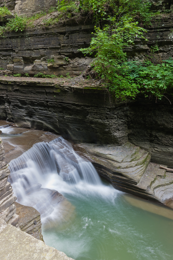
During this, the Greenlandian age, what we call Enfield Creek found a crack, widened it to form a gallery through a hill. This waterfall is emblematic of the process.
Here we see the north gallery wall, thin layers of sedimentary water-worn rock, the resistant limestone, characteristic right-angle faults worn away unevenly by flowing water.
It is 9:30 am on a July morning Robert H. Treman Park, Ithaca, Tompkins County, Ithaca, New York,
Copyright 2023 All Rights Reserved Michael Stephen Wills