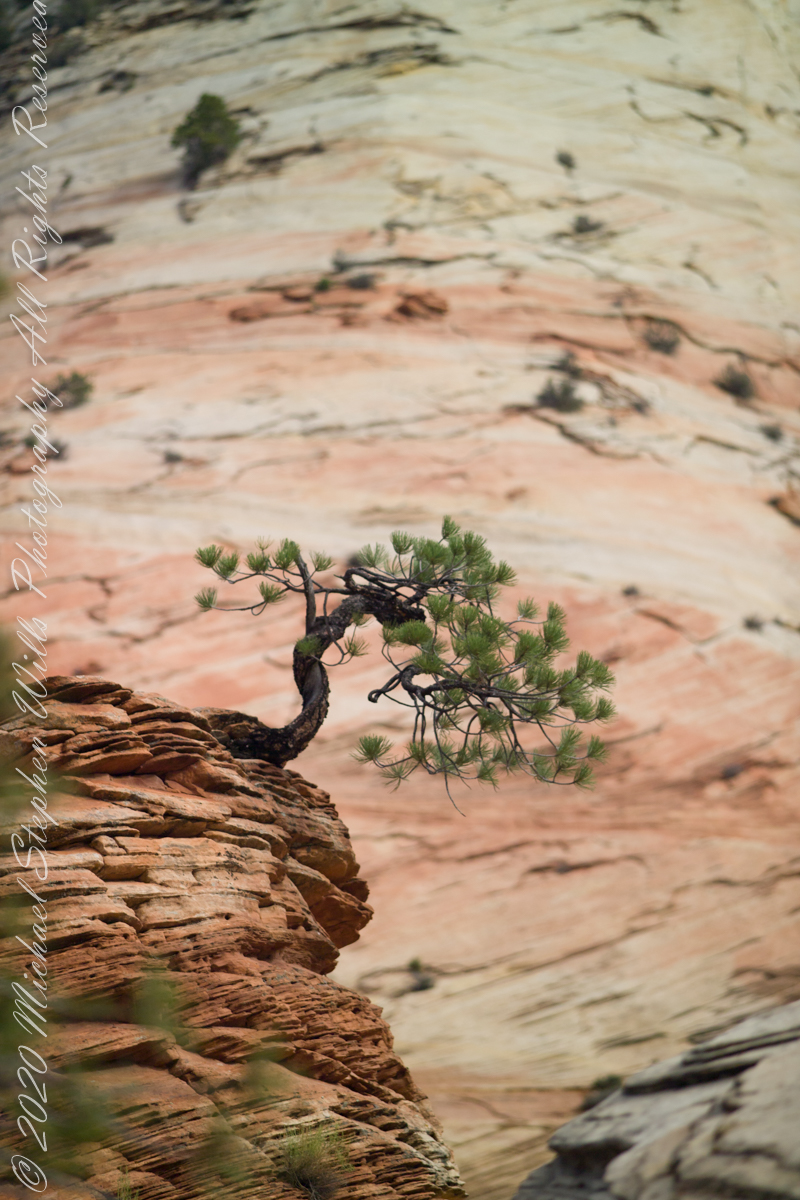
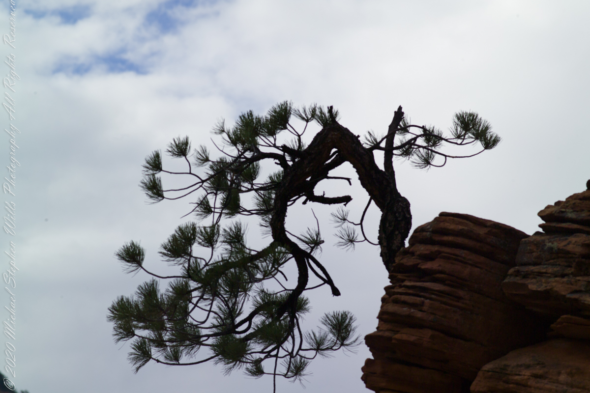
From this angle the Pinyon Pine is backed by Checkerboard Mesa slickrock.
ISO 250 1/800 sec at f/2.8
For humans travelling on foot this weather worn sandstone is anything but slippery, If we wore iron horseshoes the sense of slippery, or slick, rock becomes apparent. It was ranchers mounted on horses who coined the name slickrock.
For this shot we approached Zion National Park from the east, via route 9, past Checkerboard Mesa.
Captured with a Kodak DCS Pro SLE/c dslr and a Canon lens EF 200 mm 1:2.8 L II stabilized with the Manfrotto Studio Tripod model 475 and the 468 Hydrostatic ball head. This series explores the possibility of the iconic “Lone Pine.”
Here is a gallery of the four Lone Pine images.
Copyright 2021 Michael Stephen Wills All Rights Reserved
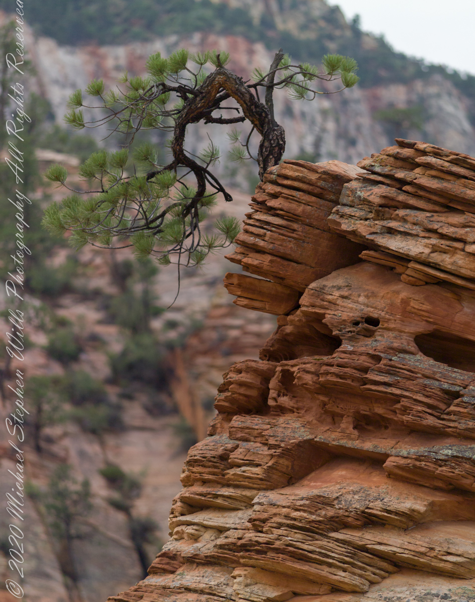
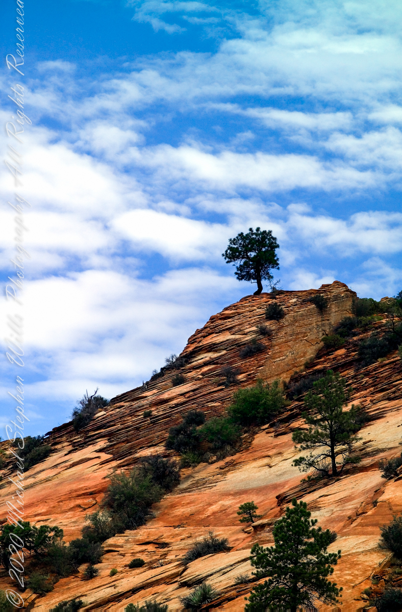
What is a Lone Pine without the sky? This specimen somewhat less gnarled than numbers 1 and 2. Here we see more of the beetling crag, layered up sediment of eons.
ISO 250 1/400 sec at f/4.0
For this shot we approached Zion National Park from the east, via route 9, past Checkerboard Mesa. Our lodging was to the east, probably the Best Western in Mt. Carmel on Rt 89. Meaning there were four opportunities for capturing memorable East Zion images over two days.
Captured with a Kodak DCS Pro SLE/c dslr and a Canon lens EF 200 mm 1:2.8 L II stabilized with the Manfrotto Studio Tripod model 475 and the 468 Hydrostatic ball head. This series explores the possibility of the iconic “Lone Pine.”
Copyright 2021 Michael Stephen Wills All Rights Reserved
Here is the same gnarled pinyon pine of the previous post, with a sky centered exposure revealing the silhouetted wonder.
ISO 250 1/1000 sec at f/7.1
Captured with a Kodak DCS Pro SLE/c dslr and a Canon lens EF 200 mm 1:2.8 L II stabilized with the Manfrotto Studio Tripod model 475 and the 468 Hydrostatic ball head. This series explores the possibility of the iconic “Lone Pine.”
Copyright 2021 Michael Stephen Wills All Rights Reserved
The eastern approach Zion Canyon is a national park unto itself, route 9 passes through otherworldly landscapes.
ISO 250 1/1000 sec at f/2.8
Captured with a Kodak DCS Pro SLE/c dslr and a Canon lens EF 200 mm 1:2.8 L II stabilized with the Manfrotto Studio Tripod model 475 and the 468 Hydrostatic ball head. This series explores the possibility of the iconis “Lone Pine.” Here the tortured existence of this organism is rendered plain.
Copyright 2021 Michael Stephen Wills All Rights Reserved
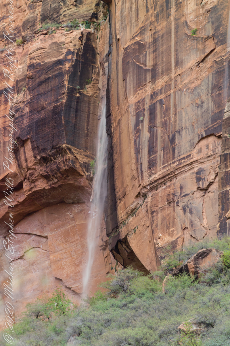
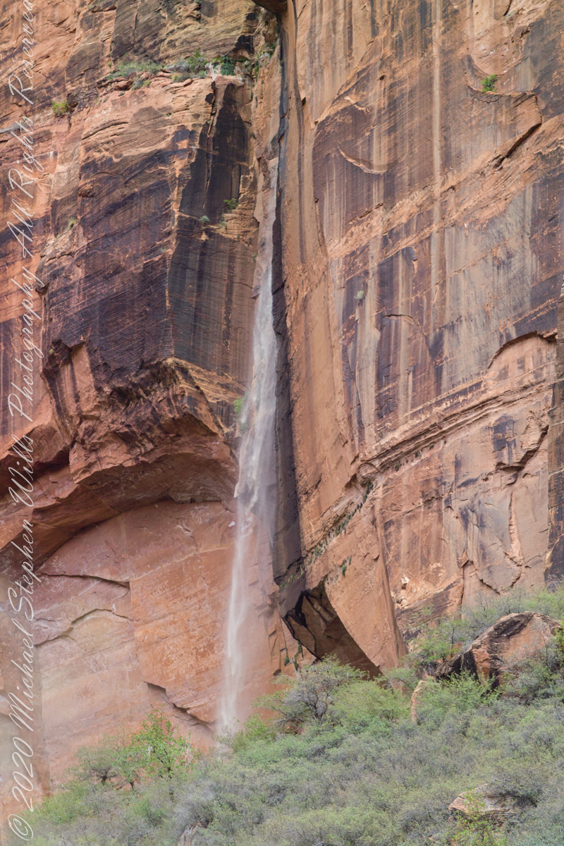
Rainwater from distant thunderstorms on the vast Colorado Plateau emerge from a cliff wall, Zion Canyon. The fall will last for a few hours, we bore lucky witness as do my images shared below.
1/15 sec at f/8.0 ISO 160
Captured with a Kodak DCS Pro SLE/c dslr and a Canon lens EF 200 mm 1:2.8 L II stabilized with the Manfrotto Studio Tripod model 475 and the 468 Hydrostatic ball head. I prefer the details of misting water at the widest lens aperture, focus is clear throughout the plane, excepting some foreground brush.
1/125 sec at f/2.8 ISO 160
Copyright 2021 Michael Stephen Wills All Rights Reserved
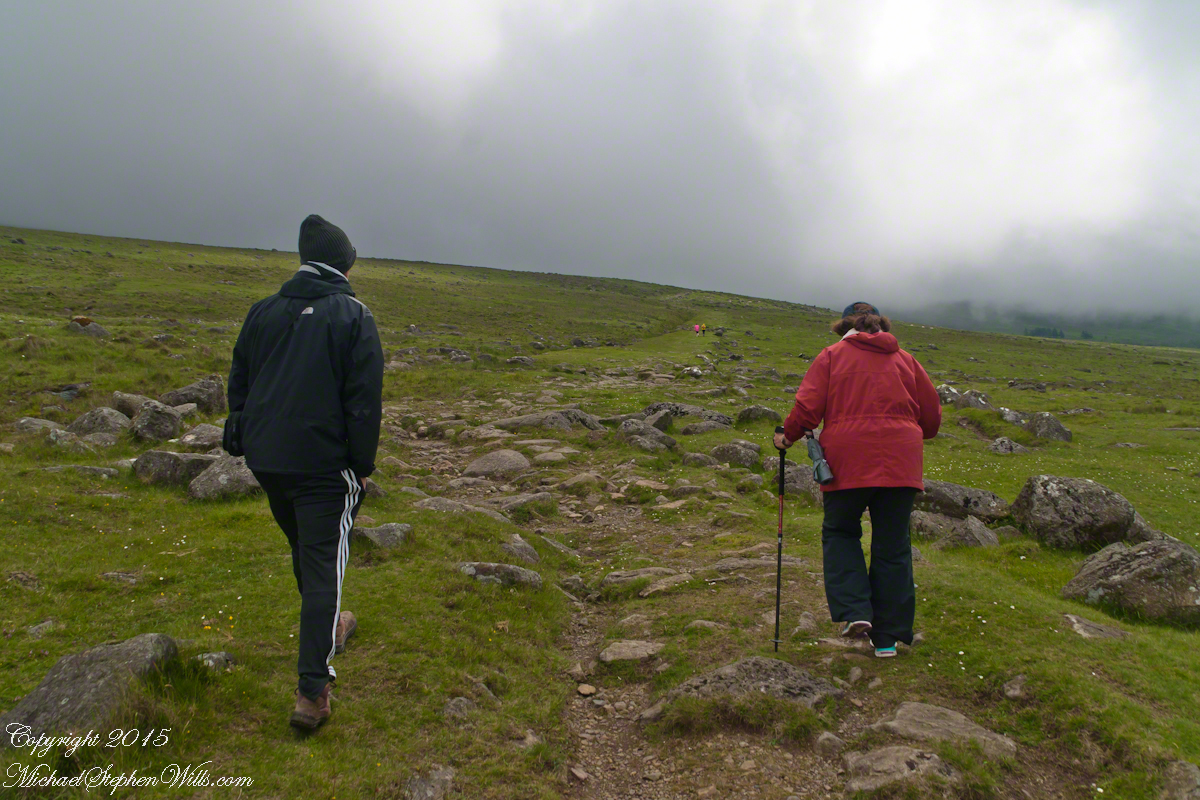
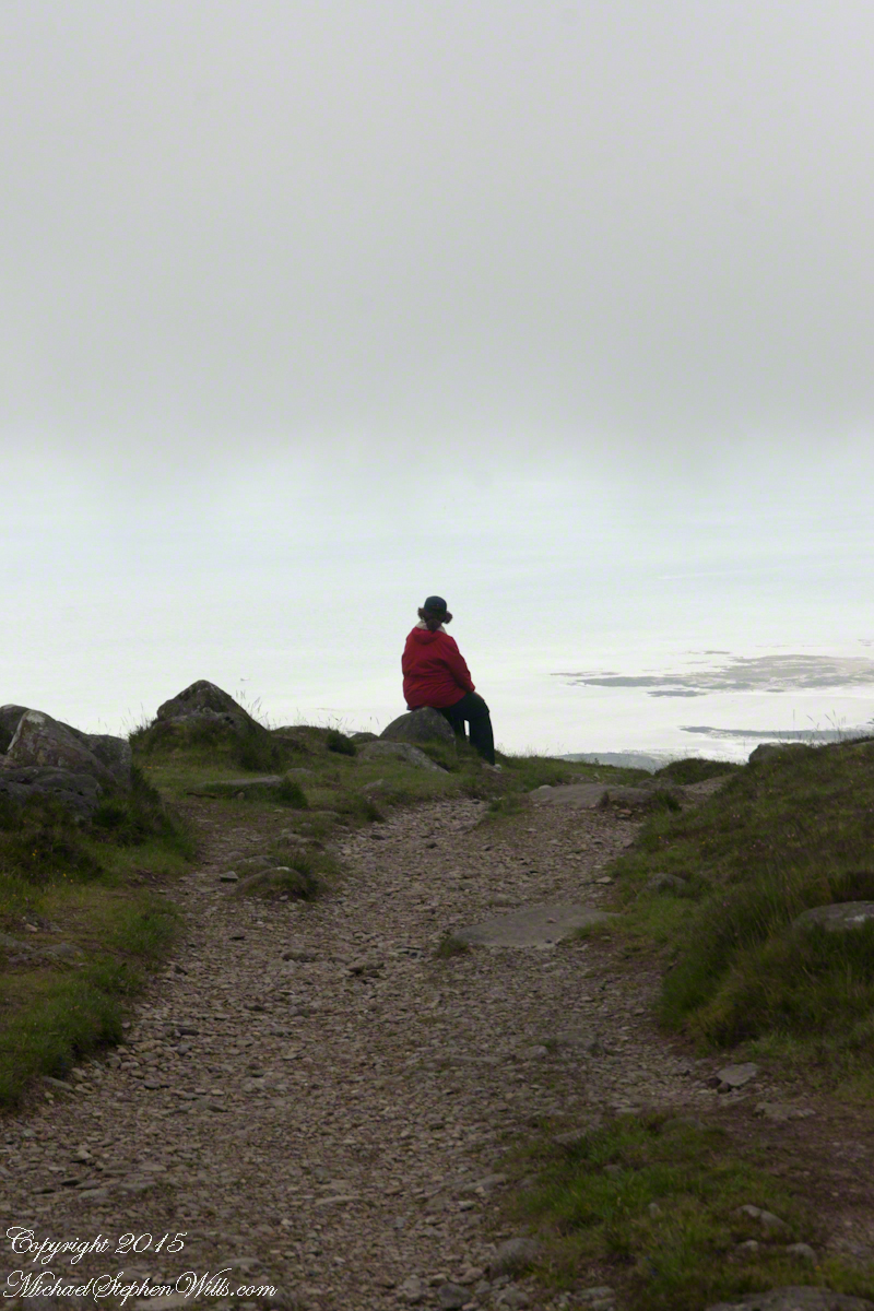
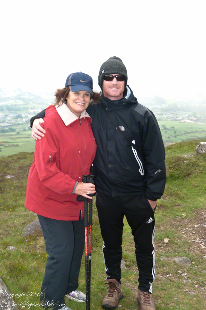
We did not climb so much as ascend, with effort, the flank of Slieve Foy, a peak of the Cooley Mountains, County Louth, Ireland. The group being cousin Sean, my wife, Pam, and myself.
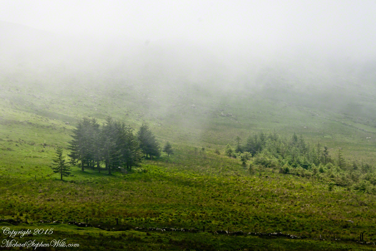
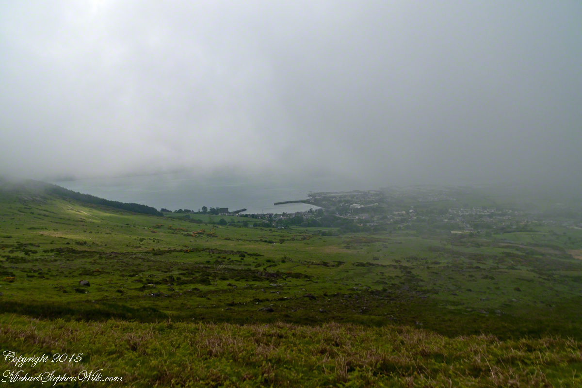
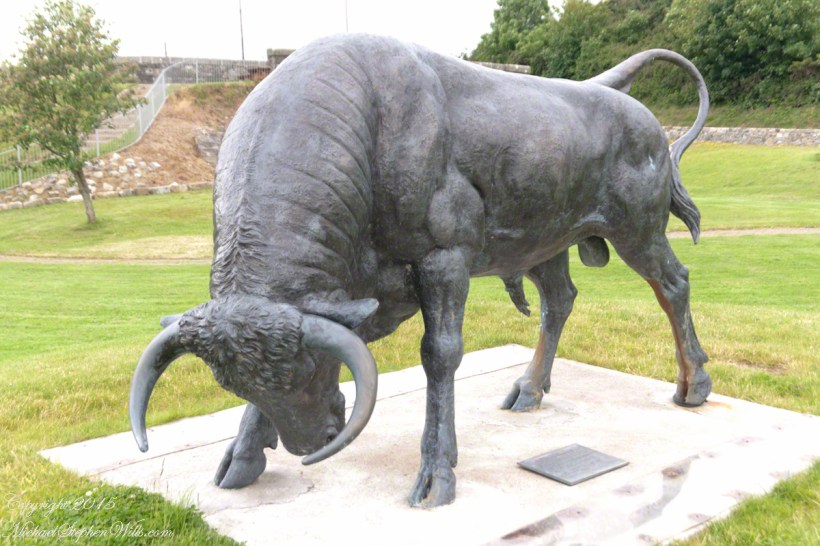
The ridge of Golyin Pass loomed in the mist where the path dissolved in low cloud. Sean pointed above, to the right to Barnavave, also know as Maeve’s Gap for the queen who came from the west of Ireland to take Donn Cúailnge, the Brown Bull of Cooley, by force of arms with an army behind her.
A modern rendering of Donn Cúailnge. See link at the bottom of this posting for more information.
When cousin Sean named Cú Chulainn, the champion of Maeve’s opponents, the Ulstermen, he recalled a story once lost, Táin Bó Cúailnge. A hospitable siege different from Maeve’s and mist are part of the story of the recovery of this tale.
A gathering of 150 poets, 100 pupils, and attendants strained the patience and wealth of Guaire Aidne mac Colmáin, King of Connacht, when it extended to a year and four months.
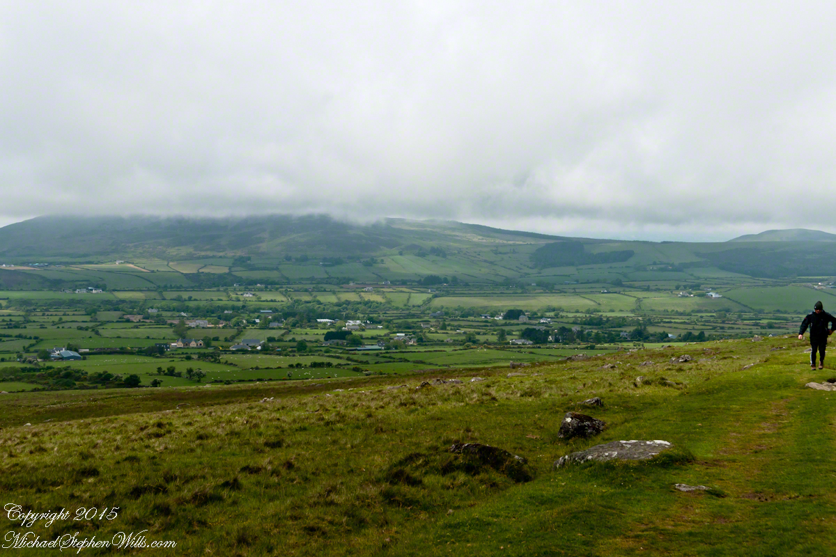
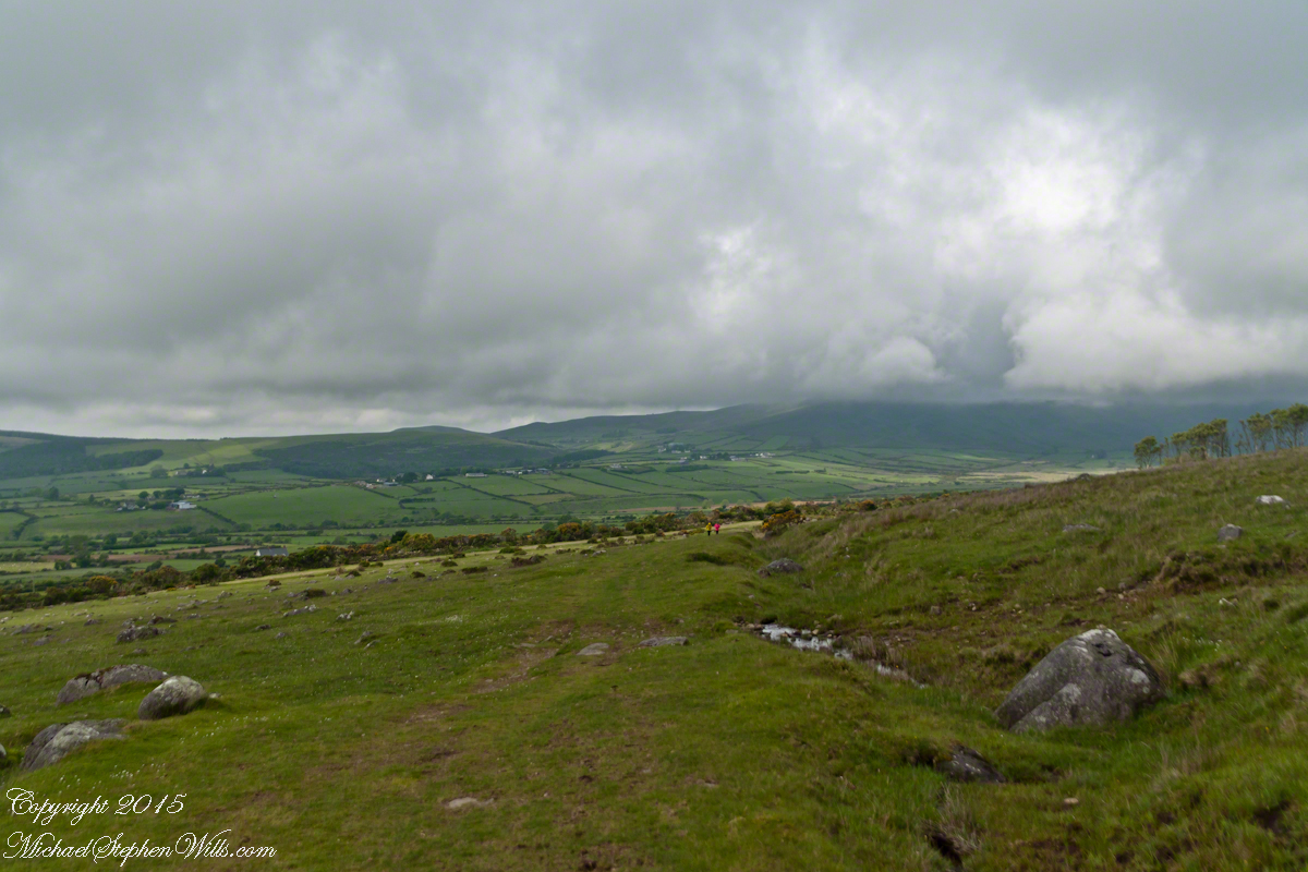
Our first and only encounter with fellow hikers. In the distance two figures appear over the next ridge, a mother and young daughter. She greeted us and challenged Sean to his knowledge of the area. Sean acquitted himself well and we continued.
On that 16th month, the king challenged the leader of his guests to the telling of a tale. Guaire demanded Seanchan Torpest, the chief poet of Connacht, to recite the whole of Táin Bó Cúailnge, known in English as the Cattle Raid of Cooley or The Táin (Cattle Raid).
Click a gallery pic for a larger view.
In this way the king was relieved of his guests: the book of the Táin was lost before their lifetimes, rumored to be abroad. Abashed at his failure, Seanchan Torpest withdrew. Fellow poets and followers trailed out from the castle.
Seanchan Torpest regrouped the host (an opened question is who then supported them) in conference to construct Táin Bó Cúailnge. It was a false hope as the gathering discovered while each poet knew a part of the whole, most of the story was lost. His honor, reputation and self-esteem in tatters the Chief Poet of Connacht, set off with Murgen, his son, and second cousin Eimena to return the Táin to Ireland.
Into mists such as those Pam, Sean and I ascended, the travelers soon were lost and separated.
Magically, Murgen finds the grave of the Uncle of Cú Chulainn in the mists, there to meet the shade of that enormous man, Fergus mac Róich is his name. In the Táin, as related in whole by Fergus to Murgen, Fergus was led by circumstances to ally with Maeve, to guide her army against the Ulstermen. As a deposed king, traitor to Ulster and Uncle to the champion Cú Chulainn, Fergus knew the tale entire.
View as we approached Goliyn Pass
It was from the mists that Murgen emerged, found his father and cousin, and returned together without the book, but with possession of the substance of the Táin.
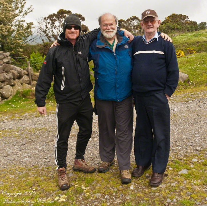
On Monday, June 9, 2014, cousin John Mills dropped his son, Sean Mills, myself and Pam Wills off at the foot of the western slopes of Slieve Foy on the Tain Way. Sean, Pam and I walked the way over the mountain and into Carlingford in the footsteps of epic Irish heroes.
Our guide, Sean Mills, proposed the walk and it fell on our last full day in Ireland. Sean’s father and our host for this visit, John Mills, transported the group including my wife Pam to the starting point at the foot of Slieve Foy.
Yes, if there is any part of the Tain Way the the mythic Irish heroes trod it is this one over Slieve Foy mountain. The saga, in Irish “Táin Bó Cúailnge” and “The Cattle Raid of Cooley” in English, features this bull, “Donn Cuailnge” “The Brown Bull of Cooley”, here as a statue erected 2011 by the Grange and District Residents Association.
Donn Cuailnge raged over the very slopes we walked this day. The myths themselves fill a volume and I am unable to do them justice here.
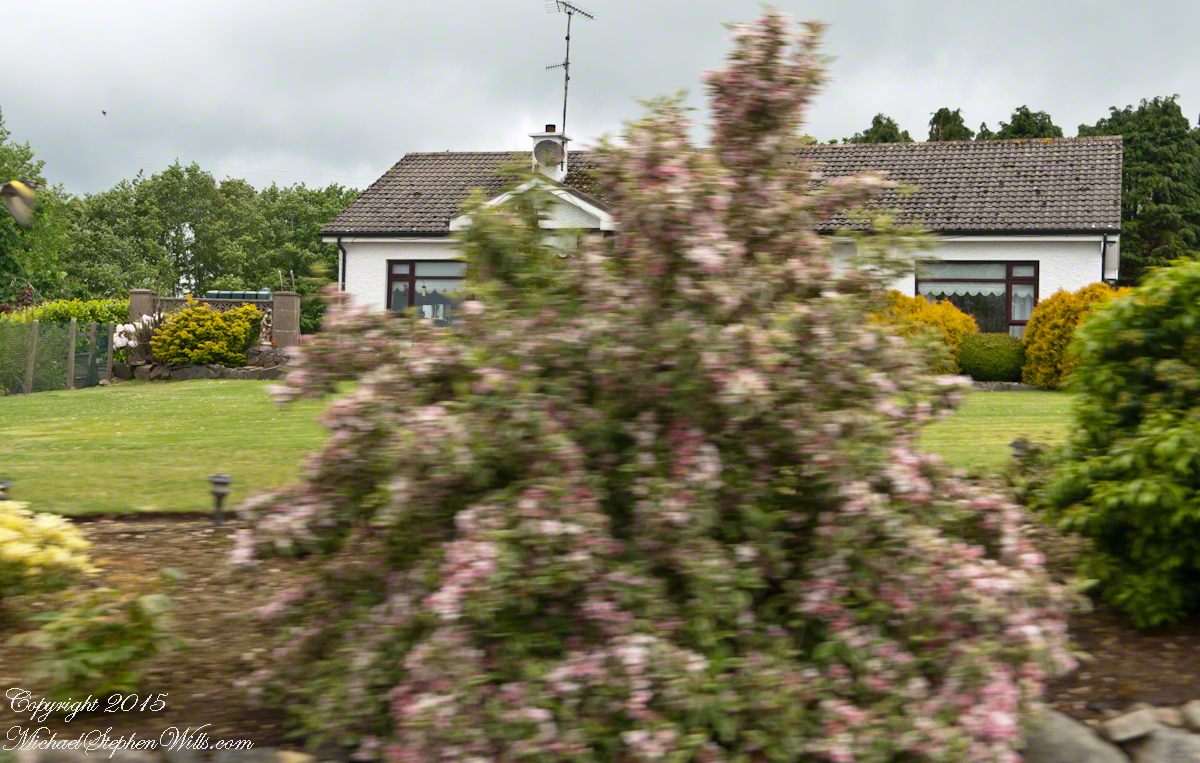
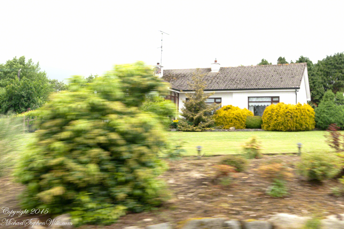
On the way, John stopped at the Old Aghameen School he attended in the late 1930’s early 1940’s 70 years before and we pass through the country soon to grace our views.
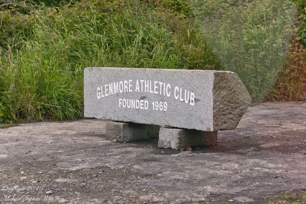
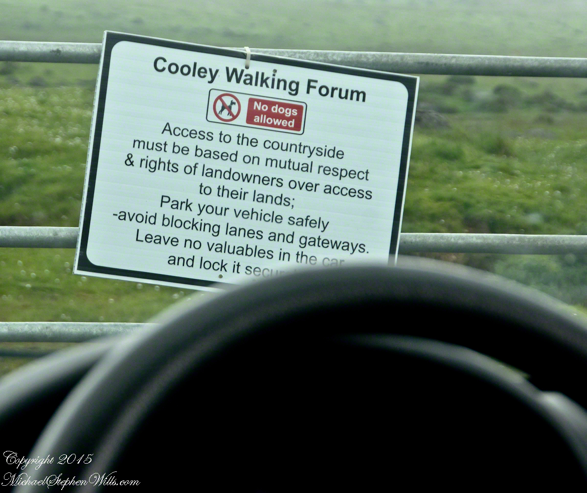
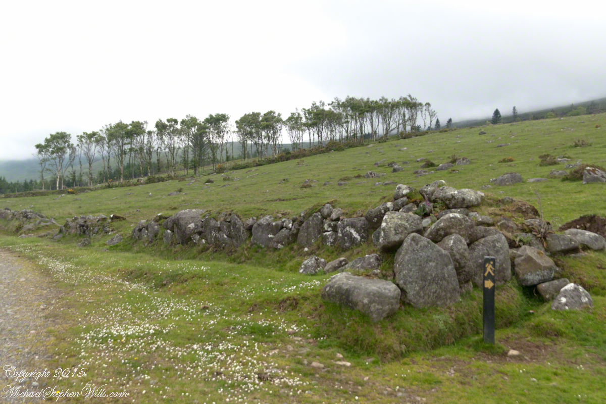
Many thanks to the Glenmore Athletic Club, the Cooley Walking Forum and land owners who provide access to the Tain Way.
We had our leave taking with John, who planned to stay near the phone for our call from Carlingford, if all went according to plan. That same year Pam had the first of two total knee replacements. This was our longest hike in Ireland and Pam was not likely to miss it, regardless of any pain. Pam is always ready to smile.
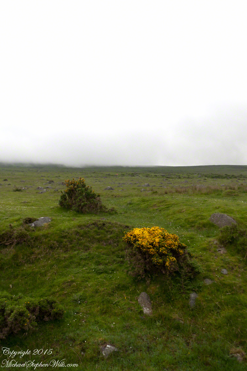
At start, the Tain Way is broad, green and welcoming.
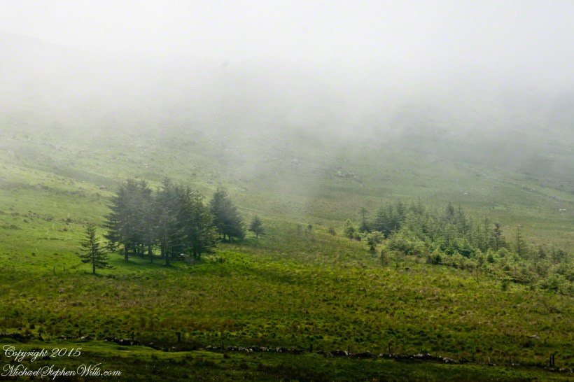
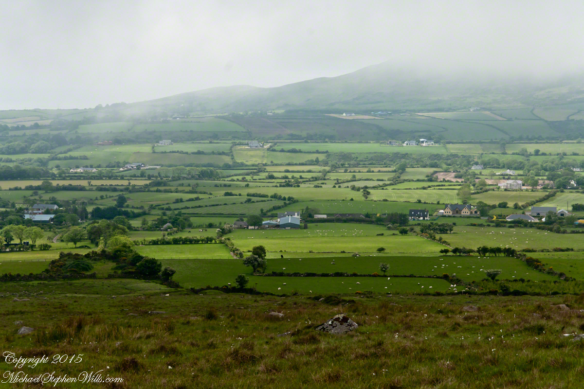
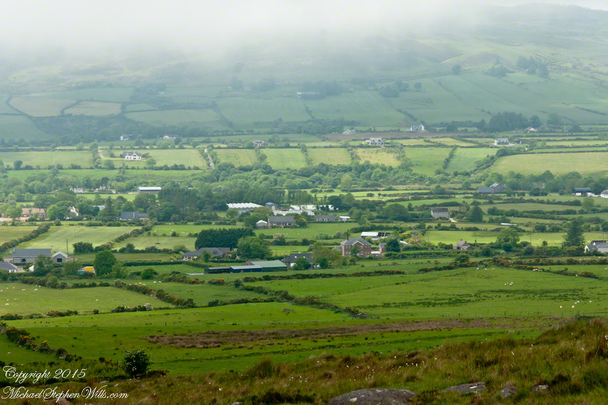
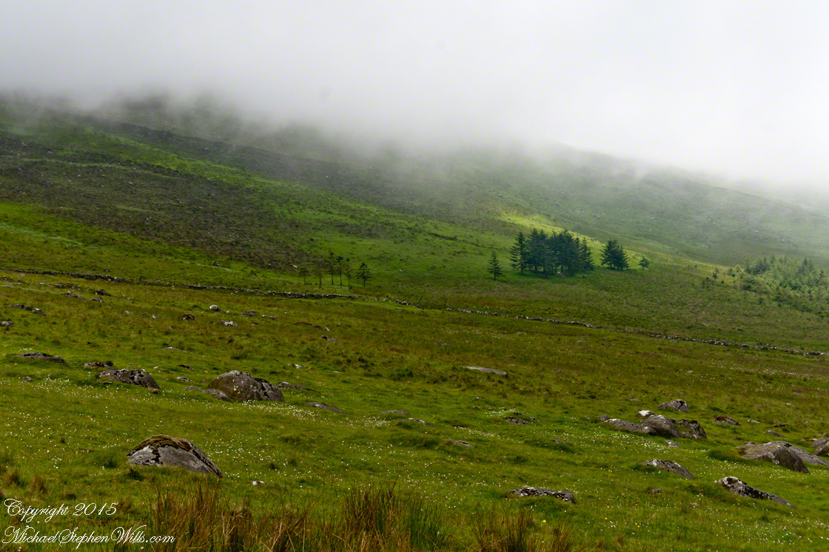
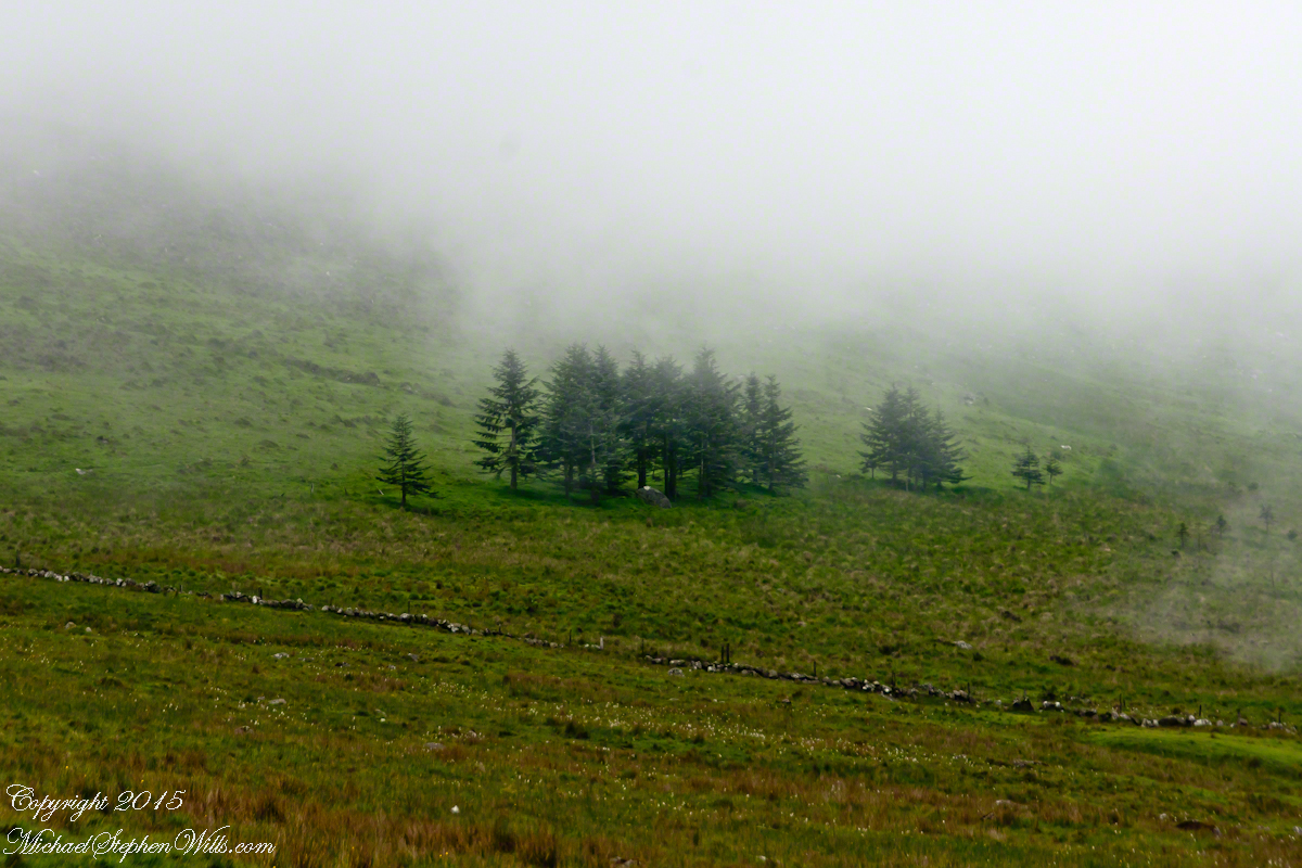
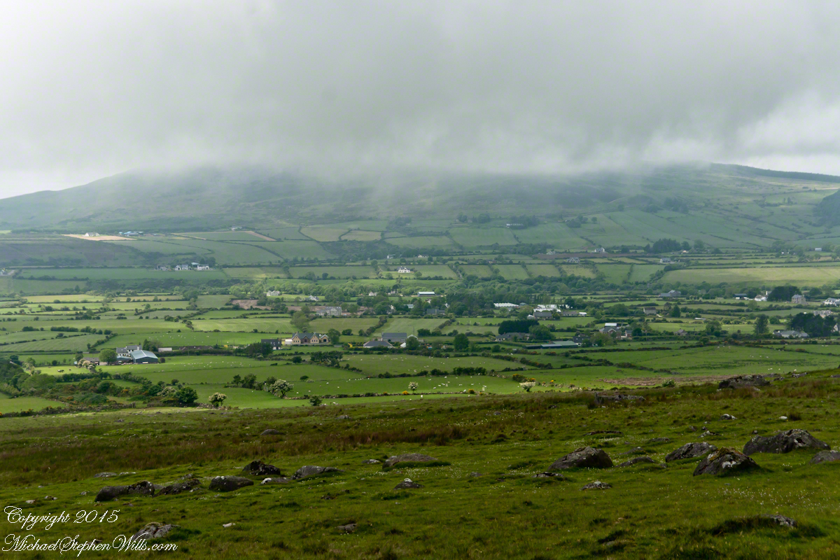
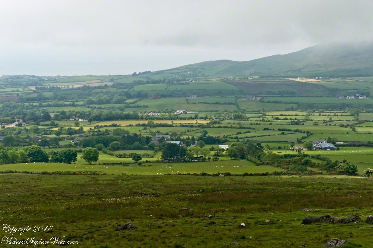
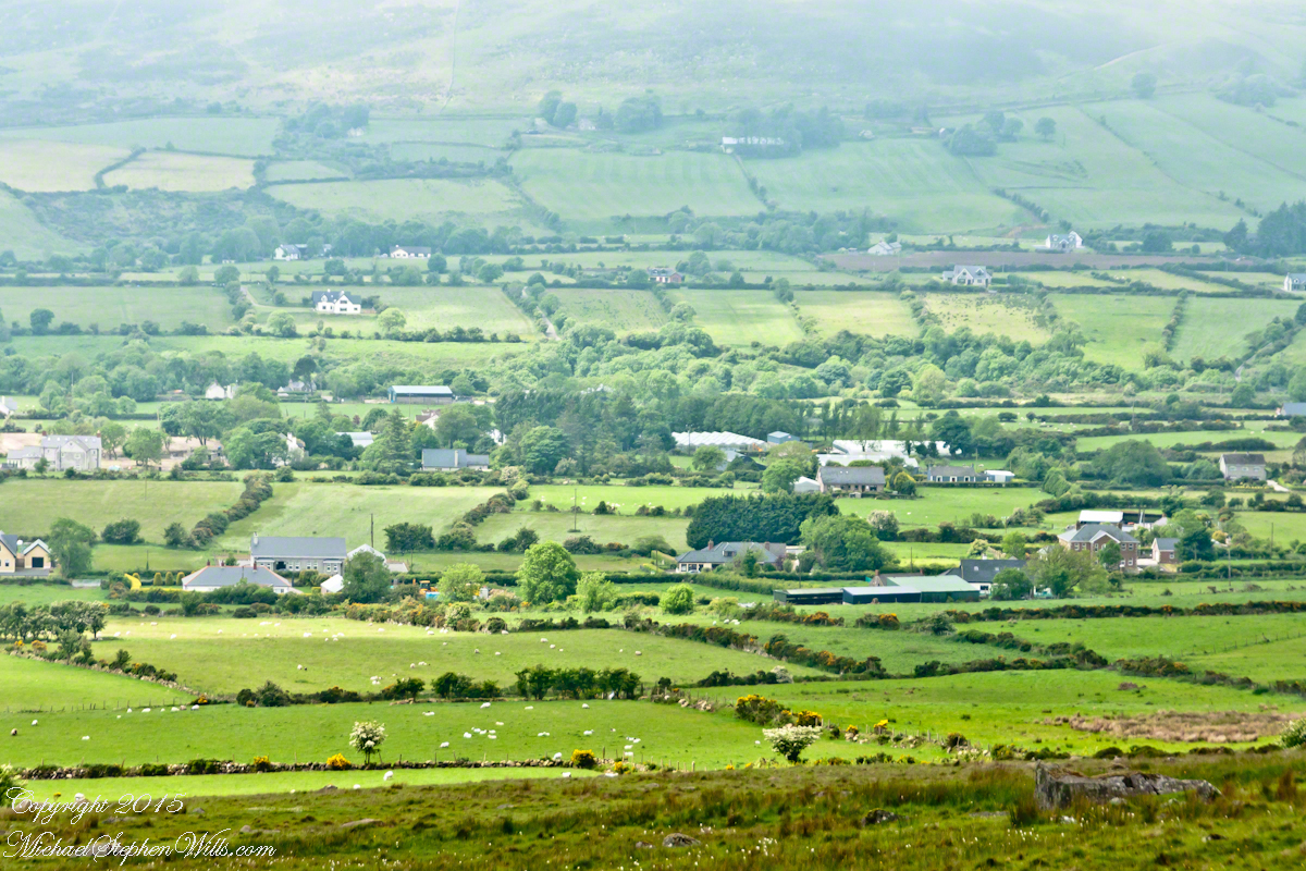
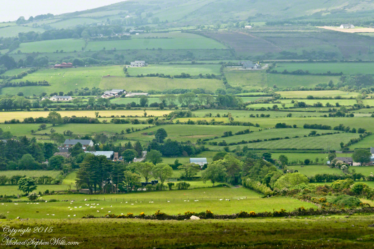
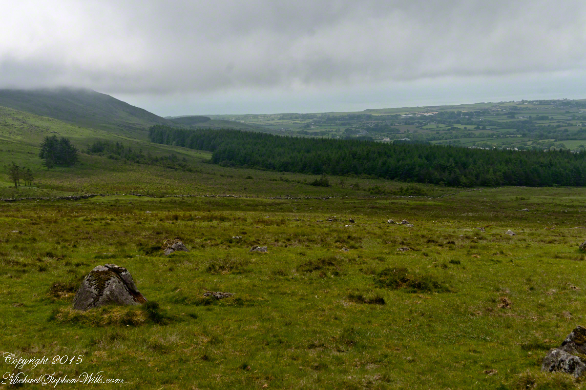
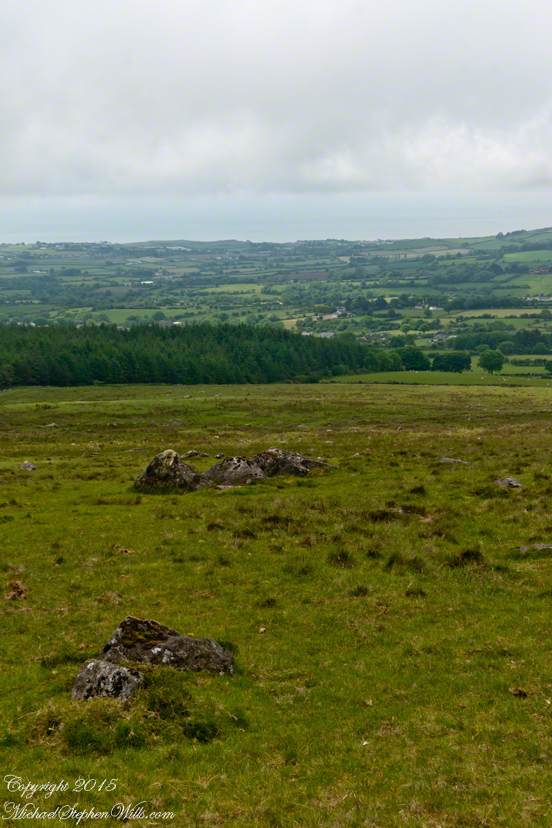
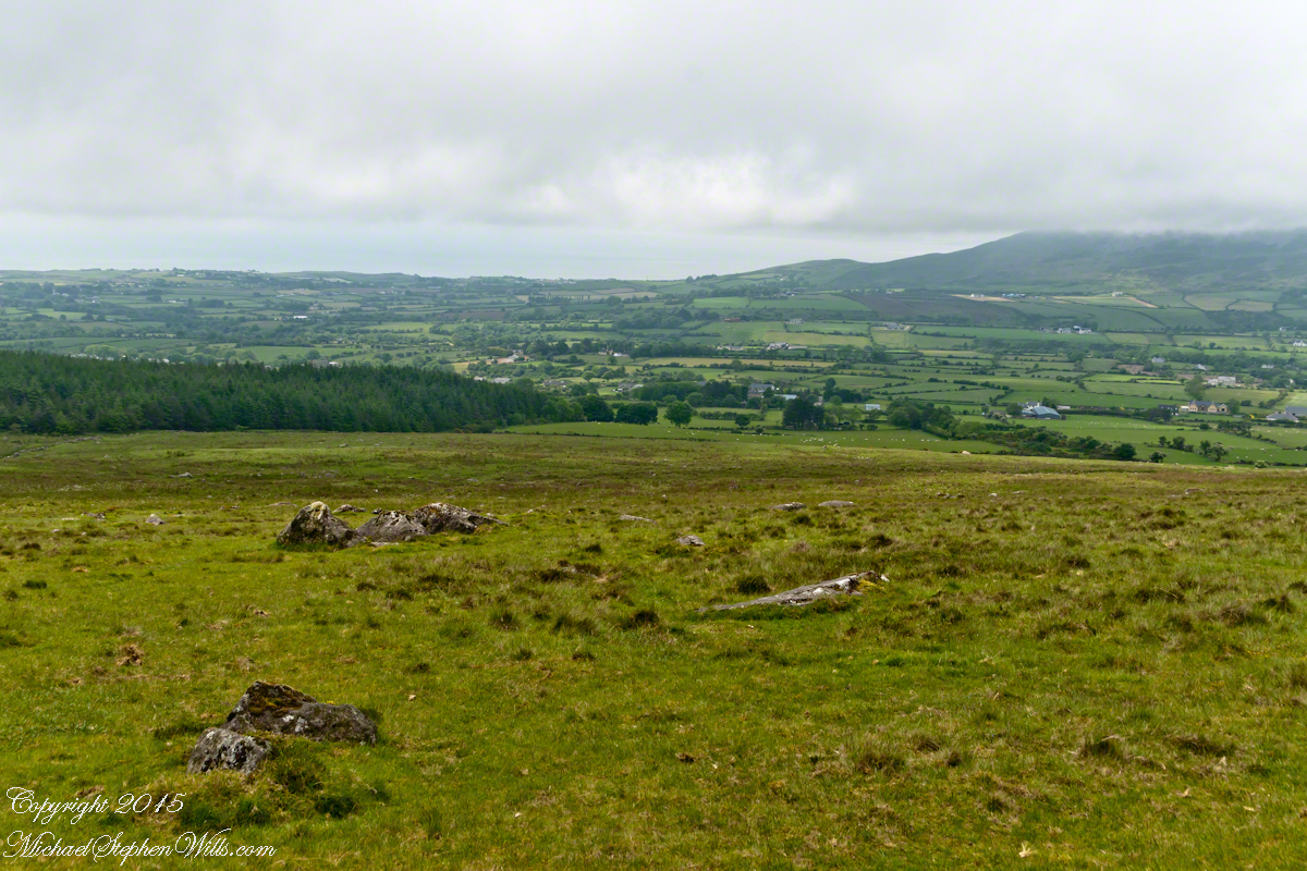
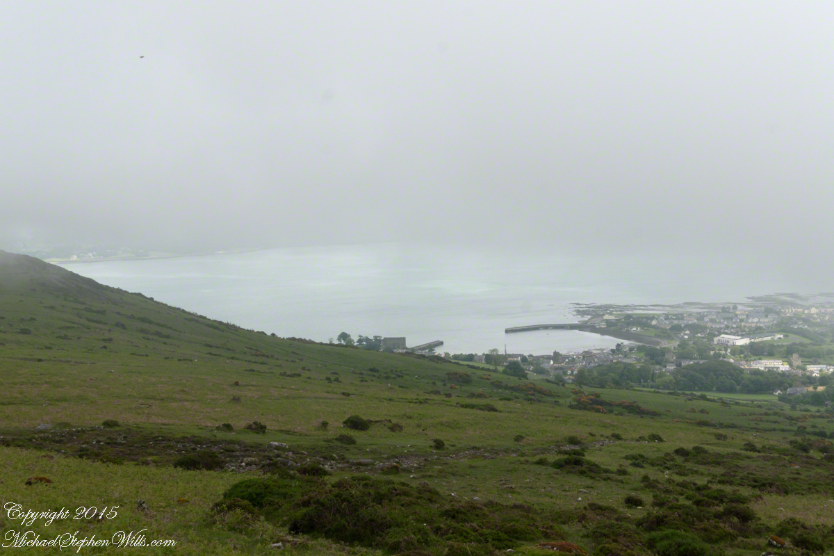
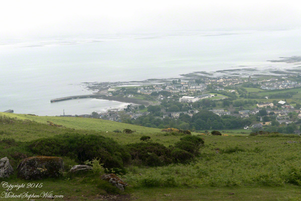
The western slopes of Slieve Foy hold views of a valley among the Cooley Mountains with Dundalk Bay of the Irish Sea to the south / southeast. It was not long before the view started to open and, then, opened and opened the entire walk to the top. We were graced with a lovely, cloudy, June day. Mist only, no rain. Plenty of wind, not strong.
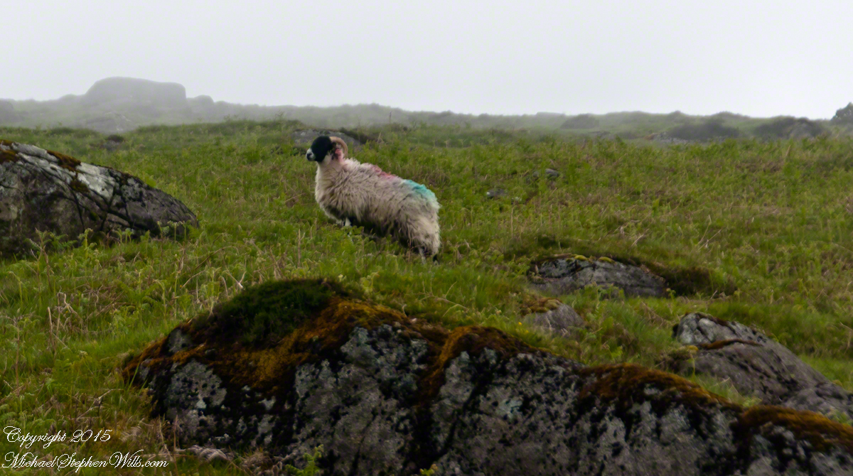
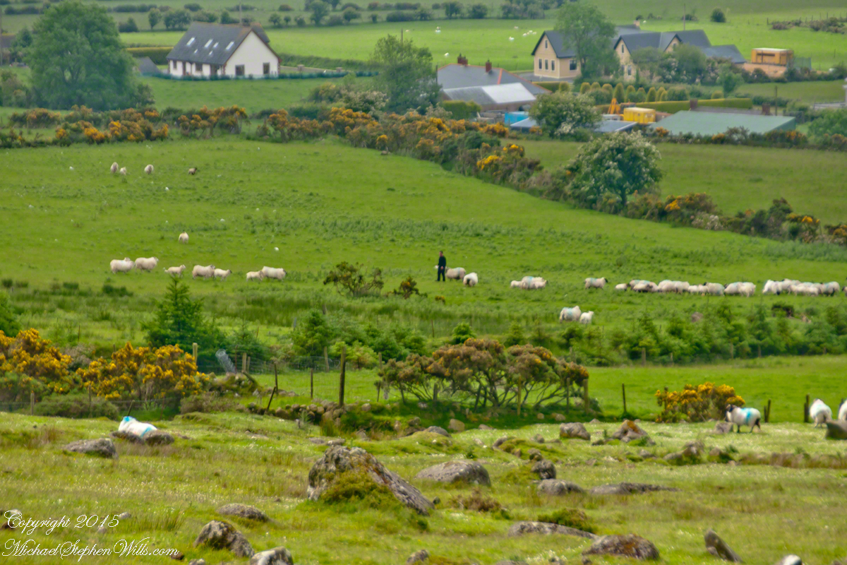
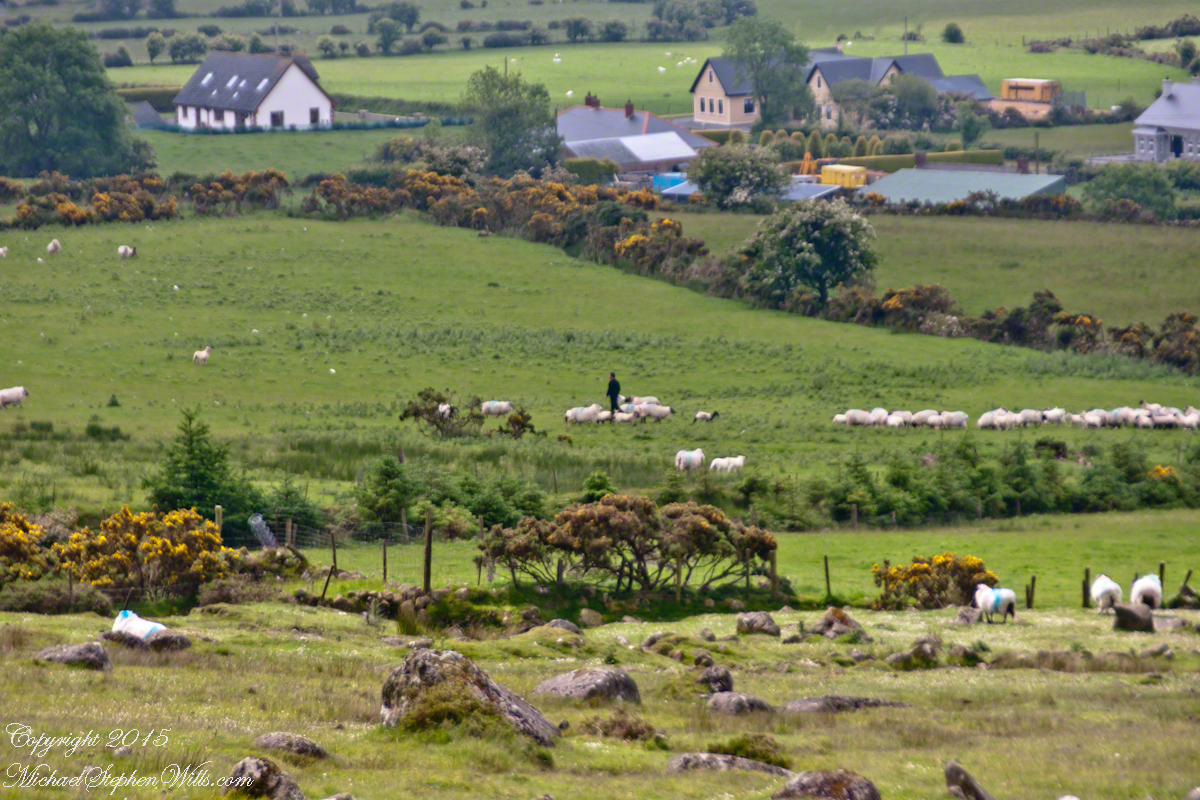
Farms are all about. Here a farmer attends to the flock. They know who he is.
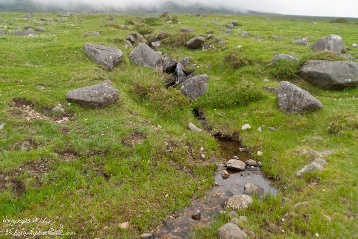
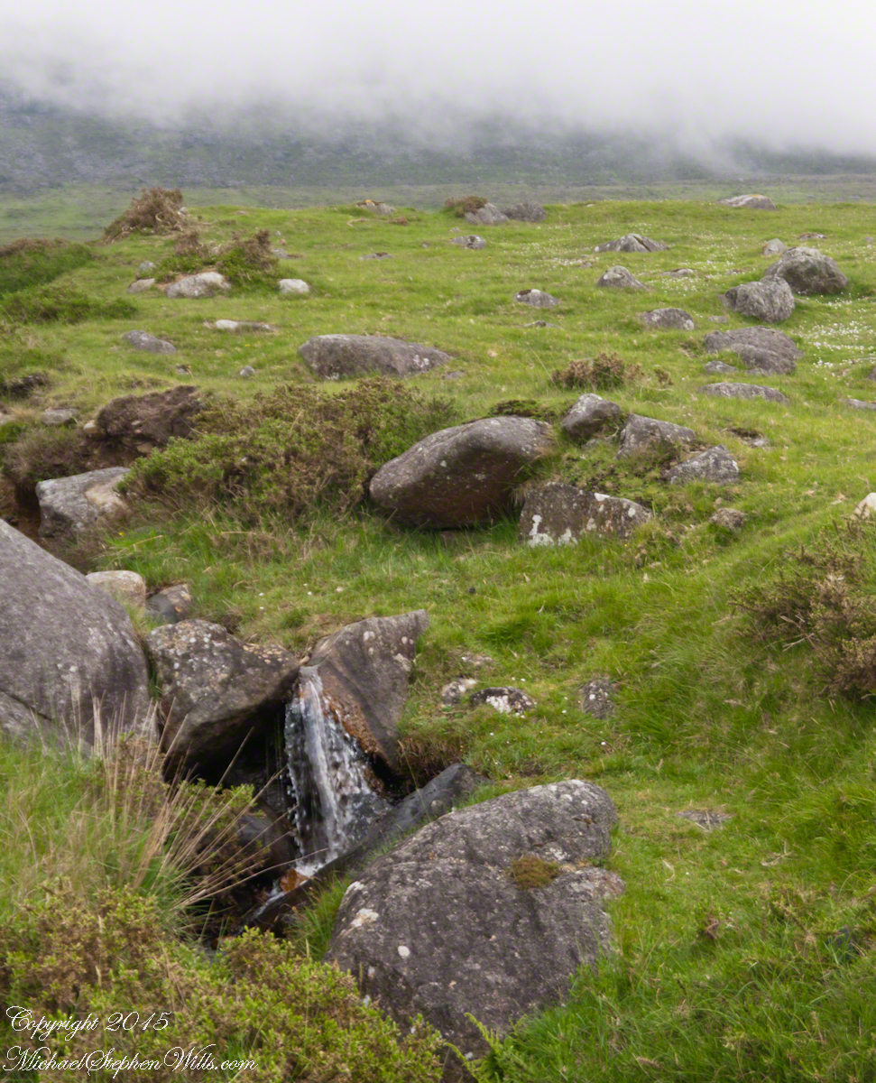
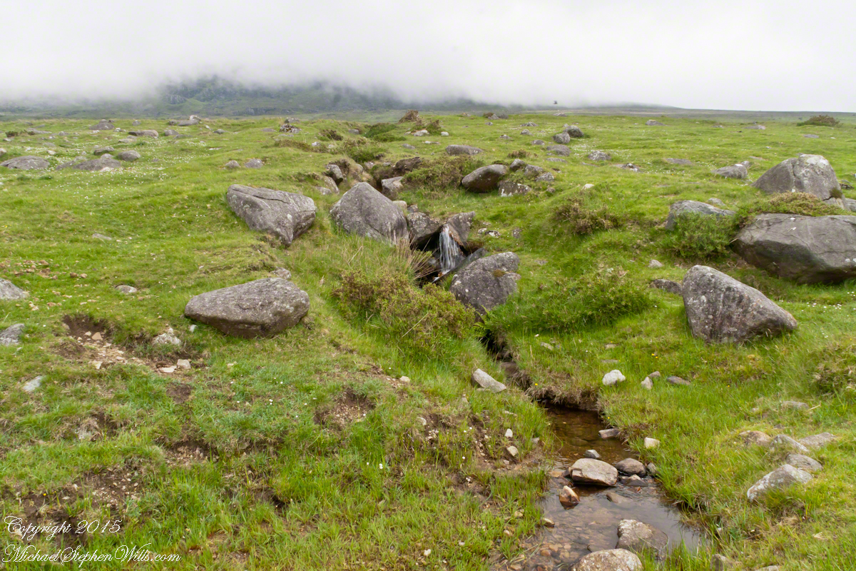
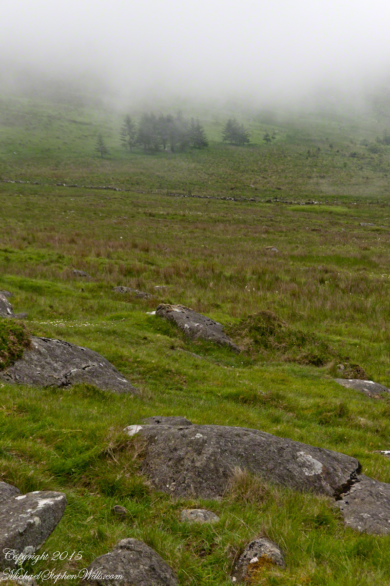
The lower slopes hold many small stream among granite stones.
I will continue with our walk on the Tain Way soon enough.
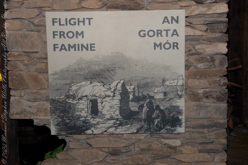
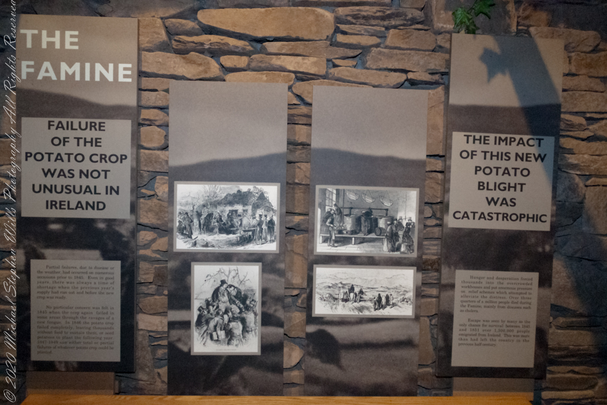
The Great Famine had profound social, cultural, and political impacts on Ireland and its relationship with Britain. It led to a significant decline in the Irish population due to death and mass emigration and is remembered as one of the darkest periods in Irish history. The event also left deep scars on the collective memory of the Irish people and played a role in the growth of Irish nationalism and the push for Irish independence in the following decades
“Partial failures, due to disease or the weather, had occurred on numerous occasions prior to 1845. Even in good years, there was always a time of shortage when the previous year’s supply had run out and before the new crop was ready.”
Cobh Heritage Center
“No particular concern was felt in 1845 when the crop again failed in some areas through the ravages of a new fungus. In 1846 the potato crop failed completely, leaving thousands without food to sustain them, or seed potatoes to plant the following year. 1847 – 1849 saw either total or partial failures of whatever potato crop could be planted.”
“Hunger and desperation forced thousands into the overcrowded workhouses and put enormous pressure on relief schemes which attempted to alleviate the distress. Over three quarters of a million people died during the Famine, mainly from diseases such as cholera. Escape was seen by many as the only change for survival: between 1845 and 1851 over 1.5 million people emigrated from Ireland. This was more than had left the country in the previous half century.”
Cobh Heritage Center
The Great Famine of Ireland, often referred to as the “Irish Potato Famine,” occurred between 1845 and 1852, with the most acute suffering taking place between 1847 and 1849. The causes of this devastating period in Irish history are multifaceted and debated among historians, but the following are generally acknowledged as the primary factors:
Potato Blight (Phytophthora infestans): The immediate cause of the famine was a potato disease known as late blight. The potato was a staple crop in Ireland, and for many poor Irish, it was the primary source of nutrition. The blight destroyed the potato crop year after year, leading to widespread hunger.
Over-reliance on a Single Variety of Potato: The Irish mainly grew a type of potato called the “Lumper,” which was particularly susceptible to the blight. This lack of genetic diversity made the entire crop more vulnerable to disease.
Land Ownership and Tenancy: Most of the land in Ireland was owned by a small number of landlords, many of whom were absentee, living in England. The Irish Catholic majority often worked as tenant farmers, living on small plots of land and paying rent to these landlords. The land was subdivided among heirs, leading to plots becoming increasingly smaller and less productive over generations.
British Colonial Policies: The relationship between Ireland and Britain played a significant role in exacerbating the famine’s effects. Some British policies and economic theories at the time discouraged intervention. For instance:
Corn Laws: These tariffs protected British grain producers from cheaper foreign competition, making grain more expensive and less accessible for the starving Irish.
Economic Beliefs: The prevailing laissez-faire economic philosophy of the time held that markets should be allowed to self-regulate without government intervention.
Exports: Even as the famine raged, Ireland continued to export food (like grain, meat, and dairy) to Britain, which was a source of controversy. Many felt these exports should have been halted or reduced to feed the starving Irish population. Inadequate Relief Efforts: While the British government did undertake some relief measures, such as opening public works projects and distributing maize (known as “peel’s brimstone”), these efforts were often insufficient, mismanaged, or too late. The public works projects sometimes did not lead to meaningful infrastructure improvements and instead focused on tasks like building roads that led nowhere.
Social and Cultural Factors: Discrimination against the Irish Catholics by the Protestant English elite, language barriers (many Irish spoke only Gaelic), and distrust between the local population and English officials further complicated relief efforts.
The Great Famine had profound social, cultural, and political impacts on Ireland and its relationship with Britain. It led to a significant decline in the Irish population due to death and mass emigration and is remembered as one of the darkest periods in Irish history. The event also left deep scars on the collective memory of the Irish people and played a role in the growth of Irish nationalism and the push for Irish independence in the following decades.
Reference: text in quotes is from “The Famine” poster. Cobh Heritage Center, May 2014.
Copyright 2023 Michael Stephen Wills All Rights Reserved
On this spring equinox morning a huge sun, filtered by morning clouds, hangs over East Hill and Cornell University. Taken from our home on West Hill, looking across the valley and Ithaca, New York.
The temperature is a balmy 18 degrees F.
Click the pic to visit my online gallery
Can you pick out these Cornell landmarks? — Jenny McGraw Tower — Lib Slope still covered in snow from last week’s storm. — the looming fortress shape of Bradford Hall.
Copyright 2021 All Rights Reserved Michael Stephen Wills
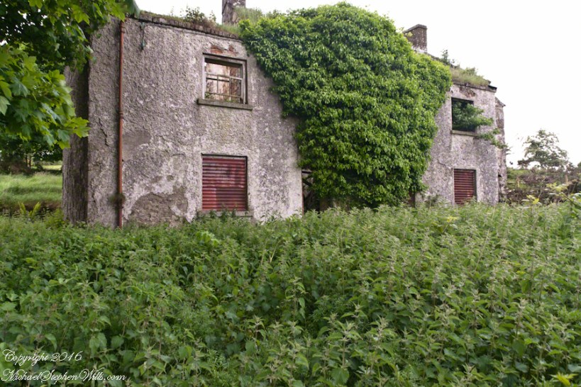
On Monday, June 9, 2014 John Mills, the first cousin of my mother, Catherine Wills nee McArdle, showed us the ruin of the schoolhouse used in the 1930 / 1940’s and which he attended as would Catherine if her parents hadn’t emigrated to Canada in the 1920’s. Free public schooling was mandated in Ireland from 1831 and by the 1850s most Irish parishes had a schoolhouse, such as this in Ballymascanlon civil parish, as part of the National Schools. When this piece was first published, Malachy Mills (a cousin), left a comment and clue…the name is Aghameen School. The following information spooled out from that.
There is an Irish language site, Duchas.ie, with listings for Aghameen, a Louth township, the very one of the school and, very rightly, it is the name of the school. There is even information from a teacher, Bean Ui Riada, who taught there 1937 – 1938, and posted information about local place names and legends. Here is the link to his postings. I learned from him that Aghameen is An tÁth Mín in Irish and means “field of the mountain meadow.” You can see from the photographs the site is on the side of a mountain, pine forests all around.
Throughout her life my Mother had correspondence with her cousins who learned how to write in this very school.
The school existed at least since 1842. In private communication arising from this blog posting I learned a friend’s great, great grandfather, Denis Joseph Doherty, came from Donegal in that year to teach in the school and married a fellow teacher, Margaret Kane who was the girl’s school teacher. They raised a family while living at the school until moving to Jenkinstown. Margaret was from Jenkinstown, not far away and also on the Cooley Peninsula. They are Malachy Mills’ great, great, great grandparents through his mother.
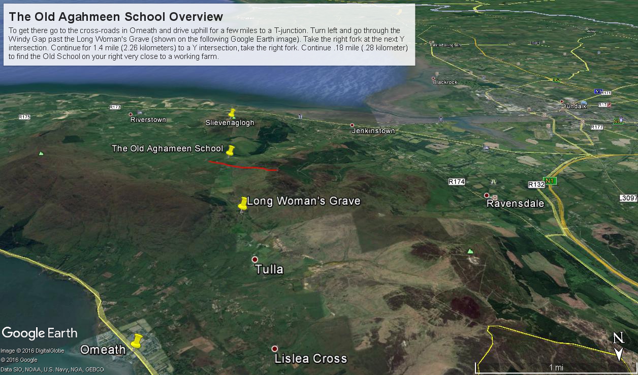
Aghameen School is located on the Cooley Peninsula, County Louth, shown in the following Google Earth Image
This is the exact location:
Latitude 54° 2’17.83″N
Longitude 6°16’3.08″W
To get there go to the cross-roads in Omeath and drive uphill for a few miles to a T-junction. Turn left and go through the Windy Gap past the Long Woman’s Grave (shown on the following Google Earth image). Take the right fork at the next Y intersection. Continue for 1.4 mile (2.26 kilometers) to a Y intersection, take the right fork. Continue .18 mile (.28 kilometer) to find the ruin is on your right.
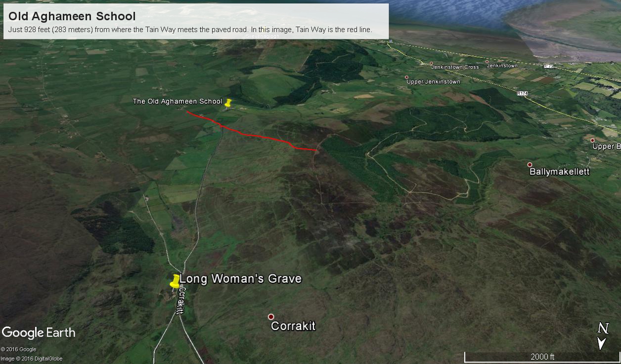
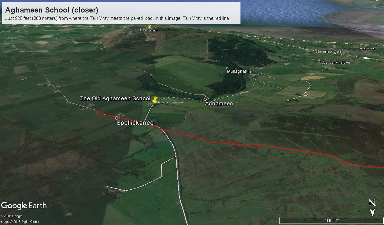
I marked the a portion of the Tain Way with a red line where it passes near the Old Schoolhouse.
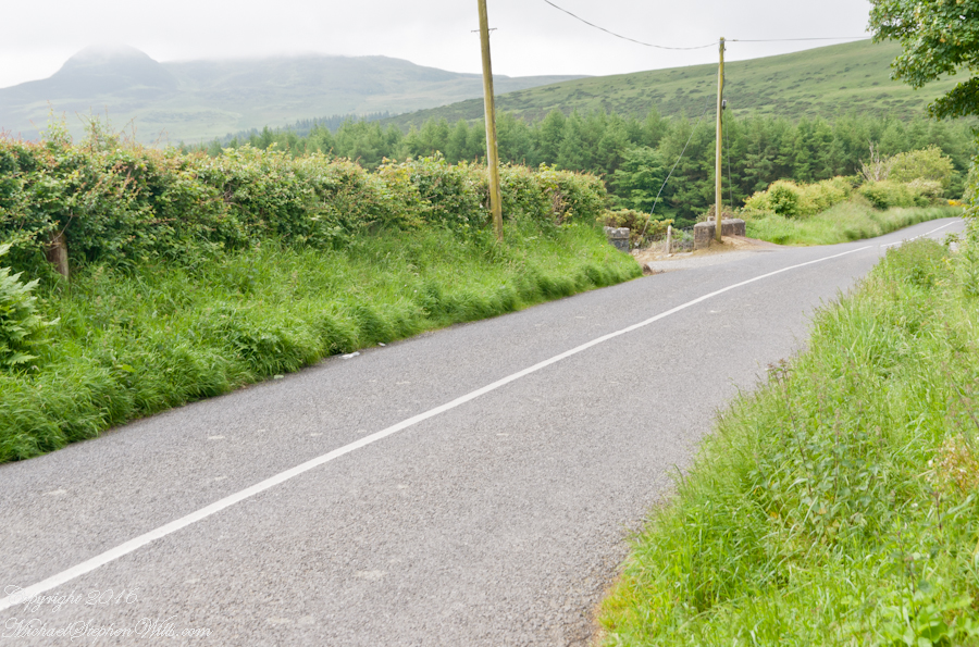
This is the road as viewed from the ruin looking south…..
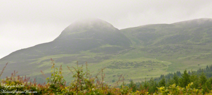
….and the distant view of the uniquely shaped peak Slievenaglogh to the southeast. Slievenaglogh in Irish is Sliabh na gCloch and means mountain of rocks. There is an identically named peak in the Mourne Mountains, to the north across Carlingford Loch. Slievenaglogh of Cooley Peninsula is an interesting element of south view from this valley.
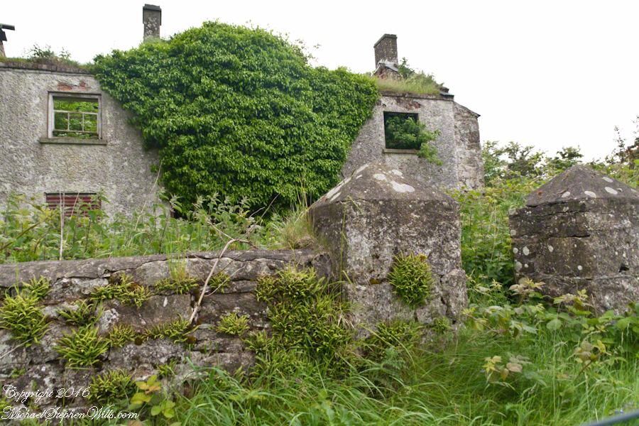
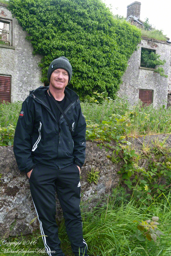
The ruin itself.
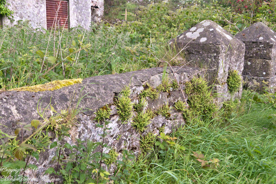
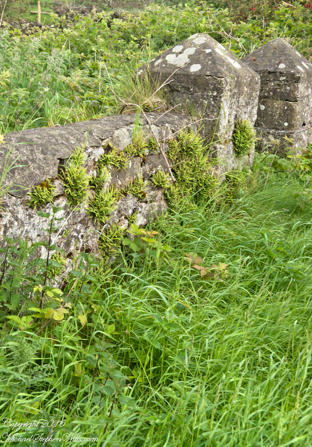
…behind a stone fence and gate posts.
Overgrown with ferns, moss, grass…..
…the ever present lichen.
John’s son, Sean Mills, was with us. That day, Sean lead us on Tain Way over the Golyin Pass over Slieve Foy with Carlingford as the destination. Indeed, the Tain Way passes a few feet from this spot, being a loop of the Cooley peninsula. The Way is a two day walk, our starting point was a few miles from the schoolhouse.


 The lower slopes hold many small stream among granite stones.