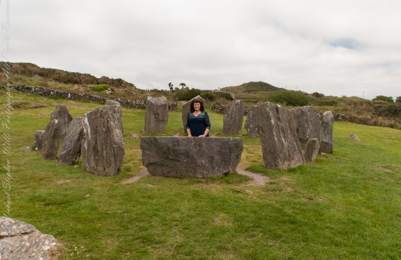
Seventeen closely placed stones with an axis pointing south-southwest toward the setting sun, formed by two “entrance” stones, one directly behind Pam, the second to the left. The recumbent in front of her forms the third axis element.
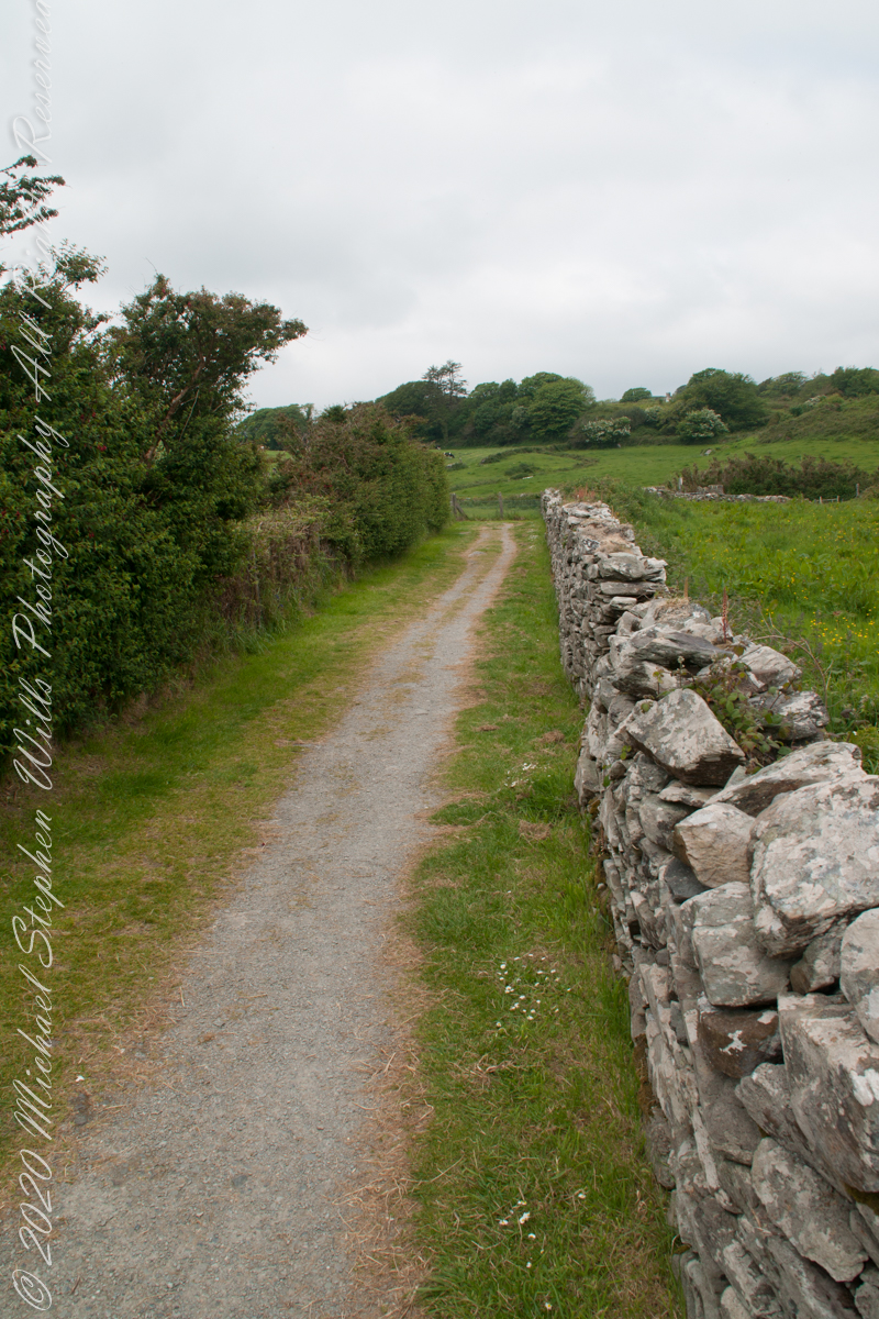
The path features in the past three posts is behind the entrance stones.
Click any pic for a larger view, in a new tab, or a slide show. When using WordPress Reader, you need to open the post first.
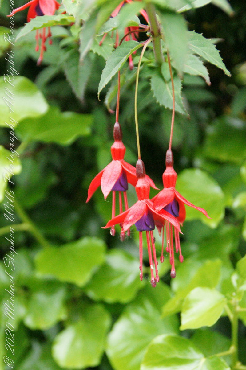
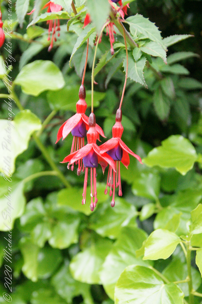
It is not surprising to find this non-native shrub growing along the path to Drombeg Stone Circle. English gardens featured fuchsia since the late 18th century. The ocean view is part of the charm of this place, the resulting milder climate suits the flourishing of exotic species of plants native to South America, the Caribbean and New Zealand.
Click any pic for a larger view, in a new tab, or a slide show. When using WordPress Reader, you need to open the post first.
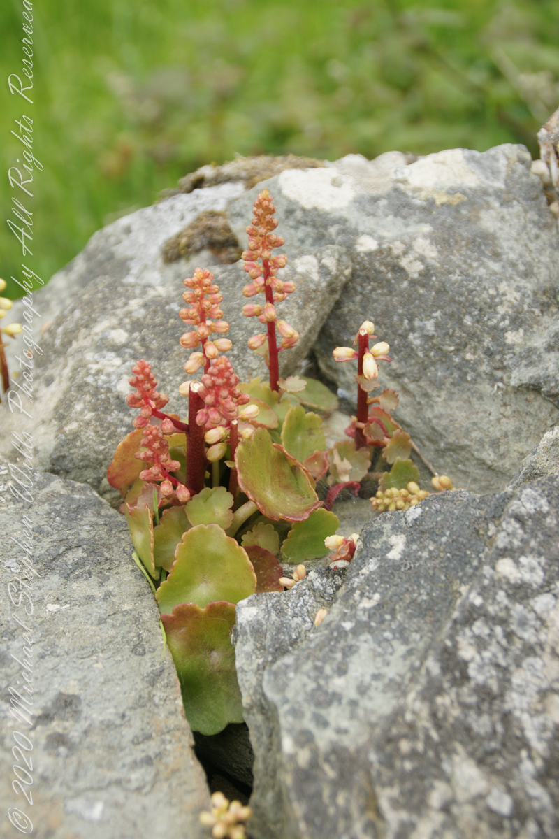
This unidentified spring of racemes, fleshy leaves and stalks, grew from the rock wall of the entry path to Drombeg Stone Circle. Here the climate is strongly influenced by the Celtic Sea, milder winters allow exotic plants to flourish.
My appraisal is this is in the Crassulaceae family, possibly the genus Kalanchoe or, more probably Umbilicus, from the fleshy, round, succulent leaves and form of the flowers. Species of Umbilicus are native to Western Europe and known to favor rock walls.
Click any pic for a larger view, in a new tab, or a slide show. When using WordPress Reader, you need to open the post first.
To close our time on the Tain Way I offer a poem written and presented to the congregation of the First Unitarian church of Ithaca New York 25 years ago, 1992. Interspersed are final photographs from our walk on the Tain Way of 2014.
The poem content is not directly biographical / confessional although it draws upon my experience as a single parent in the 1980’s through 1990’s.
A Poem Read To The Congregation
I
a crisis threatened an Irish village men women children filled the meeting place everyone participated especially the infants
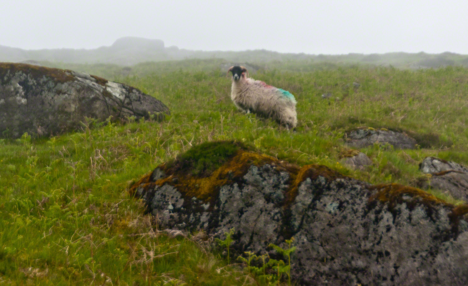
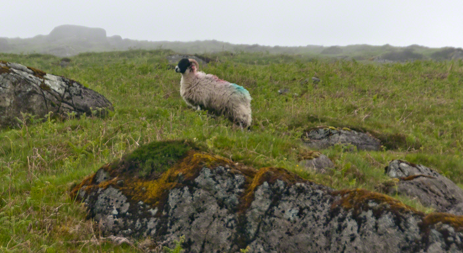
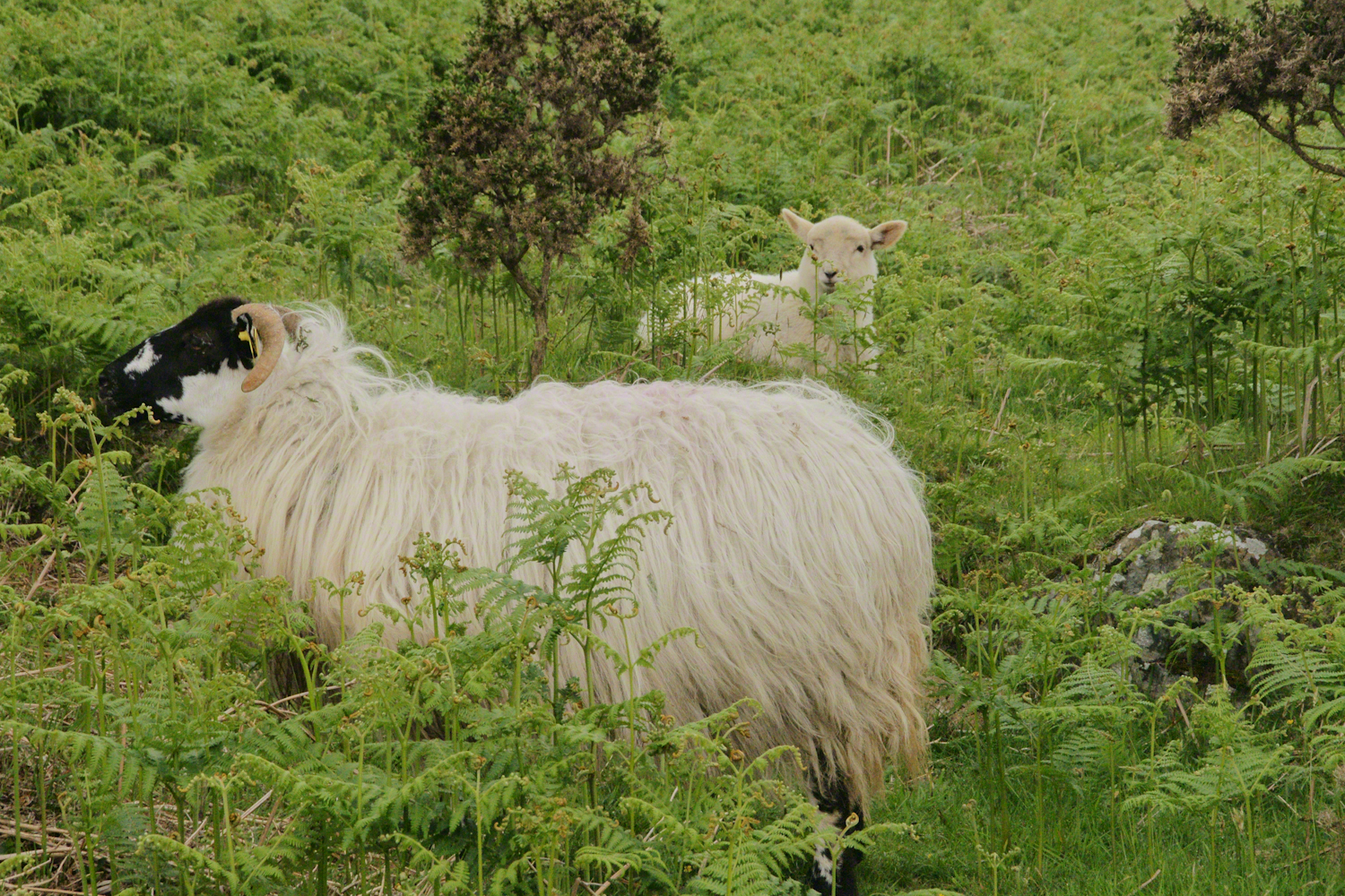
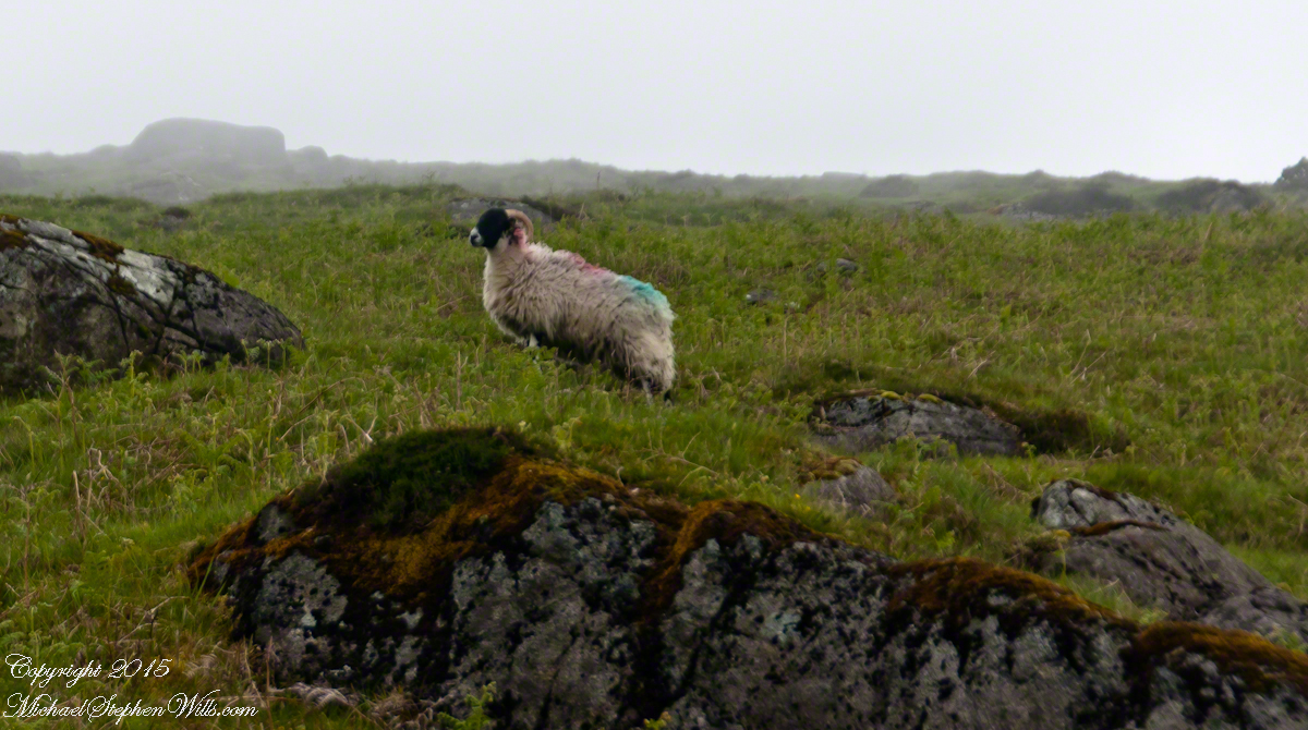
The Tail Way descends from Goliyn Pass to the northeast, passing among commons grazing. I attempted to identify the breed of this ram, but gave up. I can say sheep on the Cooley Peninsula are primarily bred for meat and there are black faced breeds known for meat production.
The flocks of County Louth commonly carry paint brands to identify ownership. Paint branding lessens wool value. This is less of an issue if the livestock are primarily raised for meat.
in spite of it all a plan was arrived at after the vote from the back of the room a man called out
….you know the type…
THIS WILL BE OUR PLAN UNTIL WE FIND OUT WHAT IT IS.
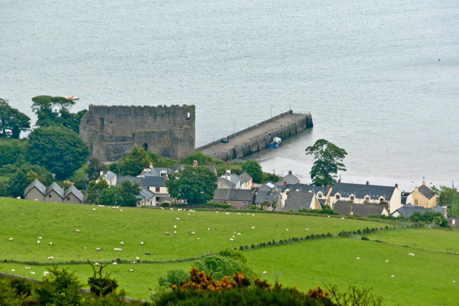
The ancient portion of Carlingford. I called the top of the castle “battlements” in the loose sense, as the ruin now longer has a walkway.
II
my son John and I have a photo of him at 5 years washing dishes standing on a chair up to his elbows in rubber gloves the caption reads “Two Men On Their Own.”
i had agreed to accept a divorce from helen only if john was left with me
one night in particular stands out from that time i did not sleep for planning what john and I would do
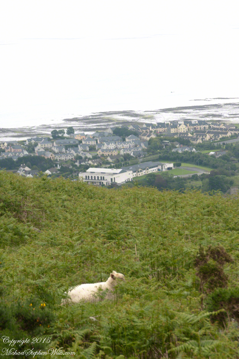
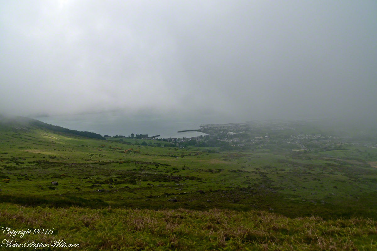
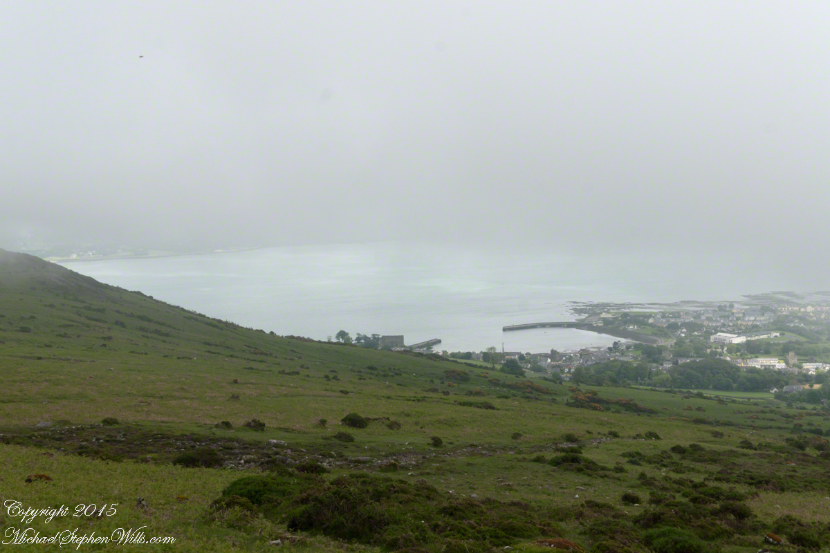
Unbranded, perfect white marks this lamb among an extensive fern bed. Tain Way steepens on approaching Carlingford. Below is the residential Carlingford, the Greenore road running to the right. The large structure with two rows of dark windows is the Four Seasons Hotel where a substantial brunch is served Sundays.
III
seven years passed not a long time since then we’ve moved found another a better life
We descended below the ridge to pass into excellent pasturage. The growth of fern hides a lush grass pasture.
raising John alone was not part of the plan Its been just john and me helen gave birth to john to have a part of me in case of loss i felt the same way and she understood
a welcome feminine voice in our home “Little House on the Prairie” and “Little House in the Big Woods” twice.
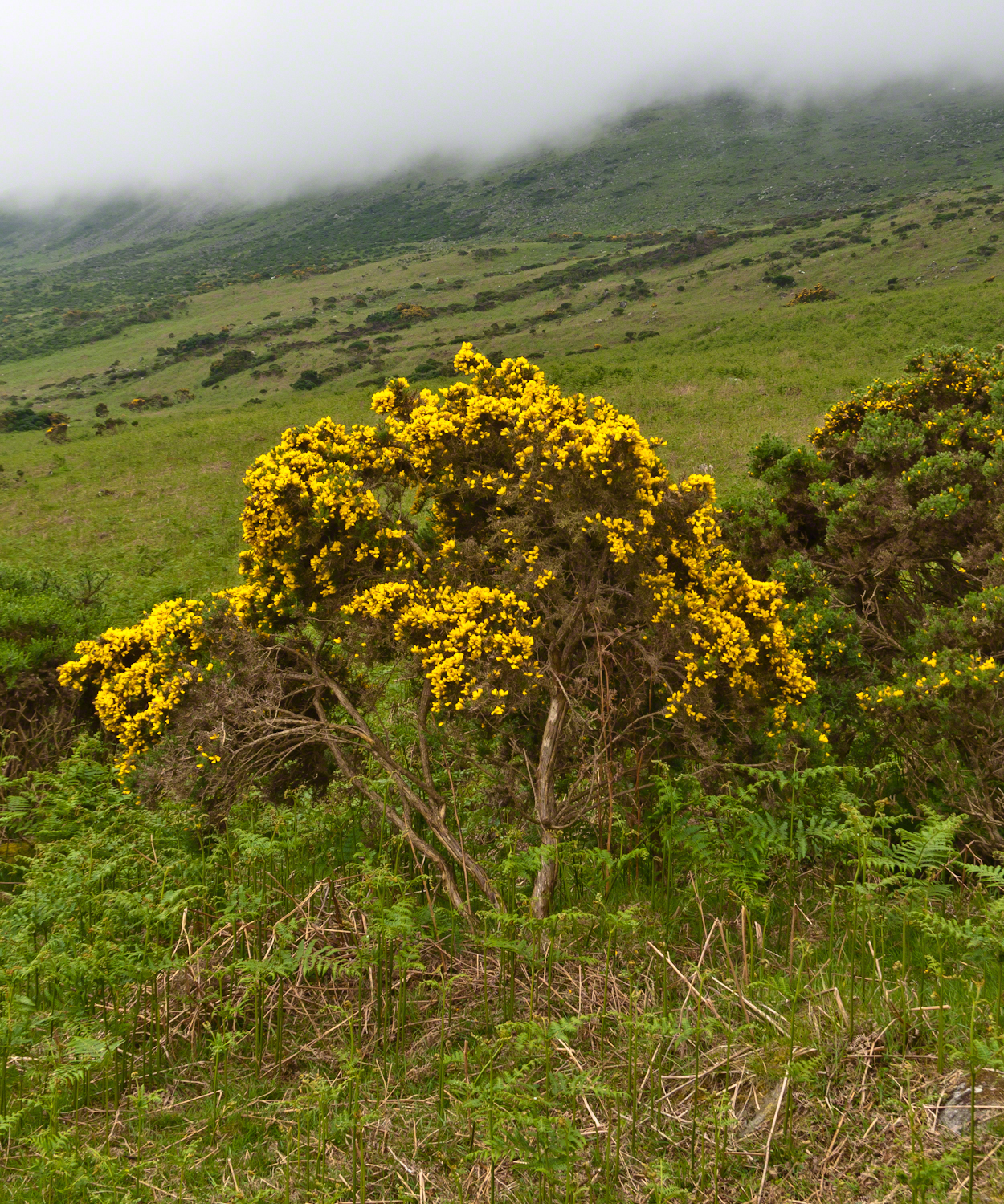
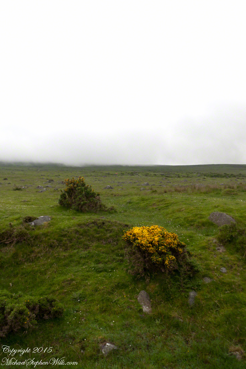
Plants and livestock on these slopes of Slieve Foy contend with adverse conditions in the form of a constant east wind. The stress is evident in the stressed trunk, although this species thrives in this environment, as seen in the strength of bloom and the yellow patches on the slopes, all of which are gorse. Gorse flowers are edible; the entire plant can be used as fodder when crushed to the consistency of moss. In Scotland there’s a museum with a roundish boulder called a Whin Stone.
V
Here is an excerpt from a newspaper article by Wilder called “HOME” that has an emotional resonance for me dated 1923 Wilder was in her 50’s.
Out in the meadow, I picked a wild sunflower, and as I looked into its golden heart, such a wave of homesickness came over me that I almost wept. I wanted Mother, with her gentle voice and quiet firmness; I longed to hear Father’s jolly songs and to see his twinkling blue eyes; I was lonesome for the sister with whom I used to play in the meadow picking daisies and wild sunflowers.
Across the years, the old home and its love called to me, and memories of sweet words of counsel came flooding back. I realize that’s all my life the teaching of these early days have influenced me, and the example set by Father and Mother has been something I have tried to follow, with failure here and there, with rebellion at times; but always coming back to it as the compass needle to the star.
So much depends upon the homemakers. I sometimes wonder if they are so busy now with other things that they are forgetting the importance of this special work. Especially did I wonder when reading recently that there was a great many child suicides in the United States during the last year. Not long ago we had never heard of such a thing in our own country, and I am sure there must be something wrong with the home of a child who commits suicide.
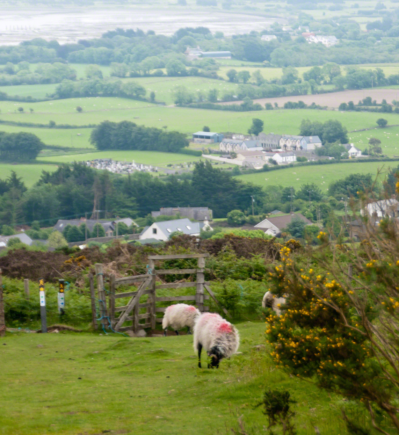
The trail detours around sheep pasture just before descending to the outskirts of Carlingford.
VI
we give so much to our children what’s left over though is ours
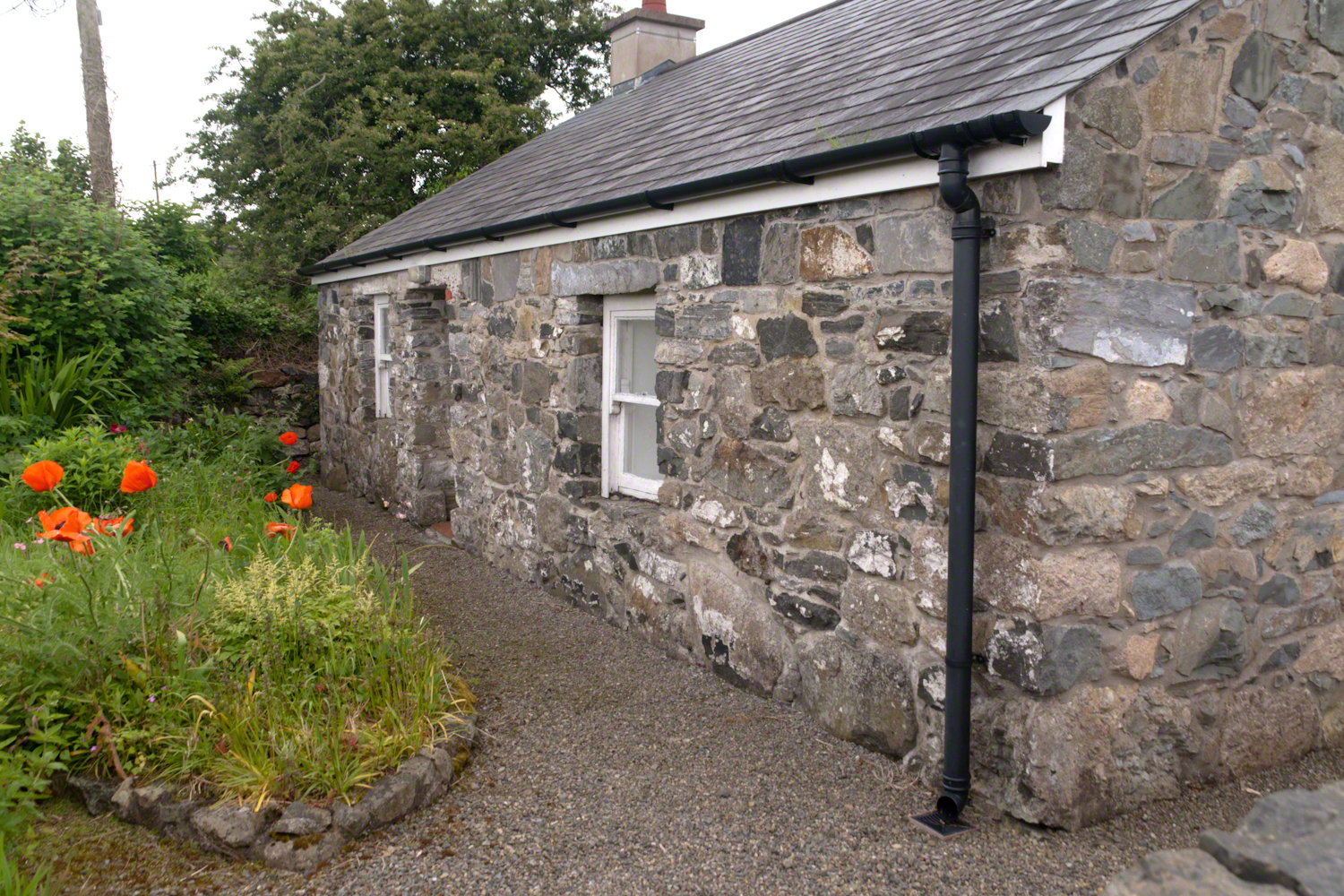
The first Carlingford home passed by the trail is a solid fieldstone home with a slate roof fronted by a natural garden featuring red poppies.
William Carlos Williams wrote it is difficult to get the news from poems yet men diet miserably every day for lack of what is found there
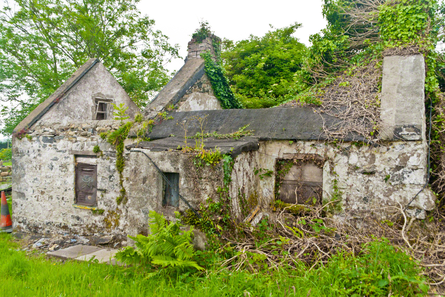
This ruin lies off the Tain Way as it descends through the outskirts of Carlingford town. Constructed of stones, mortar and what looks to be concrete. Long slate slabs protect the eves. It’s been abandoned for an age. What a story it must have, long slow and full of life.
it is not difficult to understand this to live it is another matter
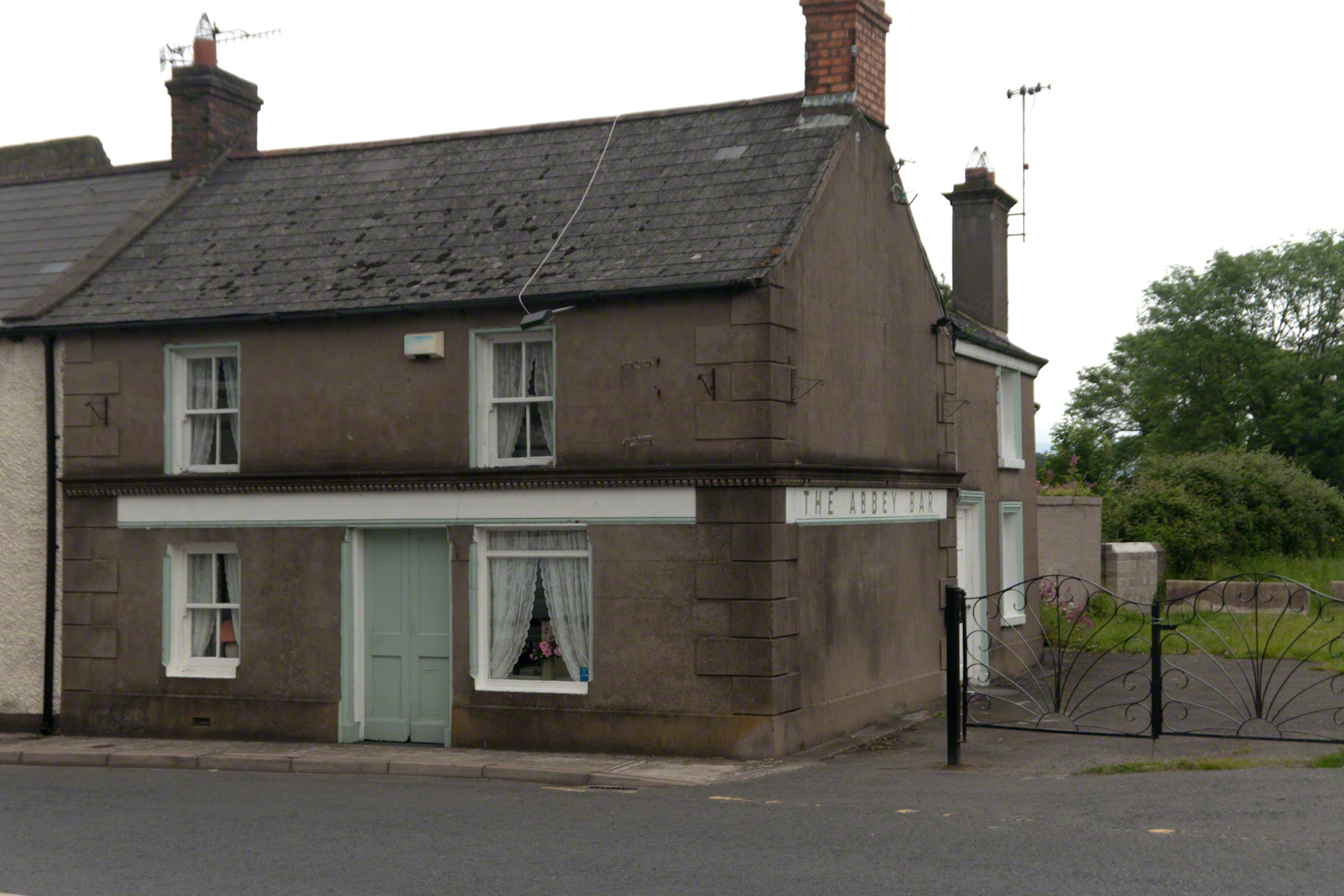
Named for the Carlingford Priory, a nearby ruin, the Abby Bar is located on Dundalk Street (R173), Liberties of Carlingford, Carlingford, Co. Louth, Ireland. Liberties of Carlingford might be called greater Carlingford in the USA.
you have to live it in order to have something left over
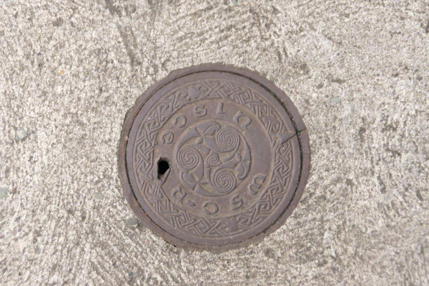
A metal cover, about 8 inches in diameter located in the sidewalk on the left side of The Abby Bar on Dundalk Street, Carlingford. The triple spiral triskelion symbol has become a Christian symbol of faith for Celtic Christians around the world, a visual representation of the Trinity (Father, Son, Holy Spirit) and eternity. In Ireland, the symbol acquired its Christian meaning prior to the 5th century. The triskelion predates Christina and even Celtic culture as petroglyphs of the astronomical calendar at the megalithic tomb Newgrange (3,200 BC). The symbol is associated with Neolithic cultures throughout Western Europe.
VII
never the less my emotional resonance in reading that piece “Home”
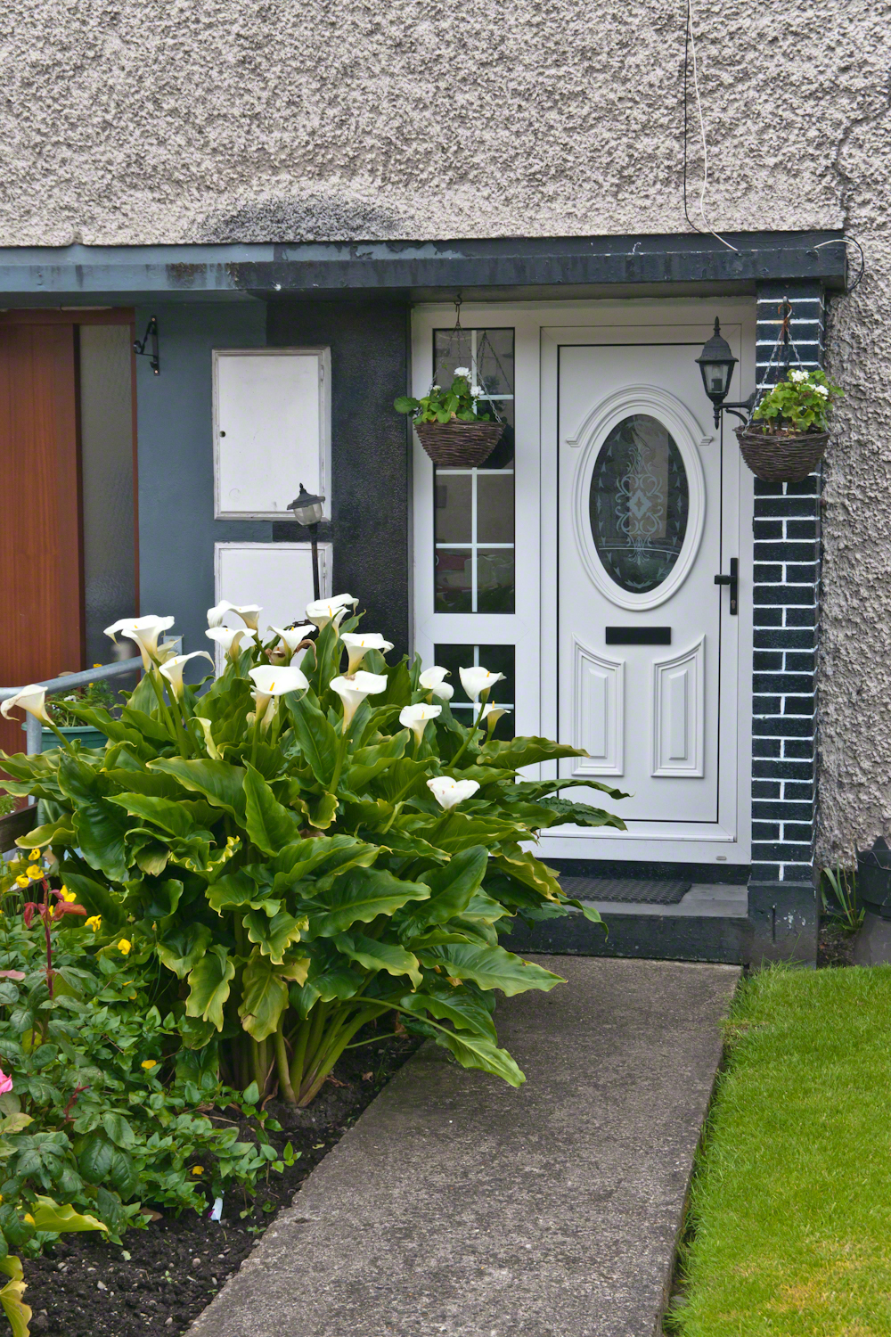
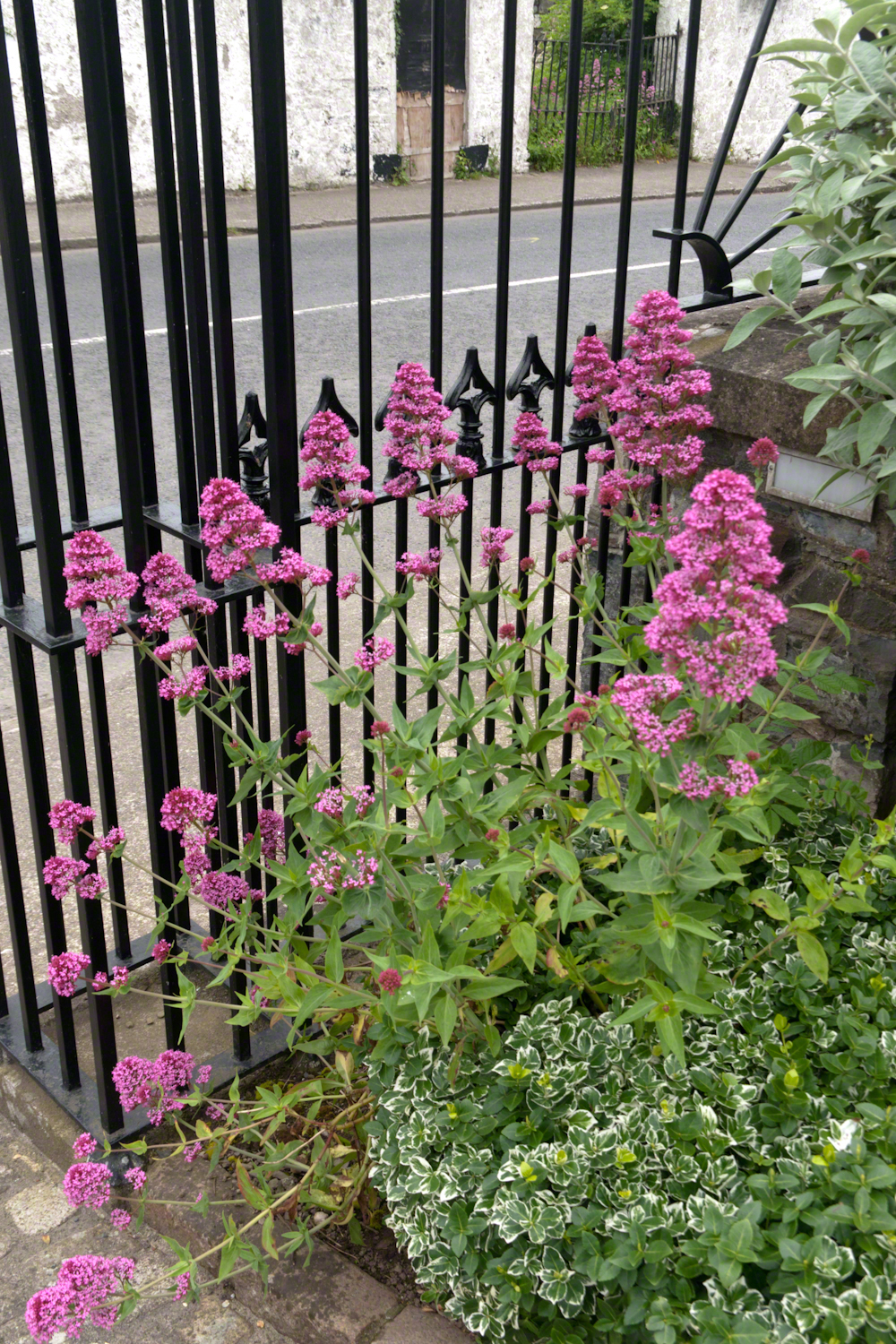
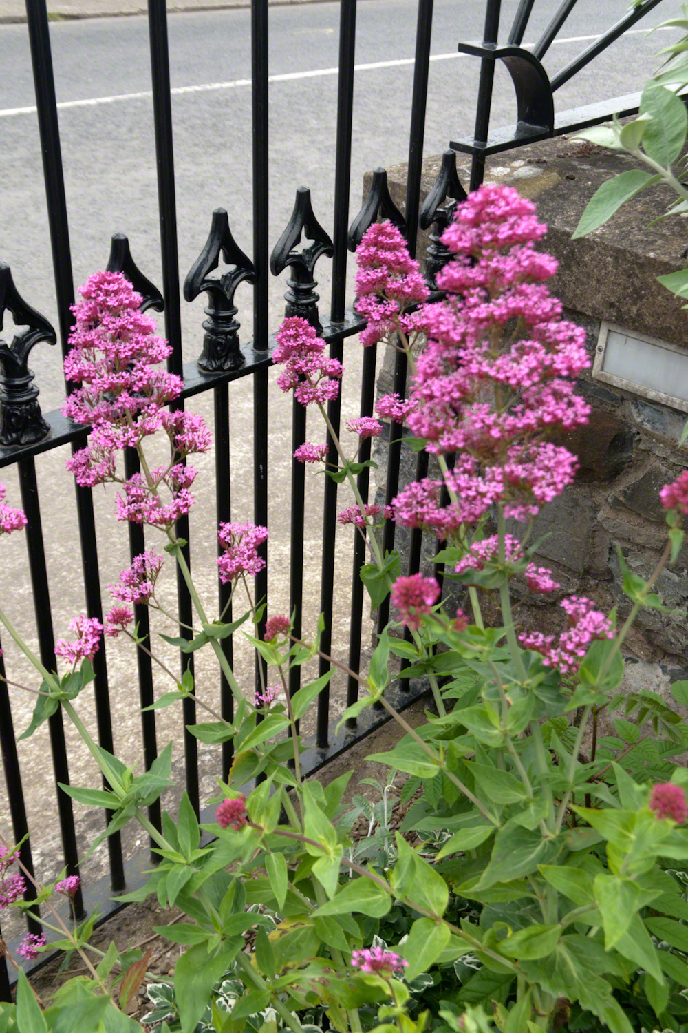
Caring touches to a well-tended home entrance along the Tain Way, Carlingford, County Louth, Ireland.
did not come from the sentiments Wilder so skillfully evoked though I shared them it was that sharp part
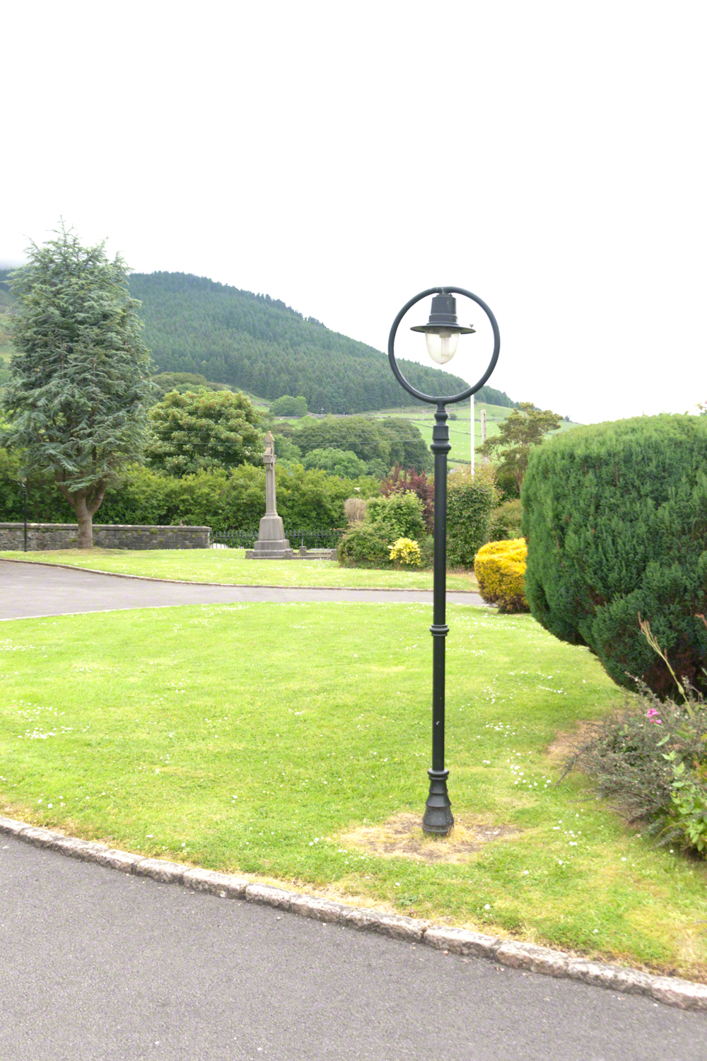
Lamp post on Church of Saint Michael grounds.
i did not agree with it lacking a reason and so must have re-read “Home” fifty times a hundred who knows
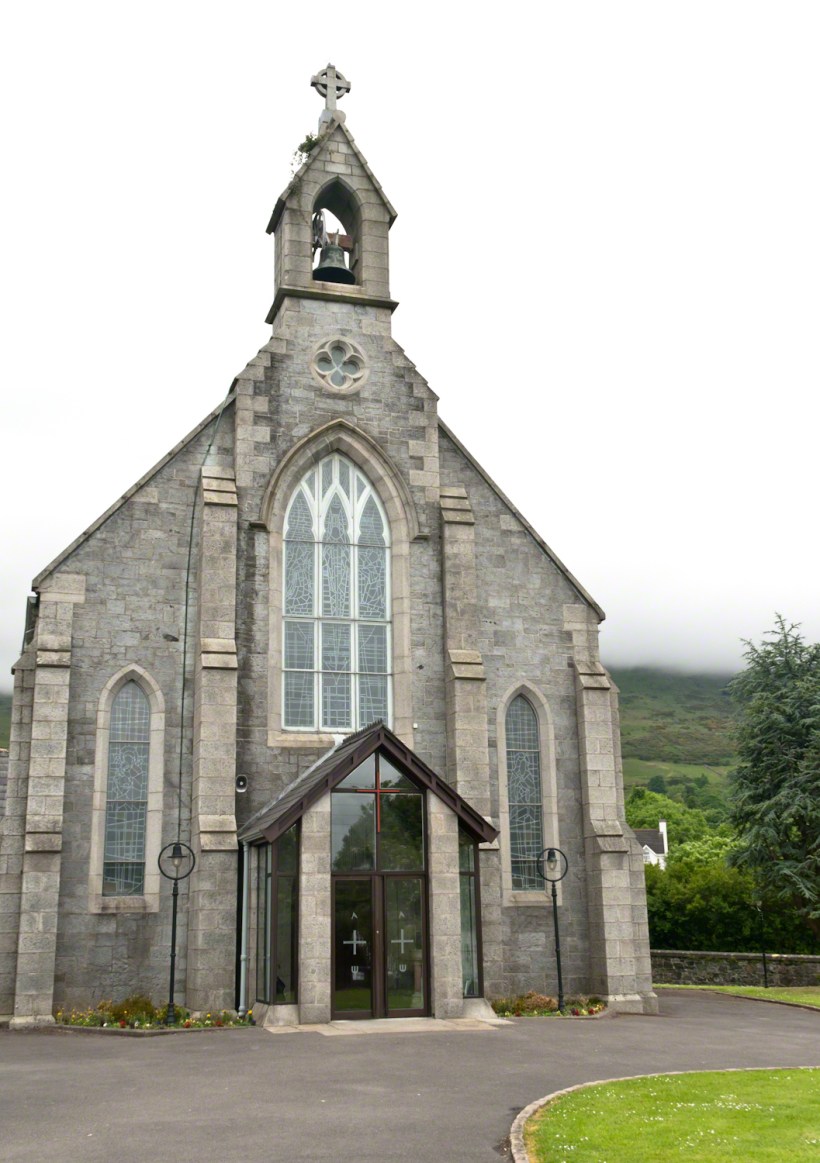
The Church of Saint Michael is a Roman Catholic Church on Dundalk Street (R173), Carlingford.
so committed to speak today and began to write something was bound to shake loose
then those lines form Deuteronomy gave themselves to me
Before you this day is set good and evil, life and death. Choose life, that both you and your descendants might live.
“Home” was a twist of these lines
as long ago as 1923 Wilder was experiencing our present contemplating the unthinkable
Wilder held her own experience as a shield and denied such a tragedy could ever touch her
for me the result is a beautiful poisoned apple innocently offered by a treasured friend
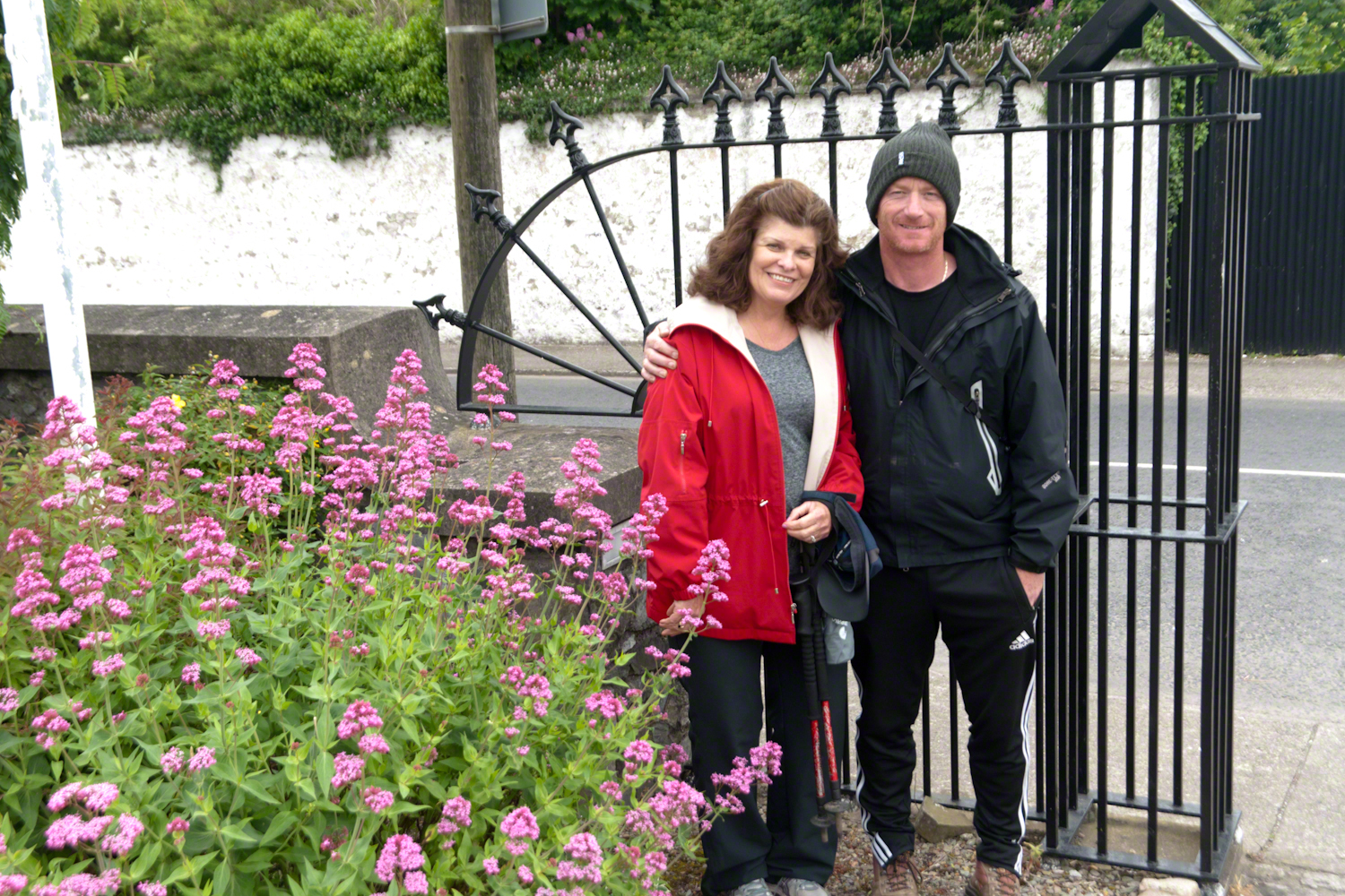
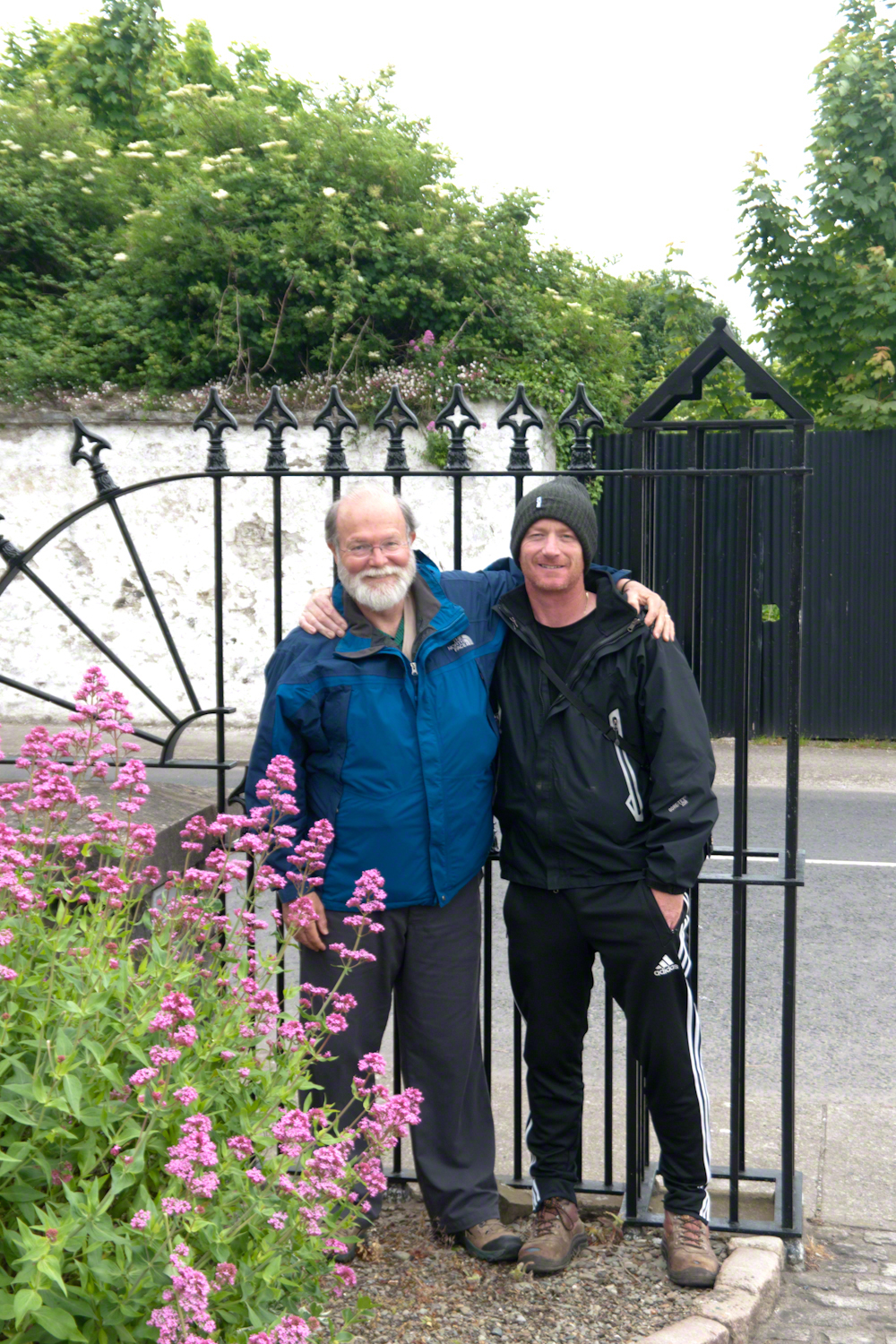
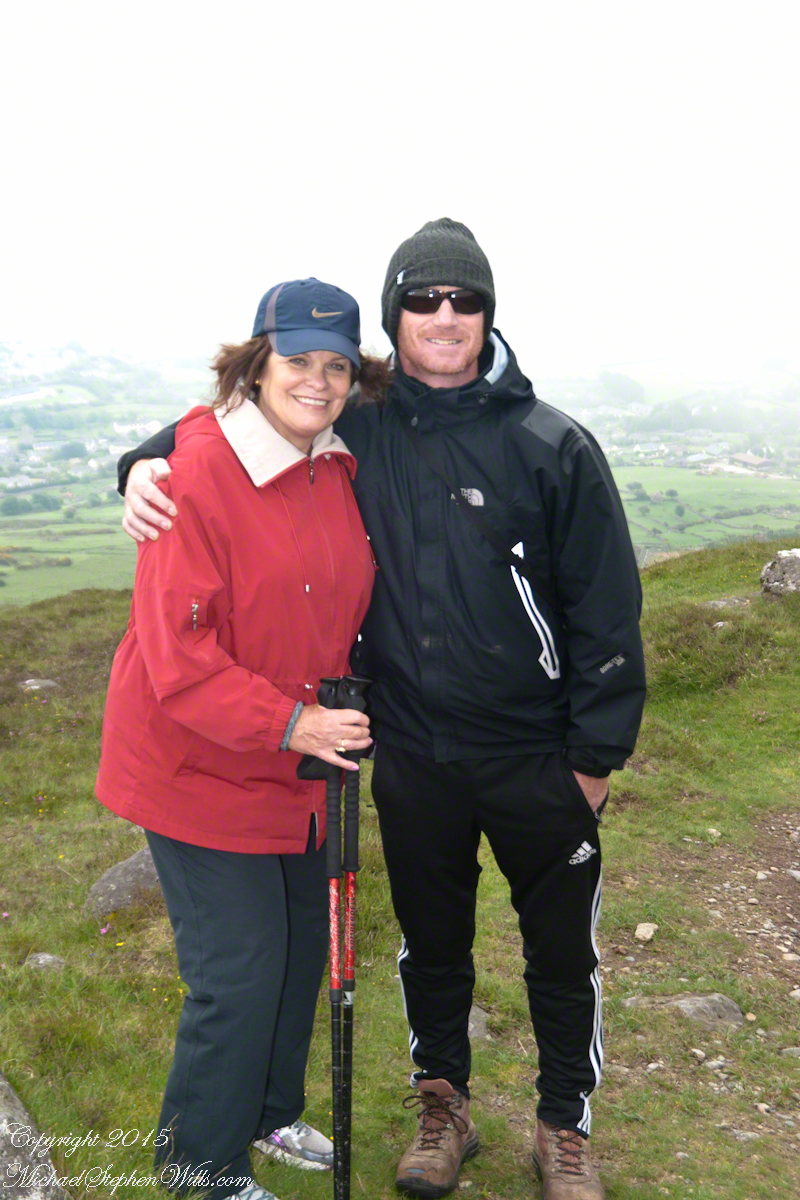
Pam Wills and Sean Mills on the grounds of the Church of Saint Michael, Dundalk Road (R176), Carlingford.
Yesterday, I simultaneously published nine photographs on my ImageKind Ireland Gallery and Getty IStock (click the links to visit): nine views taken from the slopes of Slieve Gullion.
Sunday, May 25, 2014 was a happy day for Pam and I. It was the first full day of an eighteen (18) we filled with Ireland, travelling in a loop of the island following the coast from, naming the counties where we spent time on the ground, Louth, Armagh, Dublin, Meath, Wicklow, Cork, Kerry, Claire, Mayo, Antrim, Down and back to Louth. The counties of Northern Ireland are in italics. Indeed, at this time the politics allowed us to travel freely between the Republic and the North. That day, our morning was spent in Louth attending mass, enjoying our first meeting with the family over a substantial mid-day meal (click the link for my Facebook album of the meeting). We split off that afternoon to visit the home of my cousin, Mary and her husband Joseph in County Armagh, just over the border. When Joseph offered to drive us over to Slieve Gullion it was totally new to us, we had no conception of the place or what to expect.
It was such a gift, we are grateful to Joseph for this experience. Only in 2018 when, at 64 years of age and retired”, was I able to research the place and spend time developing the photographs for publication. Two of the photographs illustrate this posting, to view the others in my online gallery, click either photograph.
Slieve is the Irish language word for “mountain.” Slieve Gullion is a lone eminence, one remnant of volcanic eruptions about 60 million years ago during the rifting of continents that produced the Atlantic Ocean. Around the mountain is the Ring of Gullion, a string of hills, 26 miles by 11 miles, surrounding the mountain and formed from the ancient collapse of a volcanic caldera. The technical name for it is a Ring Dyke and it was the first of its kind to be recognized and mapped, well before the nature of the formation was understood of be volcanic. The name Gullion is derived, in one formulation, from the name of the metalsmith, Culann. In Irish Myth, Culann’s home and workshop was on the slope of Slieve Gullion. A wealthy and respected personage, Culann invited Conchobhar mac_Neasa, king of Ulster to feast. During his approach to the mountain, passing through the surrounding plain, the king stopped to watch boys play hurling. Among them was the future hero of Ulster, the young Sétanta. Impressed with Sétanta athletic abilities, the king invited him to join in the feasting at Culann and the boy promised to follow after the game. Later, while climbing the mountain to fulfill his promise Sétanta was attacked by the guard dog of Culann. The myth says the dog was killed by Sétanta in self-defense. Never the less, in compensation to Culann, Sétanta committed to rearing a replacement and to act as guard dog in the meantime. In this way he became known as Cu Culann, “the dog of Culann.” Click for more about Cu Culann.
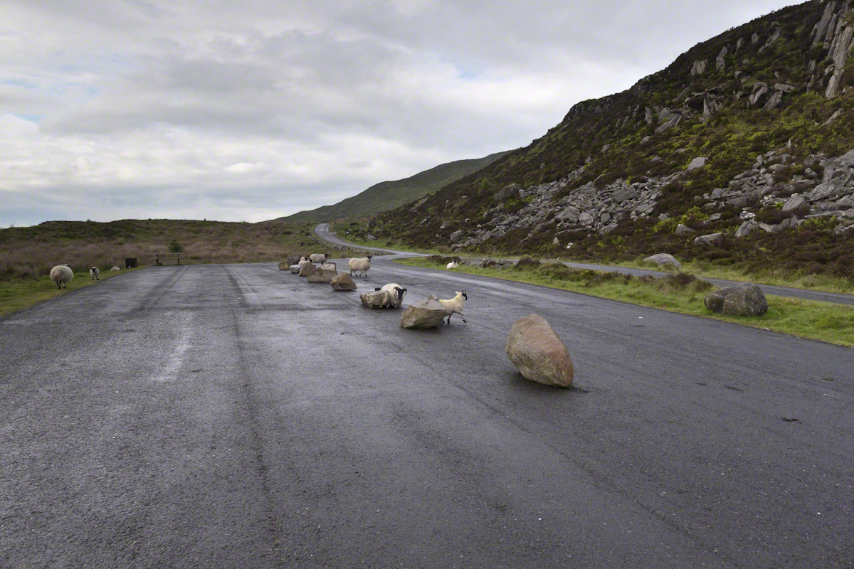
On the summit two cairns north and south of a small lake, tangible proofs of ancient peoples and beliefs. The north cairn is a more ancient passage grave, 90 feet wide, 16 feet high, the opening aligned with the setting sun on the winter solstice. The cairn north of the lake is less ancient containing two cist burials. For our visit Joseph drove us along the 8 mile drive. The following is an image of a viewing platform and the road. Just beyond, on the right, where the ridge meets the road, is the trail to the 1,880 foot summit of Slieve Gullion. Our arrival disturbed sheep resting on the asphalt. I’d have loved to spent a day climbing the summit, but it was not to be this trip.
The way is part of the Slieve Gullion Forest Park. Throughout are turnoffs to admire the view. It was during our frequent stops I pulled out the photography gear to grab the views. Here is one, looking southwest. For the other views, click either photograph to visit my Online Gallery of Ireland.
Copyright 2021 Michael Stephen Wills All Rights Reserved
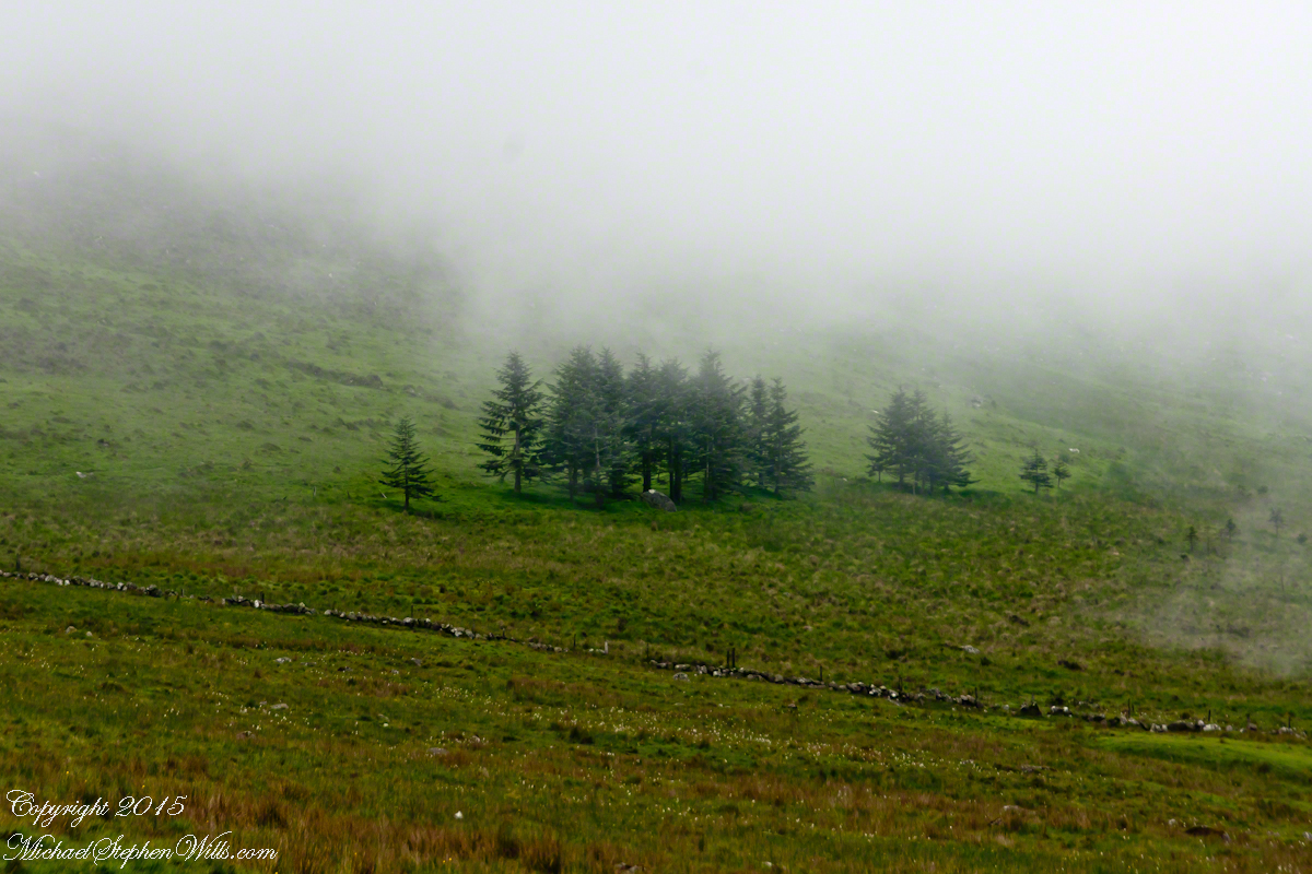
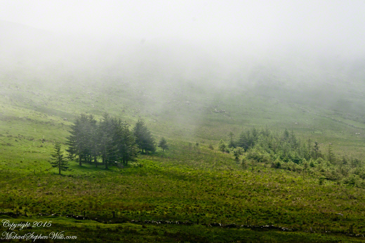
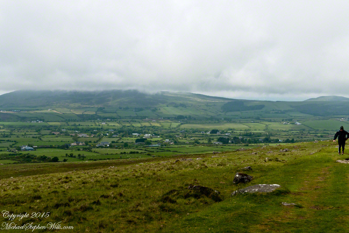
We did not climb so much as ascend, with effort, the flank of Slieve Foy, a peak of the Cooley Mountains, County Louth, Ireland. The group being cousin Sean, my wife, Pam, and myself.
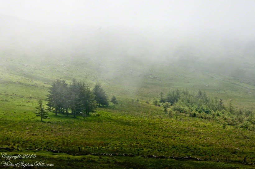
The ridge of Golyin Pass loomed in the mist where the path dissolved in low cloud. Sean pointed above, to the right to Barnavave, also know as Maeve’s Gap for the queen who came from the west of Ireland to take Donn Cúailnge, the Brown Bull of Cooley, by force of arms with an army behind her.
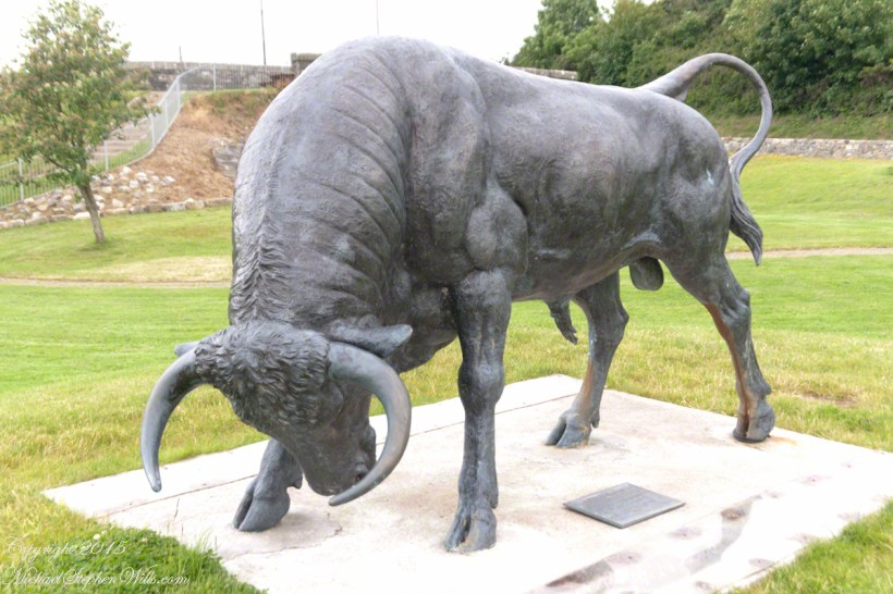
A modern rendering of Donn Cúailnge. See link at the bottom of this posting for more information.
When cousin Sean named Cú Chulainn, the champion of Maeve’s opponents, the Ulstermen, he recalled a story once lost, Táin Bó Cúailnge. A hospitable siege different from Maeve’s and mist are part of the story of the recovery of this tale.
A gathering of 150 poets, 100 pupils, and attendants strained the patience and wealth of Guaire Aidne mac Colmáin, King of Connacht, when it extended to a year and four months.
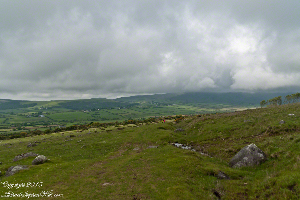
Our first and only encounter with fellow hikers. In the distance two figures appear over the next ridge, a mother and young daughter. She greeted us and challenged Sean to his knowledge of the area. Sean acquitted himself well and we continued.
On that 16th month, the king challenged the leader of his guests to the telling of a tale. Guaire demanded Seanchan Torpest, the chief poet of Connacht, to recite the whole of Táin Bó Cúailnge, known in English as the Cattle Raid of Cooley or The Táin (Cattle Raid).
Click a gallery pic for a larger view.
In this way the king was relieved of his guests: the book of the Táin was lost before their lifetimes, rumored to be abroad. Abashed at his failure, Seanchan Torpest withdrew. Fellow poets and followers trailed out from the castle.
Seanchan Torpest regrouped the host (an opened question is who then supported them) in conference to construct Táin Bó Cúailnge. It was a false hope as the gathering discovered while each poet knew a part of the whole, most of the story was lost. His honor, reputation and self-esteem in tatters the Chief Poet of Connacht, set off with Murgen, his son, and second cousin Eimena to return the Táin to Ireland.
Into mists such as those Pam, Sean and I ascended, the travelers soon were lost and separated.
Magically, Murgen finds the grave of the Uncle of Cú Chulainn in the mists, there to meet the shade of that enormous man, Fergus mac Róich is his name. In the Táin, as related in whole by Fergus to Murgen, Fergus was led by circumstances to ally with Maeve, to guide her army against the Ulstermen. As a deposed king, traitor to Ulster and Uncle to the champion Cú Chulainn, Fergus knew the tale entire.
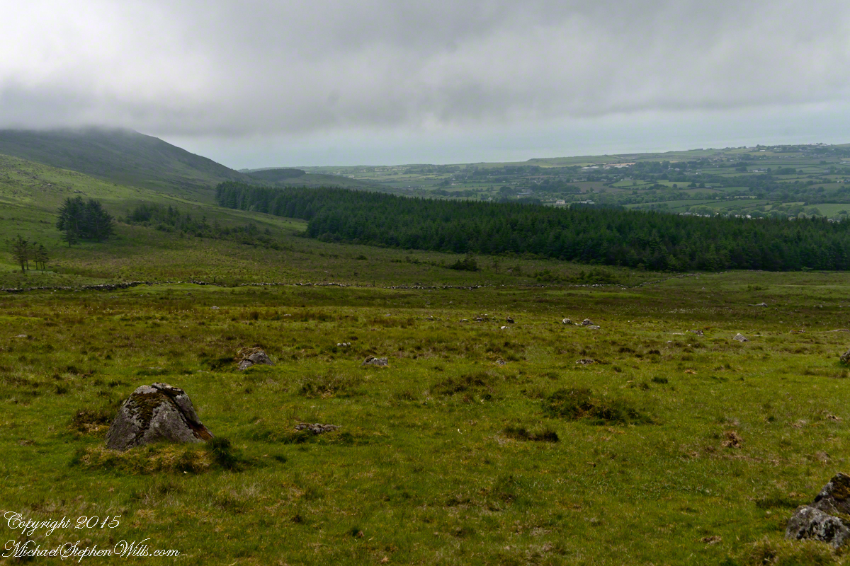
View as we approached Goliyn Pass
It was from the mists that Murgen emerged, found his father and cousin, and returned together without the book, but with possession of the substance of the Táin.
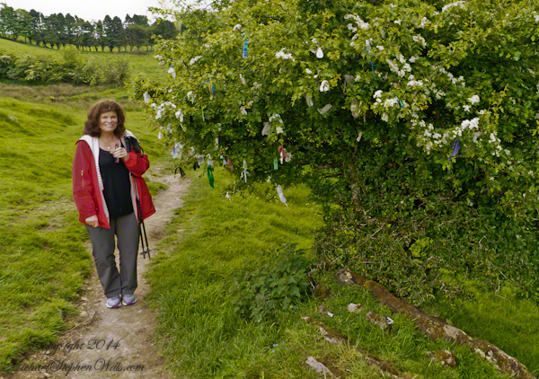
The popular name of the Loughcrew megalithic site is, “The Hill of the Witch” (In Irish, Sliabh na Caillí). In lore sites such as this are associated with The Others (“fairies”), living lives parallel and invisible to ours, touched now and then with resolutely ill effect to our side though sometimes theirs as well. Resolute as in these meetings are fated to end poorly unless…..unless the mortal knows the rules. “If you are ever in an Other’s mansion for a party never, ever eat or drink anything. Eating or drinking will condemn you to an eternal round of parties. You will dance till dropping every night.” Rules such as that, and others, can be used to turn the tables, gain an advantage, of beings from the Other Side. The story of my wife, Pam, how our lives came to be touched by this afternoon of May 27, 2014, is parallel to the tales of mortals benefiting from contact with The Others. The immediate source was the passing of my mother, Catherine Ann Wills (McCardle), at the age of 90. Mom’s passport gave her place of birth as Proleek, a place in Louth. My maternal grandmother, Mary Catherine McCardle (Mills) spoke with a brogue, less a lilt than a down to earth and kind warmth. I remembered the stories of Mom’s passage to Canada with her mother and father in 1926 at the age of three. The Ireland connection with my father was less direct as I never met his mother as an adult and we seldom spoke of her. It was left to me in the time between my Mom’s passing, an invitation for a visit from our cousin’s in County Louth, and our arrival May 2014 to understand more about Elizabeth (Duffy) Wills, my paternal grandmother. In this way, I discovered Elizabeth came from a family of Dunderry, County Meath, Ireland, her parents Matthew and Teresa (Plunket) Duffy; our tour of Ireland came to start from a bed and breakfast near Trim, County Meath, with Dunderry up the road. May 27th, we planned as an exploration of all things County Meath, to include Loughcrew, the highest point of the county in the west. Along the steep path to the hilltop a hawthorn tree covered with flowers and offerings welcomes visitors. May is the month for decorating hawthorns, the blossoms are also known as “Mayflowers” as in the ship the pilgrims sailed to Plymouth Rock.
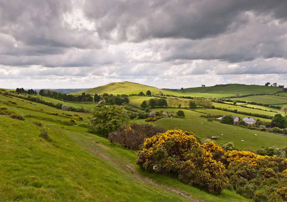
As if we entered a gateway, when pausing and turning high on the hill, this view was revealed, otherworldly in its fullness, scope and wonder as though we passed to the other side to the fairies. Cairnbane East of the Loughcrew Cairns site, County Meath Ireland, is also known as Hag’s Mountain. We are looking south, southwest from the north side toward Cairnbane West. Flowering yellow whin bush, also known as gorse, is in foreground; white flowering hawthorn trees in distance. No elements of this photograph hint at the year 2014.
A solitary standing stone below the trail to the Loughcrew site surrounded by whin bush in yellow flower and white blooms of hawthorn hedge rows. A fieldstone fence, farmhouses, a patchwork quilt of fields completes the view.
Meanwhile, in the real world, when Pam and I complete our round of the island to return to my cousins in County Louth, they told us, on this day, two young men were discovered parked next to a nearby lough, murdered during a drug deal gone bad.
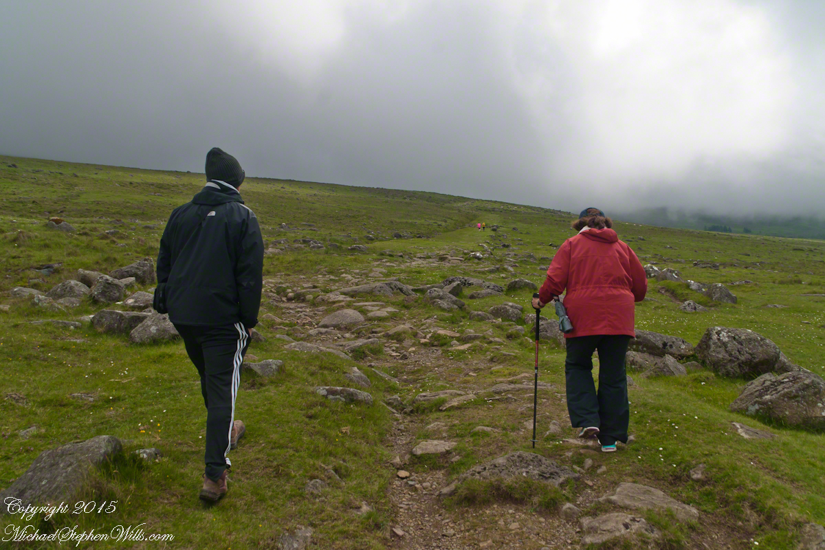
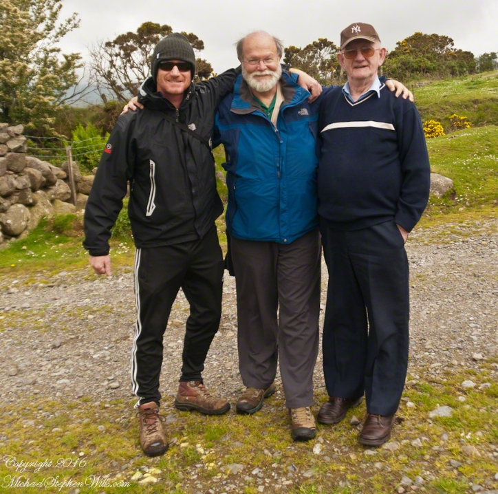
On Monday, June 9, 2014, cousin John Mills dropped his son, Sean Mills, myself and Pam Wills off at the foot of the western slopes of Slieve Foy on the Tain Way. Sean, Pam and I walked the way over the mountain and into Carlingford in the footsteps of epic Irish heroes.
Our guide, Sean Mills, proposed the walk and it fell on our last full day in Ireland. Sean’s father and our host for this visit, John Mills, transported the group including my wife Pam to the starting point at the foot of Slieve Foy.
Yes, if there is any part of the Tain Way the the mythic Irish heroes trod it is this one over Slieve Foy mountain. The saga, in Irish “Táin Bó Cúailnge” and “The Cattle Raid of Cooley” in English, features this bull, “Donn Cuailnge” “The Brown Bull of Cooley”, here as a statue erected 2011 by the Grange and District Residents Association.
Donn Cuailnge raged over the very slopes we walked this day. The myths themselves fill a volume and I am unable to do them justice here.
On the way, John stopped at the Old Aghameen School he attended in the late 1930’s early 1940’s 70 years before and we pass through the country soon to grace our views.
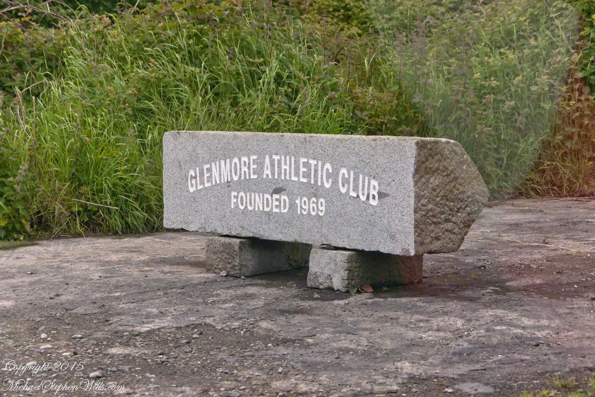
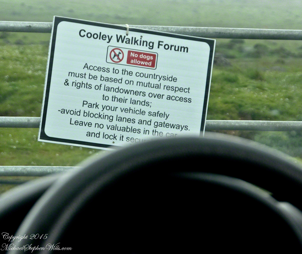
Many thanks to the Glenmore Athletic Club, the Cooley Walking Forum and land owners who provide access to the Tain Way.
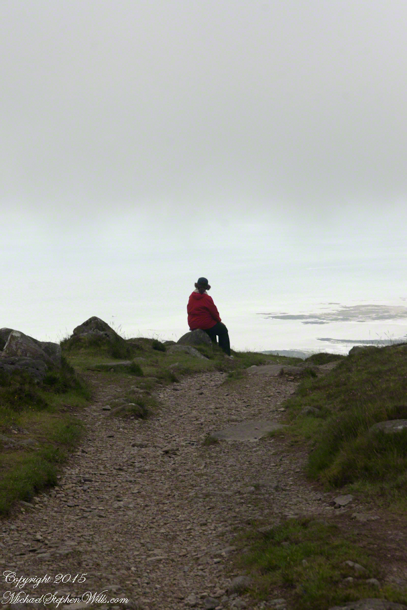
We had our leave taking with John, who planned to stay near the phone for our call from Carlingford, if all went according to plan. That same year Pam had the first of two total knee replacements. This was our longest hike in Ireland and Pam was not likely to miss it, regardless of any pain. Pam is always ready to smile.
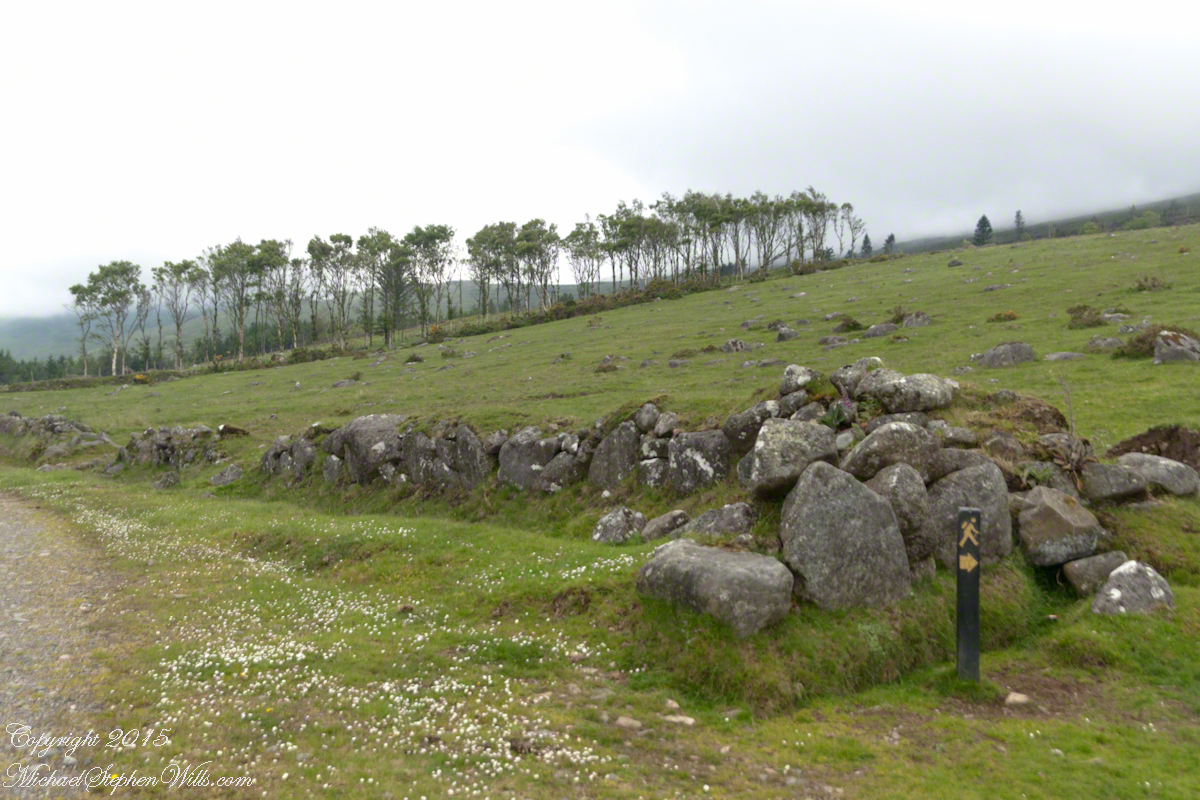
At start, the Tain Way is broad, green and welcoming.
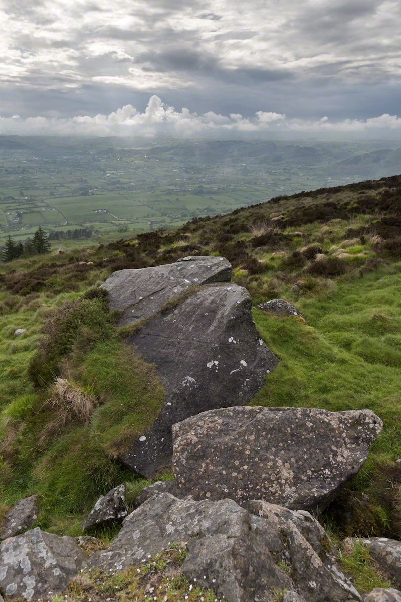
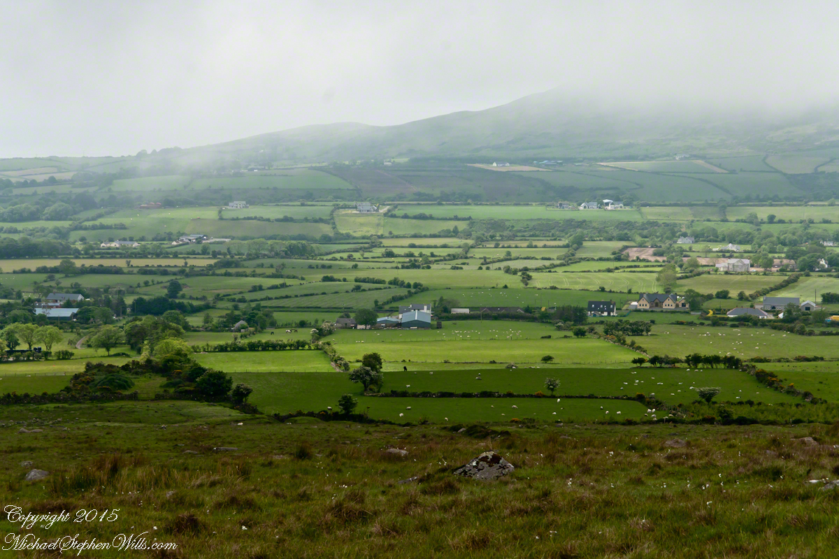
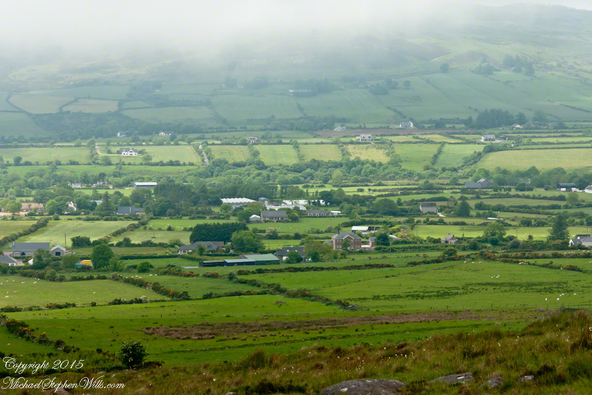
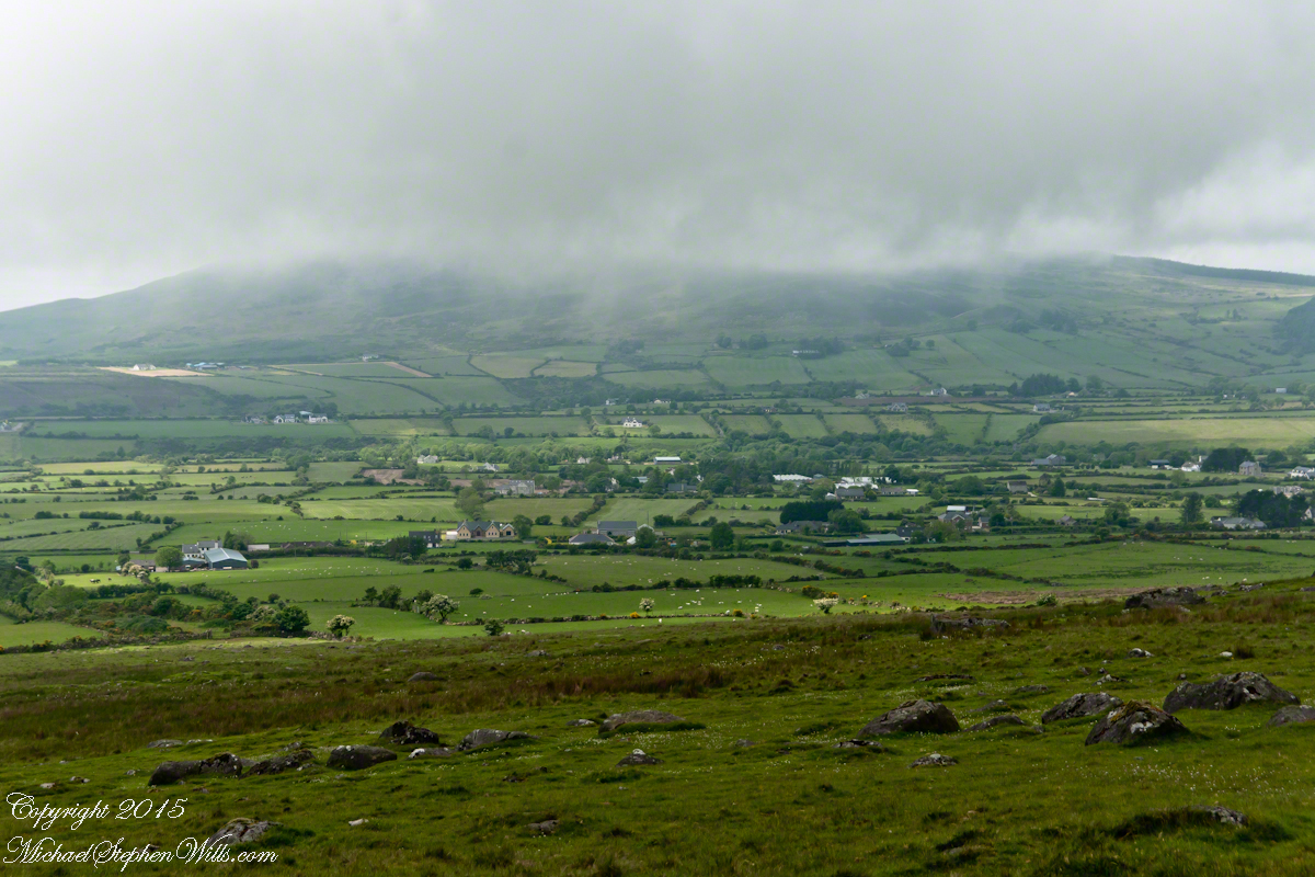
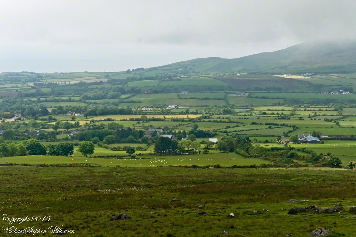
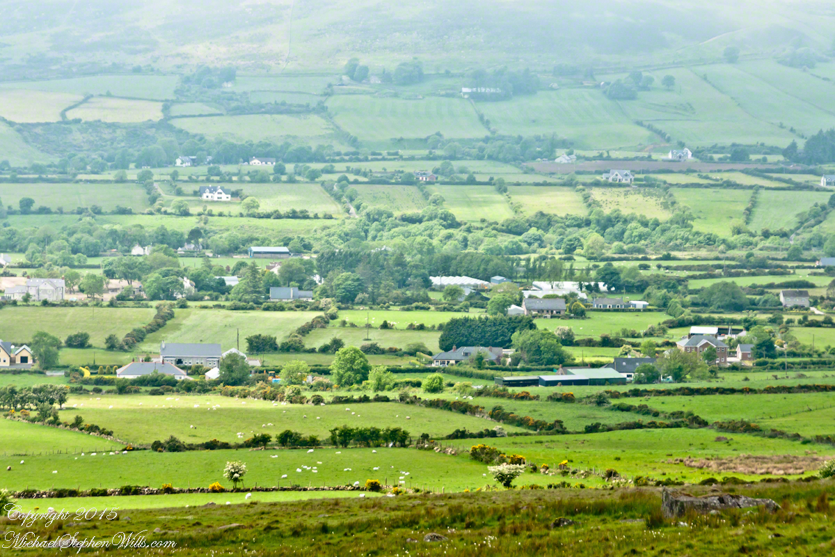
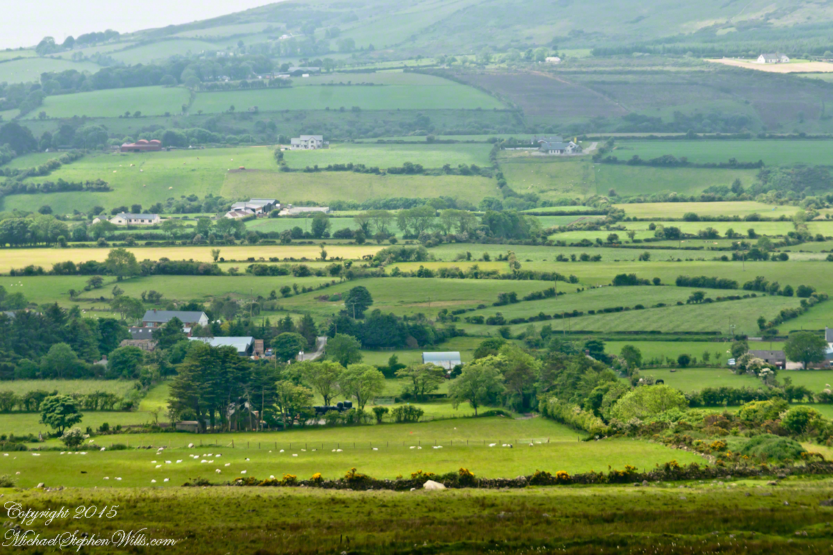
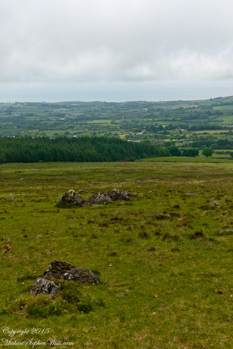
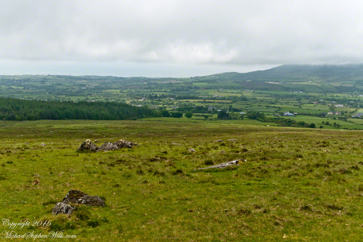
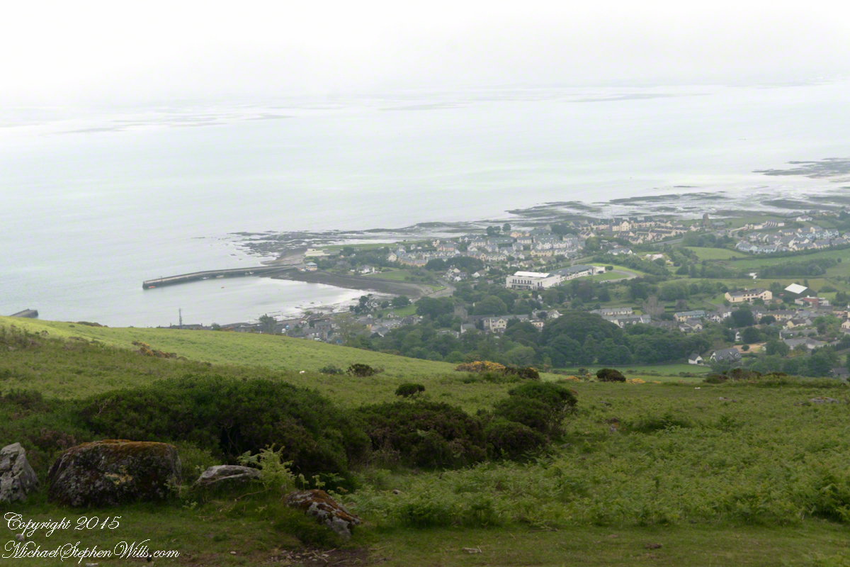
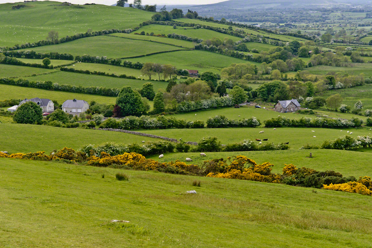
The western slopes of Slieve Foy hold views of a valley among the Cooley Mountains with Dundalk Bay of the Irish Sea to the south / southeast. It was not long before the view started to open and, then, opened and opened the entire walk to the top. We were graced with a lovely, cloudy, June day. Mist only, no rain. Plenty of wind, not strong.
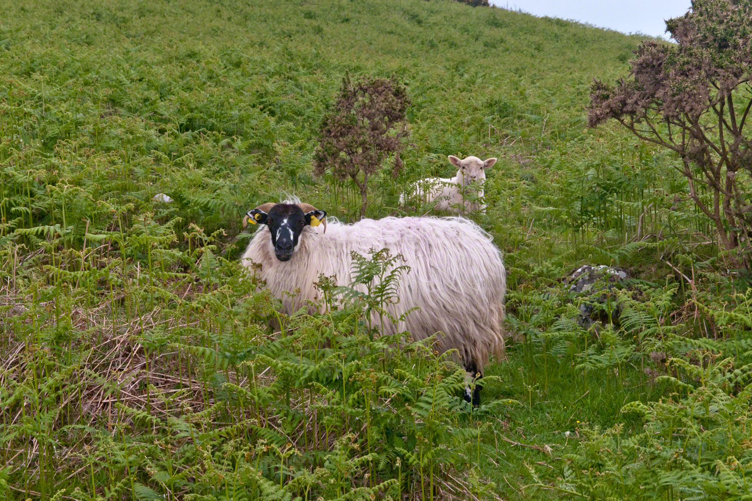
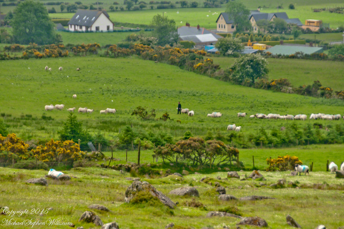
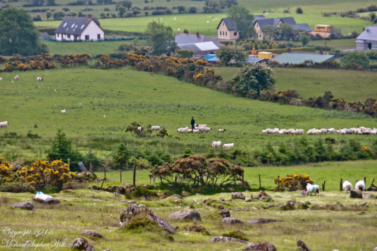
Farms are all about. Here a farmer attends to the flock. They know who he is.
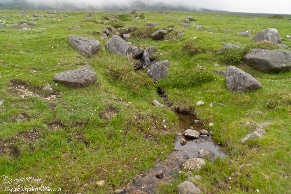
The lower slopes hold many small stream among granite stones.
I will continue with our walk on the Tain Way soon enough.
Now’s time to share a trinity of images from a morning spent about the Skellig Islands May 2014.
Pam and I have many stories from that day, a favorite is from the parking lot of Portmagee where we met the fast boat to the island. I prepared for the day by making a reservation for our ride. We traveled from Killarney, where an early morning breakfast feast spread by The Killarney Royal Hotel fortified us for the adventure. Throughout our tour, experiencing Ireland was like taking blinders off, this first experience on The Ring of Kerry was no exception, driving on a tight timeline to reach Portmagee with minutes to spare, every turn of the road presented a new delight.
Grateful to have made it to Portmagee, we quickly pulled our kit together. As I closed the bonnet, Pam exclaimed “our umbrellas.” At this point of the story we laugh together. Umbrellas indeed. I had a dim clue of what lay in store for us and insisted the umbrellas be left behind, a counter-intuitive decision for a rainy Irish day the Wild Atlantic Way. Regardless of the time, we needed a bathroom break as there will be no facilities on the fast boat or the World Heritage Site where there is no space for human waste products.
Click any photograph for my Online gallery.
I was here perched on a cliff of Valentia Island across from Portmagee looking southwest across Valentia Sound.
The humor is in our welcome aboard the fast boat, like a fishing boat with a small cabin and small deck dominated by the engine hatch. We crowded on, handed a full set of fisherman slickers. This is a heavy coat with hood and pants, all waterproof. Our close timing guaranteed the worse seat, away from the cabin in the open. It was a new experience for us and we felt a sense of dread as the craft left the protection of Valentia Sound into the open Atlantic Ocean.
We faced a west wind, driving 12+ foot waves, as the boat breached each wave the crest went over the cabin in a waterfall of salt water. Up and down, up and down. Thankfully neither of us lost breakfast as some did. I do not have photographs of the trip out or the approach to the island, my equipment was safely packed away.
In the above photograph you see the entire course of our approach to the island, a bit more than 10 (land) miles from Portmagee. We toured Valentia Island that afternoon.
Click any photograph for my Online gallery.
Climbing the side of Skellig Michael, approach to the peak and monastery.
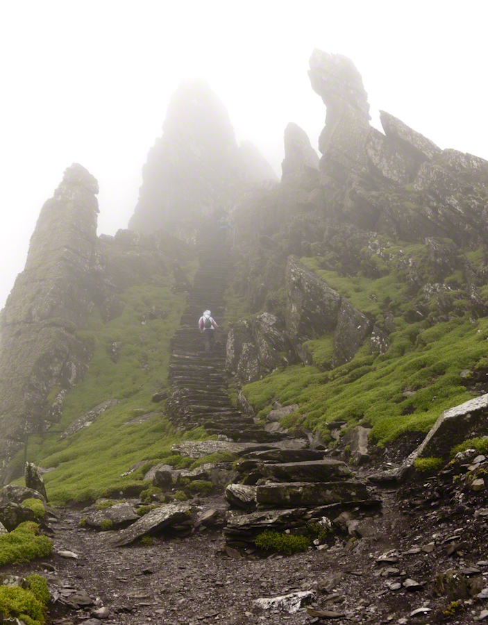
There is a fair climb to the top to view the former monastery buildings. The steps are uneven and, when wet as it was that day, slippery. I wore a waterproof North Face shell with hood for the low threatening clouds. There was no rain as such, a constant fog on the top kept all exposed surfaces wet.
From the point on, until the top, was the most exposed and uncomfortable (frightening, chilling…you get the idea). Spare yourself the experience if you are afraid of open spaces and heights. Here was a stiff wind blowing from the right, on the left the cliff falls away to the ocean. Ahead, the path narrows to about 10 inches with a cliff wall on one side, the precipice on the other. Then come the monastery entrance and rock wall safety.
Click any photograph for my Online gallery.
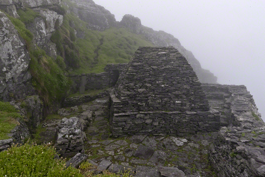
Monk Cell, Grave and Cross
This single image gives a succinct impression of the monastery setting. The bee hive shaped stone monk cell requires a stooped crawl to enter. Inside, the space is small and, thankfully, dry. The structure keeps out the rain and wind, a marvel of stone construction. This cell is off to the side, on a cliff balcony, over the wall an ocean precipice.
My closing advice is to plan your time wisely. The ship boards in less than an hour, in that time you climb the 700 steps and explore. There are people all over the place, in waves. To capture the structures without humans, you need to wait until the cohort become bored and leaves. There will be a space before the next wave of tourists breaks. Leave enough time to descend the steps safely. People have suffered fatal falls on the steps and cliffs, it is easy to do. Make your personal safety a priority.


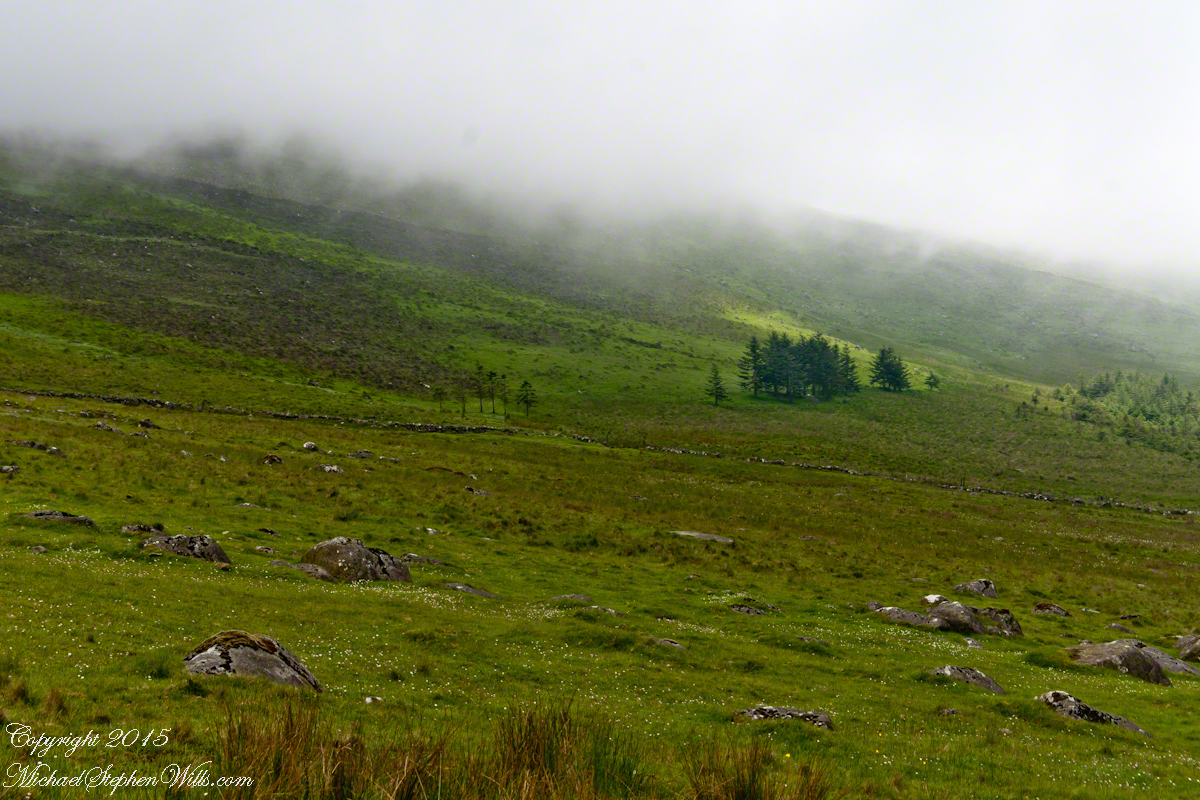
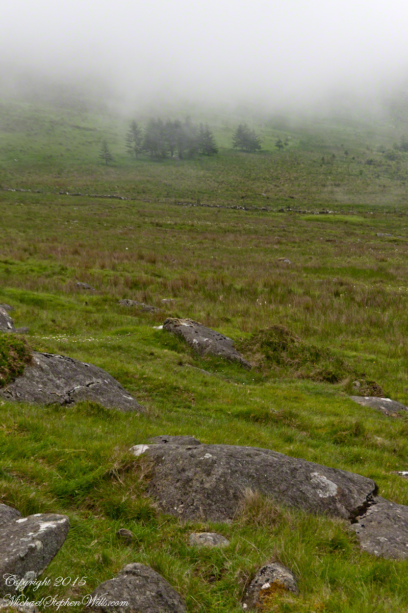
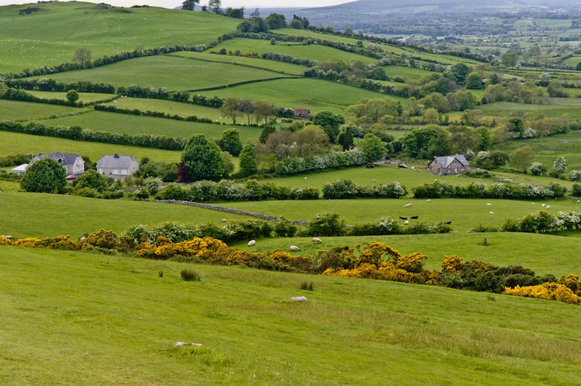


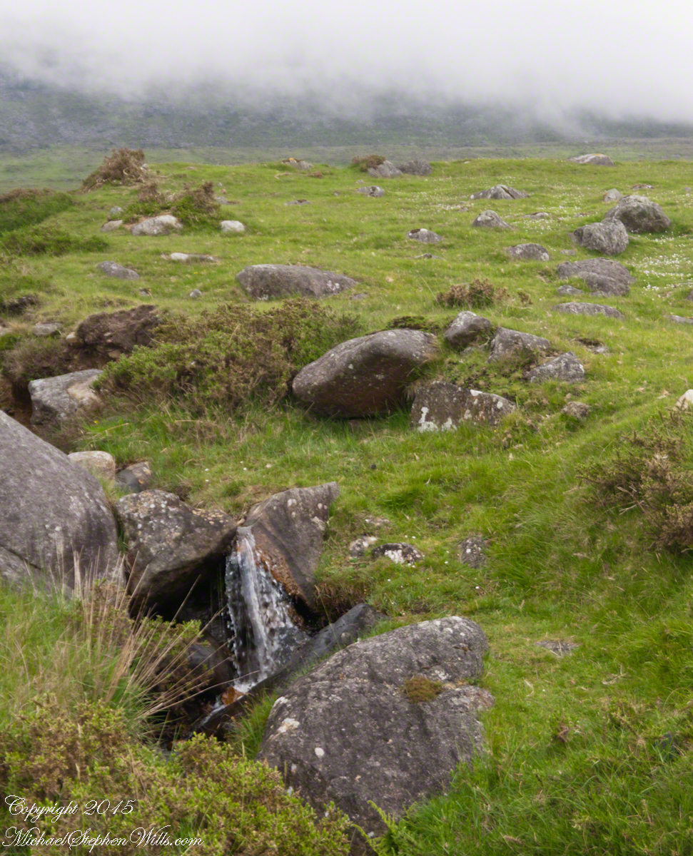
 The lower slopes hold many small stream among granite stones.
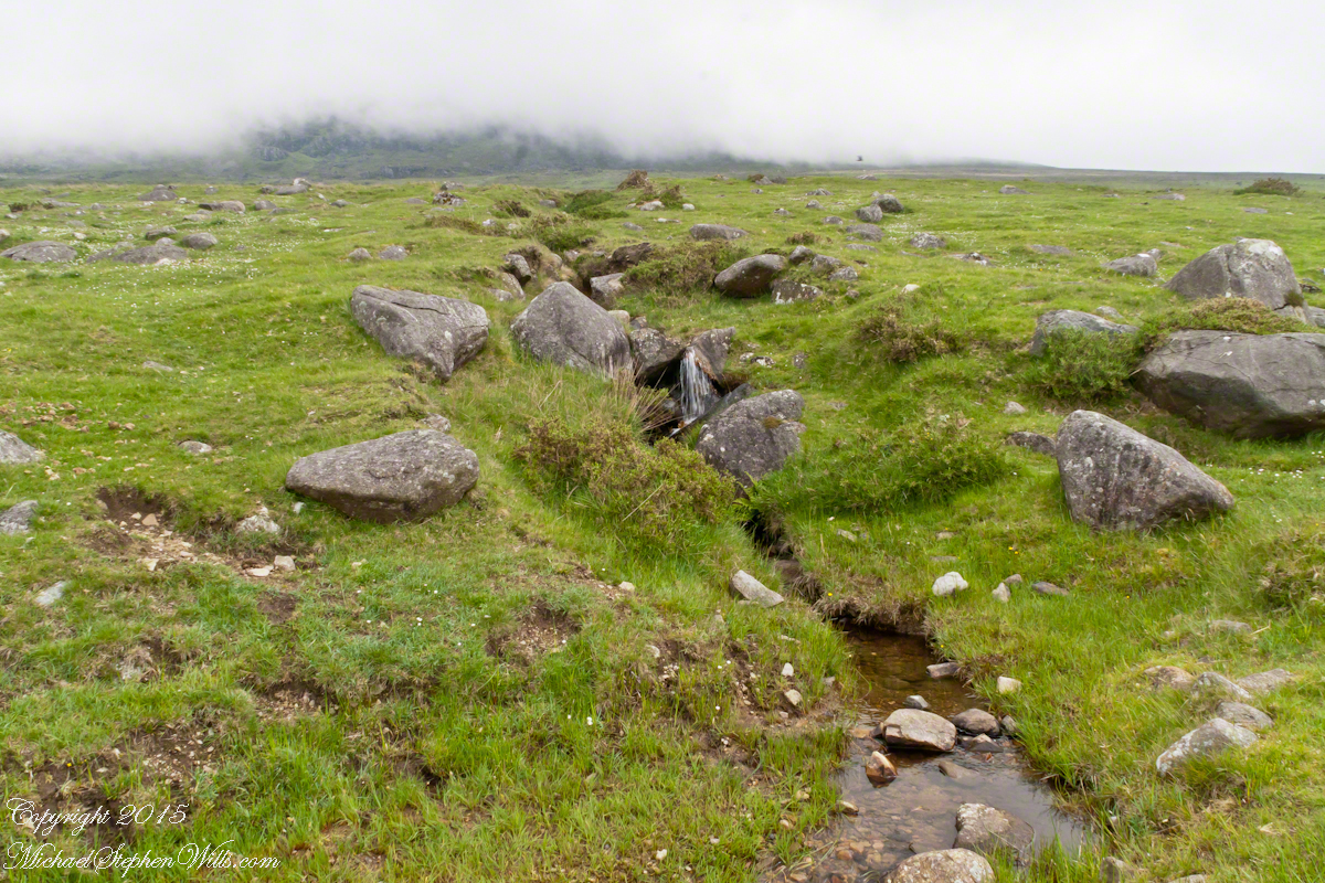