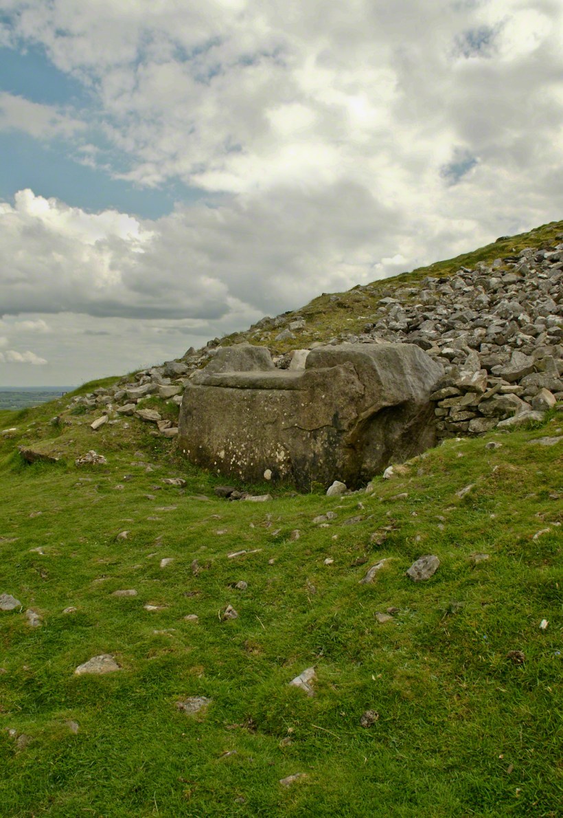
Known as the Hag’s Chair in some contexts, K29 or the Mass Rock, in others, set as a Cairn T, Loughcrew kerbstone thousands of years ago the carved symbols on front, rear and seat are very worn. There is no surviving record to inform us of the stone’s purpose. The upper side appears carved to enhance the form as chair. Set to the north of Cairn T, not in front of the entrance as with Newgrange, even this is a mystery. It is the third largest curbstone.
The popular name refers to the hill itself, “The Hill of the Witch” (In Irish, Sliabh na Caillí). In lore sites such as this are associated with The Others (“fairies”), living lives parallel to ours.
Tradition holds that, during times of the Penal Laws, Catholics gathers on for Mass using this curbstone as the altar. By this it is known as the Mass Rock.
I offer here a continuation of descriptions of a 2014 walk on the Tain Way, an appreciation of the lore and beauty of Ireland.
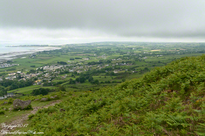
Descending the Tain Way from the ridge of Golyin Pass the sweep of Cooley Peninsula spread before us. Louth is the smallest of the Irish Republic counties, a peninsula which is mountainous where it is not farmland, one exception being Carlingford with the most people, population 1,405 in 2016.
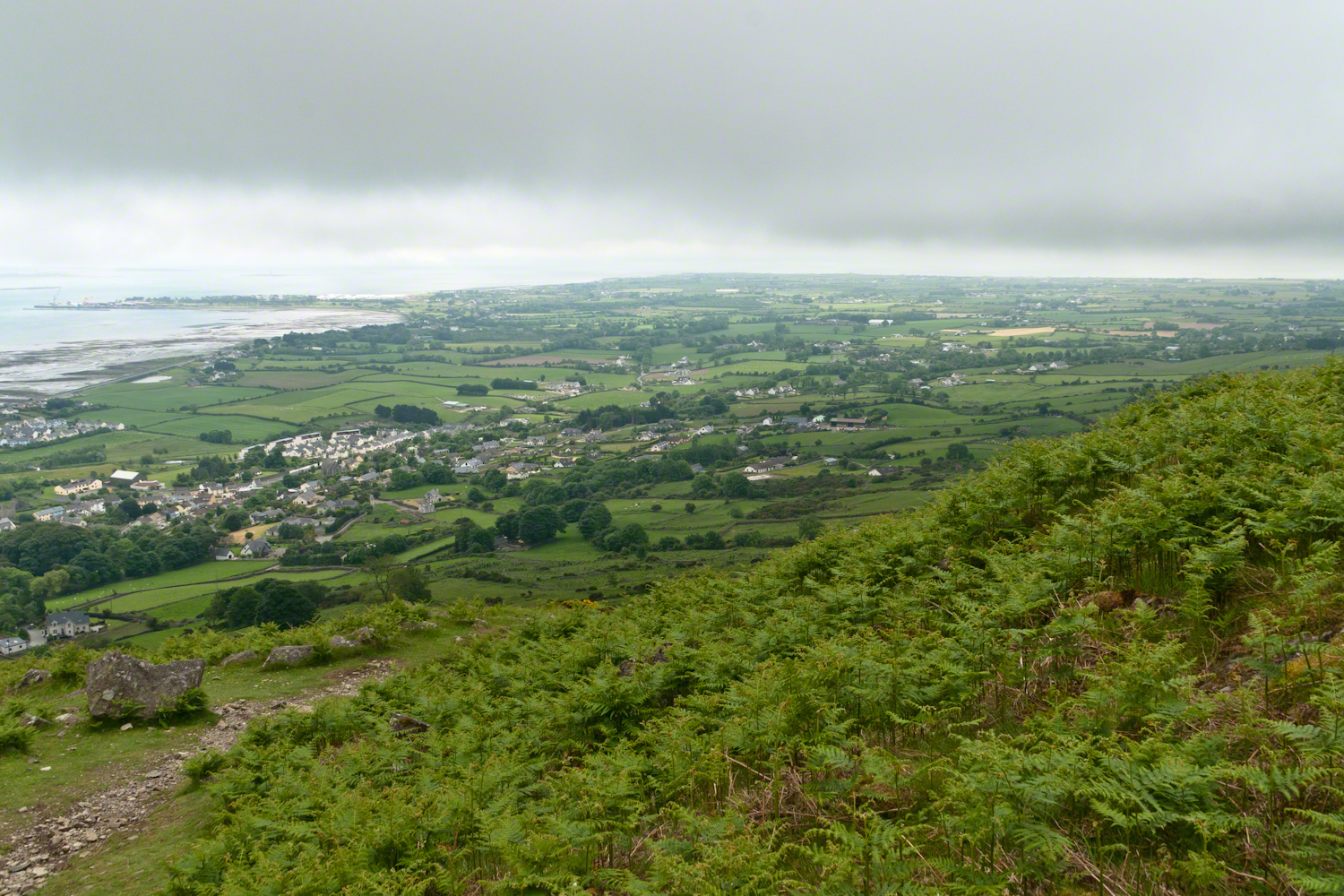
Residential Carlingford continues along the Greenore Road, farmland adjoins then continues southeast along the Cooley Peninsula margin, the Irish Sea beyond. Greenore Town and deep water port on upper left. These photographs are views from the Tain Way on the slopes of Slieve Foye, the highest mountain of County Louth.
Wander through the place names: Chapel Hill, Liberties of Carlingford, Moneymore, Leminageh, Crossalaney, Mullatee, Millgrange, Ramparts, Muchgrange, Ballyamony, Mullabane, Petestown, Ballagane, Willville, Whites Town.
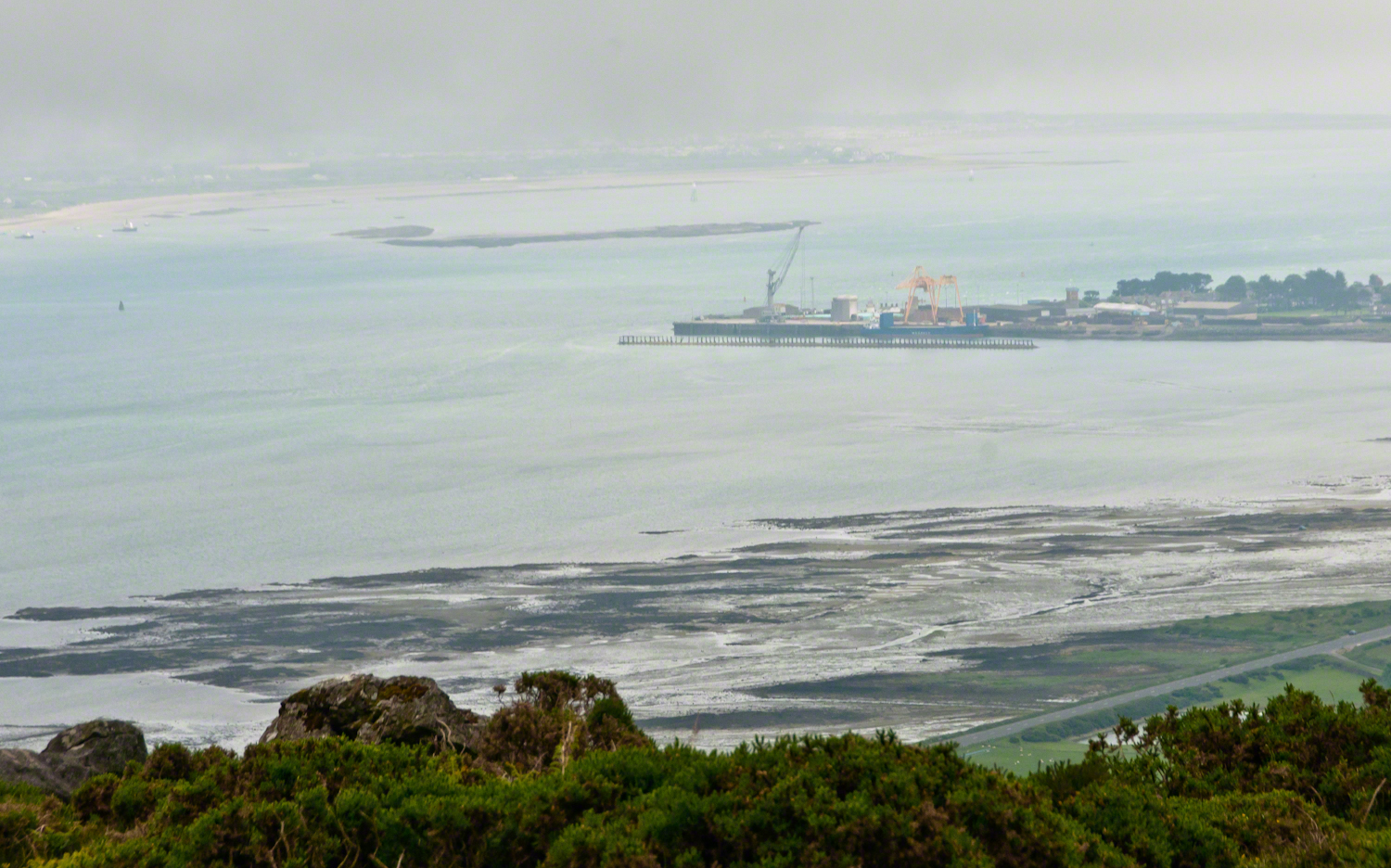
There is a deepwater port on Carlingford Lough adjacent to and part of Greenore Town. The port employed Cousin John Mills years ago, supplementing his farm income. Across the lough is Greenecastle, Newry in Northern Ireland.
The Irish Sea opens on the far side of Greenore with the Isle of Man about 52 miles east and a little north.
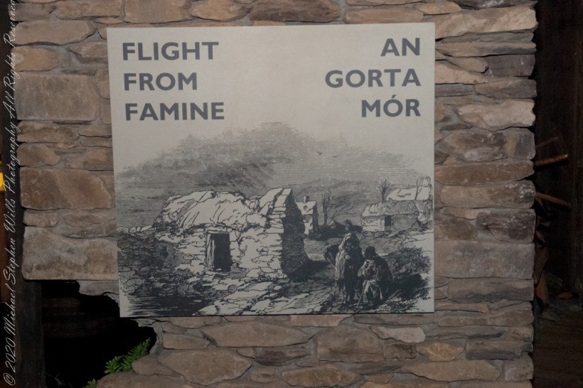
The Great Famine had profound social, cultural, and political impacts on Ireland and its relationship with Britain. It led to a significant decline in the Irish population due to death and mass emigration and is remembered as one of the darkest periods in Irish history. The event also left deep scars on the collective memory of the Irish people and played a role in the growth of Irish nationalism and the push for Irish independence in the following decades
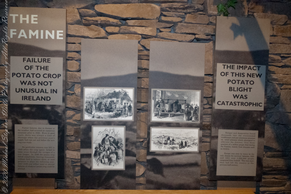
“Partial failures, due to disease or the weather, had occurred on numerous occasions prior to 1845. Even in good years, there was always a time of shortage when the previous year’s supply had run out and before the new crop was ready.”
Cobh Heritage Center
“No particular concern was felt in 1845 when the crop again failed in some areas through the ravages of a new fungus. In 1846 the potato crop failed completely, leaving thousands without food to sustain them, or seed potatoes to plant the following year. 1847 – 1849 saw either total or partial failures of whatever potato crop could be planted.”
“Hunger and desperation forced thousands into the overcrowded workhouses and put enormous pressure on relief schemes which attempted to alleviate the distress. Over three quarters of a million people died during the Famine, mainly from diseases such as cholera. Escape was seen by many as the only change for survival: between 1845 and 1851 over 1.5 million people emigrated from Ireland. This was more than had left the country in the previous half century.”
Cobh Heritage Center
The Great Famine of Ireland, often referred to as the “Irish Potato Famine,” occurred between 1845 and 1852, with the most acute suffering taking place between 1847 and 1849. The causes of this devastating period in Irish history are multifaceted and debated among historians, but the following are generally acknowledged as the primary factors:
Potato Blight (Phytophthora infestans): The immediate cause of the famine was a potato disease known as late blight. The potato was a staple crop in Ireland, and for many poor Irish, it was the primary source of nutrition. The blight destroyed the potato crop year after year, leading to widespread hunger.
Over-reliance on a Single Variety of Potato: The Irish mainly grew a type of potato called the “Lumper,” which was particularly susceptible to the blight. This lack of genetic diversity made the entire crop more vulnerable to disease.
Land Ownership and Tenancy: Most of the land in Ireland was owned by a small number of landlords, many of whom were absentee, living in England. The Irish Catholic majority often worked as tenant farmers, living on small plots of land and paying rent to these landlords. The land was subdivided among heirs, leading to plots becoming increasingly smaller and less productive over generations.
British Colonial Policies: The relationship between Ireland and Britain played a significant role in exacerbating the famine’s effects. Some British policies and economic theories at the time discouraged intervention. For instance:
Corn Laws: These tariffs protected British grain producers from cheaper foreign competition, making grain more expensive and less accessible for the starving Irish.
Economic Beliefs: The prevailing laissez-faire economic philosophy of the time held that markets should be allowed to self-regulate without government intervention.
Exports: Even as the famine raged, Ireland continued to export food (like grain, meat, and dairy) to Britain, which was a source of controversy. Many felt these exports should have been halted or reduced to feed the starving Irish population. Inadequate Relief Efforts: While the British government did undertake some relief measures, such as opening public works projects and distributing maize (known as “peel’s brimstone”), these efforts were often insufficient, mismanaged, or too late. The public works projects sometimes did not lead to meaningful infrastructure improvements and instead focused on tasks like building roads that led nowhere.
Social and Cultural Factors: Discrimination against the Irish Catholics by the Protestant English elite, language barriers (many Irish spoke only Gaelic), and distrust between the local population and English officials further complicated relief efforts.
The Great Famine had profound social, cultural, and political impacts on Ireland and its relationship with Britain. It led to a significant decline in the Irish population due to death and mass emigration and is remembered as one of the darkest periods in Irish history. The event also left deep scars on the collective memory of the Irish people and played a role in the growth of Irish nationalism and the push for Irish independence in the following decades.
Reference: text in quotes is from “The Famine” poster. Cobh Heritage Center, May 2014.
Copyright 2023 Michael Stephen Wills All Rights Reserved
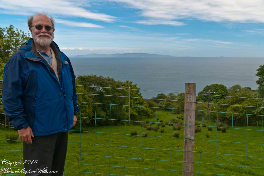
We pulled off the side of Torr Road for this fine view on the way to Torr Head to take in this view of the Irish Sea. The steeply rising distant headland is the Mull of Kintyre. Loughan an Lochan, County Antrim, Northern Ireland.
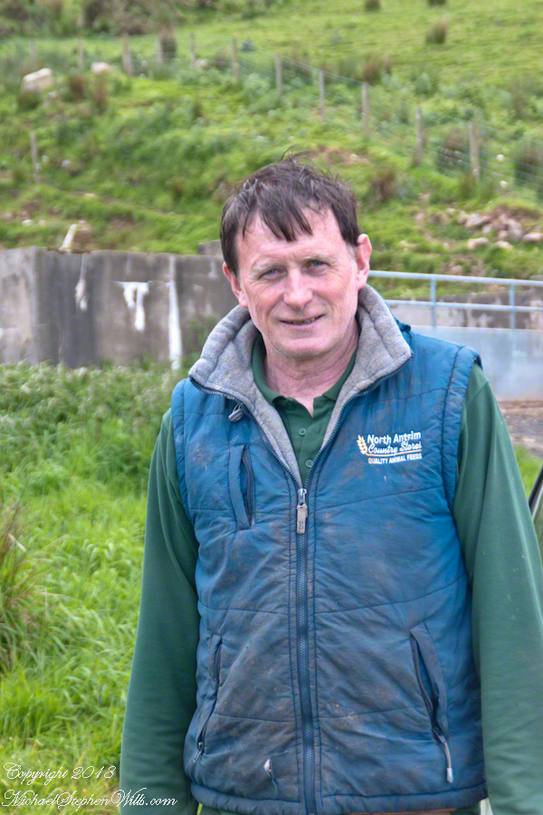
We parked on a turnout above the Loughan Cottages, near this farmer’s sheep pen. He drove up in a huge tractor and conversed with Pam while I was below shooting the cottages. He made a good impression.
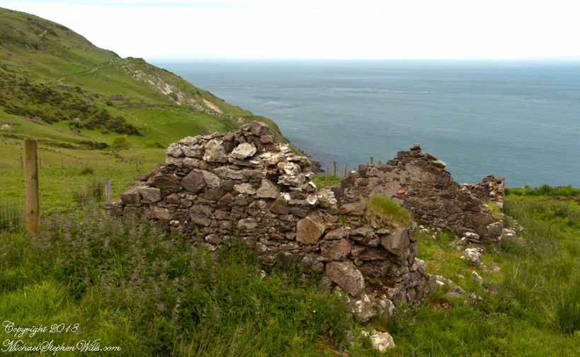
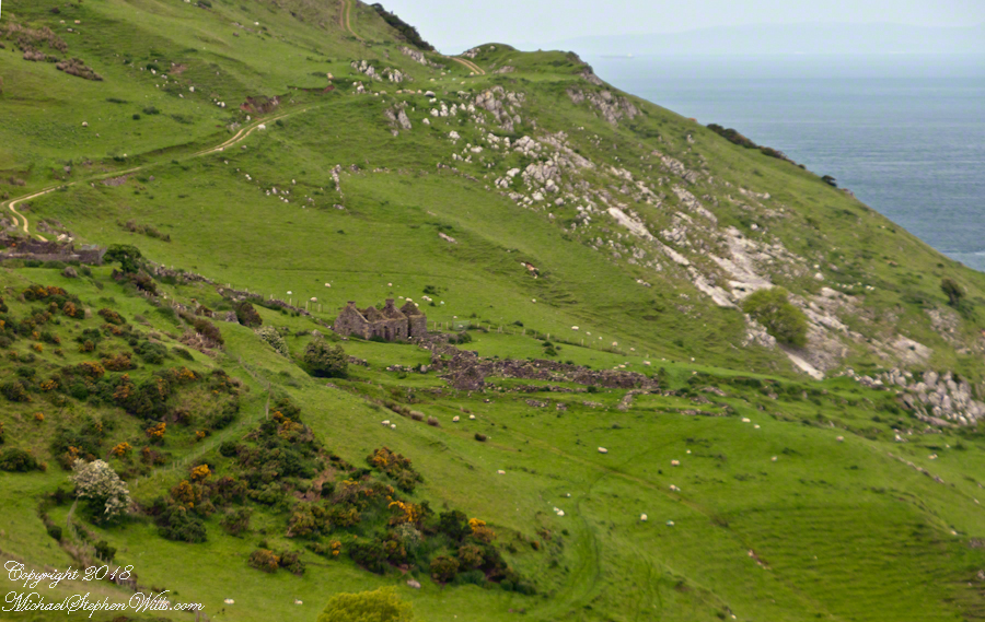
Roofless walls of a cottage more substantial than the other deserted ruins above Loughan Bay, with two fireplaces a walled porch with a view. A number of outbuilding foundations lay around. The integrity of the walls, chimneys and gables speaks to the quality of construction. A freighter in the North Channel of the Irish Sea is visible in the distance above the upper ridge. Beyond is the island of Islay, Scotland, about 30 miles distant. Loughan an Lochan, County Antrim, Northern Ireland.
I am happy to report a series of thirteen (13) photographs of these ruins were accepted for publication by Getty. You can click any of the photographs in this posting for my Getty portfolio.
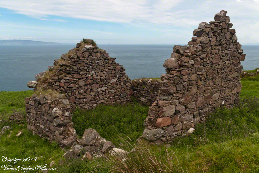
The land slopes steeply to a rocky beach.
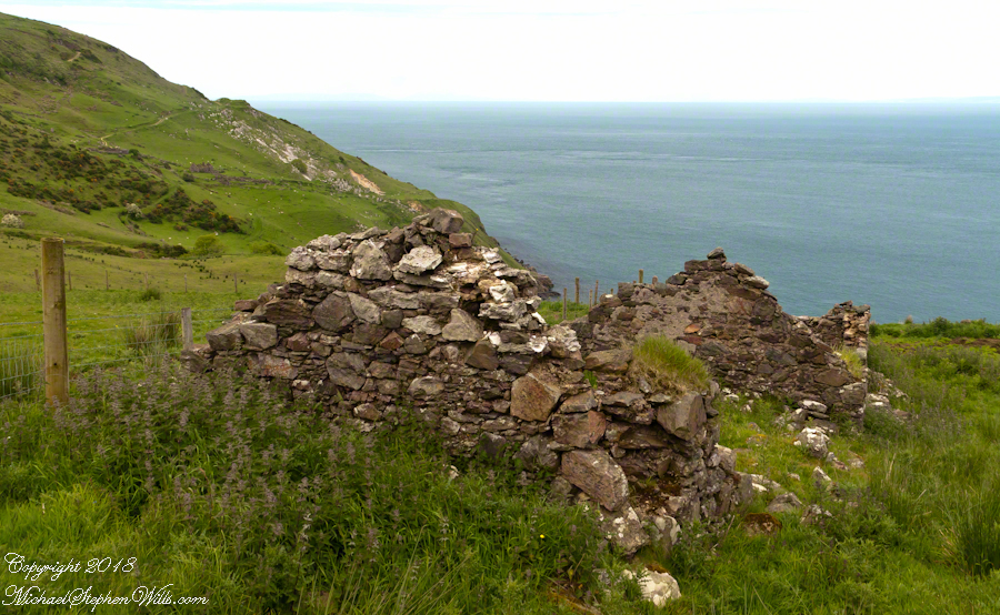
A thick growth of ferns, grass on the gable was once a home with a view of Scotland’s Mull of Kintyre 13 miles across the North Channel of the Irish Sea. The Isle of Sanda just visible on the right of the far gable. A landform named Alisa Crag is just visible in the distance, to the left of the nearest gable.
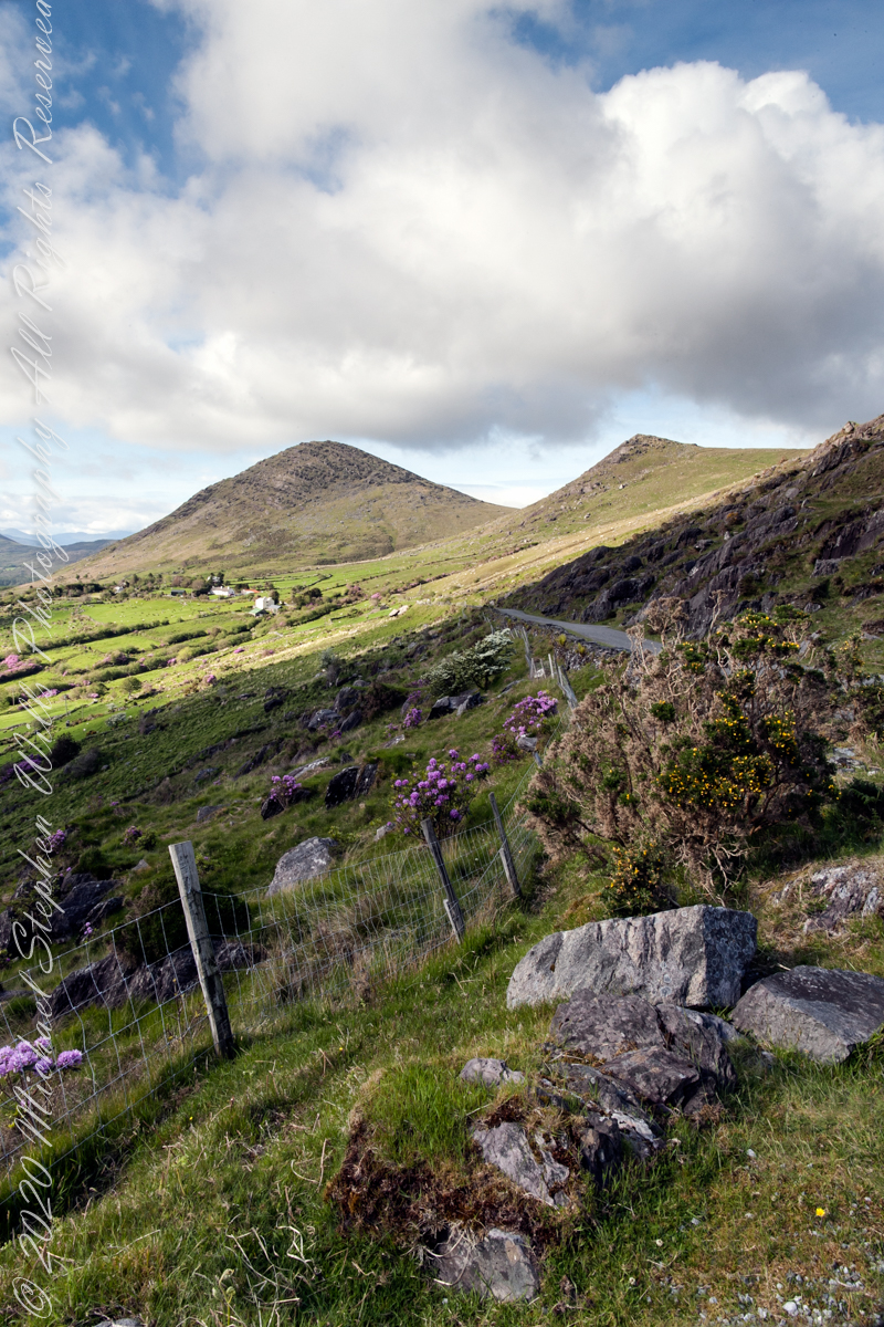
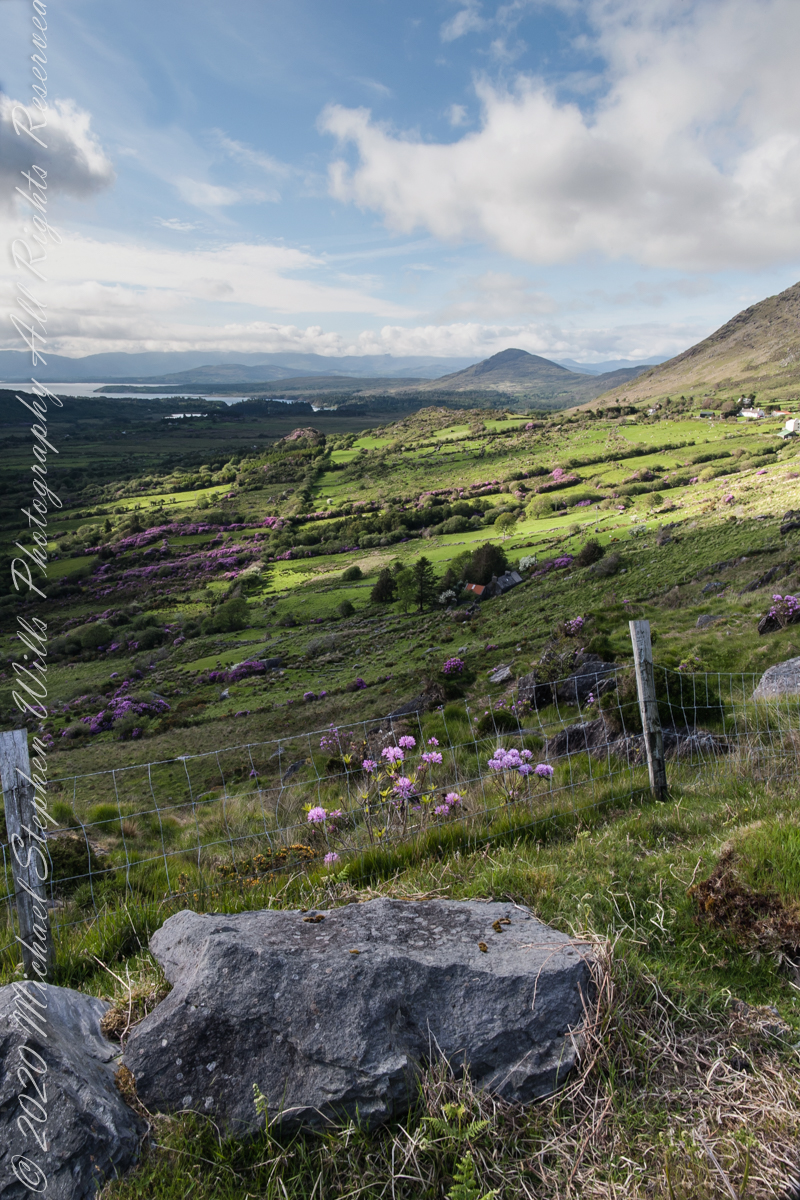
Number six of six from the Kerry County side on the descent Healy Pass, R574. Here we move away from, say goodbye (hopefully, for now) to these marvelous views, our first sight of County Kerry.
Two more strange, conical hills come into view, repeating those in the distance. These have a long story.
Beara Peninsula, Coolcreen townland, County Kerry, Republic of Ireland.
You can easily view a higher resolution versions by clicking on the photograph to open a browser tab.
Click photograph for a larger version.
Copyright 2021 Michael Stephen Wills All Rights Reserved
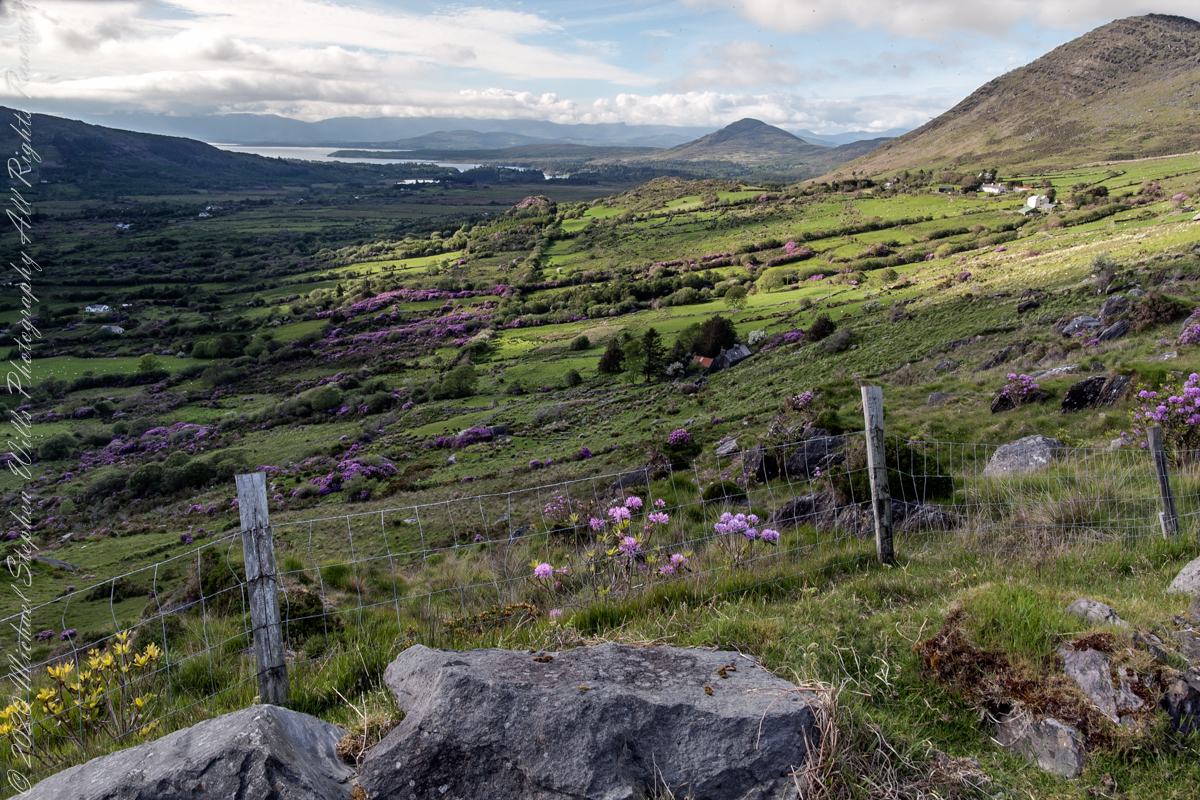
Number three of six from the Kerry County side on the descent Healy Pass, R574. I enhanced view three to level the horizon. A side by side comparison is provided, below.
Beara Peninsula, Coolcreen townland, County Kerry, Republic of Ireland.
You can easily view a higher resolution versions by clicking on the photograph to open a browser tab.
Click photograph for a larger version.
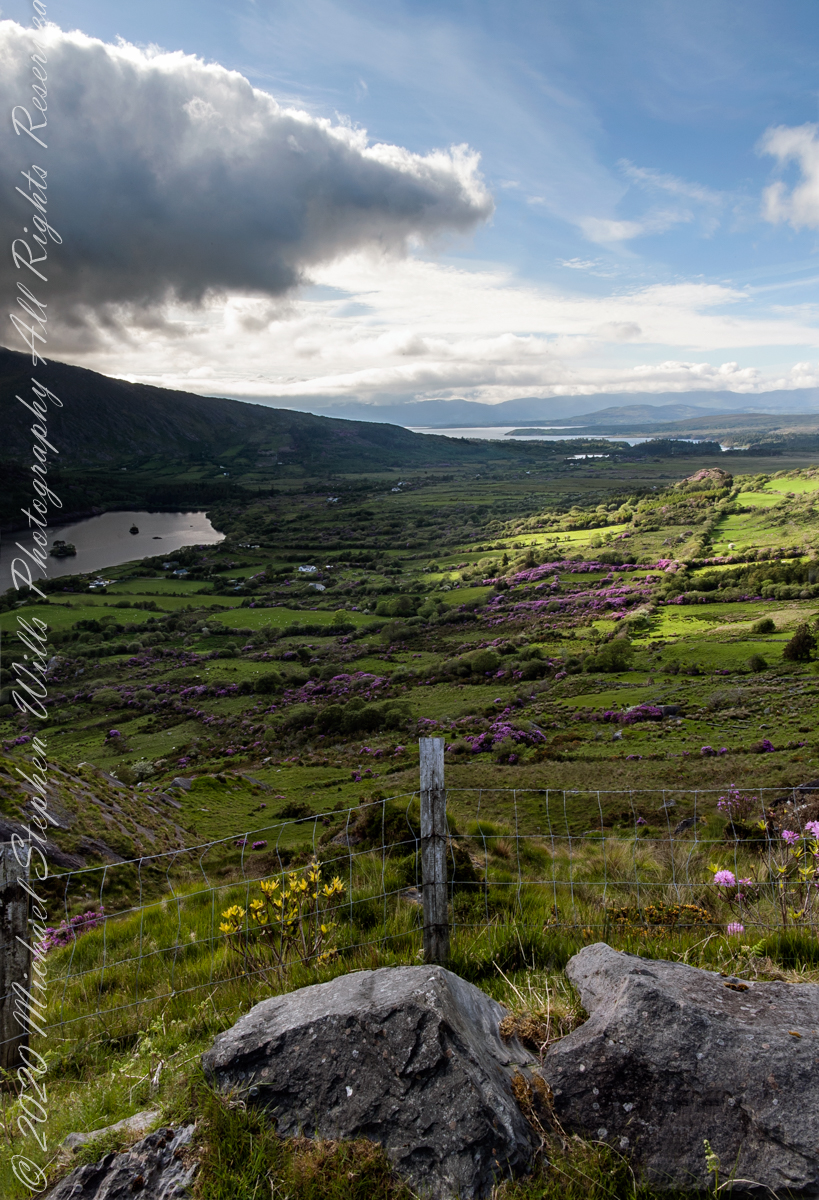
Visible from this point on R574, Healy Pass, is Glenmore Lake, the Rivers Drunminboy, Glanstrasna flowing into a sheltered inlet of the Atlantic Ocean. In 1911, the Irish National Census lists nineteen (19) persons of five (5) families listed with the names O’Sullivan, Sullivan and Shea. From this view this is a puzzle until the map is examined. The land transitions from this rock to a steep, then leveling slope down to Glanmere Lake and a stream running from the heights with plenty of reasonably level, fertile acreage. There is a glimpse of a lake. Like many of the Irish place names, Glenmore Lake has a connection to the Irish Language name, Loch an Ghleanna Mhóir. Roughly translated the name means Large Lake of the Glen. The names in use today, in English, are derived from the sounds of the Irish. It happens the Irish Ghleanna sounds link Glen (or in another version, Glan, roughly the same). Beara Peninsula, Coolcreen townland, County Kerry, Republic of Ireland.
Copyright 2021 Michael Stephen Wills All Rights Reserved
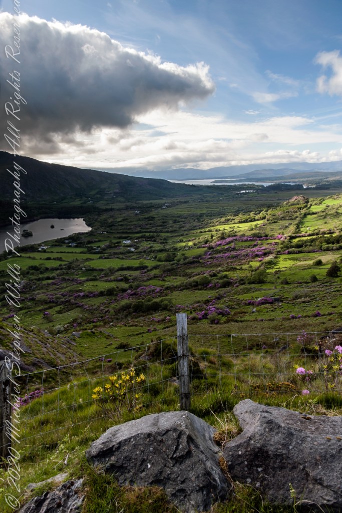
Number four of six from the Kerry County side on the descent Healy Pass, R574. Here I turn the camera on the Manfrotto studio tripod with hydrostatic ball head to the original view, a little less lit with a better leveling of the horizon.
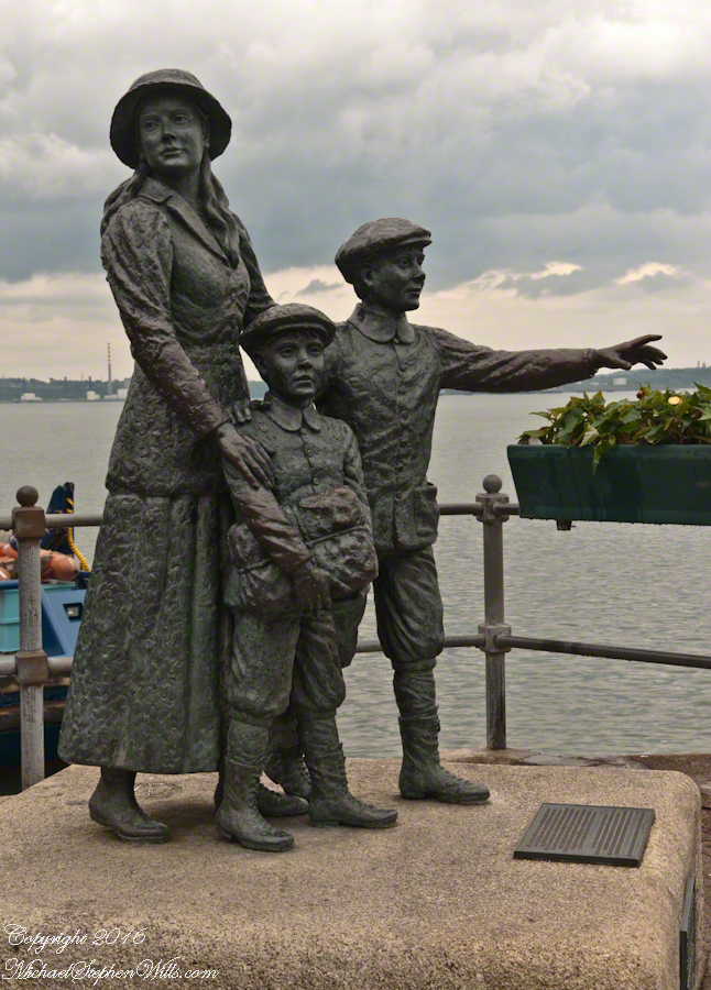
On May 29, 2014, Pam and I had the emotionally moving experience of visiting the Cóbh Heritage Centre. This statue stands outside the centre, on the quay from which thousands of Irish emigrated from what was then Queenstown. My father’s mother, Elizabeth Wills née Duffy, departed from here on April 28, 1898.
These are the words on the plaque:
‘Annie Moore and her brothers, Anthony and Phillip, embarked from this town on December 20, 1891, on the S.S. Nevada. Annie was the first person to be admitted to the United States of America through the new immigration center at Ellis Island, New York, on January 1, 1892. This sculpture was unveiled by the President of Ireland, Mary Robinson, on February 9, 1993. It was erected by Cóbh Heritage Trust Ltd. and is dedicated to all who emigrated from Ireland. This sculpture won the Zeneca Ireland Ltd. Commemorative Sculpture Award. A statue of Annie Moore was also erected at Ellis Island, New York. The commemoration of Annie Moore at New York and at Cóbh was initiated by the Irish American Cultural Institute. This sculpture is the work of Jeanne Rynhart of Bantry.'”
Number three of six from the Kerry County side on the descent Healy Pass, R574. I turned the camera a few more degrees into the gathering darkness, under the cloud, for an almost complete view of Glanmore Lake.