Enjoying travel on a horse trap, a type of carriage, on Inishmore , the largest Aran Island in Galway bay, we headed up Cottage Road from Kilronan, the main island settlement. It was from Kilronan we disembarked from the ferry, hired the driver and trap. Our destination an Iron Age fort, Dun Aengus, and sights along the way.
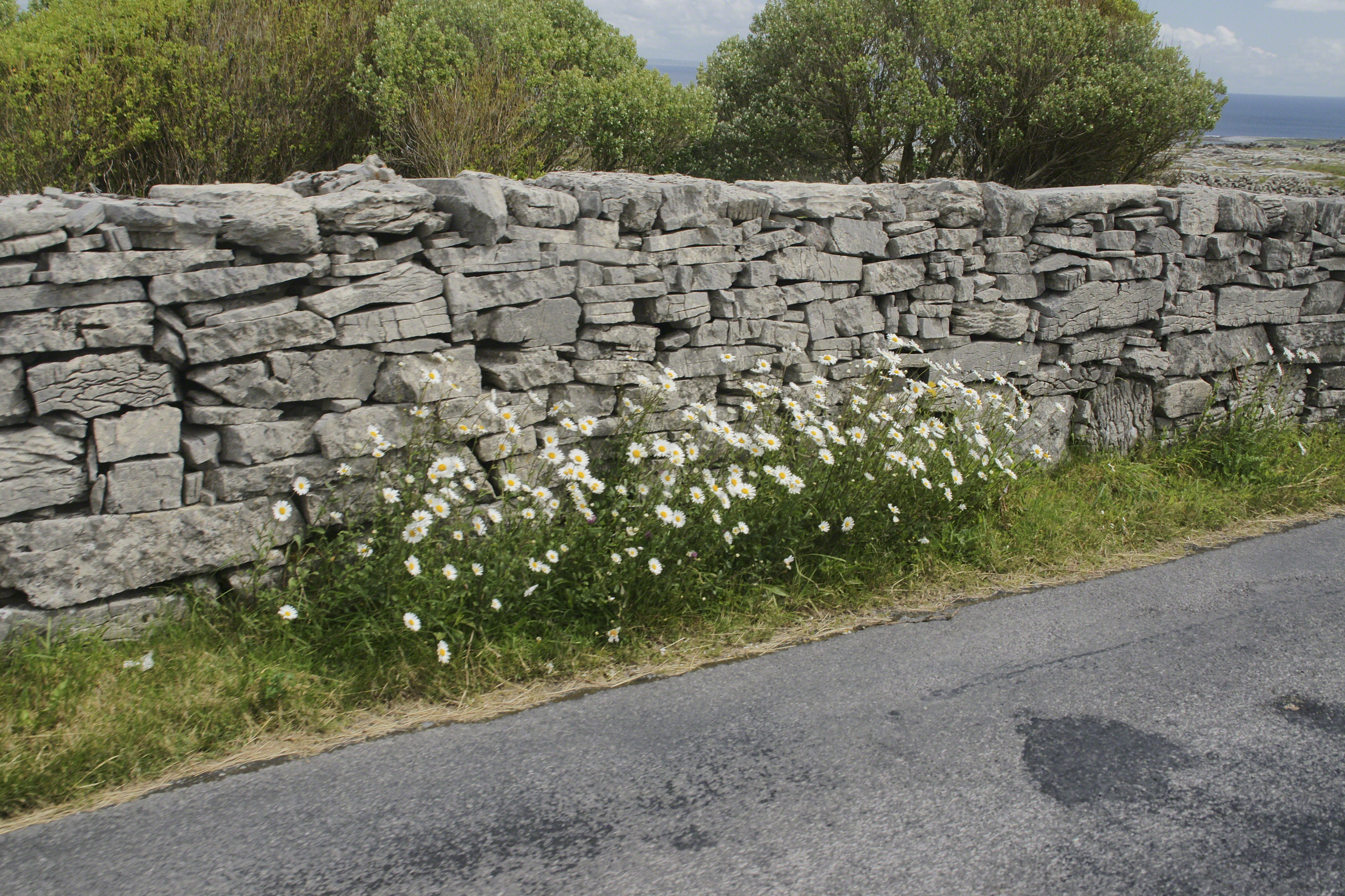
Dry Stone walls abound throughout Ireland. Ancient walls, buried in peat, were discovered in County Mayo and dated to 3,800 BC. This is a field wall on Cottage Road with daisies growing at the wall base.
The wall is composed of stones, not rocks. I have read in places a stone is a rock put to use or shaped by human hands. Other usages have rock and stone used interchangeably. For example, an internet search on “Dry Rock Wall” will return hits on the same. “You pays your money and takes your choice.”
Sources for this post: search Wikipedia for “Dry Stone”.
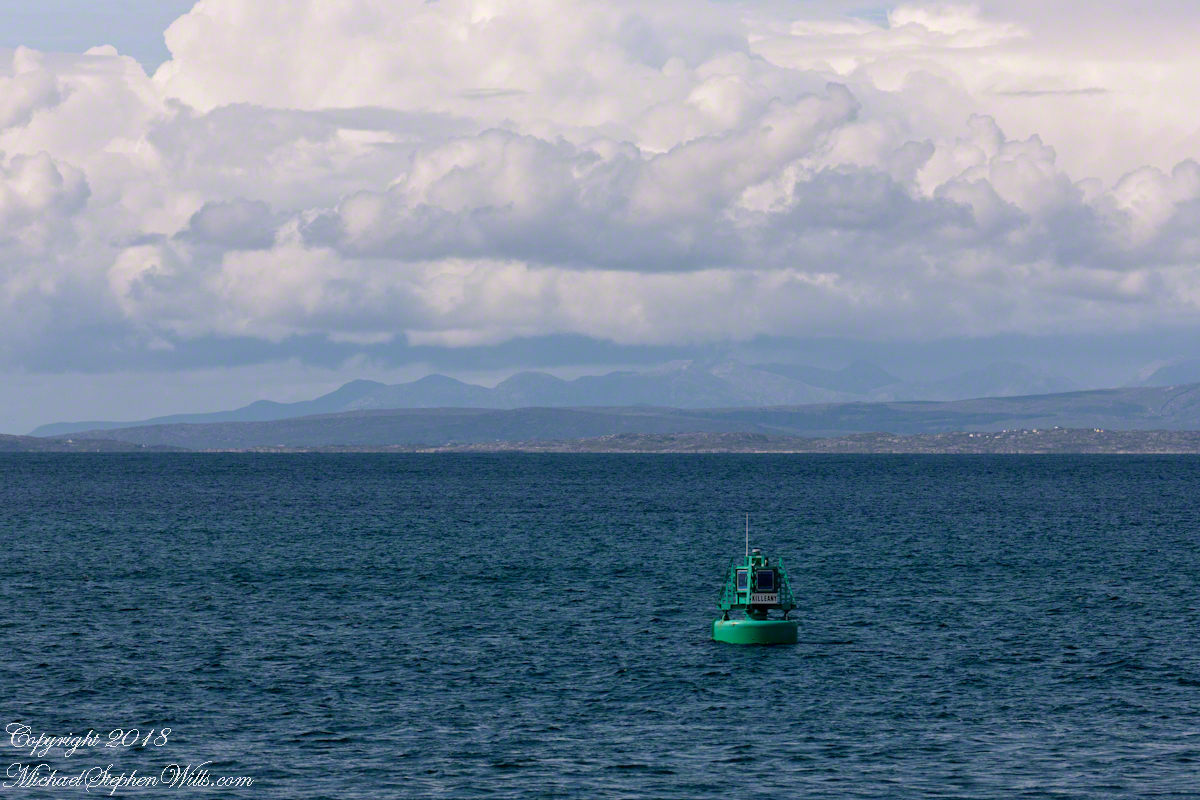
The approach to Killeany Bay of the Aran Island Inishmore is very dangerous, guarded by a Lighthouse on Straw Island to the South and the Killeany buoy to the North.
This view is to the north, northwest from a ferry en route to Inishmaan through Galway Bay. In the distance is the Connemara and the 12 Bens (12 Pins) mountains. Aran Islands, County Galway, Ireland.
There of stories of this buoy coming unmoored. October 27th 2012 it went adrift. An Aran fisherman, Micheál Seóighe (Ml Joyce) and his boat Naomh Beanán tracked it down, hauled it back to the harbor. The buoy was back in service shortly after.
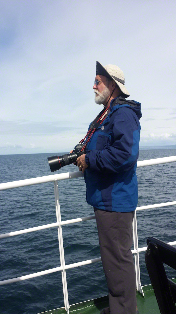
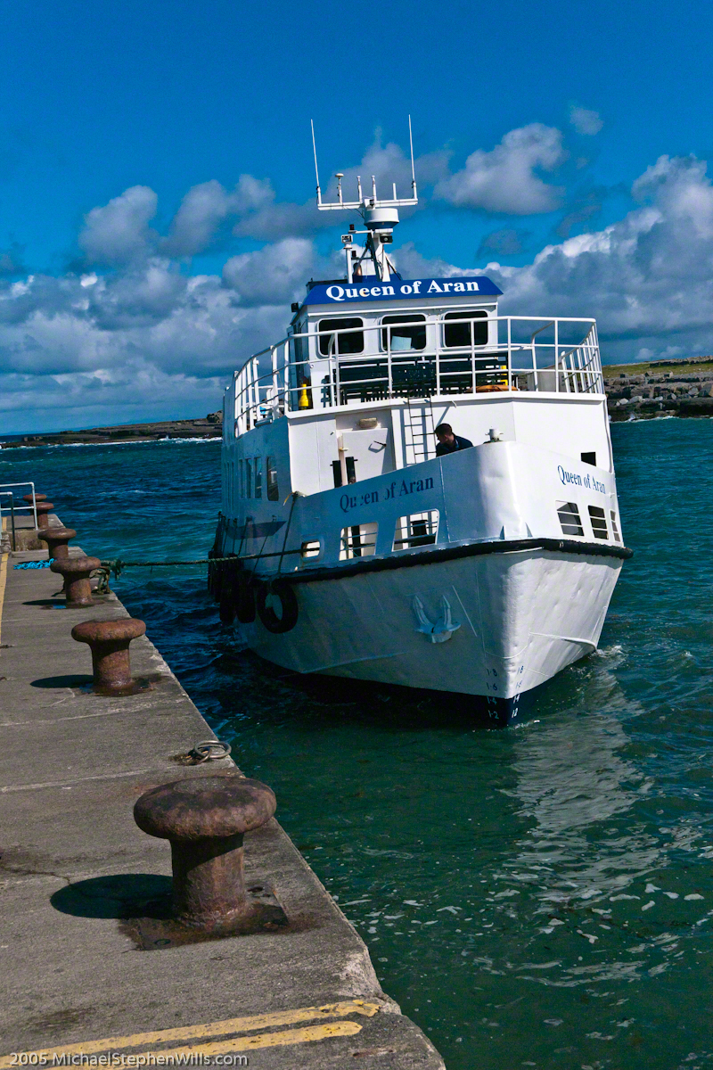
Here is a photograph of me with the camera used. It is a Canon EOS 1Ds Mark III with a Canon lens 200 mm f2.8/L. I am standing on the deck of the Queen of Aran ferry out of Doolin next to the Cliffs of Mohr.
Pam Wills took this photograph with her Samsung Galaxy 4 smart phone.
On Monday, June 9, 2014, cousin John Mills dropped his son, Sean Mills, myself and Pam Wills off at the foot of the western slopes of Slieve Foy on the Tain Way. Sean, Pam and I walked the way over the mountain and into Carlingford in the footsteps of epic Irish heroes.
Click the pic to visit my online gallery
Copyright 2022 Michael Stephen Wills All Rights Reserved
In follow-up to my last post my IStock photograph of Saint Patrick on the Hill of Tara was accepted and is available for viewing (click the link to go there).
Since July 2008 a sea generation tidal turban, “SeaGen”, produces electricity (1.2 MW) for between 18 and 20 hours a day while the tide is forced in and out of Strangeford Lough through the Narrows where the generator is installed. The first large scale commercial production of electricity from the tide, “SeaGen” is located between the Northern Ireland towns of Strangeford and Portaferry, the strength of the tides there were used by the earliest tidal mill known, the Nendrum Monastery mill dating 787 based on archeological excavation.
History records Patrick converted the island of Erin (Ireland) to Christianity in the Fifth Century AD as a return to his place of captivity and slavery.
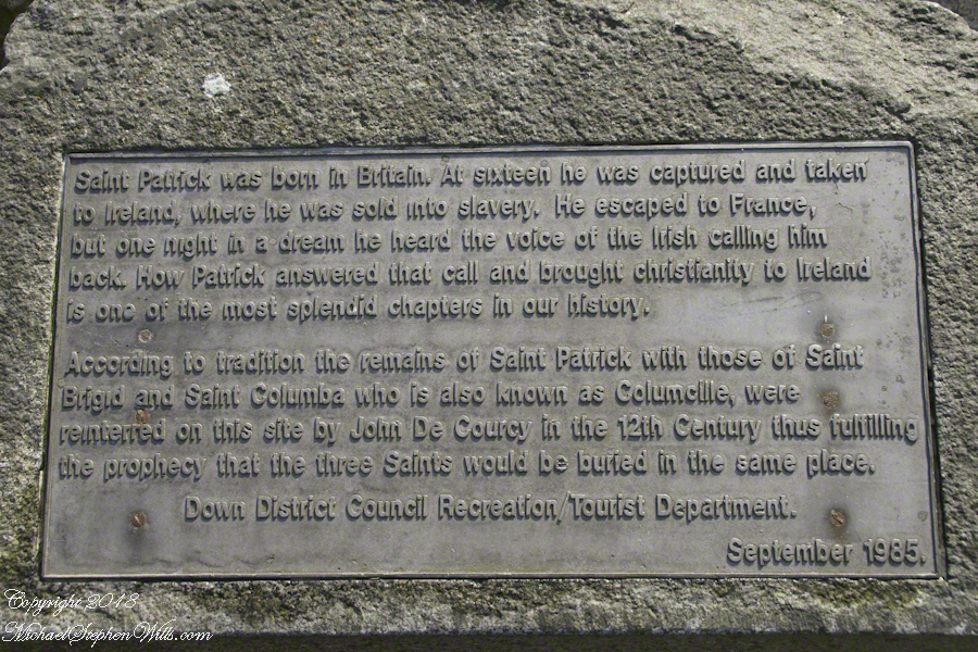
An informational plaque mounted on granite next to the grave of Saint Patrick.
There is a connection between “SeaGen” and the return of Patrick to Ireland. The first sanctuary dedicated by Patrick was at Saul, County Down not far from River Quoile that drains into Strangeford Lough. Historians identify Patrick’s first landing site, upon return, as Wicklow where he was forced to leave by the locals. Heading north in the boats of the time, the strong tide of Strangeford Narrows pulled them into the Lough and, from there, headed up the River Quoile to encounter the local chieftain, Díchu mac Trichim. Patrick’s first Irish convert to Christianity, the feast of Saint Dichu is April 29.
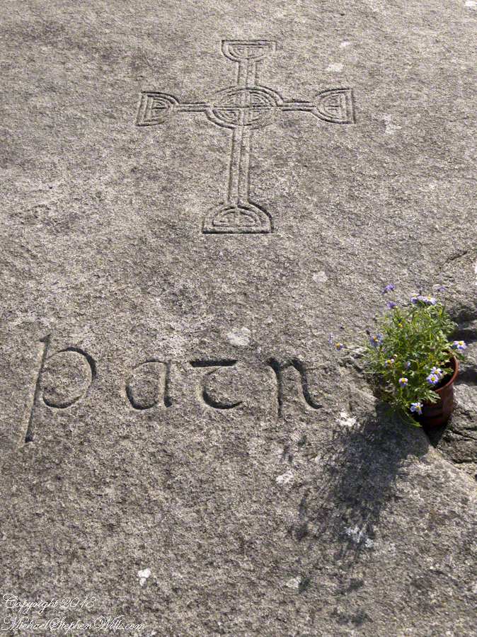
On June 7, 2014 Pam and I visited this area. Here are some photographs of the traditional burial place of Saint Patrick.
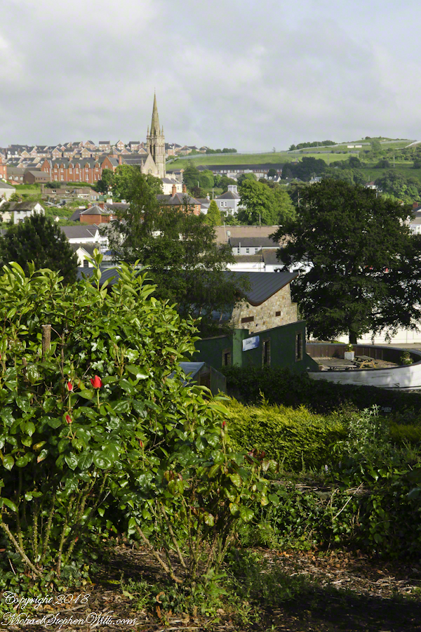
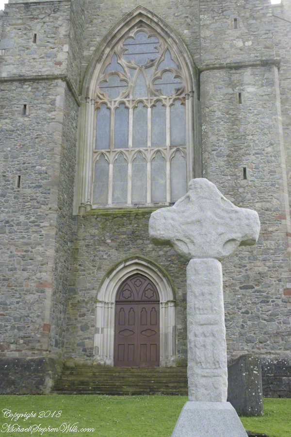
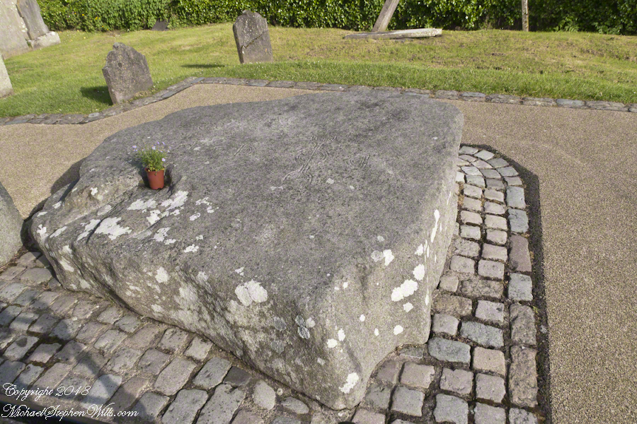
View of Downpatrick from the hill of the Cathedral Church of Holy Trinity (Down Cathedral)The High Cross of Downpatrick fronts Down Cathedral on a hill overlooking the town. The informational placard reads “The granite head and shaft date to about 900 AD and were once re-used as part of a Market Cross at the bottom of English Street. The pieces were found in various places in town, reassembled and presented to the Dean and Chapter of the Cathedral in 1897.”The placard text reads: “A large memorial stone of Mourne granite was place here in 1900 to mark the traditional burial-place of St. Patrick. The stone was quarried at Slieve-na-largie near Castlewellan, and it took 12 men 14 days to cut from the quarry.”Inscription on the upper surface of stone marking grave of Saint Patrick.
Explore the Hill of Tara with us! Discover the rich history of Saint Patrick’s statue, the legendary bonfire, and stunning panoramic views of County Meath. Join our journey through Ireland’s ancient and mystical landscapes in our blog post.
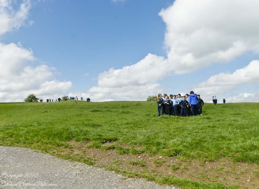
Arriving around noon on a Tuesday, Pam and I were greeted at the Hill of Tara by these children, headed to the school bus.
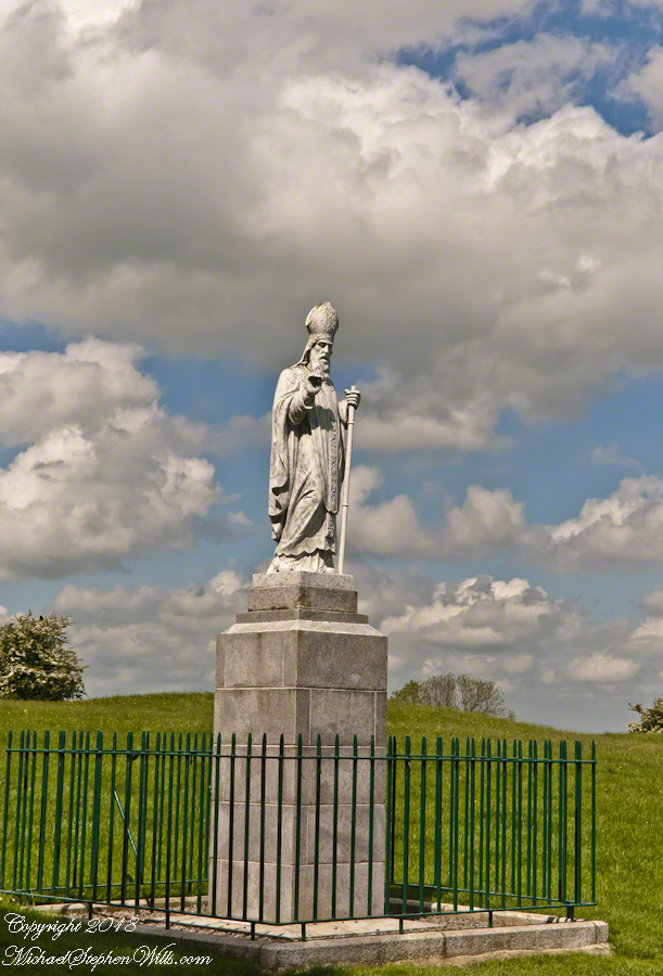
A statue of Saint Patrick fittingly welcomes visitors to the Hill of Tara, County Meath, Ireland. This statue of cast concrete was an existing statue donated by the Sisters of Charity, moved from an existing installation to the Hill of Tara in the year 2000 AD. The creator is anonymous, the is no plaque or other attribution on or around the statue. The original statue was erected on the summit of the Hill of Tara shortly after Catholic emancipation in 1829, commemorated the events of 433AD when St. Patrick lit a bonfire on the nearby hill of Slane on the eve of Easter Sunday. Slane was the second site we visited on our day of arrival, Saturday, May 24.
Lighting such a fire was contrary to the pagan laws of the time which dictated that the first fire lit that night be in Tara. Observing St. Patrick’s bonfire from afar, the chief druid of the ancient Gaelic capital predicted that if the flame were not extinguished that night, Christianity would never be extinguished in Ireland. The saint’s bonfire continued burning and the next morning, Easter Sunday, St. Patrick entered Tara to convert the king and his followers to Christianity.
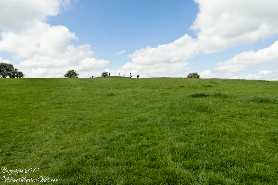
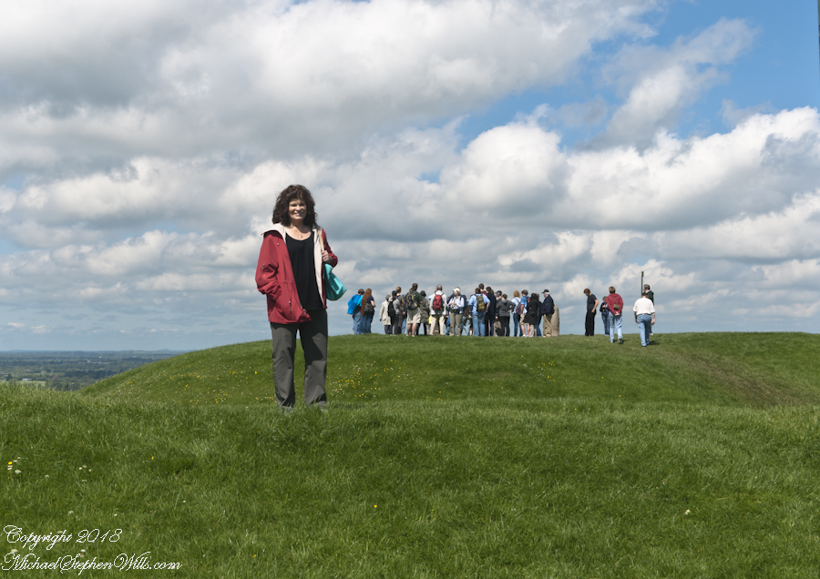
A series of mounds surmounts the hilltop, one is visible across the expanse of grass.
Climbing higher, the view opens.
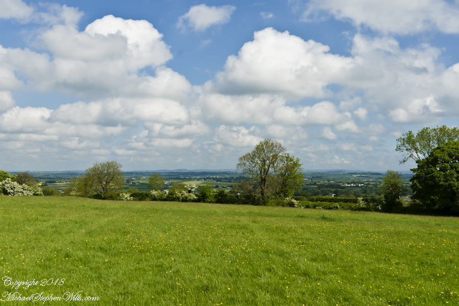
On the top, views from all cardinal directions, 360 degrees.
The Hill of Slane is visible in the east, the tall cathedral ruin though not visible in this view.
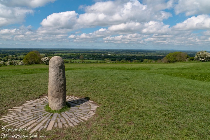
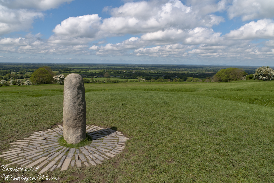
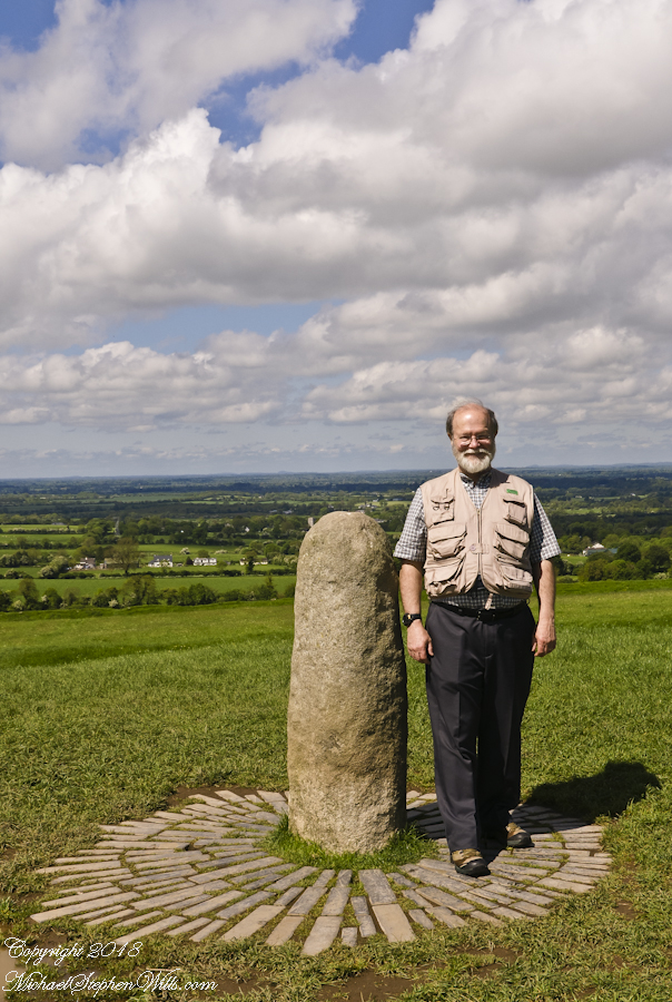
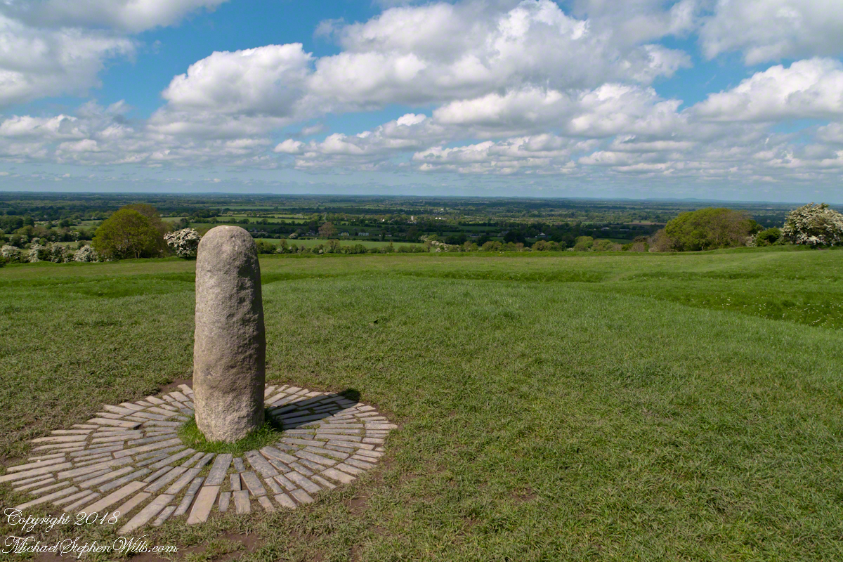
The first of the following panel is a view northwest from looking across County Meath with views of Counties Westmeath and Cavan. On the horizon, right, is Hag’s Mountain, (Irish: Sliabh na Caillí) , site of the Loughcrew Cairns. The standing stone is the “Stone of Destiny: (Irish: Lia Fáil), which served in coronation the coronation of the High Kings of Ireland. It stands on the Inauguration Mound (Irish: an Forrad) of Tara. This photograph was taken the morning of May 27, 2014 hours before the stone was vandalized, doused with green and red paint.
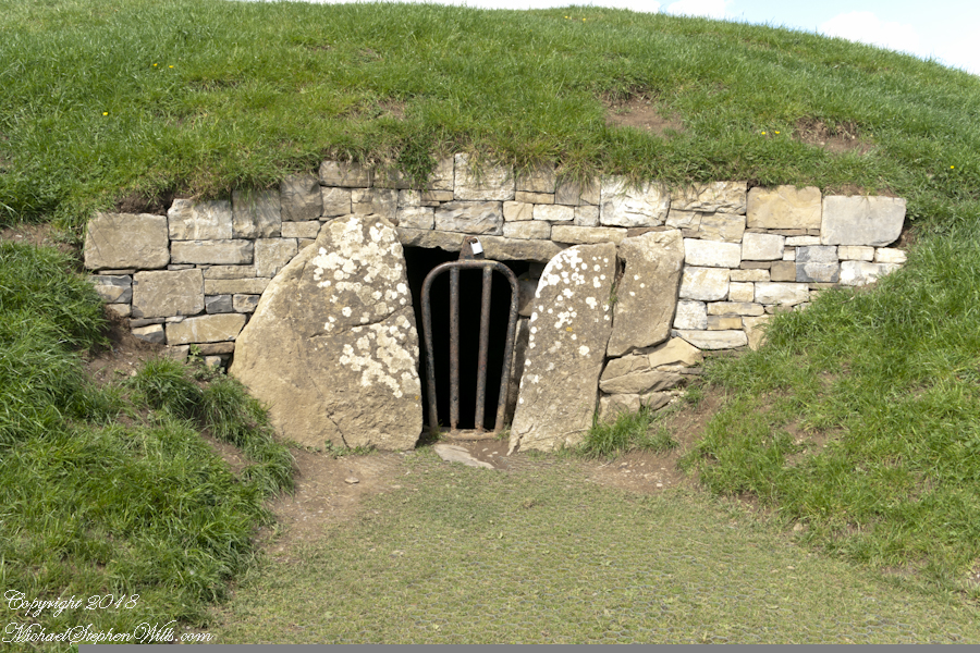
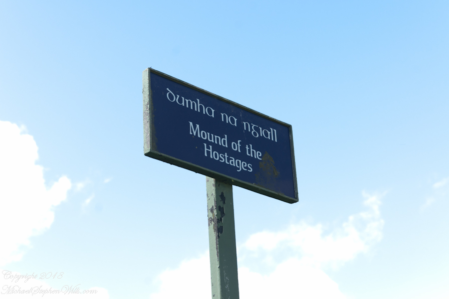
A bit to the east is the Mound of the Hostages, a passage tomb.
Walk into a glade, through the ancient graveyard to the visitors center in a deconsecrated church.
Browse my reasonably priced stock photography. This blog features three (3) photographs I published last week to Getty Istock and my Fine Art gallery.
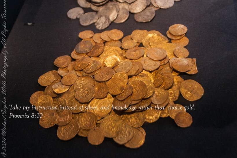
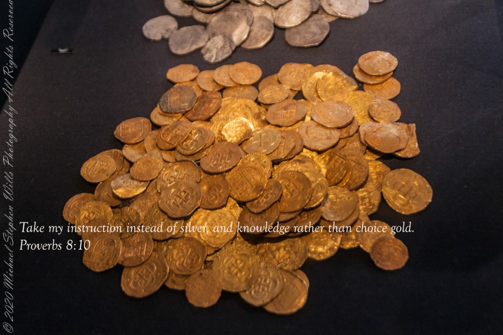
Gold on display for the permanent exhibit “Treasures of the Girona,” Ulster Museum, Belfast. It is not Leprechaun gold, certainly.
“Lay not up for yourselves treasures upon earth, where moth and rust doth corrupt, and where thieves break through and steal: But lay up for yourselves treasures in heaven, where neither moth nor rust doth corrupt, and where thieves do not break through nor steal: For where your treasure is, there will your heart be also.” Matthew 6:19-24“
Copyright 2022 Michael Stephen Wills All Rights Reserved
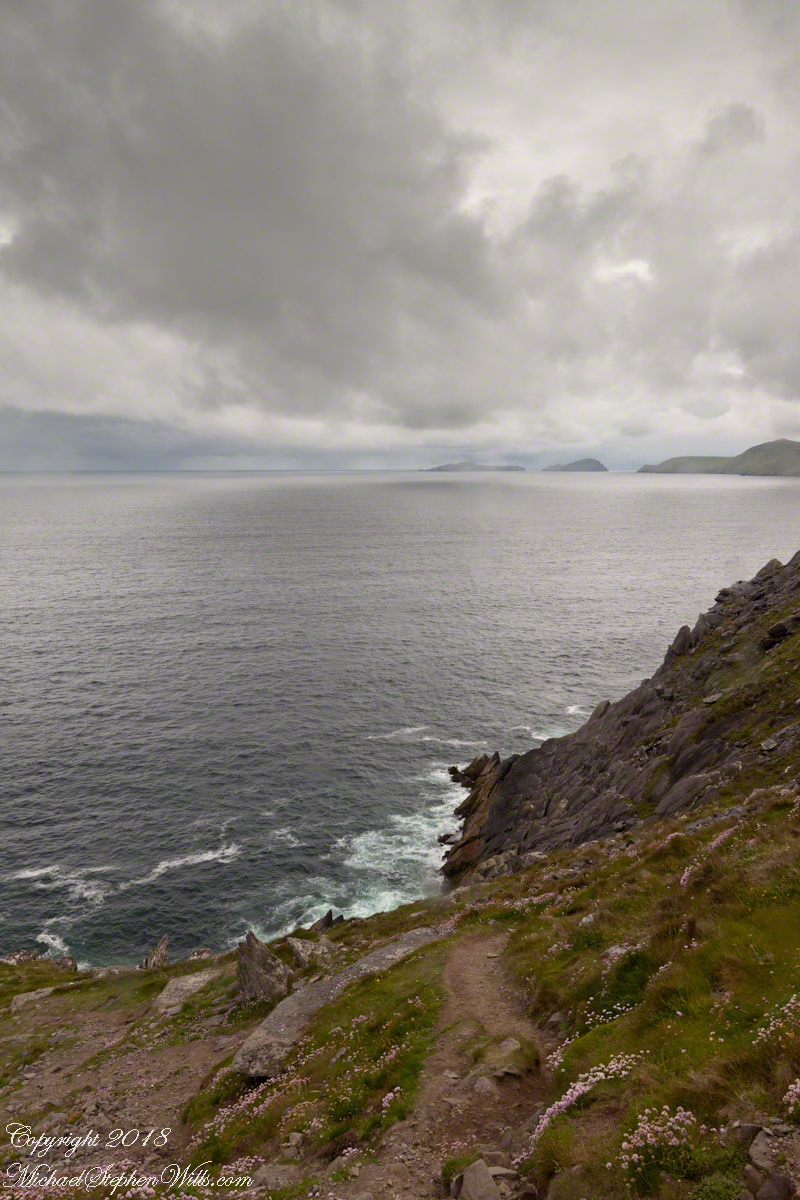
On the Dingle Peninsula, County Kerry, Ireland photograph taken from Slea Head Drive (R559), looking west down the cliff toward the North Atlantic Ocean breaking on the rocks. In the distance, Slea Head and the Blasket Islands. In the forground, the wildflower of Red Clover (Scientific Name: Trifolium pretense) (Irish Name: Seamair dhearg).
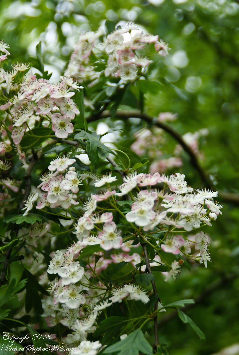
I originally published these blossoms as “wild rose”. It was my Facebook friends who pointed out these are hawthorn flowers. The key to identification was the shape of the leaves.
Blossoms of Hawthorne taken on the site of the former McCardle Home, Proleek Townland, County Louth, Ireland.
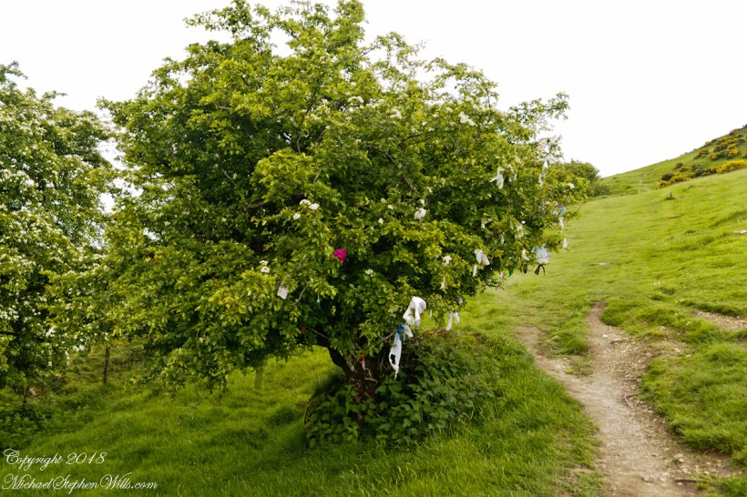
In correcting my mistake, I learned the young leaves of Hawthorn are excellent for salads. Wonder how the fairy folk, associated with single hawthorns (as in the following photograph from the Hill of Tara), react to picking leaves from their trees? I didn’t hear of the practice during our time in Ireland.
View northwest from Hill of Tara looking across County Meath with views of Counties Westmeath and Cavan. On the horizon, right, is Hag’s Mountain, (Irish: Sliabh na Caillí) , site of the Loughcrew Cairns. The standing stone is the “Stone of Destiny: (Irish: Lia Fáil), which served in coronation the coronation of the High Kings of Ireland. It stands on the Inauguration Mound (Irish: an Forrad) of Tara. This photograph was taken the morning of May 27, 2014 hours before the stone was vandalized, doused with green and red paint.
My mistake was understandable, in botany the hawthorn is in the same family as the rose. The flowers are similar, having five petals. The “haw” in hawthorn is from the Old English word for hedge, as is this linear standoff the tree lining the way up to the Loughcrew Cairns.
Reaching highest point of County Meath, Ireland means a steep path, not too long, to glorious views on all points plus Lough Craobh (Lake of the Branches).
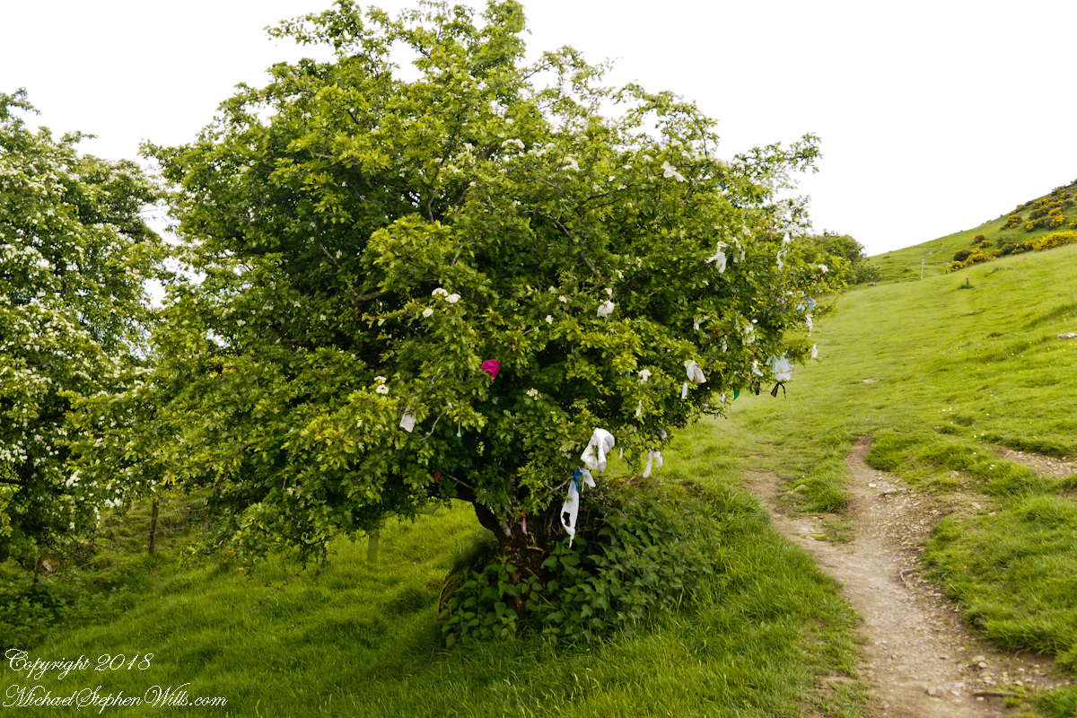
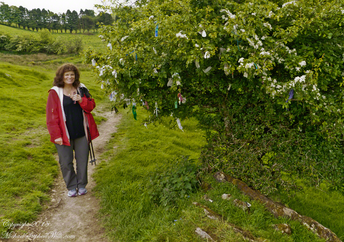
I read these votive offerings are made at Beltane, in which case these are fresh from placement May 1.
A hawthorn tree in bloom on May 27, 2016. Growing on the slope of Hag’s Mountain
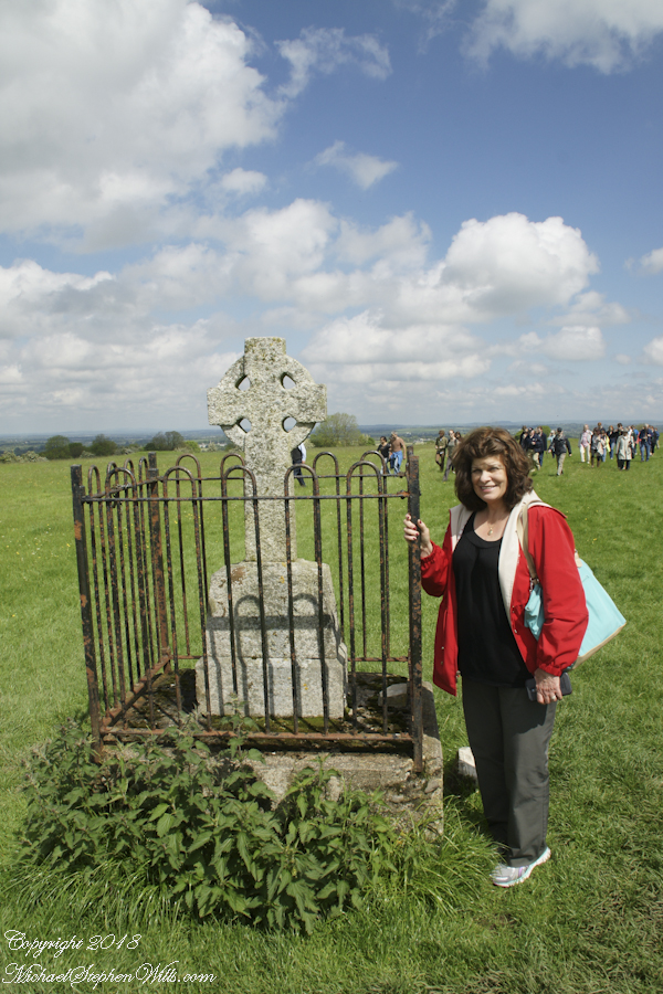
The following year Pam underwent double total knee replacements, never the less, she was great company for all our adventures on the island. Even this steep climb.
The steep path to Loughcrew passes a hawthorn covered with flowers and May offerings.
These views were our reward for reaching the top.
View from Loughcrew Cairns, “Hags Mountain”
The Emerald Isle, we fully understood this name.
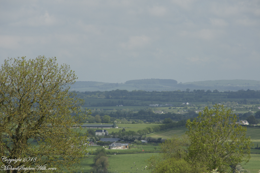
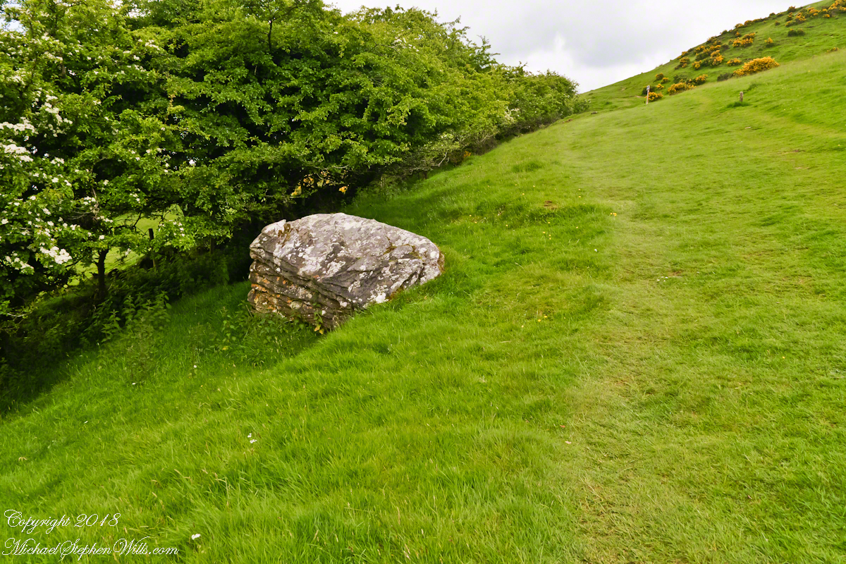
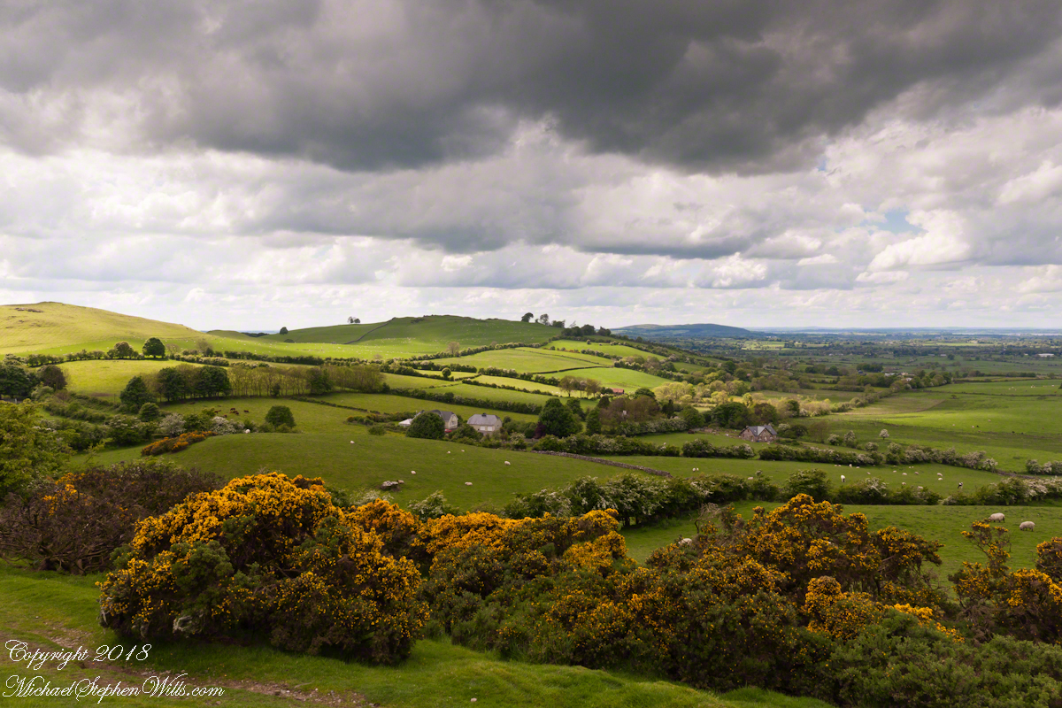
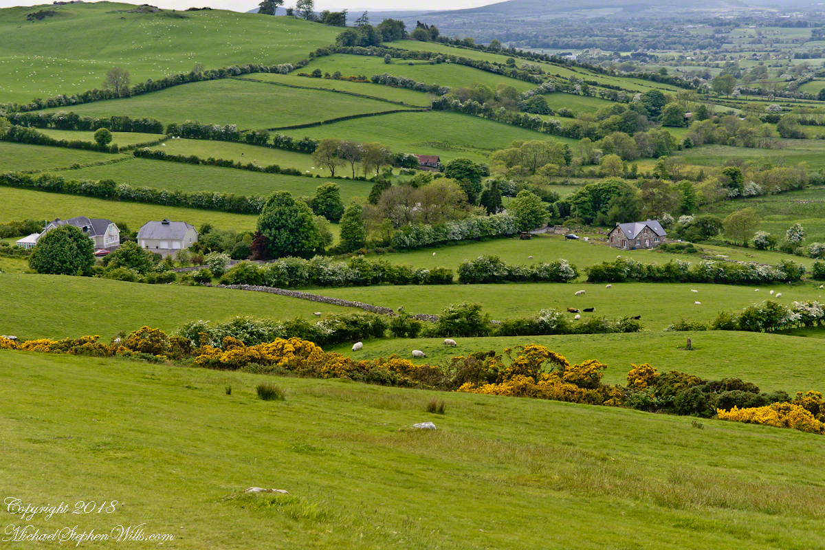
Loughcrew Megalithic Site, County Meath, Ireland. A solitary standing stone below the trail to the Loughcrew site surrounded by whin bush (gorse) and hawthorn hedge rows. A fieldstone fence, farmhouses, a patchwork quilt of fields completes the view.
The Greek name for the Hawthorn species is formed from two words meaning “strength” and “sharp”, referring to the thorny branches.
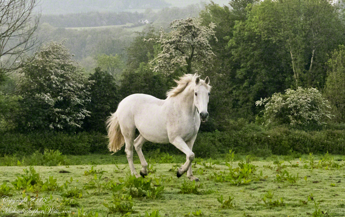
For County Cork we stayed with Marantha House B&B. Our day of arrival, that evening, I visited Charlemagne and fed him an apple, saved from dinner. We learned from our hosts, Olwen and Douglas Venn, he is a retired show horse they rescued. The following morning I visited Charlemagne again with an apple and my camera. As I walked up, starting from the far end of his field, Charlemagne rewarded me with a series of astounding poses, trotting toward me in fine form. The morning mists, hawthorn in bloom, distant hills came together for this memory.
We marveled at the hawthorn hedges in field after field. I first notice them from the World Heritage Site, Newgrange (Brú na Bóinne, “Palace of the Boyne”). Here is one on the Dingle Peninsula, on the other side of the island.
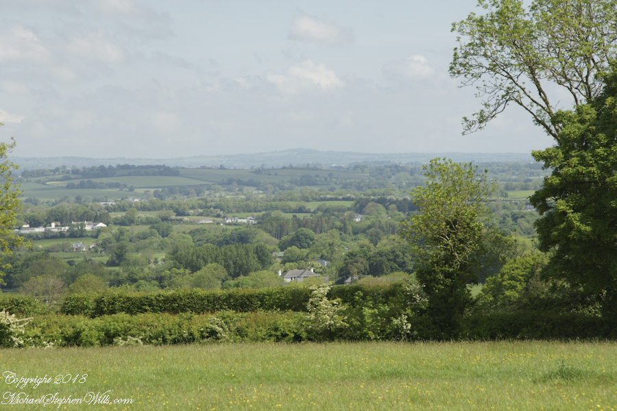
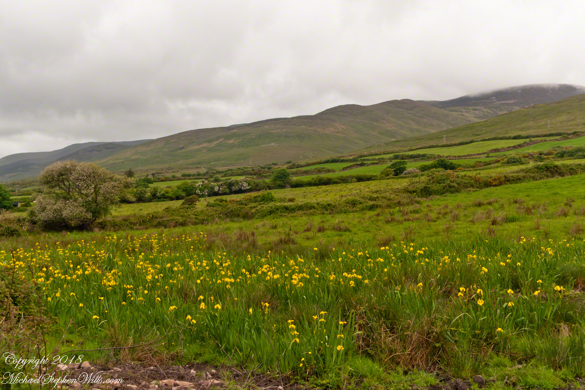
A roadside field of yellow Iris flowers with flowering Hawthorn and Whin Bush in the windbreaks. Looking northwest toward Killeenagh and Caherpierce on the R561 between Lack West and Inch. Dingle Peninsula, County Kerry, Ireland.
This series of posts started with “Proleek, Grandfather McCardle’s home” where we explored the site of great grandfather James McCardle’s Proleek farm. A kilometer from there, at Proleek Dolmen, the ancient portal stones line up to face the plain rising to Slieve Gullion, a name for the mountain taken from the Irish, Sliabh gCuillinn, meaning “mountain of the steep slope” or Sliabh Cuilinn, “Culann’s mountain.”
Click photograph to view my Ireland photography gallery
There is an connection between Proleek and Slieve Gullion. Cycles of Irish Myth place a boy named Sétanta living on Muirthemne Plain, of which what we call Proleek Townland was a part. One day, the king Conchobar was passing his kingdom, Muirthemne, on the way to a feast on the slopes of Slieve Gullion hosted by the blacksmith Culann when he stopped to watch boys playing hurling, Sétanta among them (it is ironic the Proleek Dolmen is surrounded by a golf course in modern times).
Impressed by the Sétanta’s skill, the king invites him to the feast. Having a game to finish Sétanta promises to follow. As evening falls the boy approaches the smith’s house to find himself attacked by a huge, aggressive dog. Acting in the moment, Sétanta dispatches the dog with the hurley and ball he had at hand, driving the ball down the hound’s throat. (In another version he smashes the hound against a standing stone.)
Feeling Culann mourn the loss of his beloved animal, Sétanta promises to raise and train a guard dog equal to the one he slew. Until that time he also pledged to guard Culann’s home. From that time Sétanta was known as “the hound of Cullann”, Cú Chulainn in Irish.
References
Wikipedia articles “Slieve Gullion” “Cú Chulainn” and “Conaille Muirtheimne.”
Copyright 2022 Michael Stephen Wills All Rights Reserved