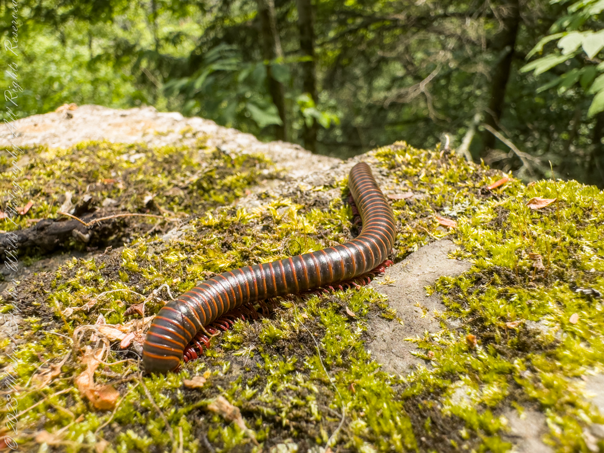
Visitors to Robert H. Treman park think nothing of crushing millipedes on the trail, it is concerning to encounter evidence of such disrespectful and boorish behavior. Here is an intact millipede I found last week. Millipedes are a group of arthropods that are characterized by having two pairs of jointed legs on most body segments; […]
Visitors to Robert H. Treman park think nothing of crushing millipedes on the trail, it is concerning to encounter evidence of such disrespectful and boorish behavior. Here is an intact millipede I found last week.
Millipedes are a group of arthropods that are characterized by having two pairs of jointed legs on most body segments; they are known scientifically as the class Diplopoda, the name derived from this feature. Each double-legged segment is a result of two single segments fused together. Most millipedes have very elongated cylindrical or flattened bodies with more than 20 segments, while pill millipedes are shorter and can roll into a tight ball. Although the name “millipede” derives from Latin for “thousand feet”, no species was known to have 1,000 or more until the discovery of Eumillipes persephone, which can have over 1,300 legs.
There are approximately 12,000 named species classified into 16 orders and around 140 families, making Diplopoda the largest class of myriapods, an arthropod group which also includes centipedes and other multi-legged creatures. Most millipedes are slow-moving detritivores, eating decaying leaves and other dead plant matter. Some eat fungi or drink plant fluids, and a small number are predatory.
Millipedes are generally harmless to humans, although some can become household or garden pests. Millipedes can be an unwanted nuisance particularly in greenhouses where they can potentially cause severe damage to emergent seedlings. Most millipedes defend themselves with a variety of chemicals secreted from pores along the body, although the tiny bristle millipedes are covered with tufts of detachable bristles. Its primary defense mechanism is to curl into a tight coil, thereby protecting its legs and other vital delicate areas on the body behind a hard exoskeleton. Reproduction in most species is carried out by modified male legs called gonopods, which transfer packets of sperm to females.
Millipedes are among the first animals to have colonized land during the Silurian period. Early forms probably ate mosses and primitive vascular plants. Millipedes also exhibit the earliest evidence of chemical defense, as some Devonian fossils have defensive gland openings called ozopores. Millipedes, centipedes, and other terrestrial arthropods attained very large sizes in comparison to modern species in the oxygen-rich environments of the Devonian and Carboniferous periods, and some could grow larger than one meter. As oxygen levels lowered through time, arthropods became smaller.
Most millipedes are detritivores and feed on decomposing vegetation, feces, or organic matter mixed with soil. They often play important roles in the breakdown and decomposition of plant litter: estimates of consumption rates for individual species range from 1 to 11 percent of all leaf litter, depending on species and region, and collectively millipedes may consume nearly all the leaf litter in a region. The leaf litter is fragmented in the millipede gut and excreted as pellets of leaf fragments, algae, fungi, and bacteria, which facilitates decomposition by the microorganisms.
Reference: “Millipede” Wikipedia
Copyright 2023 All Rights Reserved Michael Stephen Wills
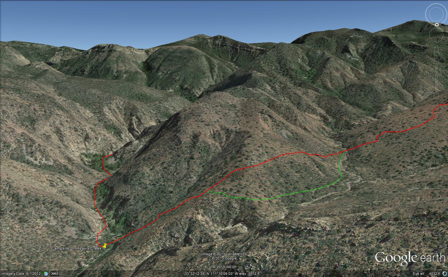
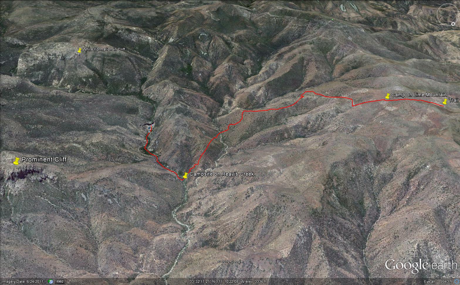
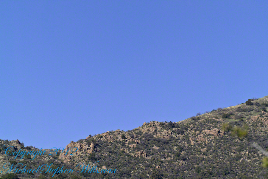
Here is an overview of my route through Cedar Basin on the way to Reavis Falls. There are two paths in the following image from Google Earth. The red path brings you into Cedar Basin and straight up a ridge and down to the campsite. The red path is incorrect in the approach to the ridge and, rather than repaint the path, I created the green path as the gradual and accurate description of how I climbed to the ridge point where I captured the photographs Hoodoos on the Descent to Reavis Falls.
No Path to Reavis Falls
You need to understand there is NO path through this terrain. It is necessary to follow a faint trail marked out by the footsteps of those before you and an occasional rock cairn placed at the most difficult points. The following image is misleading in that what looks like a road next to my green path is actually a creek bed from the Lime Mountain spring.
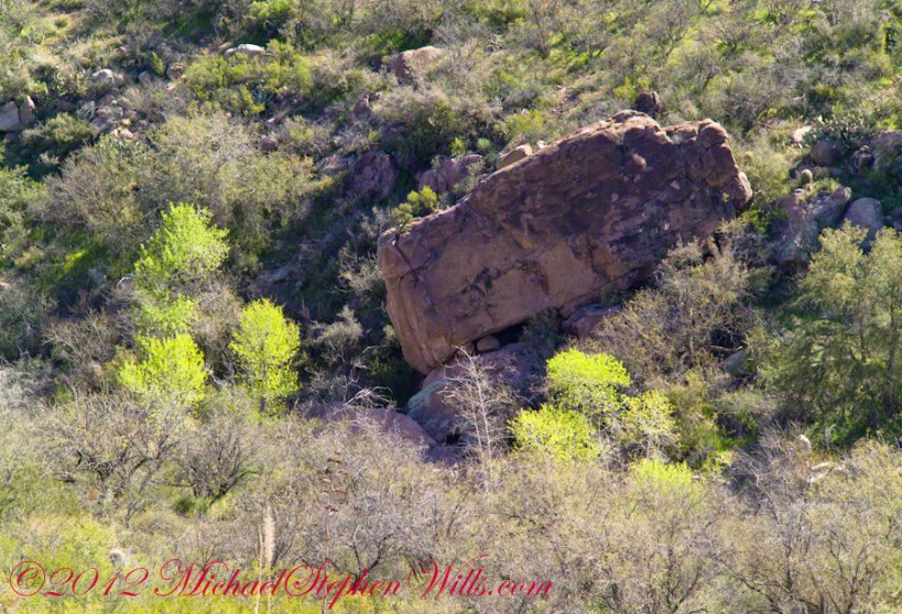
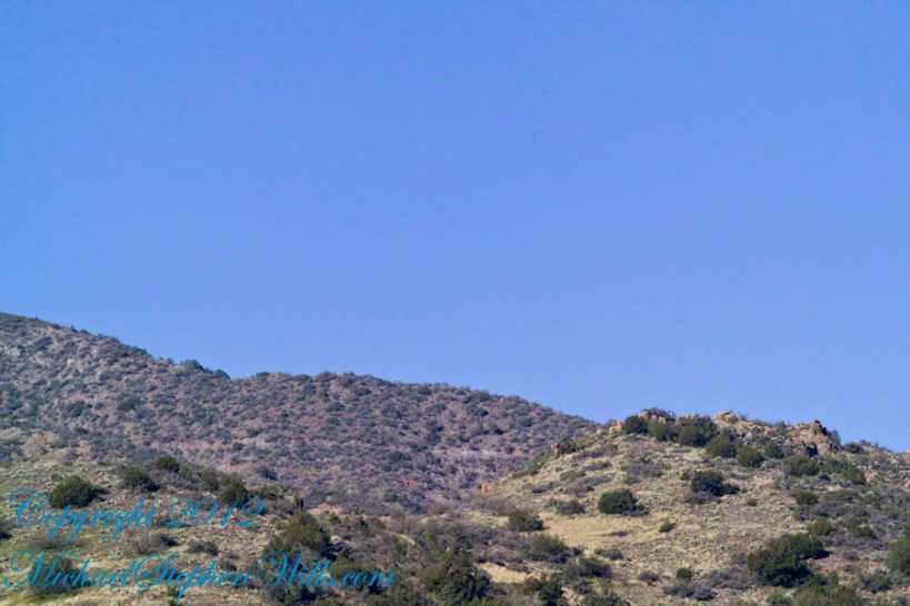
Huge Boulders
What looks like a road is the resting place of huge boulders fallen from the surrounding mountains. Since there is water, thick brush and trees grow everywhere in cracks and spaces between the boulders and rocks. Getting through the creek bed with an 80 pound pack and not getting lost is close to impossible. The solution is to hug the ridge slope, following the contours and navigate around boulders.
Reavis Canyon below the falls is filled with boulders of this size held in place by friction.
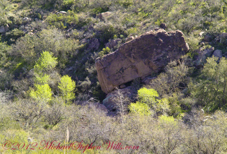
View of Reavis Canyon and Campsite
From the ridge small portions of Reavis Canyon were visible. I even spotted a campsite.
The mouth of Reavis Canyon below the falls opens into a sandy bottom. This camp, surronded by house-size boulders fallen from the slopes above, has a patch of grass bright green and fresh.
This camp, 1,636 feet below Lime Mountain peak, surrounded by house-size boulders fallen from the slopes above, has a patch of grass bright green and fresh to the right. In the center of the photograph is a tree trunk on rocks to serve as a bench next to a fireplace. With an 80 pound pack on my back, I was still an hour or so away from this spot. It was March, so sunset was around 6 pm, enough time to find a way down before darkness to overtook me.
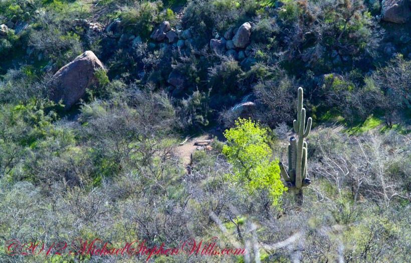
Looking down from a ridge above the canyon that holds Reavis Creek and the falls.
This is an overview of my progress, with the Lime Mountain and Reavis Canyon campsites marked. Landforms are marked on the left: the Prominent Cliff , in the background it says “White Formation on Cliff.”
Copyright 2023 Michael Stephen Wills All Rights Reserved
In my previous posting “Hoodoos on the Descent to Reavis Falls” I describe how I came to find these strange rock formations during a solo expedition to Reavis Falls in the remote eastern Superstition Wilderness.
Here I present several photographs captured from my tripod mounted Kodak DCS pro slr/c and a Canon EF 200 mm f2.8 L telephoto lens. These provide a better understanding of the strange, wonderful and possibly frightening impressions these formations make when discovered in a deserted location such as Cedar Basin.
Here is the highest point of the ridge….
Hoodoo Ridge
…..and from a portion of the ridge that projects closer to my observation point above the canyon mouth of Reavis Falls. The numerous green poles are young Saguaro cactus. In the distance are mature Saguaros with lateral arms.
Hoodoos of Cedar Basin
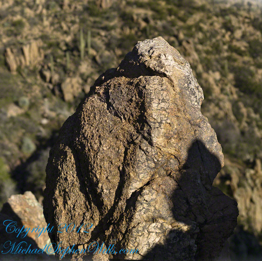
..and even closer than this were the rocks standing around me. This specimen I captured with the 50 mm 1.4 Canon lens. I believe it is a different rock type than the above, rounded, hoodoos. Those look like rock from ash of a volcanic eruption. This rock seems to be igneous, formed deep inside the earth.
Cedar Basin Rock Closeup
My next posting will describe the surroundings of the campsite from which I explored the canyon and Reavis Falls.
Copyright 2023 Michael Stephen Wills All Rights Reserved
My previous post, “Dry Juniper Descent” had me above the ridge of the featured photograph.
I interrupted my descent to Reavis Falls to stop on a ridge overlooking Reavis Creek, the same ridge that forms the western wall of the canyon. By this time it was late afternoon on a March Day with the angle of the sun being perfect for capturing rock formations. Notice the effect of the light on the distant mountains.
This is the North / Northeast view of the opposite ridge above a flow from multiple springs on Lime Mountain.
This photograph was created from multiple images using tripod-mounted Kodak DCS ProSlr/c with a 50mm, 1.4 Canon lens.
Cedar Basin hoodoos on the slopes of Lime Mountain
The ridge and slopes are covered with a rock formation named Hoodoos for the fantastic shapes taken on by layers of stone weathered over eons by water, wind, sun and cold. These hoodoos are enormous, some precisely balanced and carved into elaborate shapes. The word “Hoodoo” derives from the name of the practice of sorcery or folk magic. You can image the effect on ancient people of coming upon these formations and believing them created by malevolent beings (djinns, goblins, demons) in their leisure time, when not causing problems, and worse, for humans. These beings are especially active in desert places, such as this, which has the comforting name of Cedar Basin.
The hoodoos cast a spell on me. I had never heard of Cedar Basin, but knew, as the sun was low in the west, I needed to unload my 70 pound pack, set up the tripod and camera to spend over an hour of precious time to capture the images of this blog.
Ancient Village
Cedar Basin forms on one side from the ridge of this photograph. On the other side of the ridge, the mountain slope levels out to a site settled by ancient people we call Sin Agua. There is nothing but a few stones left of their village and way of life.
Cedar Basin
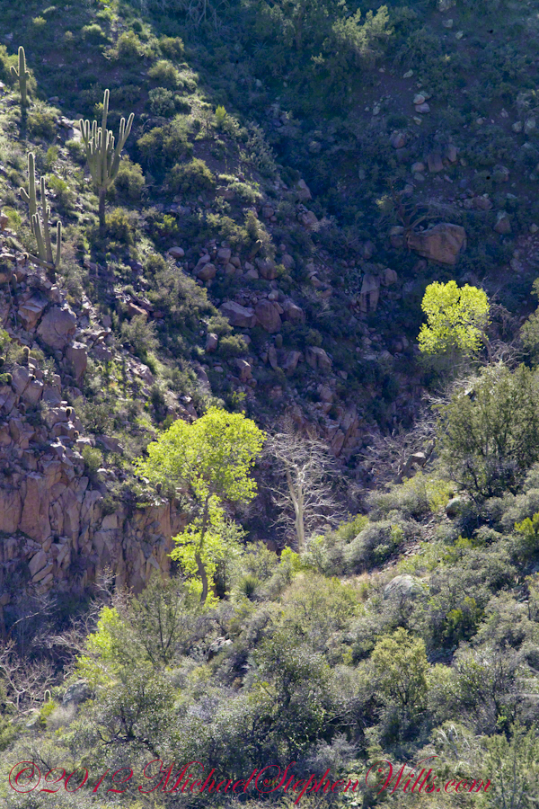
Looking to the left of the Hoodoo Panorama photograph and into Cedar Basin, you see more of that same rock type that formed the hoodoos to the right on this same ridge. This is also the lower slopes of Lime Mountain, as you can see from the color of the upper ridge.
The Slopes of Cedar Basin
This and the following photographs were created using a tripod-mounted Kodak DCS ProSlr/c with a 200mm, 1.4 Canon L type lens.
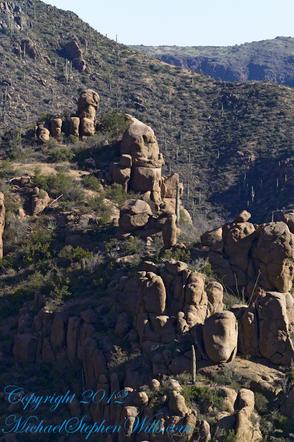
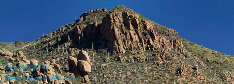
Another side of the basin is formed by the ridge I am on. This side is across from the canyon of Reavis Creek and Falls. The trail leads down switchbacks from the Dry Juniper of my previous post to a dry draw. You can see the way I came in the following two photographs. I captured Castle Dome, then panned to the right for the rest of the ridge. You can see the trail to Reavis Ranch carved into the slopes of Castle Dome.
Castle Dome Ridge and Reavis Ranch Trail
Cedar Basin and Castle Dome
I then panned one more time to the right to capture the ridge above Cedar Basin and the start of the hoodoos. It was an army spread across the entire ridge!!
Cedar Basin and Castle Dome
My next posting will feature close-up of the most interesting hoodoos from the panorama, using a 200 mm telephoto lens.
Copyright 2023 Michael Stephen Wills All Rights Reserved
On my fourth morning, after I awoke to am immense silence, my first photography subject was the lone dry juniper you see below.
Then the dawn lit up the far mountains. You can view a larger image these mountains at dawn in my previous blog, “Superstition Wilderness Dawn.”
A Lone Dry Juniper
This is a photograph of that juniper tree, dryer than most, being dead. I take it to be a One-seed Juniper from the thick growth of branches and the strong rounded aspect of the crown. I captured this photograph from a tripod mount using a Kodak DCS slr/c with a Canon EF 50mm f/1.4 USM lens.
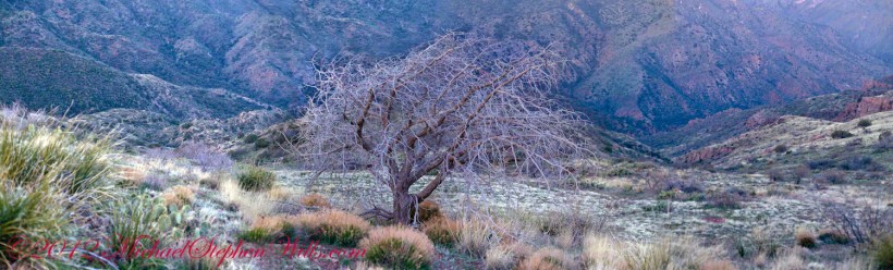
Looking into Reavis Creek Canyon from Lime Mountain
I used the tripod to bracket this shot on the left and right for the following panorama.
The Reavis Creek Canyon from Lime Mountain while still in shadow, morning
The Spirit of Elisha Reavis
From this vantage you can see my route into Reavis Creek Canyon and Reavis Falls taken on the first afternoon of the expedition. That first morning I loaded up 65 pounds of food, supplies and photography equipment and headed out from the Reavis Trailhead on the Reavis Ranch Trail. This was one of the trailed used by Elisha Reavis to ride a favorite burro and a string of 8 to 15 burros loaded with vegetables he sold to various communities throughout central Arizona. See my blogs “A Ride to Reavis Ranch” and “Apple Orchard in the Wilderness“for views of the paradise (as of the early 21st century) where Elisha Reavis, lived and prospered in the latter part of the 19th century where he lived his 70’s.
This his mountain valley, using a perennial creek, Reavis cultivated and irrigated about fifteen acres of land by himself with chickens, turkeys, hogs, burros, two horses and several dogs. The horses, teamed together, pulled a shear plow, disc and leveler. On April 9, 1896 Reavis was preparing of another trip to Mesa, to buy seed potatoes, and was found by a friend a month later on what is now the Reavis Ranch trail, to the south and west of his valley, near what is now called Grave Canyon were friends buried him.
Past the Dry Juniper and Down
102 years later, I headed up the Reavis Ranch Trail, over the ridge of Lime Mountain and past this dry juniper in the same spirit as Elisha Reavis if for a different purpose.
Pre-dawn on the fourth morning of my solo expedition to Reavis Falls, before the last posting “Among the Desert Wildflowers“, on the slopes of Lime Mountain, as the eastern sky became slightly less dark, I woke to an unusual sensation: total silence. The air was absolutely still, no insects trilled, the birds were still asleep. Lying very still, the ringing of my ears announced the silence.
In that silence I set up for this panorama taken from a tripod-mounted Kodak DCS ProSLR/c mounted with a Canon EF 200mm f/2.8L II USM telephoto lens. It is 5 image files combined. The source file is about 300 MB.
That is Pinyon Mountain in the center distance. The Arizona Trail traverses that terrain, though it is not visible from this distance (it is about 3 miles away).
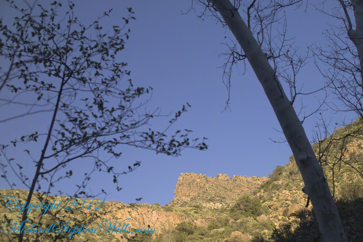
Lime Mountain is truly a light green, as you can see from the foreground ledge. From there, a cliff runs round where on a south-facing site there are cliff dwelling ruins. The trail to Reavis Falls runs to the right, along a ridge broken by a narrow canyon with access to Cedar Basin, also at the foot of these cliffs.
Copyright 2023 Michael Stephen Wills All Rights Reserved
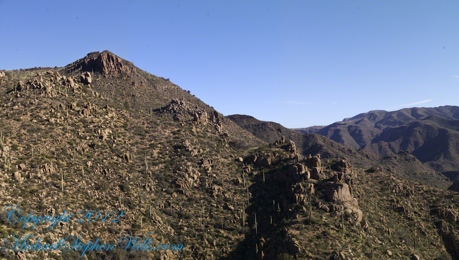
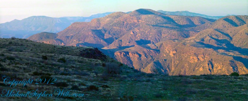
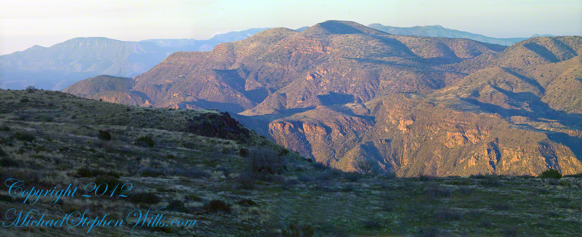
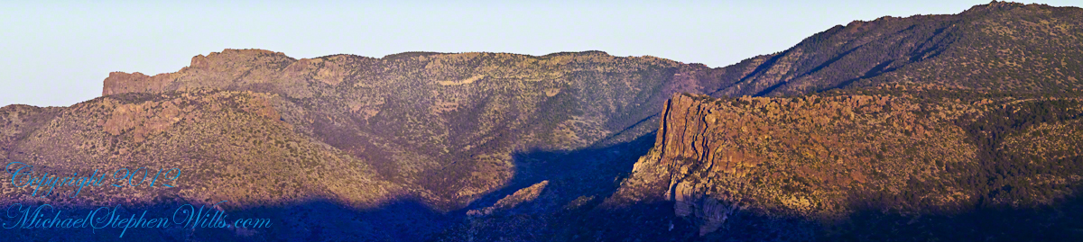
Another blog from my four day solo expedition to Reavis Falls in the remote eastern Superstition Wilderness. Here we will descend briefly to the canyon of Reavis Creek, below the Reavis Falls.
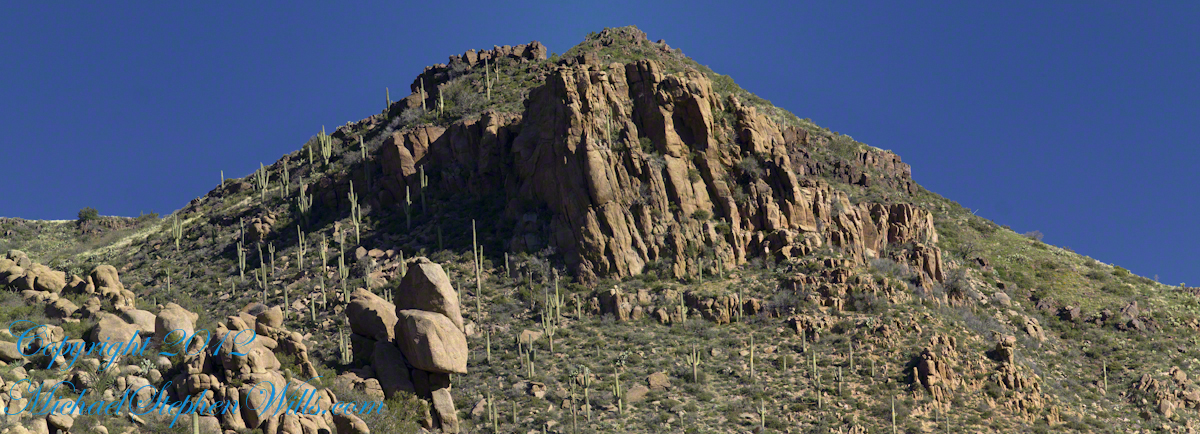
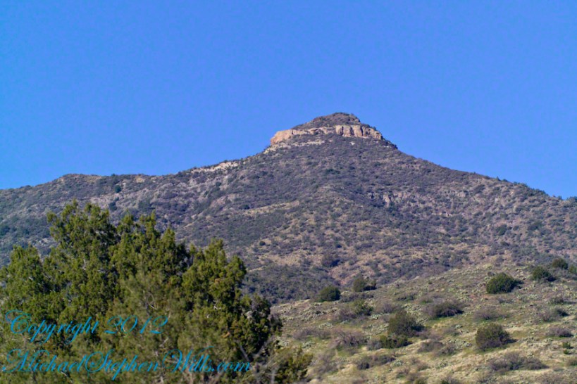
Shadows rising on the canyon walls are from Lime Mountain and Castle Dome. In the far canyon, below Two Bar Mountain, is a shadow from the notable cliff and prominence to the right, that rises above Reavis Falls, fall below and out of sight in the canyon.
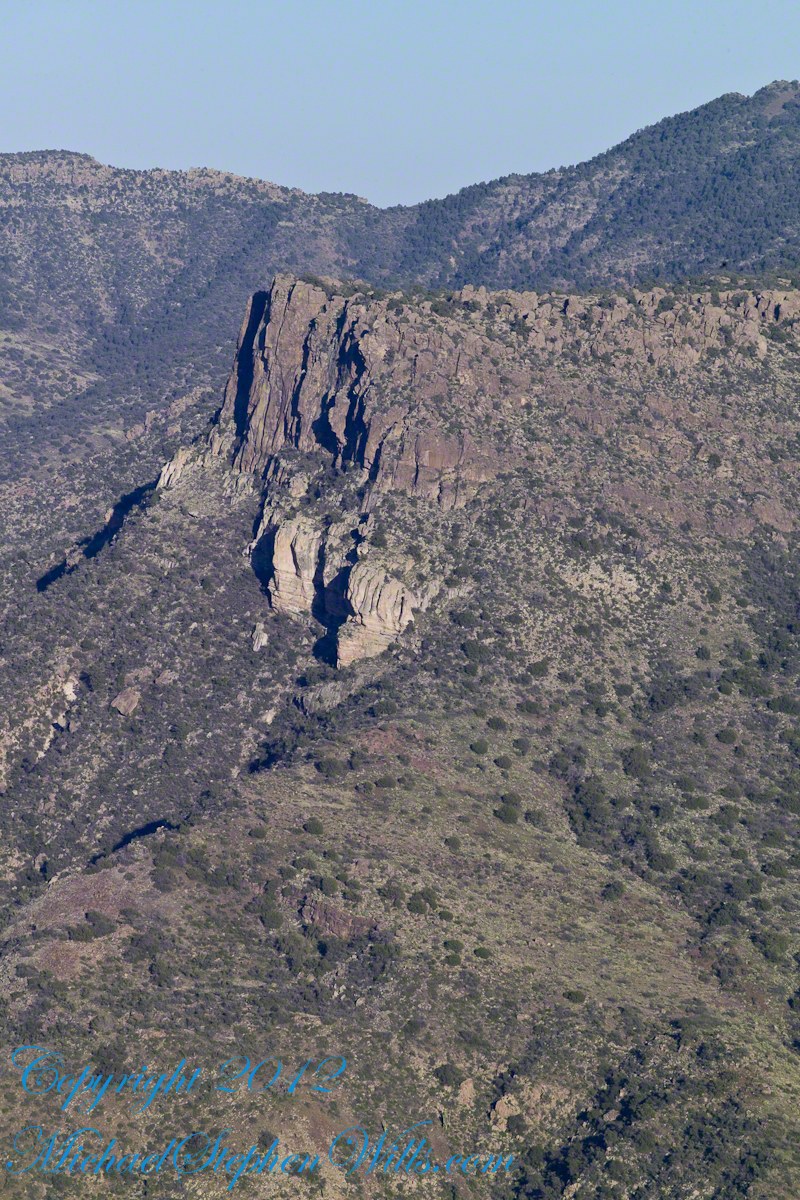
Here is that prominence from that same day, late afternoon when the sun is just starting to be low enough to throw the cliff into relief. This is a single shot with a canon 200 mm lens. This day I had climbed out of Reavis Creek, up to to this point on the slopes of Lime Mountain. Here I enjoyed an afternoon, evening, night and early morning of the following day.
The second day of the solo expedition, I hiked into the canyon of Reavis Falls from a camp at the canyon mouth. Looking up from the creek this same cliff was prominant against the sky.
Copyright 2023 Michael Stephen Wills All Rights Reserved
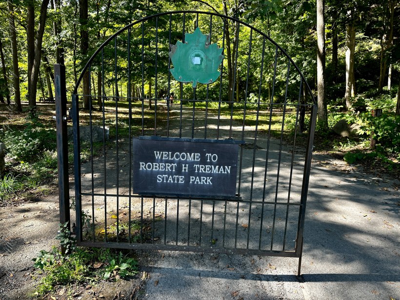
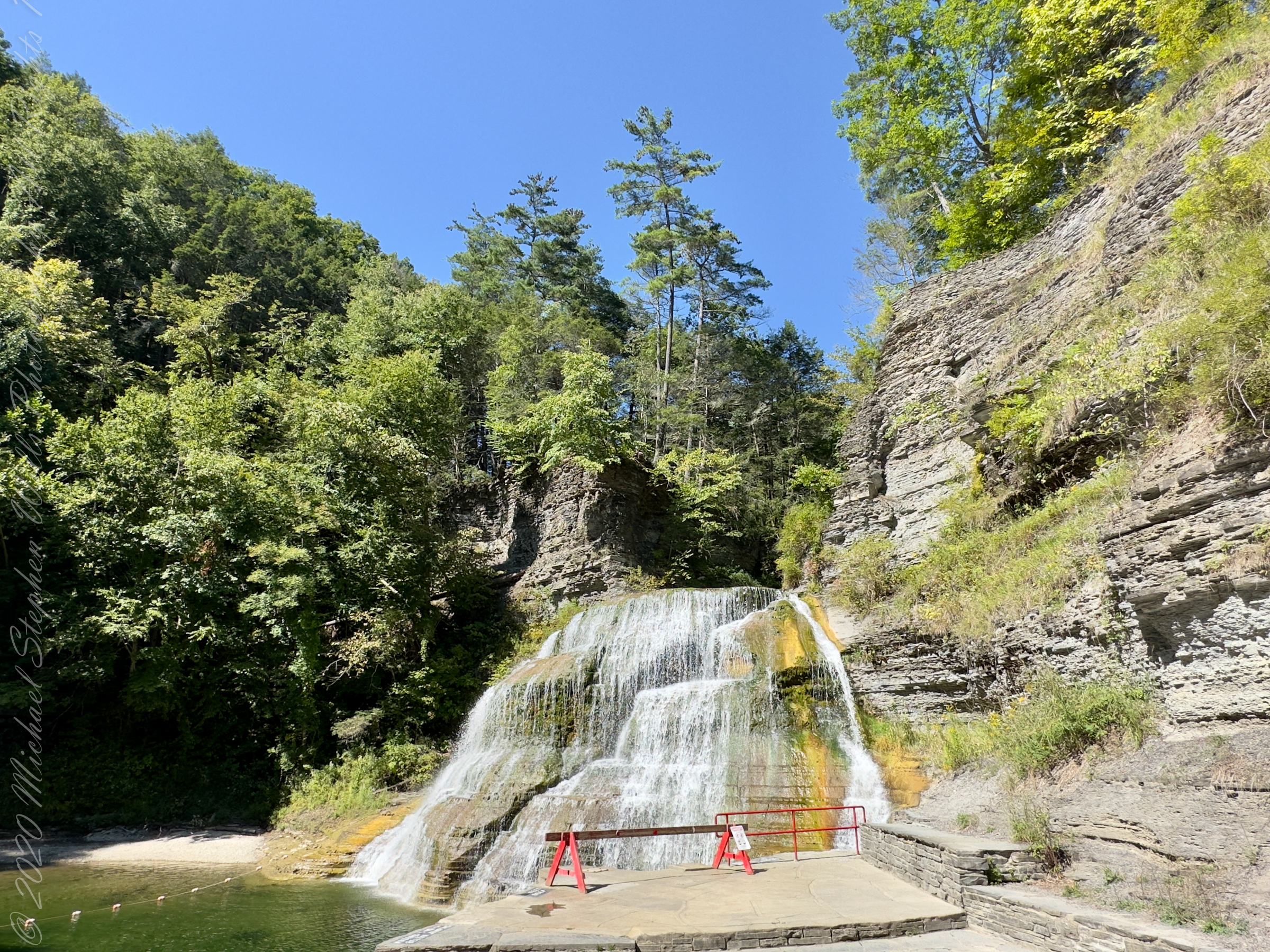
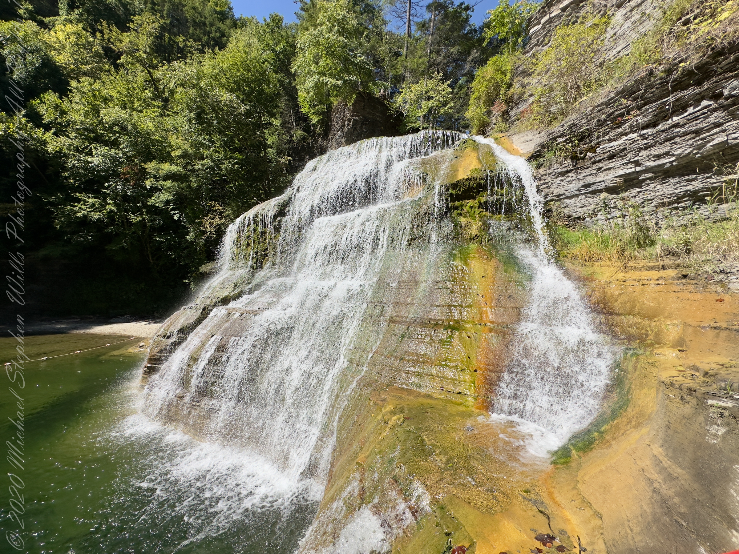
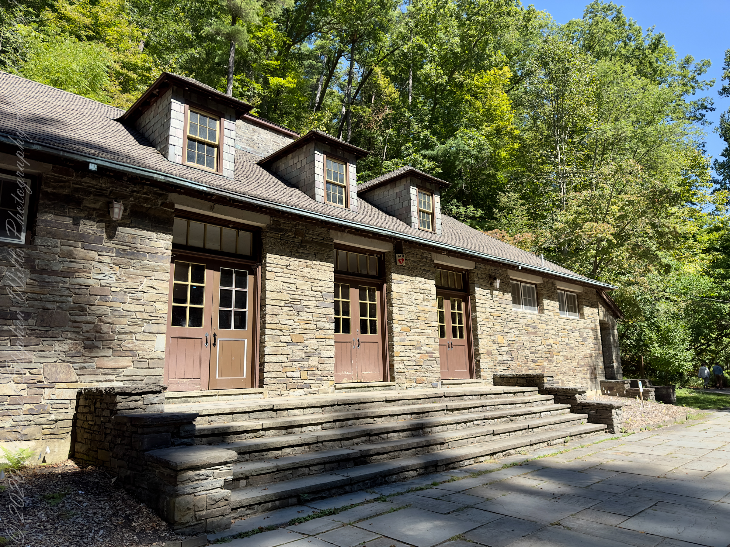
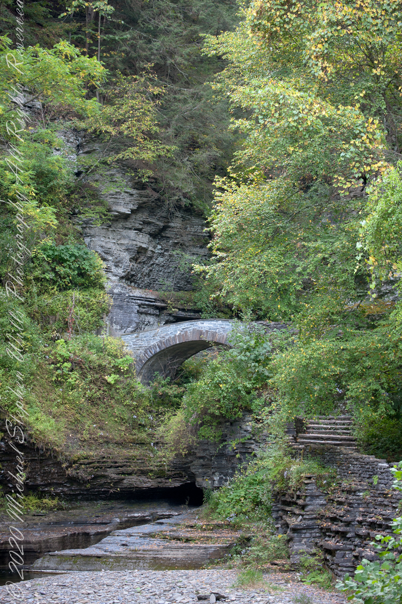
Looking back after crossing the Gallery Footbridge we are rewarded with this view, providing a better understanding of the site. It is evening on a mid-September evening, Robert H. Treman Park, Ithaca, Tompkins County, New York Copyright 2023 All Rights Reserved Michael Stephen Wills
Here we are on the Gorge Trail of Treman State Park. My readers have seen this marvelous stone bridge from a distance. Here it is on the west side, facing east/northeast and looking down into the gorge. It is evening on a mid-September evening, Robert H. Treman Park, Ithaca, Tompkins County, New York Copyright 2023 […]
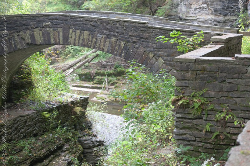
Here we are on the Gorge Trail of Treman State Park. My readers have seen this marvelous stone bridge from a distance. Here it is on the west side, facing east/northeast and looking down into the gorge.
Spanning the eastern side of the gallery entrance of the gorge.
It is evening on a mid-September evening, Robert H. Treman Park, Ithaca, Tompkins County, New York
Copyright 2023 All Rights Reserved Michael Stephen Wills