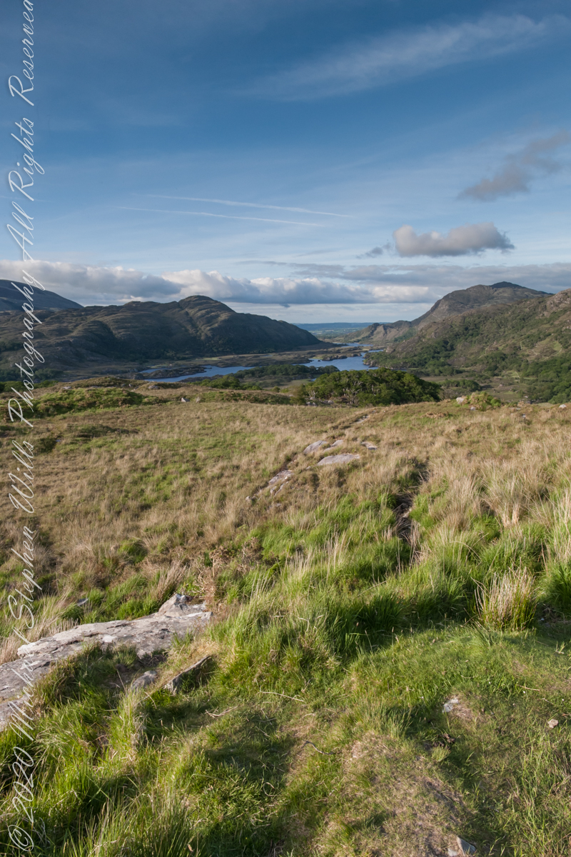
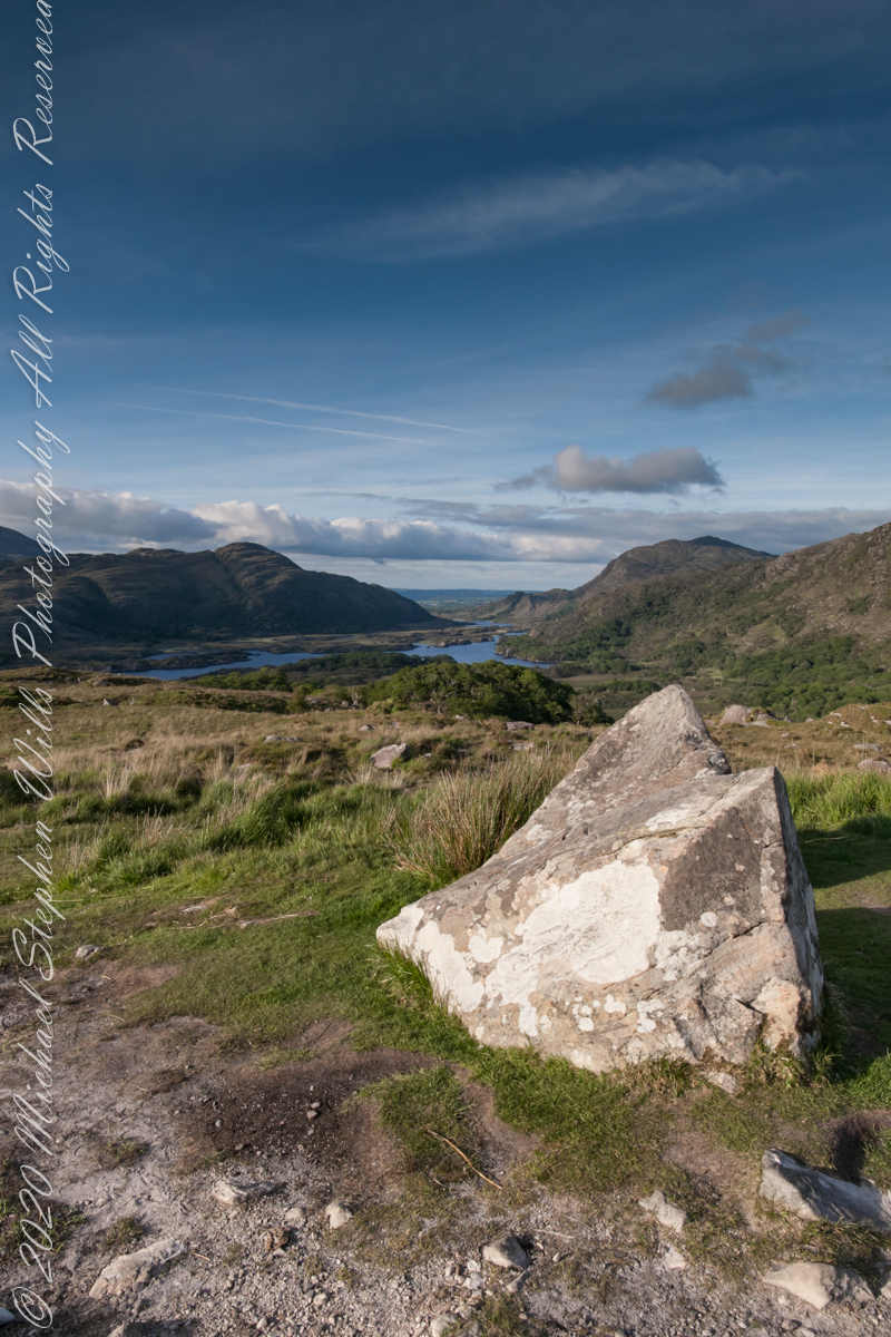
Here we are, on the road from Kenmare to Killarney, N71, part of the Ring of Kerry around the Iveragh Peninsula. The view was celebrated by Queen Victoria’s Ladies-in-Waiting during an 1861 tour of Ireland
Click pic for larger view in a new browser tab. If you are in WordPress Reader, open the post to use this feature.
Ladies View, Killarney National Park, Derrycunihy Townland, County Kerry, Republic of Ireland.
Copyright 2021 Michael Stephen Wills All Rights Reserved
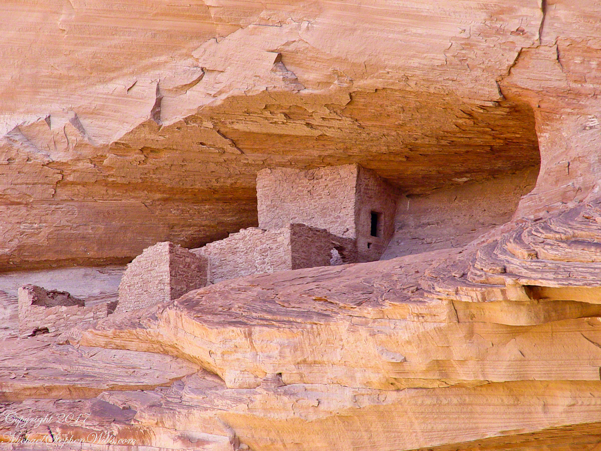
Canyon de Chelly, on the map, is shaped like a Y or a chromosome. A chromosome as the walls of the canyon carry the heritage of the people who made this place their home over millennia. A Y as in the letter ship, a foot and two arms.
6.2 miles from the canyon mouth, where the road ends at Chinle, above the branch, on the north cliff, is this photogenic ruin, called the Ledge Ruin. In my previous posting, this ruin forms the backdrop of Peter Tsosie’s portrait. Peter is the header image of this posting.
Difficult to believe, seeing it for the first time.
Difficult to see, a tiny nook in an enormous cliff, the structures formed from the same rock as though what remained after the cliff fell away.
Difficult to comprehend life there, what drove them to this effort? Fear, certainly, concern for their safety and security.
We know it by our name. Their name included the word “home.”
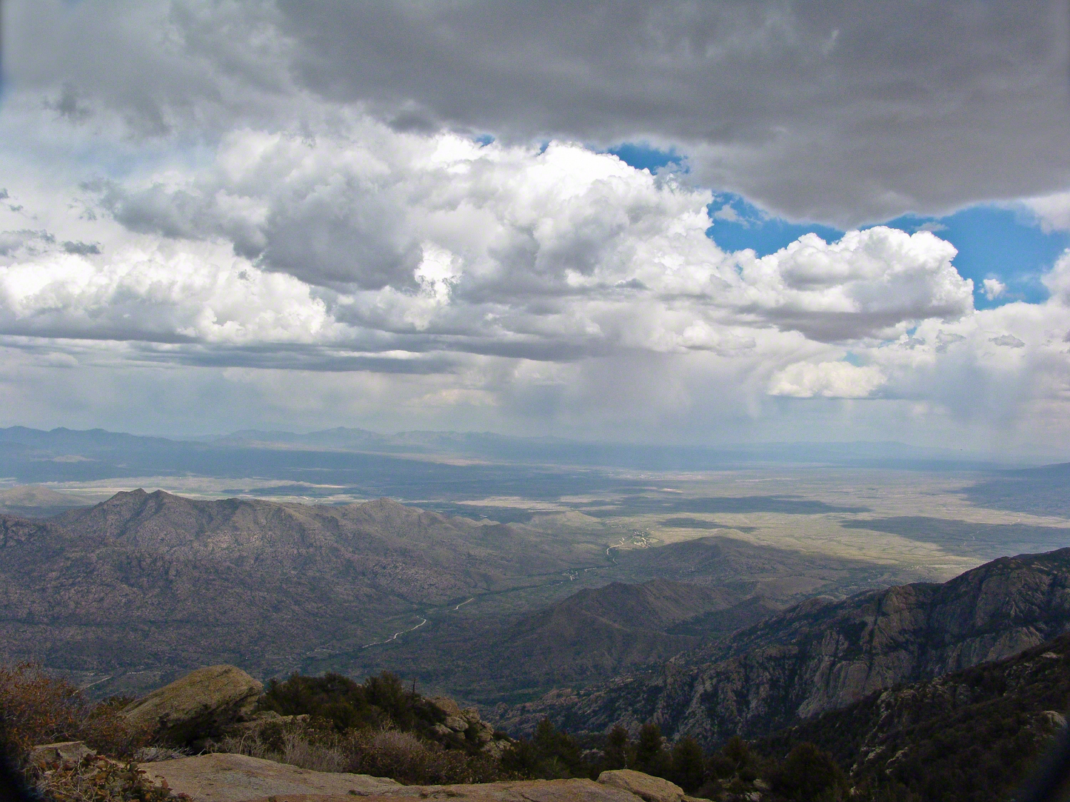
The Rincons are one of 42 Sky Mountain islands isolated from each other by the gradual warming and drying climate changes since the last ice age, 10,000 years ago. While this marvelous environment of oak and pine forests only accessible with much effort on foot, it is literally visible from every point of the Tucson valley and million human inhabitants.
Rincon is Spanish for corner, the mountains are called that from their shape enclosing a space on the west, northwest until recently used for ranching and is now falling into use for tract housing. The mountains themselves are reserved as wilderness, parts in the Saguaro National Park and the Coronado National Forest.
In the past 44 years I was lucky enough to visit the Rincon Wilderness interior three times, shouldering different style backpacks onto the mountain, walking different boots. The first, during college the 1970’s, a party of six left from the end of Speedway, up the Douglas Springs trail. The climb was an exercise in desert survival that several friendships did not survive, replace by new friends met on Mica Mountain. I have no photographs from that experience, only memories and the backpack.
Reconnecting with Arizona in 2004, thirty one years after that first experience, I took no chances. My first attempt on Rincon Peak was a success. Risk and effort were reduced, not eliminated by hiring a guide for the four day trip. We made it to Rincon Peak via the Turkey Creek Trail out of Happy Valley, climbing a mountain buttress, views ever widening and lengthening.
These are some photographs from that experience and a landscape photograph of the peak at sunset, taken the following year.
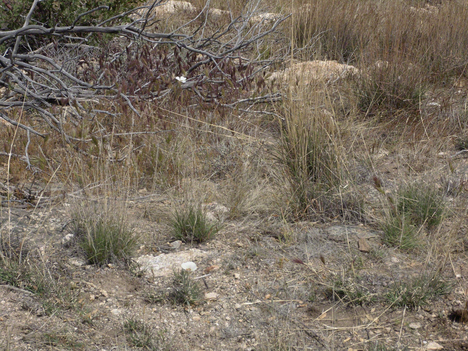
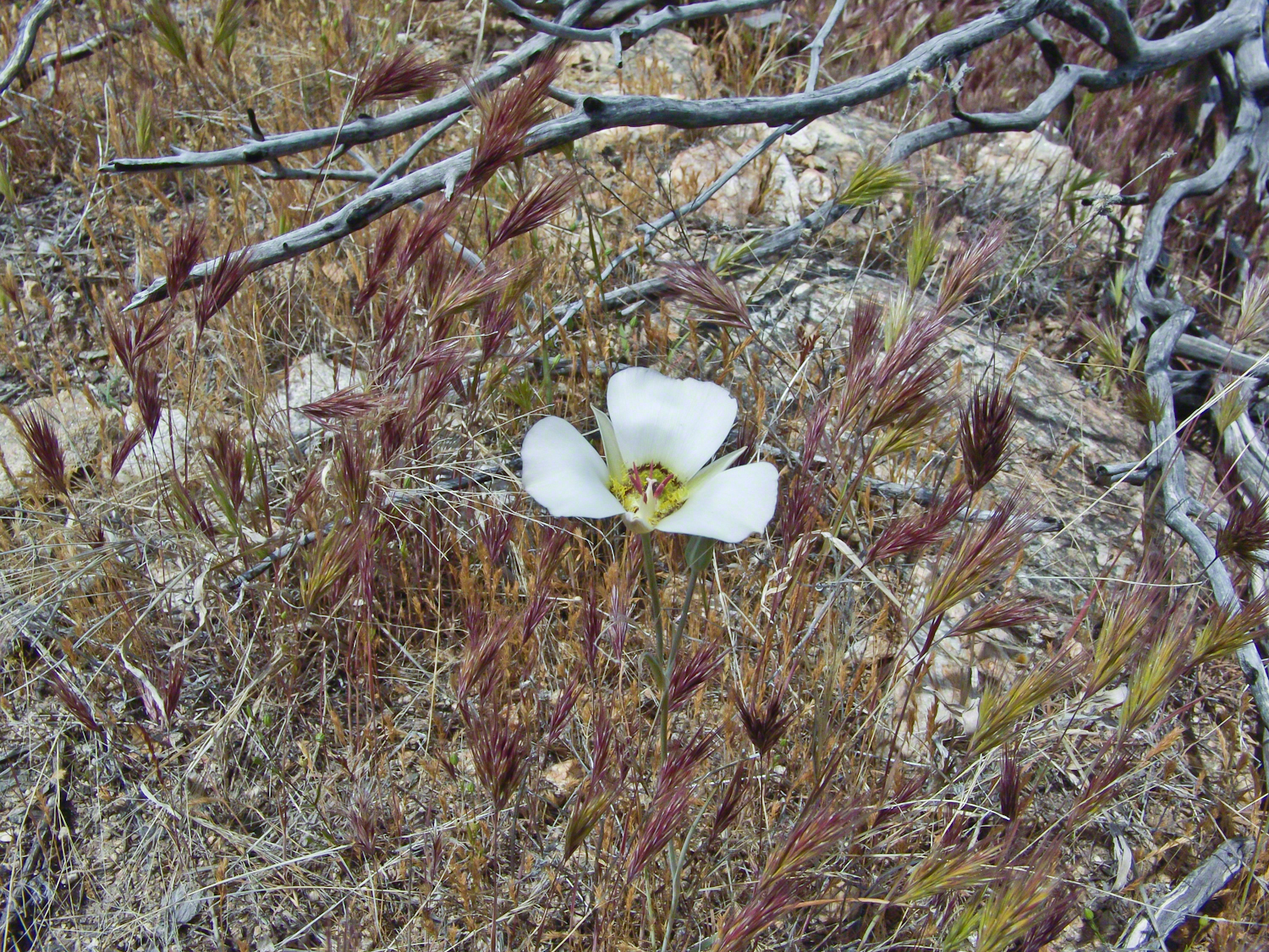
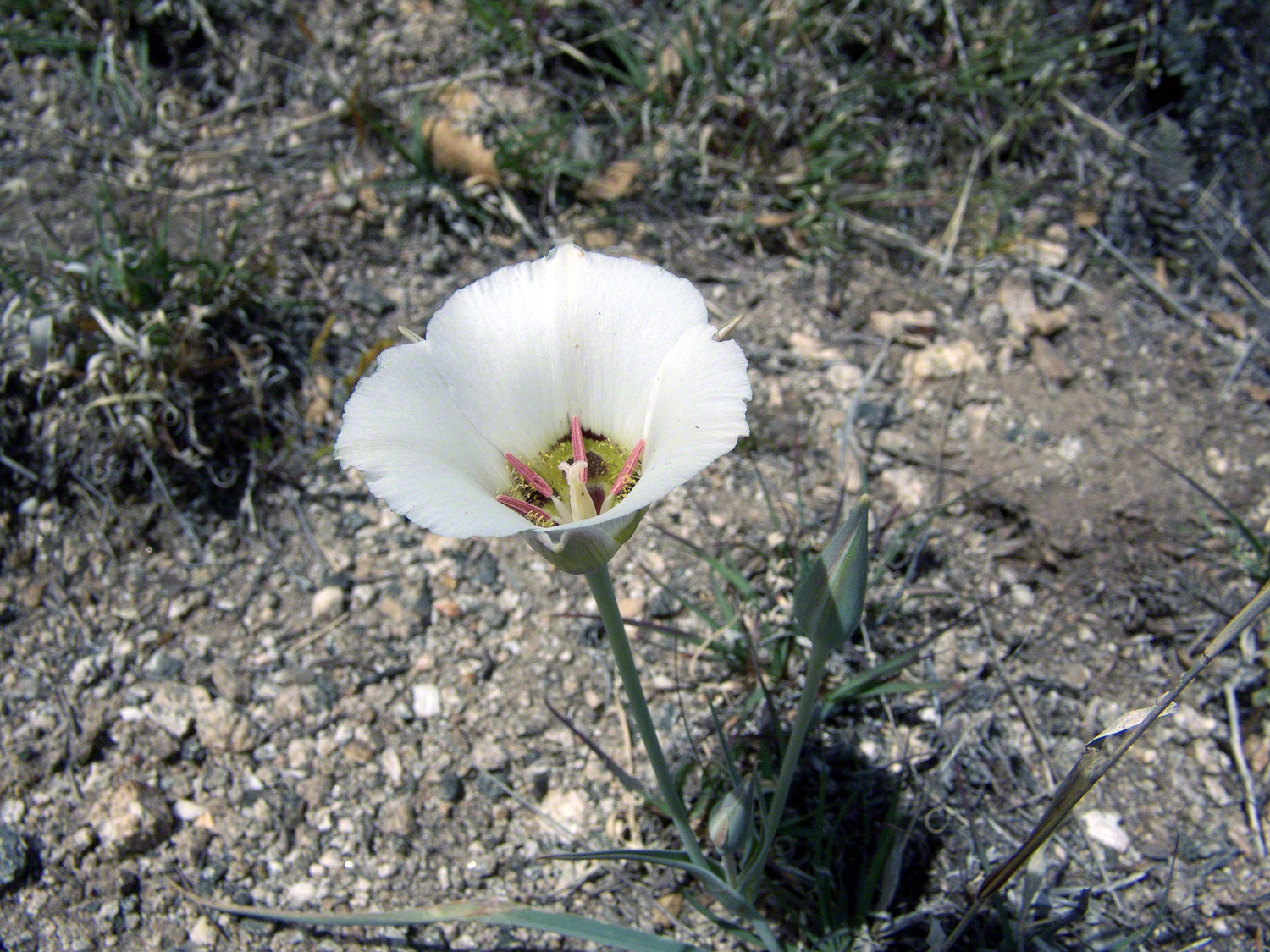
Sego Lilies bloom among a stricken oak and drying grasses on the Turkey Creek trail. This is an overview of the environment, it is the winter rains that trigger the bloom.
We paused while I unpacked my gear to capture Sego Lilies growing along the Turkey Creek Trail.
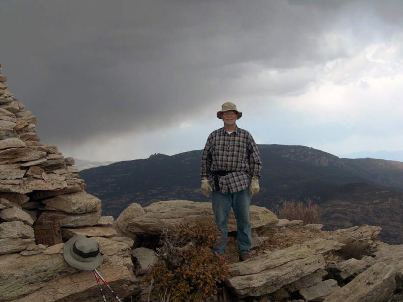
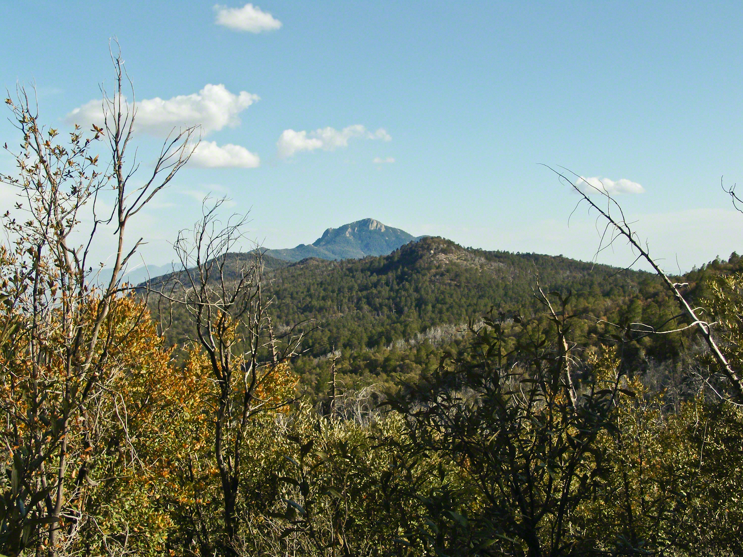
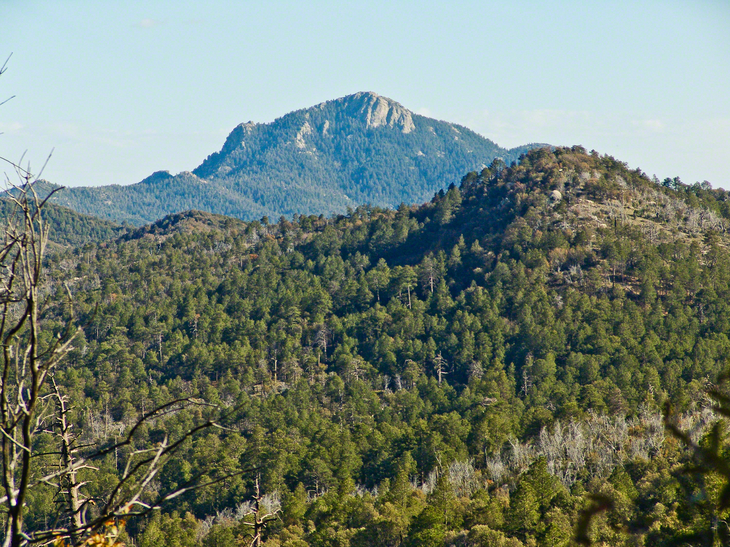
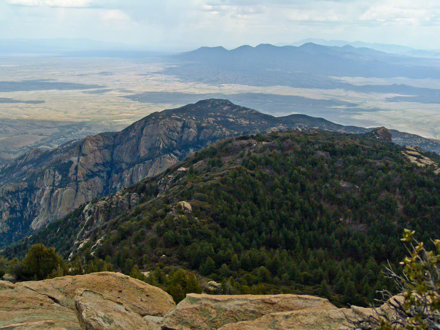
Deer Head Spring, at the top of Turkey Creek Trail was a moist spot with no accessible water when we reached it April 27, 2004. With the remains of a gallon of water each we needed to press ahead to Heartbreak Ridge and climb into Happy Valley Saddle were, thankfully, the creek was low and full of algae but usable. Here are my first views of Rincon Peak, looking across the aptly named Heartbreak Ridge and Happy Valley Saddle.
The view to south from Rincon Peak. The white rocks at lower right forms a Valley of the Moon wall. San Pedro River valley at the root, Mae West Peaks at left margin, Dragoon Mountains with Cochise Stronghold center. Taken around 12:30 on April 28, 2004 as a thunderstorm approached.
The Rincon Peak view looking south, southwest over the Valley of the Moon to the eastern Tucson Valley and the Sky Islands the Whetstone Mountains (Apache Peak), behind are the Santa Ritas. The works of man are overpowered by sky, rock, distance.
We made a hasty departure in front of the thunderstorm. It was a touch and go decision to attempt the peak that day, we made it with moments to spare.
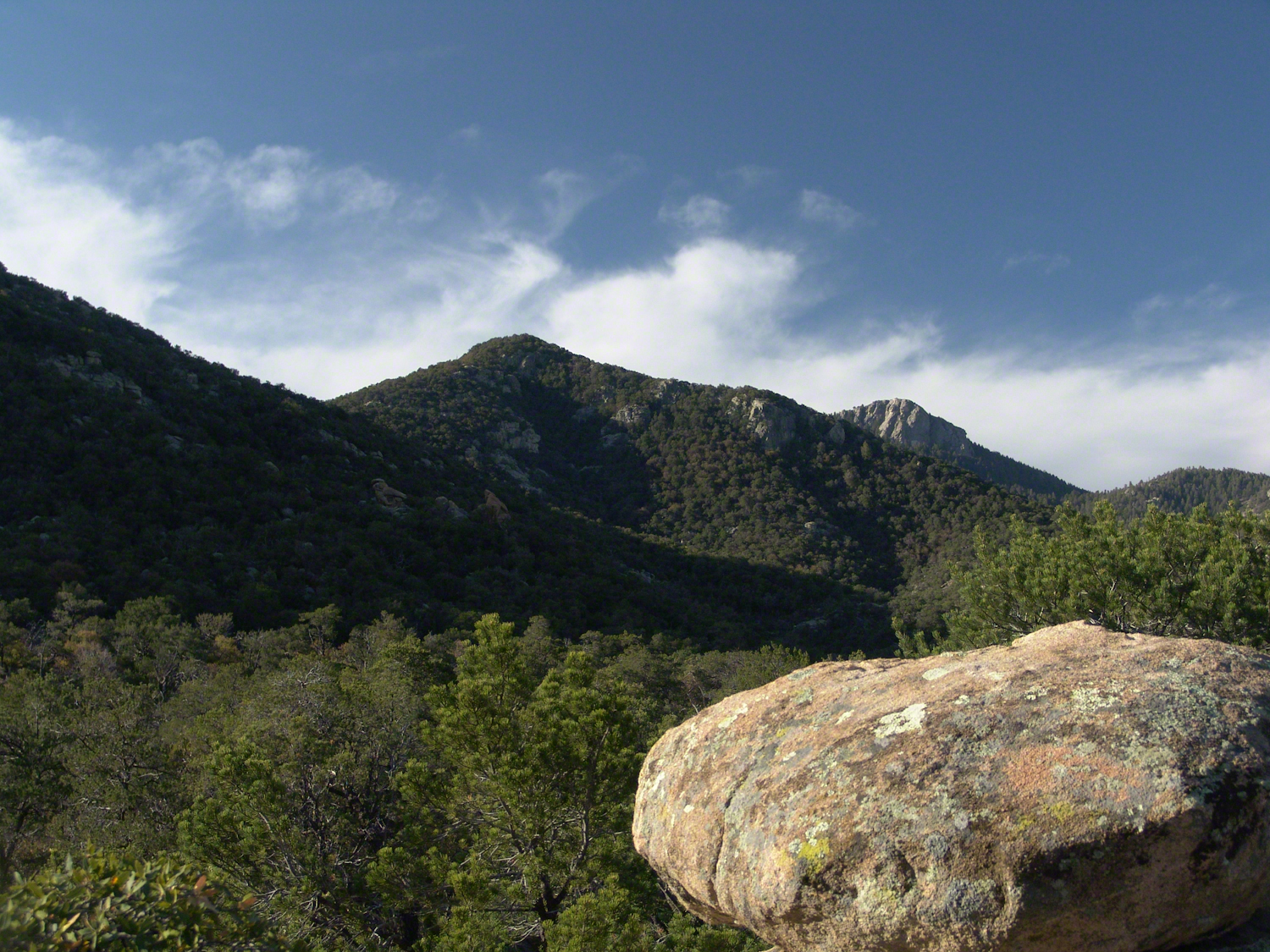
April 29, 2004 the morning after reaching Rincon Peak I set up the tripod near our Happy Valley Saddle camp to capture Rincon Peak in early morning sunlight.
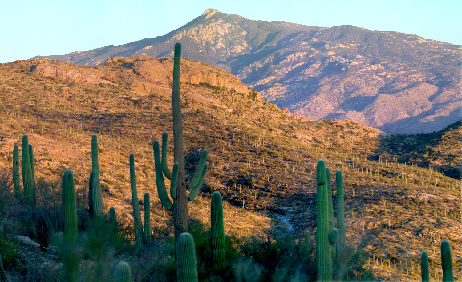
The day we descended to the X9 Ranch via the Rincon Creek trail. My guide’s grandfather had a homestead at the X9 and his access to the trailhead through private lands opened this route for us. This is a photograph of sunset on Rincon Peak from the X9 ranch. I am looking east from the Rincon (Spanish for corner) made by the massifs Rincon Peak, Mica Mountain and Tanque Verde ridge.
The evening of November 2, 2006 I climbed the Saguaro National Park, East, Tanque Verde trail for about 30 minutes to reach this view of Rincon Peak and waited until just before the sun set behind the Tucson Mountains for this shot. Then hiked back to the car in twilight. In my hurry, I tripped on a stepped turn and dove headfirst into a large prickly pear. It was a very painful experience and I regretted damaging the cactus and the loss of and good hiking shirt. There were large spines in my face and tiny, pesky spines covered my chest and back. The large spines are not barbed and come right out. I needed to visit a physician to remove them.
Copyright 2021 Michael Stephen Wills All Rights Reserved
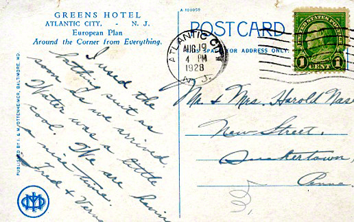
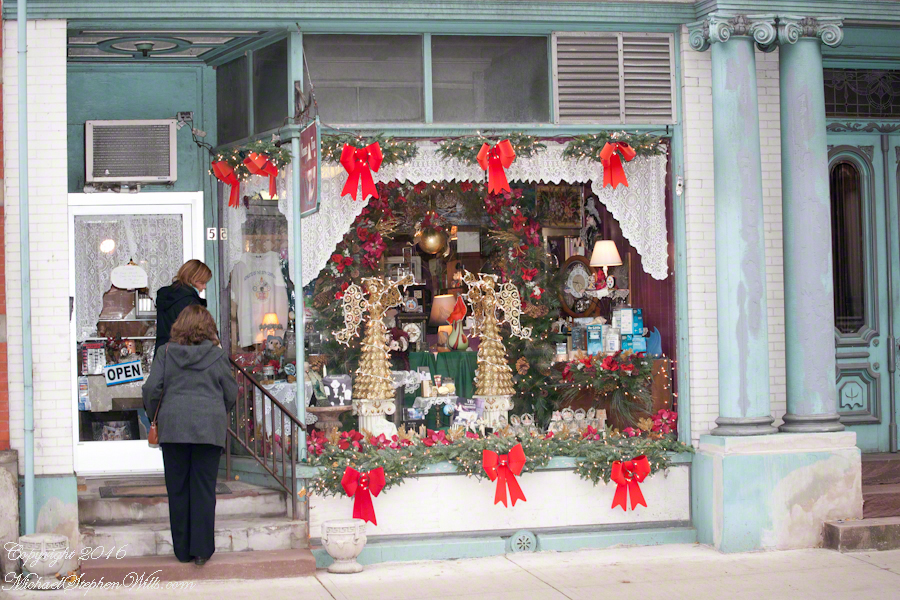
Our Black Friday visit to Jim Thorpe included shopping along Broadway. One marvelous shop at 61 Broadway, The Vintagerie, offered a small bin of antique post cards. Vaguely curious, I picked up a pile. Many were unused. A few, like the two below, travelled the US Mail, included post marks, postage and communications.
Please click any of the following images to visit a work from my online gallery. Hover your mouse over each image for more information.
Verna’s slanted and precise cursive, the message carefully planned to fit available space, demonstrate her to be stylish. The bathing suit was purchased for the trip. Before leaving, Verna shared the purchase with her acquaintance, Mrs. Nace (misspelled Nase).
Fourteen months after their vacation, the Stock Market Crashed, October 1929, leading to The Great Depression. How were Fred and Verna affected? Were there Atlantic City vacations?
The next card was purchased and sent from Allentown. It is unlikely Sara was on vacation, was it purchased during a rare trip to the city?
I know Verna misspelled Nace because, ten years into the great depression, Mrs. Nace, Emma, received this postcard from Sara. The postage is still 1 cent. Emma has moved to a new address. The message is more significant, written in a hurried hand by Sara, who concludes with love.
Emma Nace kept these cards as treasured possessions and memories until, with her passing, they were acquired, maybe in an estate sale, bundled together, transported 54 miles to 61 Broadway to be found by me, scanned (digitalized), and sent along in this blog.
Copyright 2021 Michael Stephen Wills All Rights Reserved
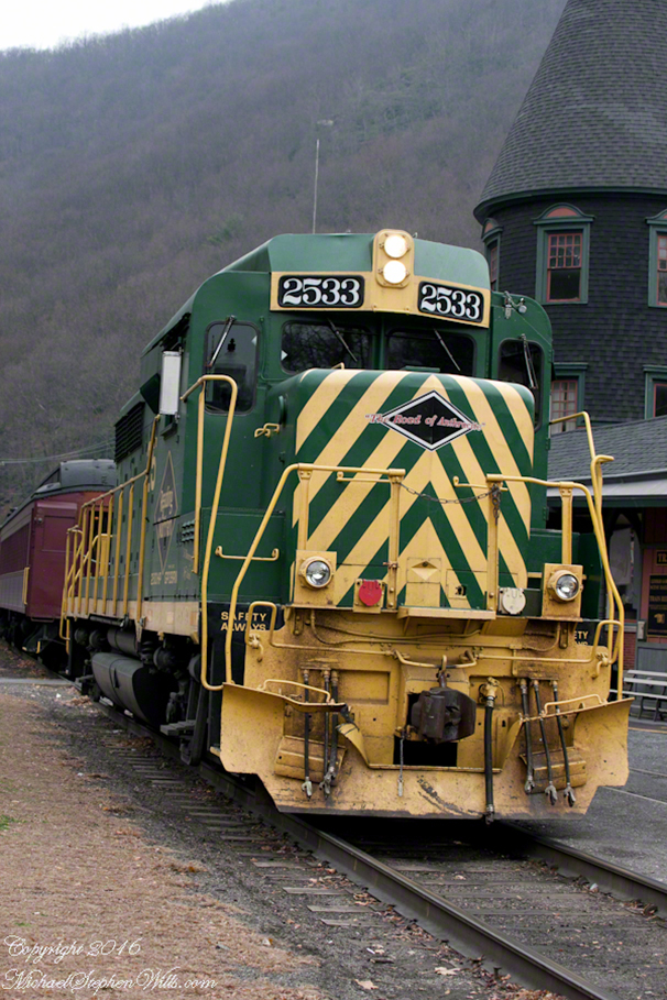
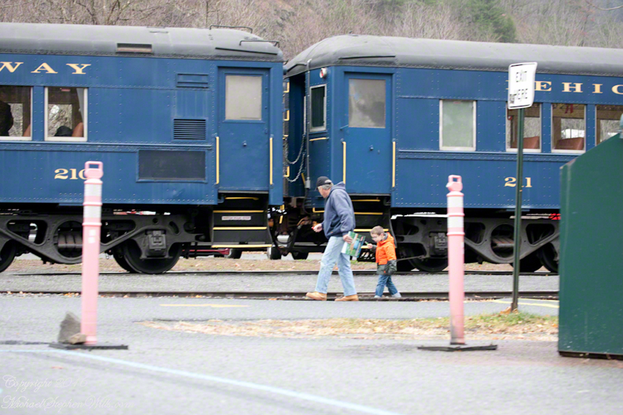
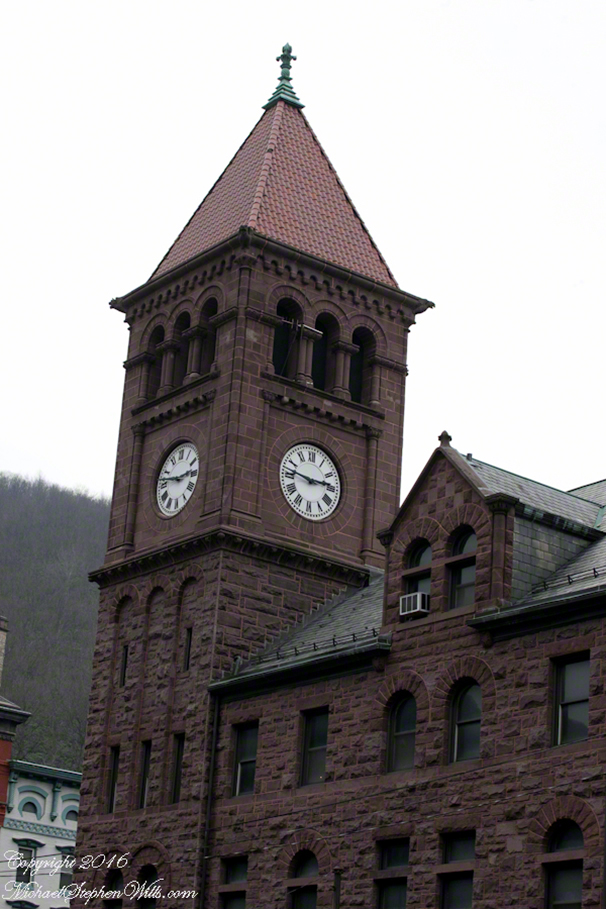
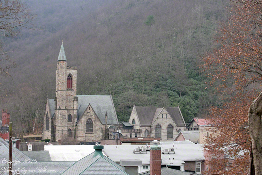
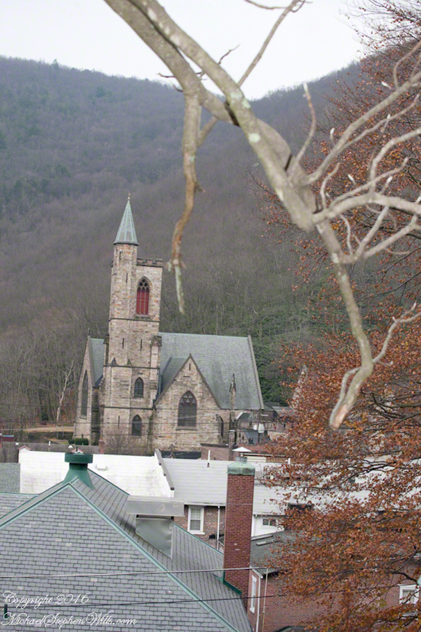
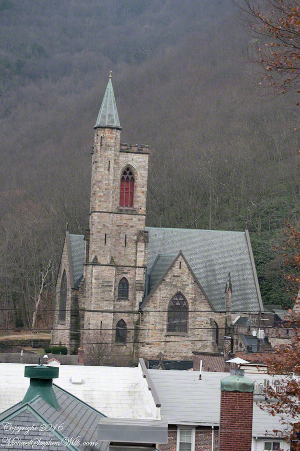
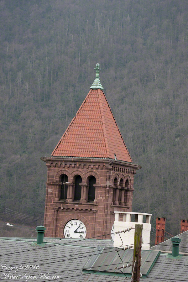
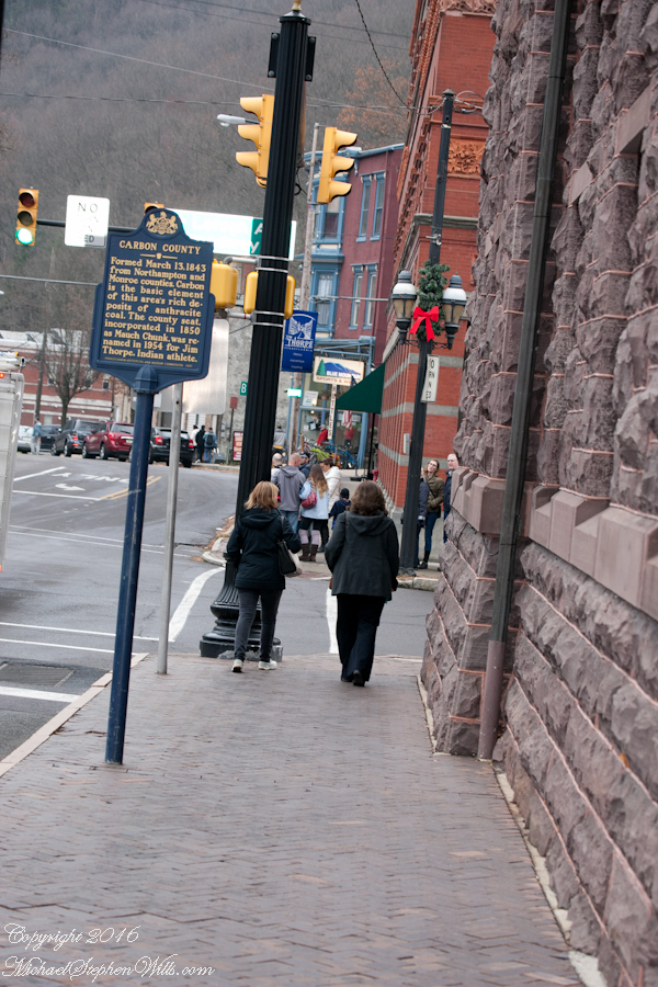
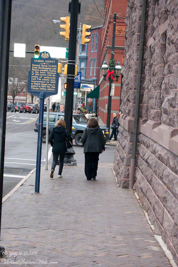
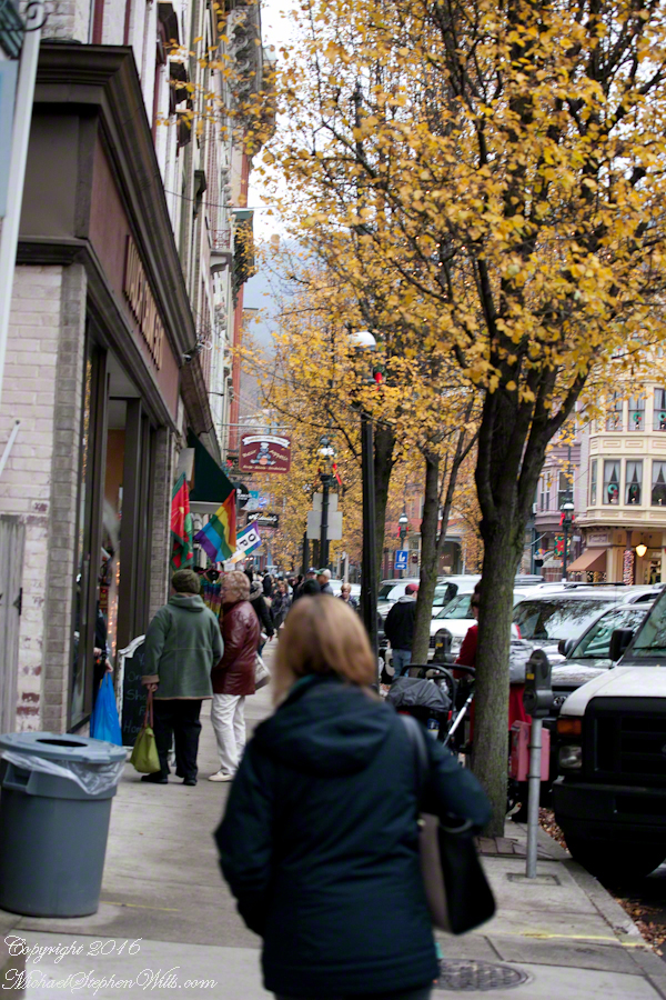
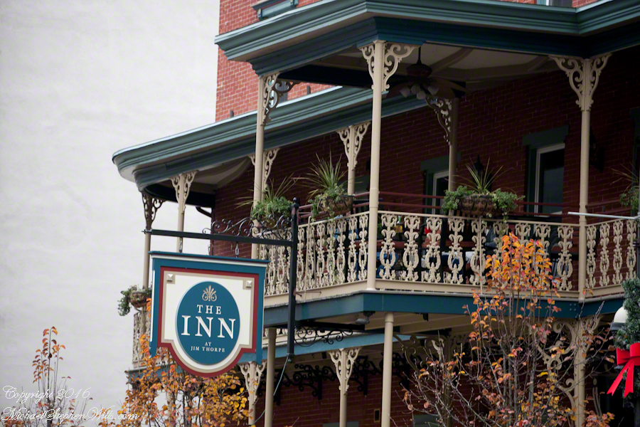
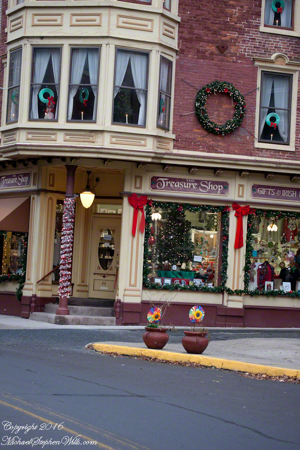
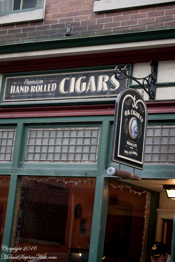
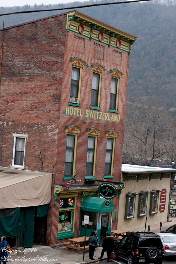
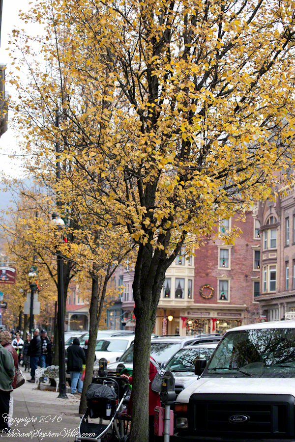
Presenting impressions of Jim Thorpe town on Black Friday 2016: unedited shots taken in late afternoon.
The best place to park is behind the train station, along the river. $5 for the day.
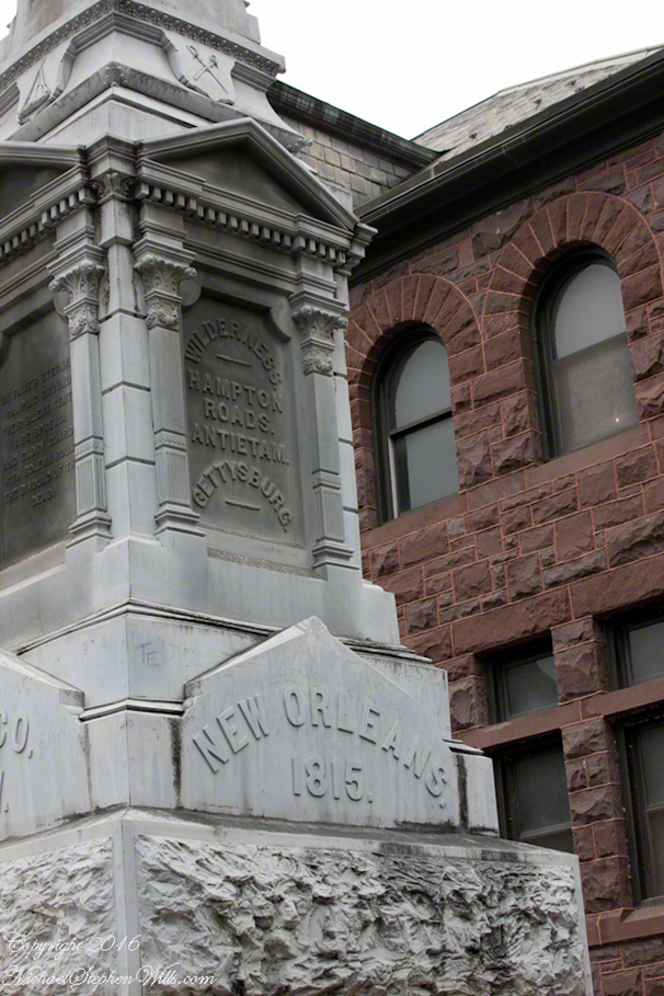
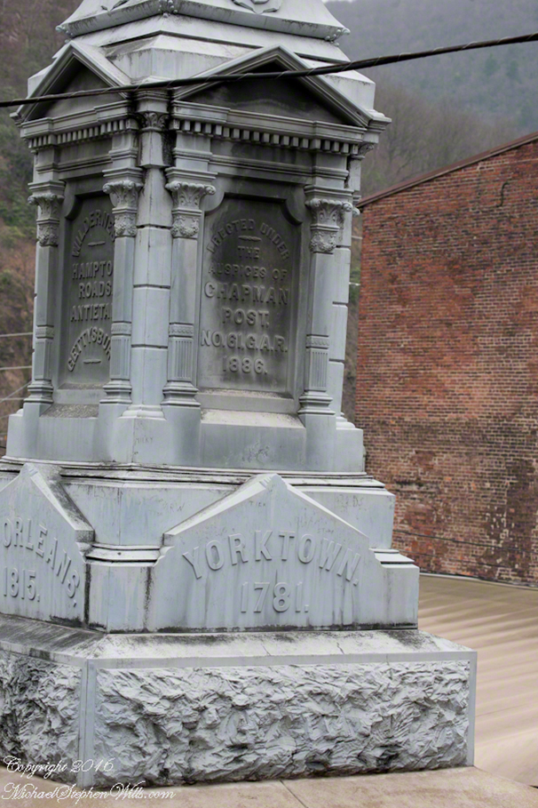
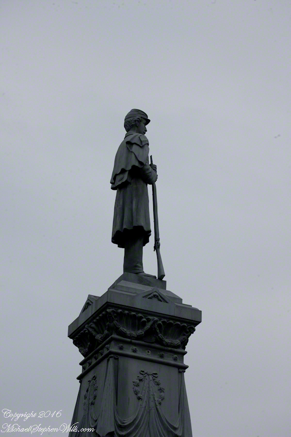
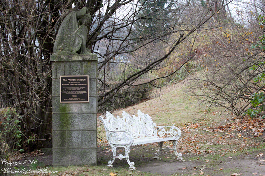
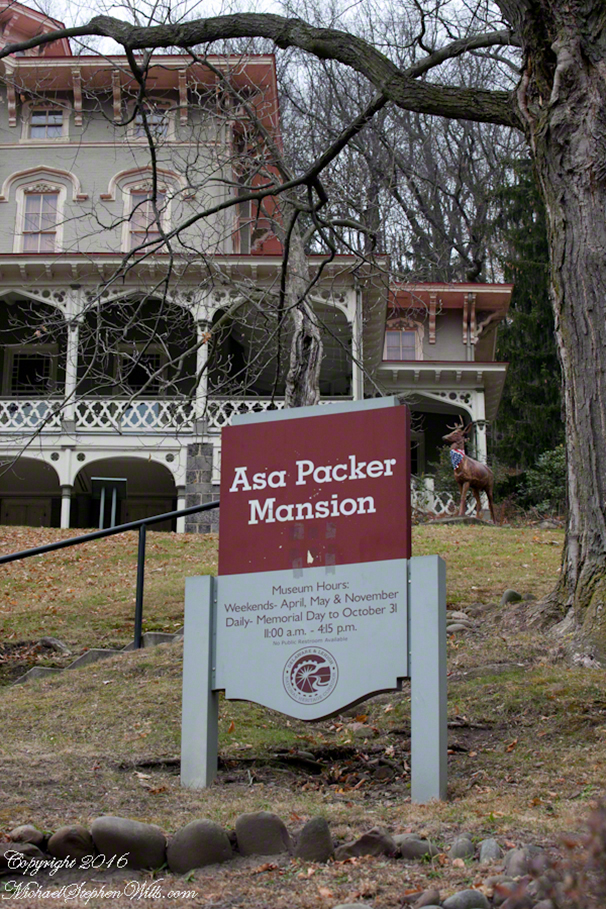
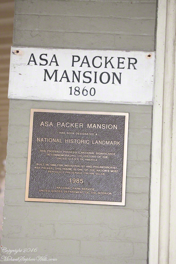
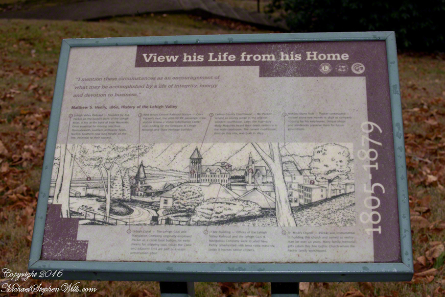
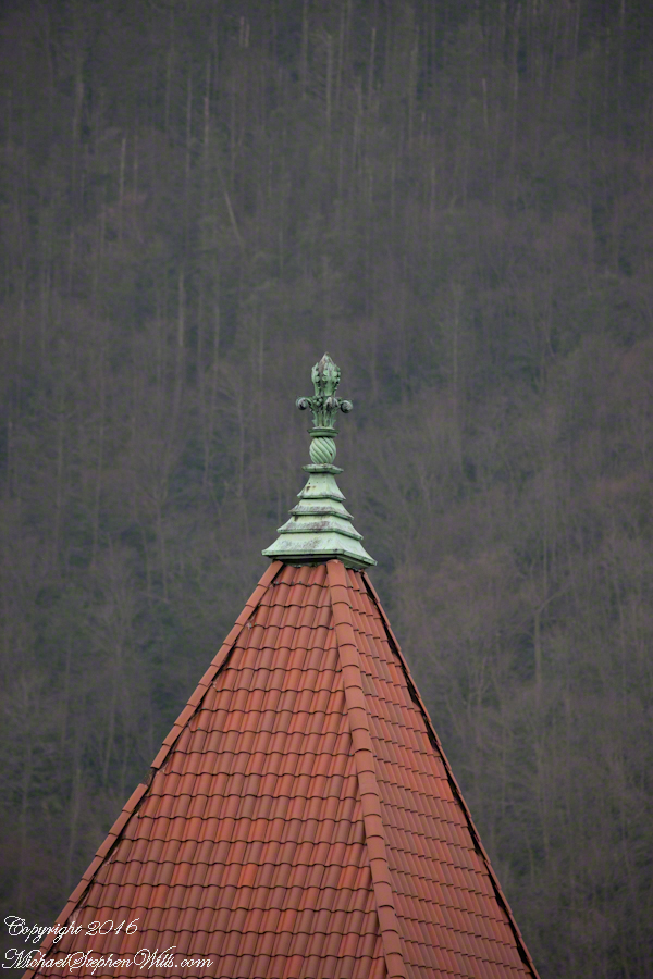
Hike up the hill to the Asa Packer Museum. The attraction is closed for the winter, but well worth the climb past the Civil War monument, so steep there are switchbacks.
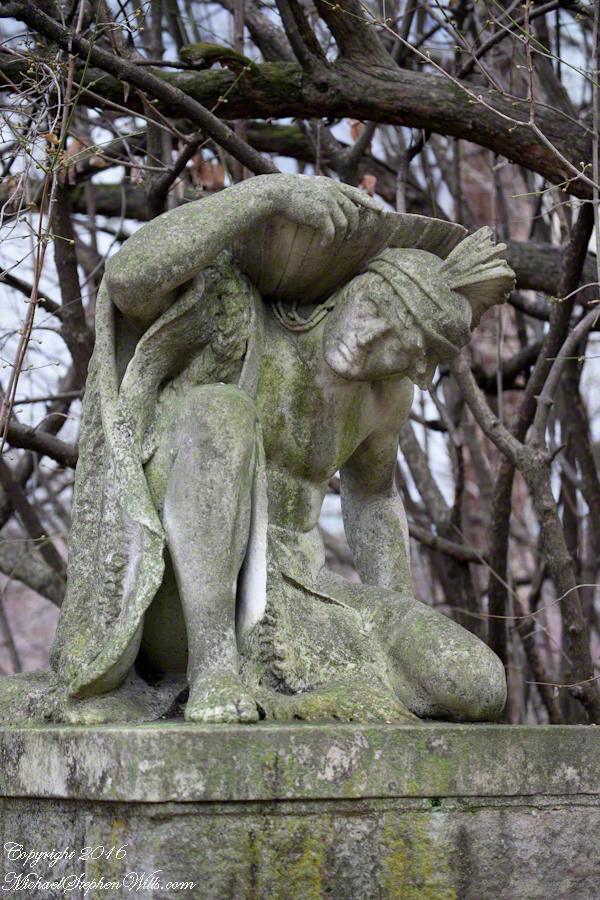
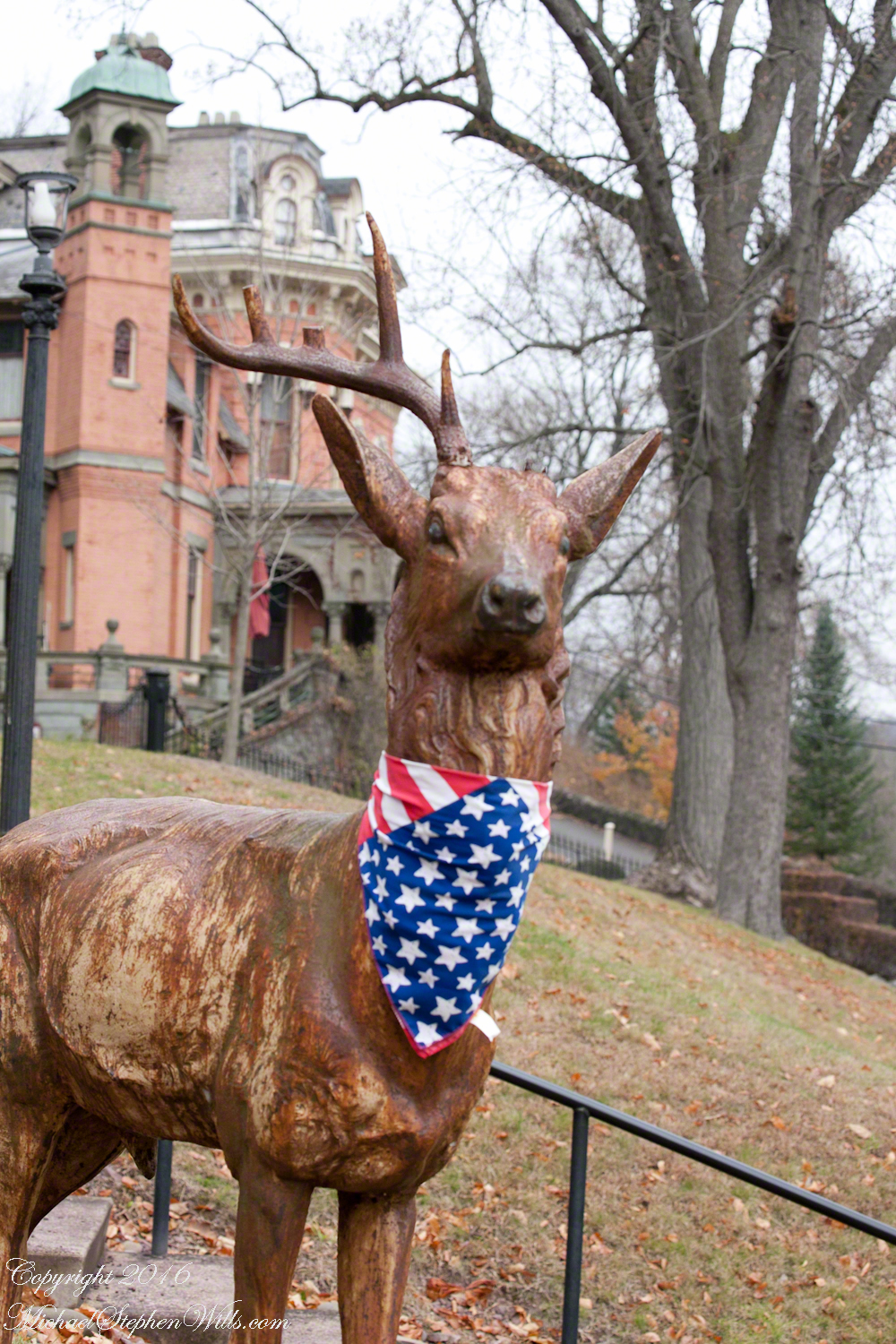
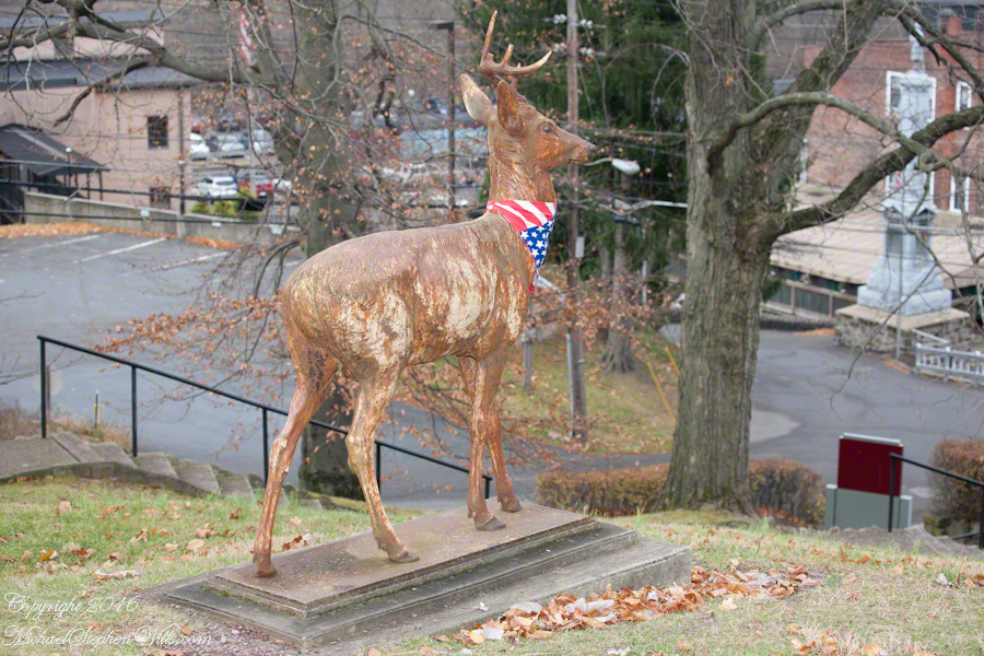
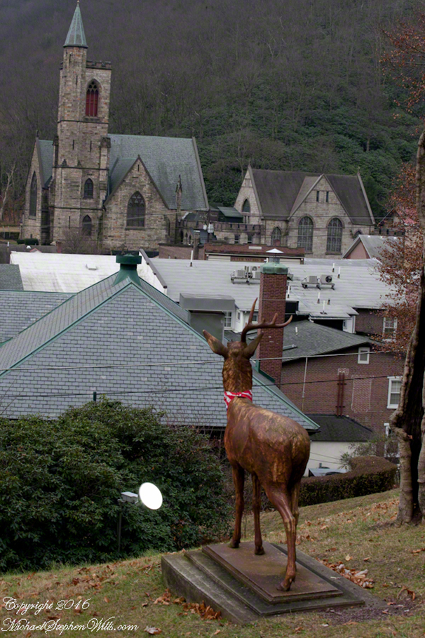
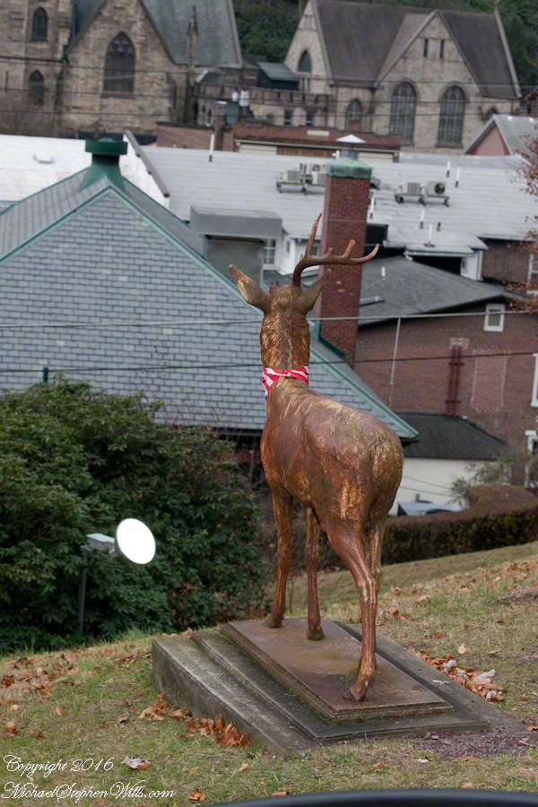
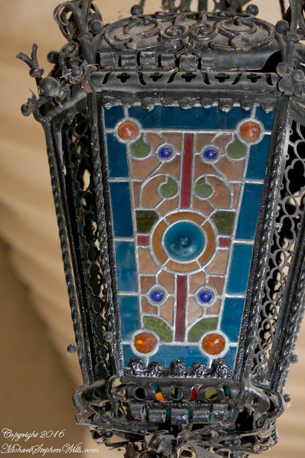
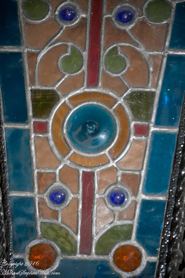
Even closed the site yields detail after detail, all interesting and worth learning more about. I was fascinated by the casted buck sculpture, can you tell? Placed to greet visitors, it demands your attention.
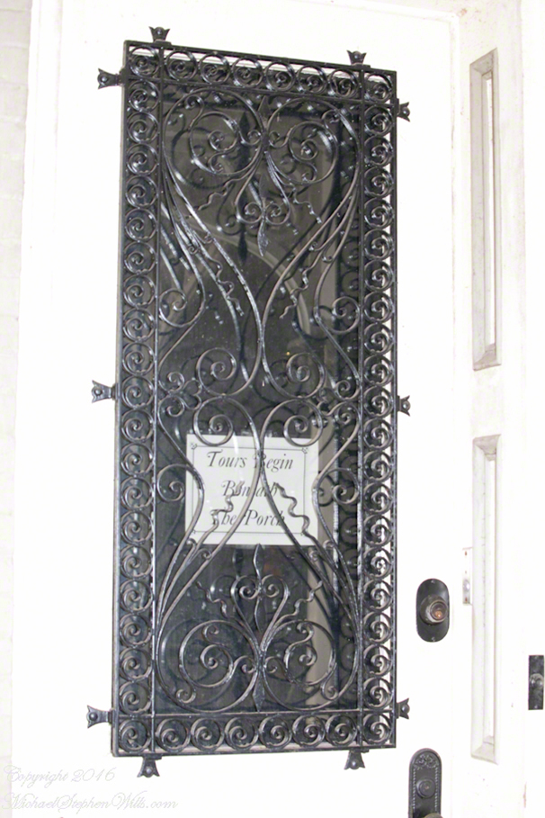
Climb some more to explore the porch…
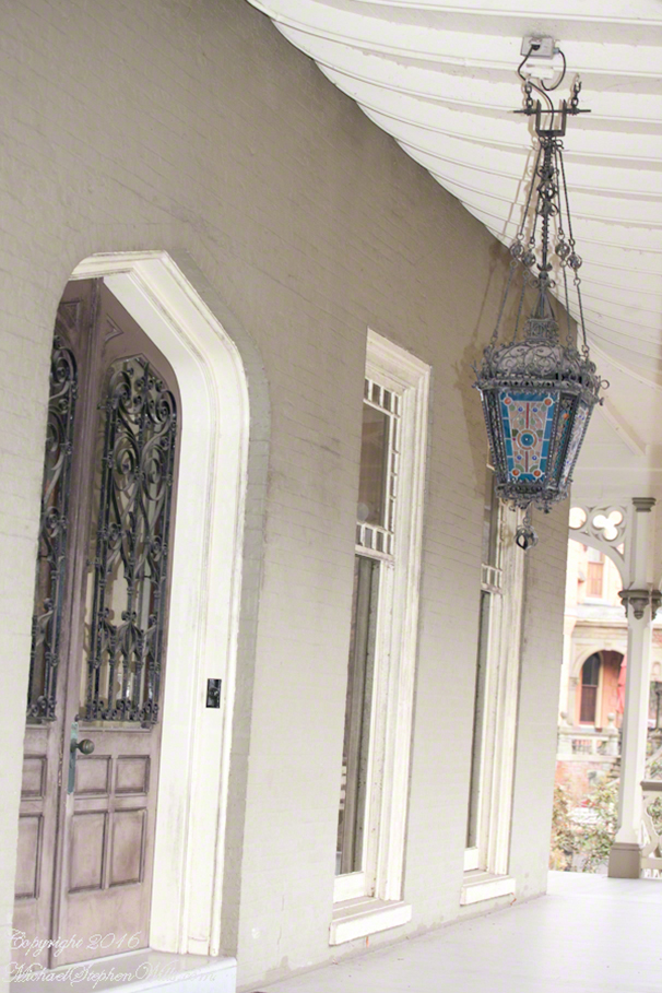
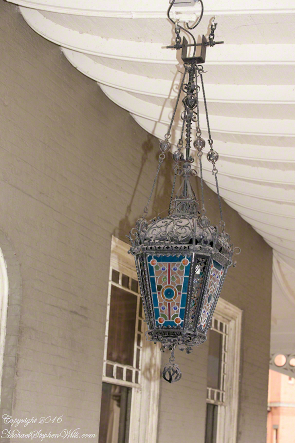
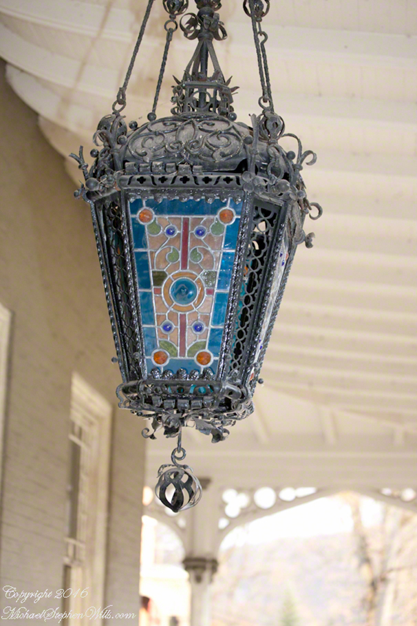
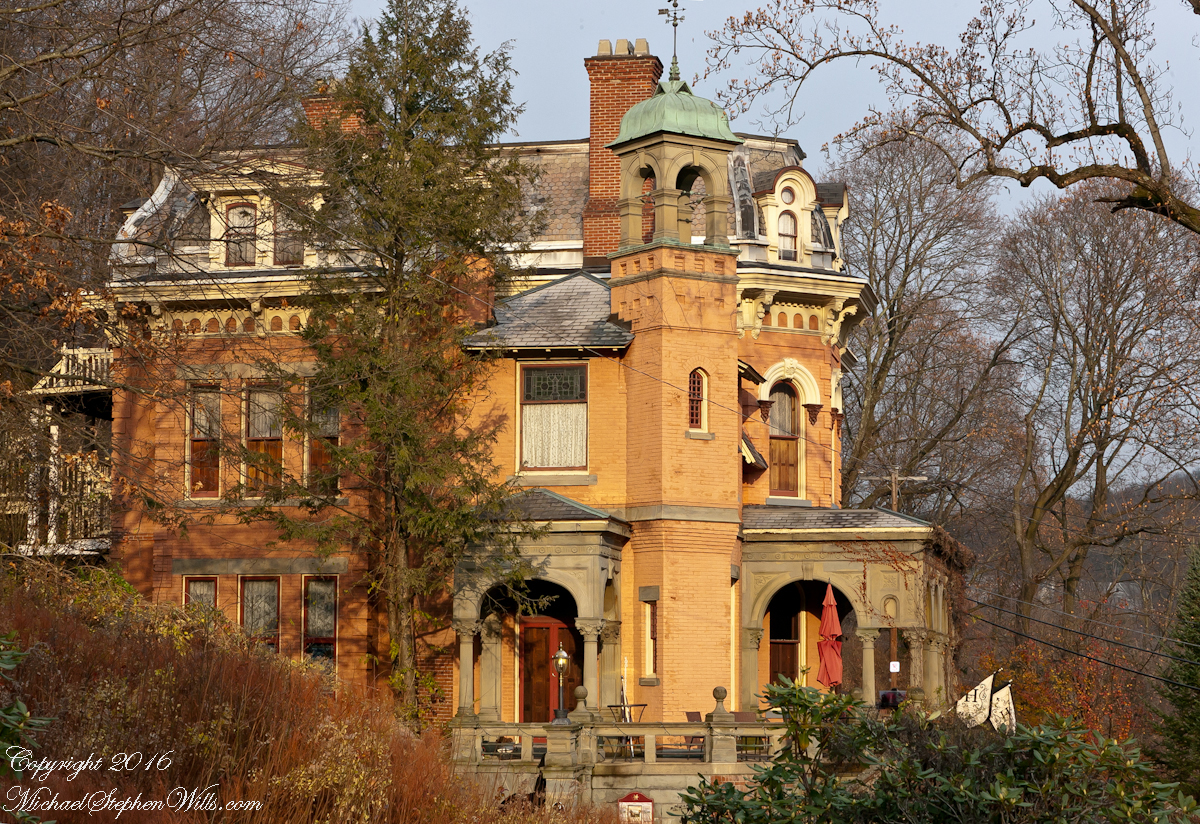
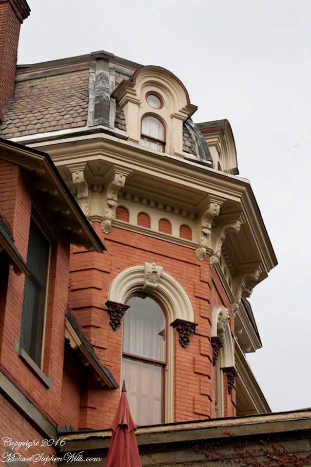
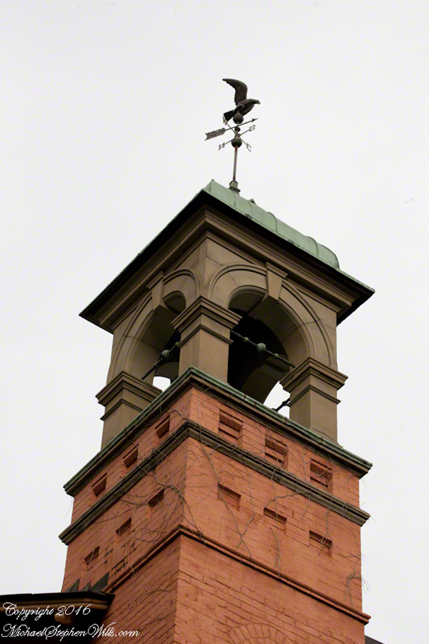
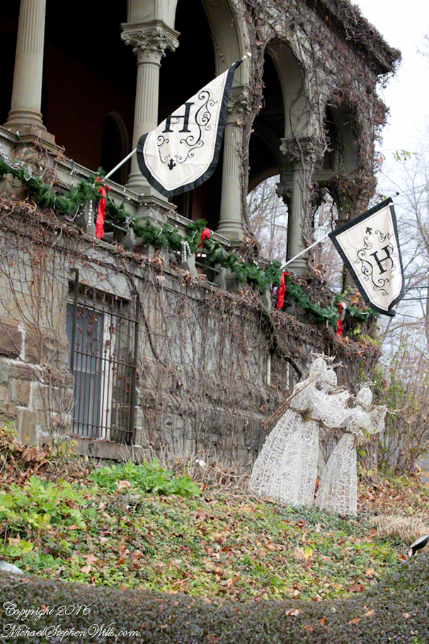
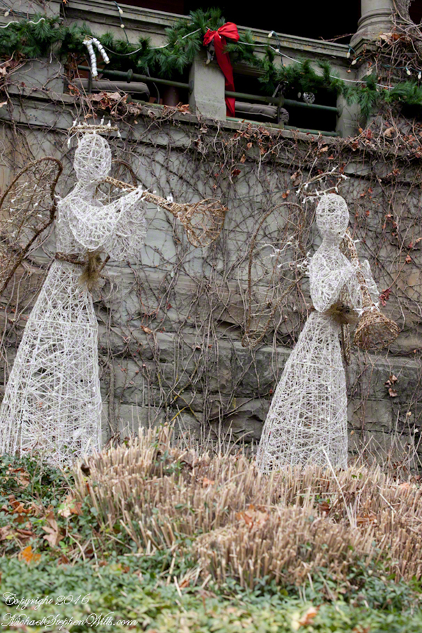
The sun makes an appearance, drawing attention to the other mansion of the site. Two brothers, and families, lived up here.
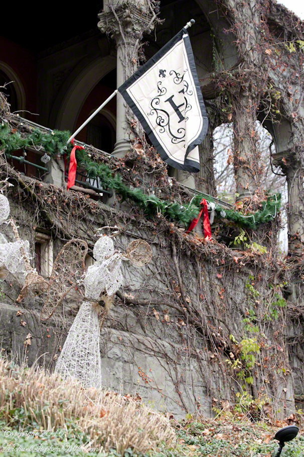
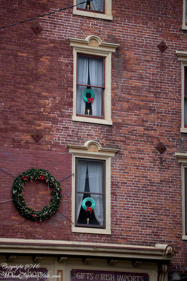
Of course, my interest turned to that neighboring mansion. It is a B&B. “Mystery weekends” advertised. That is a two day event. Guests, presented with a scenario, draw on their resources to solve…..a crime. Today, the façade decorated for Christmas. The entire village decorated for Christmas!! Christmas!! Christmas!!! I just love CHRISTMAS
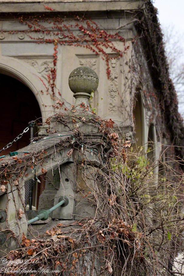
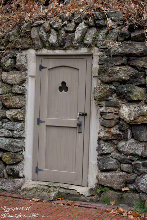
For me, the charm of these places are the details. These pull the attentive visitor into the character of the owner and/or designer. A simple storage room dug into the hillside, designed and crafted with love in the interest of the residents who experience it everyday. Built for a lifetime and longer. The door and fittings appear to be modern, “nice work.”
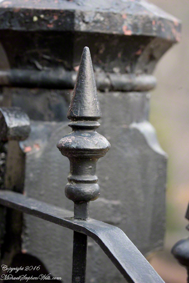
A substantial finial of a thick wrought iron fence rail.
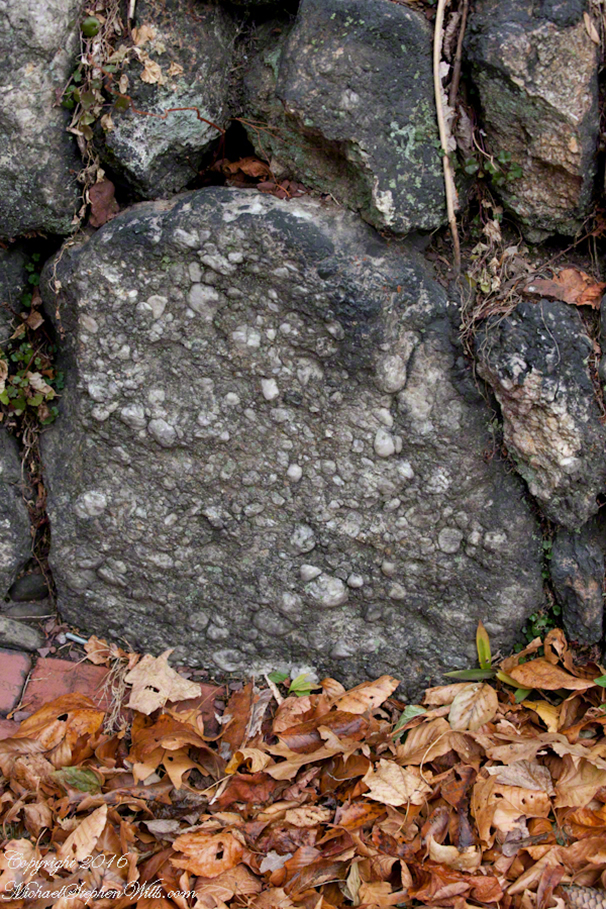
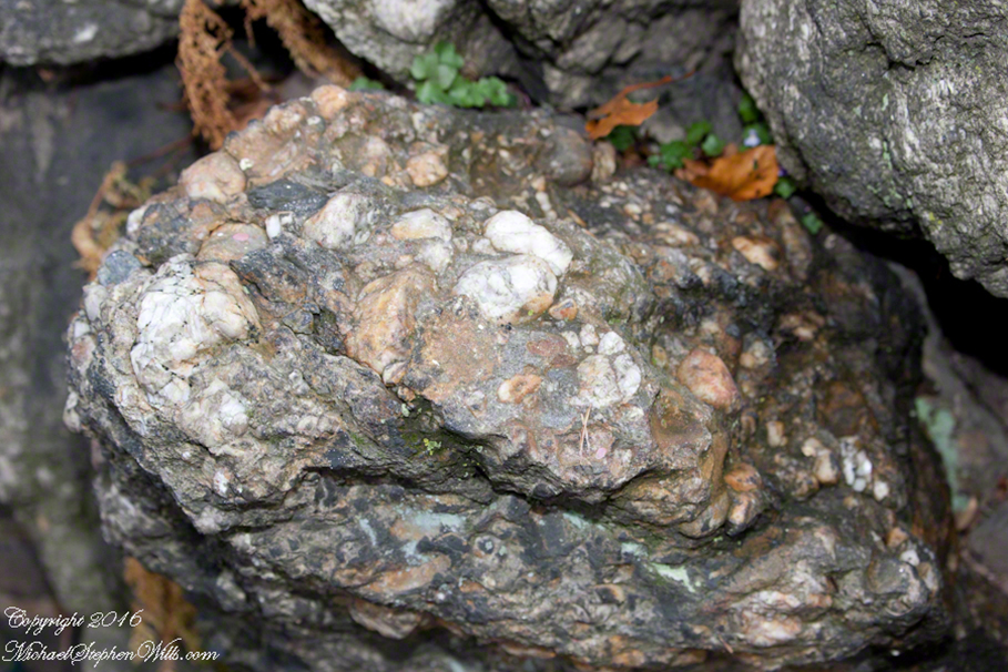
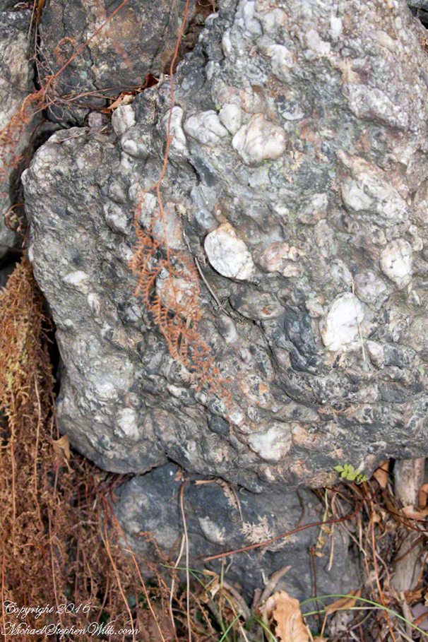
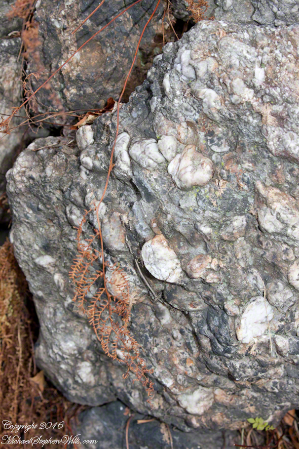
More so, the choice of building materials for retaining walls. These were spotted in the countryside, quarry or wherever by someone with an eye for unusual beauty…or a rock hounds. The boulders are carefully dressed conglomerate specimens with interesting clasts and matrix.
The museum is a place to enjoy the gathering night. Take note of the thick groves of rhododendron, native to this area: a reason to return springtime. The surrounding hills, locally called mountains, increase the charm of the setting.
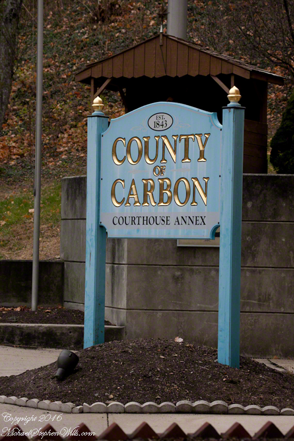
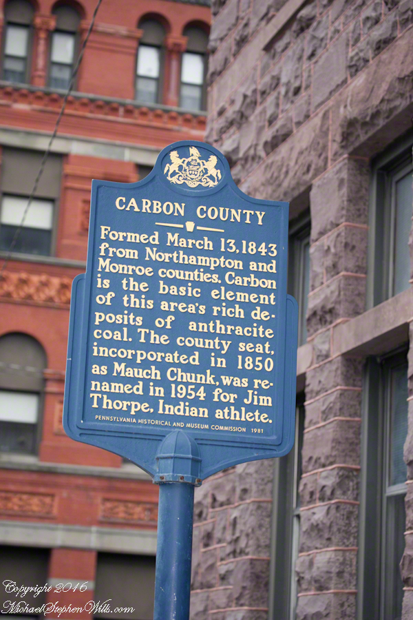
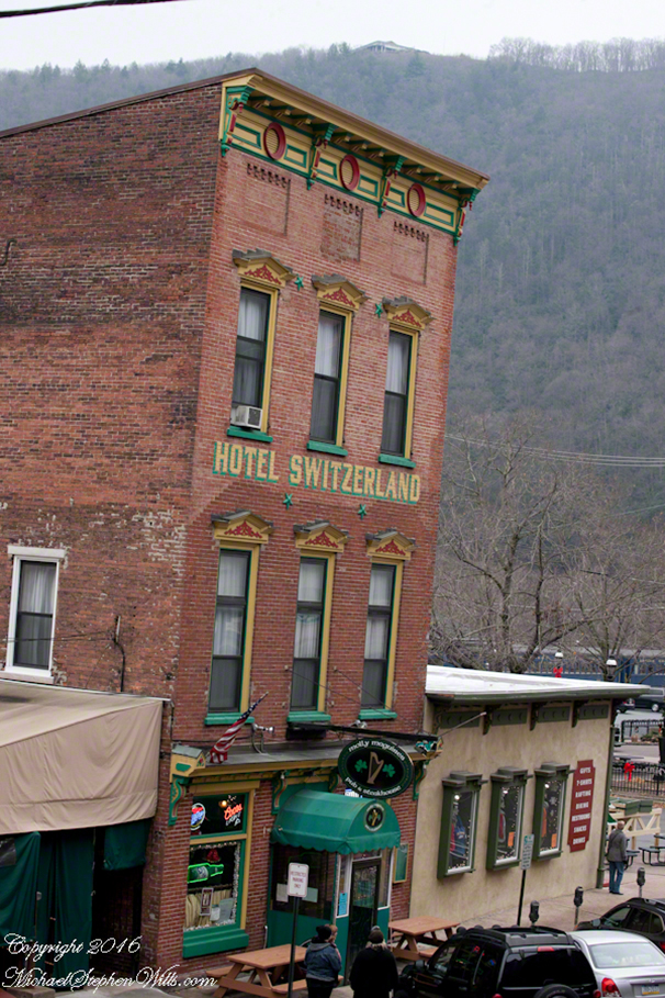
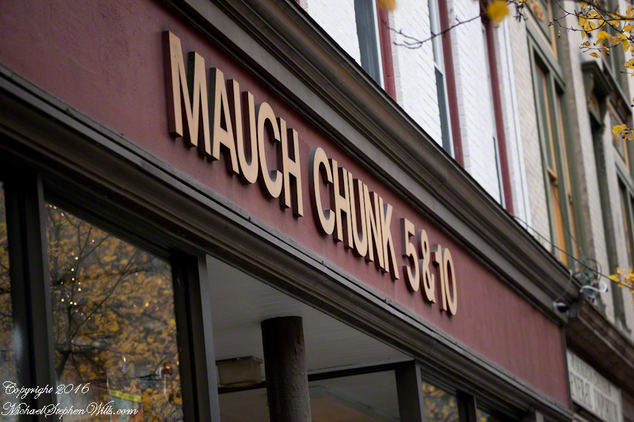
We descended into town for shopping, dinner at Molly Maquire’s and a show in the Mauch Chunk Opera house. The village was named Mauch Chunk previously until the town fathers decided to rename it to Jim Thorpe, the notable native American sports star, in a then failed effort to encourage tourism. The last decade business has improved.
Molly Maguire’s Irish Pub is a fine place for a companionable meal. Pam and I enjoyed the New York Strip steak with, of course, potatoes. A baked potato for me. Pam had the red skinned garlic mashed potatoes.
The pub is located near the train station.
If you don’t know about the Molly Macguires…google ’em.
Here we are, on the road from Kenmare to Killarney, N71, part of the Ring of Kerry around the Iveragh Peninsula. The view was celebrated by Queen Victoria’s Ladies-in-Waiting during an 1861 tour of Ireland
Click pic for larger view in a new browser tab. If you are in WordPress Reader, open the post to use this feature.
Ladies View, Killarney National Park, Derrycunihy Townland, County Kerry, Republic of Ireland.
Copyright 2021 Michael Stephen Wills All Rights Reserved
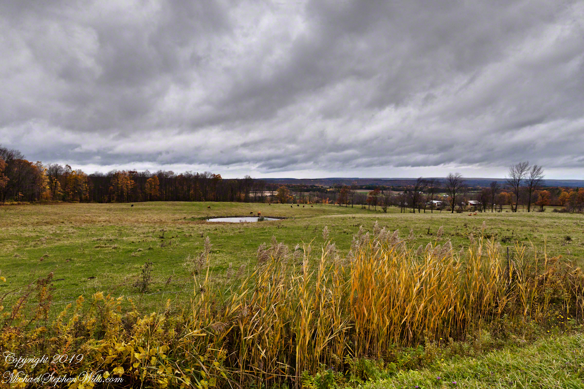
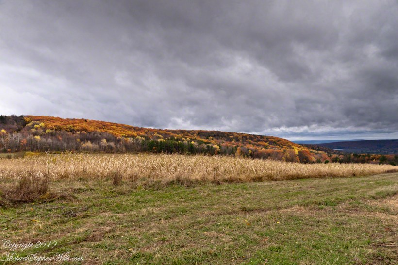
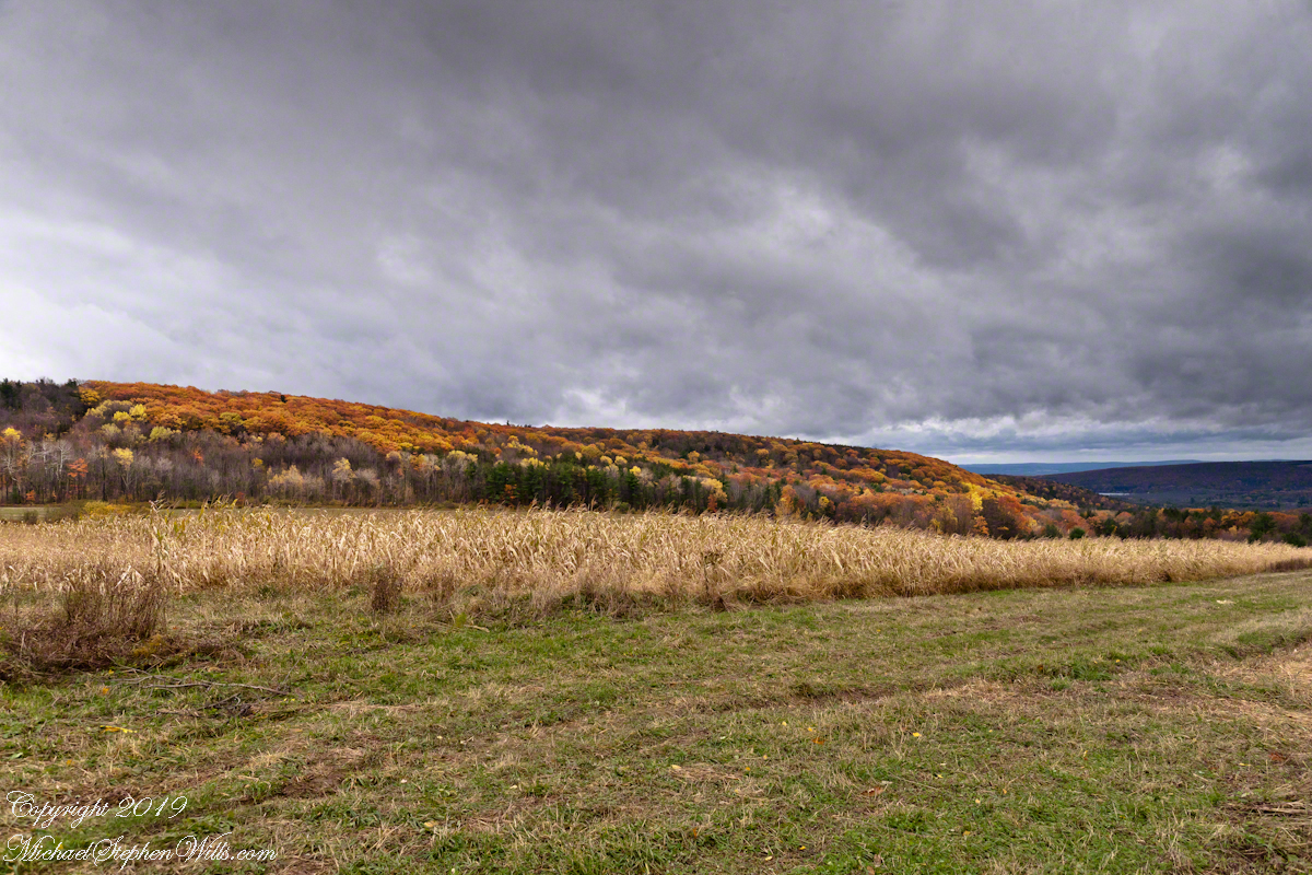
The Finger Lakes are formed by a series of inclined planes spread across central New York State.
Here we look northwest across the land between Cayuga and Seneca lakes, all forests and farm land. Seneca Lake is not visible,15 miles distant, and the Finger Lakes National Forest in between.
The only town is Hector, New York, population 4,854 in the 2,000 census. The foreground are sere grasses, a field of beef cattle and pond.
Click photograph for a larger view. To do this from WordPress Reader, you need to first click the title of this post to open a new page.
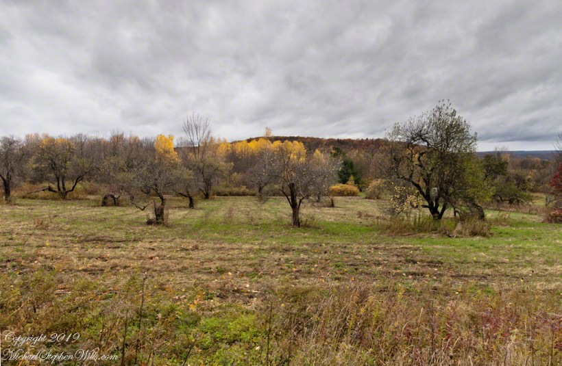
Unharvested apples on the ground and branches of this apple orchard off Black Oak Road on the slopes of Connecticut Hill, Newfield in the Finger Lakes of New York.
Click photograph for a larger view. To do this from WordPress Reader, you need to first click the title of this post to open a new page.
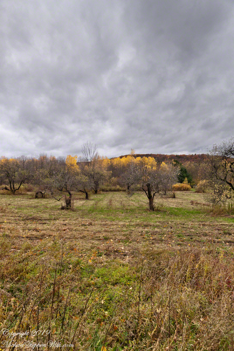
Unharvested apples on the ground and branches of this apple orchard off Black Oak Road on the slopes of Connecticut Hill, Newfield in the Finger Lakes of New York.
Click photograph for a larger view. To do this from WordPress Reader, you need to first click the title of this post to open a new page.
Black Oak Road approaches Connecticut Hill from the north. At this point a long view to west opens up that include Cayuta Lake and the distant highlands of Seneca Lake.
Click photograph for a larger view. To do this from WordPress Reader, you need to first click the title of this post to open a new page.