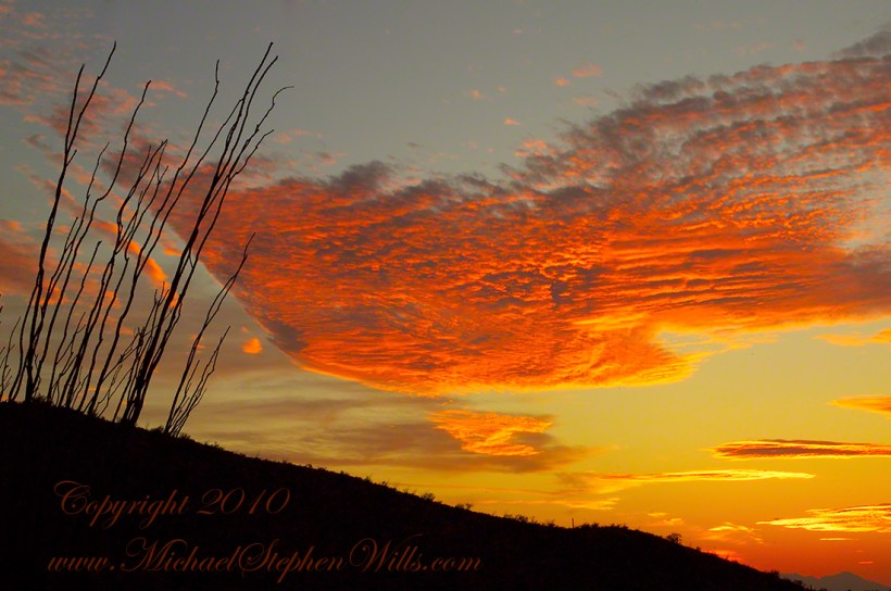
This is a retrospective diary of the day I created my print “Octillo Sunset.” You can visit “Octillo Sunset” on my online gallery by clicking on any of my blog photographs.
Choices of the Evening
Angled to the Sun
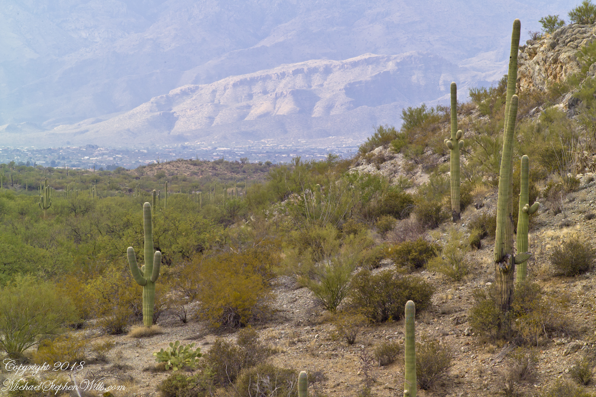
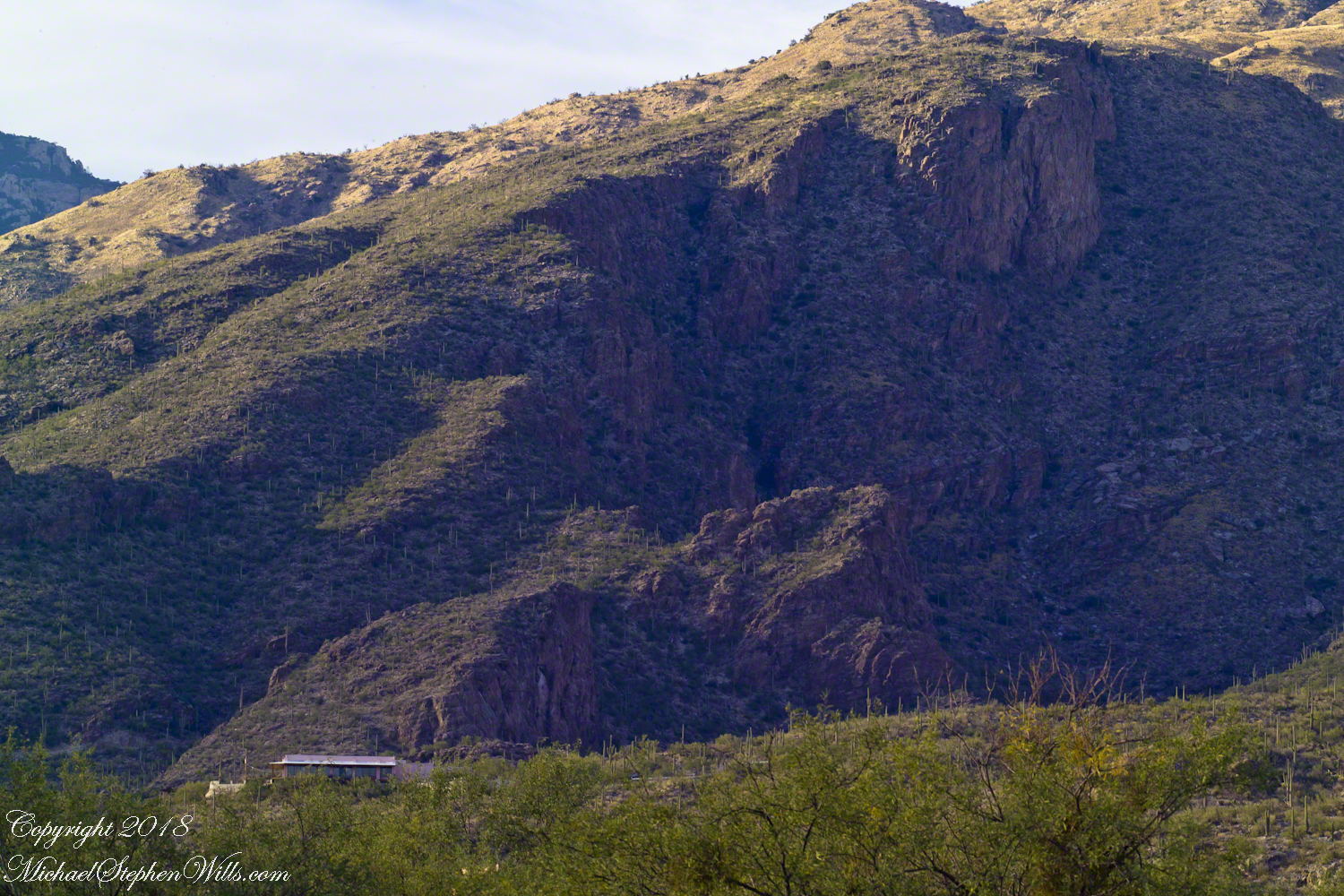
The following photograph of saguaros and distant Santa Catalina mountains is a similar view from Part 2 of this diary. Notice the saguaro on the right is also on the left in the Part 2 photo. What is happening is I turned the lens more toward the west and the sun. At this angle the lens hood offers less protection, especially as the sun is lower in the west and the time of day is passing to the best light from the lowering sun that rakes across the landscape. All this means I can bring the lens further to the west even though the lens hood is less effective.
Click any photograph to view Ocotillo Sunset
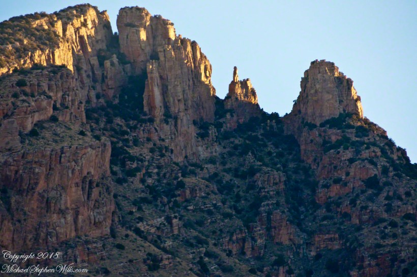
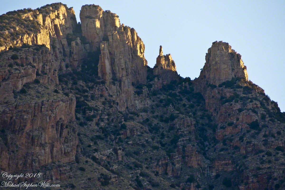
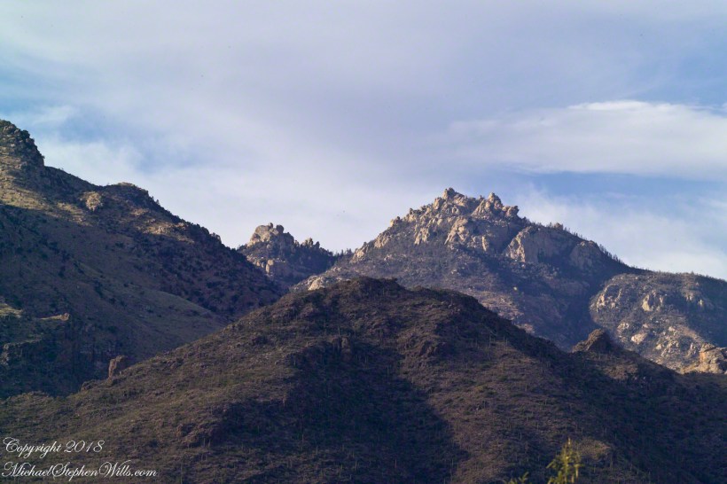
Finger Rock!!
One reason why I am offering it, is high on the Catalina mountains, in the distance, you can just see a formation called “Finger Rock”. This time of day, the lower angle of the sun brings out the canyon-shadows. Finger Rock canyon has a high western wall, you can see it as a high long shadow starting toward the very center of the picture and building up and to the right.
The following photograph is the view of Finger Rock from the floor of that canyon taken during a Spring 2011 Tucson visit. I started hiking in pre-dawn hours to catch the dawn rays on the finger.
Click any photograph to view Ocotillo Sunset
The Importance of Knowing Topography
Another aspect of this photograph is the landscape. There is a sloping bajada (alluvial fan) formed by water breaking up the mountain (in this case the Rincons) and washing it into the valley. It is the reason the saguaros appear to march into the distance. The same effect is used in movie theaters to allow the people in the rear to see over the head of people in the front.
This bajada and the higher elevation is the reason I moved from Sabino Canyon to here for a better position to view the sunset. Here is a nearly identical view, same 200 mm lens, in landscape format. The sloping land of the bajada is more visible.
Click any photograph to view Ocotillo Sunset
Changing the Lens/Sun Angle
Looking in the opposite direction, back over Lime Kiln Falls to the Rincon (mountain) foothills, the lens hood offers maximum protection. The sun is at my back and, even though it is low in the sky at the beginning of the Golden Hour, this aspect gives great color depth at the expense of loss of shadows losing some depth of field. Still, this is an interesting photograph.
On the ground in Sabino Canyon, I rethought my plans for the afternoon, given the potential of an incredible desert sunset, and decided to seek the high ground east of Tucson up against the Rincon Mountains in the Saguaro National Monument. There was still plenty of time to travel there and set up.
On arrival at the monument I took the scenic “loop” road that meandered around the desert. The Lime Kiln Falls trail makes some elevation, so I hiked that to the end. In the 1800’s the rocks in the area were exploited for their mineral content by heating them, on site, to high temperatures that released a highly caustic (chemically reactive) “quick lime” that was in high demand. All that’s left of this work is some ground discoloration.
The Dry Water Fall and former Mining Site
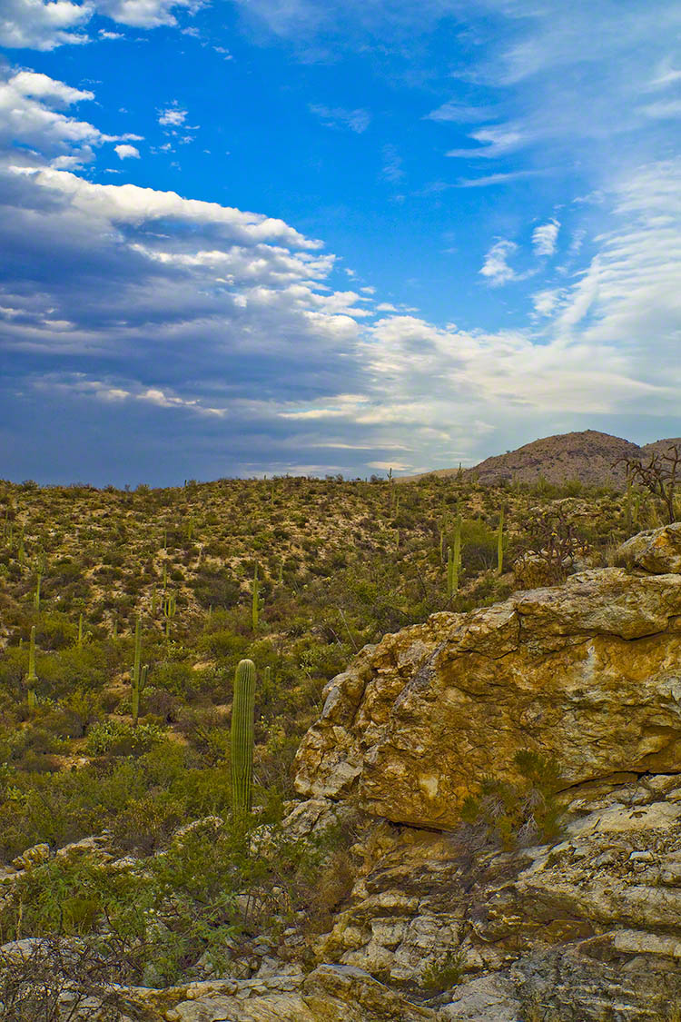
The “Falls” in question were a totally dry rock ledge that I climbed for these views. In the first photo, on the right in the distance, you can see the same mountain peaks I shared in Part One. I used the same 200 mm telephoto lens because that interesting stand of saguaros were over 100 feet away across a steep slope.
Young Saguaros
The saguaros are interesting, to me, because they are all so young and grouped together. As though s clutch of seeds from the same specimen landed together on the same spot. The saguaros are notable for their lack of arms which will form with the passing years.
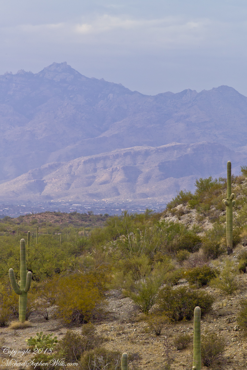
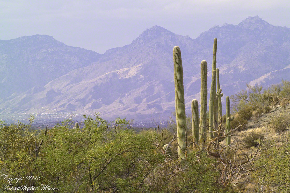
A View of the Catalinas
Late afternoon is the perfect time to photograph the Catalinas in the distance and the high, thin gathering cloud cover made for dramatic shading of the peaks. I needed to wait for a perfect moment because the light and view changed, literally, second by second. If you look closely, the city of Tucson can be seen among the foothills, to the left.
Why the Distance Stands Out (high contrast)
The lens was fitted with a deep hood. Besides being black, the interior of the hood is surfaced with black felt, the same as used for large telescopes, to capture any stray light. Light falling across the lens surface causes reflections, which is what this hood prevents. The result is the amount of contrast I captured, using the appropriate exposure and other settings. For this photograph I used F14, 1/125 and ISO160.
Click any photograph to view Ocotillo Sunset
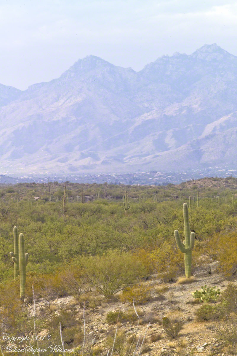
Another Catalina View
A bit further down the same trail, the desert view features an army of saguaros marching into Tucson.
Click any photograph to view Ocotillo Sunset
The Catalina Highway runs along the escarpment, in the distance, and to the top of Mount Lemmon, a 9157 foot peak. In season, you can ski in the morning, on the peak, and in an hour or so travel to the desert to sunbathe comfortably. From the trail to the top of the Rincon Mountains this view just keeps opening up farther and farther and farther. My wife, Pam, and I backpacked up there April 2011.
On a Tucson November 2005 afternoon, after my volunteer work for the University of Arizona, CALS college, alumni board of directors, in the mid-afternoon I headed for Sabino Canyon with my photography kit.
With a 25-pound pack on my back, walking from the parking lot I looked up at the incredible rock formations of the Santa Catalina mountains. It took some time to set up the tripod (at that time I was using a cheap swivel head on adjustable aluminum legs) with a 200mm telephoto lens (Canon L-series EF 200mm USM) I grabbed this shot of the hoodoo fringed peaks beyond the foothills (f16, 1/30, ISO160). The lower sun angle made the formations pop out.
Hoodoos in the Hills
You call those strange formations of upright rocks “hoodoos. Some people believe the fantastic shapes were created by spirits, today the explanation is wind, water and time create hoodoos from rock of the right stuff. It is a wonderful experience to wander among hoodoos, though unsettling because some of these large rocks are seemingly in danger of falling over at any moment.
Moving On
I have a mental list of photographic “to do’s” and the gathering clouds, typical for a Tucson November day, reminded me an awesome desert sunset was on this list, so I packed up to head for the east side of Tucson for a shot looking toward the Tucson Mountains (on the west side).
Clouds gather at sunset above a ridge serrated by saguaros.
Click any photograph to view Ocotillo Sunset
Sabino Canyon House
Before we move on, this is a fascinating image of a typical southern Arizona house perched on a ridge at the mouth of Sabino Canyon. In this image the viewer sympathizes because the telephoto lens gathers the majestic rocks around the tiny structure.
The house is perched on a Santa Catalina foothill ridge running east west, a wall of picture windows facing south with a view across the Tucson valley toward Mount Wrightson of the Santa Rita mountains, 42 miles distant. Summer thunderstorms gather on this peak, wreathing it with lightening. These times, evenings and night, the view pays for the inconvenience of this distant, hot ridge. Another time to be there is for sunsets.
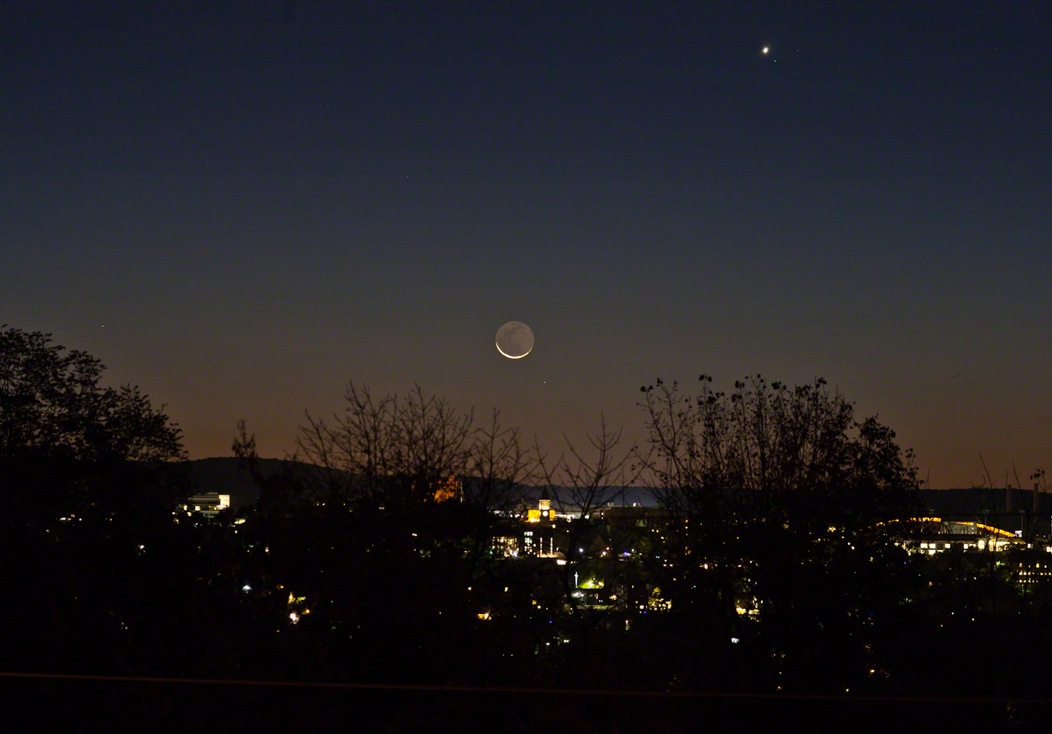
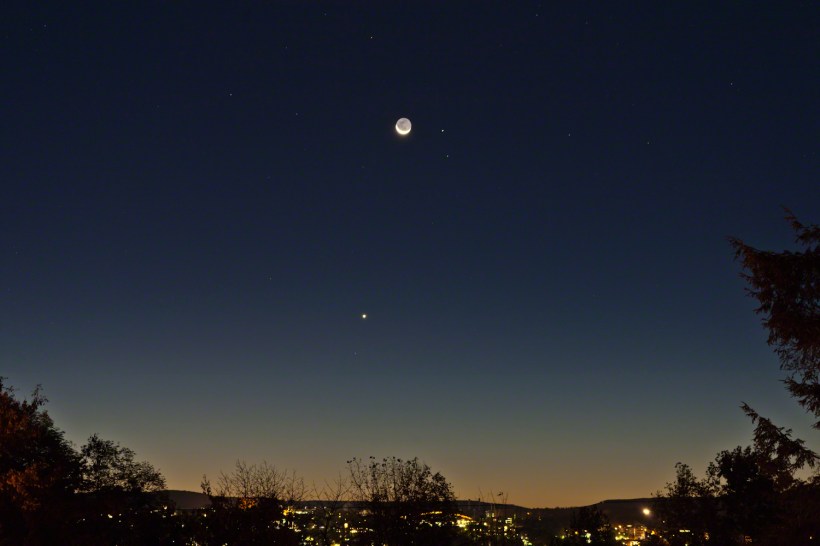
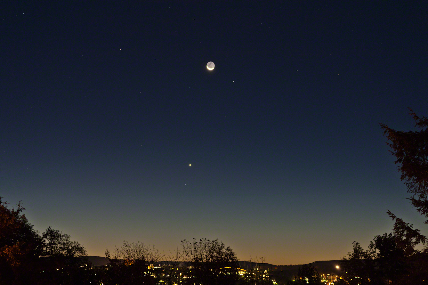
Here are two photographs taken about the same time, 6:30 am, October 18, 2017, companions to the photograph shared earlier this week.
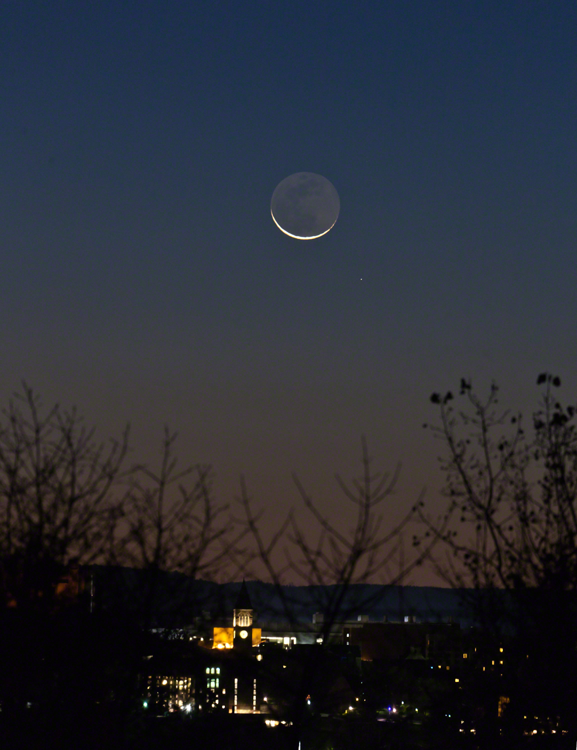
The moon rises later each day, so these shots include a larger disk closer to Cornell University. Both components, the crescent and earth-glow, were dimmer this morning. In each photograph Jenny McGraw Tower is visible.
The star is Regulus, the brightest in the constellation Leo, close below the moon. I don’t know the star close to Venus.
Here the tower is slightly to the right of the crescent, the arch of Schoellkopf stadium further right. Among the trees on left, is the baleful red glow of Bradford Hall.
The tower is outlined by the lights of Uris library, presumably filled with early rising students.
The light of Regulus (“small king”), below and to the right, is a composite of four stars moving together through space. The position of Regulus on the path in the sky of the moon, planets and asteroids (called the ecliptic) leads to the occultation of the star by the disks of the moon and, less regularly, the planets and asteroids.
Copyright 2021 Michael Stephen Wills All Rights Reserved
A thin crescent bowl filled with earthglow floating above the dawn attended by Venus, Mars, Virgo.
This was the view from Ithaca, New York at the start of dawn this morning of Tuesday, October 17, 2017. Mars is next to the moon, the stars of the constellation Virgo scattered around, Venus is the bright object below. We had a bright, clear sky not unusual for September and October.
In the city, an arch of Schoellkopf Stadium on the Cornell University campus. Cornell is on east hill. We live on west hill, across the valley. It is quiet on west hill, away from the students.
Earlier this week the crescent was in the constellation Leo where the bright limb occulted the bright star Regulus, to reappeared from behind the dark limb, a brilliant spectacle that happened after dawn for New York. It was cloudy, as usual, on October 14.
When I woke, the moon was shining through the trees, still full of just turning leaves. The crescent turned, cup like, above the horizon, to cradle the dark orb glowing from the reflected light of our earth. I did not recognize Mars, the disk was less red than usual. Research revealed the moon had two planets in seeming attendance. I also learned that, when the horns point right the moon is waning, moving toward a new, or un-illuminated, moon. When the phase moved from new it is also a crescent with horns pointing left.
This morning was a fortunate gift, I had never contemplated the moon in quite this form before.
Copyright 2021 Michael Stephen Wills All Rights Reserved
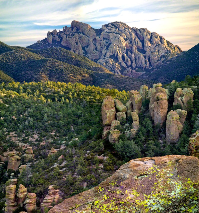
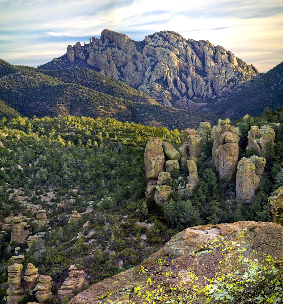
From 2004 through 2011 I visited Arizona every Autumn, October or November. As a University of Arizona Alumni Board member for the College of Agriculture and Life Sciences we had a meeting during “homecoming” and a fund raising event. I’d come early or stay later for getting acquainted with Arizona, more than was possible as an undergraduate. In 2007 I camped for several days Chiricahua National Monument of the remote south eastern corner of the state.
The park empties out this time of year, for some reason. The weather is perfection with clear skies, moderate daytime temperatures, cool nights. This time of year the Arizona White Oak acorns ripen and fall. The campground has aluminum picnic tables, the falling acorns made a loud plunks throughout the night. This would annoy some people. Me, it is a great memory.
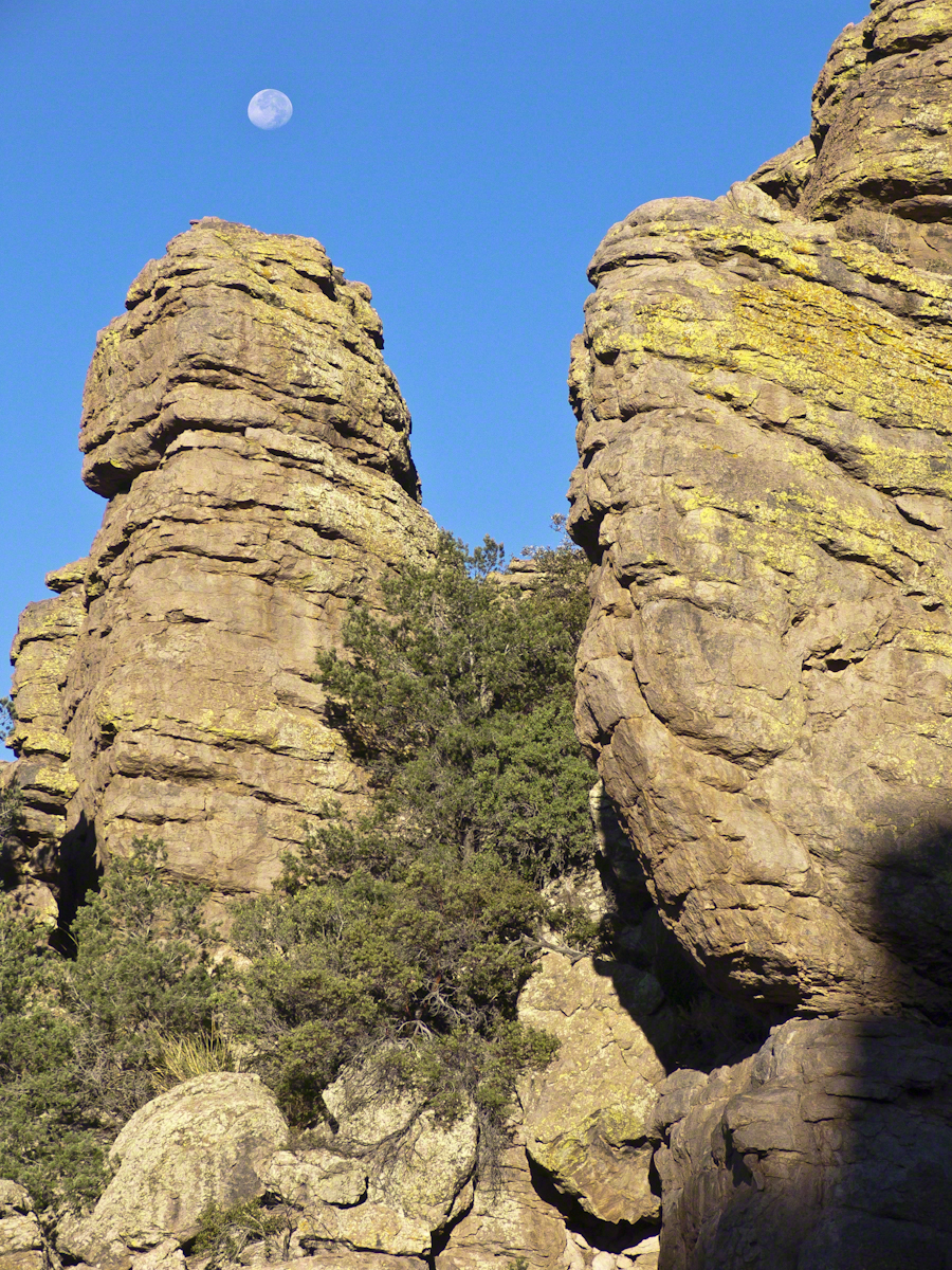
The following two images are great memories from my first morning.
Click any photograph for my Online gallery.
These formations hovered over the trail on my first morning. The rising full moon was an unplanned bonus.
I experimented this trip with a breakfast of granola with dried whole milk. It was delicious (for me) and got me out on the trail quickly. This first morning I clicked my hiking poles together to scare away bears as I walked in the pre-dawn dark. The preparation and extra effort paid off with this photograph.
Click any photograph for my Online gallery.
I met one hiker who was a harbor pilot from Hamburg, Germany. He came just to view a particular rock formation that was, literally, the rubber bath duck. It is several miles to the site, a moderate hike with significant elevation gain. He took his snapshot with a little camera and was on his way.
The following is my masterpiece from the trip. Imaging the effect of seeing this image on settlers. That same first day I turned a corner and there this was…it took a few minutes to comprehend what I saw, it was so incredible and, for me, unexpected. It first, the only perception is a huge rock dome of rough rock, then, slowly, the image of a native American profile forms in the mind. Cochise Dawn
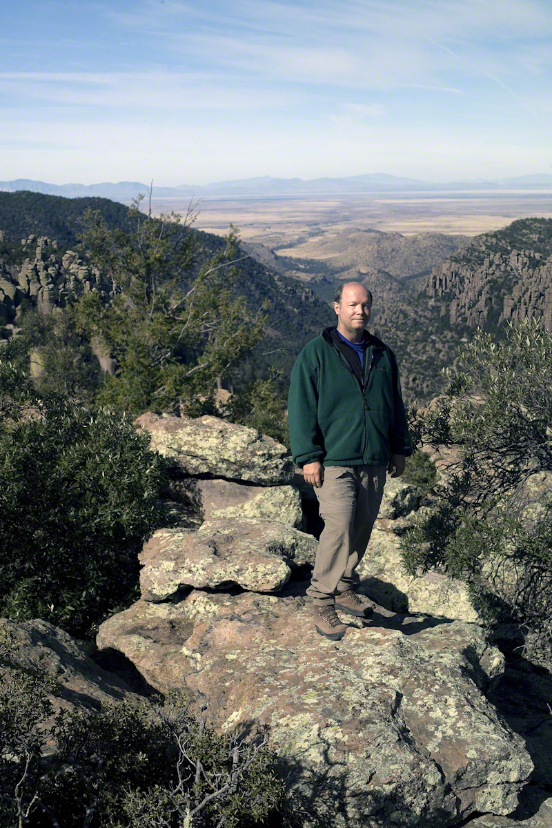
During the session for Cochise Dawn I turned the camera for the view northwest and did a self portrait. In the distance are the Galiuro Mountains and Wilderness. Tucked alongside is the Aravaipa Canyon Wilderness, hosting one of the few perennial streams of Arizona.
Copyright 2017 Michael Stephen Wills All Rights Reserved
Walking up University Avenue toward Lib Slope, listening to the noon concert from the McGraw Tower carillion (a tuned set of bells), below the Johnson Museum turn left onto a footpath, follow to the steep trail down to the Gorge Overlook along Fall Creek. Look up at the suspension bridge and water powered electric plant. Climb back, turn right and down to Stewart Avenue for the view of Fall Creek Gorge, Cayuga Lake, the former studio of Carl Sagan, built into the gorge wall. In researching this topic I learned Google Maps shows the trail and you can “walk” the trail, Google brought the camera down into the gorge.
An IPhone 7 and video editing software were used for this post.
Copyright 2021 Michael Stephen Wills All Rights Reserved
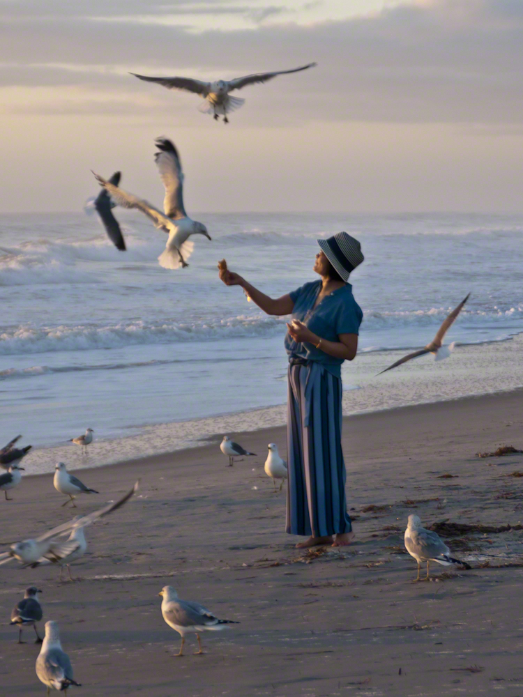
Gulls, an omnipresent element of any beach stroll. Pestiferous, abounding and incessant the gull is simple to deal with. Keep any and all foodstuffs under wraps.
Conversely, for those who adore a crowd of raucous opportunists simply pull out the food and offer it to the air. There is more about this photograph at this post, “Lady Feeding Gulls, Cocoa Beach Dawn.”
Click any photograph for a larger view.
Beach Walking
Pam and I developed a habit of hanging out in Florida during Finger Lakes Winters when the gorges are closed for safety and even walking the streets is perilous, stray black ice encounters abound. We trade icy falls for beach walks.
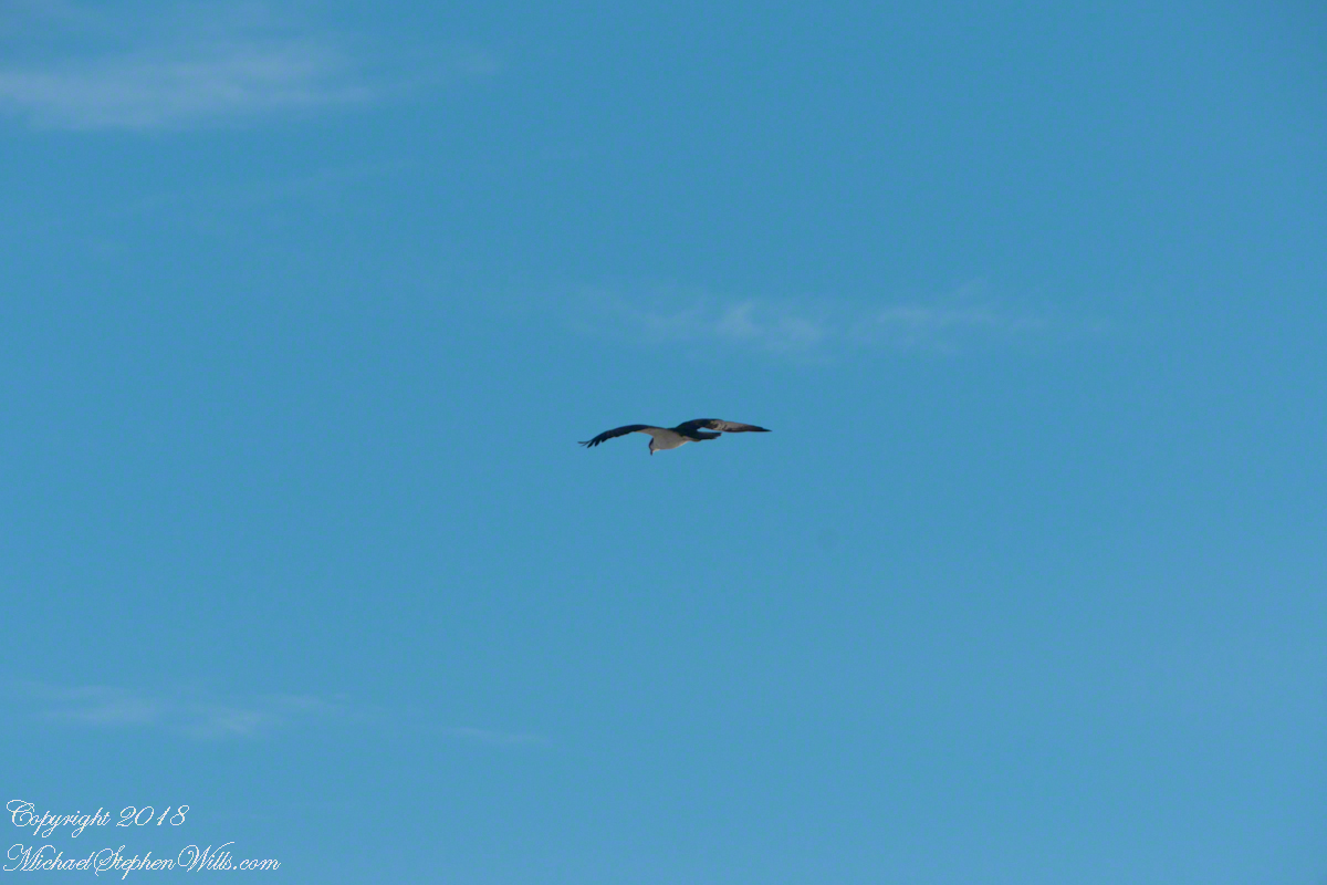
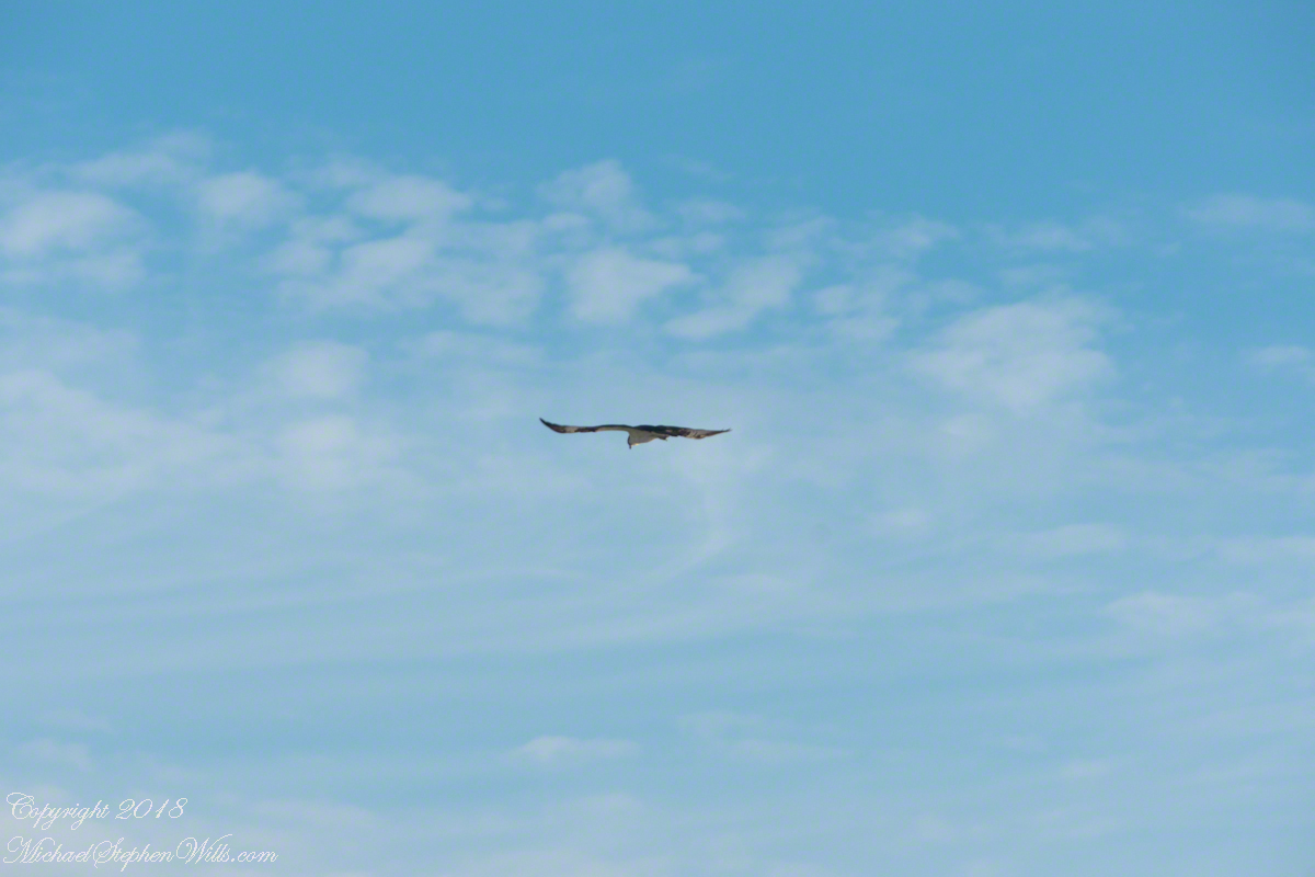
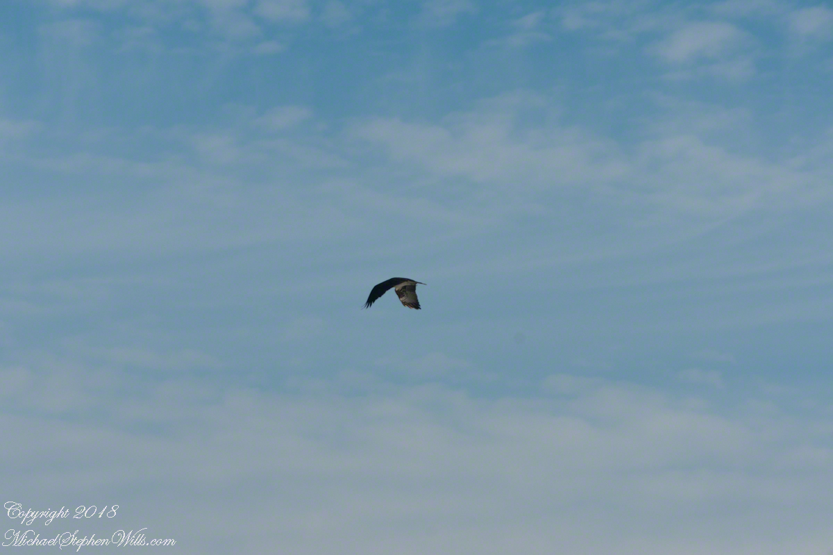
It is natural to become inured to the flight of gulls along the shore. For all my carting along the Sony Alpha 700 with a variable lens ( 18 – 200 mm) there is not a single photograph of a gull in flight. Yet, I have my eye on them until my blindness was lifted by a peculiar individual. It seemed to be a white gull, yet it had a watchful eye.
Gliding shoreline parallel with head down, how could I have mistaken it for a gull?
Osprey occupy an environmental niche along 700,000+ shoreline miles worldwide as a single species Pandion haliaetus. A unique bird with its own family, Pandionidae, and genus, Pandion, some experts recognize sub-species in geographic regions. Ours is the Western Osprey.
The following photograph is of a wing shape very different from the gull.
Osprey Stalking Behavior
IPhone 8 always in my pocket, I captured this clip of an Osprey stalking fish in the Atlantic Ocean surf. You will have a better viewing experience by clicking on the title of the embedded YouTube, then click on the Full Screen icon at the lower right.
Enter your email to receive notification of future postings. I will not sell or share your email address.
Copyright 2025 All Rights Reserved Michael Stephen Wills
Yesterday, I simultaneously published nine photographs on my ImageKind Ireland Gallery and Getty IStock (click the links to visit): nine views taken from the slopes of Slieve Gullion.
Sunday, May 25, 2014 was a happy day for Pam and I. It was the first full day of an eighteen (18) we filled with Ireland, travelling in a loop of the island following the coast from, naming the counties where we spent time on the ground, Louth, Armagh, Dublin, Meath, Wicklow, Cork, Kerry, Claire, Mayo, Antrim, Down and back to Louth. The counties of Northern Ireland are in italics. Indeed, at this time the politics allowed us to travel freely between the Republic and the North. That day, our morning was spent in Louth attending mass, enjoying our first meeting with the family over a substantial mid-day meal (click the link for my Facebook album of the meeting). We split off that afternoon to visit the home of my cousin, Mary and her husband Joseph in County Armagh, just over the border. When Joseph offered to drive us over to Slieve Gullion it was totally new to us, we had no conception of the place or what to expect.
It was such a gift, we are grateful to Joseph for this experience. Only in 2018 when, at 64 years of age and retired”, was I able to research the place and spend time developing the photographs for publication. Two of the photographs illustrate this posting, to view the others in my online gallery, click either photograph.
Slieve is the Irish language word for “mountain.” Slieve Gullion is a lone eminence, one remnant of volcanic eruptions about 60 million years ago during the rifting of continents that produced the Atlantic Ocean. Around the mountain is the Ring of Gullion, a string of hills, 26 miles by 11 miles, surrounding the mountain and formed from the ancient collapse of a volcanic caldera. The technical name for it is a Ring Dyke and it was the first of its kind to be recognized and mapped, well before the nature of the formation was understood of be volcanic. The name Gullion is derived, in one formulation, from the name of the metalsmith, Culann. In Irish Myth, Culann’s home and workshop was on the slope of Slieve Gullion. A wealthy and respected personage, Culann invited Conchobhar mac_Neasa, king of Ulster to feast. During his approach to the mountain, passing through the surrounding plain, the king stopped to watch boys play hurling. Among them was the future hero of Ulster, the young Sétanta. Impressed with Sétanta athletic abilities, the king invited him to join in the feasting at Culann and the boy promised to follow after the game. Later, while climbing the mountain to fulfill his promise Sétanta was attacked by the guard dog of Culann. The myth says the dog was killed by Sétanta in self-defense. Never the less, in compensation to Culann, Sétanta committed to rearing a replacement and to act as guard dog in the meantime. In this way he became known as Cu Culann, “the dog of Culann.” Click for more about Cu Culann.
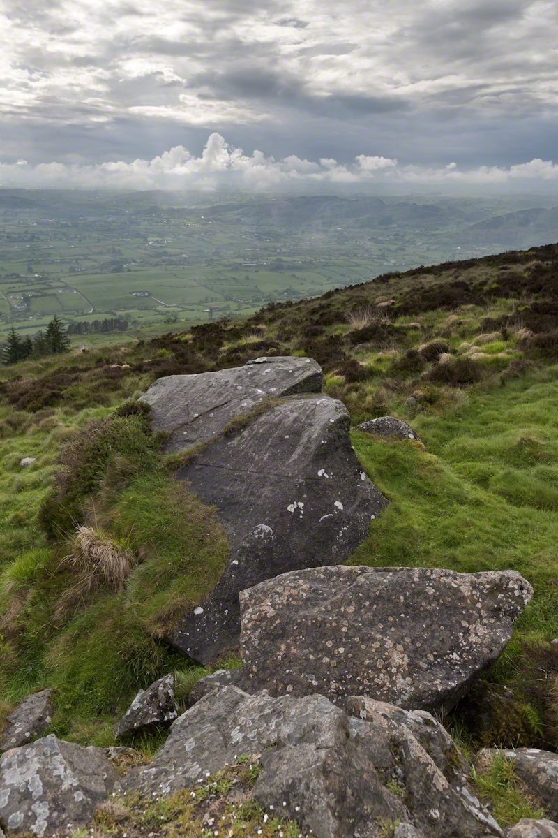
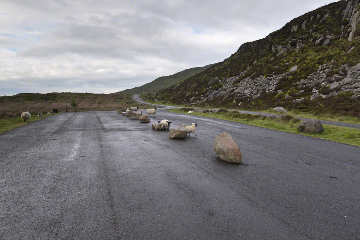
On the summit two cairns north and south of a small lake, tangible proofs of ancient peoples and beliefs. The north cairn is a more ancient passage grave, 90 feet wide, 16 feet high, the opening aligned with the setting sun on the winter solstice. The cairn north of the lake is less ancient containing two cist burials. For our visit Joseph drove us along the 8 mile drive. The following is an image of a viewing platform and the road. Just beyond, on the right, where the ridge meets the road, is the trail to the 1,880 foot summit of Slieve Gullion. Our arrival disturbed sheep resting on the asphalt. I’d have loved to spent a day climbing the summit, but it was not to be this trip.
The way is part of the Slieve Gullion Forest Park. Throughout are turnoffs to admire the view. It was during our frequent stops I pulled out the photography gear to grab the views. Here is one, looking southwest. For the other views, click either photograph to visit my Online Gallery of Ireland.
Copyright 2021 Michael Stephen Wills All Rights Reserved
Imagine a bowl with steep sides, rough and sharp in places.
Look along the bottom and see a silver stream, sparkling and singing through rocks.
A figure is clinging to the upper side, almost to the rim.
The figure is me in the setting of my blog, “A Dry Piece of Paradise”. Here is my view from that spot.
View from the rim of Nameless Canyon
Hiking along this bowl rim I came to a clearing in the juniper and Manzanita bushes, with a fire ring and pile of roughly broken wood with outstanding views on all sides. This tradition of leaving wood is a welcome intrusion of human kindness and sympathy in this wilderness. We gather wood for total strangers, people we will never meet, to potentially save them in a rainy, cold darkness.
At noon Pine Creek was two miles ahead as I looked into a steep descent, a wide canyon and open range of low oaks, almost shrubs, and small juniper trees. Later, well along the trail, I stepped over Walnut Spring, a silent thread of water through a thin blaze of trees, yellow flowers and continued toward Reavis Gap and Pine Creek on Oregon Ed’s recommendation.
“Even a blind man could find water there this year,” Ed claimed.
Ed’s van was parked at the Superstition Wilderness Tule trailhead when my sister dropped me off the morning before. She noted the van thickly coated with dust over grey primer with an Oregon license plate and changed her plan to accompany me the first mile or so for fear the van’s owner was lurking inside.
It was just as well Diane stayed behind because I met Ed two miles up the trail that first day. From the start, Ed was too outgoing and his pack more empty than light. He chatted me up on how “blue my shirt was”, seen from above, about his trips from Oregon to Arizona a few times a year, about his claim to be returning from a five day round trip to Tortilla Flats.
Ed’s good news about how the usual springs were flowing was welcome. Then, Ed expected me to give him some water for this information. This expectation of his was irrational, given his reports of good water sources. Plus, Ed was only a few miles from his van showed no physical signs of needing water.
I was to discover, a few hours in the direction he claimed to have walked, a flowing stream.
Ed’s attitude changed upon his spotting my .45 in a tactical holster strapped to my leg. Thirty seconds later he was heading down the trail. I had no water to spare and was relieved I didn’t need to escort Diane back to her car. Maybe Ed was an anti-gun advocate, but my conclusion was he had some lurking to do, back at the van.
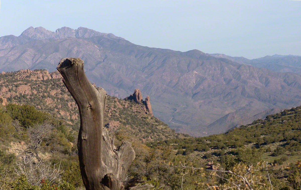
While planning this trip I imagined “Reavis Gap” to be a narrow trail between towering peaks. While walking under the water heavy pack I elaborated on this expectation, but coming on the gap I walked through and into the reality of this photograph, taken from a point looking over the gap and down into Two Bar trail. This was the site of my first meeting with “The Searcher.”
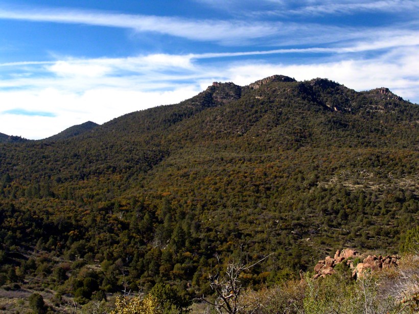
North from Reavis Gap
“The Gap” itself is a high, narrow ridge over a 7,000 foot high valley with peaks, ridges and the occasional hoodoo. That rock formation in the mid-distance includes a hoodoo. It was this hoodoo that introduced me to the gap, being what I saw first high above in the distance from Walnut Spring, a silent thread of water through a thin blaze of cottonwood trees and yellow flowers.
Here’s a link to a video I did of a vast field of Wild Oats which covered Reavis Gap that season.
I first saw the “The Searcher” on that high, narrow ridge above Two Bar trail. I guessed he was a mounted park ranger; from the wide brimmed hat he was holding and the loose fitting shirt. From a half mile away his golden brown mount was standing steady, apparently at rest. Walking up that long, moderate grade my feet hurt and the 70+ pound pack, heavy with water, was chafing. Eager to climb the steep ridge ahead, between me and Pine Creek, I passed the signpost marking the juncture of Two Bar and Reavis Ranch trails and headed up that rocky ridge.
The clatter of horse hooves came up behind much sooner than expected. Turning, I came upon the unexpected site of two horses. The mounted stranger was not a park ranger, but a well dressed cowboy on a western saddle, riding a buckskin gelding.
Behind them, on a lead, was a brown and white pinto loaded with panniers.
I was polite and climbed up on the rocks, off the path, to let them by.
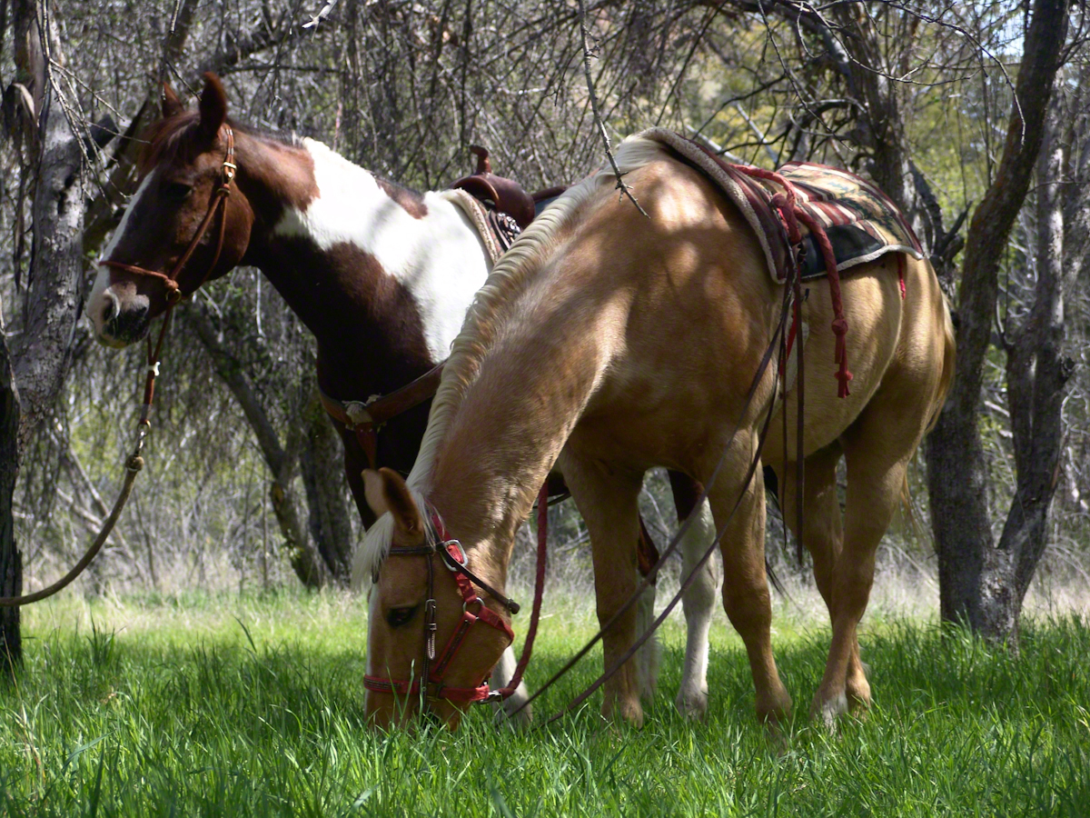
Here’s a photograph of these horses, taken a few days later.
“Colorado and Nugget, grazing at Reavis Ranch”
Enjoying the lush grass of the Reavis Ranch apple orchard, Colorado and Nugget graze.
Our chat was brief, but practical and meaningful: where we came from and conditions along the way. The stranger, who I came to call “The Searcher”, inquired about conditions in the very steep bowl behind Two Bar Mountain. He planned to camp overnight and do a Two Bar Mountain daytrip the next day, but would not if the trail was washed out by that spring’s heavy rains.
I replied the trail was obliterated in spots and even though I could pass his horses might not get by. His reply, “If you got up, so can they.” And with that he gave the buckskin a nudge and they were soon out of sight, over the ridge.
Fifteen minutes later this was my view of Pine Creek, a valley of steep sides sloping to a stream of cool water with mountains and sheer cliffs on all sides. Part of The Arizona Trail.
From a vantage point overlooking Reavis Gap tot he north. This is the view of Pine Creek, to the south.
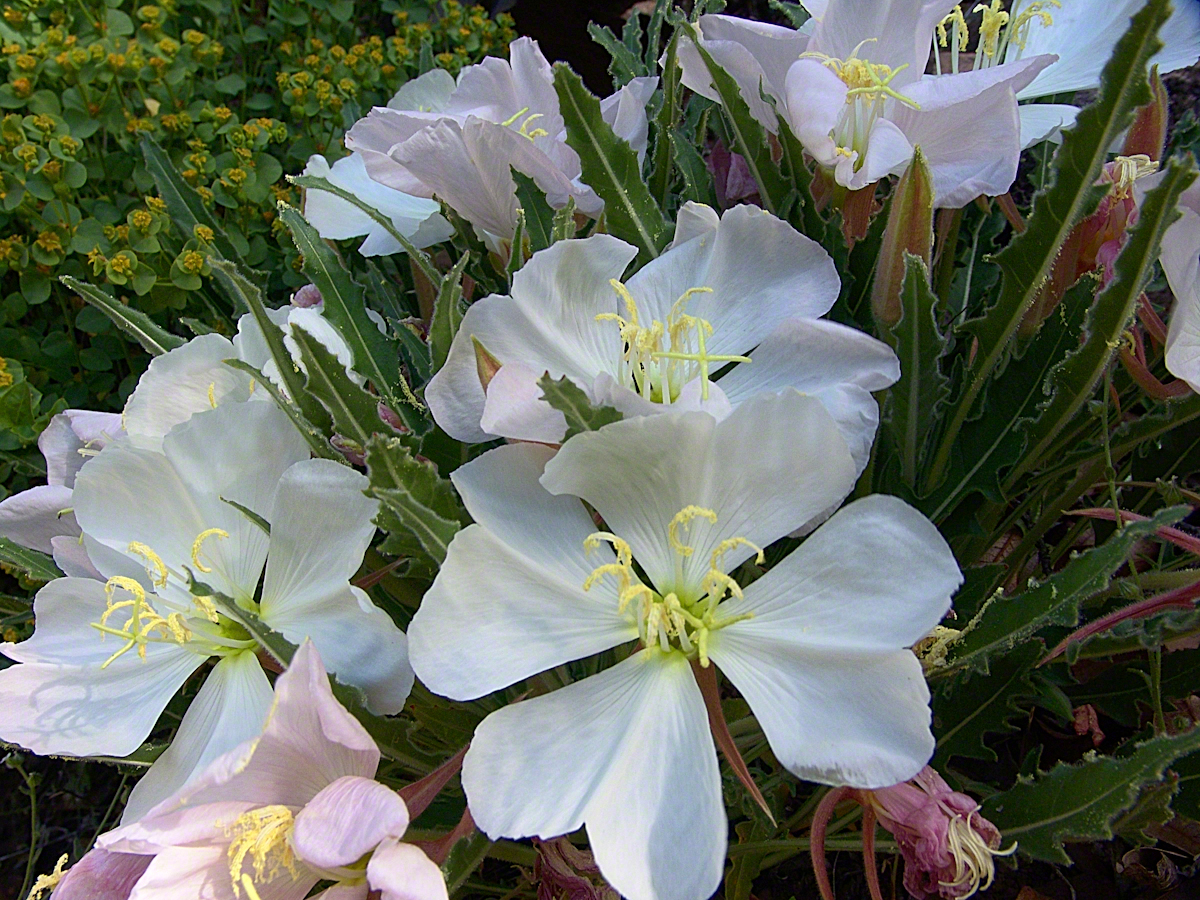
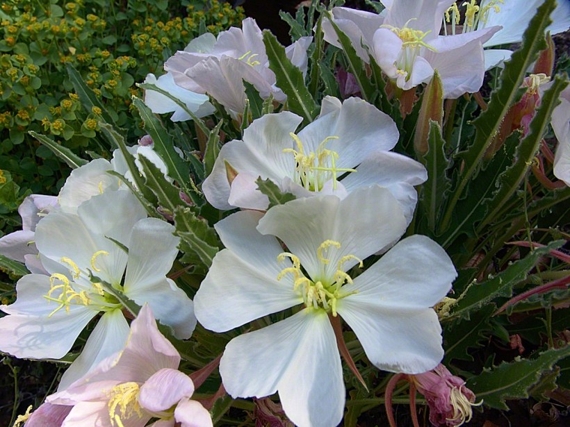
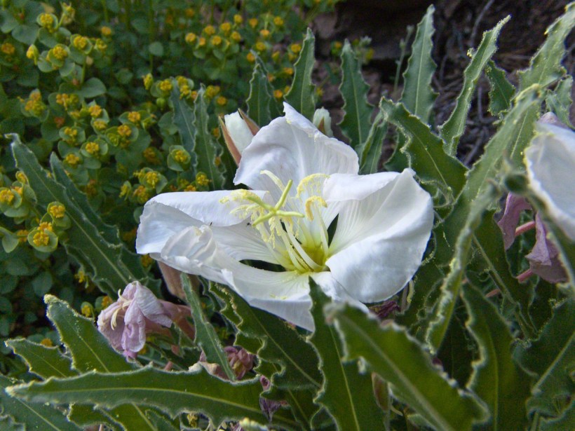
Just before reaching Pine Creek I passed a southeast facing bank sheltering a garden of tufted evening primrose and a member of the crassulaceae family both in flower. The white flower is the primrose and the yellow the crassulaceae. I was so moved by the beauty of this patch, after trekking for seven hours through endless rocks, cactus, juniper and oak, I unloaded my pack and captured this shot. As the name suggests, the flower is an evening bloom that wilts in the day’s heat. That’s why the flower is a bit floppy in this late afternoon photograph.
Note flower b
The crassulaceae is a succulent, similar to a kalanchoe, with tiny flowers composed of tiny yellow balls.
In future chapters you’ll see more of Pine Creek, visit the wilderness apple orchard at Reavis Ranch, learn more about The Searcher and an ancient, circular, rock wall on a peak overlooking Reavis Gap.
Here is a gallery of photographs from this post for you to flip through. Enjoy!!
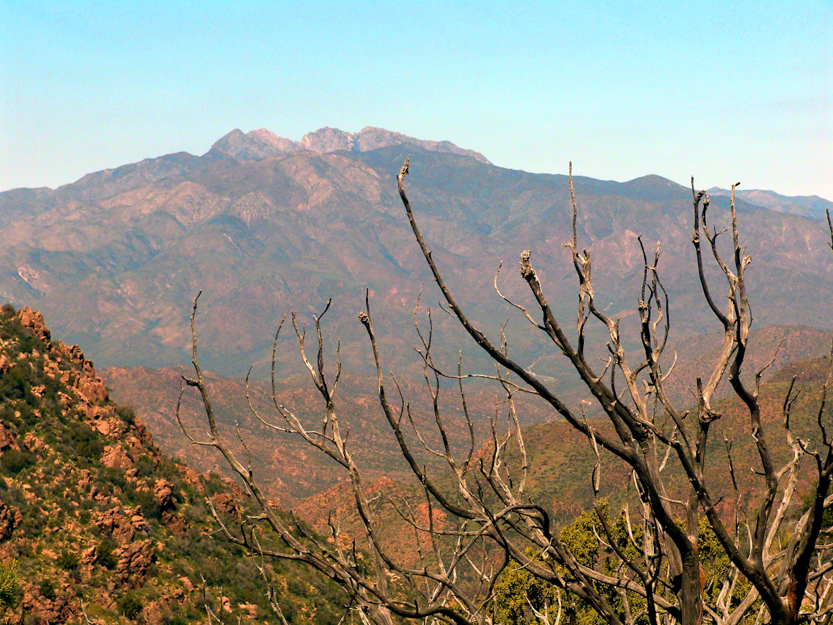
Superstition Wilderness, Arizona
The Arizona Trail passes this spot in the remote eastern Superstition Wilderness. This is the view of my path up from Nameless Canyon. In the distance is the Four Peaks Wilderness Area.
Enjoying the lush grass of the Reavis Ranch apple orchard, Colorado and Nugget graze.
From a vantage point overlooking Reavis Gap tot he north. This is the view of Pine Creek, to the south.
Pine Creek of the remote eastern Superstition Wilderness hosts this wild Tufted Evening Primrose.
This primrose growing in the remote eastern Superstition Wildreness is drooping at day’s end. These flowers rely on the hawk moth for pollination.