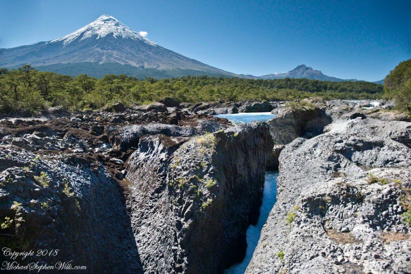
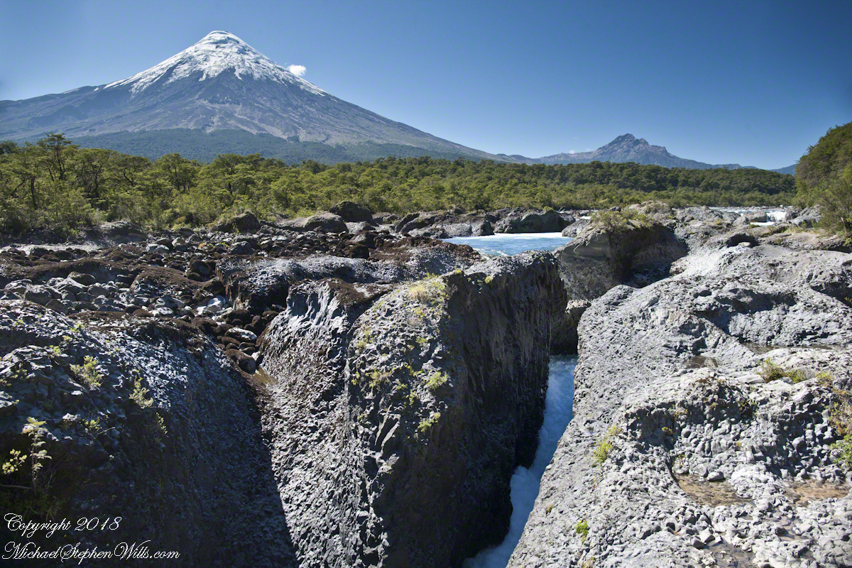
Petrohué Waterfalls (pronounced petro-WEH) is within Vicente Pérez Rosales National Park of Chile. For me, this view was one of the draws of our entire trip, that stratovolcano and its craggy children in the distance the same type as Mount Vesuvius, the volcano that wiped Pompeii off the map in 79 AD. Described by Pliny, the eruption type is named even today “plinian,” the most destructive and violent of all volcanic eruptions.
It was an irrational happiness I felt walking this place, I still smile to myself remembering it.
Click photograph for a larger view.
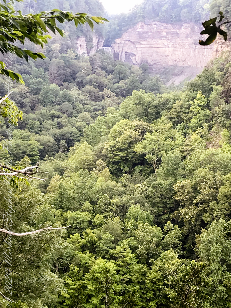
The mastery of water over volcanic rock deposited by ancient eruptions of the Orsorno Volcano.
Copyright 2021 All Rights Reserved Michael Stephen Wills
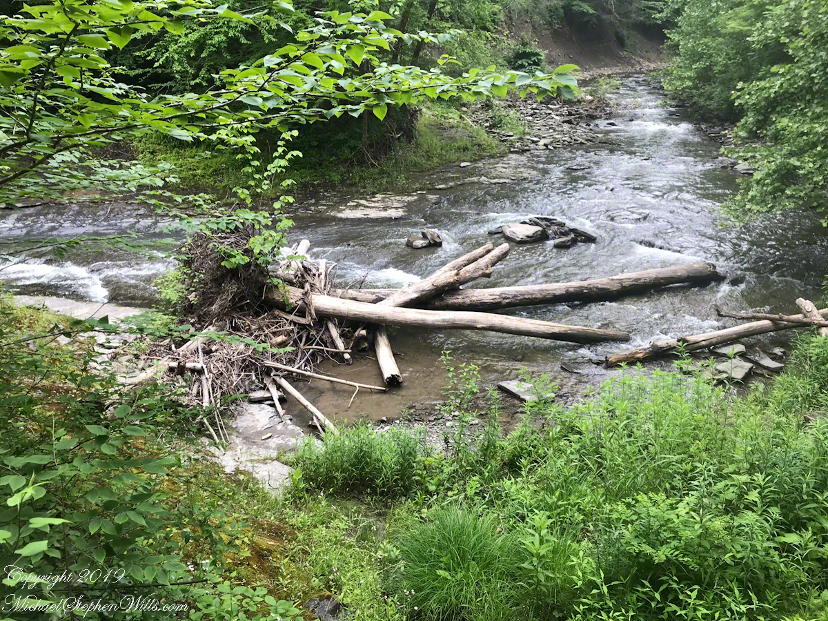
An 84-degree October walk up Cascadilla Gorge—quiet paths, bluestone porches, fresh paint on the bridge—waiting for the footbridge to catch the last, warm evening sunlight.
Every fall I make a point of walking Cascadilla Gorge at least once. On an 84-degree October 9 afternoon, Pam was tied up with chores, so I parked downtown and stopped to see the grandchildren. They were with their mom. Two were “too tired” after school to do anything. The youngest, at the age of four, was not yet in school and he floated the idea of the skateboard park; for me, that wasn’t in the cards. So I set off on foot up Court Street, past the residence of Buddhist monks at the gorge entrance.
Cascadilla Gorge is part of Cornell Botanic Gardens (formerly the Plantations), the university unit that stewards natural areas and gardens across campus. Foot traffic was light. A sign explained why: the lower trail was closed at Stewart Avenue, where the bridge spans the ravine. I crossed to the north side by the Christian Science church and wound up Cascadilla Park Road to the rim trail that climbs East Hill toward campus.
Homes line this stretch, porches facing the gorge where the constant music of creek and falls carries up. Not feeling ambitious, I made a few phone snapshots. Here the path squeezes past a porch built of local “bluestone,” a feldspathic sandstone native to the region—around town it’s sometimes called “Llenroc,” Cornell in reverse.
That pot you see in the previous photo gets a closer look here, with more of the same weathered bluestone.
The drop to the gorge floor is steep, sheer in places. The barrier fence looks stout in some sections and thins to almost nothing in others. A few years ago, a recent Cornell graduate walking home late along this path fell to his death. I continued to the fork for the Ithaca City Cemetery, climbed to Stewart Avenue, turned right to cross the Cascadilla bridge, then right again onto the Gorge Rim Trail back toward town. At the bridge I noticed part of the closure work: fresh paint on the bridge and on the suicide-prevention netting beneath. On September 24—just fifteen days earlier—a Cornell senior had jumped; the net caught him, and the fire department brought him to safety.
From the concrete barrier in that photo you can peer into the gorge: a beautiful view, the steady voice of water rising from below. I try to leave the darker stories where they belong—at least until the sight of fresh paint pulls them back to mind.
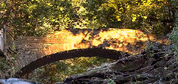
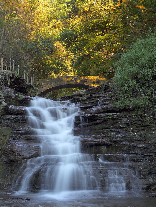
I took the following photograph in 2005, the September before my previous post, “Autumn Stroll in Sapsucker Woods” with the Kodak DSC pro slr-c, an ND filter, 50 mm lens and a tripod. It was a planned session, I work waterproof boots and was able to stand in the creek after a series of rain-free days. At this time of the year the gorge opens to the setting sun. I waited, taking a series of photographs for the perfect amount of light on the footbridge. The feature photograph (the header to this posting) is a detail from a shot with the bridge more fully lit.
The header image for this post comes from a planned session in September 2005, just before the photograph of my “Autumn Stroll in Sapsucker Woods” post. I used a Kodak DCS Pro SLR/c with an ND filter, a 50 mm lens, and a tripod. After several rain-free days I wore waterproof boots and stood mid-creek. In autumn the gorge opens to the setting sun; I waited and shot a sequence until the light laid perfectly across the footbridge. The banner image is a detail from a frame where the bridge is more fully lit.
We have a framed print of that photograph at home. I mounted it as a gift to Pam on our first Valentine’s Day.
“September Sunset in Cascadilla Gorge”
If you’ve walked Cascadilla Gorge in autumn, I’d love to hear your favorite vantage points—porches along the rim, the lower stone steps, or the footbridge at golden hour. Do you know any stories about Llenroc bluestone on these houses, or remember the Stewart Avenue Bridge before its safety upgrades? Photographers: what helps you balance deep shade and bright water from the designated trails? Share a tip or a memory in the comments.
Enter your email to receive notification of future postings. I will not sell or share your email address.
Copyright 2025 All Rights Reserved Michael Stephen Wills
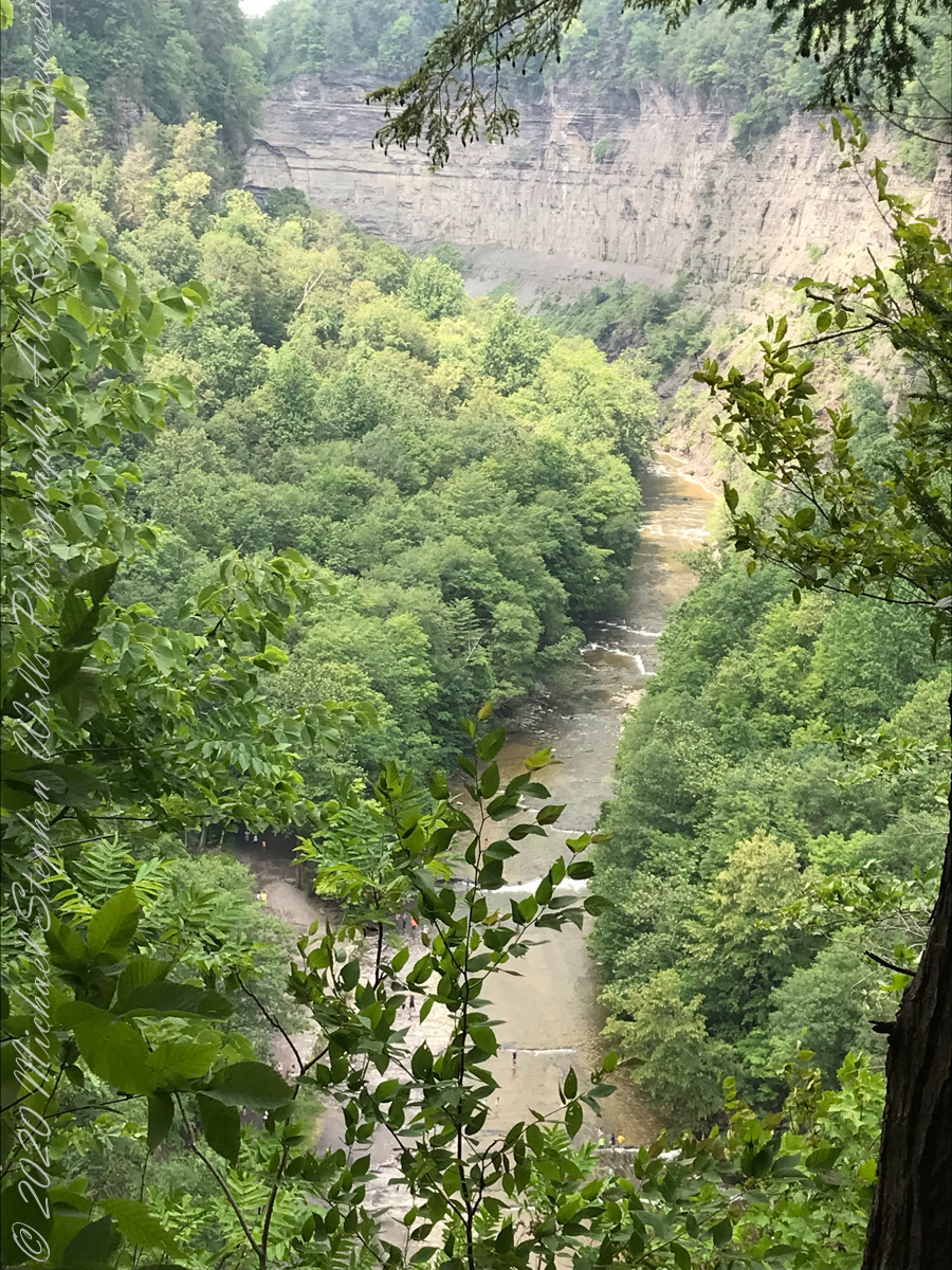
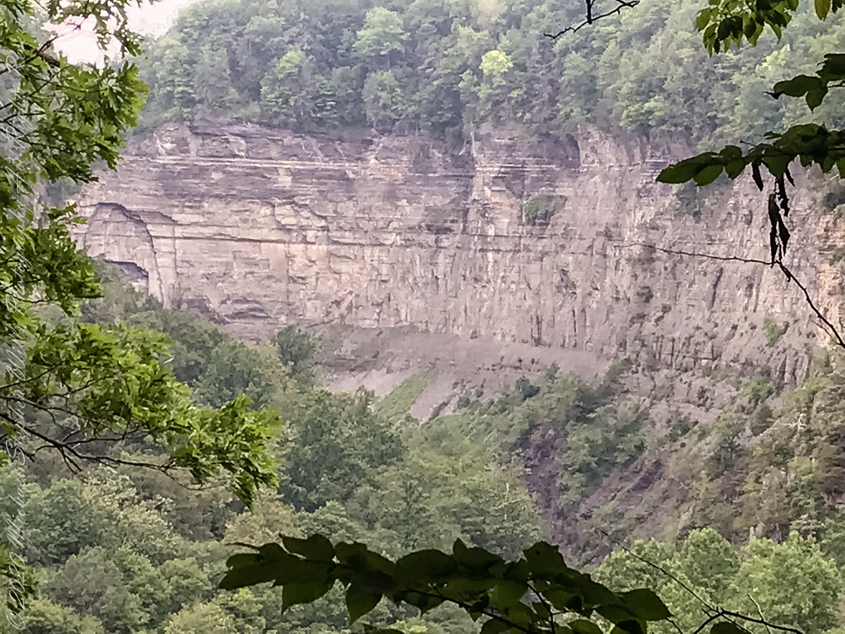
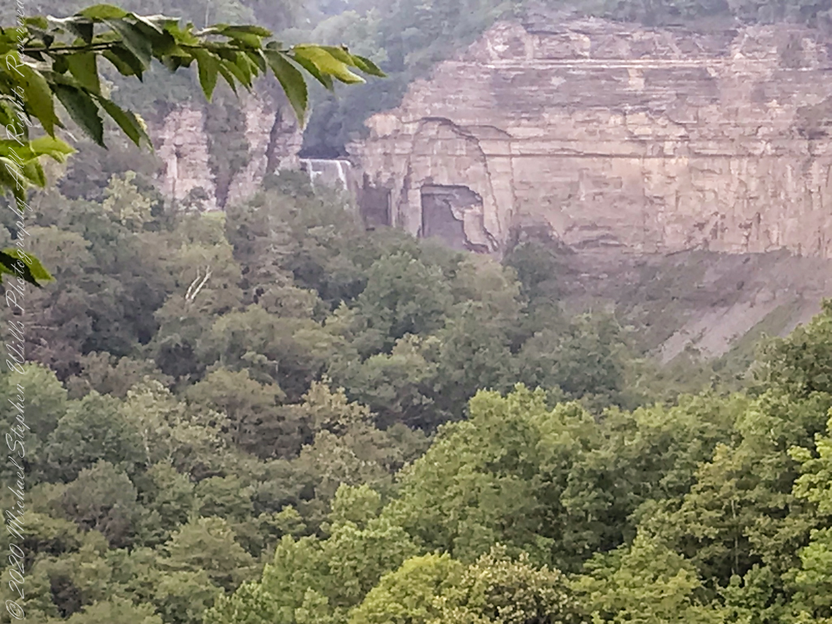
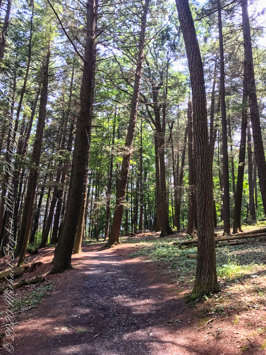
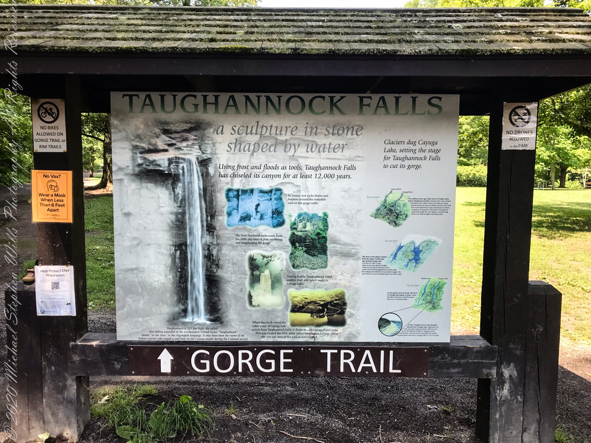
Travelling light, using IPhone captures during a 4.6 mile walk on the Gorge and North and South Rim Trails of Taughannock Falls New York State Park, Finger Lakes Region near Ithaca, New York. A few waterfalls and sights along the way. Distance is from the “Health” app on my phone.
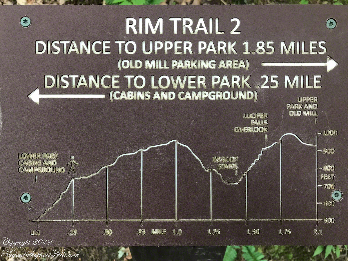
A “Rim Trail” follows the edge of the gorge. The “Gorge Trail” is within the gorge, along side the creek and ends at the 200+ foot waterfall.
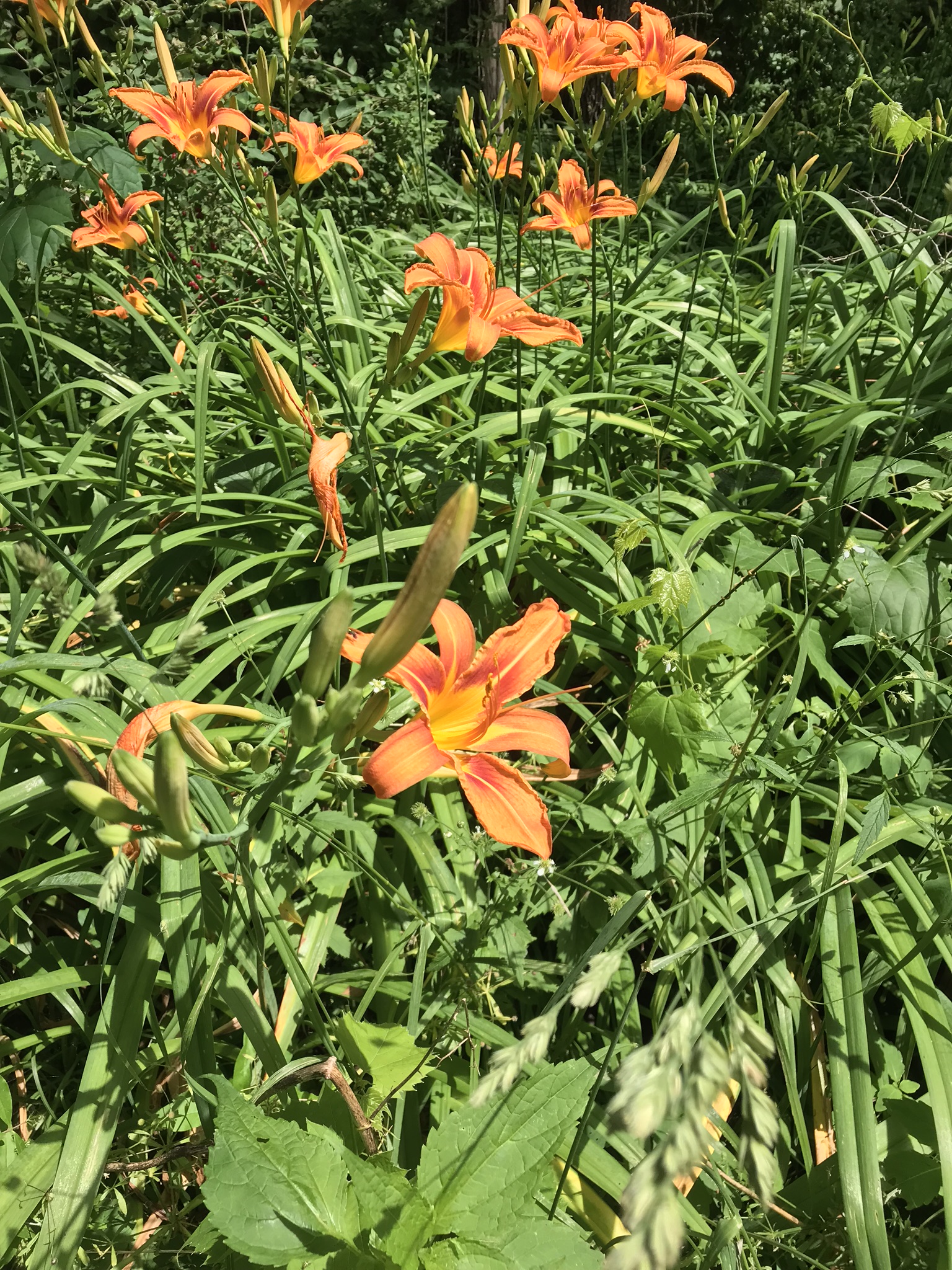
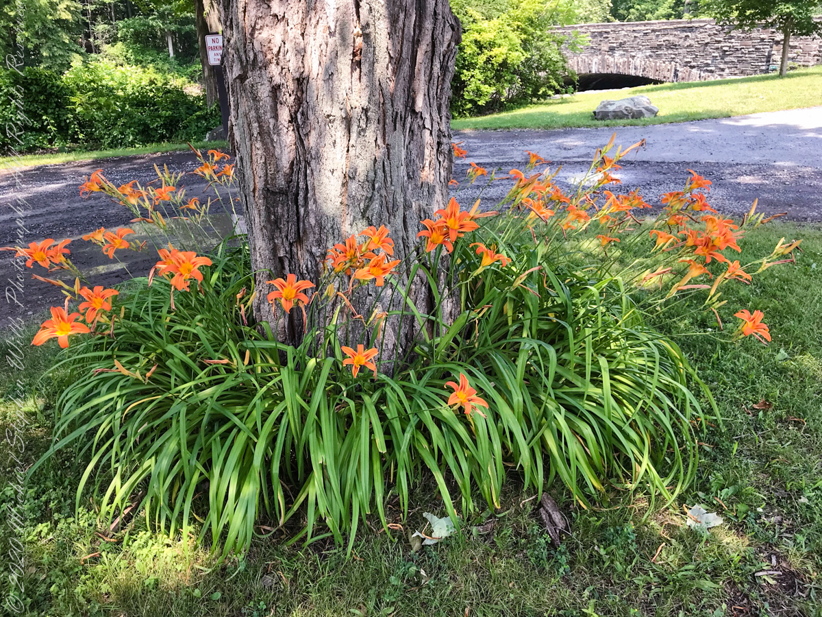
This was the day Tiger Lilies bloomed along the roads the entire 13 miles. This stand was at the beginning of the South Rim trail.
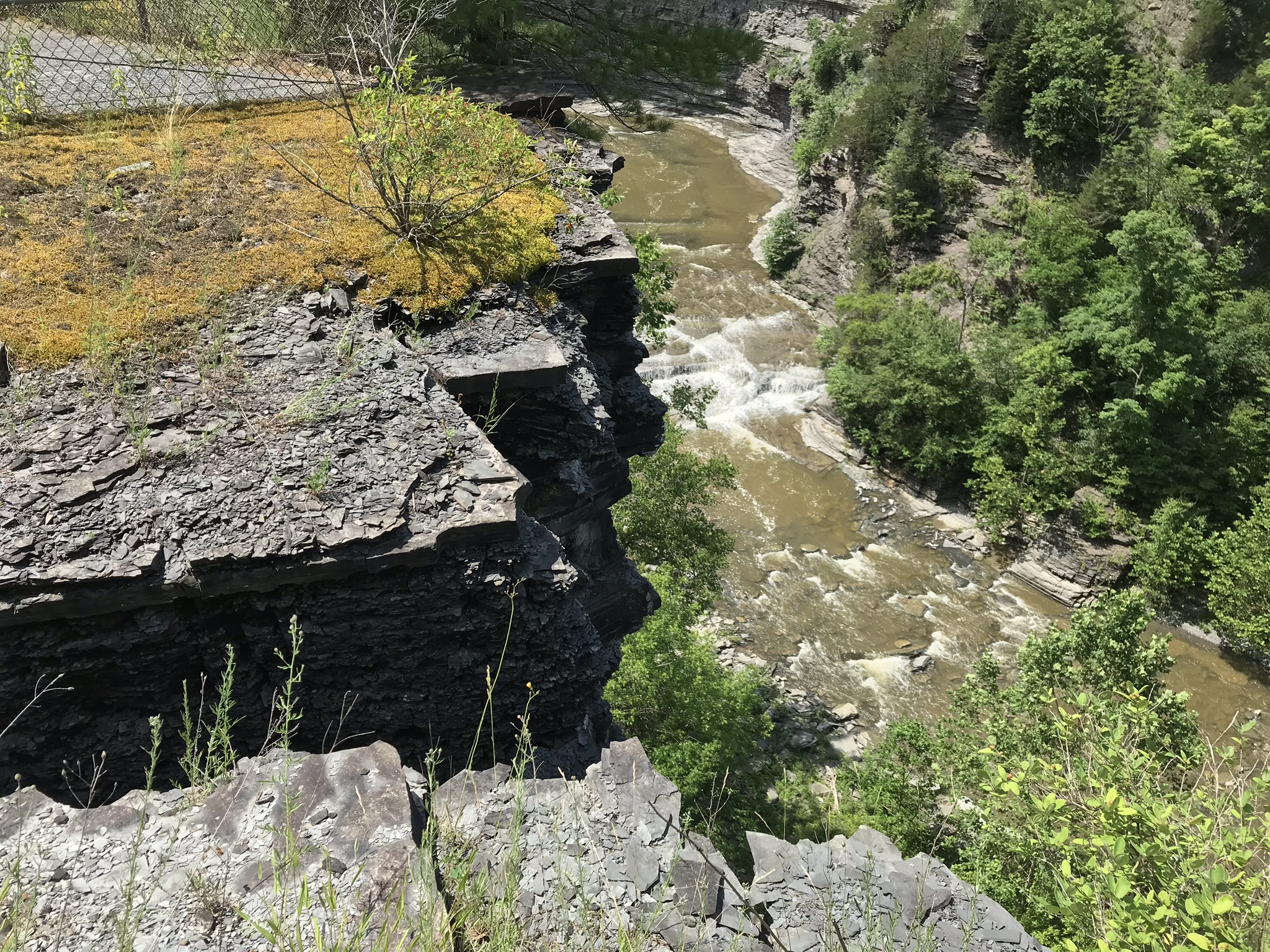
A few steps farther the trail opens up to the expanse of the gorge above the waterfall, a place to contemplate the age of these rock gazing into the open space. There is no access to the bottom of the gorge here.
On days like this, the experience carries me away, enjoying the moments and forgetting the phone in my pocket. When I come to, it is the bottom of the South Rim trail at the entrance to the Gorge Trail and the hordes walking to the falls on a Sunday afternoon. This waterfall welcomes everyone at the beginning.
The vantages I choose usually exclude the crowds, here is a video of the observation platform beneath the 215 foot Taughannock Falls. Any closer and the camera lens is covered with mist. Feels great on this hot day.
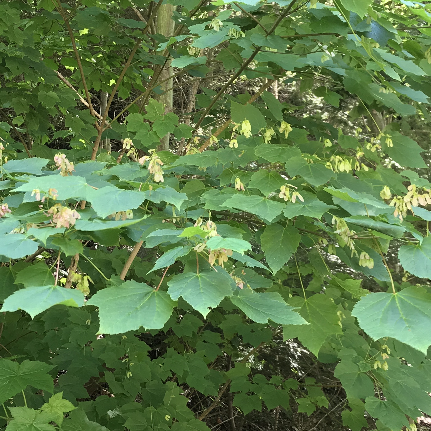
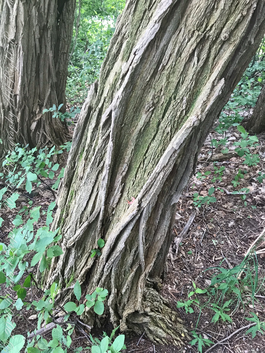
I capture this tree growing along the Gorge Trail for later identification. It has fruits similar to a maple tree. Called samaras and also known as helicopters, maple keys, whirlybirds, and polynoses these must distinguish this tree as a member of the genus Acer though the leaf shape gives me doubts. Here the gorge changes direction almost 90 degrees from, generally, north/south to east/west. There is plenty of sunlight here and the tree has taken root in the talus of the cliff face.
I researched it and discovered the scientific name is Acer pensylvanicum and more commonly known as Moosewood. There is a “famous” restaurant in Ithaca, named Moosewood, so now I know there is indeed a tree growing locally by that name. The restaurant is near the commons of Ithaca and is 100% vegetarian. The last time Pam and I at there we were packed like sardines, like some collective, and we’ve never been back. The food is good and the basis of their fame is a cookbook by the same name.
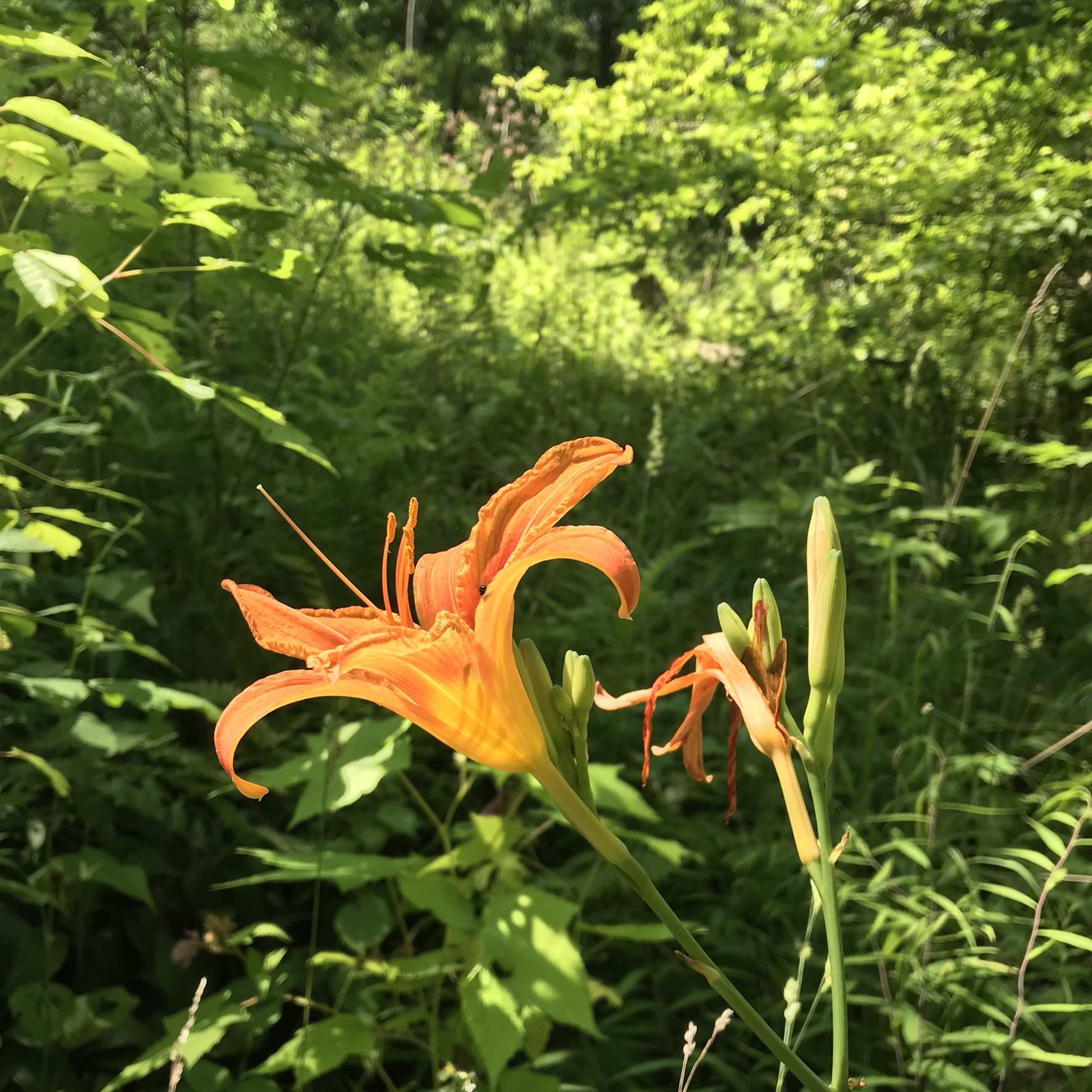
Backlit lilies found on the climb up the North Rim trail.
Travelling light, using IPhone captures during a 5.7 mile walk on the Gorge and South Rim Trails of Robert H. Treman New York State Park, Finger Lakes Region near Ithaca, New York. A few waterfalls and sights along the way. Distance is from the “Health” app on my phone.
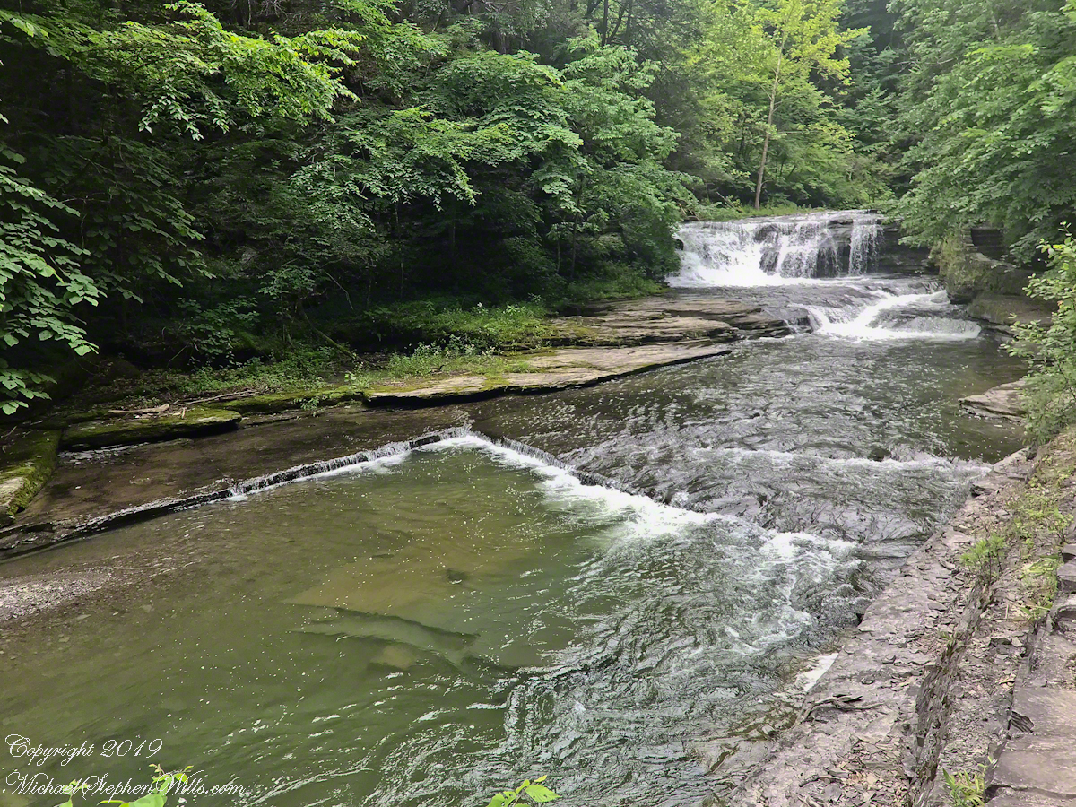
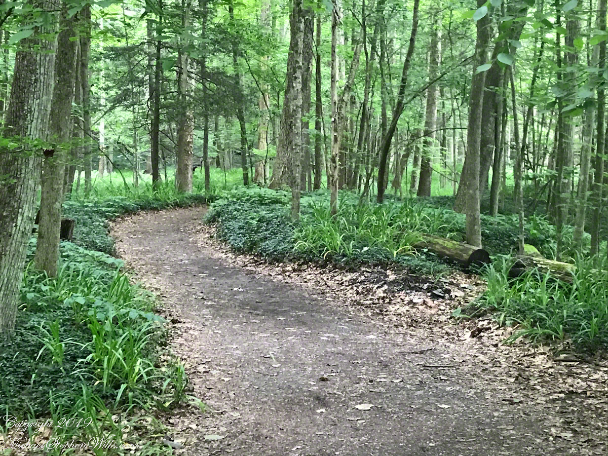
One of many waterfalls along the Gorge TrailLooking back to the above waterfallEnchanted Trail
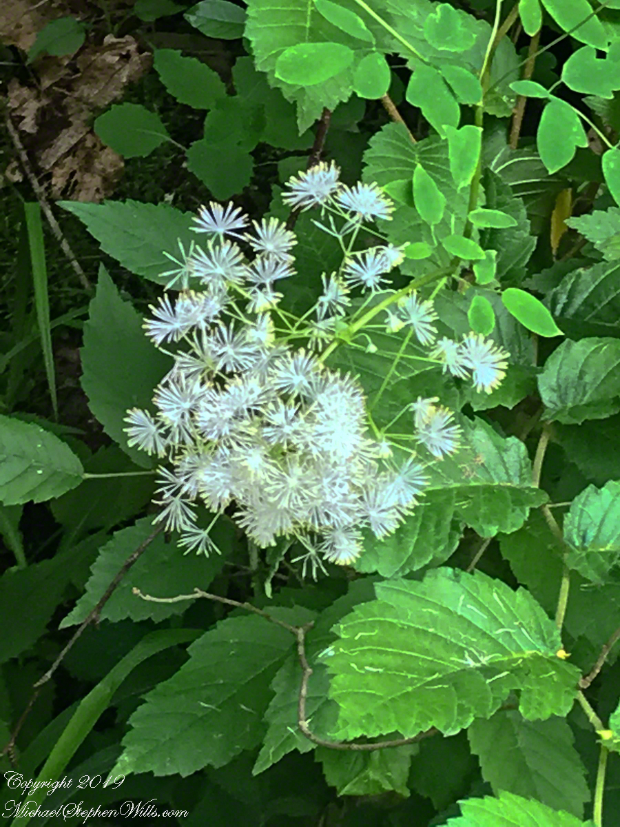
Birdsong and enchanted placeBayberry?The power of flowing water (flood stage)
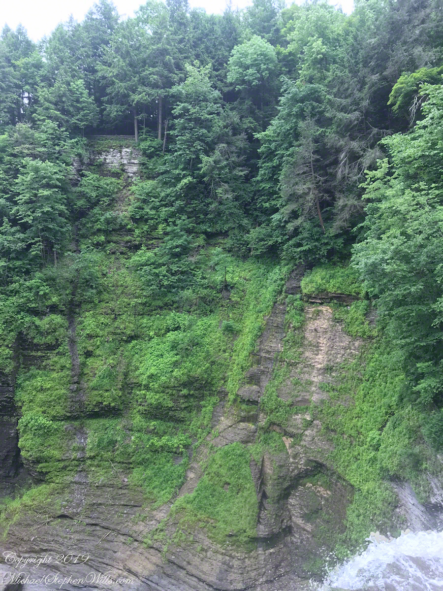
In the nature of fame, today Watkins Glen is the best known of the Finger Lakes State Parks. The International Speedway of that name enhanced and amplified name recognition during the post war years. Founded in 1948, the course used public roads of the town until the inevitable happened, an accident and the death of a seven year old child in a group of sidewalk spectators when a racer lost control.
The glen predates the race by 12,000+ years formed at that time from glaciation using materials from distant eons . Watkins Glen was known as a tourist attraction from the 19th century for the resort hotel on the south gorge rim, acquired and developed by New York State in the first years of the 20th century.
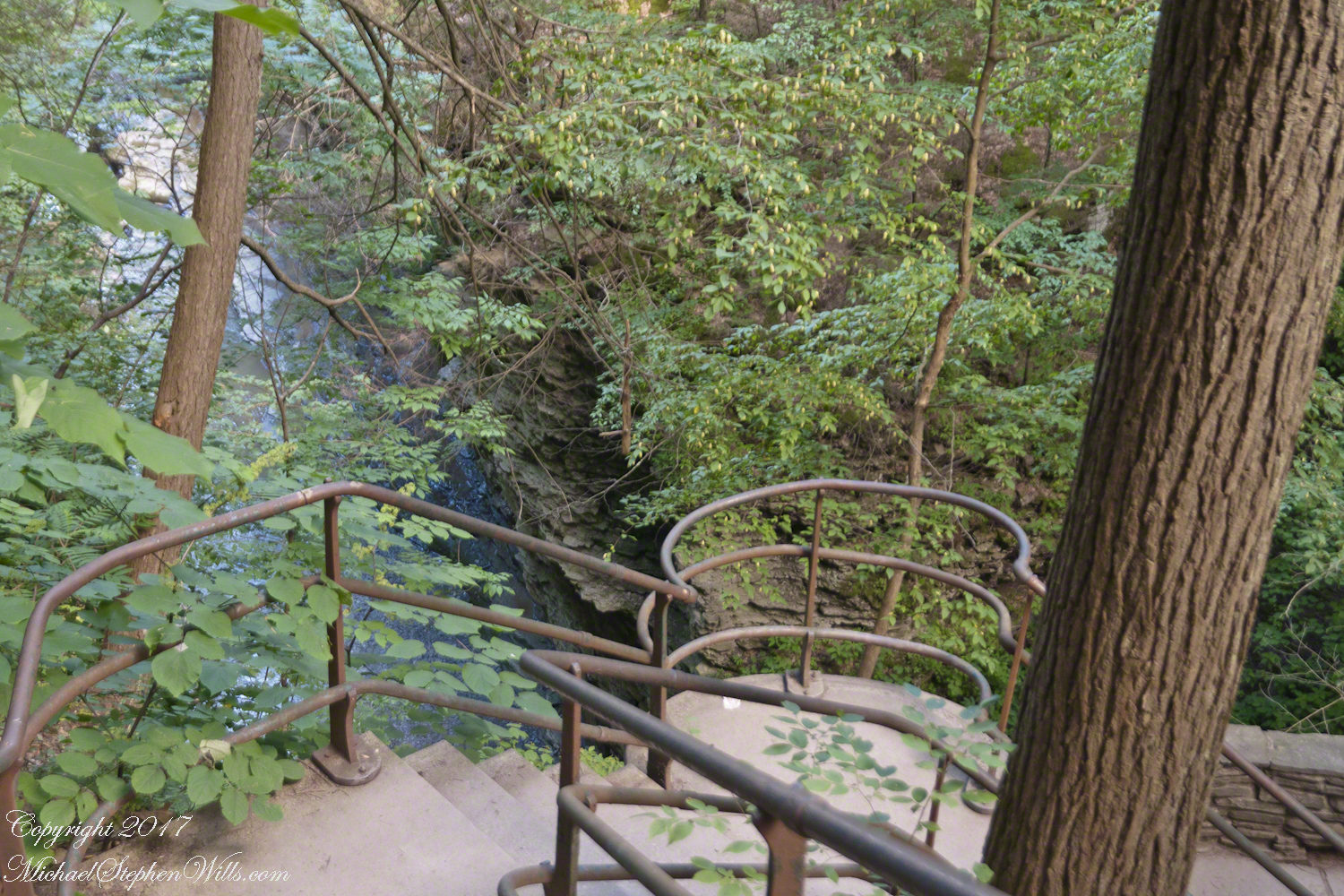
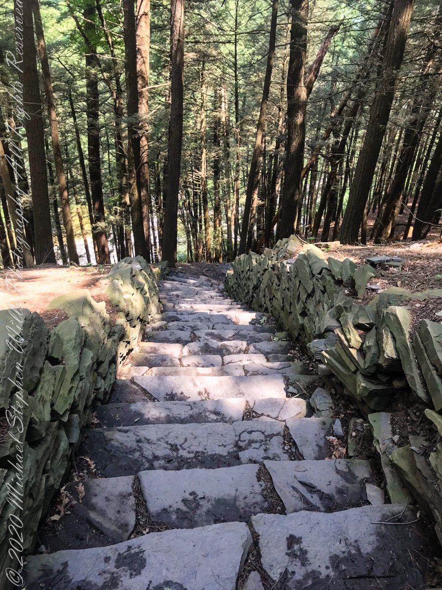
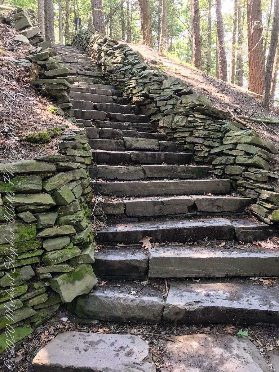
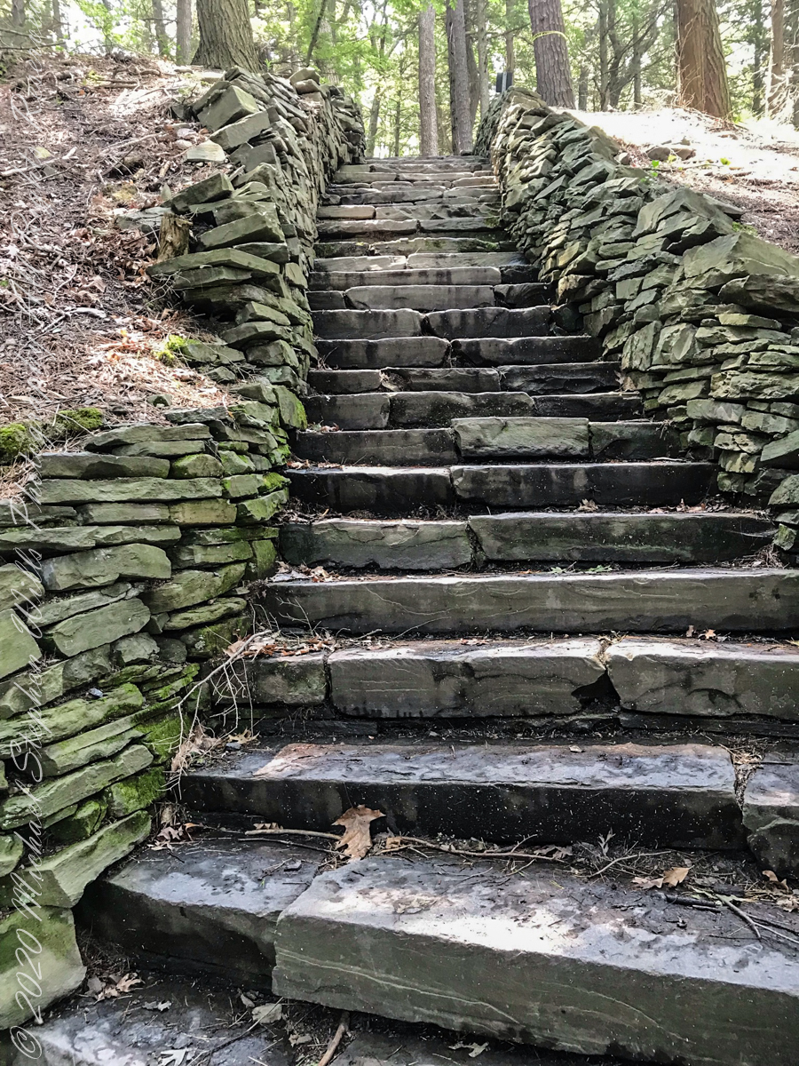
From a gate off “Lovers Lane” a sturdy flight of concrete steps with custom made handrails lead to an observation platform over the gorge. This feature will be known to many future generations……
…….the fine grained concrete is worthy of a Roman wall, the heavy iron handrails were built to specification as flowing curves unlike what is done today: built as modules and accommodated on site.
In the 20th century the fame of Watkins Glen attracted the road race, the popularity of racing enhanced park attendance. Today, the gorge trail of crowded summer weekends. On Tuesday, August 1, 2017 Pam packed a picnic lunch and we made a late start for a weekday visit. The upper entrance is enhanced by mature trees, oak, elm, hemlocks. We had our picnic under these on a moldy picnic table enhanced with a green striped table cloth and fresh coffee.
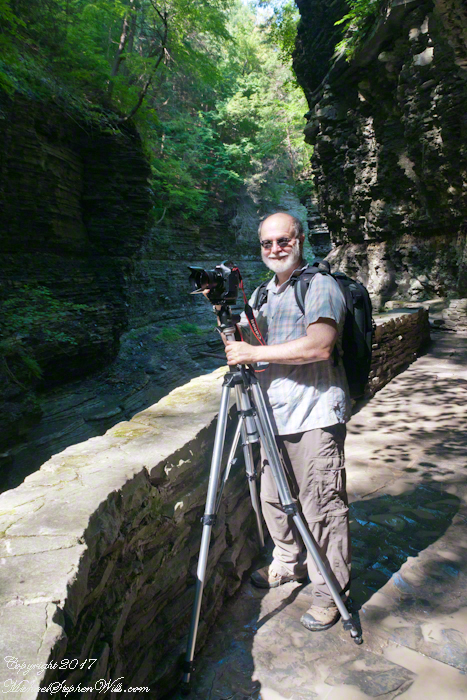
Pam is my personal photographer. Here is an example of her work.
To give me my due, I did the driving and carried the 30+ pound pack into the gorge.
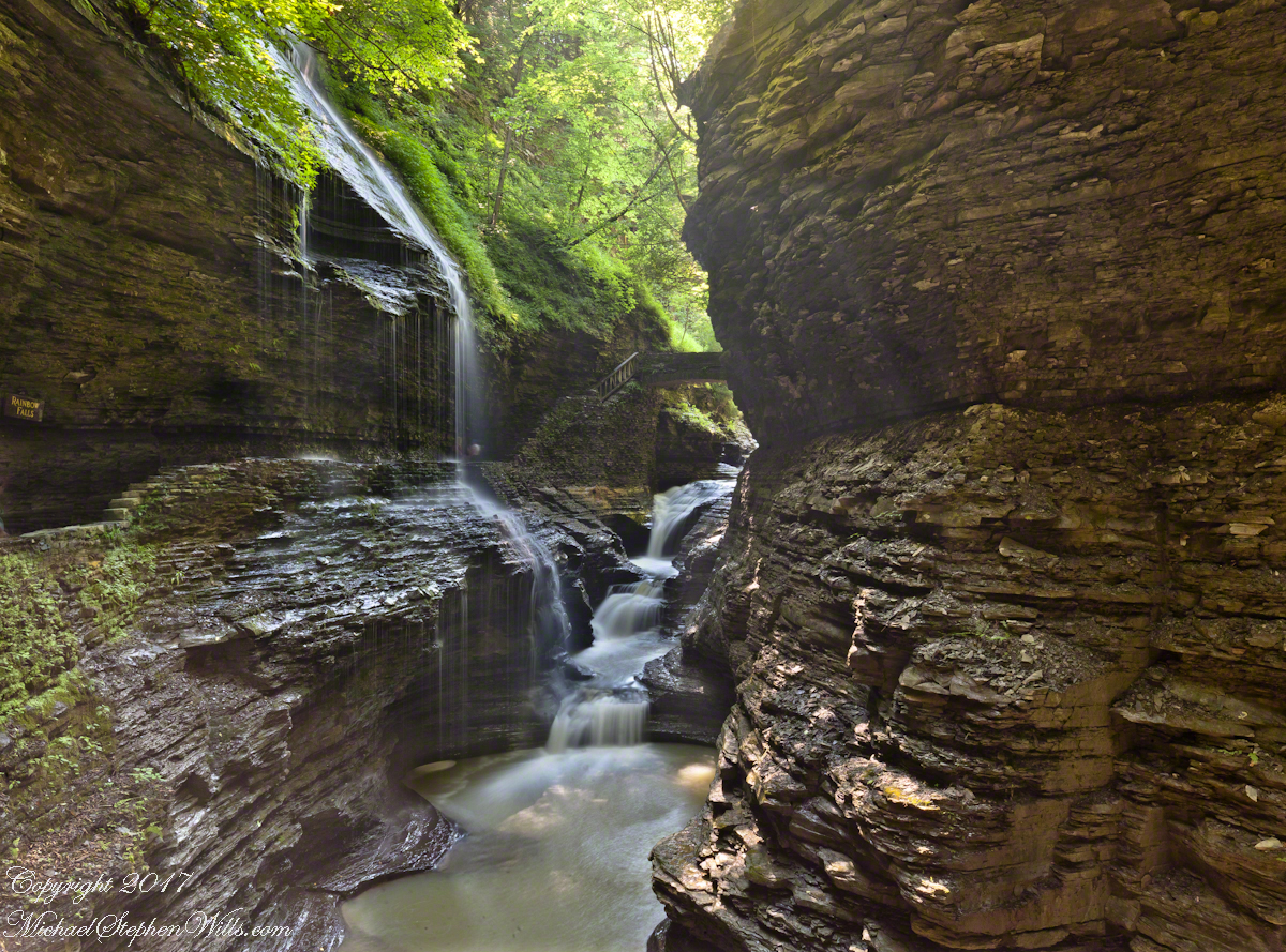
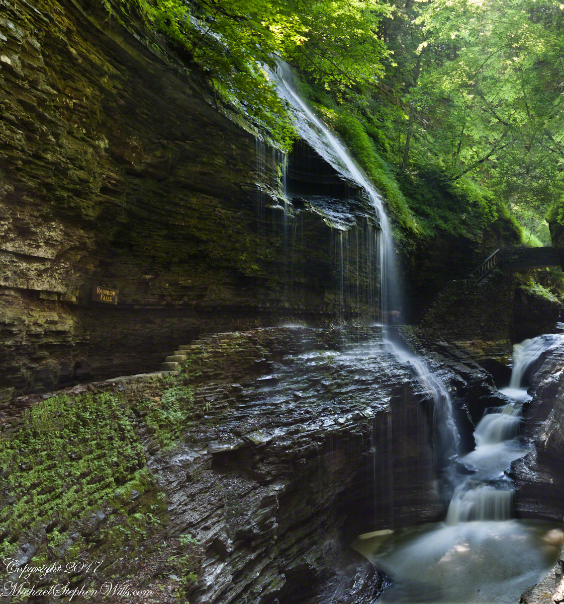
Pam captured me in position downstream from Rainbow Falls with a Manfrotto tripod with hydrostatic ball head on which is mounted a Canon EOS 1Ds Mark III and Canon EF 24mm f1.4 II USM lens, Tiffen nd 0.9 filter.
It was coming up to 4 pm eastern daylight savings time, the sun still high overhead. I needed to carefully choose a position for a frame in the wide angle lens without hot spots. Here are two results.
The sun was just of the gorge rim, to the right. Rainbow Falls forms from the tributary to Glen Creek cascading over the gorge walls.
Visitors walk under the falls where falling water eroded the soft, underlying stone to form an overhang.
Copyright 2021 Michael Stephen Wills All Rights Reserved
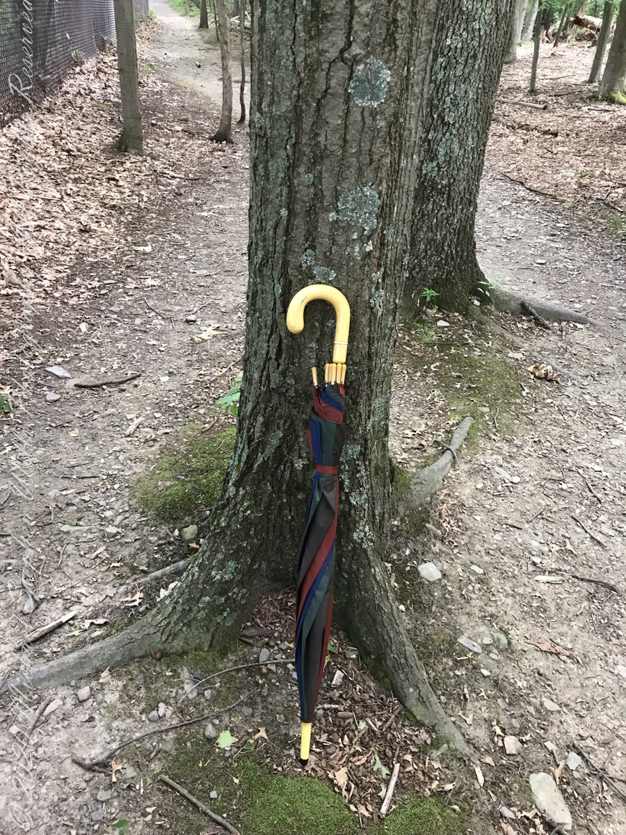
Constant winds from thunderstorm updrafts, I brought along an umbrella just in case.
Click photograph for slide show. To do this from WordPress Reader, you need to first click the title of this post to open a new page.
Maple Tree
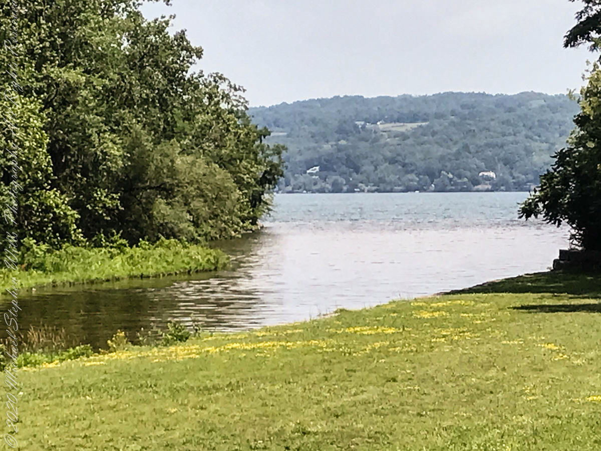
View from the South Rim Trail. The water flowing from Taughannock Falls to Cayuga Lake.
The steep, high gorge walls below the falls on a humid July morning.
gorge walls
My umbrella
Taughannock falls in distance
Taughannock Falls in distance
South Rim Stairs built by the Civilian Conservation Corps in the 1930’s
Pine Forest at foot of stairs
An interesting presentation at the Gorge entrance
Tiger Lilies
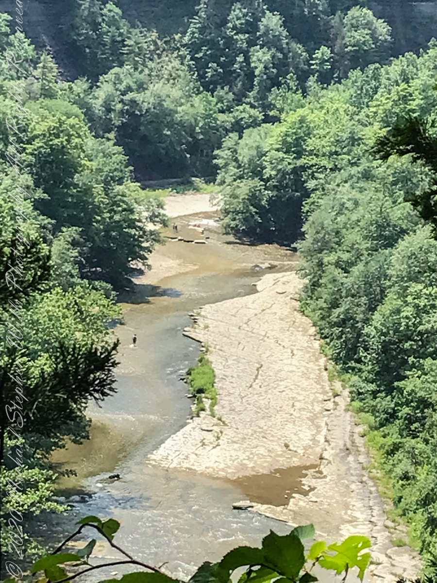
brown creek water meets Cayuga Lake (900 feet deep)
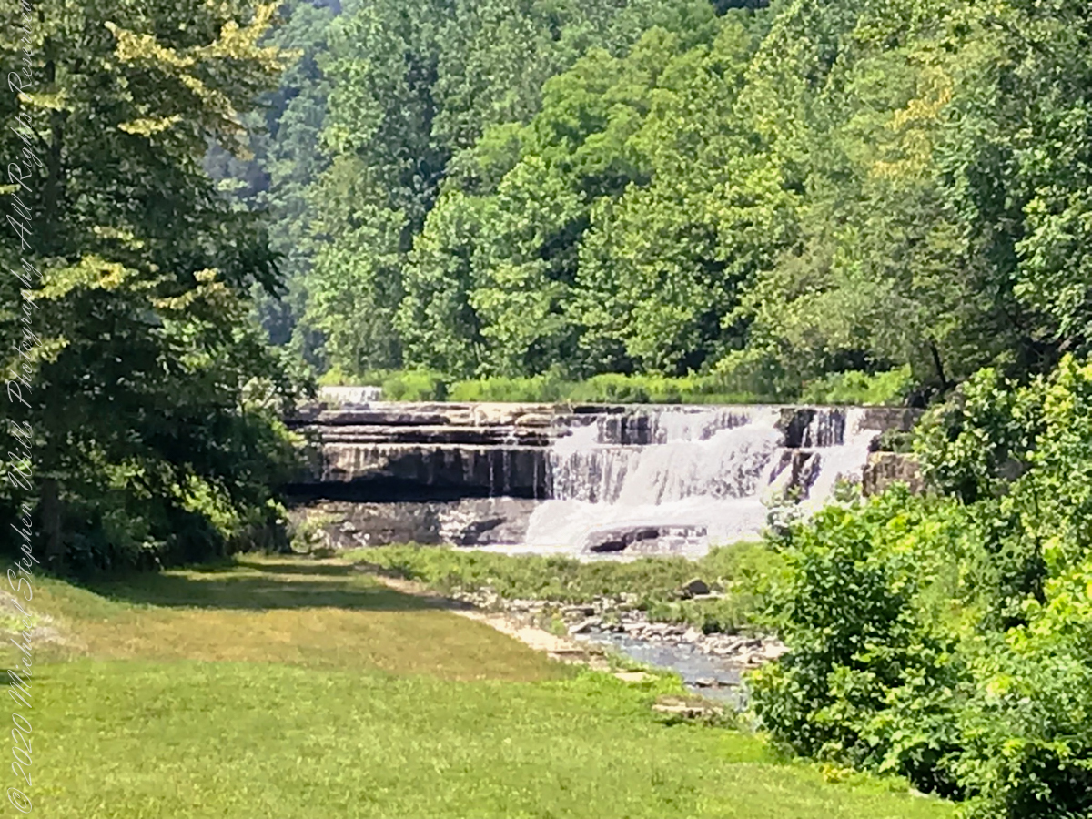
Last waterfall of Taughannock Gorge
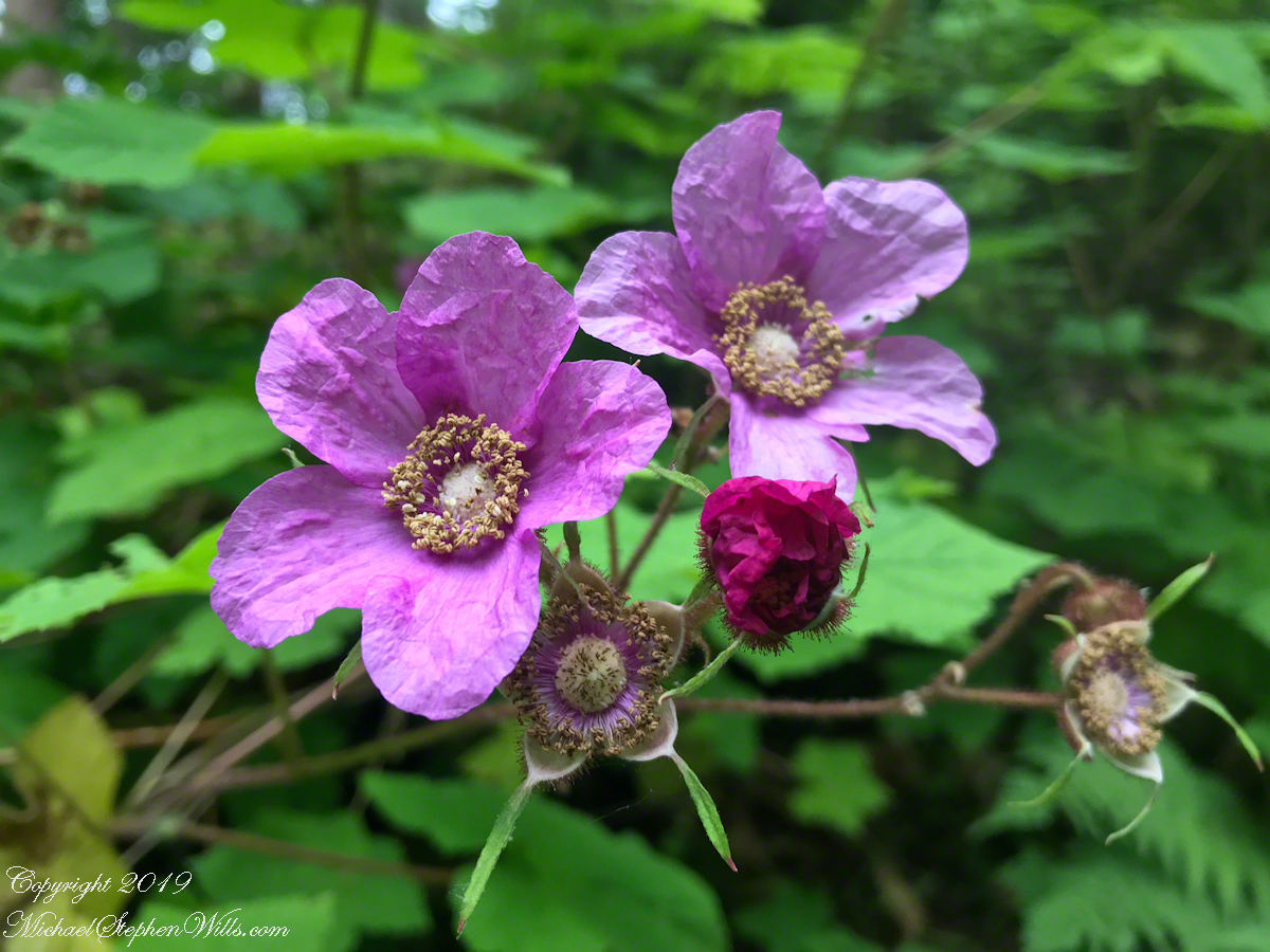
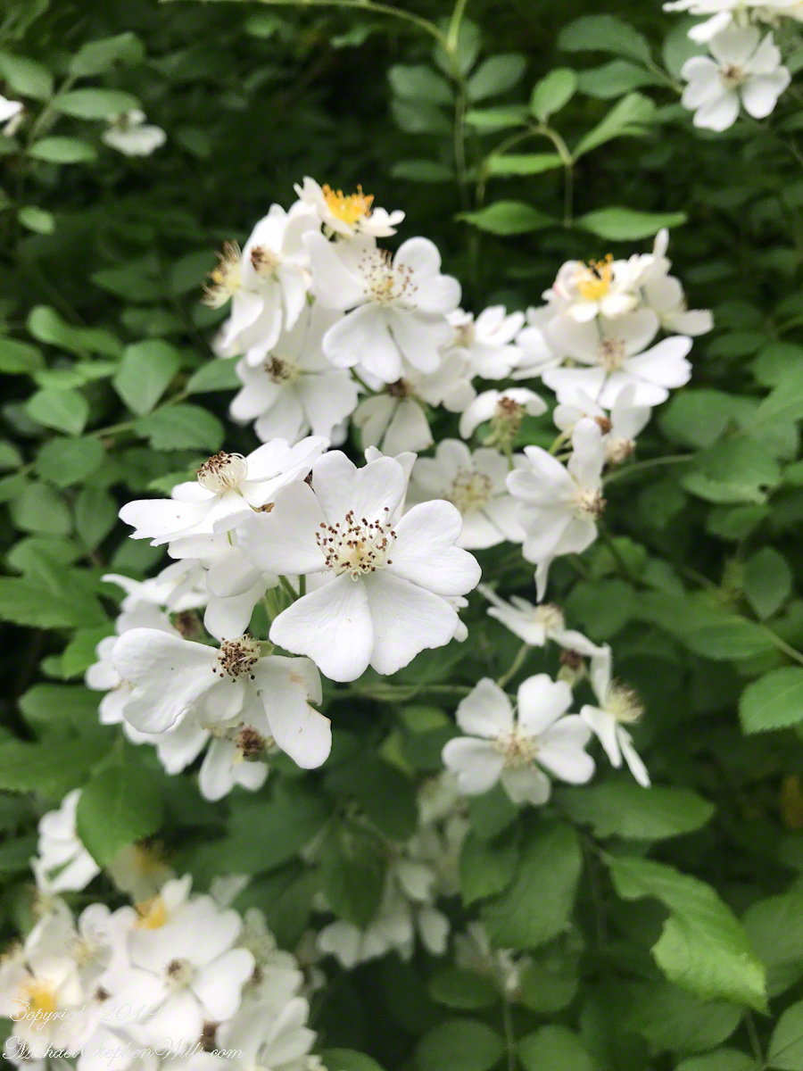
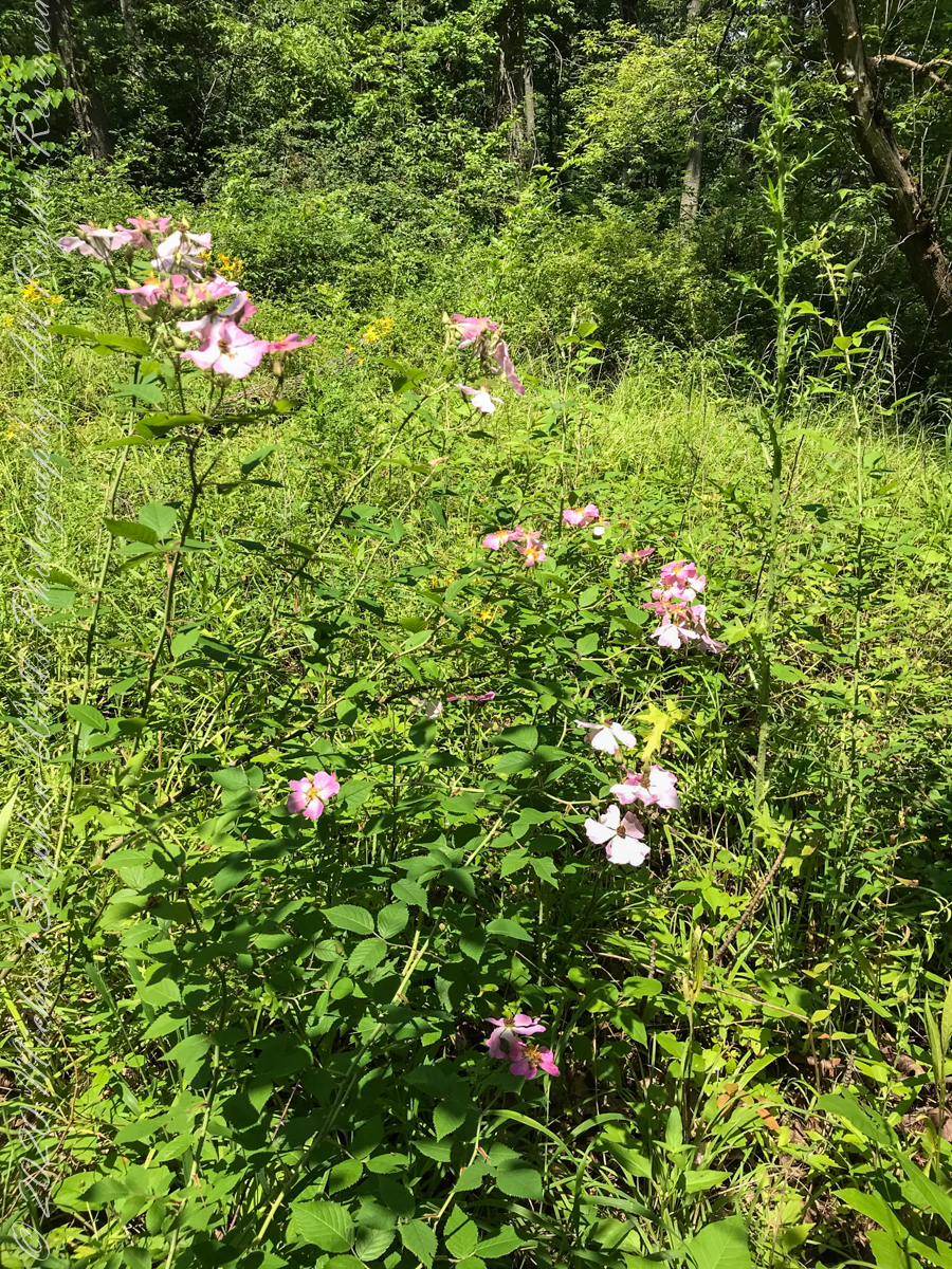
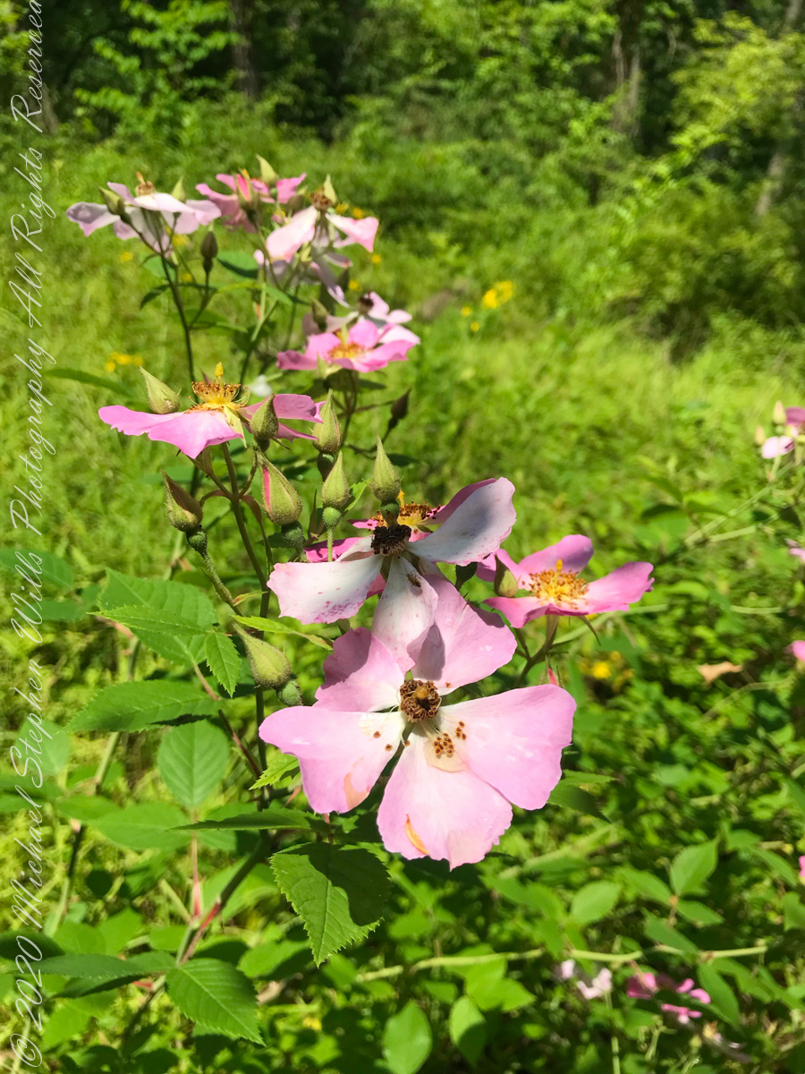
wild roses
Wild rose blooms
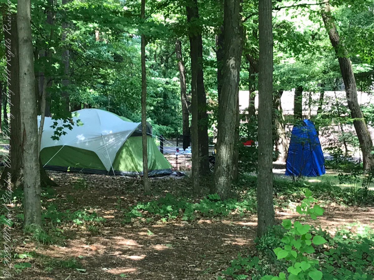
camping on North Rim
North Rim Gorge view
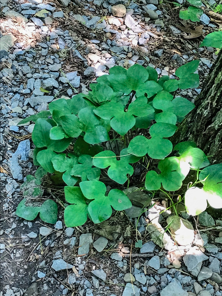
Lobe leaved Hepatica
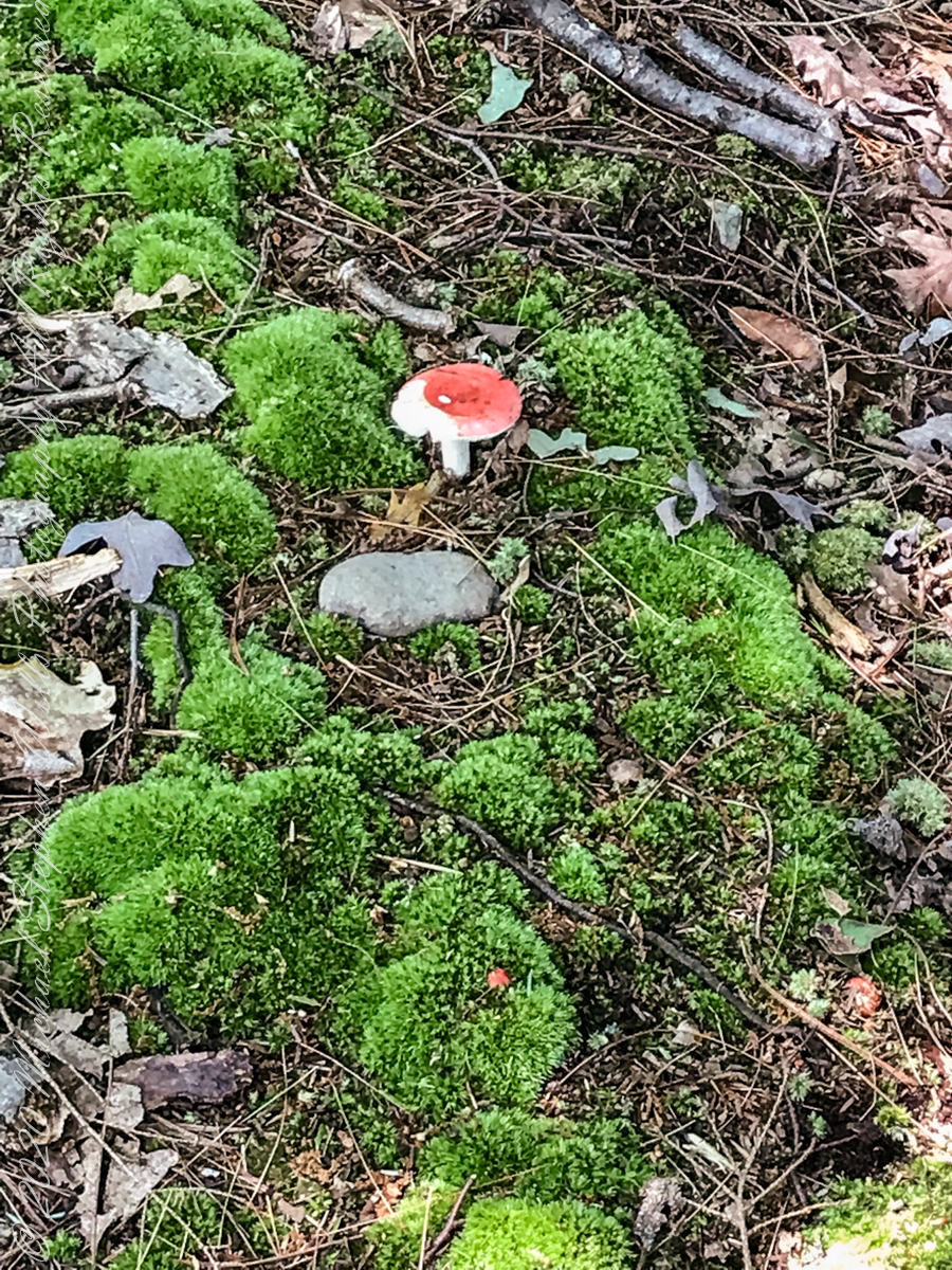
Mushroom and Moss on the “wetter” north rim
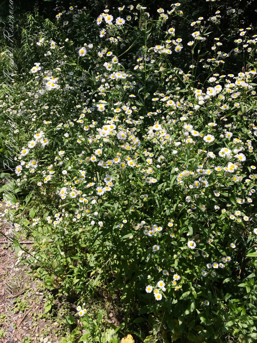
asters, an invasive species
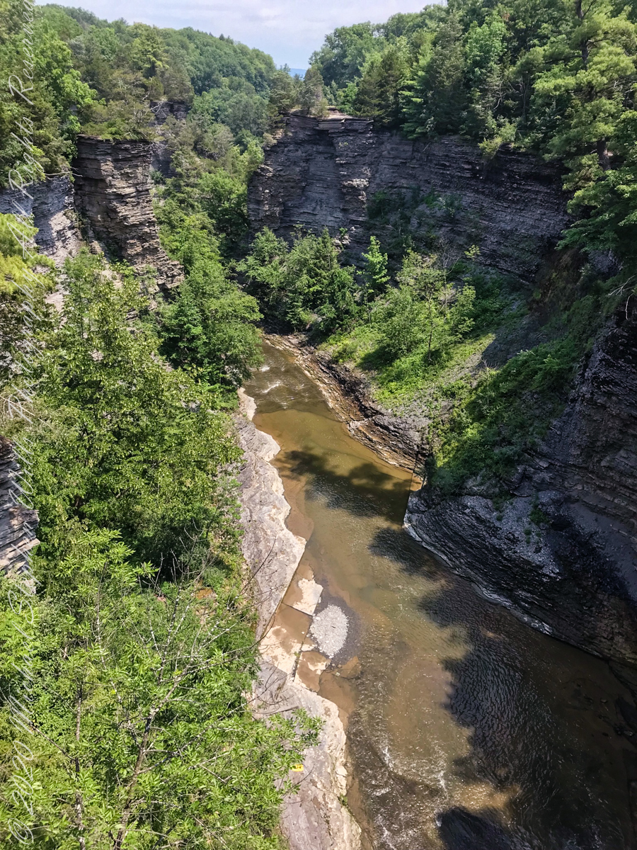
The dramatic and virtually inaccessible gorge above Taughannock Falls
Click the “Watch on YouTube” for a larger format view and more information about each video.
Taughannock Falls Gorge on a humid summer morning
Hemlock Forest on South Rim Trail
Taughannock Falls Gorge from South Rim Trail
Taughannock Falls from South Rim trail
View of Taughannock Falls Gorge from the North Rim trail on a humid summer (July) morning. Turkey Vultures circle overhead…they are there most summer days.
View of the first waterfall of Taughannock Gorge from the railroad bridge linking the North and South Rim trails on a humid summer (July) morning. This large waterfall empties to the gorge above the 210+ foot Taughannock Falls.
Copyright 2021 All Rights Reserved Michael Stephen Wills
Effects of these dual waterfalls is deeply refreshing for the people on the narrow walkway underneath.
ISO 160, 1.3 sec at f/ 8.0
Photograph two of this Hanging Garden series has the aspect shifted slightly to include the sheer cliff hovering over the waterfalls. A low ISO and tamped down diaphragm (f/8) resulting in longer exposure (1.3 sec) impart a presence for two low volume waterfalls.
Captured with a Kodak DCS Pro SLE/c dslr and a Canon EF 50 mm f/1.4 lens stabilized with the Manfrotto Studio Tripod model 475 and the 468 Hydrostatic ball head.
Copyright 2021 Michael Stephen Wills All Rights Reserved
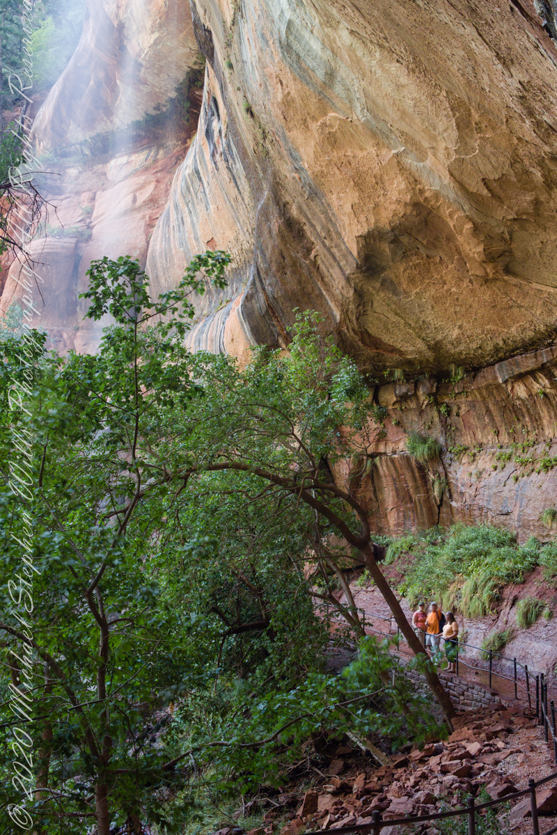
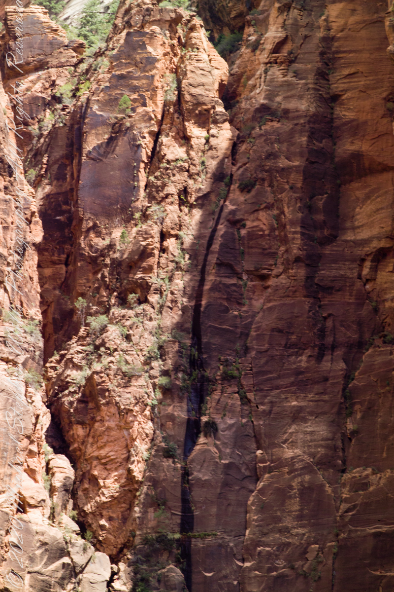
Visitors to Zion on a narrow path beneath this vast overhanging cliff of Navajo sandstone.
ISO 160, 0.8 sec at f/ 8.0
Changing the camera angle from the last “Hanging Garden” photograph, with visitors, here the visitors are less apparent, overawed by the waterfall. A low ISO and tamped down diaphragm (f/8) resulting in longer exposure (0.8 sec) captures and blurs just enough the fine waterfalls.
Captured with a Kodak DCS Pro SLE/c dslr and a Canon EF 50 mm f/1.4 lens stabilized with the Manfrotto Studio Tripod model 475 and the 468 Hydrostatic ball head.
Copyright 2021 Michael Stephen Wills All Rights Reserved
Visitors enjoying a waterfall mist (upper left) in the summer desert heat.
ISO 160, 1.3 sec at f/ 8.0
Notice a combination of low ISO and tamped down diaphragm (f/8) resulting in longer exposure (1.3 sec) has the facial features of two visitors blurred, the third was transfixed by the experience of Zion Hanging Gardens.
The header photograph is myself, at work beneath Zion cliffs, taken by Pamela Wills.
Captured with a Kodak DCS Pro SLE/c dslr and a Canon EF 50 mm f/1.4 lens stabilized with the Manfrotto Studio Tripod model 475 and the 468 Hydrostatic ball head.
Copyright 2021 Michael Stephen Wills All Rights Reserved
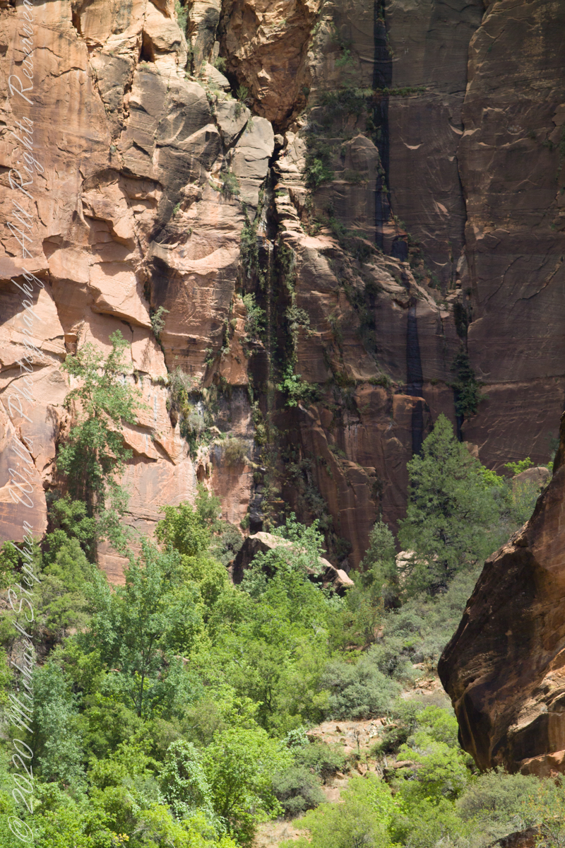
The first photograph is the myriad fractures within the Zion Navajo sandstone, hidden water transits from rainfall miles away.
ISO 250, 1/8 sec at f/22
The second photograph, water emerging as a blessed sacrament, bestowal of life nourishing wildflowers, ferns, mosses, trees.
ISO 250, 1/320 sec at f/4.0
For this third photograph the first two were merged in photoshop for a revelation. I did not take time to smooth the transition, visible as a line. I graduated from this merge technique with the purchase of a wide angle (24 mm) lens. It is so difficult to organize all the angles and exposures, plus time to bring it together.
All photographs from the Kodak DSC Pro SLR/c, Canon Lens EF 200mm 1:2.8 L II stabilized via a Manfrotto 468MG with Hydrostatic Ball Head.
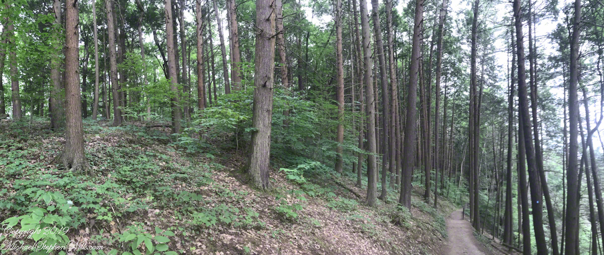
Can you spot the foot path?
Here is a gallery of the three photographs, to flip back and forth.
Copyright 2021 Michael Stephen Wills All Rights Reserved