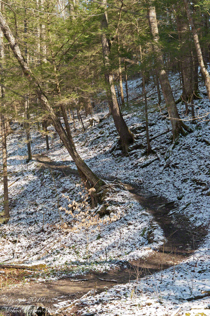
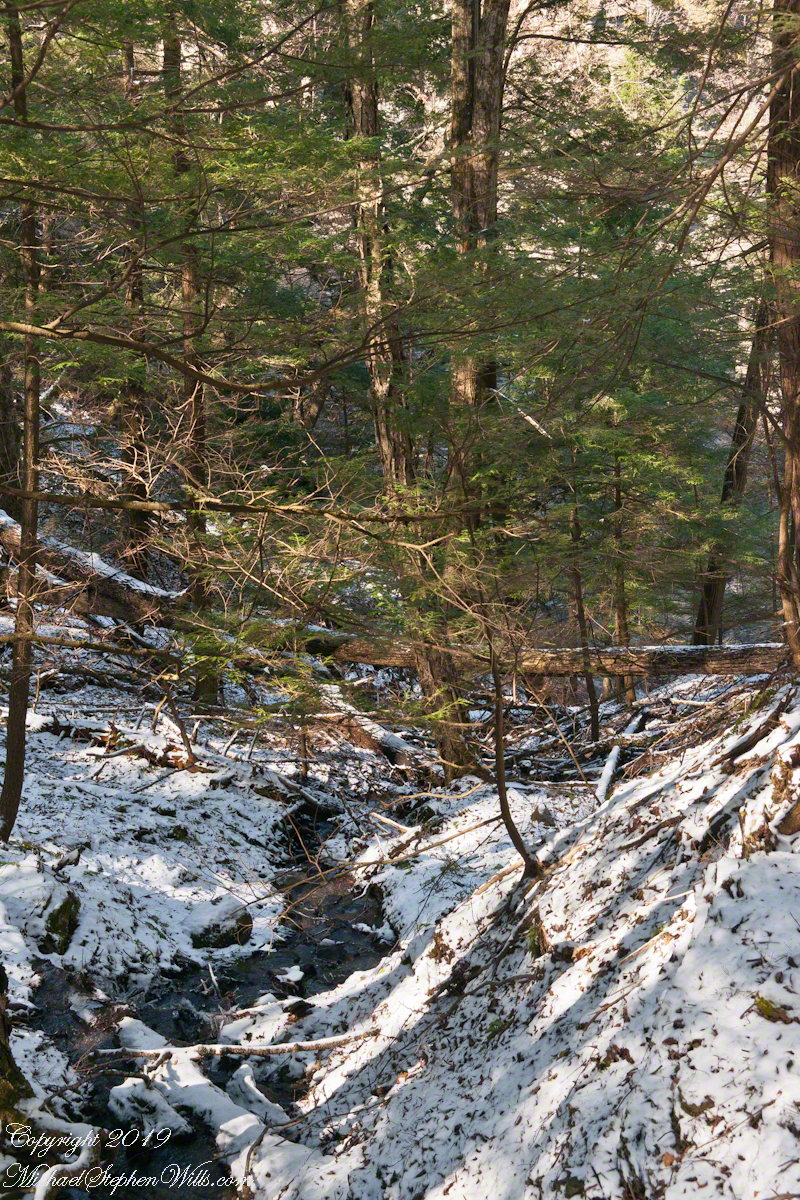
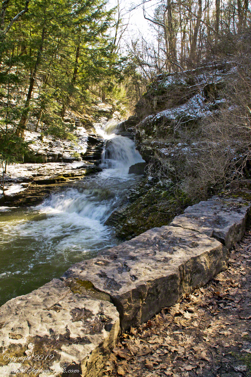
Here the Rim Trail climbs out of the flats beneath the Cliff Stairs, away from Enfield Creek, onto the upper slopes of the gorge.
Click photograph for a larger view. To do this from WordPress Reader, you need to first click the title of this post to open a new page.
Rim Trail Ascent
Early spring snow highlights the path, threading between hemlocks. The American realistic painter Andrew Wyeth comes to mind with I see the mottled texture of this light snow. He captured some of this in landscape paintings such as “Snow Flurries.”
Here is more of this effect……
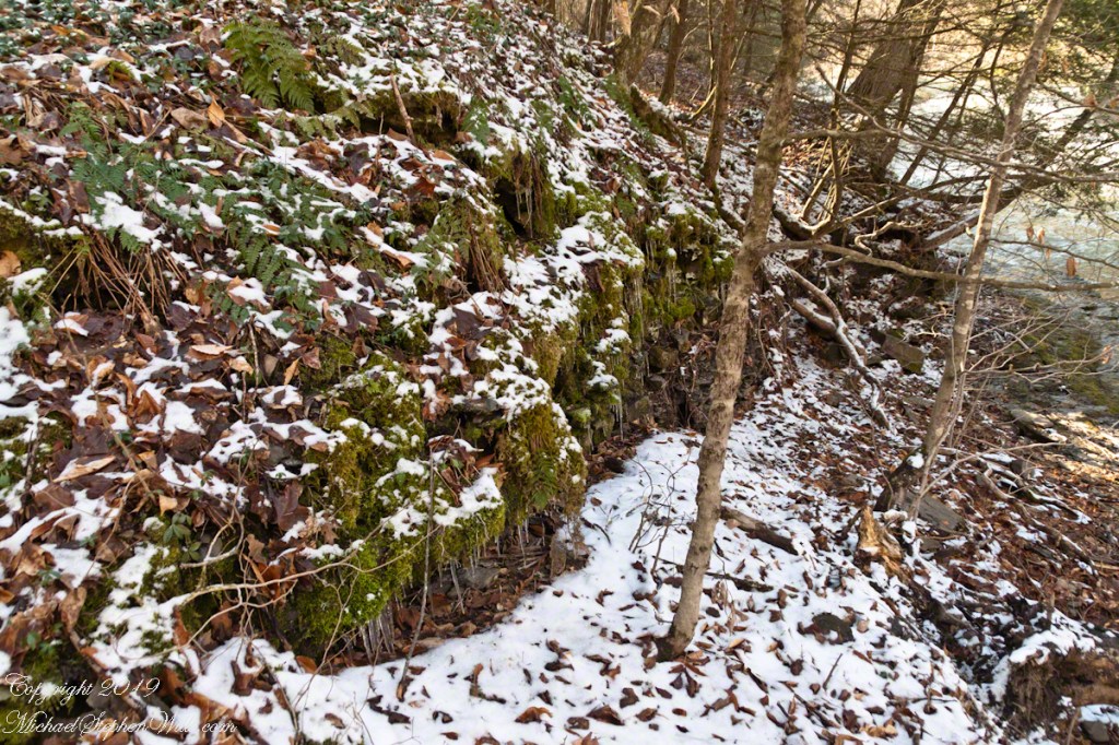
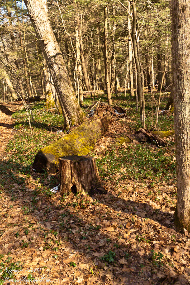
Fern, Moss, young trees, April Snow
These shots were hand held. I used a Sony Alpha 700 dslr with a variable “zoom” lens, great for framing compositions.
Robert H. Treman New York State Park.
Click for a slideshow of this Fertile Flats sequence.
Beneath the Cliff Stairs IBeneath the Cliff Stairs IIRim Trail AscentVernal Pool with Vinca VineFern, Moss, young trees, April Snow
Copyright 2024 All Rights Reserved Michael Stephen Wills
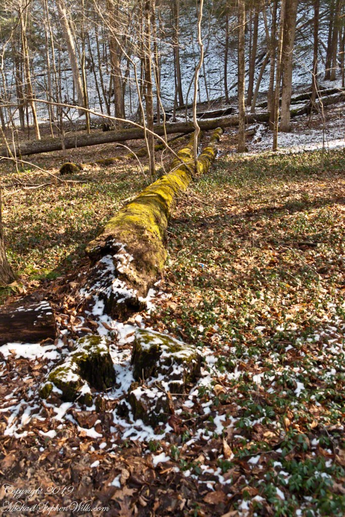
A broad, fertile flat between gorge walls supports a dense growth of invasive creeping myrtle. Springtime there is a sprinkling of small blue flowers, this may be the source of another name, periwinkle, or lesser periwinkle.
Click photograph for a larger view. To do this from WordPress Reader, you need to first click the title of this post to open a new page.
Beneath the Cliff Stairs I
Periwinkle is an evergreen and in early times vinca vine (another name we call it, from the scientific name Vinca Minor) was planted in graveyards and cemeteries. The isolated growth of vinca vine in this section of the gorge maybe from such a planting on a lost grave.
Beneath the Cliff Stairs II
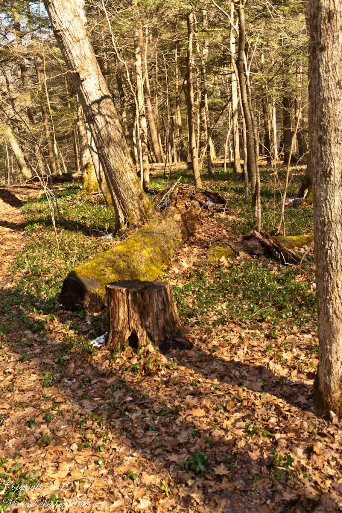
Today, the park practices leaving fallen trees in place, here they are covered in years of moss, a memory of headstones. Lesser Perriwinkle is significant for the living as the source of vincamine, from the leaves. A synthetic form of this compound is a potent vasodilator, a therapeutic treatment for stroke and other brain disorders.
These shots were hand held. I used a Sony Alpha 700 dslr with a variable “zoom” lens, great for framing compositions.
Robert H. Treman New York State Park.
Source: Wikipedia, “Vinca Minor.”
Click for a slideshow of this Fertile Flats sequence.
Beneath the Cliff Stairs IBeneath the Cliff Stairs IIVernal Pool with Vinca Vine
Copyright 2024 All Rights Reserved Michael Stephen Wills
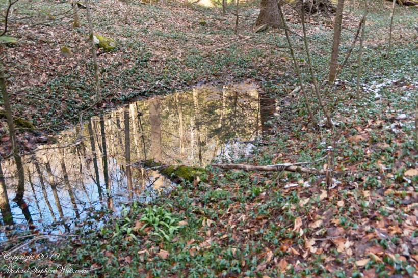
Melting snow, spring rains, gather in hollows of the forest floor to form ephemeral pools important for the development of amphibian life.
Click photograph for a larger view. To do this from WordPress Reader, you need to first click the title of this post to open a new page.
Vernal Pool with Vinca Vine
Also named vernal pools, from the Latin word for spring or the time of the equinox. The pools are ephemeral in the sense of being temporary, disappearing in the warmer, dryer late spring and summer months, a characteristic important for amphibian live in being devoid of predatory fish.
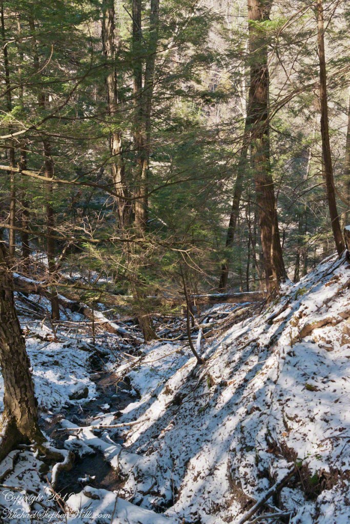
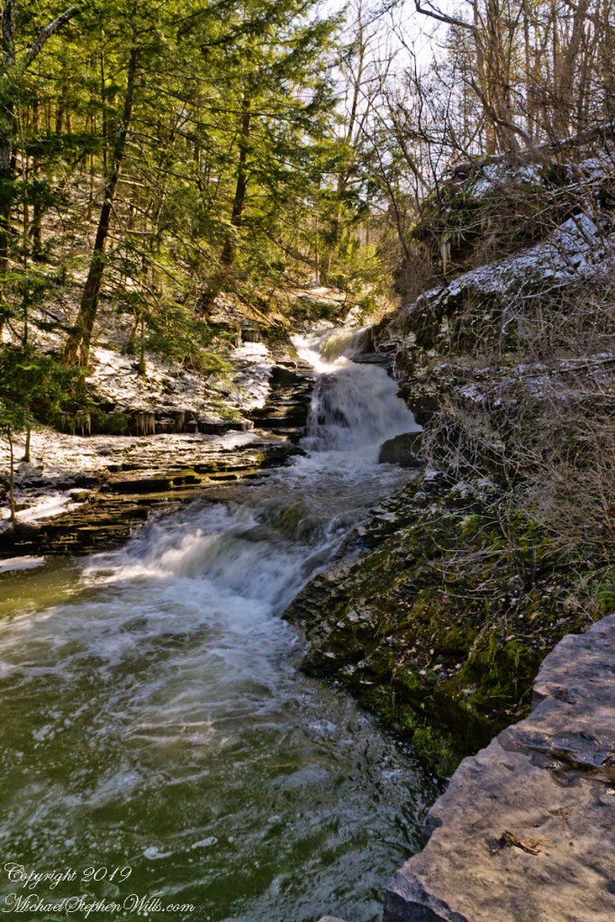
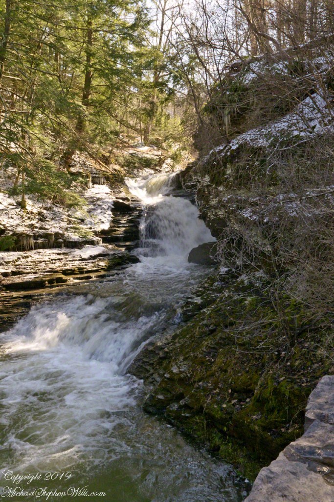
Rim trail traverses gullies. These creases in the gorge walls were formed by small streams flowing to Enfield Creek.
Click photograph for a larger view. To do this from WordPress Reader, you need to first click the title of this post to open a new page.
Gully I
Some passages require a wade, others have elaborate walkways with bridges. I initially wanted to call these ravines. Upon researching the term discovered while ravines are formed by erosion, the scale here is much smaller. I could rename Enfield Gorge, to Enfield Ravine.
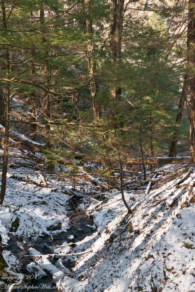
Gully II
These shots were hand held. I used a Sony Alpha 700 dslr with a variable “zoom” lens, great for framing compositions.
Robert H. Treman New York State Park.
Click for a slideshow of this Waterfall of the Old Mill sequence
Rim Trail AscentRim Trail iciclesRim Trail icicles with lichen, moss and fern.Gully IGully II
Copyright 2024 All Rights Reserved Michael Stephen Wills
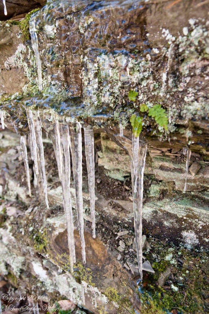
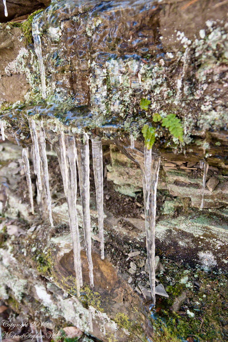
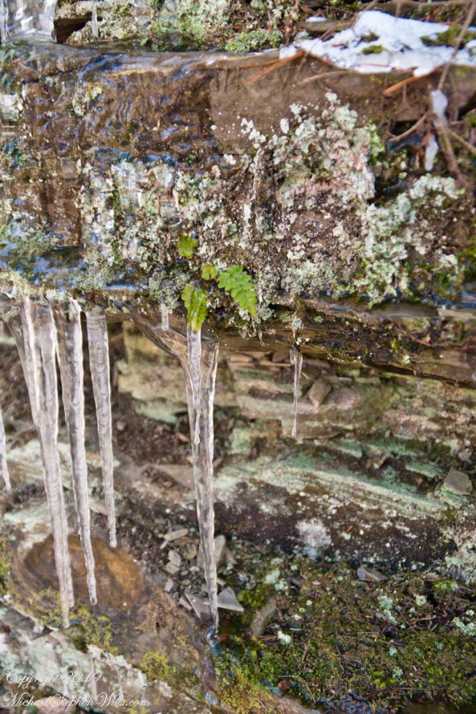
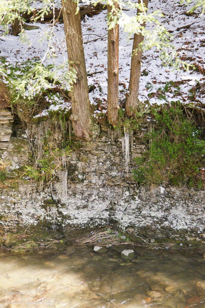
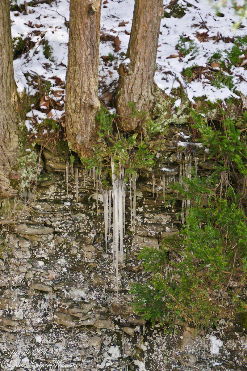
Water drips steadily from seeps, places water follows hidden cracks to emerge from the darkness. In warm seasons these may be a patch of moisture enabling the growth of ferns, only becoming evident when air is cold enough to freeze slowly running water.
Click photograph for a larger view. To do this from WordPress Reader, you need to first click the title of this post to open a new page.
Rim Trail icicles with lichen, moss and fern.
These macros capture the Moss, Fern and Lichen. These thrive in this environment.
These shots were hand held. I used a Sony Alpha 700 dslr with a variable “zoom” lens, great for framing compositions.
Robert H. Treman New York State Park.
Click for a slideshow of this Waterfall of the Old Mill sequence
Falls by the Old Mill, early springPlace where Fish Kill was harnessed to power the Old Mill Fish Kill Waterfall at the Old Mill. Sedimentary WallsIcicles hang over Fish KillRim Trail AscentRim Trail iciclesRim Trail icicles with lichen, moss and fern.This macro captures the Moss, Fern and Lichen. These thrive in this environment.
Copyright 2024 All Rights Reserved Michael Stephen Wills
Step into an early spring morning where sudden frosts adorn the Waterfall by the Old Mill with fleeting icicles, capturing nature’s delicate balance between freeze and thaw.
New icicles formed overnight from seeps through the sedimentary walls around the Waterfall by the Old Mill. On an early spring day, after a sudden frost, we walked the Rim Trail to capture the moment.
Here icicles formed during the quick April freeze hand above Fish Kill. Kill is an old Dutch word for creek.
Click photograph for a larger view. To do this from WordPress Reader, you need to first click the title of this post to open a new page.
Sedimentary Walls
Here a mix of frost and lichen mottle the rock layers.
These shots were hand held. I used a Sony Alpha 700 dslr with a variable “zoom” lens, great for framing compositions.
Robert H. Treman New York State Park.
Click for a slideshow of this Waterfall of the Old Mill sequence
Falls by the Old Mill, early spring
Copyright 2024 All Rights Reserved Michael Stephen Wills
Join me on a frost-kissed journey along the Rim Trail, capturing the transient beauty of falls freed from winter’s grip, where nature’s power remains untamed and vividly alive.
A day the falls run free of ice. On an early spring day, after a sudden frost, we walked the Rim Trail to capture the moment. Here are three captures of the same waterfall, the first visitors to the upper park encounter and the most visited and photographed right off the parking area.
Fish Kill was captured at this point to provide power to grind grain. Today neither nature nor man control the flow. Kill is the old Dutch word for creek.
Click photograph for a larger view. To do this from WordPress Reader, you need to first click the title of this post to open a new page.
Falls by the Old Mill, early spring
I have never counted the waterfalls from this one to the grand sweep of lower falls. The falls are uncountable because no two people could agree on how small a fall to credit.
Of these three versions, i prefer this one for the foreground inclusion of the enormous limestone blocks set to protect visitors from the drop. This scene is challenging photographically, bifurcated as it is by the bright sun over the fall brink. I prefer to shoot these falls early morning, for this reason, before the sun illuminates the area at all. Long exposures required demand a rock solid tripod, as it is just off the parking lot I use my studio Manfrotto for the work. Here all shots were handheld.
I used a Sony Alpha 700 dslr with a variable “zoom” lens, great for framing compositions.
Robert H. Treman New York State Park.
Click for a slideshow of this sequence of the Waterfall of the Old Mill
Copyright 2024 All Rights Reserved Michael Stephen Wills
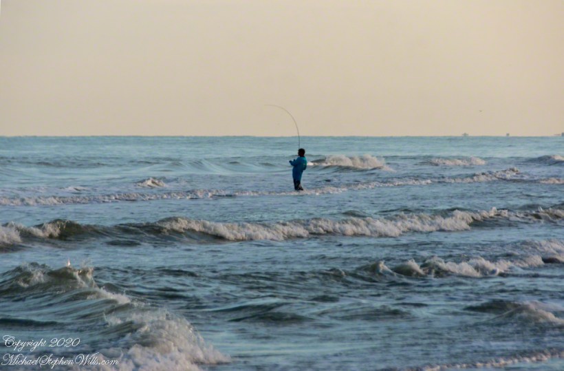
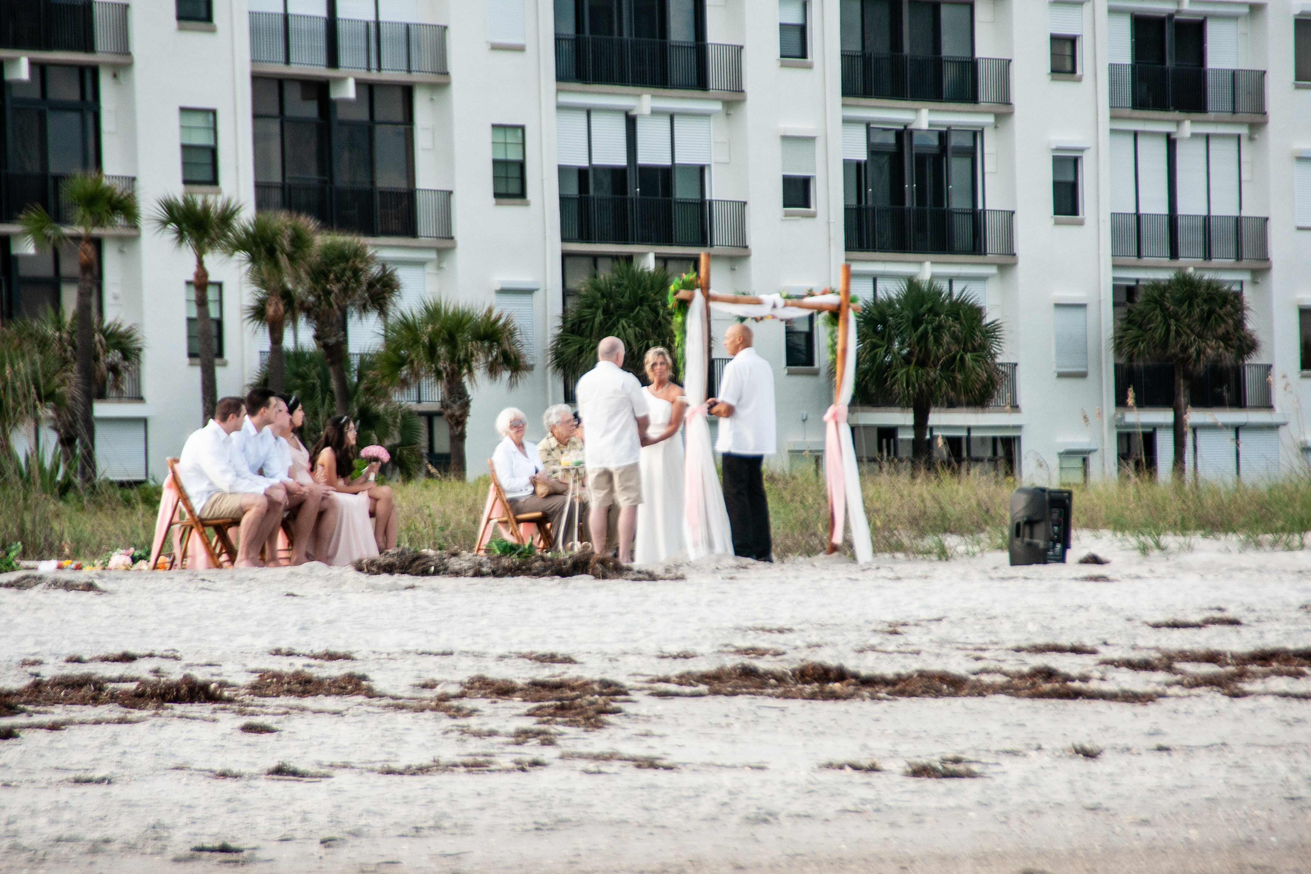
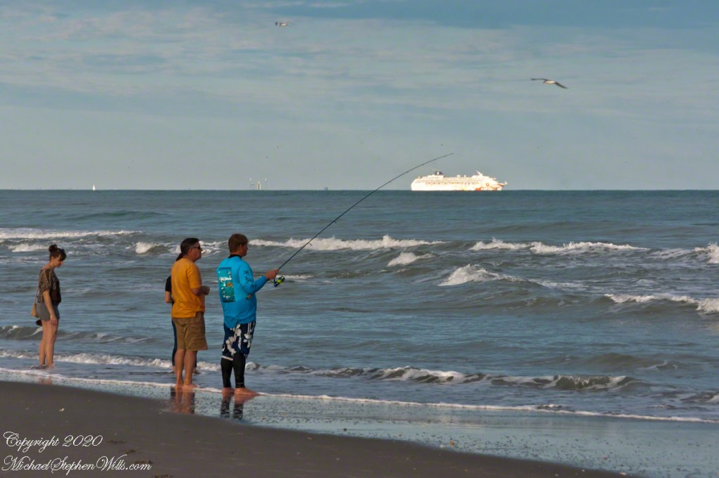
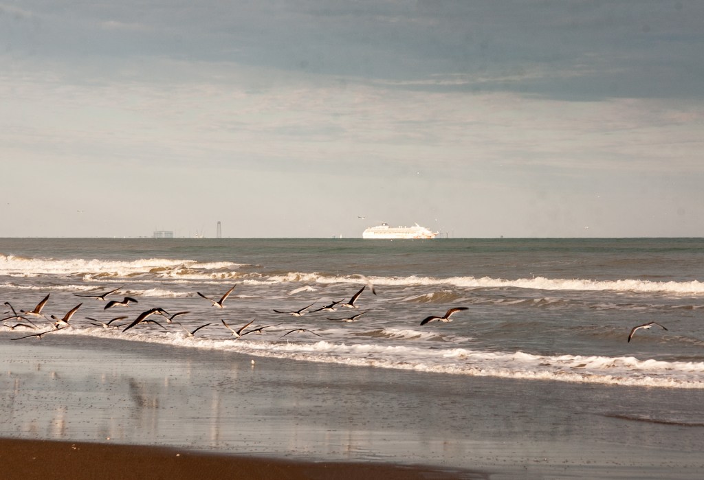
After 2 pm check in we interrupted unpacking for a sundown beach walk, IPhones and Sony Alpha 700 camera in hand on the last evening of 2019. There is a business on A1A, the main road through town, advertising “beach weddings” and “elopements.” Here, using the 18 – 200 mm f3.5-6.2 lens, I spied this grouping of a mature couple holding hands, minister in attendance, for a wedding ceremony witnessed by young adult children on the right, parents (?) left. The groom’s shorts contrast with the bride’s white gown.
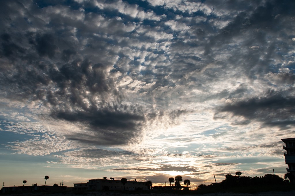
Sunlight, low in the western sky, was perfect for mirror-like reflections in the retreating surf.
A given of the Atlantic beach is the late afternoon light, best for capturing figures against the ocean.
Written below the high tide mark, a message inscribed, impermanent in spite of the deep cuts.
I have practice framing sunsets against beach development. Cannot complain as we enjoy our beach side condo.
A slide show of these images.
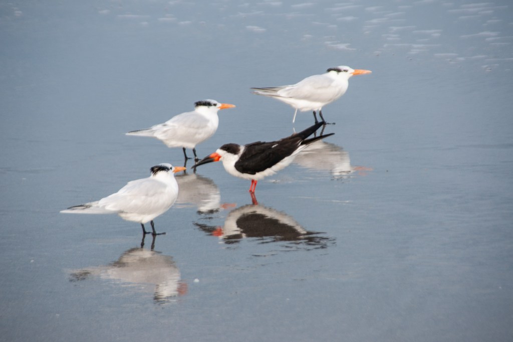
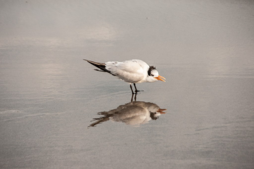
Mature Love / Beach VowsCruise Ships Depart Cape Canaveral Late AfternoonTo Each His Own PassionSurf CastingBlack Skimmer Going His Own WayGull ReflectionLast Sunset of 2019Messages in the Sand Washed Away Twice Daily at High Tide
Copyright 2024 All Rights Reserved Michael Stephen Wills
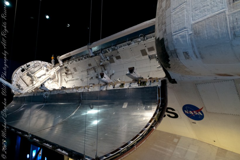
Imagine yourself floating in the vast cargo bay of the Space Shuttle Atlantis, surrounded by the essentials of space exploration. Here, in this dynamic space, the dreams of astronauts and scientists converge, where each mission reshapes our understanding of the universe. Curious? Discover more inside.
The cargo bay of the Space Shuttle Atlantis was an extensive, empty compartment located at the shuttle’s aft end, acting as the main storage area for mission payloads. A significant portion of the cargo was housed within a sizable cylindrical module named Raffaello, which contained a year’s supply of necessities—food, clothing, water, replacement parts, and scientific gear.
The dimensions of the payload area were roughly 4.6 meters (15 feet) in width and 18 meters (60 feet) in length. This spacious area enabled the shuttle to transport a diverse array of payloads, ranging from satellites to complex scientific experiments.
Exploring the Cargo Bay
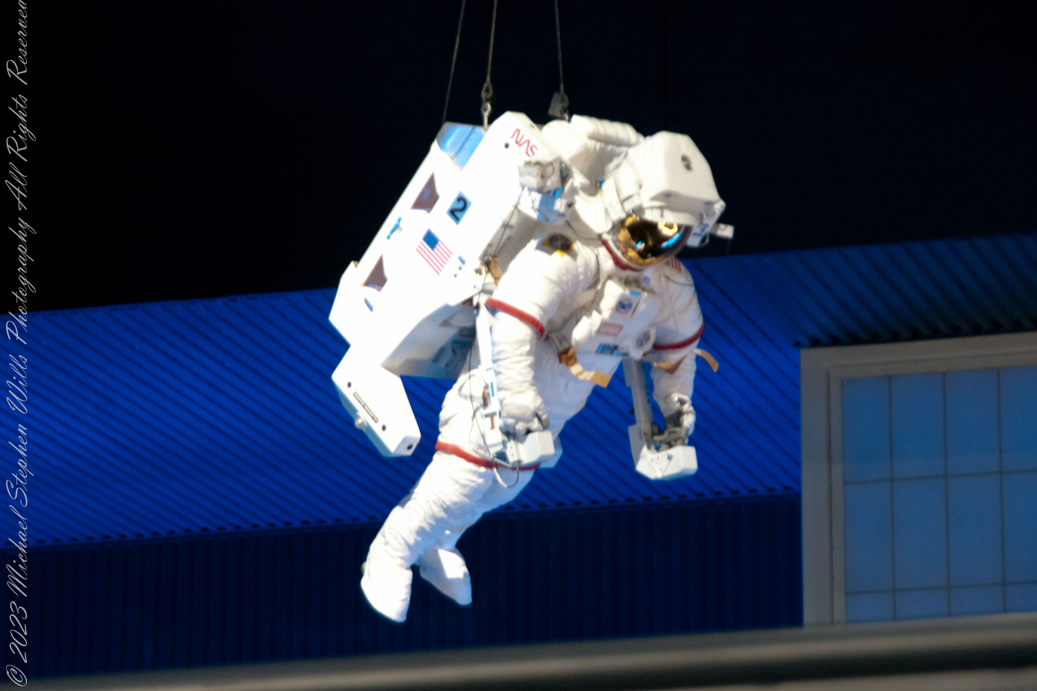
Envision yourself drifting through the cargo bay of Atlantis, encircled by a maze of wires, equipment, and neatly arranged payloads. Astronauts, tethered securely and clad in their voluminous space suits, would navigate this area, ensuring the payloads were fastened correctly for either launch or retrieval operations.
The cargo bay’s configuration was highly adaptable, tailored to meet the specific needs of each mission. It played a pivotal role in the deployment of satellites, execution of repairs, or the transportation of scientific apparatus, adapting its setup as necessary.
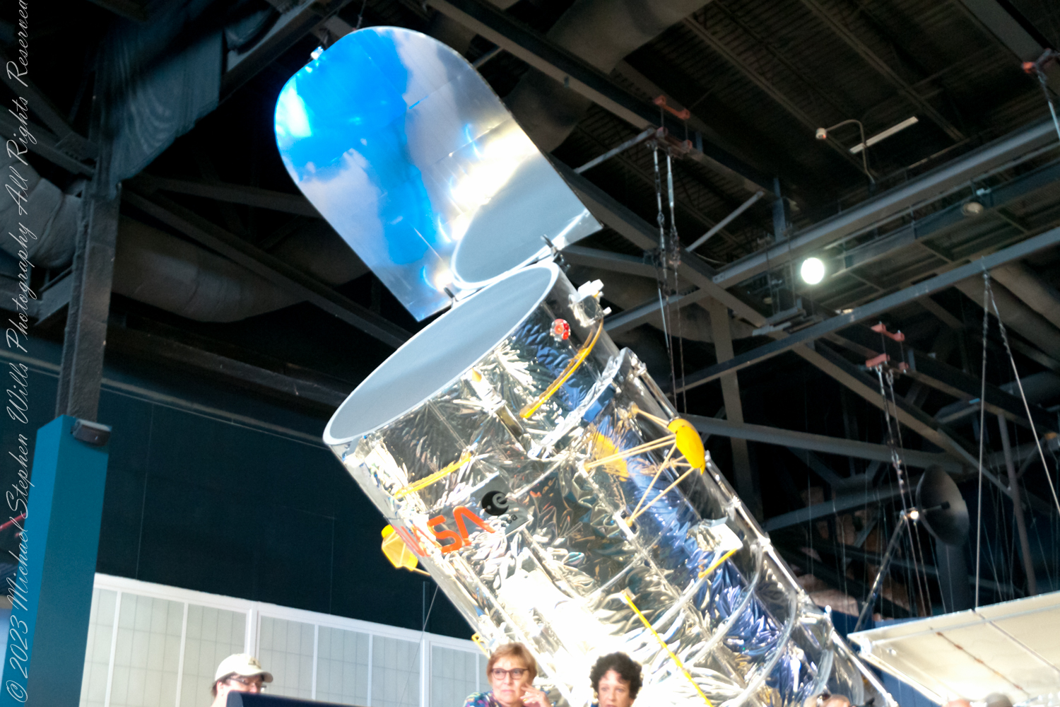
The Hubble Servicing Mission
One of the most notable missions involving Atlantis was the Hubble Space Telescope Servicing Mission 4 (SM4). For this mission, Atlantis was loaded with essential items for the Hubble, including new instruments, batteries, and gyroscopes, all carefully organized within the cargo bay for safe transport to and into orbit.
Legacy
The cargo bay of Atlantis bore witness to a myriad of significant events: the release of satellites, the construction of the International Space Station, and numerous scientific investigations. Its design and flexibility were instrumental to the Space Shuttle program’s achievements.
Copyright 2024 Michael Stephen Wills All Rights Reserved
Step beyond Earth’s bounds and glimpse the astounding intricacies of the Space Shuttle’s journey. Discover the engineering marvels that propelled humanity into orbit and back, navigating the cosmos with precision. Unveil the secrets of the stars now.
The Space Shuttle, officially known as the Space Transportation System (STS), was an iconic spacecraft operated by NASA from 1981 to 2011. It consisted of an orbiter with wings for landing like an airplane, external fuel tanks, and solid rocket boosters. With its multiple missions ranging from satellite deployment to the construction of the International Space Station, the Space Shuttle was a symbol of human ingenuity in space exploration. Central to the Shuttle’s success was its navigational system, which combined state-of-the-art technology of its time with human expertise.
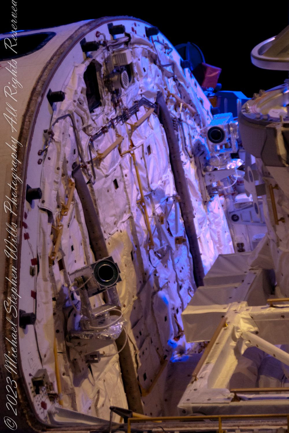
The navigation of the Space Shuttle was a complex orchestration involving both internal and external elements designed to work in the harsh environment of space. The photographs attached illustrate some of the external navigational elements.
External Navigational Elements
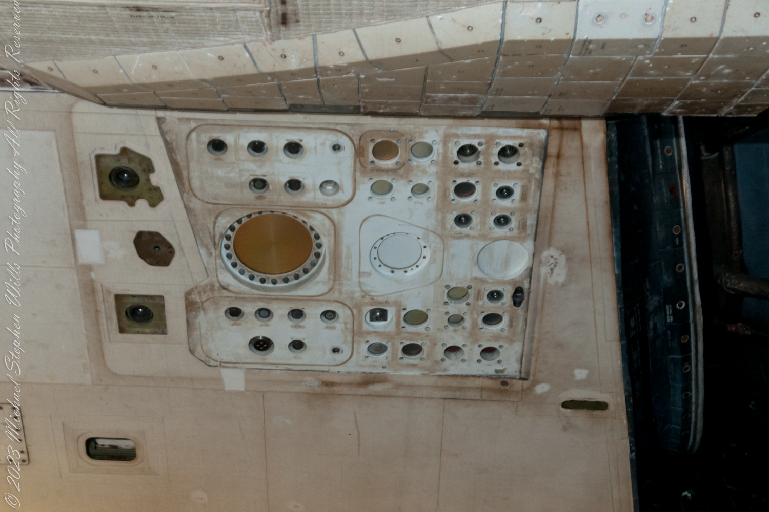
The external surface of the Space Shuttle, as seen in the following images, was covered with thousands of thermal protection system tiles. These tiles were crucial not only for protecting the Shuttle from the extreme temperatures experienced during re-entry into Earth’s atmosphere but also housed the critical sensors for navigation.
Reaction Control System (RCS)
One of the key external navigational features was the Reaction Control System (RCS), seen as clusters of small circular ports below the cockpit windows. The RCS was composed of small thrusters that could fire in short bursts to adjust the Shuttle’s orientation or speed in space. This system was vital during the maneuvers in orbit, such as satellite deployment, docking with the International Space Station, and repositioning for re-entry into Earth’s atmosphere.
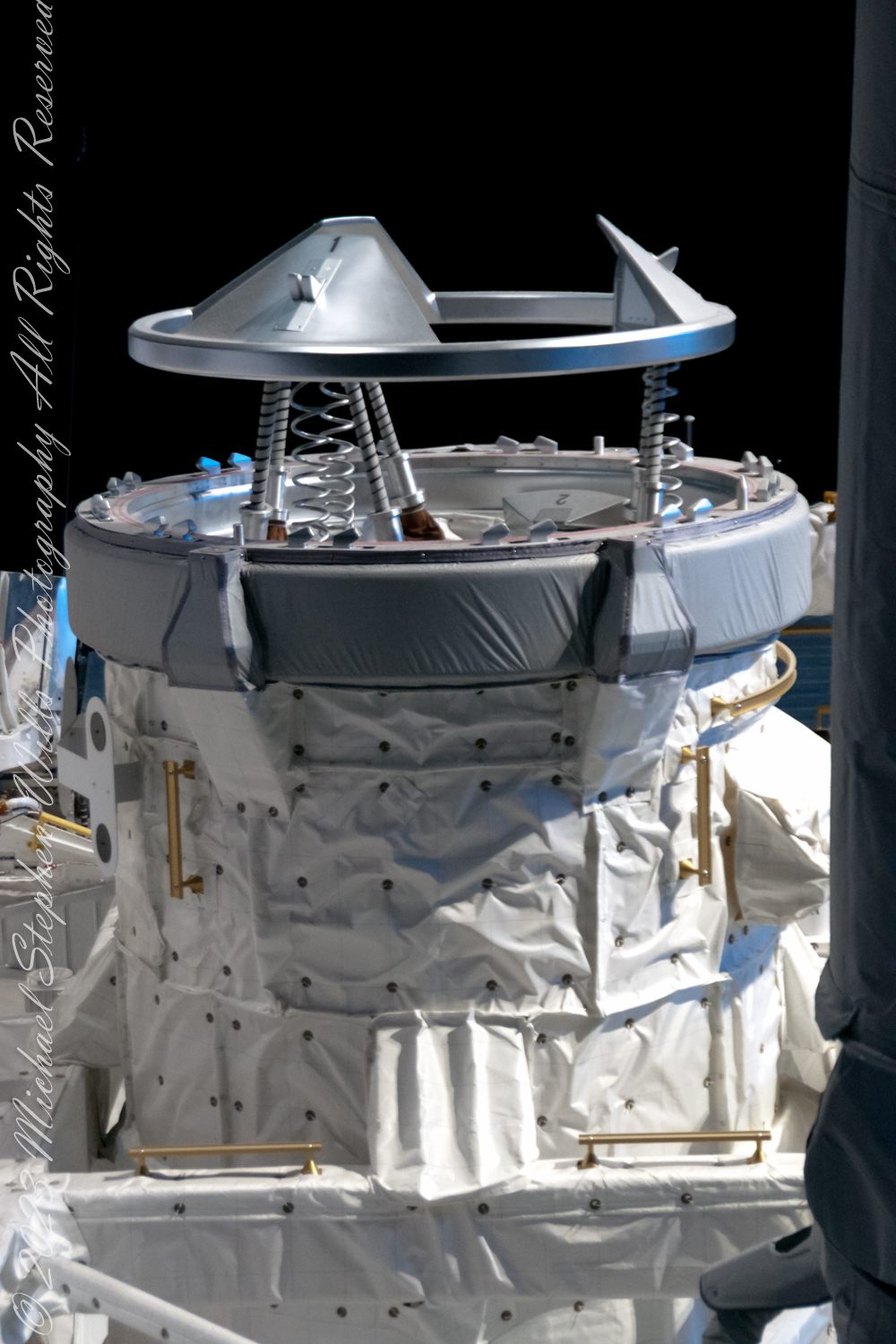
Internal Navigational Elements
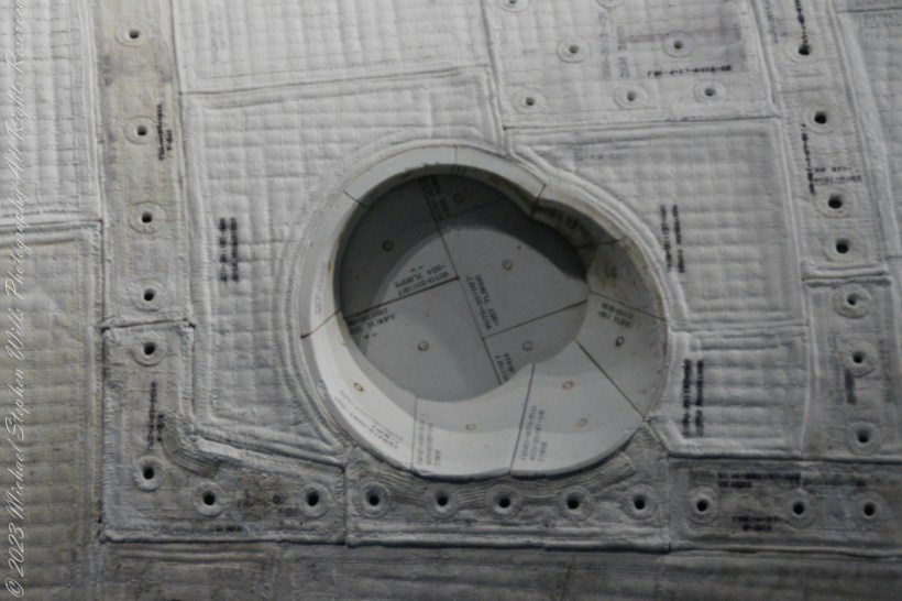
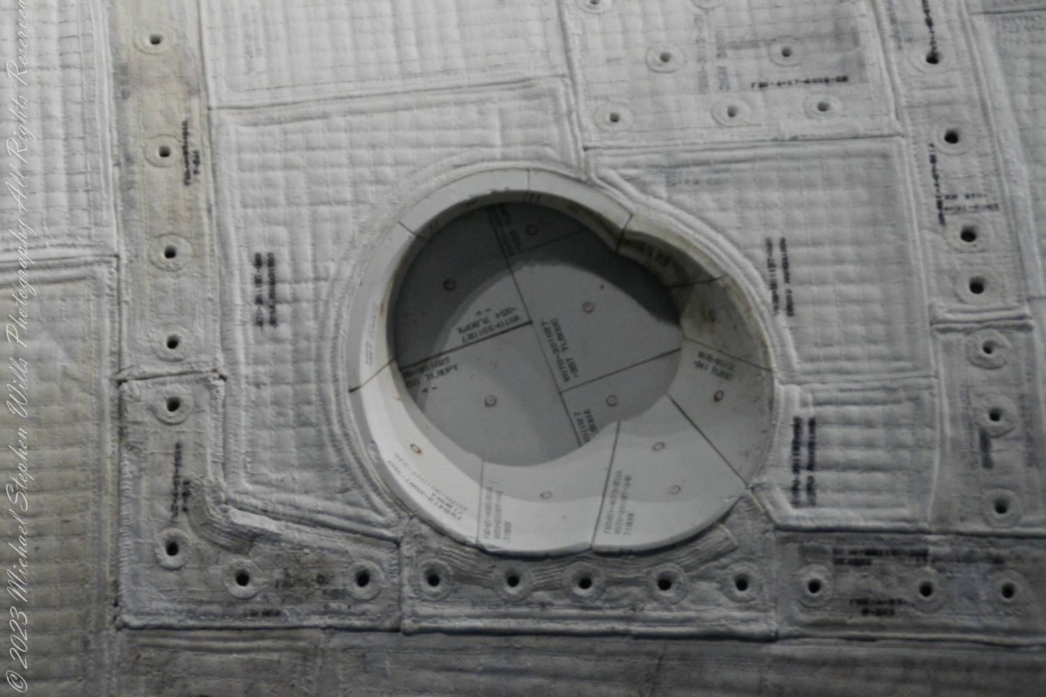
Internally, the Space Shuttle featured a complex avionics system. The following image depicts part of the orbiter’s internal structure with an array of docking mechanisms and sensor housings. The round port, surrounded by a ring of bolts, is likely an interface for the Orbiter Docking System, used for rendezvous and docking with the International Space Station.
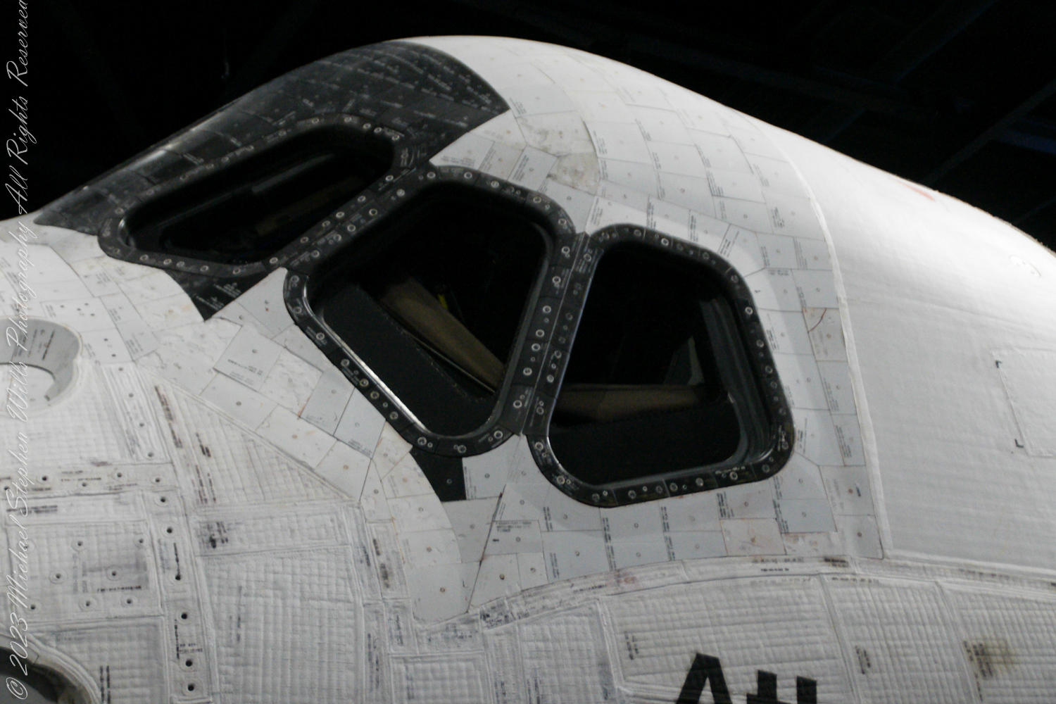
The following image shows a close-up of one of the orbiter’s windows, surrounded by reinforced panels. Each window was crucial for manual navigation, allowing astronauts to visually confirm their orientation and position relative to celestial objects and the Earth. The windows were also essential during landing, which was conducted manually by the Shuttle’s commander.
Navigational Avionics
The Shuttle’s navigation was supported by an avionics system that included inertial measurement units (IMUs), star trackers, and various other sensors. IMUs tracked the Shuttle’s position by measuring its velocity and direction, while star trackers used sightings of known star patterns to calibrate the Shuttle’s orientation in the vastness of space.
The navigational computers onboard processed data from these systems to maintain the trajectory and manage the Shuttle’s multiple systems. The computers were capable of autonomous operation, although astronauts were trained to take over manually if necessary.
Ground Support and Telemetry
In addition to onboard systems, navigation relied heavily on ground-based tracking and data relay satellites. The Shuttle communicated with NASA’s Mission Control Center, which monitored its position and trajectory, providing updates and corrections as needed. Telemetry data sent back to Earth included velocity, altitude, and engine performance metrics, which were crucial for ensuring the Shuttle’s safe passage in and out of orbit.
In Summary
The Space Shuttle’s navigational capabilities were a testament to the integration of technology and human skill. From the RCS ports on its tiled exterior to the sophisticated avionics inside, every component played a critical role in the Shuttle’s missions. This harmonious blend of internal mechanisms and external sensors, complemented by vigilant ground support, enabled the Space Shuttle to navigate the cosmos and return safely home, mission after mission.
Copyright 2024 Michael Stephen Wills All Rights Reserved