My photographic style centers on the use of natural light to visualize emotion and evoke memory. The evolution of my style began early in the year 2002, with an imperative to capture personal and fleeting memories.
My son and I traveled to New York City, to view the first Saint Patrick's Day parade after September 11, 2001. My work from that parade was so successful and satisfying (see "New York Fire Department, Saint Patrick's Day 2002") I just never stopped.
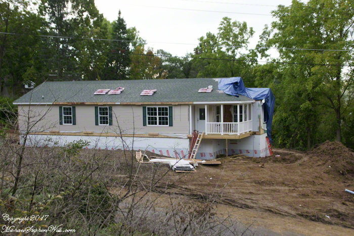
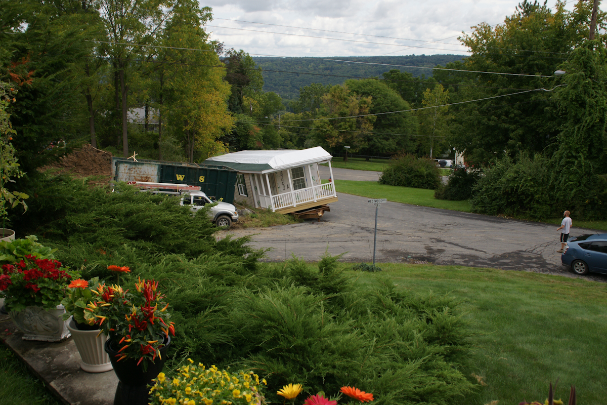
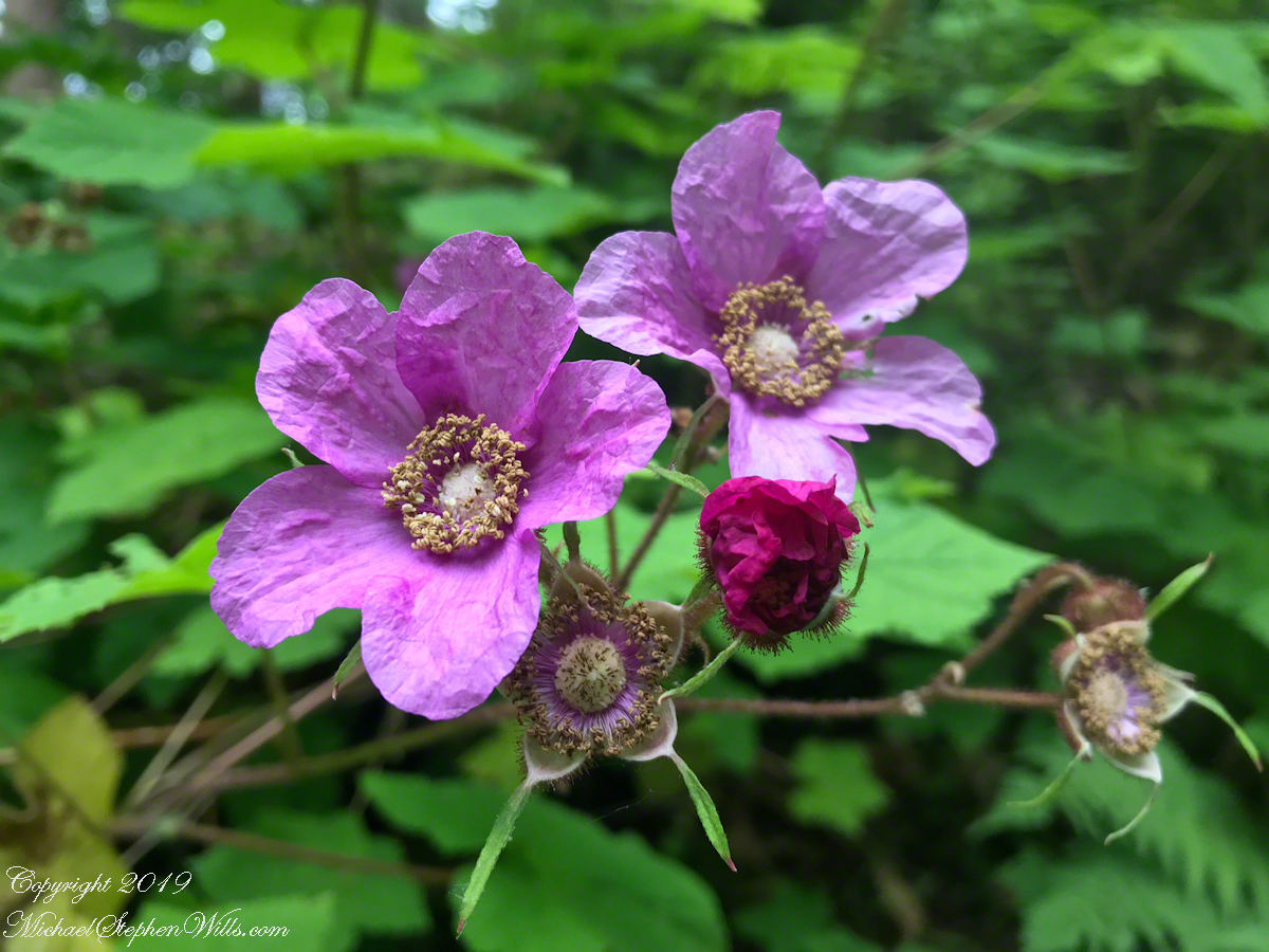
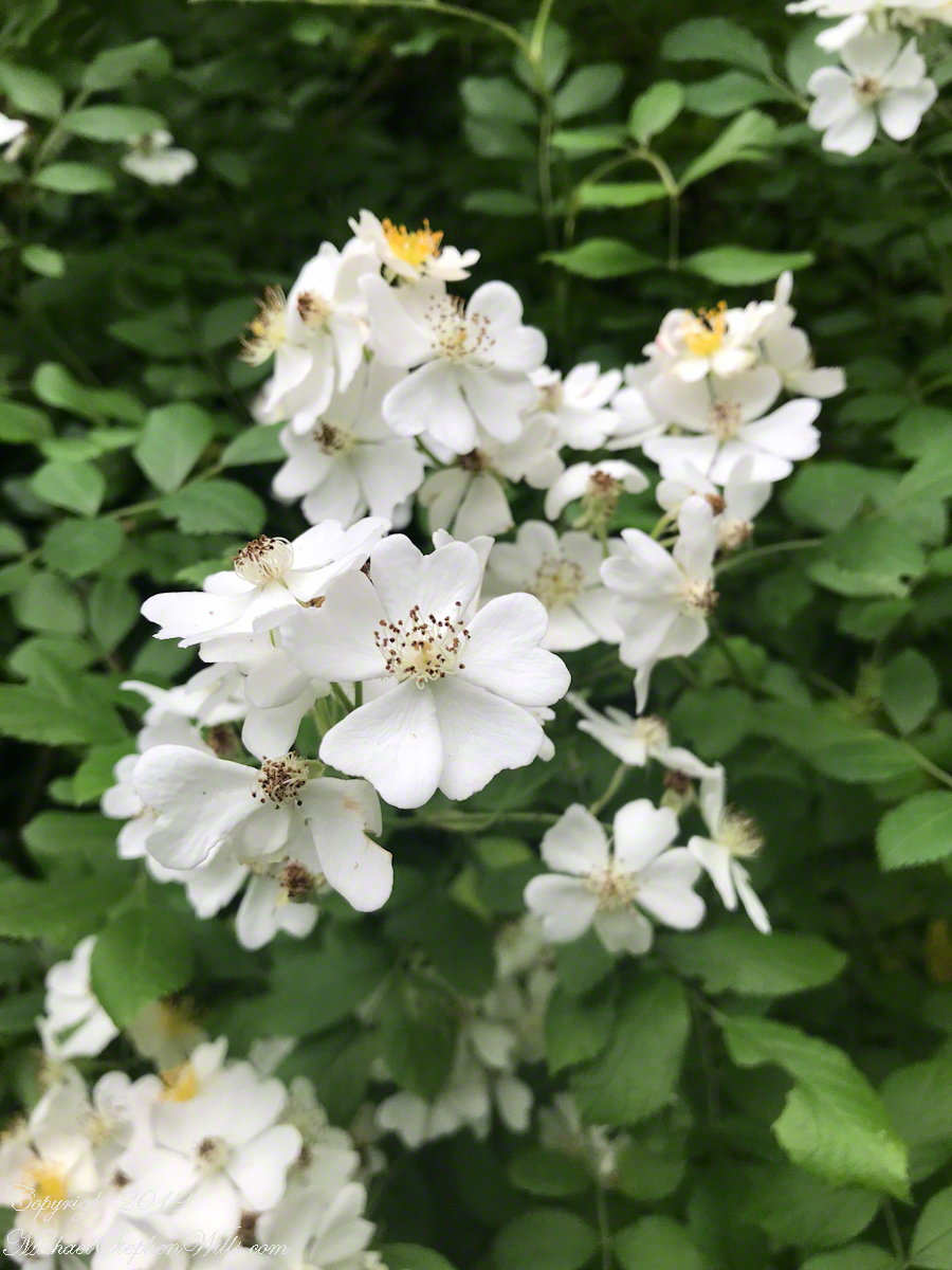
When Pam and I made Westwood Knoll our home in 2011, to the north, across the street, was an empty wooded lot that has since been subdivided into three of the last home sites in Ithaca. This summer, the corner lot was razed of all its trees, the lovely mature cherry, sycamore, ash, maple reduced to stumps to be cut up and carted away. There was a positive in that the lot was overgrown and unsightly, but every spring the upper reaches were masses of blooms and young green leaves.
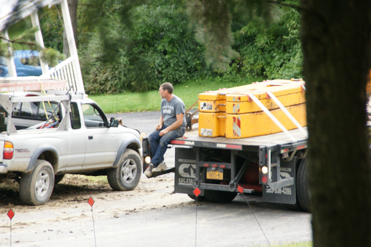
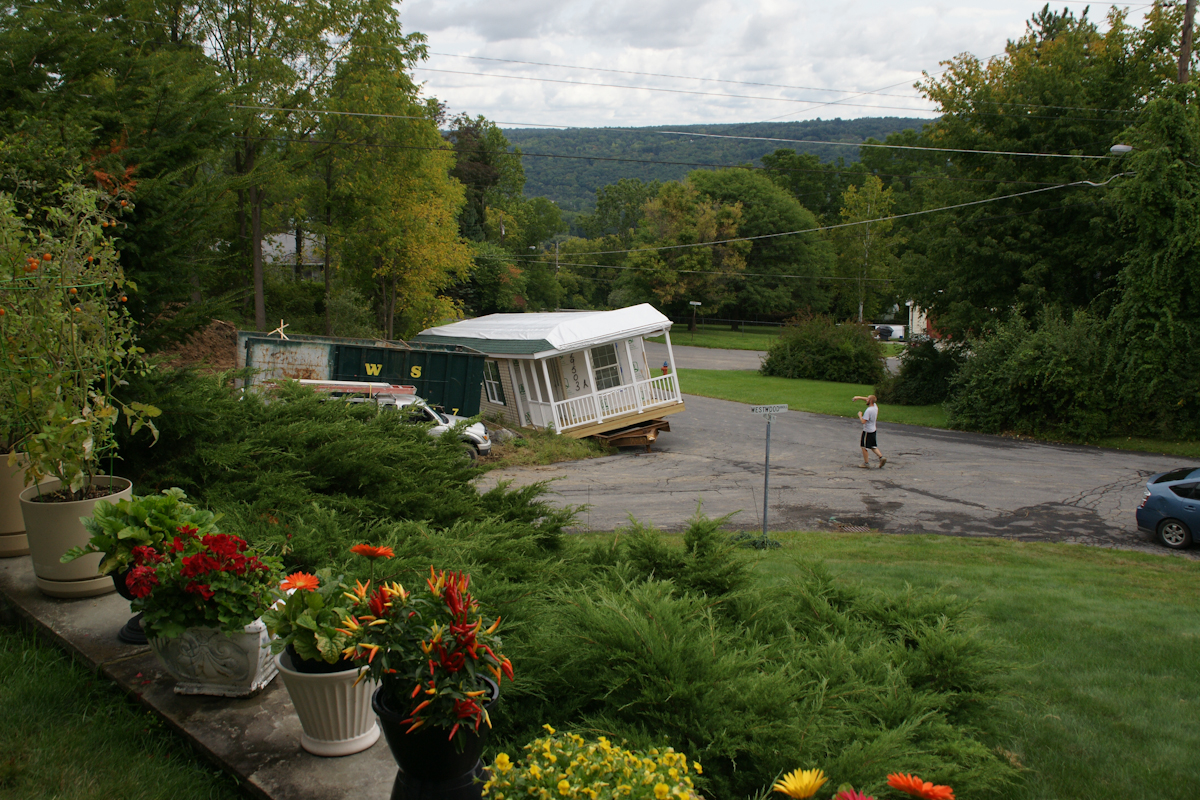
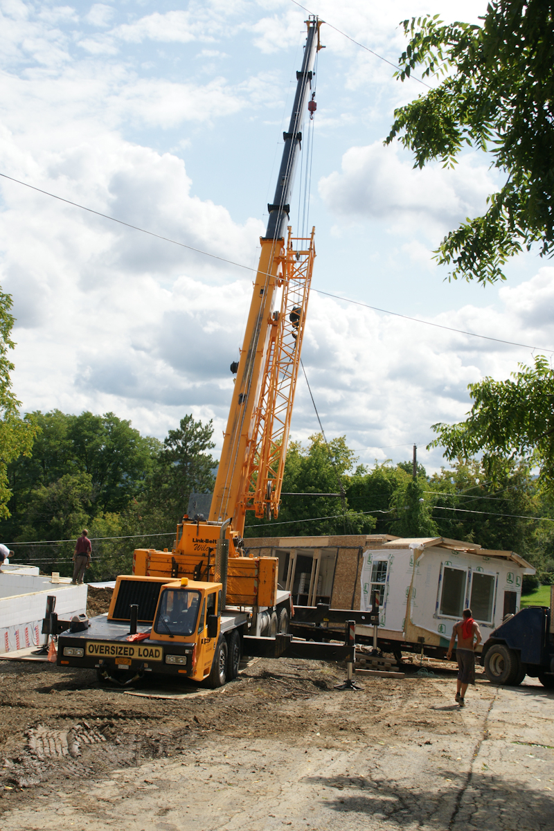
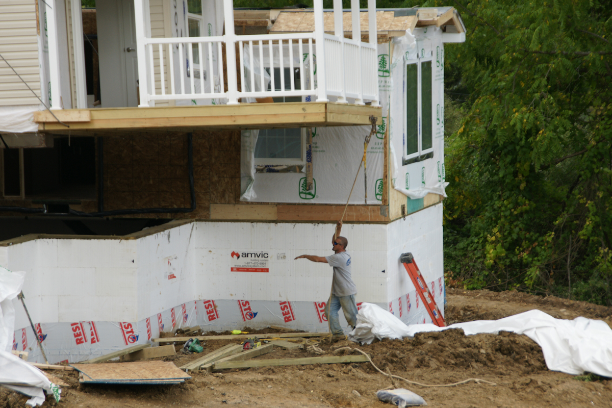
In a heavy rain on September 5th, 2017 the two parts, call them “modules”, were delivered, and then sat until September 7th to be assembled in one day. The process itself was interesting to witness and, while being otherwise occupied, I came out now and then to document the progress.
Here are my photographs. What do you think? Please leave comments.
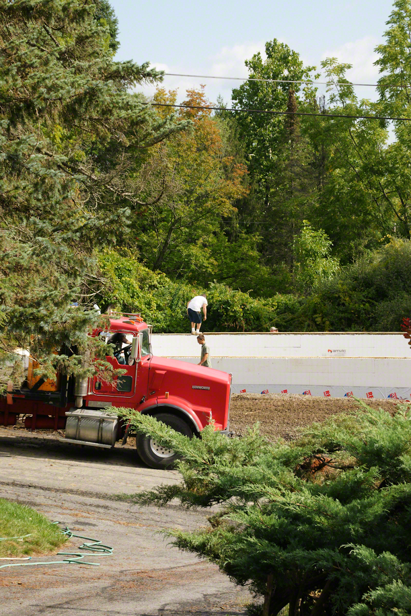
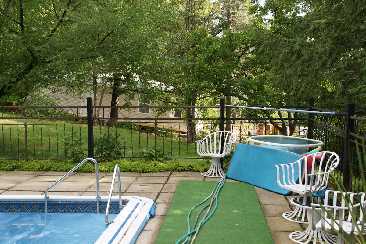
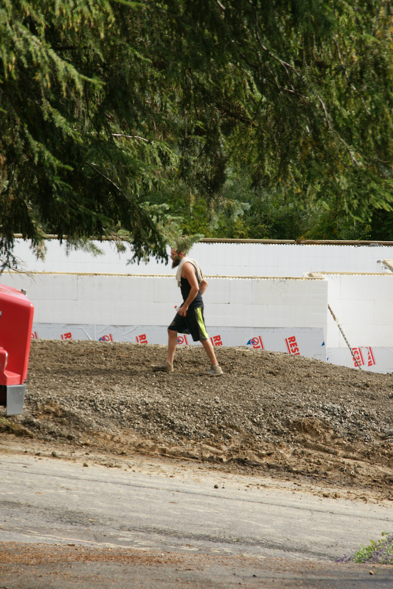
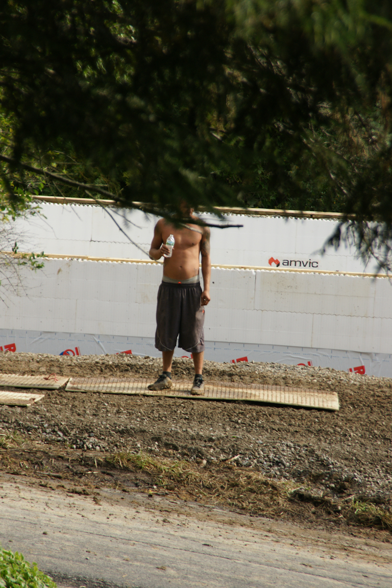
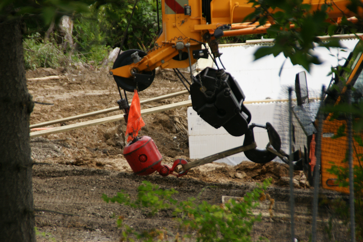
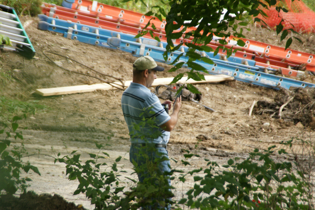
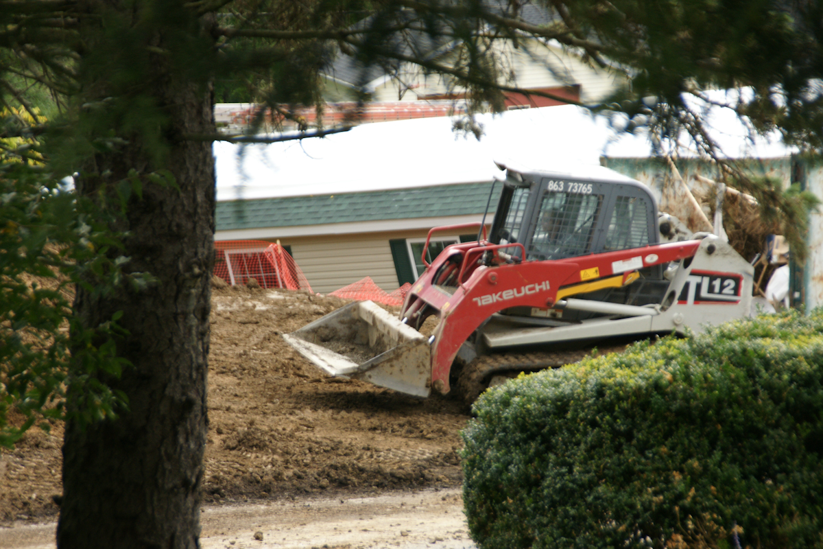
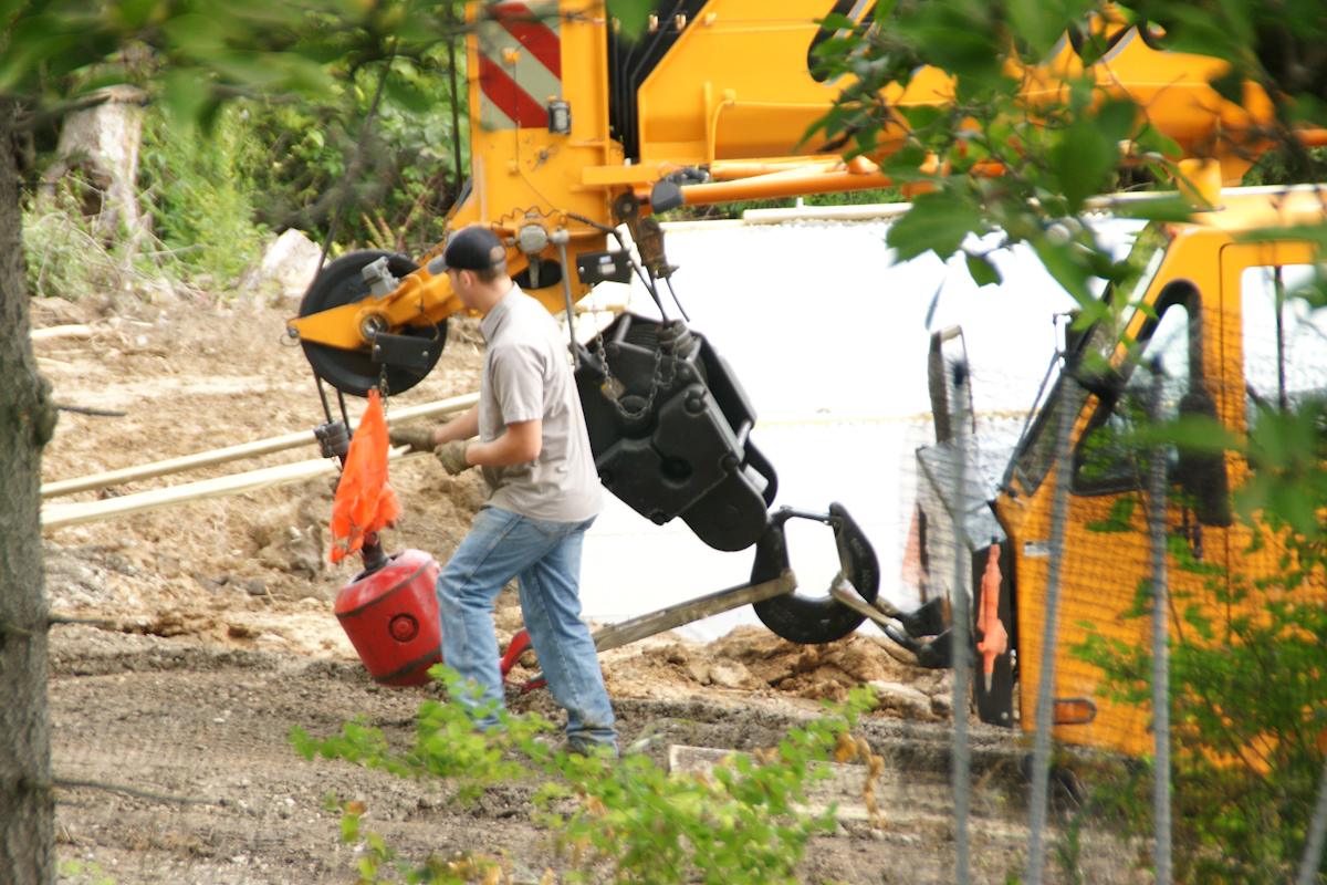
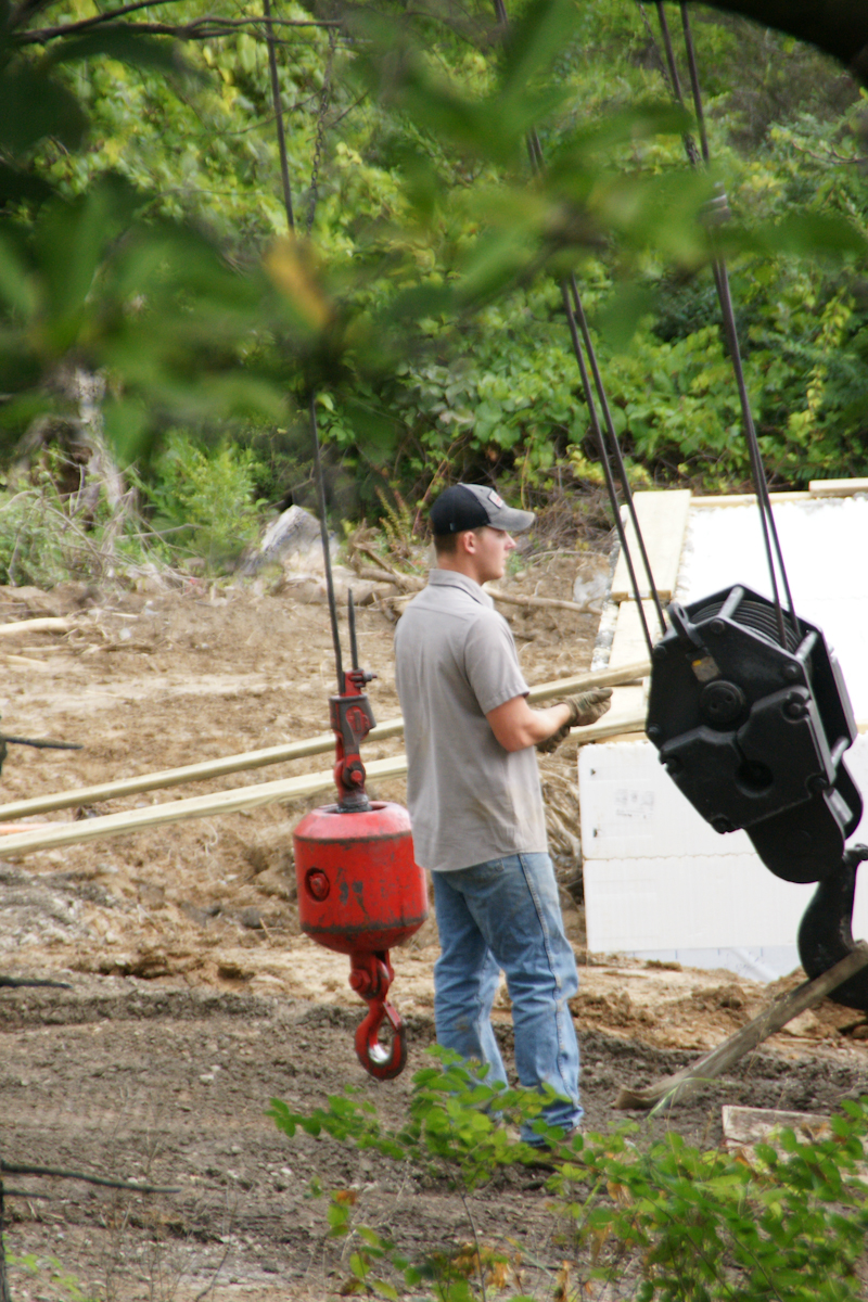
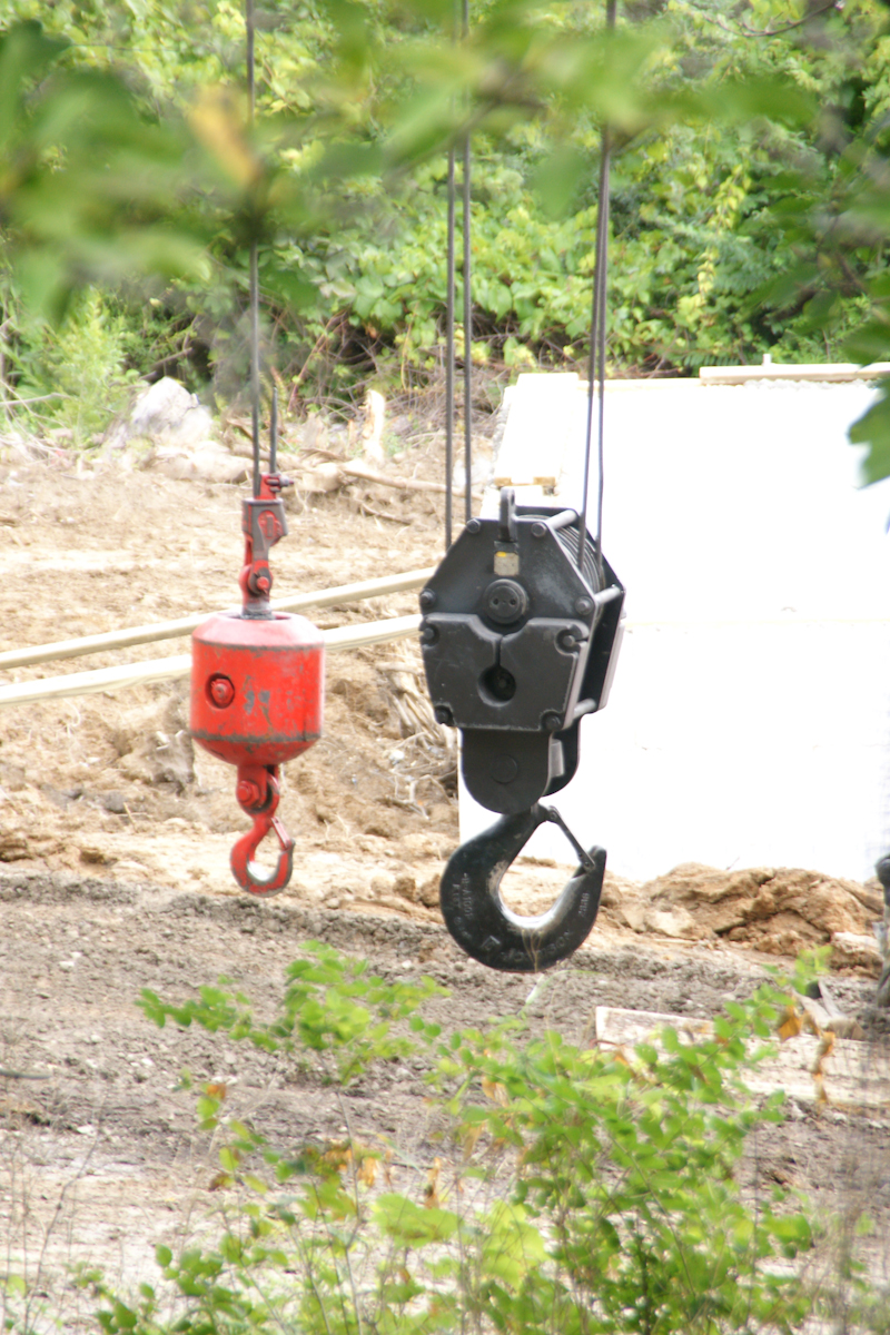
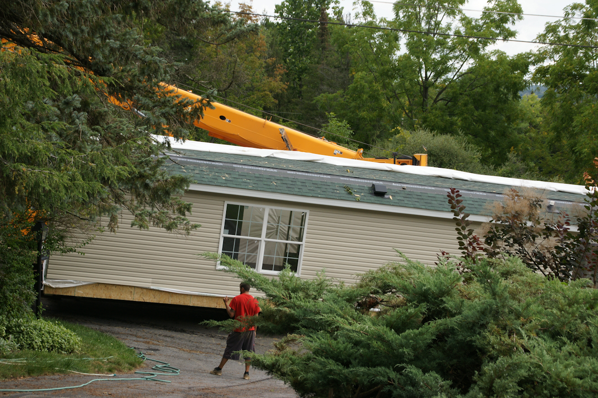
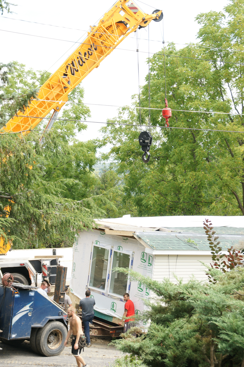
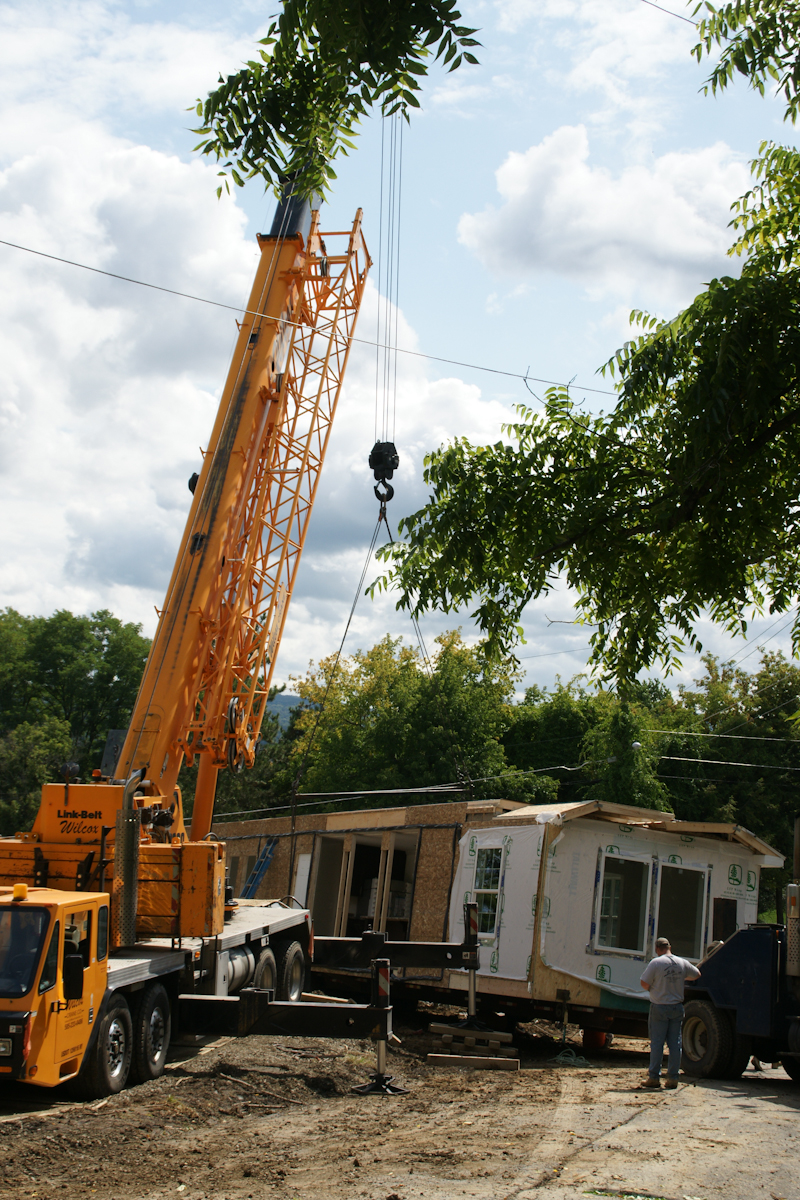
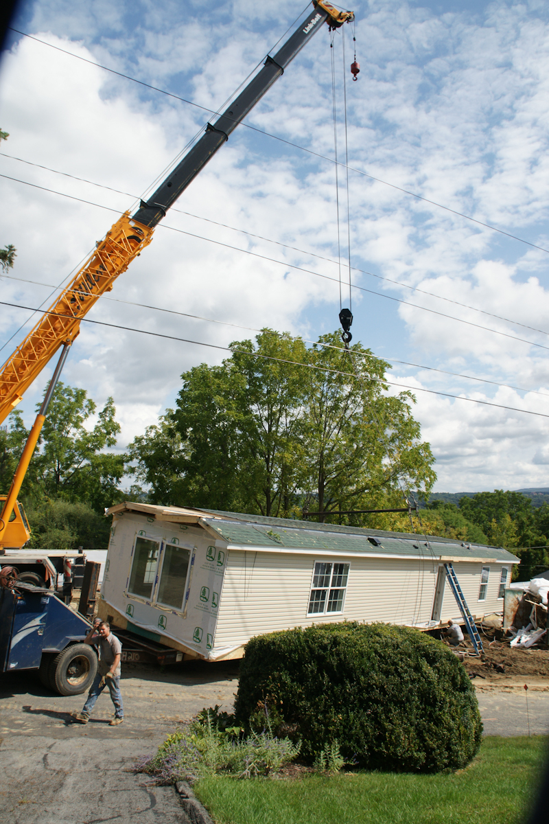
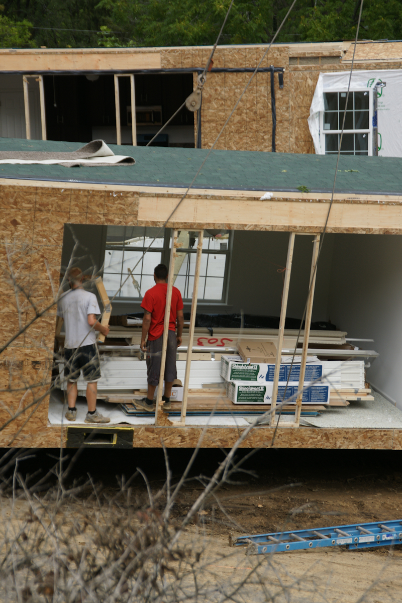
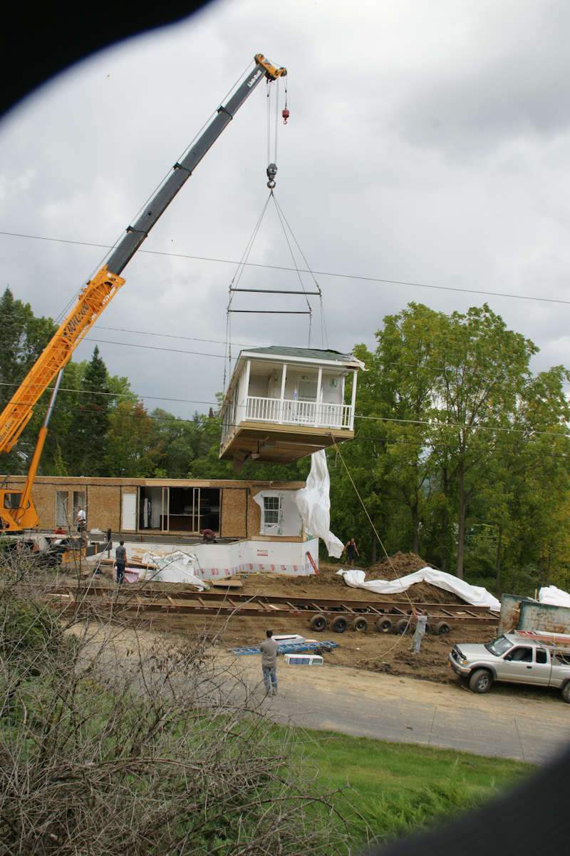
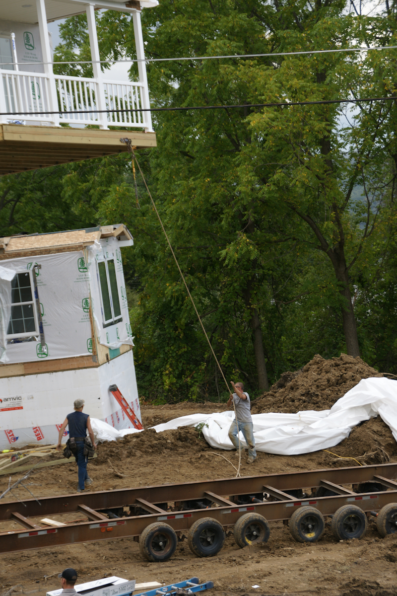
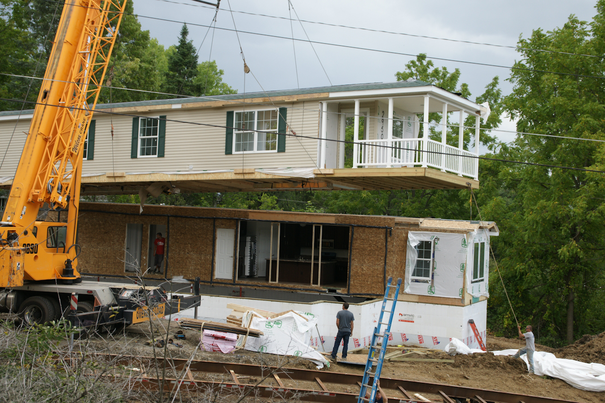
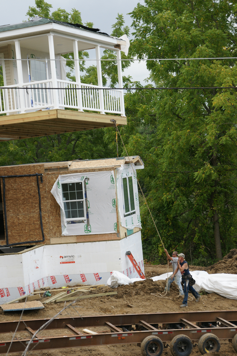
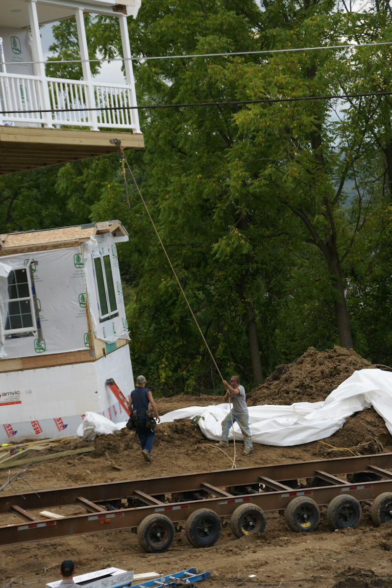
The foundation installation took a week to construct. It started with, literally, blocks of styrofoam held together with plastic and assembled by hand, like a child’s block set. There is an 8 inch gap in between filled with concrete. There was NO rebar used. bolts were inserted for attaching the modules.Module Two was delivered on wheels and moved into position by this semi.Module Two will eventually face the opposite direction. That will be the rear door. This is our swimming pool, I use garden hoses to siphon excess rainwater.Most of the workers were dressed like this, casually, no protection for feet or head. We were concerned with this. No one was injured this day, as far as we know.The worker is standing on a board on which the crane wheels will rest.Crane Boom End with hooks in transport configuration. These are attached to the modules for positioning over and lowering onto the foundation.This fellow arrived to take pictures from that smart phone.A versatile tracked loader used throughout the foundation construction and module installation.A worker prepares the hooks for use. No head protection was a concern to us.Yellow blocks of metal used to support the crane.. A railing of Module One is above the truck, to left.The red hook is ready.The hooks hang free, ready to use.This is where Module One was dumped on the side of the road on September 5th, two days before installation.We are looking here over the edge of our patio and landscaped yard to the site of module one, pre-installation, a worker approaching.The first step was to extricate module two from the mud and haul it up the street. A construction worker foreground, the boom of crane beyond.The semi backed Module Two into position, the crane boom and hooks loom.The workers were considerate of our lawn. There was minimal damage. The modules installed this day looks nothing like this image.From here Module Two will be lifted onto the foundation.Workers prepare foundation to receive Module Two while the unit is readied.I see only the black hook is in use.Another View of Module Two with worker. That is the bottom of our driveway.Module One was delivered with construction materials inside.The porch and entry door of Module One with worker and rope. The worker needs to negotiate the carrier.A 180 degree turn orients Module One to Module Two. The porch overhangs the foundation.
Positioning module one over foundation.
A worker observes from the interior of Module Two. Here is a closer view of the wire harness.
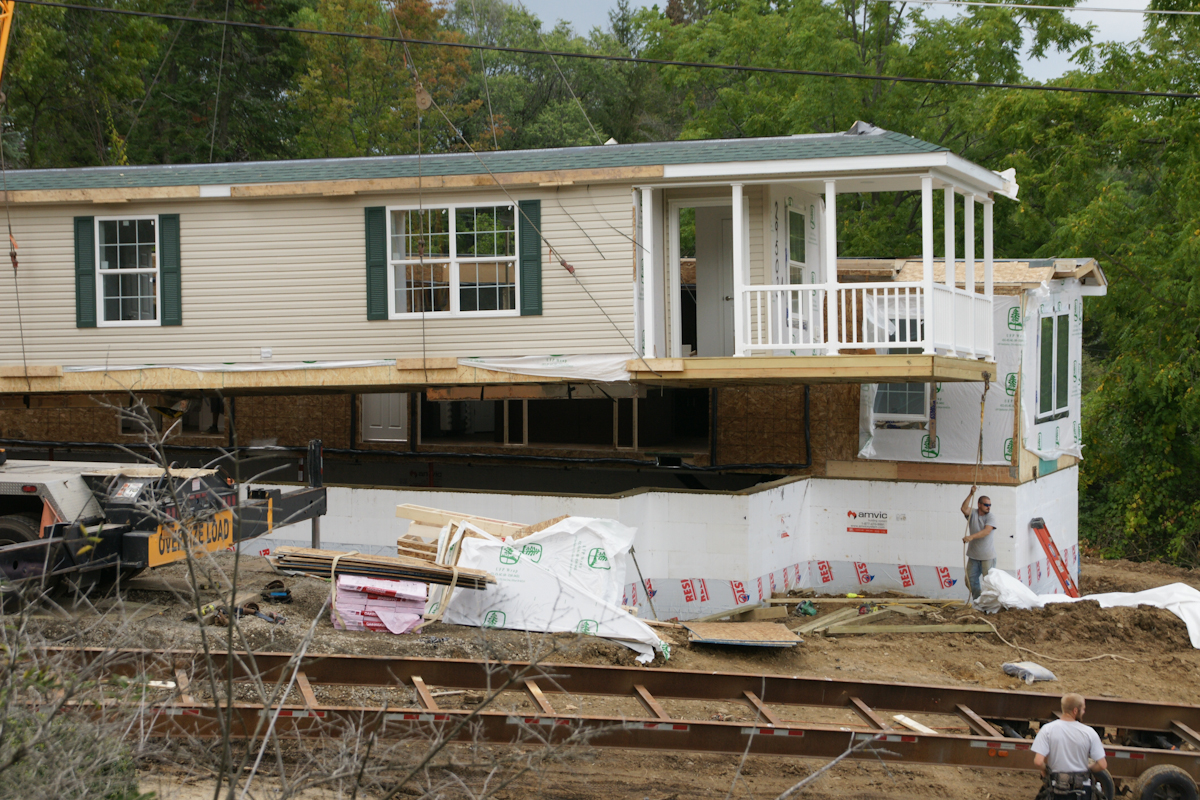
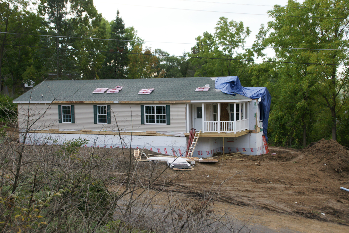
Final positioning of the module to form a whole structure.
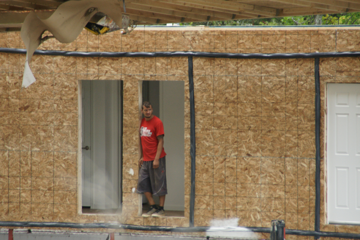
The roof panels are here lifted to a peak. The shingles and such in place for installation. These are the materials delivered inside Module One.
Update: since this post was first published September 2017 the original owners moved to the southern USA after selling the property at an inflated price to a young Cornell professor.
Copyright 2021 Michael Stephen Wills All Rights Reserved
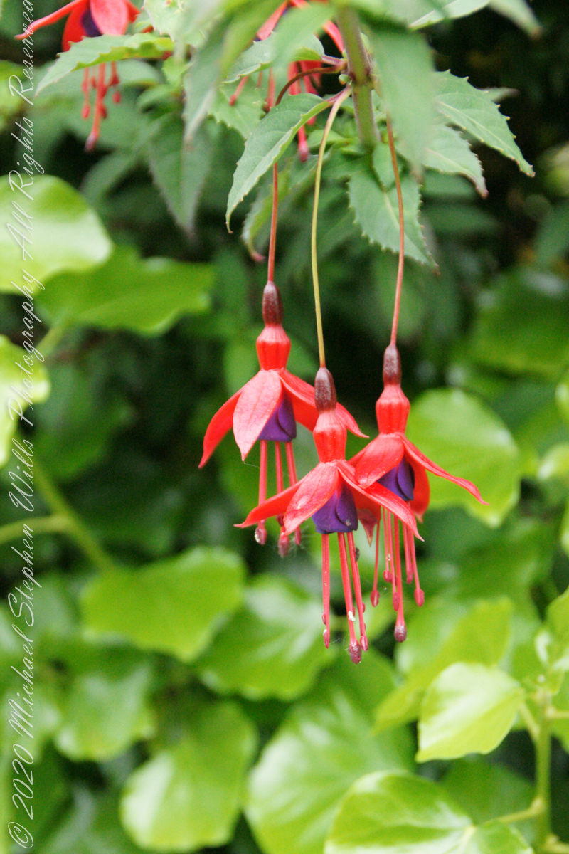
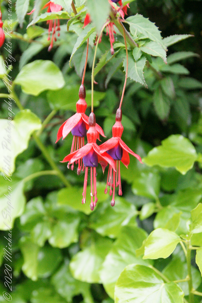
It is not surprising to find this non-native shrub growing along the path to Drombeg Stone Circle. English gardens featured fuchsia since the late 18th century. The ocean view is part of the charm of this place, the resulting milder climate suits the flourishing of exotic species of plants native to South America, the Caribbean and New Zealand.
Click any pic for a larger view, in a new tab, or a slide show. When using WordPress Reader, you need to open the post first.
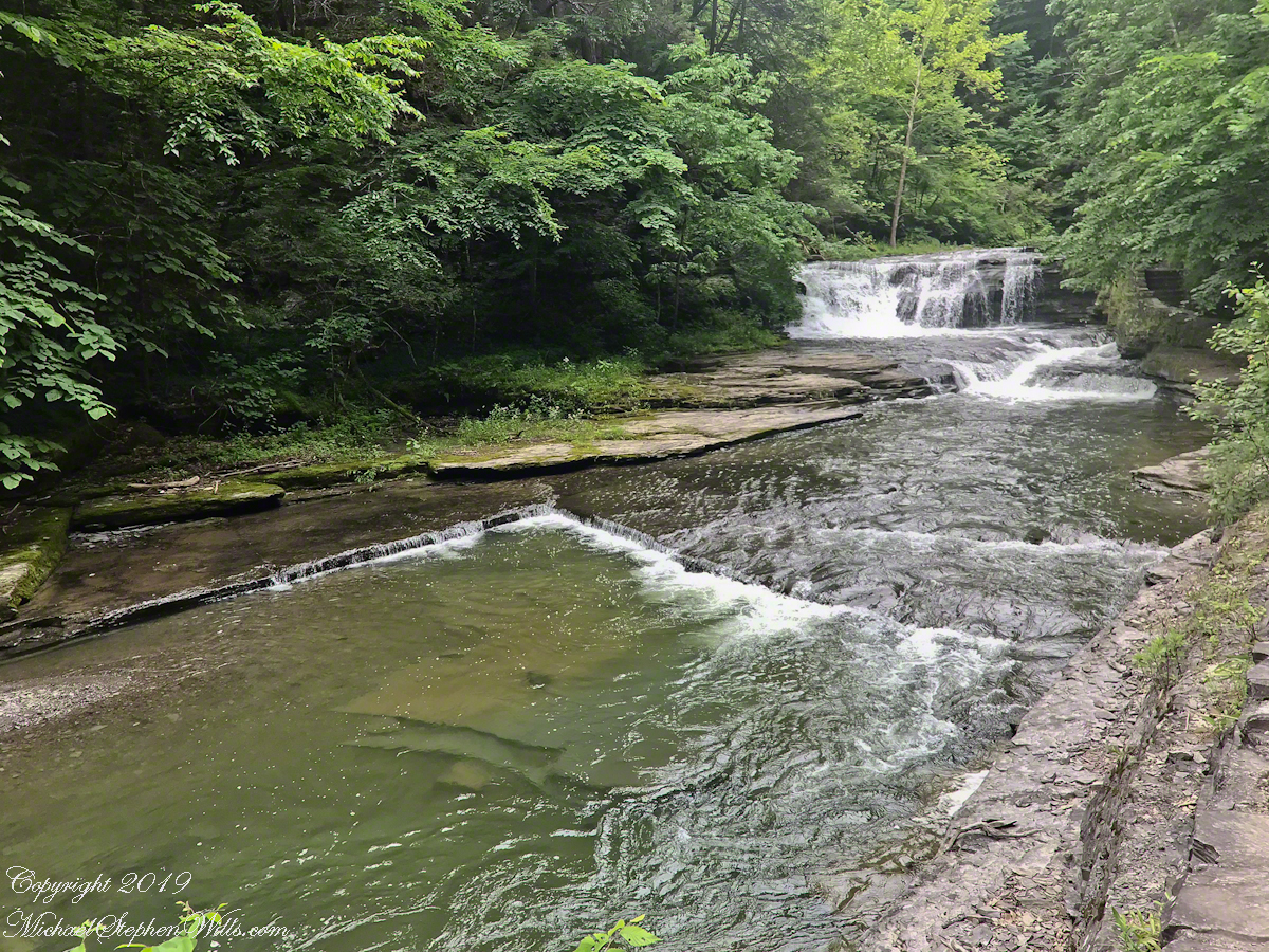
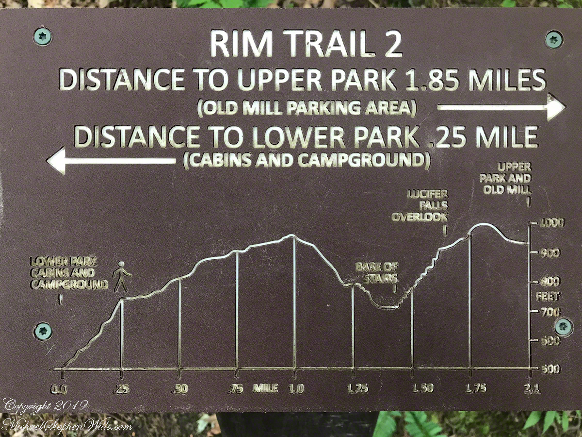
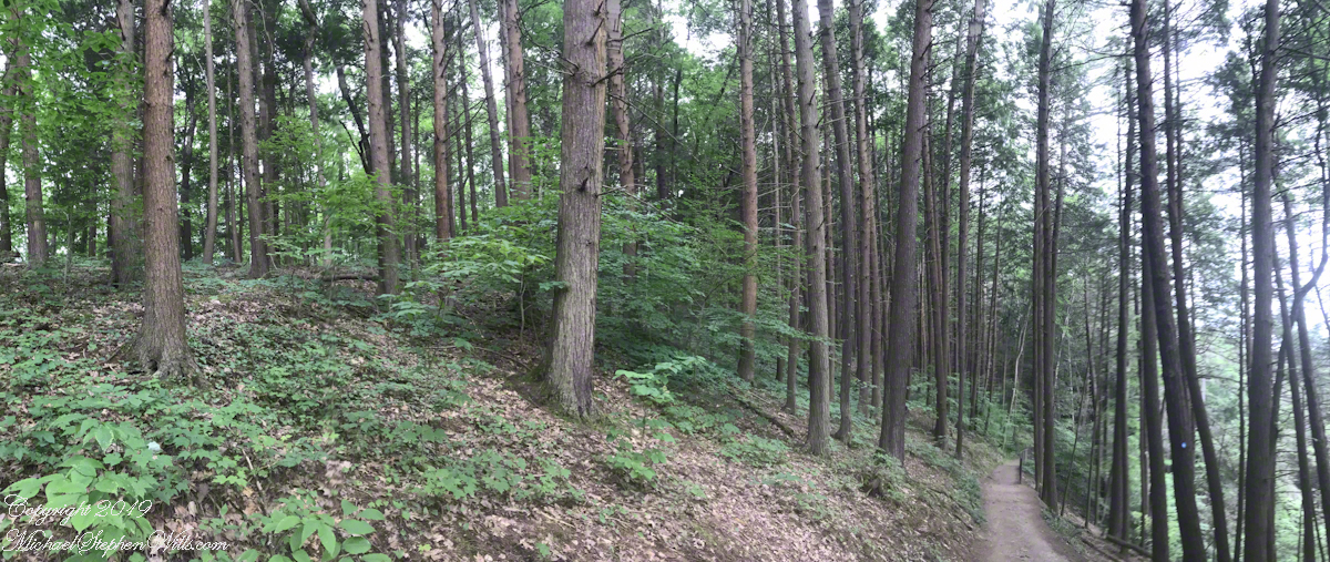
Travelling light, using IPhone captures during a 5.7 mile walk on the Gorge and South Rim Trails of Robert H. Treman New York State Park, Finger Lakes Region near Ithaca, New York. A few waterfalls and sights along the way. Distance is from the “Health” app on my phone.
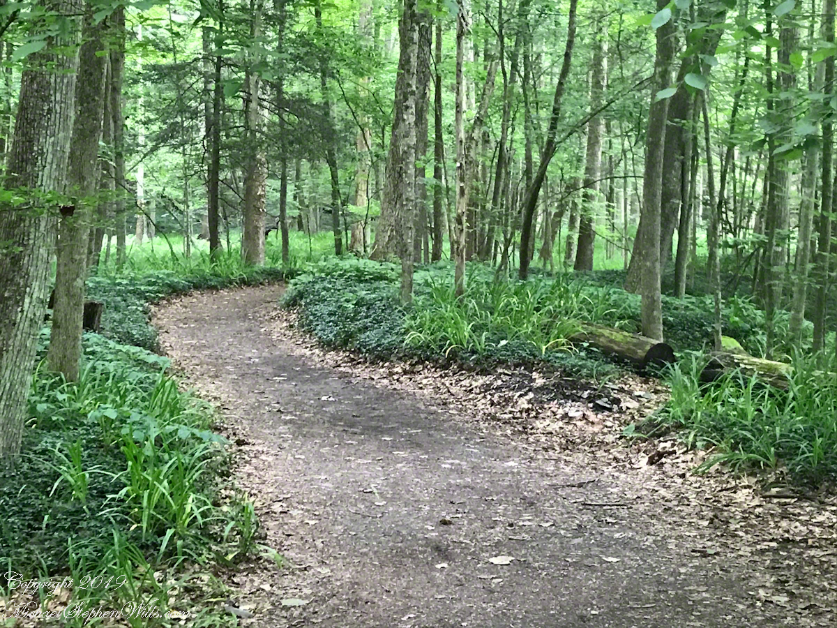
One of many waterfalls along the Gorge TrailLooking back to the above waterfallEnchanted Trail
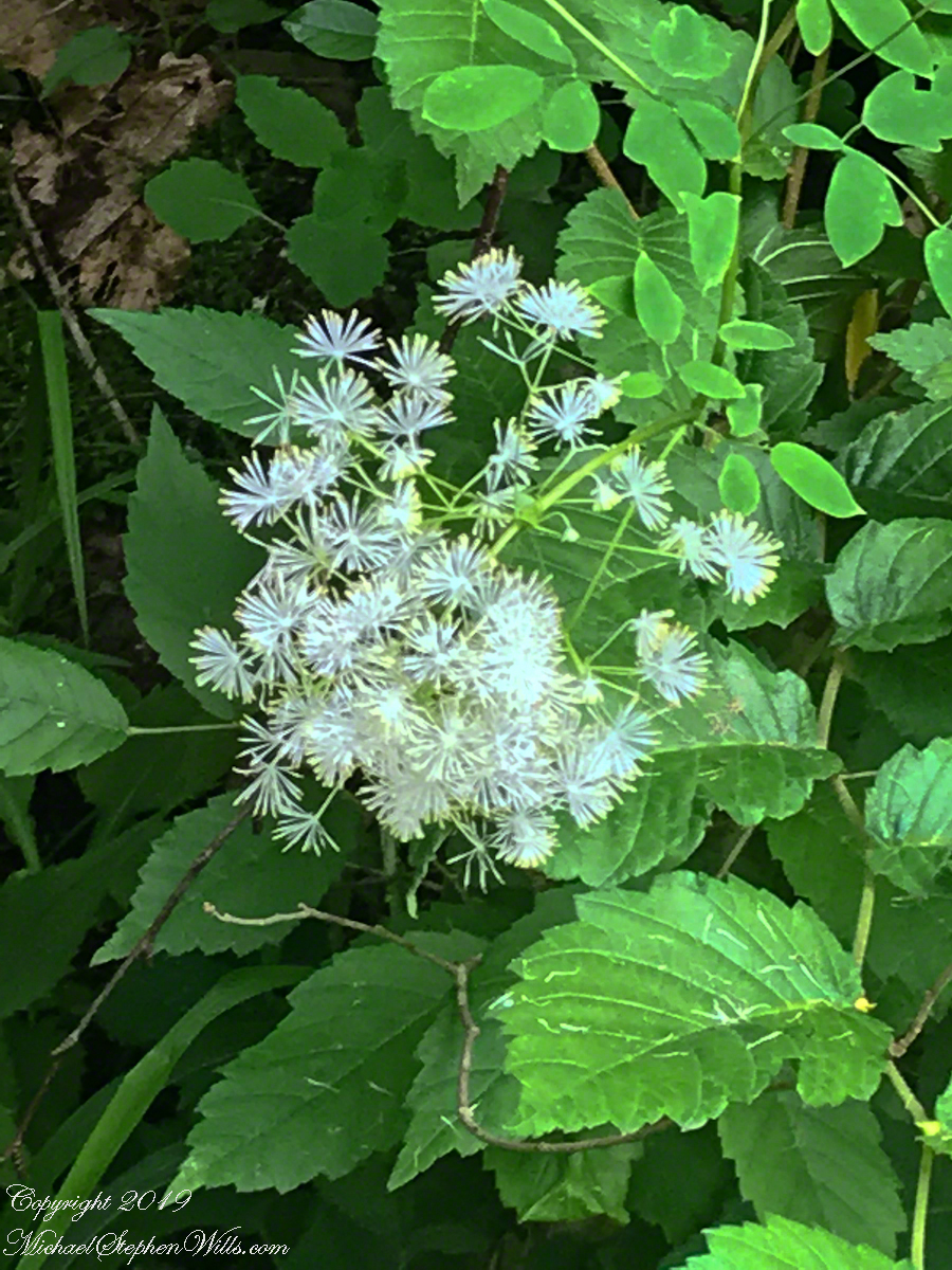
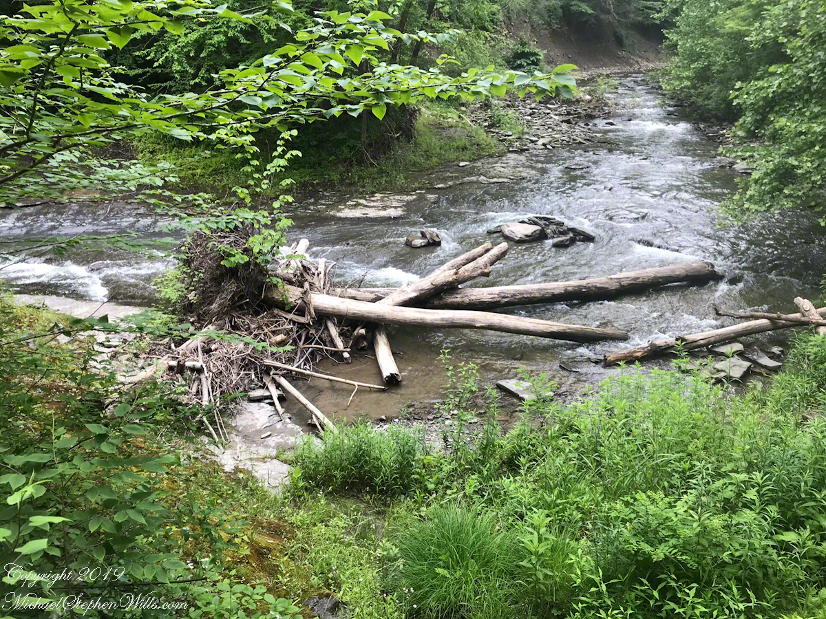
Birdsong and enchanted placeBayberry?The power of flowing water (flood stage)
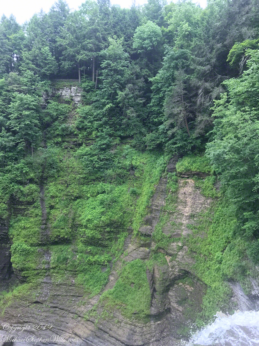
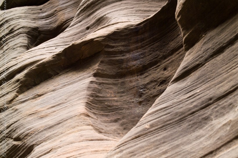
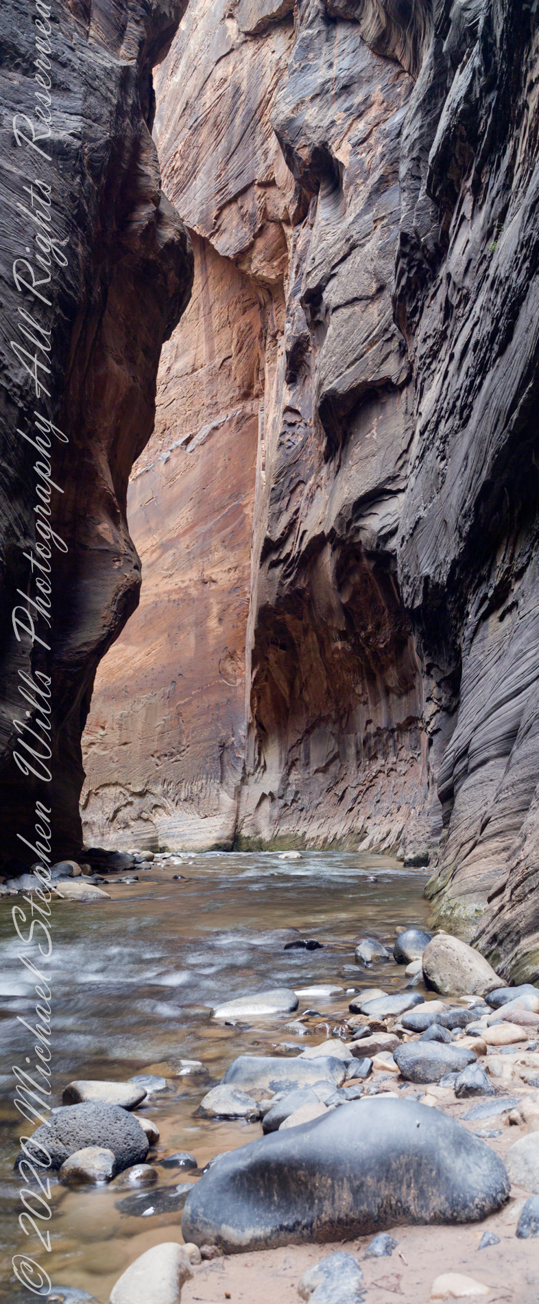
Mysterious alcoves through cross-bedded Navajo Sandstone, 15 feet, or more, above the streambed. I use mysterious in the sense I wished the formations were mysterious, standing there with nowhere to climb, witnessing the effects of floods that high above. The location is The Narrows just above Orderville Canyon junction, Zion National Park, Springdale, Utah
Copyright 2021 Michael Stephen Wills All Rights Reserved
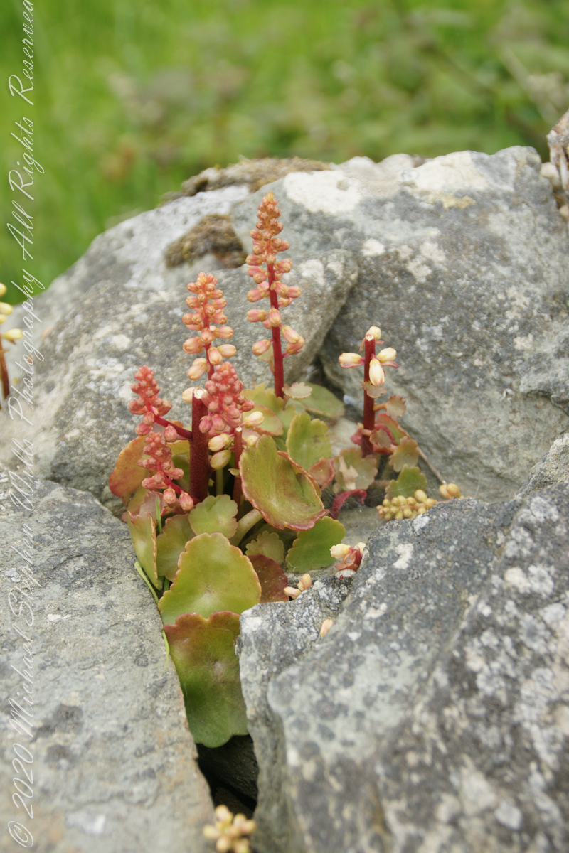
This unidentified spring of racemes, fleshy leaves and stalks, grew from the rock wall of the entry path to Drombeg Stone Circle. Here the climate is strongly influenced by the Celtic Sea, milder winters allow exotic plants to flourish.
My appraisal is this is in the Crassulaceae family, possibly the genus Kalanchoe or, more probably Umbilicus, from the fleshy, round, succulent leaves and form of the flowers. Species of Umbilicus are native to Western Europe and known to favor rock walls.
Click any pic for a larger view, in a new tab, or a slide show. When using WordPress Reader, you need to open the post first.
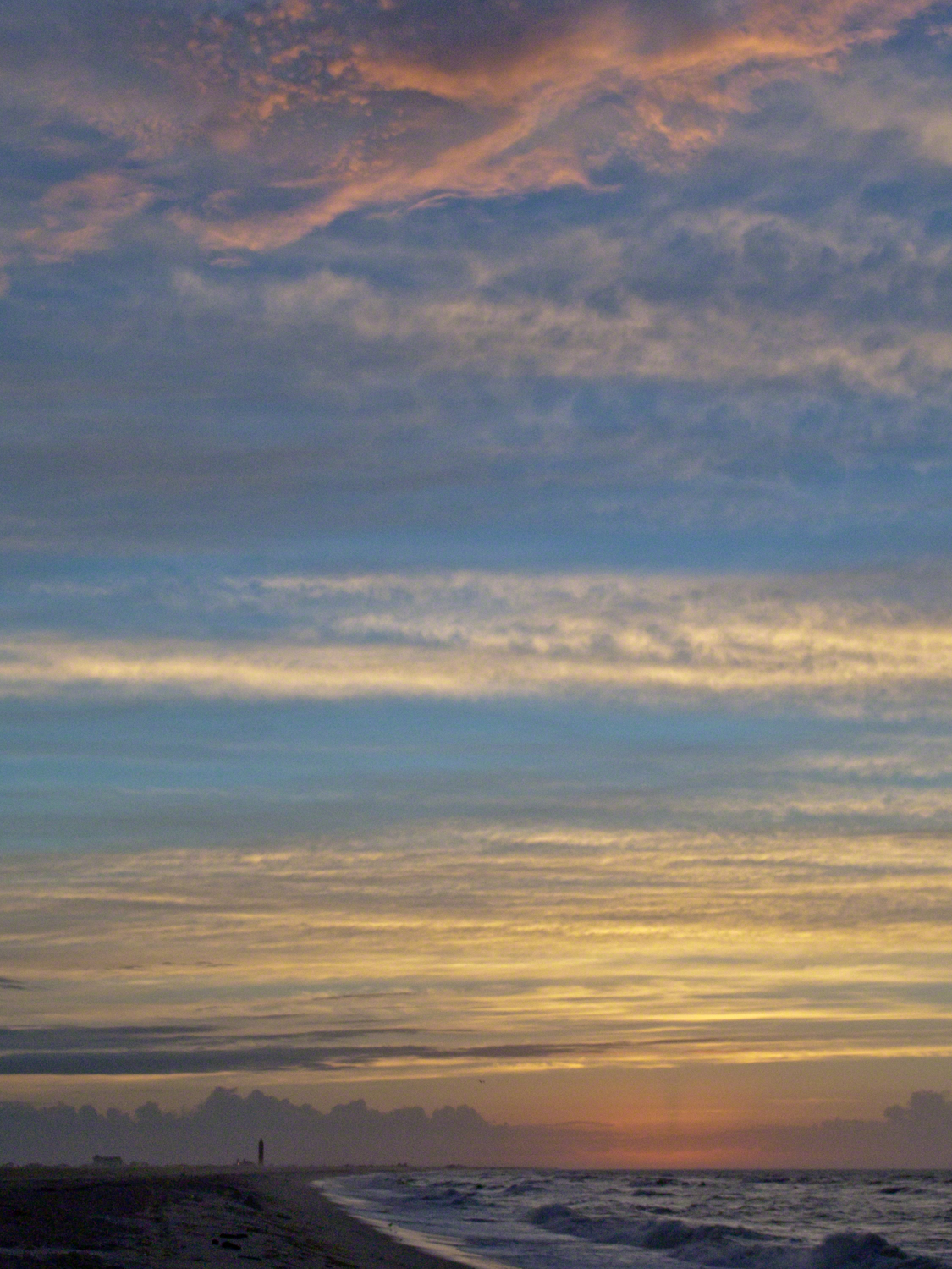
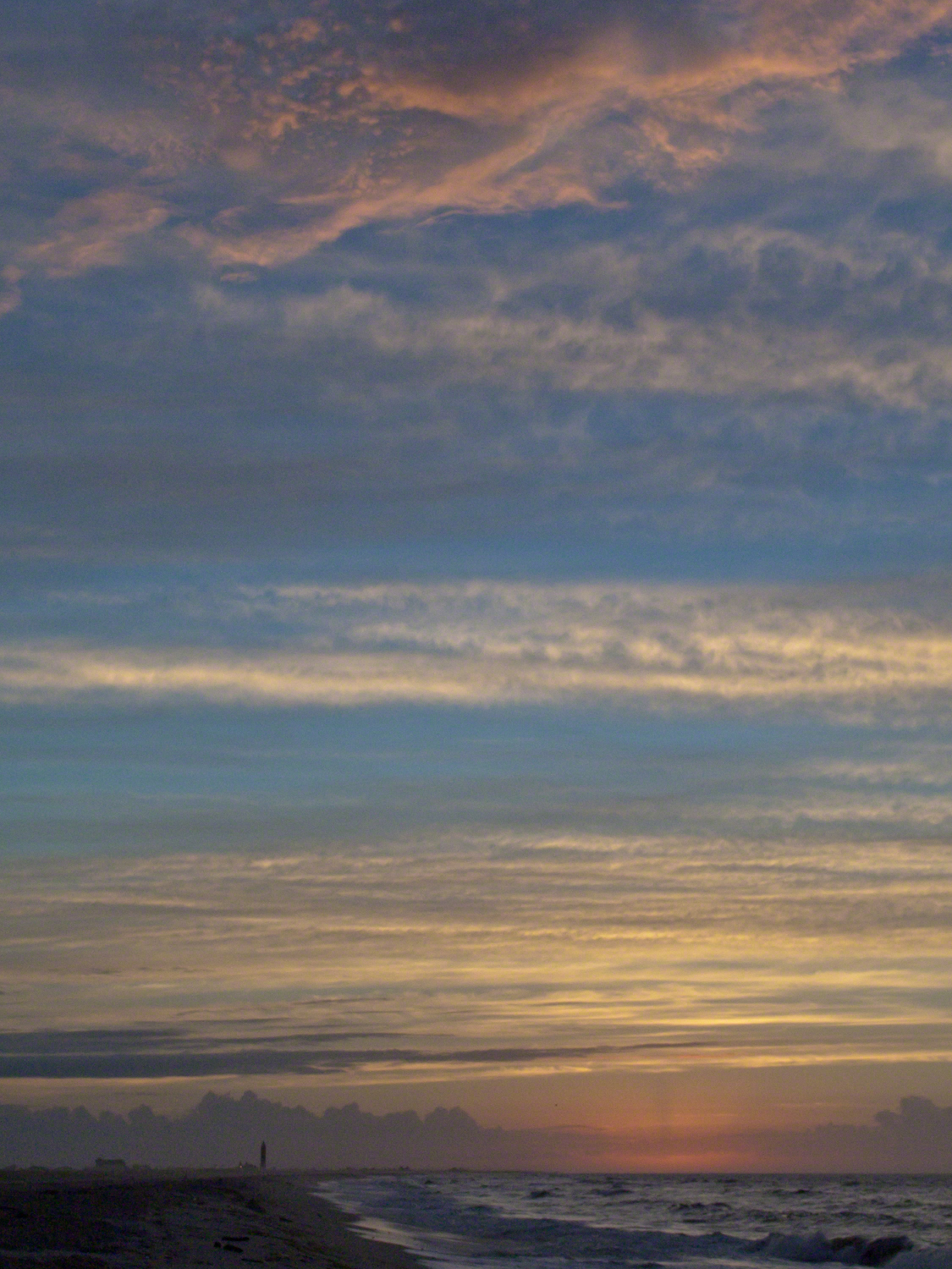
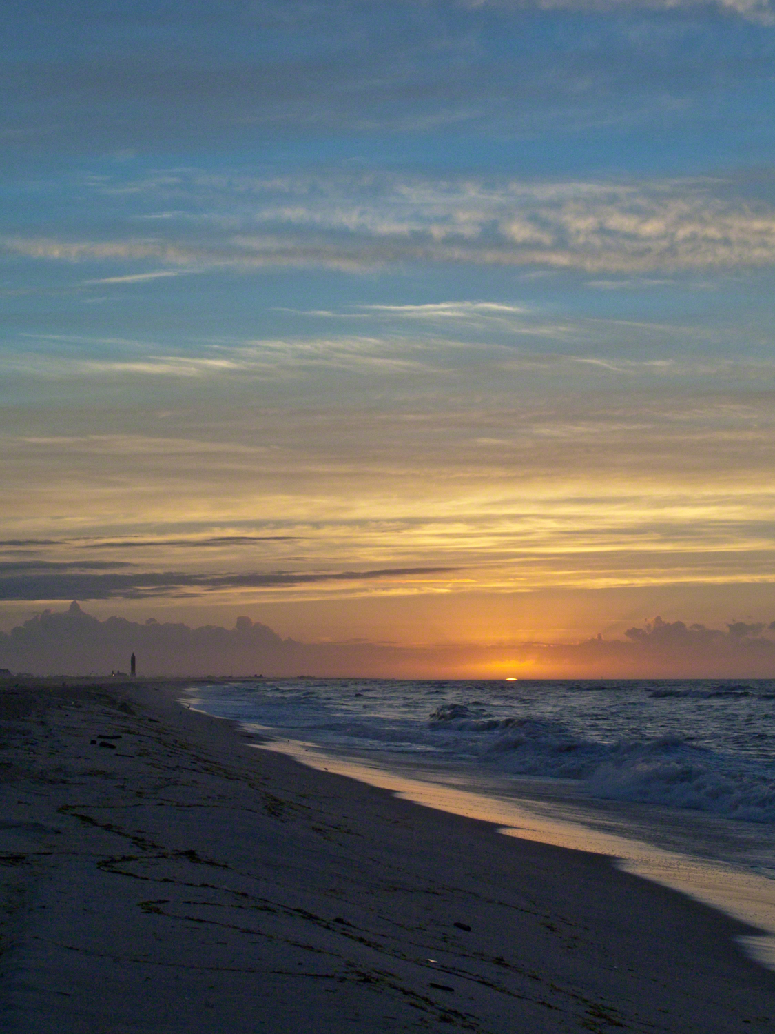
Hurricane Katrina approached the Gulf Coast and New Orleans as the sun rose on the West End of Jones Beach on Long Island, August 28, 2005. This amazing sunrise was an element of the unusual atmospheric effects that are evidence of the power of this storm.
The featured image (heading this blog) is my print, “Katrina Sunrise”. This work is enjoyed by hundreds of my clients. Use the link, below, to acquire your own. Custom framing is available.
The following images are the rough drafts taken in the early morning hours. The beach was literally deserted as I mounted the camera and framed the view for this series. Many image captions include the file time stamp, for example 6:07:13 is 6 am and 7 minutes 13 seconds.
6:07:13 First image of the set. Below the horizon the sun lights the upper atmosphere.6:07:34 As the sun approaches the horizon the lower clouds catch light. My Camera was a Sony DSC-F828 tripod mounted with a polarizing filter.6:07:56 I panned slightly to the east. ISO was set to 64 throughout.6:08:16 Gradual brightening. The lens is 7.1 – 51.0 mm f/2.0-2.8.6:08:38 All levels are brighter. It seems those low clouds will block the horizon. That was not the case. The variable focal length is 15.6 mm.6:09:05 It is happening!!!! Exposure was set to automatic on a f stop of 8.0. It was 1/3 second for this image.6:14:34 The view is panned west. That is the Robert Moses water tower of Jones Beach State Park looking like a rocket ready to blast off.6:15:15 Will those low clouds block the sun? Looks promising.6:16:11 Clouds on the upper margin catching the sun. Horizon brightening….. Exposure 1/20 second.6:14:39 This will be a disappointment if that sun does not show. Exposure 1/25 second.6:18:27 Almost there….1/15 second exposure….6:19:07 Quick framing adjustment to bring the lighting of shore margin into the composition. The final version was created from two images captured seconds after this.As the sun rose a rainbow formed in the western sky.
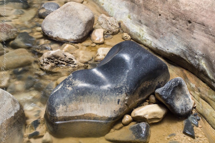
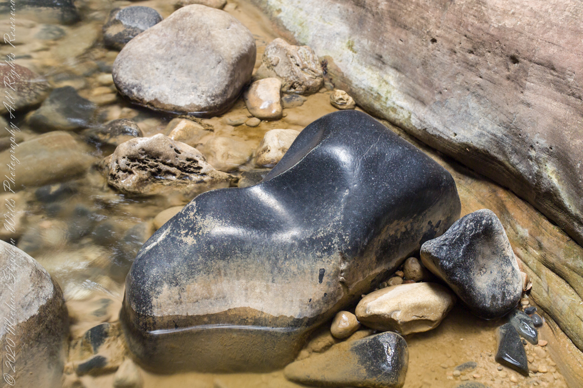
This polished basalt, the product of volcanic eruptions and eons-long weathering, is common on the Virgin River bed. Zion National Park, of The Narrows just above Orderville Canyon junction.
Copyright 2021 Michael Stephen Wills All Rights Reserved
I combined two 50 mm exposures for this view of an interesting rock and beetling canyon walls. Upstream from here it is a day’s walk to reach ground safe from flash floods, downstream at least one hour. Narrows of Zion National Park, Utah
Copyright 2021 Michael Stephen Wills All Rights Reserved
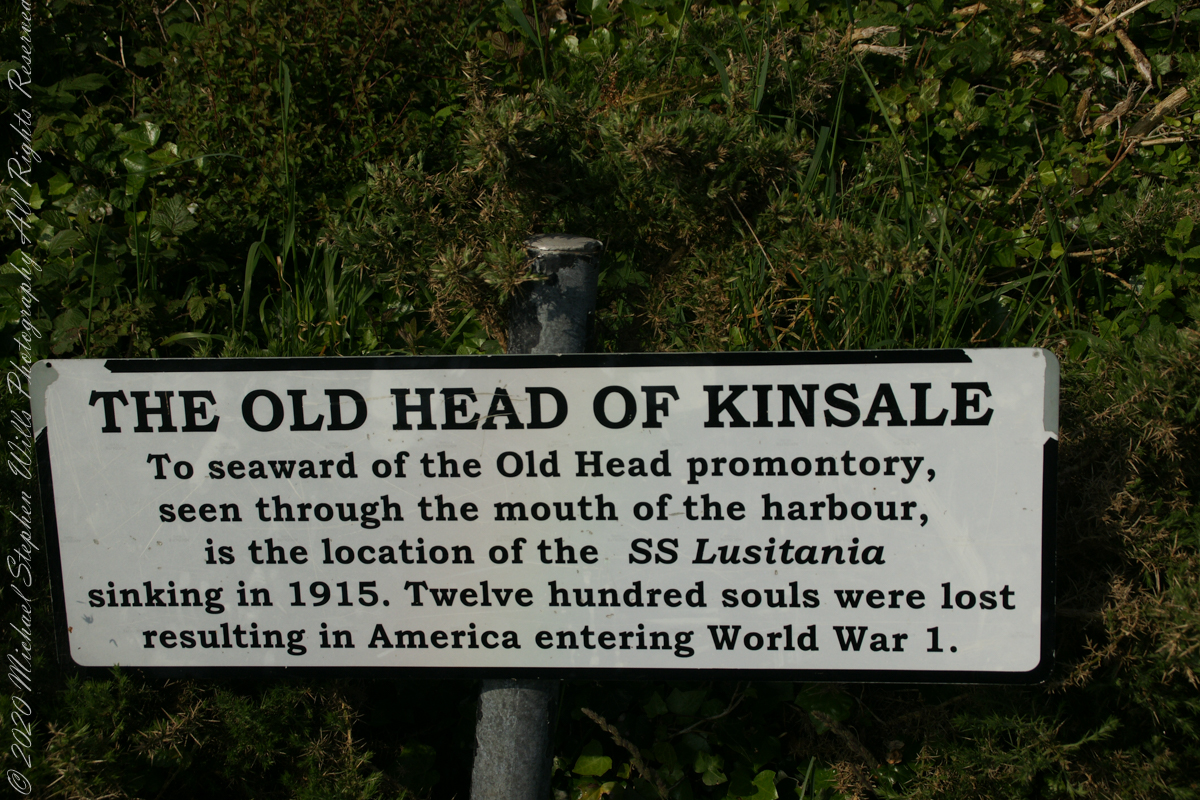
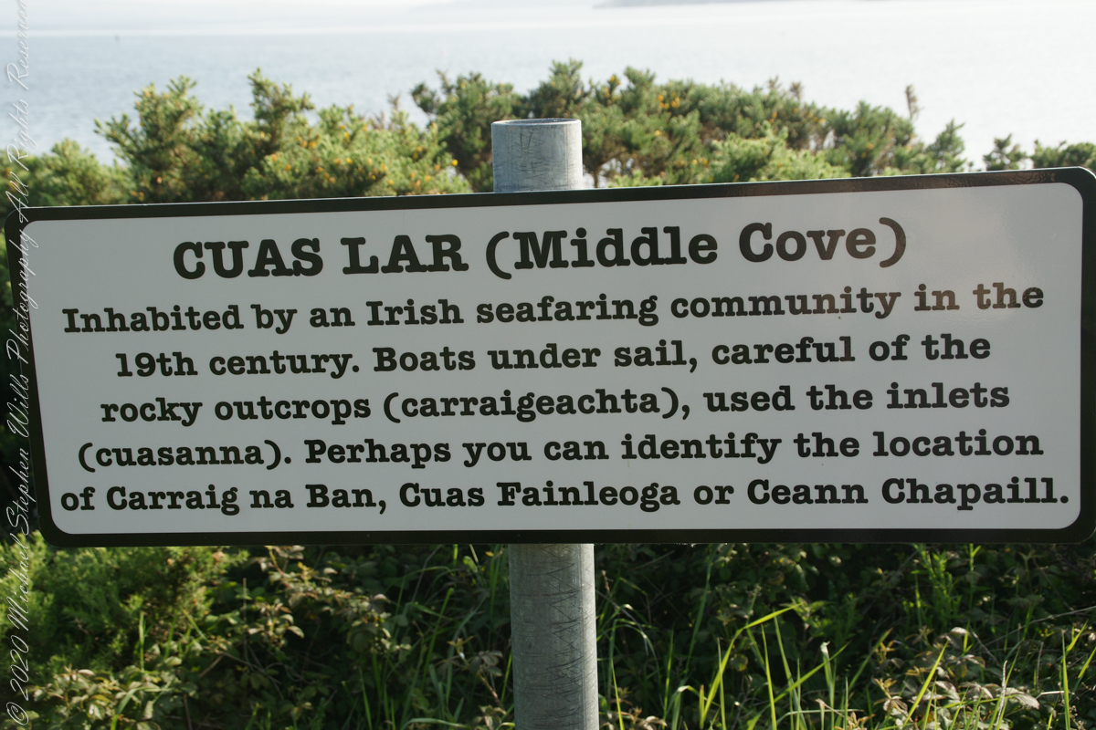
The view referred to by placard is to the right. The Old Head of Kinsale is the distant landform, looking right to left, is the portion that drops off to the ocean.
Click any pic for a larger view, in a new tab, or a slide show. When using WordPress Reader, you need to open the post first.
Here is a Google Maps screen capture showing the relationship of our position (the unnamed red drop-pin) on the right, and the Old Head of Kinsale landform, seen below the lable “Ballylane.”
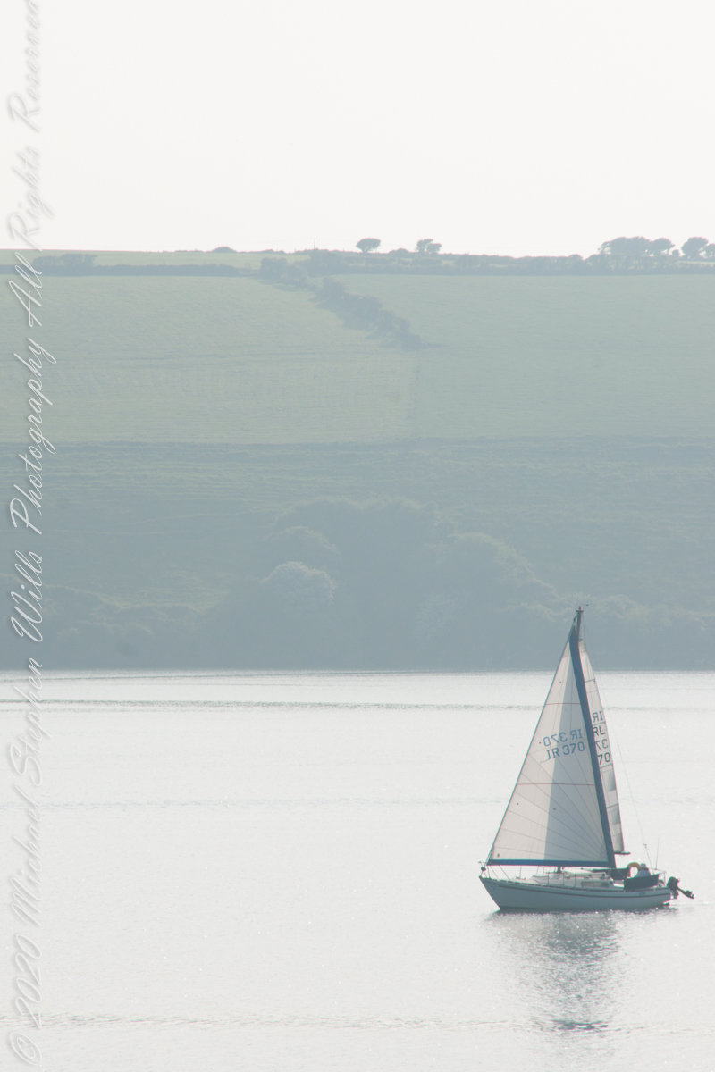
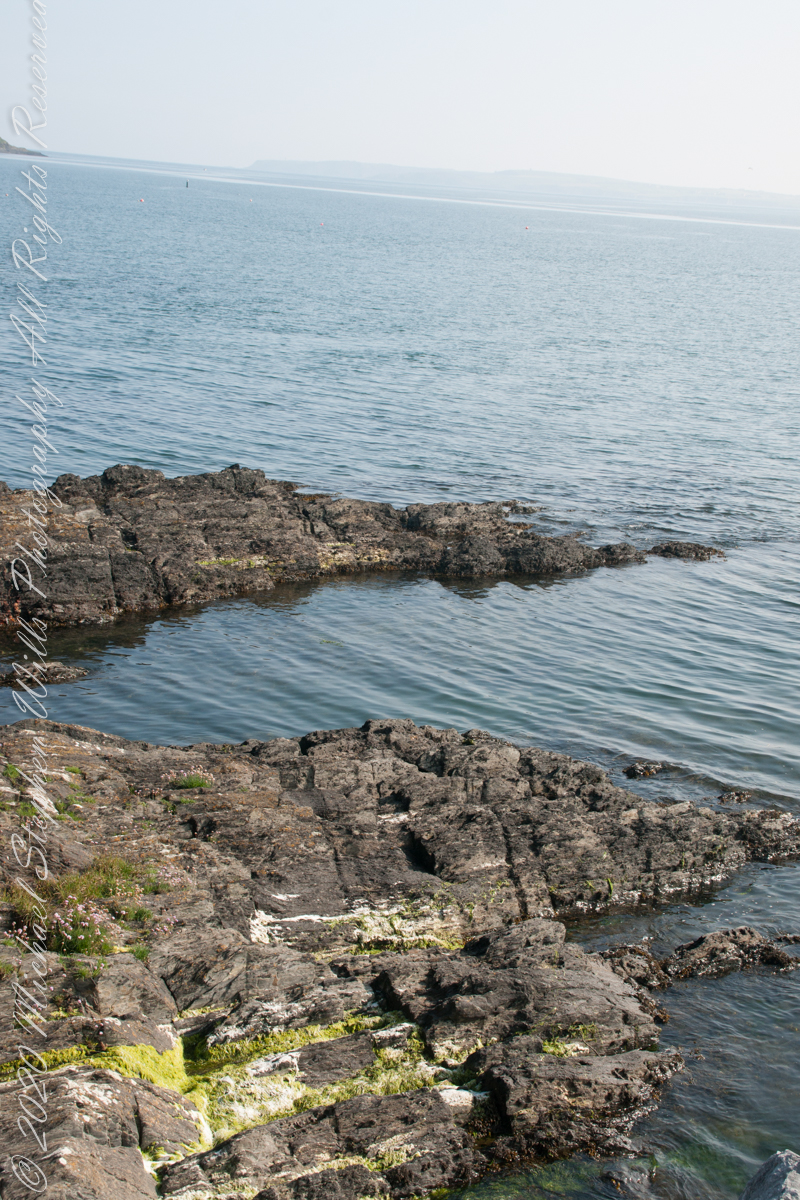
Here are the views looking toward the Celtic Sea, the Old Head of Kinsale and the cliffs at our feet.
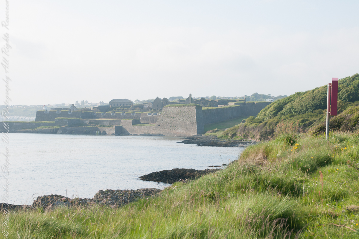
Looking back toward Charles Fort
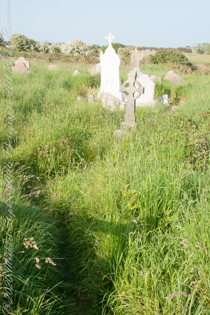
This cemetery is unmarked on the maps I use.
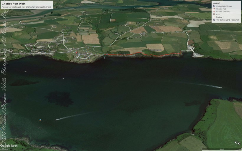
Here is a Google Earth view of our walk, the red line. The view is looking east from above the former “de Courcy family parkland.”
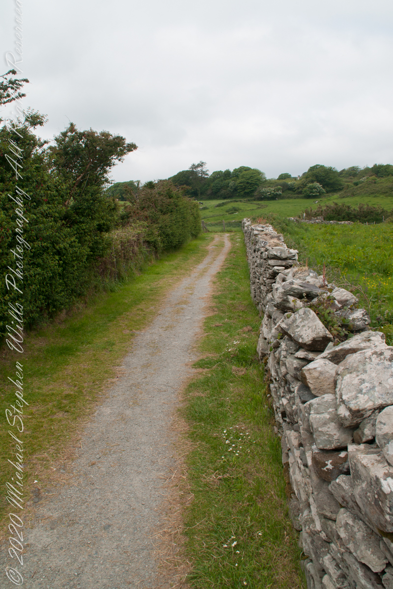
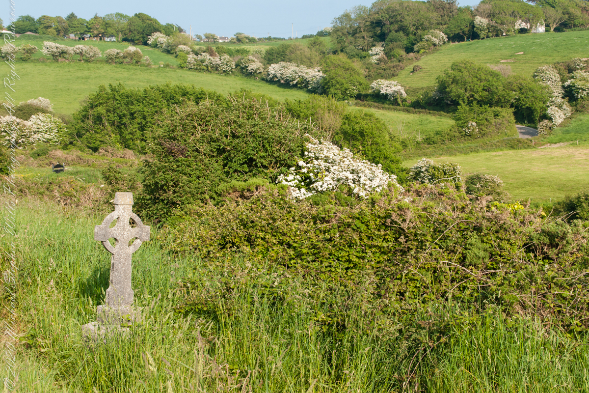
A half mile footpath, marked in red, leads from Charles fort along the shoreline cliffs, surmounted by working farmland.
Copyright 2021 Michael Stephen Wills All Rights Reserved