“When George J. Roskruge created the official map of Pima County in 1893, he named the range after James Quinlin, who had opened a stagecoach station in the nearby town of Quinlin in 1884.” — Wikipedia article for “Quinlan Mountains.”
Kitt Peak is the highest point of the Quinlan Mountains, one of a series of ranges starting near the border with Mexico, the Baboquivari Mountains. Pan Tak pass separates Coyote Mountains from the Quinlans. Farther north there is even the Roskruge Mountains and a range named for a silver mine, the Silver Bells. Roskruge originally named “Kit’s Peak” for his sister, Phillippa, married to William F. Kitt. The peak was renamed to Kitt Peak William’s request.
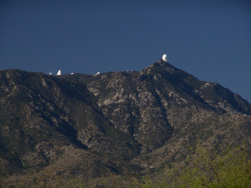
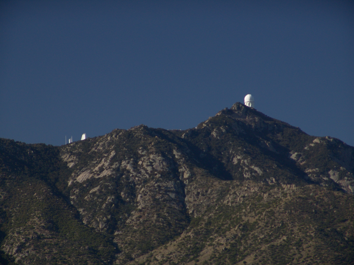
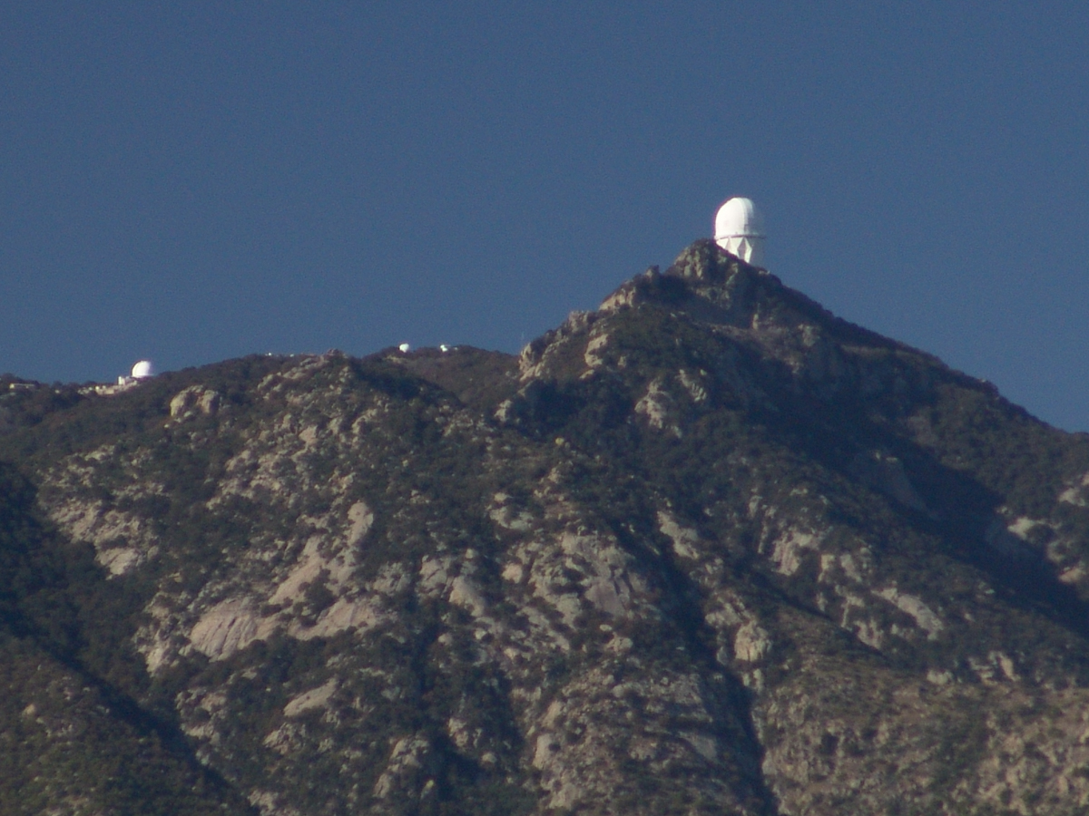
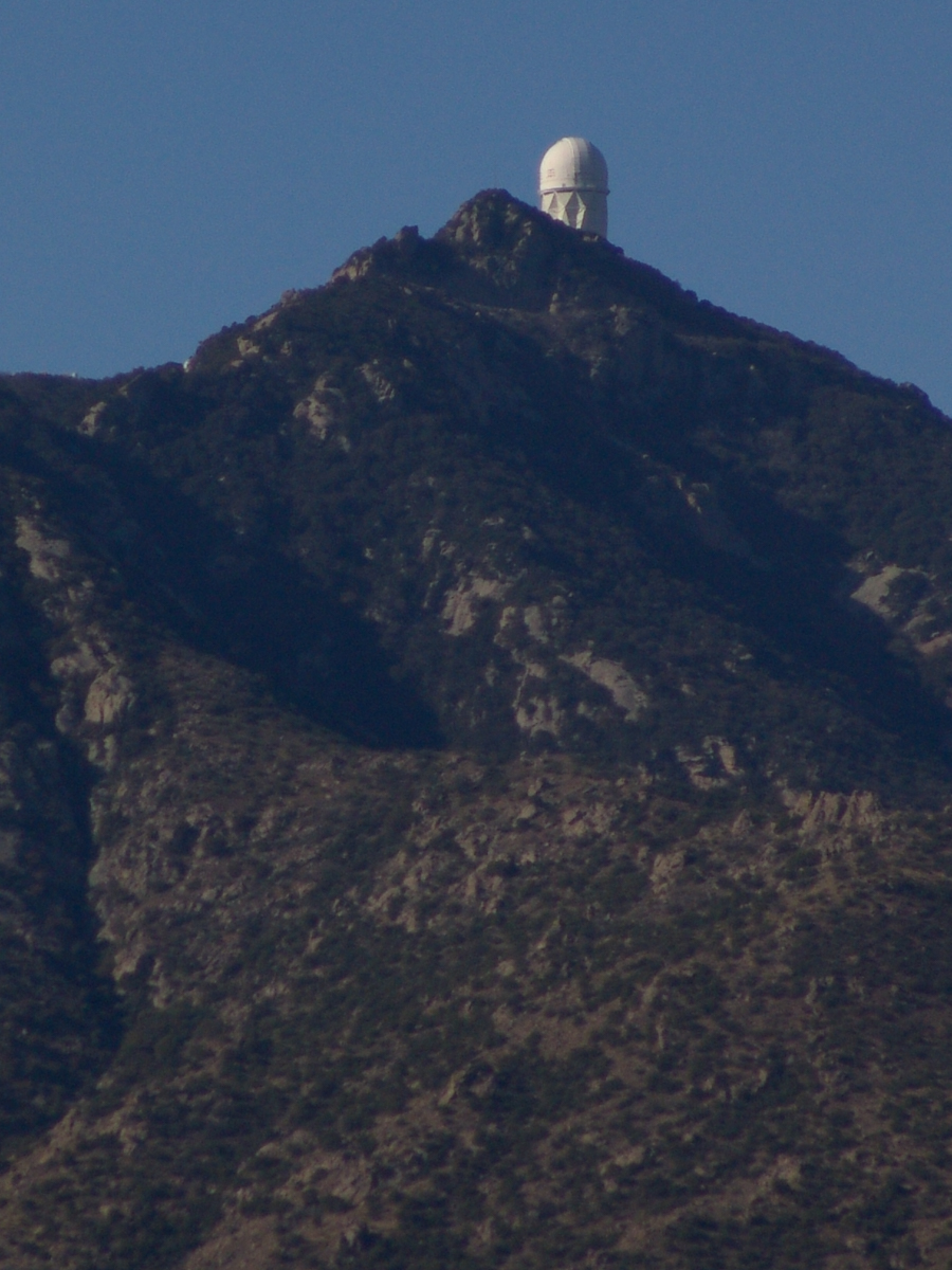
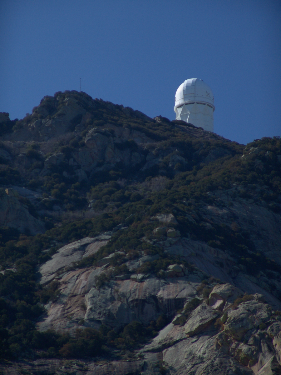
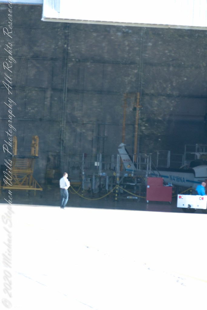
Here we see a dramatic view of Quinlan Ridge with Kitt Peak observatories, taken from the access road Arizona Routh 386. The instruments I recognize are, from left to right, McMath-Pierce Solar Telescope (second in line) and, on the end, Mayall Telescope.
And more views as I progressed toward the top.
.
The dramatic peaks are hypothesized to be igneous intrusions into metamorphic rock, these are called “Sky Islands” for the environments supported on them, radically different from surrounding lowlands. Kitt Peak is known for the stands of Manzanita Bushes
A mature Manzanita growing along the Miller Trail of the Rincon Mountain Wilderness. There is an enlargement of the flowers, to the right.
Copyright 2022 Michael Stephen Wills All Rights Reserved
The Contreras fire threatening Kitt Peak last month brought to mind a spring visit of mine to the National Observatory.
From downtown Tucson get onto Interstate 10, heading “east” toward El Paso. East in quotations as the road only turns east after the fork for Interstate 19, headed south past San Xavier del Bac mission and Nogales at the Mexican border. A few miles down I19, well before the mission, a turnoff for Arizona route 86, a road you’ll follow the better part of 36 miles, passing the Tucson Mountains on the right. Most days, the Mayall Telescope of Kitt Peak shines bright white ahead, as it did the right after dawn on Wednesday, April 20, 2005.
At some point R86 enters the 4,453.307 square mile extent Tohono O’odham Nation Reservation, you pass the town Three Points where Arizona route 286 heads south to Sasabe and the Mexican border. The next turn south is the Kitt Peak access road, Arizona route 386. On that Wednesday I was so early the gate to the peak was locked, so I pulled off the road and waited. It is a lonely place on the route for migrants from Mexico. I wandered off the road, into a wash (dry, sandy stream bed), to relieve myself, where junk from migrants was scattered around. Back in the car a helicopter approached with a black SUV. A big guy got out, walking by into the wash: the border patrol.
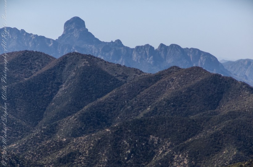
Here is a photograph from that day of Baboquivari Peak taken from Kitt Peak’
Baboquivari Peak is the most sacred place to the Tohono O’odham people. It is the center of the Tohono O’odham cosmology and the home of the creator, I’itoi. According to tribal legend, he resides in a cave below the base of the mountain. This mountain is regarded by the O’odham nation as the navel of the world – a place where the earth opened, and the people emerged after the great flood. Baboquivari Peak is also sometimes referred to as I’Itoi Mountain. In the native O’odham language, it is referred to as Waw Kiwulik, meaning “narrow about the middle”. The O’odham people believe that he watches over their people to this day. — Wikipedia
Baboquivari Peak was mentioned in the journals of Jesuit missionary Padre Kino, who made many expeditions into this region of the Sonoran Desert, beginning in 1699, establishing Spanish Missions in the area. — Wikipedia
Kitt Peak is in the sacred precinct of Baboquivari, the land just below the peak is the “Gardens of the Sacred Tohono O’odham Spirit I’itoi.” The month of my visit, the O’odham nation brought legal suit against Kitt Peak to halt construction of new telescopes in the garden. The issue was settled out of court.
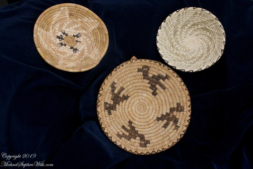
About the header photograph: From the bottom clockwise. Birds by Anmelia Juan of Geawuk (Kitt Peak 1972) – I purchased this from the Kitt Peak gift shop during my first visit; Turtle by Olvera and Simon Valenquela (Saguaro National Monument 2005); Stars by Simon Valenzuela for his daughter Pasquala Valenquela 16th Birthday (2018). Simon is of the Pascua Yaqui tribe who Learned basketmaking from his wife’s family.
Copyright 2022 Michael Stephen Wills All Rights Reserved
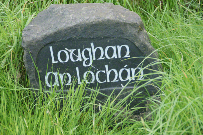
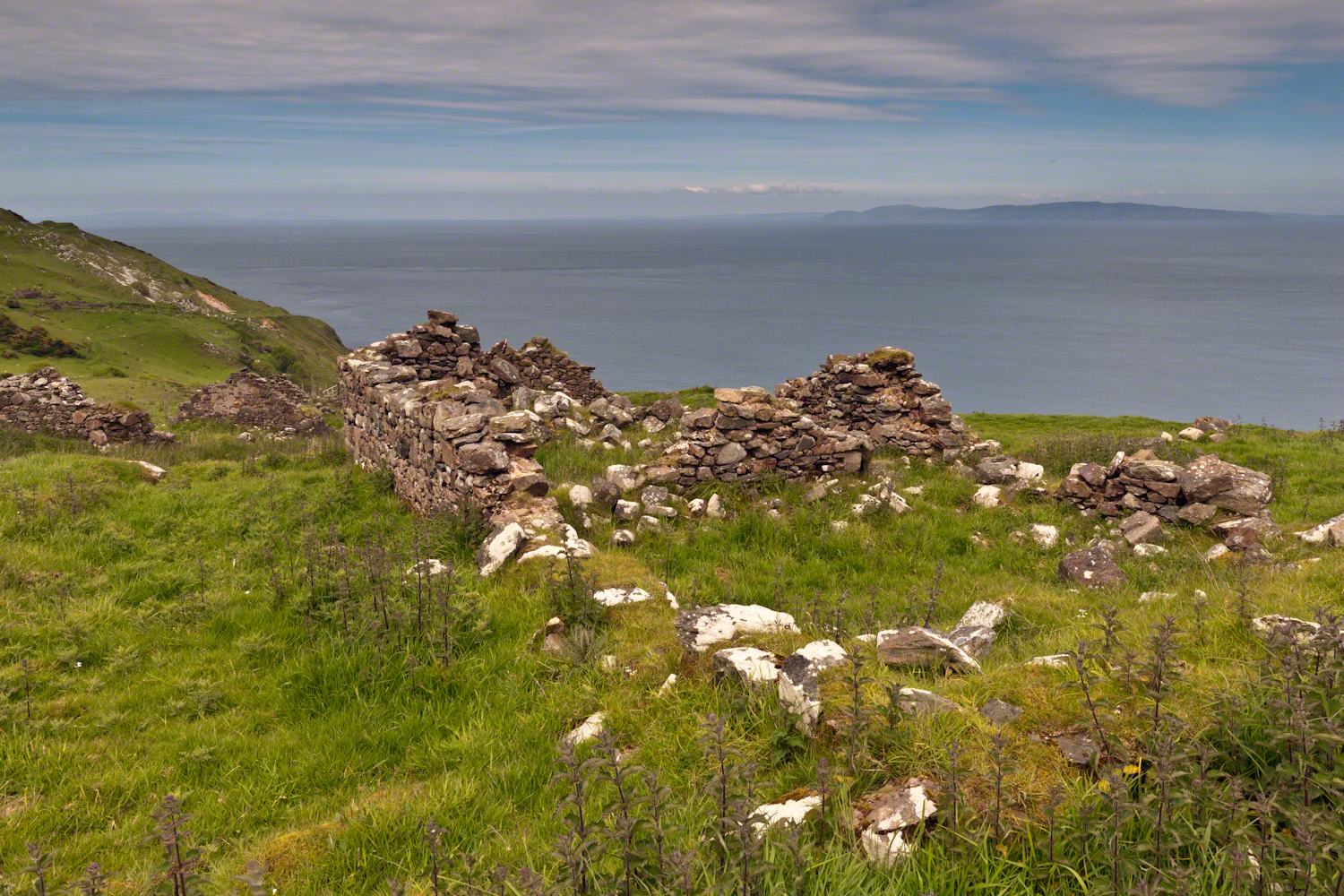
Here is a photograph from our day touring the Glens of Antrim. While making our way up the coast to Torr Head a group of stone walls resolved into ruins. A cluster of cottages on grassy slopes above the Irish sea above Loughan Bay. This is the townland of Loughan. Along the road are wonderful signs providing in handsome carved letters the place name in english and gaelic. Here a signed only provided a gaelic name: “Loughan an Lochan”…near enough to meaning “Loughan Bay” in English. The bay is a shallow scallop shaped indentation of the coast, a margin of narrow sand strand.
Ruins are spread across the slope. Immediately before the views are traces of a foundation above the grass. Beyond the top of a gable, an entire gable to the left. On the far ridge, just visible, is an entire structure with doorways, gables, walls.
Across the Irish Sea, 13 miles distant, is the Mull of Kintyre. In faint outline, rising above the horizon, find the highlands of Islay more than 30 miles. Both are tips of peninsulas jutting from Scotland.
Click pic for larger view in a new browser tab. If you are in WordPress Reader, open the post to use this feature.
The ruins lead to curiosity over who live here? What were their lives like? Why did they leave?
Here are some thoughts on various physical representations of the iconic Space Shuttle we encountered during our travels.
Vision
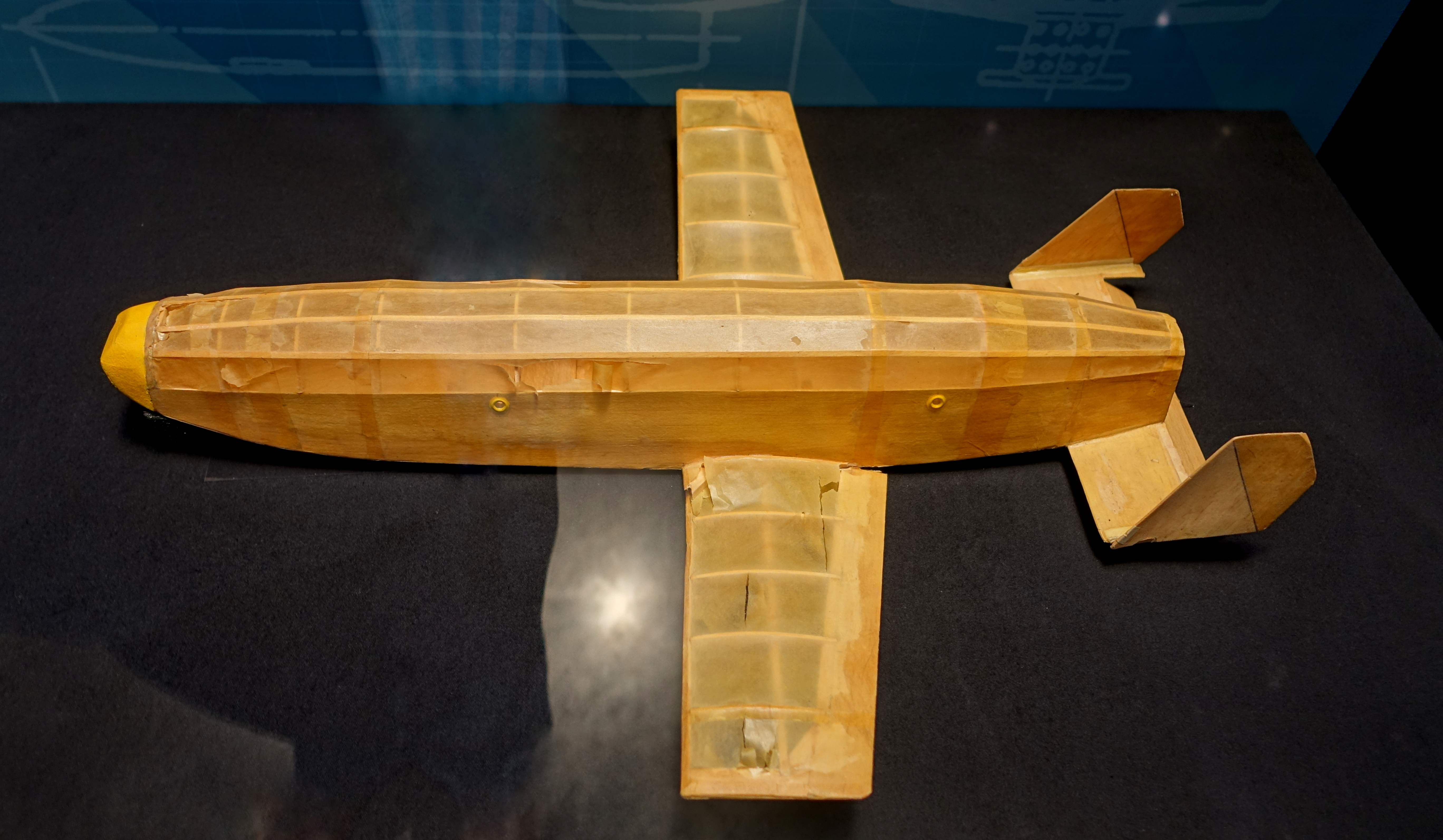
Dr. Maxime “Max” Faget joined NASA in 1958, where he headed the group that designed America’s first manned spacecraft, the Mercury capsule. In 1969, Dr. Faget was the director of engineering and development at NASA. On April 1, 1969, Dr. Max Faget tossed this balsa wood toy toward his team of engineers hard at work landing a man on the moon. During this time Dr. Faget’s team also began creating a revolutionary space vehicle for NASA. “We’re going to build America’s next spacecraft. And it’s going to launch like a spacecraft. It’s going to land like a plane.” –text from Kennedy Space Center display, see following.
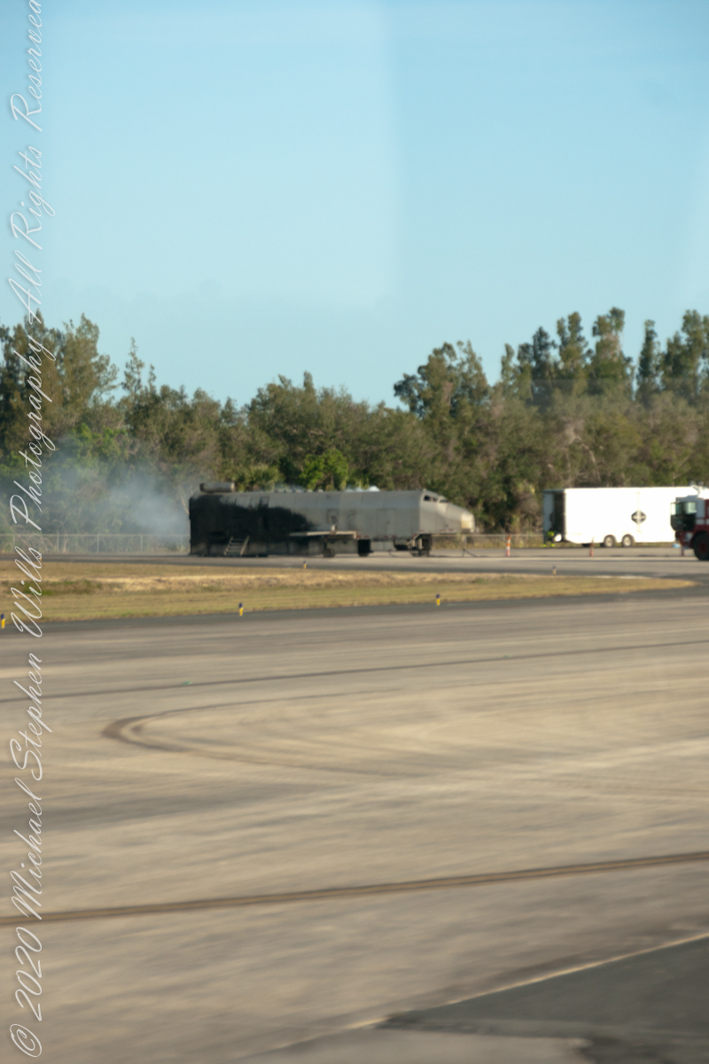
The Space Shuttle life size model still in use for fire training at Station #2 at the Shuttle Landing Facility.
Two Inspirations
On display next to the Shuttle Landing Facility
April 29, 2016 – Almost five years after NASA’s last space shuttle landed in Florida, an orbiter returned to the runway at the Kennedy Space Center. The model orbiter “Inspiration” was rolled out to Kennedy’s Shuttle Landing Facility on Wednesday (April 27), where it will be rebuilt into a traveling exhibit. The full-scale mockup was previously on display at the now-former location of the U.S. Astronaut Hall of Fame in Titusville. LVX System, which acquired the 122-foot-long (37 meter) shuttle replica from NASA, moved the Inspiration from the Hall to a work yard in January. The company, which has an agreement with NASA to study visual light communication for deep space missions, intends to use the space shuttle as a vehicle for both educational outreach and marketing. “Over the past four months, work has been done to bolster the shuttle’s structure and aesthetics in preparation for the move this week, an LVX spokesperson said.” – from the “Collect Space” web site
The “Inspiration” model of my photograph, from our 2018 Shuttle Landing Facility visit, is a second Space Shuttle mock-up built by Kennedy Space Center carpenters from a rocket booster body.
Happy Birthday
Three birthday cakes Pam Wills created with input from her grandson. He helped to decorate the cakes. Featured is the Cape Canaveral lighthouse with launch sites, Kennedy Space Center launch site 39A with the shuttle and rockets. Foreground, in partial view is a tableau of the 1969 moon landing.
Copyright 2022 Michael Stephen Wills All Rights Reserved.
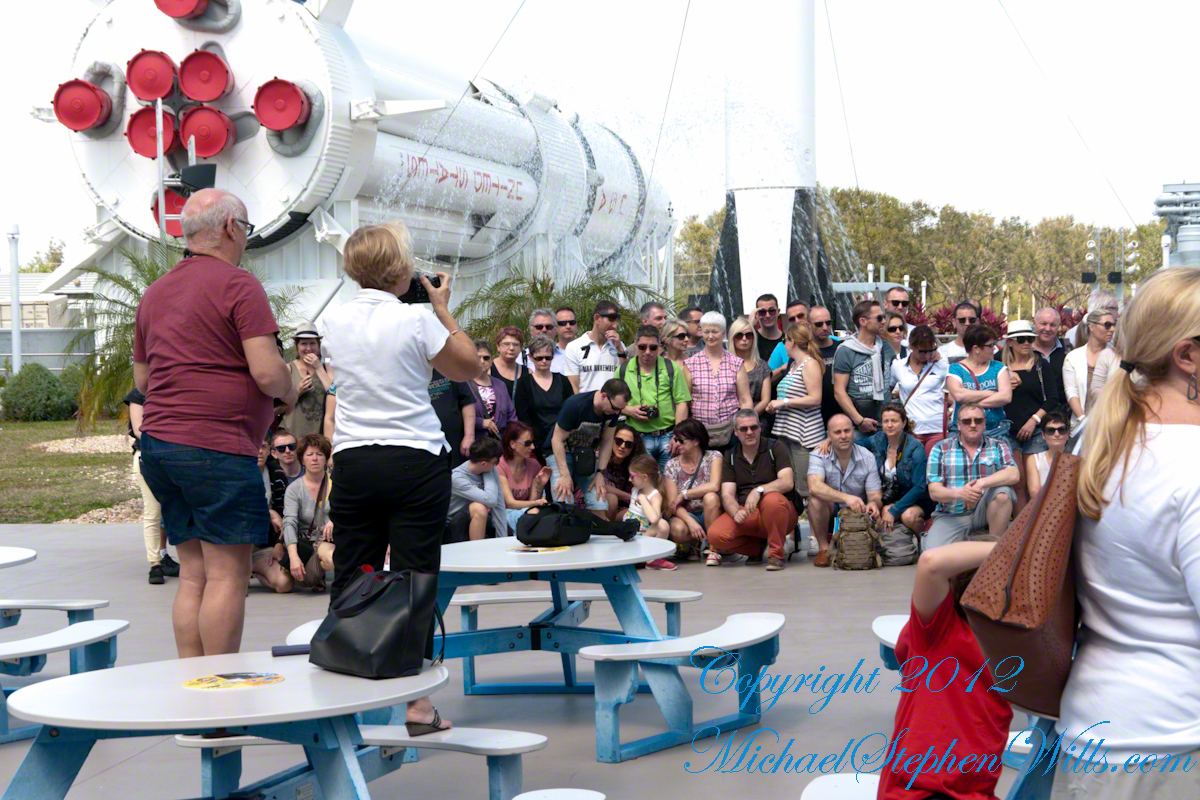
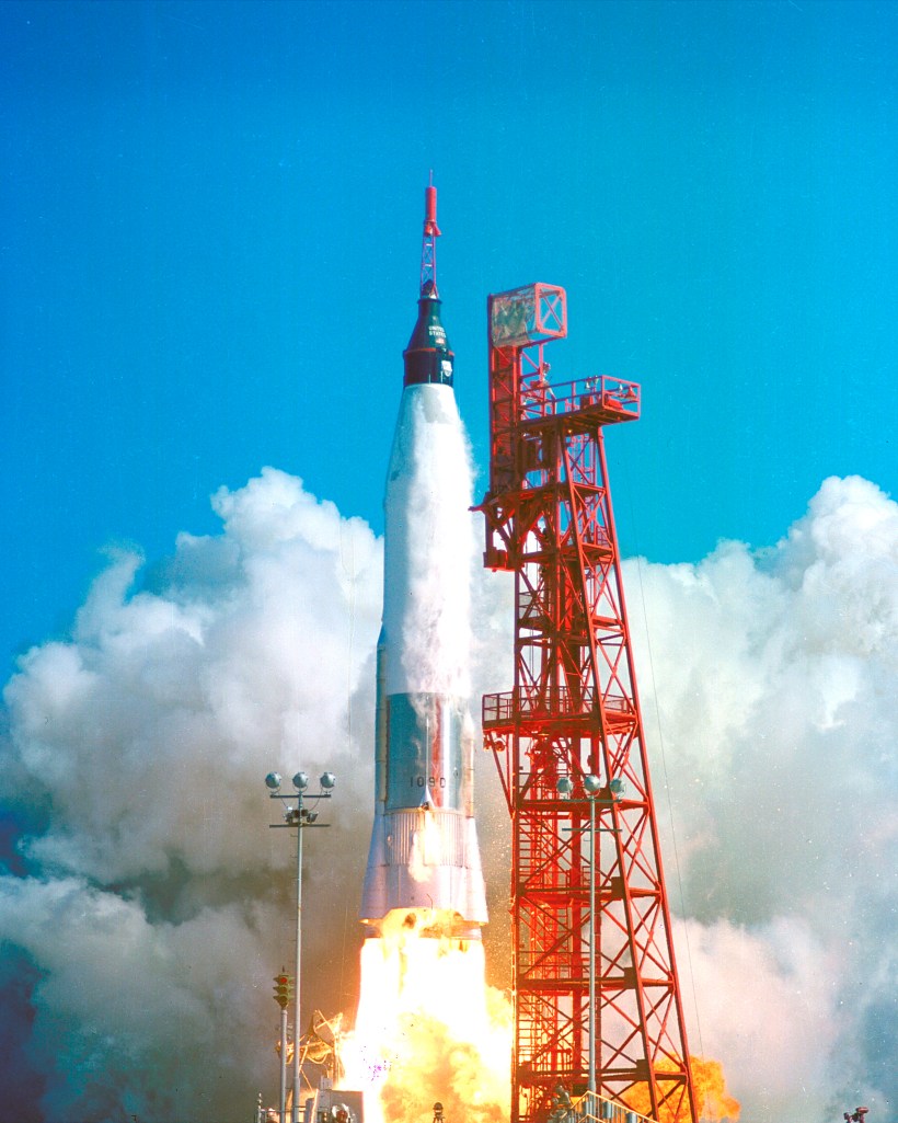
Here is the sixth in a series of photographs centered on the early history of space flight on Cape Canaveral mostly taken during a tour organized by the Cape Canaveral Lighthouse Foundation. “Google” the foundation for details of future tours. Here we explore pre-launch support for the Mercury program, including the first USA Orbital Launch of John Glenn from Launch Complexe 14 (LC 14).
Overview
Leaving LC 1 – 4 (see “Post WWII Launch Complexes”), our bus turned onto Central Control Road passing construction on Launch Complex 36 (LC36). In 2015 Blue Origin (Amazon money) leased LC36 where it planned to launch the “New Glenn” vehicle after 2020. I snapped the churned-up sand and construction equipment, not interesting at all IMHO.
Click Any Image for a larger viewe
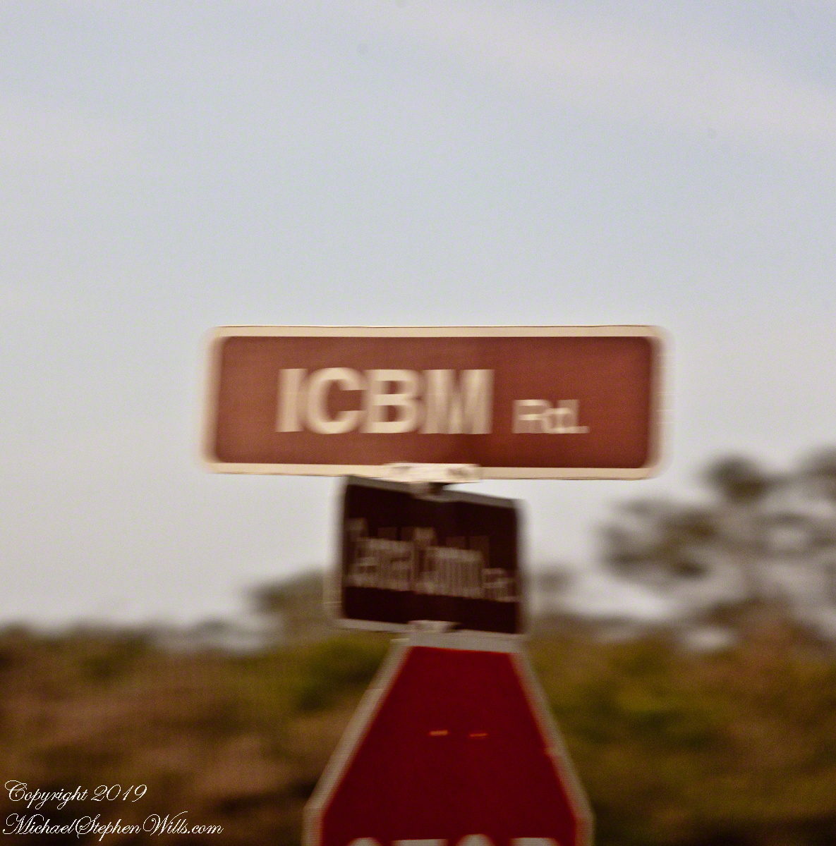
Corner of Central Control and ICBM Roads. Cape Canaveral Air Force Station.
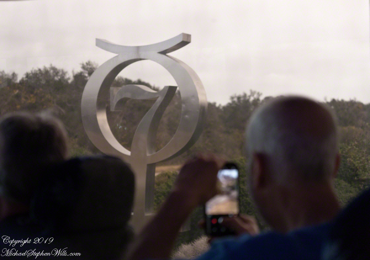
The “New Glenn” was named in homage to John Glenn, the first American to orbit the earth in 1962. We turned right onto to ICBM Road, headed generally north, following a string of launch complexes along the Altantic shore toward Launch Complex 14 (LC14). A dissapointment was not stopping to walk the Mercury 7 Memorial at the corner of ICBM Road and LC14. Our bus stopped briefly enough for the following snap. It is a memorial because John Glenn, the surviving member of Mercury 7, passed away December 8, 2016 at the age of 95.
Mercury 7 Memorial, just off ICBM Road
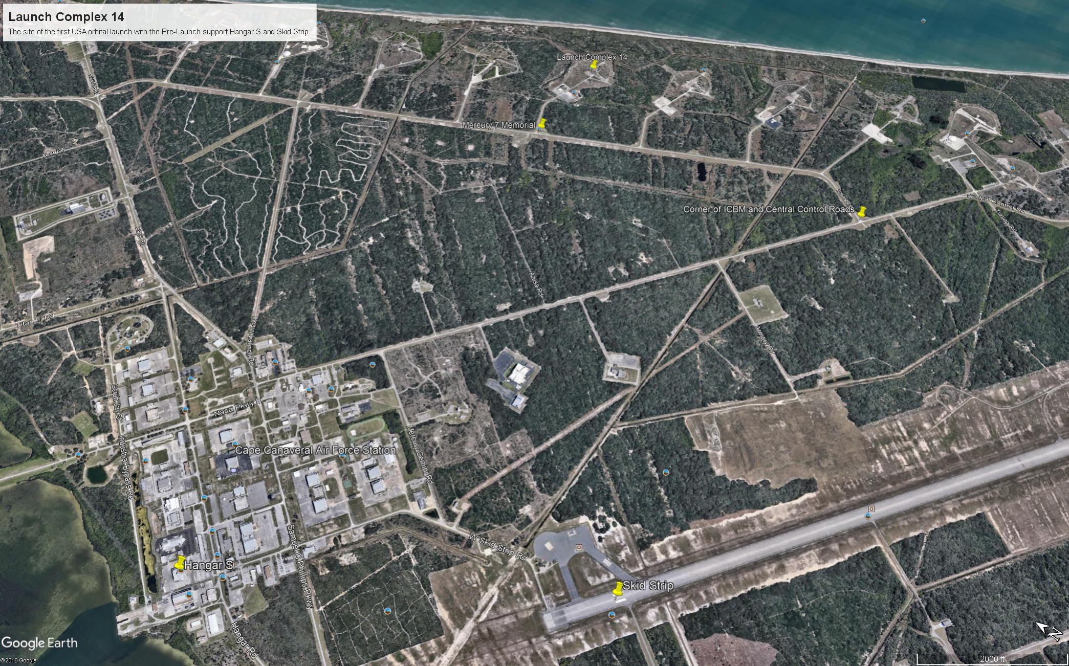
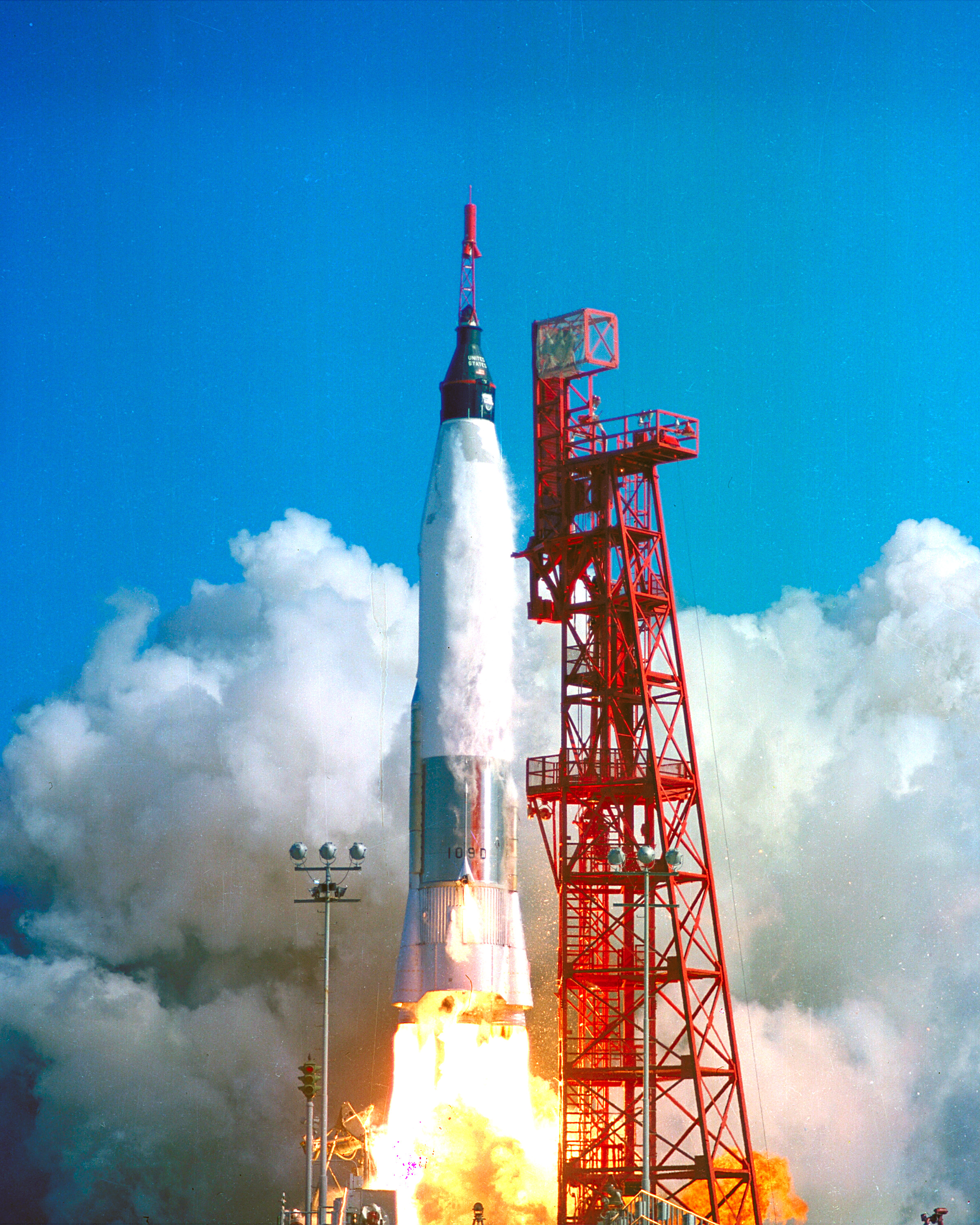
I will cover at length the Mercury-Atlas vehicle that powered John Glenn into orbit February 20, 1962. The tie-in between ICBM road and this series of launch complexes is the early space missions were on re-purposed Intercontinental Ballistic Missles (thus, ICBM). “Atlas” is the name of the ICBM used for Colonel Glenn’s 1962 flight. Click on the following image to find labled pushpins for the corner of Central Control and ICBM Roads (upper right), the road to LC14 and Mercury 7 Memorial.
You will also find a pushpin for the Skid Strip, bottom just to right of center. The earliest cruise missle tests (see “Cruise Missles” and “Post WWII Launch Complexes” ) included navigation to a landing on non-wheeled “skids.” The strip was maintained in support of the manned and later missions when cargo planes delivered the early space capsules, landing, not skidding hopefully, for transfer to a Pre-Launch facility, Hangar S.
Cape Canaveral Launch Complex 14 and Pre-Launch Support: Hangar S and the Skid Strip
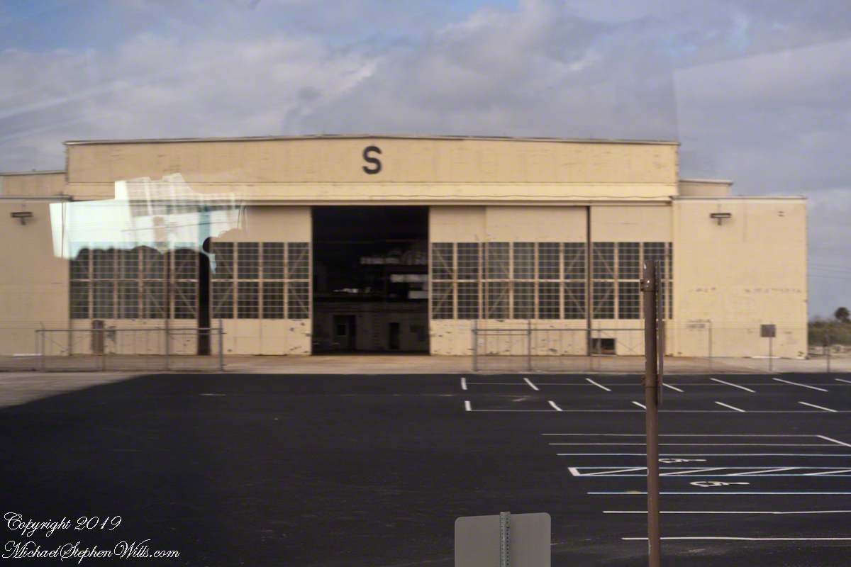
Hangar S is seen below as we passed later in the tour. Built 1957 by the military the 61,300 square feet were acquired by NASA in 1959. The early space capsules were tested here in an vacume chamber to ensure the vehicle supported an breathable atmosphere for the occupants.
The first American space voyager was Ham, a chimpanzee. Ham lived in a residential area on the second floor of Hangar S. For a period of time the Mercury 7 shared the spartan second floor quarters. “The Right Stuff” (a 1984 film from a Tom Wolfe book) included scenes from this episode of the program.
Constructed in 1957, Hangar S served for pre-flight processing from Mercury through the final flight of the Space Shuttle. This is where the Mercury 7 astronauts were first quartered on the second floor and later, is where they stayed prior to flight. The Lunar Orbiter was prepared here.
Comfortable Quarters
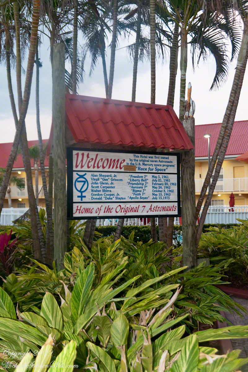
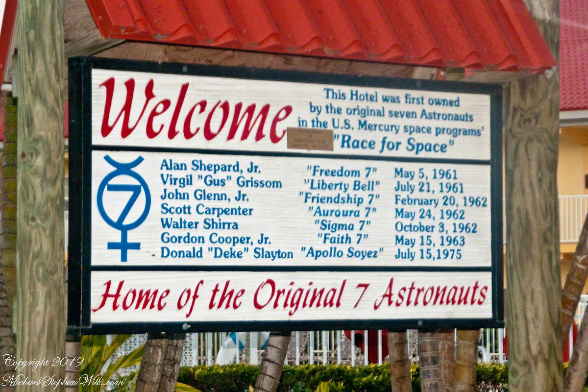
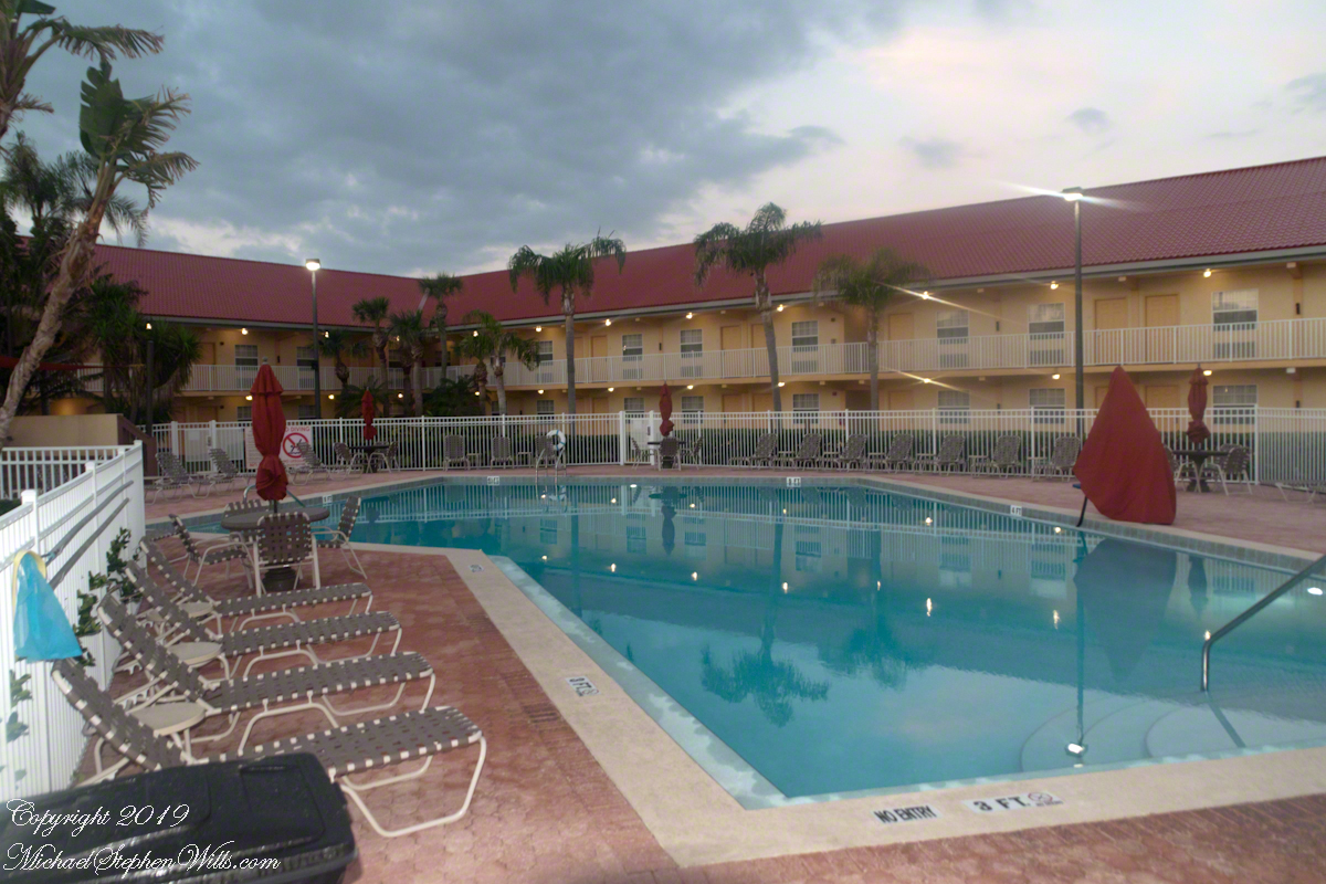
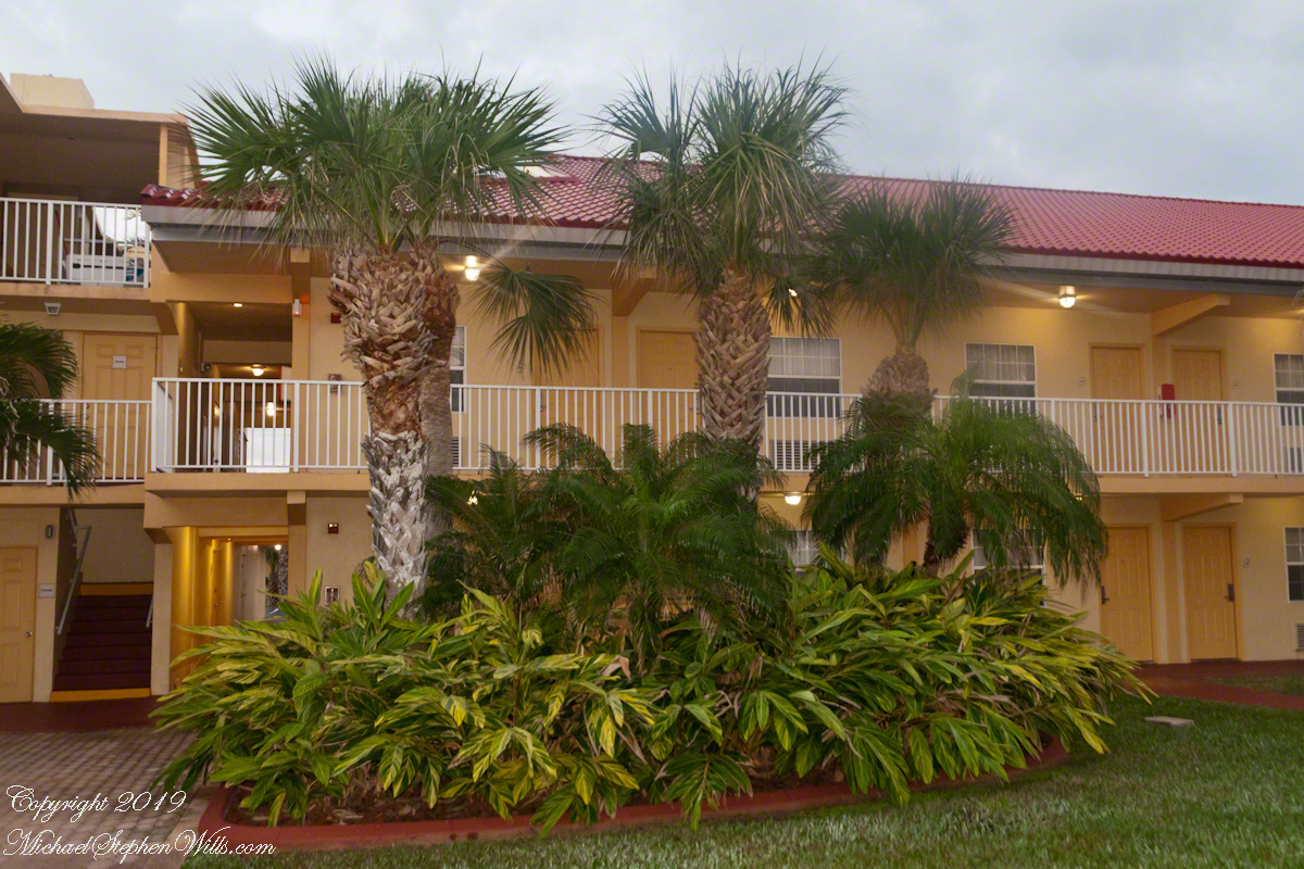
In short order arrangements were made for more comfortable quarters, just off the ocean in Cocoa Beach. It was a new hotel given over entirely to the Mercury 7. Pam and I stayed there in 2018 while taking this tour, it is the La Quinta across from the International Palms. We recommend it a clean, comfortable, reasonably price and a great story to share afterwards. The Atlantic Ocean is a five minute walk.
La Quinta Inn was the home of the Mercury 7 Astronauts, 1275 N Atlantic Avenue Cocoa Beach, Florida 32931
I learned from the tour how the hotel was donated to the Mercury 7 by a private individual. They owned the hotel. Here is a very informative sign just off the La Quinta lobby with their names. Each first mission, as named by the astronaut, is listed.
La Quinta Inn was the home of the Mercury 7 Astronauts, 1275 N Atlantic Avenue Cocoa Beach, Florida 32931View of the hotel built for and first owned by the Marcury 7 astronauts. They lived here in the early days of the USA space program.
Blastoff!!
Next post will feature images of LC14 from 2018.
Launch of Friendship 7, the first American manned orbital space flight. Astronaut John Glenn aboard, the Mercury-Atlas rocket is launched from Pad 14. Public Domain Photograph by NASA.
Sources of information for this post: I used information from the Wikipedia site for the key words John Glenn, Launch Complex 14, Mercury-Atlas, Launch Complex 36. Plus a “google” on “Hangar S History” that found an excellent page hosted on the NASA site. Cover photo of Friendship 7 Launch my be found on Flickr in “NASA on the Commons” photostream.
Copyright 2022 Michael Stephen Wills All Rights Reserved.
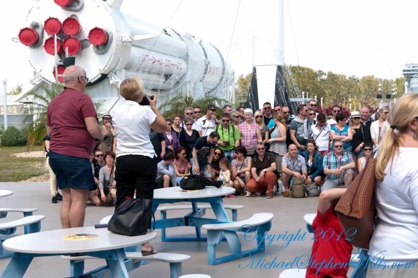
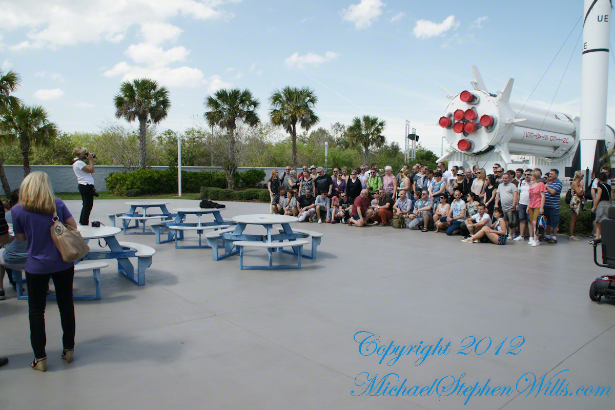
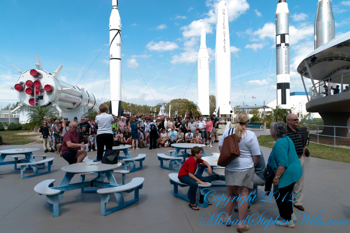
We left our Cocoa Beach hotel in the pre-dawn hours of February 6, 2018, with our tickets in hand for the first launch of Space X’s “Falcon Heavy”, our reward for arriving early was a spot on the third bus.
Tooling Around
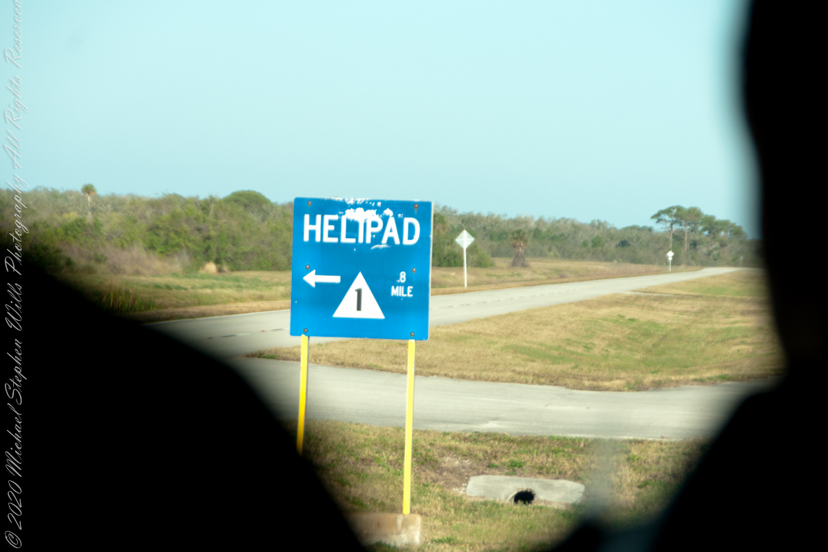
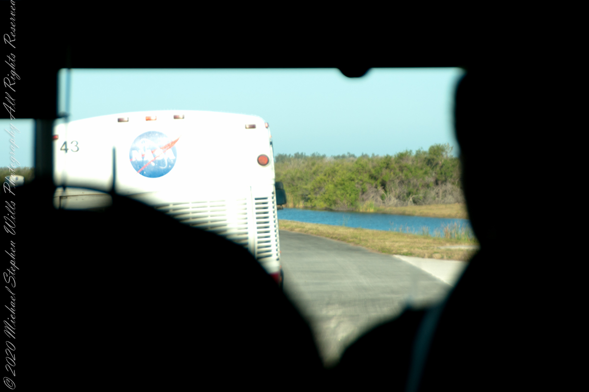
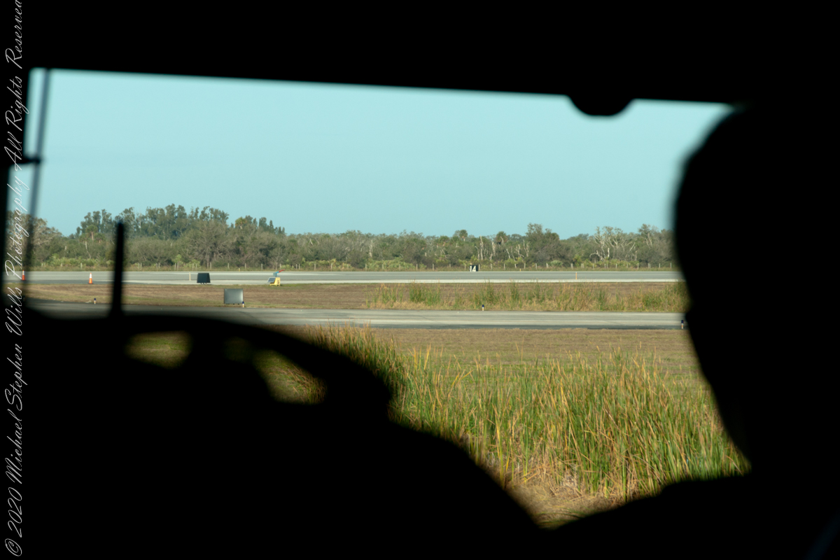
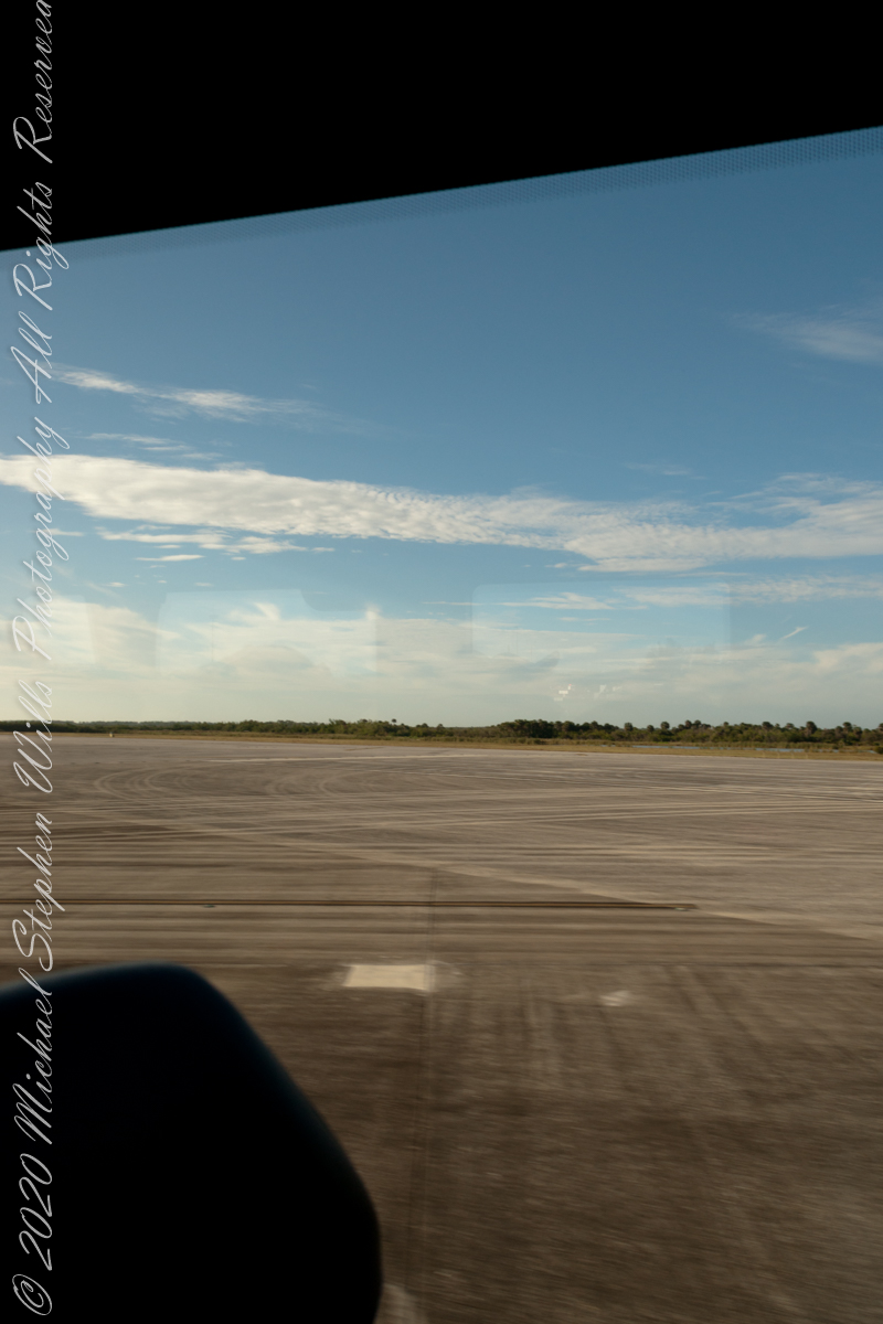
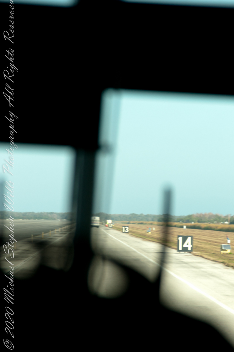
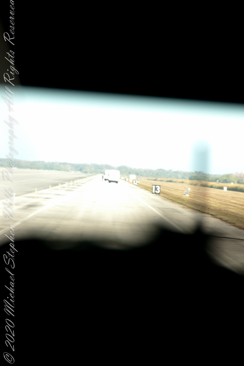
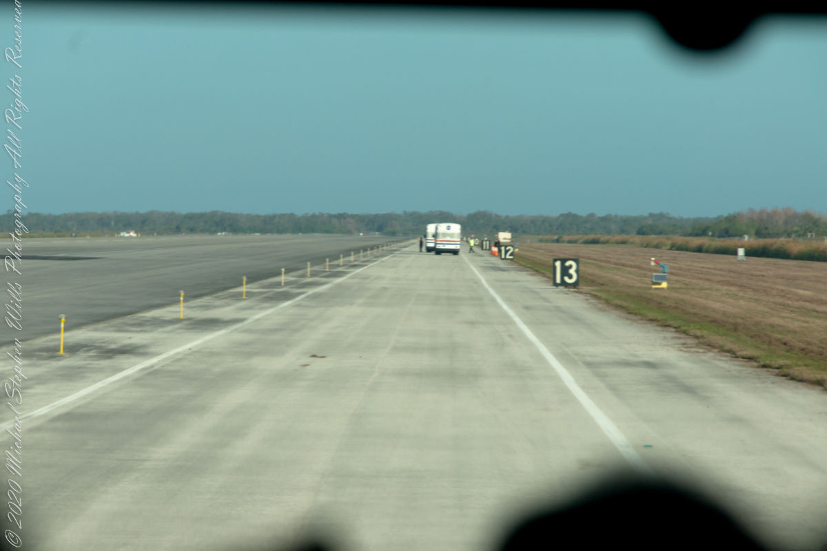
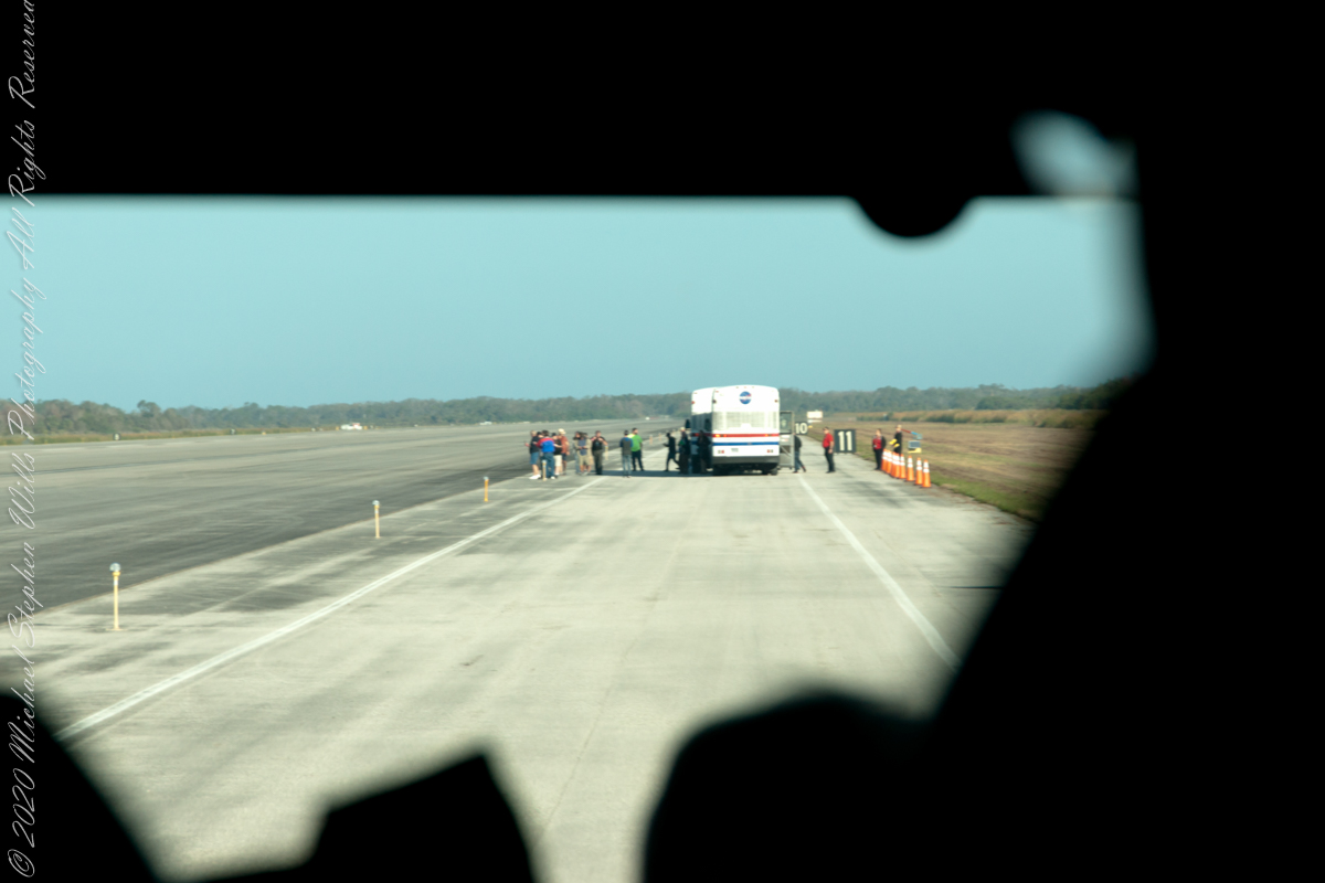
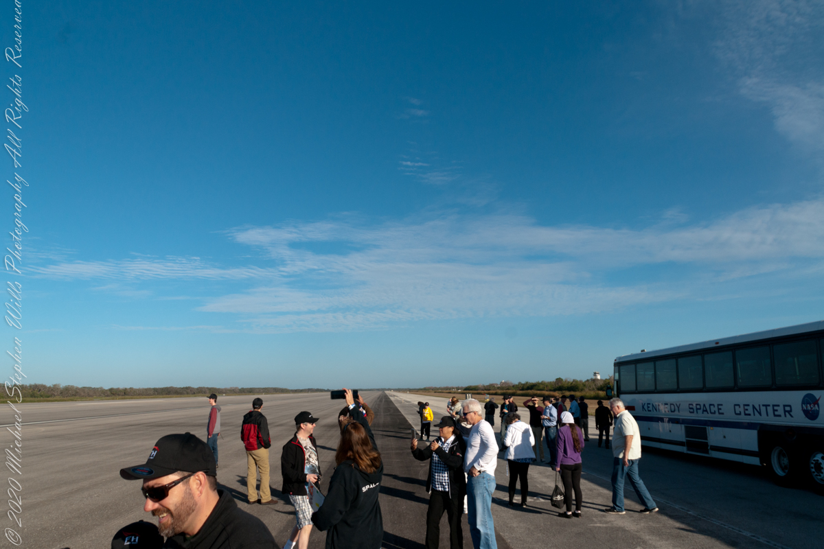
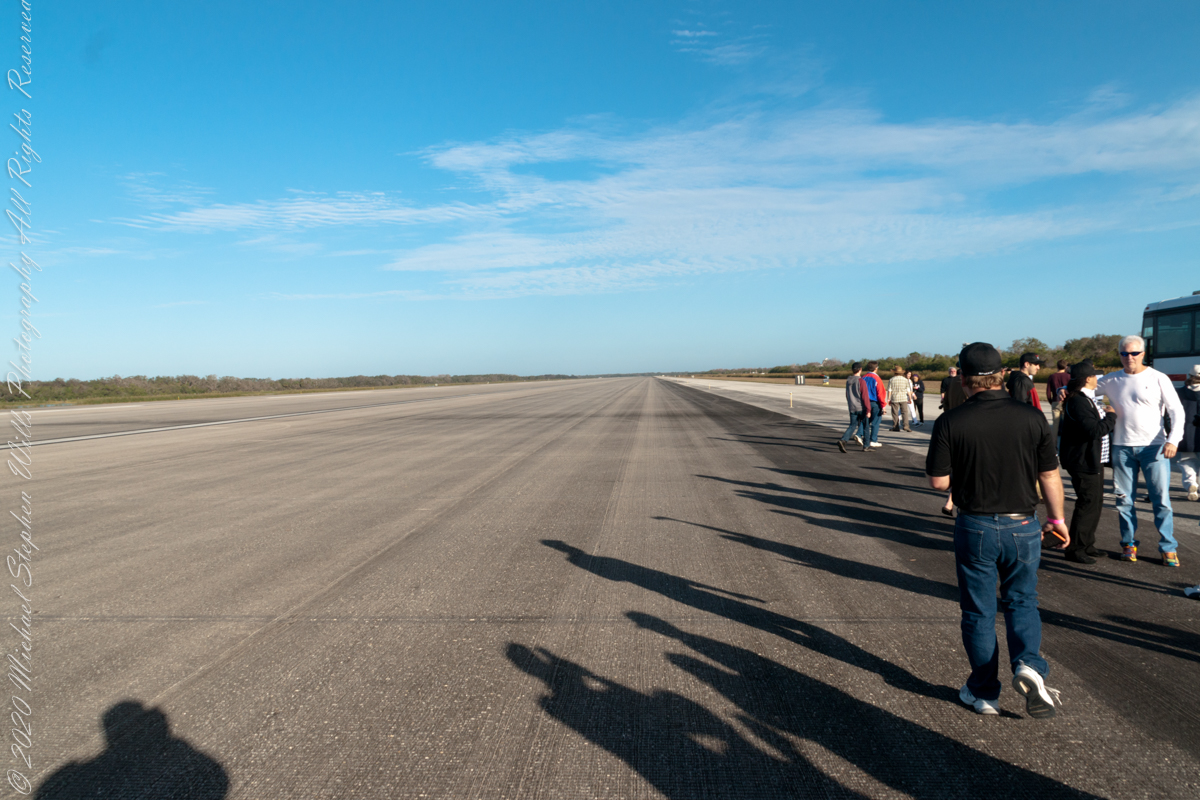
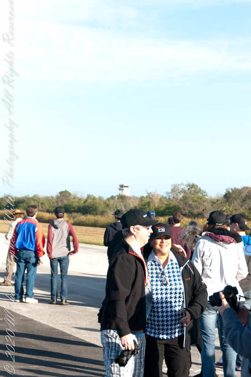
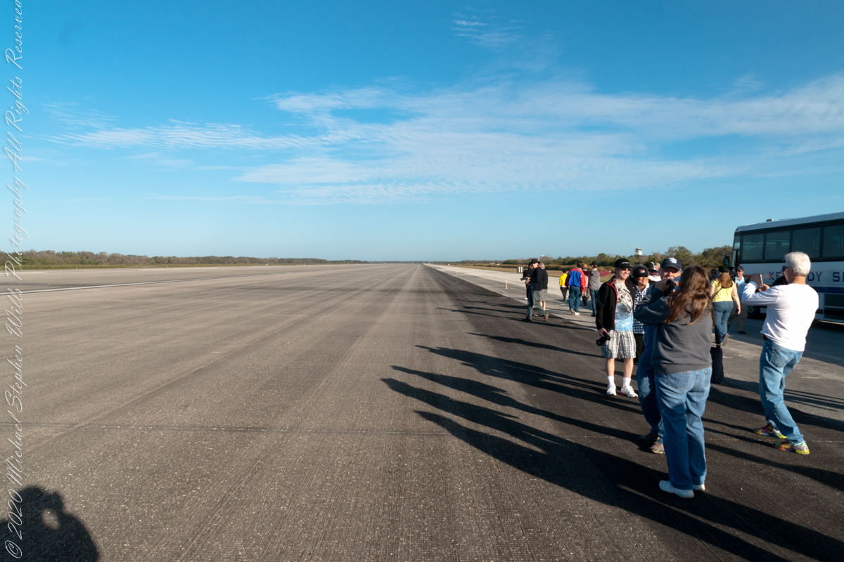
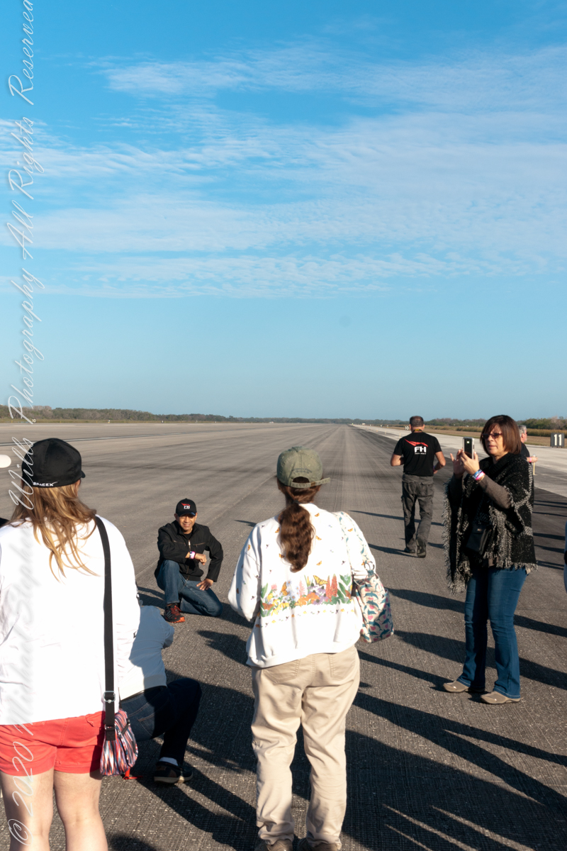
On the way to our final destination, the Apollo-Saturn V center, we were privileged to visit the Shuttle Landing Facility. Here are a few snapshots from the bus.
Click Any Image for a larger viewe
A waterway chock full of alligators — not visible until it is “too late”First view of runway
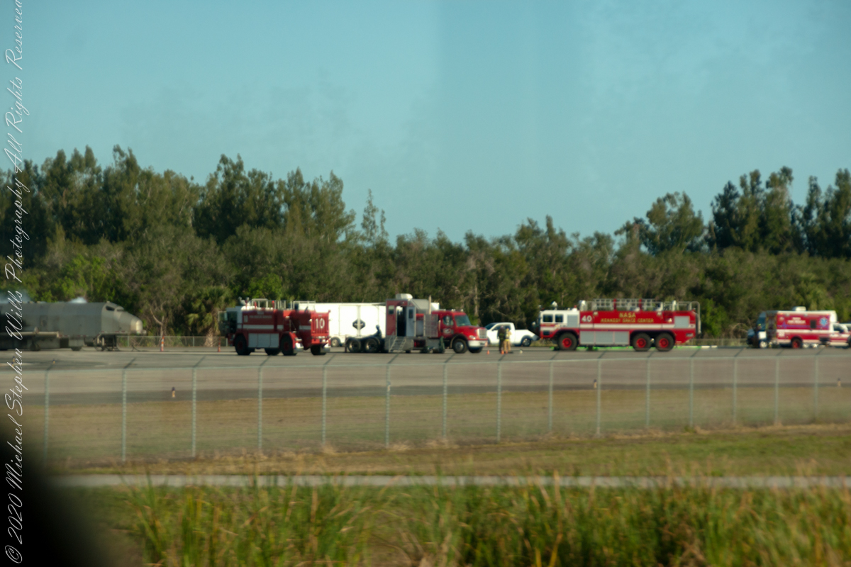
Preparing for the Worst
Fire Station 2 (Shuttle Landing Facility) – Kennedy Parkway NorthA rough and charred mock up of a Space Shuttle still smoking from the last training sessionImmense Turnabout, runway just visible
A Smooth Landing
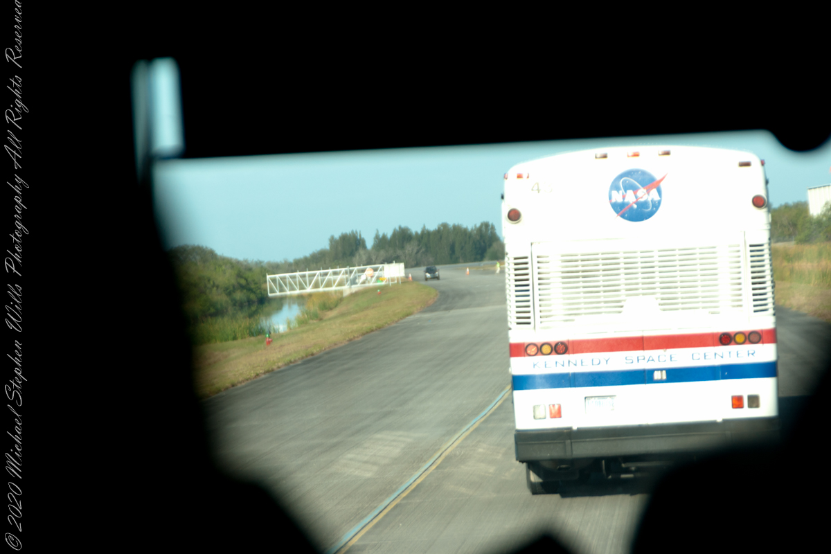
Two buses ahead of us
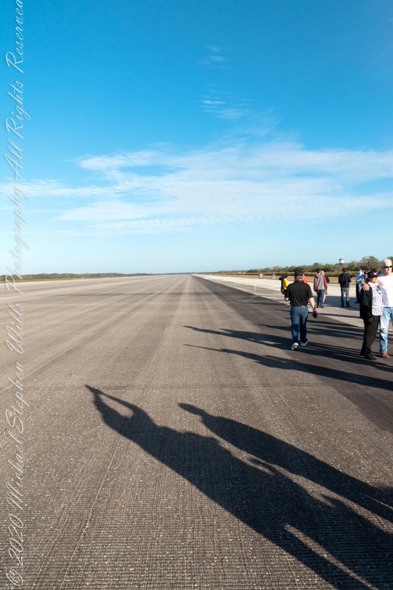
Aside from holding the record for world’s longest runway, the surface itself exceptionally engineered, consisting of an extremely high-friction concrete strip designed to maximize the braking ability of the Space Shuttle at its high landing speed, with a paving thickness of 16.0 inches (40.6 cm) at the center. It uses a grooved design to provide drainage and further increase the coefficient of friction. The original groove design was found to actually provide too much friction for the rubber used in the Shuttle’s tires, causing failures during several landings. This issue was resolved by grinding down the pavement, reducing the depth of the grooves significantly
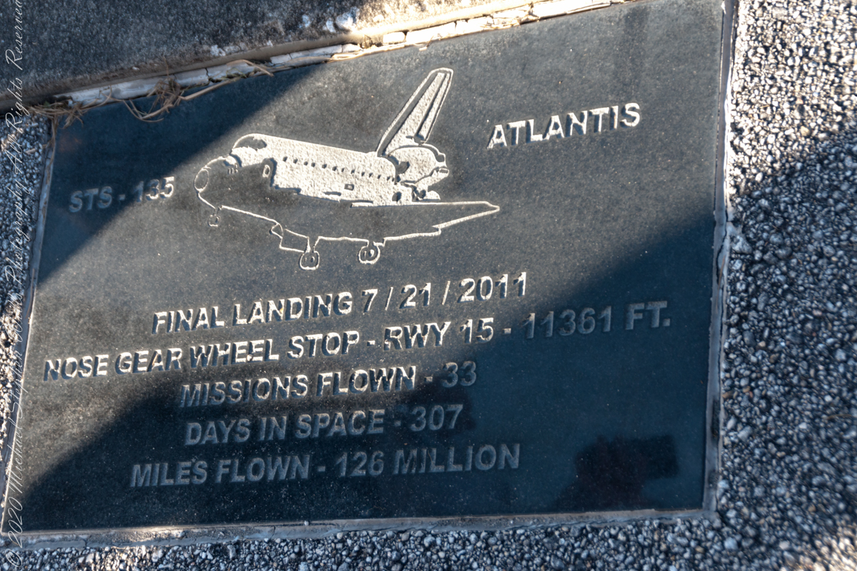
Atlantis plaque on the access pathway along the Shuttle Landing Facility. It reads “STS-135 Atlantis Final Landing 7/21/2011. Nose Gear Whell Stop – RWY 15 – 11,361 Feet. Missions Flown- 33 ; Days in Space – 307 ; Miles Flown – 125 Million
Sources of information for this post: I used information from the Wikipedia site for the key words “STS-107” as well as the official web site for Kennedy Space Center Fire Department.
Copyright 2022 Michael Stephen Wills All Rights Reserved.
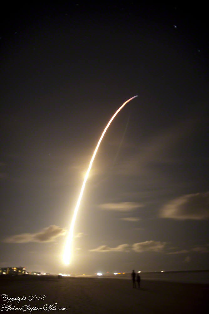
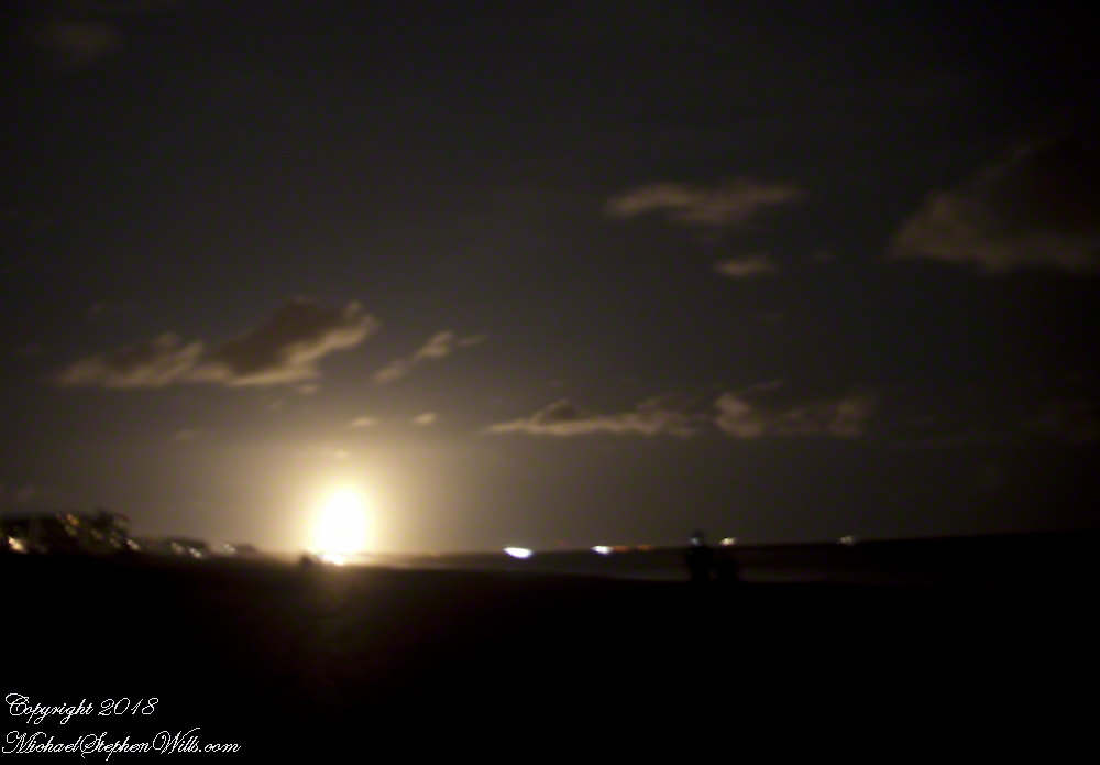
Driving to Cocoa Beach from Ithaca, Pam and I missed a horrendous storm because we did a side trip to Louisville, Kentucky, avoiding I95 January 4th and 5th and a rare and treacherous ice storm.
We met people who were stranded overnight near Savannah, Georgia while, on the same days, we drove Kentucky Hill Country for an overnight at Macon, Georgia all in excellent, dry, cold weather. The storm itself, was a stroke of luck. The first Space X launch of 2018 was delayed by the weather until the evening of Sunday, January 7th. I was in place, in the dark, on Cocoa Beach with my Canon DSLR on bulb mode, securely mounted on a travel tripod. My choice of lens was the 24 mm “wide angle.”
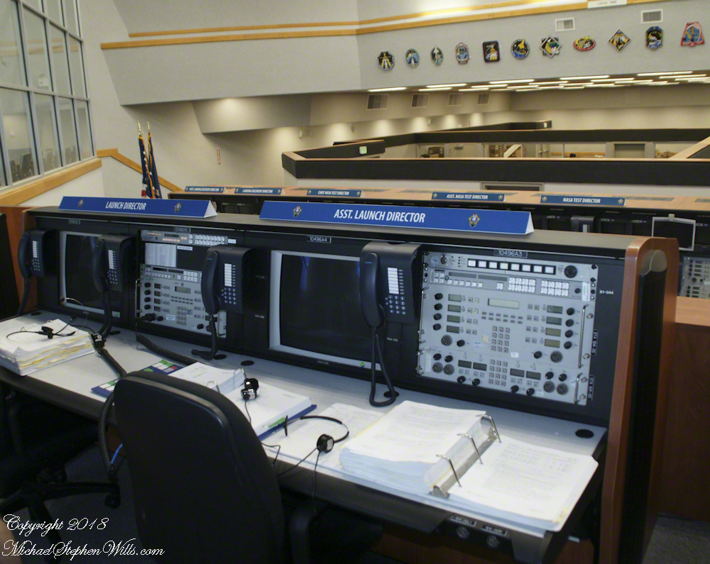
Proximity to the Kennedy Space Center is a reason we return to Cocoa Beach. A year ago, March 2007, we did the “Launch Director Tour” offered once a month (if at all) and had a fantastic day. I’ll need to blog about it.
For now, here is a shot from the former Space Shuttle launch room.
I planned camera placement well for this night launch. The view held the entire parabola of the trail. Camera placement was based on researching the launch complex, finding it on Google Earth, using the line feature to determine the orientation of the complex from my location on Cocoa Beach.
Live, the start of the launch is like a dawn in the northern sky. I broke off the exposure to somewhat capture the effect.
The human eye, only the Falcon 9 flame is visible, as a single point of bright light ever rising, lighting the beach and clouds in a soft glow.
The long exposure blends the flame into a bright parabola, at one point the rocket engines throttle back, eventually the color changed to reddish from bright white. I held the exposure until the rocket flame, in the image, turned to blue and faded away.
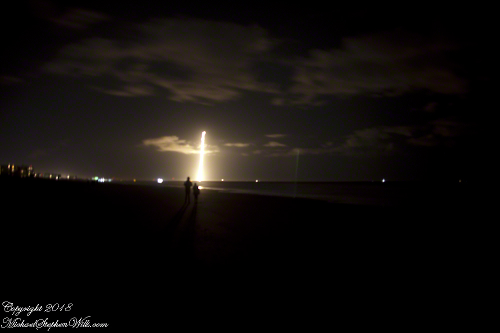
We waited for six (6) or so minutes, the camera mount and orientation unchanged, and then the incredible returning booster briefly lit up to land at Cape Canaveral Air Force Station. I missed the beginning of the burn. In retrospect, I should have timed the launch and opened the shuttle 5 minutes or so after “blast off.”
Followed by a TWO sonic boom finale. Kabooom….Kabooom.
We read in the news the secret military satellite, named “Zuma”, on top of the Falcon crashed into the Indian Ocean. SpaceX claimed the launch was a success (??), that the protective fairing jettisoned successfully. No mention was made of the secret payload. The failure was with the Northup Grumman built “Zuma” satellite? Hmmmmm.
Copyright 2022 Michael Stephen Wills All Rights Reserved.
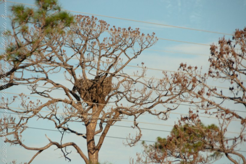
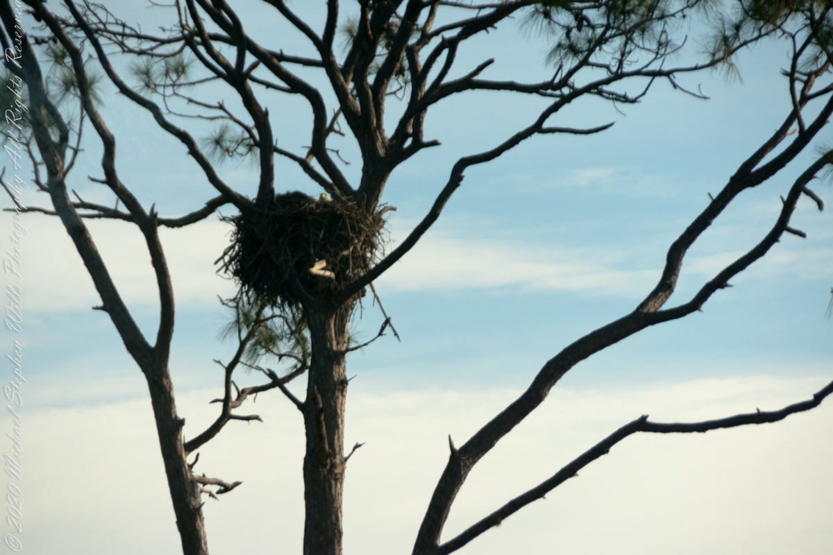
Our Shuttle Landing Facility side trip brought us twice by one of the five Bald Eagle nests around Kennedy Space Center. The entire Center land is part of the National Wildlife Refuge of Merrit Island. Rockets and wildlife coexist very well, in fact the Shuttle Landing Facility is also known as the Gator Tanning Facility. The reptiles crawl up from the canals surrounding the landing strip on all four sides to bask on the smooth concrete.
First Turn
The nest tree is on the median of a divided highway. Driving into the Landing Facility the nest tree was to the east, brightly lit by the morning sun.
Click Any Image for a larger viewe
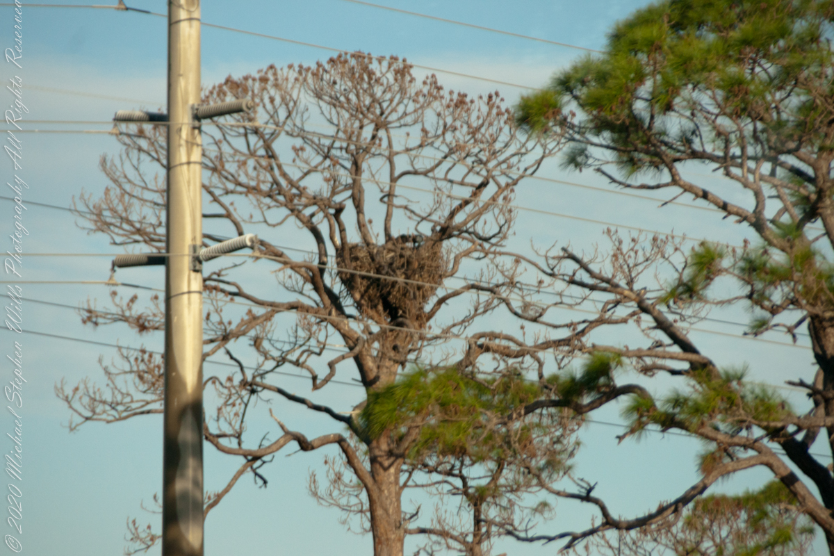
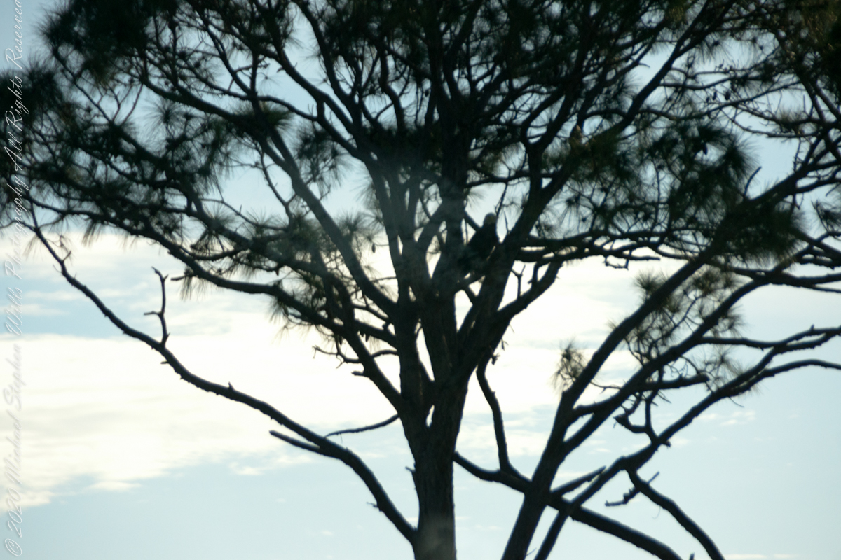
Second Turn
On the return trip the nest was backlit. Look closely: the head of an eaglet (?) is just visible above the nest rim.
The parent eagle is silhouetted in the tree branches.
Sources of information for this post: I used information from the Wikipedia site for the key words “STS-107.”
Copyright 2022 Michael Stephen Wills All Rights Reserved.
We left our Cocoa Beach hotel in the pre-dawn hours of February 6, 2018 with our tickets in hand for the first launch of Space X’s “Falcon Heavy, our reward for arriving early was a spot on the third bus to the Apollo-Saturn V center. At 4 miles from Launch Complex 39a this is the prime location for “VIP” viewing.
The Columbia Disaster
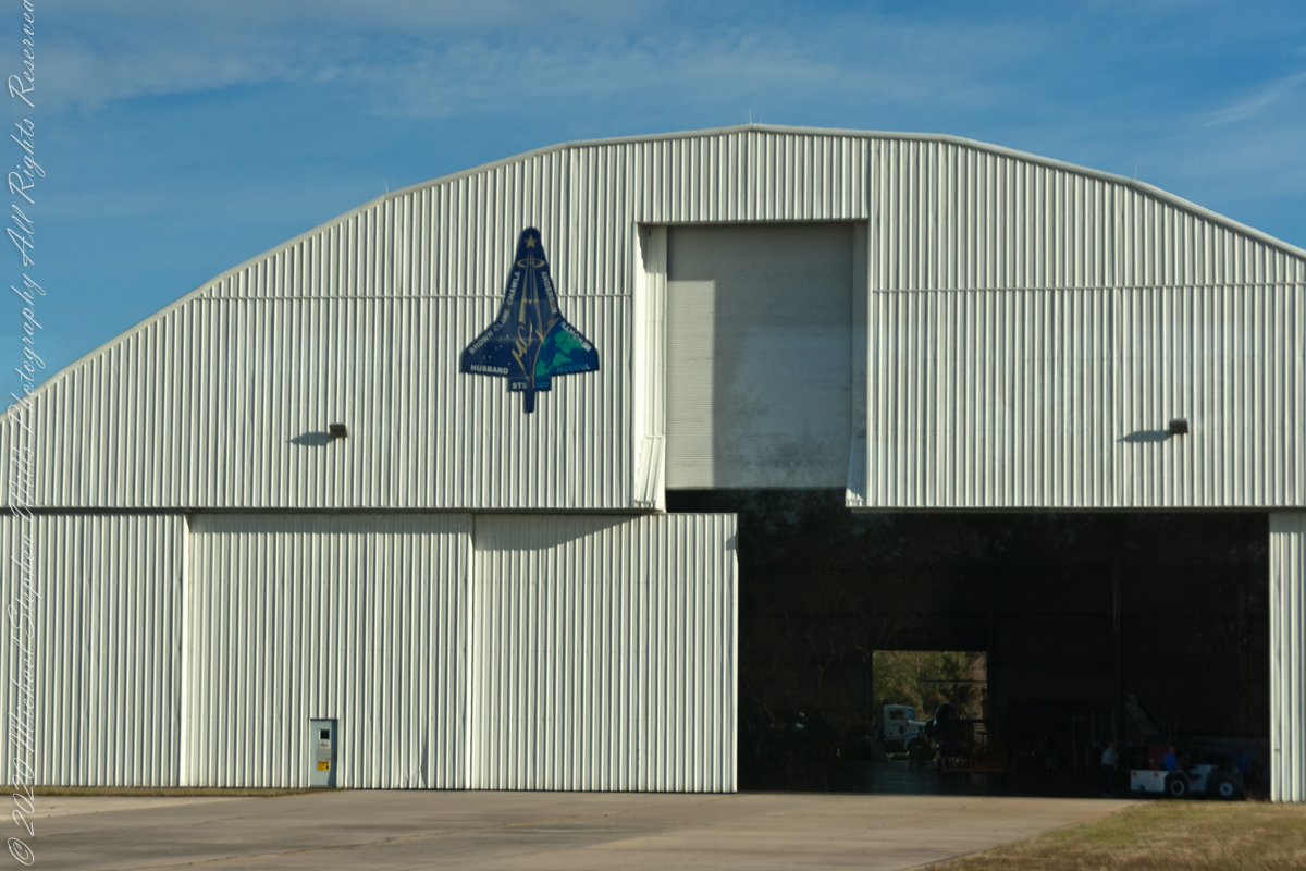
We were privileged to visit the Shuttle Landing Facility on the way, this hangar on the SLF access road was pointed out by the guide. Here was where the remains of Space Shuttle Columbia were collected after the disaster.
Click Any Image for a larger viewe
STS-107 was the 113th flight of the Space Shuttle program, and the 28th and final flight of Space Shuttle Columbia. The mission launched from Kennedy Space Center in Florida on January 16, 2003 and during its 15 days, 22 hours, 20 minutes, 32 seconds in orbit conducted a multitude of international scientific experiments. It was also the 88th post-Challenger disaster mission. An in-flight break up during reentry into the atmosphere on February 1 killed all seven crew members and disintegrated Columbia. — wikipedia
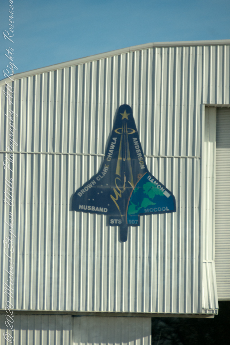
The logo is from the Columbia Accident Safety Board, the group that investigated the cause of the loss.
Immediately after the disaster, NASA convened the Columbia accident Investigation Board to determine the cause of the disintegration. The source of the failure was determined to have been caused by a piece of foam that broke off during launch and damaged the thermal protection system (reinforced carbon-carbon panels and thermal protection tiles) on the leading edge of the orbiter’s left wing. During re-entry the damaged wing slowly overheated and came apart, eventually leading to loss of control and disintegration of the vehicle. The cockpit window frame is now exhibited in a memorial inside the Space Shuttle Atlantis Pavilion at the Kennedy Space Center. — wikipedia
I zoomed in for a close look at the interior
The damage to the thermal protection system on the wing was similar to that Atlantis had sustained in 1988 during STS-27, the second mission after the Space Shuttle Challenger disaster. However, the damage on STS-27 occurred at a spot that had more robust metal (a thin steel plate near the landing gear), and that mission survived the re-entry. — wikipedia
Sources of information for this post: I used information from the Wikipedia site for the key words “STS-107.”
Copyright 2022 Michael Stephen Wills All Rights Reserved.