Our practice while taking a long trip in the car is to travel during the day, when possible, and to stop for a rest and some exercise every two hours. We were returning to Ithaca from a long trip down south when, at about the time for a rest stop we crossed the Mason-Dixon line to approach the city of Gettysburg, Pennsylvania on US Route 15.
The signed for the Gettysburg Battlefield pulled us in and we spent three hours looking around, longer than we planned for a rest stop.
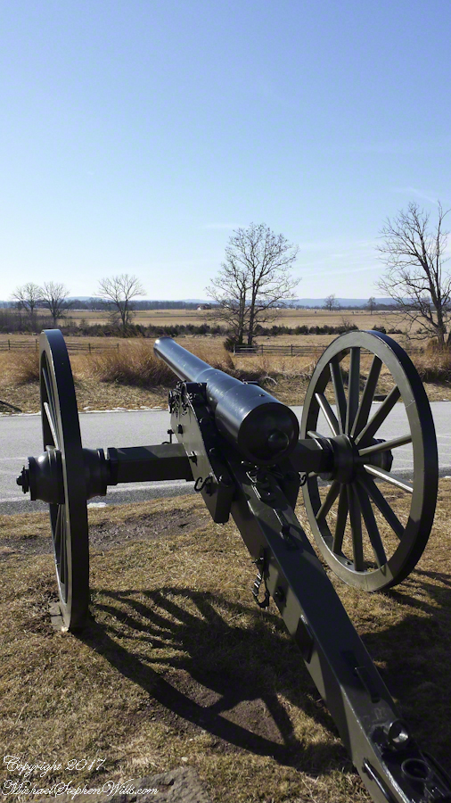
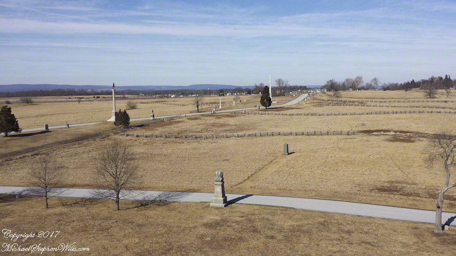
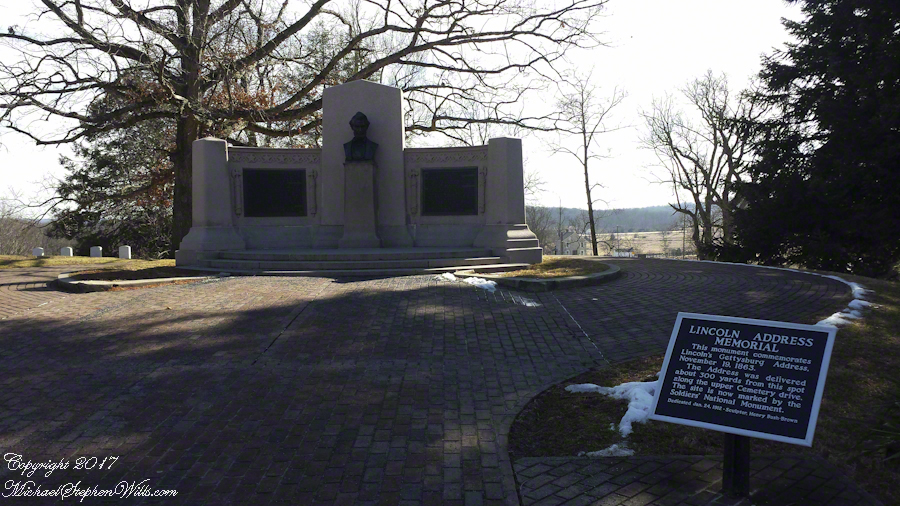
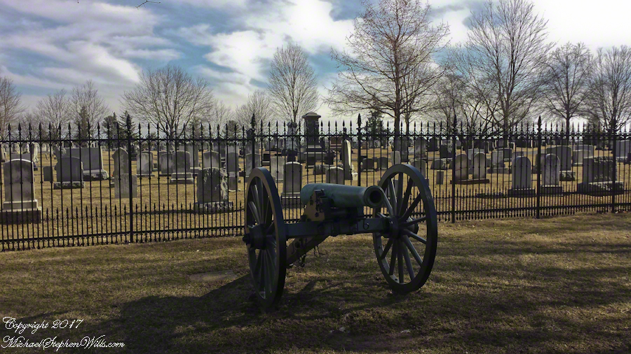
The staff at the visitor center were very helpful with our off the cuff visit plan. With the auto tour in hand we made our way to the “High Water” of the 1863 Battle of Gettysburg, the Union battle line that marked the end of Lee’s second invasion of the north and the turning of the Civil War.
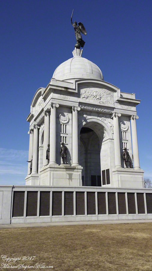
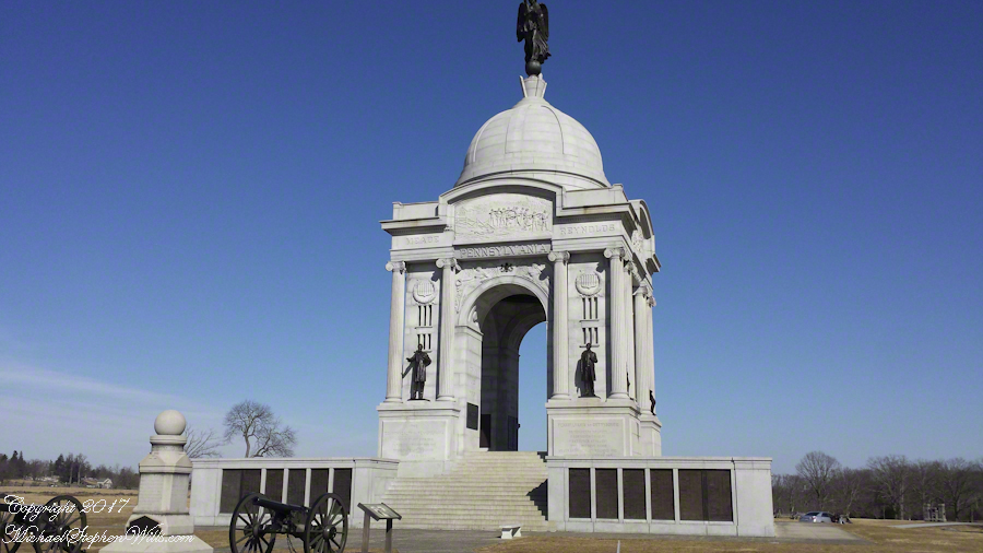
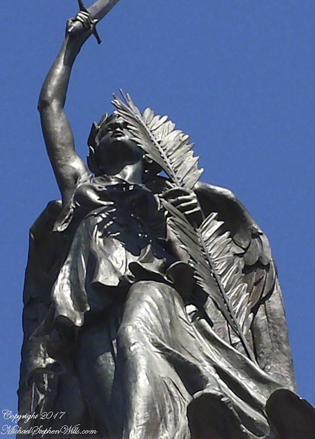
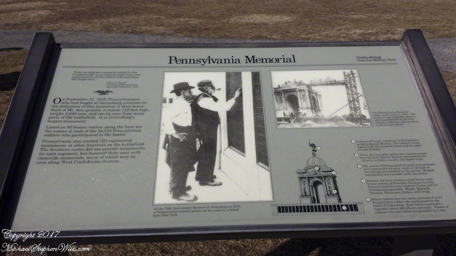
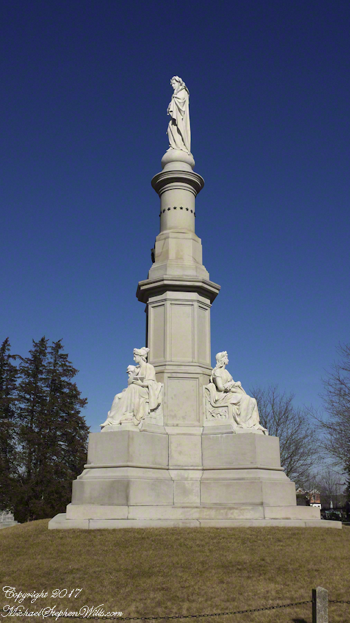
The Pennsylvania Memorial near the Highwater Mark of the 1863 Battle of Gettysburg.
The expanse of the Gettysburg National Military Park warrants a stay of three days, at least.
These photographs from my cell phone, augmented with titles and description, will give you a taste of what this national historic site has to offer.
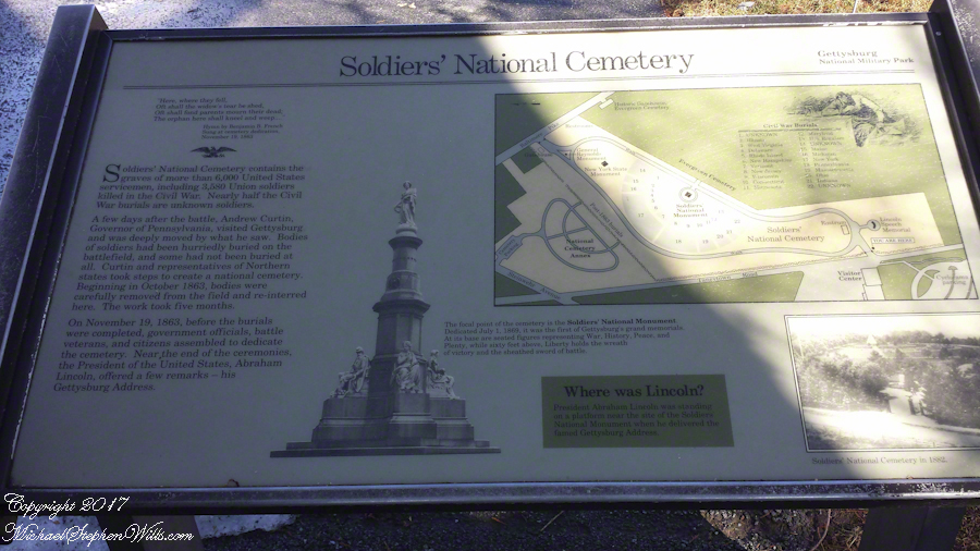
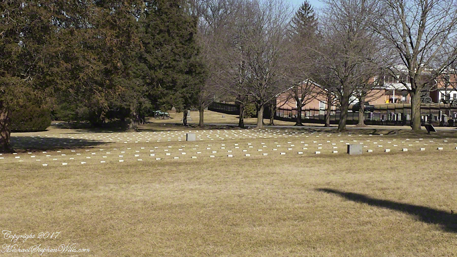
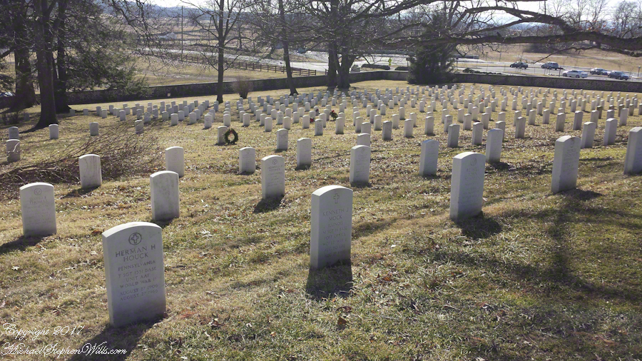
Gettysburg National Military Park includes the graves of more than 6,000 United States Servicemen, including 3,580 Union soldiers killed in the Civil War.
Notably, the day of our visit, February 12, is Lincoln’s Birthday. February was a quiet time to visit and we were blessed with a sunny, mild day. In the warm weather the place is packed with visitors.
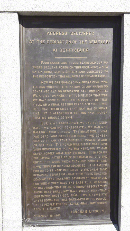
I have a feeling for the place because my 10th birthday in 1963 coincided with the hundredth anniversary of the Civil War. Also because a figure in the aftermath of the battle, David Wills, shares my surname. A lawyer who lived and practiced in Gettysburg, David Wills organized the burials and it was at his home that President stayed before the dedication of the cemetery and where the final touches of the Gettysburg Address were written. His home, a museum, is closed in the quiet season.
Most Americans alive today would not exist if this battle turned out differently.
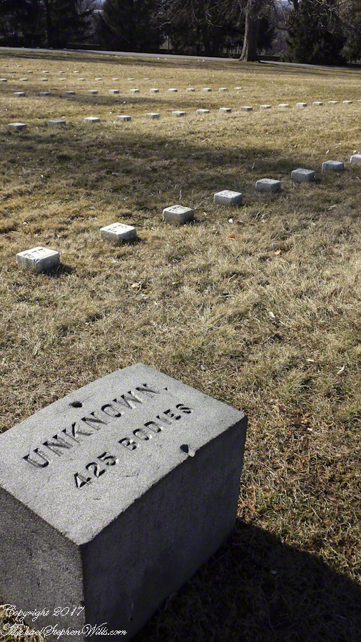
One of the chilling realizations from the day is almost half the Union graves are for unknown soldiers.
Nearly half of the Union graves are unknown soldiers.
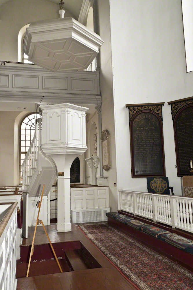
A luminous white pulpit rising from an elegant beam, as of light, graces Old North Church altar. In 1775, the Tory church minister preached from this pulpit in support of the English King. The floor space is filled not with pews; but boxes, each was the property of the occupants to furnish and decorate to taste. Today, each box has a brass plate naming the former owners.
As with sports stadium box seats today, these boxes provided the owners access to church services. Just before the pulpit is he box awarded to wealthy merchants for essential contributions to Christ Church, the formal name of the church and congregation. Today, there is a more direct sports connection: lanterns were lit in the tower for the Boston Red Socks 2004 World Series win.
Click any photograph to access my Online Fine Art Gallery
Pulpit of Old North Church, Boston
A bit after 10 pm on April 17, 1775 two men entered the church from the front door, pictured here under the arch. The church sexton Robert John Newman and Captain John Pulling carried two simple lanterns of glass and iron coated with tin. A third man, Thomas Bernard, stood watch because Boston was occupied by British “Regular” troops who patrolled the streets.
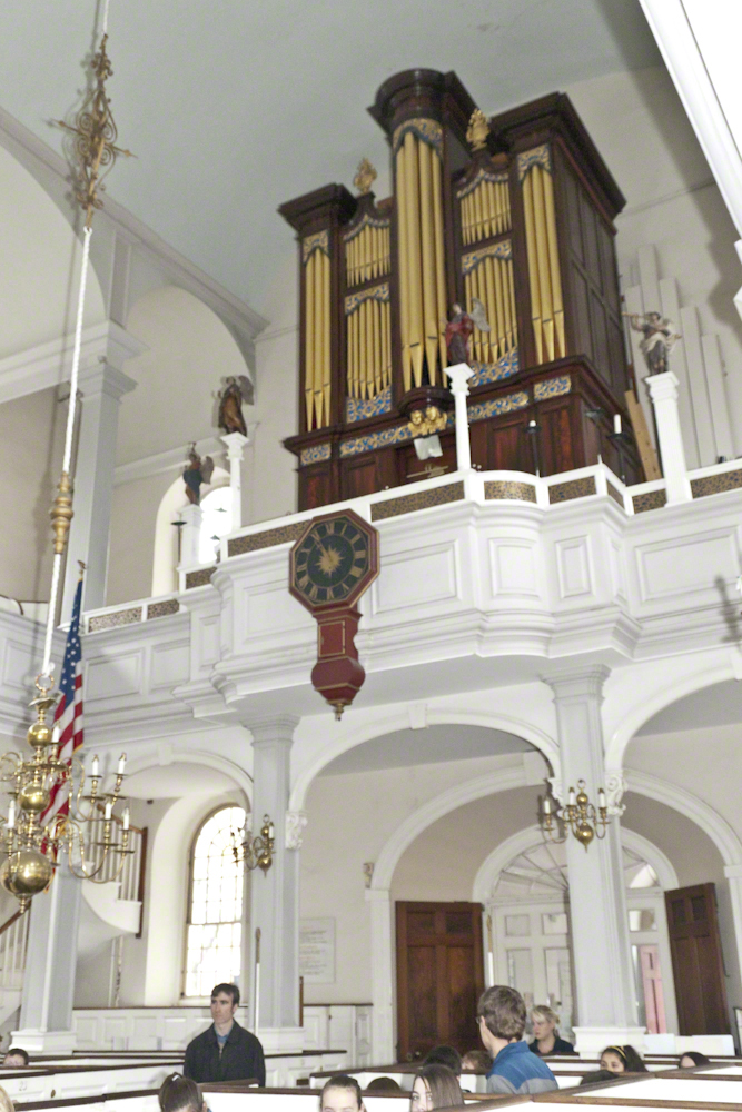
Organ above the Entrance to Old North Church, Boston
The lanterns beamed from the northwest side for but a minute, enough to serve the purpose of a backup signal to patriots across the Charles River in case Paul Revere and a second rider, William Dawes, were apprehended or killed before they could deliver the British attack plans.
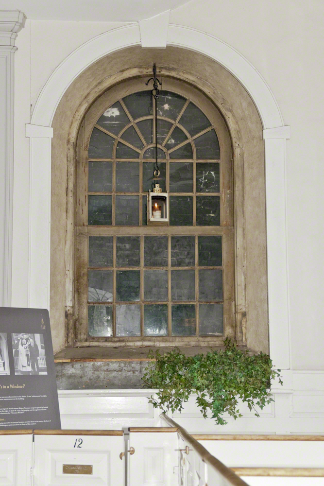
The British patrols were alert and, in no time, they were breaking down this same front door. Robert Newman made his escape from this window. The frame was bricked over and only discovered in the twentieth century. It was celebrated during the USA bicentennial by President Ford, who presented the replica lantern that now hangs with the candle lit.
Newman Window and Freedom Lantern
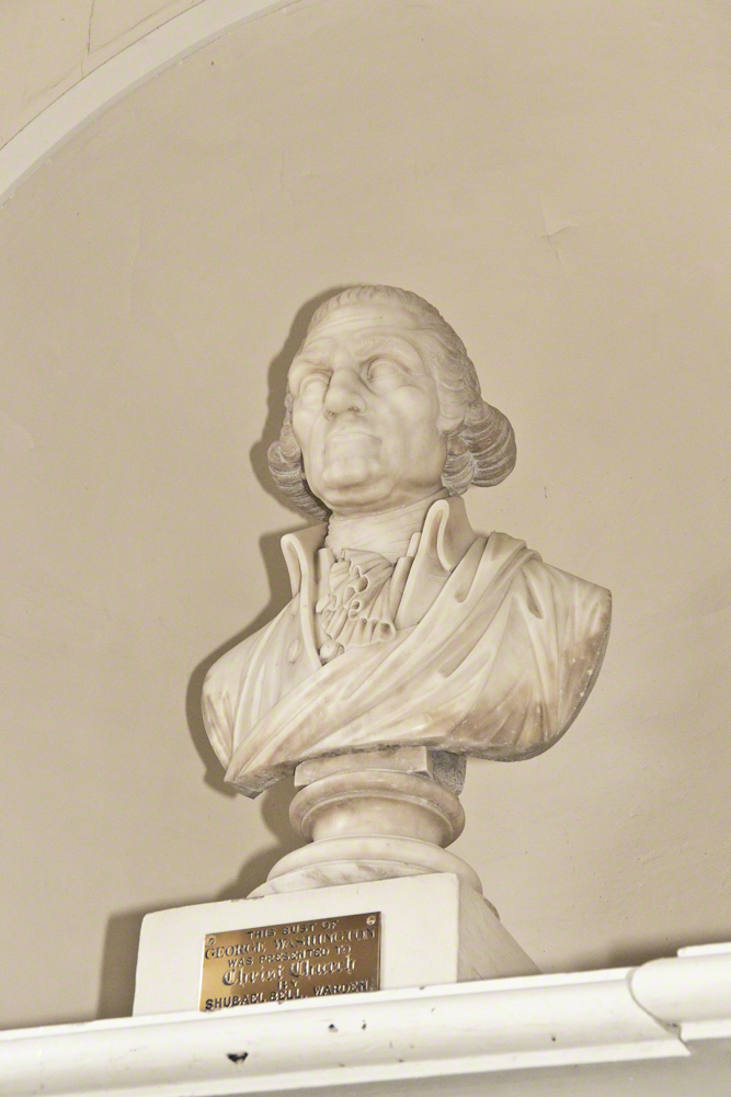
If you look closely, this bust of George Washington is visible in the Old North Pulpit photograph in a niche to the right rear. It is the oldest image of our first president. The Marquis de Lafayette is reported to have said this is the best likeness of Washington he had ever seen.
George Washington
Copyright 2022 Michael Stephen Wills All Rights Reserved
The Whitehouse Ruin of Canyon de Chelly is just visible at left in the far cliff, in the notch of the near cliff. The ruin trail is visible on the canyon floor. Notice the road following the canyon and the plantings with house on the right.
The landscapes I capture, like the face of a missing friend, fade gently from memory. My piece “Moon Fin Canyon de Chelly” became a mysterious vision. I remembered the context, the canyon topology was lost until I constructed the panorama, above, from three shots taken one evening, July 2008, from a cliff near the White House Overlook. Five years after my visit with Sean Wills, Pam and I returned to Canyon de Chelly to walk the same path.
At that time, a 50 mm lens was my widest angle, so I would take multiple images in sequence and use Photoshop later to construct a panorama. This past Sunday afternoon I spent stitching together my work from 2008. In doing so I see “my fin”, in the center, bordered by the canyon road, is attached to the White House Ruin cliff via a thin ridge.
During that session a photogenic thunderhead, lit by the evening, hovered behind the fin as the gibbous moon did that long ago evening.
After reading my last post “Valparaiso Connections VII” why Captain Pratt was so honored by the nation?
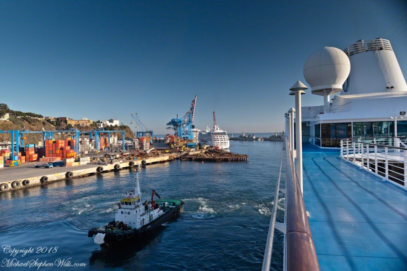
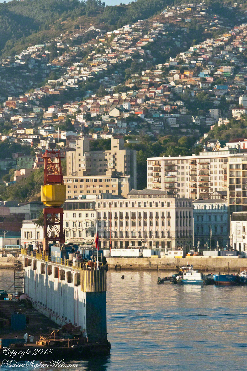
From the starboard side of the Regatta while docking at Valparaiso. On the right is the port with shipping containers, beyond are the Chilean Navy frigates Almirante Blanco Encalada and Almirante Latorre at anchor.
On that morning, May 21, 1879 the two Chilean ships blockading Iquique port were surprised by two Peruvian warships from the port of Callao, the monitor Huáscar and armored frigate Independencia.
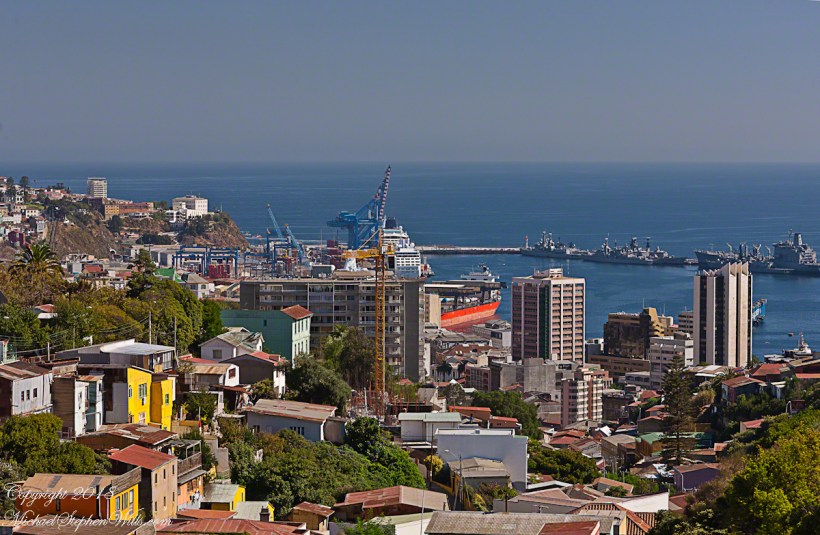
View west from La Sebastiana, former residence of Neruda, on Florida Hill. We look over the city, docks and Chilean Naval Vessels to the Pacific Ocean.
Arturo Prat commanded the Chilean corvette Esmeralda. Carlos Condell de la Haza was Covadonga’s commander.
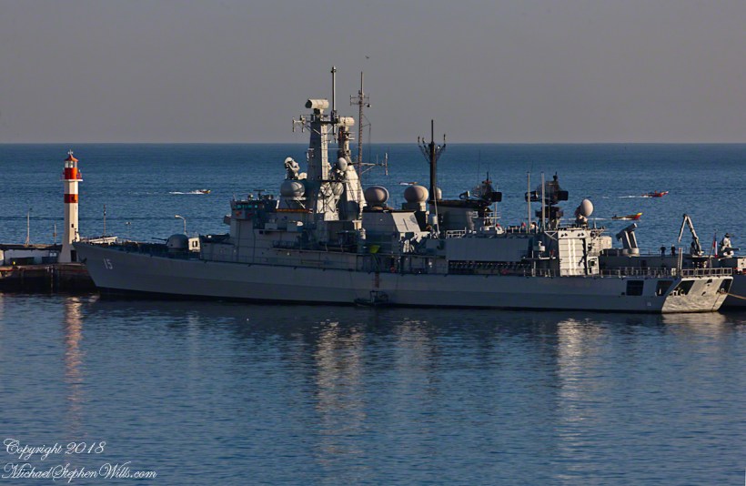
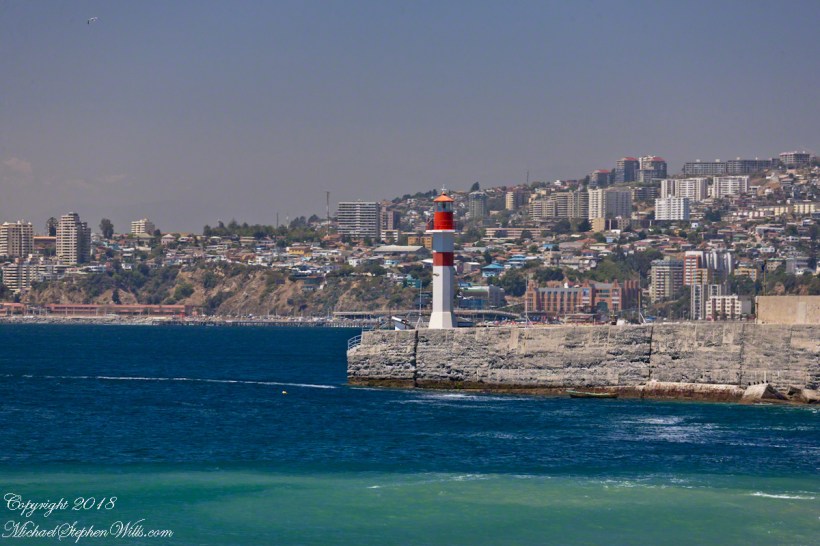
CS Almirante Blanco Encalada (FF-15), a modern frigate of the Chilean Navy at anchor. With the Durante Point lighthouse, several fast fishing boats returning with their catch.
The Chileans are outgunned by the Peruvians in armored ships. Condell fled in the Convadonga, pursued by the Independencia. This was the wiser course and most militarily effective because, following the Convadonga into shallow waters the deeper draft Independencia lost advantage when it ran aground and was lost.
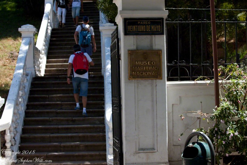
We did not have time to explore the National Maritime Museum.
Prat stood ground in the middle of the bay, any canon shots simply bounced off the heavily armored Huascar. The Esmeralda suffered shot after shot until the command of the Huascar, Captain Graf, decided to ram the Esmeralda to force a surrender and safe useless death.
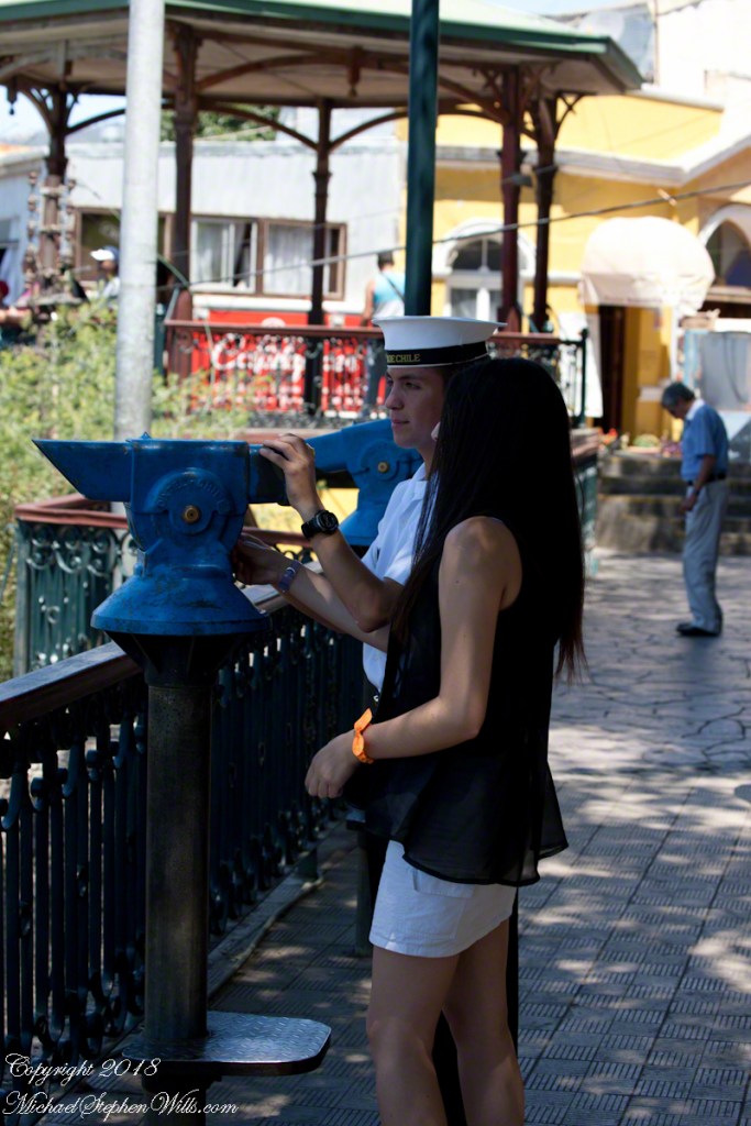
Naval Cadet with friend viewing the ships at anchor.
At the first ram to the stern, as the ships were in contact, Prat ordered an attack, “Let’s board, boys.” In the confusion only two seamen joined Prat. One failed to board, Prat and Petty Officer Juan de Dios Aldea attacked. Dios Aldea was mortally wounded. Prat continued to advance alone, to the amazement of the Peruvians, awed at his courage. Prat was gunned down on the deck of the Huascar.
He crew watched in horror. When the Esmeralda was rammed again, this time in the bow, Sublieutenant Ignacio Serrano lead of 10 Chileans to board for an attack with machetes and rifles. They were massacred by the mounted Gatling gun, only Serrano survived.
The example of Prat and his crew is taught today. Arturo Pratt is the most common street name, as well as plazas, buildings. Four major warships were named after him. The current active ship is the frigate FFG 11, the Capitan Prat. The Chilean naval academy is named Escuela Naval Arturo Prat. His portrait is on the 10,000 peso Chilean note.
Lighthouse on Punta Duprat
Copyright 2022 Michael Stephen Wills All Rights Reserved
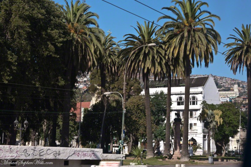
This is an answer for those of who responded to my last post Valparaiso Connections VI with “what does that desert in Peru have to do with Valparaiso?” It starts with the Plaza Victoria at the end of Pedro Montt Avenue. Victoria, as in victory not Queen Victoria. At the beginning of the 19thcentury this was a beach, the site of several ship wrecks. It was set aside as a gathering place by the Mayor, named Plaza Nueva (New Plaza), for a bullring until bullfights a law banned bullfighting on September 1823. The plaza became a place of public executions and, after Chile’s victory in the Battle of Yungay, a place of celebration, formally renamed for the victory.
The Central Valley of Chile is an exception to the topology north through Lima where agriculture and population centers follow river valleys watered by the Andes and surrounded by waterless wastes. Yungay, is among one of those watered desert valleys. Located 120 miles north of Lima, Peru at about 8,000 feet just below a summit of the Western Andes, remnants of cultures from 10,000 B.C. are proof of agriculture and human settlement. It was near Yungay, on January 20, 1839 (summer in the southern hemisphere) a force of Chilean and Peruvian dissidents called the United Restorative Army defeated a Peru-Bolivian Confederation Army to end the War of Confederation. The resulting split into different countries of Peru and Bolivia weakened a threat to Chile and Argentina, aimed in large part toward the broad and fertile Central Valley of Chile. The desperation in view in my post Valparaiso Connections VI was in large measure a motivation war, this motivation is still powerful today.
The subsequent prosperity allowed reclamation of the land of Plaza Victoria from the sea. For example, in my post Valparaiso Connections V we learned how French immigrants arrived and developed Central Valley wineries in the 19th century. Around the time of the victory Chacobuco Street was built adjacent to the plaza on reclaimed land, the Plaza Victoria was pulled from the sea.
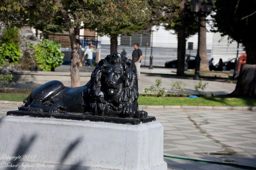
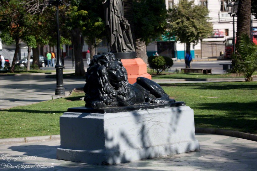
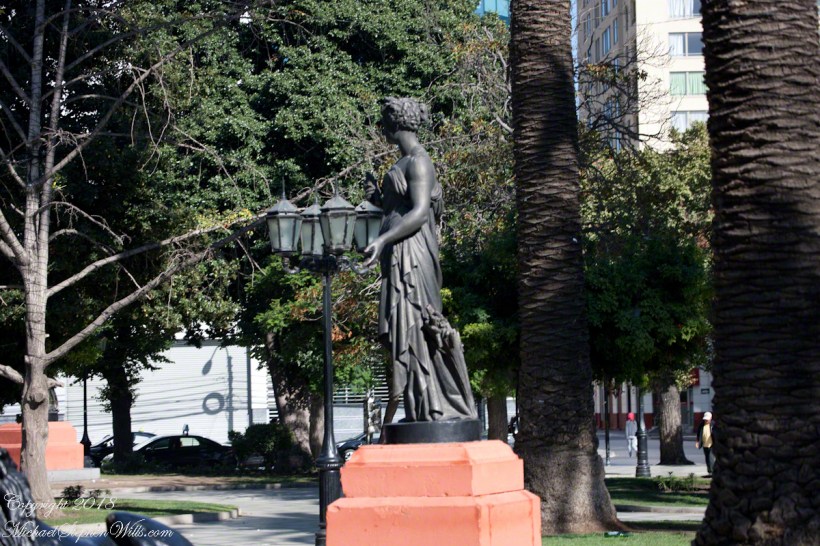
The concrete Lions and bronze statue captured in the above gallery, were elements of a round of enhancements to Plaza Victoria begun 1870.
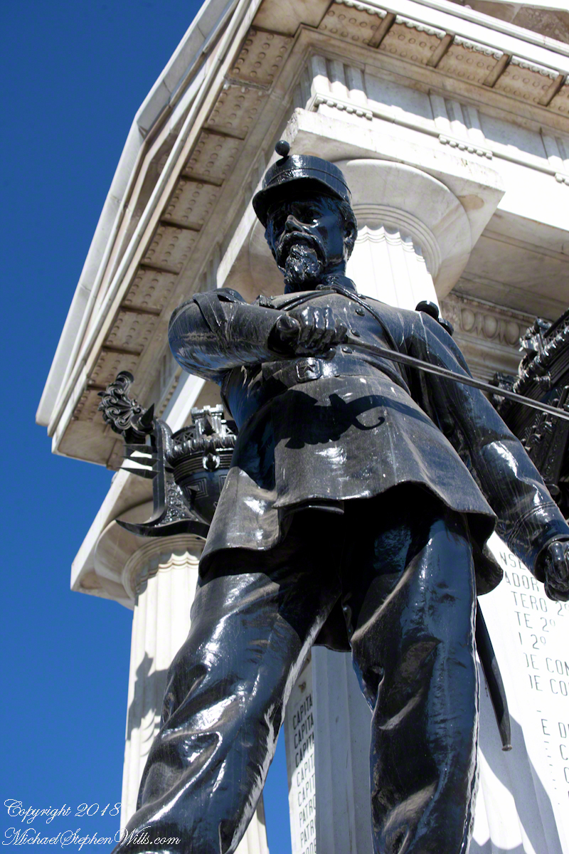
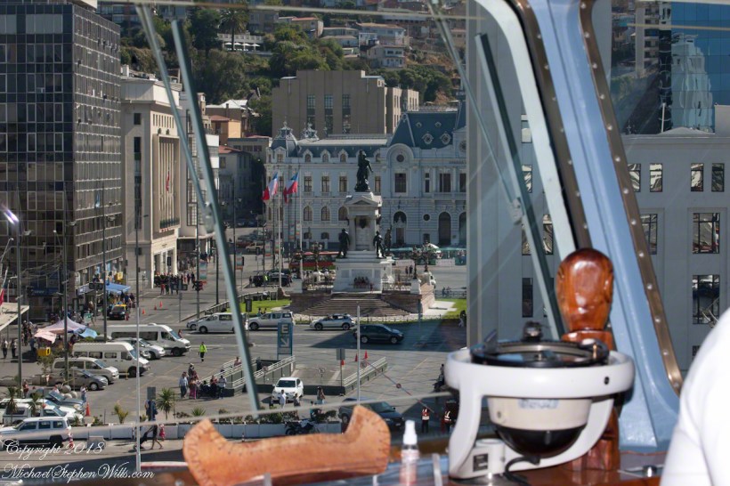
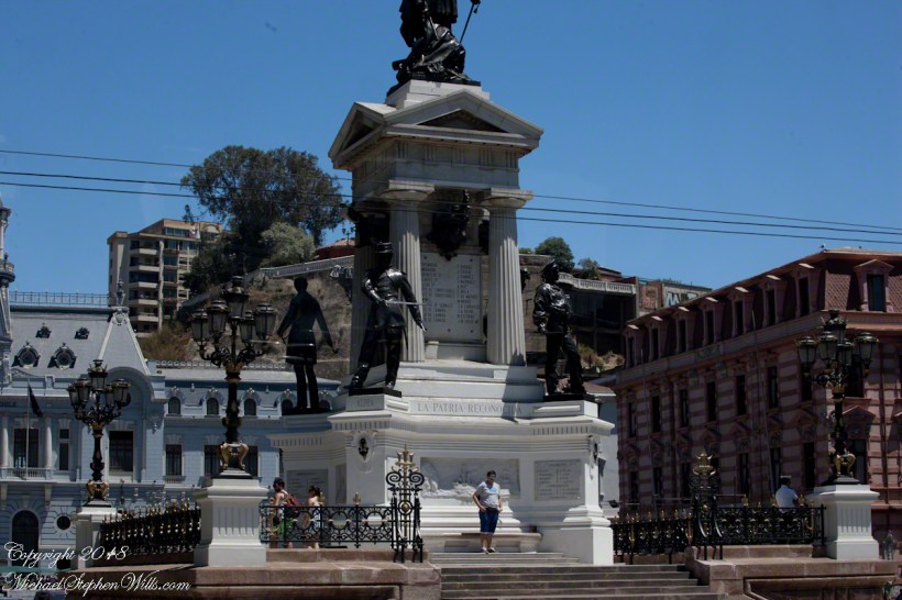
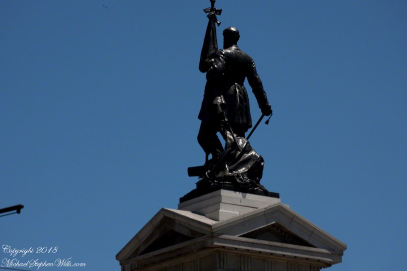
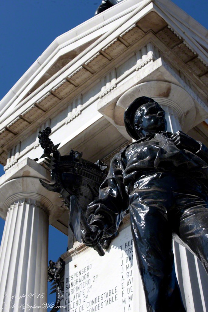
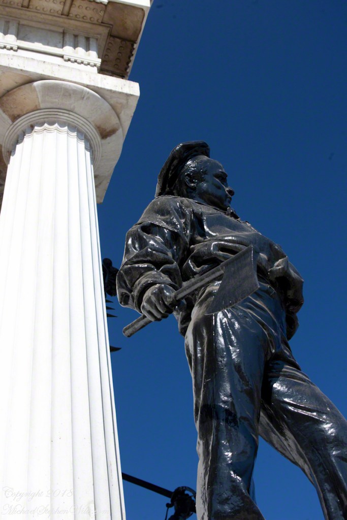
Monument to the Heroes of Iquique
Here we see from the Regatta bridge a monument to the Heroes of Iquique. The Battle of Iquique, May 21, 1879, is remembered annually as Naval Glories Day (Dia de las Glorias Navales) .
This monument commemorates the destruction of the Chilean warship Esmeralda. At the monument peak is Arturo Prat Chacón, captain of the Esmeralda who perished with his wooden ship. He and the crew were blockading the then Peruvian port of Iquique along with another ship, the Covadonga.
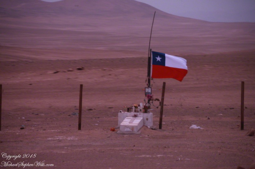
May 1879 was in the initial phase of the War of the Pacific, fought over rich mineral deposits of the Atacama desert. Today, the Chilean flag is over these barren wastes, seen here flying over a roadside memorial to an automobile accident victim. The desert is the backdrop, there are no animals or plants here, only red dirt. NASA uses the Atacama in simulations of the Martian environment.
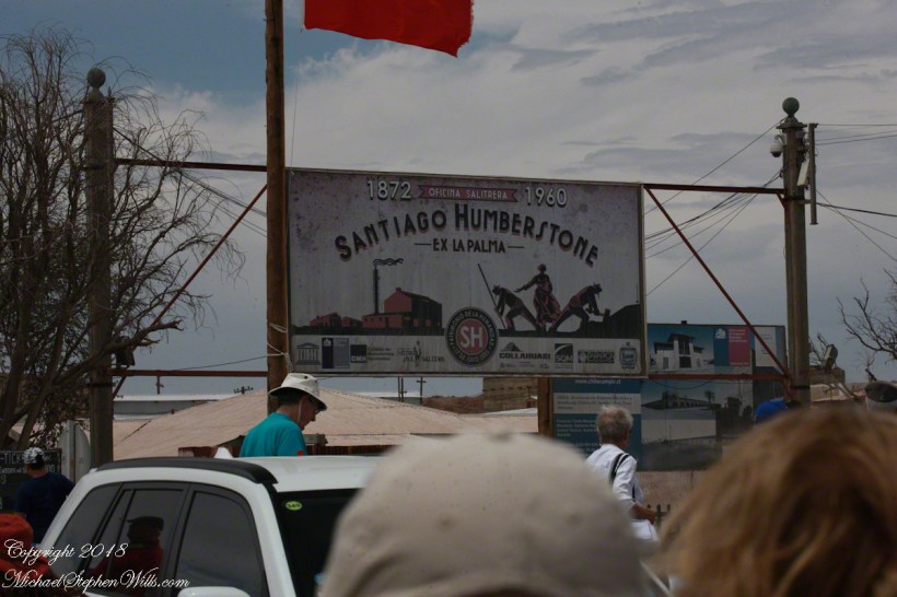
There are deposits of the mineral saltpeter, mined by large operations. Here is the entrance of a World Heritate site we visited while docked at Iquique.
The mining operation was literally scraping the deposits lying on the ground and processing it into, among other products, nitrogen fertilizer. At that time the operation was hugely lucrative, employing thousands in very difficult conditions. That is a different story.
Captain Prat faced two armored Peruvian warships, one the iron clad Huáscar. Over the course of four hours the Esmeralda was overpowered and sunk. The Huascar and the 22,500 mountain peak at Yungay, Huascarán, are named for an Inca chief.
The monument honors the bravery of Captain Prat and his crew, all of whom are named on plaques.
After the Huáscar rammed Esmeralda a third time to sink it, the Huáscar captain, Miguel Grau Seminario, rescued Chilean survivors in danger of drowning. In the meantime, the armored Peruvian warship was lured into the shallows and destroyed. Although the blockage on Iquique was lifted Peru lost one of its most powerful ships at the cost to Chile of an older wooden ship.
The defeat and examples of the Esmerelda crew and captain brought a wave of recruits to the Chilean forces. Chile was the victor of the War of the Pacific, vast tracks of the Atacama desert were taken from Bolivia, including the Saltpeter mines, shutting that country off from the Pacific Ocean. There is a connection between these memories and the Training Ship anchored in the harbor, the sixth ship to carry the name, Esmeralda (BE-43).
See my posting Valparaiso Connections V for the more recent history of the Esmeralda.
Copyright 2022 Michael Stephen Wills All Rights Reserved
Ricardo left a blank between the French Memorial Column of the Parque Italia, seen above. He made of mention of Salvadore Allende Plaza. The above photograph includes a graffiti inscribed corner of the set of steps, a platform and the area in front, a plaza, dedicated to the memory of Allende and named “Plaza del Pueblo Salvador Allende Gossens” on the 100th anniversary of his birth, 2008. The structure was not new, it was called “The People’s Plaza”, the name change was pushed through by Alberto Neumann, communist councilor. So the suppression and torture (see “Valparaiso Connections V”) was not successful in wiping out the ideals, such as they are.
The accomplishments of the Allende Presidency are another matter. The Macroeconomic Populism policies he implemented left the economy in tatters. We have only to look at the current state of Venezuela to see the entirely expected results of this economic model: hyperinflation followed by stagflation and implosion. The reactionary military coup of 1973 was, in the essentials, a rational response and a rescue from economic and social disaster until the reaction itself descended into madness.
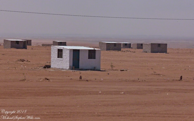
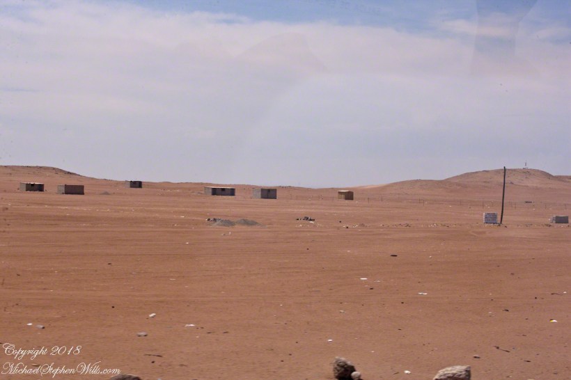
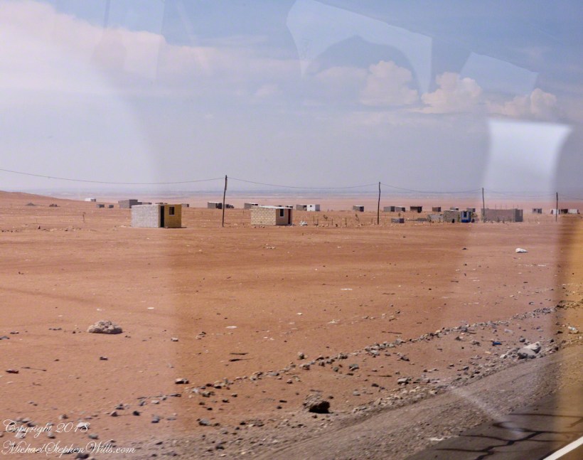
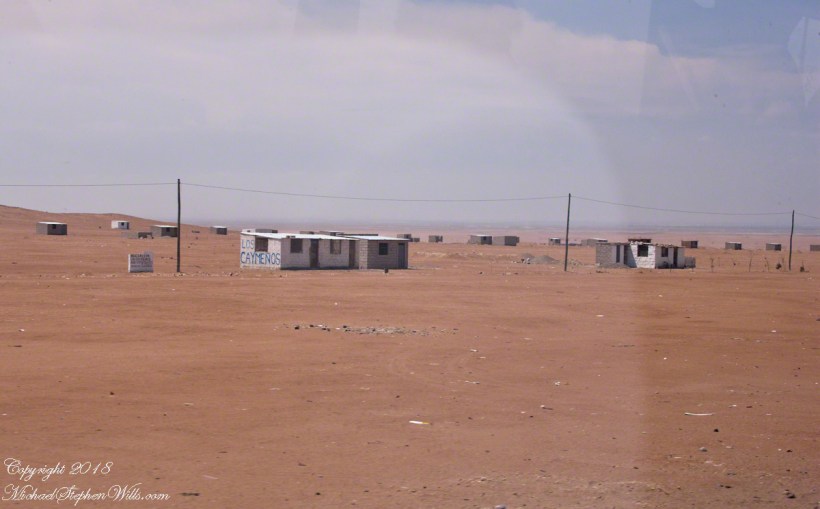
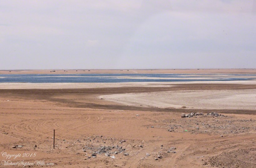
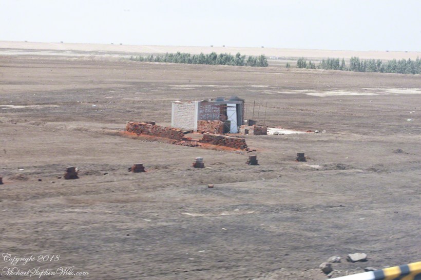
The following series of photographs are from a neighboring country, Peru, are an illustration of the pressures the political elites of Chile are negotiating. Taken from the road between the port of Mollendo and the city of Arequipa, on a vast, waterless plain.
Migrants from the Titicaca Region formed a cooperative named “Asociacion Las Caymenos Agro Exportadores”. It is the named scrawled on the small cement brick wall.
Desperate people from rural areas migrate to cities, form associations or regional clubs based on a common origin, and grab land as a group.
In this case, it is property useless for the named purpose, “agricultural export.” What they have is a dream. a dream of the government directing water to the area.
Towards this end, individuals of the group mark out plots using rocks and build structures from concrete brick and metal roofing.
This small patch of water is the basis of their desperate hope.
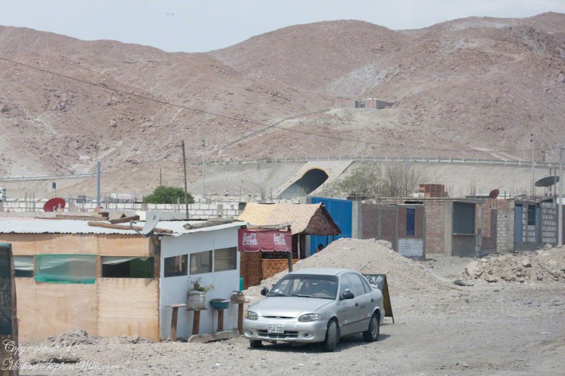
This is a more consolidate group of migrate squatters on the road called “1S” near the turnoff for Lima and a place named La Reparticion.
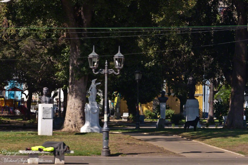
Dreams for a better life, offset by desperate circumstances bring us back to Valparaiso and the Parque Italia adjacent to Allende Plaza. The park is a small patch of green, some wonderful trees, with statuary and monuments dedicated to people of Italian heritage.
Beyond the sleeper are statues each on a plinth. The second from the right is a bust of Giovanni Battista Pastene, a gift from the city of Genoa dedicated October 12, 1961. Pastene was the first governor of Valparaiso (the region, not the city) in the 16th century. He came to Honduras in his own ship, enter the service of Pizzaro and, as master of the ship Conception, was a maritime explorer.
P
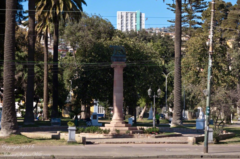
The Italian refugee collectivity of Valparaiso presented this column, in 1936, surmounted by a bronze sculpture of the Capitoline Wolf feeding the infant founders of Rome, Romulus and Remus. It is a copy of an ancient statue kept on Capitoline Hill, Rome, Italy.
The wife of Allende was of Italian heritage, Hortensia Bussi. The Fire Brigade Sesta Compagnia di Pompieri Cristoforo Colombo, operates today from Independence Avenue.
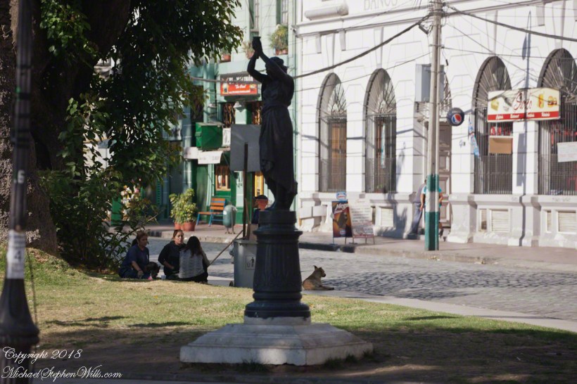
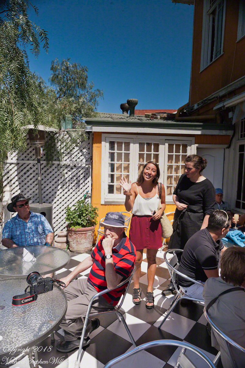
Here we have a gathering of friends, sharing the shade and beverages on this Saturday summer morning.
To begin with an epilogue to my last post, “Our Fifteen Minutes of Fame on Conception Hill” , our meeting with the El Mercurio reporter never appeared. Inquiries to the newspaper were promptly and courteously replied to, there was nothing. They suggested a search of the online archive and only a January 2014 fashion show, the article featured a photo from the same terrace. After our pleasant time we walked off some calories on Gervasoni Promenade, a showcase of city harbor and hillside views.
Most city visits on this cruise we traded independence and flexibility for the convenience of the guided tour. Ricardo, our guide, was a knowledgeable, good humored companion to our small group. After we left the promenade for Calle Conception Ricardo was most helpful.
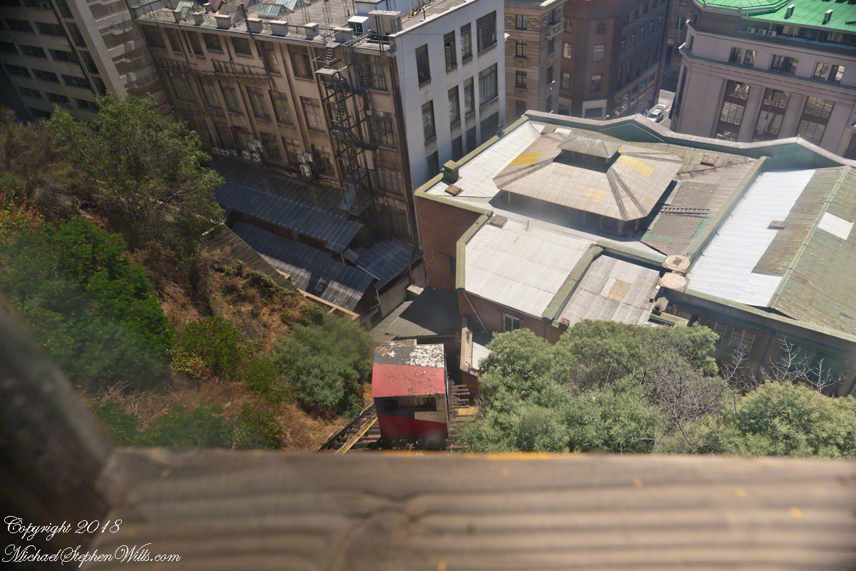
It was here I entered a photographic fugue, losing touch with my surroundings through concentration on capturing the moment.
I walked ahead of Pam, expecting her to follow, and caught the view of the arriving care of the Conception funicular.
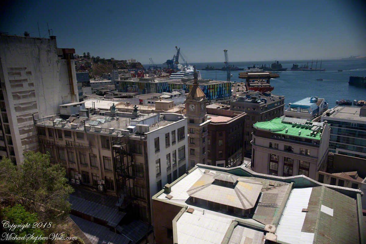
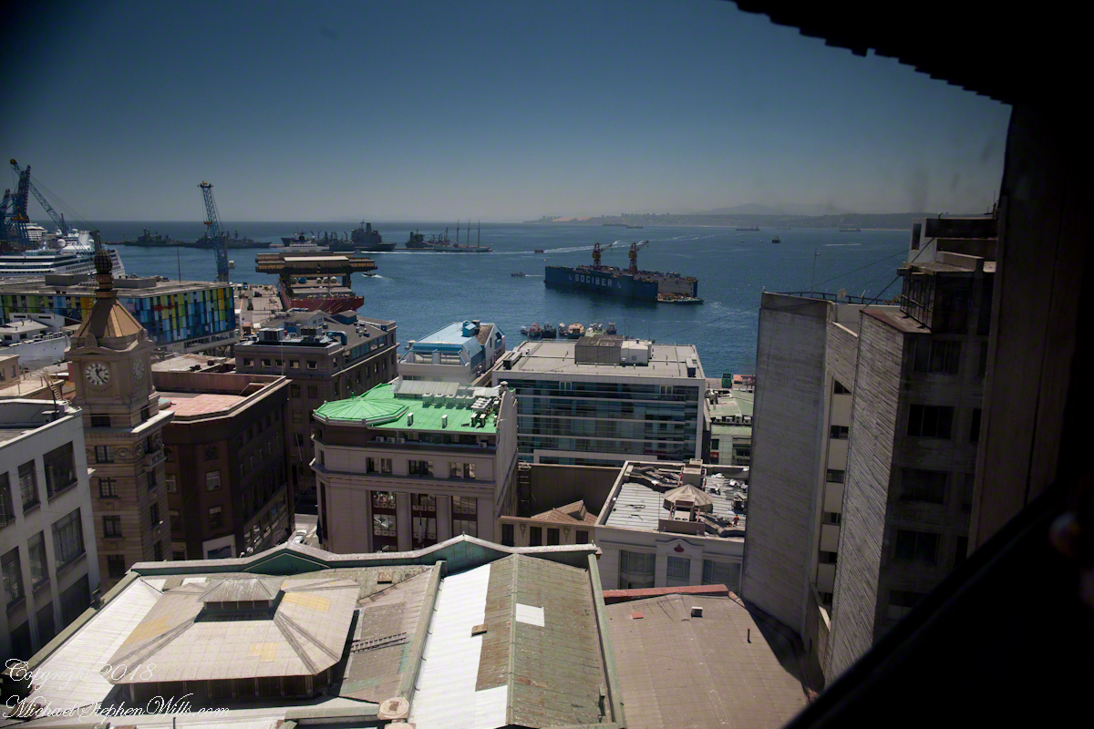
Wow, that’s the Regatta at dock. Other elements of this vista are the harbor, of course, then the famous Turri clock tower. Hmmm, almost 1:30 pm.
I was fascinated by the view of a drydock the Regatta passed while docking early that morning. It is the red structure with the letters “Sociber”, it even has a Facebook page!!!
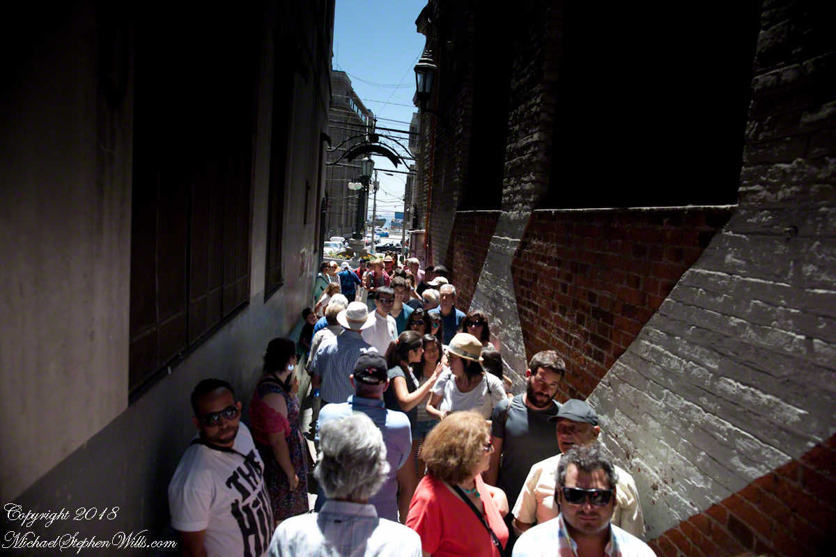
Once at street level the experience of the crowd on the alley opening onto Calle Prat, waiting for the ride up, brought back reality. “Where’s Pam?” I could not go back up because of the crowd, the views from the car fell from my mind.
I was on the street, disoriented and alone.
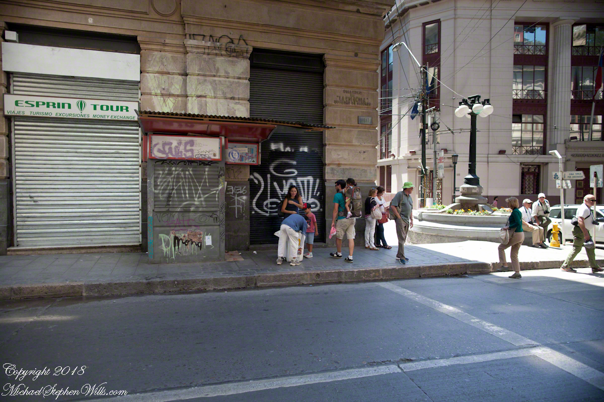
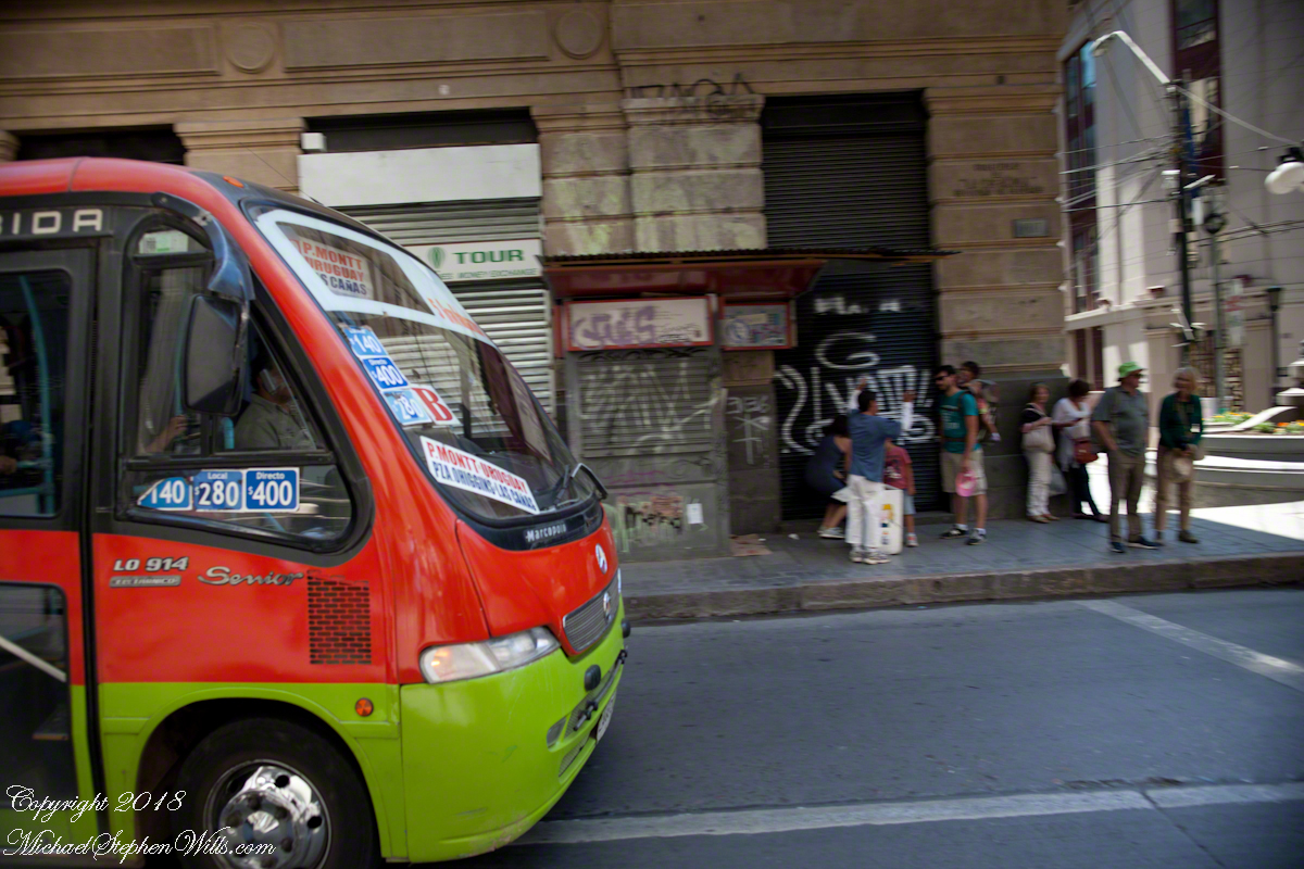
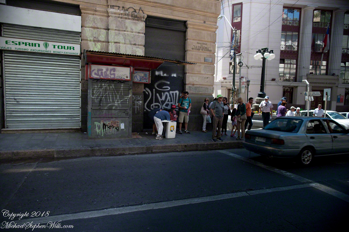
I fell back on photography to pass the time. Nowhere near the charm of Cerro Conception, typical downtown urban environment.
A man approached the family across Prat, “What is going on?” I wondered when the tour bus arrived. Still no Pam.
Oh, it is an ice cream vendor. Delicious. “Where’s Pam?” Ricardo not around, either. Back on the bus, waiting, a younger member of the tour was an Irish wag who declaimed on the benefits of freedom, even temporary.
Finally, Ricardo arrived followed by a few other tour members and Pam. Whew!! I’ll never live down “deserting” her. She was not able to find the entrance to the Conception funicular. Along with a few others they kept each other company until Ricardo rounded them up. That was a long 20 minutes (reading from the photograph metadata), I was worried. As I mentioned, at the time I was clueless about my whereabouts. Reviewing the numerous photographs, I found the “Servicio Nacional de Aduanas” (National Customs) building across the where Calle Esmeralda joins with Cochrane and pieced it together from there.
About the Conception funicular, that morning while the Regata docked I caught this view of Valparaiso hillside. It is a microcosm of the Andean topography, ravines cut through the heights. This is when I noted the Sociber drydock, it is on the lower left…look down into it — the business is to sell that dry space in the middle of the harbor for ship repair. The space and be flooded, opened to allow entry of a ship, then drained for work on the hull or whatever.
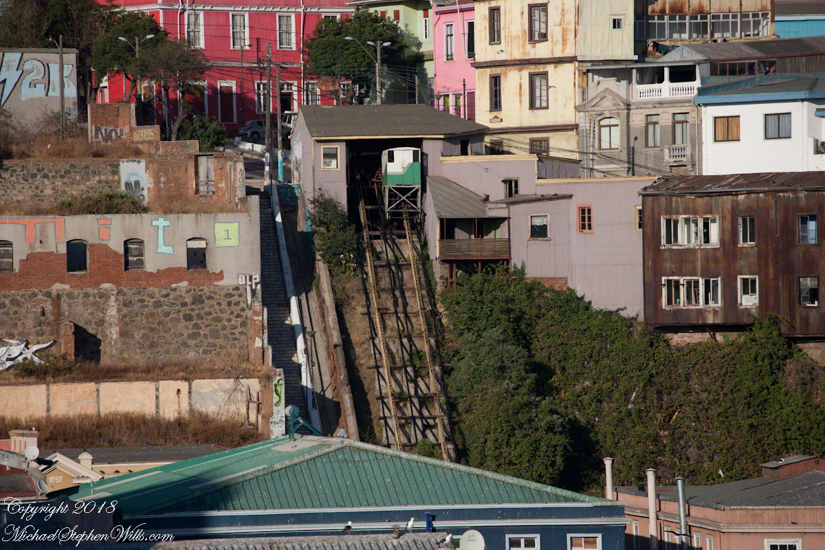
The city pioneers adapted to this terrain. As a entrepreneurial endeavor, in 1882 Mr. Liberio E. Brieba Pacheco founded the Mechanical Elevators Company of Valparaíso. Conception funicular opened the following year to facilitate the urbanization of Alegre and Concepción hills. Conception funicular is closed for repairs currently, from 1883 until recently this, the oldest and first funicular of Valparaiso lifted people from the downtown Plan (plain) to the hilltop for a small fee.
Funicular is derived from latin “funis” for rope. It is an elevator that runs two counter balanced cars on a rails on a steep, less than vertical, slope. As one car rises the other lowers.
Here are some views of the Conception funicular and environs as seen from the upper Regatta deck. First, a 24 mm wide angle view. Look to the center for the rails and one car at the top. Above are the buildings of Cerro Conception (Conception Hill).
The funicular emerges from downtown on the right in the following view. The prominent church is Parroquia Perpetuo Socorro, just above the midpoint. It rises from Cerro Cordillera, above Cerro Conception. A Catholic church founded by the Redemptionist Fathers, the first stone was laid down 1905. Learning from the devastating earthquake of 1906, the engineer Juan Tonkin chose construction of Oregon pine and concrete to stand tall today. What a view (I’ve seen photographs).
A view a bit to the right, many of the colorful exteriors are zinc panels brought from early sailing ships, repurposed as siding.
After the wide angle shot I used the variable “zoom” lens for the rest. Here is a close view of the Conception funicular. The business of building and running these services thrived, over the years up to 29 funiculars and one elevator, served the city portenos (people of the port). In 2018 seven are in operation, nine are under a process of restoration and modernization, including Conception.
Copyright 2022 Michael Stephen Wills All Rights Reserved
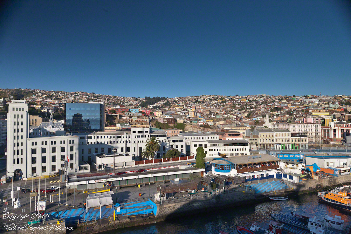
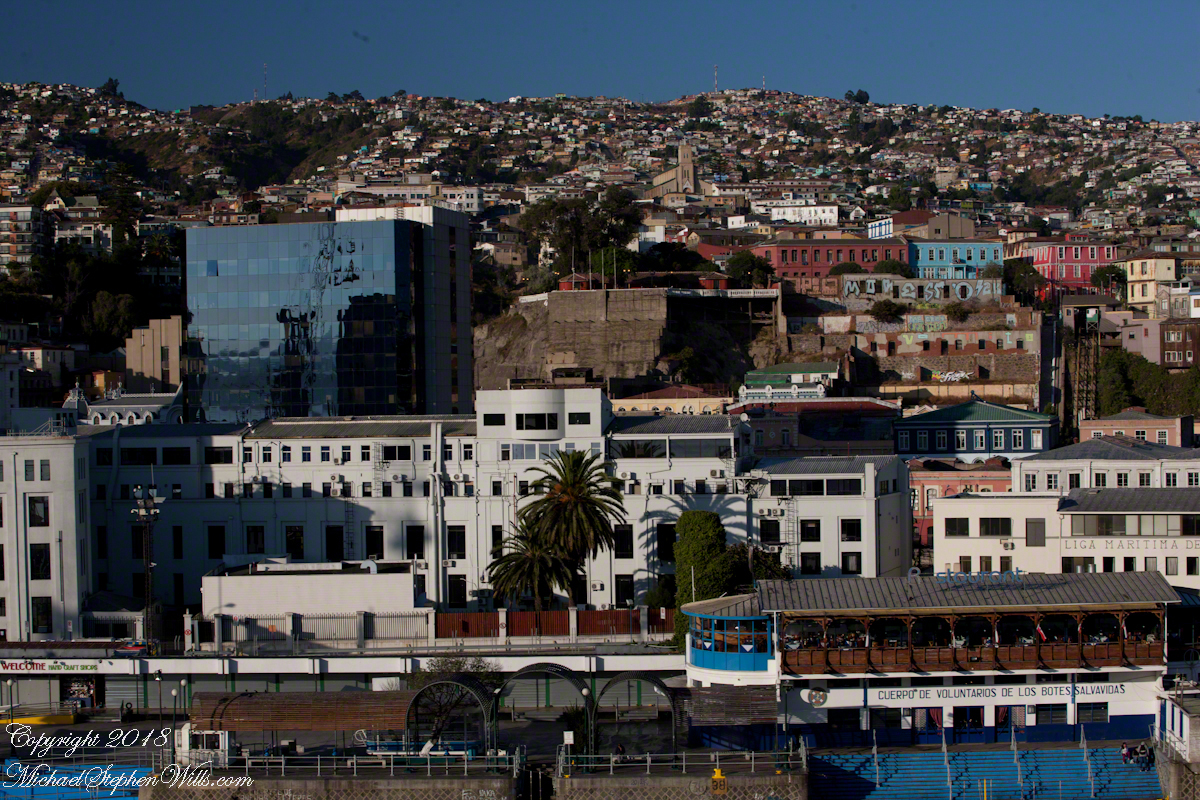
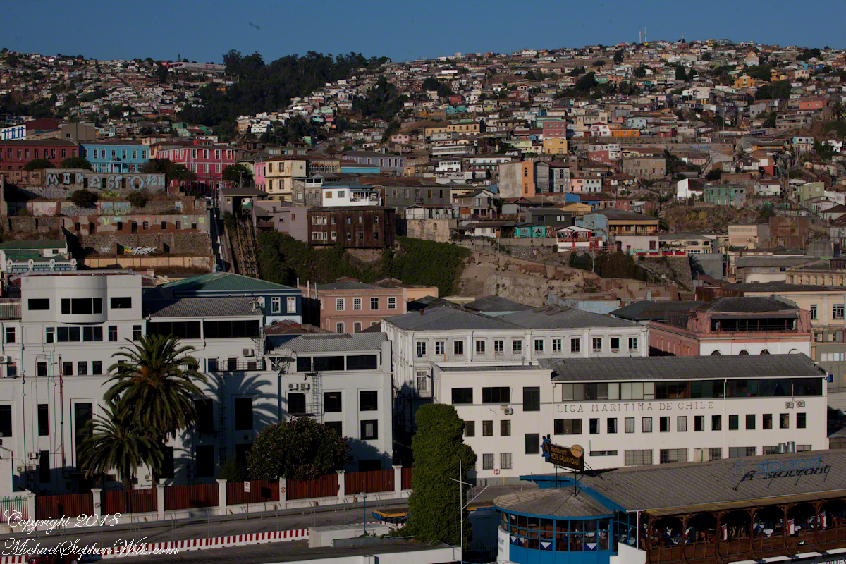
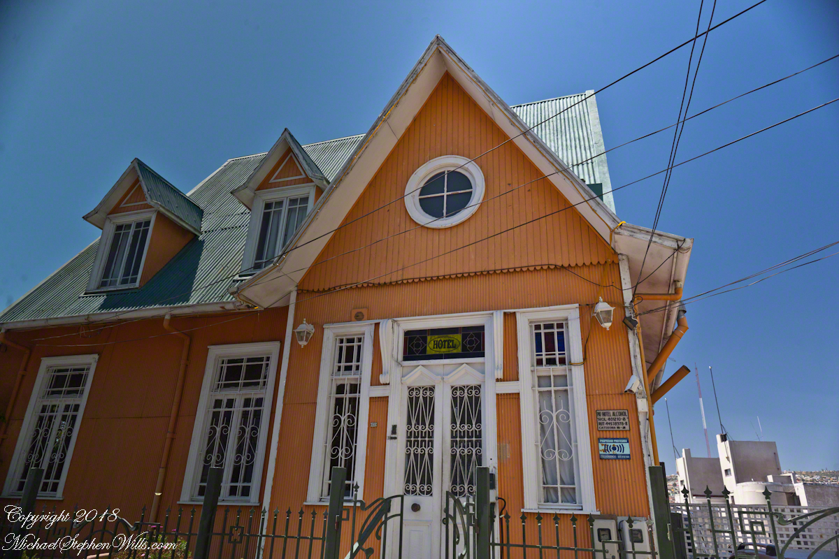
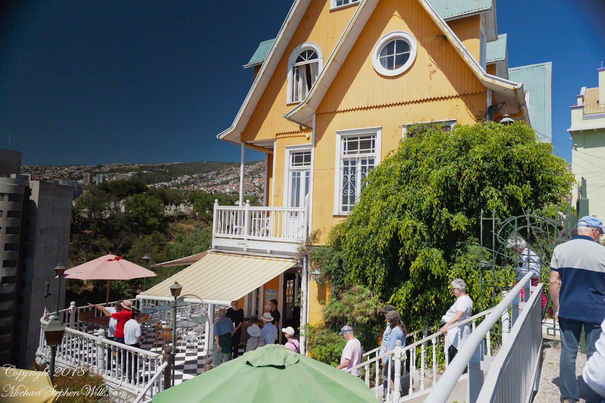
Posting about our departure from Valparaiso, Chile (see Valparaiso Departure III “The Sunset”) brings us to the time spent wandering this World Heritage Site, added to the UNESCO list in 2003. Within the amphitheater of hills is Cerro Conception (Conception Hill), historically settled by English and German immigrants. The façade of the Hotel Brighton, a building from the 19th century heyday of Valparaiso when it was a stopping point for shipping through the Straits of Magellan, reveals why so many of the buildings are alike: all are constructed from materials dropped off from sailing ships.
The theme of the Hotel Brighton evokes thoughts of immigrants remembering their origins, emigres claiming a spot of real estate to mold a sense of place for themselves. This goes both ways, Valparaiso, Indiana was formerly Porterville of Porter County. The motive force behind the renaming were the memories of the retired Captain David Porter, the sole survivor of an attack on his ship USS Essex by the British frigates Phoebe and Cherub in the War of 1812, within sight of Valparaiso. Fifty eight (58) United States Marines lost their lives in that sea battle. To point out the obvious, Captain Porter is the namesake of Porter County.
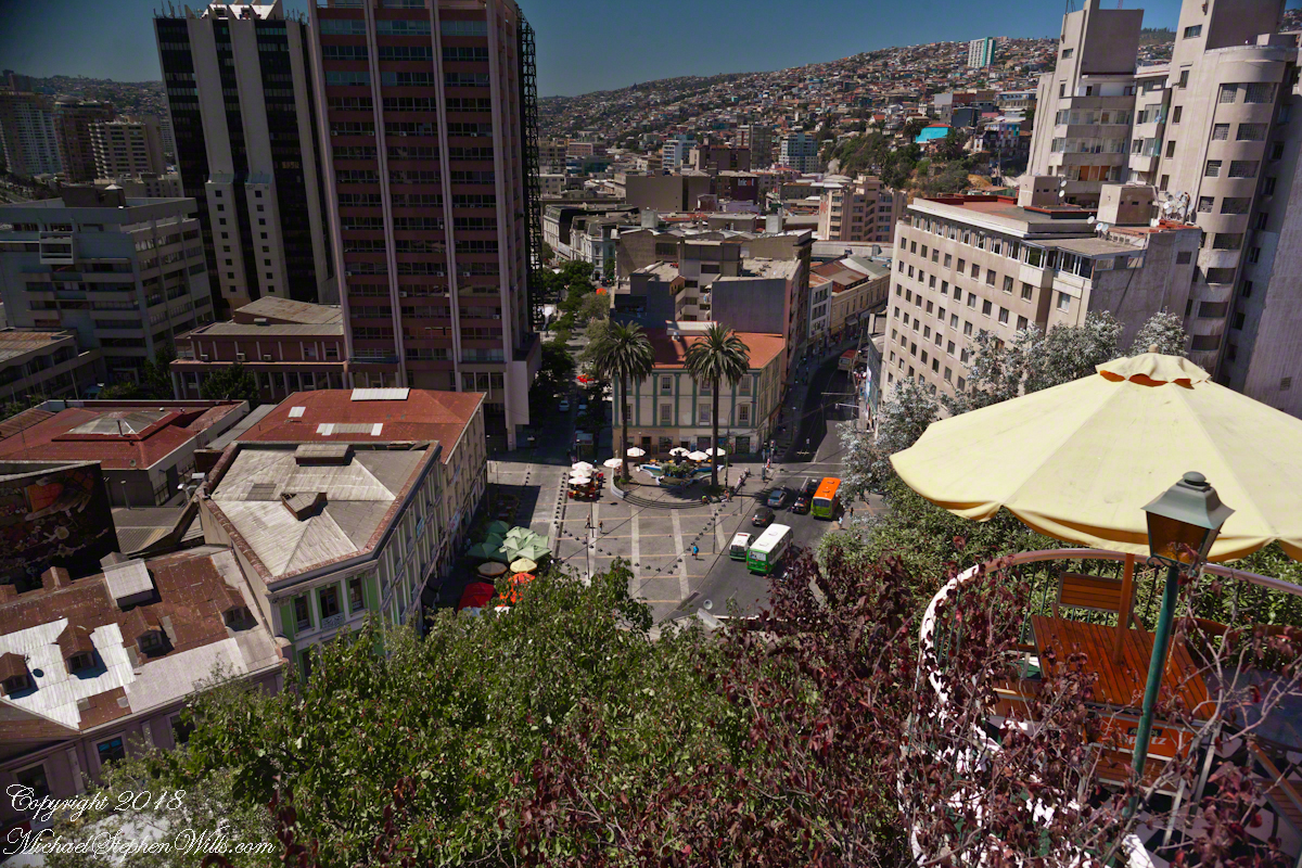
Pam corrects me when I say we “stopped for lunch” at the Hotel Brighton, pointing out we “only” had a glass of red wine and an empanada. Both were tasty, even more so with this marvelous view looking north into the other hills of the city. The yellow umbrella is on the hotel restaurant terrace.
I missed capturing the signature wrought iron gate forming the word “Brighton” among decorative scrolls. Built on the edge of Conception Hill it overlooks the coastal plain almost all of which is man-made.
During our refreshment, this young lady (see photograph below) introduced herself as a reporter for El Mercurio. Accompanied by a photographer, she interviewed us and we had our photograph taken, I returned the favor with the following photograph saying the story might appear in the next edition. Standing next to her, with a puzzled look, is our waitress who was from the States.
El Mercurio de Valparaiso is the oldest continuously published Spanish language newspaper in the world. In my research for these photographs I discovered the newpaper officers were a short walk from the landing of the Ascensor Conception.
Copyright 2022 Michael Stephen Wills All Rights Reserved
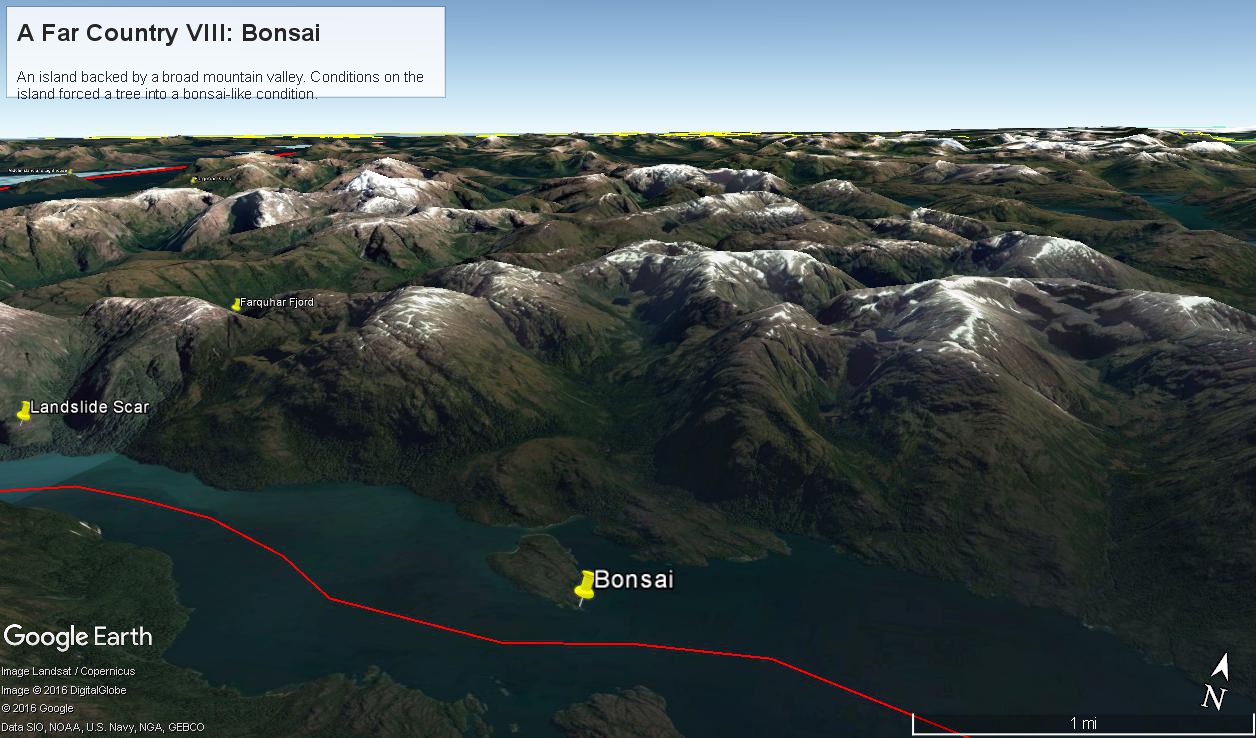
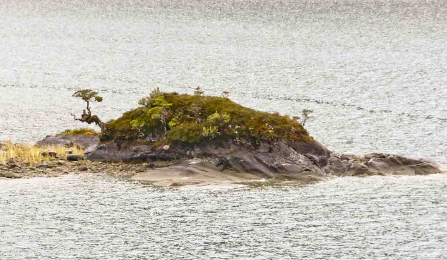
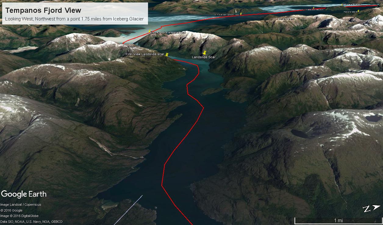
Here is a Google Earth view of Tempanos Fjord from 9,400 feet, looking north, northwest over a point on the fjord 6.5 miles from Iceberg Glacier, at 4 pm local time on February 17, 2016. This view is interesting for the insignificant island, .75 mile long, and broad mountain valley to the north fringed with waterfalls.
Marked is the location of a tree, “bonsai”, a feature of the fjord cliffs, “Landslide Scar” and a neighboring Fjord, “Farquhar Fjord.”
This blog features the tree.
The Farquhar Fjord entrance opens onto the entrance of Tempanos Fjord and is the last photograph.
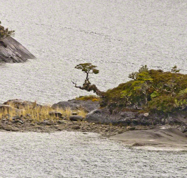
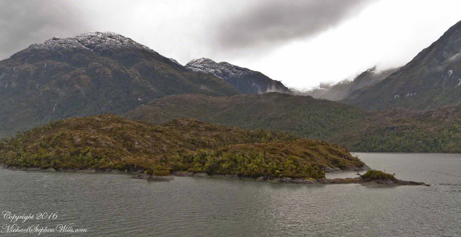
A photograph from our port side stateroom deck includes both the island and broad valley. The misshapen tree, the “bonsai”, is on an islet to the right and in front of the island. It is the small stump backlit by water reflection. The stump is more interesting than can be seen in this image from a handheld camera, at 24 mm. I used the variable lens for a closer look.
From this 133 mm, f8.0, 1/250 sec and ISO 800, still handheld, interesting details come into view. The islet is a rock on which clings a bed of moss. Several ferns, a sapling (on the far side) and a stump, on the right, are surviving. The stump presumably supported a small tree of which a “bonsai-like” twig remains.
Bonsai are fascinating, created through the art and skill of emulating pleasing natural forms. Here the moss encrusted twists and miniature tree crown were formed from a difficult environment. Bonsai of Japan originated from an ancient Chinese tradition of penjing (“tray plant”). The inspiration for this are, at origin and now, must be, in part, from admiration of the tenacity and beauty of these plants.
At the 200 mm maximum my Sony Alpha 770 (1/400, f9, ISO 800) image is a little fuzzy, still with great details.
From my interest in bonsai I am on the lookout for shapes such as this. Travelling the challenging environment of the Chilean Fjords I found examples here and there.
Click any photograph to visit my online gallery)
Copyright 2022 Michael Stephen Wills All Rights Reserved
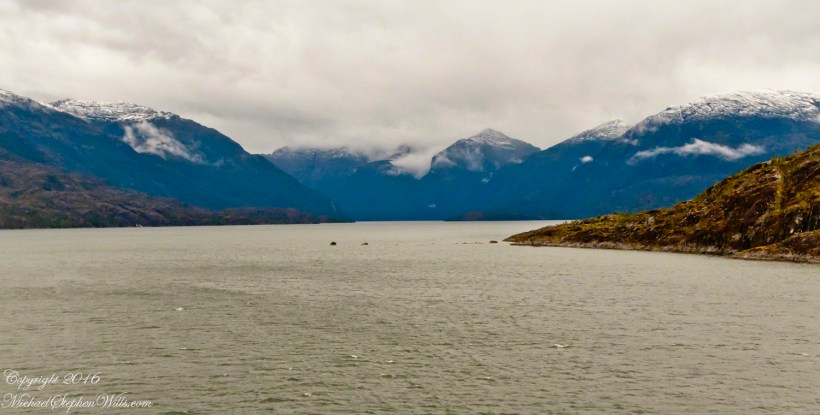
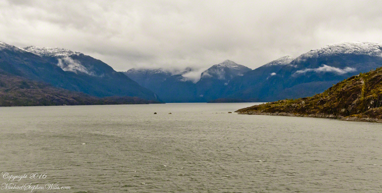
By 3:20 pm local time the Oceania was approximately 1.75 miles from the Iceberg Glacier and the captain positioned the ship for a starboard side glacier view. From our port side stateroom terrace Pam and I had this sweeping view of the way we had come.
Tempanos Fjord is a mile across here and we have a clear view of the landslide scar feature in my last blog. It is 7.75 miles distant, a small white patch on the fjord wall. The landscape scar marks where the fjord bends, changing north, northeast course to an east, southeast direction. Before the bend, the Iceberg glacier is not visible. Turn the bend and the glacier is plainly visible in the distance if the viewer is looking over the ship bow.
The following capture from Google Earth is the view from 14,000 feet. Marked are the locations of the landslide scar and the ship position were I first photographed the scar on our way into Tempanos Fjord. The red lined ship’s course may be followed out of the fjord back to the Messier Channel. The fjord follows a course among mountain peaks and deep valleys. A great pleasure of sailing Tempanos Fjord is the many vistas opening one to another.
(Click any photograph to visit my online gallery)
Copyright 2022 Michael Stephen Wills All Rights Reserved