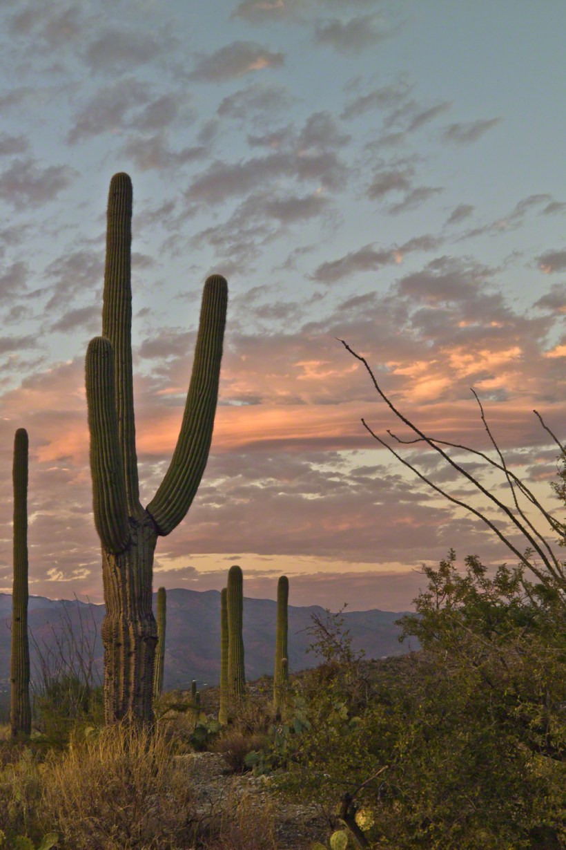
November is a special time for the ranges and basins of southern Arizona deserts. Climb a bajada of foothills, face west and wait for the sunset. That is what I did this day, November 3, 2005. East of Tucson the Saguaro National Monument at the foot of the Rincon Mountain Wilderness is where I parked, unpacked the photo gear and climbed the side of the Tanque Verde Ridge for a favorable view. Weather was pushing high level moisture from the west, clouds were developing.
You see here a shot from that session. In the distance, looking across Tanque Verde, are the Santa Catalina mountains. Months since the last rainfall, the giant Saguaros are using internal moisture reserves drawn up from a shallow root system, the flesh is less plump, the supporting structure of the ribs, always evident, are more pronounced. The last light catches these ribs in relief against a dramatic sky.
A kiva is a space used by Puebloans for rites and political meetings, many of them associated with the kachina belief system. Among the modern Hopi and most other Pueblo peoples, “kiva” means a large room that is circular and underground and used for spiritual ceremonies.
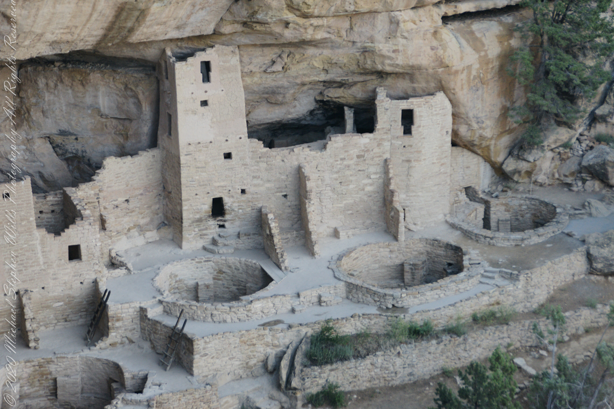
The Square Tower with four Kivas
Similar subterranean rooms are found among ruins in the North American South-West, indicating uses by the ancient peoples of the region including the ancestral Puebloans, the Mogollon, and the Hohokam.
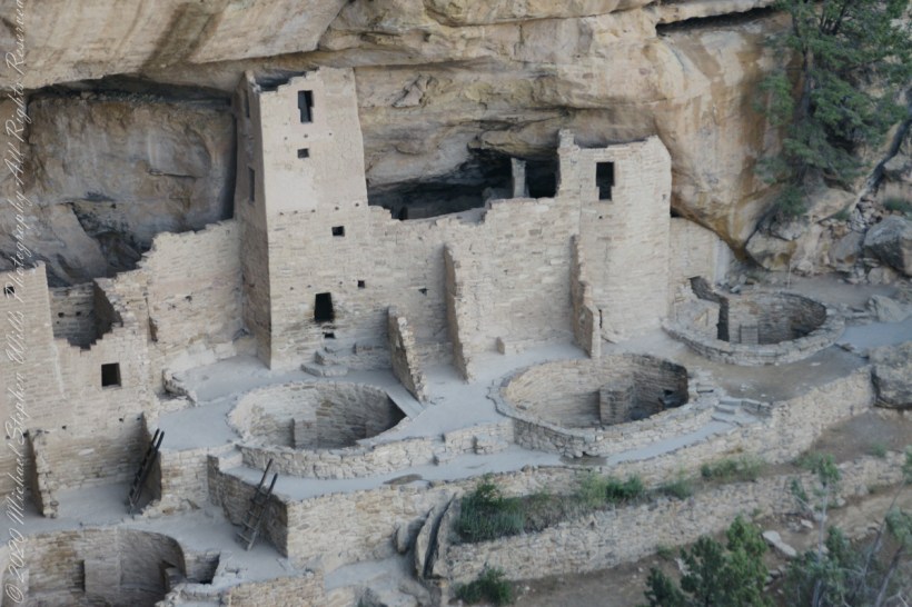
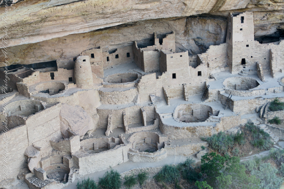
A portion of Cliff Palace including many Kivas, the round and square towers.
Those used by the ancient Pueblos of the Pueblo I Period and following, designated by the Pecos Classification system developed by archaeologists, were usually round and evolved from simpler pit-houses.
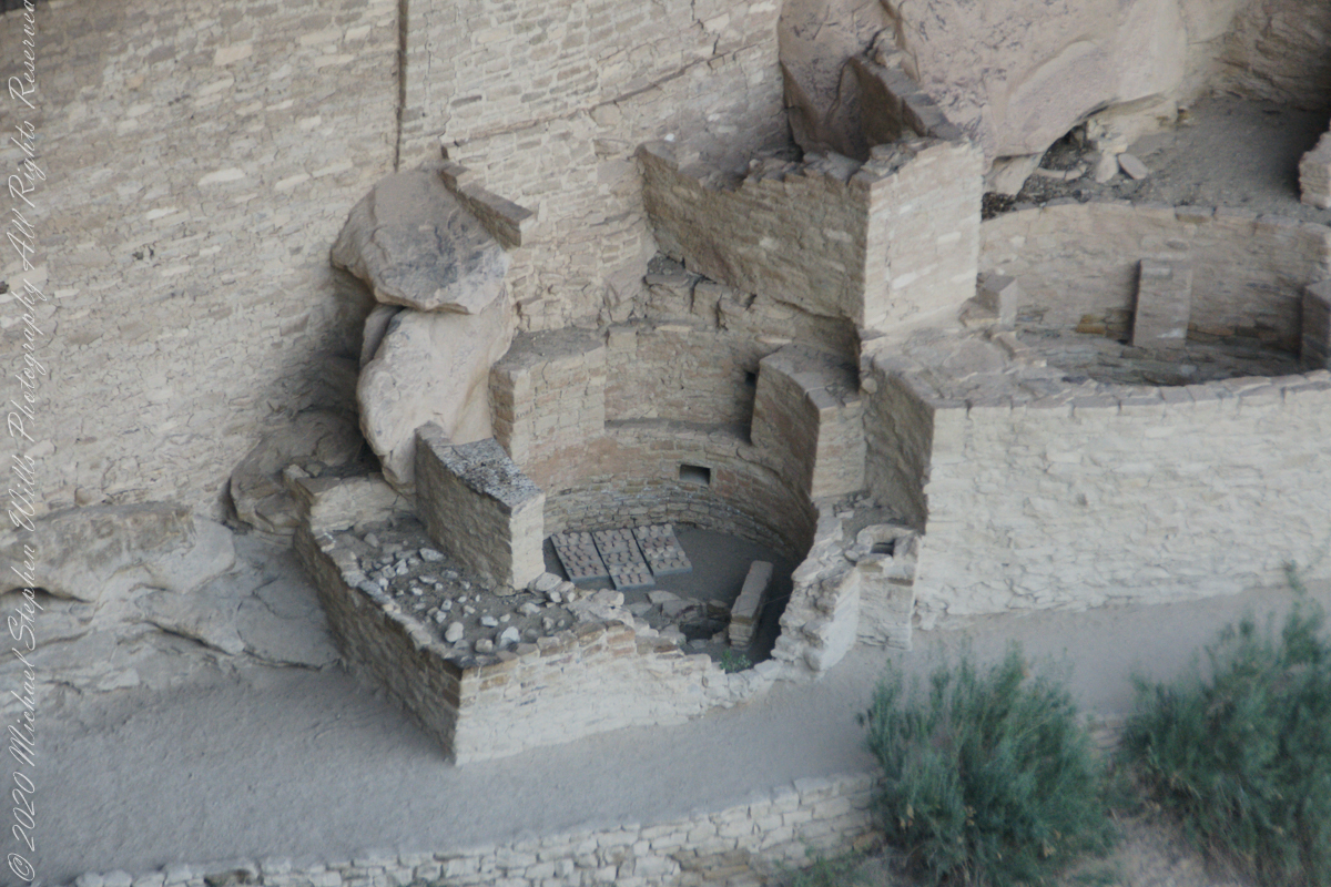
Two Kivas, one with broken wall.
For the Ancestral Puebloans, these rooms are believed to have had a variety of functions, including domestic residence along with social and ceremonial purposes.
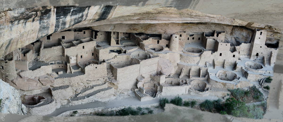
The entire Cliff Palace from the overlook, from a single wide-angle image.
During the late 8th century, Mesa Verdeans started building square pit structures that archeologists call protokivas. They were typically 3 or 4 feet (0.91 or 1.22 m) deep and 12 to 20 feet (3.7 to 6.1 m) in diameter. By the mid-10th and early 11th centuries, these had evolved into smaller circular structures called kivas, which were usually 12 to 15 feet (3.7 to 4.6 m) across.
Sipapu
Mesa Verde-style kivas included a feature from earlier times called a sipapu, which is a hole dug in the north of the chamber that is thought to represent the Ancestral Puebloans’ place of emergence from the underworld
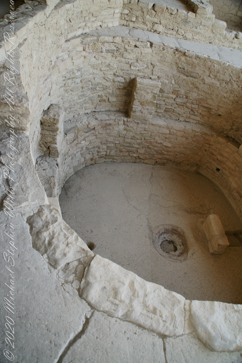
Here is a close-up of the kiva floor of the Balcony House.
Balcony House Kiva
The sipapu is the smaller pit in the floor to the left (north side) and partially blocked by the kiva wall. The larger is a firepit. The small wall to the right is placed to deflect airflow from a floor vent.
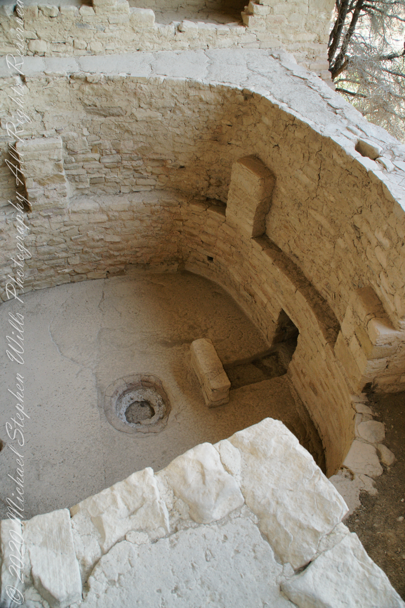
Balcony House Kiva, to the right is the floor vent in wall and deflector stone. There is the firepit and a tiny portion of the sipapu at the left edge.
I count 14 Kivas in the Cliff Palace panorama, including some with broken walls.
What is the Connection, if any, between Omphalos and Sipapu?
The global coordinate system was known to ancient Greeks, in fact they are credited with the discovery a system to locate any place on earth, an insight contained in myths of how Zeus founded Delphi as the “center of the world,” the place from which divinity irrupts, by setting two eagles at opposing ends of the world to fly, starting at the same time, same speed, the central world point identified by where the eagles’ paths crossed.
Bronze Coin from the Ptolemaic Kingdom of Egypt, reign of Ptolemy VI 2nd Century BC with the head of Zeus on one side and double eagles riding a thunderbolt on the other
To signify Delphi as this center a religious stone artifact, called an omphalos, was placed.
Most accounts locate the Delphi omphalos in the adyton (sacred part of the temple) near the Pythia (oracle). The stone sculpture itself (which may be a copy) is there to this day. The surface is a carving of a knotted net, the center hollow and widening towards the base. The omphalos represents the stone which Rhea wrapped in swaddling clothes, pretending it was newborn Zeus, in order to deceive Cronus. (Cronus was the father who swallowed his children so as to prevent them from usurping him as he had deposed his own father, Uranus).
The omphalos stone was believed to allow direct communication with the gods. Historians theorize the stone was hollow to allow intoxicating vapors breathed by the Oracle (priestess) to channel through it. However, understanding of the use of the omphalos is uncertain due to destruction of the site by Theodosius I and Arcadius in the 4th century CE.
That leaves us with the word, omphalos. In Greek the original meaning is navel, the anatomical reminder to humans of their source.
Comparing and contrasting these terms used by cultures separated widely by geography and time:
— sipapu is a religious symbol of the place ancestral peoples irrupted, born, into this world, emerging from the earth. From my readings, the word sipapu is a direct reference to the symbol. There are many sipapu, small holes in the floor of kivas (timetimes a hole in a wooden plank), representing a single place.
— omphalos is a religious symbol of where the divine irrupts into the world, from the earth, with direct linguistic natal (birth) associations. A single omphalos stone designates a single place.
Copyright 2023 Michael Stephen Wills All Rights Reserved
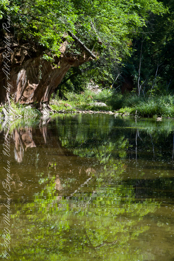
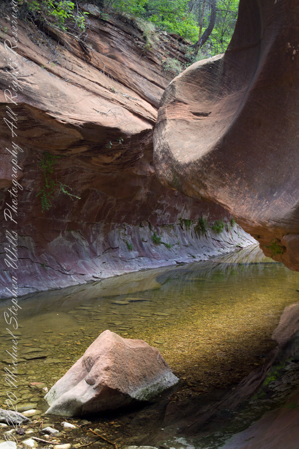
The fault of Oak Creek changes direction, here it forms a north/south gallery through Schnebly Hill Formation red sandstone for which Sedona is famous.
West Fork (108) Trail, Sedona, Yavapai County, Arizona
“Hello” from Oak Creek Canyon, “Photo by Pam Wills”
In November 2004, a visit to Canyon de Chelly with guide Hadley Tsosie revealed ancient petroglyphs and ruins, highlighting Navajo culture and the canyon’s unique beauty.
On November 3, 2004 my son, Sean, and I made our way to Chinle, Arizona on the Navajo Reservation at the mouth of Canyon de Chelly.
The next day, driving a rented 4 wheel drive, we arrived at the visitor center, at dawn, and there met Hadley Tsosie who worked as a guide. This is how you do it, if learning about the Canyon is your goal. It is possible to walk, unaccompanied, into the canyon to view the “White House” and this I highly recommend. Tourists can also drive around the rim to various overlooks. This is what most people do.
The canyon is still farmed and the tribe only allows visitors when accompanied by a guide. Only Diné (Navajo) are certified as guides. They know the rights of way and the preferences of the landowners.
We negotiated with Hadley to take us for half a day for our interest in petroglyphs and ruins. It is important to start early when the sun is low in the sky, when directly overhead the details of ruins and petroglyphs are washed out by the light. Catching the late afternoon/evening sun is also an approach that requires detailed knowledge of the route, taking into account the time of year.
Hadley was an excellent choice, though he was our only option on that day. He was fluent in Navajo beliefs, the lore of the canyon and generous in sharing what he knew.
Here is Hadley, approximately 6.2 miles into the canyon with the “Ledge Ruin” behind. We arrived at the junction just in time, before the sun was high enough to wash out the ruin. It is slow going into the canyon what with the deep sand and water that must be negotiated. Hadley did the driving and was expert. We passed other parties bogged down in the wet sand. I do not believe it was luck that kept us moving . We stopped many times to talk and admire the petroglyphs and pictographs.
Petroglyphs are symbols incised, or cut, into the surface (the name means petro, “rock”, glyph, “symbol”). In the desert climate of the southwestern USA a thin, dark pigment forms on rock surfaces of overhanging cliffs. The pigment forms from infrequent precipitation, in the form of water, flowing downward over the surface or even dew. The high heat of the desert drives a chemical reaction between water, clays, iron and manganese oxide to form a coating on the rock surface. The dark coating, called “desert varnish”, contrasts with the underlying rock. When it is scraped away a line forms. Many of the petroglyphs were of this form. Others were carved into the rock itself, more time consuming and durable. No one knows when the petroglyphs were made, they were always there are respected. People have inhabited Canyon de Chelly for over a thousand years. The word pictograph has a different meaning when used to describe prehistoric art. The earliest writing were symbols incised in wet clay, then allowed to harden. The pictographs we viewed was prehistoric art, mostly white pigment on the red rock, outlines of hands. There were also kokopelli, the outline of a flute player and jagged lines, symbolizing, Peter told us, lightening.
In November the cottonwoods were in fall foliage, a brilliant yellow under a cloudless sky. The sun is lower in the south and rises later. The Navajo Reservation follows daylight savings time, unlike Arizona. This November morning the sun rose around 7:45 am, so if you are not an early riser this time of year is an excellent choice for a Canyon de Chelly tour.
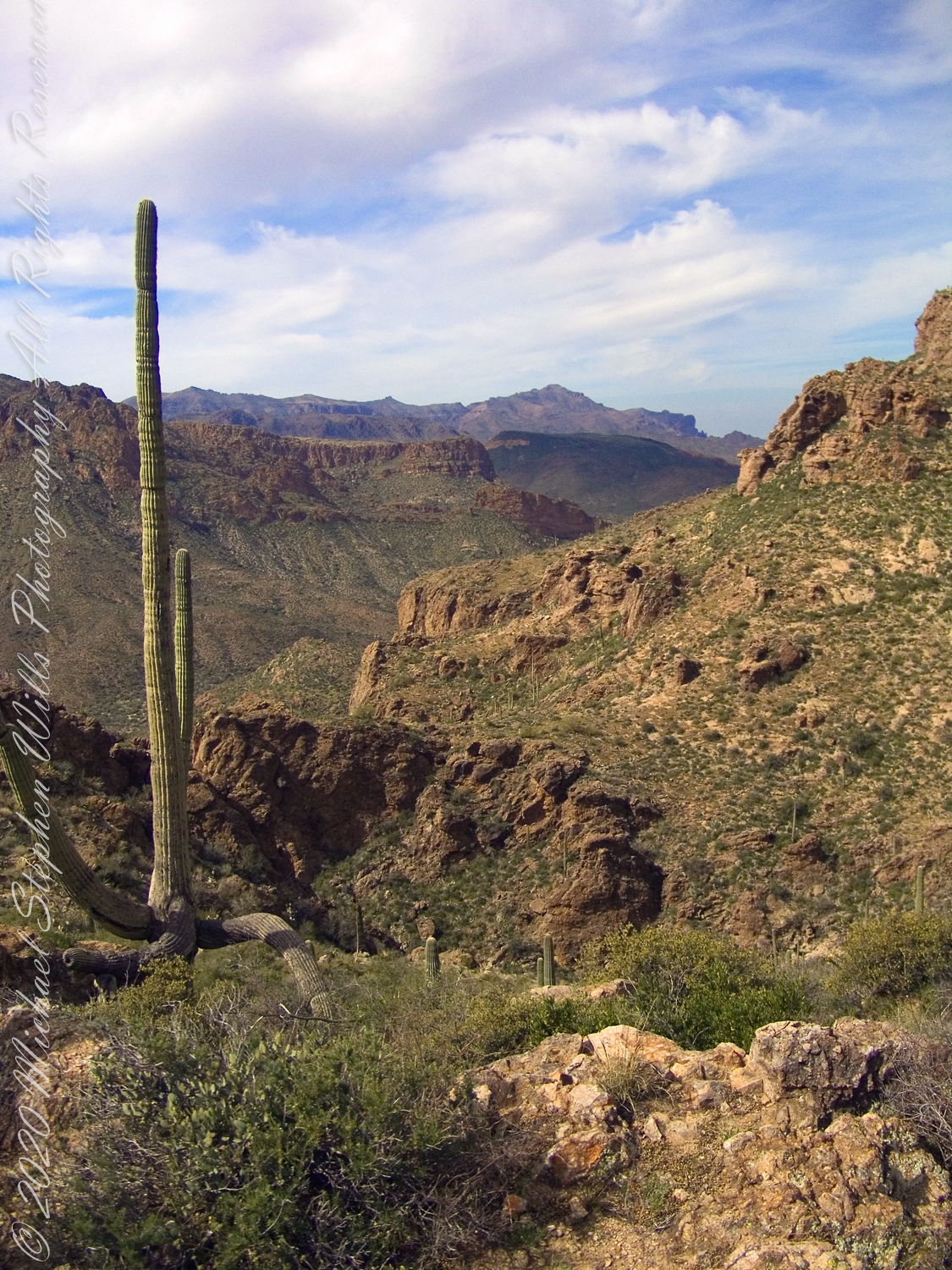
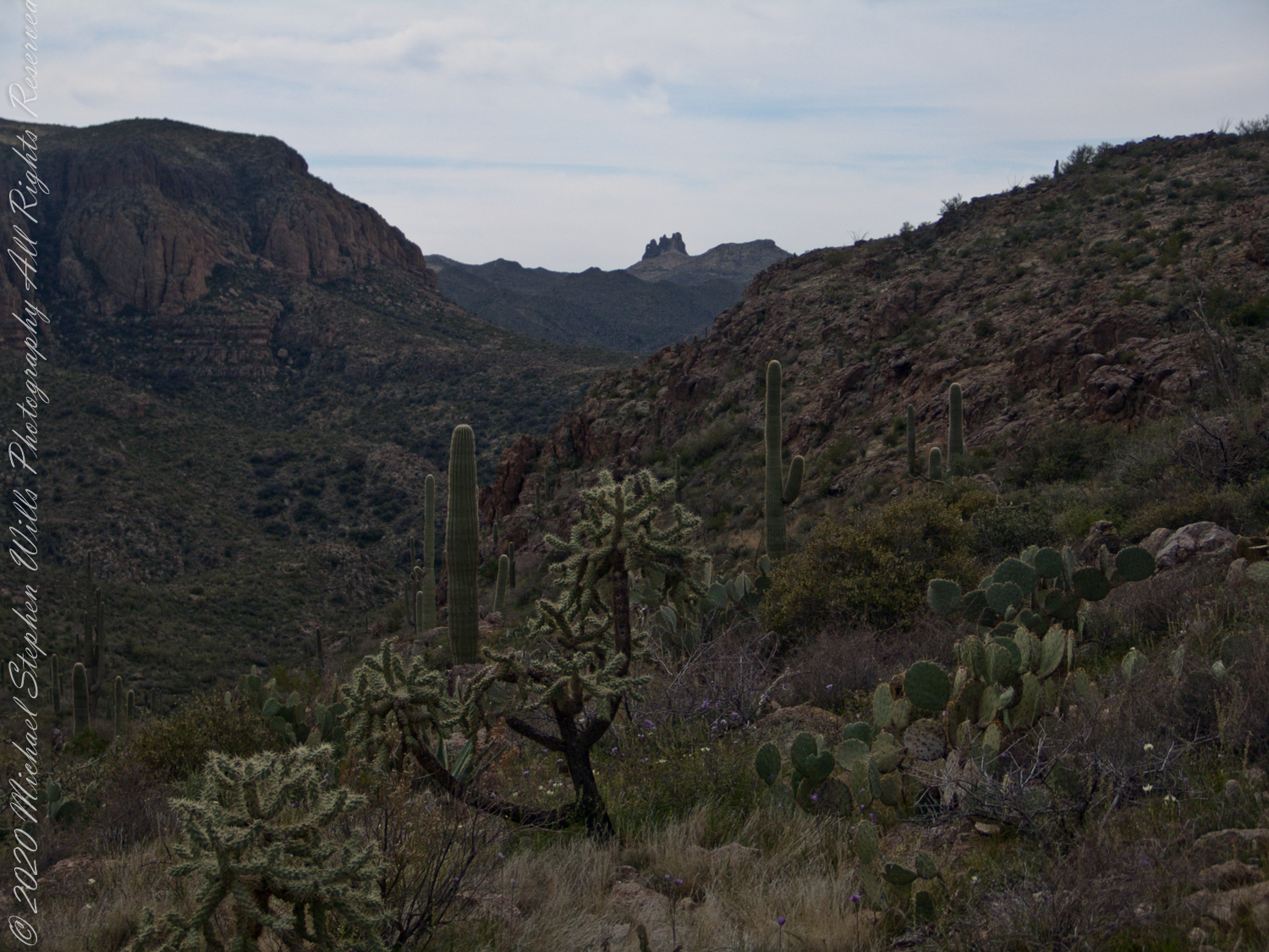
View North / Northwest from Peter’s Mesa. At our feet is a mature Saguaro Cactus towering over Charlebois Canyon, to the right Black Mountain. Bluff Spring Mountain, middle distance, then Black Top Mesa. Flatiron Peak, of the famed Superstition Mountain, is in distance. Photographed from Peter’s Trail on a March afternoon 2008. Superstition Wilderness, Tonto National Forest, Arizona
Bluff Spring Mountain, middle distance, then Black Top Mesa. Flatiron Peak, of the famed Superstition Mountain, is in distance. Photographed from Peter’s Trail on a March afternoon 2008. Superstition Wilderness, Tonto National Forest, Arizona
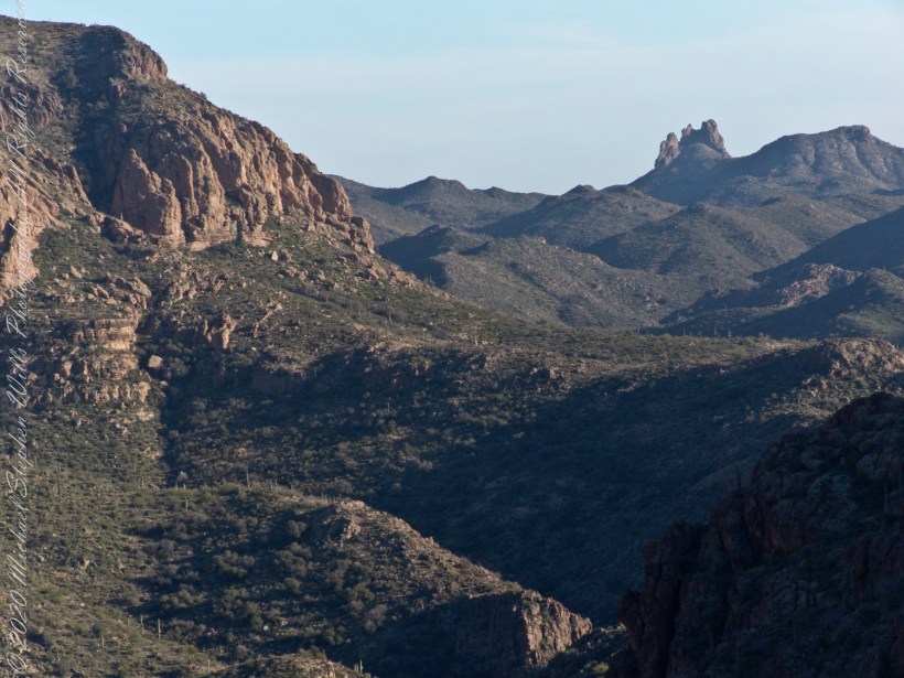
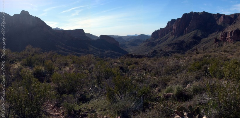
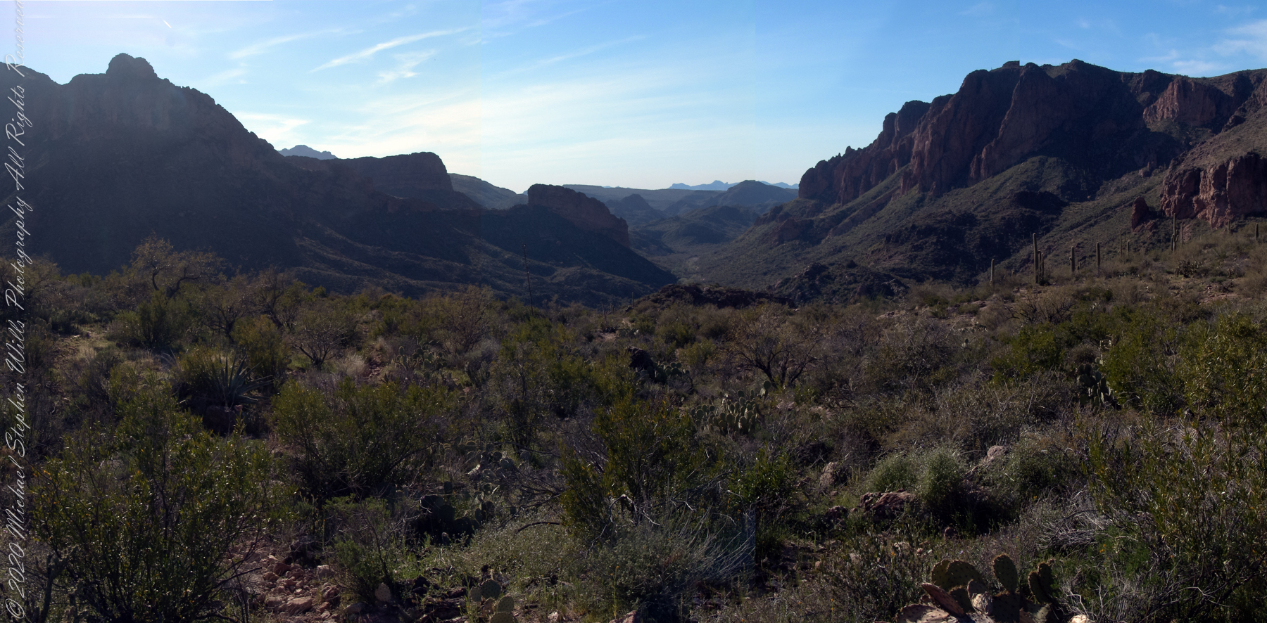
The eye of Miner’s Needle is clear in both these South / Southeast views from Peter’s Mesa looking across the Music Canyon.
Morning
Many wildflowers, sprinkled like stars through the foreground of the morning photograph with Prickly Pear, Cholla and Saguaro cactus. Beware of “Jumping Cholla”, named for its seeming ability to attack passers-by. Another name, “Hanging Chain Cholla”, is more appropriate. Each chain with many hooked barbs is lightly attached to the branch, ready to snag a ride from unwary hikers.
Light rakes across the landscape in the evening photograph, taken from another vantage point on Peter’s Mesa. Miner’s Needle is four (4) miles away “as the crow flies,” i.e., line of sight distance.
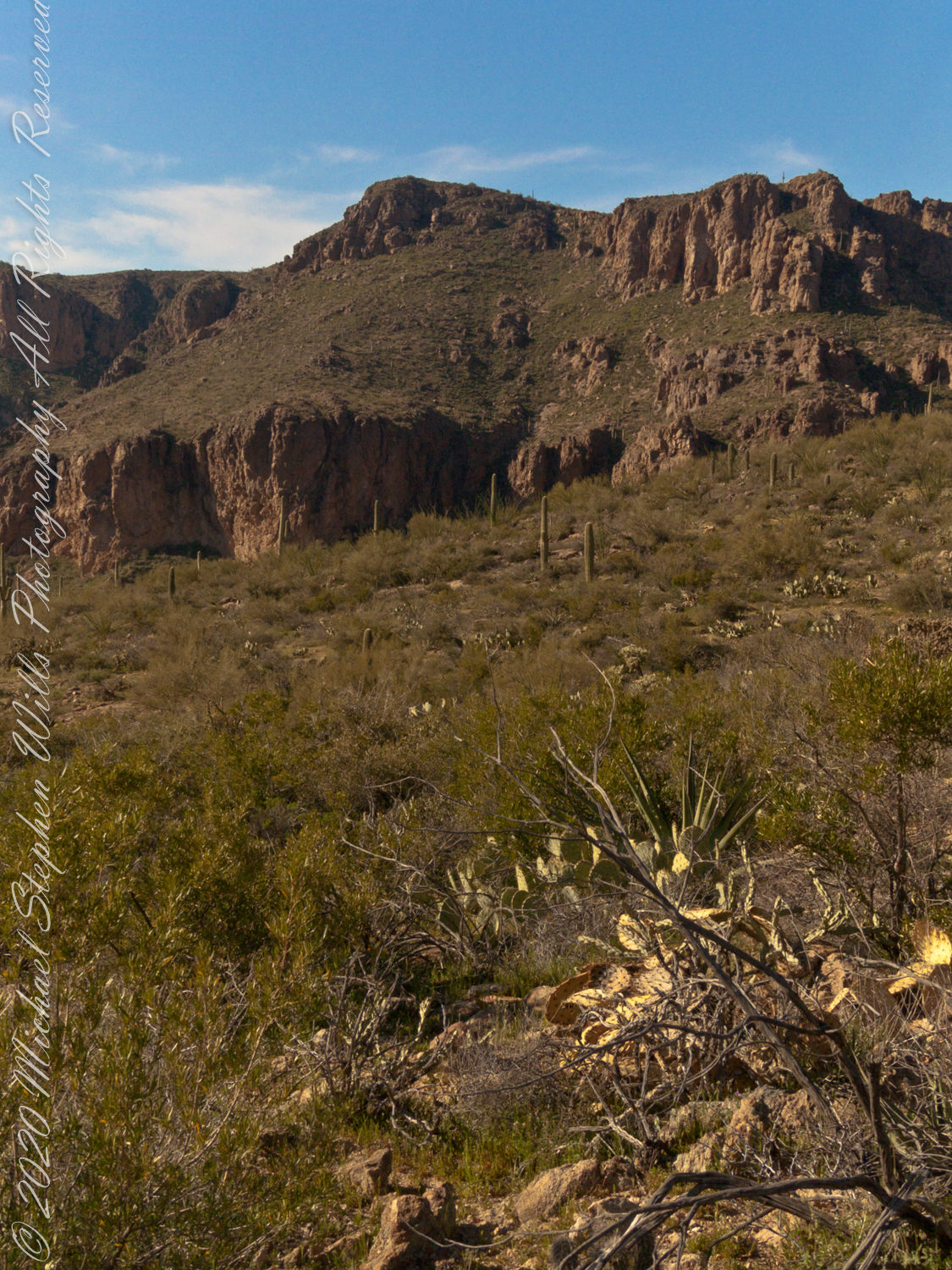
View North / Northwest from Peter’s Trail looking back the way we came. Black Mountain on right, Bluff Spring Mountain left with LaBarge Canyon running to the Red Hills center. On a March afternoon 2008.
Here we are climbing Peters Trail to the eponymous mesa and facing East to Music Mountain. Scattered in the brush are desiccated and live Prickly Pear cactus. Poles of young saguaro cactus like randomly placed telephone poles poke up around the lower slopes.
The first published record of Music Mountain is by Ray C. Howland of Mesa Arizona who sent a letter to “Everybody’s Magazine” that appeared in a feature called “Everybody’s Meeting Place: Where writers, readers and the editor gather for informal discussion,” May 1928, Volume 58, Issue 5, page 173. I reproduce Howland’s letter here with minor editing:
“I am in the deserts and mountains of Arizona most of the time. I go into town once each month for mail and provisions. I meet many things as I ramble around, many strange things, things that are beyond my ability to comprehend. One particular was in my mind as I read your printed thought in the back of Everybody’s. Far in the Superstition Mountains of Arizona, in the deepest, most rugged canyon, there are three caves halfway up a great yellow bluff. In these caves are mud dwellings. There are not the cliff-dwelling as found in other parts of Arizona.
The mud walls of these dwellings were made by people with very small hands. The handprints of these ancient masons remain as though they were made yesterday. Just below these caves a beautiful pool of crystal-clear water lies between grassy banks. Tall ghostlike sycamores grow there in great numbers.
I have camped many times beneath those sycamores. It is a beautiful spot. Such a difference between there and the hot desert that lies fifteen miles to the south.! As one lies there, just at twilight, begins the most wonderful music one could imagine. I have never heard music that could compare to it, vague, elusive at times, then again of greater volume. It is my opinion that no living being could record it.
The music is, I believe, beyond description. It seems to take you out of your moral self and transport you back ages and ages, almost to the beginning of things. For the time being one feels as though he were in another world.
I have often tried to solve this little private mystery. I can’t explain it. I can’t even describe it intelligently.
You will probably say as you read this that is is the wind among the pinnacles, caves, trees, etc. that make this wonder phenomenon. It cannot be, for usually there is no breeze in the mountains at twilight. It is still as a tomb except for that music. Besides when the breeze is blowing at any other hours of the day there is no sound.”
Here is a copy of that issue for you to see for yourselves.
In my photographs the bluffs described by Howland are seen clearly in the distance. During our expedition we were never able to visit the caves, though Dave described the location, caves, and dwellings. On Peter’s Mesa are remains of pits where Apaches and Yavapais gathered hearts of agave to roast. We visited a small cave in the side of Peter’s Mesa showing signs of high heat and possibly used for roasting agave.
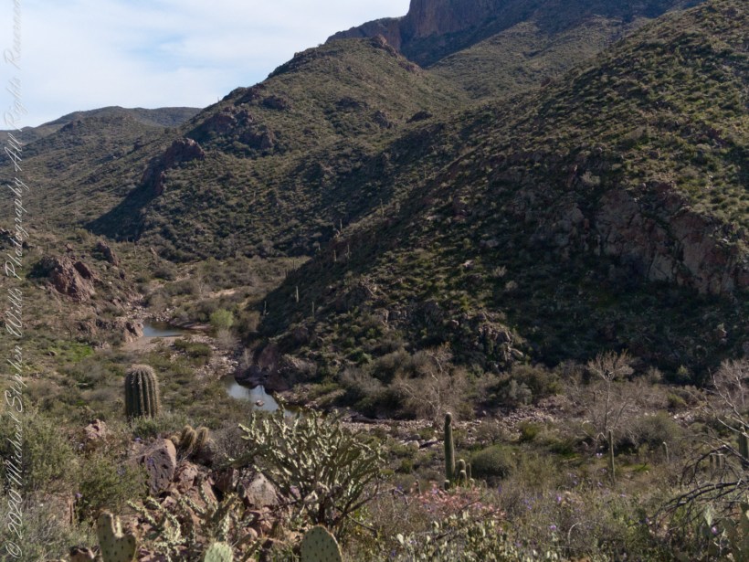
Dutchman Trail follows the outflow of two springs along the canyon floor: Music Canyon and LaBarge springs. Here we are climbing Peters Trail to the eponymous mesa and facing south / Southeast, looking down on Dutchman Trail.
This is rough country below Bluff Spring Mountain. Stag Horn Cholla cactus is lower right with Prickly Pear cactus scattered in the brush. Poles of young saguaro cactus are scattered around the lower slopes.