The canyon below 110 foot Reavis Falls is a wild place of transcendent beauty.
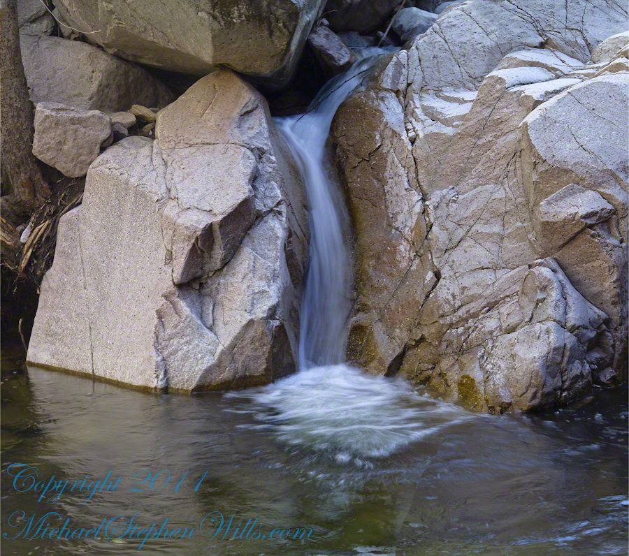
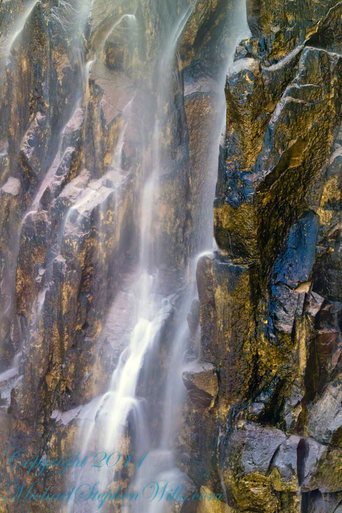
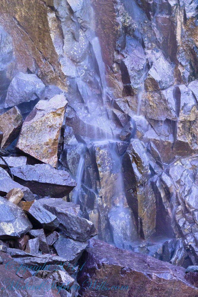
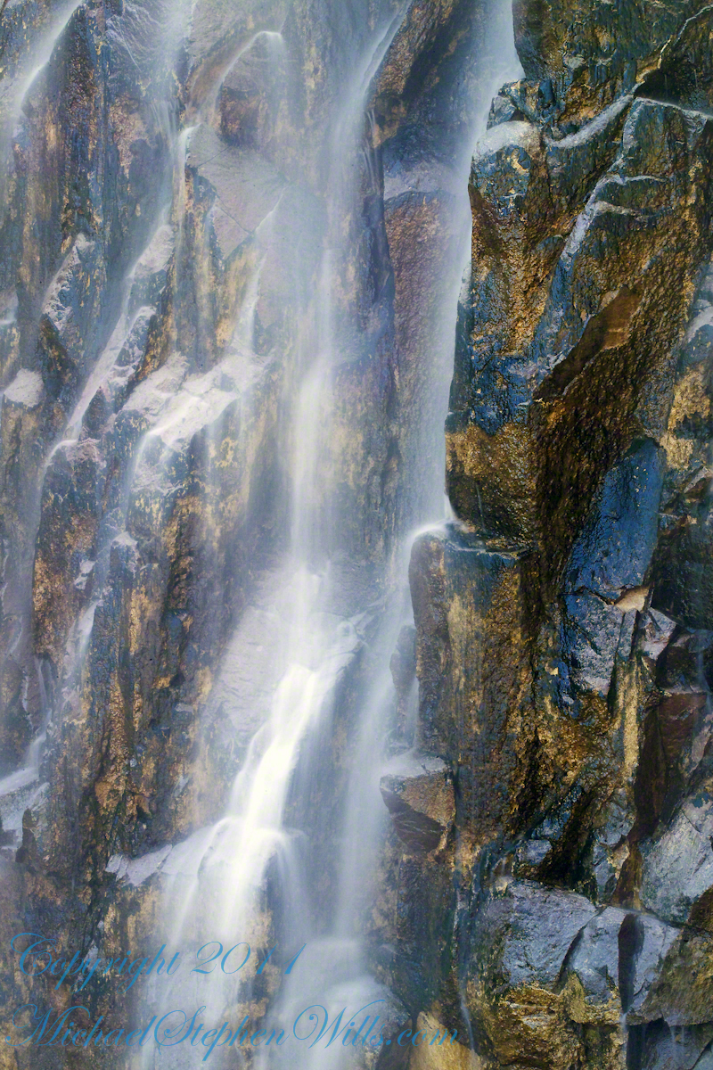
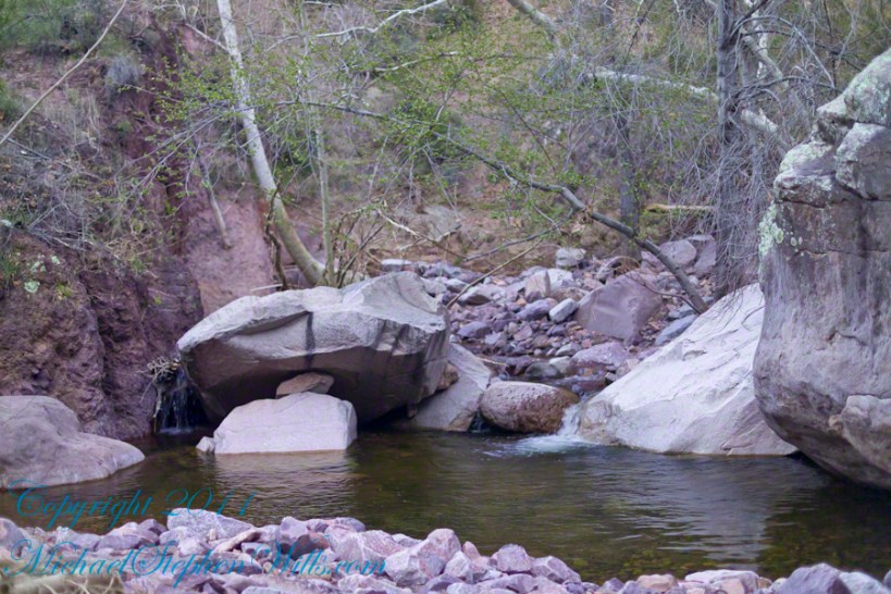
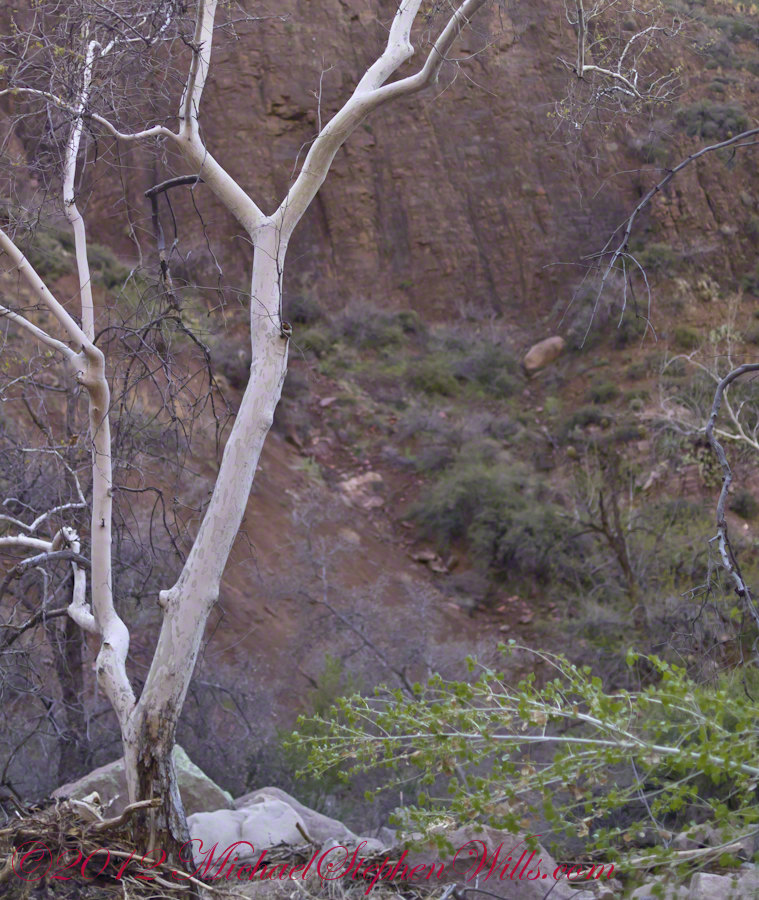
With the afternoon in front of me, the trip back to camp was a slow pleasure. On the way in, I noted several stopping points to capture photographs. Here a natural rock sluice offers a foot tall waterfall, mirroring Reavis Falls, bracketed by white igneous stone.
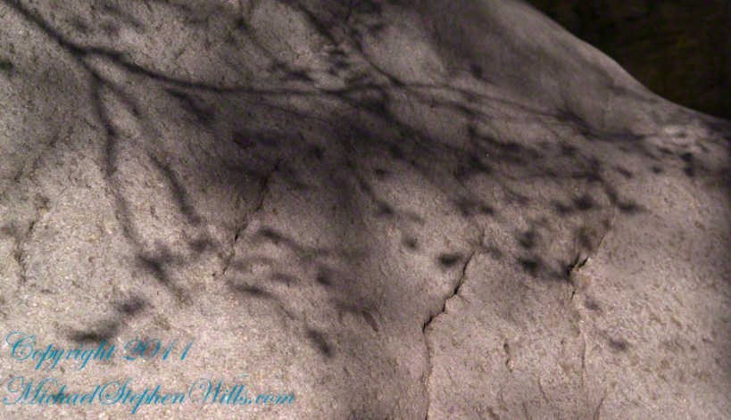
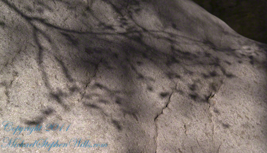
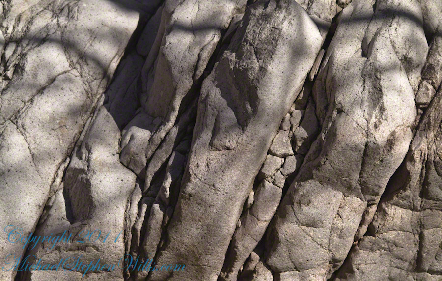
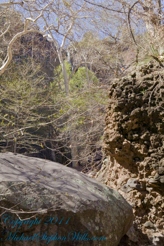
This same stone offers a screen, the bright spring sun throwing the sparse leaves into sharp relief.
Reaching Reavis Falls, once you find the canyon mouth, is three-fourths of a mile of boulder hopping and bushwacking over and around landslides, deep pools and fallen trees. Odds are you will be the only person in the canyon for weeks, if not months. Expect to be surprised. In this chapter you will (finally) visit the falls themselves.
A Camp in the Canyon
Click me for the chapter about the environment around the mouth of Reavis Canyon below the falls.
The Last Mile
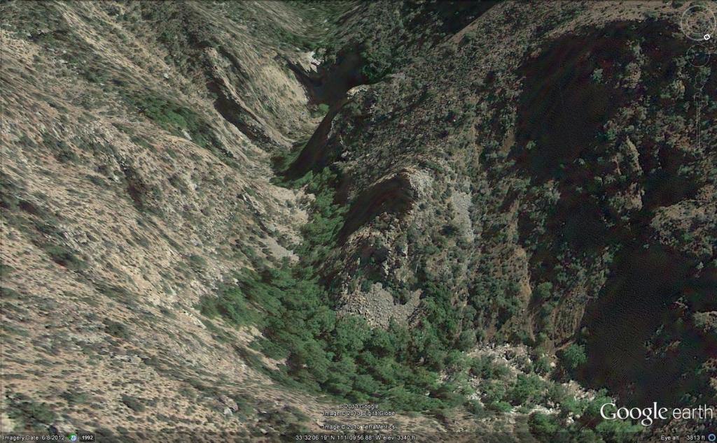
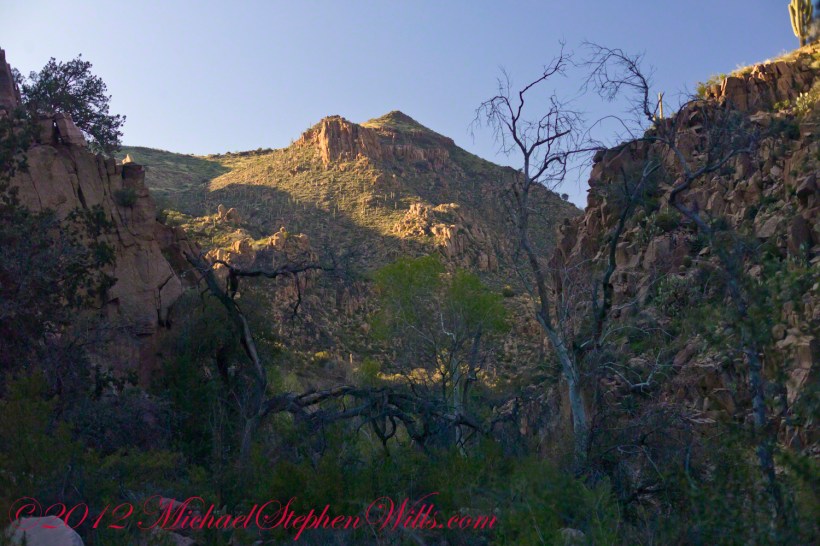
Here is an overview of the last third mile of Reavis Canyon. You can see the wall of the falls nestled in the folds of ridges towards the top, just off center.
On the lower right is a large landslide and, below there, it is complete chaos.
The vegetation grows shoulder to shoulder with interleaved branches. You will not get through there. The solution is to find a way around, usually over and around house-sized boulders.
The image was captured from Google Earth
After almost two hours of picking my way, there was a flicker of light. The fall waters were sparkling in the sunlight high above the cottonwood trees, in full Mach bloom, and the still leafless Arizona Sycamores.
This was my view of Reavis Falls from the canyon on a March day before the Arizona Sycamores have leaved. The falls are the tiny patch of white to the left of midline where the earth meets the sky. Jumbles of infallen boulders and thick growth of sycamores, oaks and fully leaved cottonwoods cloak the falls.
Another 30 minutes of canyoneering brought me to the foot of the falls.
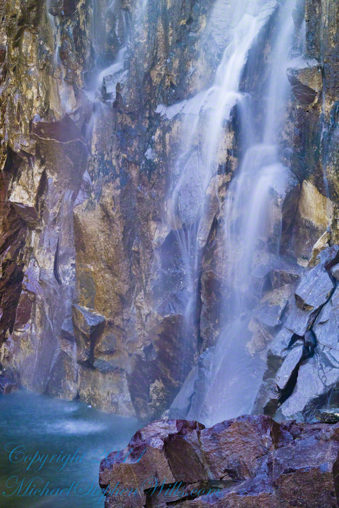
At the Foot of Reavis Falls
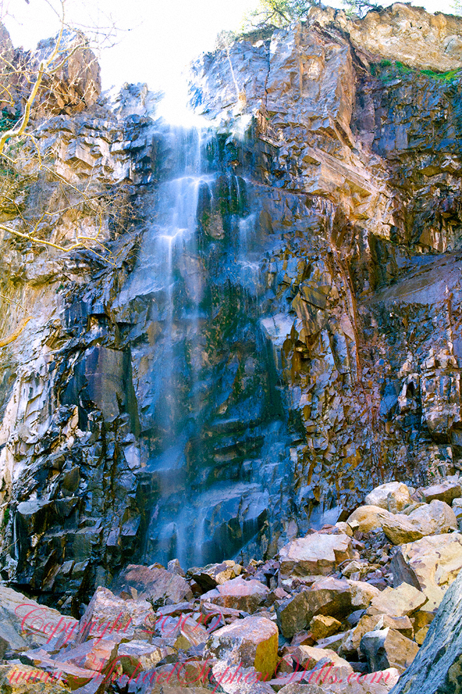
Looking up at Reavis Falls from a 20 foot tall mound of talus.
These are boulders washed down at flood time.
The rock wall is thick with microorganisms, fungi and mosses.
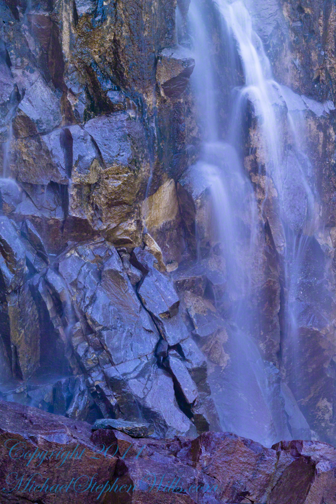
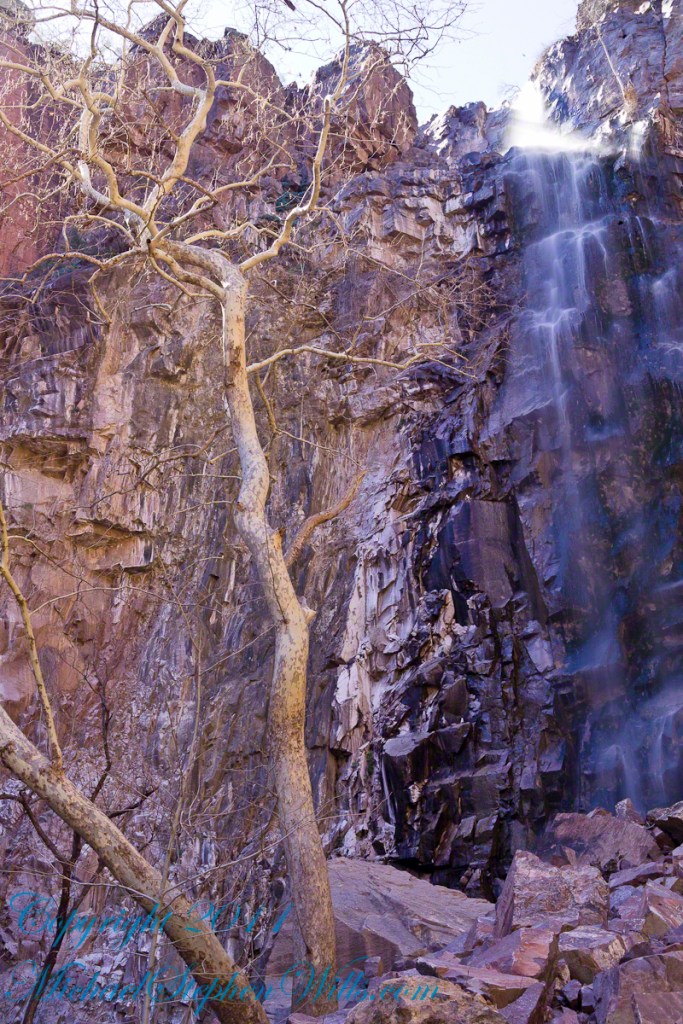
After clambering around the talus pile I found this angle….
An Arizona Sycamore, before the spring leafing, at the Foot of Reavis Falls
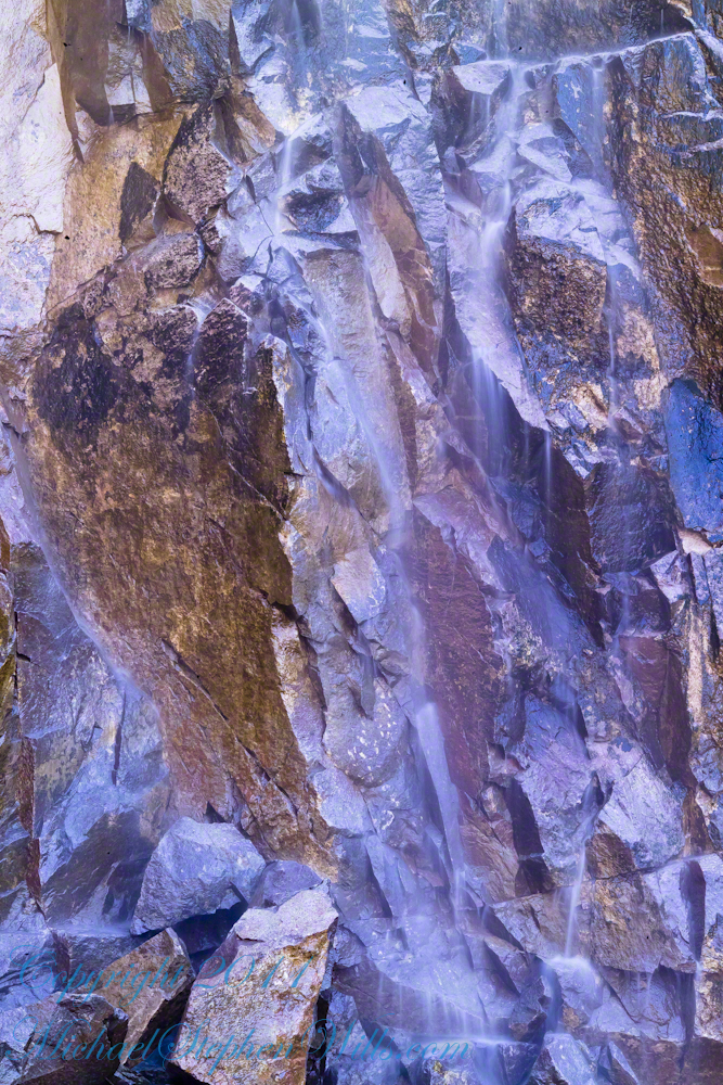
Talus at the Foot of Reavis Falls
The Reavis Falls talus is large boulders carried down Reavis Creek and washed over the falls at flood time as well as blocks fractured from the cliff face. You can see the base of the Sycamore from the previous photograph.
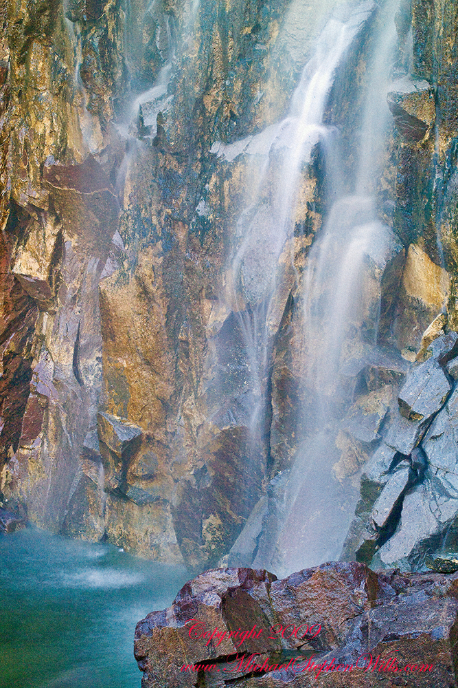
The falls are formed where Reavis Creek flows over a solid mass of rock. The talus is composed mostly of this red rock. From the edge of this cliff to the base, where the falls hit the canyon floor, is all of 140 feet. This is a far as you can proceed into the canyon without some serious climbing skills.
It is possible to climb around the canyon by climbing up the ridge from which I captured the Cedar Basin Hoodoos. See my posts below for this location (you need to work it our for yourself).
This is NOT the last post of the series. From here I will focus on the beauty of Reavis Falls and the canyon that holds them.
It was a four-day expedition so there are a few chapters covering the approach to the Falls:
The Superstition Wilderness was born from volcanic eruption and in some places (Peters Mesa) the earth still rumbles.
Here in Reavis Canyon it is the huge spring runoff that builds the environment, grinding and scouring the canyon. In my chapter The Mouth of Reavis Canyon is the story of this aspect of the canyon.
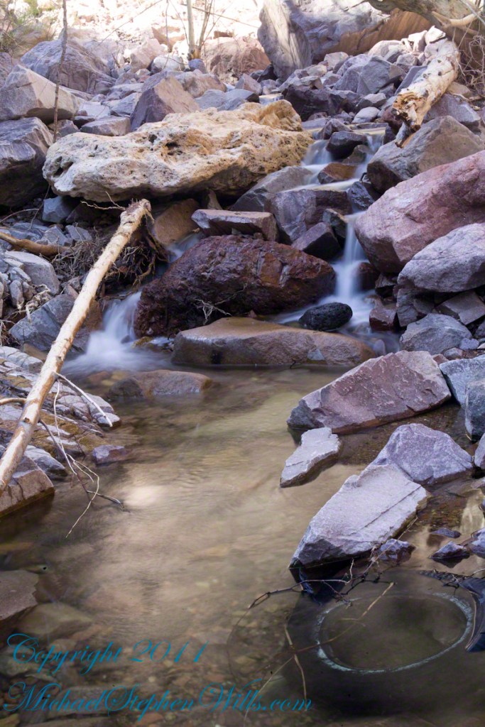
The history of this spot is written on these volcanic and igneous rocks and boulders, the uprooted tree roots and fresh water.
The tire must have washed down from Reavis Ranch.
A Canyon of Wonder and Beauty
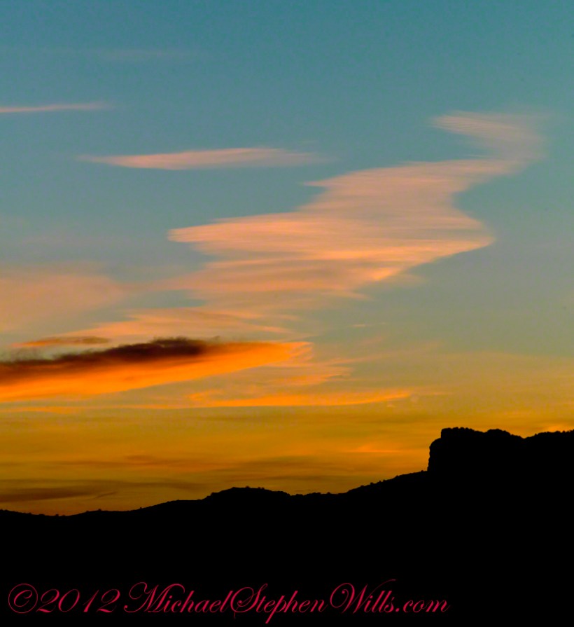
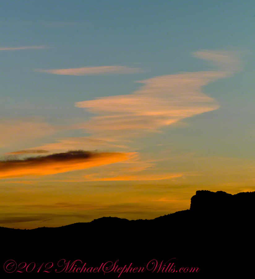
In this chapter I present, in the header, the lovely dawn sky of that day, and a tiny corner of a rock jumble in Reavis Creek. There is a large format version of the sky in my previous post, “The Mouth of Reavis Canyon.”
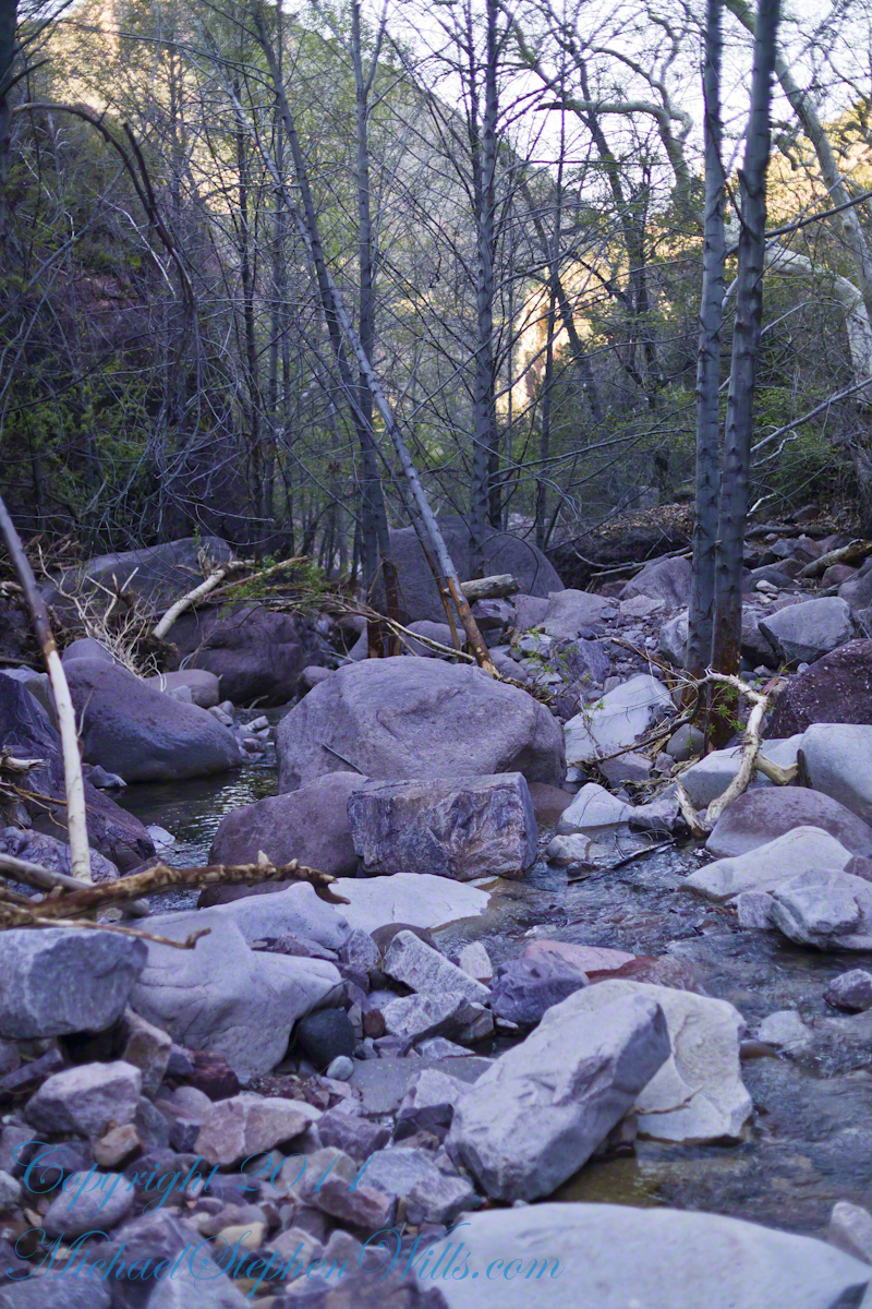
Rivulets and Rocks
Copyright 2023 Michael Stephen Wills All Rights Reserved
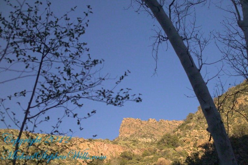
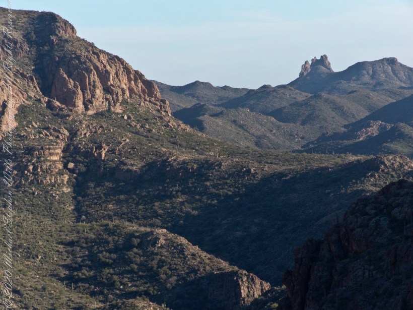
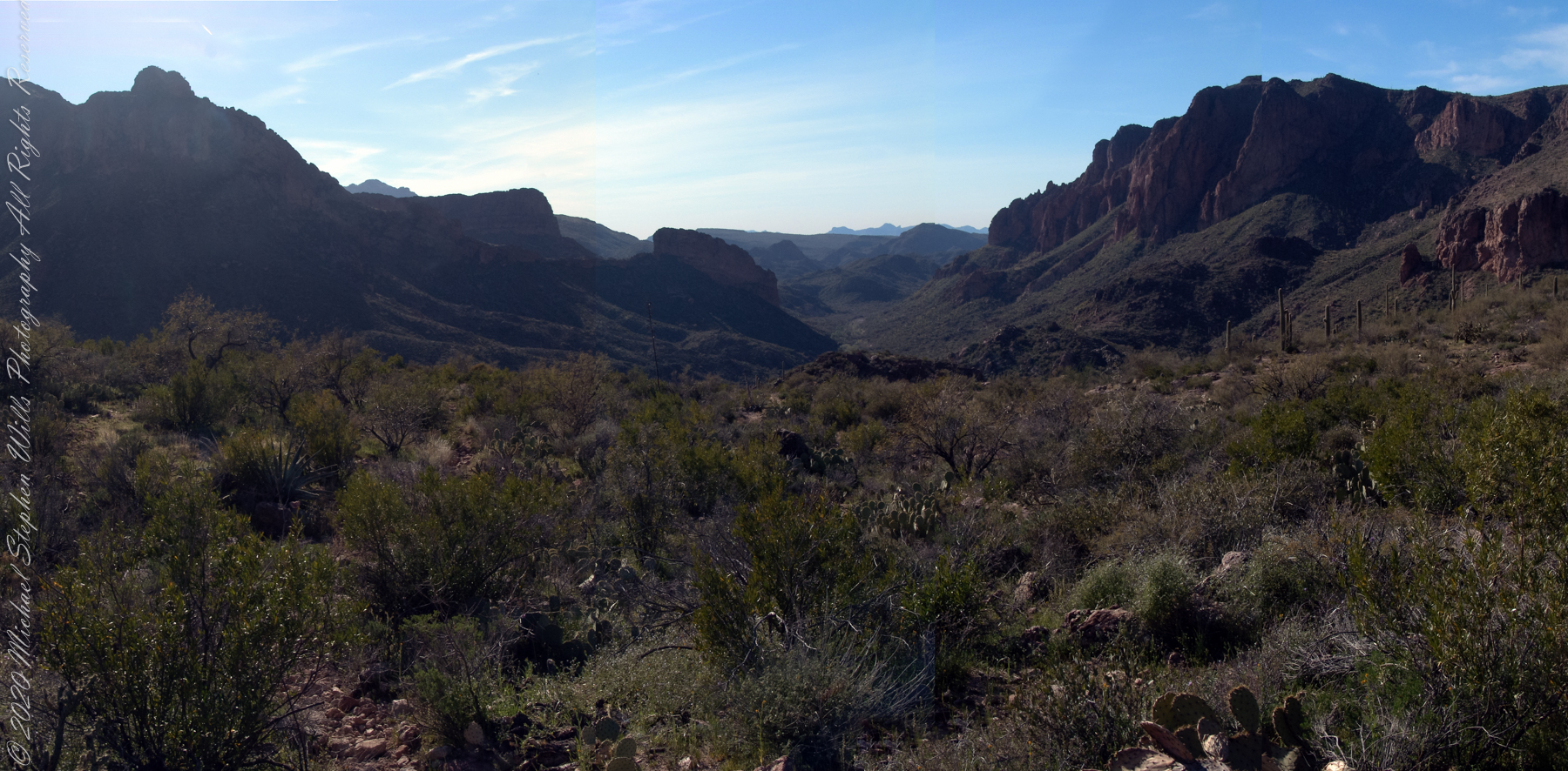
Here is the same view, in daylight. As I hiked toward the canyon mouth below Reavis Falls, looking up I saw this prominant cliff against the sky.
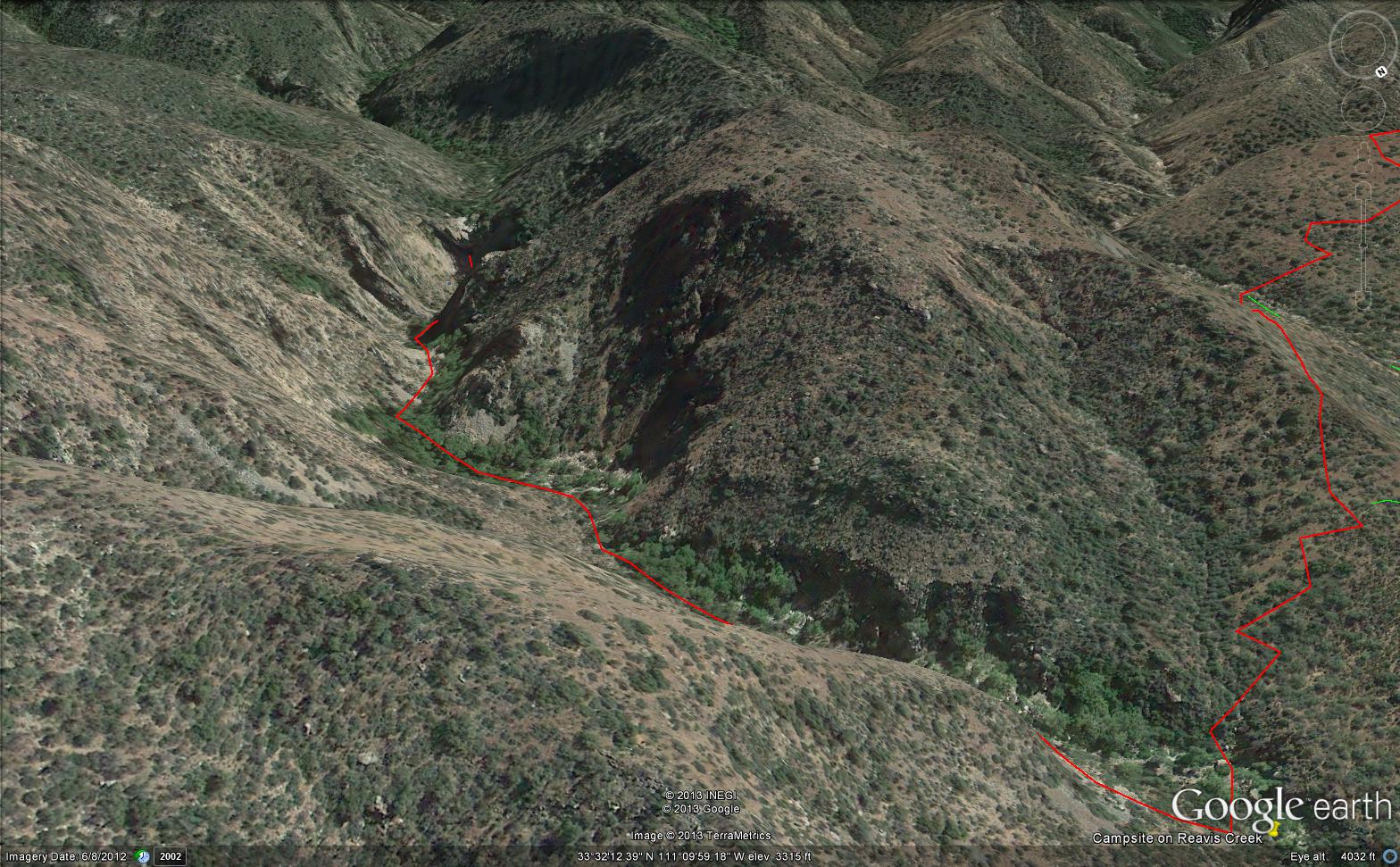
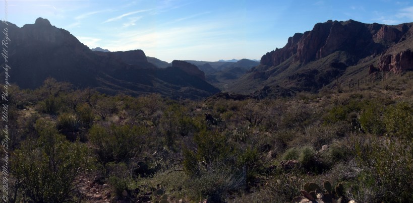
Here is the path I took toward the falls. The campsite is to the lower right, the falls are toward the center and left. My approach to the camp is on the right, moving toward the top. For another view of this location see Reavis Canyon Camp.
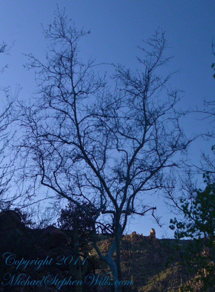
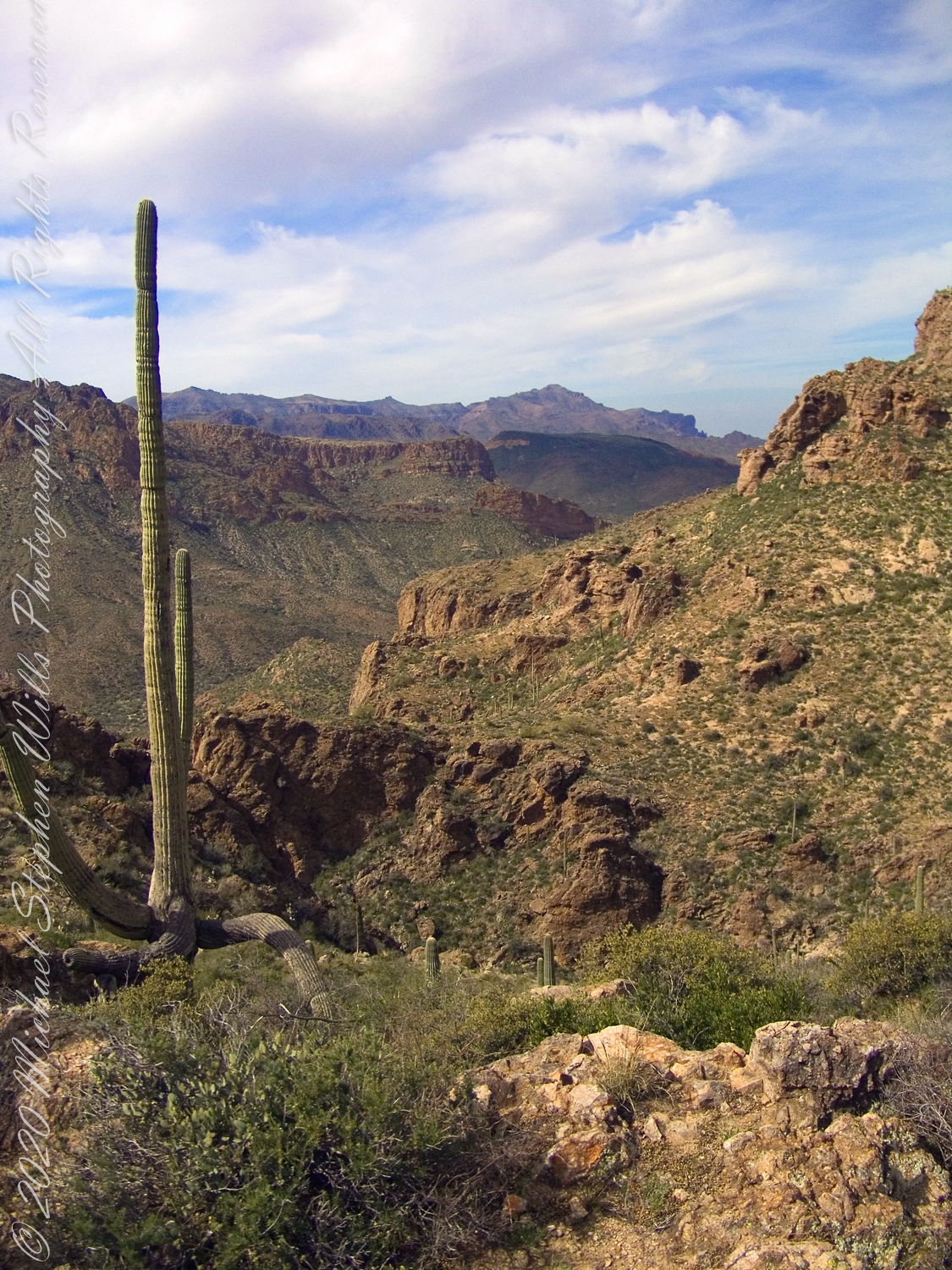
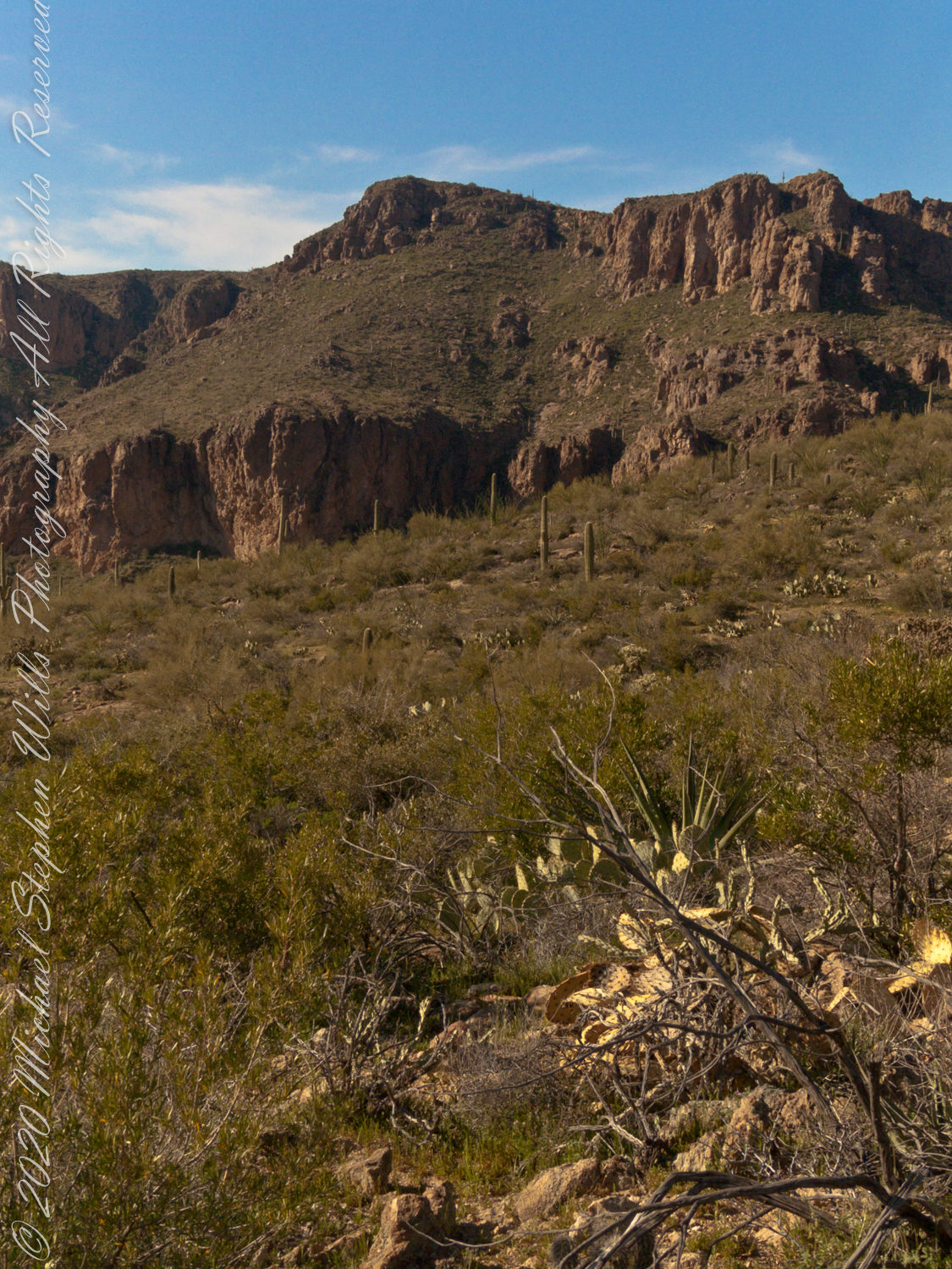
The mouth of Reavis Canyon below the falls is choked with vegetation and infallen rocks and boulders. The far slopes are thick with the poles of young saguaros. There are hoodoos, as well. In the photograph, below, one hoodoo is catching morning light. See the chapters Hoodoos on the Descent to Reavis Falls and Cedar Basin Hoodoos for more views of the hoodoos around Reavis Falls.
Hoodoos visible from the mouth of Reavis Canyon below the falls. Look toward the far slope.
Flood damage in Reavis Canyon below the falls. Note the scouring at the base of these trees and the broken limbs. This is NOT a place to be in spring thaw.
Massive spring flooding scours the canyon floor.
Flood damage in Reavis Canyon below the falls.
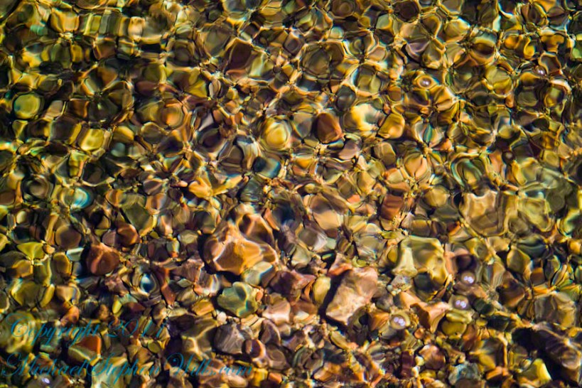
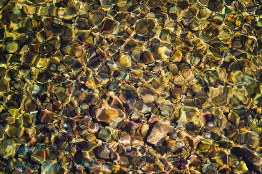
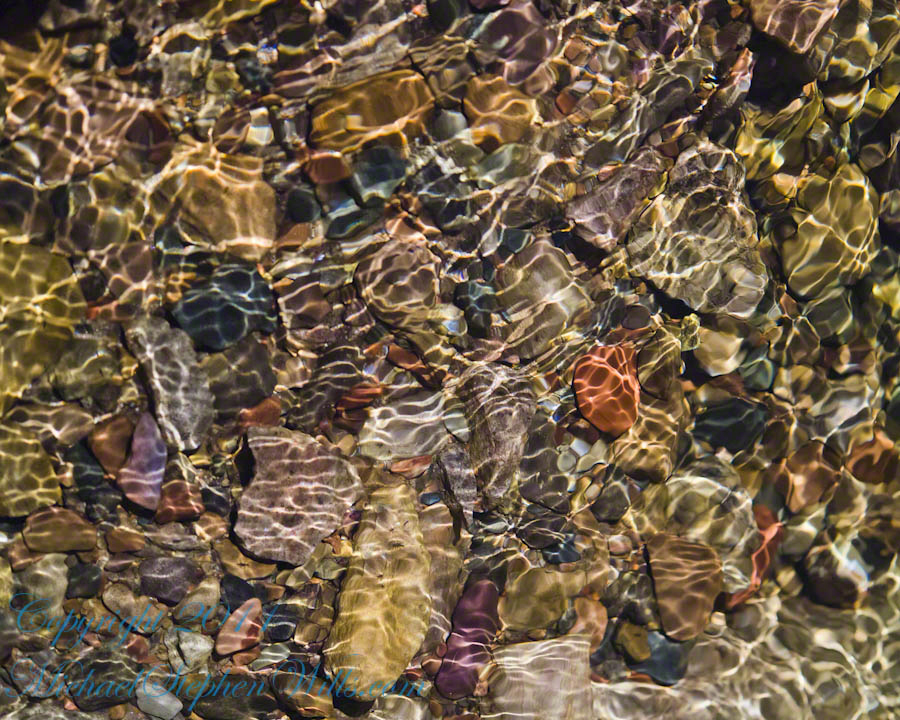
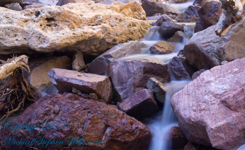
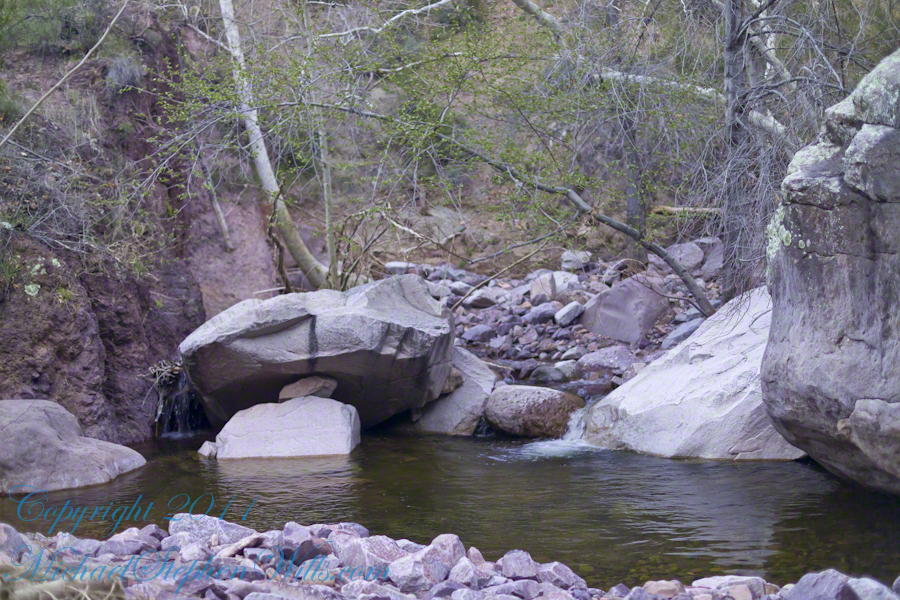
There is beauty to be found, as well. Freshly fallen rough rocks contrast with water smoothed boulders and the water surface.
Copyright 2023 Michael Stephen Wills All Rights Reserved
View North / Northwest from Peter’s Mesa. At our feet is a mature Saguaro Cactus towering over Charlebois Canyon, to the right Black Mountain. Bluff Spring Mountain, middle distance, then Black Top Mesa. Flatiron Peak, of the famed Superstition Mountain, is in distance. Photographed from Peter’s Trail on a March afternoon 2008. Superstition Wilderness, Tonto National Forest, Arizona
Bluff Spring Mountain, middle distance, then Black Top Mesa. Flatiron Peak, of the famed Superstition Mountain, is in distance. Photographed from Peter’s Trail on a March afternoon 2008. Superstition Wilderness, Tonto National Forest, Arizona
The eye of Miner’s Needle is clear in both these South / Southeast views from Peter’s Mesa looking across the Music Canyon.
Morning
Many wildflowers, sprinkled like stars through the foreground of the morning photograph with Prickly Pear, Cholla and Saguaro cactus. Beware of “Jumping Cholla”, named for its seeming ability to attack passers-by. Another name, “Hanging Chain Cholla”, is more appropriate. Each chain with many hooked barbs is lightly attached to the branch, ready to snag a ride from unwary hikers.
Light rakes across the landscape in the evening photograph, taken from another vantage point on Peter’s Mesa. Miner’s Needle is four (4) miles away “as the crow flies,” i.e., line of sight distance.
View North / Northwest from Peter’s Trail looking back the way we came. Black Mountain on right, Bluff Spring Mountain left with LaBarge Canyon running to the Red Hills center. On a March afternoon 2008.
Here we are climbing Peters Trail to the eponymous mesa and facing East to Music Mountain. Scattered in the brush are desiccated and live Prickly Pear cactus. Poles of young saguaro cactus like randomly placed telephone poles poke up around the lower slopes.
The first published record of Music Mountain is by Ray C. Howland of Mesa Arizona who sent a letter to “Everybody’s Magazine” that appeared in a feature called “Everybody’s Meeting Place: Where writers, readers and the editor gather for informal discussion,” May 1928, Volume 58, Issue 5, page 173. I reproduce Howland’s letter here with minor editing:
“I am in the deserts and mountains of Arizona most of the time. I go into town once each month for mail and provisions. I meet many things as I ramble around, many strange things, things that are beyond my ability to comprehend. One particular was in my mind as I read your printed thought in the back of Everybody’s. Far in the Superstition Mountains of Arizona, in the deepest, most rugged canyon, there are three caves halfway up a great yellow bluff. In these caves are mud dwellings. There are not the cliff-dwelling as found in other parts of Arizona.
The mud walls of these dwellings were made by people with very small hands. The handprints of these ancient masons remain as though they were made yesterday. Just below these caves a beautiful pool of crystal-clear water lies between grassy banks. Tall ghostlike sycamores grow there in great numbers.
I have camped many times beneath those sycamores. It is a beautiful spot. Such a difference between there and the hot desert that lies fifteen miles to the south.! As one lies there, just at twilight, begins the most wonderful music one could imagine. I have never heard music that could compare to it, vague, elusive at times, then again of greater volume. It is my opinion that no living being could record it.
The music is, I believe, beyond description. It seems to take you out of your moral self and transport you back ages and ages, almost to the beginning of things. For the time being one feels as though he were in another world.
I have often tried to solve this little private mystery. I can’t explain it. I can’t even describe it intelligently.
You will probably say as you read this that is is the wind among the pinnacles, caves, trees, etc. that make this wonder phenomenon. It cannot be, for usually there is no breeze in the mountains at twilight. It is still as a tomb except for that music. Besides when the breeze is blowing at any other hours of the day there is no sound.”
Here is a copy of that issue for you to see for yourselves.
In my photographs the bluffs described by Howland are seen clearly in the distance. During our expedition we were never able to visit the caves, though Dave described the location, caves, and dwellings. On Peter’s Mesa are remains of pits where Apaches and Yavapais gathered hearts of agave to roast. We visited a small cave in the side of Peter’s Mesa showing signs of high heat and possibly used for roasting agave.