My photographic style centers on the use of natural light to visualize emotion and evoke memory. The evolution of my style began early in the year 2002, with an imperative to capture personal and fleeting memories.
My son and I traveled to New York City, to view the first Saint Patrick's Day parade after September 11, 2001. My work from that parade was so successful and satisfying (see "New York Fire Department, Saint Patrick's Day 2002") I just never stopped.
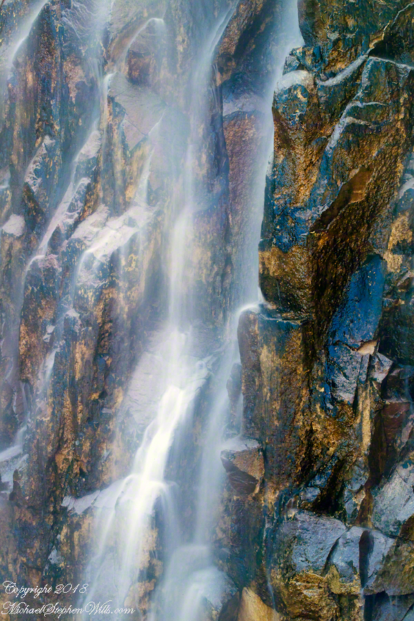
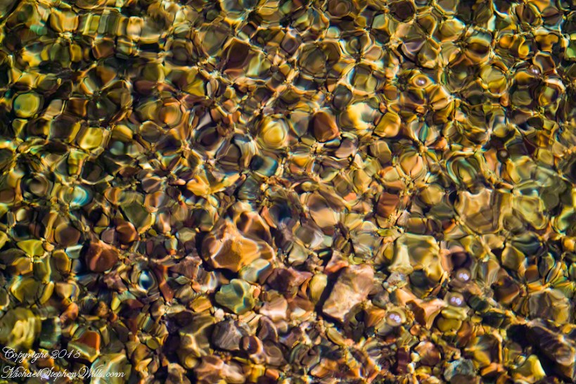
Two Nature Abstracts, macros of Reavis Creek below the falls
The light of a early spring desert afternoon on a broad rock shelves along the creek.
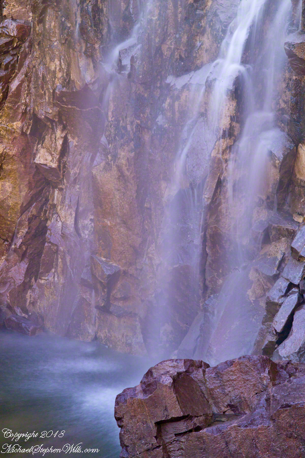
I spent a day hiking in, two days hiking out and a day of canyoneering to the foot of Reavis Falls. The featured (i.e. “header”) photograph is a view of the inner canyon, the raw material for these abstracts.
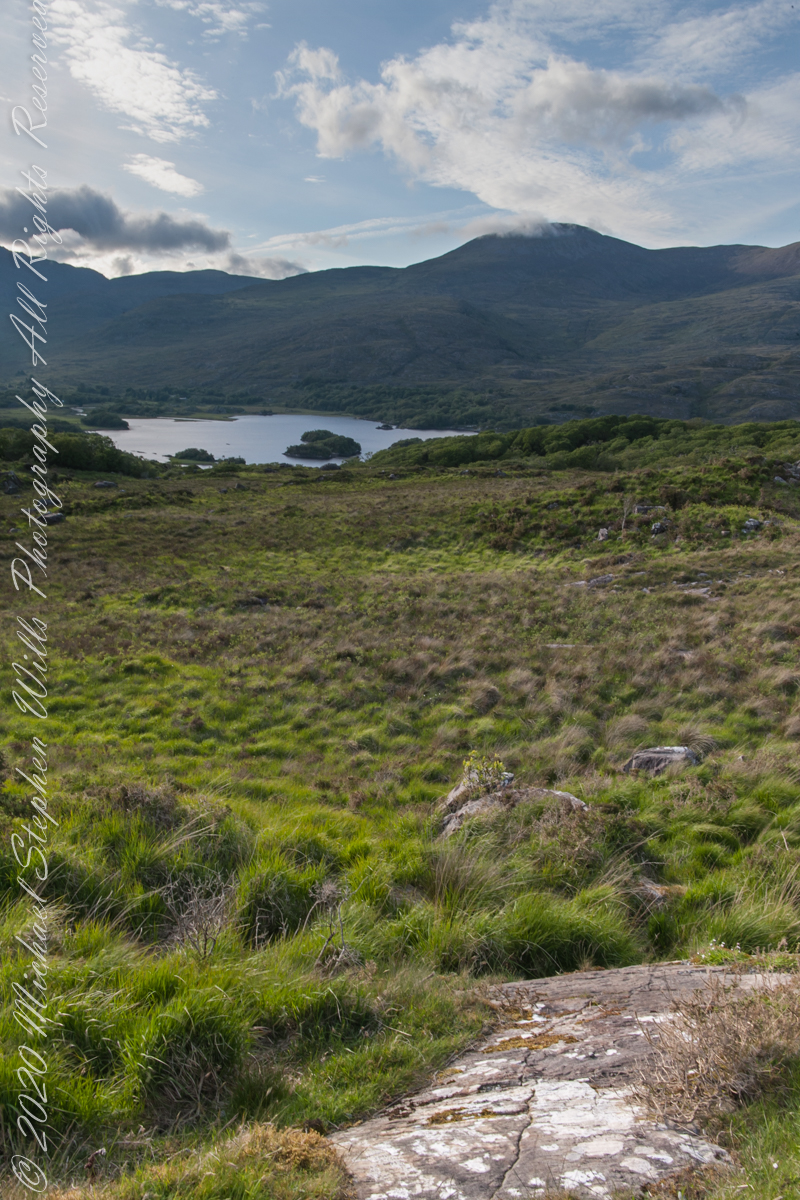
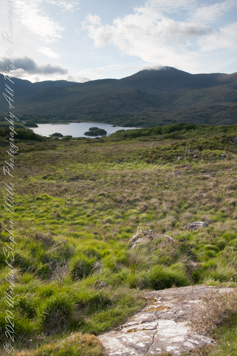
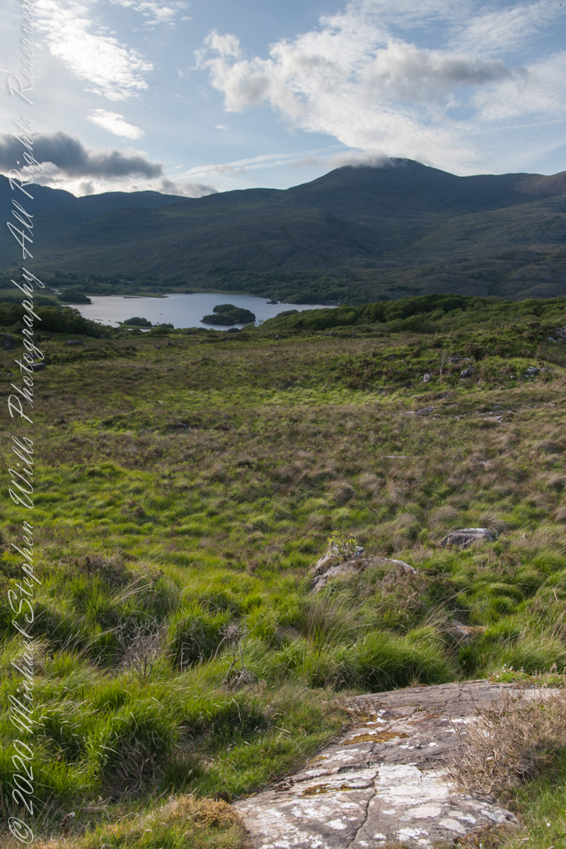
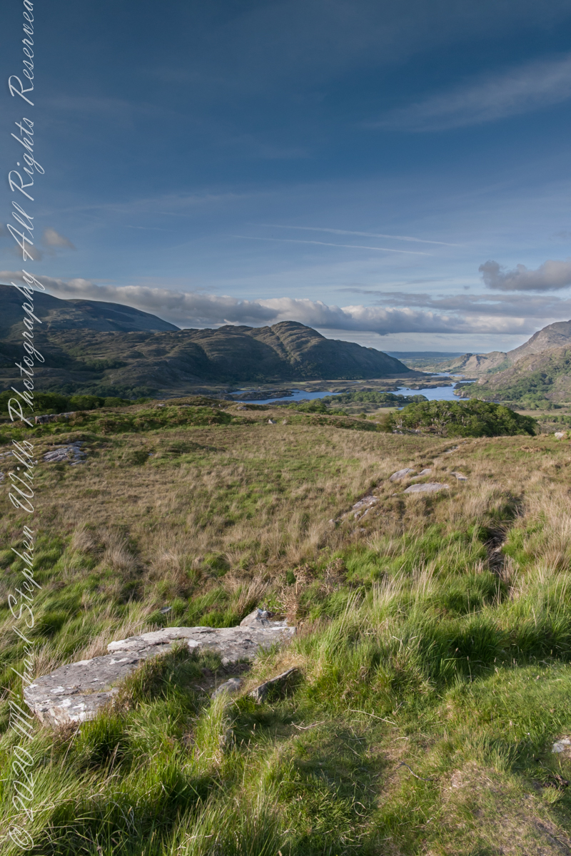
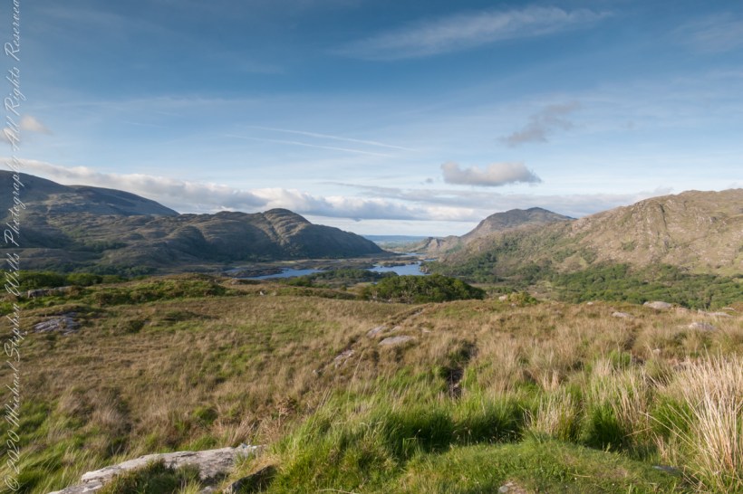
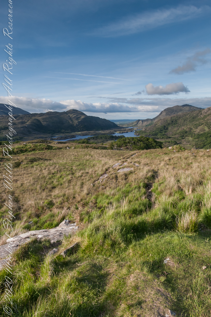
Here we are, on the road from Kenmare to Killarney, N71, part of the Ring of Kerry around the Iveragh Peninsula. The view was celebrated by Queen Victoria’s Ladies-in-Waiting during an 1861 tour of Ireland. Today’s view is different, the others were facing northeast toward Muckross Lake. Here the view faces north, with Upper Lake of Killarney in view. Owengarriff River connects the lakes.
Here is present three versions of the same file with various handling of atmospherics.
Click pic for larger view in a new browser tab. If you are in WordPress Reader, open the post to use this feature.
Version 1
version 1
Version 2Version 2
Version 3Version 3
Version 1Version 2Version 3Side by Side Comparison
Copyright 2021 Michael Stephen Wills All Rights Reserved
I received notice of IStock acceptance of select photographs from my last posting, “Wilderness Textures”, was accepted. Click to view my IStock Portfolio, including photographs from today’s posting included in the acceptance notice.
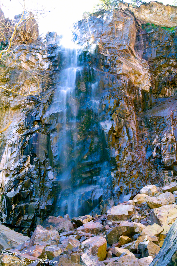
In this post I move up the Reavis Creek canyon from where the last posting, “Wilderness Textures”, was sited to the foot of Reavis Falls. With the first photograph you look up at the falls from the head of the canyon carved by the creek over eons. The rock wall, the canyon “head”, is thick with microorganisms, fungi, mosses.
Click Any Photograph for my Fine Art Gallery
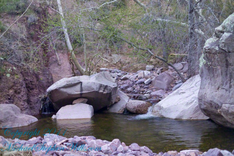
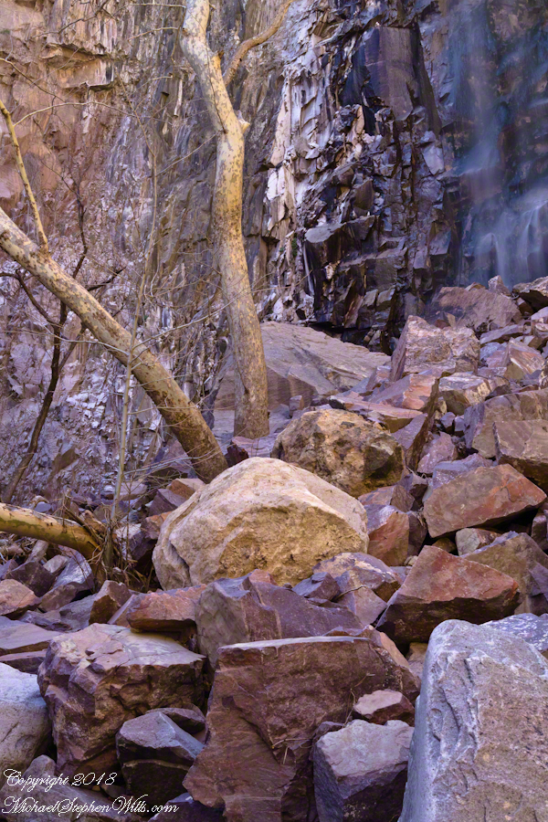
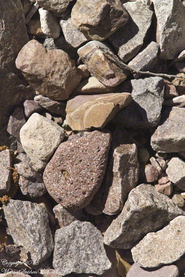
In the foreground is a jumble of boulders, some washed down at flood time, spread wide at the bottom of the falls, piled to a jumbled height of 15 feet.
Talus is the geological term for this formation. Derived from the Latin word for slope (talutum) the definition, from the Oxford English Dictionary, is “A sloping mass of detritus lying at the base of a cliff or the like consisting of material fallen from its face.”
Click Any Photograph for my Fine Art Gallery
The ankle bone is also called talus, from the French word for heel, I bring it up because climbing this chaotic, unstable jumble is a way to break your ankle. The route to Reavis Falls, a climb up one side of Lime Mountain then down the other on a non-existent (lightly marked) trail, is rated difficult and impossible with a broken leg or ankle. I was alone and very careful to check each rock for stability before putting my weight on it.
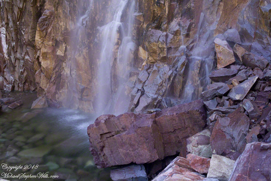
A climb of the talus pile was necessary to view the pool at the waterfall base, for this photograph.
Click Any Photograph for my Fine Art Gallery
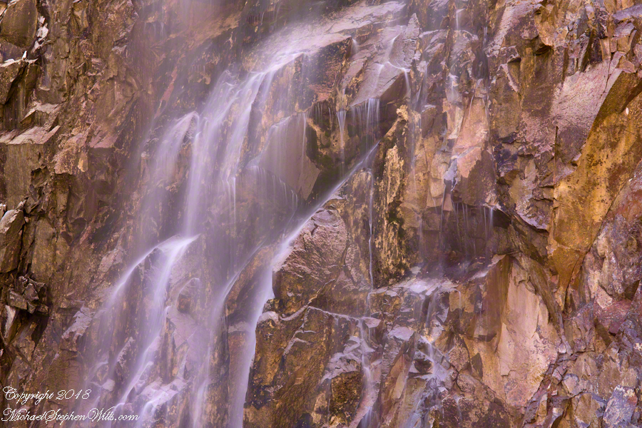
A more artistic vertical format version, below, captured with the Canon EF 100mm “macro” lens. All shots are using the Kodak DCS pro SLR-c (the “c” designated Canon lens compatibility) and a Manfrotto studio tripod with a hydrostatic ball head. The horizontal format shot was captured with a Canon EF 50mm f/1.4 USM lens. I prefer the vertical version, artistically, because the talus jumble is all but cropped out while the upper corner of the angular basalt boulder is left as an interesting focal point. The boulder, not being in the spray, is in focus to contrast with the basalt wall behind the water.
Click Any Photograph for my Fine Art Gallery
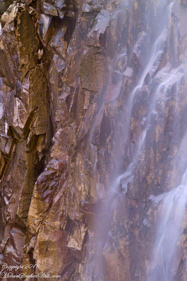
I captured a series of shots from this precarious vantage point, working up from the pool to the brim of the waterfall.
Click Any Photograph for my Fine Art Gallery
My goals was a composite photo of the falls. I have yet to succeed with this project. Maybe I will give it one more shot in spite of having learned the hard lesson the best photographs are a single moment captured in a single frame.
Click Any Photograph for my Fine Art Gallery
I find in this series the vertical aspect is more artistic. The water volume, of the falls, at this time of year offers only the finest of sprays with most of the basalt rock wall only moist. The 100mm “macro” lens allowed me to include only the falling water with a bit of the moist wall for contrast.
In the following version I experimented with color, moving from the narrow range of hues, to more contrast.
Here we are, on the road from Kenmare to Killarney, N71, part of the Ring of Kerry around the Iveragh Peninsula. The view was celebrated by Queen Victoria’s Ladies-in-Waiting during an 1861 tour of Ireland
Click pic for larger view in a new browser tab. If you are in WordPress Reader, open the post to use this feature.
Ladies View, Killarney National Park, Derrycunihy Townland, County Kerry, Republic of Ireland.
Copyright 2021 Michael Stephen Wills All Rights Reserved
These abstracts are some of my photographic output from four days and nights spent alone in the remote eastern Superstition Wilderness. For the first three days I met not a soul, all these images were captured on a single afternoon spent in the canyon below Reavis Falls, a jumble of landslides, flood debris and boulders. There is no trail. The few people who enter the canyon must negotiate around boulders, crossing Reavis Creek many times.
Click Any Photograph for my Fine Art Gallery
My backpack kit included a full sized Manfrotto studio tripod with hydrostatic ball head. The benefits more than outweighed the effort (I was a lot younger in 2008) when the Canon EF 100mm (macro) lens is mounted on a Kodak dSLR body, allowing me to take crisp shots. The tripod legs can be adjusted to precise positions for stability.
I can feel the bright afternoon desert spring sunshine in this photos. It was after the spring floods, the flow of Reavis Creek and ample still but slow. Gathering in pools over the rough stones of the creek bed, the water absolutely clear.
I held the shot over many minutes, capturing ever changing diffraction patterns.
We see in all these photos, not a homogenous blend of stones from a shared geology. Reavis Creek washes over diverse geologies: volcanic, ancient igneous extrusions, sedimentary and metamorphic are jumbled together.
Click Any Photograph for my Fine Art Gallery
This is a series of photographs of smooth, white igneous boulders with shadows of still leafless sycamore and cottonwood trees.
Graceful shadows
Strong, demonstrative shadows.
Click Any Photograph for my Fine Art Gallery
A leaning cairn, not a trail marker….
A 15 foot high jumble of stones piled at the bottom of Reavis Falls, carried over by the floods.
Here we are, on the road from Kenmare to Killarney, N71, part of the Ring of Kerry around the Iveragh Peninsula. The view was celebrated by Queen Victoria’s Ladies-in-Waiting during an 1861 tour of Ireland. Here we see Muckross Lake and the Owengarriff River connecting the lakes.
Click pic for larger view in a new browser tab. If you are in WordPress Reader, open the post to use this feature.
Ladies View, Killarney National Park, Derrycunihy Townland, County Kerry, Republic of Ireland.
Copyright 2021 Michael Stephen Wills All Rights Reserved
Here we are, on the road from Kenmare to Killarney, N71, part of the Ring of Kerry around the Iveragh Peninsula. The view was celebrated by Queen Victoria’s Ladies-in-Waiting during an 1861 tour of Ireland
Click pic for larger view in a new browser tab. If you are in WordPress Reader, open the post to use this feature.
Ladies View, Killarney National Park, Derrycunihy Townland, County Kerry, Republic of Ireland.
Copyright 2021 Michael Stephen Wills All Rights Reserved
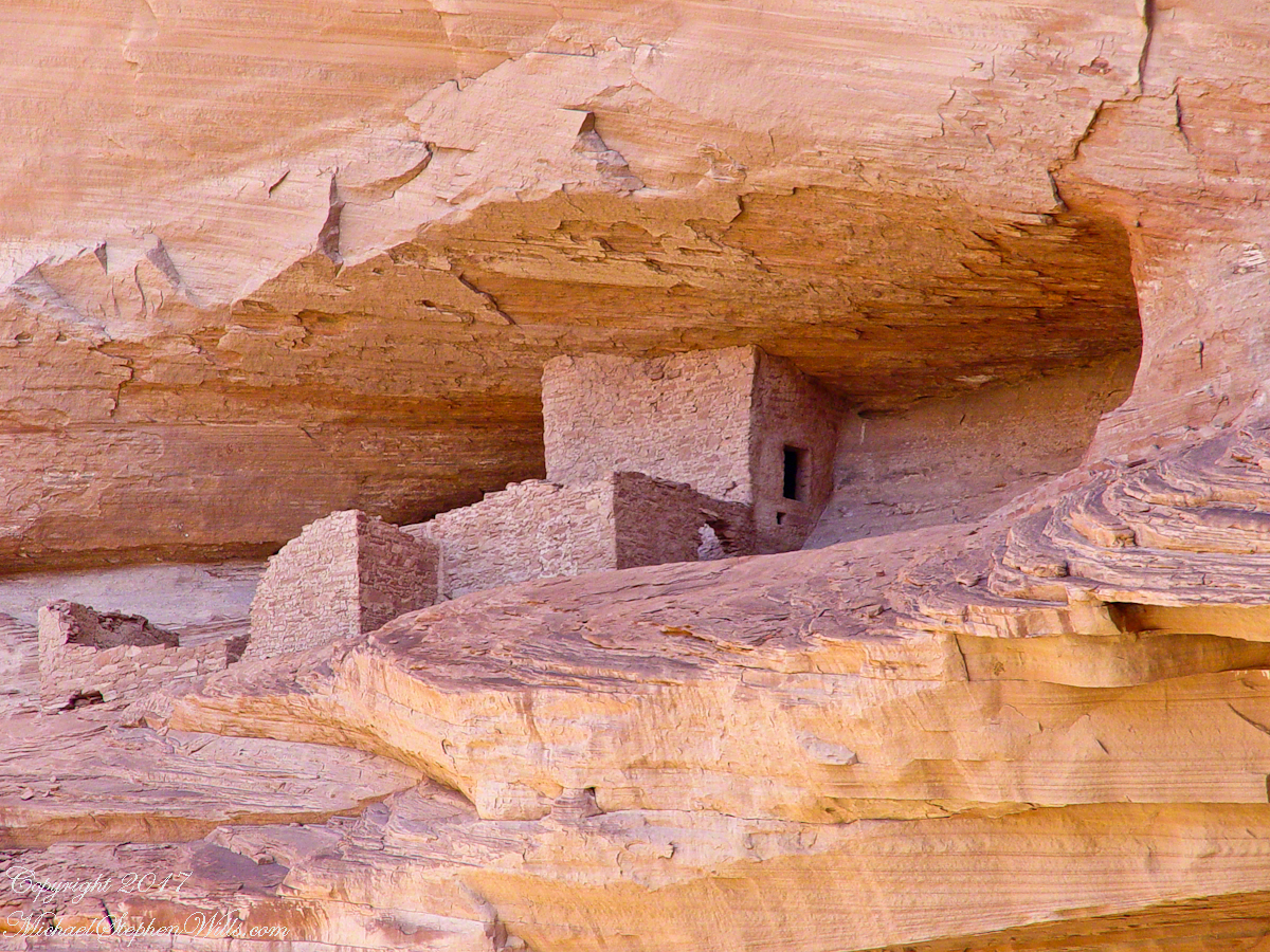
Canyon de Chelly, on the map, is shaped like a Y or a chromosome. A chromosome as the walls of the canyon carry the heritage of the people who made this place their home over millennia. A Y as in the letter ship, a foot and two arms.
6.2 miles from the canyon mouth, where the road ends at Chinle, above the branch, on the north cliff, is this photogenic ruin, called the Ledge Ruin. In my previous posting, this ruin forms the backdrop of Peter Tsosie’s portrait. Peter is the header image of this posting.
Difficult to believe, seeing it for the first time.
Difficult to see, a tiny nook in an enormous cliff, the structures formed from the same rock as though what remained after the cliff fell away.
Difficult to comprehend life there, what drove them to this effort? Fear, certainly, concern for their safety and security.
We know it by our name. Their name included the word “home.”
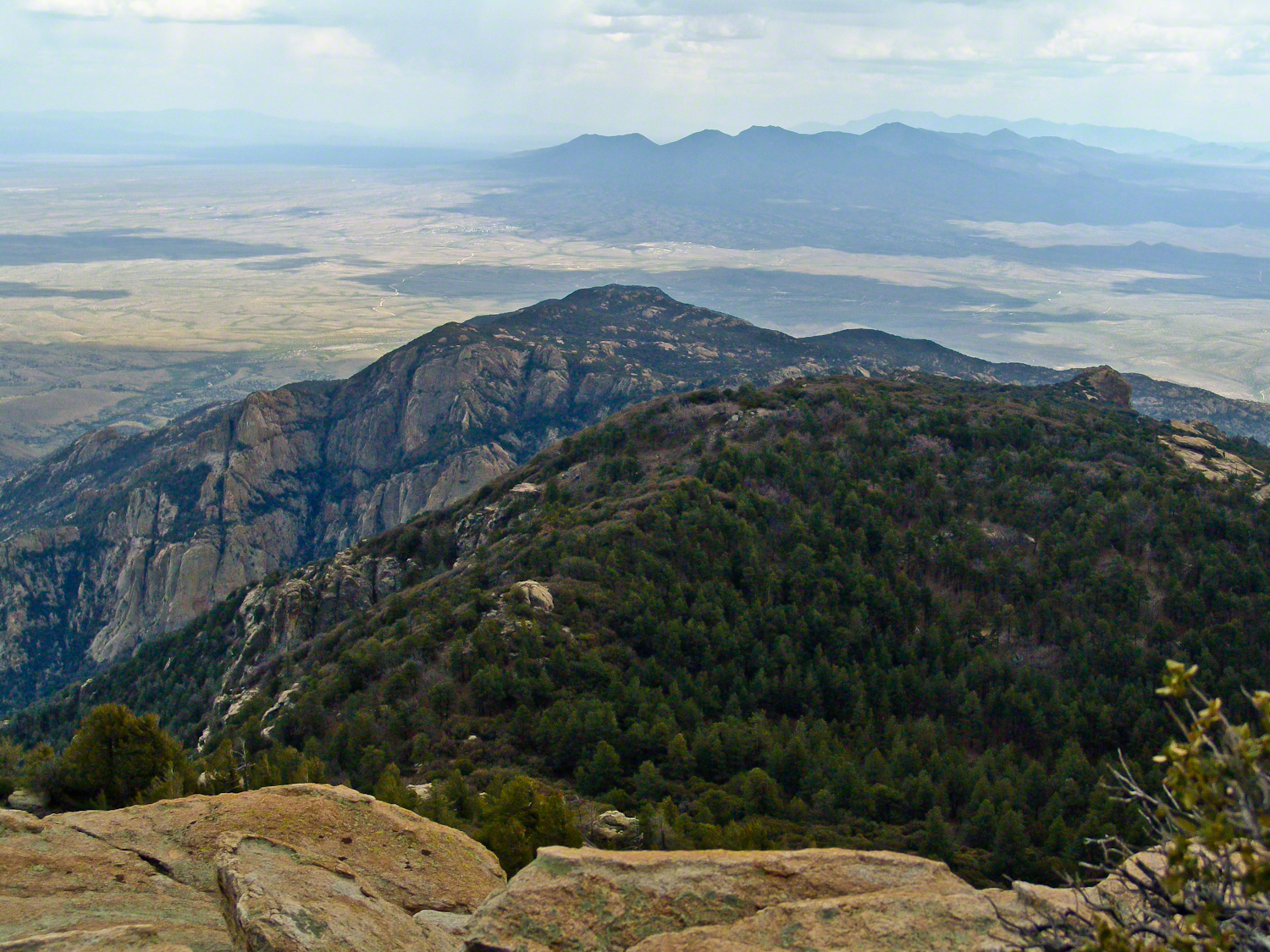
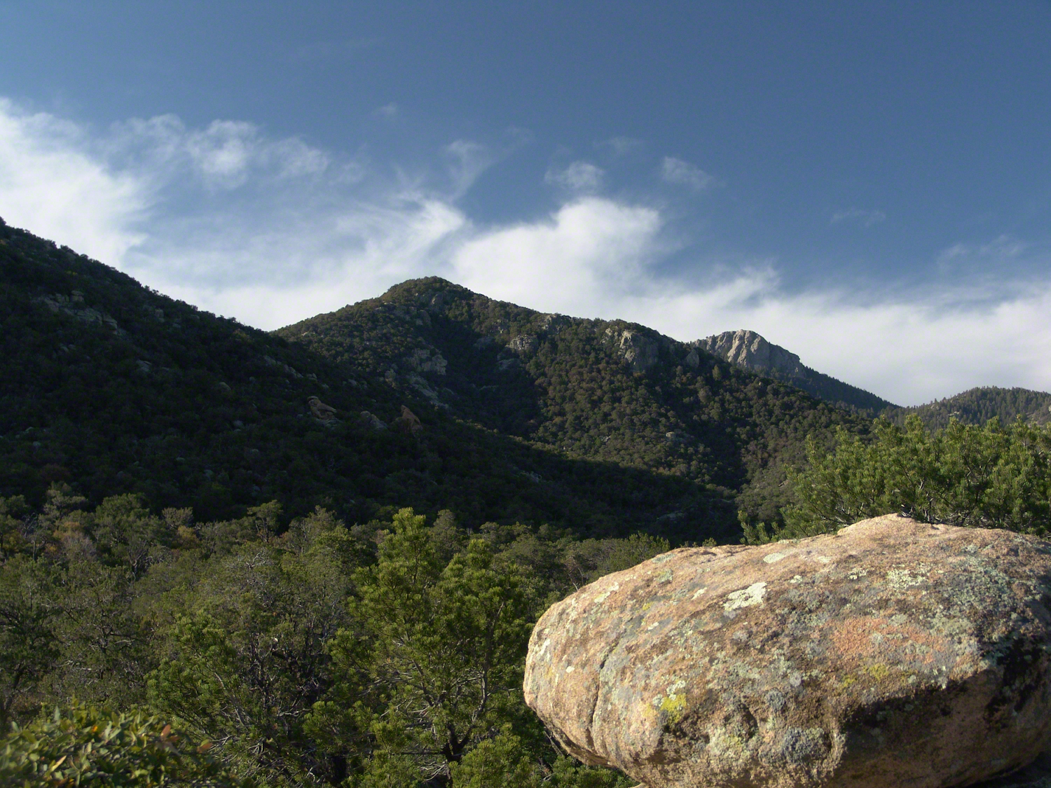
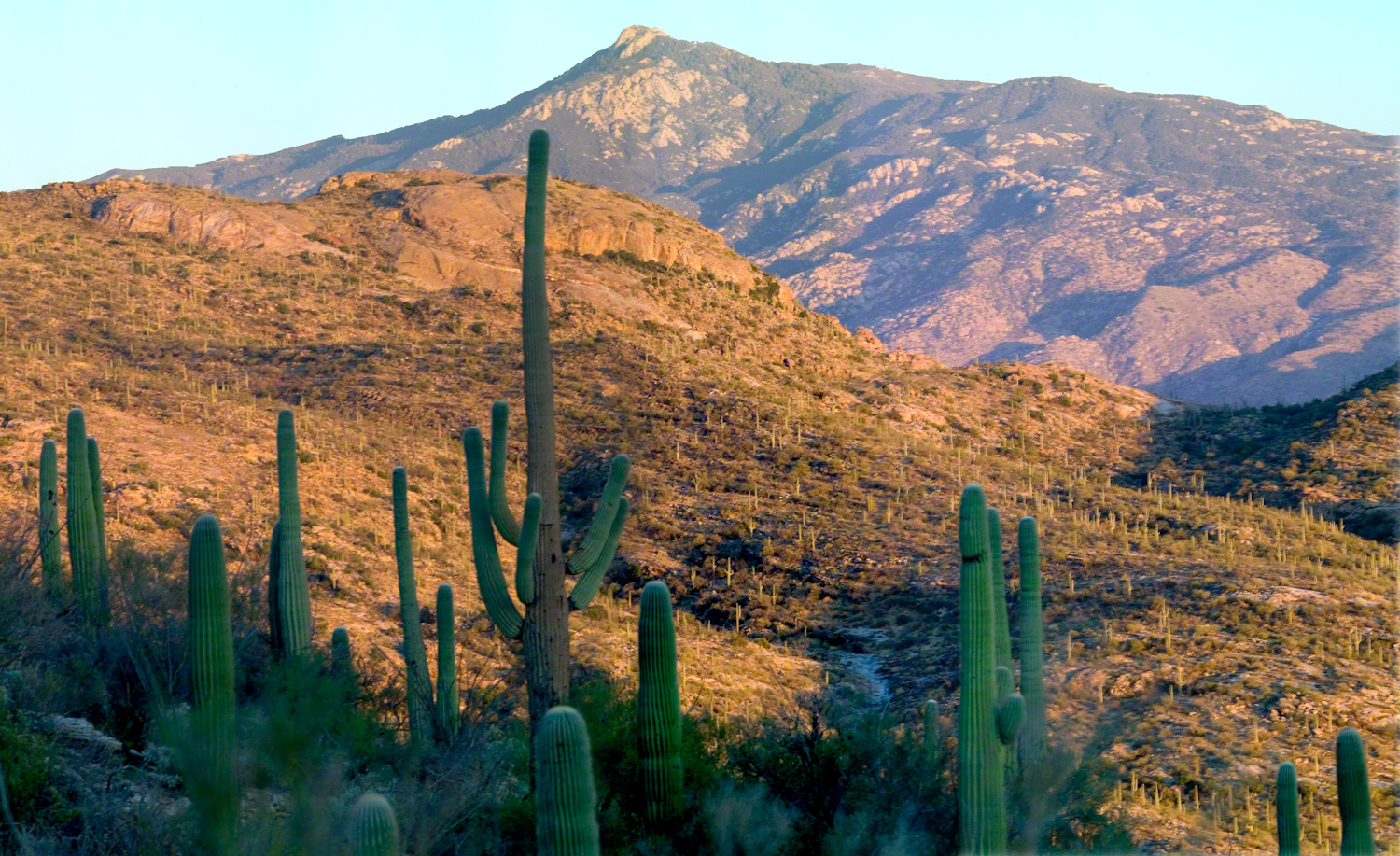
The Rincons are one of 42 Sky Mountain islands isolated from each other by the gradual warming and drying climate changes since the last ice age, 10,000 years ago. While this marvelous environment of oak and pine forests only accessible with much effort on foot, it is literally visible from every point of the Tucson valley and million human inhabitants.
Rincon is Spanish for corner, the mountains are called that from their shape enclosing a space on the west, northwest until recently used for ranching and is now falling into use for tract housing. The mountains themselves are reserved as wilderness, parts in the Saguaro National Park and the Coronado National Forest.
In the past 44 years I was lucky enough to visit the Rincon Wilderness interior three times, shouldering different style backpacks onto the mountain, walking different boots. The first, during college the 1970’s, a party of six left from the end of Speedway, up the Douglas Springs trail. The climb was an exercise in desert survival that several friendships did not survive, replace by new friends met on Mica Mountain. I have no photographs from that experience, only memories and the backpack.
Reconnecting with Arizona in 2004, thirty one years after that first experience, I took no chances. My first attempt on Rincon Peak was a success. Risk and effort were reduced, not eliminated by hiring a guide for the four day trip. We made it to Rincon Peak via the Turkey Creek Trail out of Happy Valley, climbing a mountain buttress, views ever widening and lengthening.
These are some photographs from that experience and a landscape photograph of the peak at sunset, taken the following year.
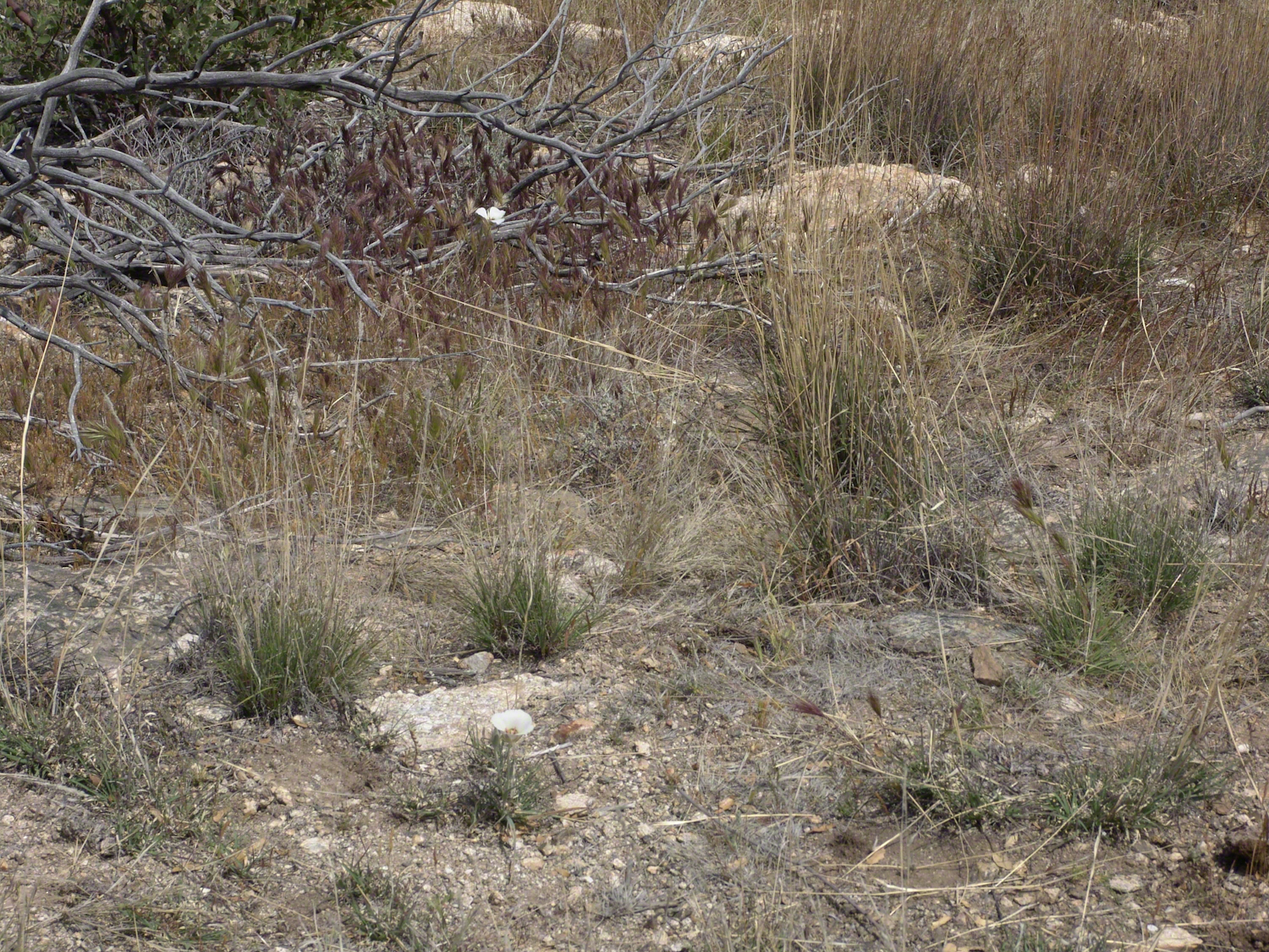
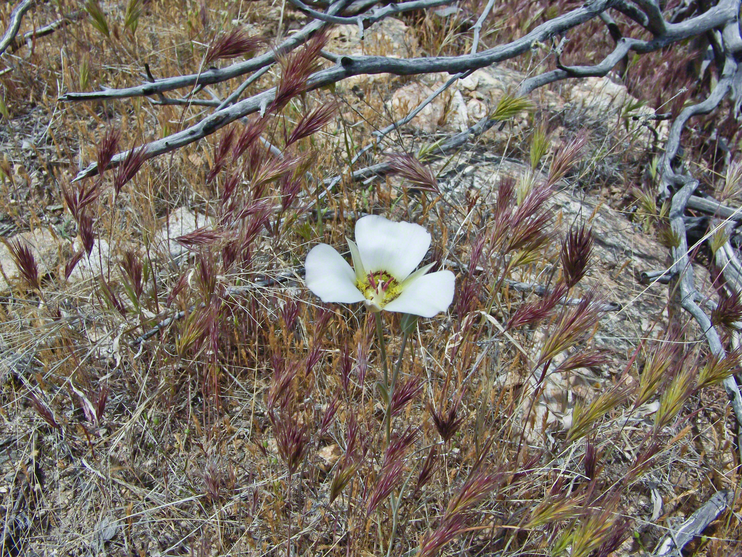
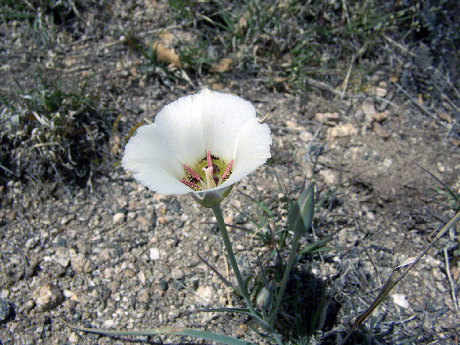
Sego Lilies bloom among a stricken oak and drying grasses on the Turkey Creek trail. This is an overview of the environment, it is the winter rains that trigger the bloom.
We paused while I unpacked my gear to capture Sego Lilies growing along the Turkey Creek Trail.
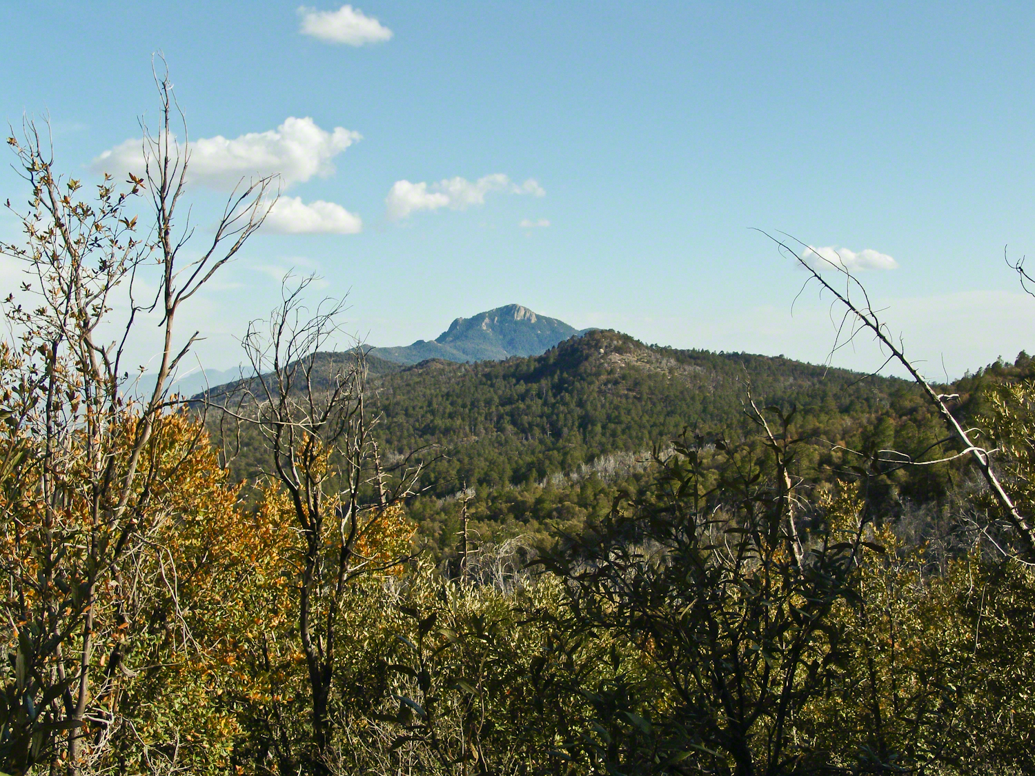
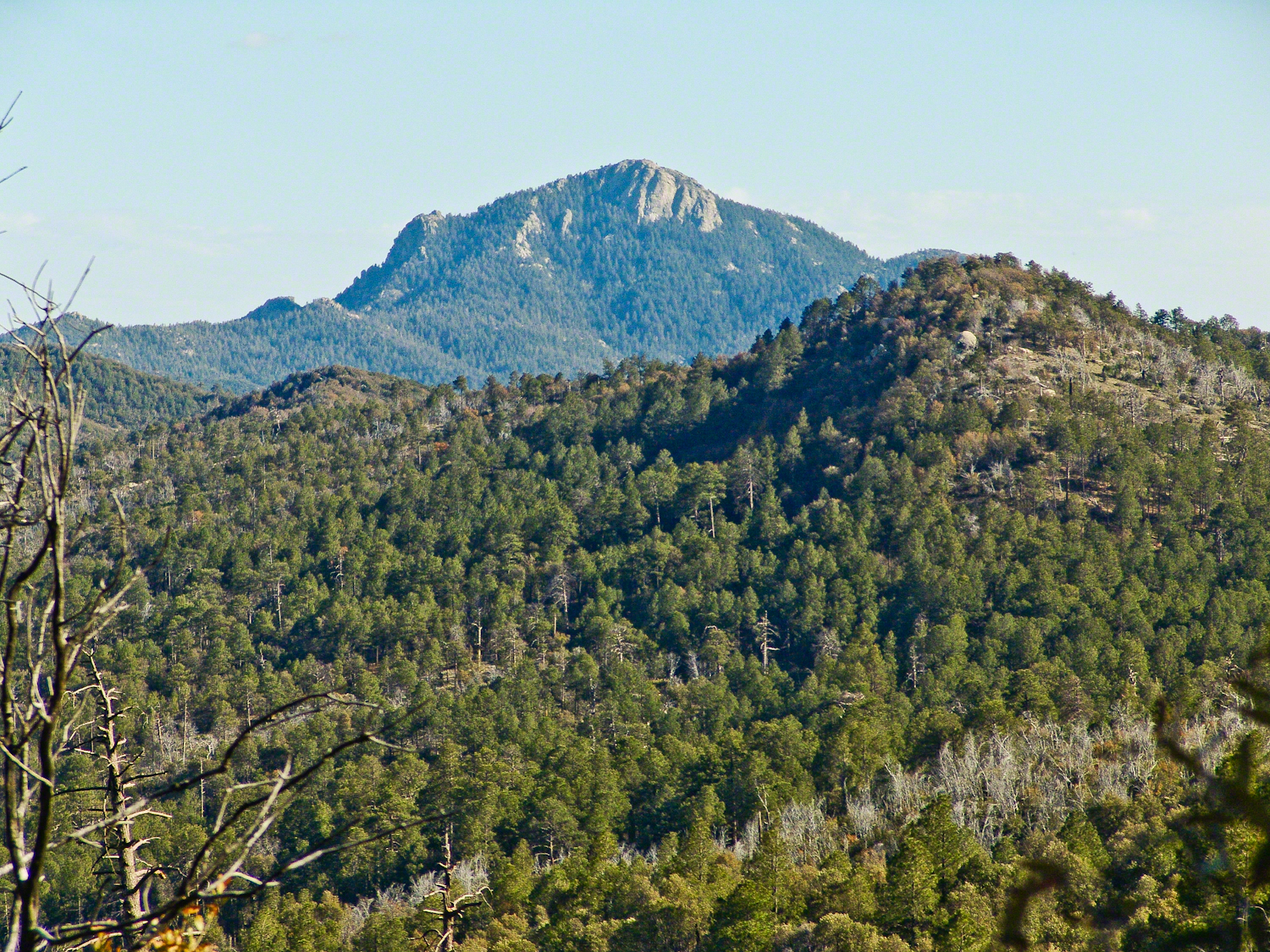
Deer Head Spring, at the top of Turkey Creek Trail was a moist spot with no accessible water when we reached it April 27, 2004. With the remains of a gallon of water each we needed to press ahead to Heartbreak Ridge and climb into Happy Valley Saddle were, thankfully, the creek was low and full of algae but usable. Here are my first views of Rincon Peak, looking across the aptly named Heartbreak Ridge and Happy Valley Saddle.
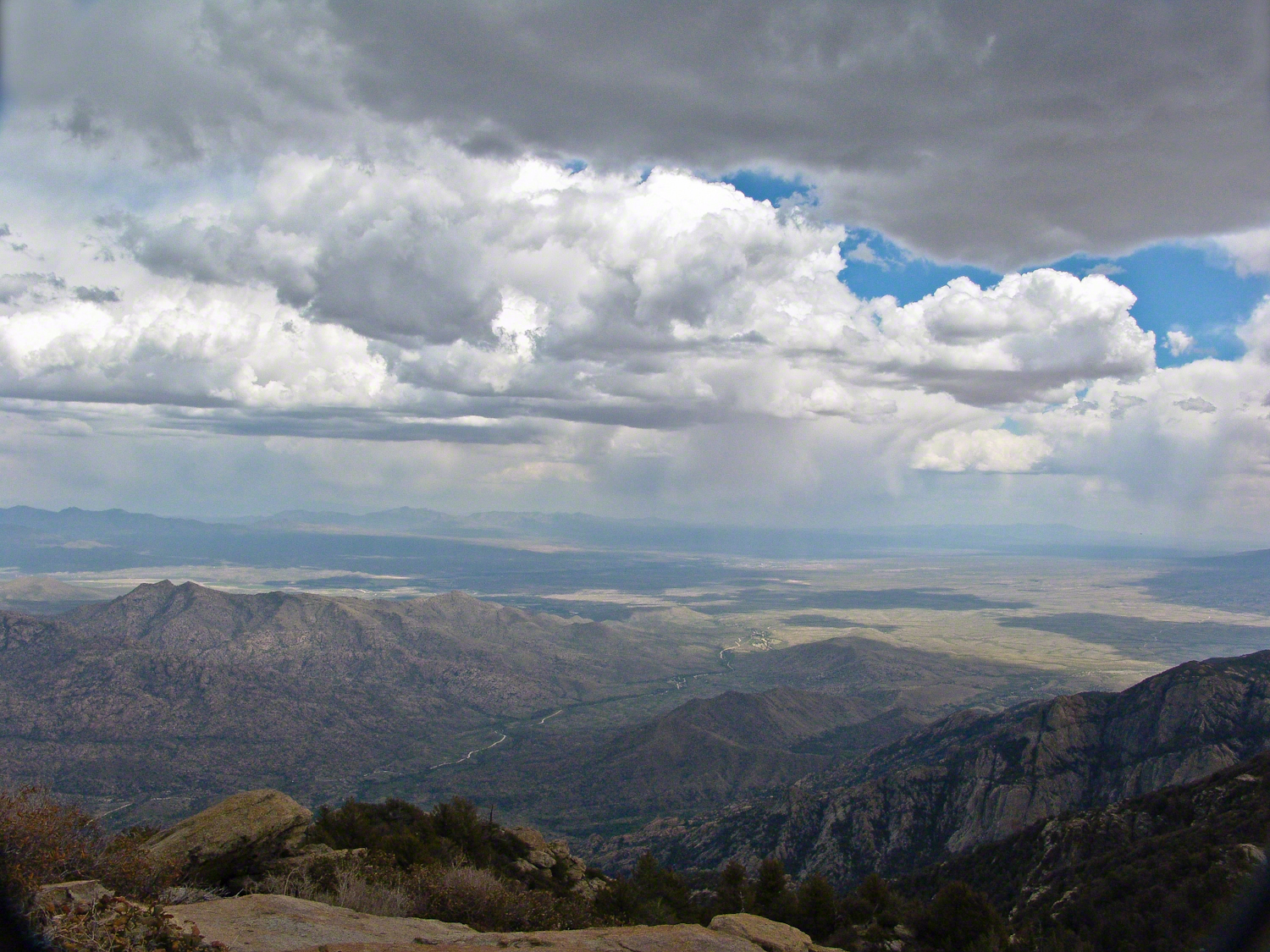
The view to south from Rincon Peak. The white rocks at lower right forms a Valley of the Moon wall. San Pedro River valley at the root, Mae West Peaks at left margin, Dragoon Mountains with Cochise Stronghold center. Taken around 12:30 on April 28, 2004 as a thunderstorm approached.
The Rincon Peak view looking south, southwest over the Valley of the Moon to the eastern Tucson Valley and the Sky Islands the Whetstone Mountains (Apache Peak), behind are the Santa Ritas. The works of man are overpowered by sky, rock, distance.
We made a hasty departure in front of the thunderstorm. It was a touch and go decision to attempt the peak that day, we made it with moments to spare.
April 29, 2004 the morning after reaching Rincon Peak I set up the tripod near our Happy Valley Saddle camp to capture Rincon Peak in early morning sunlight.
The day we descended to the X9 Ranch via the Rincon Creek trail. My guide’s grandfather had a homestead at the X9 and his access to the trailhead through private lands opened this route for us. This is a photograph of sunset on Rincon Peak from the X9 ranch. I am looking east from the Rincon (Spanish for corner) made by the massifs Rincon Peak, Mica Mountain and Tanque Verde ridge.
The evening of November 2, 2006 I climbed the Saguaro National Park, East, Tanque Verde trail for about 30 minutes to reach this view of Rincon Peak and waited until just before the sun set behind the Tucson Mountains for this shot. Then hiked back to the car in twilight. In my hurry, I tripped on a stepped turn and dove headfirst into a large prickly pear. It was a very painful experience and I regretted damaging the cactus and the loss of and good hiking shirt. There were large spines in my face and tiny, pesky spines covered my chest and back. The large spines are not barbed and come right out. I needed to visit a physician to remove them.
Copyright 2021 Michael Stephen Wills All Rights Reserved
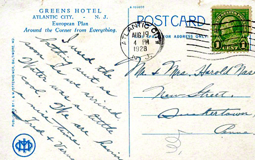
Our Black Friday visit to Jim Thorpe included shopping along Broadway. One marvelous shop at 61 Broadway, The Vintagerie, offered a small bin of antique post cards. Vaguely curious, I picked up a pile. Many were unused. A few, like the two below, travelled the US Mail, included post marks, postage and communications.
Please click any of the following images to visit a work from my online gallery. Hover your mouse over each image for more information.
Verna’s slanted and precise cursive, the message carefully planned to fit available space, demonstrate her to be stylish. The bathing suit was purchased for the trip. Before leaving, Verna shared the purchase with her acquaintance, Mrs. Nace (misspelled Nase).
Fourteen months after their vacation, the Stock Market Crashed, October 1929, leading to The Great Depression. How were Fred and Verna affected? Were there Atlantic City vacations?
The next card was purchased and sent from Allentown. It is unlikely Sara was on vacation, was it purchased during a rare trip to the city?
I know Verna misspelled Nace because, ten years into the great depression, Mrs. Nace, Emma, received this postcard from Sara. The postage is still 1 cent. Emma has moved to a new address. The message is more significant, written in a hurried hand by Sara, who concludes with love.
Emma Nace kept these cards as treasured possessions and memories until, with her passing, they were acquired, maybe in an estate sale, bundled together, transported 54 miles to 61 Broadway to be found by me, scanned (digitalized), and sent along in this blog.
Copyright 2021 Michael Stephen Wills All Rights Reserved