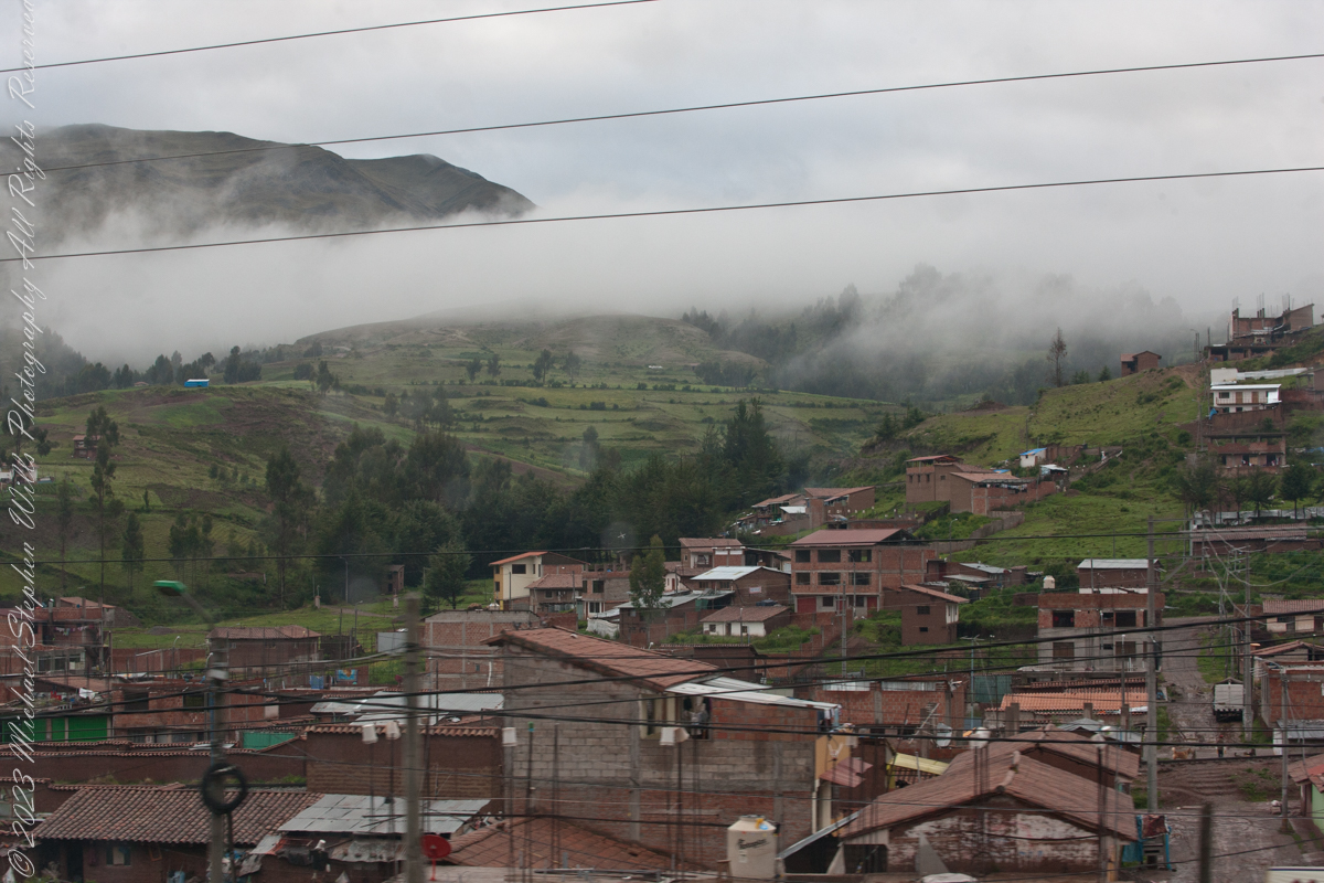
Here we are, passing the outskirts in the hills surrounding Cusco, Peru. Route 3S, going under various names. Highland Road (North) (Longitudinal de la Sierra Norte)Highway, climbs out of Cusco in broad switchbacks.
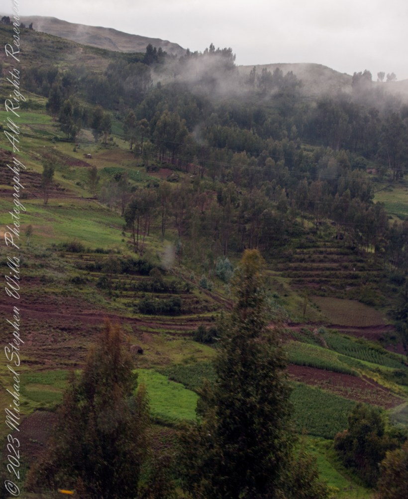
View of terraced fields from route 3S through the hills above Cusco, Peru. “In the South American Andes, farmers have used terraces, known as andenes, for over a thousand years to farm potatoes, maize, and other native crops.“
“Terraced farming was developed by the Wari culture and other peoples of the south-central Andes before 1000 AD, centuries before they were used by the Inca, who adopted them. The terraces were built to make the most efficient use of shallow soil and to enable irrigation of crops by allowing runoff to occur through the outlet. The Inca people built on these, developing a system of canals, aqueducts, and puquios to direct water through dry land and increase fertility levels and growth. These terraced farms are found wherever mountain villages have existed in the Andes. They provided the food necessary to support the populations of great Inca cities and religious centers such as Machu Picchu.“
Reference: “Terrace (earthworks)” Wikipedia
Copyright 2023 Michael Stephen Wills All Rights Reserved
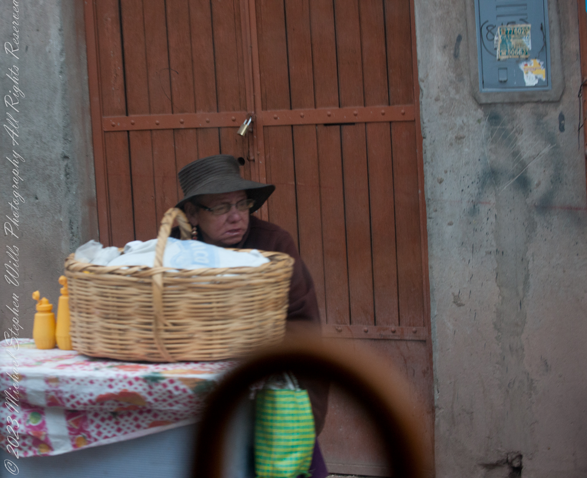
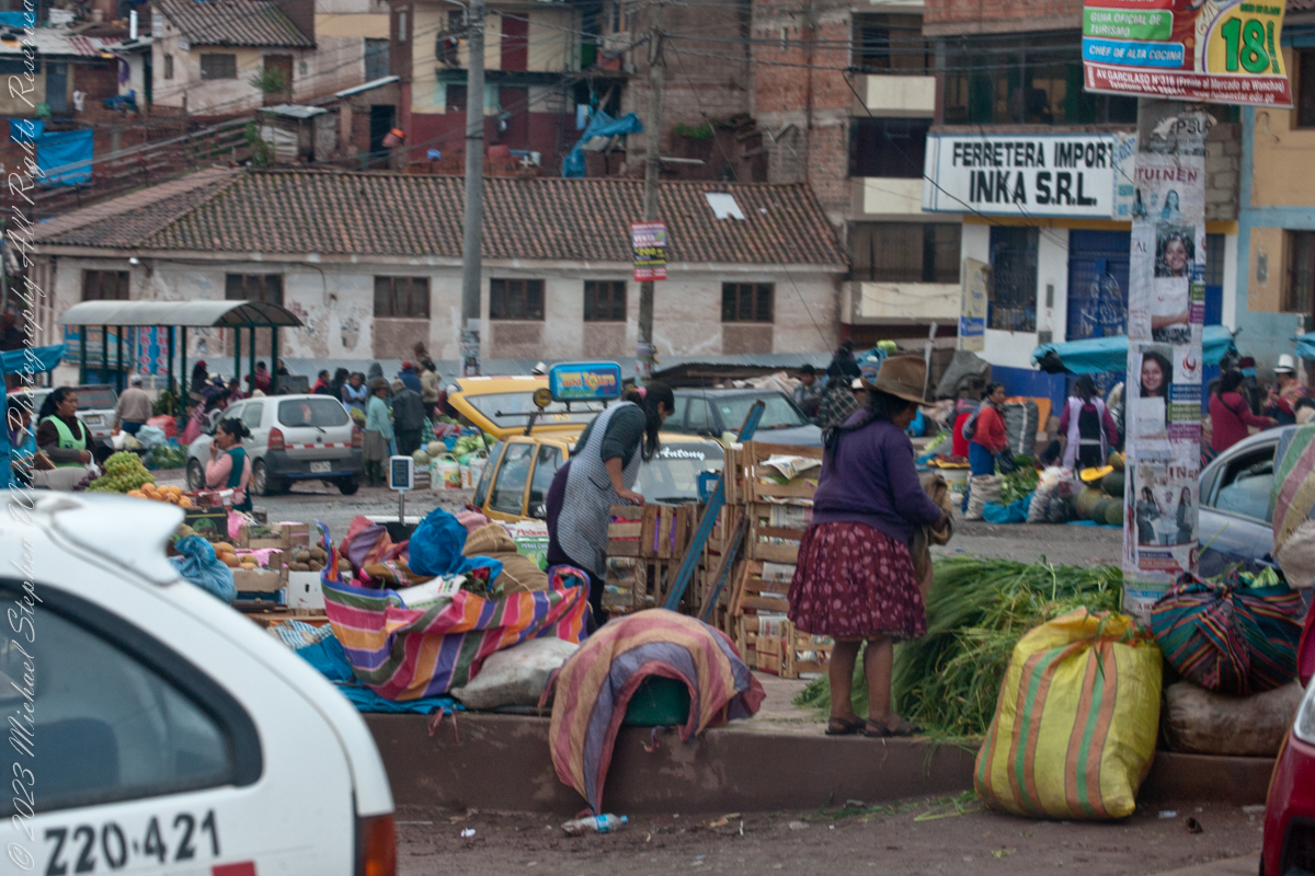
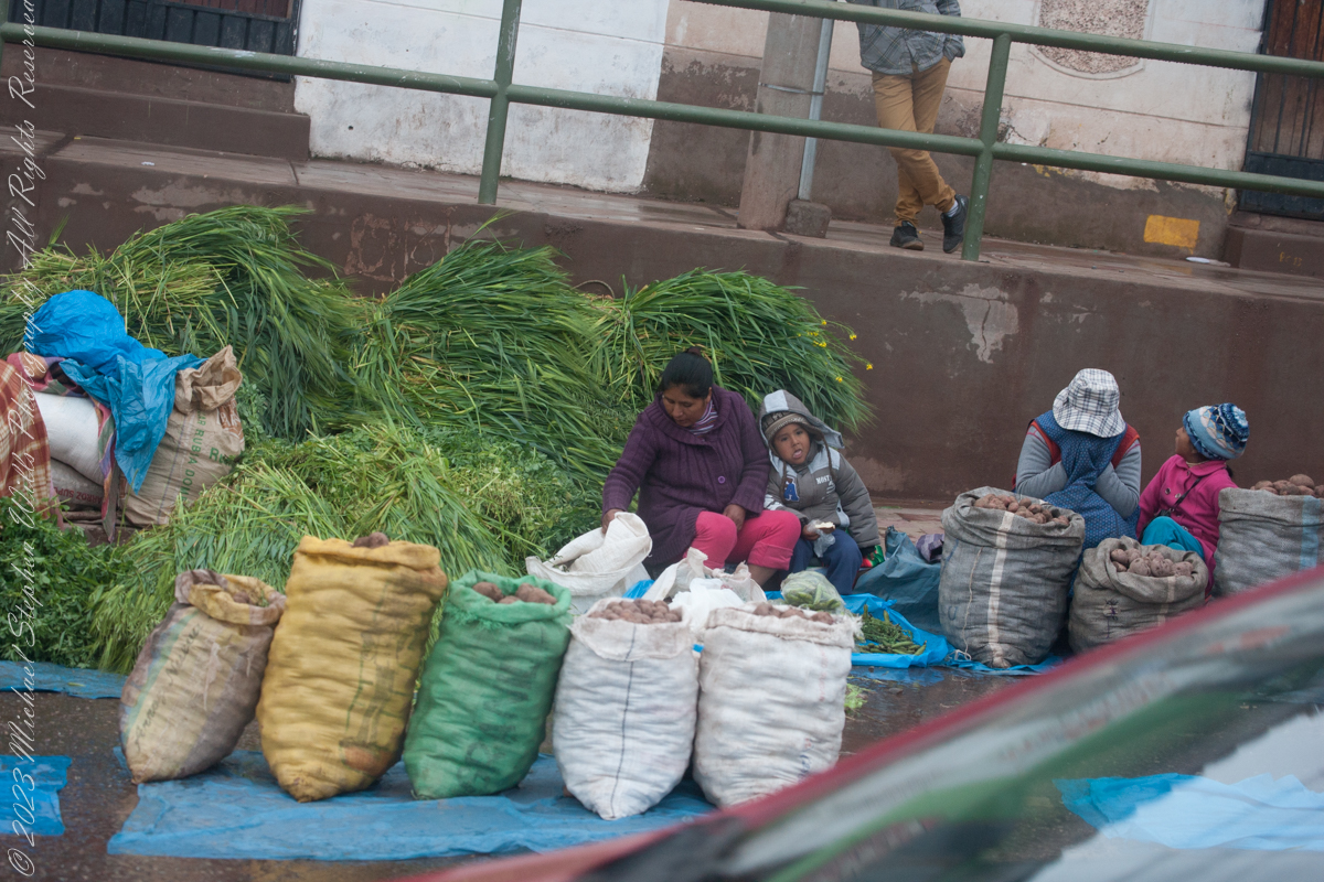
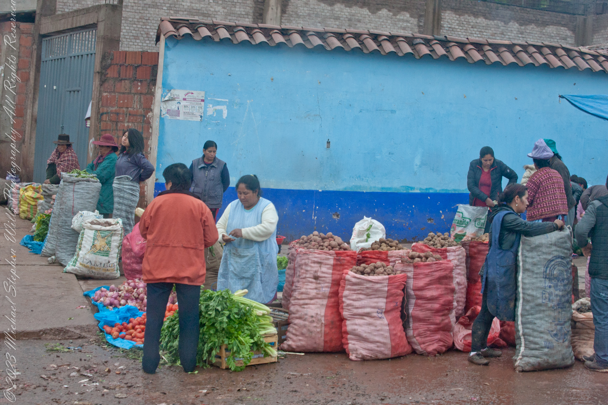
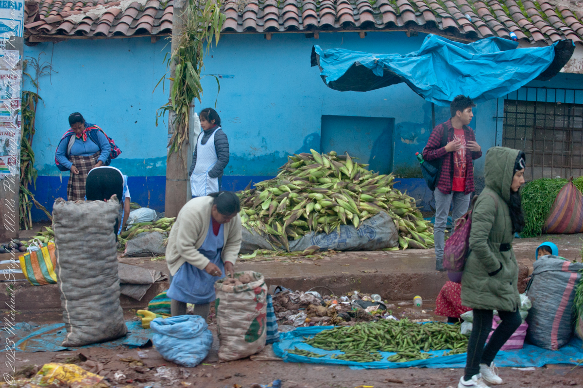
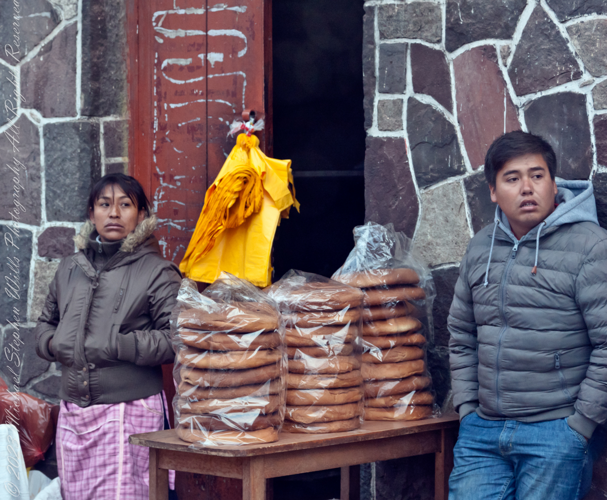
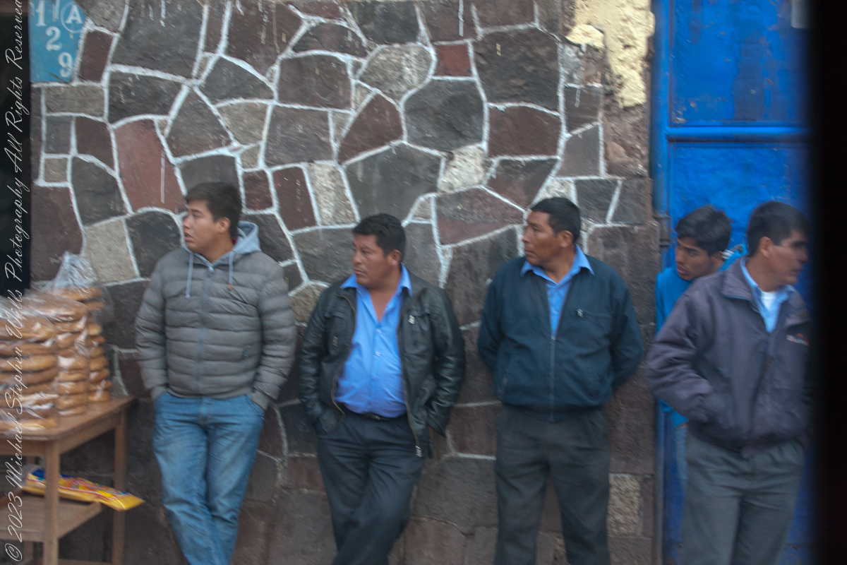
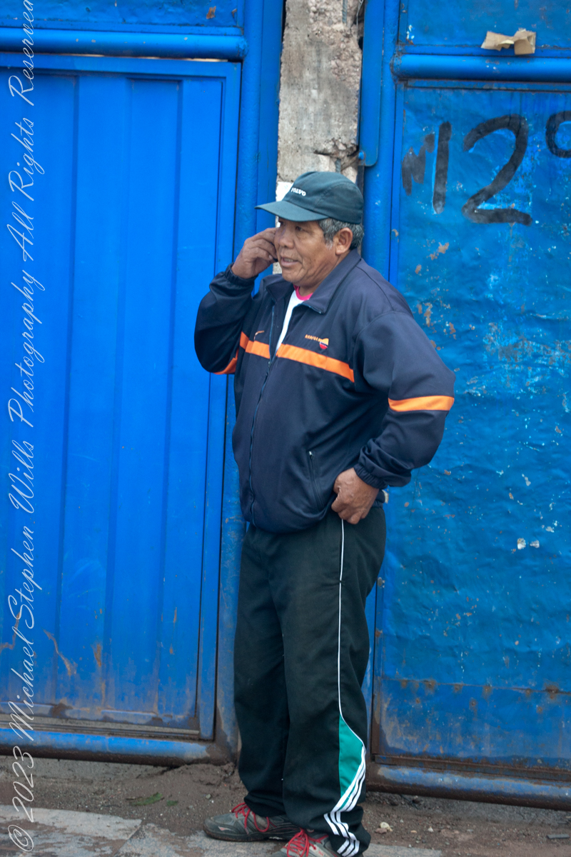
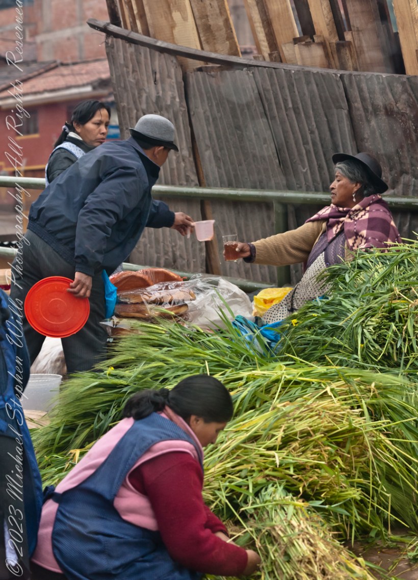
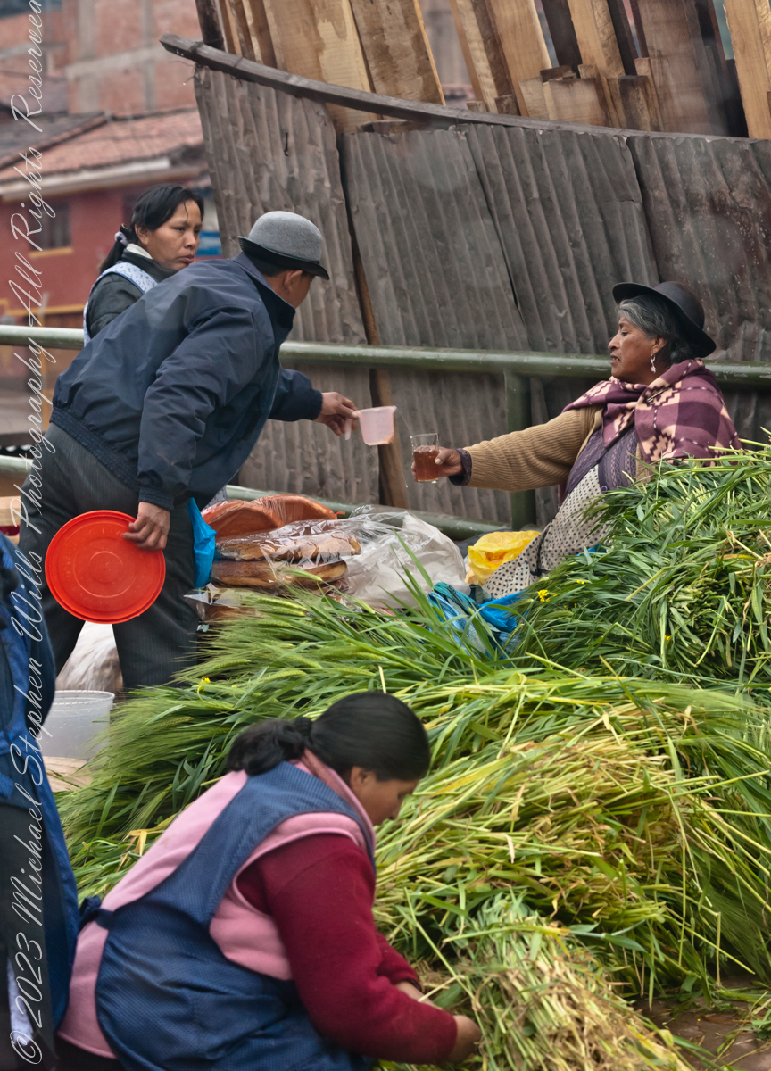
The scenes at Cusco’s Saturday Market were fascinating. The shooting was through a clean bus window using a handheld Canon EF 70-300 f/4-5.6 L IS USM lens mounted on the Canon dslr 1DS Mark III.
“Inka S.R.L.” is a agriculture company full name INDUSTRIA DE ALIMENTOS E INVERSIONES PERU INKA SRL specialized in ELAB OF OTHER PROD. FOOD.. It was created and founded on February 2, 2002.
Very early for these children…
Quechua people or Quichua people, may refer to any of the aboriginal people of South America who speak the Quechua languages, which originated among the Indigenous people of Peru. Although most Quechua speakers are native to Peru, there are some significant populations in Ecuador, Bolivia, Chile, Colombia, and Argentina. The woman center left sports traditional fabrics of her pants and shawl.
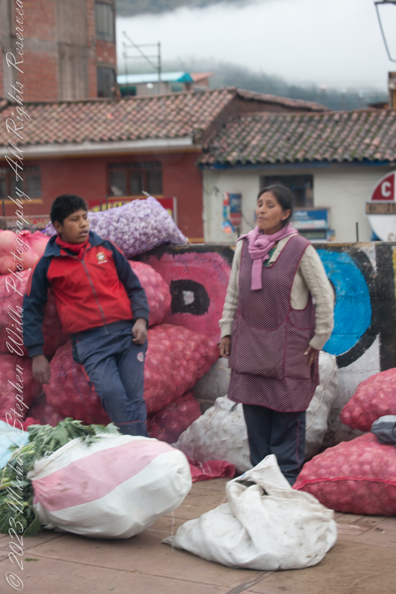
Onions and garlic, potatoes? Wild potato species can be found from the southern United States to southern Chile. The potato was originally believed to have been domesticated by Native Americans independently in multiple locations, but later genetic studies traced a single origin, in the area of present-day southern Peru and extreme northwestern Bolivia. Potatoes were domesticated there approximately 7,000–10,000 years ago, from a species in the Solanum brevicaule complex. In the Andes region of South America, where the species is indigenous, some close relatives of the potato are cultivated.
Potatoes!!
Maize, also known as corn in North American and Australian English, is a cereal grain first domesticated by indigenous peoples in southern Mexico about 10,000 years ago.
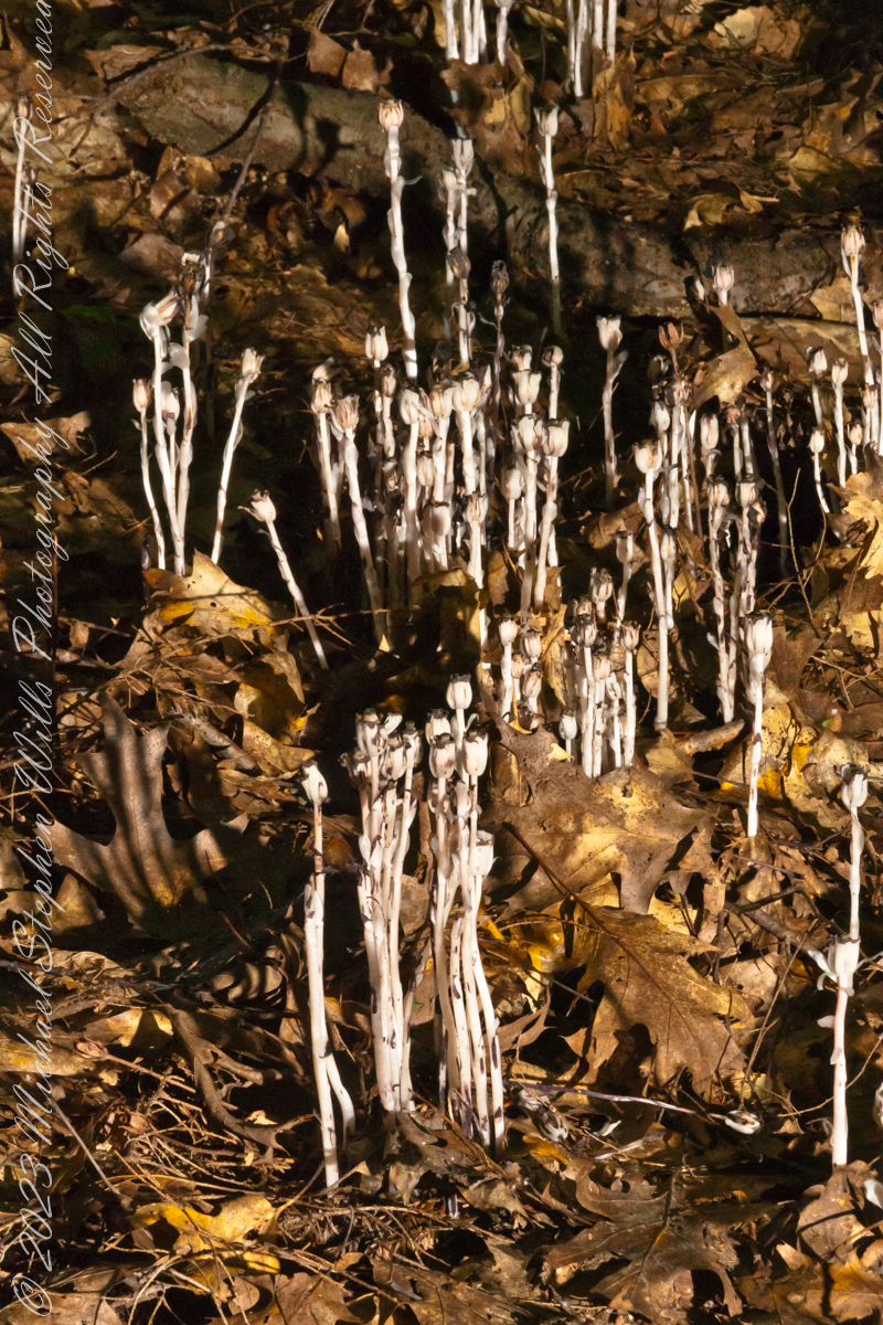
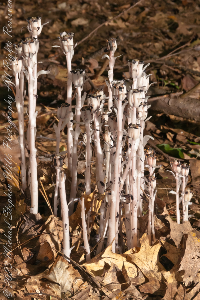
I found these popping up from leaf litter, a mixture of last year’s maple and elm, on an August morning. The dappled light, varied from bright to very dark, exceeded the dynamic range of my equipment, so I set up the Sony dslr Alpha700 with the Sony lens DT 18-200mm f3.5-6.3 on a tripod and, using the remote feature, placed the flash at an optimal angle.
“Monotropa uniflora, also known as ghost plant, ghost pipe, or Indian pipe, is an herbaceous perennial plant native to temperate regions of Asia, North America, and northern South America, but with large gaps between areas. The plant is sometimes completely waxy white, but often has black flecks or pale pink coloration. Rare variants may have a deep red color. The name “Monotropa” is Greek for “one turn” and “uniflora” is Latin for “one flowered” as there is one sharply curved stem for each single flower. It flowers from early summer to early autumn, often a few days after rainfall. The fruit, an oval capsule-like structure, enlarges and becomes upright when the seeds mature, at this point stem and capsule looking desiccated and dark brown or black. The seeds of Monotropa uniflora are small, ranging between 0.6–0.8 mm (3⁄128–1⁄32 in) in length.“
“Unlike most plants, it is white and does not contain chlorophyll. Instead of generating food using the energy from sunlight, it is parasitic, and more specifically a mycoheterotroph. Its hosts are certain fungi that are mycorrhizal with trees, meaning it ultimately gets its food from photosynthetic trees. Since it is not dependent on sunlight to grow, it can grow in very dark environments as in the understory of dense forest. The complex relationship that allows this plant to grow also makes propagation difficult.“
“The flowers of Monotropa uniflora are visited by various bee and fly species, most commonly bumblebees. Bumblebees are an important pollen dispersal agent for the plant.“
“Like most mycoheterotrophic plants, Monotropa uniflora associates with a small range of fungal hosts, all of them members of Russulaceae.“
“It is often associated with beech trees.“
“The plant contains glycosides and may be toxic to humans.“
“In addition to various reported medical uses, the plant has been used as an anxiolytic in herbal medicine since the late 19th century.“
Reference: in italics is from “Monotropa uniflora,” Wikipedia
Copyright 2023 Michael Stephen Wills All Rights Reserved
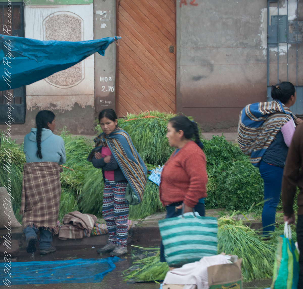
I caught these participants of the Cusco, Peru, Saturday Market as our bus progressed toward Machu Picchu during our daytrip to that ruin. The shooting was through a clean bus window using a handheld Canon EF 70-300 f/4-5.6 L IS USM lens mounted on the Canon dslr 1DS Mark III.
A group of Quechua vendors during the Saturday Market of Cusco. A seller of baked goods is taking a break while, in the foreground, a woman prepares an order of greens used to feed guinea pigs, a staple of native Peruvian cuisine.
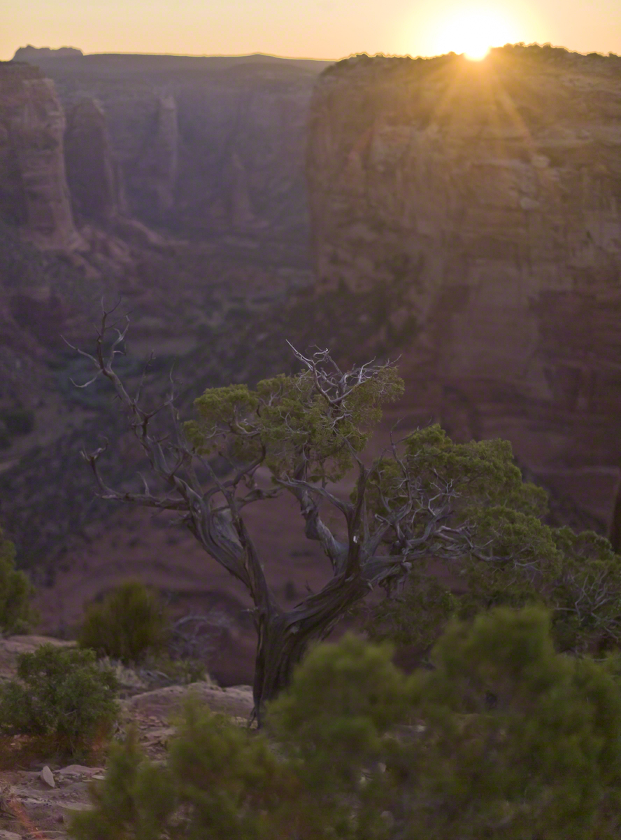
In this post we start the day of my posting “Family Trek“, July 19, 2008, when, well before the sun rose at 6:23 am Mountain Daylight Time (the Navajo Reservation observes daylight savings, the rest of Arizona does not), Pam and I were at the Spider Rock Overlook.
Most visitors to the canyon make use of a system of roads and parking lots next to strategic views. There is the White House Overlook we visited our first day, July 18, to hike from the trailhead into the canyon. There are also, on the south side of the canyon:
Tsegi Overlook, taken from a Navajo word that translates directly to “between the rocks” and usually refers to a deep canyon with steep cliffs.
Junction Overlook above the point where Canyon Del Muerto (see my posting “Sun and Shade, Canyon Del Muerto”, and Canyon De Chelly intersect. There is an Anasazi ruin in the south-facing cliff across the canyon.
Sliding House Overlook, another Anasazi run across the canyon.
Face Rock Overlook, to view the eponymous formation.
Spider Rock Overlook, the most stunning rock formation.
Click any photograph for my Online gallery.
Looking east from the Spider Rock overlook, Canyon De Chelly.
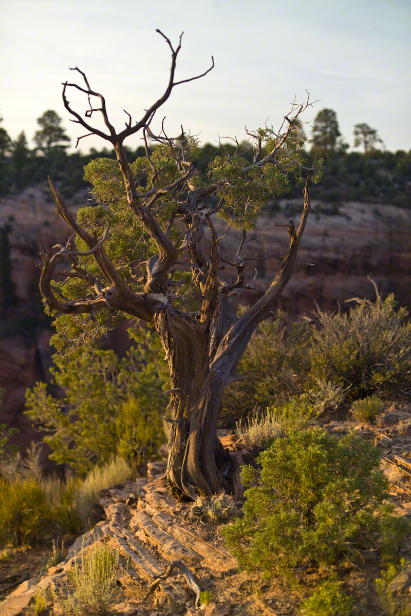
While getting ready I scoped out the location for interesting visual tropes. Utah Junipers are exceptionally hardy shrubs, stressed individual plants grow into compelling forms shaped by hardship. As the sun rose, this specimen emerged from the gloom and caught the first sun rays.
Click any photograph for my Online gallery.
A distressed Utah Juniper on the edge of Canyon De Chelly overlooking Needle Rock a few moments after sunrise.
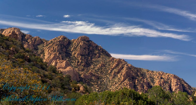
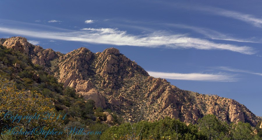
Dragoon Mountains of southeastern Arizona are named, not for the resemblance of this ridge to the back of a Dragon, but for a type of soldier trained for horseback riding and infantry. These were the U.S. troops sent to “pacify” the Chiricahua Apache homeland.
Understanding location lighting is a matter of experience and luck.
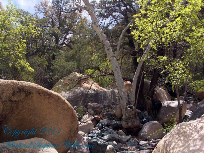
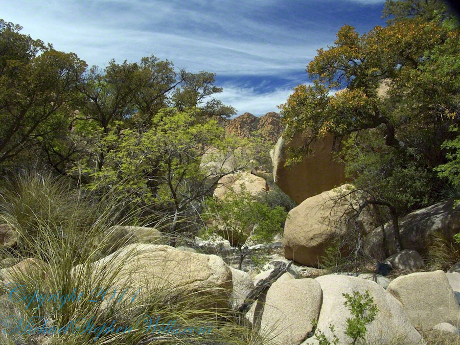
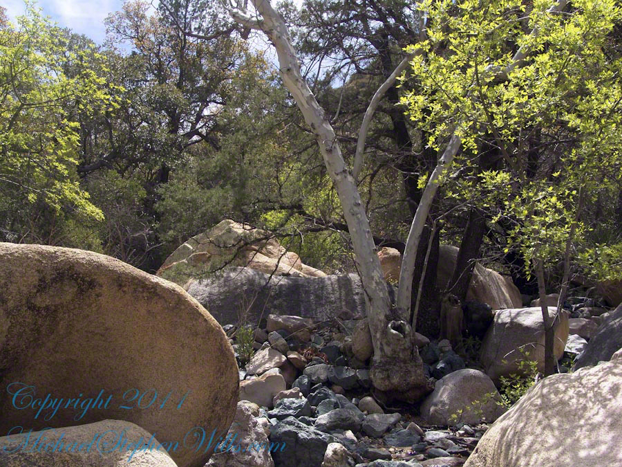
Cochise Stronghold campsites are on the eastern slope of the Dragoons, sheltering them from the late afternoon sun.
One this day in April I explored the trails until sunset and was lucky enough to be setup for the 14 minutes of that day when the light was absolutely perfect.
Copyright 2023 Michael Stephen Wills All Rights Reserved
Understanding location lighting is a matter of experience and luck.
Cochise Stronghold campsites are on the eastern slope of the Dragoons, sheltering them from the late afternoon sun.
One this day in April I explored the trails until sunset and was lucky enough to be setup for the 14 minutes of that day when the light was absolutely perfect.
“Dragoon Spires in Afternoon Light”
These photographs are from two days spent at Cochise Stronghold, a part of the U.S. Forest Service Coronado Forest managed by Arizona State Parks located off the Interstate 10 East of Tucson between Benson and Wilcox.
This rugged natural fortress was, for some 15 years, the home and base of operations for the famed Chiricahua Apache Chief, Cochise. Cochise and about 1,000 of his followers, of whom some 250 were warriors, located here.
Born in present-day Arizona, Cochise led the Chiricahua band of the Apache tribe during a period of violent social upheaval. In 1850, the United States took control over the territory that today comprises Arizona and New Mexico. Not hostile to the whites at first, he kept peace with the Anglo-Americans until 1861, when he became their implacable foe because of the blunder of a young U.S. Army officer, Lt. George Bascom. In that year, Cochise and several of his relatives had gone to an encampment of soldiers in order to deny the accusation that they had abducted a child from a ranch. The boy was later proved to have been kidnapped by another band of Apaches.
During the parley, Cochise and his followers were ordered held as hostages by Bascom, but Cochise managed to escape almost immediately by cutting a hole in a tent. Bascom later ordered the other Apache hostages hanged, and the embittered Cochise joined forces with Mangas Coloradas, his father-in-law, in a guerrilla struggle against the American army and settlers. The capture and murder of Mangas Coloradas in 1863 left Cochise as the Apache war chief. The U.S. Army captured him in 1871 and prepared to transfer the Chiricahua to a reservation hundreds of miles away, but he escaped again and renewed the resistance campaign. The following year after negotiating a new treaty with the help of Thomas Jeffords, the band was allowed to stay in their homeland.
Cochise is reputed to have been a master strategist and leader who was never conquered in battle. He died peacefully on the newly formed Chiricahua reservation in 1874. His son, Taza succeeded him as chief. Upon his death, he was secretly buried somewhere in or near his impregnable fortress. The exact location has never been revealed or determined.
The town of Cochise, Cochise County, the renowned geological feature known as Cochise’s Head in the Chiricahua Mountains, and the Stronghold are all named in tribute to him.
Copyright 2023 Michael Stephen Wills All Rights Reserved
These photographs are from two days spent at Cochise Stronghold, a part of the U.S. Forest Service Coronado Forest managed by Arizona State Parks located off the Interstate 10 East of Tucson between Benson and Wilcox.
Here is the Cochise Stronghold information sign from the Douglas Ranger District of the Coronado National Forest.
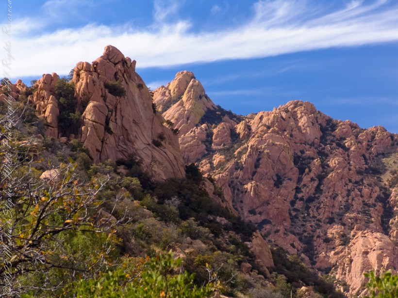
The Dragoon Mountains are a low range that barely rises above the surrounding desert floor. Nevertheless, the granite boulders are spectacular and well worth visiting for the scenery alone. This mountain range is remote from cities or even any large towns, so visitation is light. Late fall, winter, and early spring are the best times to visit. Temperatures exceeding 100 degrees are common even in spring and fall. Cochise Stronghold Campground is closed in June, July, and August due to the often-extreme heat.
Safety First: Heat and low humidity are real hazards for people unfamiliar with desert climates. A person can loose up to 5 quarts of fluid a day and it is easy to become seriously dehydrated without realizing it, so drink plenty of fluids even if you do not feel very thirsty. Always carry extra water in your car. When going on a hike, even if a short one, take a day pack with water, snack foods, protective clothing, flashlight, first aid kit, compass, and map. To avoid sun in
Copyright 2023 Michael Stephen Wills All Rights Reserved
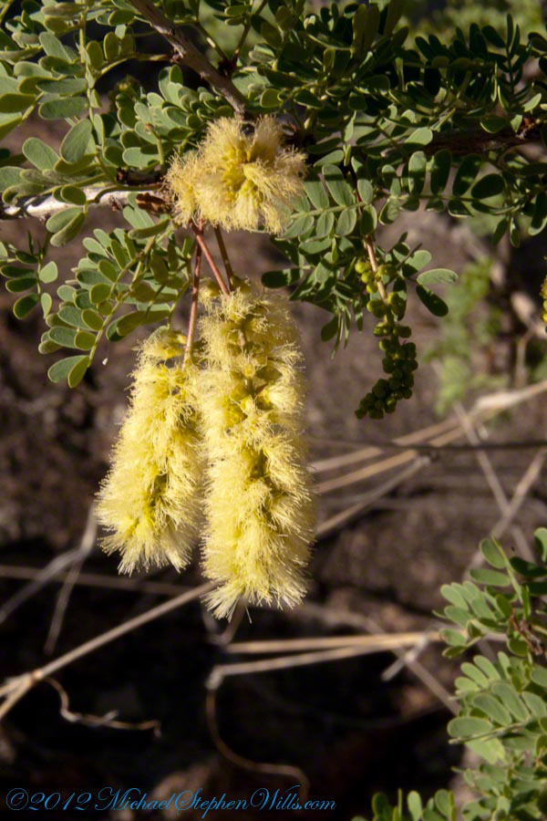
Mesquite is the Sonoran Desert smell carried by distant rain, omnipresent and humble, a survivor with tap root extending 190 feet down to draw on the water table.
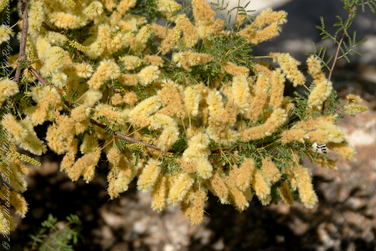
Prosopis is the scientific name for about 40 species of leguminous trees. Present in North America since the Pliocene era, mesquite wood has been dated to 1300 BC.
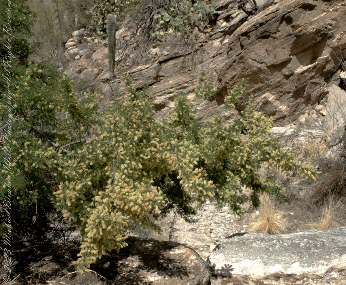
I found this flowering mesquite bush in Finger Rock Canyon of the Catalina Mountains outside Tucson, Arizona.
They are thought to have evolved with megafauna in the New World. The loss of North American megafauna at the end of the Pleistocene era gave way to one theory of how the Prosopis spp. were able to survive.
One theory is that the loss of the megafauna allowed Prosopis spp. to use their fruit pods to attract other organisms to spread their seeds; then, with the introduction of livestock, they were able to spread into grasslands.
The plentiful legumes that develop from these flowers are edible when cooked. The shape and color of the seeds can be understood from this empty seed pod that happens to lie near a tarantula burrow.