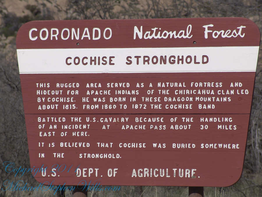
Interstate 10 between Benson and Wilcox ascends through a field of enormous, eroded granite boulders. Off to the west are the Dragoon Mountains, otherwise known as “Cochise Stronghold.” This rugged area served as a natural fortress and hideout for Apache Indians of the Chiricahua clan led by Cochise. He was born in this Dragoon Mountains about 1815. From 1869 to 1872 the Cochise band battled the U.S. Calvary because of the handling of an incident at Apache Pass about 30 miles east of here. It is believed that Cochise was buried somewhere in the Stronghold.
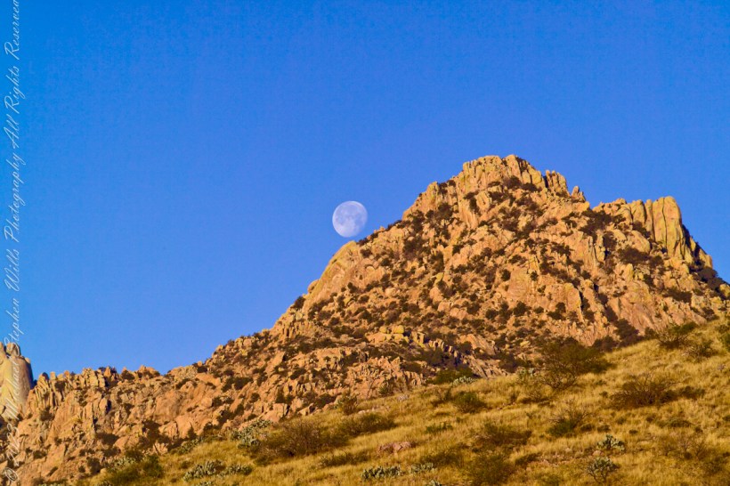
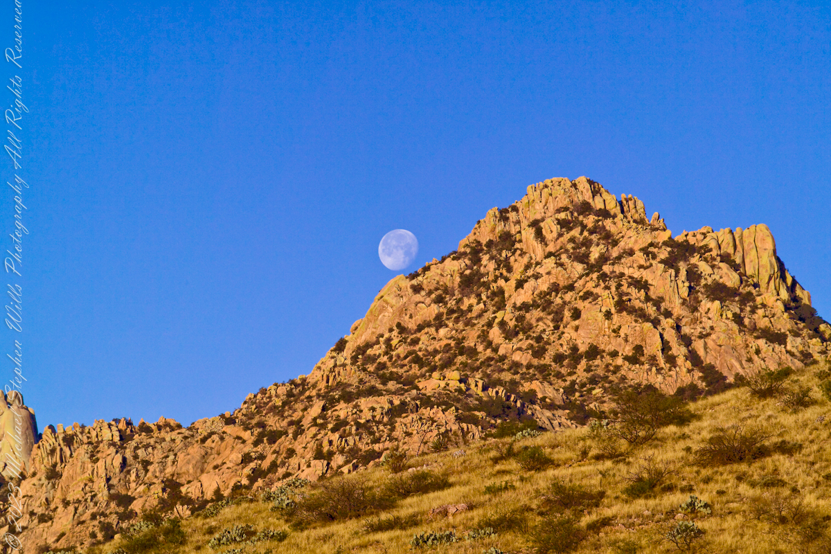
One April morning, very early, on the road to Cochise Stronghold. We stopped everything for me to unload the equipment to capture a gibbous moon low in the west, grazing a hoodoo ridge of Cochise Stronghold of the Dragoon Mountains. Near Dragoon, Cochise County, Arizona
Copyright 2023 Michael Stephen Wills All Rights Reserved
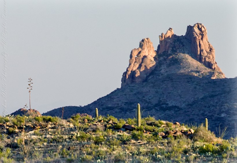
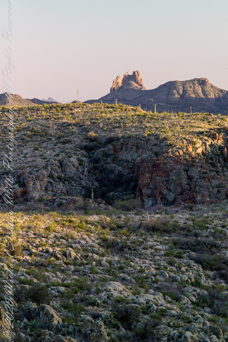
I was a member of an expedition to Peter’s Mesa March 2008, a place central to Superstition Wilderness treasure legends. This is a sunset view, looking south, southwest. Light raking across the desolation and Miner’s Needle creates a fascinating spectacle. Ancient volcanism, apparent throughout the Superstition Wilderness, is here seen in the texture, form and type of rock as well as the mineral deposits. Miner’s Needle, like Weaver’s Needle (not seen in this view), are eroded volcanic summits. Look closely for the “eye” of Miner’s Needle, easier seen in the cropped heading photograph. To this day, hopeful prospectors search for gold nuggets.
There is one form of volcanism present today as an eerie rumble or hiss, similar to an enormous distant jet engine heard now and then during our two days on the mesa, louder and closer than an overhead plane could produce. The view includes many notable Sonoran Desert plants. Many young Saguaro cactus are in the form of green poles. Catching the dramatic light, on the ridge is a tall single flower of an Agave, known as the “Century Plant” it flowers once in a long life and dies.
Peters Mesa is named after “Old Pete” Gottfried Petrasch, father of Hermann and Rhiney Petrasch. Old Pete worked for Jim Bark for awhile in the 1890s doing odd jobs. Irregular employment gave Pete and Sons time to s searched for the Lost Dutchman Mine in the years following the death of the source of the legend, the “Dutchman” Jacob Waltz. The Petrasches were one of the first groups to search for the mine, and gold in general. They covered almost the entire Superstition range in their combined searches.
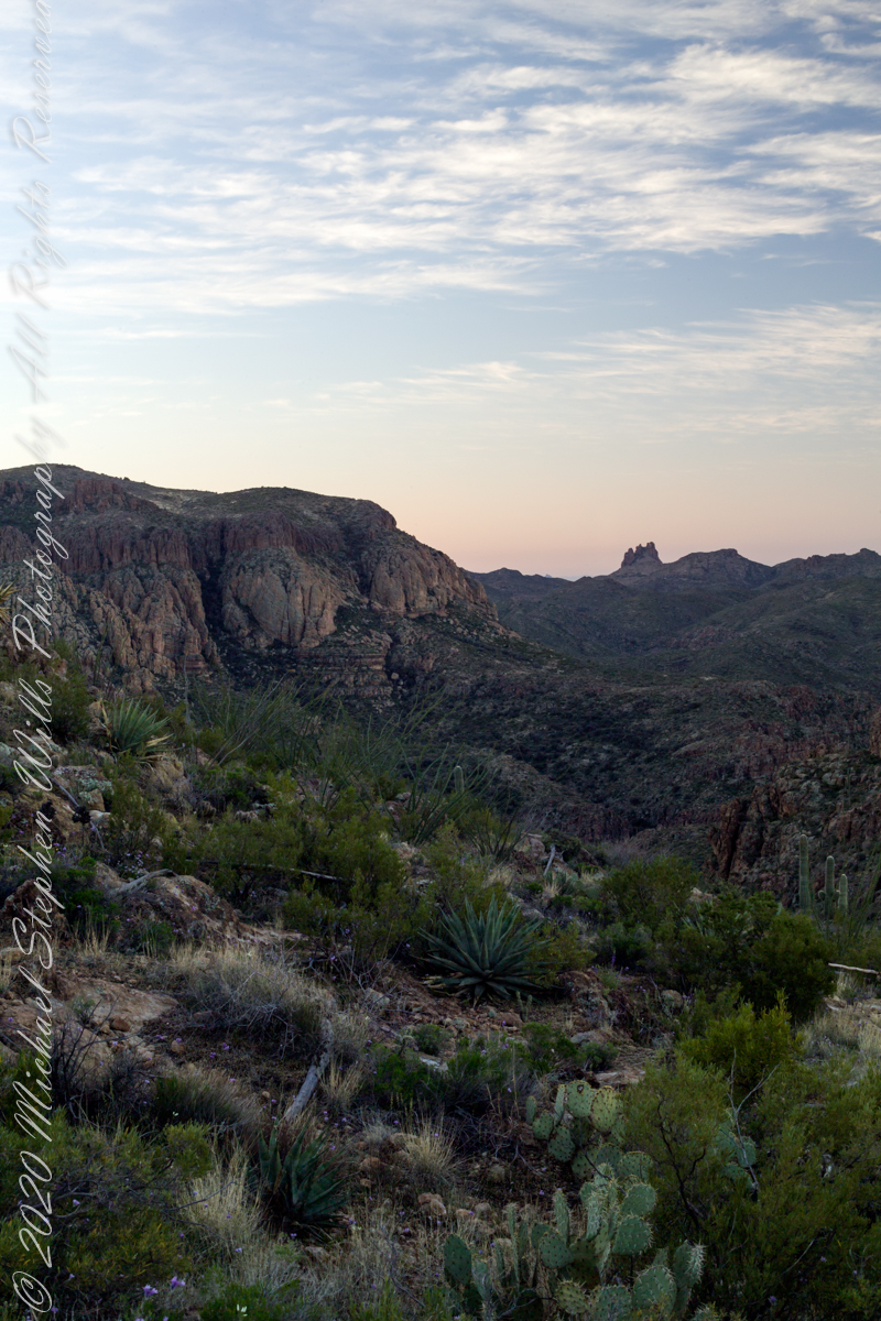
Sunrise looking across Music and LaBarge Canyons to Miner’s Needle
On our first day on the mesa, we came across the remains of one of these camps, on the top of Squaw Canyon, a deplorable junk pile discarded by searchers, presumably disappointed, too lazy to cart it out. That March, we were lucky to find the remnants of winter rains in the form of a meager trickle at the bottom of a shallow draw off Peter’s Mesa trail up from La Barge canyon. We had a good time of it until the trip was cut short by a storm front and torrential rains. We were back in Apache Junction before they hit.
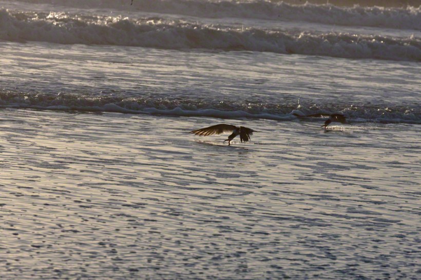
A multi-day hatch of small fry around the time of a new moon triggered this Black Skimmers (scientific name: Rynchops niger) feeding behavior surf off Cocoa Beach, Brevard County on Florida’s Atlantic Coast.
Copyright 2022 Michael Stephen Wills All Rights Reserved
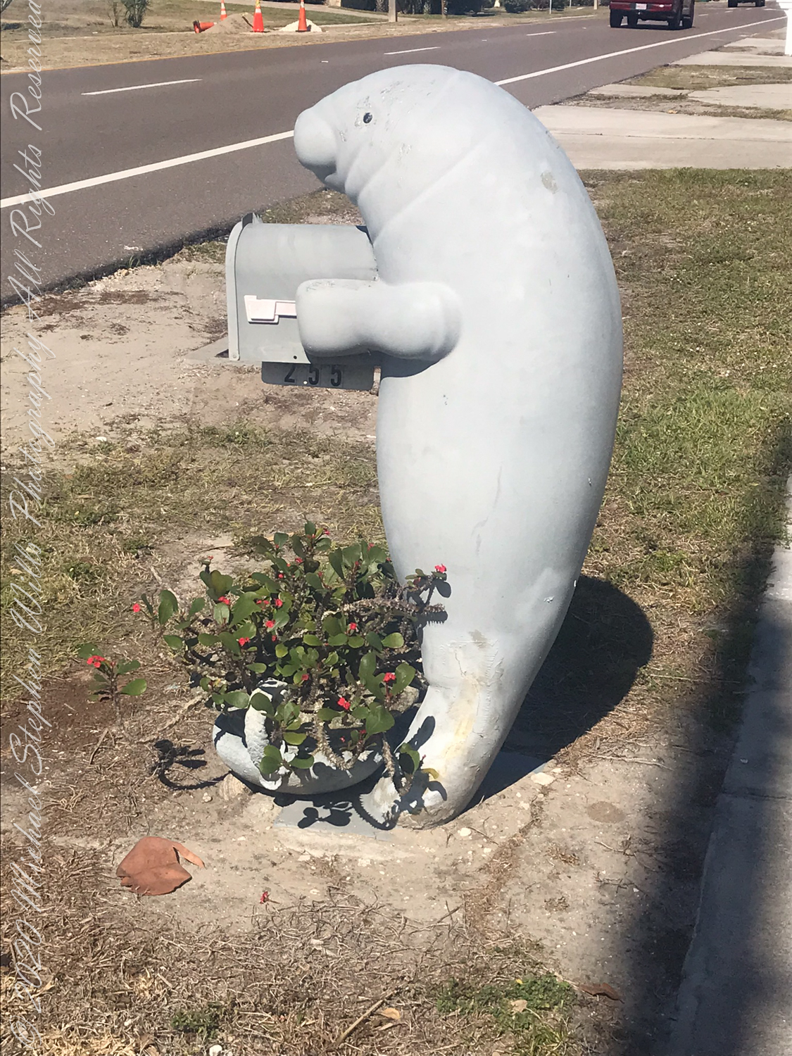
No, the Manatee mailbox on Atlantic Avenue is NOT the whale sighted….more of that later. February 3rd 2022 dawned with scattered clouds to fracture sunbeams.
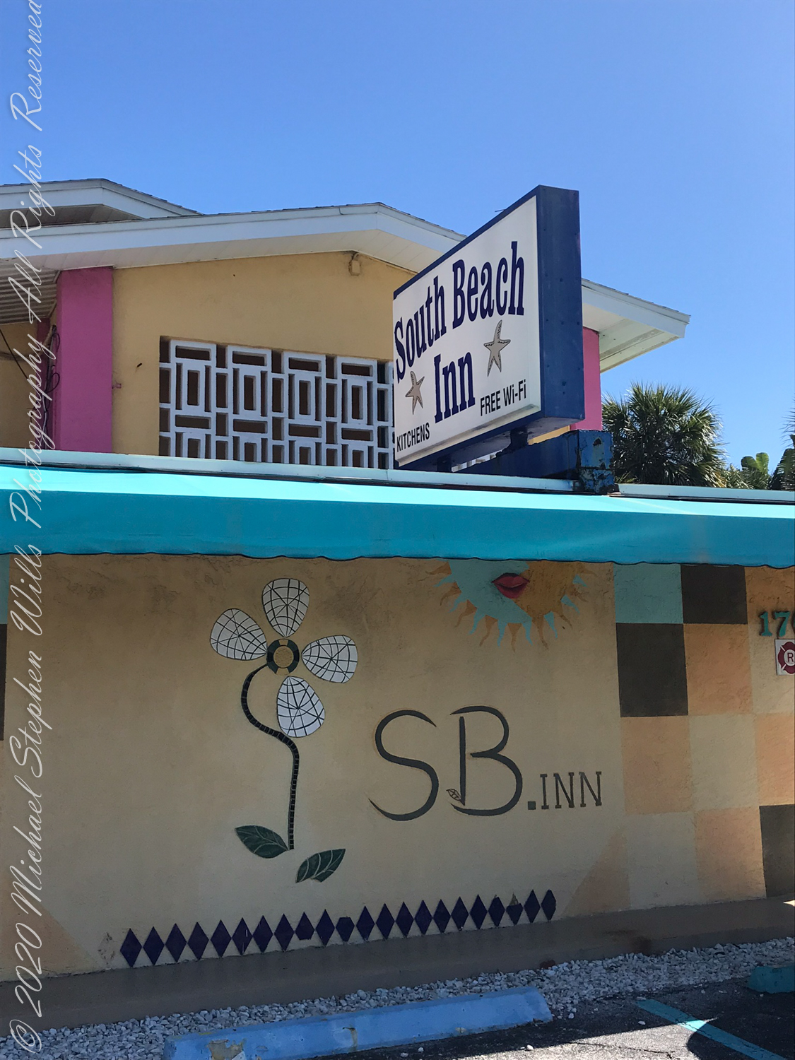
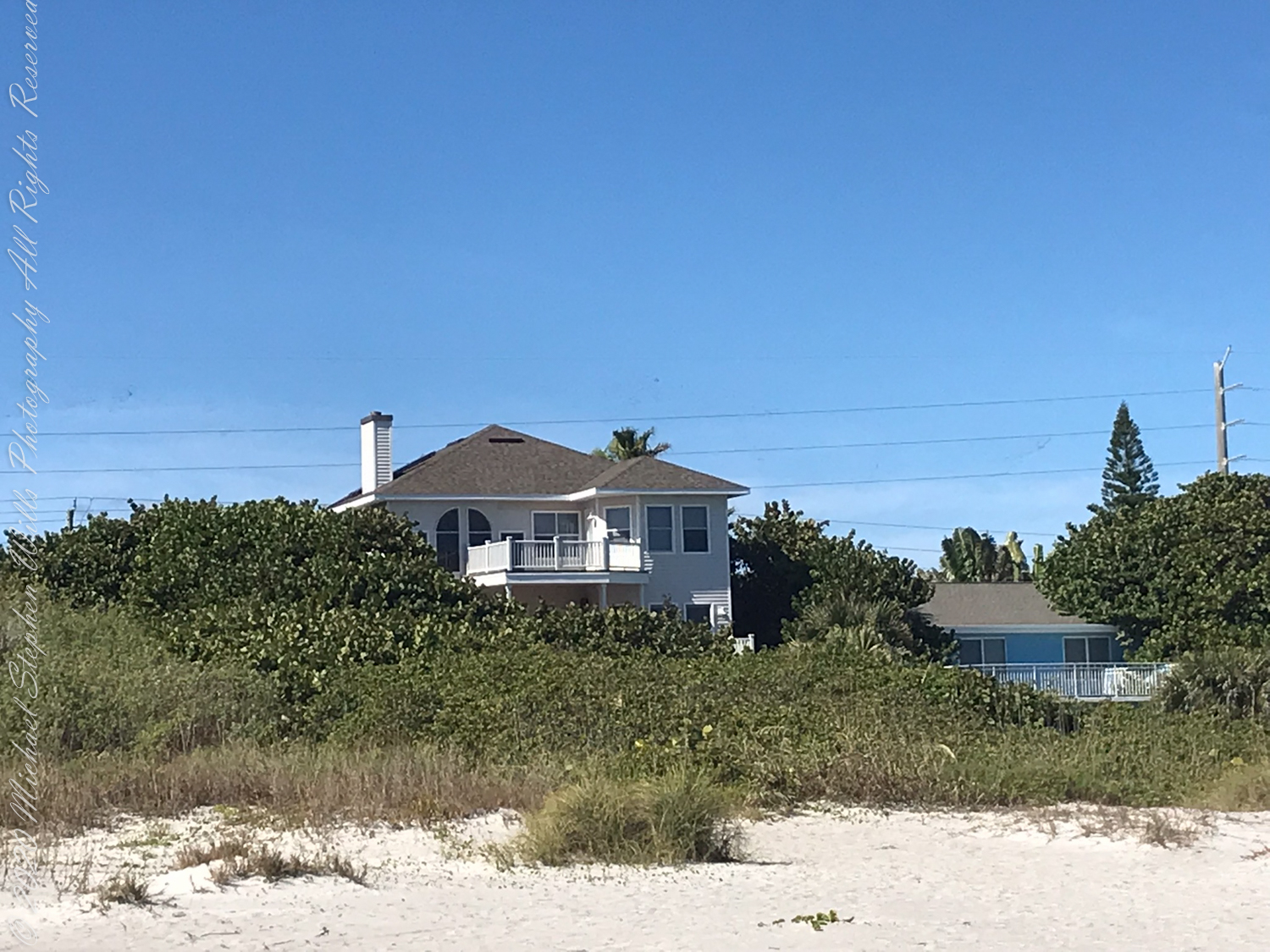
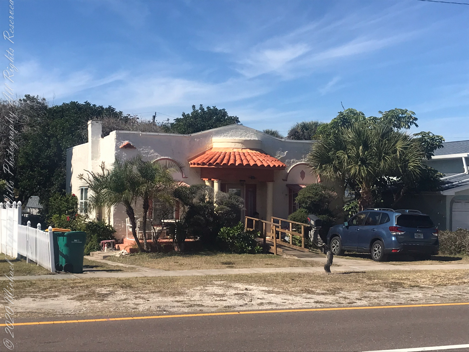
Walking south I made the 2+ mile point where, up from the beach on South Atlantic Avenue, is a memorable facade.
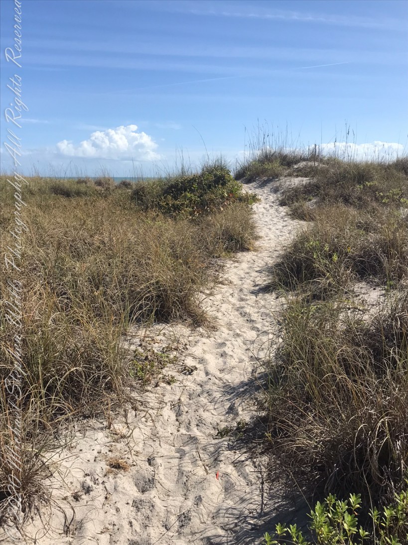
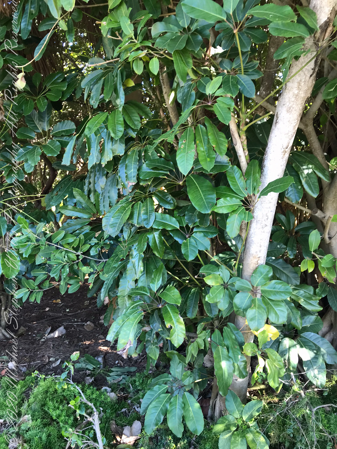
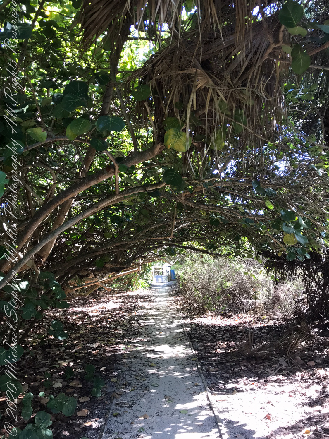
Also exotic schefflera, paths to the beach through Sea Grapes.
Looking back to the Sea Grapes path from the beach
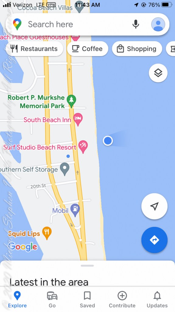
February is the time for Right Whale sightings on the Florida Atlantic Coast. On the beach, near the blue dot on the following map, were lines of people facing the ocean, some with binoculars and cameras with long lenses.
About 500 feet out, beyond where the wave roll begins, a person sat on a paddle board looking to my right. In the following IPhone videos an occasional black hump, roiling water, a flipper and the signature spout are visible. It is too far for identification, I call it a Right Whale from their reputation for visiting these shores in late January/February.
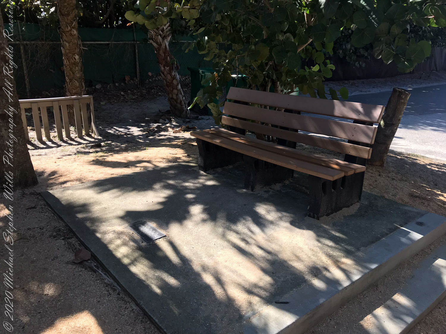
An hour later, I left the beach at South 4th Street to capture the following local color.
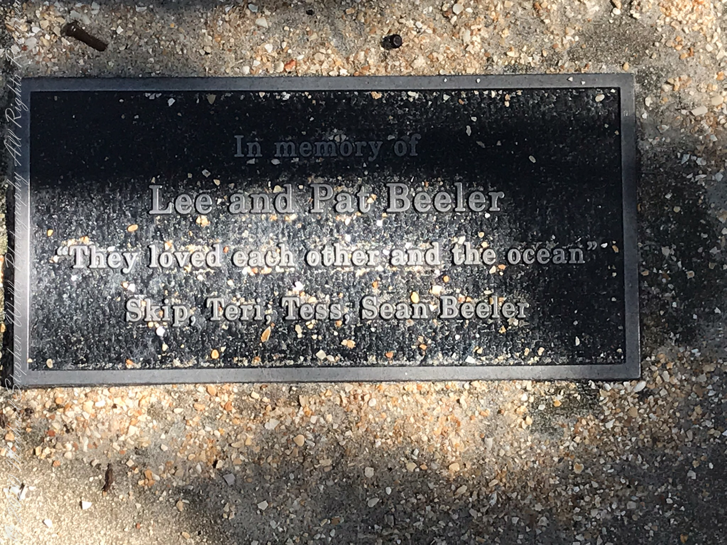
South 4th Street Beach AccessIn memory of Lee and Pat Beeler, “They loved each other and the ocean” Skip, Teri, Tess, Sean BeelerapproachableunapproachableManatee Mailbox
Copyright 2022 Michael Stephen Wills All Rights Reserved
Booking our February/March 2016 passage on the Oceania Regatta from Lima, Peru to Buenos Aires, Argentina we started early, Spring 2017. We made two excellent choices: a stateroom with balcony on the port side. Waking each morning we were treated to views of the shoreline. On the morning of February 15, 2016 as we sailed the Chacao Channel toward Puerto Montt I was up 4:15 am before the sun rose to photograph our approach to the city.
I knew a classic 8,701 foot high stratovolcano topped with glaciers, named Orsorno, was out there and, amazingly, appeared on the horizon, seventy five miles distant to the northeast outlined by the gathering dawn. The sky was just brightening from total darkness at this time.
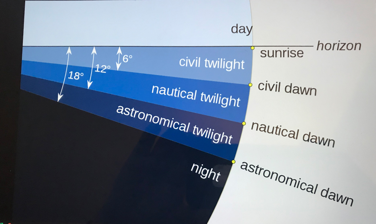
Use your pinky finger to apprehend the sky dome. Imagine yourself at sea, out of sight of land, on a calm day. Keeping your arm extended, place your pinky-tip on the horizon due east, raise your arm directly overhead. The average sized pinky-tip will have spanned 90 of its lengths. The distance measured from the horizon to directly overhead, the zenith, is 90 degrees of sky dome, about one pinky-width per degree, one-fourth of the entire 360 degrees of sky around your spot on the globe.
The apparent width of the sun disk from earth covers 1/2 degree of sky dome. The disk center point moves 15 degrees per hour (360/24 = 15). Using these facts to estimate time to sunset is relatively straightforward. Estimating time to dawn from the sky is more difficult. This graphic, “Twilight-dawn subcategories,” is a way to grasping what happens. Your position on the earth globe affects the experience. For example, at northern latitudes above 60°34′ summer nights never become darker than civil twilight because the sun’s midpoint never drops lower than 6 degrees below the horizon. Civil twilight lasts all night long summer times in parts of Sweden and Finland.
Attribution: “Pmurph5, CC BY-SA 4.0 , via Wikimedia “
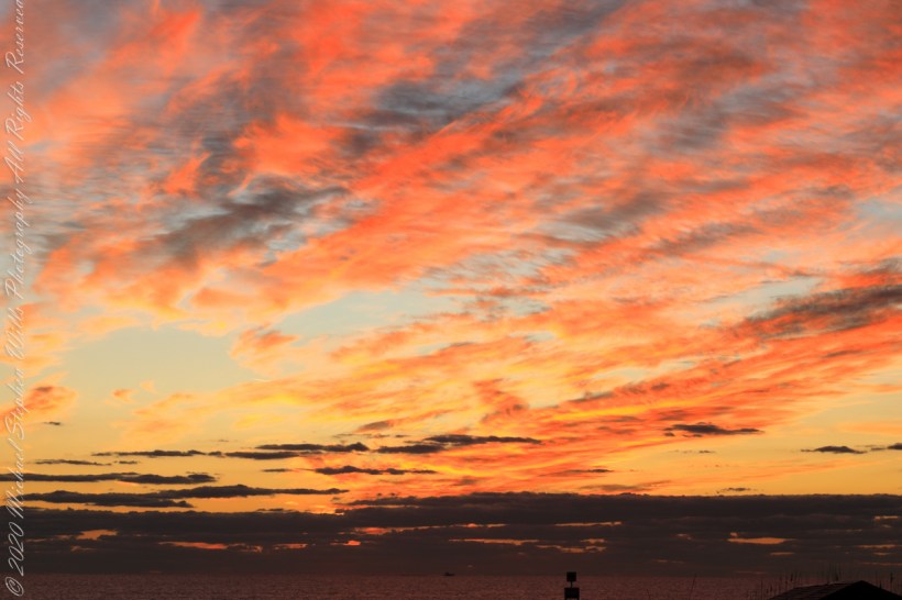
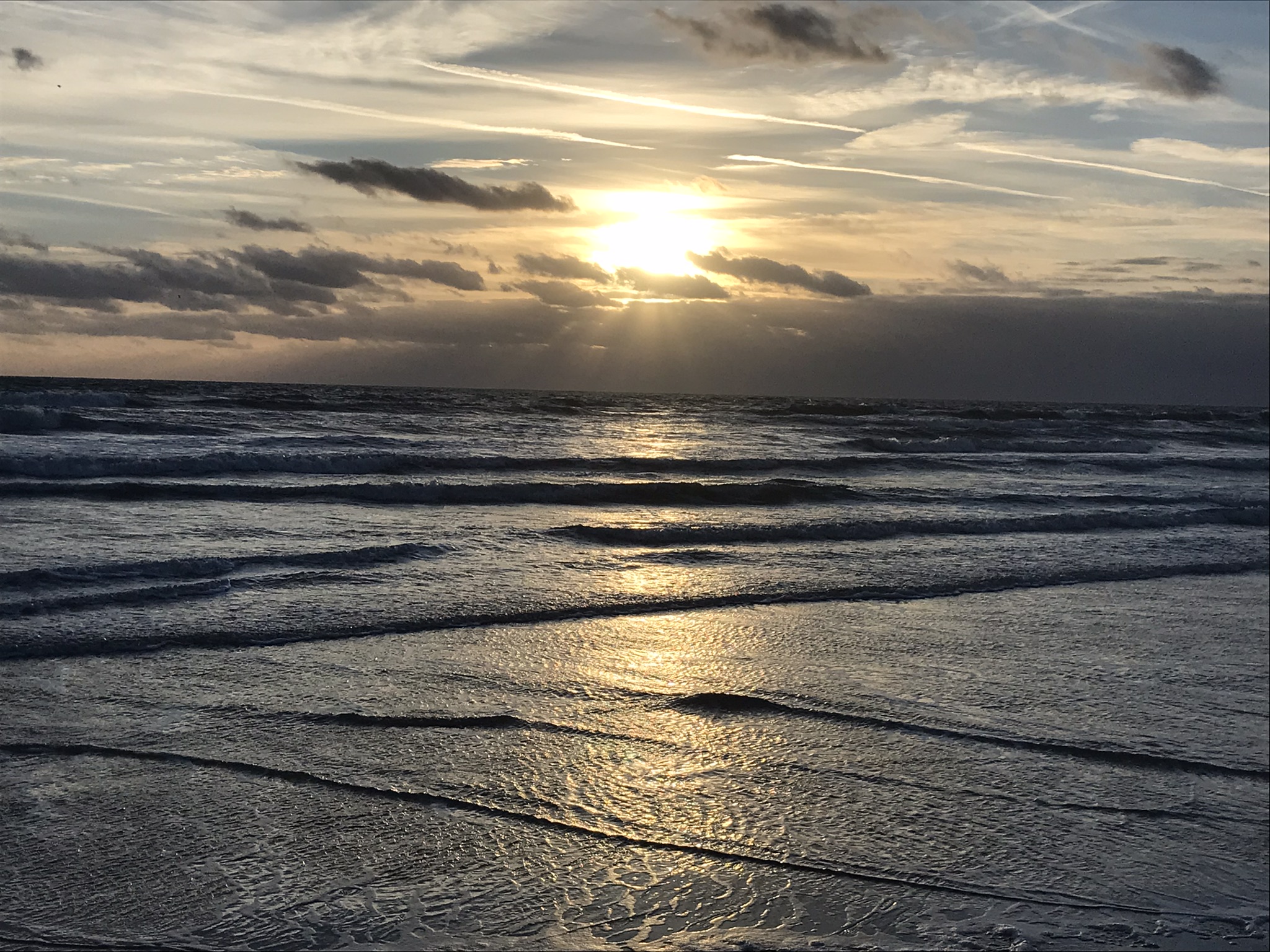
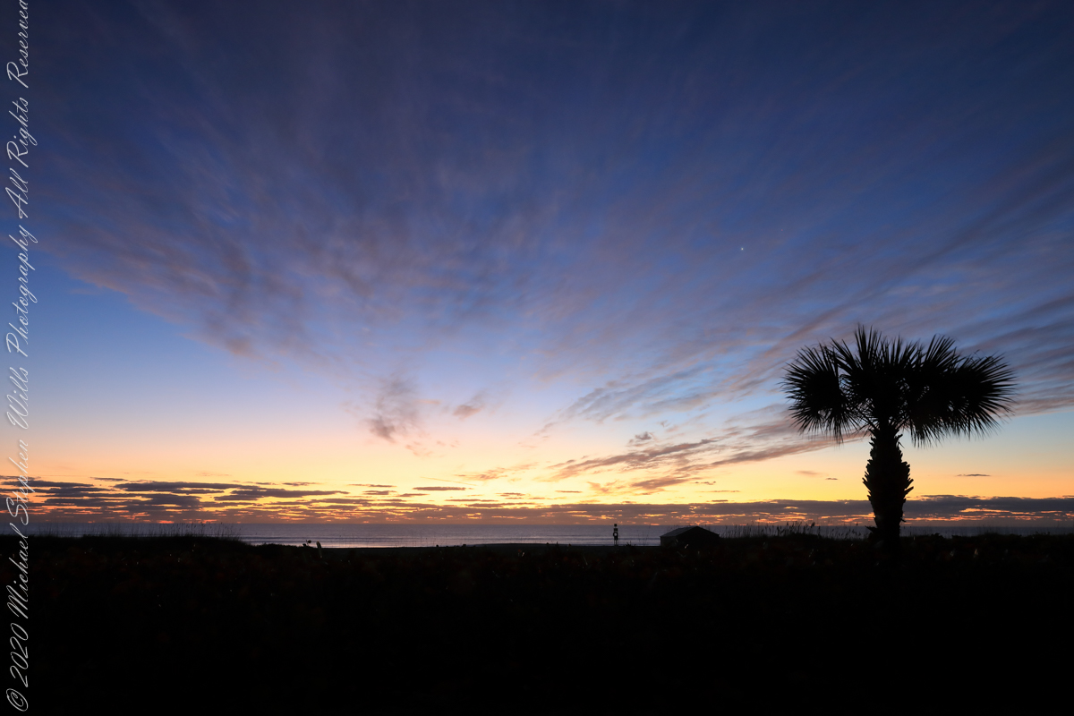
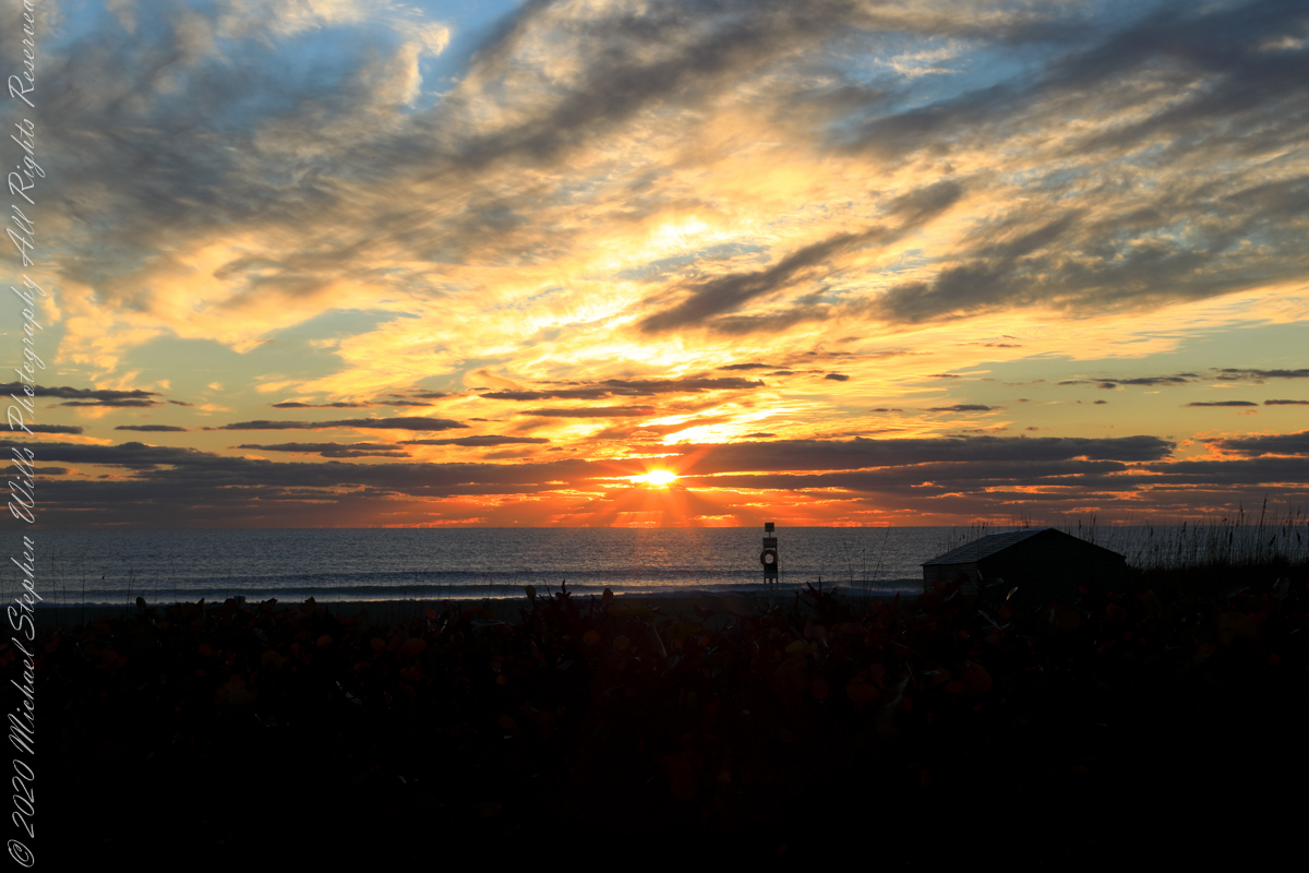
The date-time stamp on the first photograph of this series is 6:46:23 am, Cocoa Beach sunrise for February 1st was 7:09:40, 00:23:17, 23.283 minutes in decimal notation, later. This duration divided by 60 minutes in an hour and multiplied by the sun’s apparent velocity across the sky (15 degrees per hour) and minus the .25 degree between sun’s center and disk edge, gives the sun’s center as 5.57 degrees below the horizon: this is a photograph of the sky a minute or so after the sun passed civil dawn into civil twilight. I am not more exact because this calculation does not account the deviation of the sun path from due east at this latitude, lengthening civil twilight duration by almost a minute.
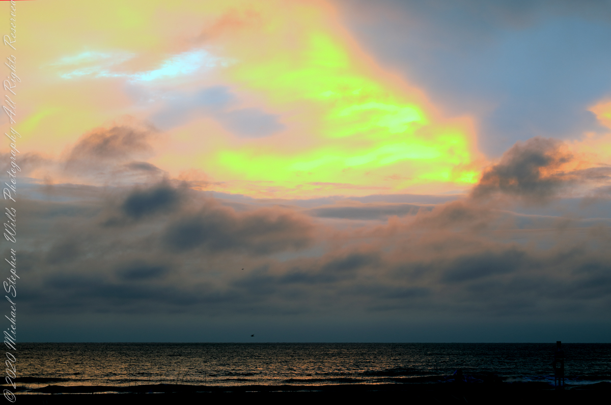
Edge of Civil Twilight: dark clouds soon to take light
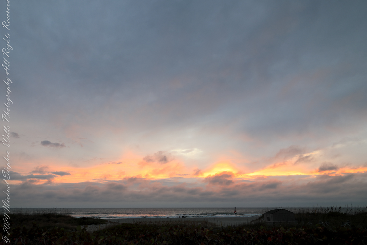
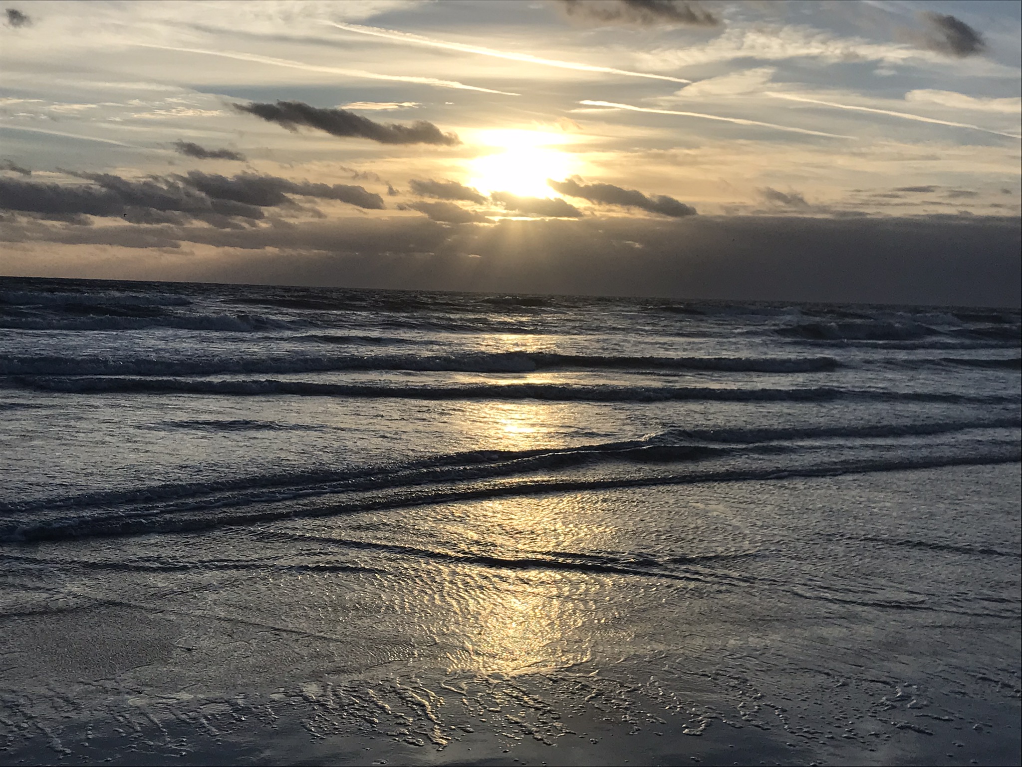
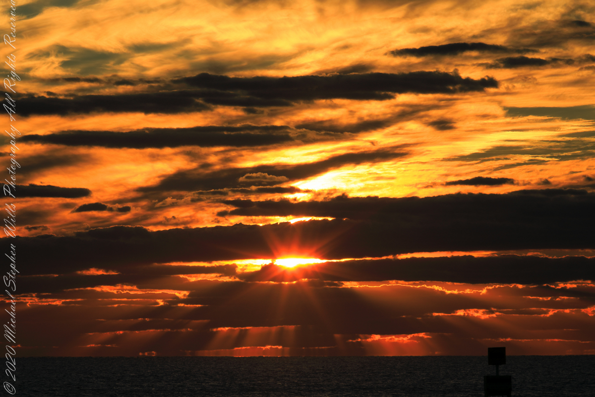
The following photograph is time-stamped 7:05:06, 4.567 minutes until sunrise, sun center is just below the horizon, setting the dark clouds of the previous photograph fleetingly on fire.
Civil Twilight at the edge of sunrise
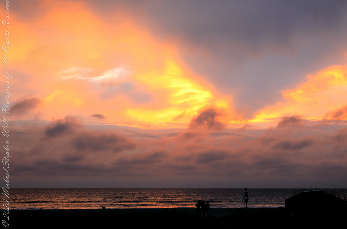
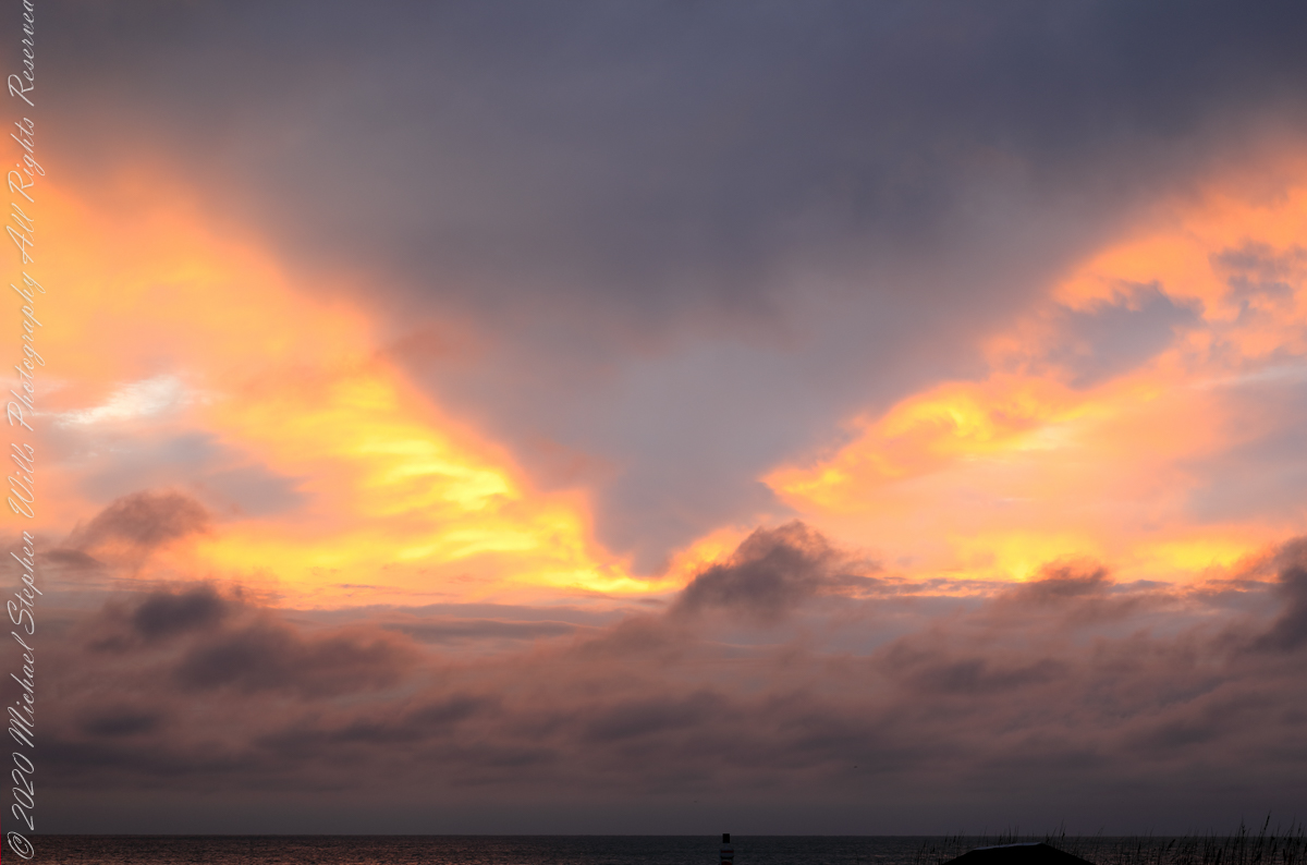
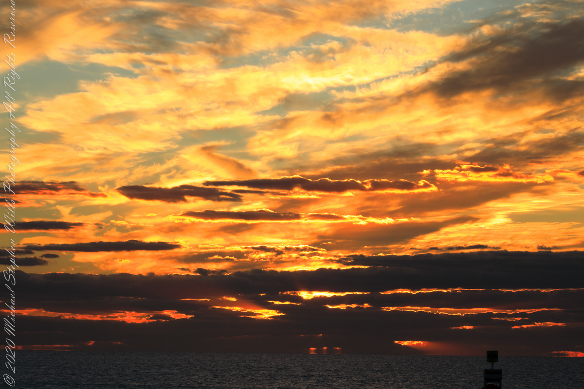
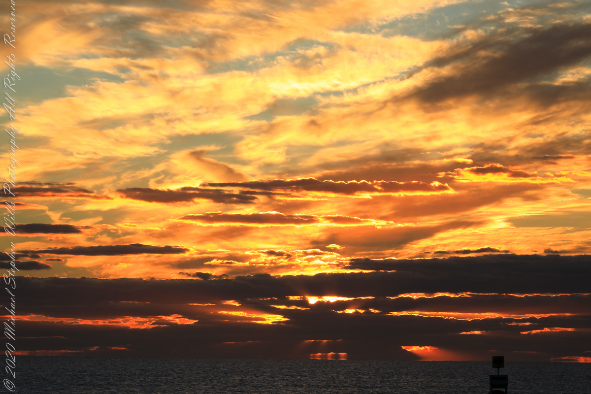
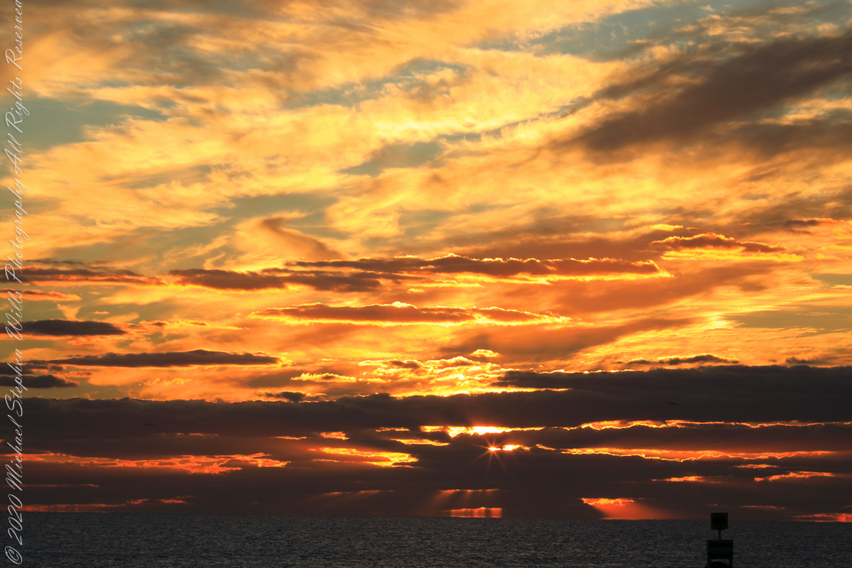
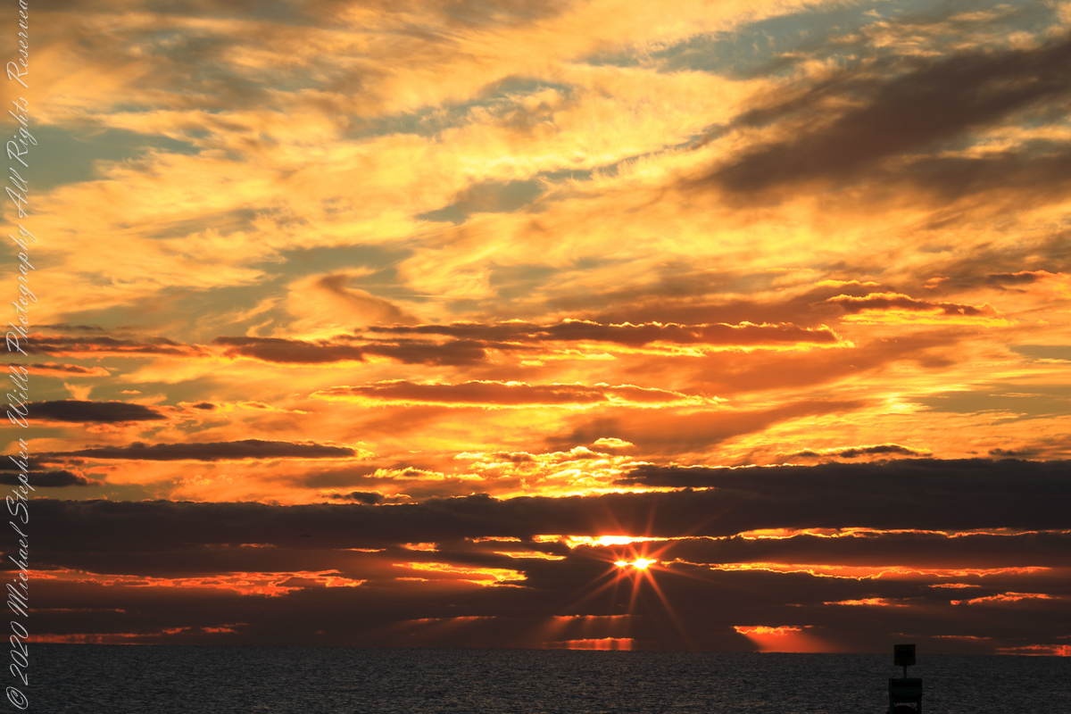
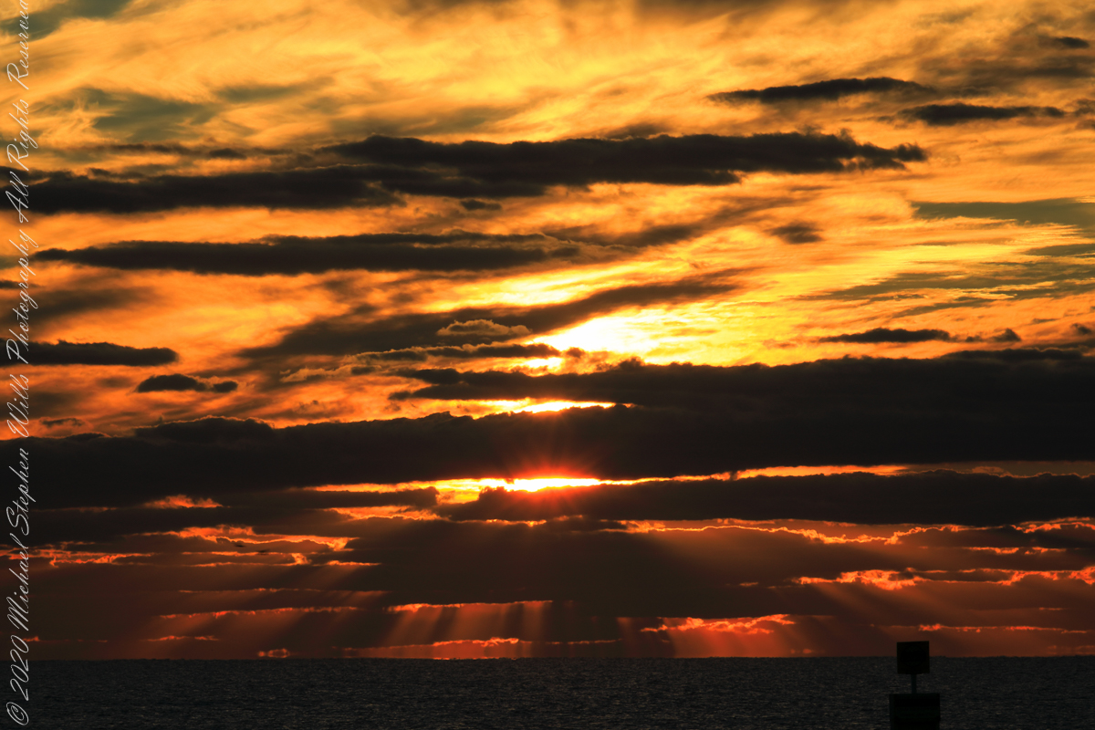
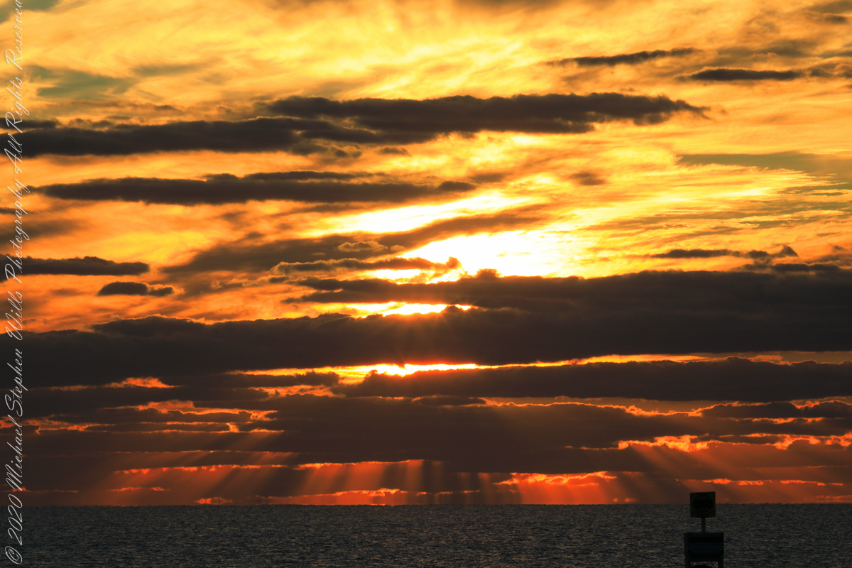
Sunrise has passed in the following photographs, obscured by clouds and making for a great light show. Enjoy!!
References
“Dawn” Wikipedia page, the graphic “Twilight-dawn subcategories,” and the descriptions of subcategories came from this page.
Copyright 2022 Michael Stephen Wills All Rights Reserved
Even on vacation I rise early to better enjoy the day. This year’s escape from the Ithaca winter, at Cocoa Beach, up at 5 am with a beach chair and oranges in hand I walked in darkness from our beach side resort to the tide high point. My time occupied by sky watching I peeled, and ate, oranges while locating stars through the wind blown clouds. When the barely perceptible dawn light began I packed it up to find Pam, who asked to be awake for sunrise.
This day, we ate breakfast from ready to eat food purchased from the Publix market close by on Atlantic Avenue, and caught up with the news craziness. We had a day at the Kennedy Space Center planned after the sunrise walk.
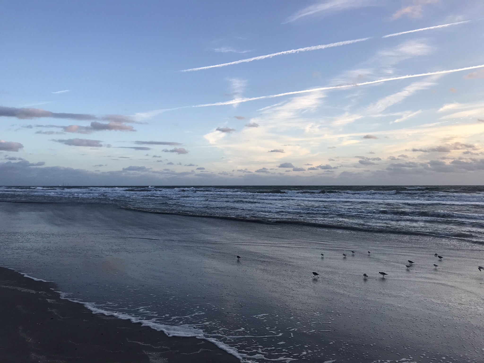
Here is our view while walking north along the tide line. In the far far distance are the Kennedy Space Center Vehicle Assembly building and a space launch gantry. Follow the shoreline to find the pier.
We walked nowhere near the pier, barely visible, not to mention Sam Shepard park. The pier and park are a day’s walk. We had a few hours free before our “Lunch with an Astronaut” event at Kennedy Space Center.
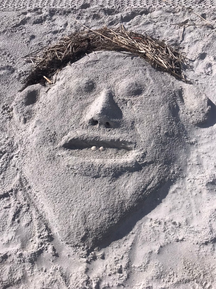
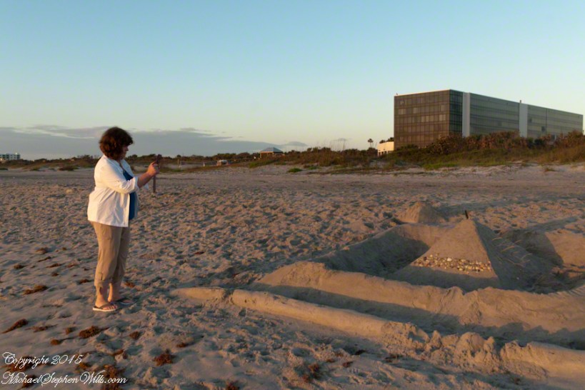
The highlight of this sunrise walk was this large sandcastle on the beach in front of a condominium, the Hilton is to the left. Lori Wilson Park is out of sight to the left. A great feature of the park, for us since the International Palms were we stayed is next to it to the north, was the park life guards.
So, we approached this sandcastle from the north. It survived the high tide to a new day, obviously it required time and resources to build. The day before was a big beach day. Wednesday was a brilliant, summer-like day for the first of March.
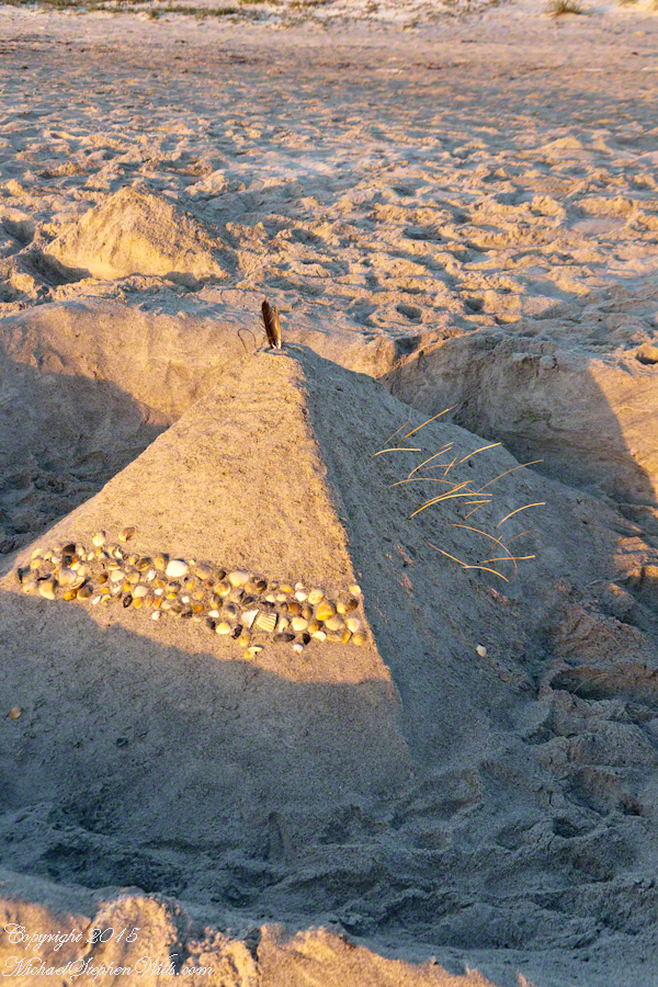
A little closer, the footsteps inside the first moat are interesting.
Pam next to the castle provides scale
Here is the central pyramid. I enjoy the dawn light on the grasses. That is a sea gull feather on the apex.
Decorative sea shell band facing the ocean.
The destiny of all our human conceits. Impermanence is part of the beauty of sand castles.