View shared by generations of newlyweds standing on a stone bridge across Enfield Creek. This is another version, taken a few years later and earlier in the season, Memorial Day morning.
Here, I have taken the lessons learned from the last post: to run from the Raw file, open it in Photoshop, make Raw dialog adjustments conversed in an .XMP file written by Photoshop. Export from Lightroom using these adjustments.
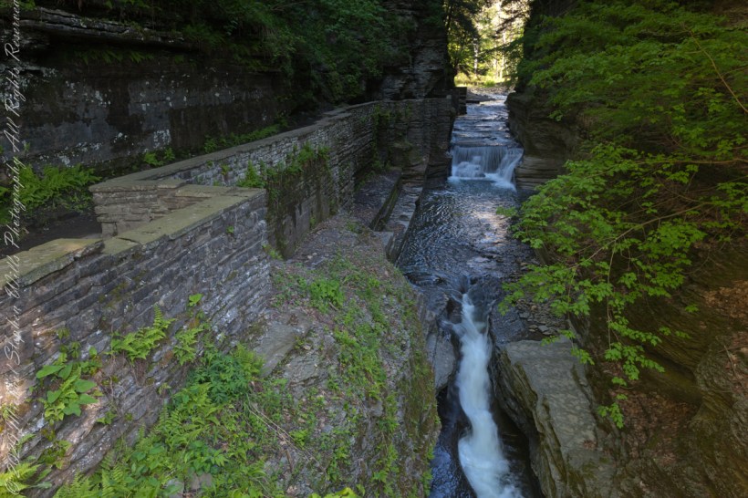
We are looking back on the place where Treman Gorge Trail from the Old Mill enters a narrow gallery looking here northwest along Enfield Creek.
It is 8:30 am on a Memorial Daty morning Robert H. Treman Park, Ithaca, Tompkins County, Ithaca, New York,
Copyright 2023 All Rights Reserved Michael Stephen Wills
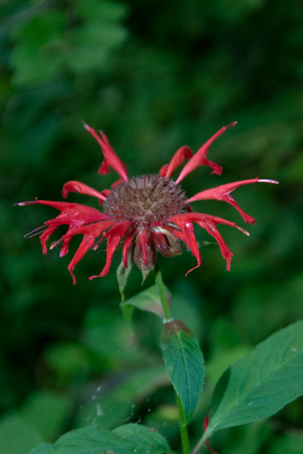
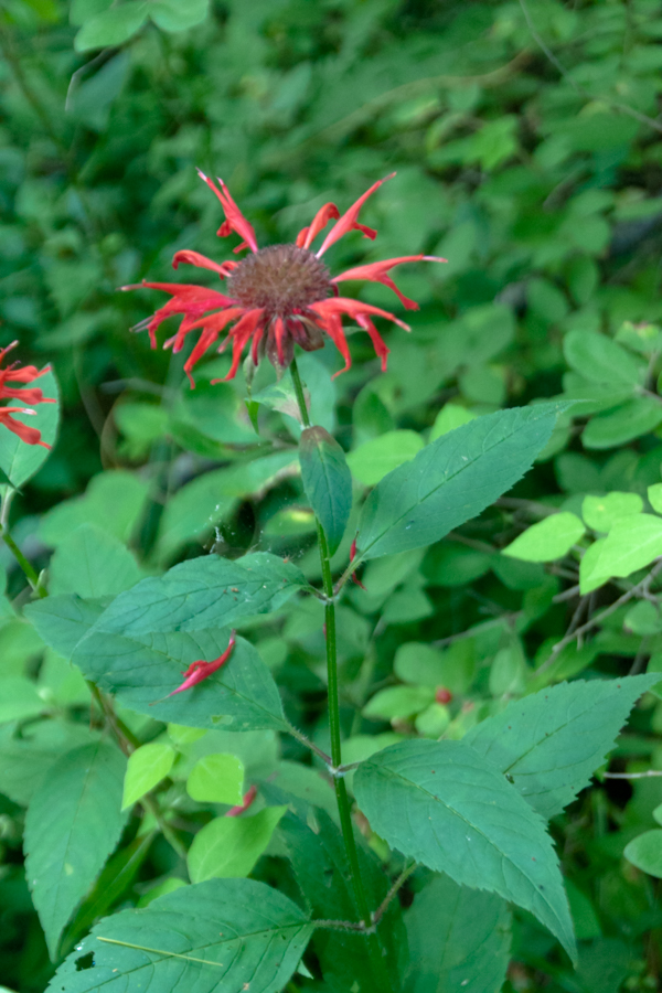
Monarda didyma is also known as crimson beebalm, scarlet beebalm, scarlet monarda, Eau-de-Cologne plant, Oswego tea, or bergamot. A wildflower native to the Finger Lakes, Crimson beebalm is extensively grown as an ornamental plant, both within and outside its native range; it is naturalized further west in the United States and also in parts of Europe and Asia.
It grows best in full sun, but tolerates light shade and thrives in any moist, but well-drained soil. As suggested by membership in the Lamiaceae (mint) family, Beebalm, as an aromatic herb, has a long history of use as a medicinal plant by many Native Americans, including the Blackfoot. The Blackfoot people recognized this plant’s strong antiseptic action and used poultices of the plant for skin infections and minor wounds.
An herbal tea made from the plant was also used to treat mouth and throat infections caused by dental caries and gingivitis. Beebalm is a natural source of the antiseptic thymol, the primary active ingredient in modern commercial mouthwash formulas. The Winnebago used an herbal tea made from beebalm as a general stimulant. It was also used as a carminative herb by Native Americans to treat excessive flatulence. As a matter of local interest, Iroquois of Oswego, New York, made the leaves into a tea, giving the plant one of its common names.
It is 9:30 am on a July morning Robert H. Treman Park, Ithaca, Tompkins County, Ithaca, New York,
References
Wikipedia, “Monarda didyma”
“The Botanical Garden, Vol II” Roger Phillips and Martyn Rix, Firefly Books, 2002. Page 284
Copyright 2023 All Rights Reserved Michael Stephen Wills
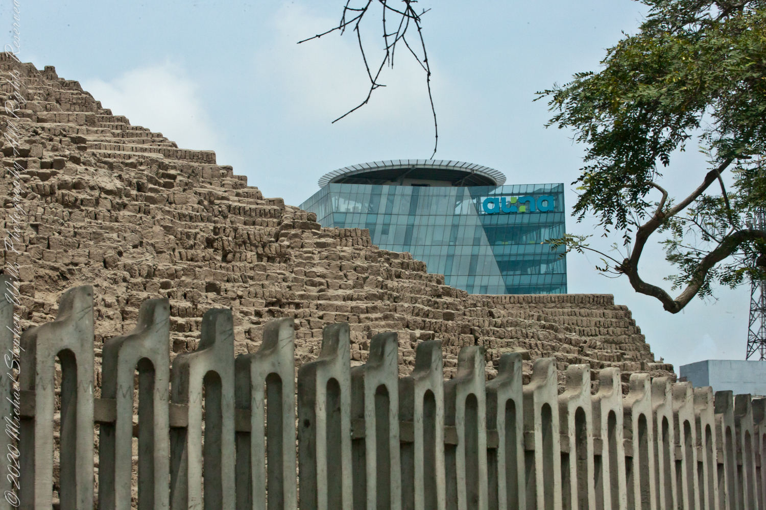
View of Clinica Delgado (hospital) from Lima Peru’s Elias Aguirre (street), Huaca Pucllana filling the foreground. Huacas are commonly located in nearly all regions of Peru outside the deepest parts of the Amazon basin in correlation with the regions populated by the pre-Inca and Inca early civilizations. They can be found in downtown Lima today in almost every district, the city having been built around them. Huaca Pucllana, located in Miraflores district, is an adobe and clay pyramid built from seven staggered platforms. It served as an important ceremonial and administrative center for the advancement of the Lima Culture, a society which developed in the Peruvian Central Coast between the years of 200 AD and 700 AD.
View North / Northwest from Peter’s Mesa. At our feet is a mature Saguaro Cactus towering over Charlebois Canyon, to the right Black Mountain. Bluff Spring Mountain, middle distance, then Black Top Mesa. Flatiron Peak, of the famed Superstition Mountain, is in distance. Photographed from Peter’s Trail on a March afternoon 2008. Superstition Wilderness, Tonto National Forest, Arizona
Bluff Spring Mountain, middle distance, then Black Top Mesa. Flatiron Peak, of the famed Superstition Mountain, is in distance. Photographed from Peter’s Trail on a March afternoon 2008. Superstition Wilderness, Tonto National Forest, Arizona
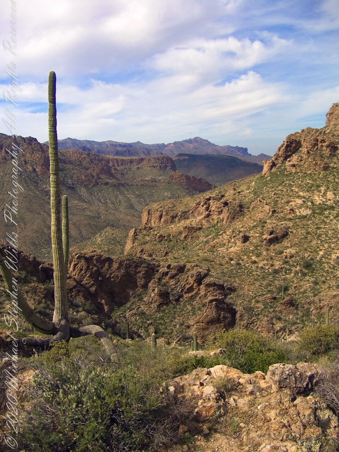
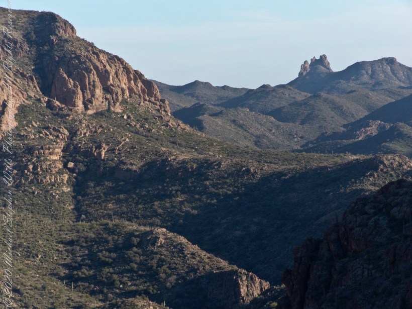
The eye of Miner’s Needle is clear in both these South / Southeast views from Peter’s Mesa looking across the Music Canyon.
Morning
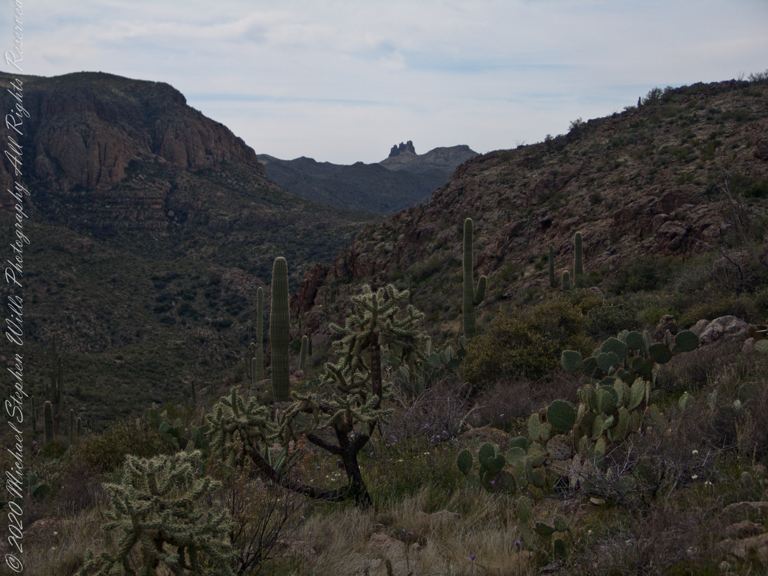
Many wildflowers, sprinkled like stars through the foreground of the morning photograph with Prickly Pear, Cholla and Saguaro cactus. Beware of “Jumping Cholla”, named for its seeming ability to attack passers-by. Another name, “Hanging Chain Cholla”, is more appropriate. Each chain with many hooked barbs is lightly attached to the branch, ready to snag a ride from unwary hikers.
Light rakes across the landscape in the evening photograph, taken from another vantage point on Peter’s Mesa. Miner’s Needle is four (4) miles away “as the crow flies,” i.e., line of sight distance.
Dutchman Trail follows the outflow of two springs along the canyon floor: Music Canyon and LaBarge springs. Here we are climbing Peters Trail to the eponymous mesa and facing south / Southeast, looking down on Dutchman Trail.
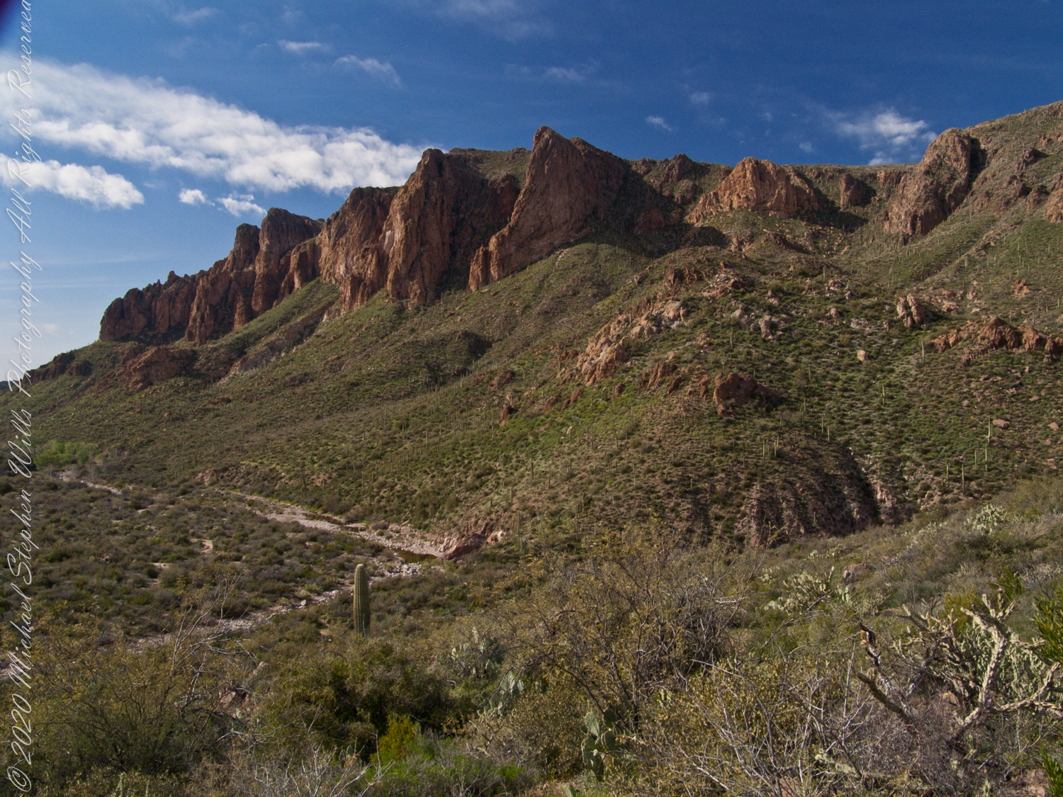
This is rough country below Bluff Spring Mountain. Stag Horn Cholla cactus is lower right with Prickly Pear cactus scattered in the brush. Poles of young saguaro cactus are scattered around the lower slopes.
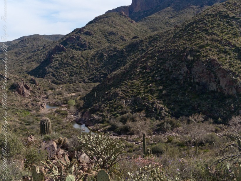
After a respite among the cool spring waters, we headed up Peters Trail for the top of Peter’s mesa where, for all we knew, there was no water.
In this photograph I face northwest, looking down on Dutchman Trail. The peak, upper center left, is Black Mountain. The cleft of Charlebois Canyon is lower middle right. Stag Horn Cholla cactus is lower right with Prickly Pear cactus scattered in the brush. Poles of young saguaro cactus are scattered around the lower slopes. Look carefully and you can make out the pooled water of our rest stop.
Copyright 2022 Michael Stephen Wills All Rights Reserved
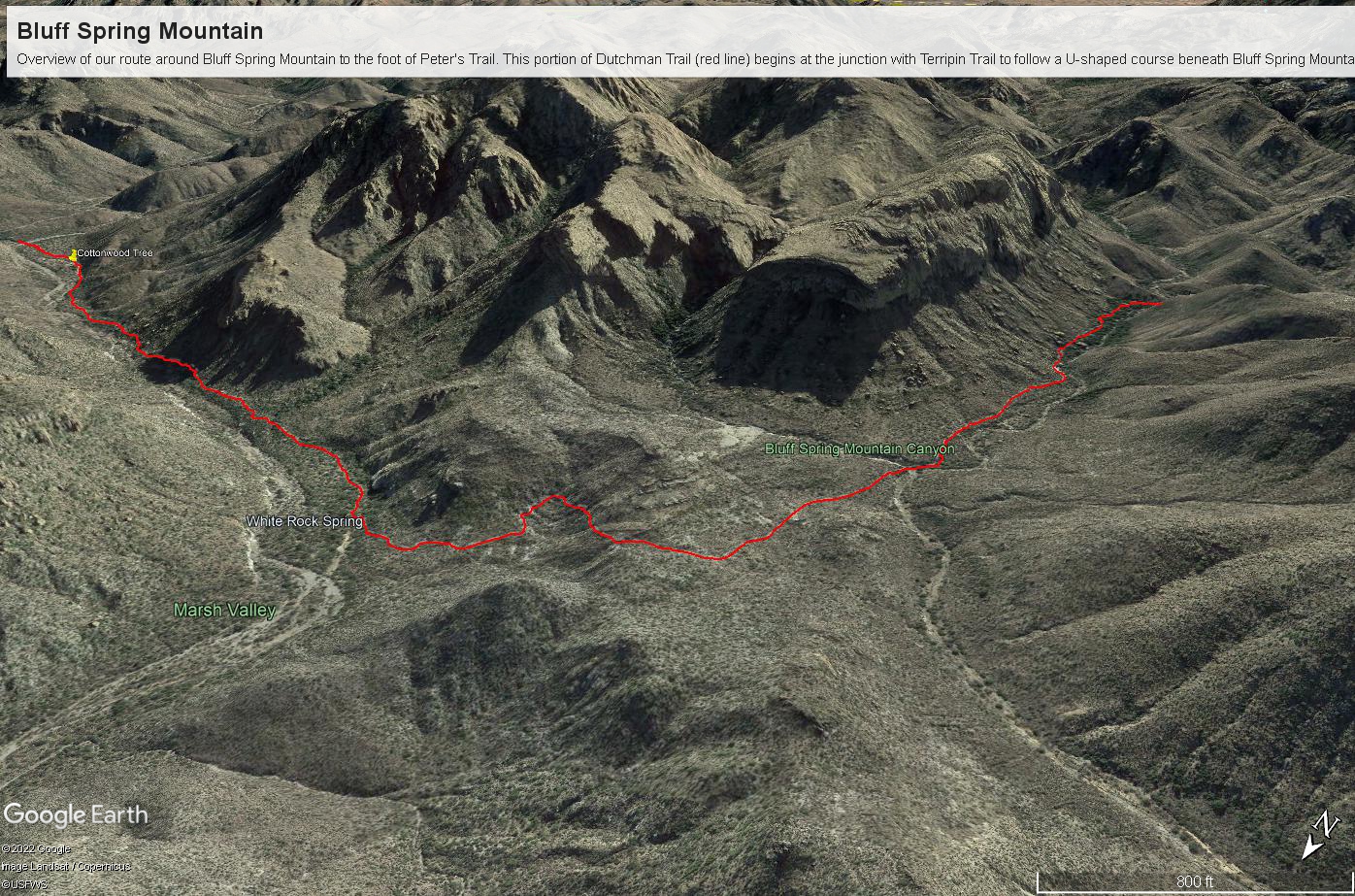
Here is a recap of the last few Superstition Wilderness posts. The expedition route, in red, starts on the right where Dutchman and Terrapin trails meet. The total distance is 2.6 miles. Photograph timestamps tell me about 2 hours passed — 1.3 miles per hour in this rough country.
Here is a gallery of photographs from this portion of our expedition.
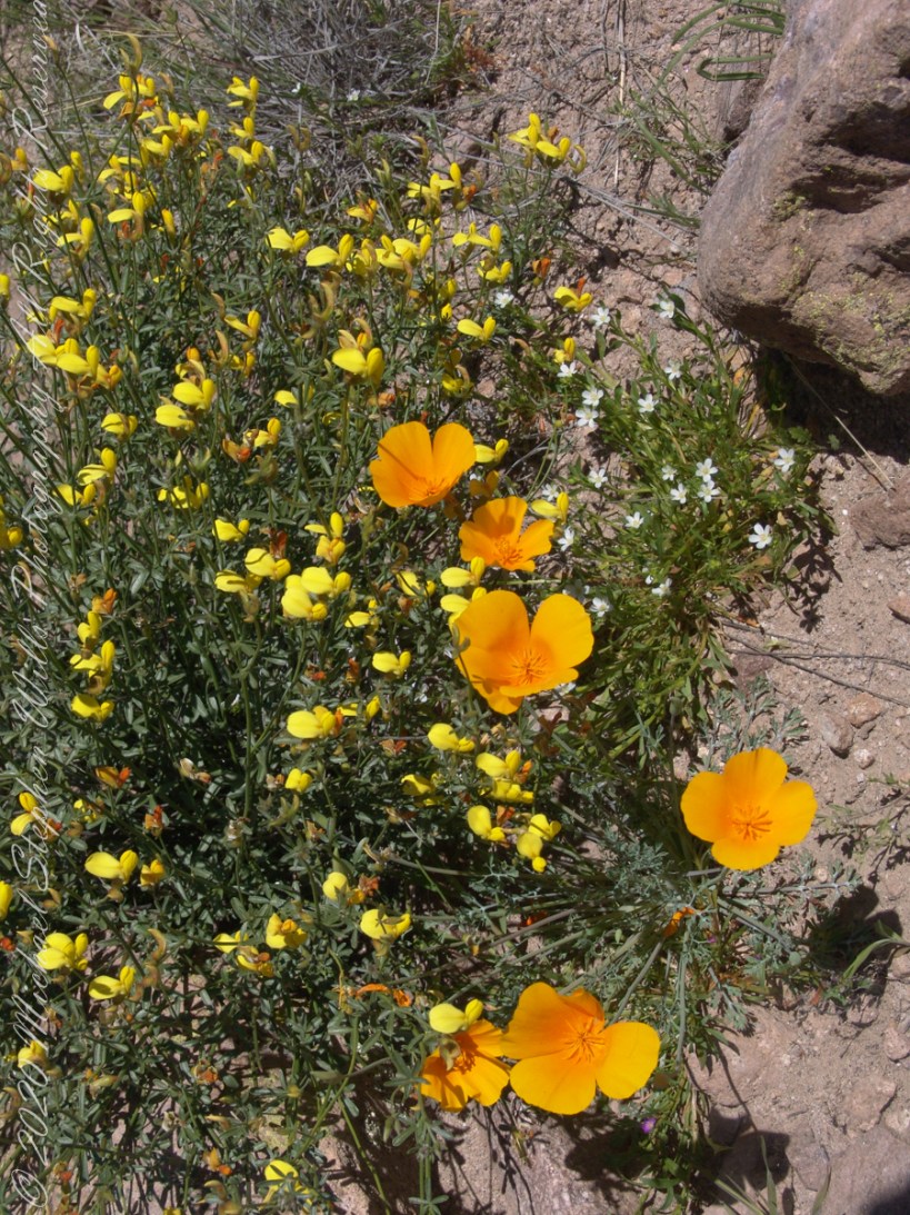
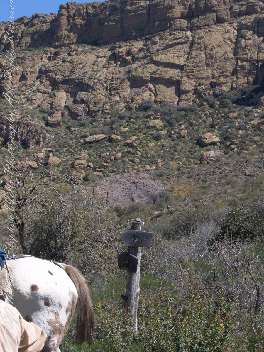
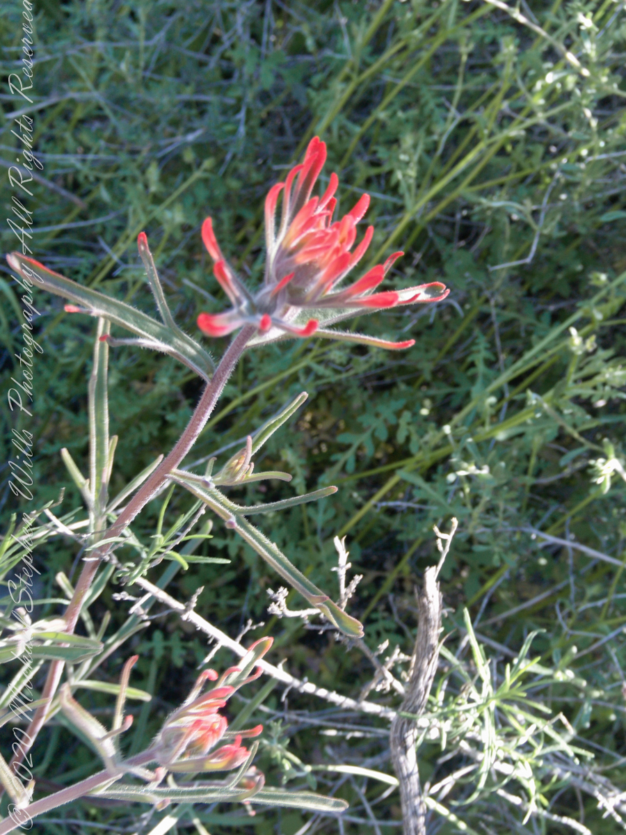
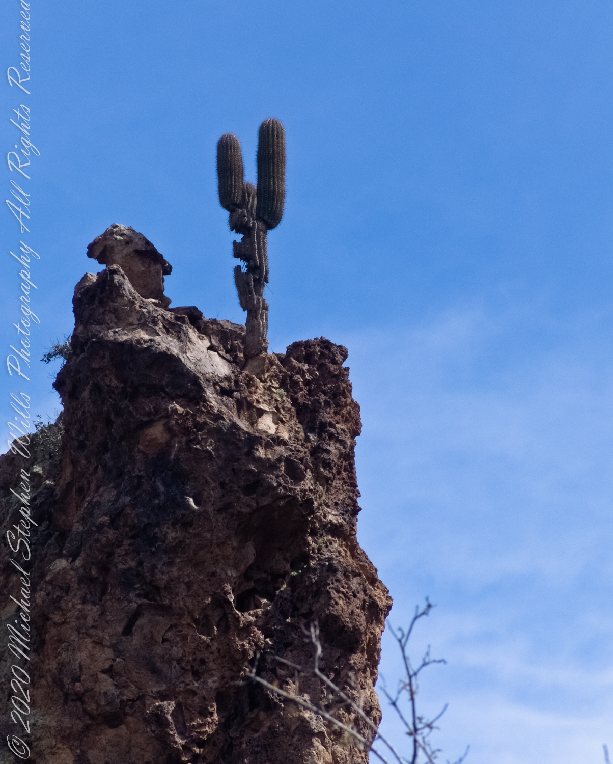
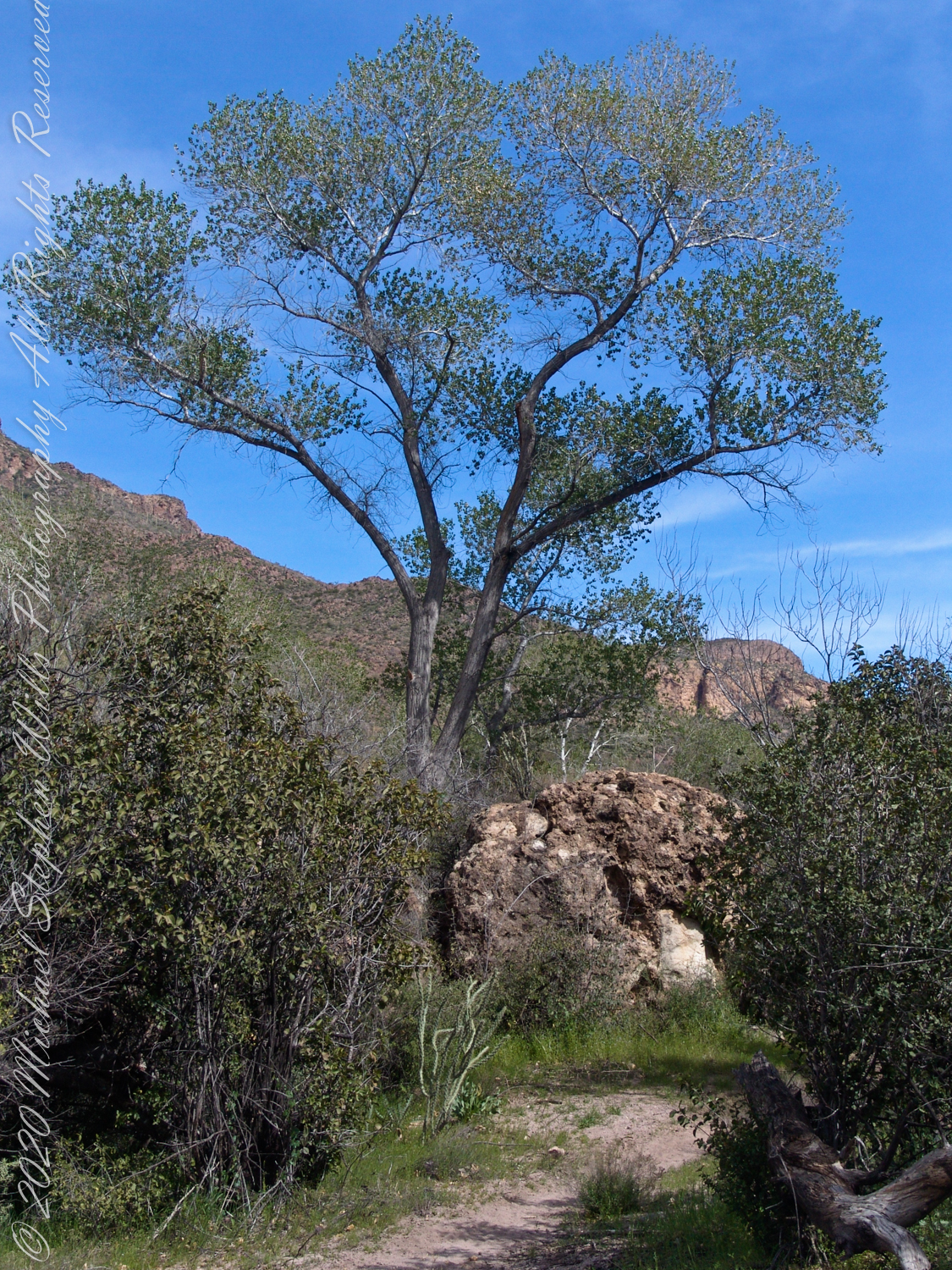
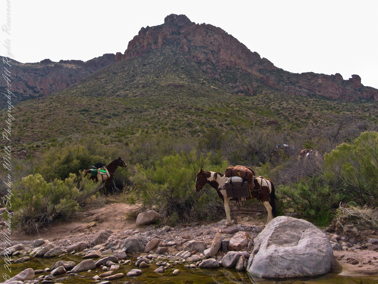
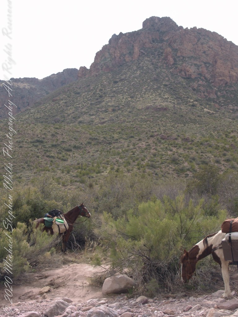
The beetling cliffs off Bluff Spring Mountain loom over where Terrapin and Dutchman trails meet. Patches of yellow are Mexican Poppies blooming on the talus slope. Terrapin Trail climbs the ridge, to right, Here is where I caught up with mounted expedition members, the spotted rump of an Appaloosa figures prominantly next to the sign post. Superstition Wilderness, Tonto National Forest, ArizonaTerrapin Trail almost immediately starts a climb up to an eponymous pass between Bluff Springs Mountain and Weavers Needle. From here, it is the best way into the mountain. The trail name is a misnomer, as terrapin (Malaclemys terrapin) turtle habitat is near the ocean. There is a desert tortoise (Gopherus agassizii) you might encounter during the rainy season as they are otherwise inactive. Superstition Wilderness, Tonto National Forest, ArizonaAl Conant at Terrapin and Dutchman trails. His Appaloosa is enjoying fresh grass. Superstition Wilderness, Tonto National Forest, ArizonaThe bright yellow flowers on right are a member of the pea (Fabaceae) family named Wright’s Deervetch (Acmispon wrightii) I am able to pick it out from many similar flowers due to the characterictis narror leaves with small hairs. These start out yellow, turning to red with age eventually forming brown seed pods. Mexican Poppy (Eschscholtzia californica) to the right. The small white flowers are Chickweed (Minuartia macrantha) of the family Carnation (Caryophyllaceae) . These are growing along Dutchman trail, March 2008, at the base of Bluff Spring Mountain. Superstition Wilderness, Tonto National Forest, ArizonaView from Dutchman Trail between Black Top Mesa and Bluff Springs Mountain, approaching White Rock Spring and LaBarge canyon. Looking Northwest, in the distance is Malapais Mountain behind Red Hills. Volcanic rock and Cholla cactus in foreground followed by Prickly Pear and Saguaro cactus. Superstition Wilderness, Tonto National Forest, ArizonaCastilleja is the genus name of this flower, also known as Prarie Fire. There are over 200 species throughout the Americas. On the Dutchman Trail, LaBarge Canyon, Superstition Wilderness, Tonto National Forest, ArizonaLost gold mine legends tell of Saguaros bearing secret markings leading to the hidden location of rich gold mines. This specimen lives in LaBarge Canyon, along the Dutchman trail.View North / Northwest on Dutchman Trail between Bluff Spring Mountain and Peter’s Mesa. The creek flowing from Charlebois, Music Mountain and LaBarge springs nourishes this Fremont’s Cottonwood (Populus fremontii) and other riparian flora. The tree is flanked by volcanic rock from an ancient eruption. Coordinates: 33°27’29.60″N , 111°20’56.23″W, LaBarge Canyon, Superstition Wilderness, Tonto National Forest, ArizonaColorado at the foot of Peter’s Trail near Charliebois CanyonBehind Colorado and “Ed’s Horse” (don’t recall the name) is Bluff Spring Mountain.
Copyright 2022 Michael Stephen Wills All Rights Reserved
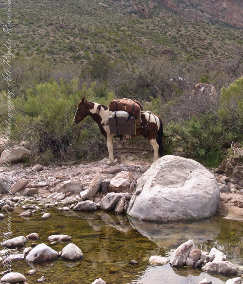
The expedition party rested where Dutchman Trail intersected the creek, full of flow from Charlebois Canyon, Music Canyon and LaBarge springs. We filled the water reservoirs in preparation for the climb up to the night’s camping spot on Peter’s Mesa, a 1,300 foot climb over 1.2 miles.
Behind Colorado and “Ed’s Horse” (don’t recall the name) is Bluff Spring Mountain.
A view to west on Dutchman Trail between Bluff Spring Mountain and Peter’s Mesa. The creek flowing from Charlebois, Music Mountain and LaBarge springs nourishes this Fremont’s Cottonwood (Populus fremontii) and other riparian flora. The tree is flanked by volcanic rock from an ancient eruption.