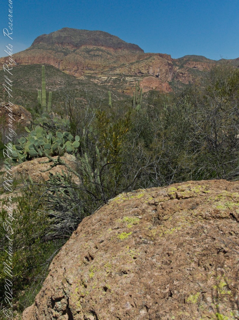
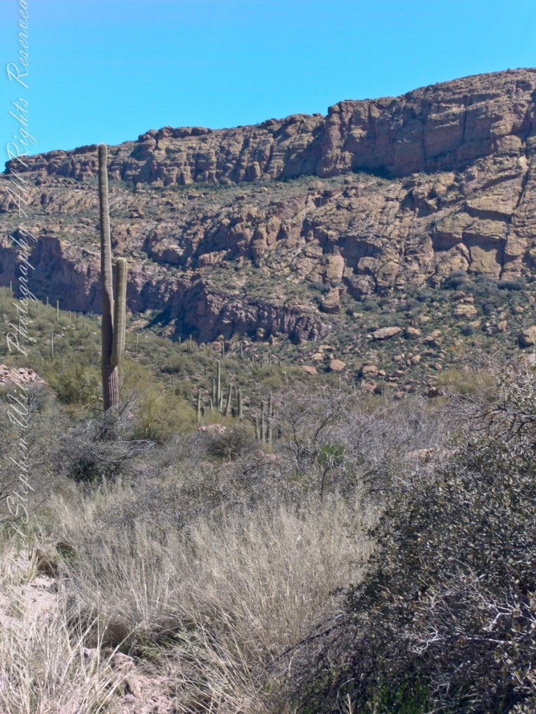
Lost gold mine legends tell of Saguaros bearing secret markings leading to the hidden location of rich gold mines. This specimen, perched on an ancient volcanic boulder, lives in LaBarge Canyon along the Dutchman trail.
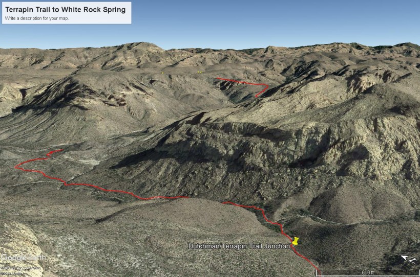
This view from Dutchman Trail was taken on the red line trail (below) between Black Top Mesa (out of view, on left) and Bluff Springs Mountain (right), on the approach to White Rock Spring and LaBarge canyon (the large canyon at the north end (left) of the red line.
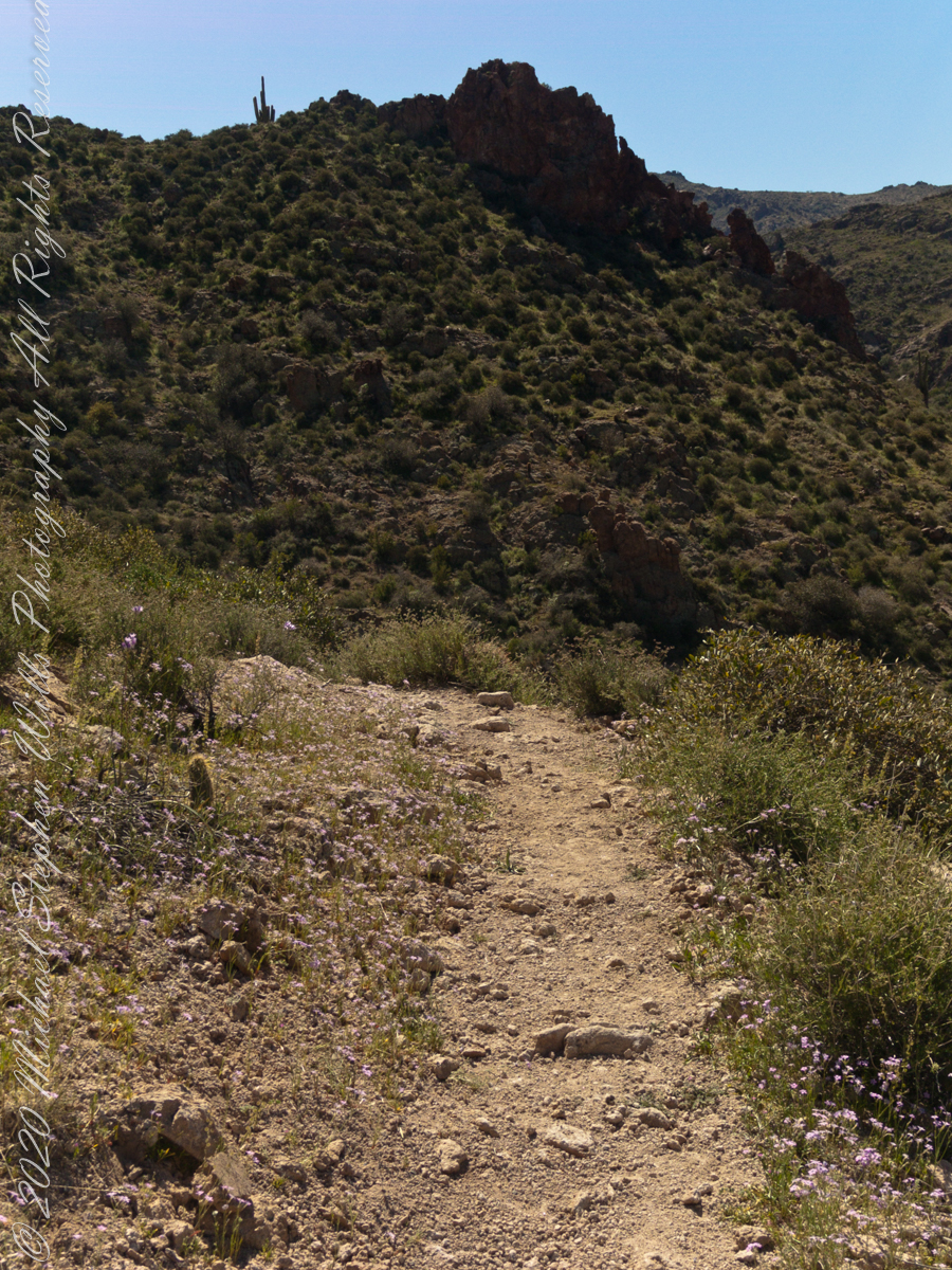
Terrapin Trail to White Rock Spring on Dutchman Trail
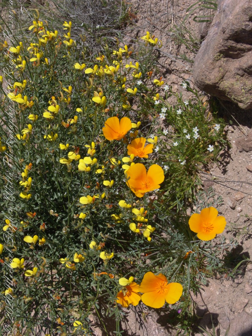
Those cliffs above the Dutchman Trail (in red from the push pin “Dutchman Terrapin Trail Junction”) climb 670 feet in 0.2 mile. Fifteen minutes after starting I stopped to photograph a group of wildflowers.
Terrapin Trail to White Rock Spring on Dutchman Trail
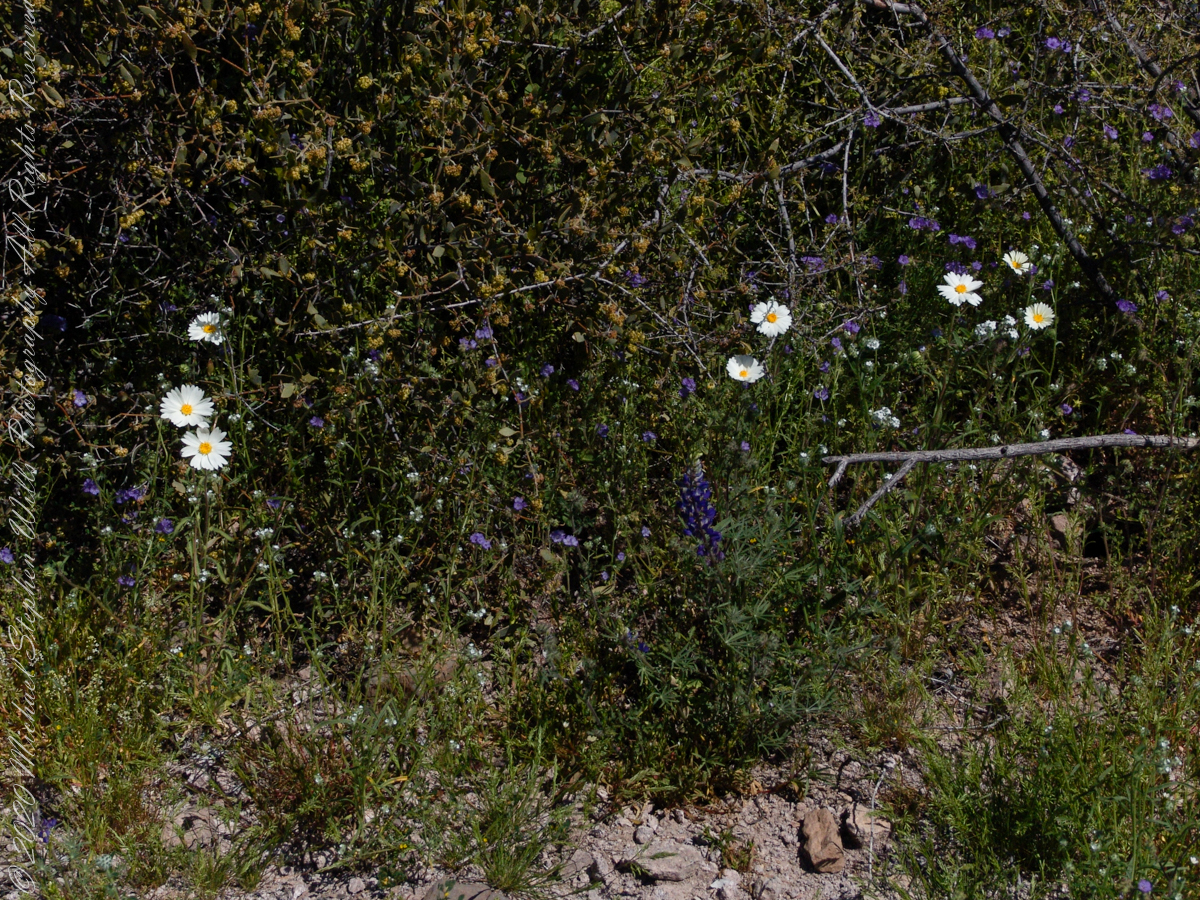
The bright yellow flowers on right are a member of the pea (Fabaceae) family named Wright’s Deervetch (Acmispon wrightii) I am able to pick it out from many similar flowers due to the characteristic narrow leaves with small hairs. These start out yellow, turning to red with age eventually forming brown seed pods. Mexican Poppy (Eschscholtzia californica) to the right.
The small white flowers are Chickweed (Minuartia macrantha) of the family Carnation (Caryophyllaceae).
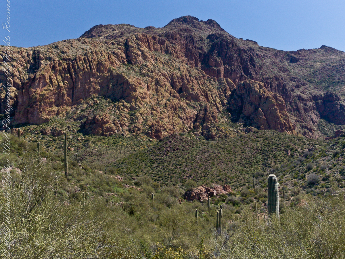
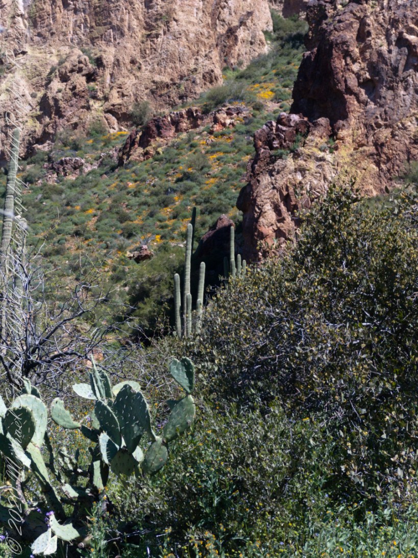
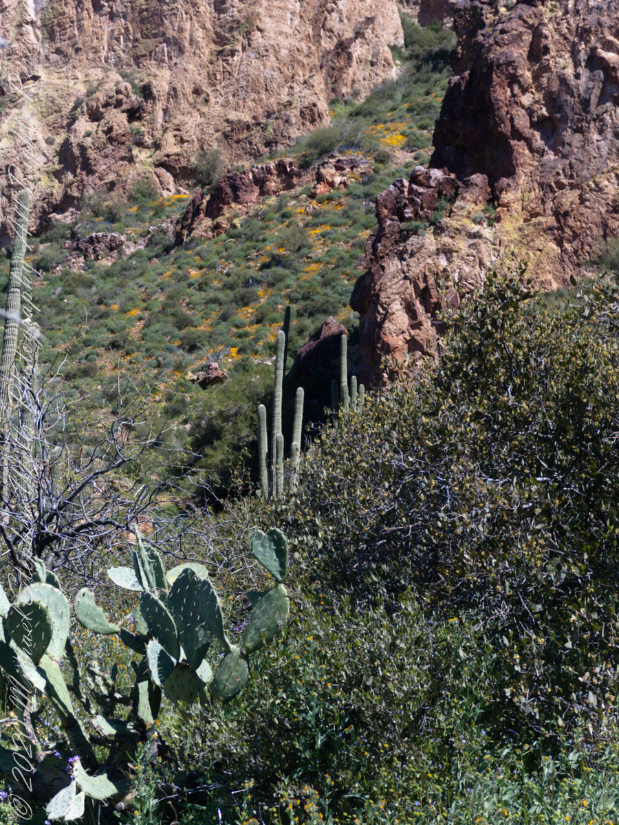
As we descended Upper Black Top Mesa Pass into Bluff Spring Mountain canyon we found, foreground, Palo Verde and brittle bush, and, midground, Saguaro. The presence of Palo Verde reveals water flows through this area intermittently though not enough to sustain a large tree. Palo Verde is in the pea family (Fabaceae), as evidenced by production of seeds in pods.
Calling it “Buff Mountain” some say the mountain is named for these buff-colored cliffs. Others, calling it “Bluff Spring Mountain” name it for the cliffs and the spring within a canyon on top.
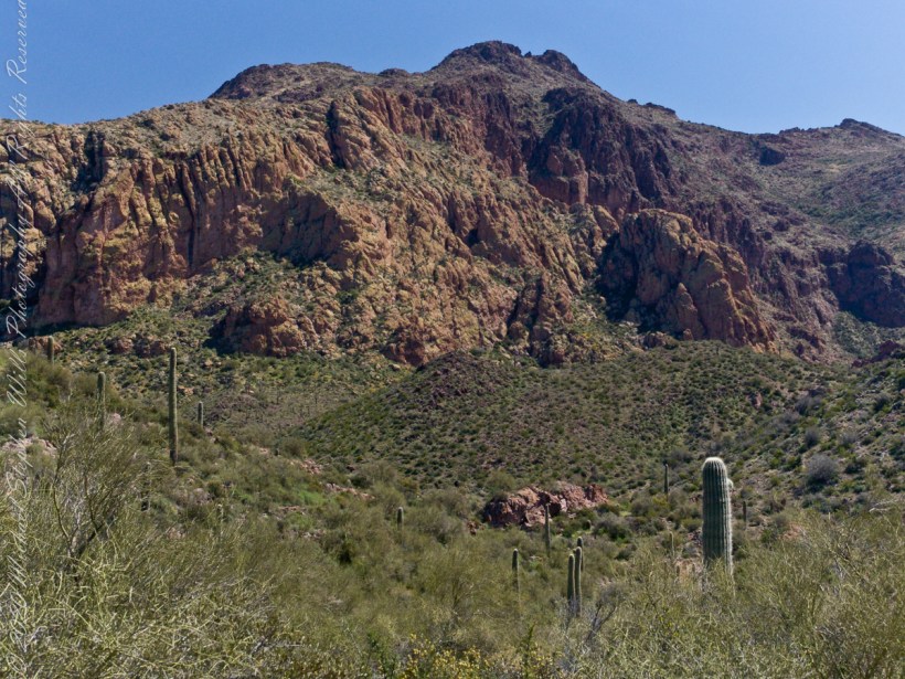
Bluff Spring Mountain from the slopes of Black Top Mesa
Closer to the junction with Terrapin Trail this Bluff Spring Mountain ridge rose above us. A fine specimen of mature Saguaro cactus is in midground.
Slievenaglogh is the name of a peak on the Cooley Peninsula of County Louth, Ireland near to the birthplace of my Mom, Proleek, a few townlands to the west.
Click photograph for a larger view. To do this from WordPress Reader, you need to first click the title of this post to open a new page.
Slievenaglogh View, northeast
On the northeast slope of Slievenaglogh peak (Irish: Sliabh na gCloch) on the road from Mullaghattin Townland to Riverstown.
Here we look northeast from the Slievenaglogh Townland, the valley between Slieve Foy and Slievenaglogh peaks.
The view includes Little River, Ballycoly Townland and Castletown River.
Adjacent is a sheep pasture with a farm ruin behind the yellow flowered gorse (whin bush, scientific name Ulex).
Slieve Foy is the far ridge lost in clouds. Early morning, late May 2014.
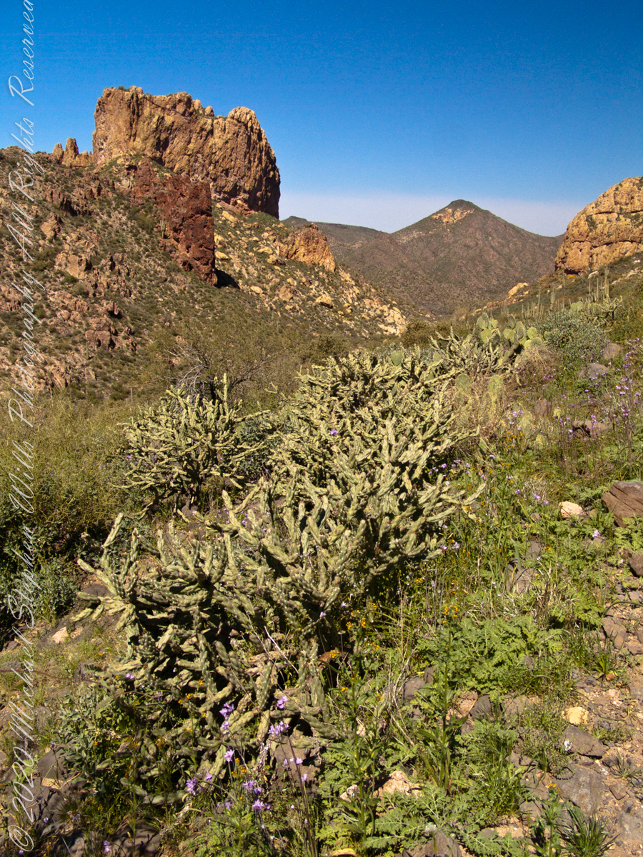
Our second day began in East Boulder Canyon, in the following map it is at the foot of the “Z” of the orange line, the Dutchman Trail, lower left center. The shape is the signature of a switchback needed to negotiate a steep slope up to Upper Black Top Mesa pass. This day will see us traverse Dutchman Trail to the intersection with Peter’s Trail (yellow), another steep climb up Peter’s Mesa.
A topographic map including Yellow Peak with Dutchman Trail in orange. Upper Black Top Mesa Pass lower center.
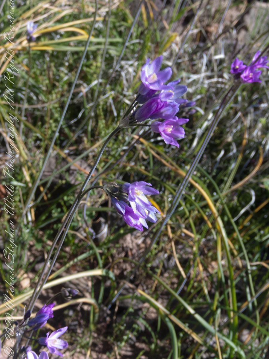
Today’s post features photographs of flourishing Sonoran Desert plants and landscape on the slopes of Black Top Mesa. Dipterostemon capitatus known by the common names blue dicks, purplehead and brodiaea is native to the Western United States (particularly Arizona, California, Oregon, Utah, New Mexico and northwest Mexico.
Dutchman Trail above East Boulder Canyon, Palamino Mountain left, Yellow Peak in distance. We are on the side of Black Top Mesa.
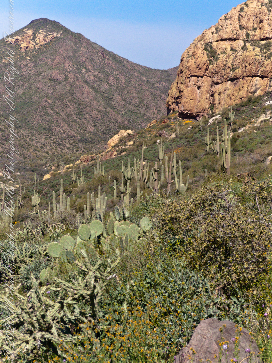
Here I used the “zoom” for a better view of distant Yellow Peak. In foreground is Brittlebush (Encelia farinosa) and Blue Dick. In the distance Saguaro Cactus. Below the cliff of Black Top Mesa, above East Boulder Canyon, is a patch of yellow, Mexican Poppy (Eschscholtzia californica).
Slope of Black Top Mesa above East Boulder Canyon with the distant Yellow Peak.
Here is camera, set to zoom, is swung toward the mesa cliffs. Prickly Pear and Brittlebush growing along the Upper Black Top Mesa Pass trail. I have not identified the shaggy shrub above the Brittlebush. In the distance Saguaro Cactus (Carnegiea gigantean) flourishes. Below the cliff are patches of “gold dust”, the Mexican Poppy.
PCliffs of Black Top Mesa
Heading southeast climbing out of East Boulder Canyon with a very young Saguaro Cactus (Carnegiea gigantean) just off trail on left, a large specimen silhouetted on ridge ahead. Windmill Pink (AKA Common Catchfly) (Silene gallica) foreground, lower left. Brittlebush (Encelia farinosa) on both sides.
Upper Black Top Mesa Pass
This post ends as it began, with wildflowers growing next to the trailon a March morning. Blue Dicks (AKA Purplehead) (Dipterostemon capitatus), Tidy Tips (Layia) — daisy like flower, Brittlebush flowers are yellow when not dried. The larger small white flowers are Desert Phlox (Phlox austromontana) — I have not identified the tiny white flowers sprinkled around.
Pam and I were drawn outside the day after Valentine’s a bit of sun, an unreliable warm breeze, a promise of exercise. Our expectations were disappointed for all but the last at the foot of the Taughannock Falls gorge trail.
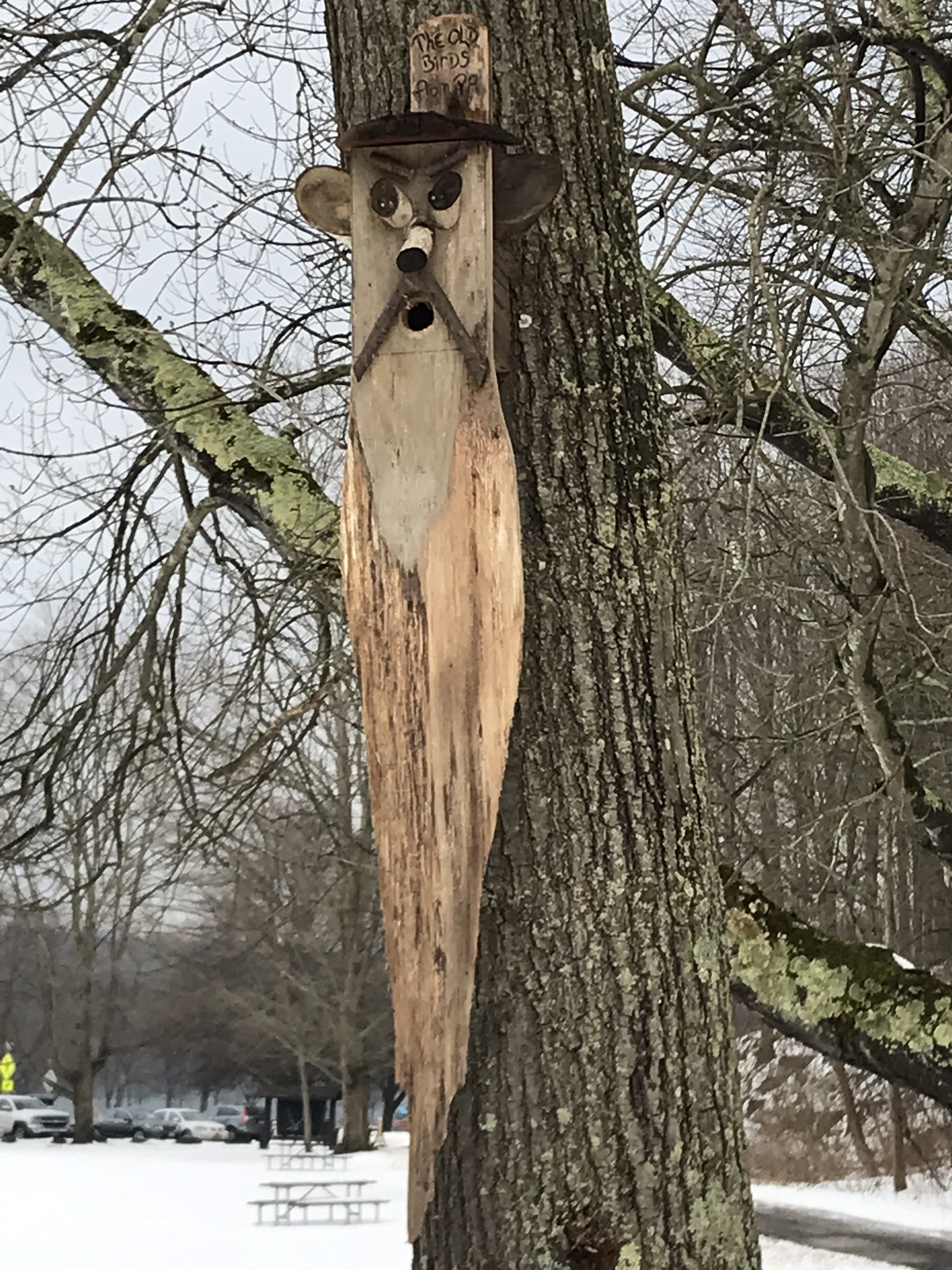
We had a reminder mid-February marks the start of avian mating behavior with this addition to the view from Taughannock Creek, the first large waterfall. For the cold, drizzly excursion I chose the IPhone, in a waterproof case, for the images. The fanicful birdhouse inscription reads “The Old Birds from Pa.”
Click the photograph for my “Finger Lakes Memories” Online gallery.
The winding gorge takes a general east, southeasterly direction. Where the sun cannot reach the snow was reduced to a treacherous slushy ice mix more nasty than dangerous.
View from the Overlook on the way to the trail. This is the endpoint of our hike, viewed from the gorge rim.
Of all the area hiking experiences, Taughannock Gorge Trail is the only one available year round. The gorge is wide with enough room for the footpath to avoid the cliff edge. Today, there were places were ice formations were throwing large ice chunks down the slope. The park ranges place tree trunks along the cliff base, with warning signs to stay away. Still, there are visitors who stray too close with fatal outcomes reported by local news.
Pam was fascinated by the appearance of snow and ice accumulated on the talus, here seen from the Taughannock Falls viewing bridge.
Click photograph for my “Finger Lakes Memories” online gallery. Photo by Pam.
You can just pick out the viewing bridge in the Falls Overlook video.
Click photograph for my “Finger Lakes Memories” Online Gallery. Photo by Pam.
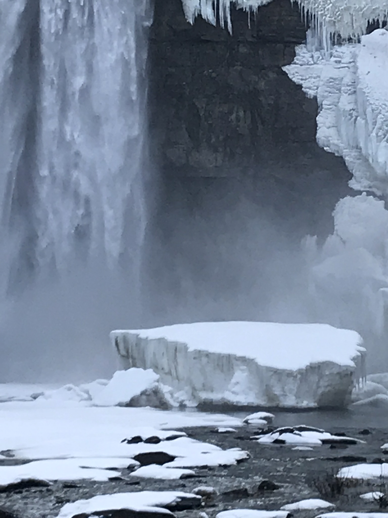
Taughannock Falls bound by ice is a most dramatic sight. I need to post photographs from a 2005 visit during an especially frigid February. Here, the falls have thrown off the ice, leaving this house-size chunk.
Click photograph for my “Finger Lakes Memories” Online Gallery
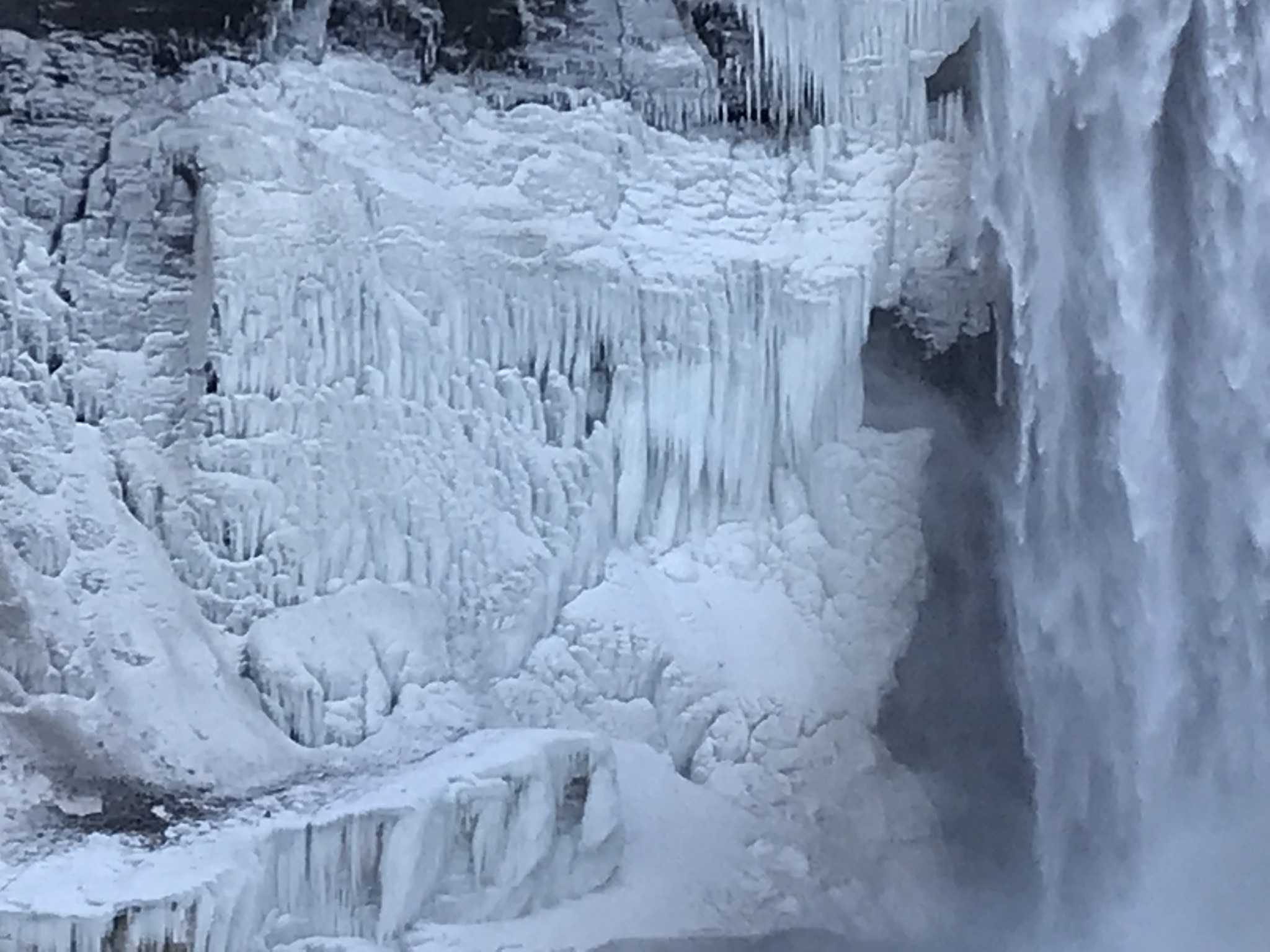
The surrounding gorge walls are continually frost coated by the mist.
Click the photograph for my “Finger Lakes Memories” Online Gallery
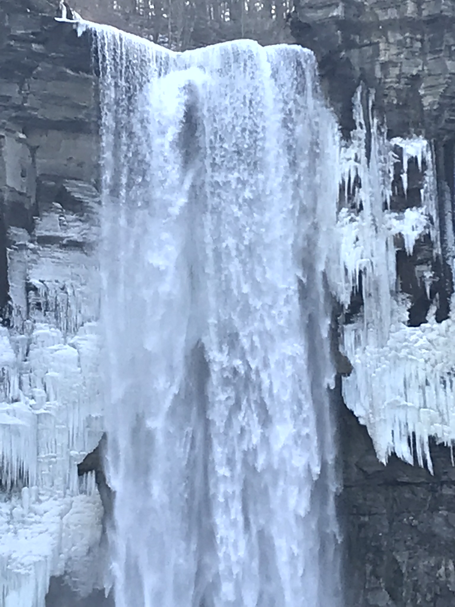
210 foot Taughannock Falls from the viewing bridge.
In more clement seasons the Gorge Trail ends much closer to the falls. Today, it was closed as, during winter and especially thaws, blocks of the sandstone cap break away to fall with great force across that part of the trail. This viewing area is visible in the Falls Overlook video.
Copyright 2019 All Rights Reserved Michael Stephen Wills