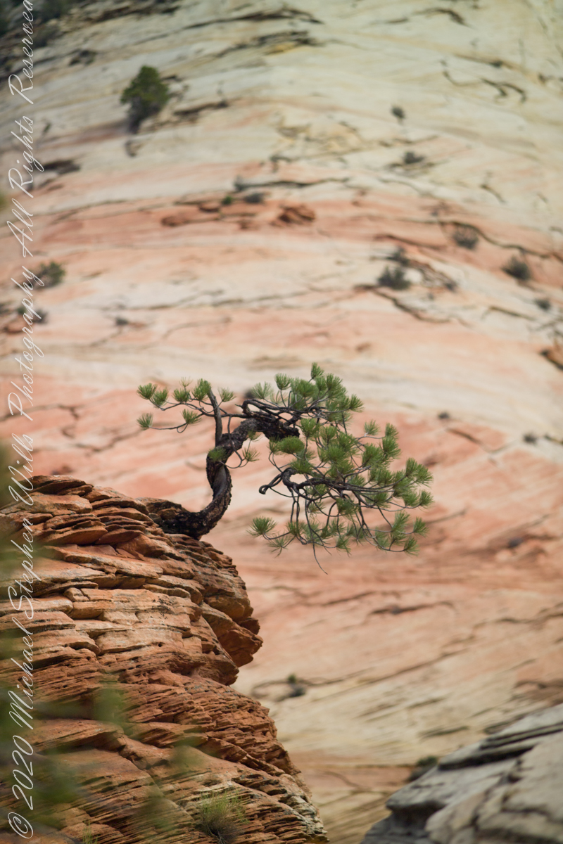
From this angle the Pinyon Pine is backed by Checkerboard Mesa slickrock.
ISO 250 1/800 sec at f/2.8
For humans travelling on foot this weather worn sandstone is anything but slippery, If we wore iron horseshoes the sense of slippery, or slick, rock becomes apparent. It was ranchers mounted on horses who coined the name slickrock.
For this shot we approached Zion National Park from the east, via route 9, past Checkerboard Mesa.
Captured with a Kodak DCS Pro SLE/c dslr and a Canon lens EF 200 mm 1:2.8 L II stabilized with the Manfrotto Studio Tripod model 475 and the 468 Hydrostatic ball head. This series explores the possibility of the iconic “Lone Pine.”
Here is a gallery of the four Lone Pine images.
Copyright 2021 Michael Stephen Wills All Rights Reserved
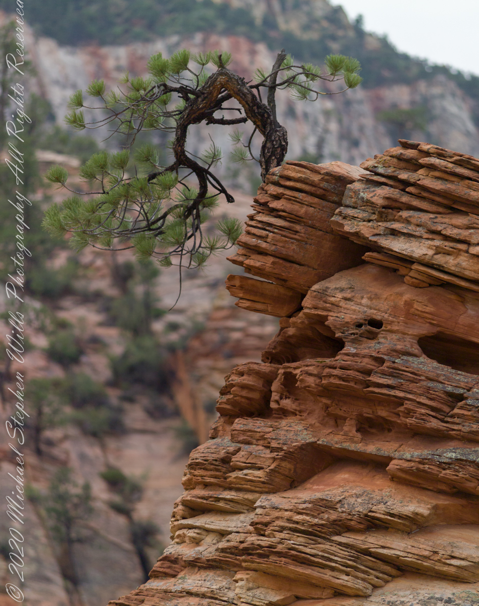
What is a Lone Pine without the sky? This specimen somewhat less gnarled than numbers 1 and 2. Here we see more of the beetling crag, layered up sediment of eons.
ISO 250 1/400 sec at f/4.0
For this shot we approached Zion National Park from the east, via route 9, past Checkerboard Mesa. Our lodging was to the east, probably the Best Western in Mt. Carmel on Rt 89. Meaning there were four opportunities for capturing memorable East Zion images over two days.
Captured with a Kodak DCS Pro SLE/c dslr and a Canon lens EF 200 mm 1:2.8 L II stabilized with the Manfrotto Studio Tripod model 475 and the 468 Hydrostatic ball head. This series explores the possibility of the iconic “Lone Pine.”
Copyright 2021 Michael Stephen Wills All Rights Reserved
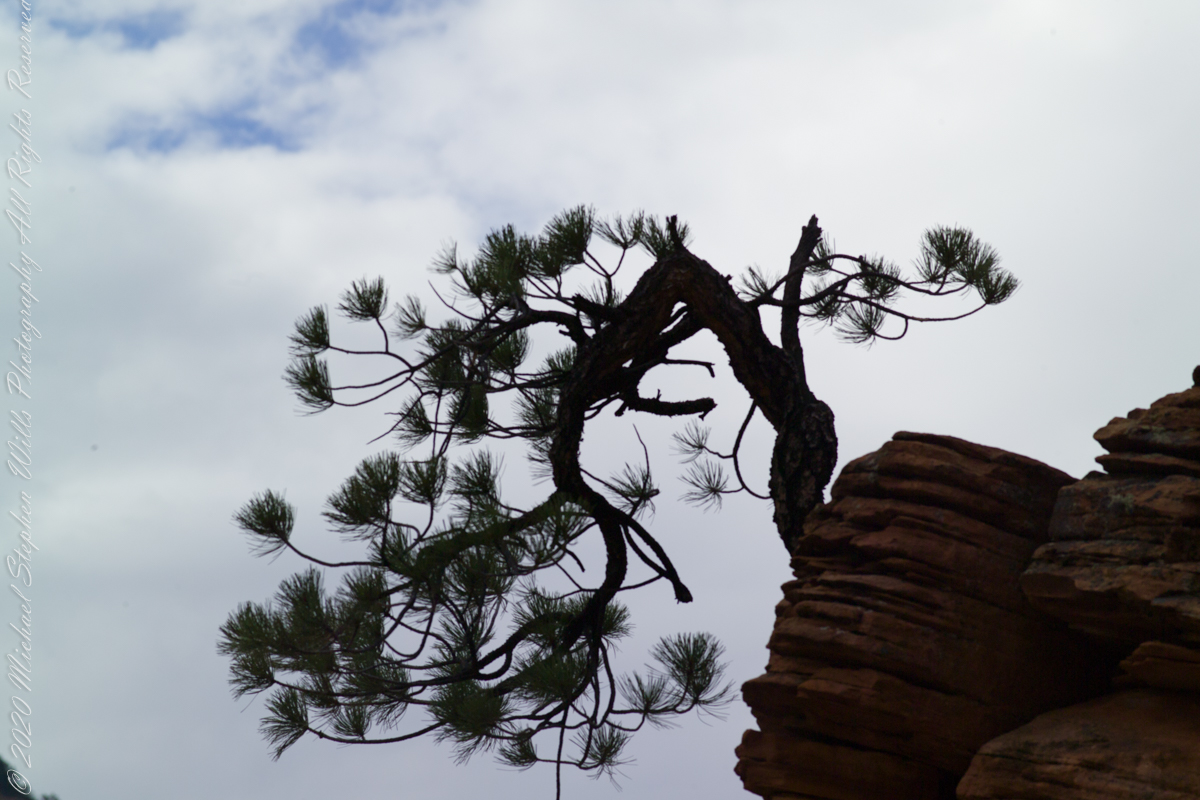
Here is the same gnarled pinyon pine of the previous post, with a sky centered exposure revealing the silhouetted wonder.
ISO 250 1/1000 sec at f/7.1
Captured with a Kodak DCS Pro SLE/c dslr and a Canon lens EF 200 mm 1:2.8 L II stabilized with the Manfrotto Studio Tripod model 475 and the 468 Hydrostatic ball head. This series explores the possibility of the iconic “Lone Pine.”
Copyright 2021 Michael Stephen Wills All Rights Reserved
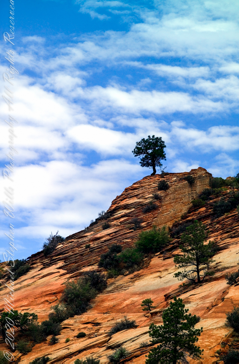
The eastern approach Zion Canyon is a national park unto itself, route 9 passes through otherworldly landscapes.
ISO 250 1/1000 sec at f/2.8
Captured with a Kodak DCS Pro SLE/c dslr and a Canon lens EF 200 mm 1:2.8 L II stabilized with the Manfrotto Studio Tripod model 475 and the 468 Hydrostatic ball head. This series explores the possibility of the iconis “Lone Pine.” Here the tortured existence of this organism is rendered plain.
Copyright 2021 Michael Stephen Wills All Rights Reserved
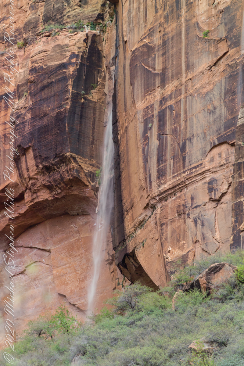
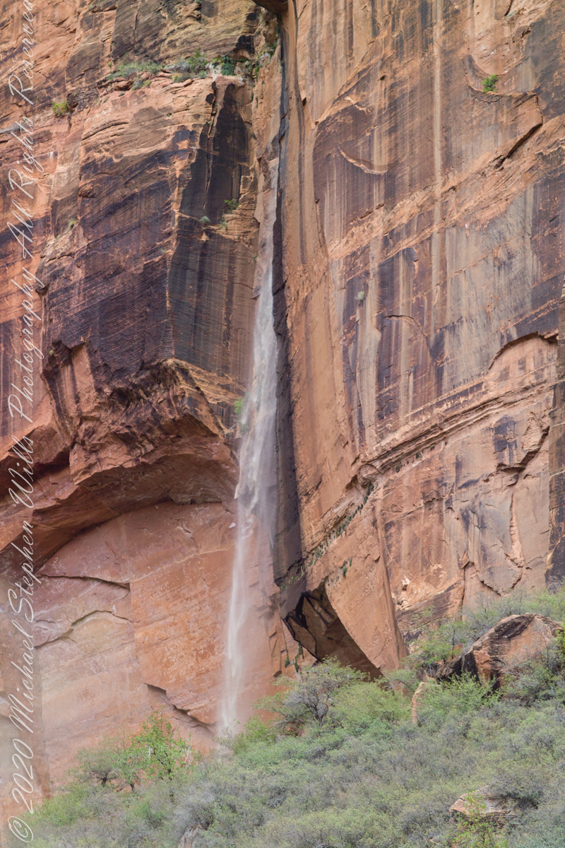
Rainwater from distant thunderstorms on the vast Colorado Plateau emerge from a cliff wall, Zion Canyon. The fall will last for a few hours, we bore lucky witness as do my images shared below.
1/15 sec at f/8.0 ISO 160
Captured with a Kodak DCS Pro SLE/c dslr and a Canon lens EF 200 mm 1:2.8 L II stabilized with the Manfrotto Studio Tripod model 475 and the 468 Hydrostatic ball head. I prefer the details of misting water at the widest lens aperture, focus is clear throughout the plane, excepting some foreground brush.
1/125 sec at f/2.8 ISO 160
Copyright 2021 Michael Stephen Wills All Rights Reserved
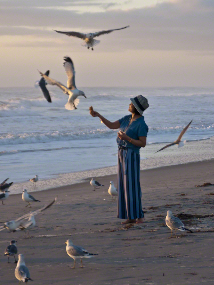
Gulls, an omnipresent element of any beach stroll. Pestiferous, abounding and incessant the gull is simple to deal with. Keep any and all foodstuffs under wraps.
Conversely, for those who adore a crowd of raucous opportunists simply pull out the food and offer it to the air. There is more about this photograph at this post, “Lady Feeding Gulls, Cocoa Beach Dawn.”
Click any photograph for a larger view.
Beach Walking
Pam and I developed a habit of hanging out in Florida during Finger Lakes Winters when the gorges are closed for safety and even walking the streets is perilous, stray black ice encounters abound. We trade icy falls for beach walks.
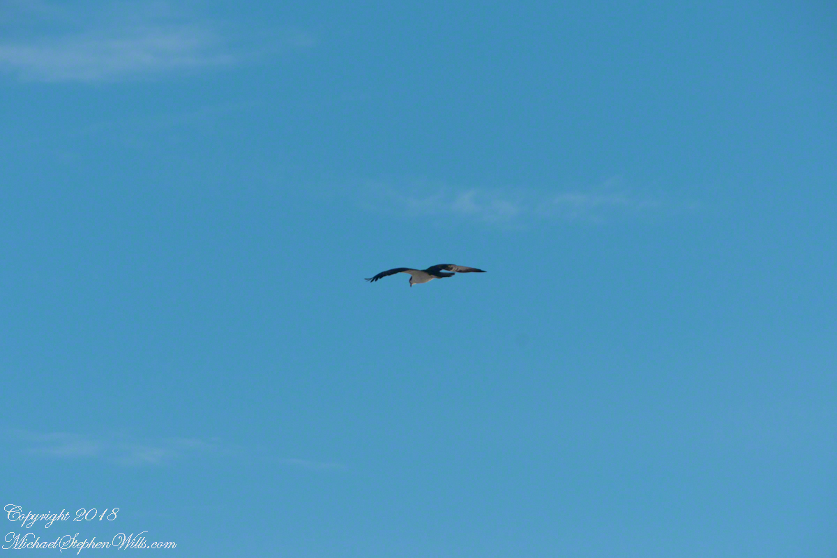
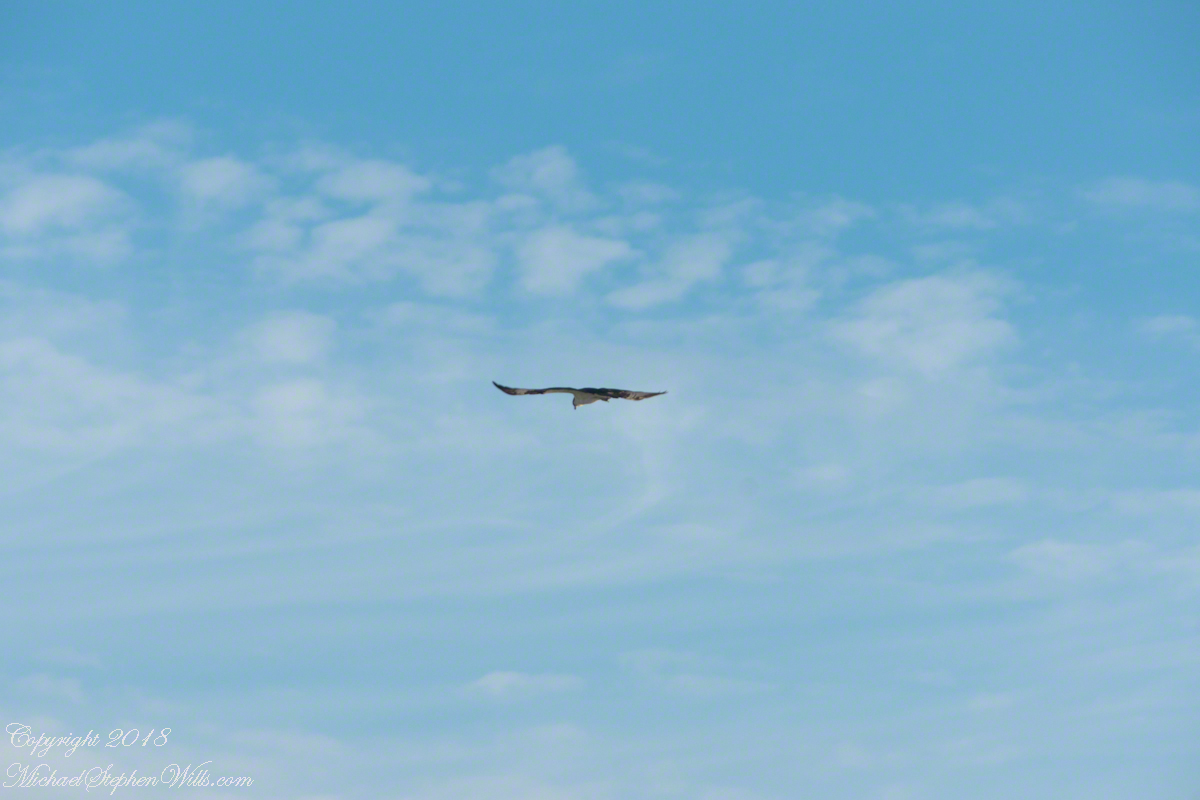
It is natural to become inured to the flight of gulls along the shore. For all my carting along the Sony Alpha 700 with a variable lens ( 18 – 200 mm) there is not a single photograph of a gull in flight. Yet, I have my eye on them until my blindness was lifted by a peculiar individual. It seemed to be a white gull, yet it had a watchful eye.
Gliding shoreline parallel with head down, how could I have mistaken it for a gull?
Osprey occupy an environmental niche along 700,000+ shoreline miles worldwide as a single species Pandion haliaetus. A unique bird with its own family, Pandionidae, and genus, Pandion, some experts recognize sub-species in geographic regions. Ours is the Western Osprey.
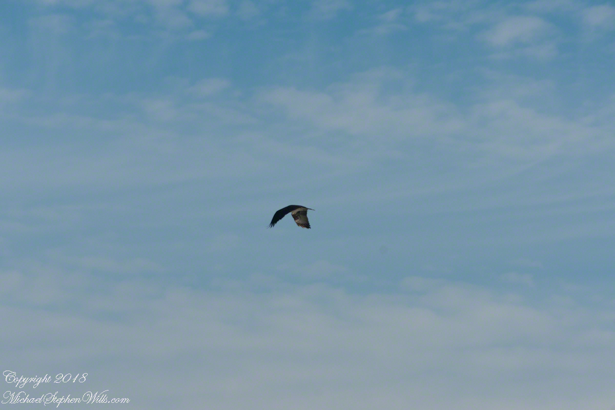
The following photograph is of a wing shape very different from the gull.
Osprey Stalking Behavior
IPhone 8 always in my pocket, I captured this clip of an Osprey stalking fish in the Atlantic Ocean surf. You will have a better viewing experience by clicking on the title of the embedded YouTube, then click on the Full Screen icon at the lower right.
Enter your email to receive notification of future postings. I will not sell or share your email address.
Copyright 2025 All Rights Reserved Michael Stephen Wills
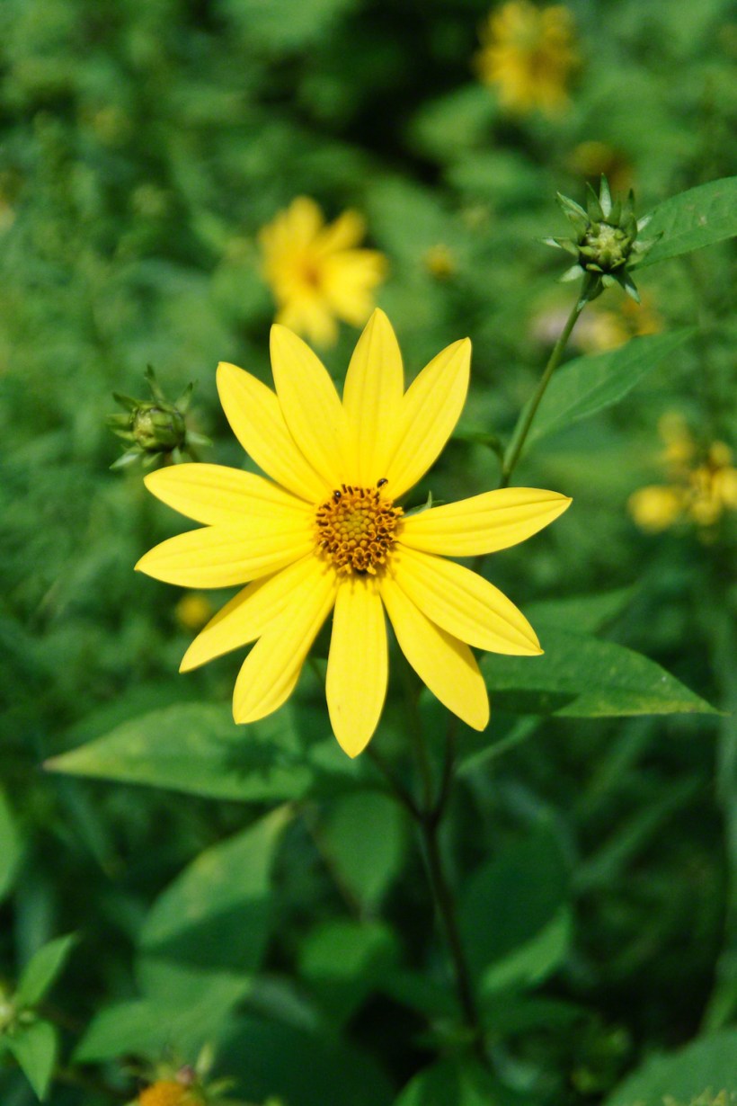
“Out in the meadow, I picked a wild sunflower, and as I looked into its golden heart,such a wave of homesickness came over me that I almost wept. I wanted Mother, withher gentle voice and quiet firmness; I longed to hear Father’s jolly songs and to see his twinkling blue eyes; I was lonesome for the sister with whom I used to play in the meadow picking daisies and wild sunflowers.”
from “Laura Ingalls Wilder, Farm Journalist, Writings from the Ozarks” edited by Stephen W. Hines”
Photography Copyright 2021 Michael Stephen Wills All Rights Reserved
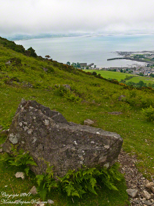
Rocks such as this are a favorite perch for leprechauns to rest and contemplate the works of man who have invaded their world. Inhabitants of Carlingford who wander Slieve Foye have come upon them often enough, their stories and certitude in the existence of the Little People are resistant to manifold doubters with their reasons and arguments.
Kevin Woods, aka McCoillte, was a doubter until worked on a stone wall on property he owned on Ghan Road, Carlingford. His belief did not arise on the discovery of the leather purse, covered with ages of dust and lime, nor with the gold coins inside. McCoillte pocketed the coins for luck. As luck would have it, McCoillte loved to walk on Slieve Foye. It was on one such walk he and his dog encountered Little People who paralyzed them to escape. His unexplained absence led to troubles with the wife.
This experience brought McCoillte around to enough of a belief that he, with lots of help, succeeded in petitioning the E.U. European Habitats directive to recognize leprechauns a protected species. According to a page on the Celtic Times web site, “The E.U. sent Madame Isobel Jeanne from Fecamp in Brittany France to Carlingford with the official letter declaring Carlingford Mountain (Note: otherwise known as Slieve Foye) protected, on the grounds that they could not prove or disprove their existence.” The page is titled “The Carlingford Leprechaun.” Google “Last Leprechauns” learn more about McCoillte’s stories.
I came upon this rock on June 9, 2014 on a day my cousin Sean Mills invited us to walk the Tain Way over Slieve Foye. It was such a finely shaped piece of what I suppose to be granite, the view of Carlingford, the lough and farmland so compelling, I spent time composing this landscape.
You can make out “King John’s Castle” just over the ridge and its yellow flowering gorse, on the margin of the blue lough. It is the boxy, grey structure; crenellations are visible on high resolution versions of the image. Carlingford is known for the castle, the popular name is for the English monarch who spent time there, although it was built by another.
A hellish shriek assaulted the cold 3 am darkness.
The scream was instantly recognizable. Anything but terrified, after a confused scramble I reinserted the pin into a personal security device hung from my backpack. Wrapped in a silly waffle weave blanket, tossing restless in the cold, the pin lanyard hung up then pulled free. Several minutes had passed with that sound flowing out over the canyon, calling all carnivores to breakfast.
I had drifted off with the wind shaking my tent like a drunken prankster and now all was totally and absolutely quiet. In spite of the cold, the inadequate blanket and the imaginary creatures looking for the source of that scream, the next two hours sped by in a fitful doze.
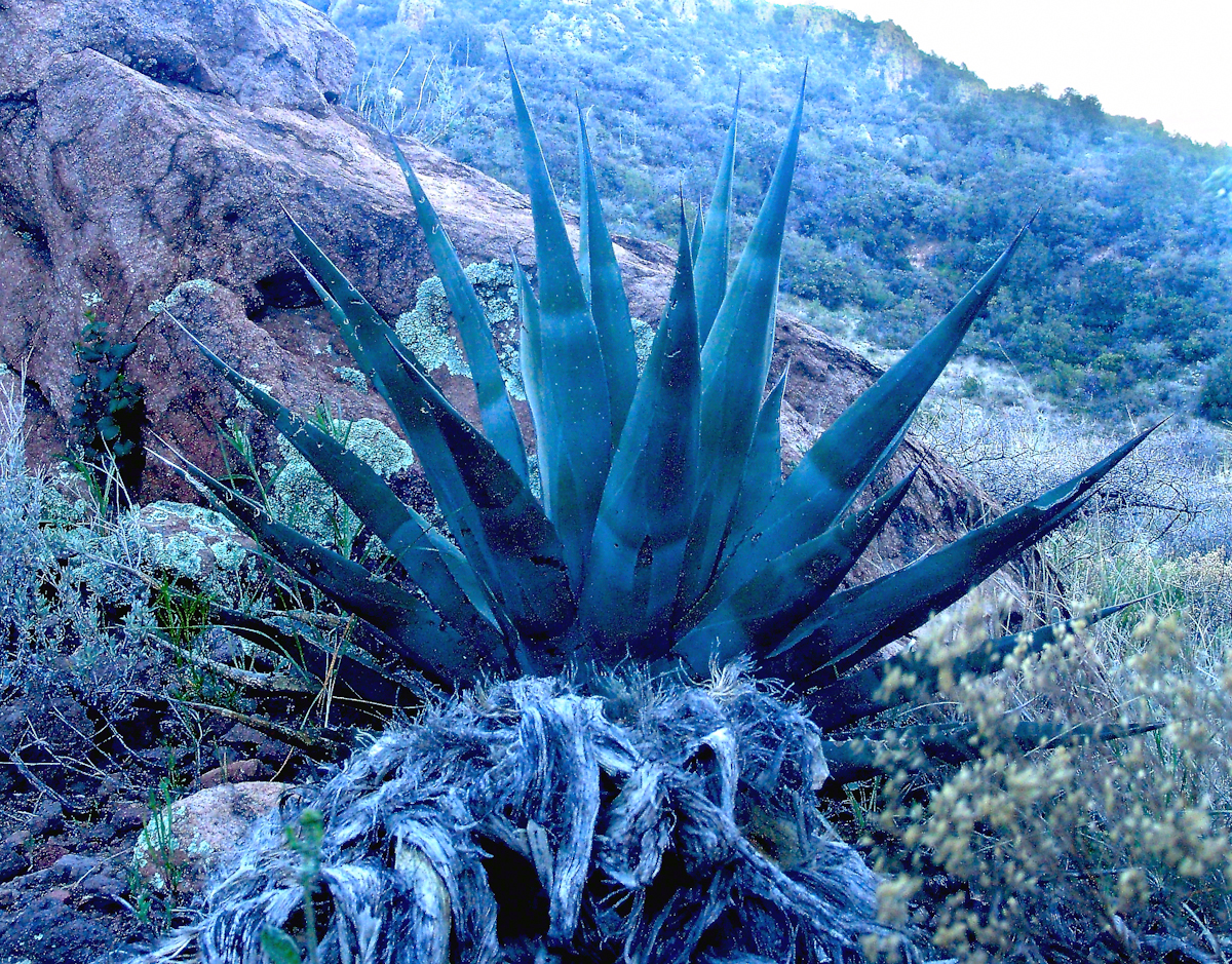
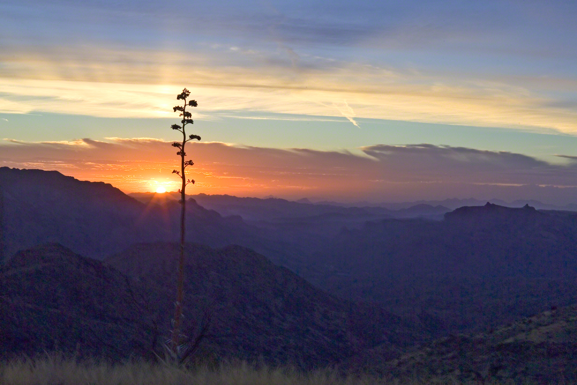
Agave Heart
At 5 am I crawled out to find the thinnest crescent moon imaginable gracing the eastern sky, kept company by a century plant silhouetted against the early dawn light.
Click any photograph for a higher resolution image.
These stalks raise the golden flowers of this agave 10 to 15 feet above the green prickly rosette. Century plant stalks can be seen throughout the Superstitions, even at the high elevations among towering Ponderosa Pine.
Here is an agave in predawn light I caught on the next day, in Pine Creek canyon.
Agave in PreDawn Light
The leaves are used as needle and thread with the very sharp tip as the needle and the long leaf fibers, when properly dried and shredded, as thread. These leaves guard the agave heart from the harvest. A poke from an agave spike can be deep and painful.
The young shoots of the stalks are a succulent delicious treat raw. Roasted, the agave heart is a fresh, somewhat sweet delight. The earliest residents of this desert left numerous roasting pits on the mountain slopes, located where the agave still grows.
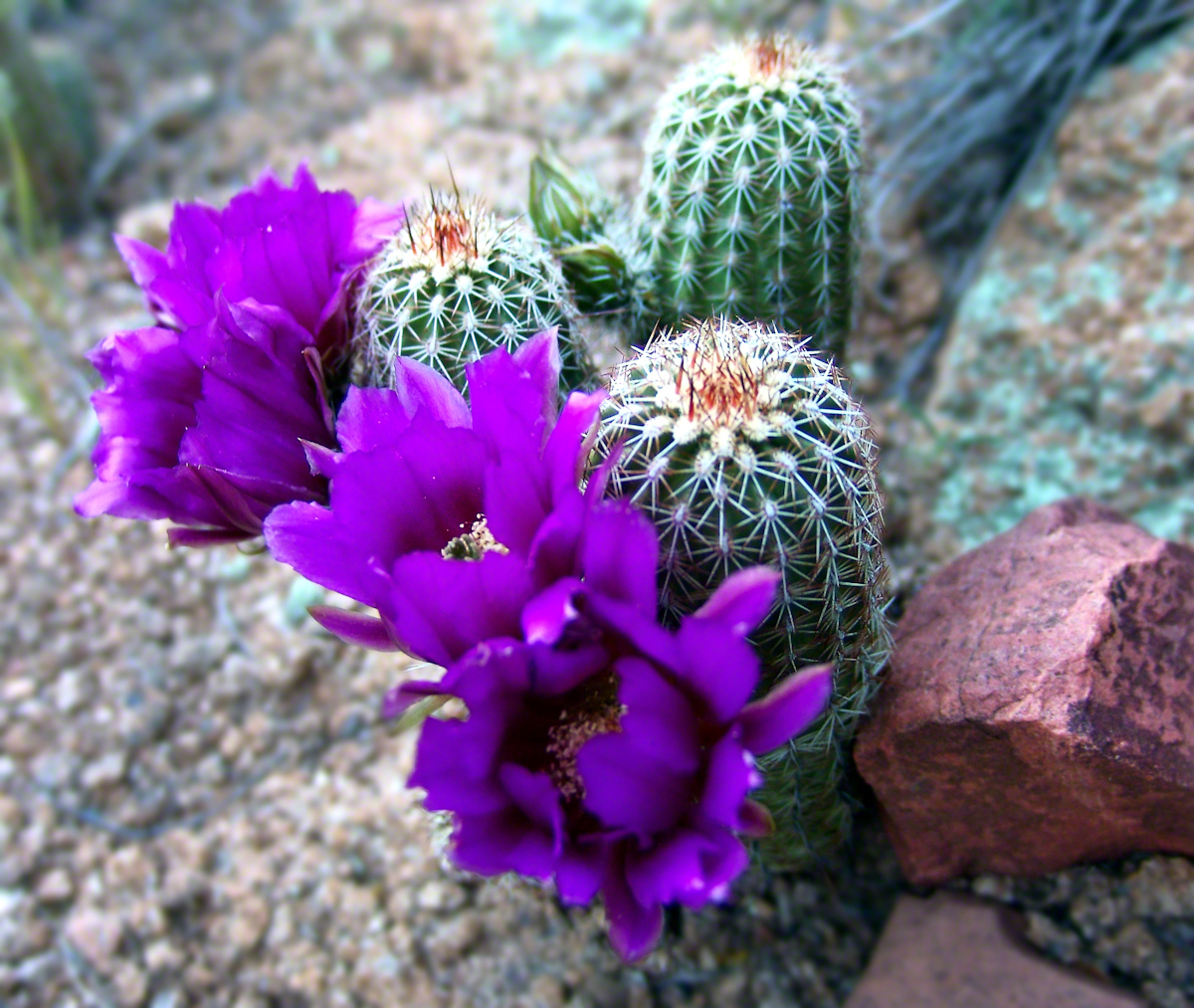
Dawn and the Pretty Hedgehogs
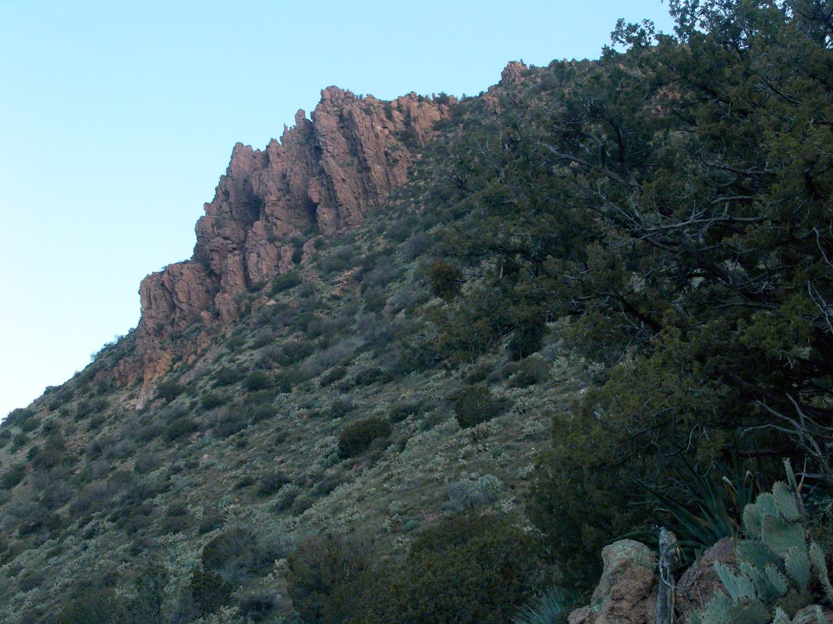
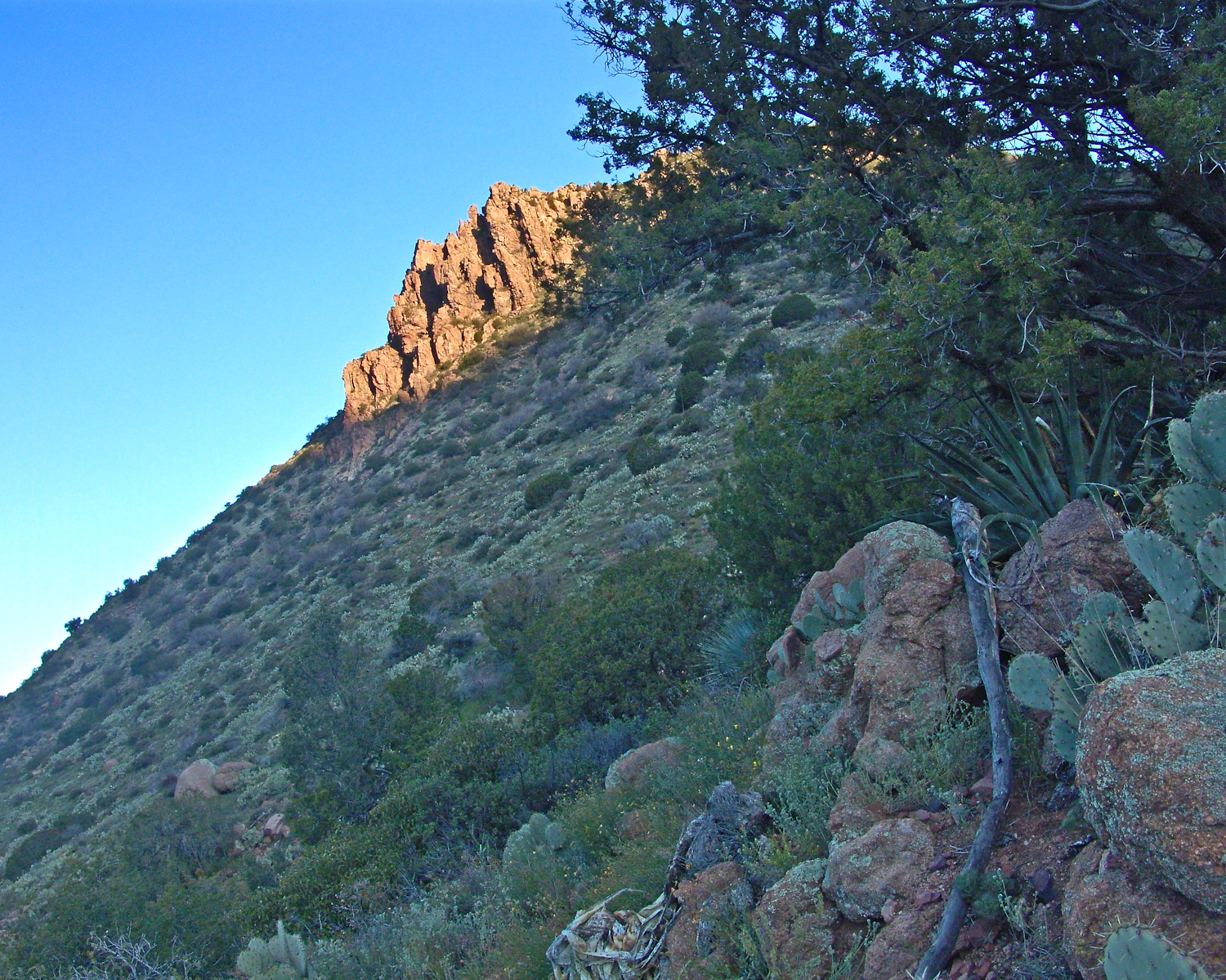
Although cold, the still dry air felt marvelous and even distant objects appeared absolutely clear. In this environment the spread of sun with its rising is a ritual. Here’s a photograph of the canyon walls a few minutes before the sun reached them.
Slopes of Two Bar Mountain in PreDawn Light
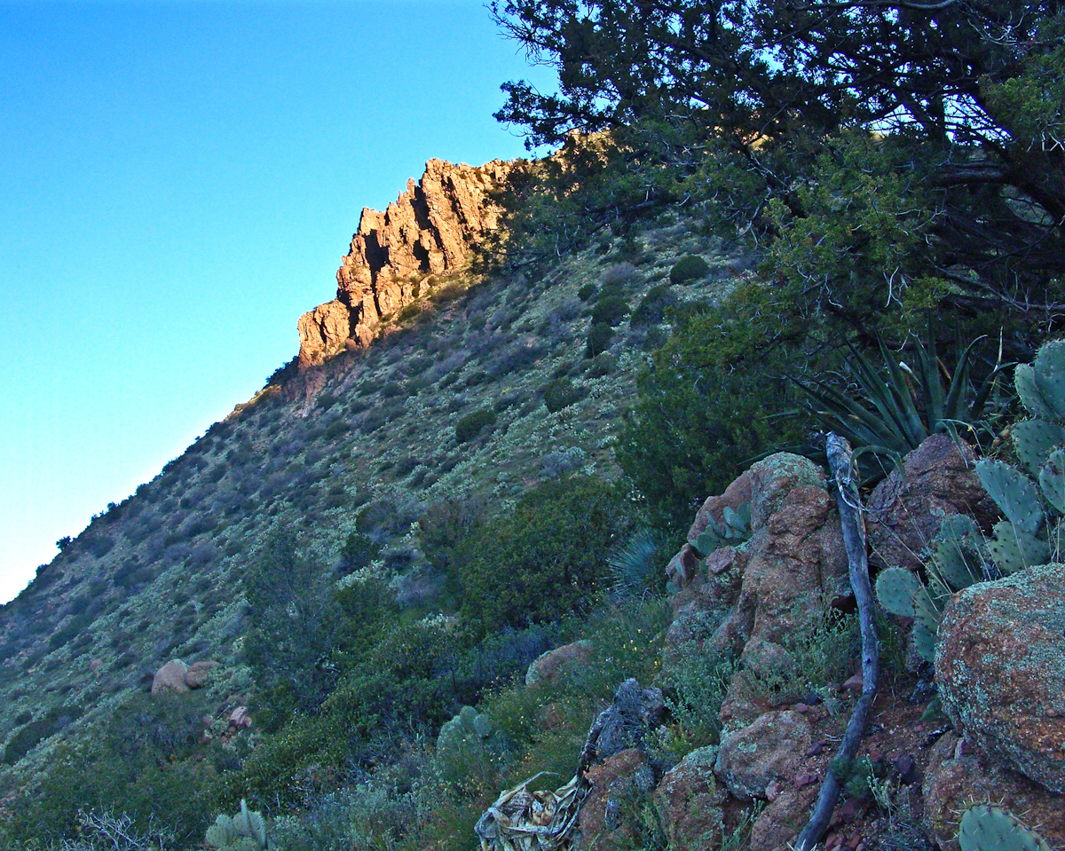
And, a few minutes later, as the sun passed the ridges of Two Bar Mountain.…
Dawn on the Slopes of Two Bar Mountain
By the way, that’s a desiccated agave stalk to the lower right, on the rocks.
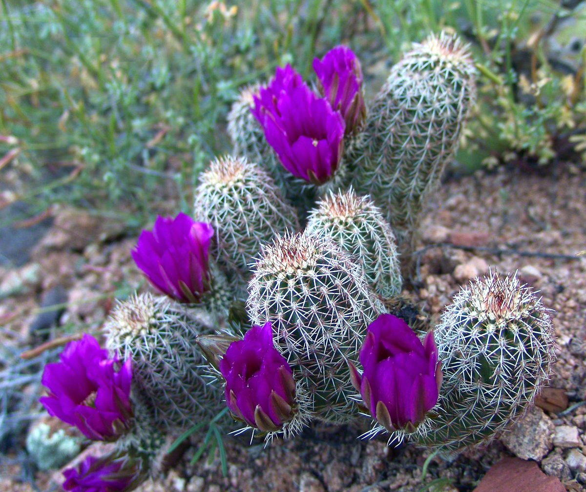
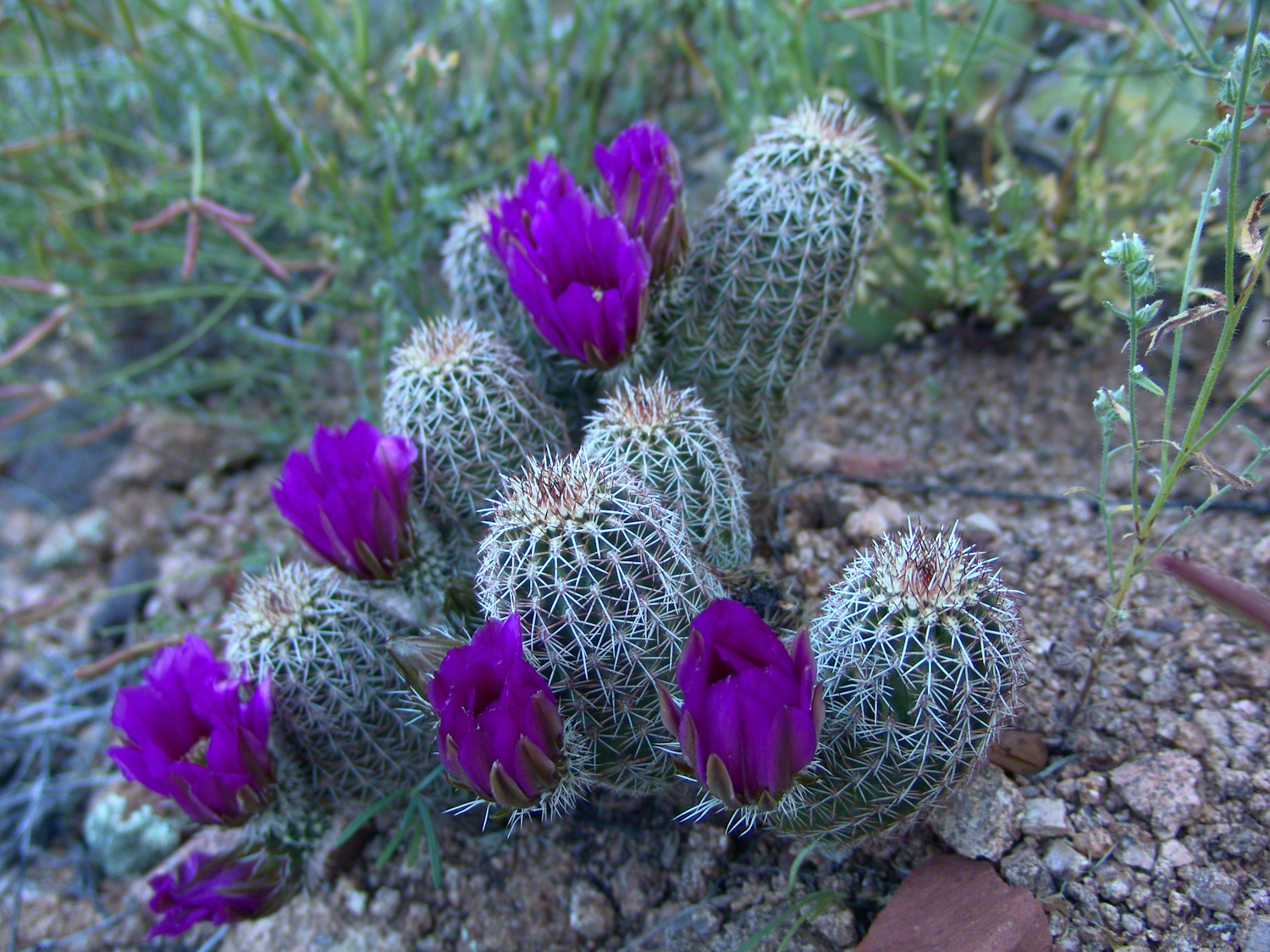
At my feet, spread at intervals on the brown red broken rock, small Hedgehog cacti bloomed lavender.
Lavender Hedgehog BlossomsLavender Hedgehog BlossomsLavender Hedgehog Blossoms with Buds
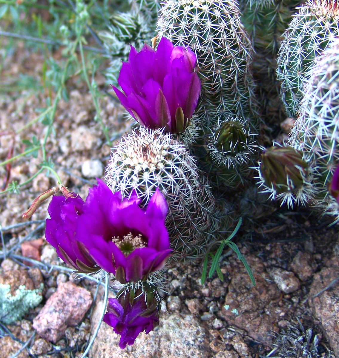
Cacti, such as the blossoming lavender Hedgehog seen above, require a space which enjoys full sunlight for most of the day. The thick grown of juniper trees limited sunlight and compete with the cacti for water. This image will give you an idea of the extent of the juniper growth.
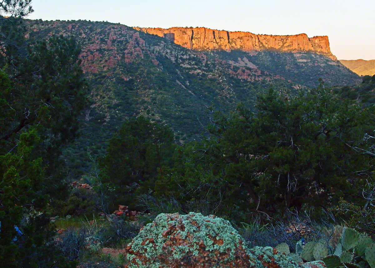
Nameless Canyon in the Dawn
Looking into Nameless Canyon
In the above photograph you are looking west over a canyon that is unnamed on maps. The dramatic flat ridge bathed in light is a landmark marking the canyon of Reavis Falls, on the far side in this view. Make your way down the canyon where is joins Reavis Creek, turn left and the falls are a few miles upstream. This is NOT the easiest path to the falls.
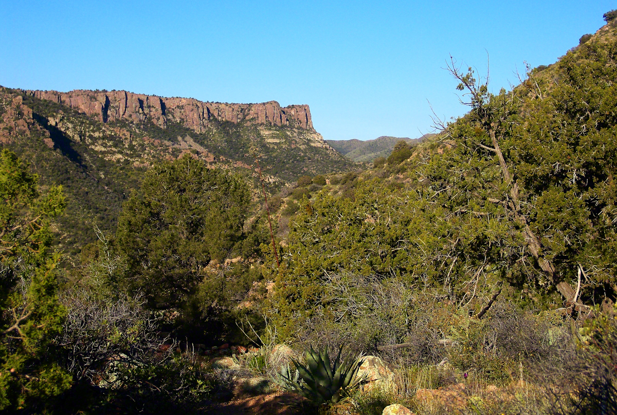
As the sun rose I needed to prepare for the day’s trekking, but took one more portrait of this lovely nameless canyon traversed by an almost non-existent path.
Nameless Canyon Morning
This season, a cold stream ran at canyon bottom. Flowing among the rocks the water produced peals of a crystal bell, but this was not my last memory of this place.
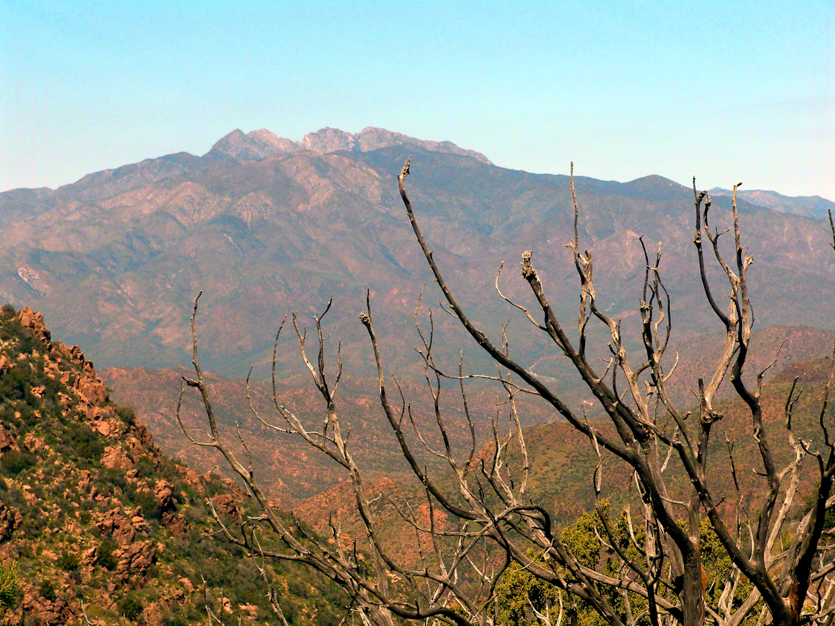
In the “Nameless Canyon Morning” image, on the left there is the almost vertical (no exaggeration) canyon wall I climbed in 4.5 hours that morning. It traversed 800 feet altitude in less than a mile. The path was substantially longer because it followed the contour lines of the land in long loops called switchbacks. As I proceeded up the canyon wall, to the southeast, above the opposite canyon wall, the memorable Four Peaks gradually appeared. Here’s the view from my lunchtime perch…..
Four Peaks from Nameless Canyon
This view looks over the basin of Reavis Creek and includes the, out of sight, 140 foot high Reavis Fall, the highest free fall in Arizona.
The four mile climb up the 2,000 foot eastern Superstition Wilderness bajada and escarpment consumed the morning and much of the afternoon. It was the 80 pound backpack that did it. Ten days of supplies, tent, equipment and 3.5 gallons (28 pounds) of water; enough food for a trek across the Superstition Wilderness, water enough for two days. One day in, one day out if the water could not be replenished. Mine was a water commitment, enough water storage to allow two days to trekking to another source.
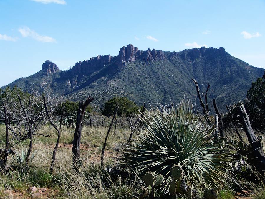
Two Bar Mountain from Tule Canyon trail with corral made from mesquite trunks and barbed wire. Yucca and prickly pear in foreground.
Here the canyon rim view from atop the escarpment…..
Here I found the huge mountain lion track in the dry mud from the spring rain, where water pooled and the cat drank.
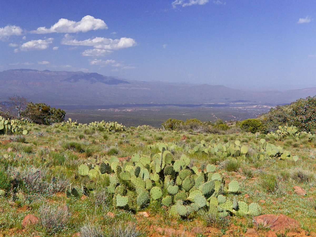
…over trail 122, the Tule Canyon Trail, looking out from the wilderness. Tule Canyon trail is very lightly used and only present in the form of occasional cairns. There is a red rock cairn in the midground. Theodore Roosevelt Lake of the Salt river is in the distance, as is the dirt road to the trail head. A settlement is visible, on the right.
A rancher formed a cattle watering hole by damming an ephemeral stream and that day the pool held some water. Shortly after a rain a large mountain lion had approach the pool for a drink, leaving a footprint in the now dry mud.
I knew a mountain lion attack was improbable: I ran more risk of being run down on a New York City sidewalk by a madman or, even more so, of having a heart attack. Still, during my brief lunch I faced east, looking over Apache Lake for the possibility of a cat leaping up from the canyon. On all other sides was an open area until, a quarter-mile uphill, there was a thick growth of Manzanita reaching to the ridge.
After that climb to the escarpment rim I was in a race to reach a safe campsite at an unknown location, the other side of Two Bar ridge, before sunset at 6:46 pm mountain time. Yes, the time was exact to the minute. If sunset found me on the mountain side or ridge, rapid fall of darkness would force me to set camp.
The following photograph was taken the winter of February 2006 from a campsite below Castle Dome on Reavis Ranch Trail. A red line, starting to the left, is Trail 119, my path along Two Bar mountain ridge, beneath the mountain peaks, with switchbacks into a nameless canyon.
Overview of my path to the nameless canyon behind Two Bar Mountain.
Ahead of me was a 400 foot ascent in a half mile to Two Bar Ridge, two miles along the glorious ridge providing endless views to the west and northwest. An 800 foot descent to a nameless canyon below Two Bar Mountain. This left no time for photography!!
This photograph, taken 4 miles to the west and 10 months later, is similar to what I enjoyed, and dreaded, that day. A flowering century plant stalk grows at the end of the plant’s long life, usually 10 – 30 years. After death, the plant is reborn through suckers from its roots.
A Superstition Wilderness Sunset from a February 2006 backpack.
My hope was to find some flat terrain in that canyon, for a camp site. If only there was time enough to reach it. My progress was bedeviled by sudden gusts of wind, grabbing like a large cat, throwing off-balance.
The west wind was whipping the bushes as I entered the Manzanita. Here is a photo of the plant from a later backpack to the Rincon Mountain Wilderness. Yes, the trunk is a dark, rich red. “Manzana” is apple is spanish, the plan is named “Little Apple” for the small green fruits much loved by bears.
A mature Manzanita growing along the Miller Trail of the Rincon Mountain Wilderness. There is an enlargement of the flowers, to the right.
Manzanita leaves were thick around me snapping in the wind, making it seem at all moments a large creature was moving. The trail was difficult and several times I needed to turn back to find it, all the while climbing continuously.
On ridge was the highest point for a hundred or more miles to the west, so the wind was free to run which it did in huge gusts. You can get an idea of the openness from the Superstition sunset photo. For awhile the Manzanita acted as protection, then I descended along the west face of the Two Bar Mountain ridge.
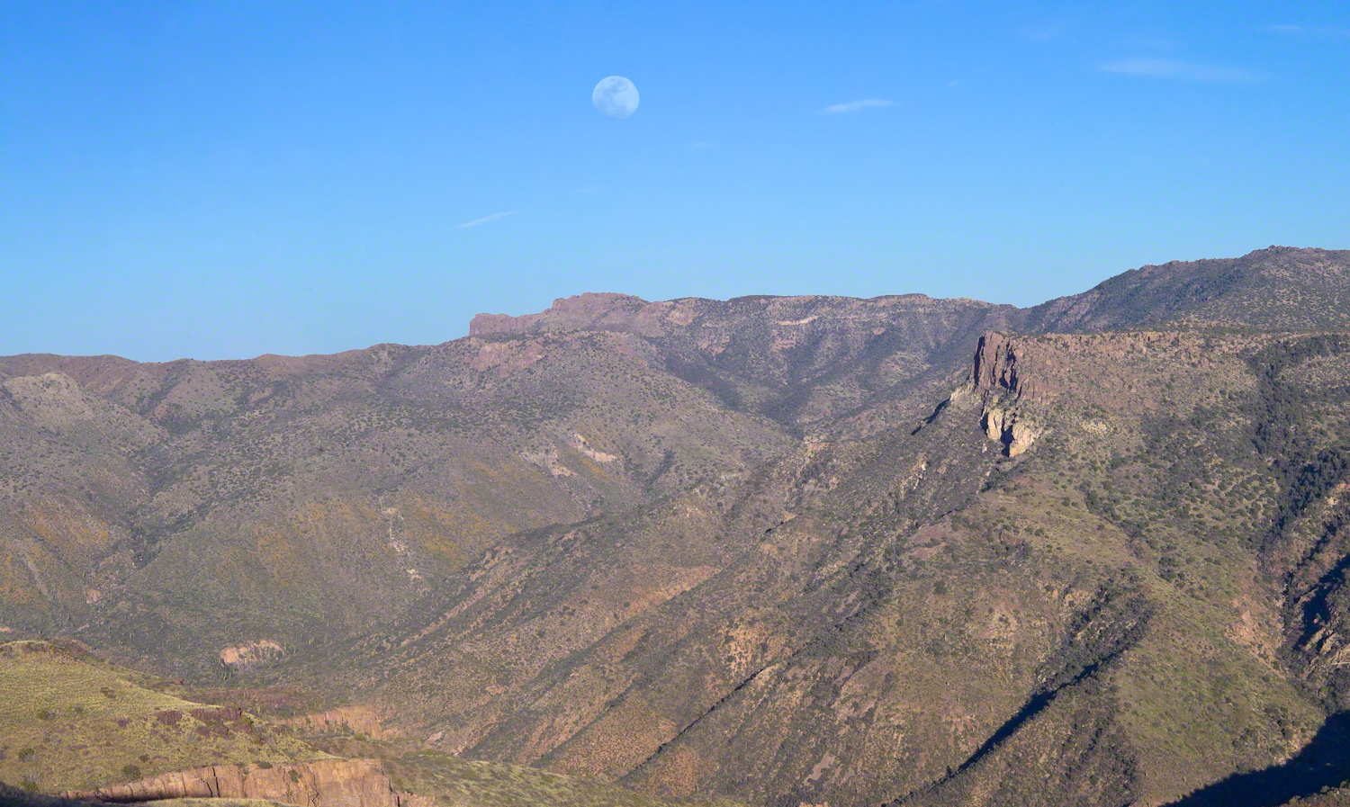
Two Bar Mountain and Ridge from Lime Mountain with rising moon.
My hat tie-down were tested on that two miles of ridge, the brim was molded around the right side of my head. The backpack acted as a sail so that it was taken in the wind gusts, affecting my balance.
On mountain trails the path is full of stones of all sizes and, aside from the occasional rattlesnakes, critter scat or, at lower elevations, Gila monsters, it is the rock that forces hikers to look four steps ahead, planning moves carefully to avoid falls. The 80 pound backpack, wind, rocks, high perch and, not forgetting the prickly pear cactus and jumping cholla, all slowed me to less than a mile an hour. I was jumpy walking through that Manzanita and this slowed me down more.
Trail 122 joins Trail 119 on Two Bar Ridge. On the ridge a substantial barbed wire fence separates federal land from the working ranch. Where the trails crosses, the fence has a break. The hiker needs to wend through a simple maze impassable to cattle.
Of all the trail, this is the most clearly marked. Fences have deep historical significance for the western United States. Range wars were fought between men who had different beliefs about land use and ownership. Many historians associate the building of barbed wire fences with the passing of the Old West.
Up until the fence, cattle grazing visibly damaged the land and plants. After the fence, the land was free to become as it was since the beginning of time. Up here, there’s wonderful grass that was, in this season after heavier than normal winter rains, was lush and green.
The trail followed the fence for a ways, then descends steeply into a fold of the land, leaving me in shade as the sun, low in a cloudless sky, raked over the mountainside with a brilliant golden light. The Two Bar Mountain and Ridge with Moon photograph, above, gives an idea of the effect.
Below, the canyon floor seemed a mass of prickly pear cactus groves. I decided the lower canyon wall was the best choice for camp…as unlikely as that sounds.
Here, the trail was anything but straight and almost invisible, descending in looping curves called switchbacks.
Here’s a photo from the following morning. I found a small shelf on a ridge overlooking the canyon floor, amongst wonderful shrubby Juniper trees. Tiny hedgehog cactuses were covered in lavender blooms. There is a decrepit stalk of a Century (yucca) plant lying over the rock.
Morning view from my camp in a nameless canyon below Two Bar Mountain.
On approaching the shelf, the air turned suddenly cold as the sun fully set and the wind gained even more in strength flowing up the canyon and over Two Bar Mountain. Stony ground made it impossible to stake the tent, instead I used small boulders to fix the corners and sides of the tent. Once inside, I was grateful for an excellent mat to protect me from the small jagged stones at one with the ground. The tent walls held back the wind. I forgot to back an excellent sleeping bag for the trip. Instead of buying one in Phoenix, my sister lent me a light waffle weave blanket. “What was I thinking???” It was a restless, cold night. The sun was very welcome the following day.