“When George J. Roskruge created the official map of Pima County in 1893, he named the range after James Quinlin, who had opened a stagecoach station in the nearby town of Quinlin in 1884.” — Wikipedia article for “Quinlan Mountains.”
Kitt Peak is the highest point of the Quinlan Mountains, one of a series of ranges starting near the border with Mexico, the Baboquivari Mountains. Pan Tak pass separates Coyote Mountains from the Quinlans. Farther north there is even the Roskruge Mountains and a range named for a silver mine, the Silver Bells. Roskruge originally named “Kit’s Peak” for his sister, Phillippa, married to William F. Kitt. The peak was renamed to Kitt Peak William’s request.
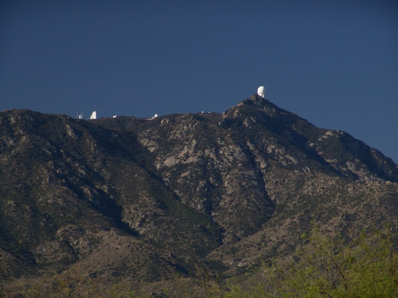
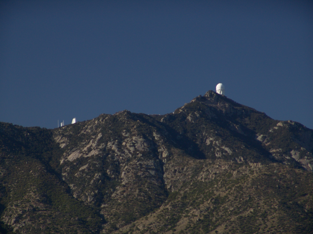
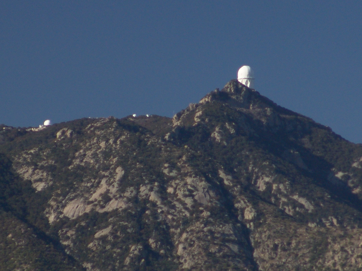
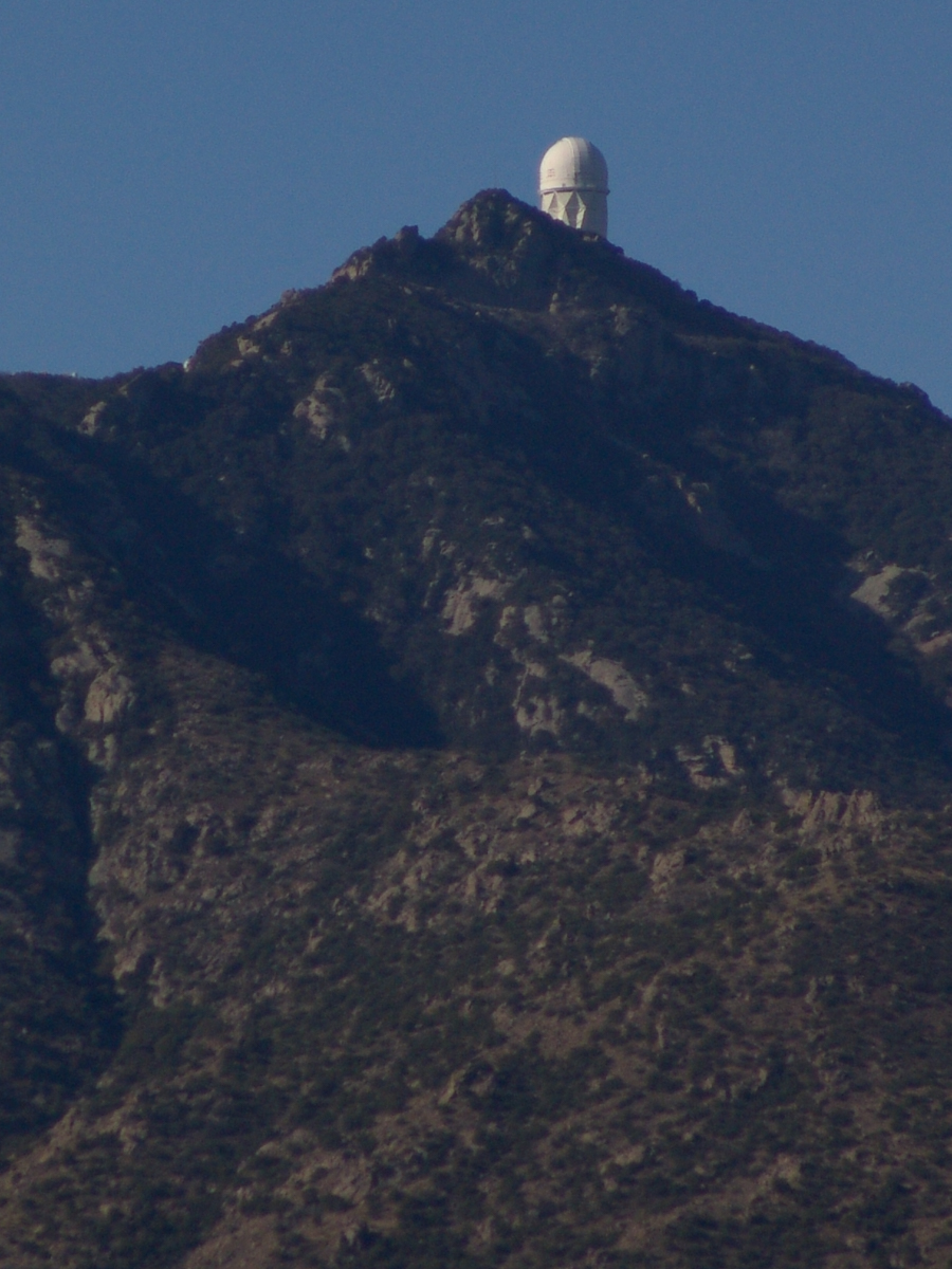
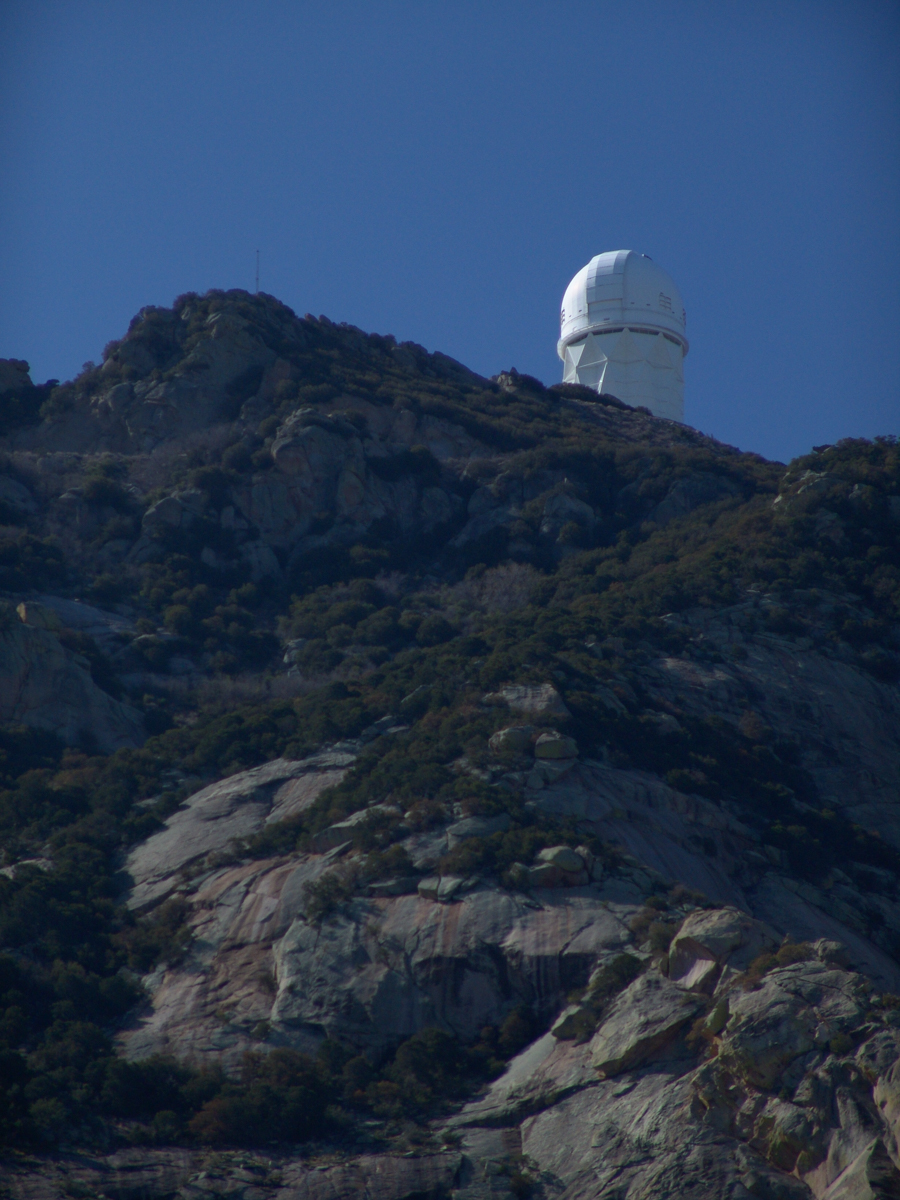
Here we see a dramatic view of Quinlan Ridge with Kitt Peak observatories, taken from the access road Arizona Routh 386. The instruments I recognize are, from left to right, McMath-Pierce Solar Telescope (second in line) and, on the end, Mayall Telescope.
And more views as I progressed toward the top.
.
The dramatic peaks are hypothesized to be igneous intrusions into metamorphic rock, these are called “Sky Islands” for the environments supported on them, radically different from surrounding lowlands. Kitt Peak is known for the stands of Manzanita Bushes
A mature Manzanita growing along the Miller Trail of the Rincon Mountain Wilderness. There is an enlargement of the flowers, to the right.
Copyright 2022 Michael Stephen Wills All Rights Reserved
The Contreras fire threatening Kitt Peak last month brought to mind a spring visit of mine to the National Observatory.
From downtown Tucson get onto Interstate 10, heading “east” toward El Paso. East in quotations as the road only turns east after the fork for Interstate 19, headed south past San Xavier del Bac mission and Nogales at the Mexican border. A few miles down I19, well before the mission, a turnoff for Arizona route 86, a road you’ll follow the better part of 36 miles, passing the Tucson Mountains on the right. Most days, the Mayall Telescope of Kitt Peak shines bright white ahead, as it did the right after dawn on Wednesday, April 20, 2005.
At some point R86 enters the 4,453.307 square mile extent Tohono O’odham Nation Reservation, you pass the town Three Points where Arizona route 286 heads south to Sasabe and the Mexican border. The next turn south is the Kitt Peak access road, Arizona route 386. On that Wednesday I was so early the gate to the peak was locked, so I pulled off the road and waited. It is a lonely place on the route for migrants from Mexico. I wandered off the road, into a wash (dry, sandy stream bed), to relieve myself, where junk from migrants was scattered around. Back in the car a helicopter approached with a black SUV. A big guy got out, walking by into the wash: the border patrol.
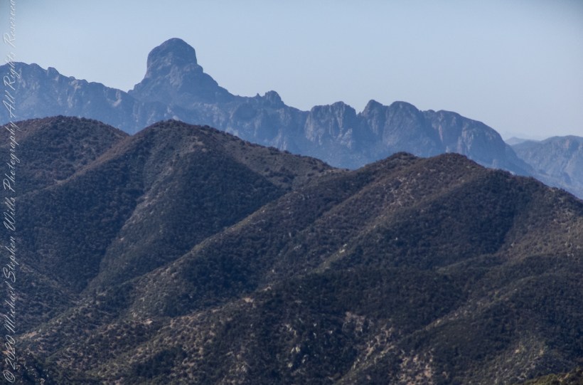
Here is a photograph from that day of Baboquivari Peak taken from Kitt Peak’
Baboquivari Peak is the most sacred place to the Tohono O’odham people. It is the center of the Tohono O’odham cosmology and the home of the creator, I’itoi. According to tribal legend, he resides in a cave below the base of the mountain. This mountain is regarded by the O’odham nation as the navel of the world – a place where the earth opened, and the people emerged after the great flood. Baboquivari Peak is also sometimes referred to as I’Itoi Mountain. In the native O’odham language, it is referred to as Waw Kiwulik, meaning “narrow about the middle”. The O’odham people believe that he watches over their people to this day. — Wikipedia
Baboquivari Peak was mentioned in the journals of Jesuit missionary Padre Kino, who made many expeditions into this region of the Sonoran Desert, beginning in 1699, establishing Spanish Missions in the area. — Wikipedia
Kitt Peak is in the sacred precinct of Baboquivari, the land just below the peak is the “Gardens of the Sacred Tohono O’odham Spirit I’itoi.” The month of my visit, the O’odham nation brought legal suit against Kitt Peak to halt construction of new telescopes in the garden. The issue was settled out of court.
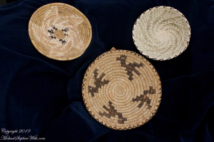
About the header photograph: From the bottom clockwise. Birds by Anmelia Juan of Geawuk (Kitt Peak 1972) – I purchased this from the Kitt Peak gift shop during my first visit; Turtle by Olvera and Simon Valenquela (Saguaro National Monument 2005); Stars by Simon Valenzuela for his daughter Pasquala Valenquela 16th Birthday (2018). Simon is of the Pascua Yaqui tribe who Learned basketmaking from his wife’s family.
Copyright 2022 Michael Stephen Wills All Rights Reserved
Sky islands are isolated mountains surrounded by radically different lowland environments. The term originally referred to those found near the southern borders of the U.S. states of Arizona and New Mexico with the northern borders of the Mexican States of Chihuahua and Sonora such as the Dragoon Mountains featured in this post. The isolation has significant implications for these natural habitats. The American Southwest region began warming up between ∼20,000–10,000 years before the present-day and atmospheric temperatures increased substantially, resulting in the formation of vast deserts that isolated the sky islands.
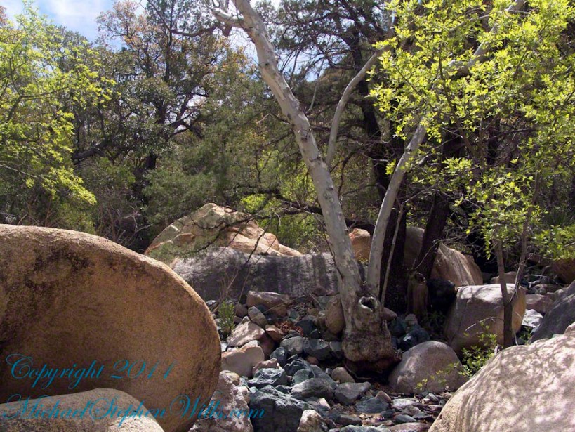
This sycamore tree survives life in this ephemeral stream of an Arizona “Sky Island” by allowing entire trunks to die off during extended dry spells. The tree is an Arizona Sycamore (Platanus wrightii).
Informative sign at campsite
Reference: wikipedia article “Sky Islands.”
Copyright 2022 Michael Stephen Wills All Rights Reserved
The Whitehouse Ruin of Canyon de Chelly is just visible at left in the far cliff, in the notch of the near cliff. The ruin trail is visible on the canyon floor. Notice the road following the canyon and the plantings with house on the right.
The landscapes I capture, like the face of a missing friend, fade gently from memory. My piece “Moon Fin Canyon de Chelly” became a mysterious vision. I remembered the context, the canyon topology was lost until I constructed the panorama, above, from three shots taken one evening, July 2008, from a cliff near the White House Overlook. Five years after my visit with Sean Wills, Pam and I returned to Canyon de Chelly to walk the same path.
At that time, a 50 mm lens was my widest angle, so I would take multiple images in sequence and use Photoshop later to construct a panorama. This past Sunday afternoon I spent stitching together my work from 2008. In doing so I see “my fin”, in the center, bordered by the canyon road, is attached to the White House Ruin cliff via a thin ridge.
During that session a photogenic thunderhead, lit by the evening, hovered behind the fin as the gibbous moon did that long ago evening.
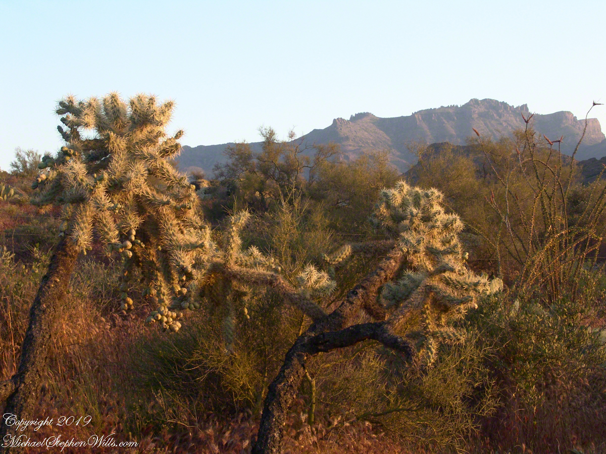
Notable Sonoran Desert Plants, all in the same frame. From the left, back row: staghorn cholla, ocotillo, saguaro. Front row: teddy bear cholla, yucca. I am not certain the greenery to the left of the yucca is brittle bush.
First Water trail head is the most used access point to the Superstition Wilderness, being the closest to Phoenix and its satellite cities and suburbs. For day hikers there are ample and interesting route choices as all foot trails of the west side terminate at First Water making for a variety of loops and incredible views. For horse people there are facilities to park huge trailers.
The ready access from Mesa, where my sister and husband had their home, was the primary reason I planned to finish my cross wilderness hike on the Dutchman Trail. Named for Jacob Waltz of the fabulous legend of the Lost Dutchman mine, the inspiration for The Searcher’s Superstition Wilderness expeditions and, ultimately, why he and I met and my change of plans.
On our ride over from Roosevelt he told of his difficulties building a home in Apache Junction, sleepless nights spent guarding building supplies from thieves. He looked forward to moving day.
This photographic record of five days in the wilderness would be much different without that meeting yet, there I was that afternoon with plenty of time for photography during the golden hours of late afternoon as I wandered the desert gardens until my sister arrived.
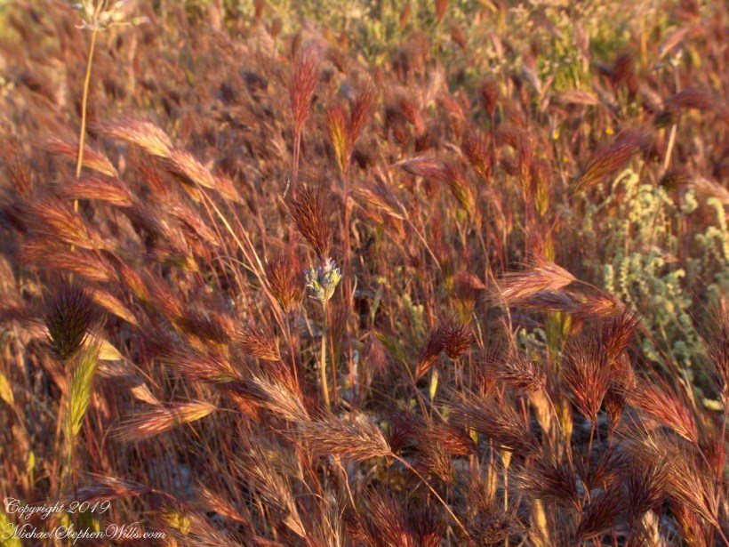
Wild Barley
The long distant ridge beyond the rugged near hills is the backbone of the famed “Superstition Mountain.” On the far right are hoodoos, appearing as so many teeth on a jaw. Gorgeous saguaros in the foreground.
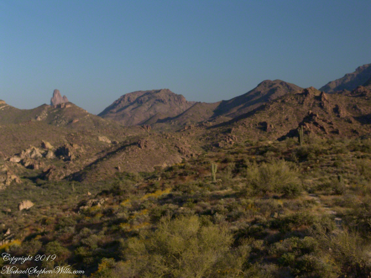
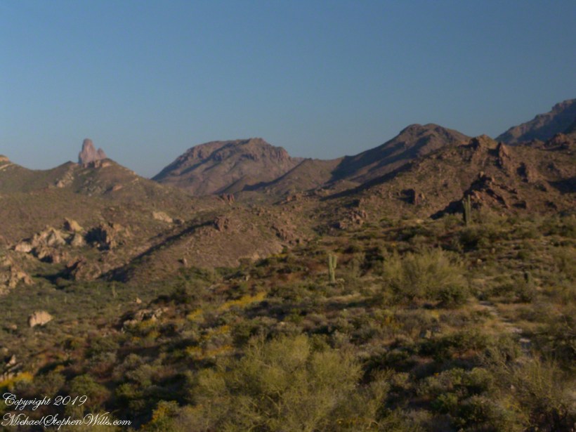
Weavers Needle is the distant peak, 5.5 dry miles away in this view to the west / southwest.
I’ve always been partial to how the dense spines of cactus catch the evening light. These staghorn chollas are in front of the same ridge of the Superstition Mountain. A famous formation, “The Flatiron” is visible on the far right.
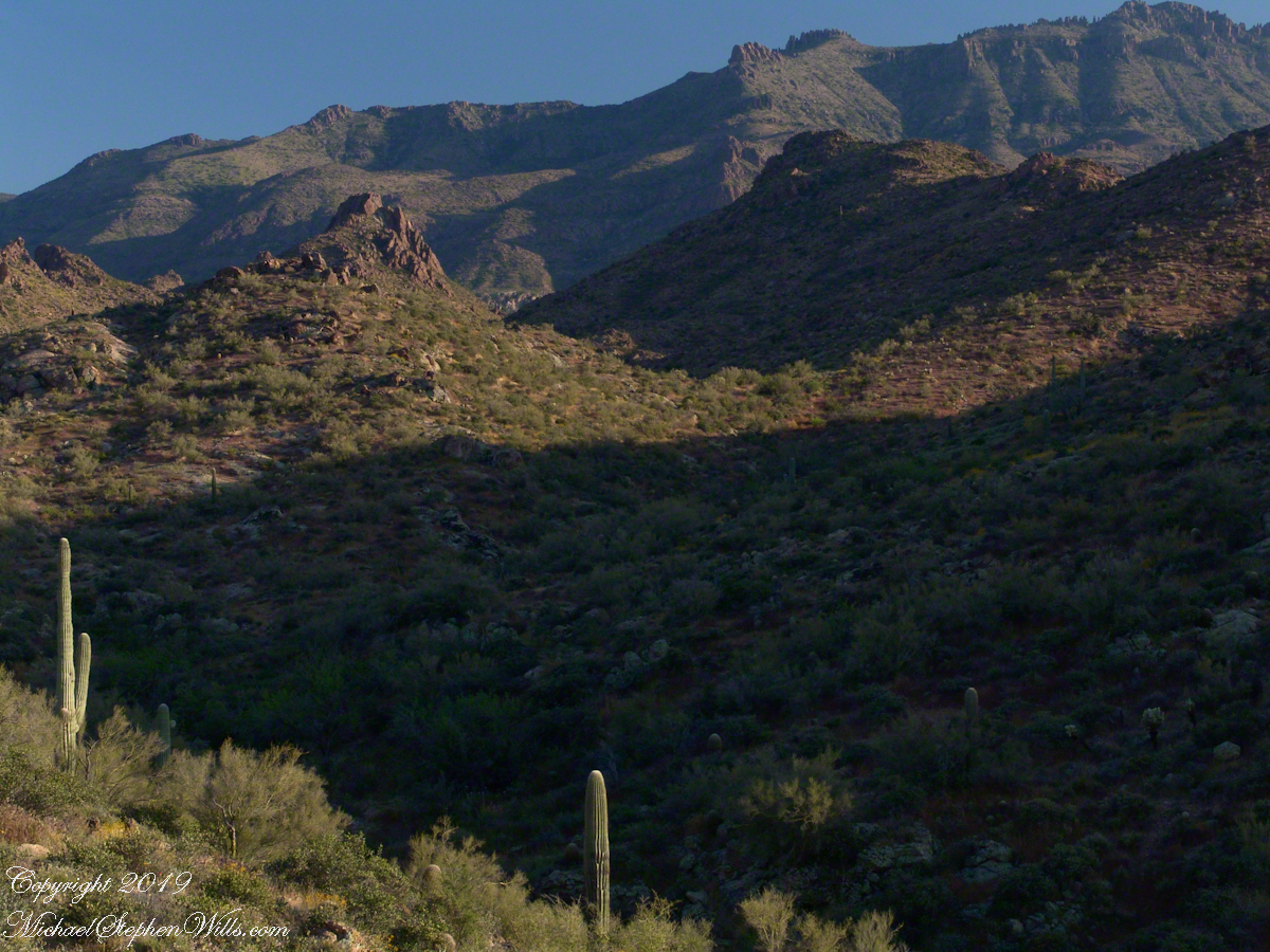
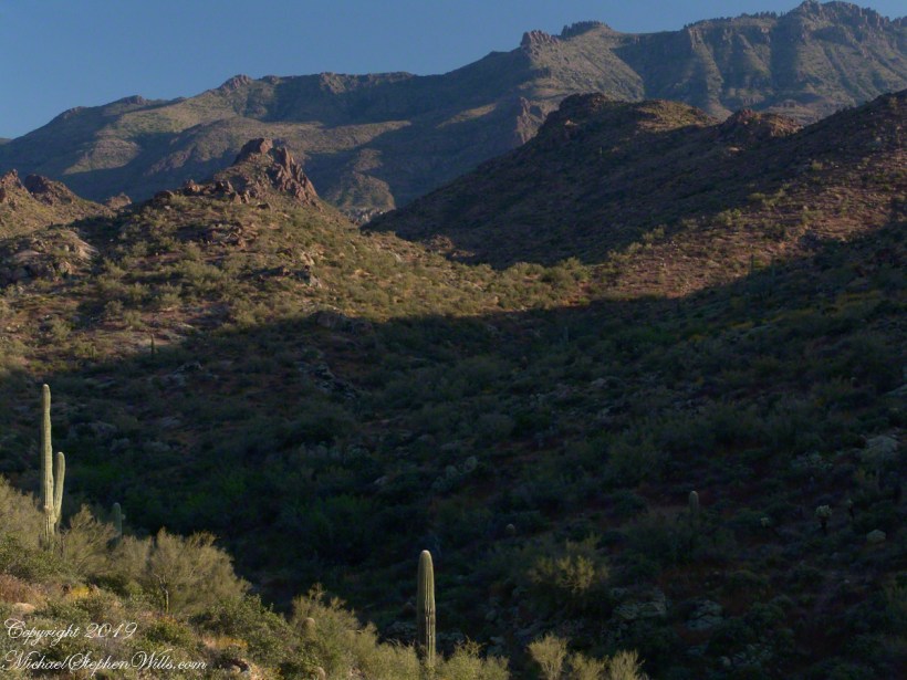
The road to the trail head, Service Road 78, winds through 2.6 miles of hills. Here is another overview of Sonoran desert life.
You might remember hedgehog cactus blossoms from my posting “A Dry Piece of Paradise”. The following are from the large hedgehog cactus in the foreground of the preceding photograph.
Future Plans
During the drive back with my sister, Diane, we talked of plans for returning to the Reavis Ranch together, as a backpack expedition. In coming days I met with The Searcher to explore possibilities for a horse expedition and, three years later, these plans came together for a trip kicked off from this same First Water trail head.
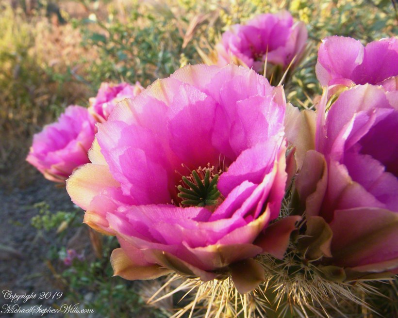
Hedgehog Cactus Blooms
Here is a gallery of the same photos. It is fun to flip back and forth with me disappearing from the scene.
It is possible to walk the distant ridge starting from Lost Dutchman State Park. Hoodoos are visible on the right side.
Weaver’s Needle is visible above the near hills. the First Water trail traverses this desert.
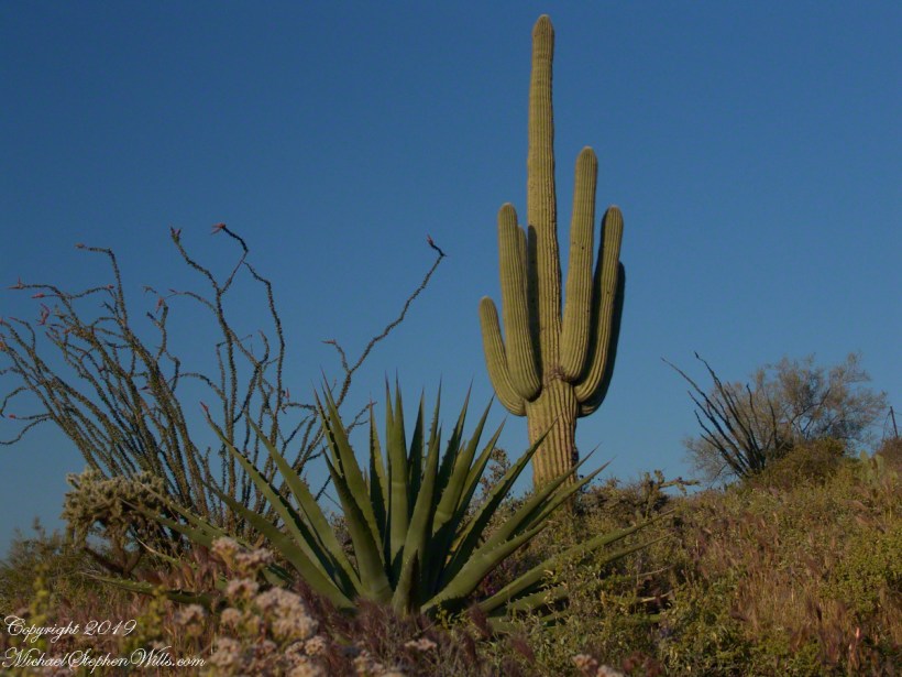
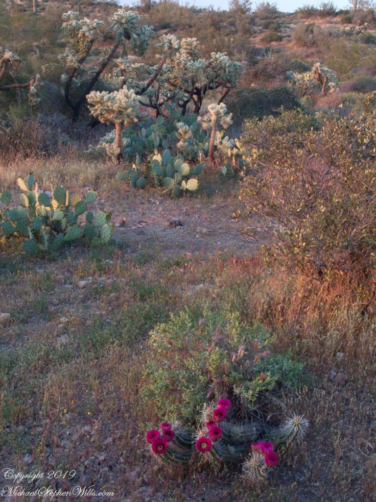
Ocotillo, yucca and saguaro. Two types of cholla cactus are also visible.
Also known as Teddy Bear Cholla. Hoodoos are visible on the distant ridge.
The Searcher arrived after breakfast. My camp was bundled up to join the rest of The Searchers equipment and supplies on Colorado’s panniers that replaced the saddle where I sat, and was dumped from, yesterday. This fifth morning of the adventure, I was to have the experience of a light pack for the 4.7 mile trail from Pine Creek to Campaign Creek, past the Reavis Mountain School of Self Reliance.
First, there was the climb to the edge of Pine Creek canyon where we, for the last time, enjoyed the view to the north of the Arizona Trail and, in the distance, the Four Peaks Wilderness.
North from Reavis Gap
At Reavis Gap we took a rest before the 1500 descent to Campaign Creek on a trail rated as so difficult backpackers go miles out of the way to access Reavis Ranch.
I split an energy bar and took a swig of water before setting up the tripod to capture the following view of our path. The ridge, hazy in the distance of 22 miles, is Apache Peaks, the near descending ridges an improbable green after a wet winter. In the previous photograph, “North from Reavis Gap” you can clearly see the transition from the desert to a grassland biome as the elevation increases.
Generations
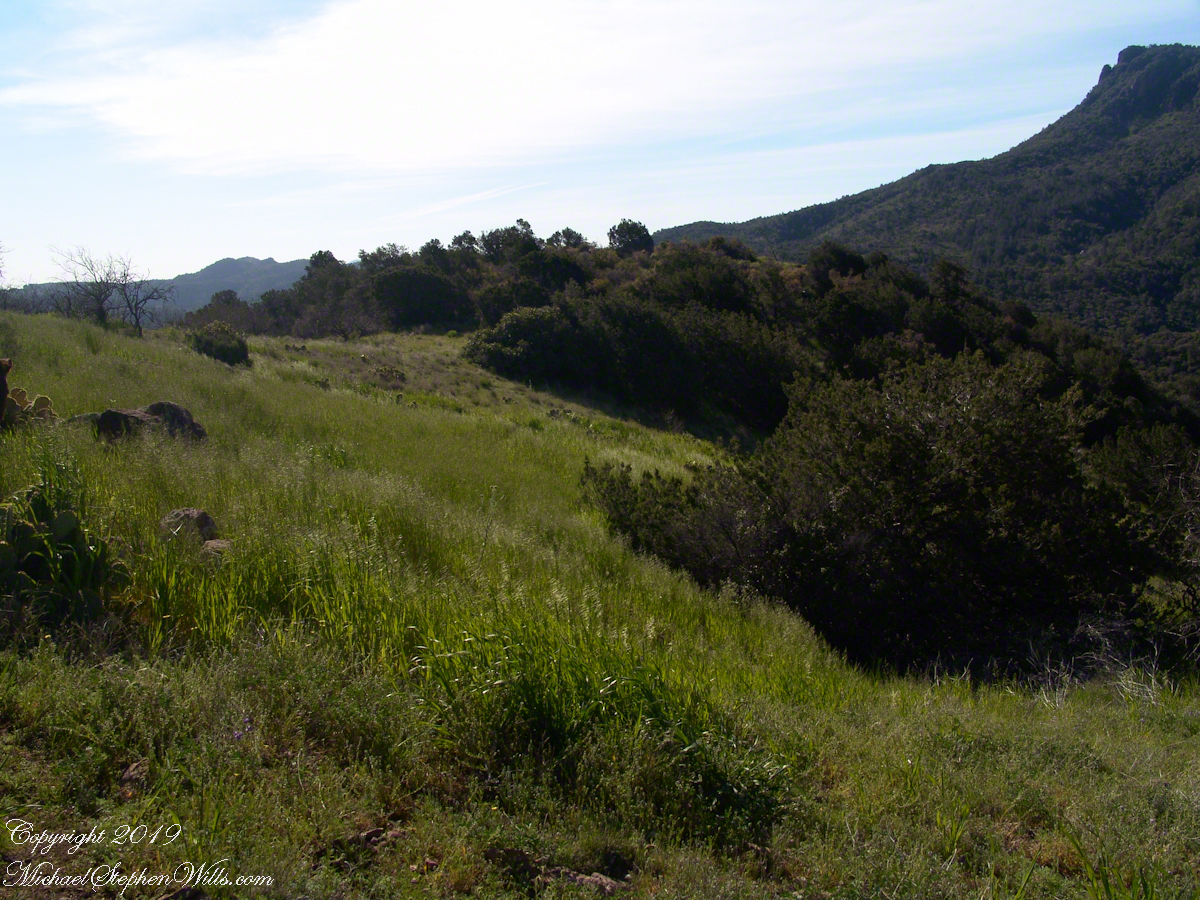
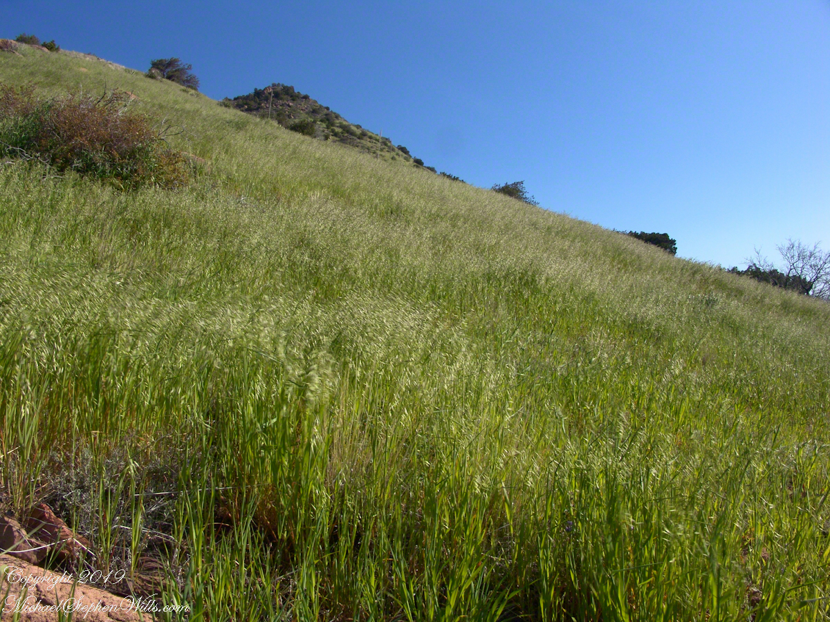
On this, the southern shoulder of Two Bar Mountain, we enjoyed desert grasslands almost the entire length, starting with this unlikely oat field. The higher, eastern Superstitions are the western and northern-most Sky Island of Southern Arizona: rising from the desert as isolated mountain systems, catchments for passing storms, with life zones progressing with altitude, the highest typical of Canada. As with oceanic islands, each is a haven for life with potential for evolution of unique species from the isolating effect of the surrounding desert.
These oats are domesticated grain spilled from a horse or donkey pack to thrive in the decades since, sprouting into this spread of light green after a wet winter, ripening, then turning gold with the summer, the grains falling to wait for the next opportunity. This green hue is my first impression of Reavis Gap, see my post “Two Meetings” for a video of the morning breezes rippling along the hillside.
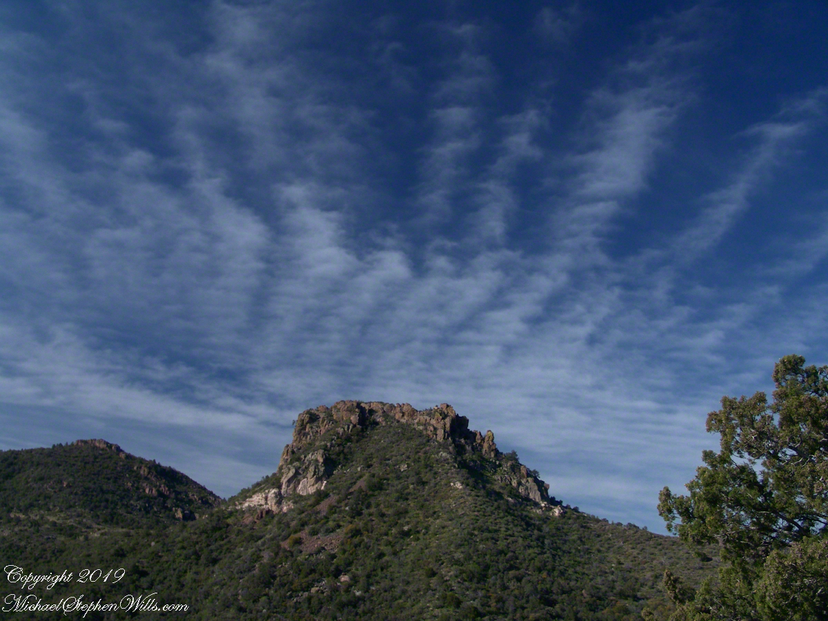
The camera sweeps 180 degrees for all the views from this spot, including prickly pear cactus among the grasses, a butte-like formation to the west, as in the following photograph.
Upper Horrell, the end of the beginning.
We passed the length of the Reavis Mountain School of Self Reliance, the Reavis Gap trail is 100 feet or so higher on the north side. The name “Upper Horrell” is attached to this location. Reavis Gap trail used to start at a ranch house, part of the “Upper Horrell Ranch.” Horrell is the family name of the former owners.
Upper Horrell is a fortunate location for the school, with the perennial Campaign Creek flowing parallel to their 13 acres on which is a large garden, many fruit trees, livestock and poultry. The school provides lodging and classes throughout the year.
The Searcher initiated his time in the Superstitions with wilderness survival classes and they allowed him to park is horse trailer and pickup outside the gates. We were loaded and out of there with a stop at Roosevelt, population 28, where we were the only customers for mesquite grilled hamburgers and french fries. We talked about the potential for future trips and I took him up on an offer to store my stuff until then. In the following years I did more Superstition Wilderness day trips, backpack expeditions, some with my sister Diane, and one horse expedition with The Searcher and a friend.
Here is a gallery of this post’s photographs, for you to flip through.
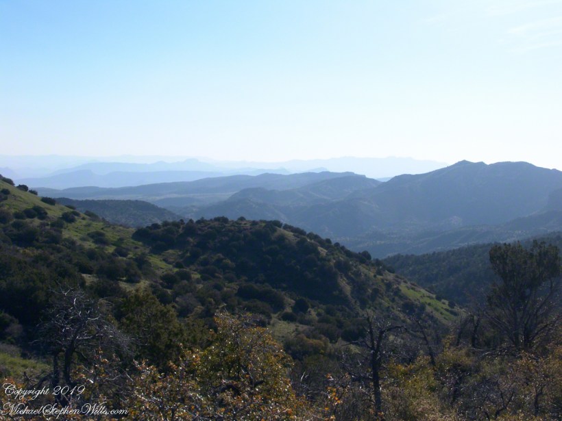
The Arizona Trail passes this spot in the remote eastern Superstition Wilderness. This is the view of my path up from Nameless Canyon. In the distance is the Four Peaks Wilderness Area.
The view down the canyon followed by the steep Reavis Gap trail from Campaign Creek.
The viaw back toward the Superstition Wilderness from the Reavis Gap trail on the approach to Reavis Gap.
Two Nature Abstracts, macros of Reavis Creek below the falls
The light of a early spring desert afternoon on a broad rock shelves along the creek.
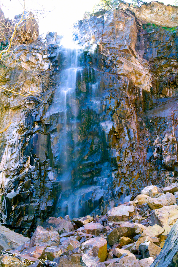
I spent a day hiking in, two days hiking out and a day of canyoneering to the foot of Reavis Falls. The featured (i.e. “header”) photograph is a view of the inner canyon, the raw material for these abstracts.
I received notice of IStock acceptance of select photographs from my last posting, “Wilderness Textures”, was accepted. Click to view my IStock Portfolio, including photographs from today’s posting included in the acceptance notice.
In this post I move up the Reavis Creek canyon from where the last posting, “Wilderness Textures”, was sited to the foot of Reavis Falls. With the first photograph you look up at the falls from the head of the canyon carved by the creek over eons. The rock wall, the canyon “head”, is thick with microorganisms, fungi, mosses.
Click Any Photograph for my Fine Art Gallery
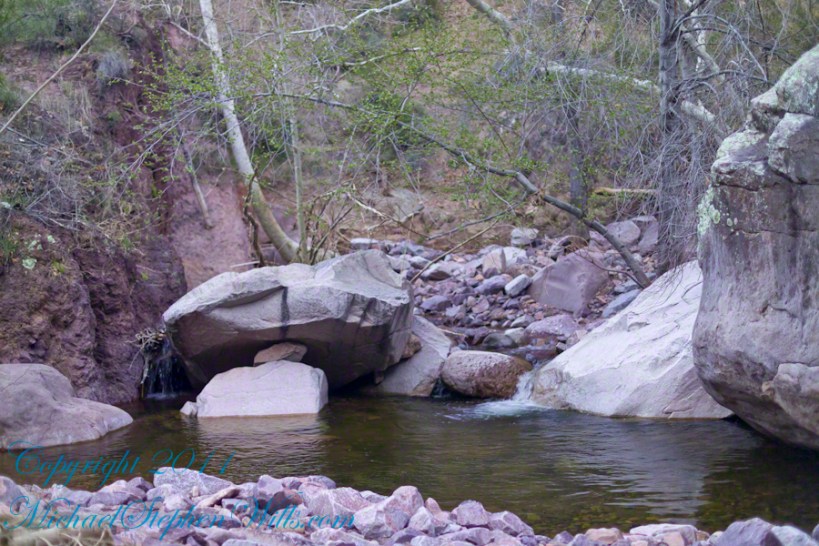
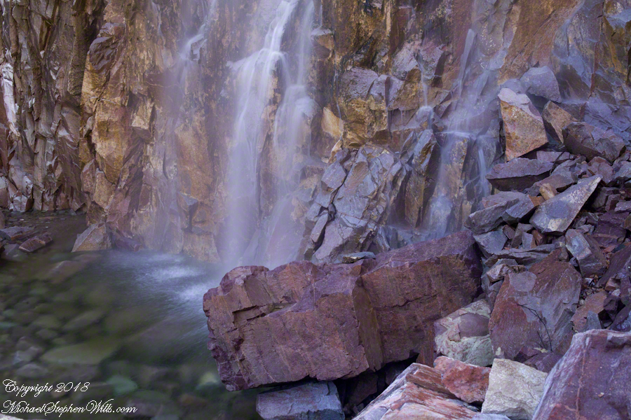
In the foreground is a jumble of boulders, some washed down at flood time, spread wide at the bottom of the falls, piled to a jumbled height of 15 feet.
Talus is the geological term for this formation. Derived from the Latin word for slope (talutum) the definition, from the Oxford English Dictionary, is “A sloping mass of detritus lying at the base of a cliff or the like consisting of material fallen from its face.”
Click Any Photograph for my Fine Art Gallery
The ankle bone is also called talus, from the French word for heel, I bring it up because climbing this chaotic, unstable jumble is a way to break your ankle. The route to Reavis Falls, a climb up one side of Lime Mountain then down the other on a non-existent (lightly marked) trail, is rated difficult and impossible with a broken leg or ankle. I was alone and very careful to check each rock for stability before putting my weight on it.
A climb of the talus pile was necessary to view the pool at the waterfall base, for this photograph.
Click Any Photograph for my Fine Art Gallery
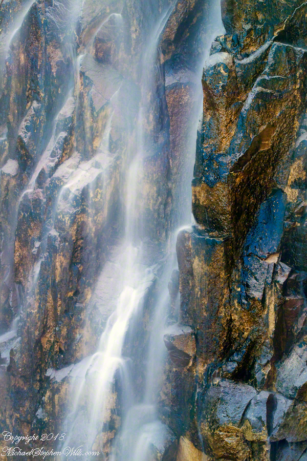
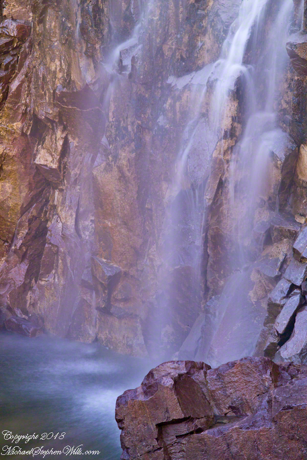
A more artistic vertical format version, below, captured with the Canon EF 100mm “macro” lens. All shots are using the Kodak DCS pro SLR-c (the “c” designated Canon lens compatibility) and a Manfrotto studio tripod with a hydrostatic ball head. The horizontal format shot was captured with a Canon EF 50mm f/1.4 USM lens. I prefer the vertical version, artistically, because the talus jumble is all but cropped out while the upper corner of the angular basalt boulder is left as an interesting focal point. The boulder, not being in the spray, is in focus to contrast with the basalt wall behind the water.
Click Any Photograph for my Fine Art Gallery
I captured a series of shots from this precarious vantage point, working up from the pool to the brim of the waterfall.
Click Any Photograph for my Fine Art Gallery
My goals was a composite photo of the falls. I have yet to succeed with this project. Maybe I will give it one more shot in spite of having learned the hard lesson the best photographs are a single moment captured in a single frame.
Click Any Photograph for my Fine Art Gallery
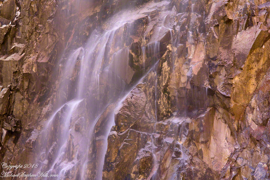
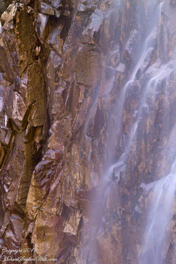
I find in this series the vertical aspect is more artistic. The water volume, of the falls, at this time of year offers only the finest of sprays with most of the basalt rock wall only moist. The 100mm “macro” lens allowed me to include only the falling water with a bit of the moist wall for contrast.
In the following version I experimented with color, moving from the narrow range of hues, to more contrast.
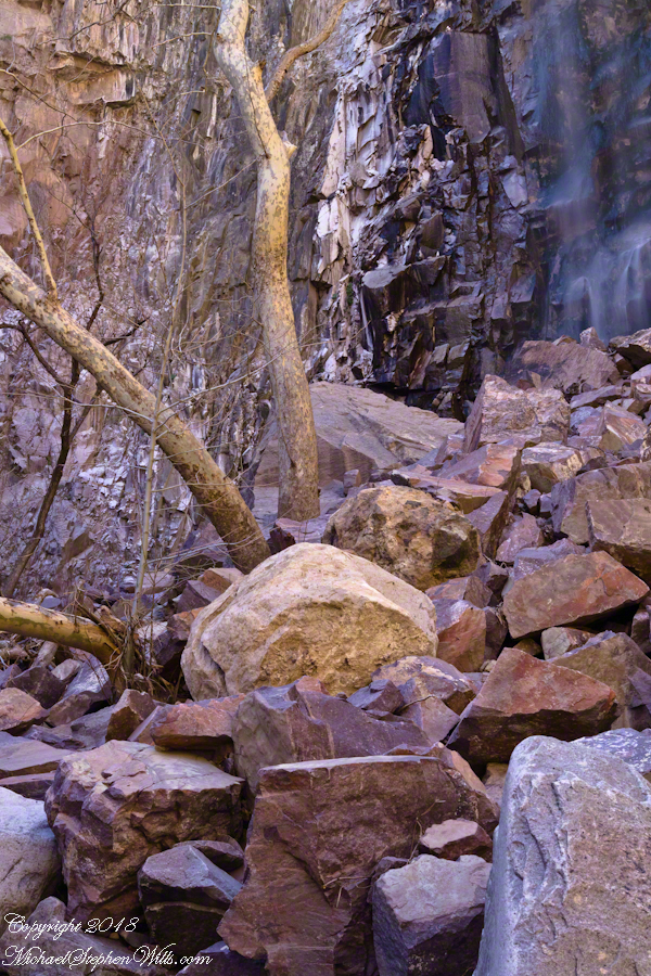
These abstracts are some of my photographic output from four days and nights spent alone in the remote eastern Superstition Wilderness. For the first three days I met not a soul, all these images were captured on a single afternoon spent in the canyon below Reavis Falls, a jumble of landslides, flood debris and boulders. There is no trail. The few people who enter the canyon must negotiate around boulders, crossing Reavis Creek many times.
Click Any Photograph for my Fine Art Gallery
My backpack kit included a full sized Manfrotto studio tripod with hydrostatic ball head. The benefits more than outweighed the effort (I was a lot younger in 2008) when the Canon EF 100mm (macro) lens is mounted on a Kodak dSLR body, allowing me to take crisp shots. The tripod legs can be adjusted to precise positions for stability.
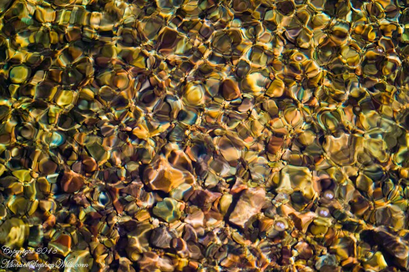
I can feel the bright afternoon desert spring sunshine in this photos. It was after the spring floods, the flow of Reavis Creek and ample still but slow. Gathering in pools over the rough stones of the creek bed, the water absolutely clear.
I held the shot over many minutes, capturing ever changing diffraction patterns.
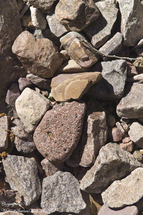
We see in all these photos, not a homogenous blend of stones from a shared geology. Reavis Creek washes over diverse geologies: volcanic, ancient igneous extrusions, sedimentary and metamorphic are jumbled together.
Click Any Photograph for my Fine Art Gallery
This is a series of photographs of smooth, white igneous boulders with shadows of still leafless sycamore and cottonwood trees.
Graceful shadows
Strong, demonstrative shadows.
Click Any Photograph for my Fine Art Gallery
A leaning cairn, not a trail marker….
A 15 foot high jumble of stones piled at the bottom of Reavis Falls, carried over by the floods.
Canyon de Chelly, on the map, is shaped like a Y or a chromosome. A chromosome as the walls of the canyon carry the heritage of the people who made this place their home over millennia. A Y as in the letter ship, a foot and two arms.
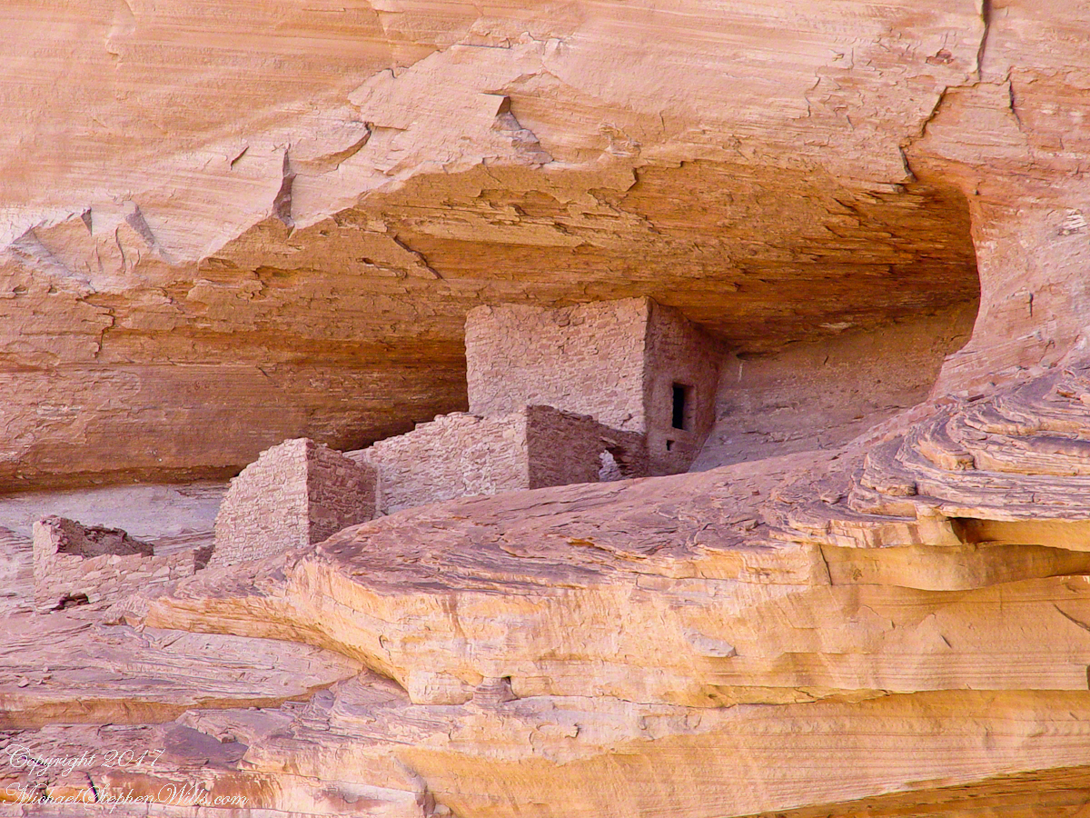
6.2 miles from the canyon mouth, where the road ends at Chinle, above the branch, on the north cliff, is this photogenic ruin, called the Ledge Ruin. In my previous posting, this ruin forms the backdrop of Peter Tsosie’s portrait. Peter is the header image of this posting.
Difficult to believe, seeing it for the first time.
Difficult to see, a tiny nook in an enormous cliff, the structures formed from the same rock as though what remained after the cliff fell away.
Difficult to comprehend life there, what drove them to this effort? Fear, certainly, concern for their safety and security.
We know it by our name. Their name included the word “home.”