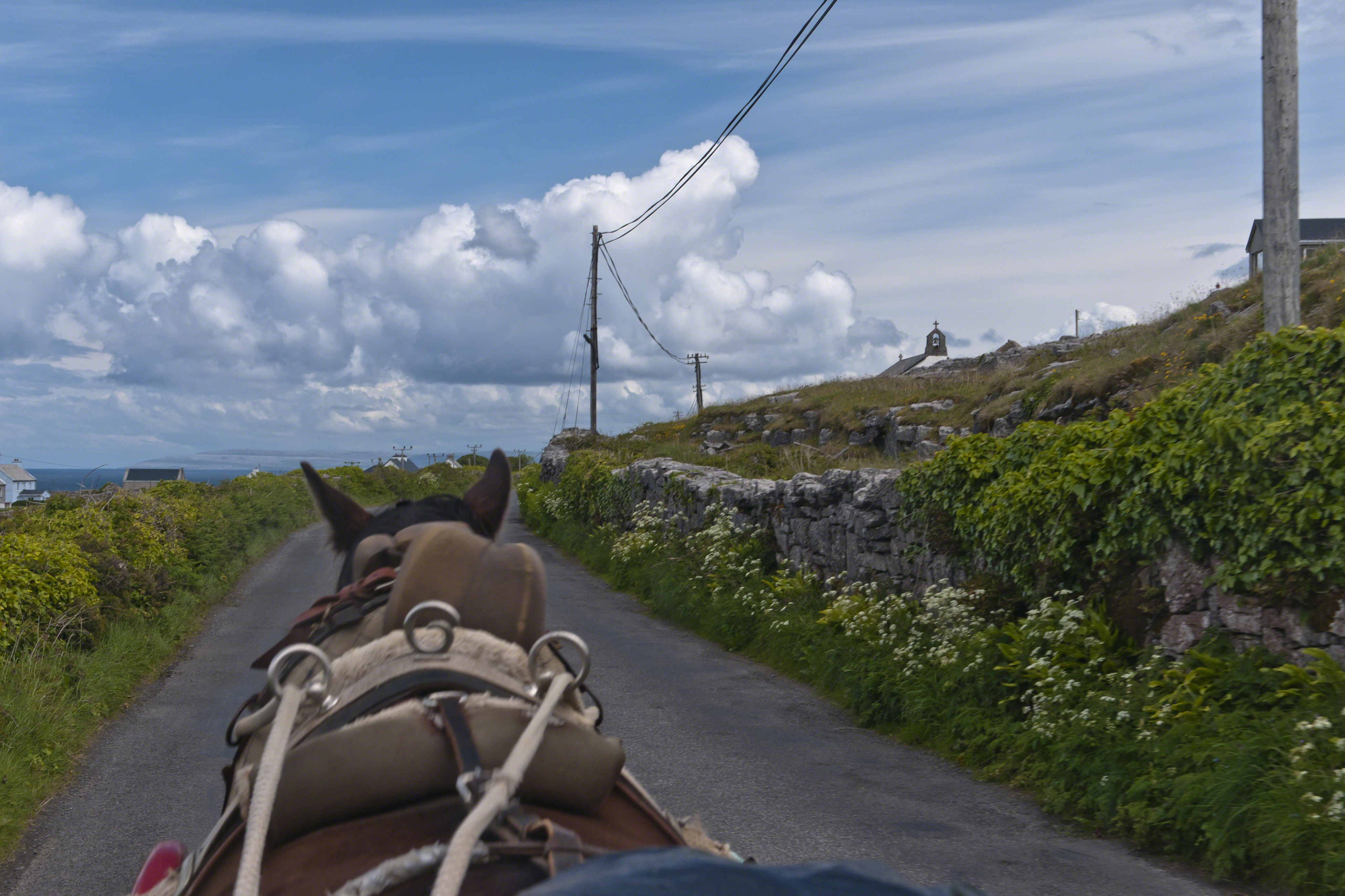
Enjoying travel on a horse trap, a type of carriage, on Inishmore (Inis Mór), the largest Aran Island in Galway Bay.
Click the link for my Getty IStock photography of the Aran Islands
Copyright 2019 All Rights Reserved Michael Stephen Wills

Travel at its best
Enjoying travel on a horse trap, a type of carriage, on Inishmore (Inis Mór), the largest Aran Island in Galway Bay.
Copyright 2019 All Rights Reserved Michael Stephen Wills

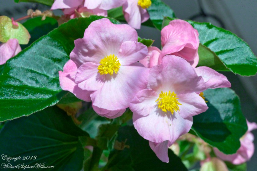
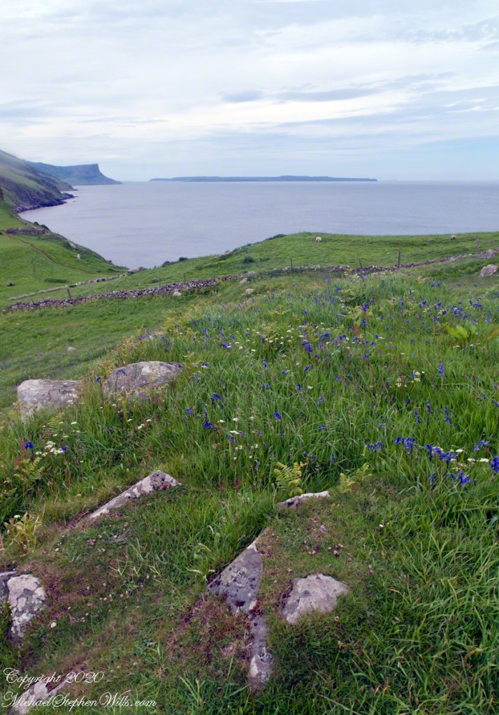
a season of wildflowers across a karst landscape
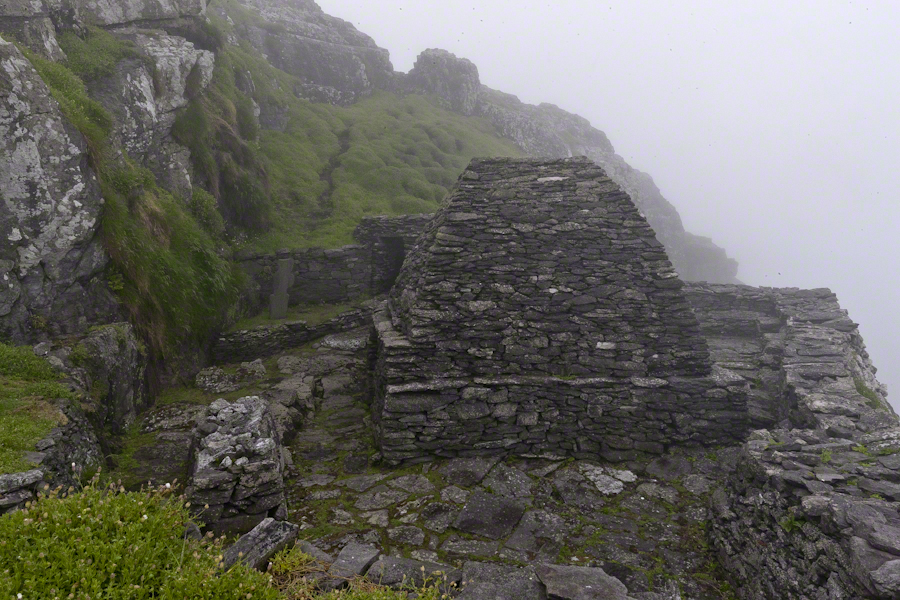
Another aspect of the gradual 1/2 mile inclined path to the central ring of the prehistoric Dun Aonghasa ruins of County Galway, Ireland.
The view north, northwest from this way to Dun Aonghasa (Dun Aengus). In early June, looking across wildflowers, karst landscape, walled fields, farms, the North Atlantic Ocean, coast of Connemara and the 12 Bens (12 Pins) mountains.
Note the doorway (with long lintel) in the surrounding wall, to left of center in middle distance.
Click the photograph for a larger view.

References: search wikipedia “Dún Aonghasa.”
An early morning revelation
Click Me for more Florida photos from my colleciton
One early morning, just after dawn, Cocoa Beach, Florida, I had a revelation. My wife and I walk the beach four or more miles each day we are lucky enough to be in Florida for the winter. Yes, we are “snow birds” who flee the snows of New York for a few weeks, now and then.
We love to catch the sunrise together, have breakfast, pull together a lunch for a long walk. We catch the passing beach scenery, find a place to enjoy our meal, and return late afternoon.
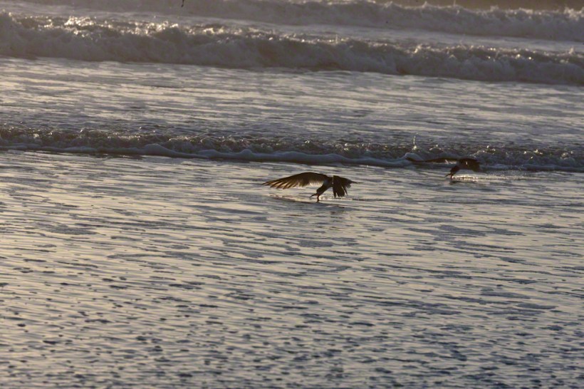
The Black Skimmer (Scientific Name: Rynchops niger) literally stands out from the gulls. The individuals gather together in a large group. If there is a wind, most group members face into it. They are aloof and dignified, unlike the gulls who grift for food, obnoxious and bothersome if you make the mistake of throwing a gull a morsel.

Black Skimmers are just as large a gulls. Slender, tern-like, black and white bodies. Recognize a Black Skimmer from the colorful red of the base of the bill. Click me for more of my Florida offerings.

My early morning revelation was how the Black Skimmer feeds, flying just above the surf, the lower mandible extended to fish by feel. Unless you beach walk early mornings, you will be most familiar with the habit of grouping together, facing into the wind. I captured this individual, a member of a larger group, just after sunrise, on Cocoa Beach. It was just me and the Skimmers.

Their feeding is successful enough to allow them to longue on the beach most of the day. I have only seen them feed early mornings. Here is another part of their feeding behavior. They feed as a group in long sweeping lengths. At the end, they turn as a group and head the other way. Here are three Black Skimmers in a turn.

One morning, after our sunrise view, I pulled together my photography kit for this successful photo shoot. Enjoy!!

discerning a fascinating species
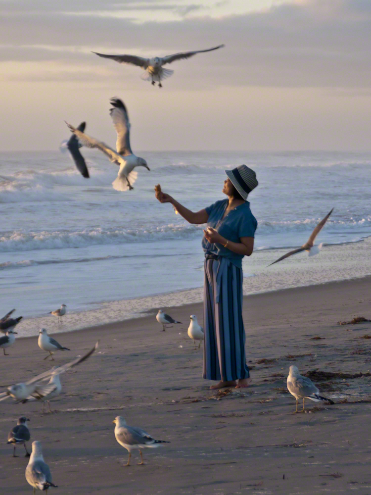
Gulls, an omnipresent element of any beach stroll. Pestiferous, abounding and incessant the gull is simple to deal with. Keep any and all foodstuffs under wraps.
Conversely, for those who adore a crowd of raucous opportunists simply pull out the food and offer it to the air. There is more about this photograph at this post, “Lady Feeding Gulls, Cocoa Beach Dawn.”

Pam and I developed a habit of hanging out in Florida during Finger Lakes Winters when the gorges are closed for safety and even walking the streets is perilous, stray black ice encounters abound. We trade icy falls for beach walks.
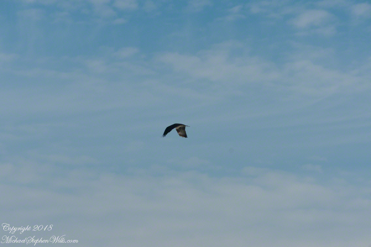
It is natural to become inured to the flight of gulls along the shore. For all my carting along the Sony Alpha 700 with a variable lens ( 18 – 200 mm) there is not a single photograph of a gull in flight. Yet, I have my eye on them until my blindness was lifted by a peculiar individual. It seemed to be a white gull, yet it had a watchful eye.
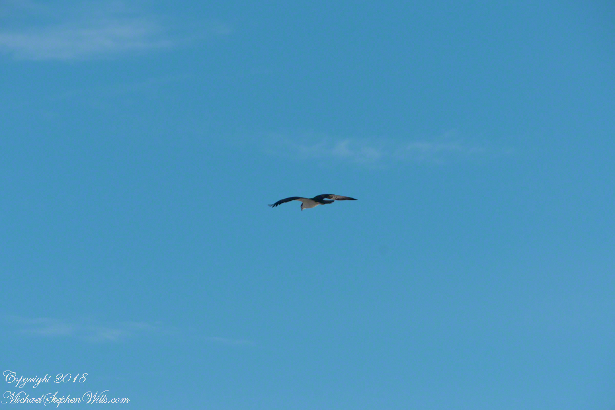
Gliding shoreline parallel with head down, how could I have mistaken it for a gull?
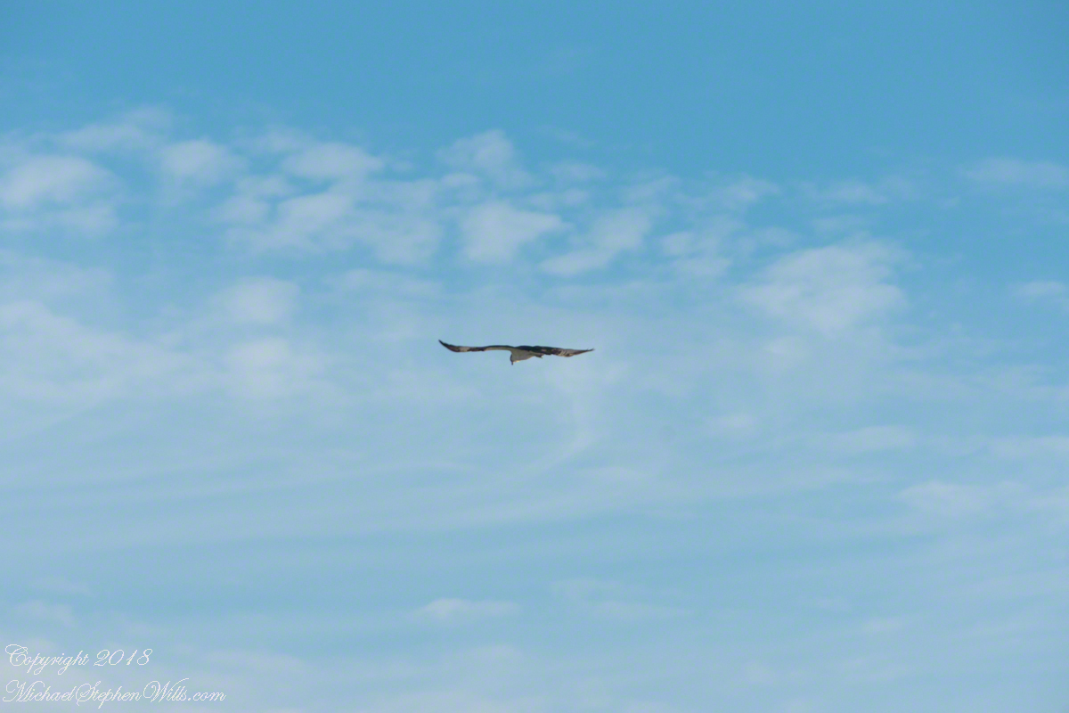
Osprey occupy an environmental niche along 700,000+ shoreline miles worldwide as a single species Pandion haliaetus. A unique bird with its own family, Pandionidae, and genus, Pandion, some experts recognize sub-species in geographic regions. Ours is the Western Osprey.
The following photograph is of a wing shape very different from the gull.
IPhone 8 always in my pocket, I captured this clip of an Osprey stalking fish in the Atlantic Ocean surf. You will have a better viewing experience by clicking on the title of the embedded YouTube, then click on the Full Screen icon at the lower right.
Rescue operations and memorials
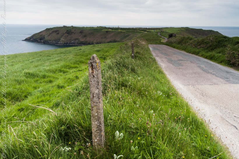
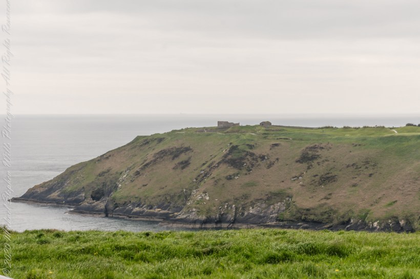
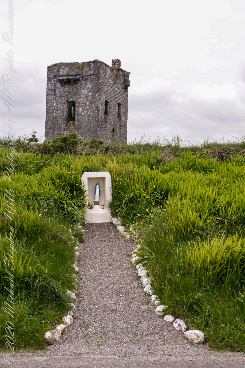
Our day of touring Kinsale and environs, the last day of May 2014, continues with our morning visit to the “Old Head of Kinsale.” Head is short for headland, a narrow strip of land projecting into the sea.
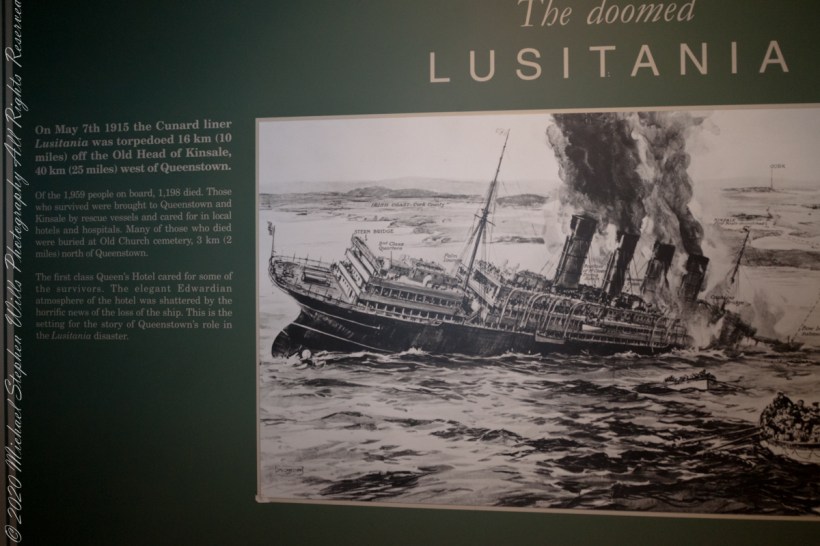
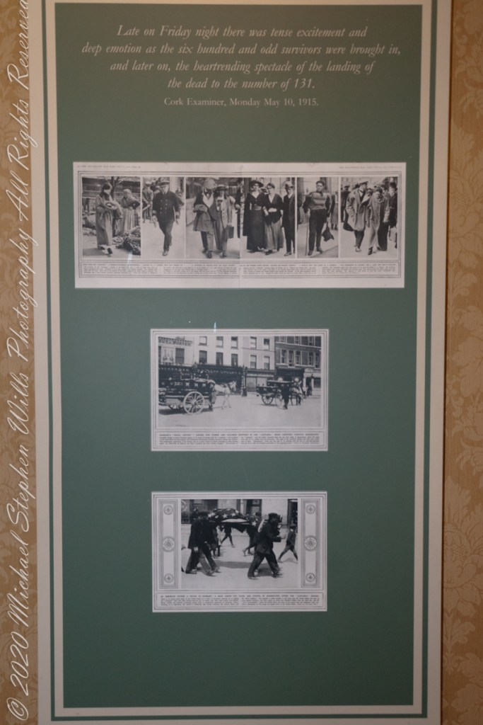
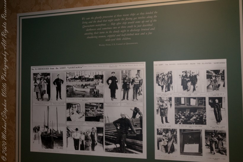
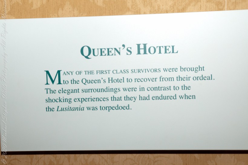
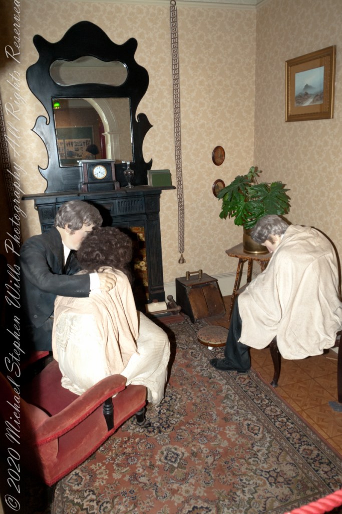
On May 7th, 1915 the Cunard liner Lusitania was torpedoed 16 km (10 miles) off the Old Head of Kinsale, 40 km (25 miles) west of Queenstown. Of the 1,959 people on board, 1,198 died. Those who survived were brought to Queenstown and Kinsale by rescue vessels and cared for in local hotels and hospitals. Many of those who died were buried at Old Church cemetery, 3 km (2 miles) north of Queenstown. The first class Queen’s Hotel cared for some of the survivors. The elegant Edwardian atmosphere of the hotel was shattered by the horrific news of the loss of the ship. This is the setting for the story of Queenstown’s role in the Lusitania disaster. –text from Cobh Heritage Center poster, see image below.
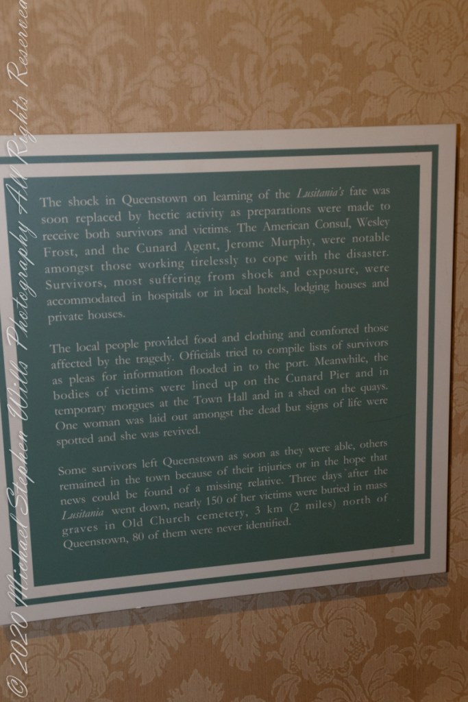
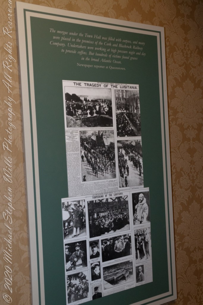
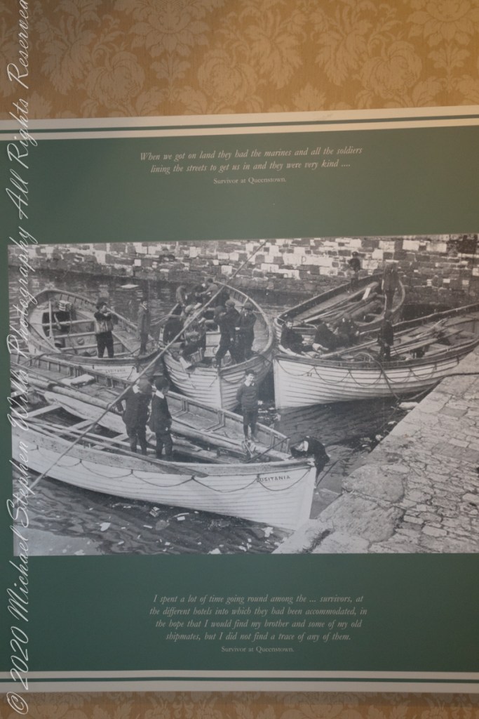
The Old Head is notable, in the contest of the Lusitania attack, for being the land closest to the incident. Cobh, then named “Queenstown”, was the focus of rescue operations. See text below, from a display of the Cobh Heritage Museum.
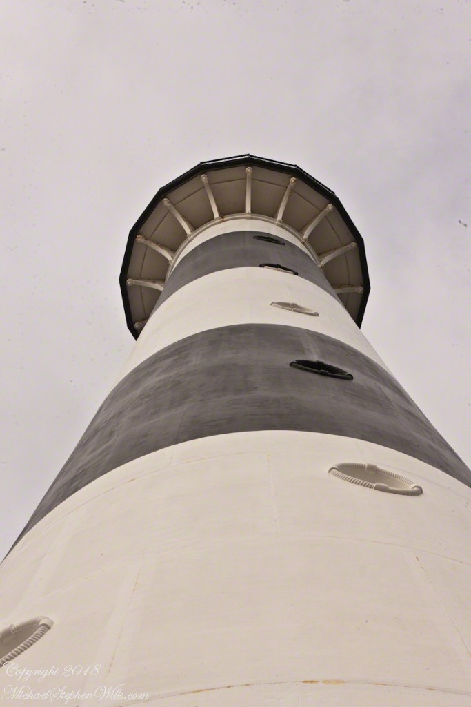
The Kinsale tower is just over nine meters high, with walls up to 80 cm thick. Records show a signal crew was in place in 1804 and the tower finished the following year, though severely affected by dampness. When Napoleon was defeated by Wellingtons forces at Waterloo, 1815. With the diminished threat these expensive installations were neglected. The 1899 Ordnance Survey map lists the site as being in ruins. During our 2014 visit the local community was renovating the tower and the work appears complete sometime before 2021.
I did not see and/or recall much emphasis in the museum for pillorying Germany, after all a German U-boat was responsible. Curious, I did a Wikipedia search and found this text. The topic of Ireland, Germany and World War I is complicated.
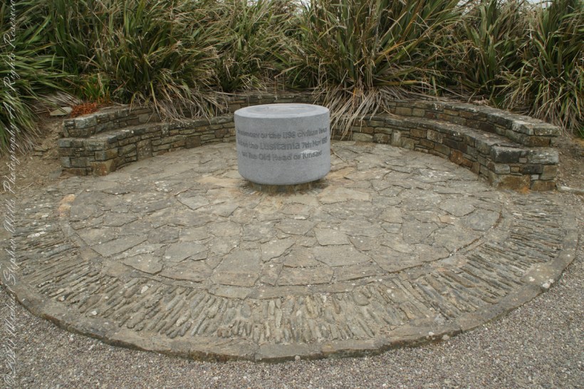
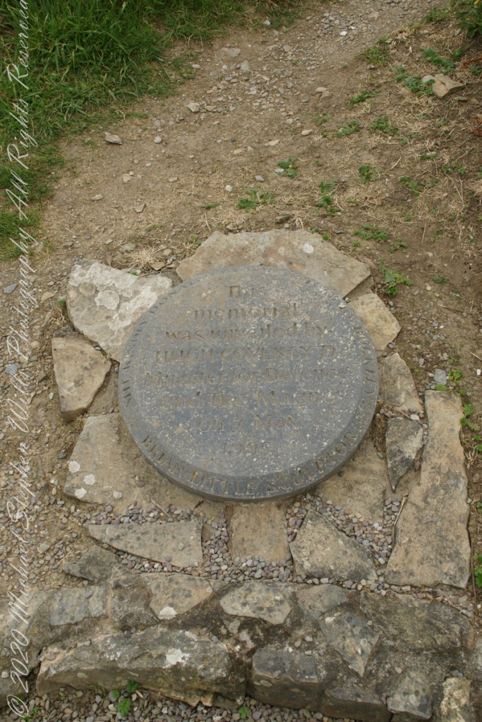
The original memorial to the Lusitania was unveiled on the 80th anniversary of the May 7th, 1915 sinking (May 7, 1995), Old Head of Kinsale, County Cork Ireland. The imemorial nscription reads “In memory of the 1198 civilian lives lost on the Lusitania 7th May 1915 off the Old Head of Kinsale.”
The inscription of the commemoration plaque accompanying the memorial reads, “This memorial was unveiled by Hugh Coveney D Minister of Defense and The Marine on 7 May 1995.” Around the edge of the medallion reads, “Brian Little Sculptor” “This (cannot read) donated by Lan and Mary Buckley”
19th Century Technology
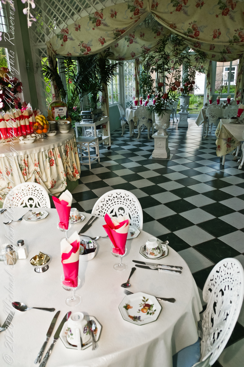
Our day of touring Kinsale and environs, the last day of May 2014, began with this elegant breakfast by Marantha House near Blarney, our base for County Cork.
On the way to the Old Head of Kinsale. Located in Knocknacurra on the Kinsale side of Bridge Kinsale on R600. Looking toward the peninsula of Castle Park Village and James Fort. Coordinates 51°41’40.1″N 8°31’42.0″W
This tower, at the apex of the Old Head ring route, has extensive views. The next station at Seven Heads, to the southwest, is visible against the skyline on a clear day. These are two of the 81 stations planned for this signaling system implemented in the first years of the 19th century when a French naval invasion was a possibility.
The Kinsale tower is just over nine meters high, with walls up to 80 cm thick. Records show a signal crew was in place in 1804 and the tower finished the following year, though severely affected by dampness. When Napoleon was defeated by Wellingtons forces at Waterloo, 1815. With the diminished threat these expensive installations were neglected. The 1899 Ordnance Survey map lists the site as being in ruins. During our 2014 visit the local community was renovating the tower and the work appears complete sometime before 2021.


A Trinity of Skellig Images
Now’s time to share a trinity of images from a morning spent about the Skellig Islands May 2014.
Pam and I have many stories from that day, a favorite is from the parking lot of Portmagee where we met the fast boat to the island. I prepared for the day by making a reservation for our ride. We traveled from Killarney, where an early morning breakfast feast spread by The Killarney Royal Hotel fortified us for the adventure. Throughout our tour, experiencing Ireland was like taking blinders off, this first experience on The Ring of Kerry was no exception, driving on a tight timeline to reach Portmagee with minutes to spare, every turn of the road presented a new delight.
Grateful to have made it to Portmagee, we quickly pulled our kit together. As I closed the bonnet, Pam exclaimed “our umbrellas.” At this point of the story we laugh together. Umbrellas indeed. I had a dim clue of what lay in store for us and insisted the umbrellas be left behind, a counter-intuitive decision for a rainy Irish day the Wild Atlantic Way. Regardless of the time, we needed a bathroom break as there will be no facilities on the fast boat or the World Heritage Site where there is no space for human waste products.

The humor is in our welcome aboard the fast boat, like a fishing boat with a small cabin and small deck dominated by the engine hatch. We crowded on, handed a full set of fisherman slickers. This is a heavy coat with hood and pants, all waterproof. Our close timing guaranteed the worse seat, away from the cabin in the open. It was a new experience for us and we felt a sense of dread as the craft left the protection of Valentia Sound into the open Atlantic Ocean.
We faced a west wind, driving 12+ foot waves, as the boat breached each wave the crest went over the cabin in a waterfall of salt water. Up and down, up and down. Thankfully neither of us lost breakfast as some did. I do not have photographs of the trip out or the approach to the island, my equipment was safely packed away.
In the above photograph you see the entire course of our approach to the island, a bit more than 10 (land) miles from Portmagee. We toured Valentia Island that afternoon.

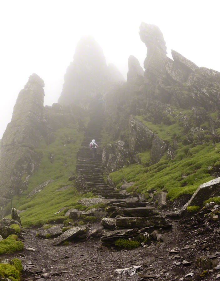
There is a fair climb to the top to view the former monastery buildings. The steps are uneven and, when wet as it was that day, slippery. I wore a waterproof North Face shell with hood for the low threatening clouds. There was no rain as such, a constant fog on the top kept all exposed surfaces wet.
From the point on, until the top, was the most exposed and uncomfortable (frightening, chilling…you get the idea). Spare yourself the experience if you are afraid of open spaces and heights. Here was a stiff wind blowing from the right, on the left the cliff falls away to the ocean. Ahead, the path narrows to about 10 inches with a cliff wall on one side, the precipice on the other. Then come the monastery entrance and rock wall safety.
This single image gives a succinct impression of the monastery setting. The bee hive shaped stone monk cell requires a stooped crawl to enter. Inside, the space is small and, thankfully, dry. The structure keeps out the rain and wind, a marvel of stone construction. This cell is off to the side, on a cliff balcony, over the wall an ocean precipice.
My closing advice is to plan your time wisely. The ship boards in less than an hour, in that time you climb the 700 steps and explore. There are people all over the place, in waves. To capture the structures without humans, you need to wait until the cohort become bored and leaves. There will be a space before the next wave of tourists breaks. Leave enough time to descend the steps safely. People have suffered fatal falls on the steps and cliffs, it is easy to do. Make your personal safety a priority.
Copyright 2021 Michael Stephen Wills All Rights Reserves

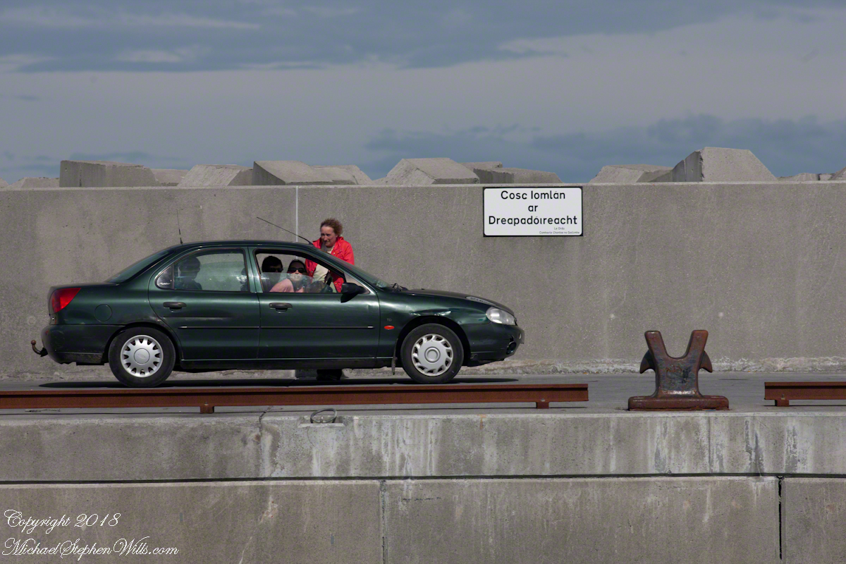
Inisheer Welcomes Their Champions
After we passed the Killeany bouy on our ferry trip, on the Queen of Aran, (click the link to see this posting) from the harbor of Inis Mor to Doolin, the ship made four, yes four, dockings before arriving at Doolin: three on Inis Meáin and one on Inisheer.
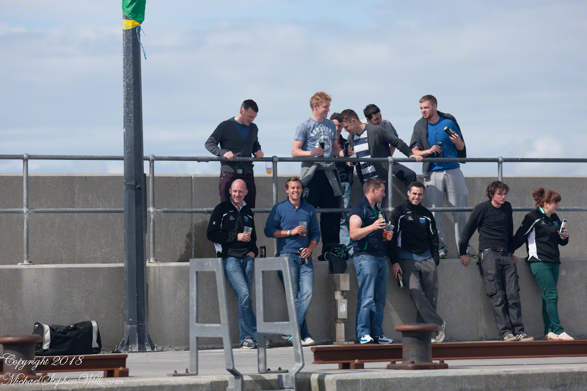
A few days prior the Gaeltacht held the annual Irish football championship the weekend of May 21 through June 1 in Moycullen, County Galway. It was the Three Aran Islands (Oileaín Árann) team who won the 2014 championship. Sunday, June 1, the weekend of their victory, the cup was presented to Inis Mór, the largest Aran island and the one furthest into Galway Bay.
The team on Monday, June 2, the day of our trip, was on Inis Meáin, in celebration mode. Some of them were waiting for the ferry when we pulled into the dock of Inis Meáin, the second largest Aran island between the other two.
The first of the previous three photographs is of the waiting team members who boarded and we left for Inisheer Island, the smallest of the three and the closest to Galway City. The Queen of Aran was well out of the harbor when I imagine the radio in the pilot house said, “Come back, there are more team members on the dock.” So we turned around, docked and several more came on board.
In way once again, well away from the harbor, the ferry turned around for a second time for a third landing at the Inis Meáin dock. With the full compliment of champions on board the ferry turned out of the harbor a third and final time for the last leg of with Silver Cup’s tour of the islands.
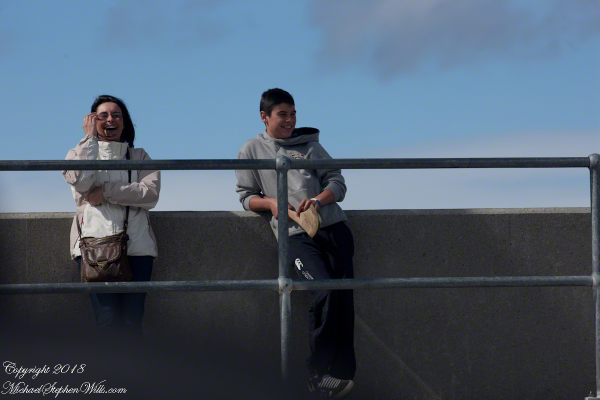
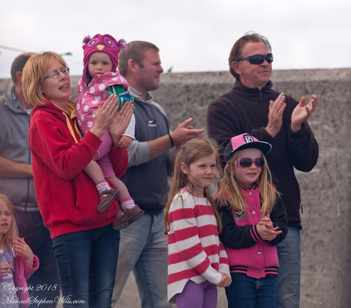
The population of Inisheer is about 250 souls. It seemed all were waiting to greet the team.
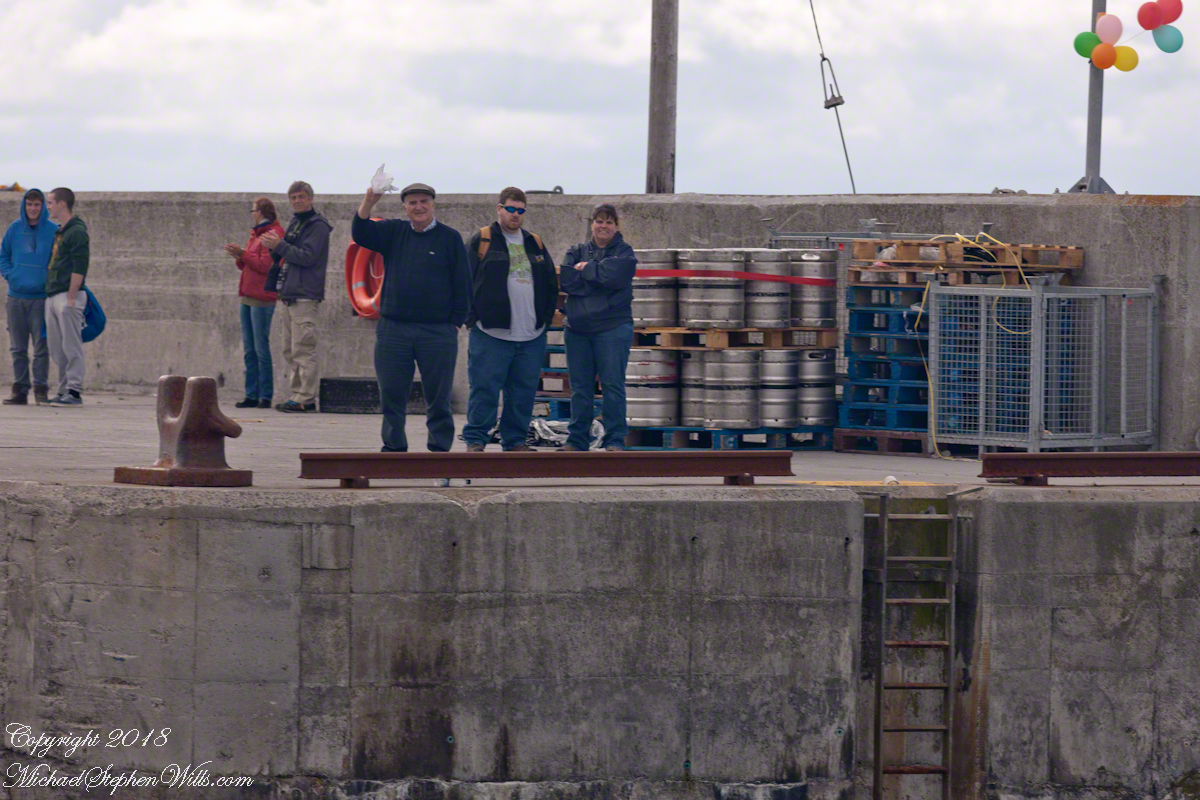
A large bon fire blazed as the Queen of Aran approached.
People lined the dock from beginning to end.
Calling out, waving their arms.
Standing and smiling. Here is a flock of fans, from Galway apparently, very pleased at the sight.
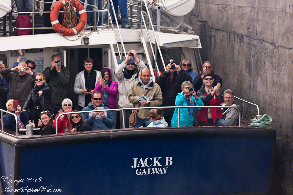
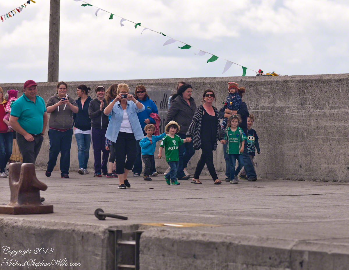
The team was on the upper ferry deck. I turned around and was lucky enough to capture the team captain (Not sure, but who else would it be?) holding the silver cup for all to admire. Theirs for a year.

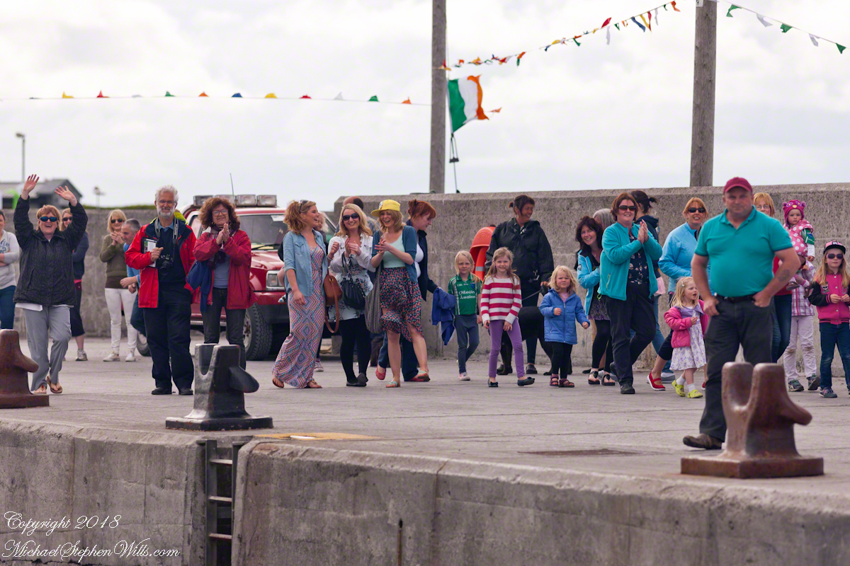
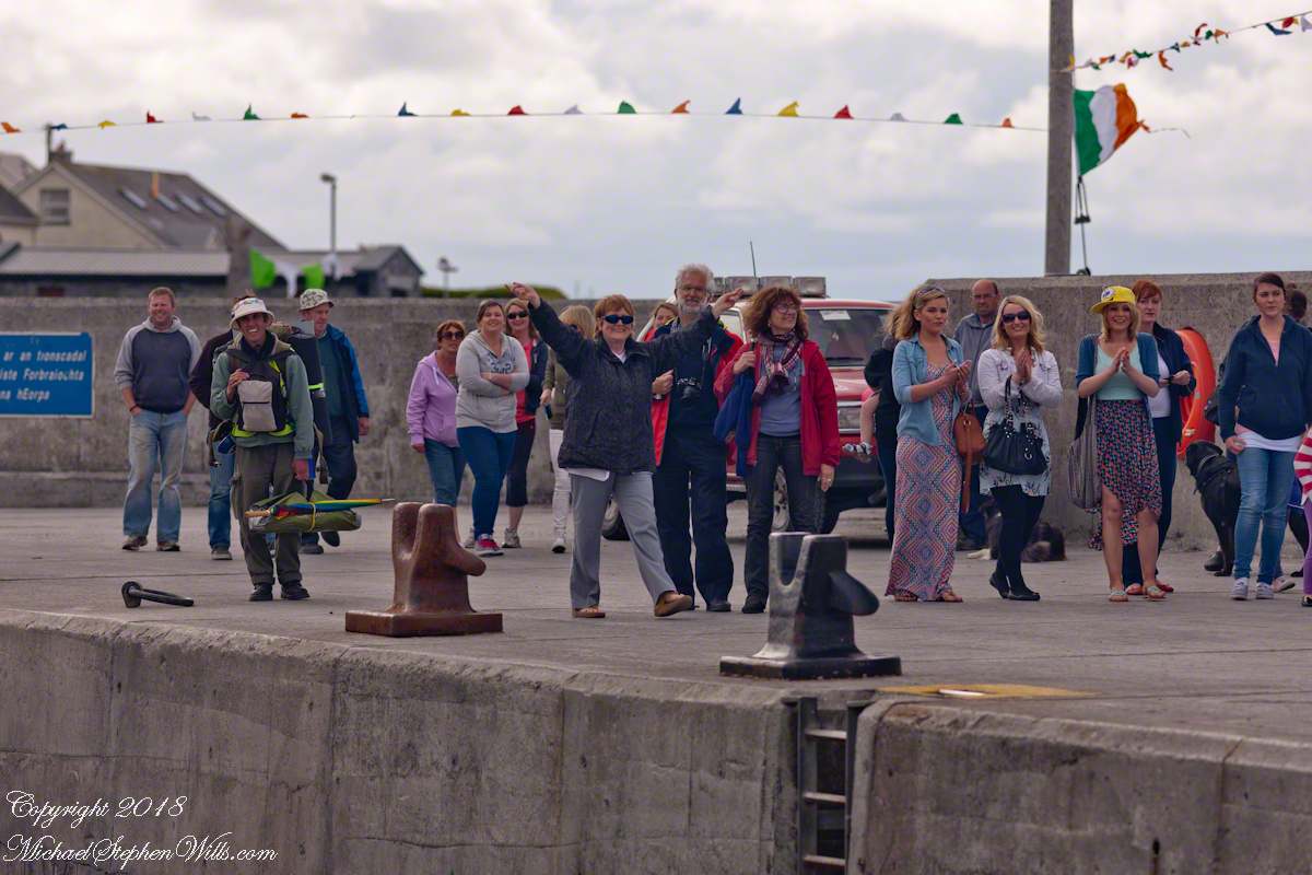
The crowd welcomed their own back home.
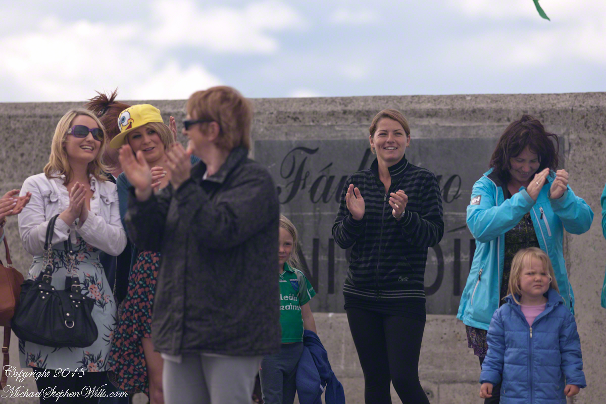
Surrounded the team and walked them grandly to town.
….and a photographic gallery.
As of June 9, 881 is the count of subscribers to this blog, an interesting number. The individual numerals sum to a prime number, 17. I appreciate each and every “1” added together, you readers. Thank You.
Today, June 20, 5:44 pm Eastern Daylight Time, is the Summer Solstice for our Northern Hemisphere, the longest day of the year.
Here is a selection of images from past posts.
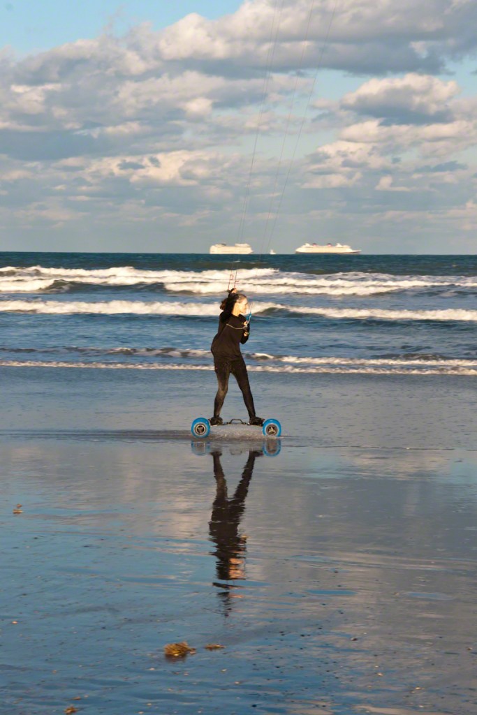
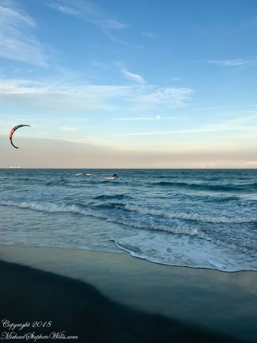
catching the wind
Awhile after encountering the hydrofoil the same north wind powered a large, eight foot wingspan kite high overhead. Cheri Down Park, my meeting point for lunch with Pam, was in sight as I took a detour to talk with the kite flier.
Click me to open video in a new browser tab for better experience.
Seated in a comfortable beach chair, he turned a one foot diameter reel pulling the kite in. Kite flying was a relaxation for this permanent resident. As the kite descended overhead I caught this short video. In retrospect the beauty is ominous, a metaphor for the approaching novel coronavirus (COVID-19).
Click me to open video in a new browser tab for better experience.
