A span of 10,000 years spreads between now and the first possibility of settlement on the island of Eire, then swept clean to bare rock by the weight of ice. Current scholarship of the Dún Aonghasa ruins, Inishmore, County Galway, the Irish Republic place a settlement within the inner of the four dry stone rings after 6,500 years (1,500 BC or 3,500 years ago). By way of scale, the first settlement took about 30 times the duration of the U.S. Constitution ratification through 2025: the last state, Rhode Island, ratified the Constitution 1789.
By 700 BC, 2,700 years ago, a series of upright, closely placed stones, were erected between the second and third rings called a cheval de fries field (“Frisian horses” in English) today, this defensive structure evokes the enormous scale of the struggles around this place of defense.
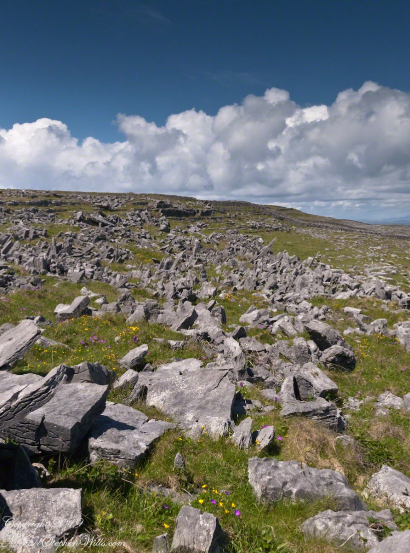
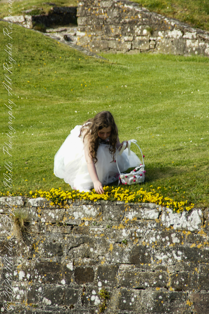
This is a portion of that field, I believe, taken as Pam and I approach the inner ring entrance, walking a wide path cleared of barriers. Click the photograph for a larger image with caption.
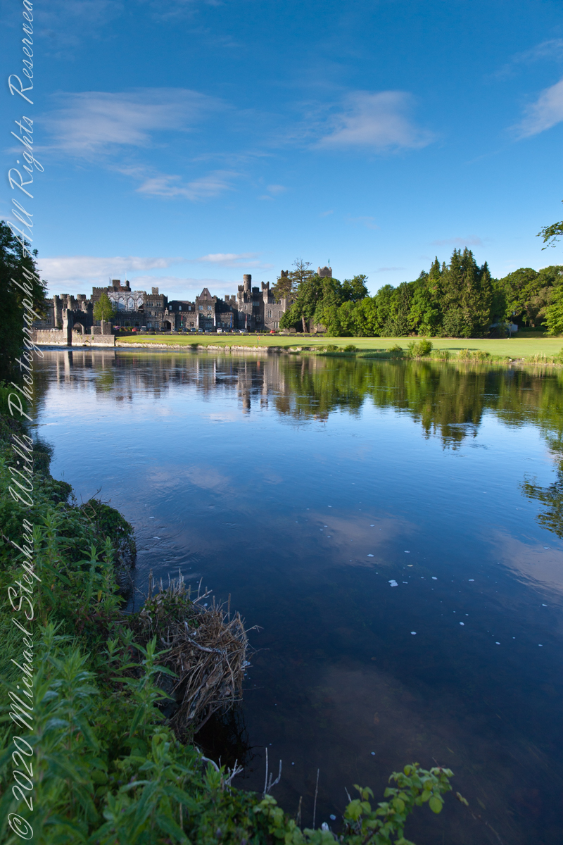
At Ashford Castle, swans glide on the Cong River’s glassy waters, weaving together myth, history, and cinema in a timeless reflection of Ireland’s enduring spirit.
Headed south from Cong Village, past the venerable Cong Abbey then Saint Mary’s Church of Ireland, the road bends into the Ashford Castle estate. Time seems to shift here. The stonework of the abbey lingers in memory, only to give way to manicured parkland, ancient trees, and the shimmer of water. The road itself, aptly named Ashford Castle, carries the traveler to a place where history, nature, and imagination meet.
I do not recall passing a guard box on my first visit, though one now stands firmly on the roadside, manned and proper, as though the estate were never meant to be entered without ceremony. In truth, Ashford Castle has always carried the air of a threshold—between village and wild, past and present, myth and reality.
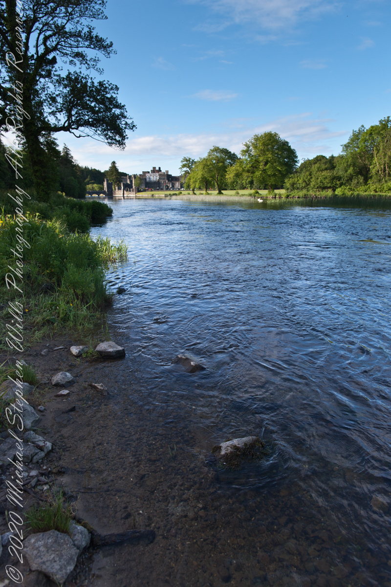
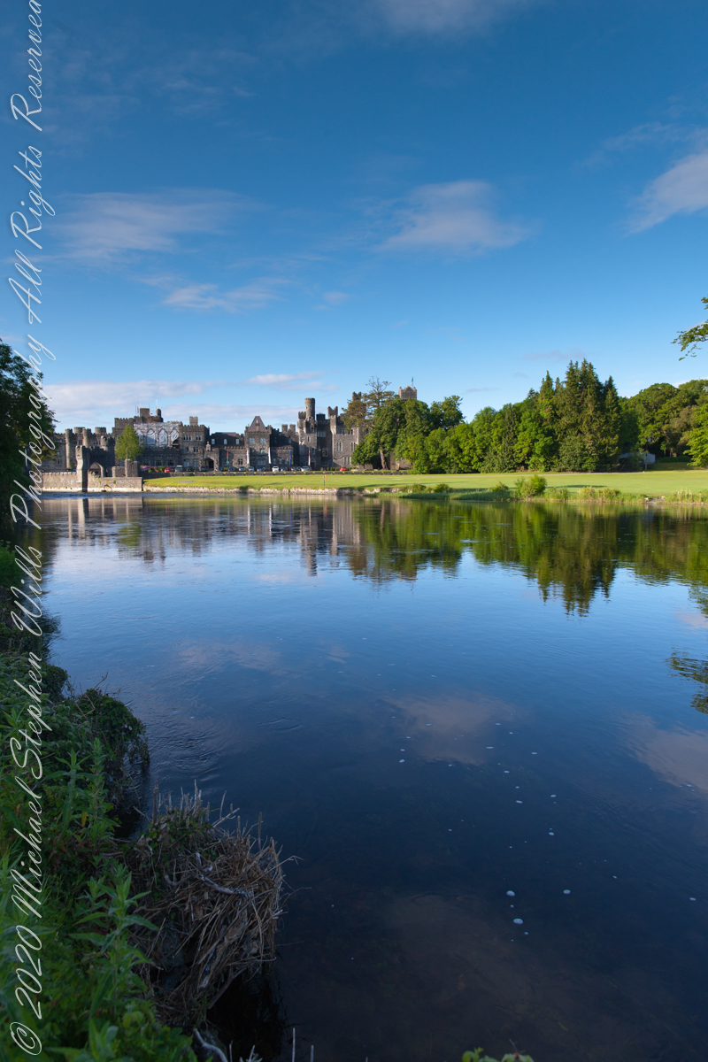
Soon the road brings one to the banks of the Cong River. Here the water widens, flowing calm and sure, and across it rises the battlemented silhouette of Ashford Castle itself. Its towers, turrets, and stony walls seem to grow from the riverbank like something inevitable, a fortress transformed into elegance. The castle’s mirrored reflection on the water doubles the grandeur, as though the real and imagined castle exist side by side.
It is no wonder filmmakers found inspiration here. Scenes from the classic 1952 film The Quiet Man—the tale of Sean Thornton, played by John Wayne, and the fiery Mary Kate Danaher, embodied by Maureen O’Hara—were shot on the far bank of this very river. To watch them walking by these waters is to see Ashford Castle woven into Hollywood’s Irish dreamscape, a backdrop both romantic and enduring.
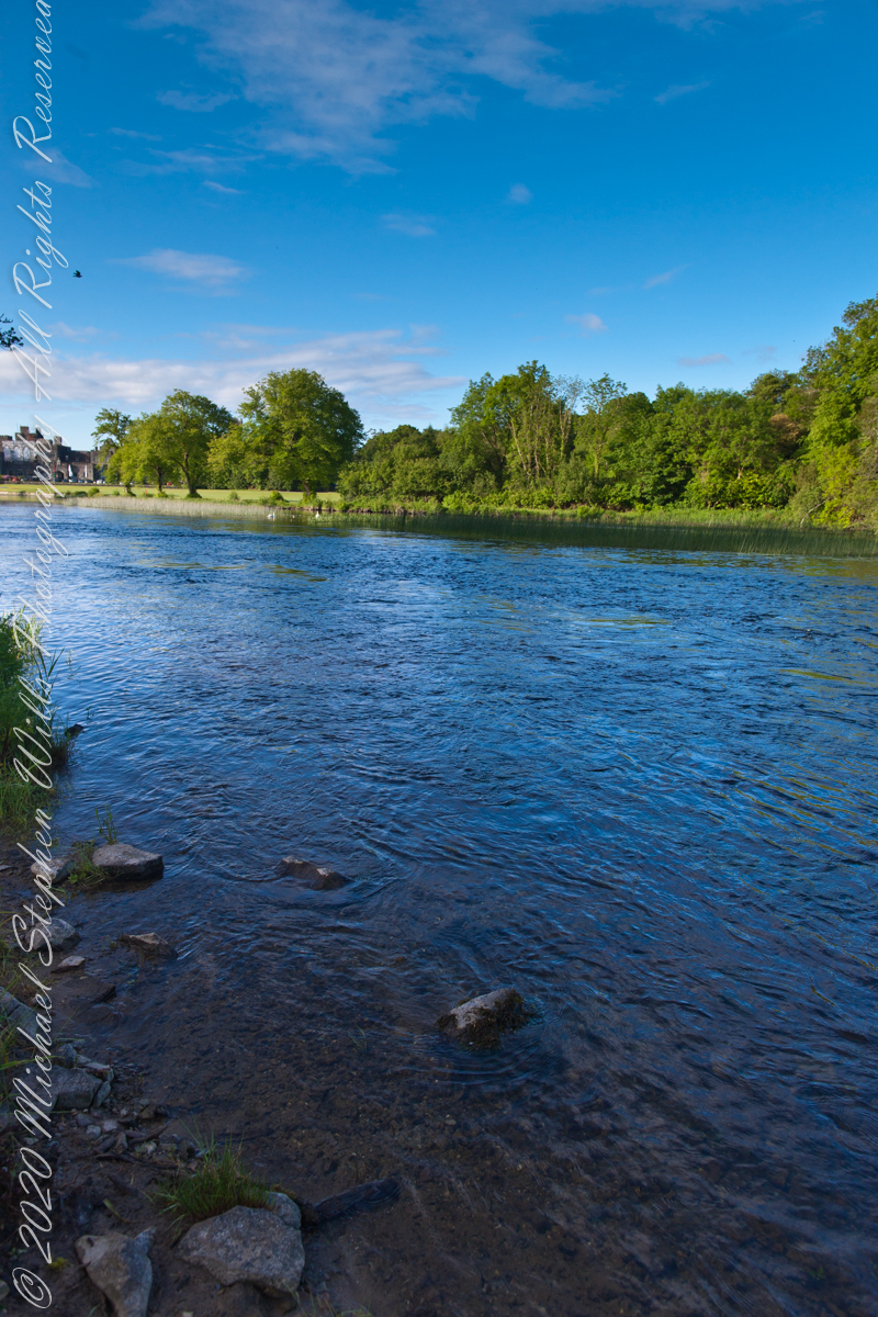
Yet long before cinema, the river was already a stage. The Cong River is a natural marvel. It emerges from the same Carboniferous limestone that shapes the Burren of County Clare—an austere landscape of limestone pavements etched with fossils and caves, where rare alpine and Mediterranean plants thrive among ancient tombs. Through fissures in this ancient bedrock, the waters of Lough Mask find their way underground before rising again at Cong. This subterranean journey, through stone filters laid down some 350 million years ago, leaves the water clarified, luminous, and cold. By the time it slides past Ashford Castle, it has the purity of glass.
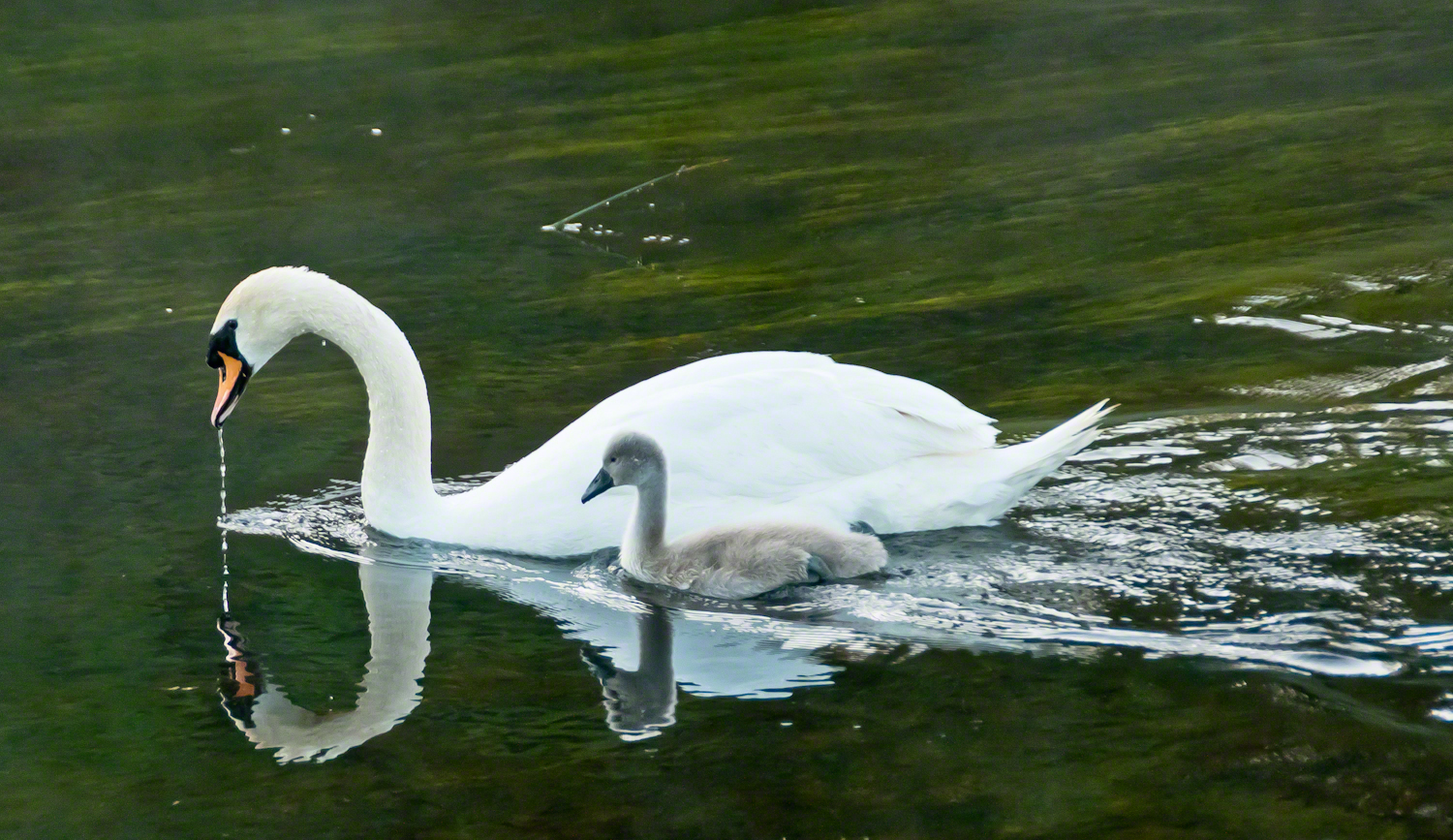
It is in this clarity while walking the opposite bank on a different morning I found a parent swan and its cygnet feeding. The adult glided, immaculate, its long neck bowed as drops of river fell from its beak. At its side, the cygnet paddled with earnest strokes, gray down still clinging, a fragile shadow of what it would one day become. Together they traced a quiet path across the water, ripples fanning behind them.
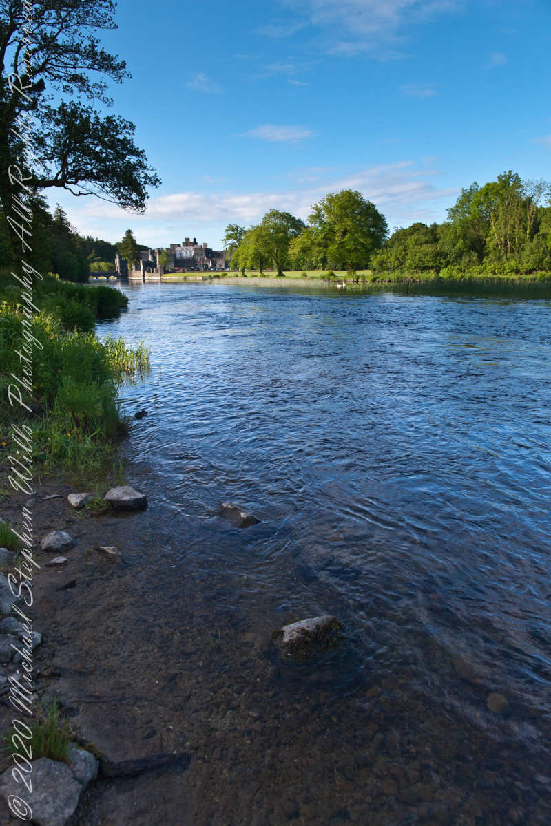
Few images so perfectly match their setting: a medieval castle, guardian of centuries, reflected in the same waters where these swans carried on their timeless rhythm of nurture and growth. It was as if the river itself composed the scene—a blending of stone, water, bird, and sky that belonged nowhere else but here.
The swan has long been a symbol in Irish lore. The Children of Lir, cursed to live as swans for nine hundred years, are among the most haunting figures of Celtic mythology. To see the white bird with its offspring before Ashford Castle was to glimpse that myth breathing still, alive on the Cong River.
Photographers know the difficulty of capturing water and stone without losing the life between them. On that morning, however, the river gave freely—its surface alternately smooth as glass and dappled with breeze. Stones at the water’s edge appeared like stepping-stones into history. Each frame revealed another face of the estate: the wide reach of the Cong, the castle framed by trees, the play of cloud shadows across the current.
The castle itself, though reshaped as a luxury retreat, still speaks of older times. Founded in the 13th century by the Anglo-Normans, Ashford passed through centuries of conquest and change before becoming, in the 19th century, a romantic Victorian pile. Today its battlements remain picturesque rather than defensive, but the sense of continuity—of lives unfolding along these banks—has not faded.
Standing there, camera in hand, I was struck by the layered meaning of this place. The Cong River flows from unseen caverns, purified by limestone older than memory. It nourishes swans, reeds, and trout alike. It reflects both a castle and a sky. Along its opposite bank, legends of cinema and Celtic lore alike find footing.
As the swan and cygnet drifted slowly downstream, I thought of them as part of the same enduring thread. Parent and child mirrored castle and village, past and future, permanence and change. The ripples they left widened until they touched both banks, an unbroken gesture across centuries.
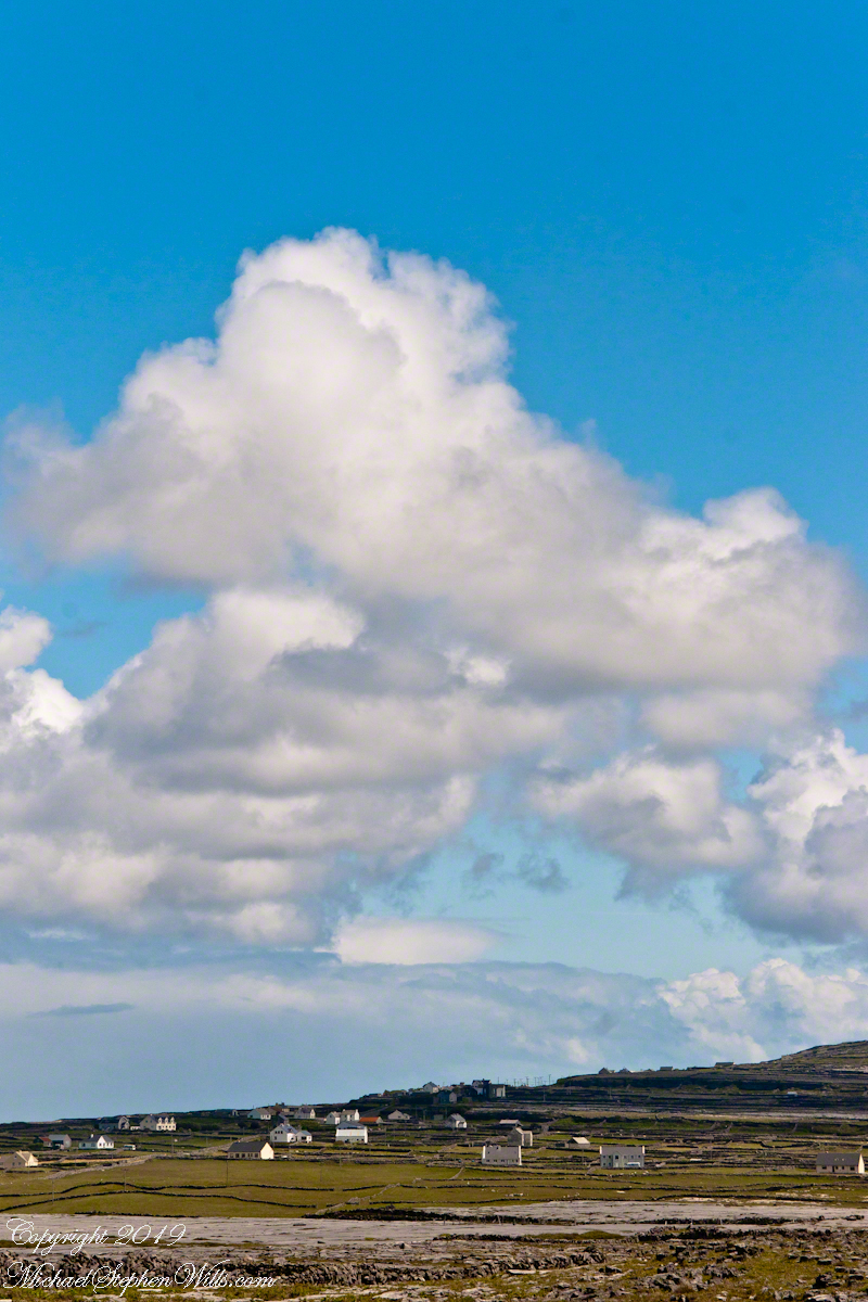
From the commanding location of Dún Aonghasa, looking northeast across Inishmore, the logic of the ancients becomes clear. No better vantage could be found—land unfurling like a hand toward Galway Bay, cottages nestled in green folds, clouds billowing above like sails caught mid-journey. A place of presence. A place of permanence.
Perched high on the cliff’s edge, the fort behind, the Atlantic at the back, the wind carried stories—unwritten, unspoken, but felt in the bones. Below, stone walls divided the island into patterns of memory. Fields outlined in rock, laid long ago by hands familiar with hardship and patience. The sea’s pulse echoed faintly in the distance, as steady and unfathomable as time itself.
No words were needed in that moment. Just the hush of sky and stone. Cottages, bleached bright by limewash—kalsomine, the old name still whispered by some—stood resilient against the elements, each one a witness to generations. Each one seemed to carry a personal reverence, a tenderness carved into the landscape.
Paths led gently inland, where wind slowed and voices from distant homes rose faintly through the open air. Along those paths, the rhythm of island life could be read in hoof prints, scattered wool, and the sharp, clean edges of hand-cut stone. There, among the hedges of limestone and wild grass, the living and the lost felt close.
The cloud cover shifted constantly. Shadows passed like thoughts across the land. Toward the shore, the sky opened wide. A silence filled the lungs, as bracing and deep as the Atlantic itself. Time seemed to slow, the mind slipping into the rhythm of the land.
Limestone pavement, rough beneath the boots, told its own tale of erosion and survival. That the earth here could sustain even the most modest farming seemed improbable. Yet here it was: a testament to stubborn hope and quiet ingenuity. In that quiet, ancient energy rose—something older than the fort, older than language. A pulse shared with the rock and wind.
The fort eventually came back into view—perched as if grown from the cliff itself, curved walls enclosing nothing but air and sky. I perceived no defensive bluster, only presence. And what a view it commanded. On days like this, the clouds formed towering cathedrals overhead, white and gold in the sun. Below, the cottages and fields seemed miniature, perfect, enduring.
The wind played echoes of prayer, lullaby, and laughter mingled with the call of seabirds. The thought came that nothing here was ever truly lost—only layered. Generation upon generation, each leaving some trace: a stone placed just so, a wall mended one final time, a cottage roof patched for another winter.
Here, even the air speaks. It moves gently but insistently, brushing the cheeks and stirring something ancient within the chest. Beneath it, the island breathes: not loudly, not urgently, but with the slow, deep rhythm of the tides.
As the sun dipped slightly westward, light changed across the fields, cottages glowing warm against darkening green. The wind softened. The clouds drifted, still massive but no longer looming. Time to return. A glance back offered one last communion with sky, stone, and silence.
Inishmore, on that day had been absorbed. Understood not with the mind, but with something quieter. Something that listens without need for words.
It was the kind of overcast morning that seems to cradle the island in a blanket of mist, a gentle hush falling over the land as though even the Atlantic held its breath. Pam and I had arrived by ferry at Kilronan, the main settlement on Inishmore (Inis Mór), the largest of the Aran Islands nestled in Galway Bay. There, amid the bustle of arrivals and greetings, we found our driver—a wiry, weather-worn man with a soft brogue and kind eyes—and his horse trap, a simple two-wheeled carriage with room enough for three and the sounds of hooves to accompany our journey.
We set out up Cottage Road, the stone-paved track winding westward from the harbor. The sea fell away behind us as we climbed, a gray shimmer stretching to the hazy outline of Connemara’s mountains on the far side of the bay. Our destination was the dramatic cliffside ringfort of Dún Aonghasa, a place older than memory. But it was the unexpected moments in between—the ones not printed in guidebooks—that linger longest in the mind.
As we rounded a bend flanked by low stone walls, wildflowers blooming defiantly in the cracks, our driver pulled the reins gently and pointed with his crop.
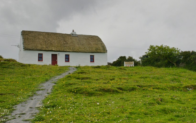
“There,” he said, nodding ahead, “is a fine example of a traditional Aran cottage.”
And there it was—a vision from another time. The thatched roof curved softly like a that blanket itself, straw golden against the brooding sky. The walls were whitewashed to a perfect matte sheen, gleaming in spite of the cloud cover. A crimson door and two window frames punctuated the front façade like punctuation in a poem. Just to its right, set further back on the hill, stood a tiny replica of the same cottage, identical in every feature. I blinked, half believing it was an illusion.
This thatched cottage with matching child’s playhouse is on Cottage Road out of Kilronan Village on the Aran island, Inishmore, County Galway, Ireland.
We only stopped briefly—it was a private residence—but the sight of it left a kind of imprint. I turned in the trap seat to keep it in view as long as I could. The cottage was perfectly placed, facing Galway Bay with a commanding view. I imagined the light pouring across the line of mountains, catching the glint of sea and sky.
“There’s a name for that finish,” I said, recalling something I’d read, “whitewash, or lime paint.”
Our driver nodded. “That’s the old way. Made from slaked lime. We’d call it ‘whitening’ when I was a lad.”
Whitewash differs from paint in the most elemental of ways. It becomes part of the stone, absorbed into the very surface. Like a memory of bone. And yet, it requires care. Apply it to a wall not properly cleaned or moistened, and it flakes, pulls away like a broken promise. But done right, it lasts, breathes with the building.
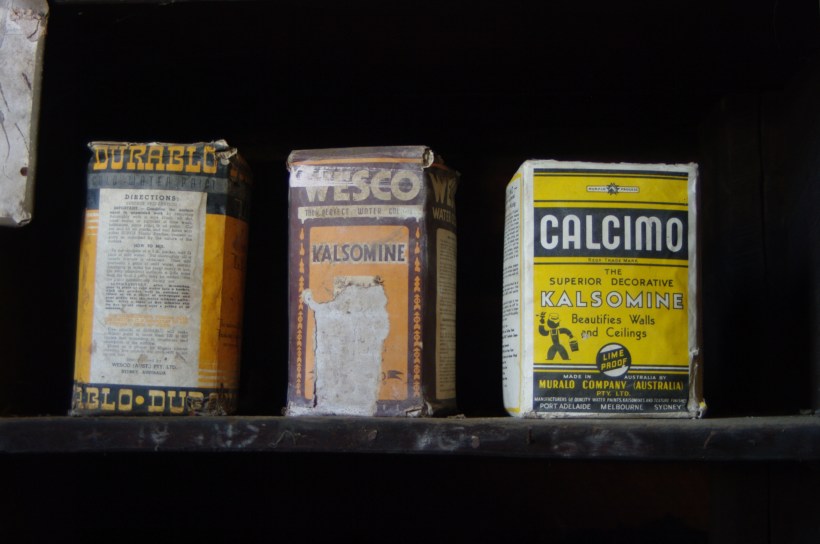
Upon our return, researching “whitewash,” if found this photograph from the Yarloop railway workshops Yarloop, Western Australia. There, on a shelf, where three old boxes sat like relics: DURABLO, WESCO, and CALCIMO. All contained kalsomine—the powdered form of lime paint. CALCIMO promised to “beautify walls and ceilings” and was proudly marked “LIME PROOF.” There was something quietly heroic in that. Lime-proof, as though against time itself.
Looking at the box of Calcimo, a product of the Murabo Company of Australia, I was struck by how far the tradition had traveled. From island cottages in the Atlantic to distant corners of the Southern Hemisphere, the language of whitewash—of simplicity and purity—had touched the world.
We returned by the same road, past that same cottage, the small one still keeping watch beside it like a child beside a parent. And I knew then that the islands hadn’t just given me sights—they had offered stories, silent ones written in thatch and stone, in lime and wind.
Sources for this post: search wikipedia for “White Wash”. White wash photo author: Wikipedia commons user Gnangarra
Join me on a journey through Inishmore, Galway Bay on a horse-drawn carriage. We’ll see a ruined church, horse pasture, and iron age fort, Dun Aengus, with reflections on the word ‘riven.’
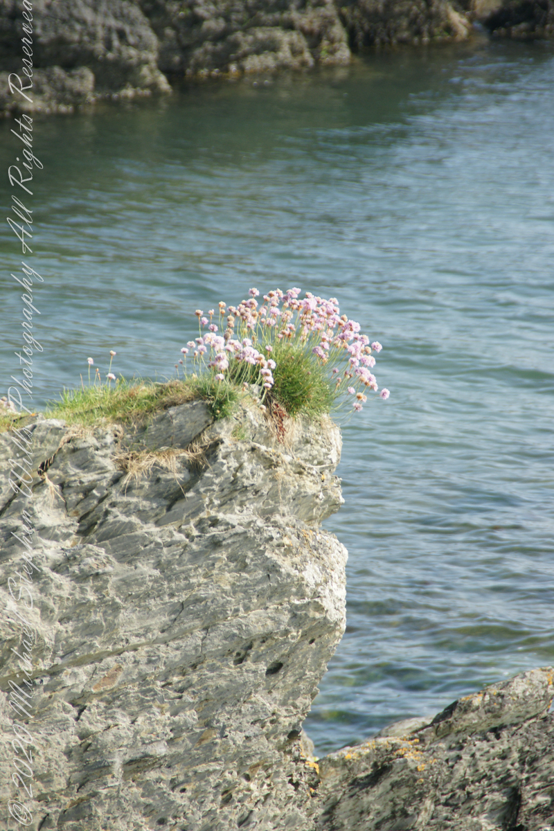
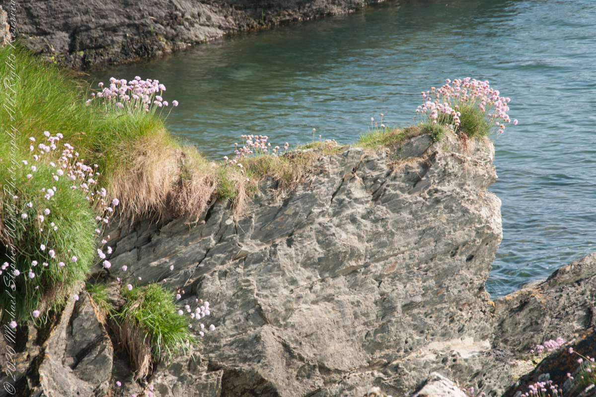
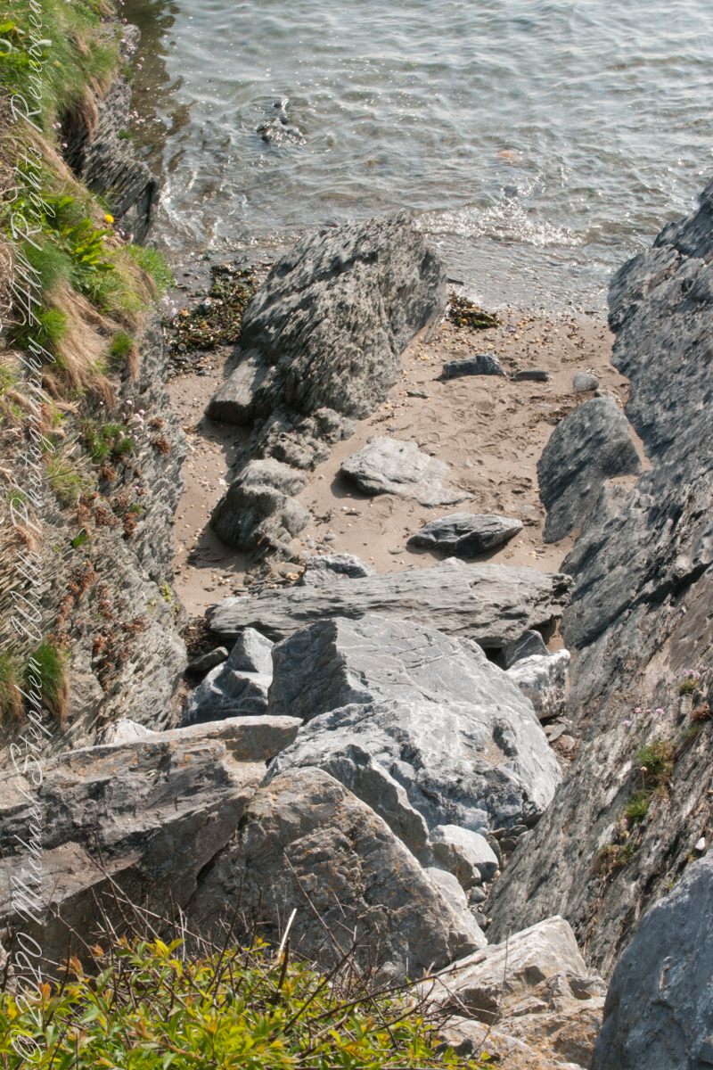
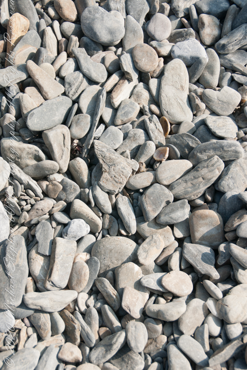
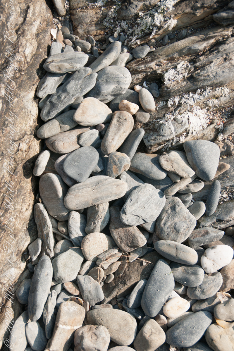
We continued down the half mile “Sallyport” footpath, marked in red on the Google Earth view provided at the end of this post, along shoreline cliffs to find these croppings of Sea Pink on jagged rocks.
Oddly, the jags being perfect places for Sea Pink to perch. Scientific name, Armeria maritima, and also known by Thrift or Sea Thrift, a reason these evergreen perennials are found on the obverse of the British Three Pence coin issued 1937 – 1952. Thrifty can mean to buy a lot for a little money — three pence is very little money.
Click any pic for a larger view, in a new tab, or a slide show. When using WordPress Reader, you need to open the post first.
Another sign informing hikers of the view.
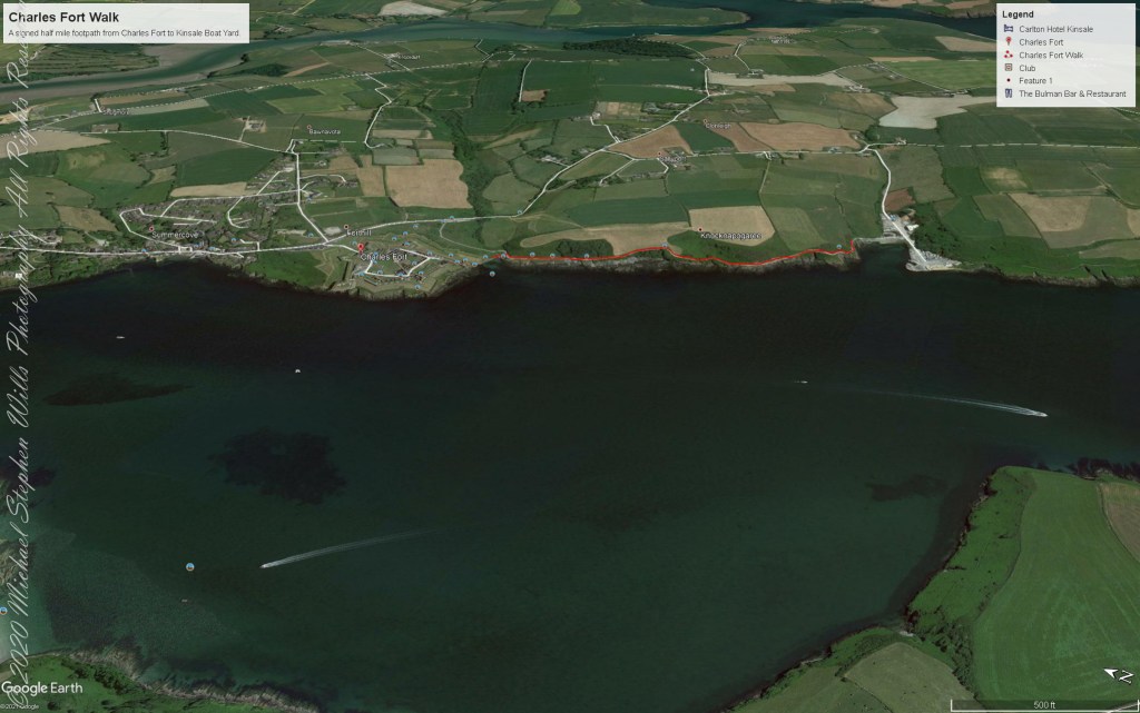
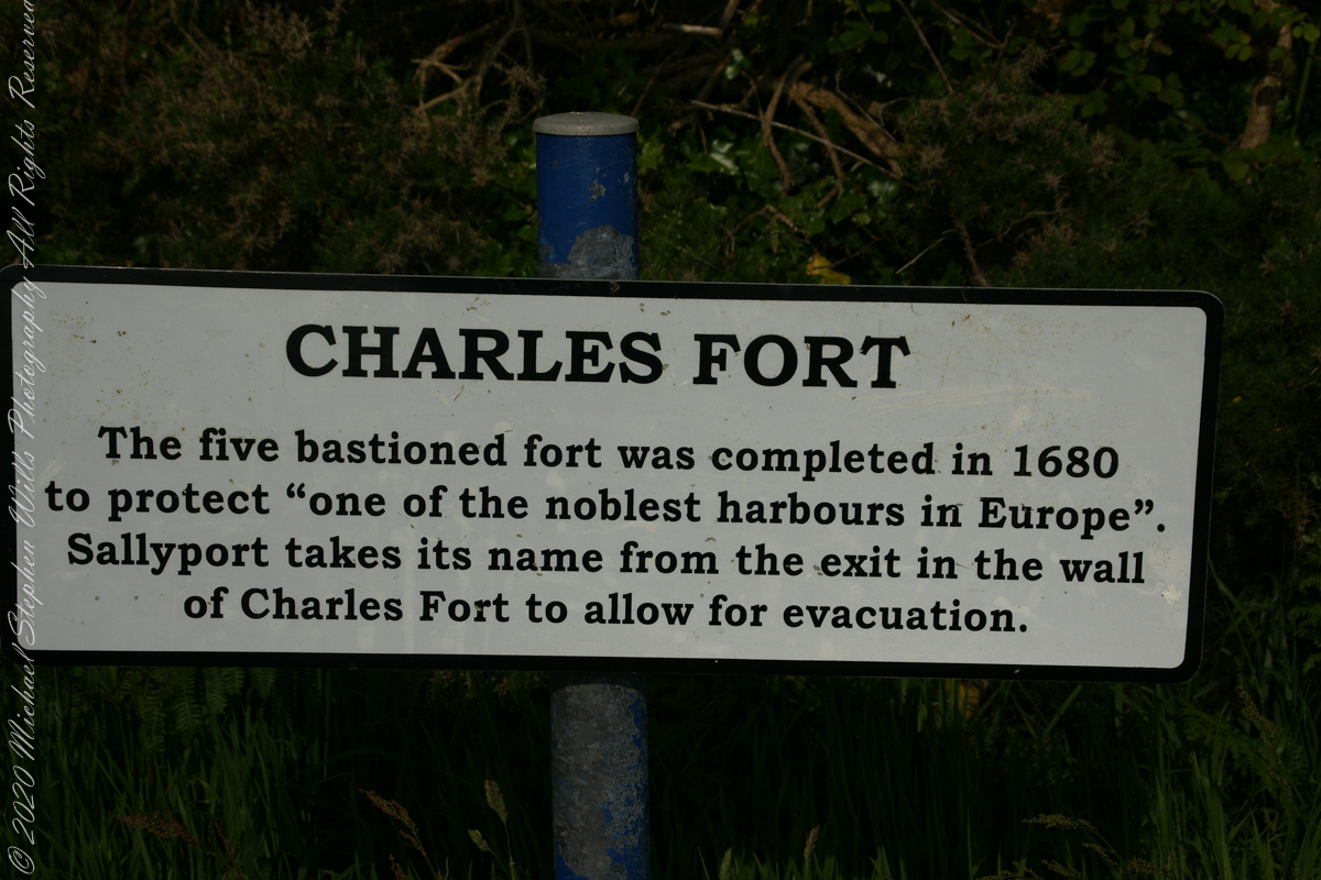
DeclivitySea SmoothedSmoothed over time by wave actionA half mile footpath, marked in red, leads from Charles fort along the shoreline cliffs, surmounted by working farmland.
Reference
“Armeria maritima” – wikipedia
Copyright 2023 Michael Stephen Wills All Rights Reserved
A half mile footpath, marked in red on the following Google Earth view, leads from the Charles fort sallyport, along the shoreline cliffs, surmounted by working farmland and looks toward the Celtic Sea.
To “sally” is to suddenly charge out from a besieged place against the enemy. The word is also used as a noun. It can also be used to describe our walk, as a sally to an unusual place.
The town above the walk is named Sallyport
Here is a view of the Celtic Sea from the Sallyport
From Wikipedia: “The Celtic Sea receives its name from the Celtic heritage of the bounding lands to the north and east. The name was first proposed by E. W. L. Holt at a 1921 meeting in Dublin of fisheries experts from Great Britain, France, and Ireland. The northern portion of this sea was considered as part of Saint George’s Channel and the southern portion as an undifferentiated part of the “Southwest Approaches” to Great Britain. The desire for a common name came to be felt because of the common marine biology, geology and hydrology of the area. It was adopted in France before being common in the English-speaking countries; in 1957 Édouard Le Danois wrote, “the name Celtic Sea is hardly known even to oceanographers.”[3] It was adopted by marine biologists and oceanographers, and later by petroleum exploration firms. It is named in a 1963 British atlas.. A 1972 article states ‘what British maps call the Western Approaches, and what the oil industry calls the Celtic Sea […] certainly the residents on the western coast [of Great Britain] don’t refer to it as such.'”
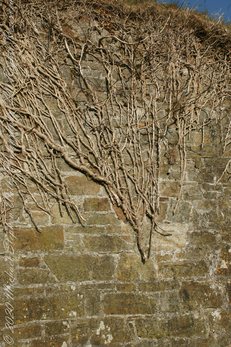
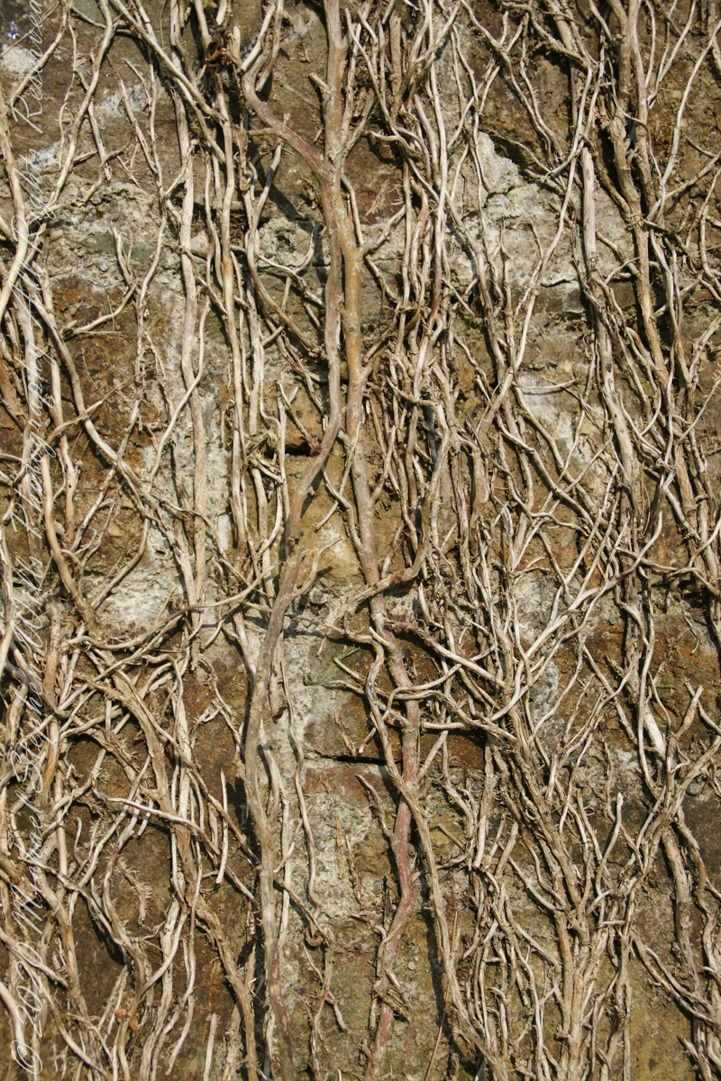
Views of the wall from previous photograph. The vines were separated from roots to preserve the walls, leaving interesting patterns.
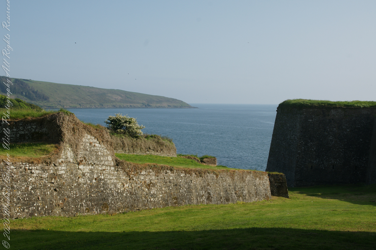
The distant land to the right, beyond the walls, is the Old Head of Kinsale.
Informational placards along the walk give background to the views enjoyed by hikers.
Here is the above view.
SONY DSC
Pam, at start of our walk. Poking above the walls is the Charles Fort Lighthouse. “This lighthouse is a directional light marking the way to safe anchorage close to Kinsale. In 1665 King Charles II granted letters patent to Sir Robert Reading to erect six lighthouses on the coast of Ireland, including one at Barry Oge’s castle, near Kinsale later to become Charles Fort. The original structure would have had a coal fire on its roof. In 1810 powers given to the Commissioners for Barracks and others between 1767 and 1806 were all vested in the Corporation for Preserving and Improving the Port of Dublin or the Ballast Board. This board took over the general lighting and marking of the coast when fourteen lighthouses were transferred to it including that at Charles Fort. This lighthouse, built in 1929, is one of the more recent to be found along the coast, with most dating to the nineteenth century. A new mains powered light at Charles Fort Lighthouse was put into operation on the 14 April 2004 marking the end of a long era of gas and oil powered lights in Ireland.” Quote is from the link provided in references.
May 30, 2014 outside of Charles Fort, Kinsale, County Cork, Republic of Ireland
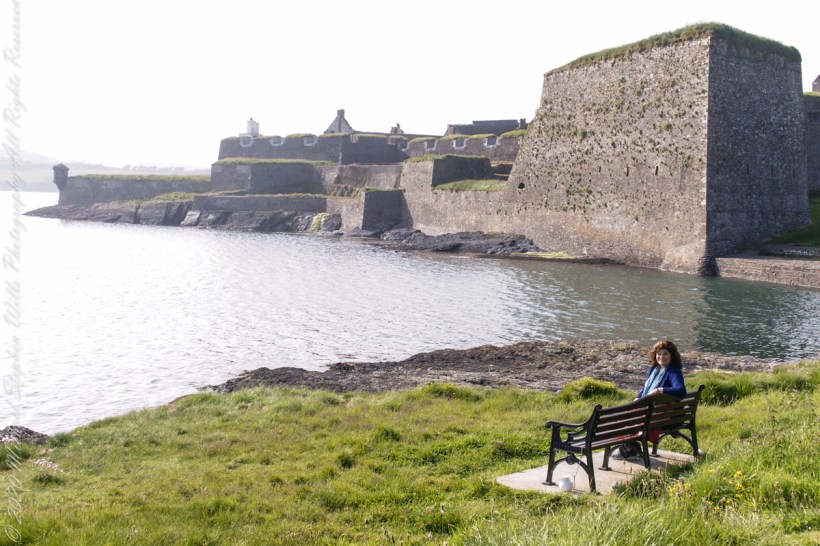
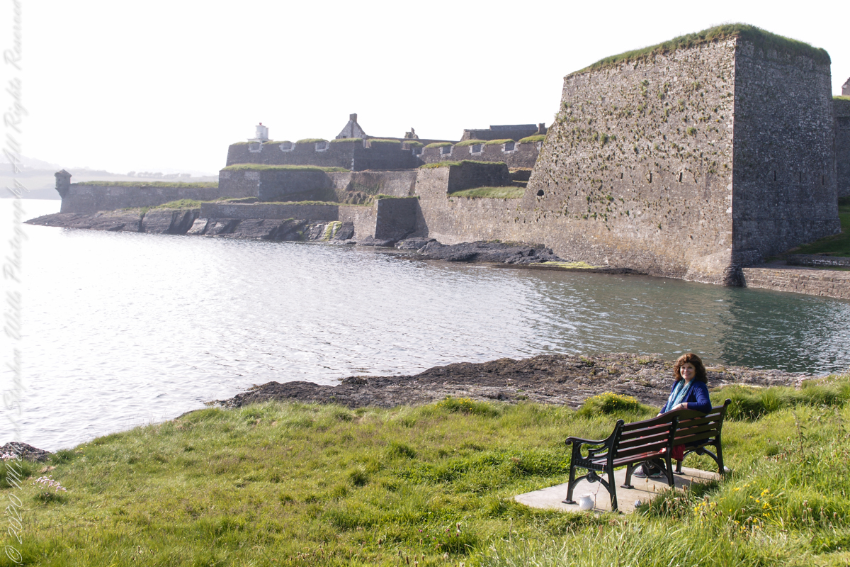
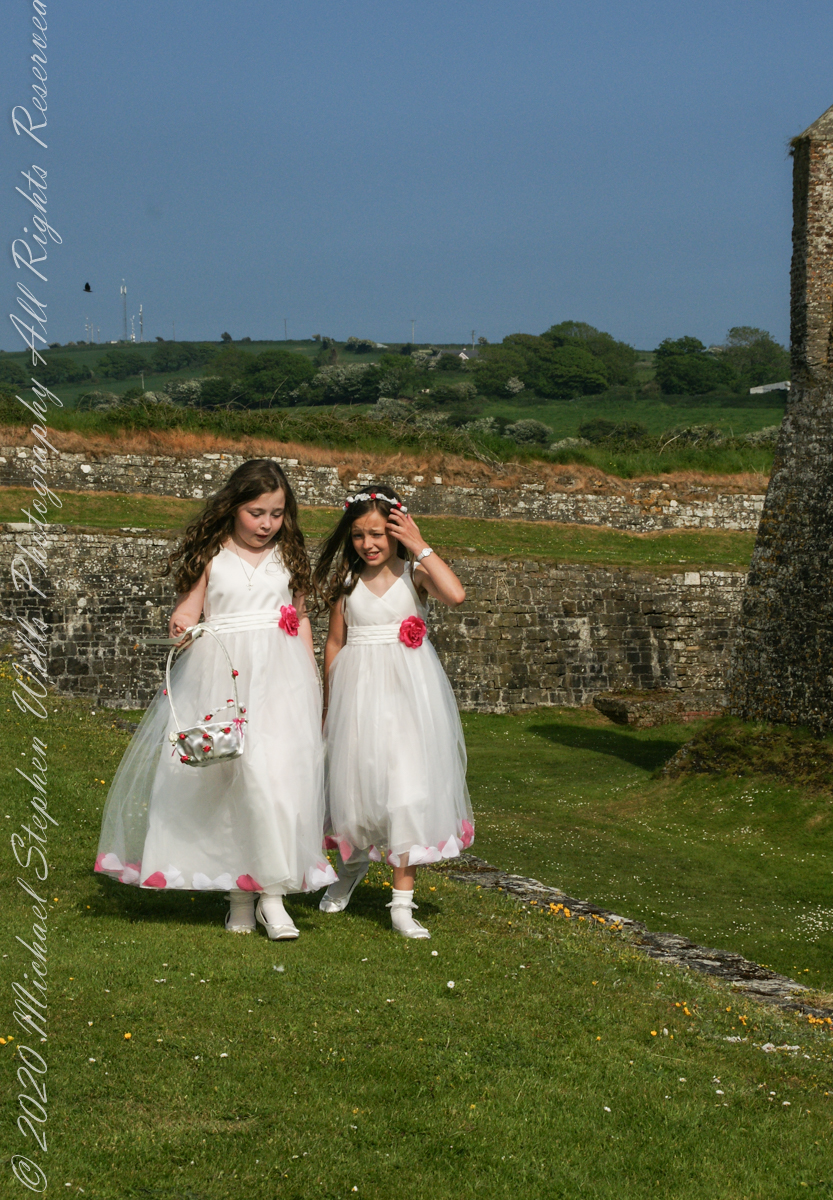
Arriving at Charles Fort, the “new” fort compared to the “old” James Fort across the cove, late in the day after our walking tour of Kinsale and lunch, the gate to the interior was closed. Pam and I made do with exploring the outer battlements where the citizens of Kinsale were enjoying themselves.
A shortcoming of Charles Fort was the high ground you can see behind the figures. The defenses are strong on the seaward side and open to attack from the land.
After exploring Kinsale town and lunch Pam and I drove two miles, along the east side of the cove, to the ruins of Charles Fort, one of a pair of fortifications protecting Kinsale from seaward attack. The “New Fort,” Charles, faces the “Old Fort”, James, across the cove.
Built in the 17th century on the site of an older fortification, Ringcurran Castle, it is named for Charles II, the English monarch of the time. The fort was burned during by retreating anti-treaty forces in 1922 during the Irish Civil war. It lay derelict until today’s 1971 until now restoration.
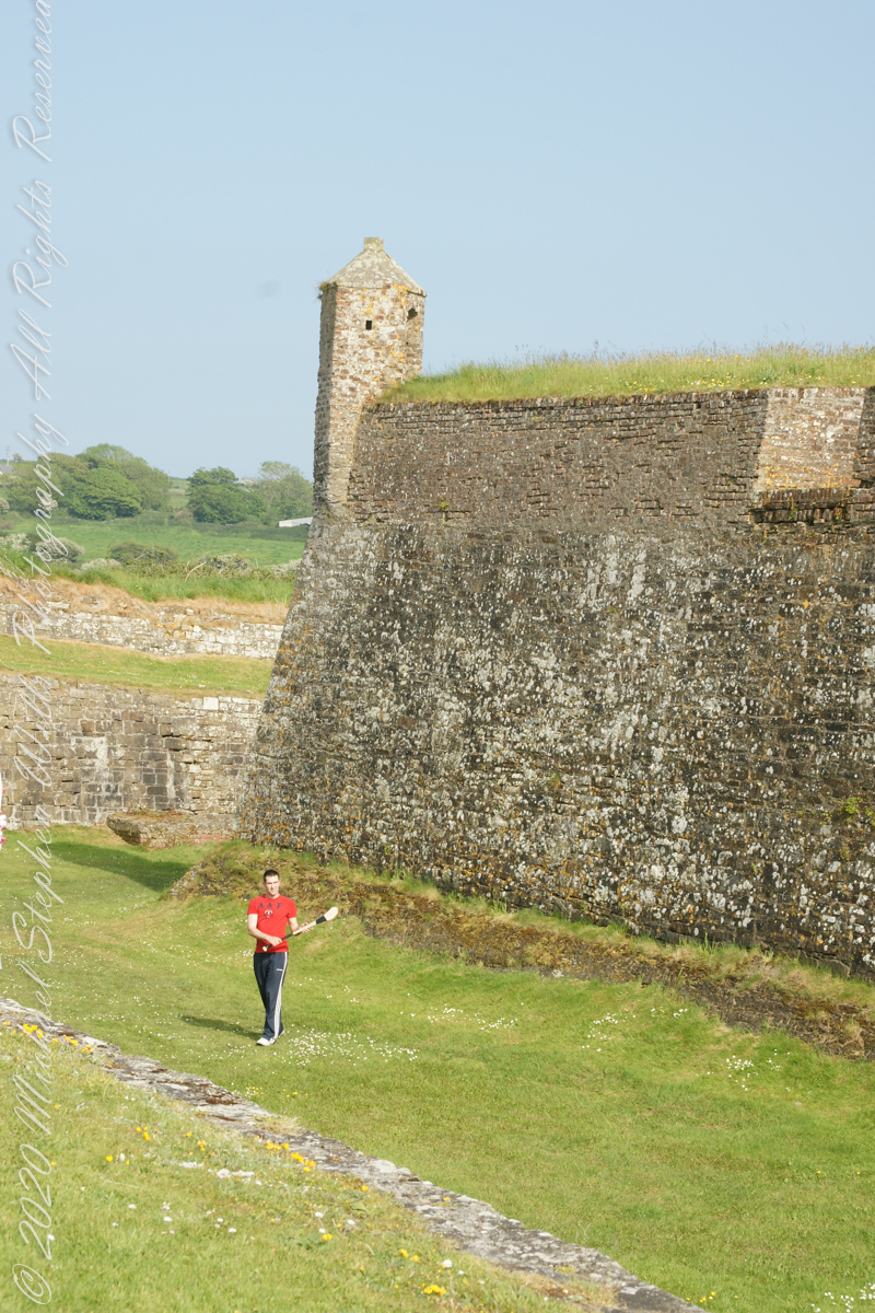
Upon our arrival this young man was handling a hurley and sliotar beneath the fort wall, an incarnation of Cúchulainn playing hurling at Emain Macha. From Wikipedia, “Hurling is older than the recorded history of Ireland. It is thought to predate Christianity, having come to Ireland with the Celts. The earliest written references to the sport in Brehon law date from the fifth century. Seamus King’s book A History of Hurling references oral history going back as far as 1200 BCE of the game being played in Tara, County Meath. The tale of the Táin Bó Cuailgne (drawing on earlier legends) describes the hero Cúchulainn playing hurling at Emain Macha.”