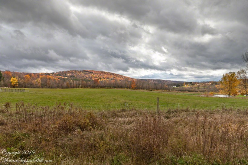
Connecticut Hill from Harvey Hill Road on a late October afternoon. Newfield of the Finger Lakes Region of New York State.

dramatic sky
Connecticut Hill from Harvey Hill Road on a late October afternoon. Newfield of the Finger Lakes Region of New York State.
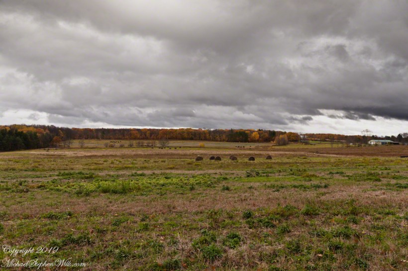
Hay Bales!!
The land opens up on the slopes of Connecticut Hill, Newfield of the Finger Lakes Region of New York State.


Five wait off stage for their turn to fly.
This Monarch butterfly emerged from the chrysalis a few moments ago. A minimum of two hours is required for the wings to harden before release to the wild.
Five wait off stage for their turn to fly.
Rainy weather forced us to leave her resting a full 24 hours.


Here are two videos of a Monarch release from 2020.

Looking east
This the fifth and final of a series of landscape photographs taken from this position.

The peak is named, in the English language, Slievenaglogh. It is so strange as it’s not English, being instead a transliteration of the Irish name “Sliabh na gCloch.” This is “Rock Mountain” translated literally. Slievenaglogh is carried to the townland, a long thin swath of land being the peak and associated ridge-line.
The rocks up there are called “gabbro,” a type of magma slowly cooled under ground. Slievenaglog, Slieve Foy across the valley, and the Morne mountains all formed within volcano magma chamber(s) of the Paleocene, 66 million years ago, a time associated with extensive volcanism and the Cretaceous–Paleogene extinction event that gave rise to the current age.
Our younger cousin has been up there, optimistically we left it for a later trip.


View of Slieve Foy
This the fourth of a series of landscape photographs taken from this position.
The distant ridge, Slieve Foy, is the site of a mythic battle from the epic “The Cattle Raid of Cooley” (Irish: Táin Bó Cúailnge).
Pam and I did a circuit of the island, returning to the home of my Mom’s first cousin. Our last full day on Ireland a cousin took us on the Tain Trail, over Maeve’s Gap of Slieve Foy and into Carlingford town.
Our route is partly visible to the right of the ridge, hidden in low clouds.
Rural Scenery
These are the second and third of a series of landscape photographs taken from this position. See the previous post for the first.
I visited here early morning of the Monday Pam and I embarked on a trip around the island of Ireland.
Arrived the previous Saturday when, after some sites between Dublin airport and the Cooley Peninsula, we met my Mom’s first cousin who had invited us for a visit. We had a grand time meeting them.
The ruin in this view is on the slopes of the peak. Some of these ruins are former homes with the replacement nearby. This appears to be an abandoned farm.
Click Me for the first post of this series.
Click me for the next post of this series.

It goes on and on and on
Slievenaglogh is the name of a peak on the Cooley Peninsula of County Louth, Ireland near to the birthplace of my Mom, Proleek, a few townlands to the west.
On the northeast slope of Slievenaglogh peak (Irish: Sliabh na gCloch) on the road from Mullaghattin Townland to Riverstown.
Here we look northeast from the Slievenaglogh Townland, the valley between Slieve Foy and Slievenaglogh peaks.
The view includes Little River, Ballycoly Townland and Castletown River.
Adjacent is a sheep pasture with a farm ruin behind the yellow flowered gorse (whin bush, scientific name Ulex).
Slieve Foy is the far ridge lost in clouds. Early morning, late May 2014.
Anything but devilish
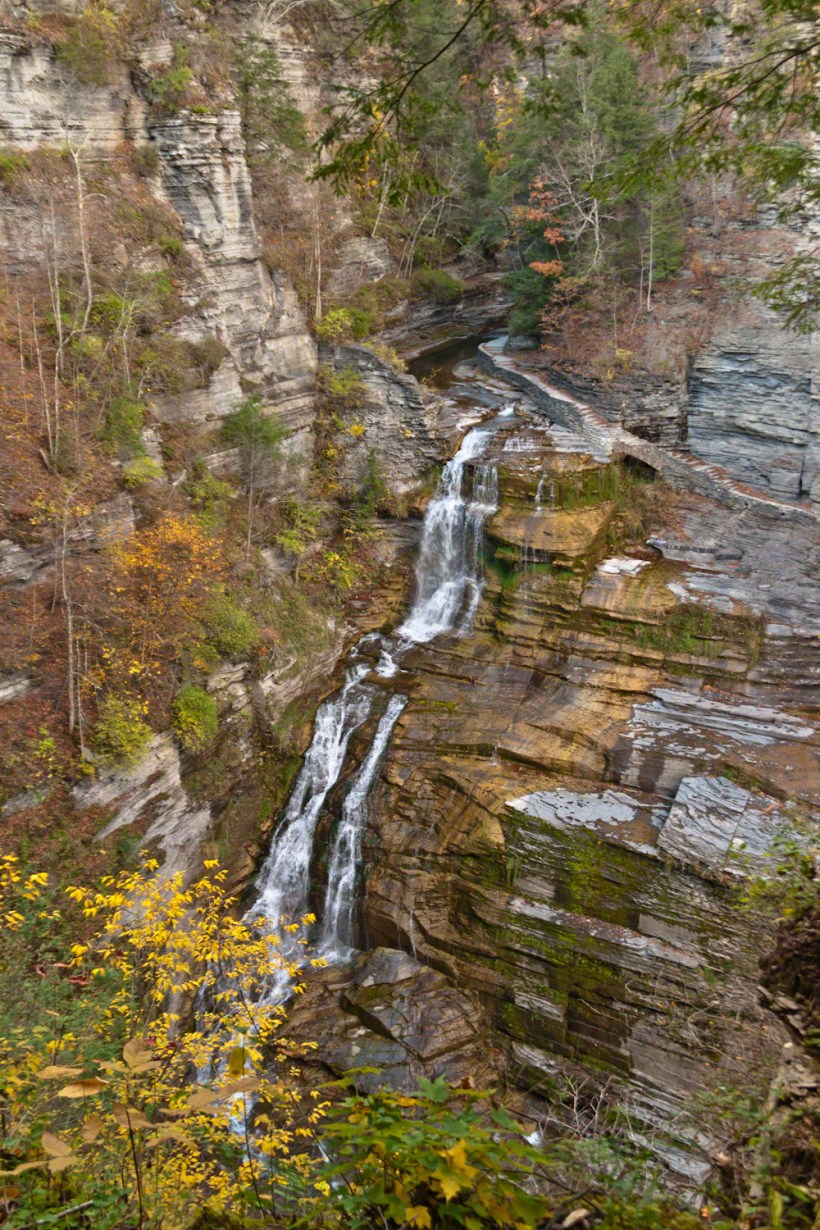
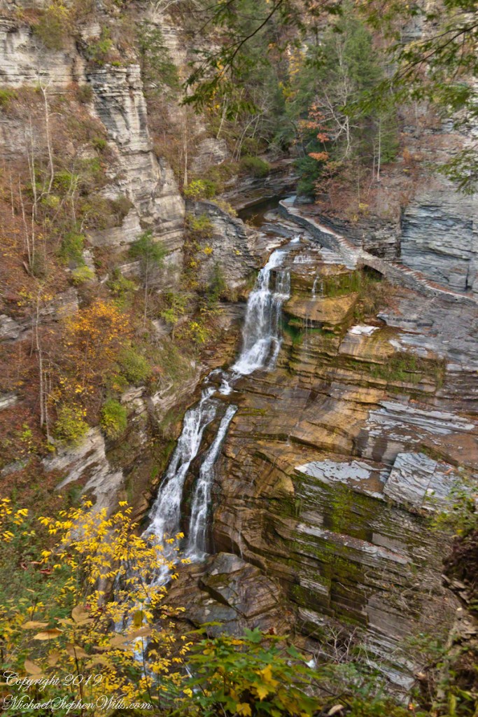
A full sweep of Lucifer Falls on an autumn evening, the sun hidden behind the gorge walls. Here the Gorge Trail emerges from the shelter of the gorge, emerging into a dizzying view.

Look Around
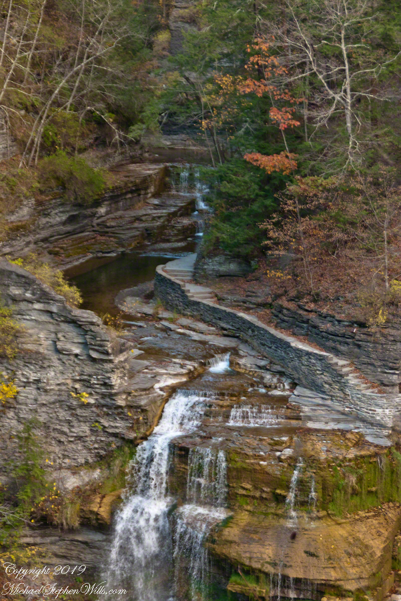
Standing on the trail alongside Lucifer Falls, crane your neck, up and up to the cliff top. Look closely to see the protective rock wall of the overlook.
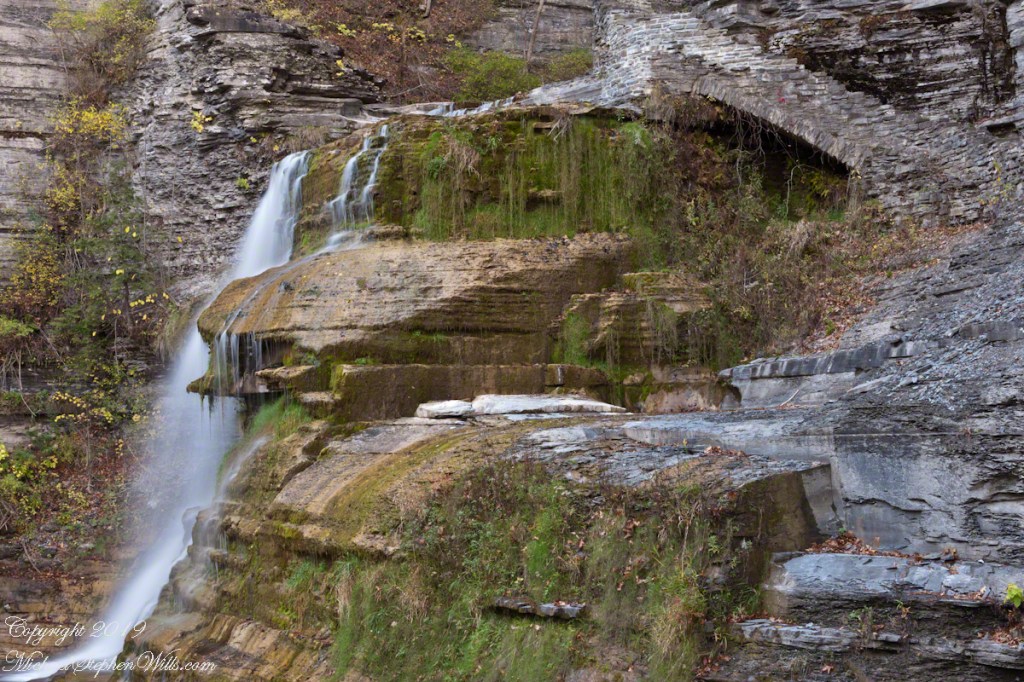
The Rim Trail includes this overlook of Lucifer Falls with, upstream, the Devil’s Kitchen waterfall, the path of the Gorge Trail in between.
The full sweep of Lucifer Falls on an autumn evening, the sun hidden behind the gorge walls. Here the Gorge Trail emerges from the shelter of the gorge, emerging into a dizzying view.

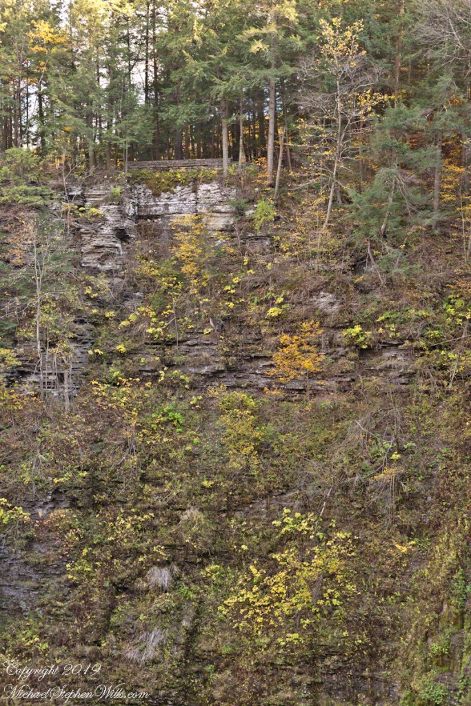
On the way to “Devil’s Kitchen”
This trail, built into the slate/sandstone gorge wall, follows the descent of Lucifer Falls. Here we view the brink and the path alongside. Follow this trail to Devil’s Kitchen, up and around the corner.