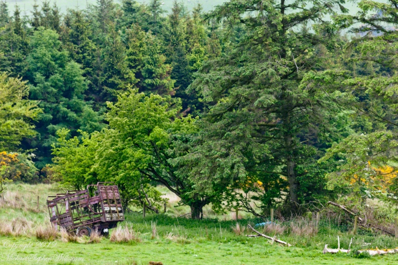
In the early dawn, I walked the path to Killen, drawn by the legacy of my mother’s Irish youth. An abandoned hay wagon stood, a relic amidst the whispers of history and myth. Join me in uncovering the roots that intertwine family and the enduring Irish land.
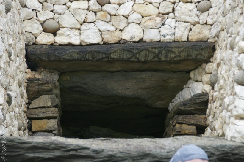
Step into the ancient world of Neolithic monuments and discover the astounding astronomical knowledge of our ancestors. Explore the Newgrange Lightbox in Ireland and similar marvels across Europe, revealing a deep connection between ancient peoples and the cosmos. Join me in unveiling these architectural wonders.
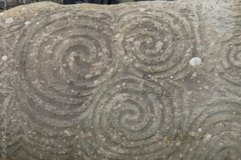
Discover the mysteries of the Newgrange monument’s Entrance Stone, a showcase of exquisite Neolithic rock art. Explore spirals, lozenges, and geometric designs that define European megalithic art and delve into their potential meanings and cultural significance. Join me in uncovering the secrets of this ancient Irish wonder.
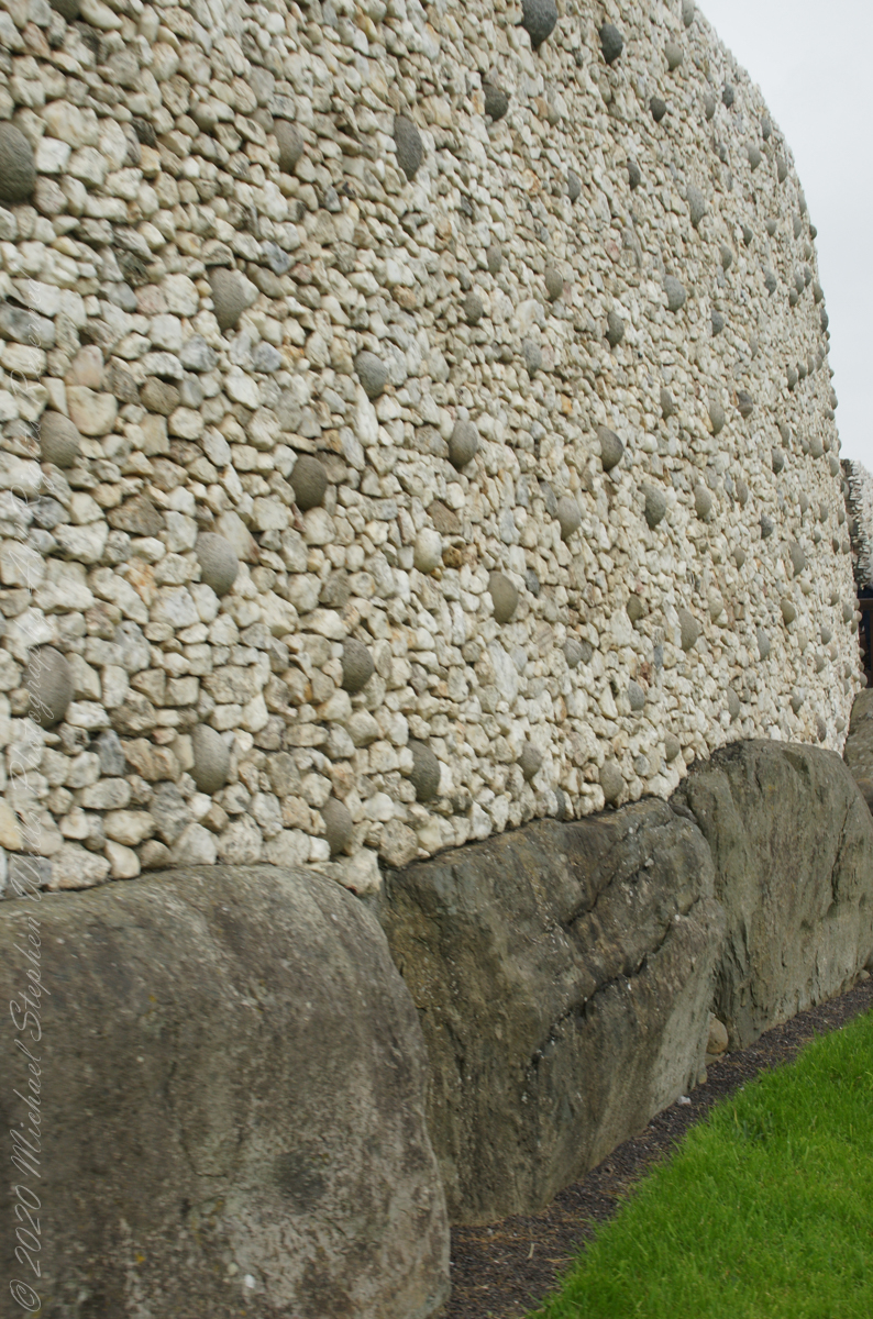
The Newgrange façade and entrance of today is a creation from the large quantity of small stones unearthed and conserved during excavation given form by a steel-reinforced concrete retention wall.
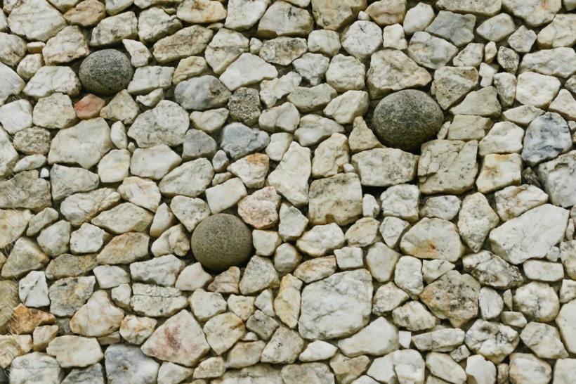
The brilliant white quartz cobblestones were collected from the Wicklow Mountains, 31 miles to the south. Our guide called them “sunstones” for the way they reflect sunlight. In the following photograph is white quartz, the same excavated 1967-1975 from the Newgrange site and incorporated into the facade, I collected from “Miners Way” along R756 (above Glendalough).
You can also see in these photographs dark rounded granodiorite cobbles from the Mourne Mountains, 31 miles to the north. Dark gabbro cobbles from the Cooley Mountains and banded siltstone from the shore at Carlingford Lough both locations on the Cooley Peninsula where my mother’s family still has farms.
The stones may have been transported to Newgrange by sea and up the River Boyne by fastening them to the underside of boats at low tide. None of the structural slabs were quarried, for they show signs of having been weathered naturally, so they must have been collected and then transported, largely uphill, to the Newgrange site. The granite basins found inside the chambers also came from the Mournes.
Geological analysis indicates that the thousands of pebbles that make up the cairn, which together would have weighed about 200,000 tons, came from the nearby river terraces of the Boyne. There is a large pond in this area that is believed to be the site quarried for the pebbles by the builders of Newgrange.
Facade and Kerbstones
Most of the 547 slabs that make up the inner passage, chambers, and the outer kerbstones are greywacke. Some or all of them may have been brought from sites either 3 miles away or from the rocky beach at Clogherhead, County Louth, about 12 miles to the northeast.
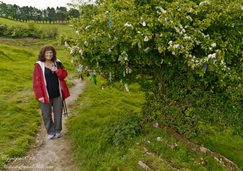
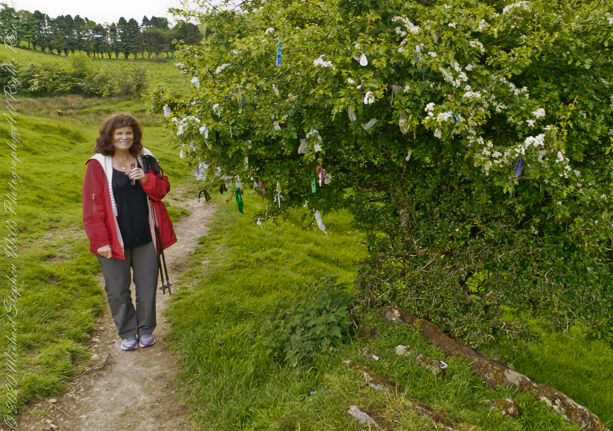
Pam and I were lucky enough to plan our tour of Ireland for May and June when the Hawthorne trees are in bloom. Named sceach gheal in Gaelic, the white clusters of blossoms symbolize hope. Hawthorns are plentiful throughout the island. The Irish revere the tree and associate each Hawthorn with the Little People. There are roads in Ireland that curve around a Hawthorn tree because the local people convinced the engineers to do so, to save the tree.
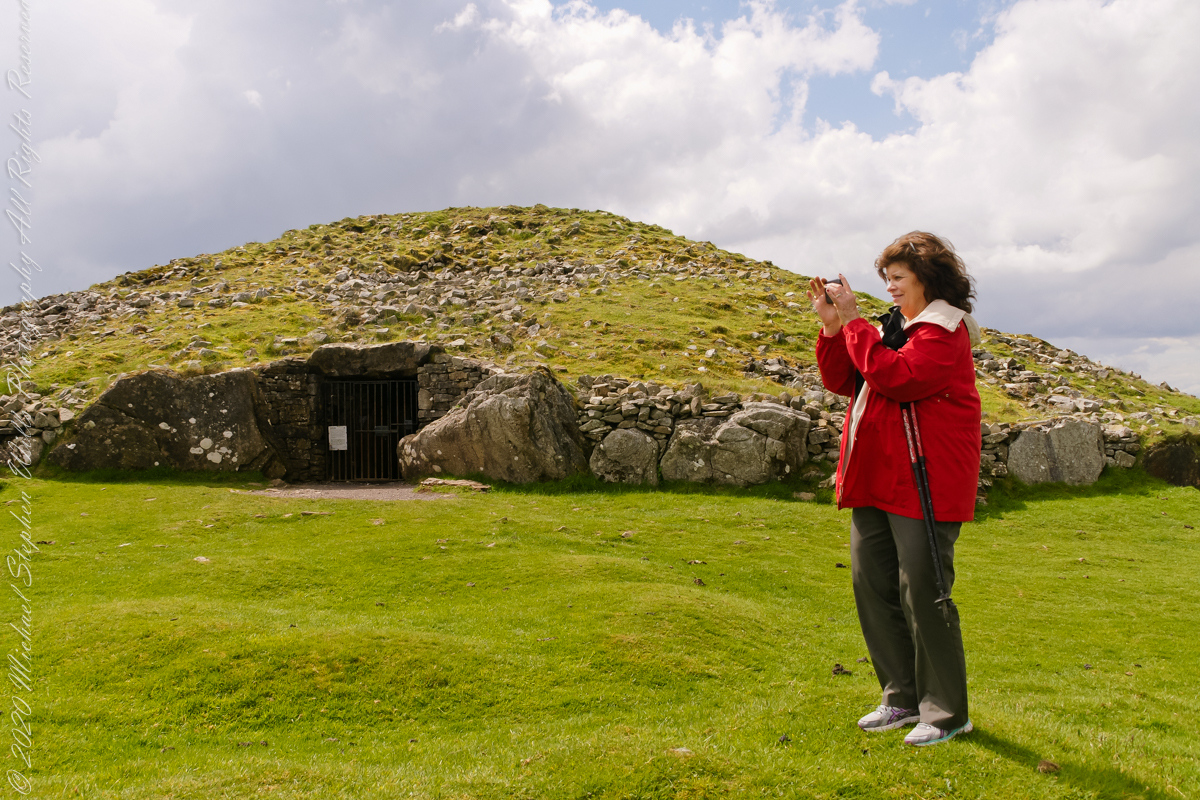
This specimen, covered with offerings (to the Little People?), is on the trail to Loughcrew. Even with her knee trouble, Pam made it to the top of the Hag’s Mountain to visit Cairn T of the Loughcrew Passage tombs.
The steep path to Loughcrew passes a hawthorn covered with flowers and may offerings.
Pam loves to capture images and returned from Ireland with a large collection. Most of the photos of me at work are by Pam. Here Pam is capturing the summit view of Hag’s Mountain with the Cairn T entrance gate in the background. Lucky for us, a fellow visitor made the trip to Loughcrew Gardens and picked up the gate key from the café. In a later post I will share my work from inside this passage tomb.
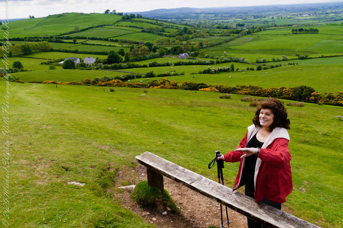
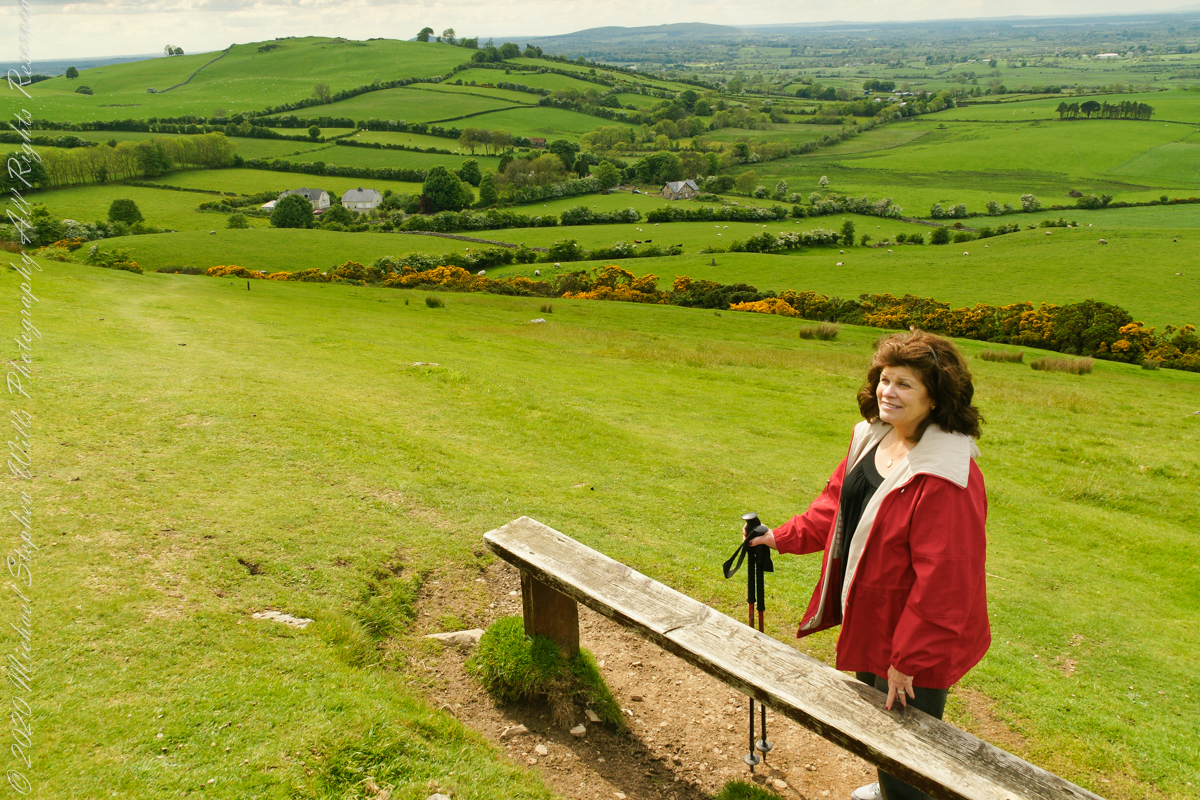
Pam makes friends wherever we go. She started down the mountain before me to take it easy on her knees. When I caught up, Pam and a young Irish family were deep in conversation. I took the opportunity to capture Pam with that gorgeous view to the northwest, Irish countryside with Lake of the Branches in the far distance.
Copyright 2023 Michael Stephen Wills All Rights Reserved
This the fifth and final of a series of landscape photographs taken from this position.
Click photograph for a larger view. To do this from WordPress Reader, you need to first click the title of this post to open a new page.
Slievenaglogh View with road, east
The peak is named, in the English language, Slievenaglogh. It is so strange as it’s not English, being instead a transliteration of the Irish name “Sliabh na gCloch.” This is “Rock Mountain” translated literally. Slievenaglogh is carried to the townland, a long thin swath of land being the peak and associated ridge-line.
The rocks up there are called “gabbro,” a type of magma slowly cooled under ground. Slievenaglog, Slieve Foy across the valley, and the Morne mountains all formed within volcano magma chamber(s) of the Paleocene, 66 million years ago, a time associated with extensive volcanism and the Cretaceous–Paleogene extinction event that gave rise to the current age.
Our younger cousin has been up there, optimistically we left it for a later trip.
Slievenaglogh View, northeastSlievenaglogh View, east northeastSlievenaglogh View, east northeastSlievenaglogh View, north northeastSlievenaglogh View with road, east
This the fourth of a series of landscape photographs taken from this position.
Click photograph for a larger view. To do this from WordPress Reader, you need to first click the title of this post to open a new page.
Slievenaglogh View, north northeast
The distant ridge, Slieve Foy, is the site of a mythic battle from the epic “The Cattle Raid of Cooley” (Irish: Táin Bó Cúailnge).
Pam and I did a circuit of the island, returning to the home of my Mom’s first cousin. Our last full day on Ireland a cousin took us on the Tain Trail, over Maeve’s Gap of Slieve Foy and into Carlingford town.
Our route is partly visible to the right of the ridge, hidden in low clouds.
These are the second and third of a series of landscape photographs taken from this position. See the previous post for the first.
Click photograph for a larger view. To do this from WordPress Reader, you need to first click the title of this post to open a new page.
Slievenaglogh View, east northeastSlievenaglogh View, east northeast
I visited here early morning of the Monday Pam and I embarked on a trip around the island of Ireland.
Arrived the previous Saturday when, after some sites between Dublin airport and the Cooley Peninsula, we met my Mom’s first cousin who had invited us for a visit. We had a grand time meeting them.
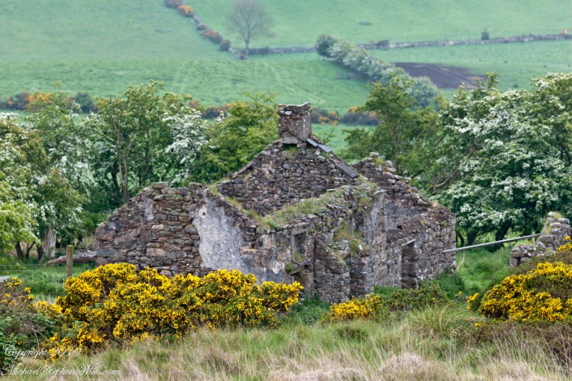
The ruin in this view is on the slopes of the peak. Some of these ruins are former homes with the replacement nearby. This appears to be an abandoned farm.