Discovering San Xavier del Bac: A Desert Gem

San Xavier del Bac, known as the “White Dove of the Desert,” embodies rich history and spirituality, blending Indigenous and Spanish influences, while remaining a vibrant community centerpiece today.

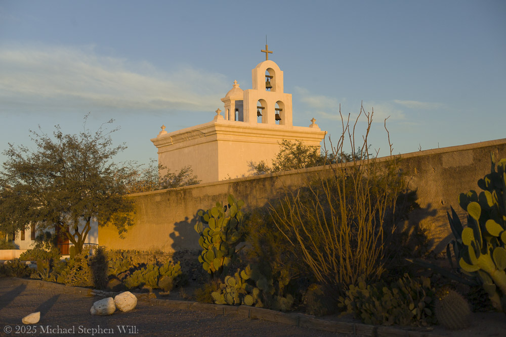
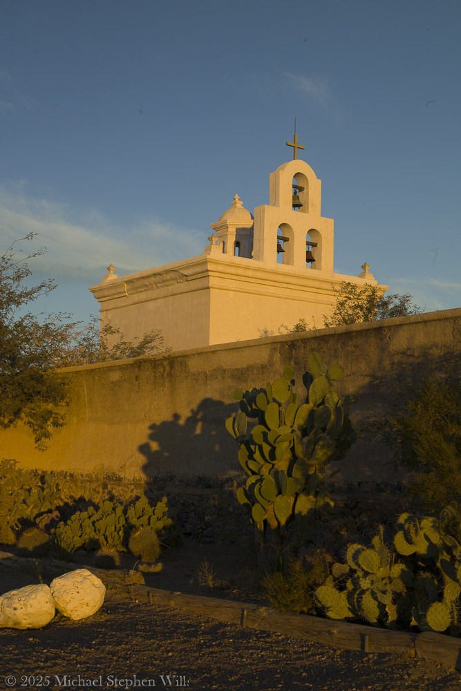
I remember how the rising sun washes the mission’s white adobe walls in soft gold. Mission San Xavier del Bac stands about 10 miles south of downtown Tucson, on the San Xavier Indian Reservation of the Tohono O’odham Nation.​

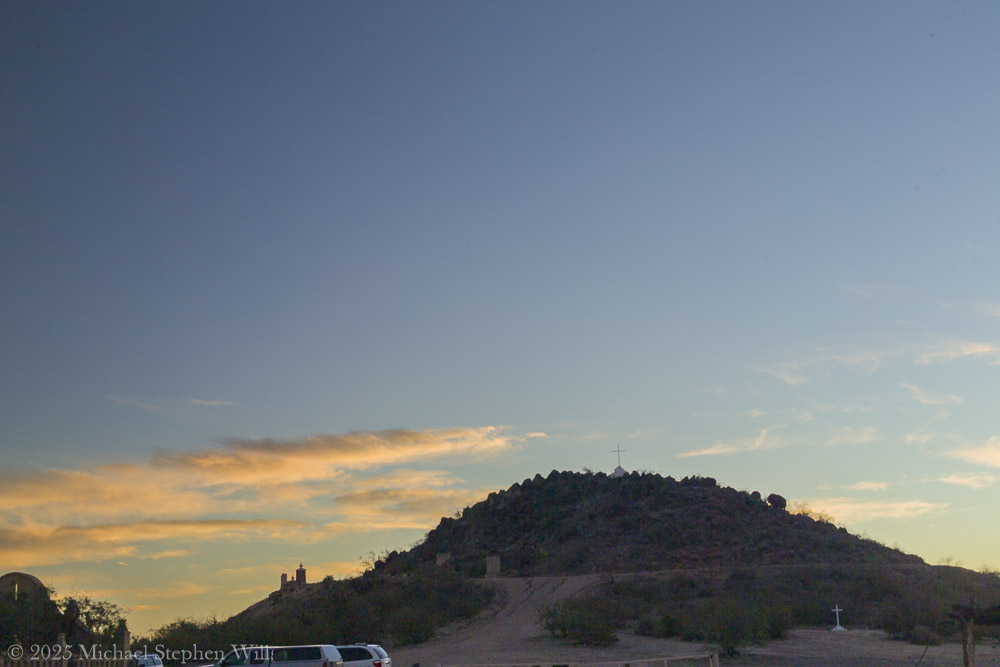
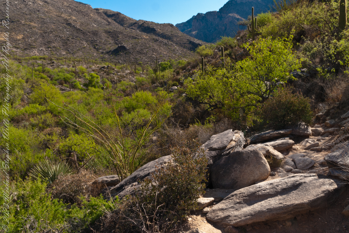
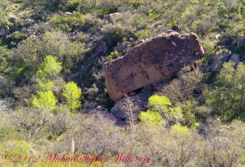
Before sunrise, I climb Grotto Hill, just east of the mission. A well-worn path and a few stone steps lead upward, passing stations of the cross and a humble grotto shrine nestled in the slope. As I ascend, the soft golden light gathers. Ocotillo stems and saguaros dot the hillside, their long shadows stretching over the desert floor. Reaching the top, I find a lone white cross planted firmly into the rocky soil. The cross is simple, yet it holds a quiet gravity – a silent witness to the prayers and hopes of those who have come here. I stand beside it to catch my breath. Below me spreads the mission complex, glowing white and rose in the gathering dawn. From this height, the scene is breathtaking: the desert expands in every direction, painted in brushstrokes of copper, violet, and gold. The distant Tucson mountains catch the first light. There is a profound peace up here. It’s easy to imagine Father Kino himself climbing a similar hill, surveying this “Water Place” and dreaming of a mission that would stand the test of time.

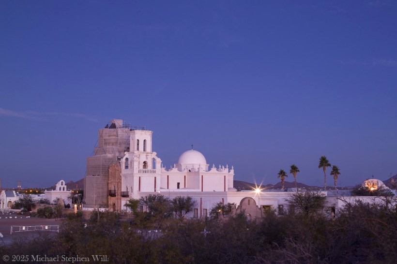
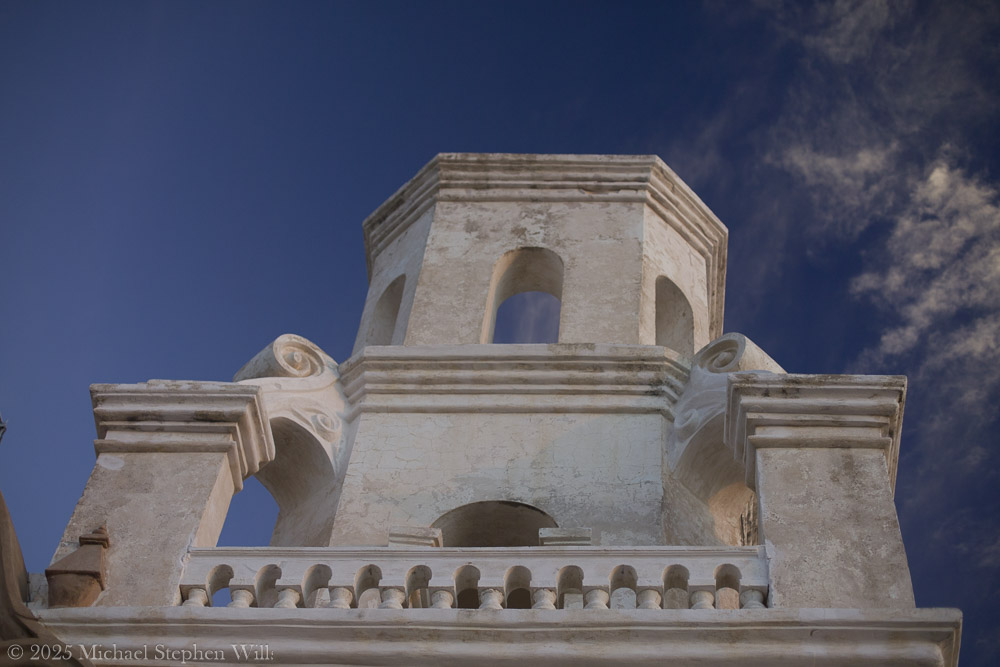
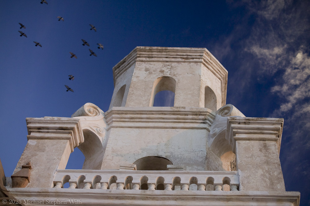
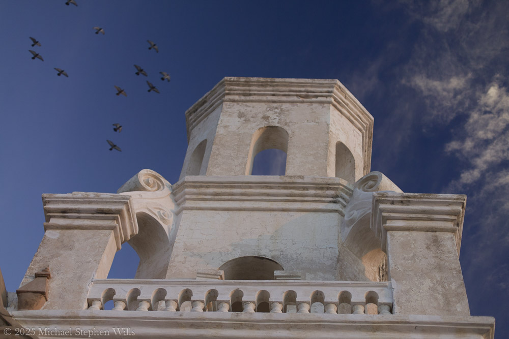
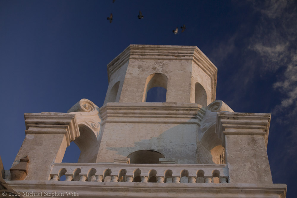
Often called the “White Dove of the Desert”​the church gleams against the wide Sonoran sky, its twin bell towers and central dome radiant in the glow. In this moment, the 18th-century mission seems to hover between earth and heaven – a bright vision in the desert, tethered by history and faith.

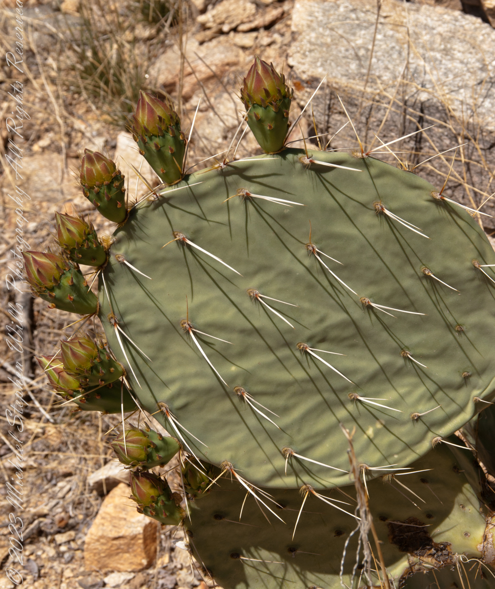
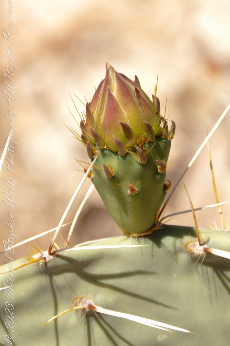
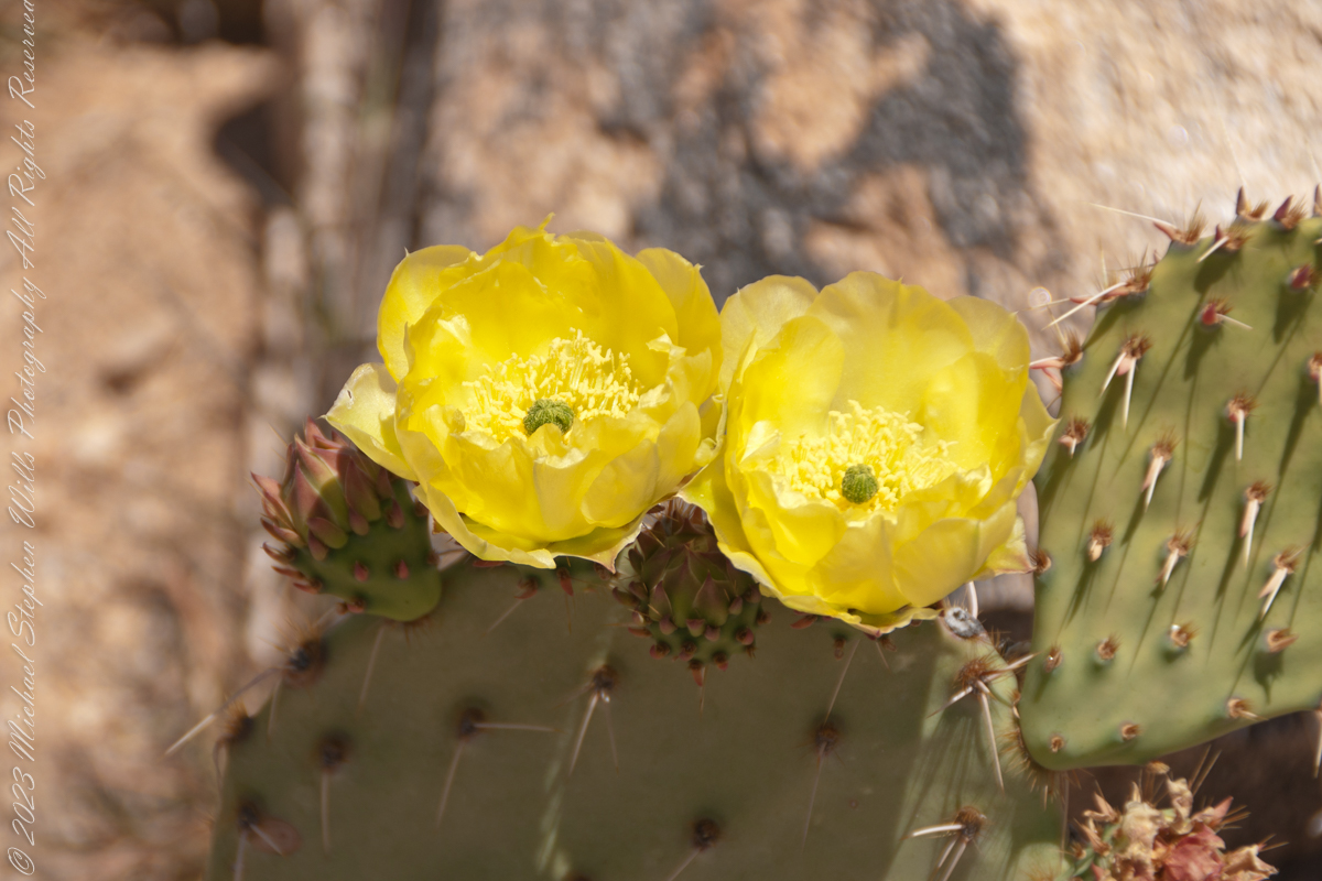
I walk toward the old mission, feeling the crunch of desert sand beneath my feet and brushing past creosote bushes and prickly pear cacti. There is a hush here, broken only by a gentle breeze and the distant coo of a dove – as if nature itself respects the sanctity of this place. In my mind I rell that this mission was first founded in 1692 by the Jesuit missionary Father Eusebio Kino​, who encountered the O’odham community living at this oasis they called Wa:k, meaning “Water Place”​

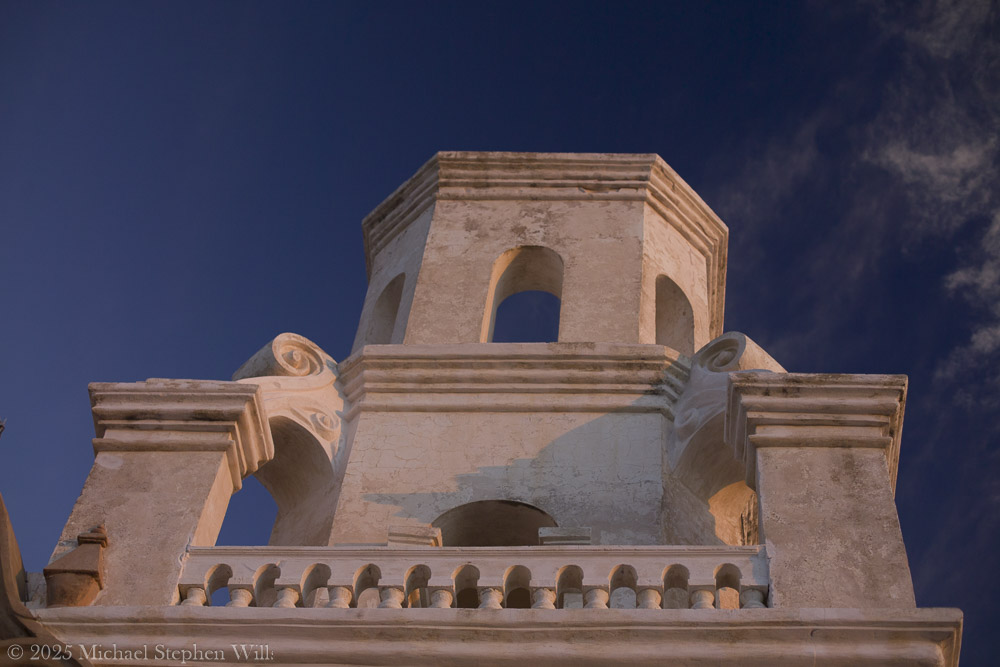
The springs have long since gone dry, but the name lives on, a reminder that this now-arid land once nurtured life-giving water. The church before me isn’t the original Kino saw, but the one begun in 1783 under Spanish Franciscan friars​ who raised these walls with the help of O’odham artisans. I marvel that I am standing before a structure over two centuries old – the oldest European-built structure in Arizona​– yet still alive with spirit.

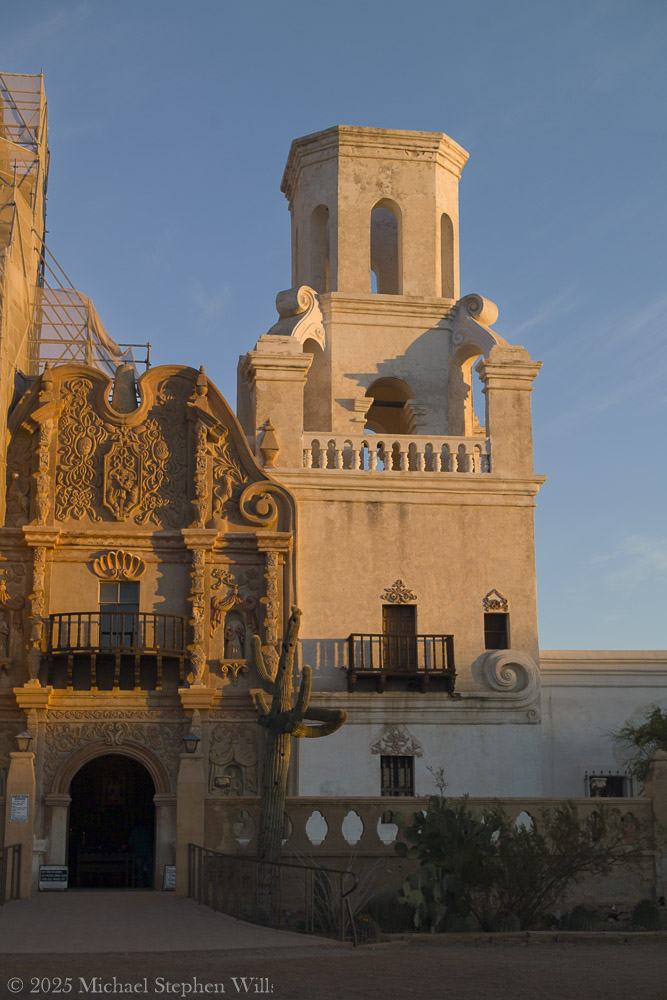
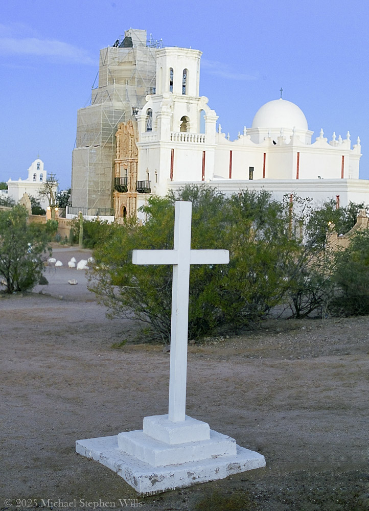
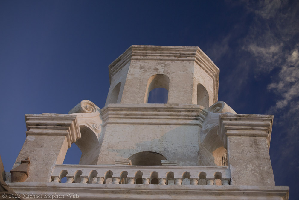
Stepping into the courtyard, I tilt my head back to absorb the facade’s details. The ornate Baroque façade is a symphony of carved plaster and painted relief, an exuberant blend of Moorish, Spanish, and Indigenous influences. Faded yet still vivid, saints and angels watch from their niches on the church front. Every arch and cornice is edged in shadow and dawn light, revealing craftsmanship considered one of the finest examples of Mexican Baroque architecture in the United States​

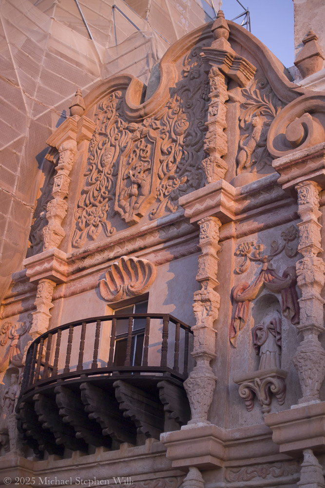
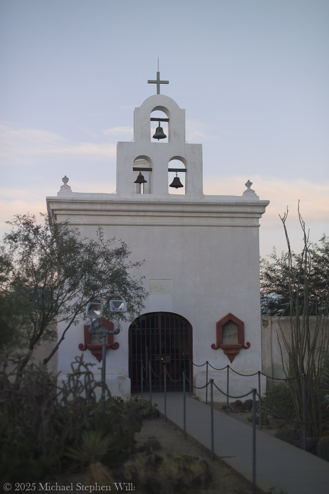
The front entrance is flanked by intricate scrolls and whimsical carvings – floral motifs, seashell patterns, and statuary wearing serene expressions. I gently run my fingers along the weathered wooden doors, feeling the grain that generations of hands have touched. Through a crack in the door, I catch a glimpse of the dim interior: candles flicker on the altar and the air carries a hint of melted wax and sweet incense. The sanctuary seems to exude centuries of devotion. Even outside, I sense a whisper of ancient prayers in the silence.

As the day progresses, the world feels alive again. A pair of children laugh and chase each other across the dusty plaza, their voices echoing off the thick adobe walls. Nearby, the aroma of fresh frybread lingers – evidence of Tohono O’odham vendors who often set up stands by the church, selling frybread “popovers” and Indian tacos to visitors. This mingling of old and new, sacred and every day, makes the mission feel utterly genuine, the heart of a living community. I see an elderly O’odham woman in a shawl kneel at a side shrine, lips moving in quiet prayer, and I realize that for the Tohono O’odham, this mission is more than a historic landmark. It is a living spiritual home that continues to anchor their community. Indeed, the church is still an active parish that serves the local O’odham families, with regular Masses and gatherings held within its walls​

The sense of continuity is palpable – the faith that built this place in the 18th century endures unwaveringly today.

Standing in front of San Xavier del Bac, I feel a personal connection that is hard to put into words. The centuries-old mission glows fresh in morning light. I close my eyes and sense the presence of all who have been here before – the O’odham villagers, the Spanish padres, the countless pilgrims and visitors. In the stillness, time blurs. Past and present mingle in the desert air. When I finally turn to leave, my heart is quiet, uplifted by the encounter. In this sacred and remote place, I have touched a living history and felt the embrace of a peace that transcends centuries. I carry that gentle peace with me into the day, grateful for the memories of light, silence, and the enduring soul of San Xavier del Bac.

Bibliography

  • Wikipedia. “Mission San Xavier del Bac.” (2025).
  • National Park Service. “San Xavier del Bac Mission.” (2021).
  • Patronato San Xavier. “History of the Mission – Timeline.” (2025).

The Flatiron

Where is the ironing board?

The setting sun’s glow on the end point of Upper Siphon Draw trail, The Flatiron.

Click Me for my Online Gallery

The mountain was formed by a series of volcanic eruptions between 20.5 and 18 million years ago. The west face of the mountain is composed of dacite lava and rhyolitic tuff. The overlying tuff was deposited during an eruption which created a collapse caldera bounded by faults. Dome resurgence reactivated these faults, causing uplift of the caldera floor which juxtaposed the softer tuff and more resistant dacite. Differential weathering caused the outer tuff to erode faster, leaving the dacite cliffs exposed and creating the prominent mountain visible today.

The Flatiron, the mesa-like projection above us in this view, is long solidified dacite lava. The word dacite comes from Dacia, a province of the Roman Empire which lay between the Danube River and Carpathian Mountains (now modern Romania and Moldova) where the rock was first described. Lost Dutchman State Park, Apache Junction, Maricopa County, Arizona

Reference: Wikipedia “Superstition Mountain” and “Dacite Lava.”

Copyright 2023 Michael Stephen Wills All Rights Reserved

Dragoon Ridge

Dragoon, not dragon

Dragoon Mountains of southeastern Arizona are named, not for the resemblance of this ridge to the back of a Dragon, but for a type of soldier trained for horseback riding and infantry.  These were the U.S. troops sent to “pacify” the Chiricahua Apache homeland.

Understanding location lighting is a matter of experience and luck.

Cochise Stronghold campsites are on the eastern slope of the Dragoons, sheltering them from the late afternoon sun.

One this day in April I explored the trails until sunset and was lucky enough to be setup for the 14 minutes of that day when the light was absolutely perfect.

Copyright 2023 Michael Stephen Wills All Rights Reserved

Dragoon Spires

Lucky enough

Understanding location lighting is a matter of experience and luck.

Cochise Stronghold campsites are on the eastern slope of the Dragoons, sheltering them from the late afternoon sun.

One this day in April I explored the trails until sunset and was lucky enough to be setup for the 14 minutes of that day when the light was absolutely perfect.

“Dragoon Spires in Afternoon Light”

These photographs are from two days spent at Cochise Stronghold, a part of the U.S. Forest Service Coronado Forest managed by Arizona State Parks located off the Interstate 10 East of Tucson between Benson and Wilcox.

This rugged natural fortress was, for some 15 years, the home and base of operations for the famed Chiricahua Apache Chief, Cochise.  Cochise and about 1,000 of his followers, of whom some 250 were warriors, located here.

Click Me for my OnLine Gallery

Born in present-day Arizona, Cochise led the Chiricahua band of the Apache tribe during a period of violent social upheaval. In 1850, the United States took control over the territory that today comprises Arizona and New Mexico.  Not hostile to the whites at first, he kept peace with the Anglo-Americans until 1861, when he became their implacable foe because of the blunder of a young U.S. Army officer, Lt. George Bascom.   In that year, Cochise and several of his relatives had gone to an encampment of soldiers in order to deny the accusation that they had abducted a child from a ranch. The boy was later proved to have been kidnapped by another band of Apaches.

During the parley, Cochise and his followers were ordered held as hostages by Bascom, but Cochise managed to escape almost immediately by cutting a hole in a tent. Bascom later ordered the other Apache hostages hanged, and the embittered Cochise joined forces with Mangas Coloradas, his father-in-law, in a guerrilla struggle against the American army and settlers. The capture and murder of Mangas Coloradas in 1863 left Cochise as the Apache war chief.   The U.S. Army captured him in 1871 and prepared to transfer the Chiricahua to a reservation hundreds of miles away, but he escaped again and renewed the resistance campaign. The following year after negotiating a new treaty with the help of Thomas Jeffords, the band was allowed  to stay in their homeland.

Cochise is reputed to have been a master strategist and leader who was never conquered in battle.  He died peacefully on the newly formed Chiricahua  reservation in 1874.  His son, Taza succeeded him as chief.   Upon his death, he was secretly buried somewhere in or near his impregnable fortress.  The exact location has never been revealed or determined.

The town of Cochise, Cochise County, the renowned geological feature known as Cochise’s Head in the Chiricahua Mountains, and the Stronghold are all named in tribute to him.

Copyright 2023 Michael Stephen Wills All Rights Reserved

Cochise Stronghold Introduction

Campground is closed in June, July, and August due to the often-extreme heat

These photographs are from two days spent at Cochise Stronghold, a part of the U.S. Forest Service Coronado Forest managed by Arizona State Parks located off the Interstate 10 East of Tucson between Benson and Wilcox.

“Idyllic Desert Landscape with Boulders”


Click Me for my OnLine Gallery

“Generations”


Here is the Cochise Stronghold information sign from the Douglas Ranger District of the Coronado National Forest.

The Dragoon Mountains are a low range that barely rises above the surrounding desert floor. Nevertheless, the granite boulders are spectacular and well worth visiting for the scenery alone. This mountain range is remote from cities or even any large towns, so visitation is light. Late fall, winter, and early spring are the best times to visit. Temperatures exceeding 100 degrees are common even in spring and fall. Cochise Stronghold Campground is closed in June, July, and August due to the often-extreme heat.

Safety First: Heat and low humidity are real hazards for people unfamiliar with desert climates. A person can loose up to 5 quarts of fluid a day and it is easy to become seriously dehydrated without realizing it, so drink plenty of fluids even if you do not feel very thirsty. Always carry extra water in your car. When going on a hike, even if a short one, take a day pack with water, snack foods, protective clothing, flashlight, first aid kit, compass, and map. To avoid sun in

Copyright 2023 Michael Stephen Wills All Rights Reserved

Cochise Spring

ancestral Apache land

Interstate 10 between Benson and Wilcox ascends through a field of enormous, eroded granite boulders. Off to the west are the Dragoon Mountains, otherwise known as “Cochise Stronghold.”

Informative sign at campsite

Starting from the campsite is the “Sky Islands Traverse” hiking trail, leading up into the mountains. I wandered from the trail to follow a dry streambed to this residual pool of water, the time being early spring, and this is what remained from the winter rains.

Click Me for my Online Galleries

A single butterfly of the genus Anthocharis generally called “Orangetip” for the colorful upper wing tips. These exist throughout the world, here in Arizona they migrate across the desert, obtaining refuge and nourishment from “Sky Islands” such as the Dragoon Mountains

Copyright 2022 Michael Stephen Wills All Rights Reserved

Mesquite Flowers and Seeds

desert survival

Mesquite is the Sonoran Desert smell carried by distant rain, omnipresent and humble, a survivor with tap root extending 190 feet down to draw on the water table.

Click Me for my Online Gallery

Prosopis is the scientific name for about 40 species of leguminous trees. Present in North America since the Pliocene era, mesquite wood has been dated to 1300 BC.

I found this flowering mesquite bush in Finger Rock Canyon of the Catalina Mountains outside Tucson, Arizona.

They are thought to have evolved with megafauna in the New World. The loss of North American megafauna at the end of the Pleistocene era gave way to one theory of how the Prosopis spp. were able to survive.

One theory is that the loss of the megafauna allowed Prosopis spp. to use their fruit pods to attract other organisms to spread their seeds; then, with the introduction of livestock, they were able to spread into grasslands.

The plentiful legumes that develop from these flowers are edible when cooked. The shape and color of the seeds can be understood from this empty seed pod that happens to lie near a tarantula burrow.

Click me to read more about the uses of mesquite.

References:
“Mesquite,” Wikipedia

Copyright 2023 Michael Stephen Wills All Rights Reserved

Cottonwood Shade in Pima Canyon

The cottonwood’s deep roots draw water from a mountain stream.

Looking back down Pima Canyon on a spring morning plenty of green under the unrelenting sun.

Click me for more Arizona photographs from my online gallery

A large Fremont’s Cottonwood Offers shade and protection along the Pima Canyon Trail.

In the shade, a grapevine, offers a vain promise of grapes.

The cottonwood’s deep roots draw water from a mountain stream.

Native Americans in the Western United States and Mexico used parts of Frémont’s cottonwood variously for a medicine, in basket weaving, for tool making, and for musical instruments. The inner bark of Frémont’s cottonwood contains vitamin C and was chewed as an antiscorbutic – treatment for vitamin C deficiency. The bark and leaves could be used to make poultices to reduce inflammation or to treat wounds.

The Pima people of southern Arizona and northern Mexico lived along Sonoran Desert watercourses and used twigs from the tree in the fine and intricate baskets they wove. The Cahuilla people of southern California used the tree’s wood for tool making, the Pueblo peoples for drums, and the Lower Colorado River Quechan people in ritual cremations. The Hopi of Northeastern Arizona carve the root of the cottonwood to create kachina dolls.

Reference: Wikipedia “Fremont’s Cottonwood.”

Copyright 2023 Michael Stephen Wills

Cactus Blossoms in Pima Canyon

Delicate buds develop into a flower, and then, into a cactus tuna

A set of photographs of buds and blossoms of the Prickly Pear Cactus taken in Pima Canyon of the Pusch Ridge Wilderness of the Catalina Mountains.

Click Me for more information from my Online Galleries.

Eight New  Blossoms

Here are 8 flower bud growing from one cladode (pad).  There is a 9th bud on a second cladode.  What is interesting about these pads are the needle shadows.  Although thin, each provides some protection from the sun.

Cactus Closeup

This delicate bud will develop into a flower and, then, into a cactus fruit (in spanish, tuna).  The fruit retains those tiny spines, called glochids, which detach on the smallest contact.  The pads are also covered with them.

Prickly pears are known for growing into thickets.  The Cuban government created a “cactus curtain” of prickly pears around the Guantanamo naval base in the 1960’s, to prevent Cubans from escaping to refuge in the United States.

Cactus Flowers

Look closely at the anthers of these flowers.  Each curls over when touched, depositing its pollen.  The habit of prickly pears to grow together in thickets mean there are clusters of blossoms in springtime.

Copyright 2023 Michael Stephen Wills

Reavis Canyon Camp

below the Falls

Here is an overview of my route through Cedar Basin on the way to Reavis Falls.  There are two paths in the following image from Google Earth.  The red path brings you into Cedar Basin and straight up a ridge and down to the campsite.  The red path is incorrect in the approach to the ridge and, rather than repaint the path, I created the green path as the gradual and accurate description of how I climbed to the ridge point where I captured the photographs Hoodoos on the Descent to Reavis Falls.

No Path to Reavis Falls

You need to understand there is NO path through this terrain.  It is necessary to follow a faint trail marked out by the footsteps of those before you and an occasional rock cairn placed at the most difficult points.  The following image is misleading in that what looks like a road next to my green path is actually a creek bed from the Lime Mountain spring.

Huge Boulders

What looks like a road is the resting place of huge boulders fallen from the surrounding mountains. Since there is water, thick brush and trees grow everywhere in cracks and spaces between the boulders and rocks.  Getting through the creek bed with an 80 pound pack and not getting lost is close to impossible. The solution is to hug the ridge slope, following the contours and navigate around boulders.

Reavis Canyon below the falls is filled with boulders of this size held in place by friction.

View of Reavis Canyon and Campsite

From the ridge small portions of Reavis Canyon were visible.  I even spotted a campsite.

The mouth of Reavis Canyon below the falls opens into a sandy bottom. This camp, surronded by house-size boulders fallen from the slopes above, has a patch of grass bright green and fresh.

This camp, 1,636 feet below Lime Mountain peak, surrounded by house-size boulders fallen from the slopes above, has a patch of grass bright green and fresh to the right.  In the center of the photograph is a tree trunk on rocks to serve as a bench next to a fireplace. With an 80 pound pack on my back, I was still an hour or so away from this spot.  It was March, so sunset was around 6 pm, enough time to find a way down before darkness to overtook me.

Looking down from a ridge above the canyon that holds Reavis Creek and the falls.

This is an overview of my progress, with the Lime Mountain and Reavis Canyon campsites marked. Landforms are marked on the left: the Prominent Cliff , in the background it says “White Formation on Cliff.”

Copyright 2023 Michael Stephen Wills All Rights Reserved