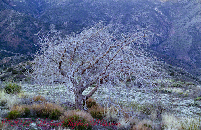
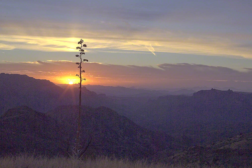
On my fourth morning, after I awoke to am immense silence, my first photography subject was the lone dry juniper you see below.
Then the dawn lit up the far mountains. You can view a larger image these mountains at dawn in my previous blog, “Superstition Wilderness Dawn.”
A Lone Dry Juniper
This is a photograph of that juniper tree, dryer than most, being dead. I take it to be a One-seed Juniper from the thick growth of branches and the strong rounded aspect of the crown. I captured this photograph from a tripod mount using a Kodak DCS slr/c with a Canon EF 50mm f/1.4 USM lens.
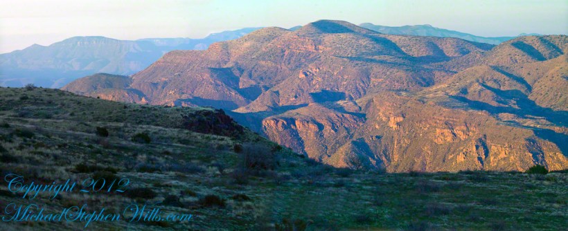
Looking into Reavis Creek Canyon from Lime Mountain
I used the tripod to bracket this shot on the left and right for the following panorama.
The Reavis Creek Canyon from Lime Mountain while still in shadow, morning
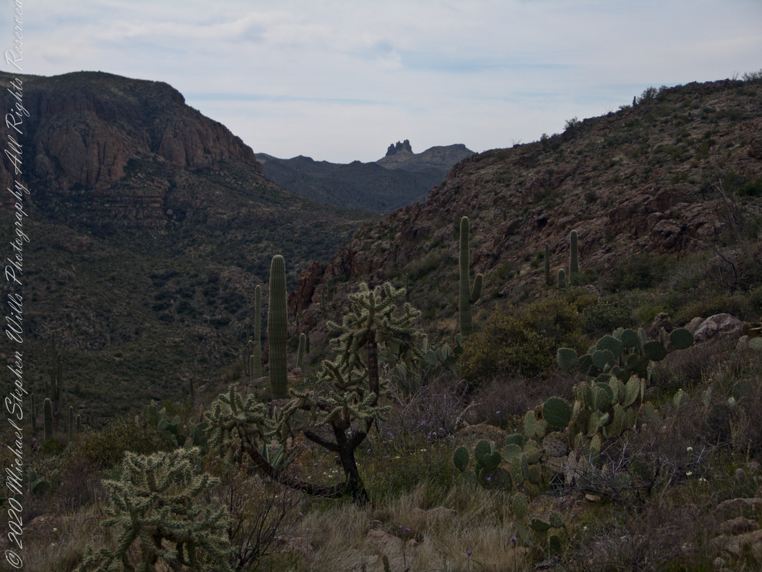
The Spirit of Elisha Reavis
From this vantage you can see my route into Reavis Creek Canyon and Reavis Falls taken on the first afternoon of the expedition. That first morning I loaded up 65 pounds of food, supplies and photography equipment and headed out from the Reavis Trailhead on the Reavis Ranch Trail. This was one of the trailed used by Elisha Reavis to ride a favorite burro and a string of 8 to 15 burros loaded with vegetables he sold to various communities throughout central Arizona. See my blogs “A Ride to Reavis Ranch” and “Apple Orchard in the Wilderness“for views of the paradise (as of the early 21st century) where Elisha Reavis, lived and prospered in the latter part of the 19th century where he lived his 70’s.
This his mountain valley, using a perennial creek, Reavis cultivated and irrigated about fifteen acres of land by himself with chickens, turkeys, hogs, burros, two horses and several dogs. The horses, teamed together, pulled a shear plow, disc and leveler. On April 9, 1896 Reavis was preparing of another trip to Mesa, to buy seed potatoes, and was found by a friend a month later on what is now the Reavis Ranch trail, to the south and west of his valley, near what is now called Grave Canyon were friends buried him.
Past the Dry Juniper and Down
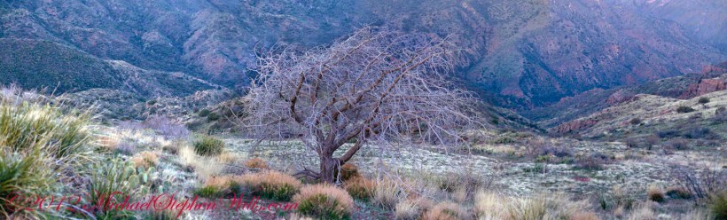
102 years later, I headed up the Reavis Ranch Trail, over the ridge of Lime Mountain and past this dry juniper in the same spirit as Elisha Reavis if for a different purpose.
Pre-dawn on the fourth morning of my solo expedition to Reavis Falls, before the last posting “Among the Desert Wildflowers“, on the slopes of Lime Mountain, as the eastern sky became slightly less dark, I woke to an unusual sensation: total silence. The air was absolutely still, no insects trilled, the birds were still asleep. Lying very still, the ringing of my ears announced the silence.
In that silence I set up for this panorama taken from a tripod-mounted Kodak DCS ProSLR/c mounted with a Canon EF 200mm f/2.8L II USM telephoto lens. It is 5 image files combined. The source file is about 300 MB.
That is Pinyon Mountain in the center distance. The Arizona Trail traverses that terrain, though it is not visible from this distance (it is about 3 miles away).
Lime Mountain is truly a light green, as you can see from the foreground ledge. From there, a cliff runs round where on a south-facing site there are cliff dwelling ruins. The trail to Reavis Falls runs to the right, along a ridge broken by a narrow canyon with access to Cedar Basin, also at the foot of these cliffs.
Copyright 2023 Michael Stephen Wills All Rights Reserved
See Evening on Two Bar Mountain for another chapter of my four-day solo expedition to Reavis Falls in the remote eastern Superstition Wilderness.
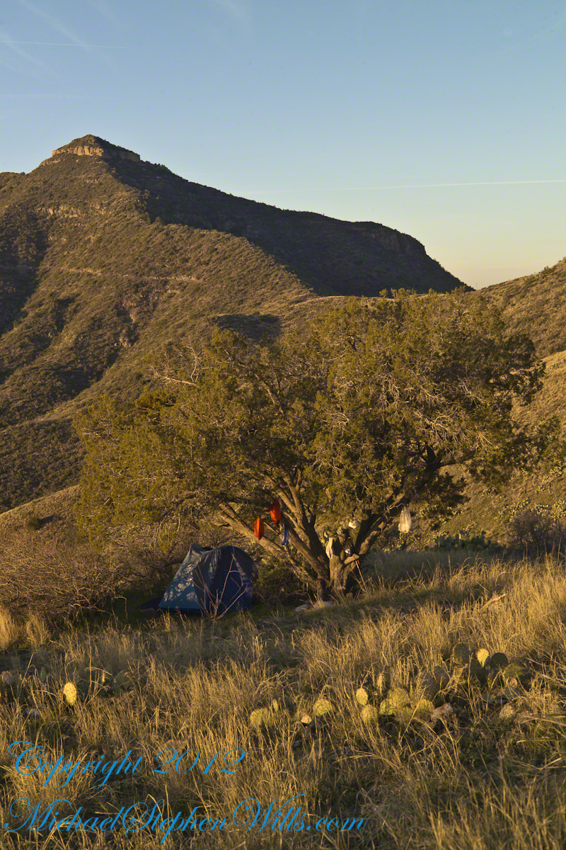
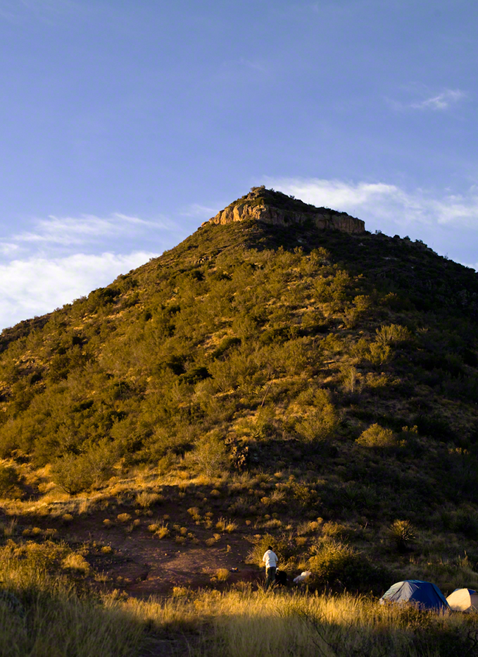
Campsite at Morning
On the late-morning of day three I climbed out of the Reavis Creek valley to camp on the slopes of Lime Mountain. There I watched the afternoon progress to evening, a full moon rise in a bright sky and other events featured in this blog. All around my campsite under a lone juniper the mountain side was blooming.
Grasses, Cacti and Flowers
Among the grasses, cacti and lichen-covered rocks were many small wildflowers. I was careful to avoid damaging them and otherwise enjoyed their beauty and plentiful blooms my entire stay. I capture some of them in the early morning light and spent some time identifying them for you.
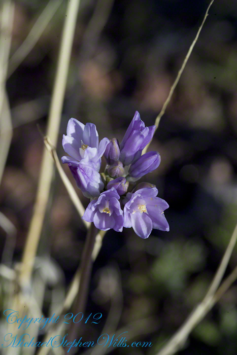
Desert Hyacinth is a perennial lilly (Liliaceae).
It grows from an onion-like bulb used for food by pioneers and Native Americans. This lilly propagates through this bulb and, also, from seed that forms from these flowers.
The umbel-shaped flowers grow in clusters at the end of long, leafless stalks. Each blossom is an inch across and has six segments that are like petals.
Also called Blue Dicks, bluedicks, Papago lily, purplehead, grassnuts, covena, coveria.
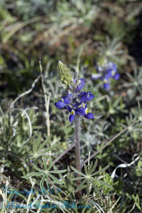
Lupine is a pea, a perennial herb and a favorite of bees. Like other lupines, it improves the soil. Their root nodules, with the aid of certain bacteria, allow lupines and other legumes to absorb free nitrogen from the air.
A member of the Phlox family (Polemonium), this five (5) petal flower bloomed in small groups on erect stalks with sparse leaves. The stamen heads are notable for a bright blue color.
Copyright 2023 Michael Stephen Wills All Rights Reserved
Another blog from my four day solo expedition to Reavis Falls in the remote eastern Superstition Wilderness. Here we will descend briefly to the canyon of Reavis Creek, below the Reavis Falls.
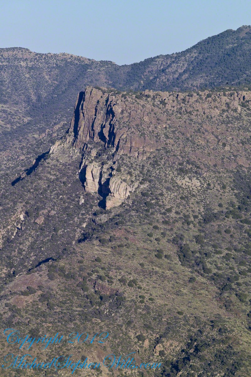
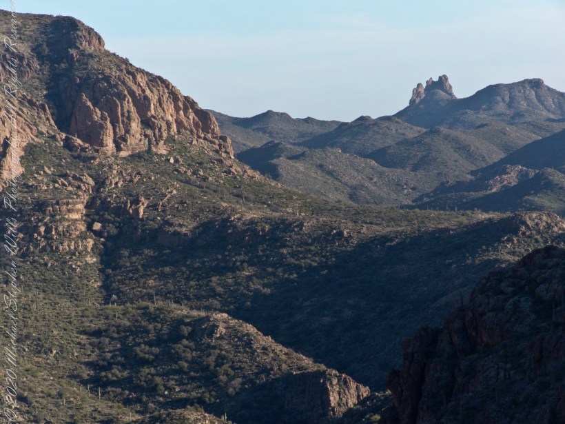
Shadows rising on the canyon walls are from Lime Mountain and Castle Dome. In the far canyon, below Two Bar Mountain, is a shadow from the notable cliff and prominence to the right, that rises above Reavis Falls, fall below and out of sight in the canyon.
Here is that prominence from that same day, late afternoon when the sun is just starting to be low enough to throw the cliff into relief. This is a single shot with a canon 200 mm lens. This day I had climbed out of Reavis Creek, up to to this point on the slopes of Lime Mountain. Here I enjoyed an afternoon, evening, night and early morning of the following day.
The second day of the solo expedition, I hiked into the canyon of Reavis Falls from a camp at the canyon mouth. Looking up from the creek this same cliff was prominant against the sky.
Copyright 2023 Michael Stephen Wills All Rights Reserved
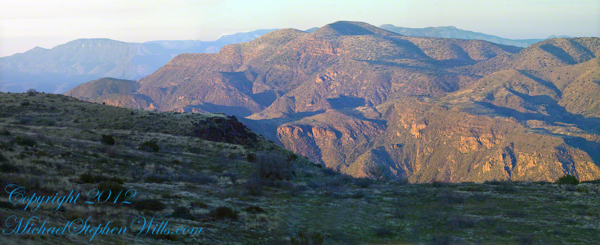
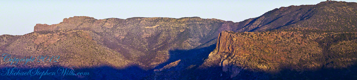
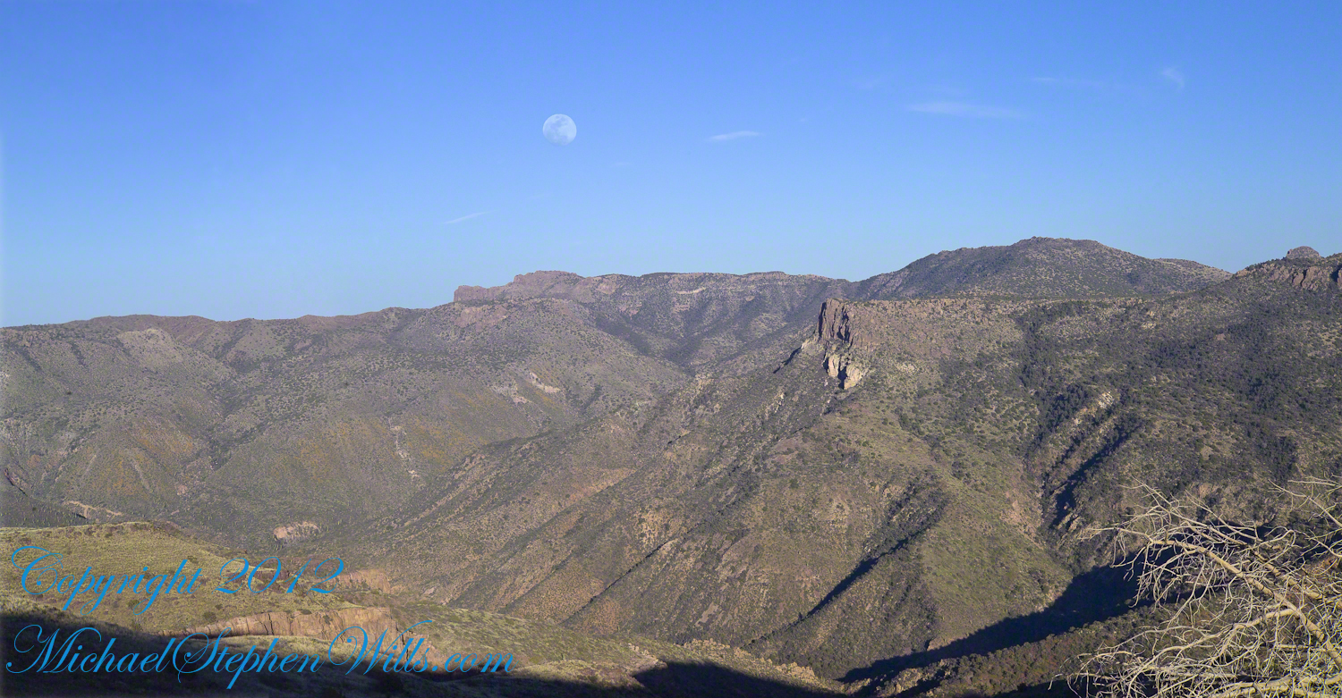
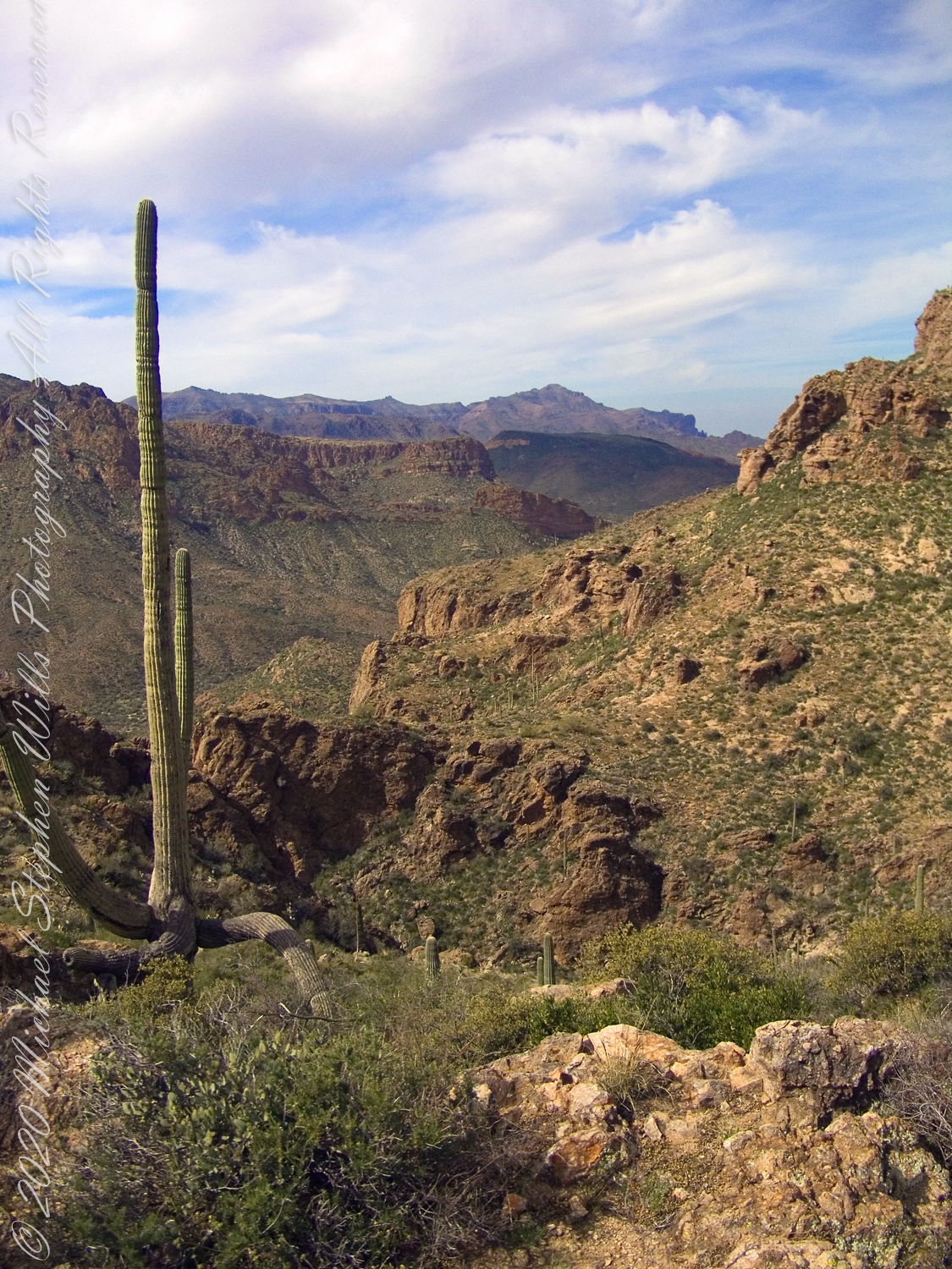
Two Bar Mountain is only part of this view taken the evening of Day Three, my solo expedition to Reavis Falls in the Superstition Wilderness of Arizona.
The view encompasses most of the four day expedition, being the climb into the lower Reavis Creek Canyon from which I camped. I spent one entire day walking up the valley to the falls.
The patches of yellow on the far slopes to the left and into Reavis Valley are Mexican Poppy (Eschscholtzia californica) blooms.
To find lower Reavis Creek Canyon, look for the prominent cliff formation in the very center of the image. Follow the end of the cliff down to a dark shadow. The western canyon wall creates the heavy shadow. As you move to the right, in the image, the shadow becomes wider because the canyon wall becomes higher.
The view also encompasses a 2005 solo expedition over Two Bar Mountain using the Tule and Two Bar Ridge trails into the Superstition Wilderness around Pine Creek. See my blog “Racing the Sun” for an image Two Bar Mountain with the path of (most of) two days of that expedition.
An interesting feature of the full size image (lost in the small-scale reproduction of this blog) is the host of enormous saguaro cactuses marching up the sides of the canyon to the left, thinning out and ending on the western walls of the canyon (the slope directly beneath my viewpoint). Our course, each cactus is perfectly still, casting a huge shadow, and seems very tiny. The nearest is a mile away. We are seeing in this thinning host the lower Sonoran in transition to the upper Sonoran life zone.
All of this in one view from Lime Mountain. Here is another, taken just as the sun set.
Copyright 2023 Michael Stephen Wills All Rights Reserved
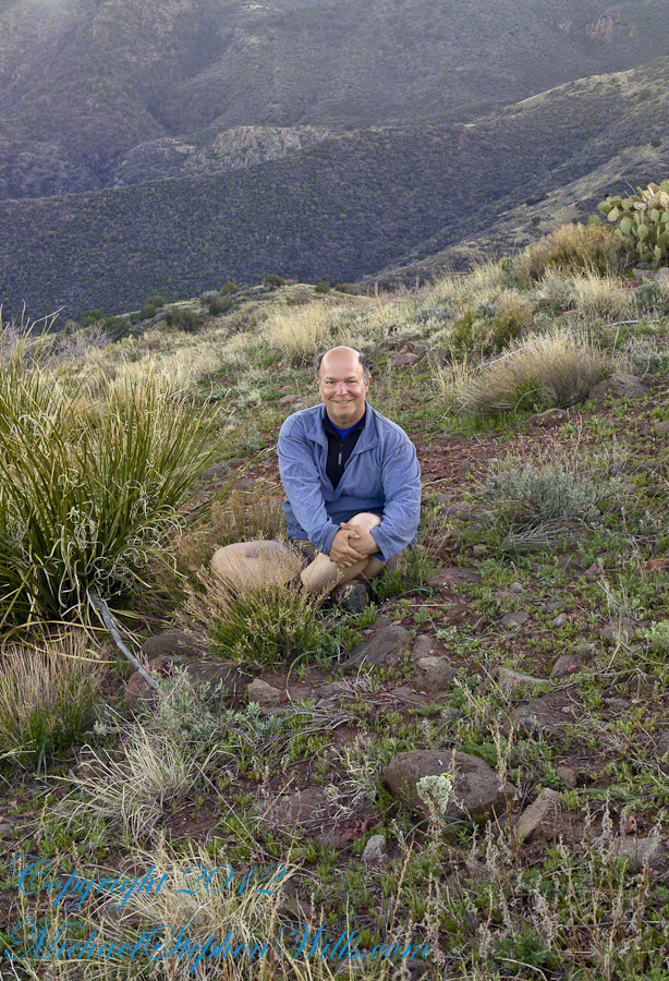
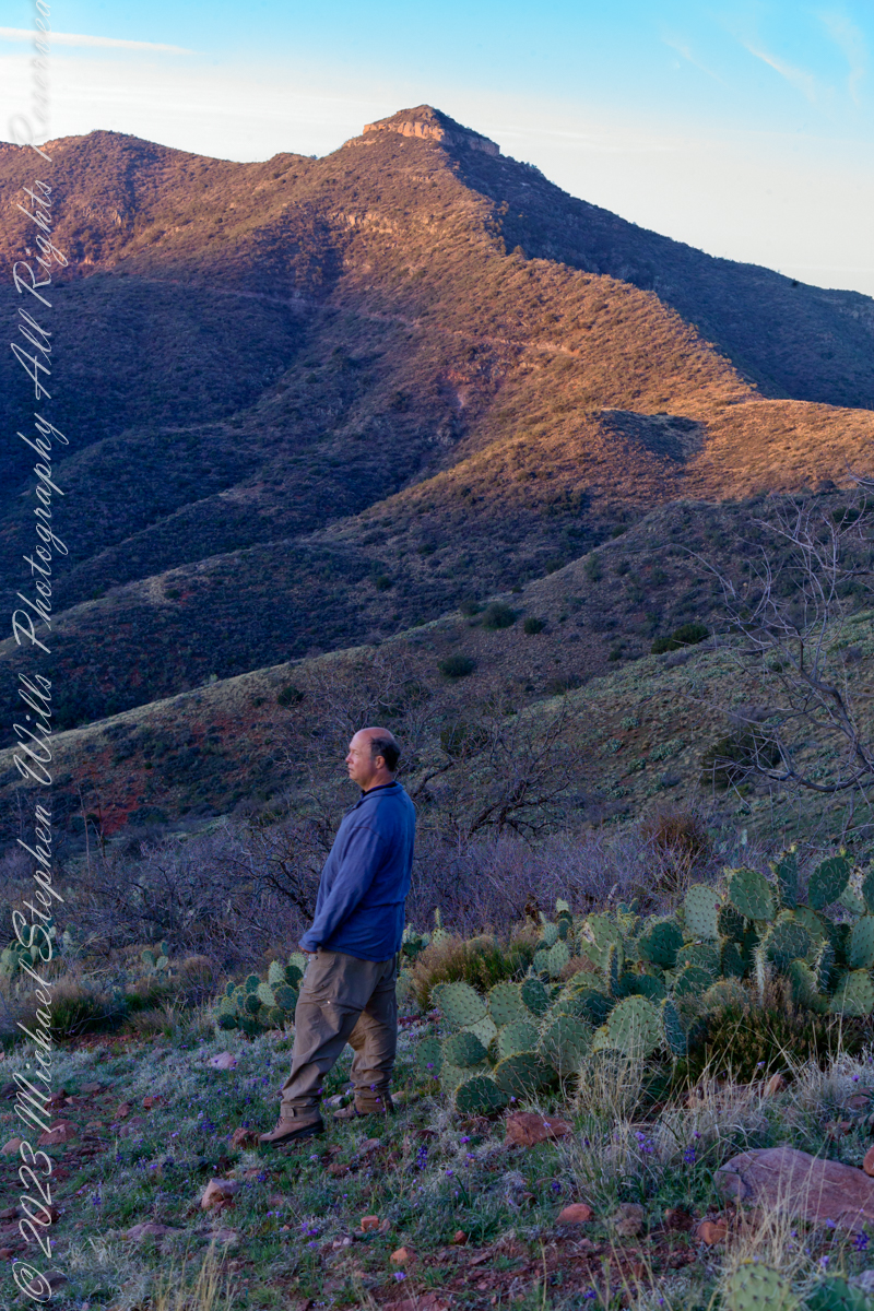
This post features photographs from my solo expedition to Reavis Falls in a remote corner of the Superstition Wilderness of Arizona.
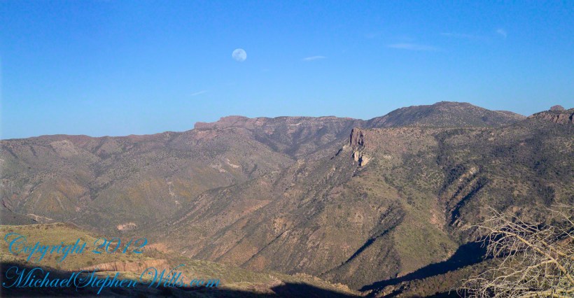
The morning of Day Four, my solo expedition to Reavis Falls in the Superstition Wilderness of Arizona. I camped on Lime Mountain, off the trail to Reavis Falls. That is Castle Dome behind me. The line sloping up the mountain is the Reavis Trail to Reavis Ranch.
My campsite.
Looking toward Pinyon Mountain and the Arizona Trail (not visible) that fine morning.
Copyright 2023 Michael Stephen Wills All Rights Reserved
About 700 years ago, when the expansion of the Mongol empire was under way, on the other side of the planet people discovered a series of caves, formed in tuff, with a favorable location in a south facing cliff near water. Tuff, a rock formed from volcanic ash, is hard, brittle and soluble in water. From these properties this series of caves formed. The southern exposure provided excellent climate control for people, like those we now call the Salado, who understood how to exploit the location.
They constructed from local materials (mud, plants and rock) rooms in the upper cave just far enough inside to be warmed by the winter sun and protected during the summer when the sun’s sky-path was higher. Who knows how long the Salado lived in what must have been this paradise or why they left.
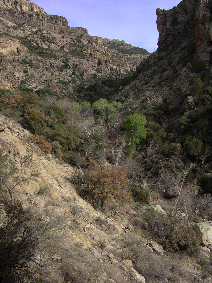
In March 2006, after returning from a nine-day backpack trip to the remote eastern Superstition Wilderness I used a four-wheel vehicle to reach the Roger’s Trough trailhead for a day trip to this site in Roger’s Canyon. The advantage of Roger’s Trough is the high elevation that leaves “just” about 1,100 feet of climbing (2,200 total) for the day. As it happens, it is downhill to the ruins though there is plenty of ups and downs plus scrambling over rocks.
I started late morning and a returning party met me on the way out and warned against leaving packs unattended. It seems they were victimized by pack rats. My timing was lucky and I had the site to myself.
First (refer to the “Roger Canyon” photograph, above) I climbed the cliff opposite from the ruins to set up a tripod an telephoto lens to shoot through the trees to capture the main building inside that very interesting looking tuff (see below). That central column (to the right) divides the cave opening and there are views from inside, up and across the canyon. In season, the cliffs are occupied by nesting birds and, higher up, there are fascinating caves in locations too high and steep to reach without the proper equipment.
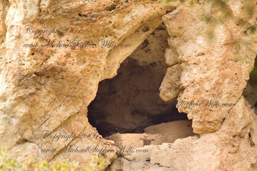
As it is, climbing into the upper cave requires an exposed rock scramble. By “exposed” I mean the climber is exposed to falling. That is an intact wooden lintel of the visible structure opening and the larger structure, to the right, has curved walls.
Salado Cave Ruin
I then explored in and around the site. The location of a lower cave made it useful for storage, it was walled off and the sturdy structure still stands today. By the way, I inverted this view for artistic purposes.
Lower Storage Room
A lower cave is opened and accessible. Looking out, I felt the original inhabitants were with me and then a raven started calling over and over and over.
Lower Cave
I was so fascinated by the possibilities of the site that time got away from me until this incessant cawing of a raven made me notice the lengthening cliff shadows. Here is a view (see below) of my way home, back up Rogers Canyon. My last shot before packing up. It took just over two hours to get out, at a steady pace. It was twilight as I approached the Rogers Trough trail head.
By the way, my posting before this one (“Finding Circlestone”) includes a shot of White Mountain. In that view, these ruins are on the other side of White Mountain.
View up Rogers Canyon from the Ruins
Copyright 2023 Michael Stephen Wills All Rights Reserved
I first learned about Circlestone from stories The Searcher told during my first backpack into the eastern Superstition Mountains, on the Tule trail, April 2005. I described this in “Riding from Pine Creek to the Reavis Valley” where the Searcher described a stone circle, overgrown with Alligator Juniper, on the slopes of Mound Mountain. He pointed south toward a peak and foothills that rose from the valley floor and said, “follow the fire trail east from the southern Reavis Ranch valley.” There were strange happenings associated with Circlestone (as he called it) and he’d never taken the time to go there. “There is a book full of stories.” I eventually sought out Circlestone on the web and in books, but after I found it on my own using only the Searcher’s directions and advice from friends met on the way.
Sunset from Castle Dome
Backpacking with my sister
In 2006 I explored Circlestone twice along with my sister, Diane, who accompanied me. First for nine days early March 2006 using the Reavis Ranch trail from the north and the second for five days in November 2006, coming us the same trail from the south. Our first trip was Diane’s first “real” backpack adventure and we took it slow with a camp at Castle Dome where there are flat areas and exceptional views. Above, is the sunset from our second night (I camped the first night next to the car…we took it very, very sloooowwww).
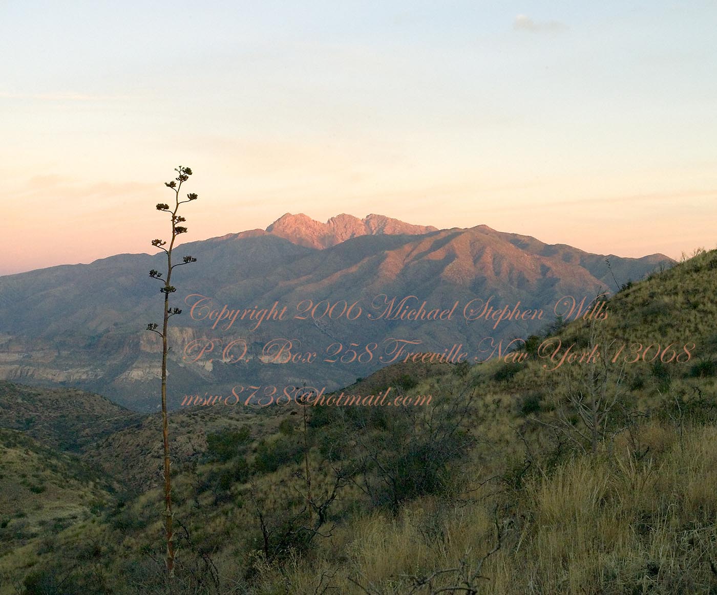
Four Peaks Sunrise
Castle Dome
Then, there was morning of our third day. Here is the Four Peaks Wilderness in the first rays of dawn. These are green, rolling foothills of grass, low shrubs and a few juniper. If you know where to look, there’s an unmarked trail to Reavis Falls (the highest waterfall in Arizona). I found the trail and visited the falls on a later trip.
Castle Dome Sunrise
After enjoying the Four Peaks, you turn around and see Castle Dome in the morning light, as in this photograph. Remember the same of the “dome”, because it is visible from the ultimate view from Circlestone.
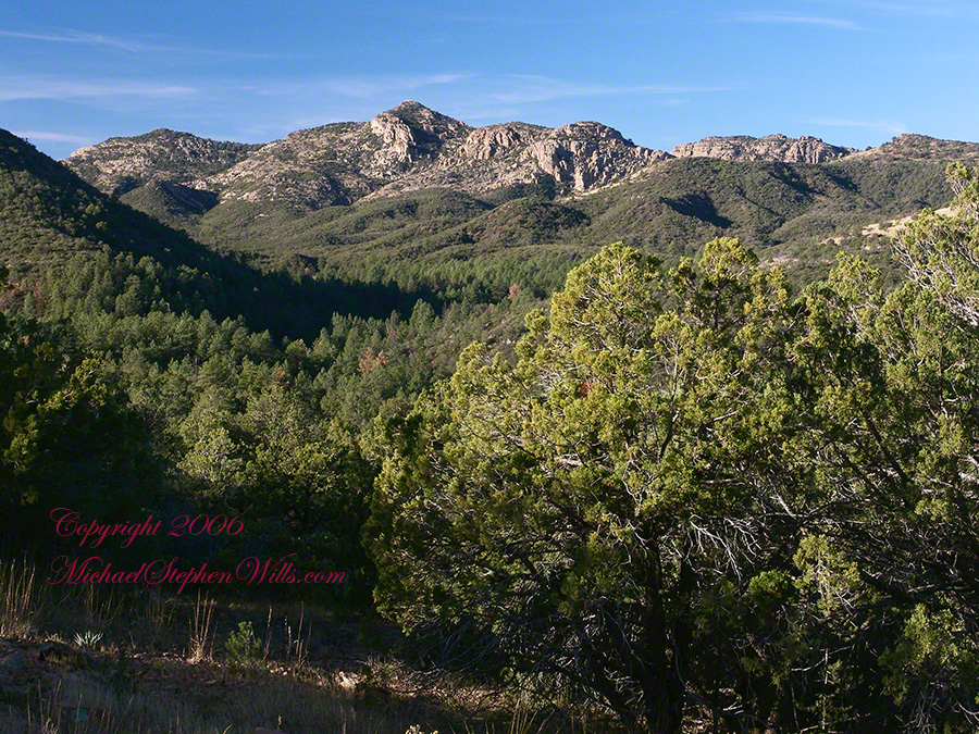
Reavis Valley and White Mountain from the trail to Circlestone
The Trail to Circlestone
Our camp was in the Reavis Valley, one of the first sites along the creek coming from the north. There were fantastic rock formations across the creek. Not far from there, the land falls away into steepness and then Reavis Falls. The Searcher told me about going that way, once. There is no trail down to the falls overlook and deep canyon carved by the water.
This photograph, above, is from a lovely forest of pinyon trees that grow along the trail to Circlestone (described by the Searcher as rising from the southern Reavis Valley). You can see the valley, just to the right, and a longer and steeper valley that rises from it up to White Mountain. That way is the southern legs of Reavis Trail. I have a movie clip from this same spot of the pinyons moving in the breeze and may post it at a later time.
All of the trail to Circlestone is a climb. You pass over “Whiskey Spring”, named for a still kept there in the 1800’s and over a steep defile gouged from the rock. The trail is well marked and I am told that, sometimes, there is no cairn marking the trail to Circlestone. If you are desperate to get there, look-up some excellent hiking directions available on the web. I have even found the circle on GoogleEarth, since I know where to look. If you like a challenge and the adventure, go from the directions the Searcher gave me.
Four Peaks from Circlestone
From the fire line trail, the unmarked branch to Circlestone climbs steeply and follows a ridge through Alligator juniper, punctuated by stalks of century plant, to a broad way that rises to Circlestone as though to a monument overgrown by the same juniper.
My Circlestone Mystery
There was an unusual experience on our first trip, on this portion of the trail. We were winding through the Juniper and, as it happened, Diane fell behind. After awhile I missed her and waited and, after a minute, went back to look for her. I found Diane sobbing uncontrollably, deep in grief over our father who passed away eleven years before. We talked about it until she felt better. She said it was as though a door opened and she could feel out father. What makes this exceptional is Diane is not given to anything like this and I ascribe her deep grief to the nature of the site. It is a mystery to this day.
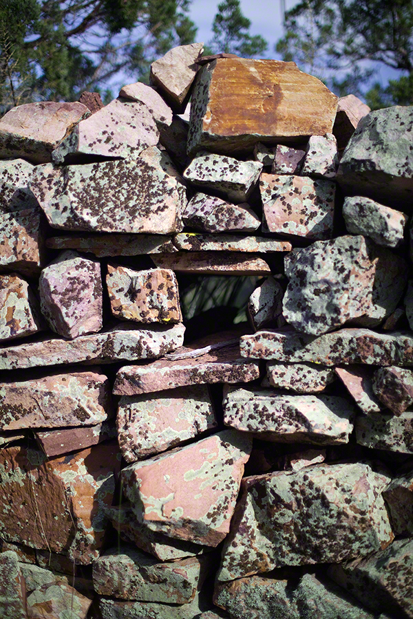
At Circlestone, that first trip, we explored and experienced the site. You cannot see the entire wall at any point and need to wander through and over it, being careful not to disturb anything. Here and there, in the outer wall, are openings like the one in this photograph.
Site-Hole in the Circlestone Wall
At Circlestone
I call it a site hole because, on your knees, it is possible to look through and see the distant view through the trees. As you can see, the stones are a striking red color with green lichen growing thick.
On the second trip in November, knowing the way and having great weather, I brought my cameras to capture the exceptional views, one of which is above. I’d dearly love to come back to camp just below the ruin and do some work in the evening and morning light. For now, I can enjoy those views from Castle Dome.
Three Horsemen and Castle Dome
Can you see the dome in the middle distance. I did a portrait of three horsemen who road up to Circlestone in November. We came to know them pretty well, that afternoon and the following morning down in the valley.
Three Horsemen
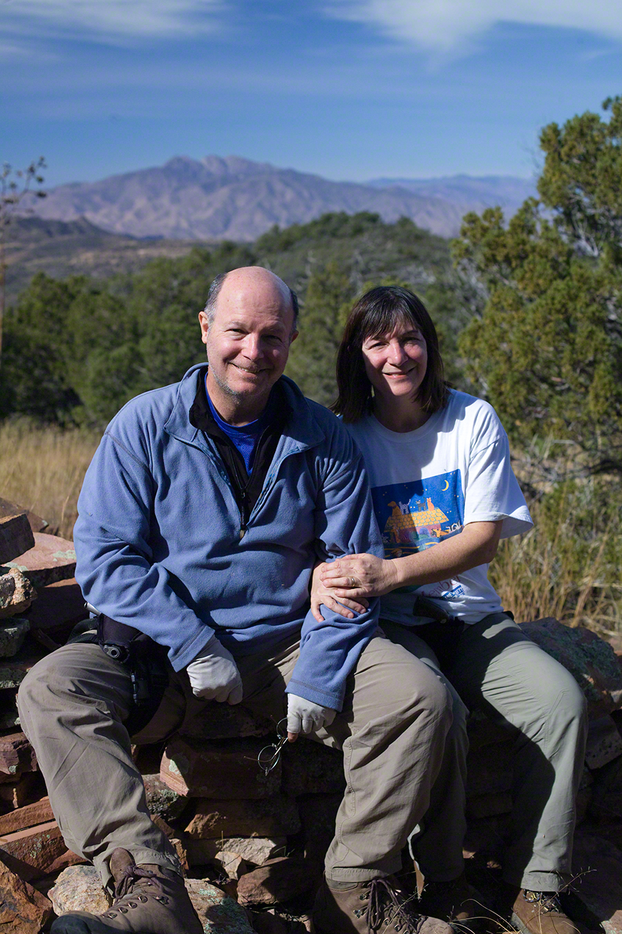
I carted up a tripod, so you can see Diane and I in the same spot.
Mike and Diane at Circlestone
Copyright 2023 Michael Stephen Wills, All Rights Reserved
View North / Northwest from Peter’s Mesa. At our feet is a mature Saguaro Cactus towering over Charlebois Canyon, to the right Black Mountain. Bluff Spring Mountain, middle distance, then Black Top Mesa. Flatiron Peak, of the famed Superstition Mountain, is in distance. Photographed from Peter’s Trail on a March afternoon 2008. Superstition Wilderness, Tonto National Forest, Arizona
Bluff Spring Mountain, middle distance, then Black Top Mesa. Flatiron Peak, of the famed Superstition Mountain, is in distance. Photographed from Peter’s Trail on a March afternoon 2008. Superstition Wilderness, Tonto National Forest, Arizona
The eye of Miner’s Needle is clear in both these South / Southeast views from Peter’s Mesa looking across the Music Canyon.
Morning
Many wildflowers, sprinkled like stars through the foreground of the morning photograph with Prickly Pear, Cholla and Saguaro cactus. Beware of “Jumping Cholla”, named for its seeming ability to attack passers-by. Another name, “Hanging Chain Cholla”, is more appropriate. Each chain with many hooked barbs is lightly attached to the branch, ready to snag a ride from unwary hikers.
Light rakes across the landscape in the evening photograph, taken from another vantage point on Peter’s Mesa. Miner’s Needle is four (4) miles away “as the crow flies,” i.e., line of sight distance.