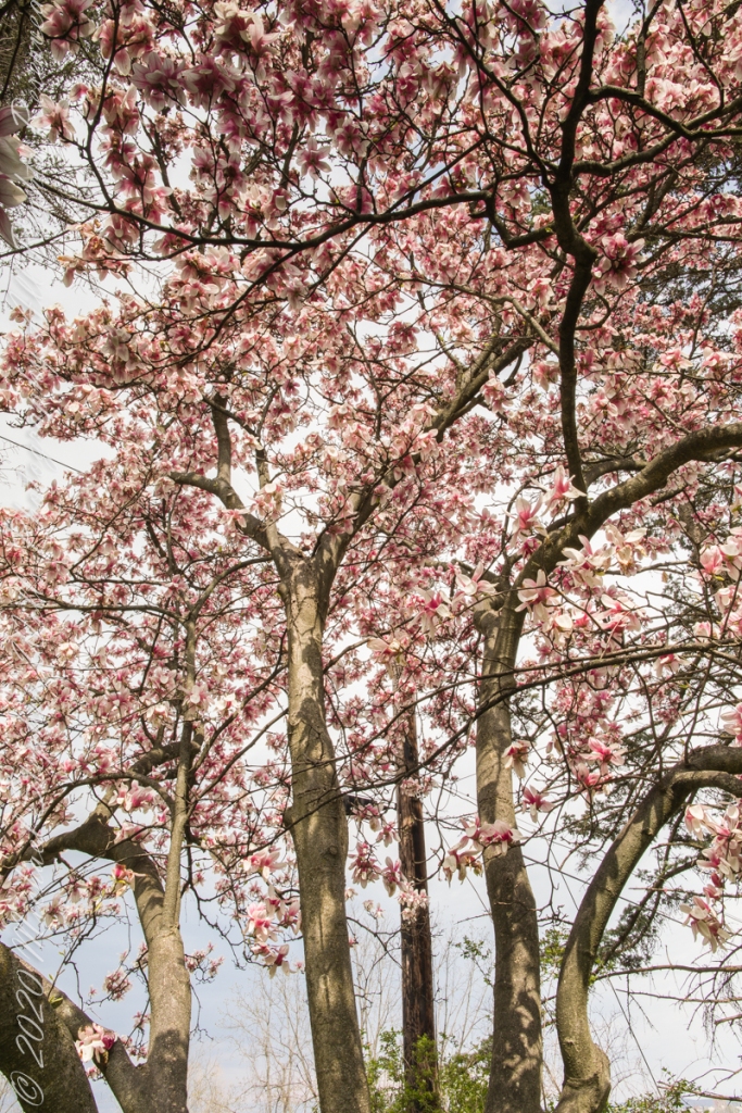
The Magnolia genus has been around for eons, come characteristics are protective from beetles as they existed before bees and relied upon beetles for fertilization. Our’s may be the species Magnolia dawsoniana (Dawson’s Magnolia), it shares many of the published characteristics: among them tolerance to our hardiness zone 5, flower color and shape, tree growth pattern.
This was an exceptional year for blooms. starting late April, lasting into May. The fence around trunks is for protection against bucks (male deer), from rubbing their horns in autumn.
Canon 50 mm f1.2
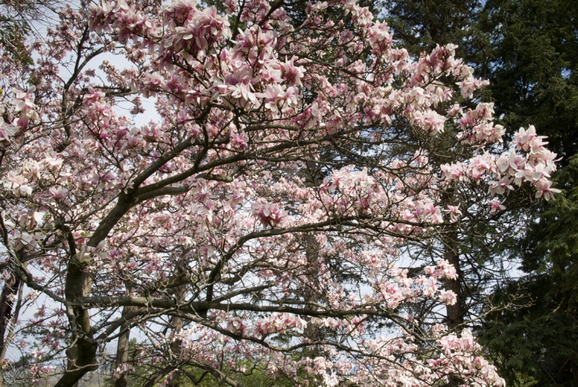
For most of these 2021 photographs I used the lens Canon 24 mm f/1.4L II USM, the one captioned 50 mm I used Canon 50mm f/1.2L USM. The Canon EOS 5D Mark IV dslr with the Manfrotto Studio tripod with hydrostatic ball head for all.
The last great year was 2018……
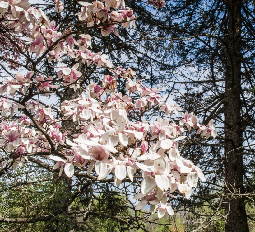
Canon 100 mm “macro” lens
For these 2018 photographs the Canon 24 mm and Canon EF 100mm f/2.8L “Macro” lenses with Canon’s EOS-1Ds Mark III dslr.
Copyright 2021 All Rights Reserved Michael Stephen Wills
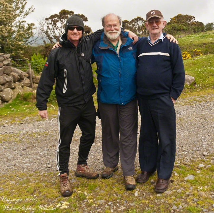
On Monday, June 9, 2014, cousin John Mills dropped his son, Sean Mills, myself and Pam Wills off at the foot of the western slopes of Slieve Foy on the Tain Way. Sean, Pam and I walked the way over the mountain and into Carlingford in the footsteps of epic Irish heroes.
Our guide, Sean Mills, proposed the walk and it fell on our last full day in Ireland. Sean’s father and our host for this visit, John Mills, transported the group including my wife Pam to the starting point at the foot of Slieve Foy.
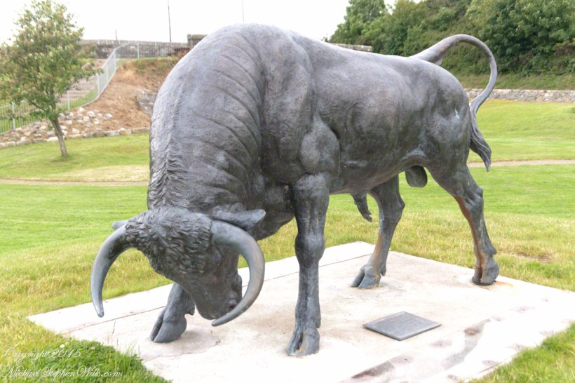
Yes, if there is any part of the Tain Way the the mythic Irish heroes trod it is this one over Slieve Foy mountain. The saga, in Irish “Táin Bó Cúailnge” and “The Cattle Raid of Cooley” in English, features this bull, “Donn Cuailnge” “The Brown Bull of Cooley”, here as a statue erected 2011 by the Grange and District Residents Association.
Donn Cuailnge raged over the very slopes we walked this day. The myths themselves fill a volume and I am unable to do them justice here.
On the way, John stopped at the Old Aghameen School he attended in the late 1930’s early 1940’s 70 years before and we pass through the country soon to grace our views.
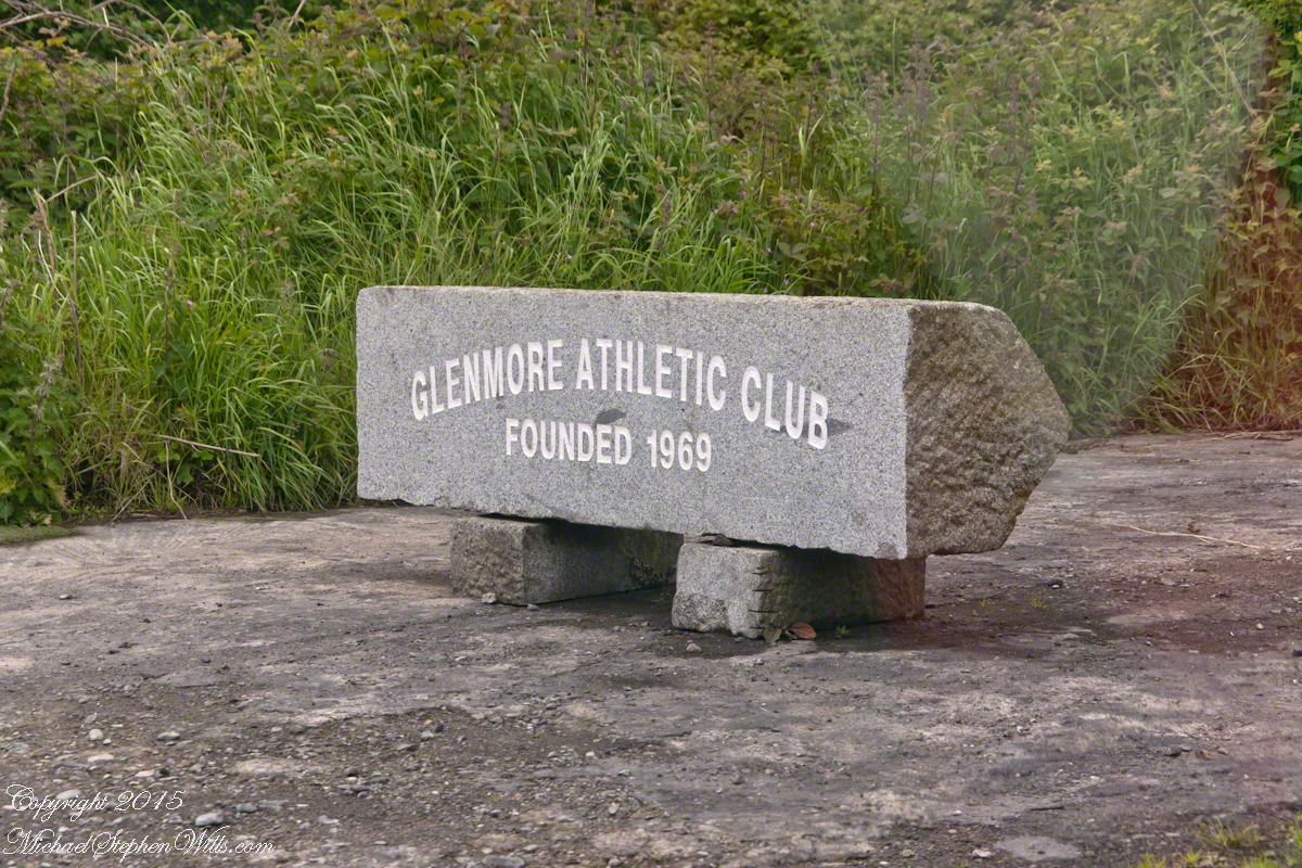
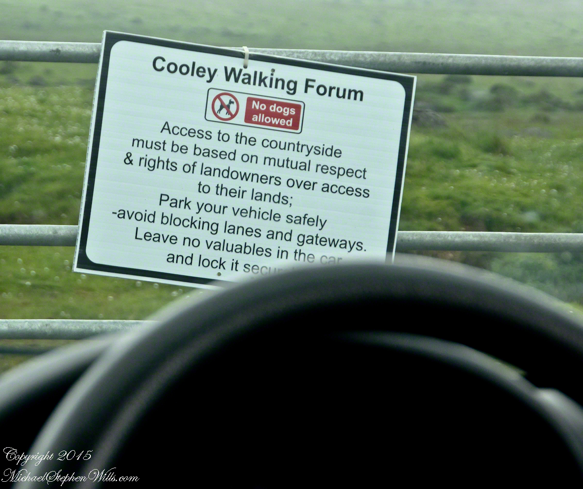
Many thanks to the Glenmore Athletic Club, the Cooley Walking Forum and land owners who provide access to the Tain Way.
We had our leave taking with John, who planned to stay near the phone for our call from Carlingford, if all went according to plan. That same year Pam had the first of two total knee replacements. This was our longest hike in Ireland and Pam was not likely to miss it, regardless of any pain. Pam is always ready to smile.
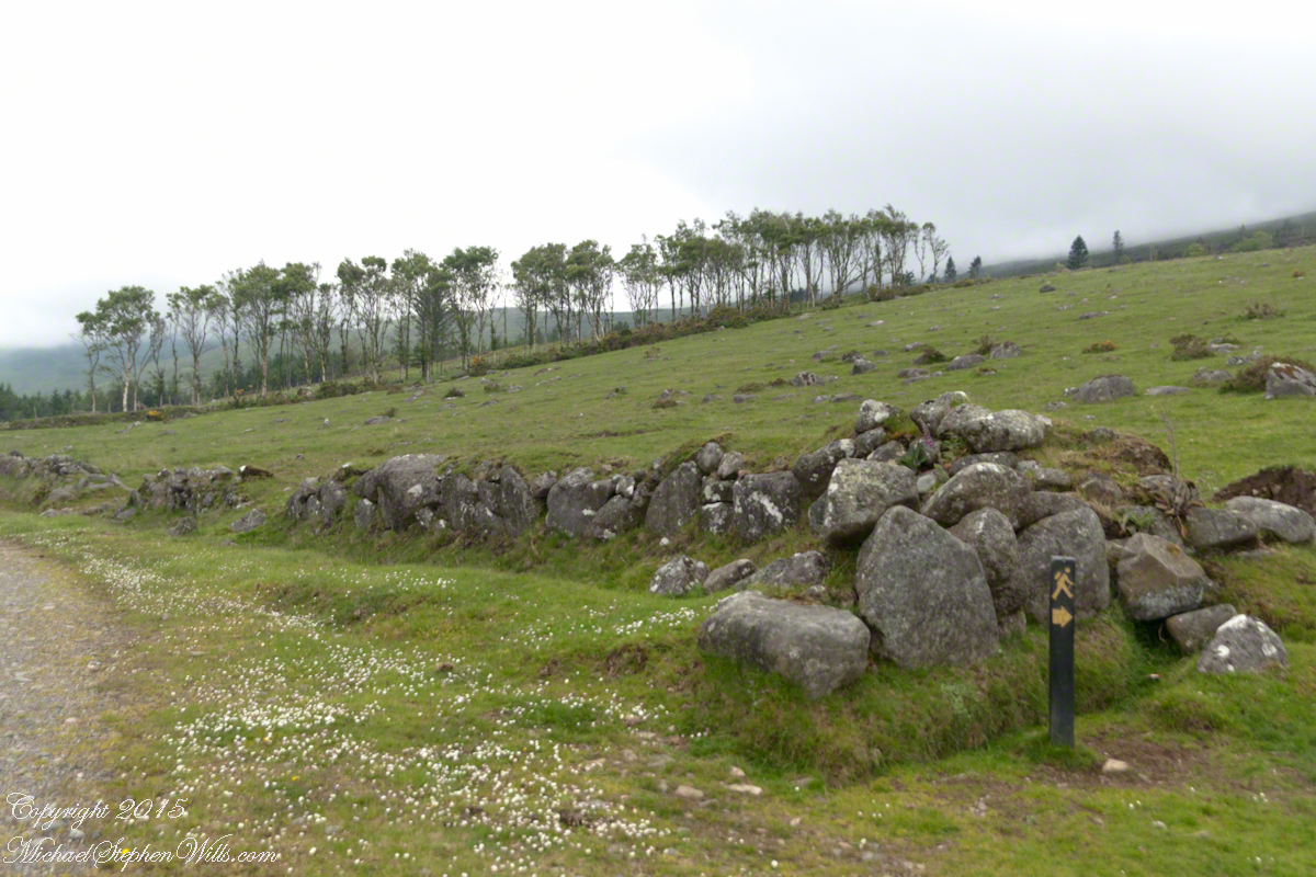
At start, the Tain Way is broad, green and welcoming.
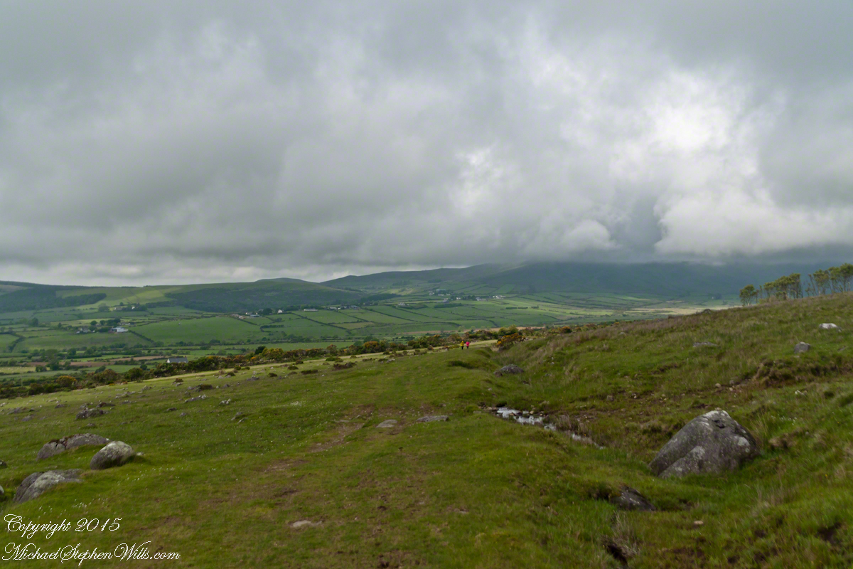
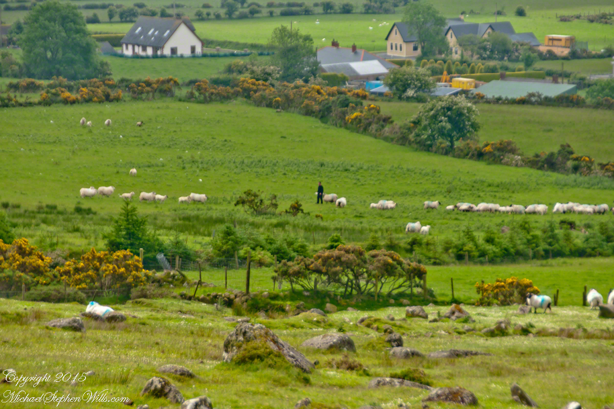
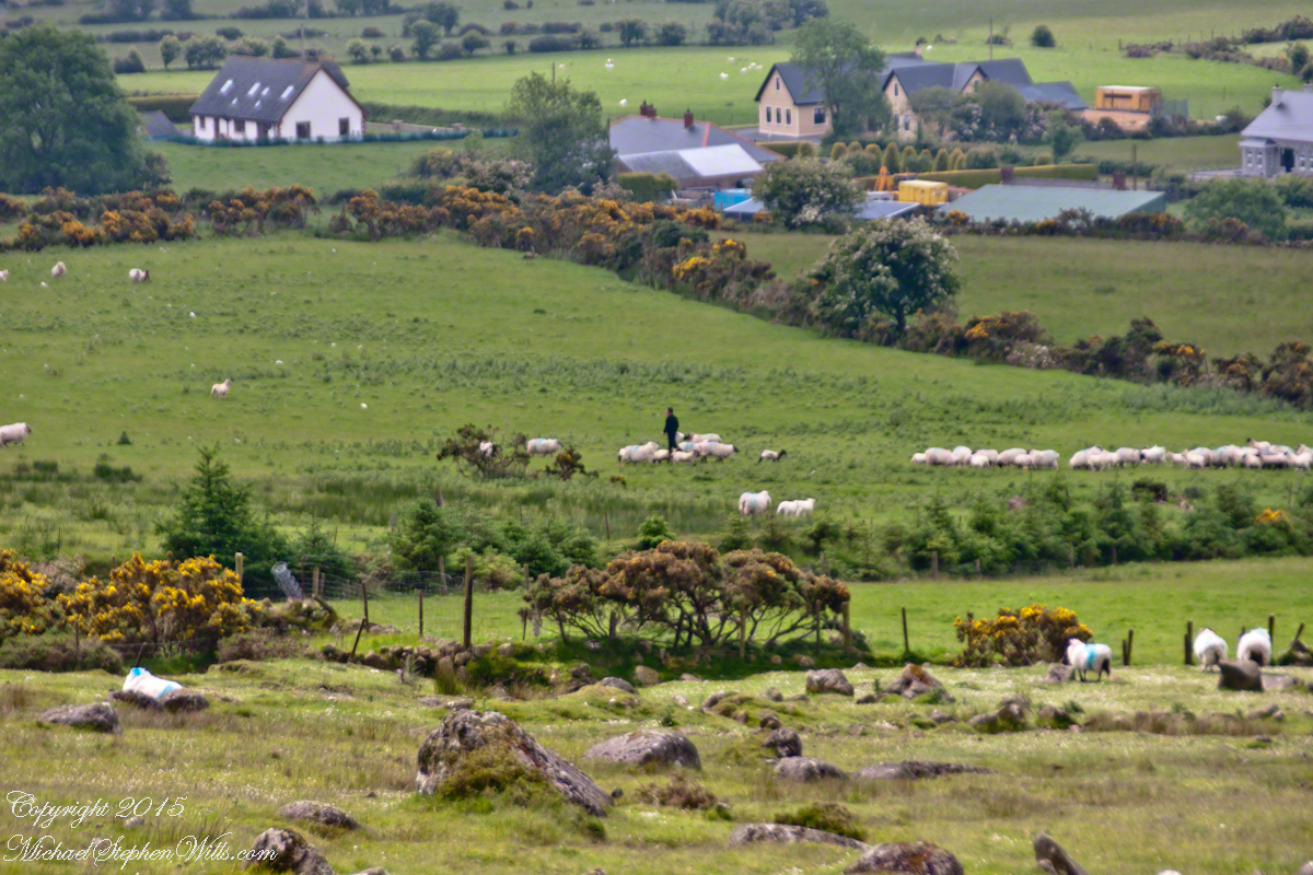
The western slopes of Slieve Foy hold views of a valley among the Cooley Mountains with Dundalk Bay of the Irish Sea to the south / southeast. It was not long before the view started to open and, then, opened and opened the entire walk to the top. We were graced with a lovely, cloudy, June day. Mist only, no rain. Plenty of wind, not strong.
Farms are all about. Here a farmer attends to the flock. They know who he is.
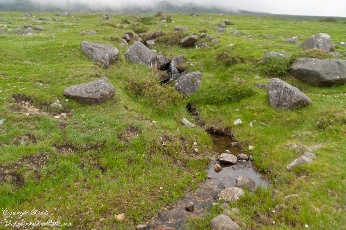
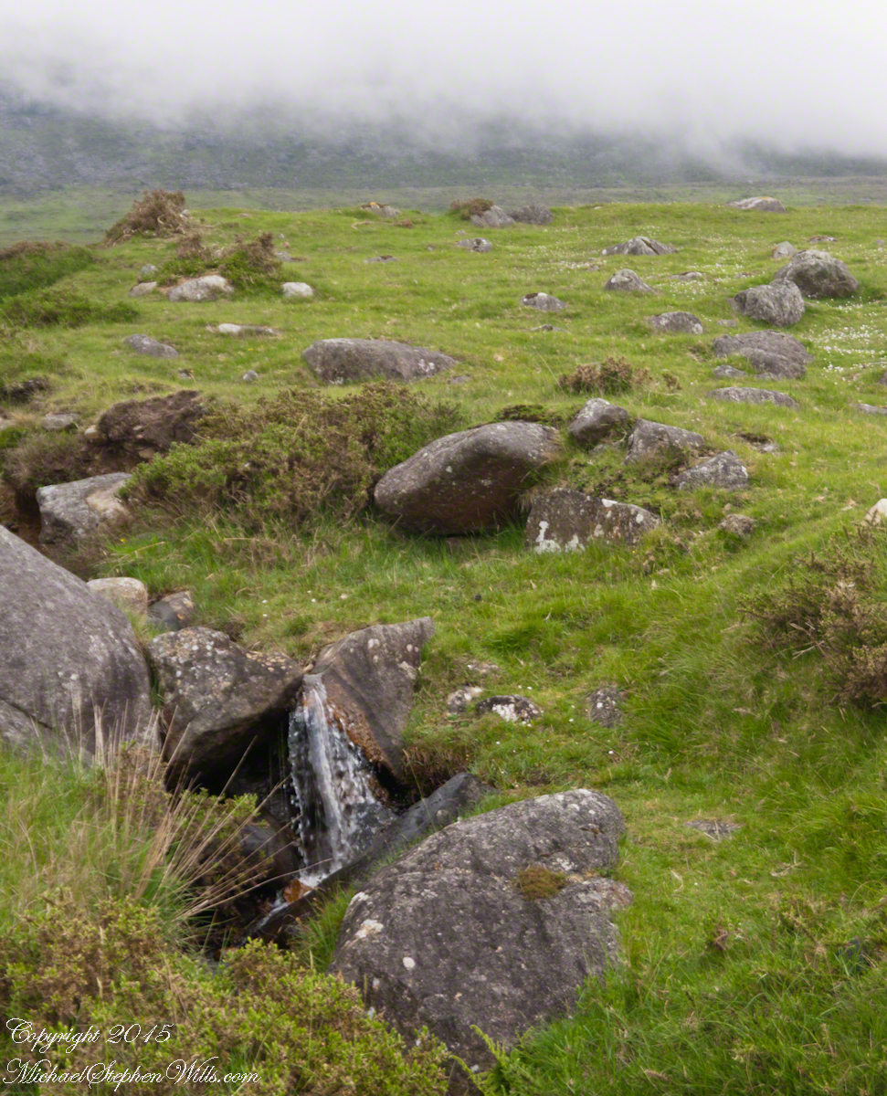
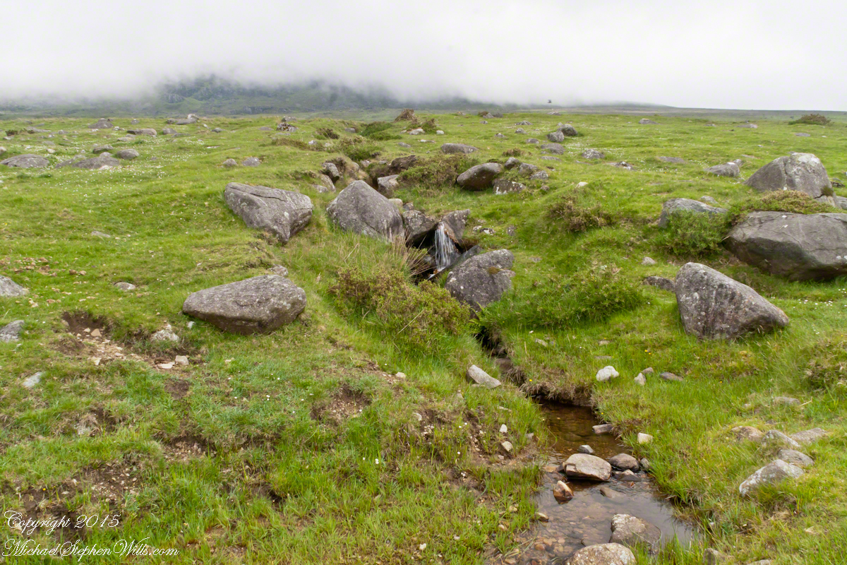
The lower slopes hold many small stream among granite stones.
I will continue with our walk on the Tain Way soon enough.
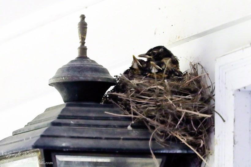
Our backyard robins returned this year. Pam, remembering the “miss” they made on her roses, tore down the first bits of nest on our carriage light. They persisted and I implored her to “have a heart,” agreeing to look after their mess. Here she is in the second day, note how she shimmies to form the nest bowl.
Copyright 2021 All Rights Reserved, Michael Stephen Wills
Now’s time to share a trinity of images from a morning spent about the Skellig Islands May 2014.
Pam and I have many stories from that day, a favorite is from the parking lot of Portmagee where we met the fast boat to the island. I prepared for the day by making a reservation for our ride. We traveled from Killarney, where an early morning breakfast feast spread by The Killarney Royal Hotel fortified us for the adventure. Throughout our tour, experiencing Ireland was like taking blinders off, this first experience on The Ring of Kerry was no exception, driving on a tight timeline to reach Portmagee with minutes to spare, every turn of the road presented a new delight.
Grateful to have made it to Portmagee, we quickly pulled our kit together. As I closed the bonnet, Pam exclaimed “our umbrellas.” At this point of the story we laugh together. Umbrellas indeed. I had a dim clue of what lay in store for us and insisted the umbrellas be left behind, a counter-intuitive decision for a rainy Irish day the Wild Atlantic Way. Regardless of the time, we needed a bathroom break as there will be no facilities on the fast boat or the World Heritage Site where there is no space for human waste products.
Click any photograph for my Online gallery.
I was here perched on a cliff of Valentia Island across from Portmagee looking southwest across Valentia Sound.
The humor is in our welcome aboard the fast boat, like a fishing boat with a small cabin and small deck dominated by the engine hatch. We crowded on, handed a full set of fisherman slickers. This is a heavy coat with hood and pants, all waterproof. Our close timing guaranteed the worse seat, away from the cabin in the open. It was a new experience for us and we felt a sense of dread as the craft left the protection of Valentia Sound into the open Atlantic Ocean.
We faced a west wind, driving 12+ foot waves, as the boat breached each wave the crest went over the cabin in a waterfall of salt water. Up and down, up and down. Thankfully neither of us lost breakfast as some did. I do not have photographs of the trip out or the approach to the island, my equipment was safely packed away.
In the above photograph you see the entire course of our approach to the island, a bit more than 10 (land) miles from Portmagee. We toured Valentia Island that afternoon.
Click any photograph for my Online gallery.
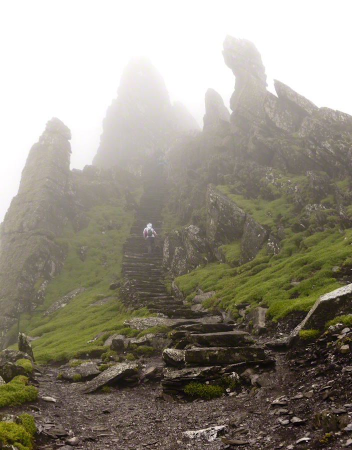
Climbing the side of Skellig Michael, approach to the peak and monastery.
There is a fair climb to the top to view the former monastery buildings. The steps are uneven and, when wet as it was that day, slippery. I wore a waterproof North Face shell with hood for the low threatening clouds. There was no rain as such, a constant fog on the top kept all exposed surfaces wet.
From the point on, until the top, was the most exposed and uncomfortable (frightening, chilling…you get the idea). Spare yourself the experience if you are afraid of open spaces and heights. Here was a stiff wind blowing from the right, on the left the cliff falls away to the ocean. Ahead, the path narrows to about 10 inches with a cliff wall on one side, the precipice on the other. Then come the monastery entrance and rock wall safety.
Click any photograph for my Online gallery.
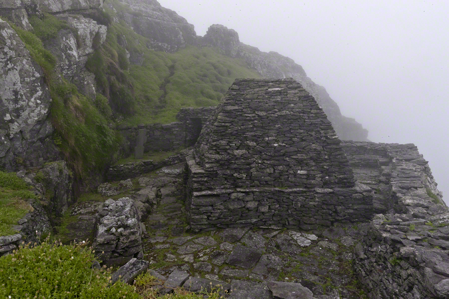
Monk Cell, Grave and Cross
This single image gives a succinct impression of the monastery setting. The bee hive shaped stone monk cell requires a stooped crawl to enter. Inside, the space is small and, thankfully, dry. The structure keeps out the rain and wind, a marvel of stone construction. This cell is off to the side, on a cliff balcony, over the wall an ocean precipice.
My closing advice is to plan your time wisely. The ship boards in less than an hour, in that time you climb the 700 steps and explore. There are people all over the place, in waves. To capture the structures without humans, you need to wait until the cohort become bored and leaves. There will be a space before the next wave of tourists breaks. Leave enough time to descend the steps safely. People have suffered fatal falls on the steps and cliffs, it is easy to do. Make your personal safety a priority.
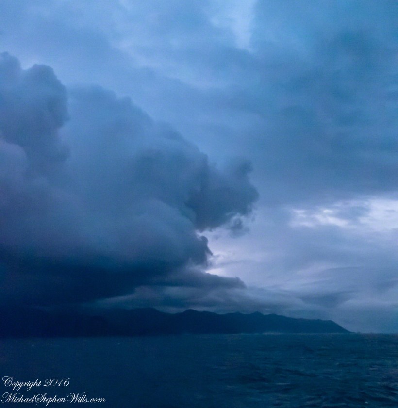
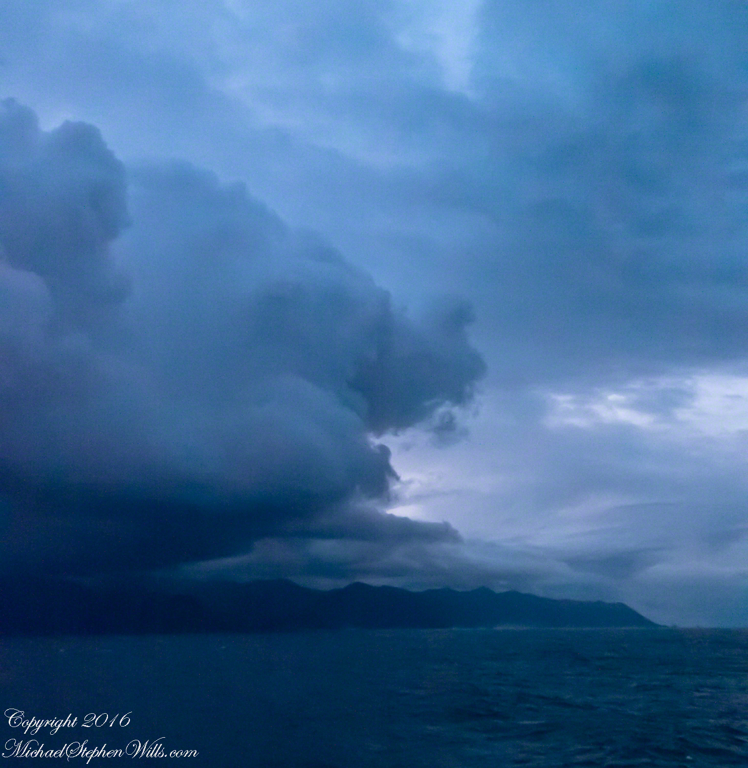
Rounding the Aysen Region headland of the Penas Gulf. Next land will be the Magellian Region extending to Cape Horn. In the Penas Gulf we will enter the Messier Channel and the fjords.
Taken with a tripod mounted Sony DSLR A 700 DT 18-200 variable lens set to 18 mm. 1/40 second at f4.5 ISO 6400. The sun was still low, after sunrise with gathering storm clouds from the terrace of our state room (a moving ship).
Our early morning traverse of the Penas Gulf was smooth sailing in route for Tarn Bar, entrance to the Messier Channel. We’ll pass Wager Isle where May 14, 1741 the H.M.S. Wager wrecked, stranding the crew. Speaking to the conditions on board, immediately some of the crew broke into the “Spirit Room, got drunk, armed themselves and began looting, dressing up in officers’ clothes and fighting,” many drowning the next day when the Wager flooded and sank.
The original fronts piece to Byron’s Narrative; “Being an Account of the Shipwreck of The Wager and the Subsequent Adventures of Her Crew.”
The remaining 140 officers and crew manned the boat to make for shore in the Patagonian winter. Five years later, midshipman John Byron, grandfather to the poet Lord Byron, made it back to England with the Captain David Cheap. Just west of Wager Isle is the larger Byron Isle, named in his honor.
On this south heading our cabin on the port side faced east. In these early morning hours, I set up on the stateroom balcony, so for better or worse there is no views of either Wager or Byron Isle.
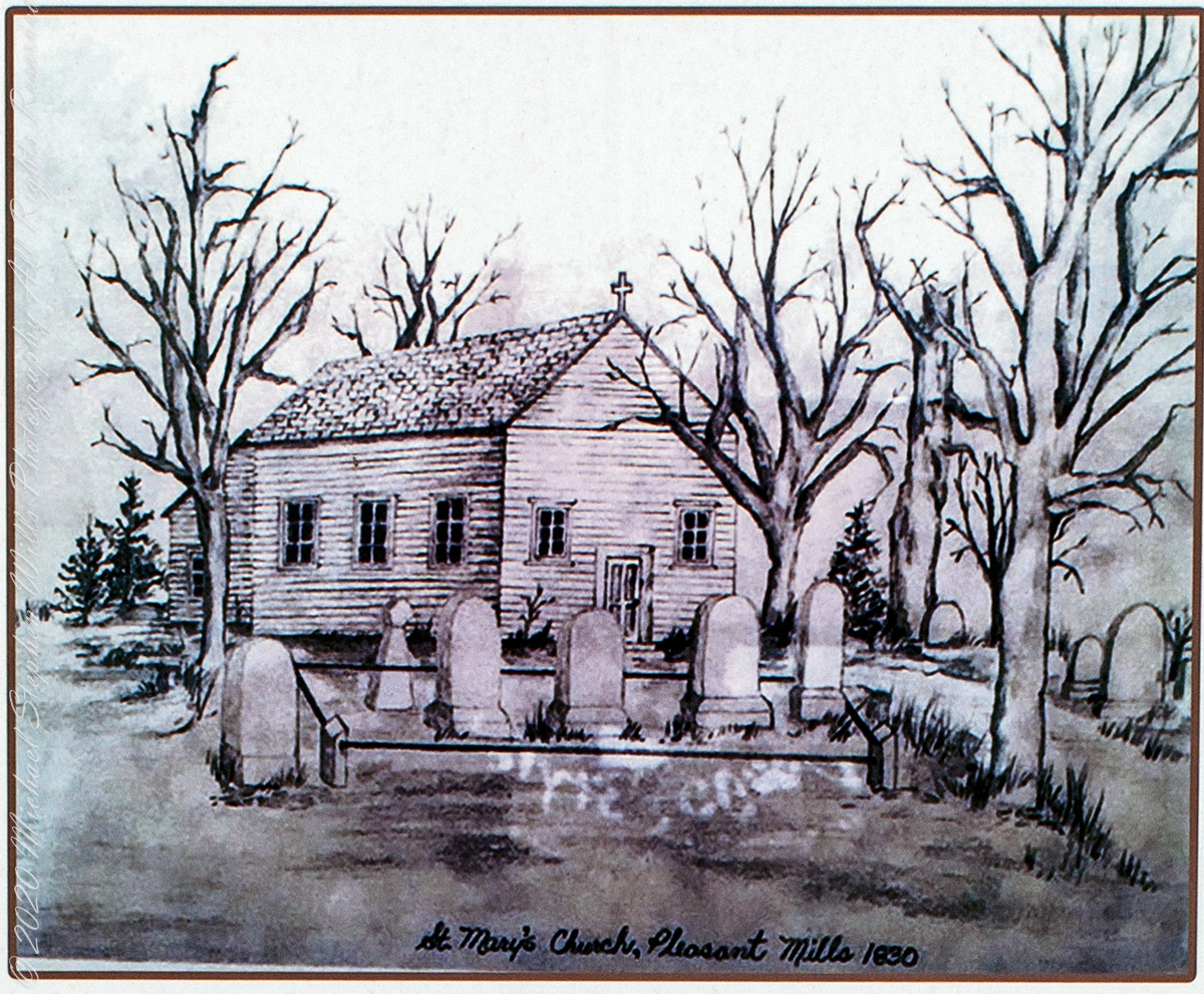
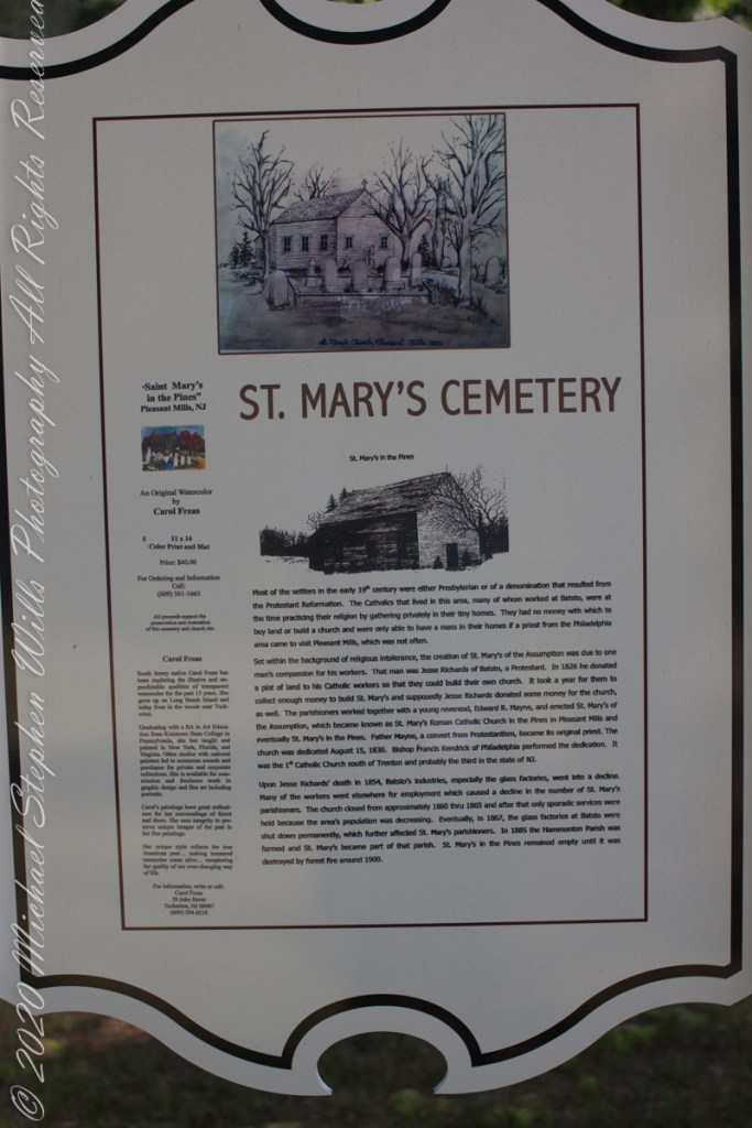
The Pinelands chemical reactions / iron furnaces of Part III are elements of the warp and weft of our family’s story. Saint Mary Assumption (“Saint Mary’s of the Pine”) Roman Catholic church was another. Family members comprise 60% (60 percent) of the burials, comprising these family names: Dellett (see Pinelands Connections I), Milley, Wills, McCambridge.
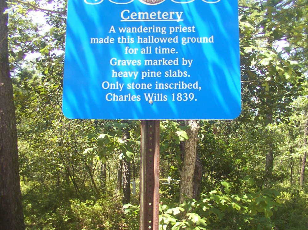
photoshopped from the historical sign on site by Michael Wills
“Most of the settlers in the early 19th century were either Presbyterian or of a denomination that resulted from the Protestant Reformation. The Catholics that lived in this area, many of whom worked at Batsto, were at the time practicing their religion by gathering privately in their tiny homes. They had no money with which to buy land or build a church and were only able to have a mass in their homes if a priest from the Philadelphia area came to visit Pleasant Mills, which was not often. Set within the background of religious intolerance, the creation of St. Mary’s of the Assumption was due to one man’s compassion for his workers. That man was Jesse Richards of Batsto, a Protestant. In 1826 he donated a plot of land to his Catholic workers so that they could build their own church. It took a year for them to collect enough money to build St. Mary’s and supposedly Jesse Richards donated some money for the church, as well. The parishioners worked together with a young reverend, Edward R. Mayne, and erected St. Mary’s of the Assumption, which became known as St. Mary’s Roman Catholic Church in the Pines in Pleasant Mills and eventually St. Mary’s in the Pines. Father Mayne, a convert from Protestantism, became its original priest. The church was dedicated August 15, 1830. Bishop Francis Kendrick of Philadelphia performed the dedication. It was the first Catholic Church south of Trenton and probably the third in the state of New Jersey. Upon Jesse Richards’ death in 1854, Batsto’s industries, especially the glass factories, went into a decline. Many of the workers went elsewhere for employment which caused a decline in the number of St. Mary’s parishioners. The church closed from approximately 1860 through 1865 and after that only sporadic services were held because the area’s population was decreasing. Eventually, in 1867, the glass factories at Batsto were shut down permanently, which further affected St. Mary’s parishioners. In 1885, the Hammonton Parish was formed and St. Mary’s became part of that parish. St. Mary’s in the Pines remained empty until it was destroyed by forest fire around 1900.” From the sign “St. Mary’s Cemetery, St. Mary’s in the Pines”).
Saint Mary of the Assumption Historical Sign
The historical sign includes an offer in support of the preservation and restoration of the cemetery and church site. An original water color (pictured above) by Carol Freas, 11×14 color print and mat, Price $40.00. For information, write or call Carol Freas, 39 John Street, Tuckerton, NJ 08087 (609) 294-0218
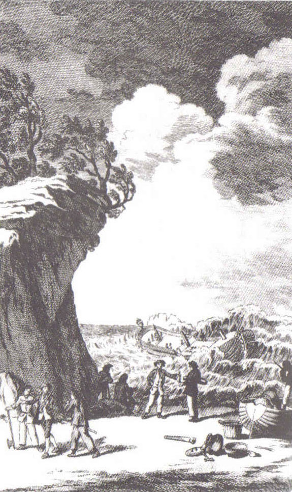
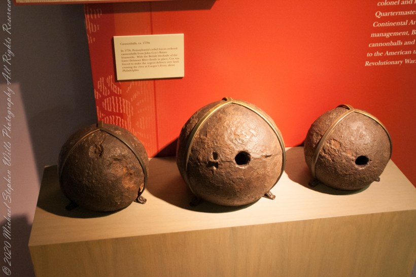
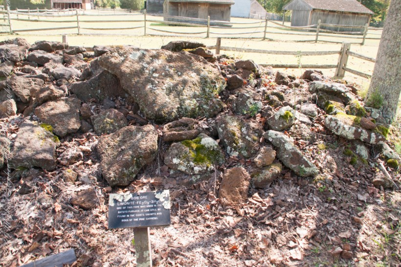
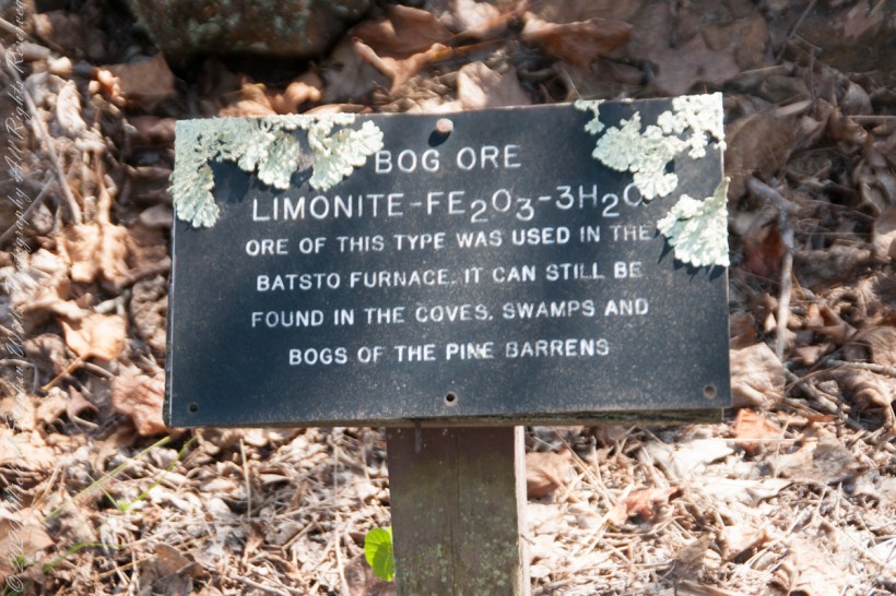
“There was also iron in the Pinelands. Most of the now vanished towns in the pines were iron towns — small, precursive Pittsburghs, in every part of the forest, where fine grade of pig and wrought iron were made. One of the geological curiosities of the Pine Barrens is that rainwater soaking down through fallen pine needles and other forest litter takes on enough acid to leach out iron from the sands below; the dissolved iron moves underground into the streams, where it oxidizes on contact with the air and forms a patch of scum on the surface that is partly rust brown and partly iridescent blue, and resembles an oil slick left by an outboard motor; drifting over to the edges of the streams, this iron-oxide film permeates the sands and gravels of the riverbanks and cements them together into a sandstone composite that has been known for centuries as bog iron. From it ironmasters of the Pine Barrens made cannonballs by the thousand and then them by wagon over the sand roads and on to the Continental Army at Valley Forge and elsewhere.” From The New Yorker magazine, November 26, 1967, “Profiles, The Pine Barrens I” creative non-fiction by the great John McPhee.
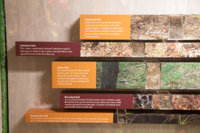
Pinelands Soils
Bog Iron
Bog Iron Cannonballs
Batso Village Exhibits
“In 1770, a Philadelphian named John Cox was a member of the first Committee of Correspondence and a member of the Council of Safety. With the coming of war, he became a lieutenant colonel and, eventually, assistant quartermaster general of the Continental Armies. His ironworks at Batsto flourished on war contracts from the Quartermaster Corps. In 1778, Cox sold Batsto for forth thousand pounds — a capital gain of about sixteen hundred per cent……Batsto was to reach its most developed stage in the eighteen-thirties and eighteen-forties, when the town had a population of eight hundred. Batsto is one of the few iron towns that remain in the Pine Barrens. …..The state has restored its water-powered sawmill, and sawyers cut white cedar there and make cedar shingles for use in restoration of Batsto buildings.” From The New Yorker magazine, November 26, 1967, “Profiles, The Pine Barrens I” by John McPhee.
Competition from more productive sources of iron and the coal-fired Pittsburg furnaces brought down the Pinelands iron works at their height. By 1848 the furnace at Batsto was cold.
“Driving along a sand road between the vanished town of Calico and the vanished town of Munion Field, we passed a house that was so many miles from any other house that Fred said, with evident admiration, “He got well in away from everybody, didn’t he?” Fred made a similar remark every time we passed a house or cabin that was particularly deep and alone in the weeds. Getting — or staying — way from everybody is a criterion that apparently continues to mean as much to many of the people in the pines as it did to some of their forebears who first settled there. Tories, for example, fled into the pines during the American Revolution. People with names like Britton and Brower, loyal to the King, and sometimes covered with feather and tar, left their homes in colonial cities and took refuge in the Pine Barrens. Also, during the eighteenth century, when the farmlands of western New Jersey were heavily populated with Quakers, the Pine Barrens served as a catch basin for Quakers who could not live up to the standards of the Quaker code….” From The New Yorker magazine, November 26, 1967, “Profiles, The Pine Barrens I” creative non-fiction by John McPhee.
Vanished like the towns of Washington, Calico, Munion Field are the reasons that led to the union of the Quaker George Wills and Mary Dellett, daughter of James, emigrant from Northern Ireland. It is reasonable to surmise George, separated from the Quakers, sought refuge in the pines as a young man.
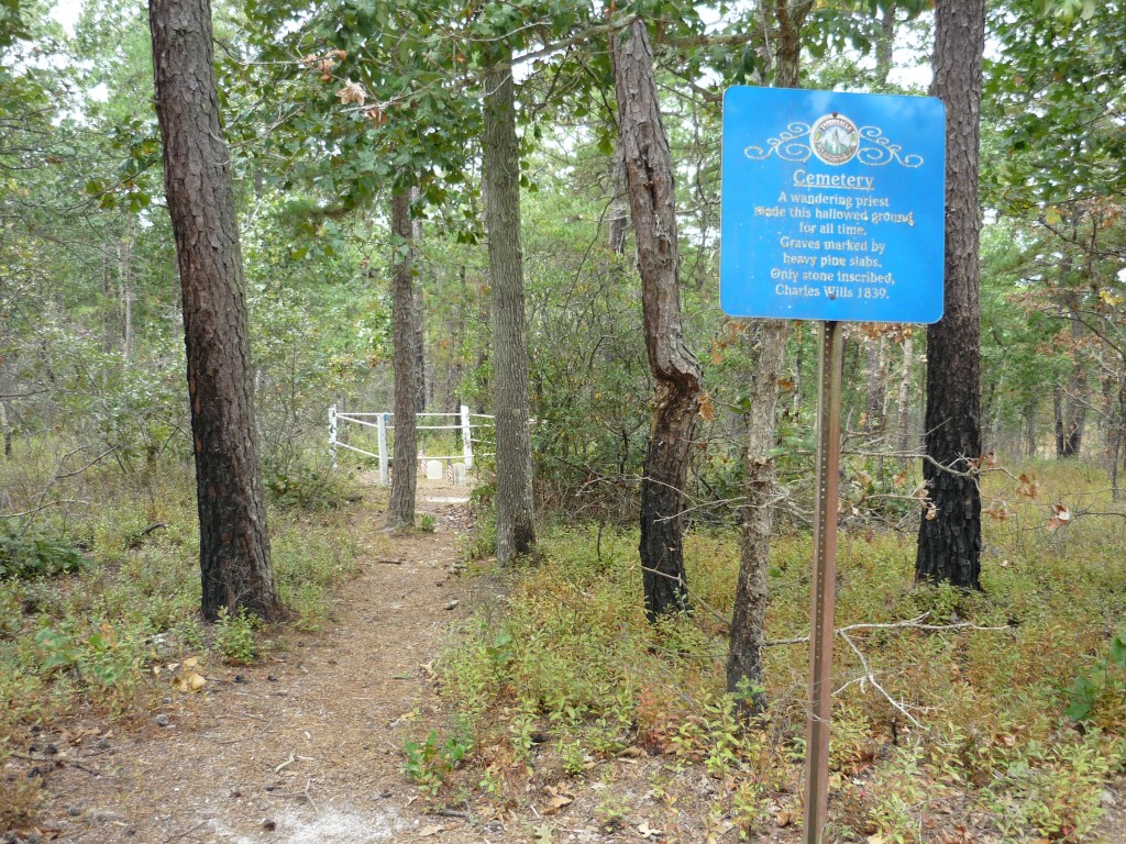
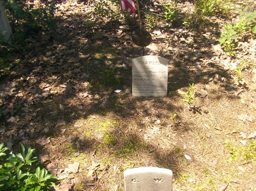
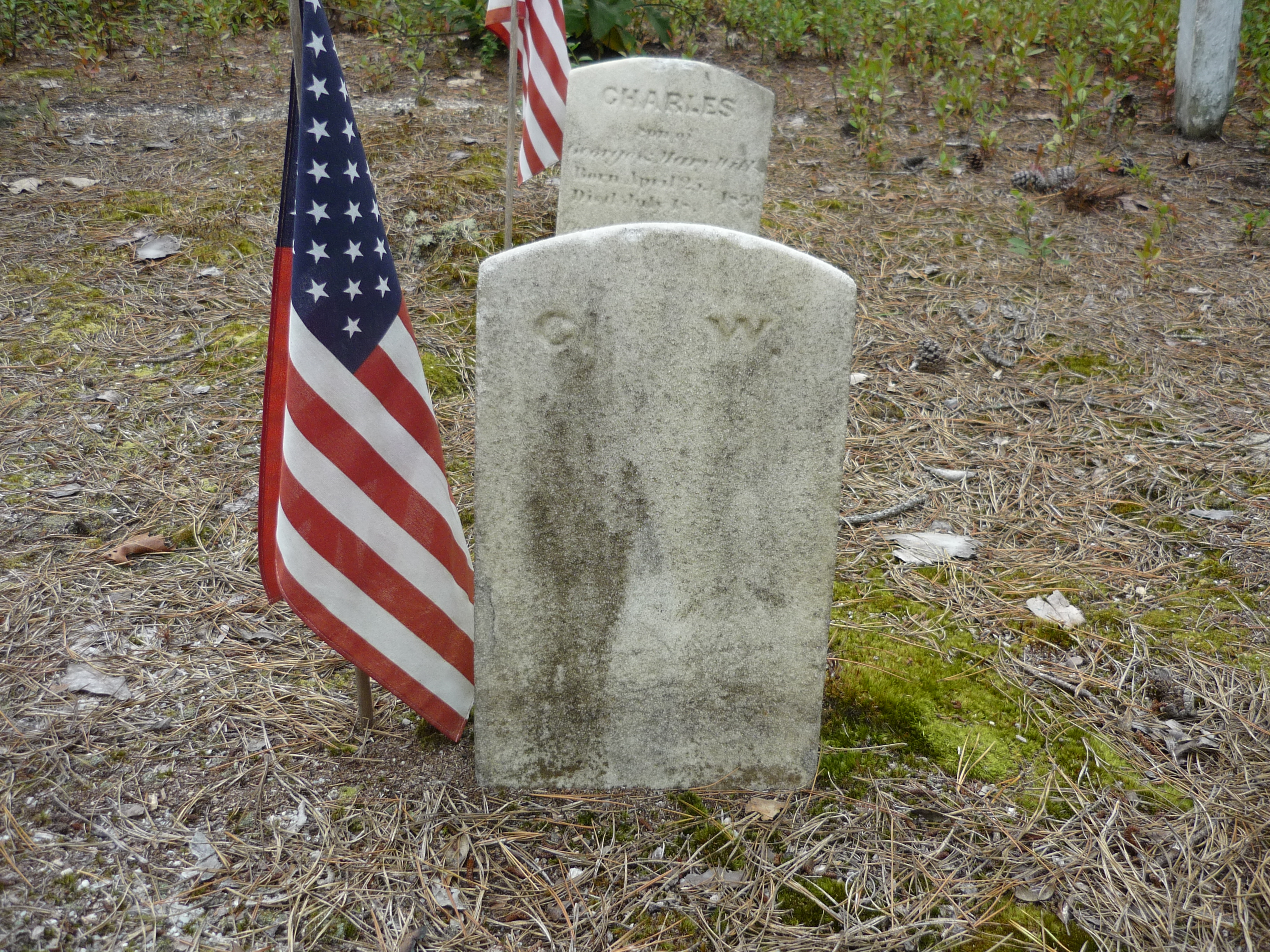
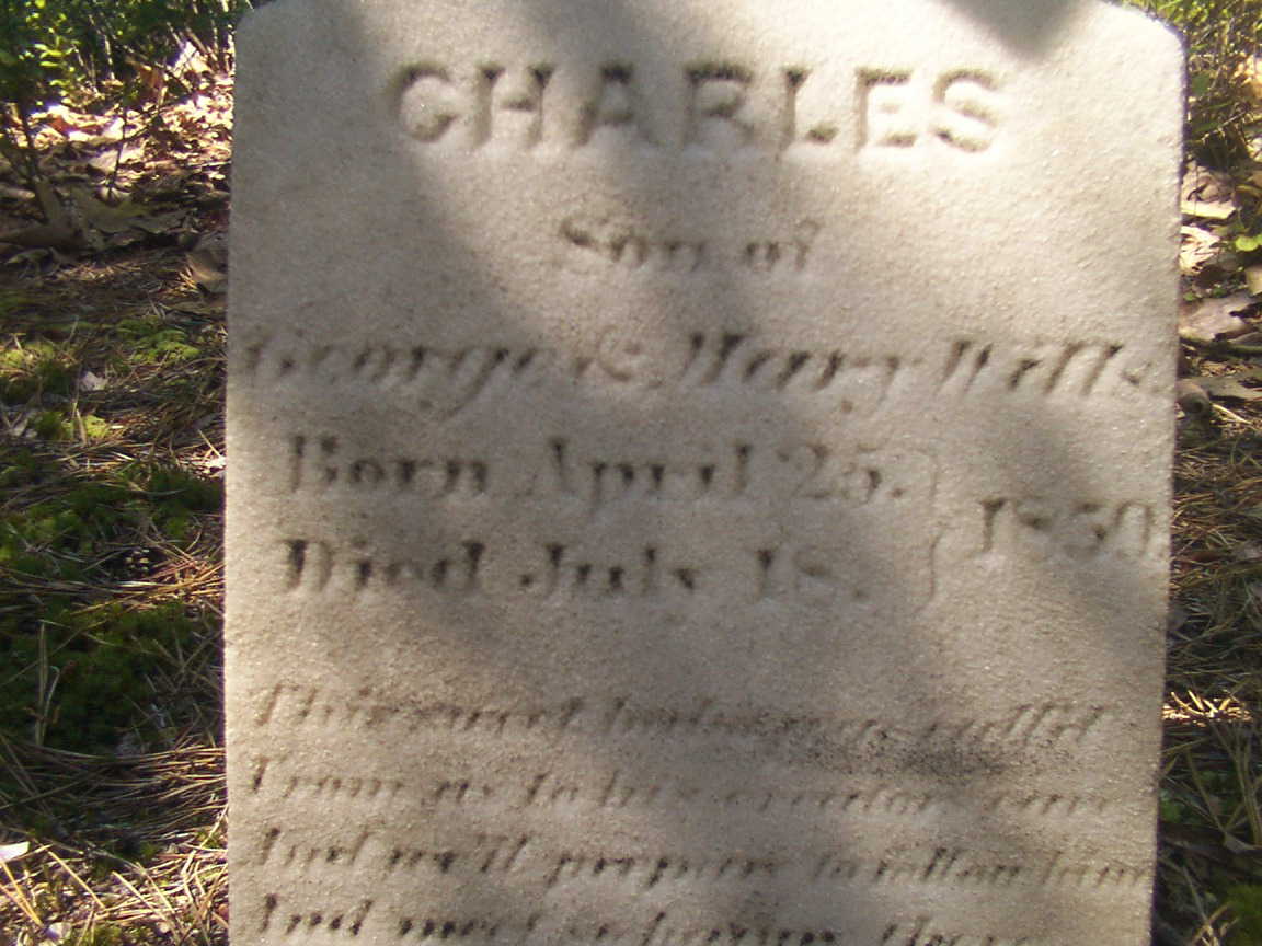
Path through the pinesStone is inscribed “1850” IMHO
We can tease grief and loss from the records and landscape, When Joseph C. Clark visited George and Mary on August 24, 1850 to record the persons living there, if the U.S. Constitution prescribed the recording of the grief he experienced, the record would show Charles missing from the list. Follow the sand path, “Eagle Road” three miles north where he lays in the ground of the family cemetery, having passed just days before the 1850 census was taken.
The loss of a cherished presence can be inferred from the use of precious marble to mark his resting place. The heavy pine slabs of his companions long since vanished.
I am gratified to find Charles’ grave honored The stone is inscribed with “1850” not the 1839 from the recent, blue, signage.
As with the Wills Hotel, the Wills Family Cemetery is best found through global coordinates: 39°45’49.7″N 74°34’01.4″W
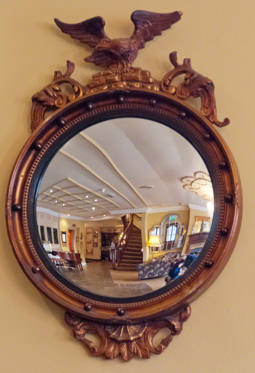
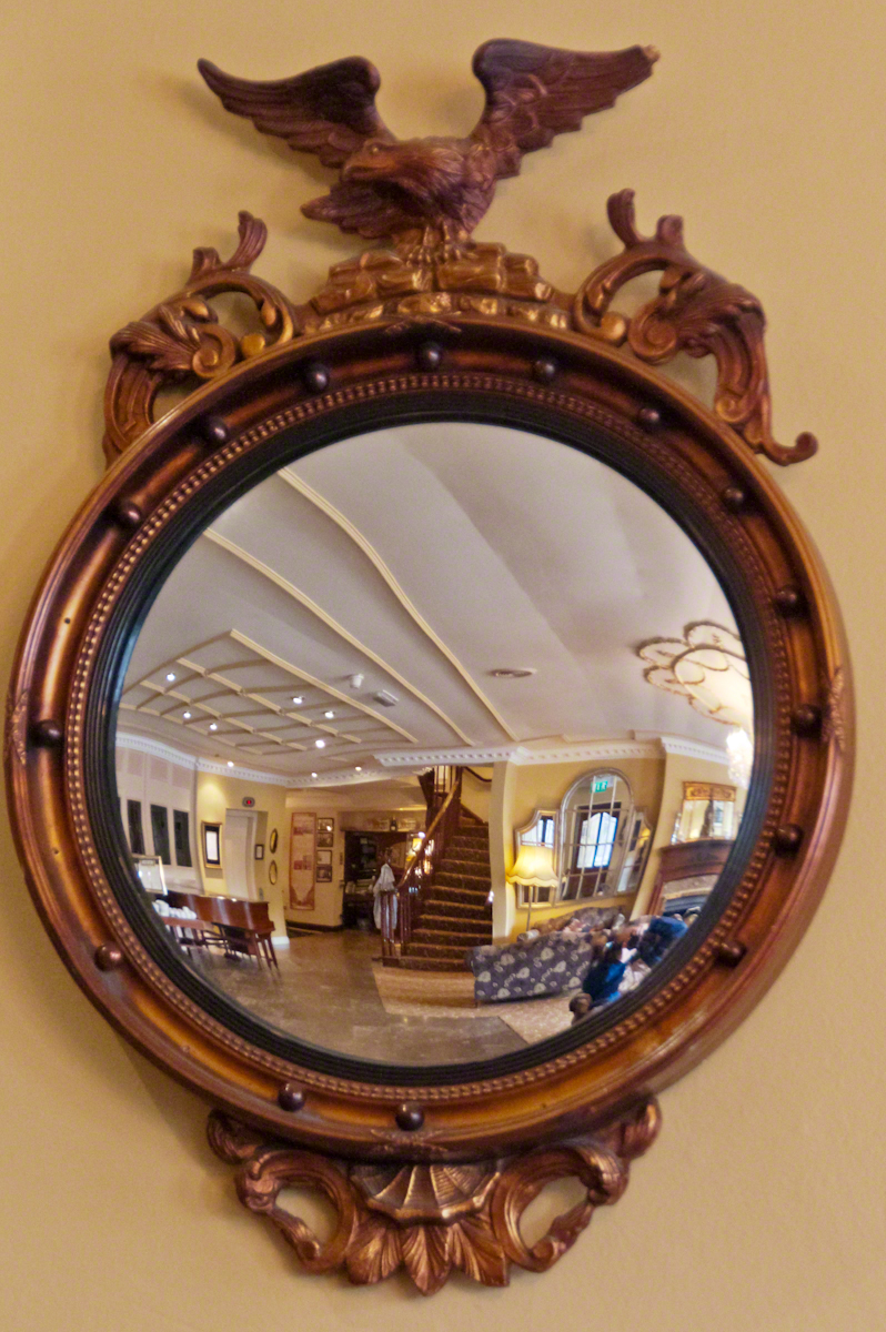
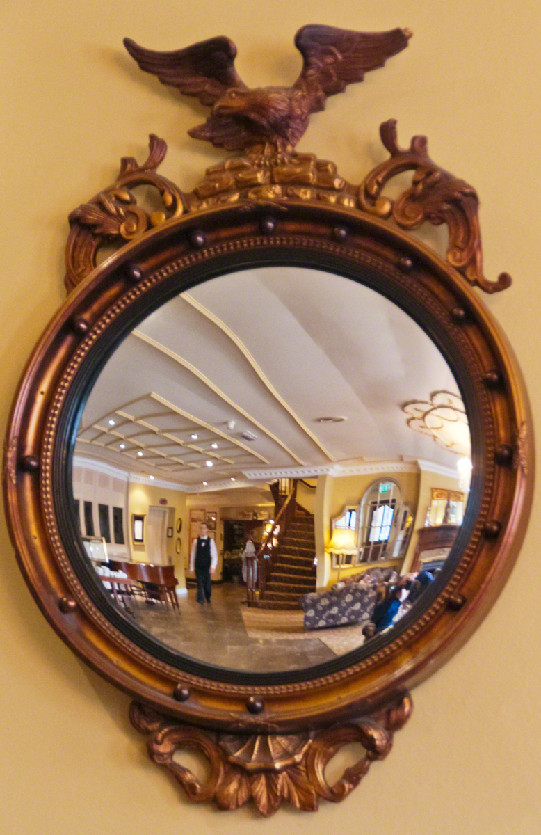
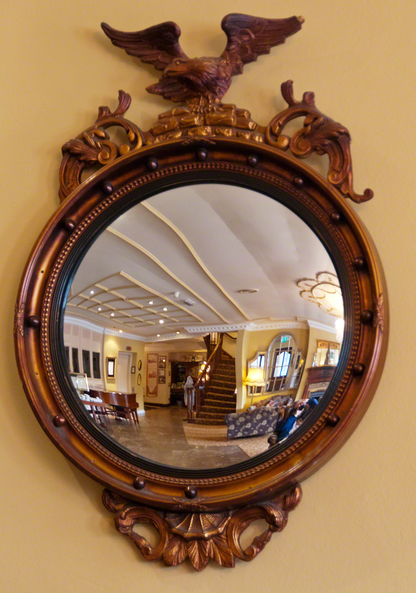
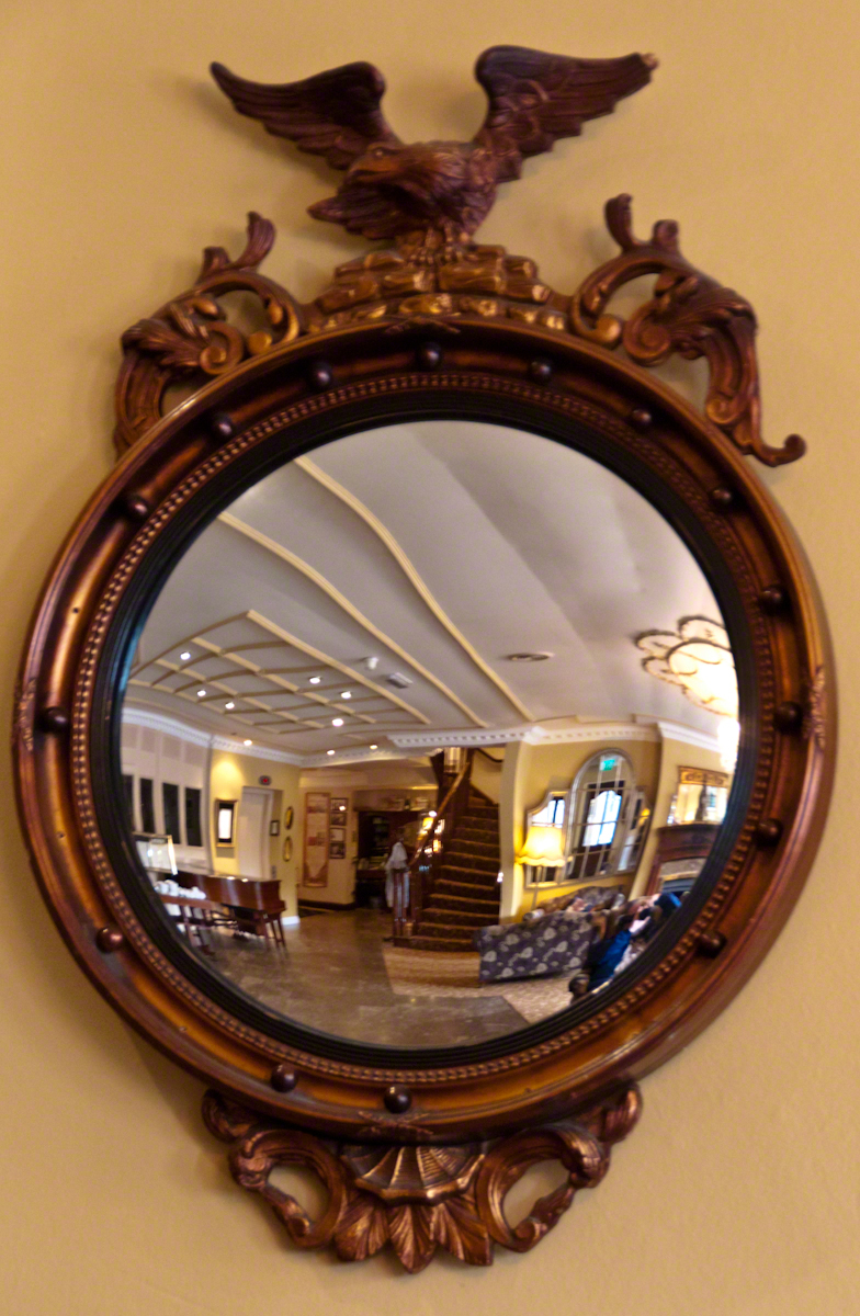
The morning of our day on the Dingle Peninsula I left the room early, my Sony Alpha 700 in hand, while Pam finished her preparations. The elevator deposited me in the lobby and I proceeded to capture images of the Killarney Royal Hotel, our base for three nights.
This marvelous “antique” mirror caught my eye. We are used to seeing convex mirrors in the upper corners of elevators, strategically located at hallway junctions, automated teller machines and parking garages all with the intention of providing a wide, fisheye, view to detect unsavory, lurking types and danger.
Click any photograph to open my Online Gallery in a new window/tab.
This spotless, framed convex mirror is from a older, saner time. Such objects came in use from the 1400’s (15th century). When all glass was blown, a convex surface was easier to produce than a flat and, since all glass was expensive to produce, a convex mirror was a popular luxury item, an expensively framed status symbol.
As the mirrors were an element of elite surroundings, art came to include them as objects in the midground, the surface reflecting back to the viewer a different viewpoint. An opportunity for an artist to demonstrate virtuosity. Examples are Jan van Eyck’s “Arnolfini Portrait” and the left wing of the Werl Triptych by Robert Campin.
Known as the “sorcerer’s eye” from the all encompassing view and, in keeping with our modern uses, even back then also called a”banker’s eye.” Symbolically, the 15th century paintings used a pristine mirror to represent the Immaculate Conception.
The five images here are the final result of trial and error, working out the details of using a flash in the relatively low light of the morning lobby, avoiding my reflection, maintaining a sharp focus throughout the field, capturing the unique details of the frame without distortion and the mirror’s wide angle view. I gave up on the flash and, instead, did this series at f5.6 and the ISO incremented 800 to 3,200. As such, the exposure ranged from 1/5 to 1/25 of a second. All shots were handheld.
I hope you enjoy the results. This was a promising start to our memorable day of exploration.
Since 1877 primary education in Uruguay is universal, compulsory and free. These days students receive free education through university, literacy is the highest in South America at 95%, equally for males and females.
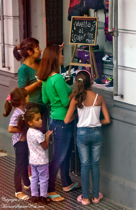
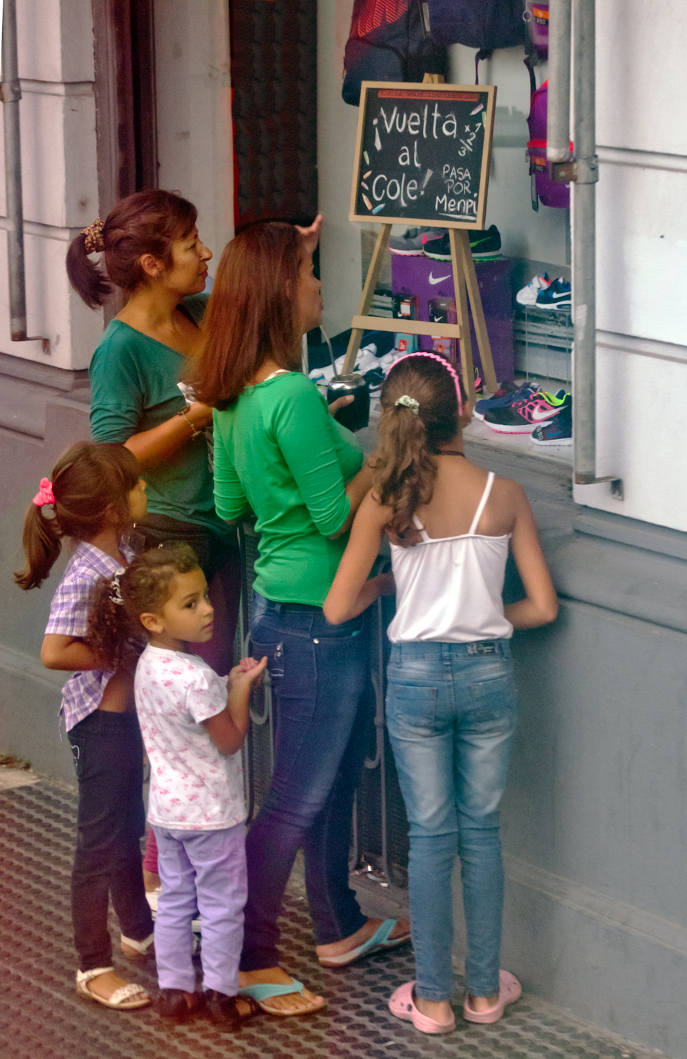
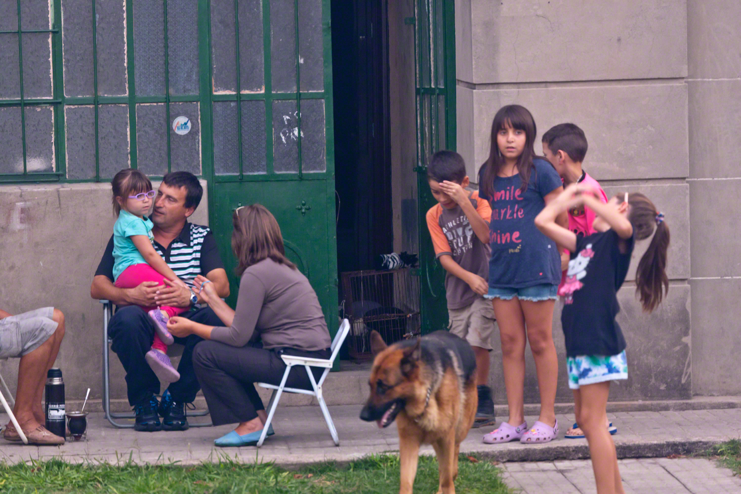
These photographs are from a cruise around South American my wife, Pam, and I enjoyed February / March 2016 on the Oceania ship Regatta. This was the evening of February 26, 2016, a Friday, in the city Montevideo, Uruguay.
This image is the theme of this blog, “back to school”. On Avenue Gral Eugenio Garzon of the Colon neighborhood of Montevideo a mother and four daughters discuss a shop window featuring “back to school” clothing and necessaries. The children range in age from pre-school to teen. This is evidently a serious discussion about preparing for the school year which starts in March for Uruguay.
A government program launched in 2007 expands Information and Communication technologies in primary schools with these goals:
— To distribute technology,
— To promote knowledge,
— To generate social equity.
Called Ceibal, after a tree native to Uruguay, the program was a success. From 2009 – 2012 450,000 laptops, popularly named “”ceibalitas”, were delivered to children coordinate with teacher training and a monitoring and evaluation model for assessing the impact nationally. Ceibal is the acronym for “Conectividad Educativa de Informática Básica para el Aprendizaje en Línea” (Educational Connectivity/Basic Computing for Online Learning in English).
These photographs build on the theme of the positive influence education has on the lives of Uruguayans, many of whom live in poverty.
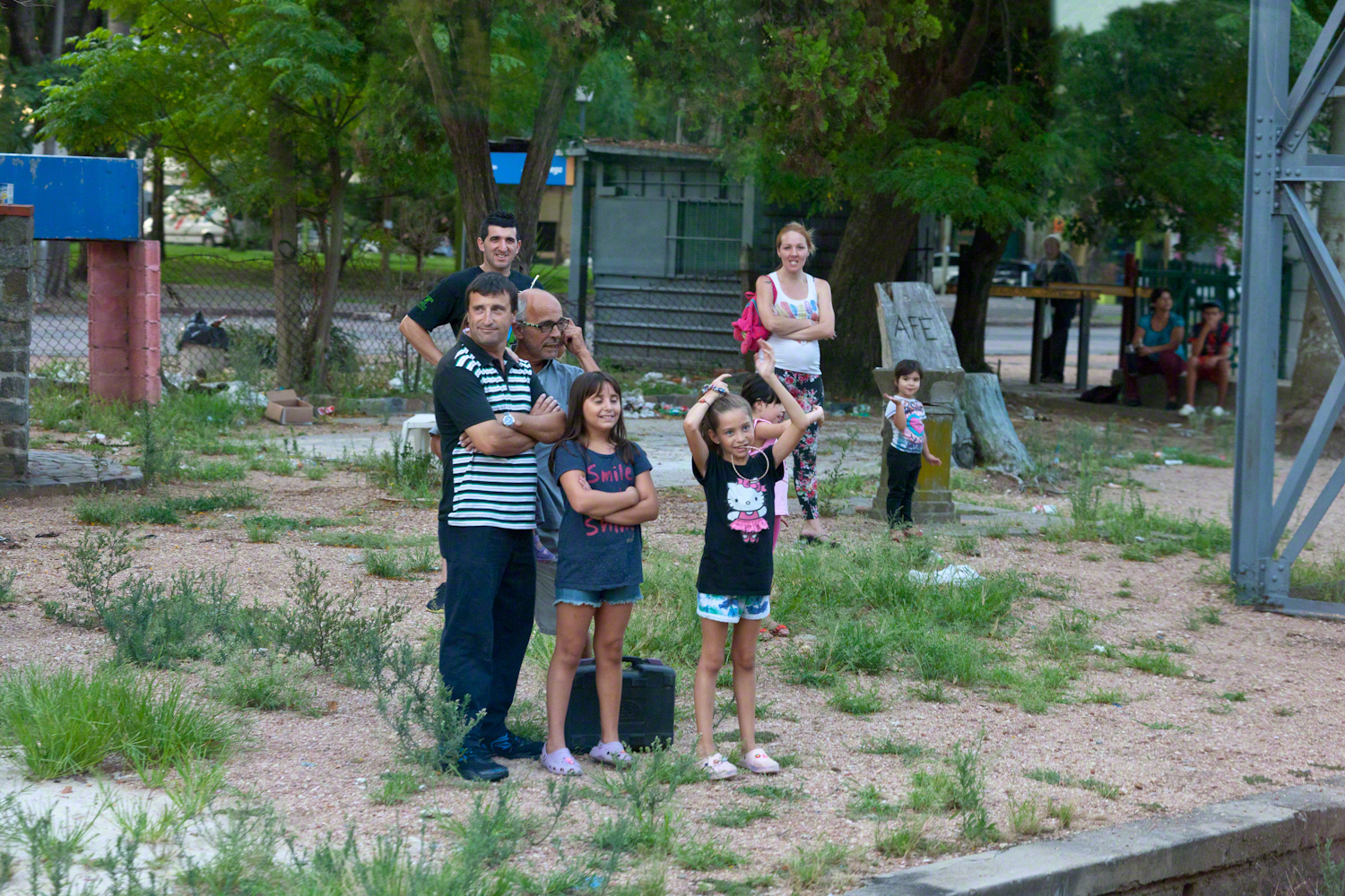
A family gathering in their yard on Avenue Gral Eugenio Garzon, enjoying a cool late summer evening.
Traffic and a gas station. People were out and about, walking and conversing. There is a makeshift trailer attached to the motorcycle, behind is a large truck.
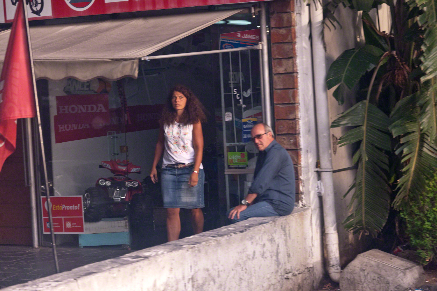
Storefront with customer and man loitering on wall. A mini-Honda all terrain vehicle is on display.
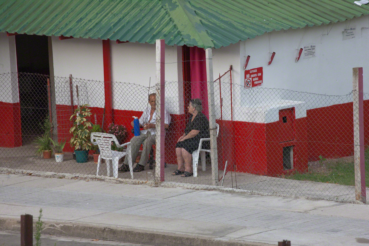
Mate is a beverage enjoyed throughout South America. Here companions enjoy a warm summer evening with a thermos of hot water and mate gourd behind a restaurant, their view across the train tracks and the Colon rail station is of a playground and playing fields.
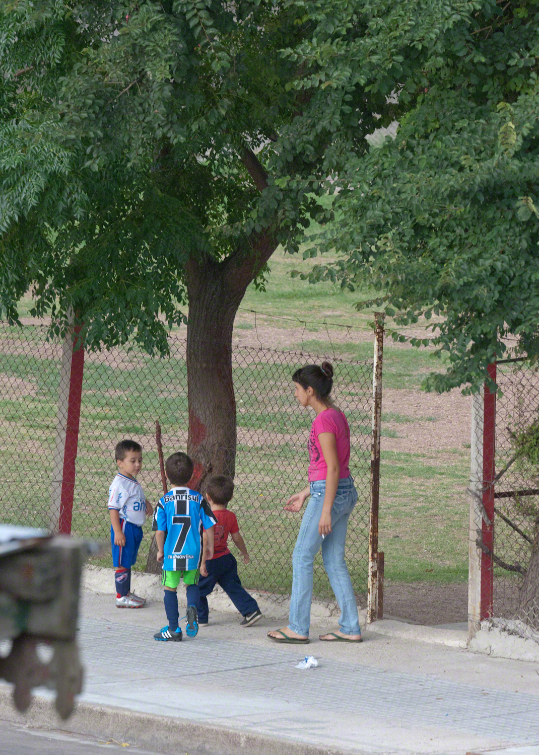
A family of very young soccer players coming from practice with teammates. The sponsors of lucky number 7 are the bank Banrisul and Tramontina, a kitchenware manufacturer.
We waited to board an historic train and shared the station with Montevideans waiting for a passenger train. Here are two families: a mother and pre-teen daughter colorfully dressed, a grandmother and grandson. Behind them are the playing fields and playground.
A passenger train heading north passed while we waited for our ride to begin. Curiosity shines from this child’s eyes.
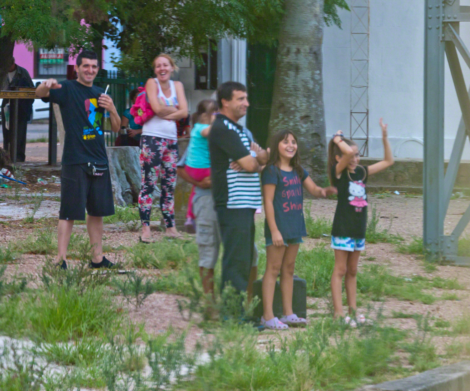
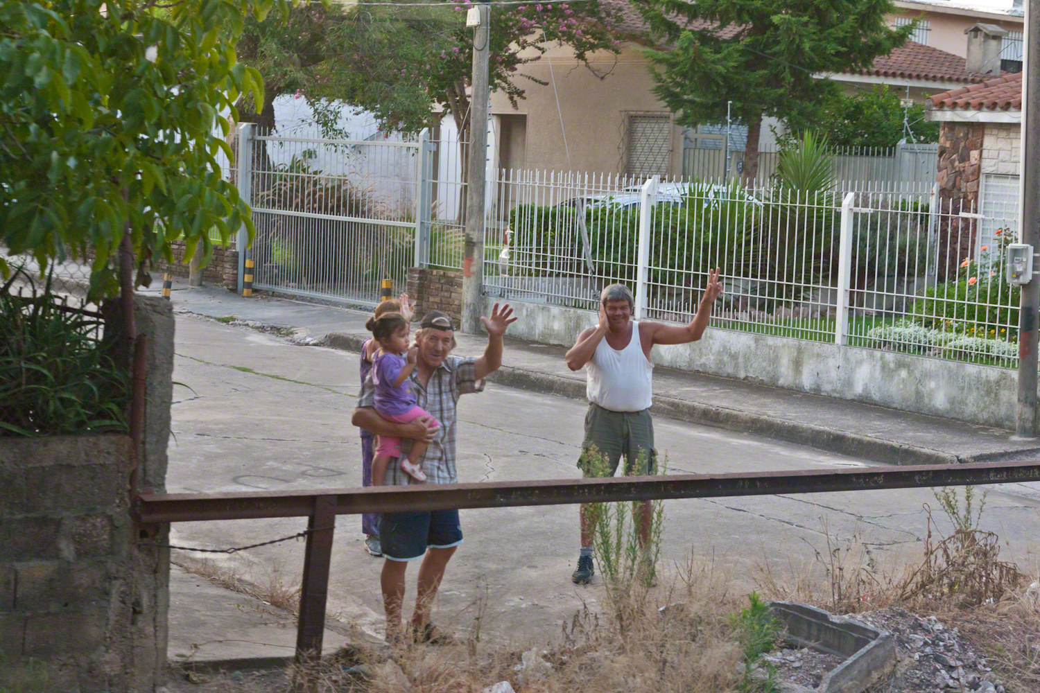
Happy families greeted us with waves and smiles during our trip to downtown Montevideo.
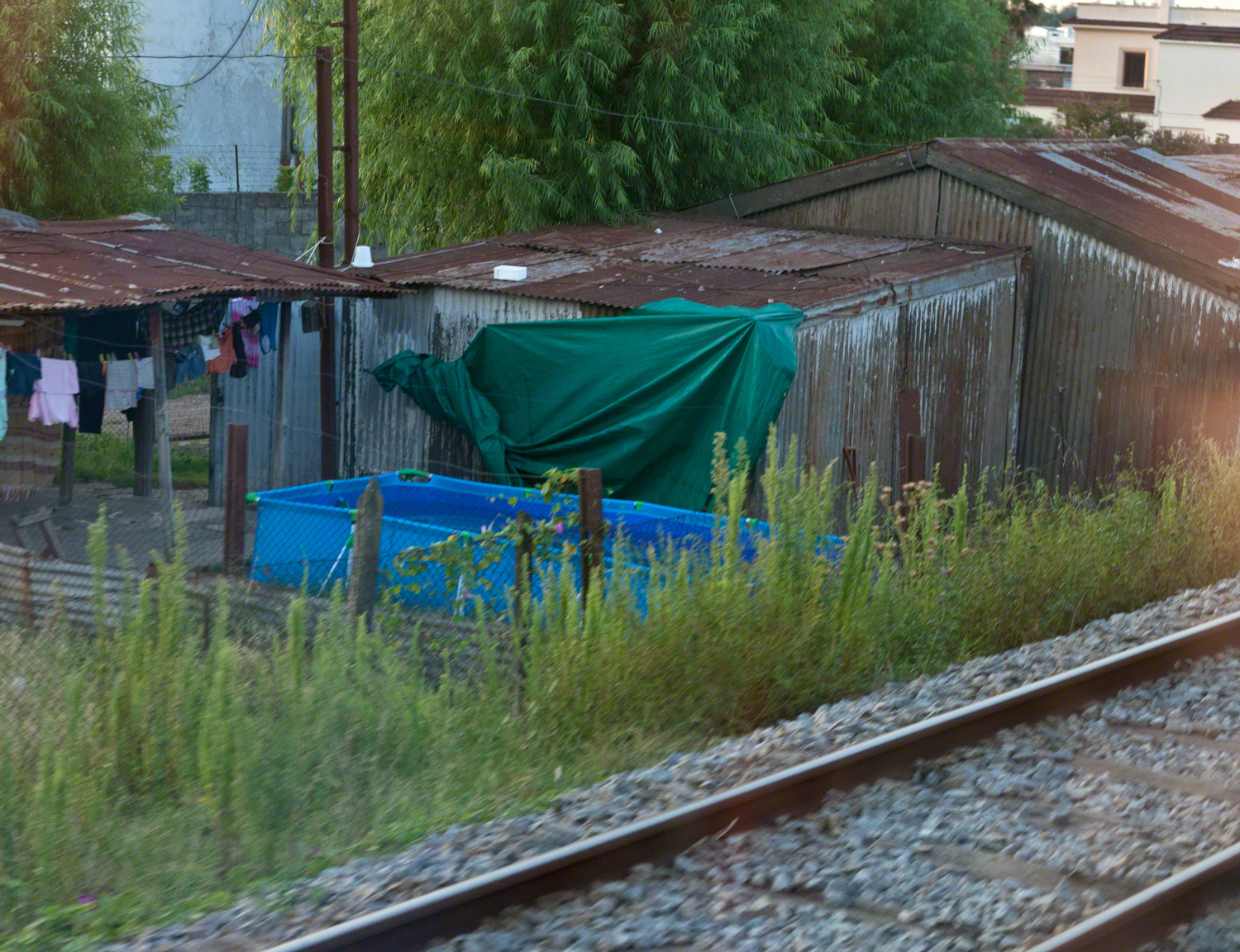
Some of the homes along the rail line. Pools such as that are popular in cities. We saw a great many on the streets in Lima, Peru.
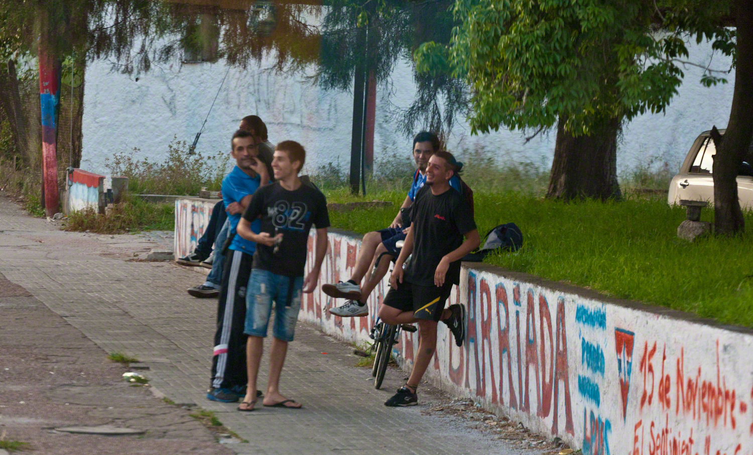
Reaction to the historic train from a group of young men.
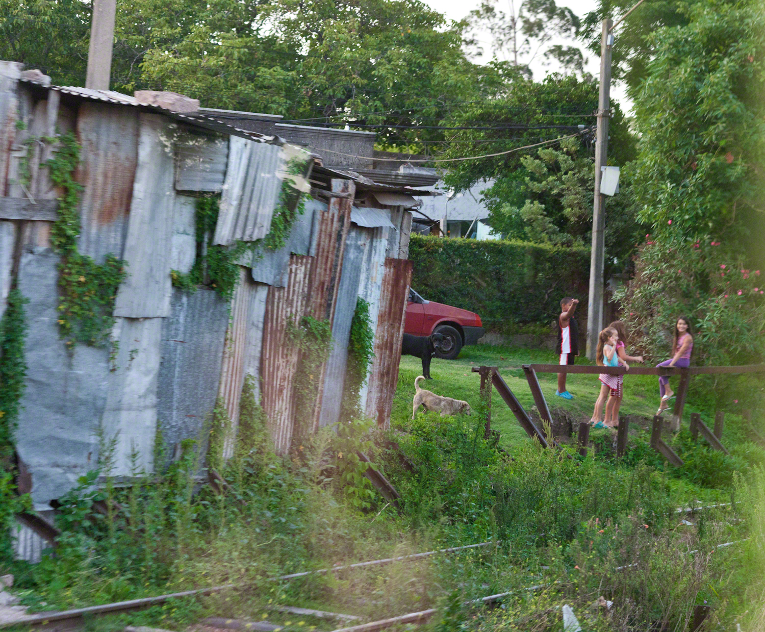
Curious playmates gather at the end of the road.
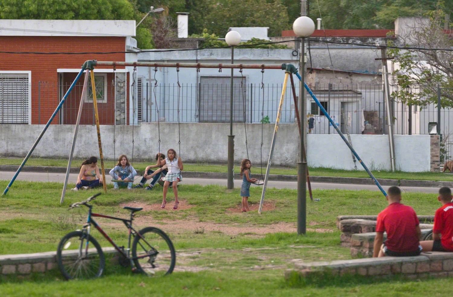
A well attended playground.
Copyright 2021 Michael Stephen Wills All Rights Reserved


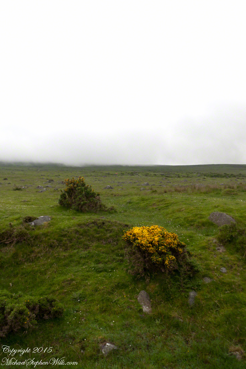


 The lower slopes hold many small stream among granite stones.