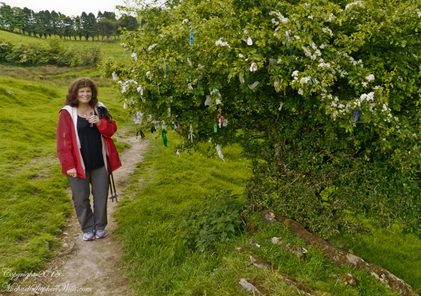
Pam and I were lucky enough to plan our tour of Ireland for May and June when the Hawthorne trees are in bloom. Named sceach gheal in Gaelic, the white clusters of blossoms symbolize hope. Hawthorns are plentiful throughout the island. The Irish revere the tree and associate each Hawthorn with the Little People. There are roads in Ireland that curve around a Hawthorn tree because the local people convinced the engineers to do so, to save the tree.
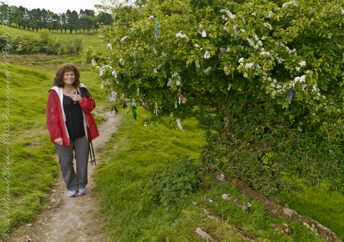
This specimen, covered with offerings (to the Little People?), is on the trail to Loughcrew. Even with her knee trouble, Pam made it to the top of the Hag’s Mountain to visit Cairn T of the Loughcrew Passage tombs.
The steep path to Loughcrew passes a hawthorn covered with flowers and may offerings.
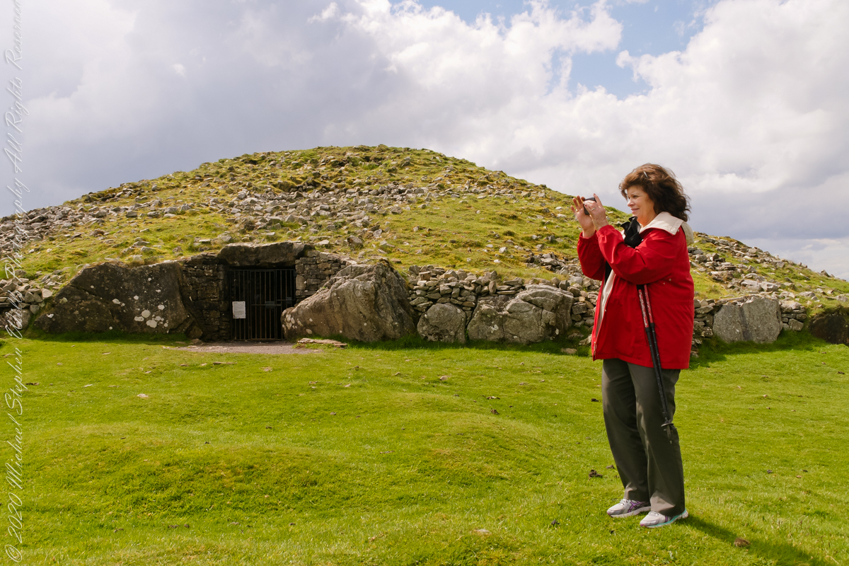
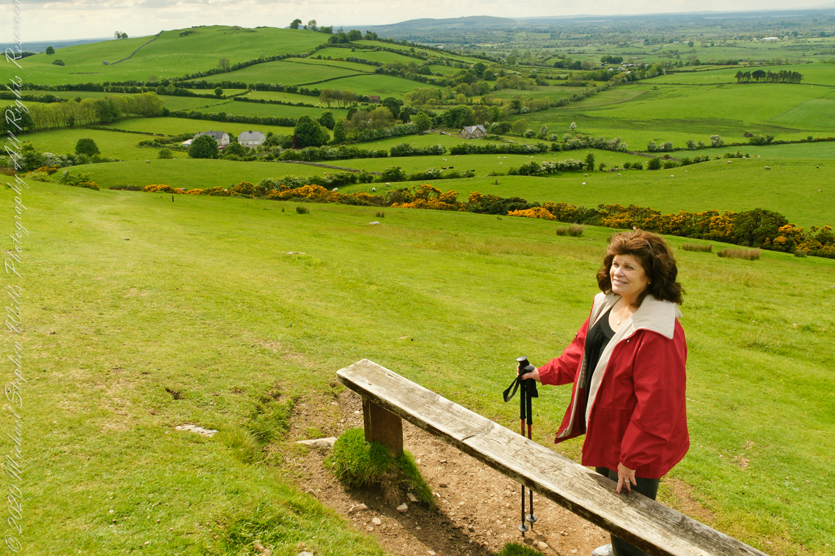
Pam loves to capture images and returned from Ireland with a large collection. Most of the photos of me at work are by Pam. Here Pam is capturing the summit view of Hag’s Mountain with the Cairn T entrance gate in the background. Lucky for us, a fellow visitor made the trip to Loughcrew Gardens and picked up the gate key from the café. In a later post I will share my work from inside this passage tomb.
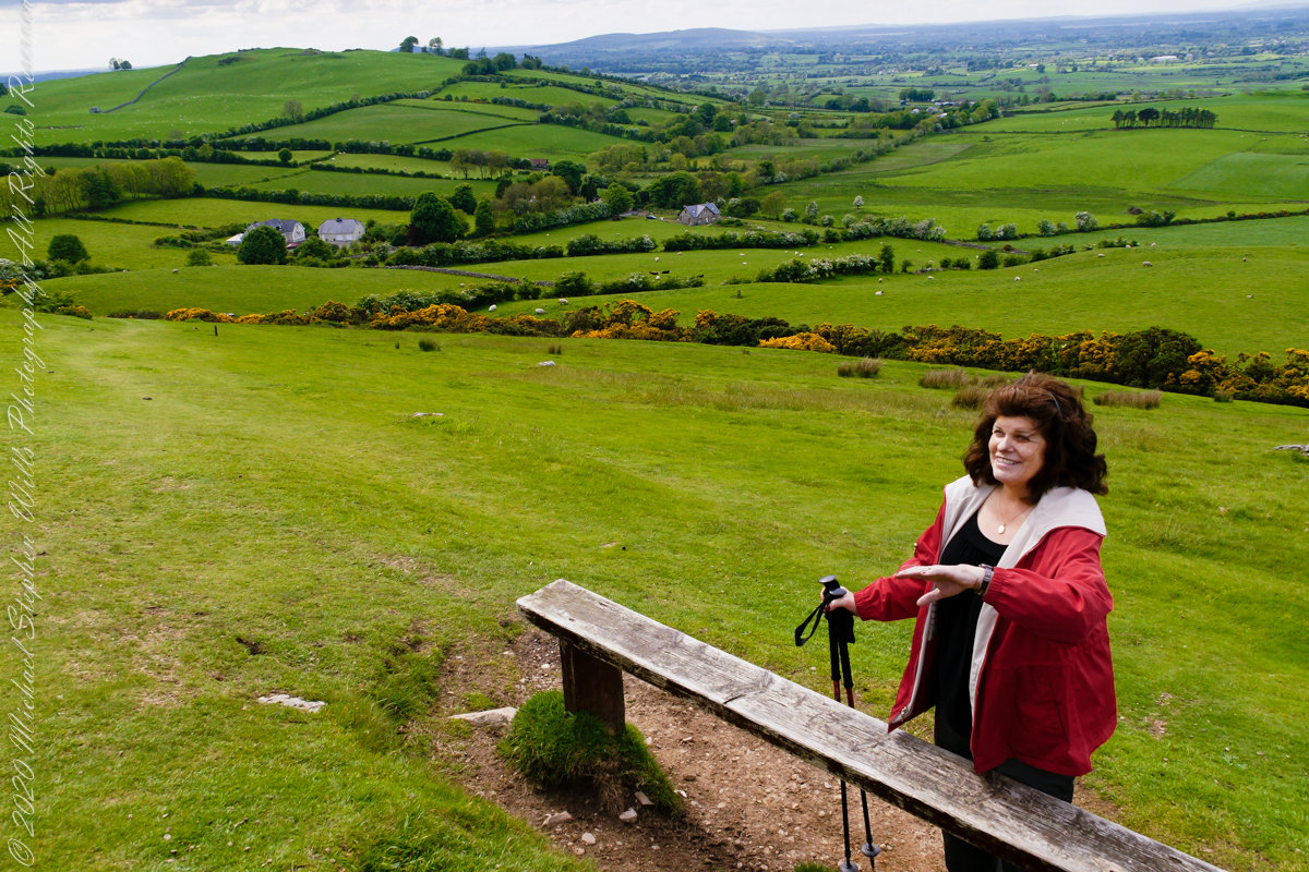
Pam makes friends wherever we go. She started down the mountain before me to take it easy on her knees. When I caught up, Pam and a young Irish family were deep in conversation. I took the opportunity to capture Pam with that gorgeous view to the northwest, Irish countryside with Lake of the Branches in the far distance.
Copyright 2023 Michael Stephen Wills All Rights Reserved
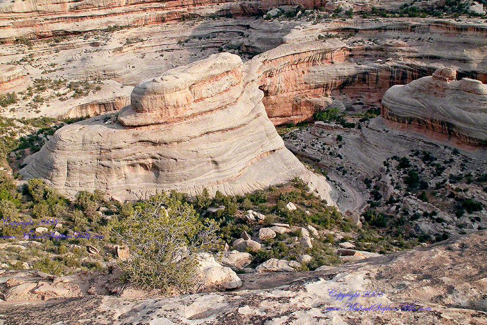
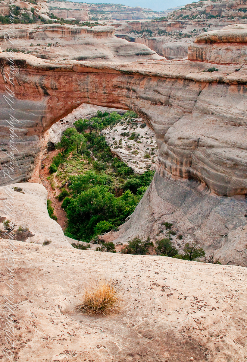
I created a series of fine art prints from a visit my wife Pam and I made to Natural Bridges National Monument in Utah. Here are a few of these prints which grace fine homes around the world. Click any of the photographs to visit the gallery.
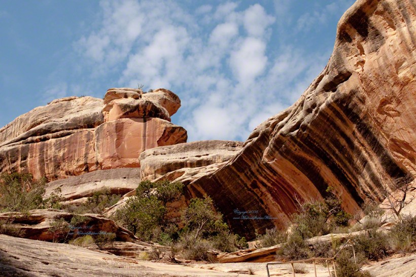
We walked a narrow cliff patch climbed a series of weathered pine ladders to achieve these views of Sipapu Bridges National Monument.
While the sky is unchanged, below the canyon rim is another world. The black stripes of the cliffs is desert varnish, a thin deposit of clay, iron and manganese oxides. The rock supporting the varnish is resistant to wear and protected from direct precipitation (in this case by the overhanging cliff).
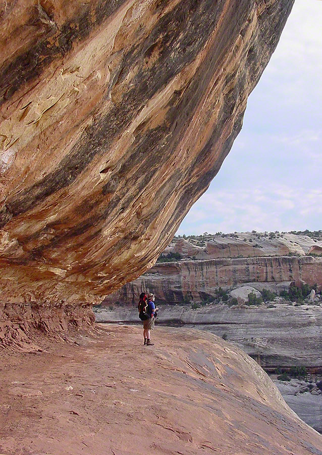
Eventually we came to a ledge with a view of Sipapu Bridge. Pam took the opportunity to capture this amazing experience.
Mike at Sipapu BridgeSONY DSC
A Utah Juniper (Juniperus osteosperma). Historically, across the west, Native Americans used the wood in building their houses. They ate the berries; smoked the bark; made shoes, clothing, and rope from it.
Sipapu is a Hopi word for the small hole or indentation in the floor of kivas used by the Ancient Pueblo Peoples and modern-day Puebloans. It symbolizes the portal through which their ancient ancestors first emerged to enter the present world. A natural bridge is formed through erosion by water flowing in the stream bed of the canyon. Sipapu Bridge is 268 feet across and, standing in the stream bed, it is 220 feet above your head.
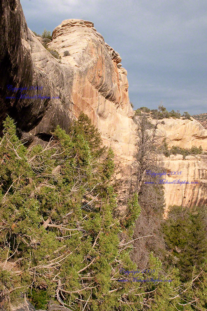
Here is a close up of the white Permian sandstone of the bridge arch. The entire canyon is carved from this stone and named after it.
Sipapu is one of the largest natural bridges known.
Part of the Natural Bridges National Monument in Utah, a place inaccessible until the “uranium boom” of the 1950’s and the road was only paved in 1976.
We visited on a July day of thunderstorms, which you see building here. If you look closely at the base of the bridge, you can see the railings my wife and I used to climbed the steep sides of White Canyon.
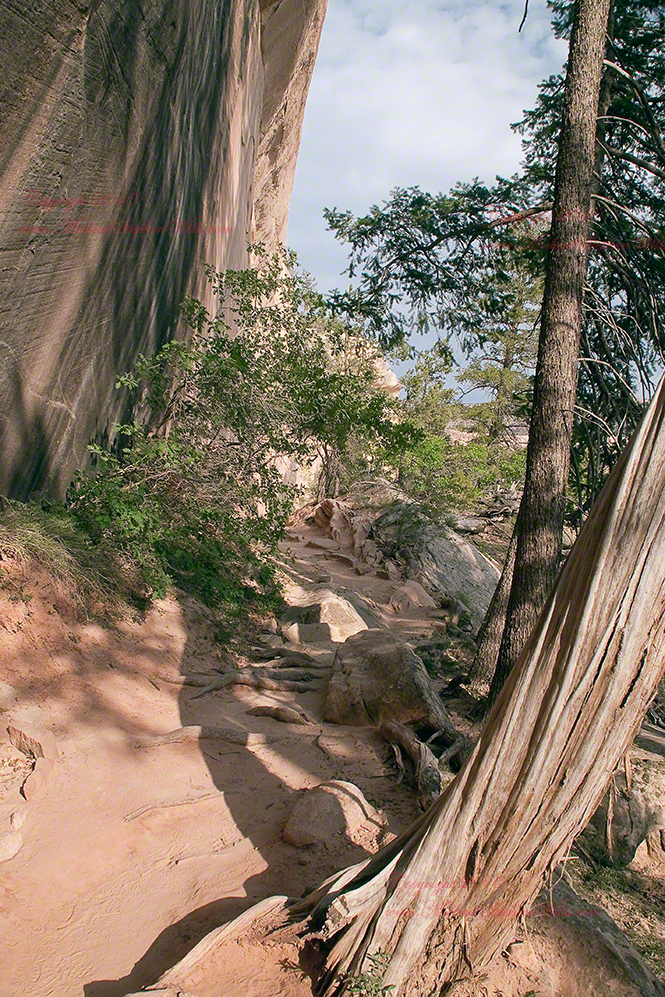
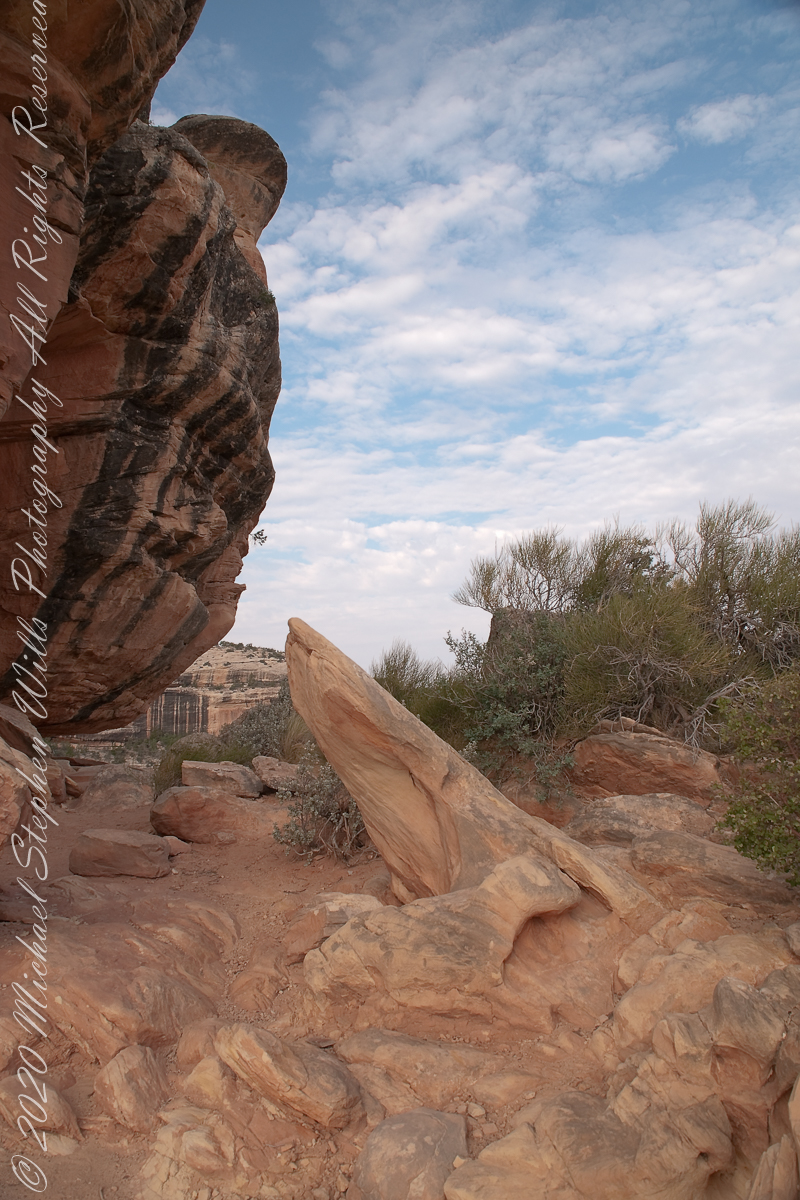
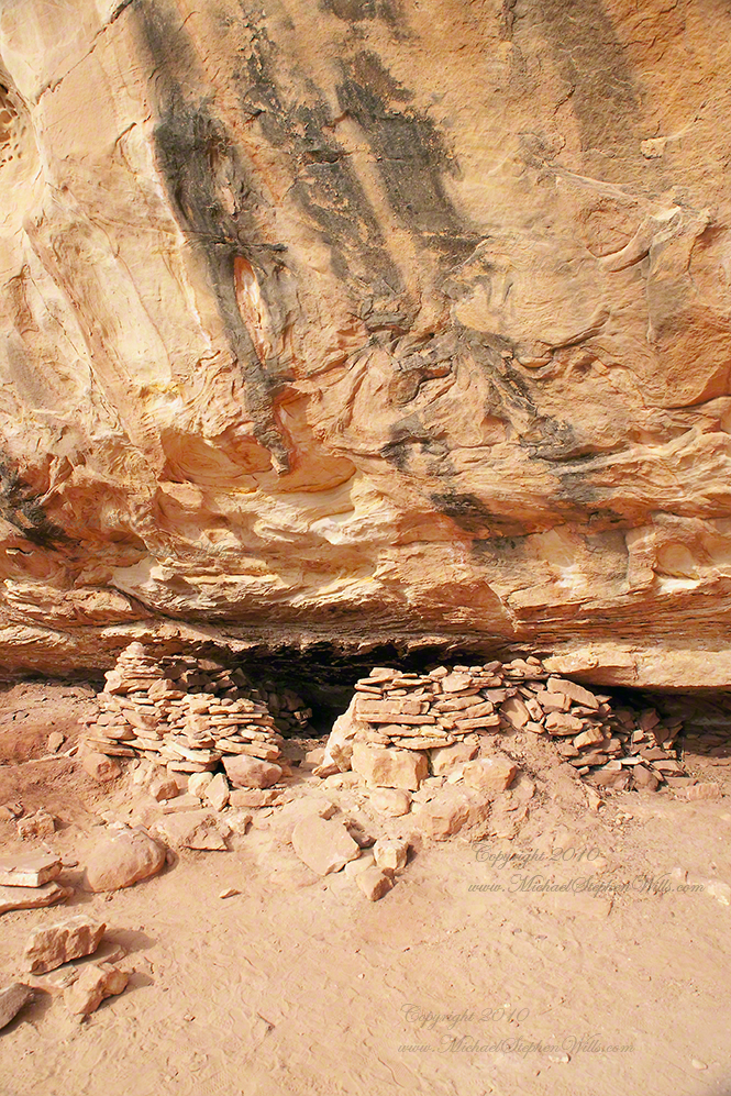
We hiked a few miles along an unmaintained trail. On the way we passed ancient cliff dwellings. The area is a maze of canyons throughout which these ruins are scattered.
Sipapu is a Hopi word for the small hole or indentation in the floor of kivas used by the Ancient Pueblo Peoples and modern-day Puebloans. It symbolizes the portal through which their ancient ancestors first emerged to enter the present world.
A natural bridge is formed through erosion by water flowing in the stream bed of the canyon.
Sipapu Bridge is 268 feet across and, standing in the stream bed, it is 220 feet above your head. That is white Permian sandstone, after which White Canyon is named.
Copyright 2023 Michael Stephen Wills All Rights Reserved
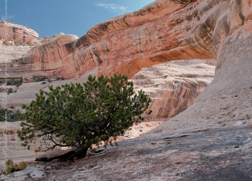
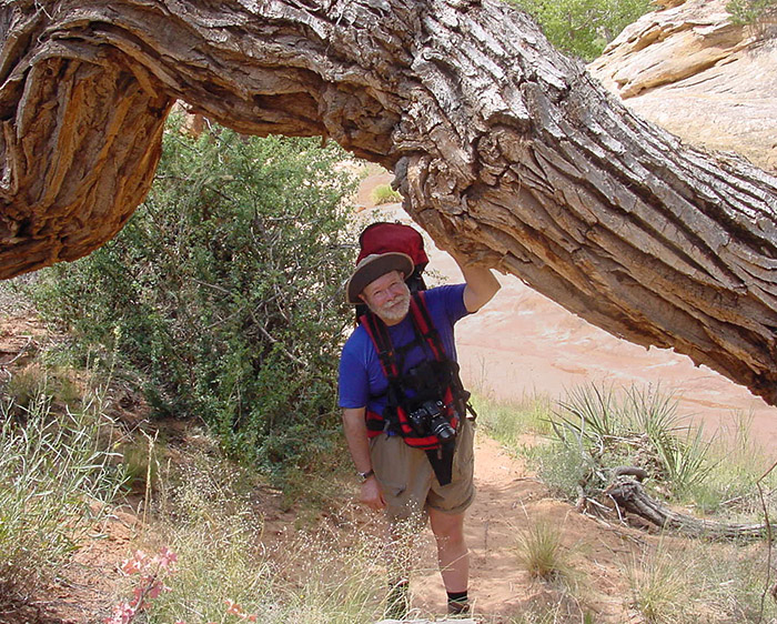
Here is a unique tree in the unworldly environment near Sipapu Bridge, Natural Bridges National Monument. I am looking from under a huge Cottonwood tree trunk, in the above photography taken by my wife Pam.
THIS TREE
This tree is an older specimen of the Utah Juniper featured with my fine art print of Sipapu Bridge (click any pic in this posting to view). Also known as Shag Bark juniper for the thin peices that separate from the trunk. These tress can live to over 600 years and, like this example, are photogenic.
Utah Junipers are found throughout the American Southwest, here growing near Sipapu Bridge of Natural Bridges National Monument, Blanding, Urah
It is a common species through Utah, being found most often at elevations above sagebrush/grass and below pinyon pine (4,000 to 7,500 feet). As the environment changes with the presence of people and changing climate, this juniper is becoming more common. Nearly 1/5th the land of Utah is covered by Utah Juniper.
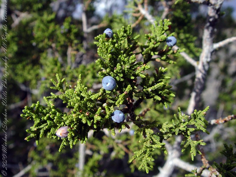
Macro of the leaves and berries of the One Seed Juniper taken near Kachina Point of the Petrified Forest National Park near Holbrook, Arizona
USES!!
Not shown here are the fascinating (for me, anyway) berries (also called “cones” or “berry-cones”). Each contains seeds, is hard and green, about a quarter inch across. If you are brave enough to eat it, you find it to have a pleasant, resinous flavor (a taste like the aroma of pine cones). These seeds are the manner in which the Utah Juniper spreads. The tree has both male and female parts and can fertilize itself, so it is possible an isolated stand can all spring from a single individual (unlike humans, for example).
Native Americans consume the berries and the wood, being highly decay resistant, is commonly used for fence posts and other applications exposed to the elements.
Juniper berries are eaten by jackrabbits, foxes and coyotes. Many bird species rely on this abundant fruit for fall and winter food. Mule deer will each the scaly leaves when other food is scarce, for example when the winter snows are very deep.
Copyright 2023 Michael Stephen Wills All Rights Reserved
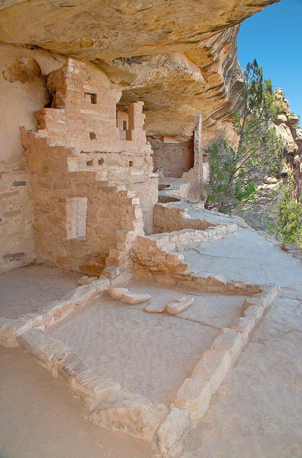
This group of buildings was crafted into a cliff face over 1,000 years ago.
Visitors must climb over the cliff and through narrow tunnels, security features created by the builders.
High Security and Adventure
Security barriers include a 32 foot, entrance ladder made from pine trunks and a narrow squeeze through a 12 foot tunnel.
My photograph of Balcony House features ruins to rooms on a plaza. Also shown are edges of two kivas (circular ceremonial chambers) built into the plaza floor. I am standing in a plaza, next to the cliff.
Behind me (not visible) is the narrow security tunnel used by the ancient builds to control access. Today, visitors crawl through the narrow tunnel to exit the site. There are 40 rooms in Balcony House.
Copyright 2023 Michael Stephen Wills All Rights Reserved
“From the fire tower on Bear Swamp Hill, in Washington Township, Burlington County, New Jersey, the view usually extends about twelve miles. To the north, forest land reaches to the horizon. The trees are mainly oaks and pines, and the pine predominate. Occasionally, there are long, dark, serrated stands of Atlantic white cedars, so tall and so closely set that they seem spread against the sky on the ridges of hills, when in fact they grow along streams that flow through the forest. To the east, the view is similar, and few people who are not native to the region can discern essential differences from the high cabin of the fire tower, even though one difference is that huge areas out in this direction are covered with dwarf forests, where a man can stand among the trees and see for miles over their uppermost branches. To the south, the view is twice broken slightly — by a lake and by a cranberry bog — both otherwise it, too, goes to the horizon in forest. To the west, pines, oaks, and cedars continue all the way, and the western horizon includes the summit of another hill — Apple Pie Hill — and the outline of another fire tower, from which the view three hundred and sixty degrees around is virtually the same as the view from Bear Swamp Hill, where, in a moment’s sweeping glance, a person can see hundreds of square miles of wilderness. The picture of New Jersey that most people hold in their minds is so different from this one that, considered beside it, the Pine Barrens, as they are called, become as incongruous as they are beautiful.” From The New Yorker magazine, November 26, 1967, “Profiles, The Pine Barrens I” creative non-fiction by the great John McPhee.
This quote captures the contours of a place, now known as “The Pinelands,” a corner of Burlington County, New Jersey my English, Irish, Scottish ancestors settled from 1677 until my grandfather, James Edward Wills, left for northern New Jersey, Asbury Park, in the first years of the twentieth century. This past decade, more so since retirement 2017, I’ve explored these two hundred and twenty (220) or so years beginning with amorphous asides over the years from my father and second hand through my sisters then through online research via Ancestry.com (Ancestry) and other searches.
From my father and sisters I knew to search southern New Jersey. The United States decennial census, “thank you Constitution,” listed a George and Margaret Wills with my grandfather among their children. Great Grandfather George Wills was listed as a 14 year old child of George and Mary Wills in the 1850 census. How could I be sure? DNA technology with internet based social interaction helped there. I was contacted by a Dellett descendant, identified by DNA as a fourth cousin, who claimed Mary Wills as a double great aunt, the daughter of James and Ann Dellett. Here is a screen capture of an Ancestry “ThruLines” analysis showing the six living ancestors of James and Ann in the database. I removed the names and photos of the other five to preserve privacy. The DNA fourth cousin relationship was an exact match to the family tree.
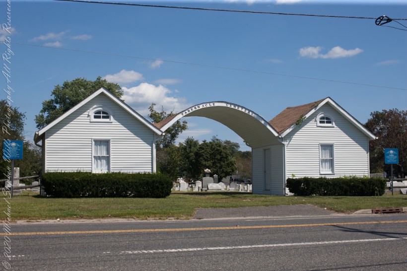
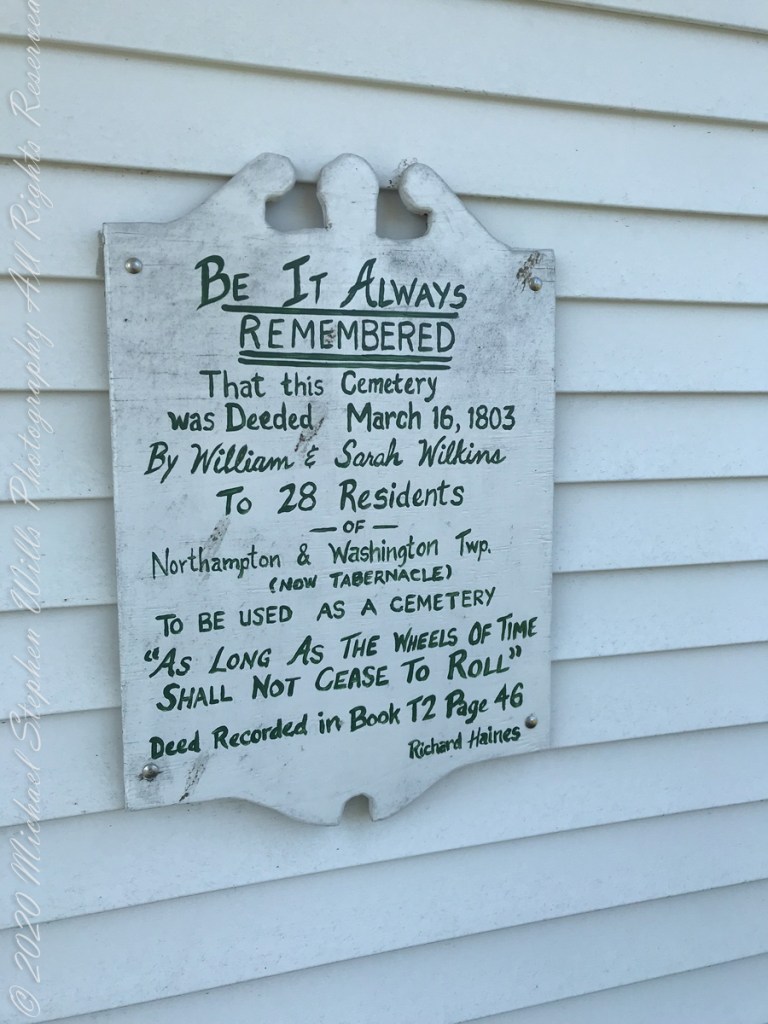
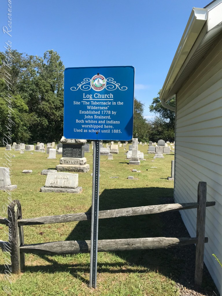
Cousin Delette provided antique photographs of George and Mary. I did a “FindAGrave” search, their final resting place is in a place named Tabernacle, Burlington County, New Jersey. September 2019 my wife Pam and I did a weekend tour with a bed and breakfast base in the city of Burlington, New Jersey. The rest of the photos in the following slideshow are from that weekend.
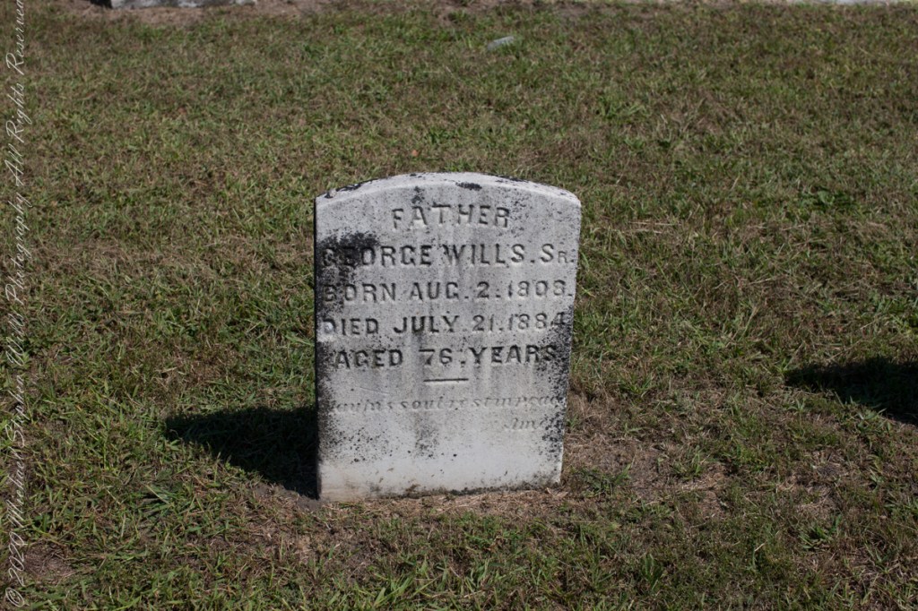
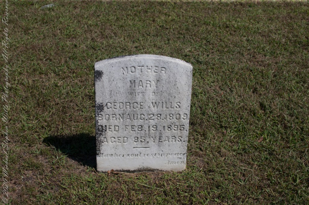
Resting place of double great Grandparents George and Mary WillsWooden Plaque on left sdie of entry pavilion. Sign to left of pavilionGeorge Wills, Hotel Keeper, around 1850Father, George Wills, Sr., Born August 2, 1809, Died July 21, 1884 Aged 76 years., May his soul rest in peace, AmenMary Dellett Wills, as widow after 1894Mother Mary wife of George Wills, Born August 28, 1809, Died February 18, 1895 Aged 85 years. May her soul rest in peace, Amen
Here is the same Ancestry “ThruLines” analysis with the immediate family links exploded. through my “first cousin 1 time removed” I was able to communicate with a “lost” niece of my father who shared reminiscences of him from the time he was just released from World War II Naval Service, before meeting Mom.
Twenty million years ago a then nonexistent earth-bound human civilization could recognize none of the prominent stars of the constellation Scorpius (The Scorpion) as these, compared to our 4.6 billion year old star, lit up less than 12 million years ago. The brightest star, Alpha Scorpii AKA Antares, is a red giant destined to burst into a supernova bright as the full moon within two million years. Will the human race be around to witness it?
Such as it is, The Scorpion was traced out by the Babylonian astronomers around 8 BCE following even more ancient Sumerian traditions naming Alpha Scorpii “The Heart of the Scorpion.”
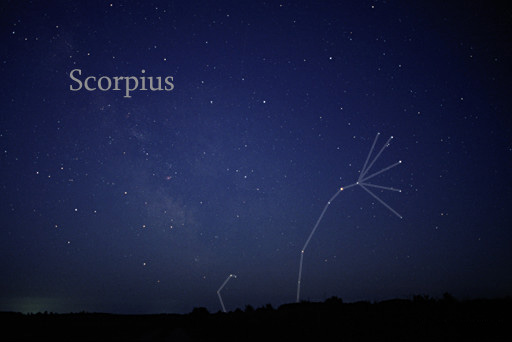
I first became aware of Antares March 2009 during a stay on Cocoa Beach. Setting the room clock to a 5 am alarm to view the sunrise. As I sat listening to the surf, Antares glowed dark red in the south. It is the reddish tint star in the following illustration.
Here is a photograph of Antares, the reddish dot in center, along with the 6 of the 18 Scorpius bright stars. For this shot a Canon EOS 5D Mark IV dlsr had mounted a Canon lens EF 70-300 f4-5.6L IS USM set to 70 mm focal length, 1600 ISO. Exposure was “bulb,” meaning when the shutter button is pressed and held the shutter remains open: for this exposure this was for approximately 10 seconds. The equipment was held steady on a Manfrotto BeFree Carbon Fiber tripod. As the Earth continued to turn, the resulting star images are smeared a bit.
Bracketing Antares, the Scorpion Heart are “The Arteries” Theta and Tau. About those Greek letters, these designate relative brightness of each star respective of the others in the constellation. “Alpha” the first letter of the Greek alphabet is the brightest. Here are the other letters listed, with the alphabetic order in brackets Beta(2), Delta(4), Pi(16), Sigma(18), Tau(19). Ancient Greek built on the traditions of the Mesopotamians (Babylonian and Sumerian) and were in turn used for modern stellar nomenclature, including the tracings of sky images, the constellations.
The position of a relatively minor star, Tau, near Antares elevates it to the important function of an artery. The stars themselves run against their brightness hierarchy placement: The star Delta Scorpii, after having been a stable 2.3 magnitude star, flared in July 2000 to 1.9 in a matter of weeks. It has since become a variable star fluctuating between 2.0 and 1.6. This means that at its brightest it is the second brightest star in Scorpius.
Copyright 2023 Michael Stephen Wills All Rights Reserved
Theresa (2), Michael (5), Christine (4) in the livingroom of 107 Deepdale Parkway, Albertson, New York on Valentines Day 1959Chocolate Valentines Day cake by Pamela WillsPam and I aboard the Oceania Regatta sailing the Pacific Ocean off Chile. The following day we reached Puerto Montt.
Copyright 2025 Michael Stephen Wills All Rights Reserved
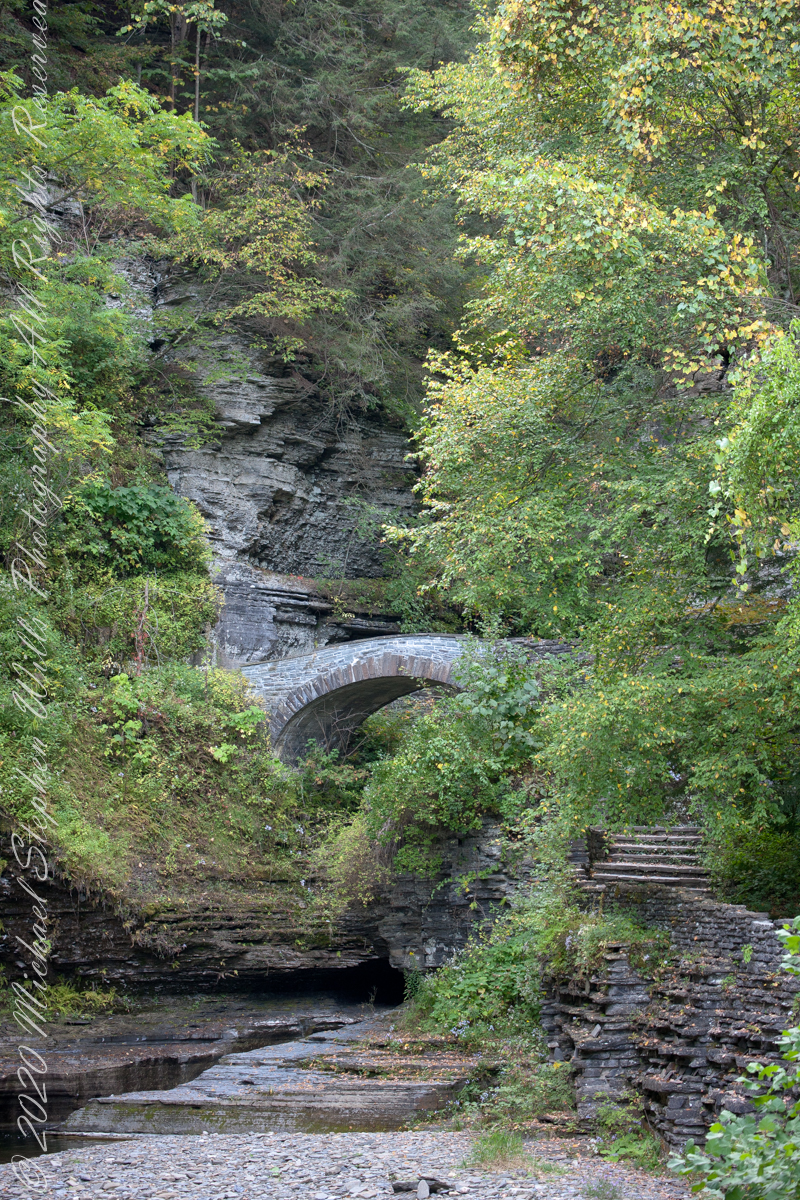
Looking back after crossing the Gallery Footbridge we are rewarded with this view, providing a better understanding of the site. It is evening on a mid-September evening, Robert H. Treman Park, Ithaca, Tompkins County, New York Copyright 2023 All Rights Reserved Michael Stephen Wills
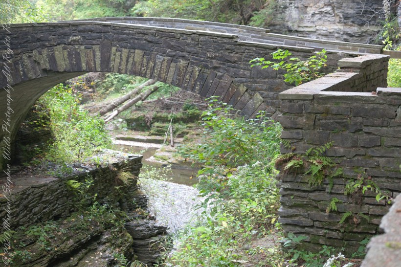
Here we are on the Gorge Trail of Treman State Park. My readers have seen this marvelous stone bridge from a distance. Here it is on the west side, facing east/northeast and looking down into the gorge. It is evening on a mid-September evening, Robert H. Treman Park, Ithaca, Tompkins County, New York Copyright 2023 […]
Here we are on the Gorge Trail of Treman State Park. My readers have seen this marvelous stone bridge from a distance. Here it is on the west side, facing east/northeast and looking down into the gorge.
Spanning the eastern side of the gallery entrance of the gorge.
It is evening on a mid-September evening, Robert H. Treman Park, Ithaca, Tompkins County, New York
Copyright 2023 All Rights Reserved Michael Stephen Wills