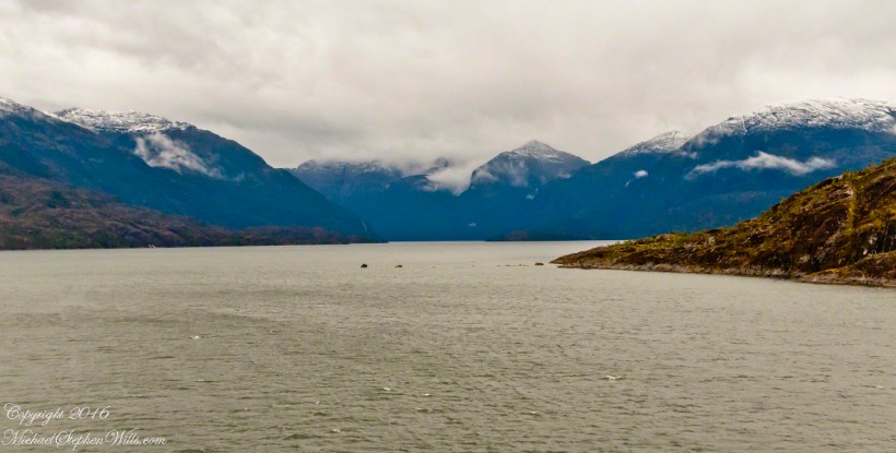
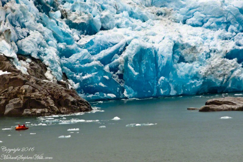
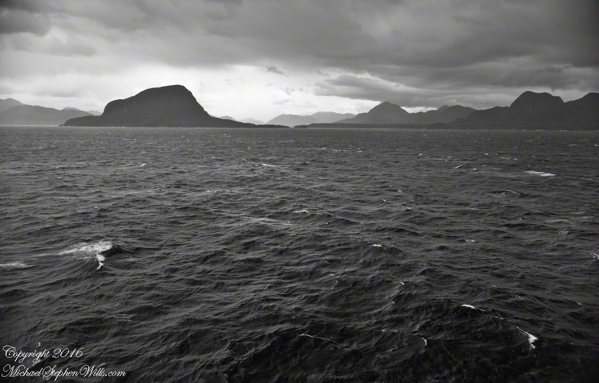
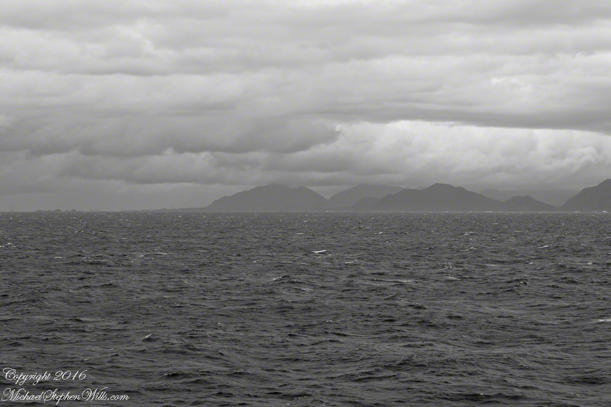
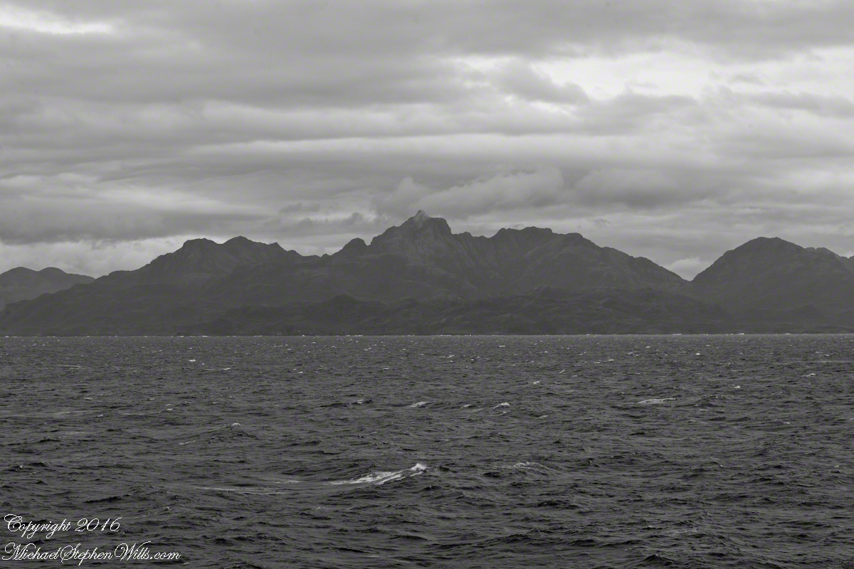
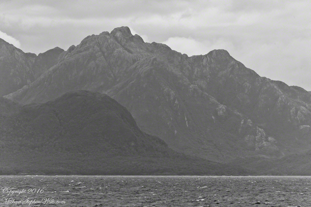
By 3:20 pm local time the Oceania was approximately 1.75 miles from the Iceberg Glacier and the captain positioned the ship for a starboard side glacier view. From our port side stateroom terrace Pam and I had this sweeping view of the way we had come.
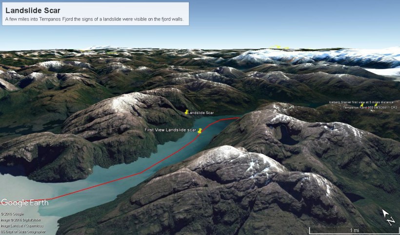
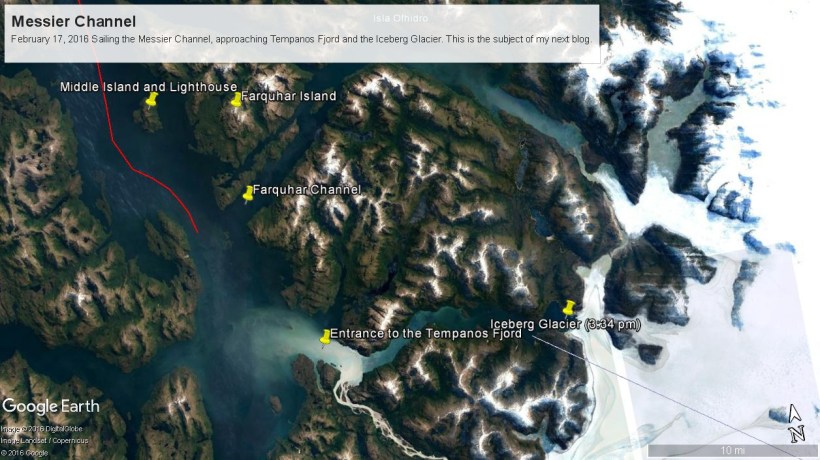
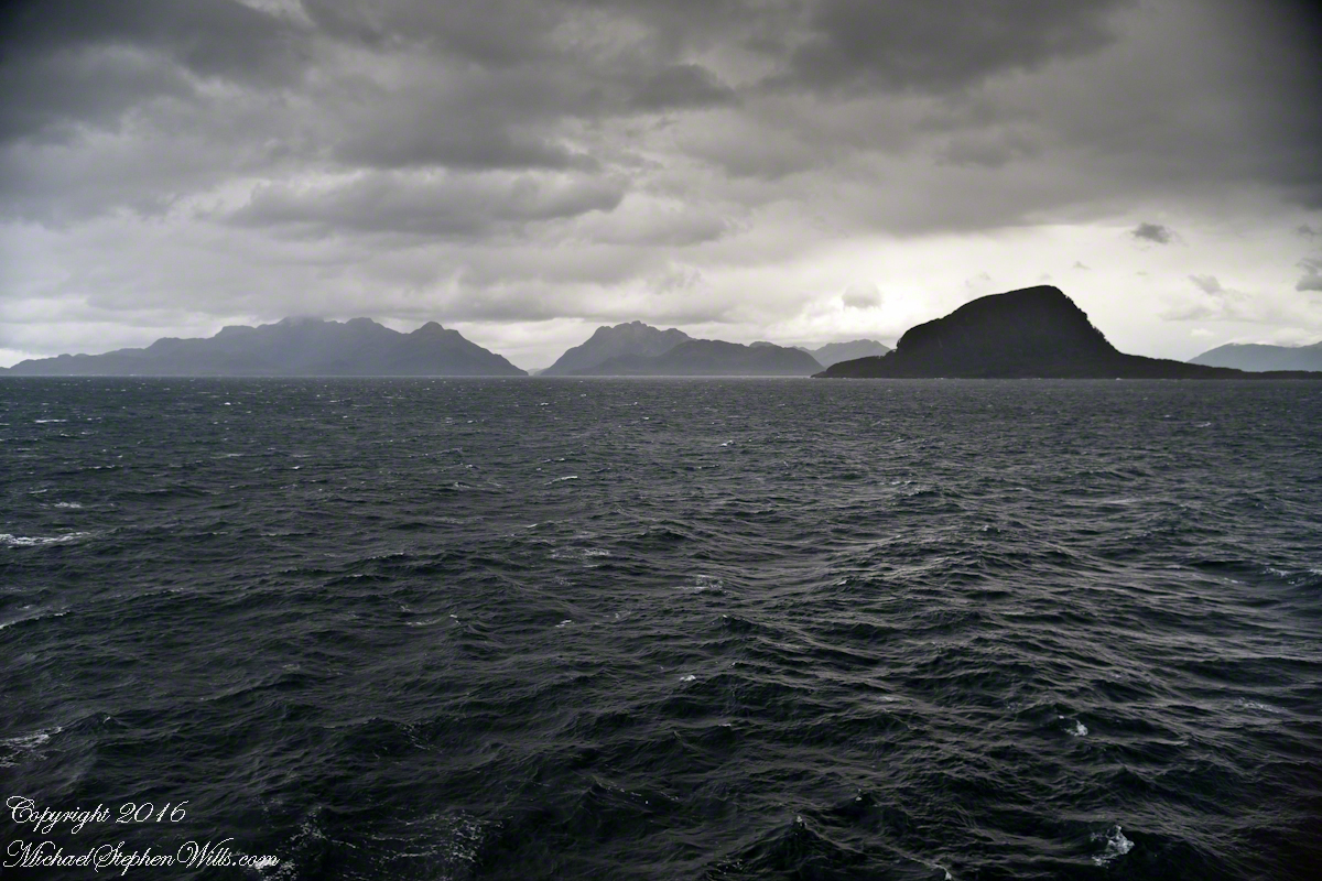
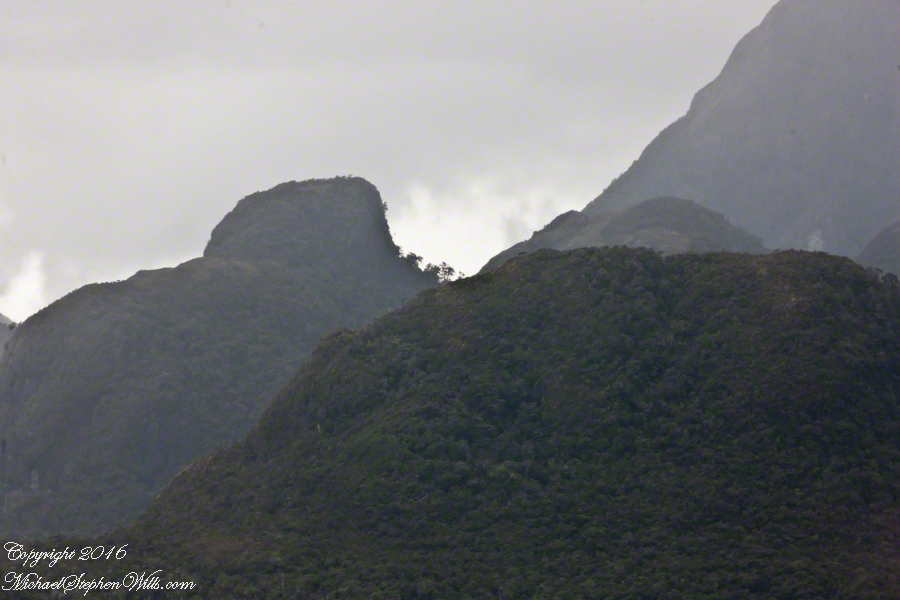
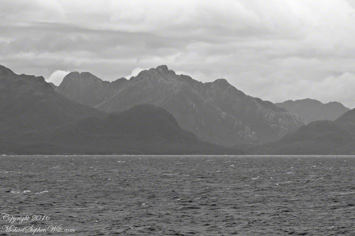
Tempanos Fjord is a mile across here and we have a clear view of the landslide scar feature in my last blog. It is 7.75 miles distant, a small white patch on the fjord wall. The landscape scar marks where the fjord bends, changing north, northeast course to an east, southeast direction. Before the bend, the Iceberg glacier is not visible. Turn the bend and the glacier is plainly visible in the distance if the viewer is looking over the ship bow.
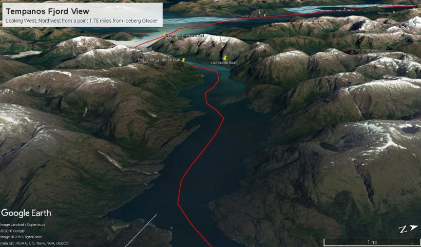
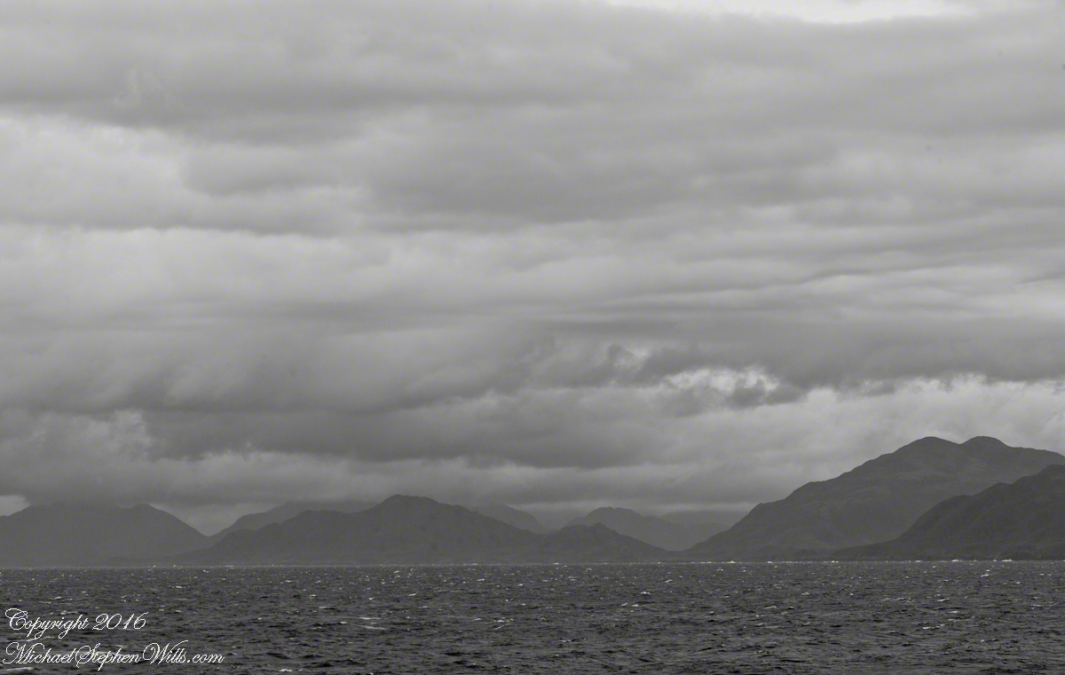
The following capture from Google Earth is the view from 14,000 feet. Marked are the locations of the landslide scar and the ship position were I first photographed the scar on our way into Tempanos Fjord. The red lined ship’s course may be followed out of the fjord back to the Messier Channel. The fjord follows a course among mountain peaks and deep valleys. A great pleasure of sailing Tempanos Fjord is the many vistas opening one to another.
(Click any photograph to visit my online gallery)
Copyright 2022 Michael Stephen Wills All Rights Reserved
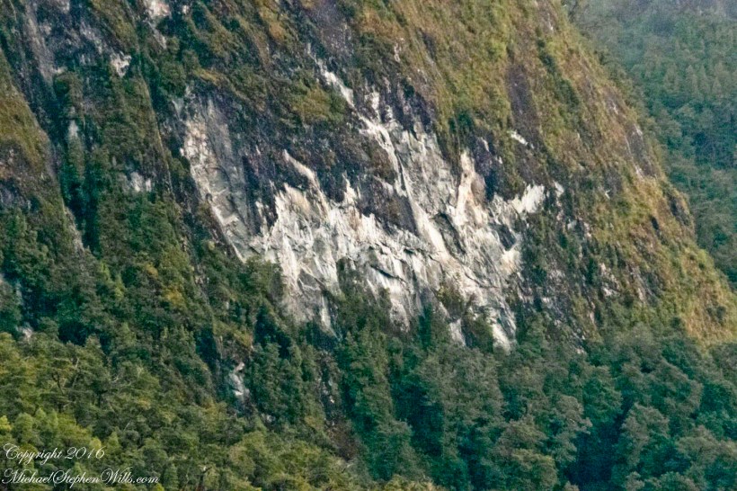
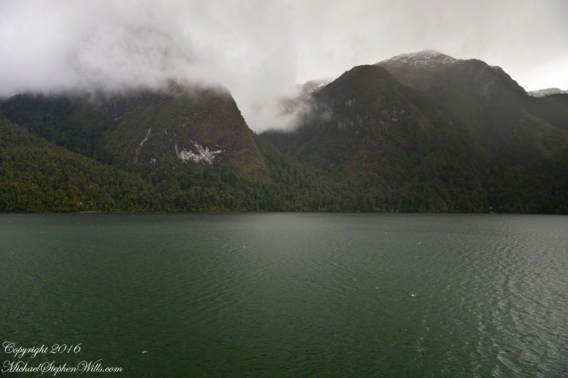
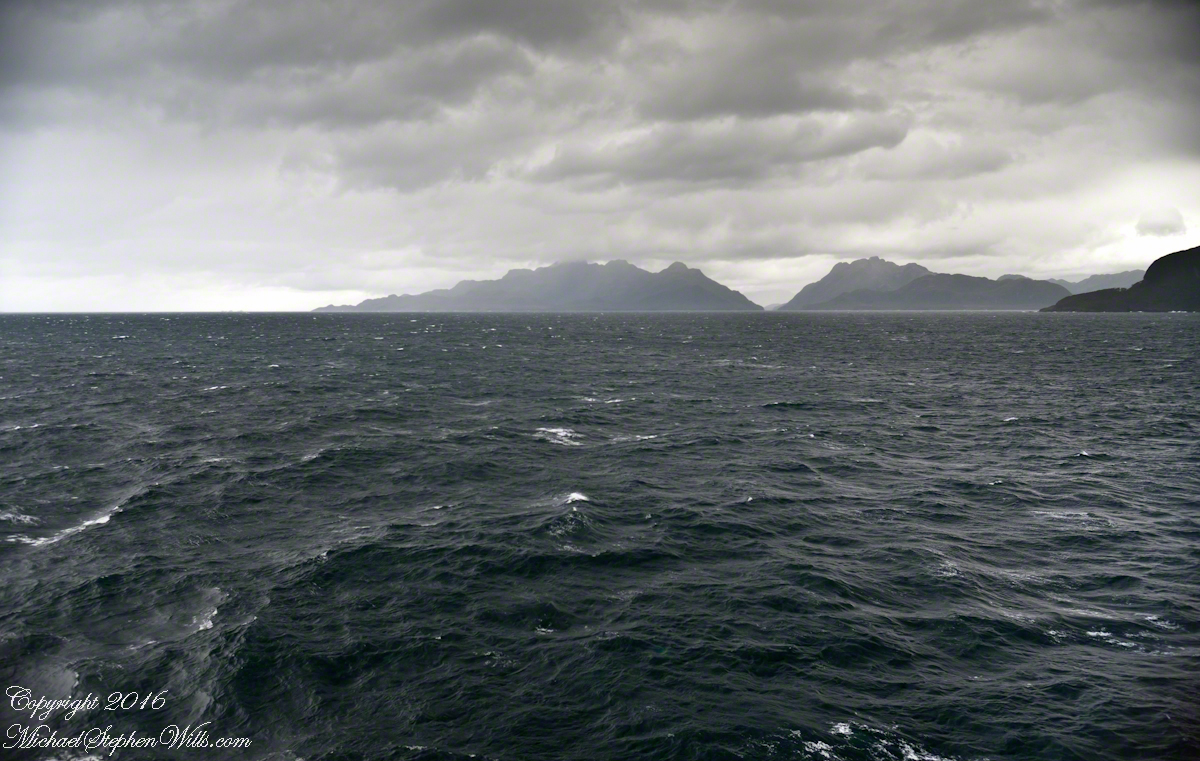
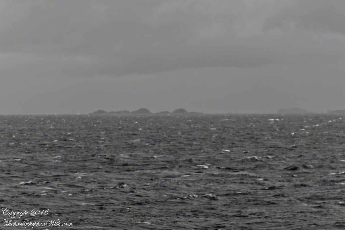
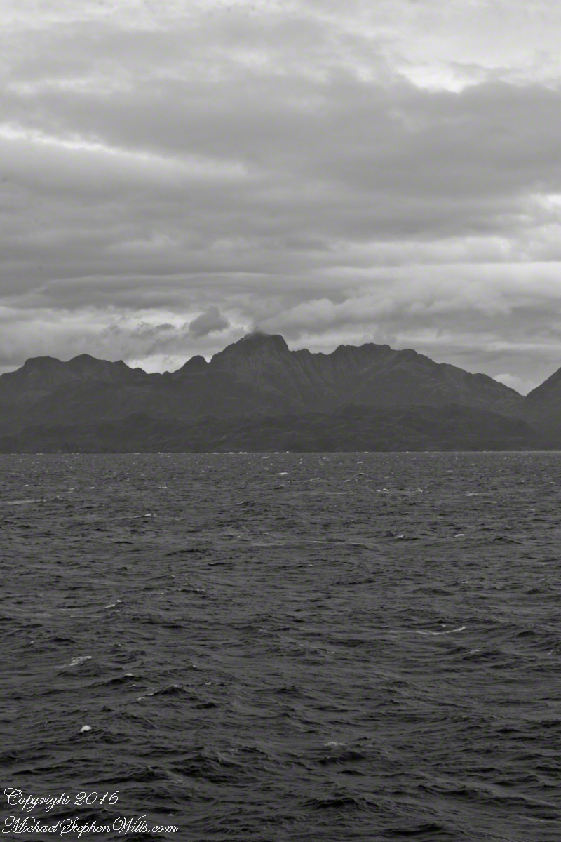
By 2:45 pm local time the Oceania was almost 4 miles into Tempanos Fjord, 10.5 miles from the Iceberg Glacier, when this telling gash on a mountain buttress forming the side of one of many glacial valleys.
Here is the Google Earth overview of our course that day through Tempanos Fjord, as the red line. Visible is the Farquhar Fjord, to the north. Marked is the position of the scar and the approximate position where I took the first view. Where the fjord bends to the southeast the glacier is not yet visible.
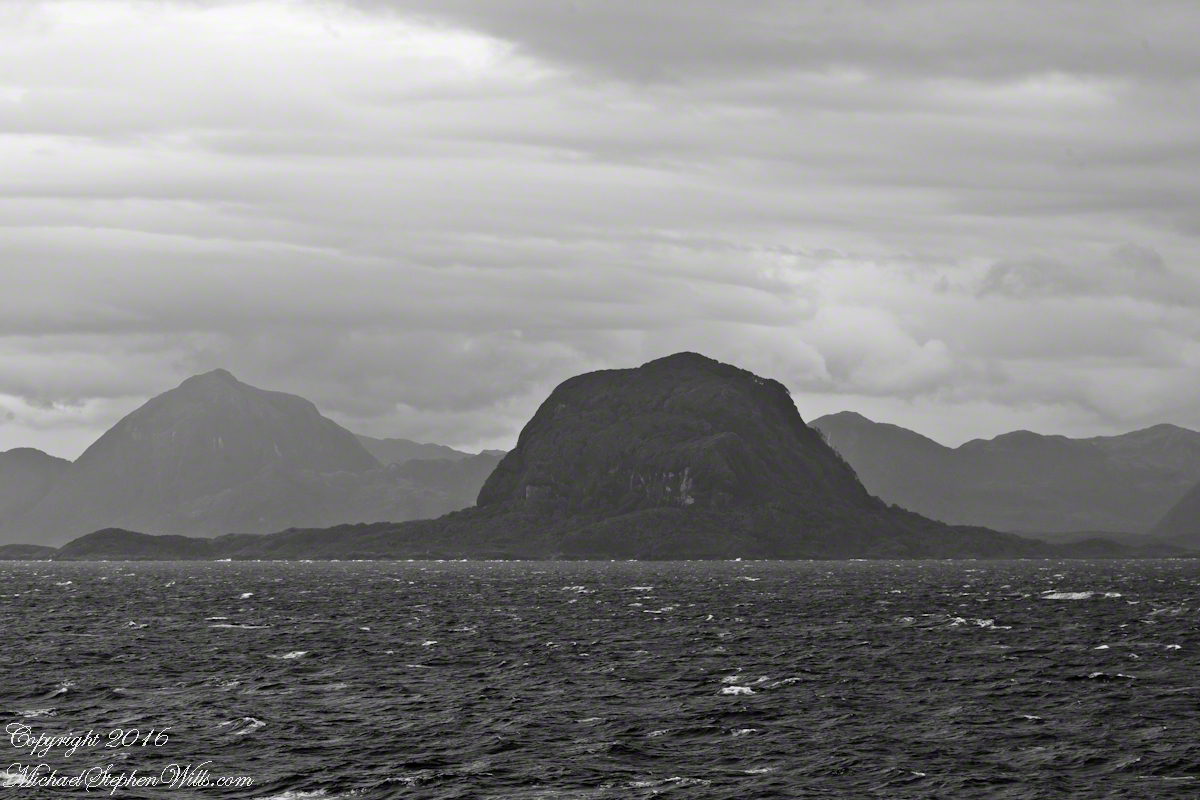
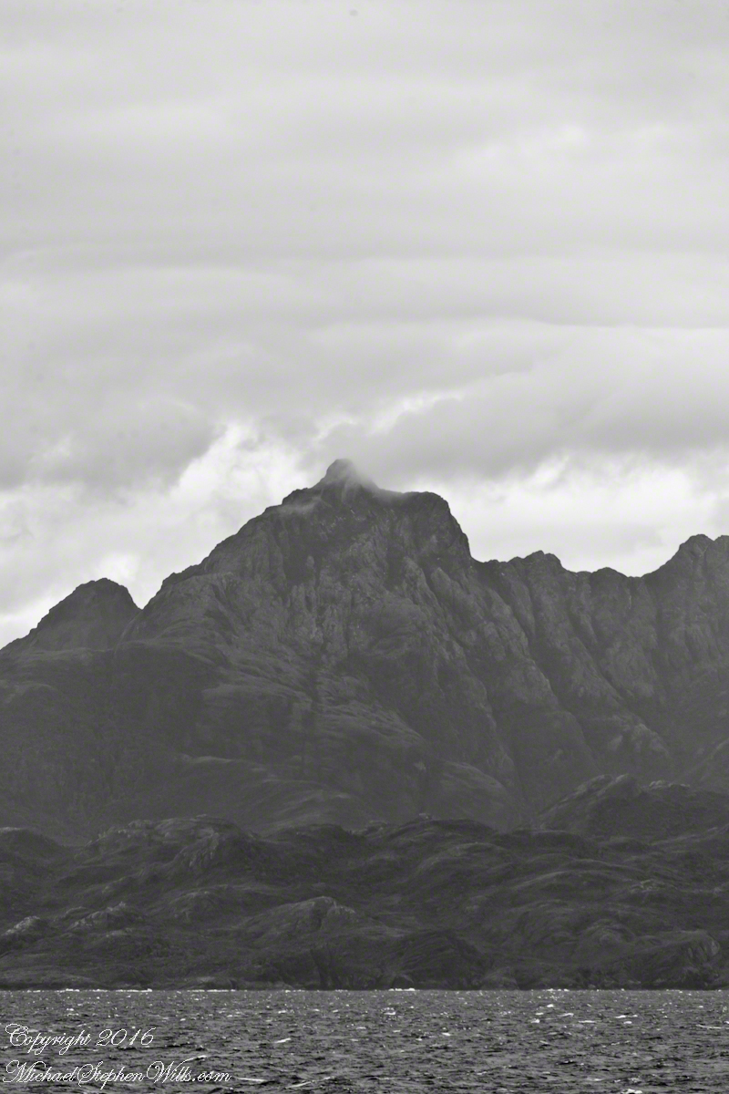
The scar, for all the rawness of the stone, is not recent. There was time for a forest to cover the destruction. The Oceania steamed past, making steady progress. The gash appeared ahead, unremarked. I wonder what the effect was after the cracks, slowly widened over decades by the ice, forced friction to give way to gravity, the mountainside sliding, perhaps, into the fjord. Hard to tell. There is no remnants of the slide visible.
All is larger than it first appears. Those are full size pines below the scar. It is the steepness of the cliff face that holds off the vegetation, the whiteness of the rock the source of the apparent freshness of the gash.
The mountainsides are threaded with waterfalls. Look closely to the left of the gash for a very thin line ending in a spray.
(Click any photograph to visit my online gallery)
TCopyright 2022 Michael Stephen Wills All Rights Reserved
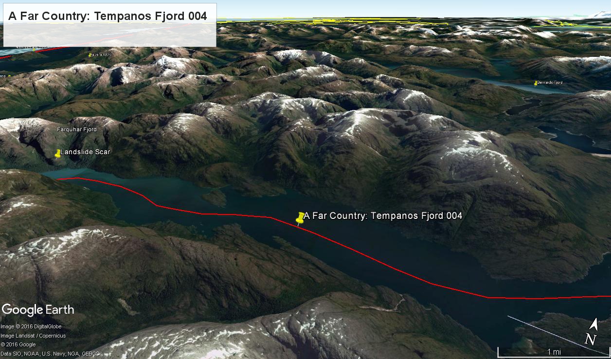
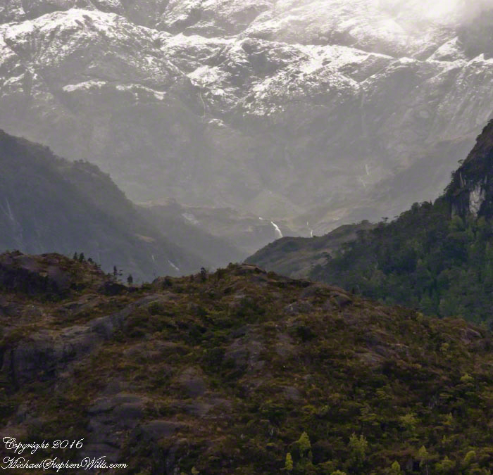
This is a view of the fjord countryside from the Oceania Regatta position about 4.75 miles from Iceberg Glacier . As the Regatta proceeded at the slow rate of 4.6 knots, I captured this high valley and waterfall from the position marked with the central pushpin in the following GoogleEarth image from 14,000 feet altitude.
Click any pic to visit my OnLine Gallery.
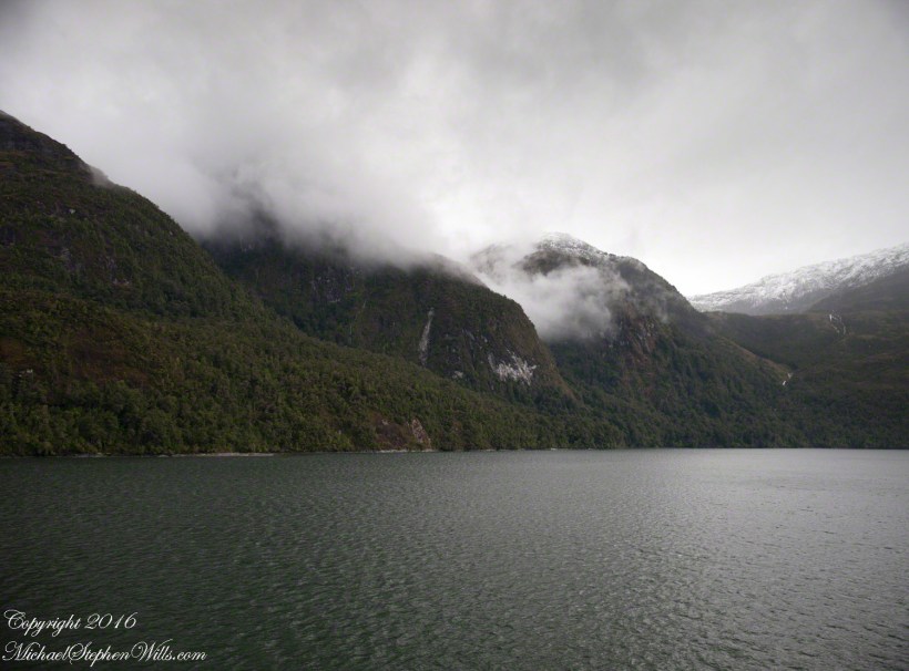
The following photograph is the view North. The far waterfalls are fed by two mountain top lakes, waters that feed into Tempanos Fjord. We are in the Chilean Aisen (also spelled Aysen) Region (XI) looking into a valley between Tempanos, Farquhar and Bernardo fjords. This island and valley has NO name, as far as I can tell. The region is uninhabited, part of the Bernardo O’Higgins National Park.
This was taken with a handheld Sony DSLR-A700, the variable lens at 200mm, 1/800 sec at f/13.
Copyright 2022 Michael Stephen Wills All Rights Reserved
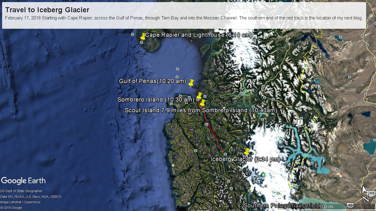
Here are a series of maps to aid your understanding of this series of blogs, starting with sunrise off Cape Rapier and ending with my next blog, the approach to Tempanos Fjord and the Iceberg Glacier.
Copyright 2022 Michael Stephen Wills All Rights Reserved
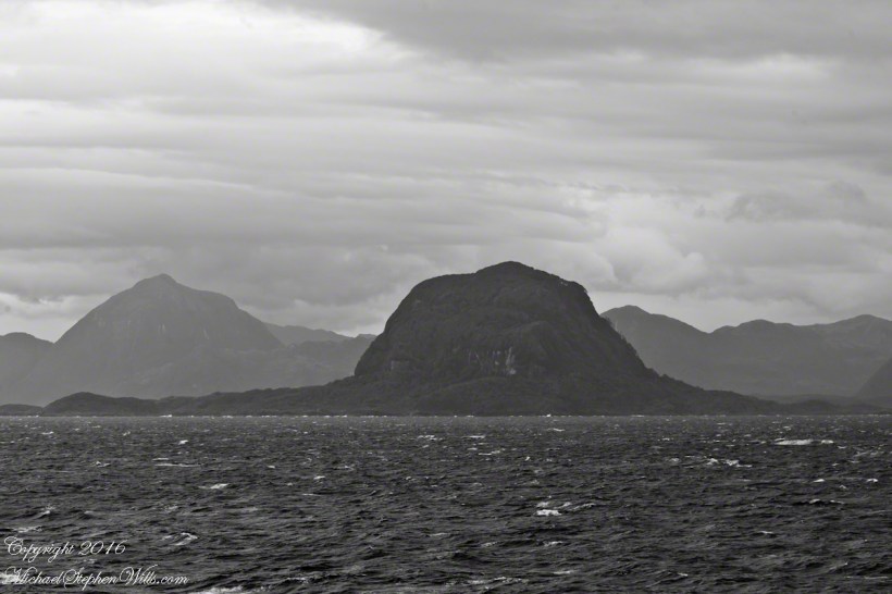
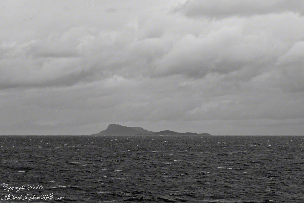
Islands Sombrero and Zealous In the distance are the crags of Porcia Island separated from Zealous Island, in the foreground, by Canal Cronjé (not visible). Sombrero Island is left, Zealous is the right.
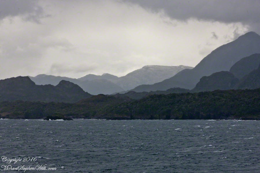
The Gulf of Penas is a sunken bowl of the western side of the southern Andes. Instead of canyons and valleys, fjords surrounded by craggy peaks are the rule. Sailing ships, driven by storms of the western Pacific, found ways through the fjords all the way to the straits of Magellan. This was our route as we entered the Messier Channel, a route discovered in the earliest years of colonial exploration.
Looking back the way we came…..
Peninsulas Larenas, Fresia, the Gulf of Penas The view is north-northeast from the entrance of the Messier Channel
At the mouth of the channel, Zealous and Sombrero are neighboring, and isolated hills. Surrounded by water, they are also islands. Zealous is just under 2,000 feet. Sombrero, at 200 feet, is prominent only for its position and shape.
Here we are crowded by headlands, points, islands all rising steeply from the water.
Here I have views of these islands with craggy peninsulas in the distance. The view is to the northeast and east.
Sombrero Island, 200 feet tall, rounded by glacial erosion.Sombrero Island, Peninsulas Larenas and Fresia The entrance to Fjord Eloise is in the distance where the two ridges separate. We are here sailing the Messier Channel.
Copyright 2022 Michael Stephen Wills All Rights Reserved
On our way to Fjord Tempanos and the Iceberg Glacier…..
Background: on a ship, facing the bow (front), starboard is right and port is left).
In the 8 miles from Tarn Bay and Sombrero Island lands press closer, higher, islands increase in number. This is a listing of some of the islands we passed. These names reflect the history of Chile, the waves of immigrants touch the land with memories. After some of the names, below, I provide in parentheses the derivation.
On starboard was the northern Wellington Archipelago (English General): Pinochet (the Chilean dictator), Penguin, Juan Stuven (Spanish and German), Chang (the far east), Millar (German).
On port, the names have a military flavor: Zealous, Scout, Scylla (Sea Monster of Greek mythology), Alert, Orlebar (British Officer Augustus Orlebar).
These port side island names reflect what is on the minds of mariners as navigational options narrow with the channel. Innumerable channels, points, mid-channel islets, all looking very much the same, a potentially confusing jumble. Chilean maritime law demands ships have on board, working from the bridge, a certified Chilean maritime pilot to transverse the country’s dangerous channels and fjords. The combination of stopping distance (multiple nautical miles) and the loss of steering when a ship moves slowly make it essential to know, exactly, the route ahead. It was a Chilean maritime pilot who help keep us safe.
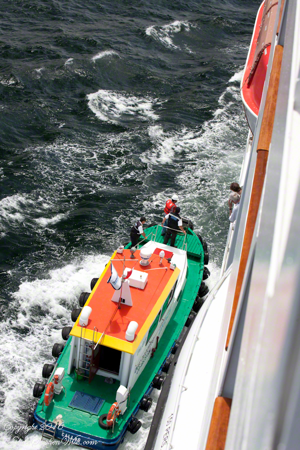
A great personal hazard for pilots is boarding the ship from the pilot boat. From our stateroom terrace we observed fast pilot boats in all seas approach the Regatta miles from port, the pilot on the bow, pull up alongside. Without a harness, the pilot transfers from boat to ship. We observed this several times from our stateroom veranda.
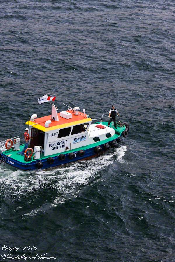
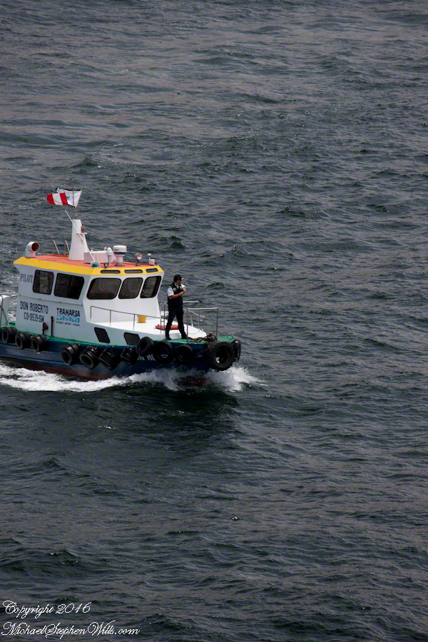
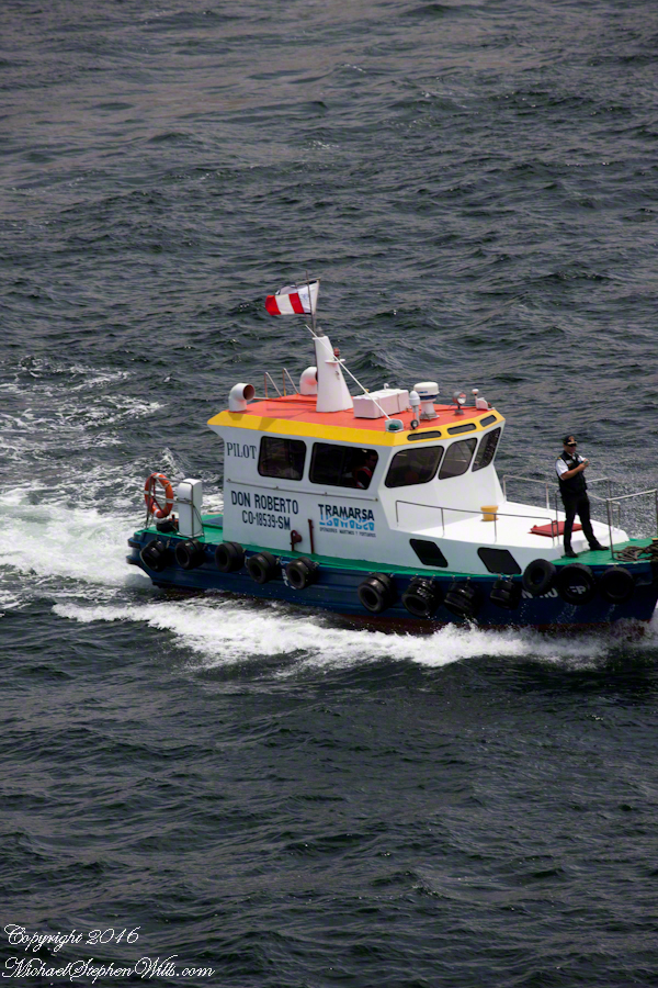
Here are shots of the pilot boat approaching the Regatta off the Peruvian port of Matarani. The boat was mirrored by the colorfully painted houses of Peru.
A fast pilot boat from Matarani approaches the Oceania Regatta. On the bow, the pilot will transfer from boat to ship. On board he will work with the Regatta crew to safely navigate the approach to the Matarani harbor and dock. The whiteness on the land is diatomaceous earth.The whiteness on the land is diatomaceous earth.
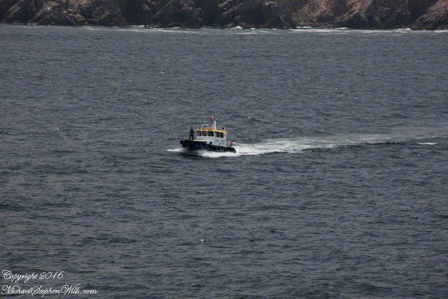
A cautious approach. In the third shot the boat turns to slowly approach the Regatta.
Alongside, boat crewmembers joint Don Roberto on the bow to assist in the transfer. I am not sure which of the two blue uniformed persons was “our” pilot.
I did not capture the boarding of the pilot who served the Regatta through the Chilean Fjords. Was is at Puerto Montt? Puerto Chacobuco? I am not sure. I do know a maritime pilot was on board as the channel narrowed to 2 miles, named Scout Channel were we passed Scout Island. I was facing generally east from our port side stateroom veranda while capturing these photographs as the Regatta headed south.
Scout Island. The water is Scout Channel
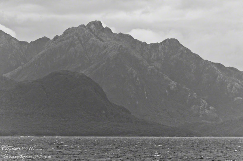
The peak on Scout Island is about 2,100 feet. The smaller peaks in front are about 1,200 and 1,500 feet. All rise straight up from Scout channel.
Scout Island lies on the Scout CanalLying just south of Scout Island, Scylla Island is between our ship, in the Scout Canal, and the Kruger Canal. The Kruger is short, between Islands Scout, Orebar, Zealous, Porcia and Tito.Islet Alert is between Canal Scout and Canal Kruger. On the far left there are waves breaking on Pilot Point of Orebar Island, marking the northern end of a small bay, named Hale. You can see the bay behind Islet Alert. On the far left there are waves breaking on Pilot Point
In English the Gulf of Penas means “Gulf of Distress.” Open to the storms of the western pacific ocean, ships seeking refuge sail this body of water to reach the shelter of the bays around the entrance of the Messier Channel.
Stargazing Chileans named the channel after Charles Messier (1730 – 1870), author of a catalog of 110 visually diffuse celestial objects such as the Great Cluster of Hercules, the Crab Nebula of Taurus, the Ring Nebula of Lyra. As Messier catalog objects these are listed on star charts as M13,M1,M57.
The Larenas and Fresia peninsulas of Aisen Province, Chile, on the southeastern shores of the gulf are seen here as we approach the Messier Channel. The shore is dotted with islets and islands. The Chilean pilot who came aboard at Puerto Chacobuco is earning his salary, keeping us safe. To reach the channel we pass through Tarn Bay, generally north to south. The southern margin of the bay is marked by Sombrero Island, the subject of my next blog.
Larenas Peninsula and Merino IsletsClose-up of the Merino IsletsAyautau IslesThe Northern Patagonian Ice Fields lay to the east and north of these mountains of the Larenas Peninsula.High Ridge of the Larenas PeninsulaLarenas Peninsula High Ridge 2Larenas Peninsula High Ridge Close 3The craggy heights of the Larenas Peninsula are in the rear. On the right are Fresia Point (of the eponymous peninsula) and the entrance to Fjord Eloisa.Larenas Peninsula High Ridge Closer 5
Copyright 2022 Michael Stephen Wills All Rights Reserved
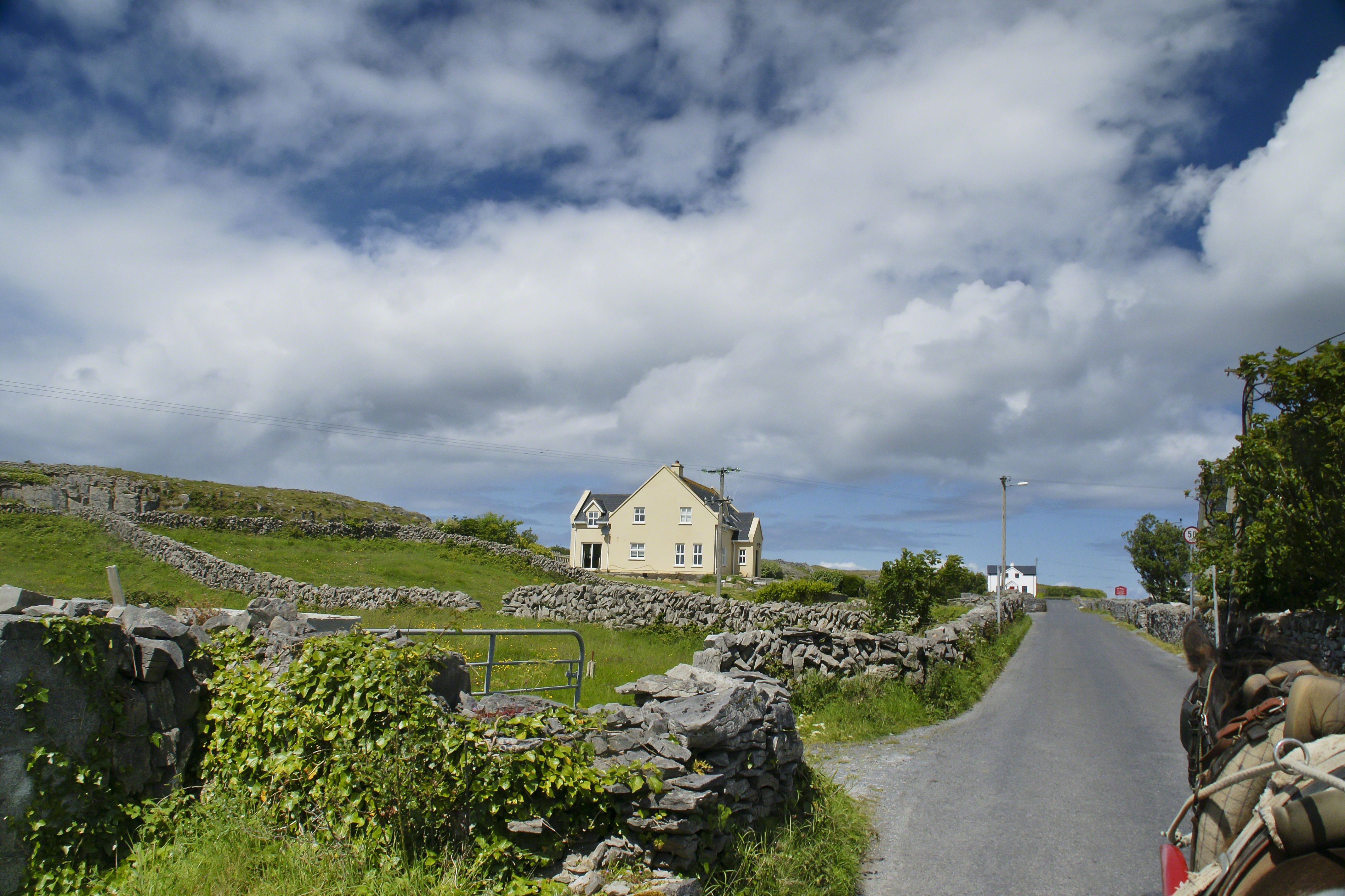
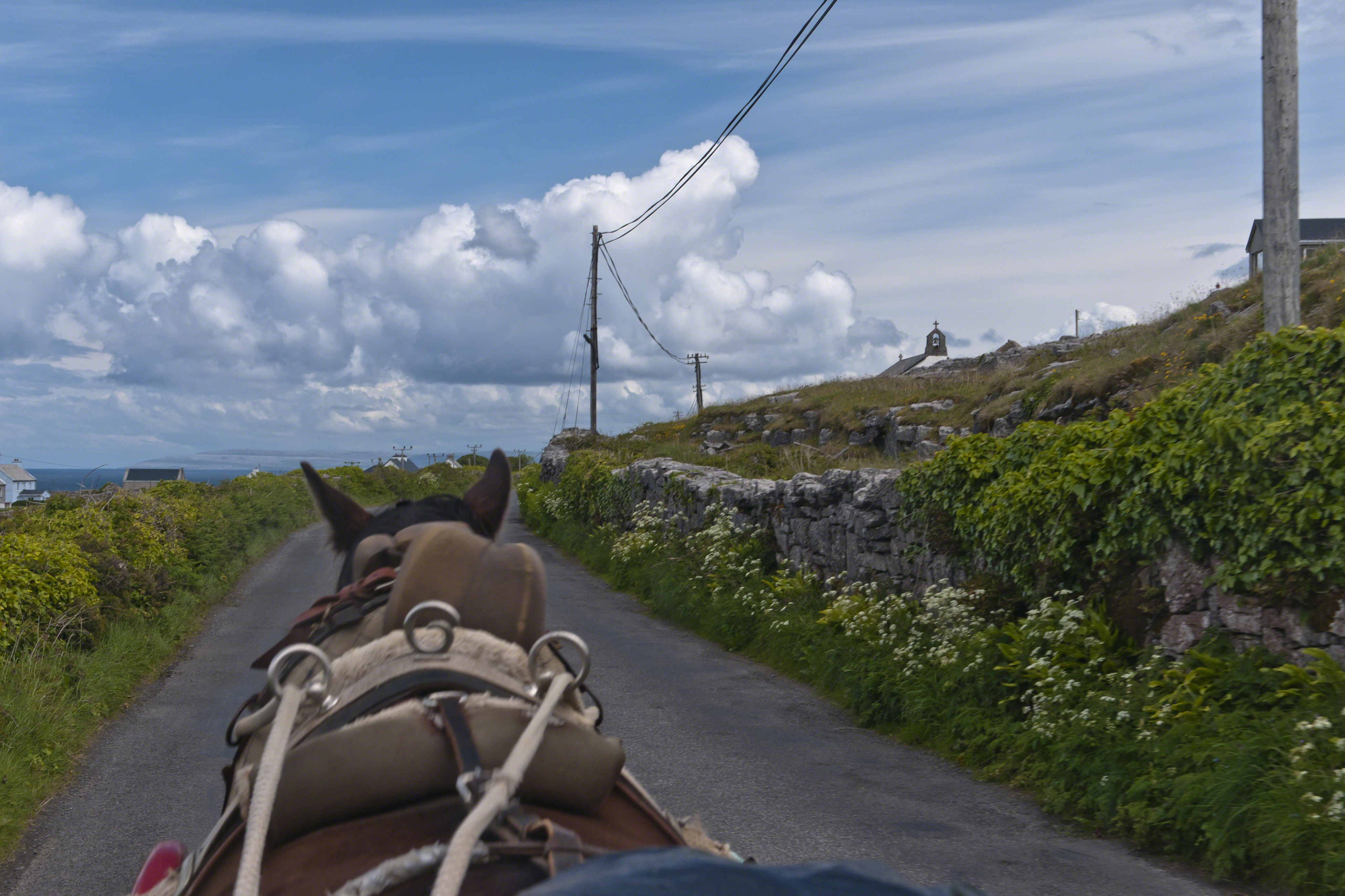
Enjoying travel on a horse trap, a type of carriage, on Inishmore (Inis Mór), the largest Aran Island in Galway Bay we headed up Cottage Road from Kilronan, the main island settlement. It was there we embarked from the ferry, hired the driver, his horse drawn trap. Our destination an iron age fort, Dun Aengus (Dún Aonghasa, the Irish language name) and the sights along the way.
Headed up Cottage Road, I captured this view of dry stone walls and homes against the May sky over the shoulder of our horse.
Another aspect of the gradual 1/2 mile inclined path to the central ring of the prehistoric Dun Aonghasa ruins of County Galway, Ireland.
The view north, northwest from this way to Dun Aonghasa (Dun Aengus). In early June, looking across wildflowers, karst landscape, walled fields, farms, the North Atlantic Ocean, coast of Connemara and the 12 Bens (12 Pins) mountains.
Note the doorway (with long lintel) in the surrounding wall, to left of center in middle distance.