On Point at the Cusco Saturday Market reprise

Marketing choices

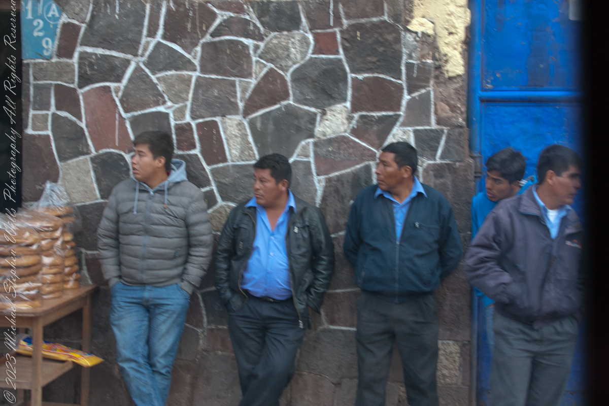
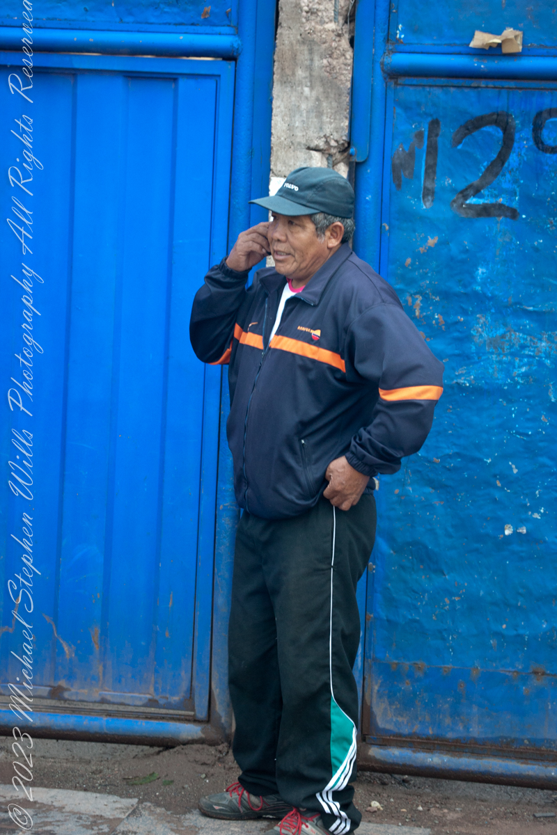
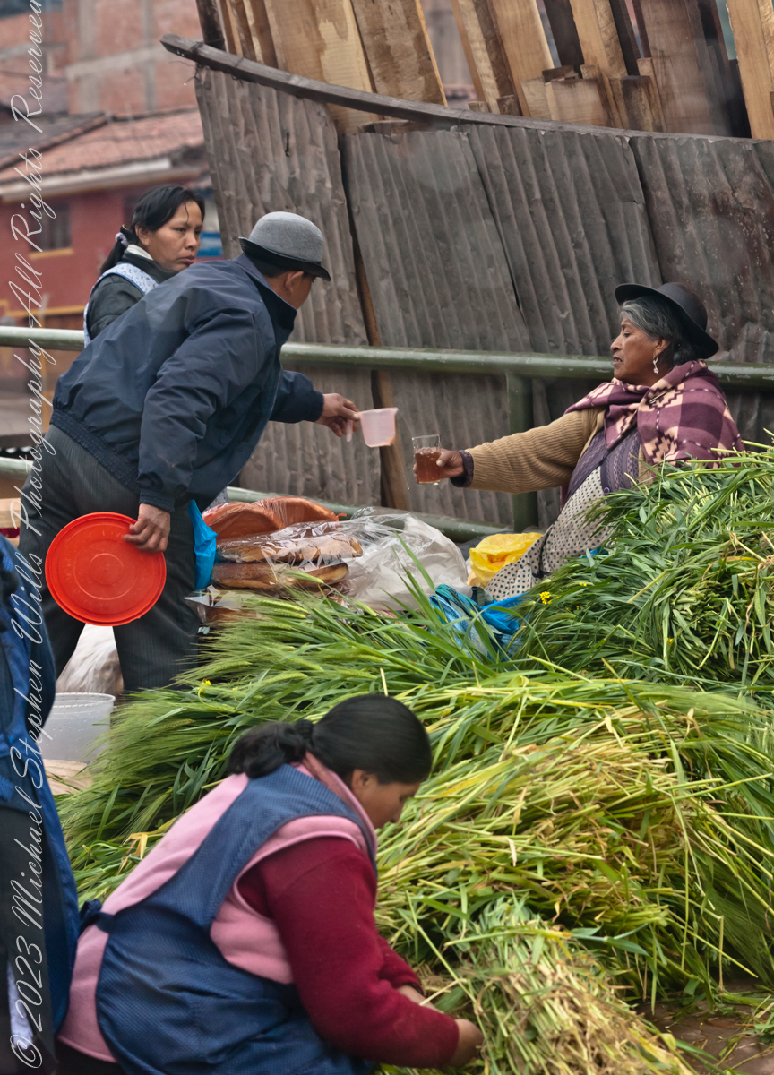
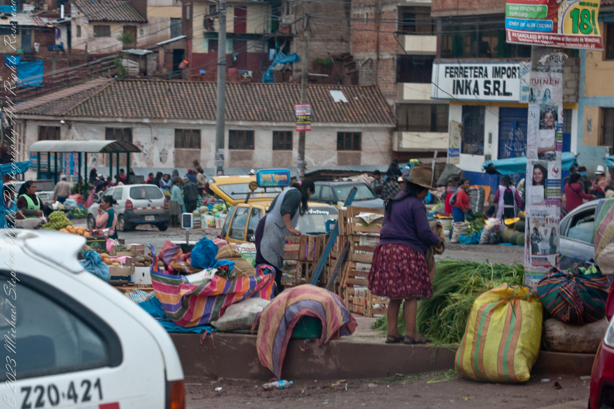
The scenes at Cusco’s Saturday Market were fascinating. The shooting was through a clean bus window using a handheld Canon EF 70-300 f/4-5.6 L IS USM lens mounted on the Canon dslr 1DS Mark III.

Click Me for my Online Gallery

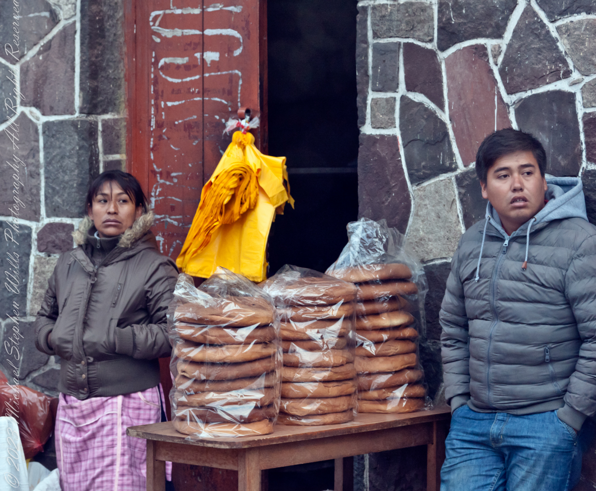
“Inka S.R.L.” is a agriculture company full name INDUSTRIA DE ALIMENTOS E INVERSIONES PERU INKA SRL specialized in ELAB OF OTHER PROD. FOOD.. It was created and founded on February 2, 2002.

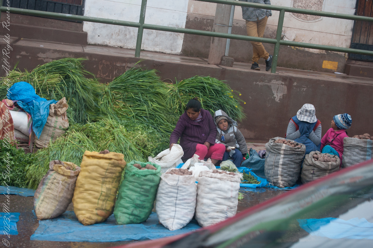
Very early for these children…

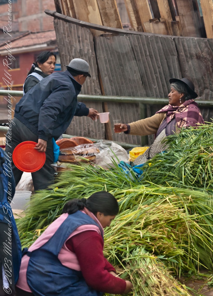
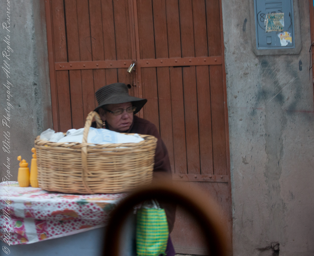
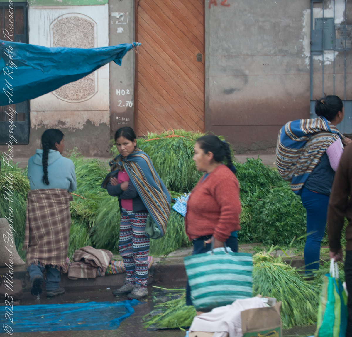
Quechua people or Quichua people, may refer to any of the aboriginal people of South America who speak the Quechua languages, which originated among the Indigenous people of Peru. Although most Quechua speakers are native to Peru, there are some significant populations in Ecuador, Bolivia, Chile, Colombia, and Argentina. The woman center left sports traditional fabrics of her pants and shawl.

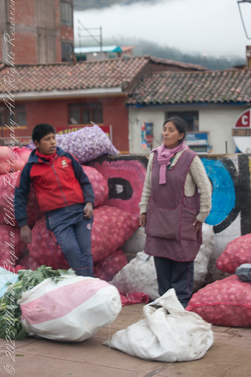
Onions and garlic, potatoes? Wild potato species can be found from the southern United States to southern Chile. The potato was originally believed to have been domesticated by Native Americans independently in multiple locations, but later genetic studies traced a single origin, in the area of present-day southern Peru and extreme northwestern Bolivia. Potatoes were domesticated there approximately 7,000–10,000 years ago, from a species in the Solanum brevicaule complex. In the Andes region of South America, where the species is indigenous, some close relatives of the potato are cultivated.
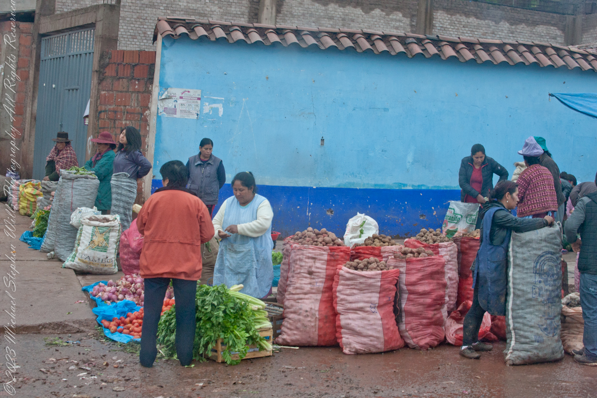
Potatoes!!

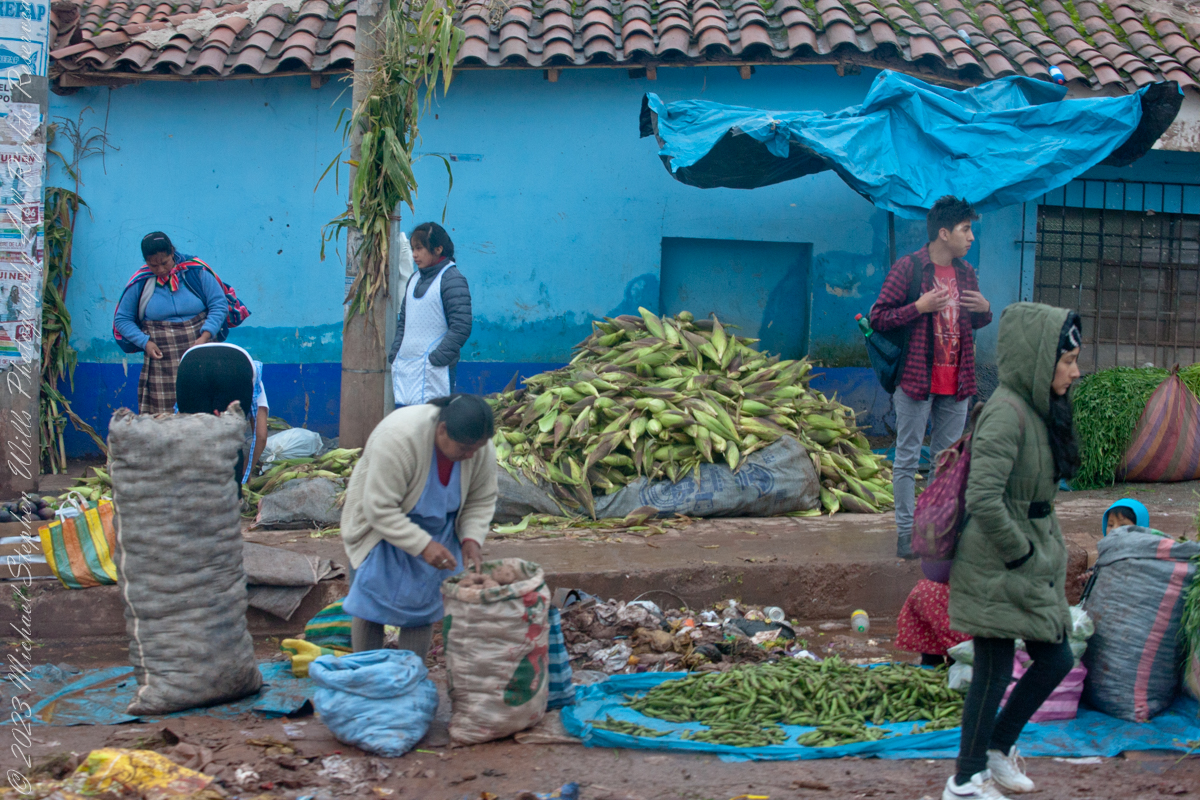
Maize, also known as corn in North American and Australian English, is a cereal grain first domesticated by indigenous peoples in southern Mexico about 10,000 years ago.

Click Me for the next post in this series.

Reference: Wikipedia “Maize,” “potato,” “Indigenous peoples of Peru.”

Copyright 2023 Michael Stephen Wills All Rights Reserved

On Point at the Cusco Saturday Market

Marketing choices

I caught these participants of the Cusco, Peru, Saturday Market as our bus progressed toward Machu Picchu during our daytrip to that ruin. The shooting was through a clean bus window using a handheld Canon EF 70-300 f/4-5.6 L IS USM lens mounted on the Canon dslr 1DS Mark III.

Click Me for my Online Gallery

Several days supply of bread for a family.

Cusco, Peru– February 6, 2016:

Watching the world go by.

Transacting business

Click Me for the next post in this series.

Copyright 2023 Michael Stephen Wills All Rights Reserved

Breaktime

Cusco Saturday Market

A group of Quechua vendors during the Saturday Market of Cusco. A seller of baked goods is taking a break while, in the foreground, a woman prepares an order of greens used to feed guinea pigs, a staple of native Peruvian cuisine.

Click Me for my Online Gallery

Cusco, Peru– February 6, 2016:

We were headed out of Cusco on our daytrip to Machu Picchu.

Click Me for the next post in this series.

Copyright 2023 Michael Stephen Wills All Rights Reserved

Juniper Sunrise

crack of dawn

In this post we start the day of my posting “Family Trek, July 19, 2008, when, well before the sun rose at 6:23 am Mountain Daylight Time (the Navajo Reservation observes daylight savings, the rest of Arizona does not), Pam and I were at the Spider Rock Overlook.

Most visitors to the canyon make use of a system of roads and parking lots next to strategic views.  There is the White House Overlook we visited our first day, July 18, to hike from the trailhead into the canyon.  There are also, on the south side of the canyon:

  • Tsegi Overlook, taken from a Navajo word that translates directly to “between the rocks” and usually refers to a deep canyon with steep cliffs.
  • Junction Overlook above the point where Canyon Del Muerto (see my posting “Sun and Shade, Canyon Del Muerto”, and Canyon De Chelly intersect.  There is an Anasazi ruin in the south-facing cliff across the canyon.
  • Sliding House Overlook, another Anasazi run across the canyon.
  • Face Rock Overlook, to view the eponymous formation.
  • Spider Rock Overlook, the most stunning rock formation. 
Sunrise Canyon De Chelly
Looking east from the Spider Rock overlook, Canyon De Chelly.

While getting ready I scoped out the location for interesting visual tropes.  Utah Junipers are exceptionally hardy shrubs, stressed individual plants grow into compelling forms shaped by hardship.  As the sun rose, this specimen emerged from the gloom and caught the first sun rays.

Juniper Sunrise
A distressed Utah Juniper on the edge of Canyon De Chelly overlooking Needle Rock a few moments after sunrise.

Enjoy!!

Click for the first posting of this series, “Portrait of a Navajo Guide.”
 

The Flatiron

Where is the ironing board?

The setting sun’s glow on the end point of Upper Siphon Draw trail, The Flatiron.

Click Me for my Online Gallery

The mountain was formed by a series of volcanic eruptions between 20.5 and 18 million years ago. The west face of the mountain is composed of dacite lava and rhyolitic tuff. The overlying tuff was deposited during an eruption which created a collapse caldera bounded by faults. Dome resurgence reactivated these faults, causing uplift of the caldera floor which juxtaposed the softer tuff and more resistant dacite. Differential weathering caused the outer tuff to erode faster, leaving the dacite cliffs exposed and creating the prominent mountain visible today.

The Flatiron, the mesa-like projection above us in this view, is long solidified dacite lava. The word dacite comes from Dacia, a province of the Roman Empire which lay between the Danube River and Carpathian Mountains (now modern Romania and Moldova) where the rock was first described. Lost Dutchman State Park, Apache Junction, Maricopa County, Arizona

Reference: Wikipedia “Superstition Mountain” and “Dacite Lava.”

Copyright 2023 Michael Stephen Wills All Rights Reserved

Treman Millipede

Visitors to Robert H. Treman park think nothing of crushing millipedes on the trail, it is concerning to encounter evidence of such disrespectful and boorish behavior. Here is an intact millipede I found last week. Millipedes are a group of arthropods that are characterized by having two pairs of jointed legs on most body segments; […]

Visitors to Robert H. Treman park think nothing of crushing millipedes on the trail, it is concerning to encounter evidence of such disrespectful and boorish behavior. Here is an intact millipede I found last week.

Millipedes are a group of arthropods that are characterized by having two pairs of jointed legs on most body segments; they are known scientifically as the class Diplopoda, the name derived from this feature. Each double-legged segment is a result of two single segments fused together. Most millipedes have very elongated cylindrical or flattened bodies with more than 20 segments, while pill millipedes are shorter and can roll into a tight ball. Although the name “millipede” derives from Latin for “thousand feet”, no species was known to have 1,000 or more until the discovery of Eumillipes persephone, which can have over 1,300 legs.

There are approximately 12,000 named species classified into 16 orders and around 140 families, making Diplopoda the largest class of myriapods, an arthropod group which also includes centipedes and other multi-legged creatures. Most millipedes are slow-moving detritivores, eating decaying leaves and other dead plant matter. Some eat fungi or drink plant fluids, and a small number are predatory.

Millipedes are generally harmless to humans, although some can become household or garden pests. Millipedes can be an unwanted nuisance particularly in greenhouses where they can potentially cause severe damage to emergent seedlings. Most millipedes defend themselves with a variety of chemicals secreted from pores along the body, although the tiny bristle millipedes are covered with tufts of detachable bristles. Its primary defense mechanism is to curl into a tight coil, thereby protecting its legs and other vital delicate areas on the body behind a hard exoskeleton. Reproduction in most species is carried out by modified male legs called gonopods, which transfer packets of sperm to females.

Millipedes are among the first animals to have colonized land during the Silurian period. Early forms probably ate mosses and primitive vascular plants. Millipedes also exhibit the earliest evidence of chemical defense, as some Devonian fossils have defensive gland openings called ozopores. Millipedes, centipedes, and other terrestrial arthropods attained very large sizes in comparison to modern species in the oxygen-rich environments of the Devonian and Carboniferous periods, and some could grow larger than one meter. As oxygen levels lowered through time, arthropods became smaller.

Most millipedes are detritivores and feed on decomposing vegetation, feces, or organic matter mixed with soil. They often play important roles in the breakdown and decomposition of plant litter: estimates of consumption rates for individual species range from 1 to 11 percent of all leaf litter, depending on species and region, and collectively millipedes may consume nearly all the leaf litter in a region. The leaf litter is fragmented in the millipede gut and excreted as pellets of leaf fragments, algae, fungi, and bacteria, which facilitates decomposition by the microorganisms.

Reference: “Millipede” Wikipedia

Copyright 2023 All Rights Reserved Michael Stephen Wills

Dragoon Ridge

Dragoon, not dragon

Dragoon Mountains of southeastern Arizona are named, not for the resemblance of this ridge to the back of a Dragon, but for a type of soldier trained for horseback riding and infantry.  These were the U.S. troops sent to “pacify” the Chiricahua Apache homeland.

Understanding location lighting is a matter of experience and luck.

Cochise Stronghold campsites are on the eastern slope of the Dragoons, sheltering them from the late afternoon sun.

One this day in April I explored the trails until sunset and was lucky enough to be setup for the 14 minutes of that day when the light was absolutely perfect.

Copyright 2023 Michael Stephen Wills All Rights Reserved

Dragoon Spires

Lucky enough

Understanding location lighting is a matter of experience and luck.

Cochise Stronghold campsites are on the eastern slope of the Dragoons, sheltering them from the late afternoon sun.

One this day in April I explored the trails until sunset and was lucky enough to be setup for the 14 minutes of that day when the light was absolutely perfect.

“Dragoon Spires in Afternoon Light”

These photographs are from two days spent at Cochise Stronghold, a part of the U.S. Forest Service Coronado Forest managed by Arizona State Parks located off the Interstate 10 East of Tucson between Benson and Wilcox.

This rugged natural fortress was, for some 15 years, the home and base of operations for the famed Chiricahua Apache Chief, Cochise.  Cochise and about 1,000 of his followers, of whom some 250 were warriors, located here.

Click Me for my OnLine Gallery

Born in present-day Arizona, Cochise led the Chiricahua band of the Apache tribe during a period of violent social upheaval. In 1850, the United States took control over the territory that today comprises Arizona and New Mexico.  Not hostile to the whites at first, he kept peace with the Anglo-Americans until 1861, when he became their implacable foe because of the blunder of a young U.S. Army officer, Lt. George Bascom.   In that year, Cochise and several of his relatives had gone to an encampment of soldiers in order to deny the accusation that they had abducted a child from a ranch. The boy was later proved to have been kidnapped by another band of Apaches.

During the parley, Cochise and his followers were ordered held as hostages by Bascom, but Cochise managed to escape almost immediately by cutting a hole in a tent. Bascom later ordered the other Apache hostages hanged, and the embittered Cochise joined forces with Mangas Coloradas, his father-in-law, in a guerrilla struggle against the American army and settlers. The capture and murder of Mangas Coloradas in 1863 left Cochise as the Apache war chief.   The U.S. Army captured him in 1871 and prepared to transfer the Chiricahua to a reservation hundreds of miles away, but he escaped again and renewed the resistance campaign. The following year after negotiating a new treaty with the help of Thomas Jeffords, the band was allowed  to stay in their homeland.

Cochise is reputed to have been a master strategist and leader who was never conquered in battle.  He died peacefully on the newly formed Chiricahua  reservation in 1874.  His son, Taza succeeded him as chief.   Upon his death, he was secretly buried somewhere in or near his impregnable fortress.  The exact location has never been revealed or determined.

The town of Cochise, Cochise County, the renowned geological feature known as Cochise’s Head in the Chiricahua Mountains, and the Stronghold are all named in tribute to him.

Copyright 2023 Michael Stephen Wills All Rights Reserved

Cochise Stronghold Introduction

Campground is closed in June, July, and August due to the often-extreme heat

These photographs are from two days spent at Cochise Stronghold, a part of the U.S. Forest Service Coronado Forest managed by Arizona State Parks located off the Interstate 10 East of Tucson between Benson and Wilcox.

“Idyllic Desert Landscape with Boulders”


Click Me for my OnLine Gallery

“Generations”


Here is the Cochise Stronghold information sign from the Douglas Ranger District of the Coronado National Forest.

The Dragoon Mountains are a low range that barely rises above the surrounding desert floor. Nevertheless, the granite boulders are spectacular and well worth visiting for the scenery alone. This mountain range is remote from cities or even any large towns, so visitation is light. Late fall, winter, and early spring are the best times to visit. Temperatures exceeding 100 degrees are common even in spring and fall. Cochise Stronghold Campground is closed in June, July, and August due to the often-extreme heat.

Safety First: Heat and low humidity are real hazards for people unfamiliar with desert climates. A person can loose up to 5 quarts of fluid a day and it is easy to become seriously dehydrated without realizing it, so drink plenty of fluids even if you do not feel very thirsty. Always carry extra water in your car. When going on a hike, even if a short one, take a day pack with water, snack foods, protective clothing, flashlight, first aid kit, compass, and map. To avoid sun in

Copyright 2023 Michael Stephen Wills All Rights Reserved

Oak Creek Mandala

early one still morning

This quiet nook is hidden along the Oak Creek Canyon trail, though easy enough to find.

I visited there just at dawn when the air was still and the usually busy site deserted.

Oak Creek Canyon is named for the native, evergreen oak species unique to desert environments.  The leaves conserve moisture: small, thick.  I remember camping at the Chiricahua National Monument on November.  All night the acorns fell onto the metal picnic tables, a loud metallic thunk.  

The post header is a primrose flower growing on the bank of Oak Creek.

Recognize the rock from “Oak Creek Mandala”?  This is farther up the Oak Creek Canyon trail, “photograph by Pam Wills.”  I am in my warm weather photography kit of the time having passed the camera to Pam for the shot.

Click this link for my Fine Art Photography gallery. You can find Oak Creek Mandala in the Arizona gallery.  The gallery description gives more information about the site.

Click this link for another Arizona post, “Cochise Dawn.”