Cascadilla Gorge: Nature and Art in Harmony

Explore this place with me in the spirit of Thanksgiving.

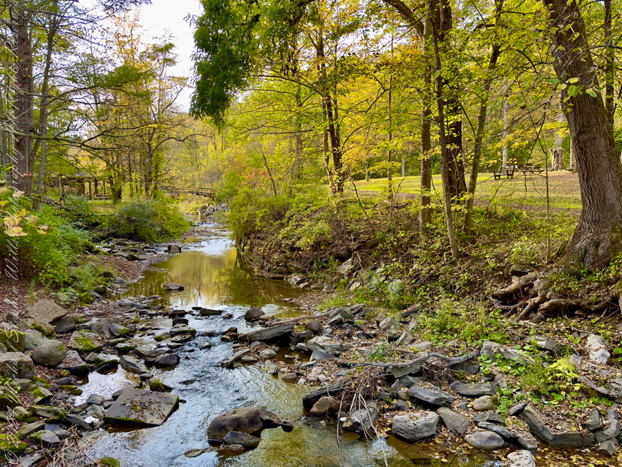
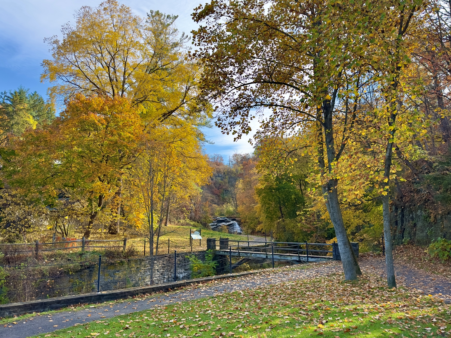
As I step into Cascadilla Gorge from the Linn Street entrance, I’m greeted by the soft rustling of leaves and the constant, soothing rush of water. The air this Halloween Day is warm, the autumn colors vibrant against the cool blue sky. I know Cascadilla Gorge is part of the Cornell Botanical Gardens, but the immediate beauty of this natural sanctuary makes it easy to forget I’m still within the city limits of Ithaca. The sounds of the gorge draw me in, as if whispering there’s more to see, more to explore. With a deep breath, I begin my journey up the trail, eager to discover what lies ahead.

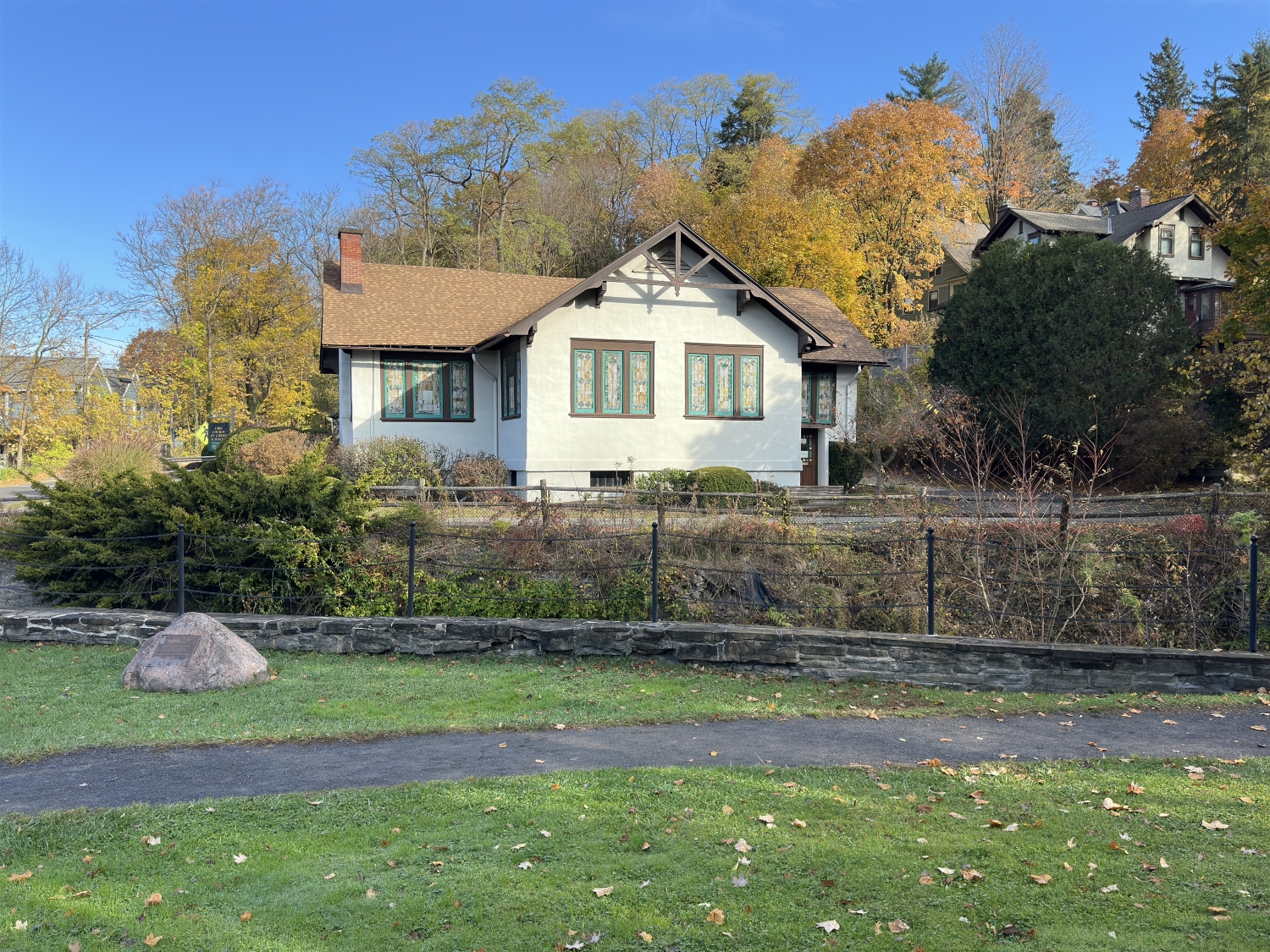
Just a short way in, I notice the First Church of Christ, Scientist perched on the corner of University Avenue and Cascadilla Park Road. The architecture of the church is both quaint and elegant, with its light-colored facade framed by dark trim and roof. Surrounded by foliage, it feels like the church belongs here, as much a part of the landscape as the trees and rocks. The sight of this historic building nestled so close to the gorge reminds me that this wild and ancient place is woven into the fabric of Ithaca’s community life.

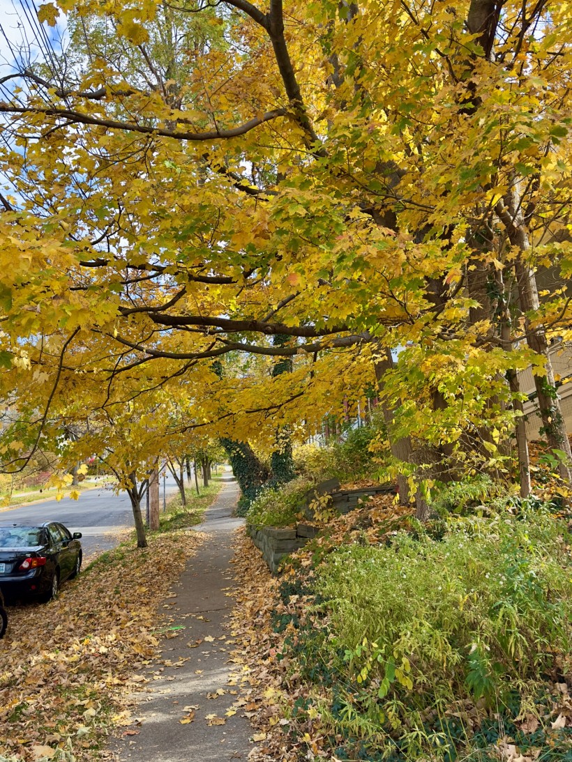
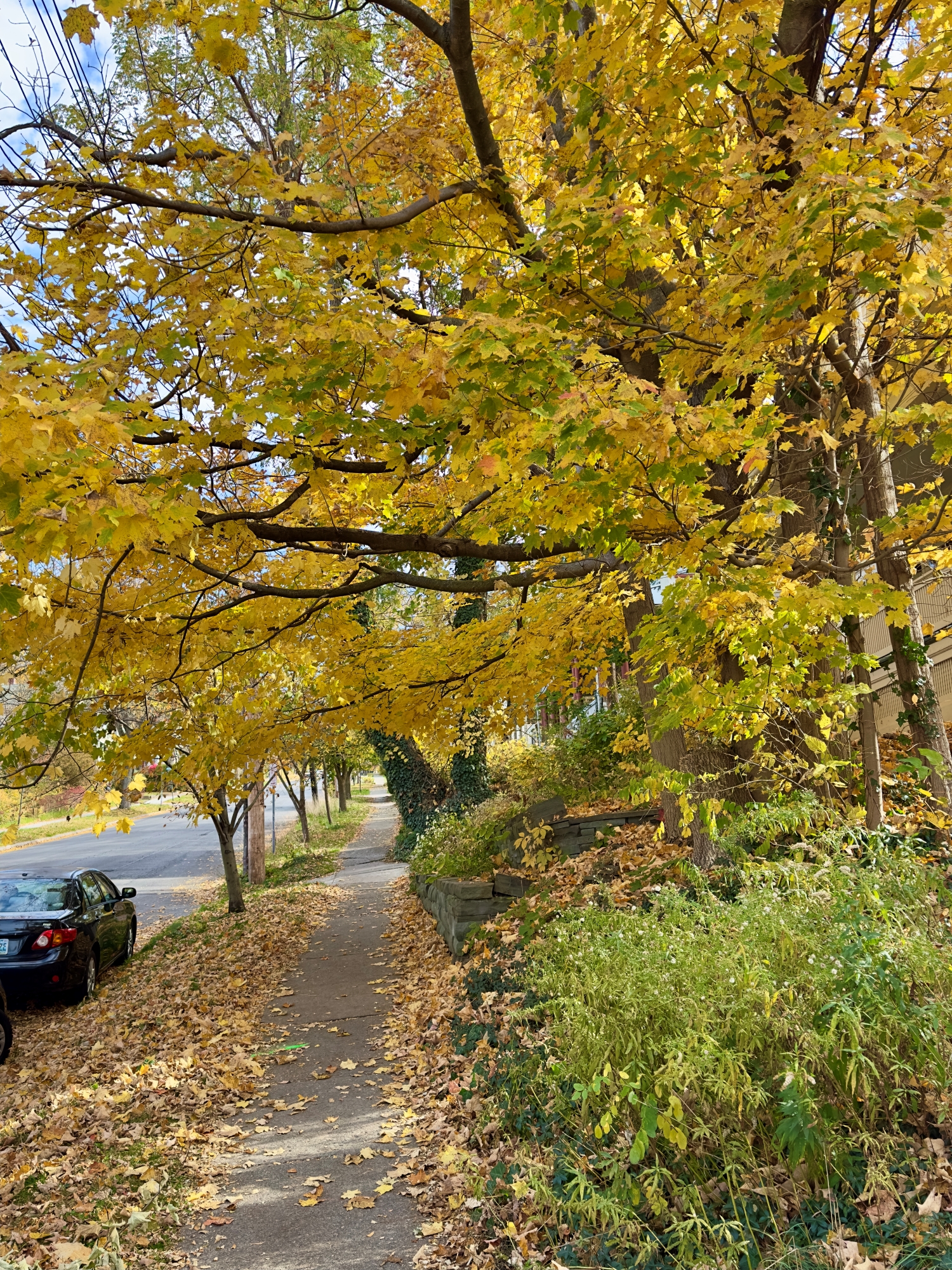
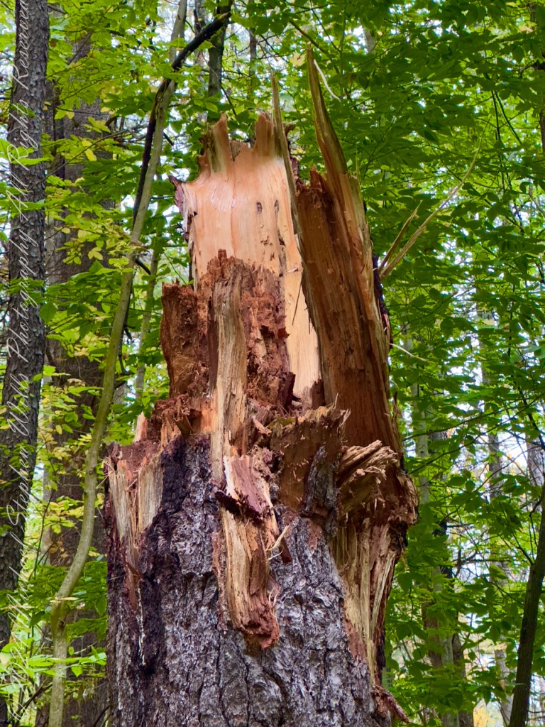
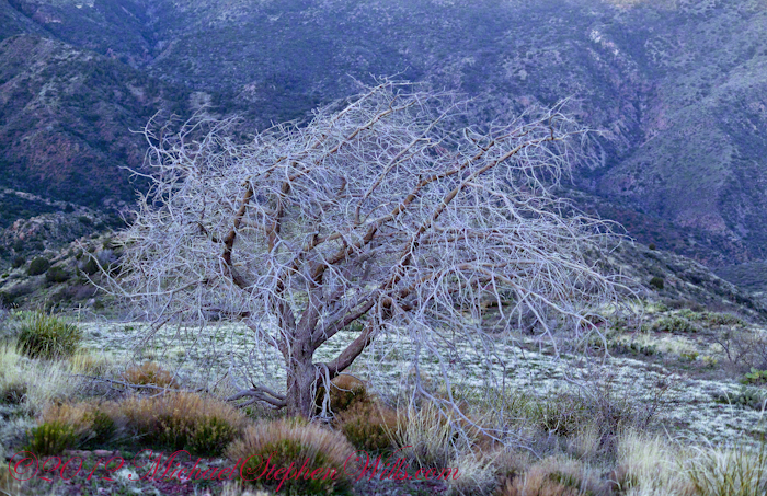
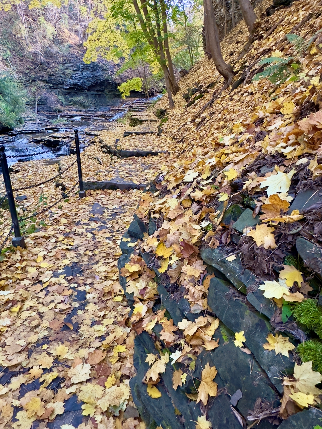
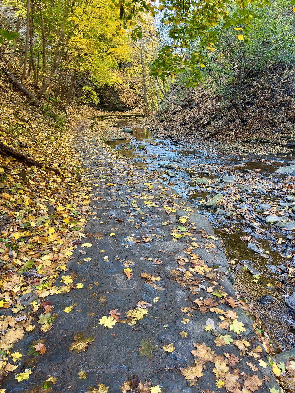
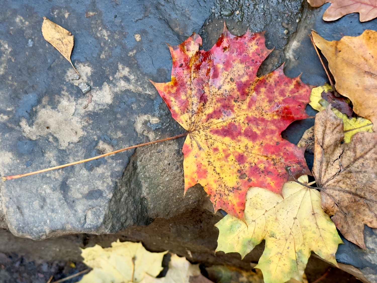
I move further along the trail, and the terrain begins to shift. Fallen leaves create a golden carpet along the path, their crisp shapes overlapping like nature’s confetti celebrating the season. Each step crunches underfoot, adding my own rhythm to the symphony of sounds. The trees overhead are a kaleidoscope of colors—deep golds, fiery oranges, and the occasional flash of red from Virginia Creeper vines (Parthenocissus quinquefolia). Together, the trees create a canopy that filters sunlight, casting dappled patterns on the gorge walls. It’s an ever-changing play of light and shadow, one moment bright and the next subdued, adding a layer of magic to the experience.

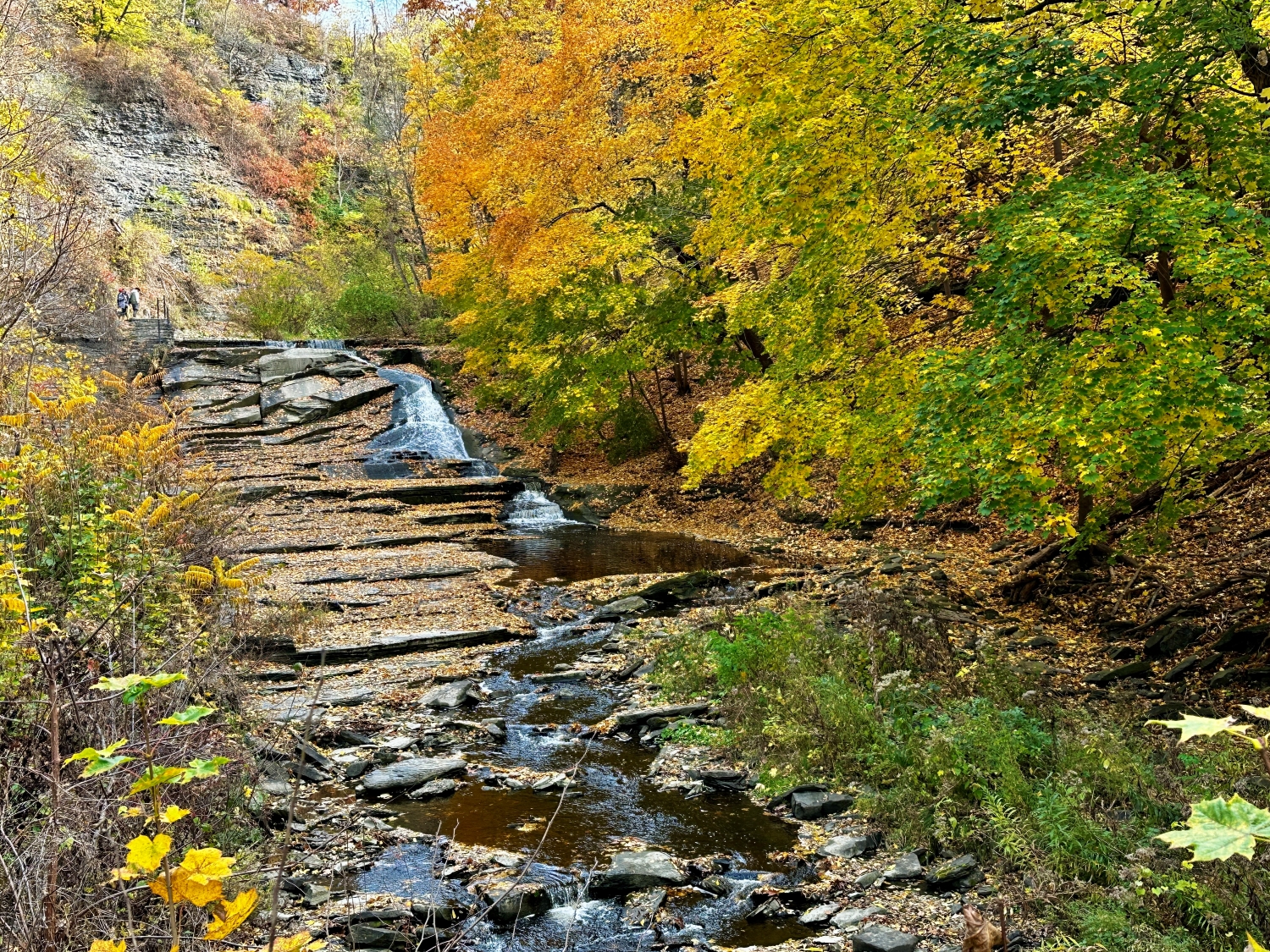
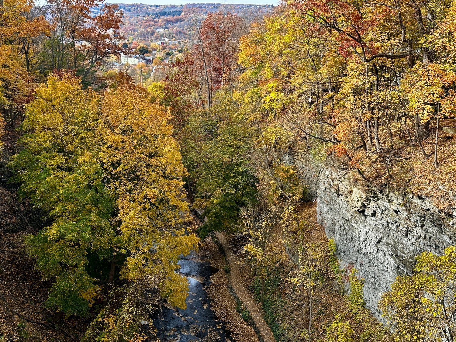
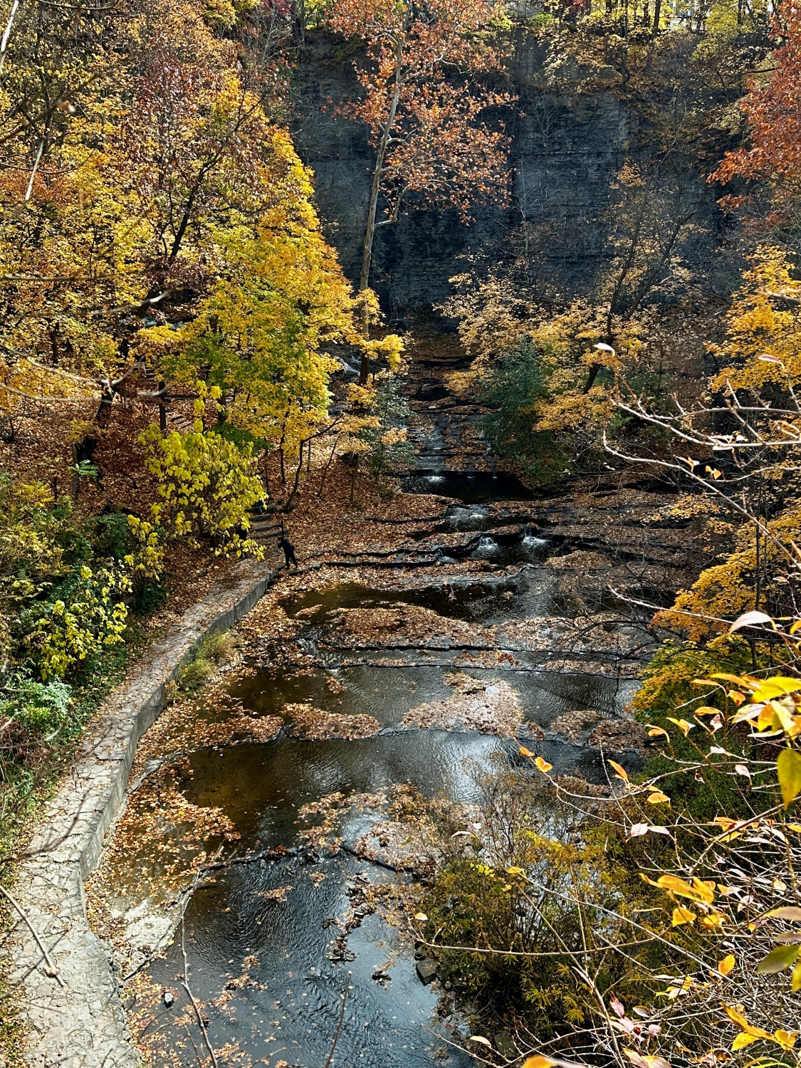
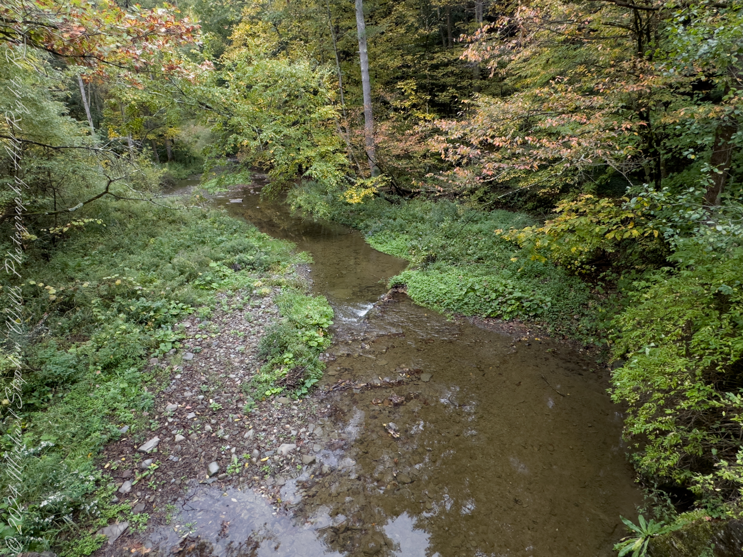
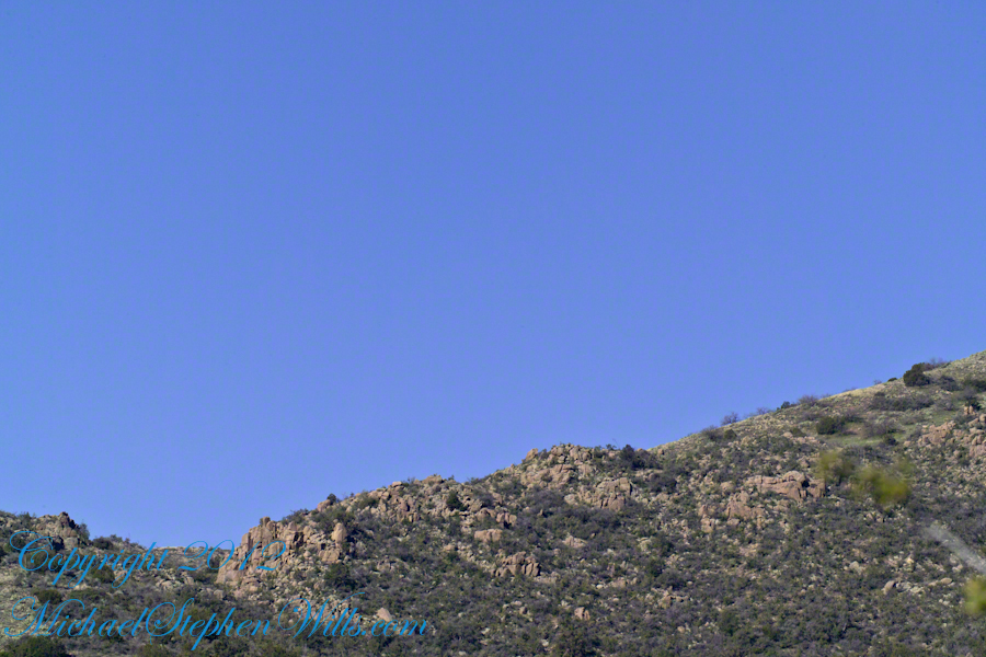
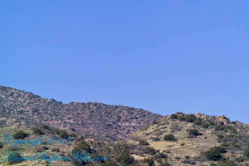
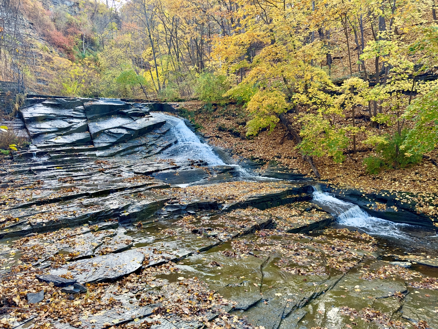
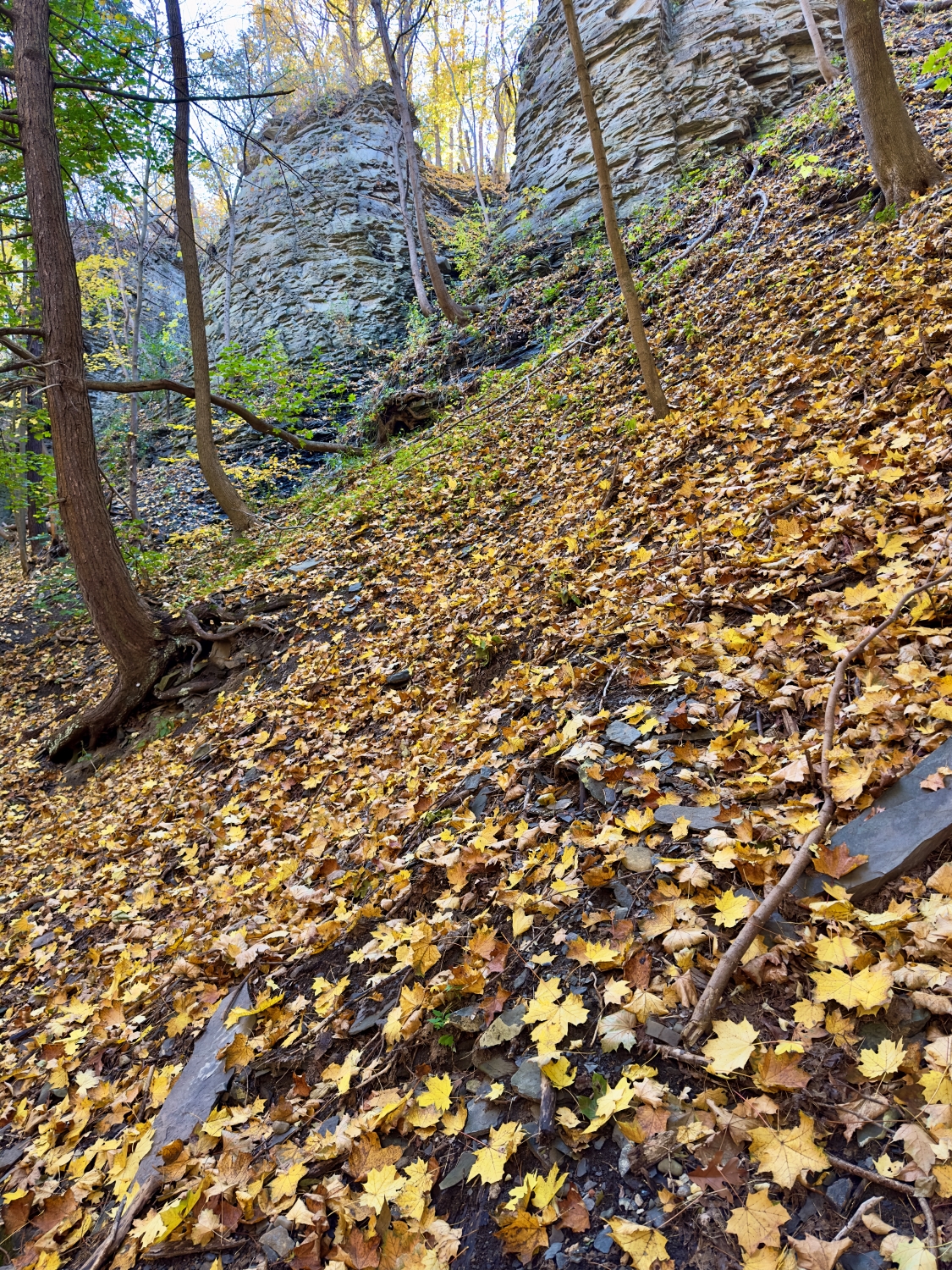
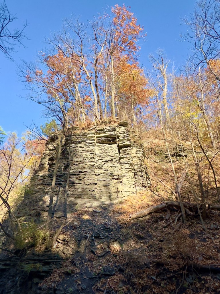
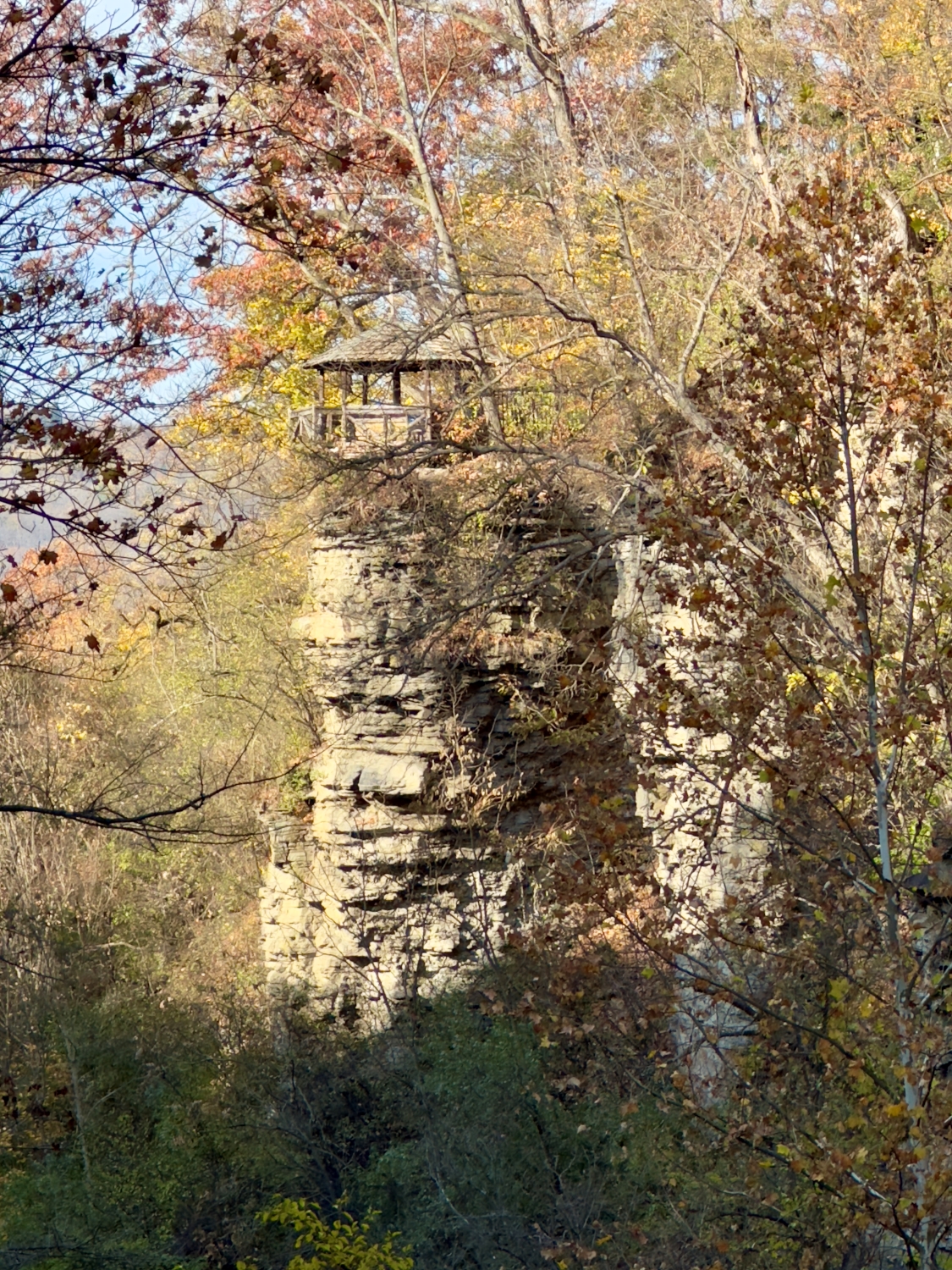
As I follow the trail upward, the gorge narrows, and I find myself surrounded by towering walls of rock. Here, layers of siltstone and shale formed more than 300 hundred million years ago are exposed, a testament to the forces of water and time that carved this place across mere millennia of recent geologic time. The rock formations are fascinating, with the water flowing over them in gentle cascades, finding every groove and crevice. There’s something humbling about standing in a place shaped by forces so much larger and older than myself. I pause, letting the rush of water and the stillness of stone fill my senses.

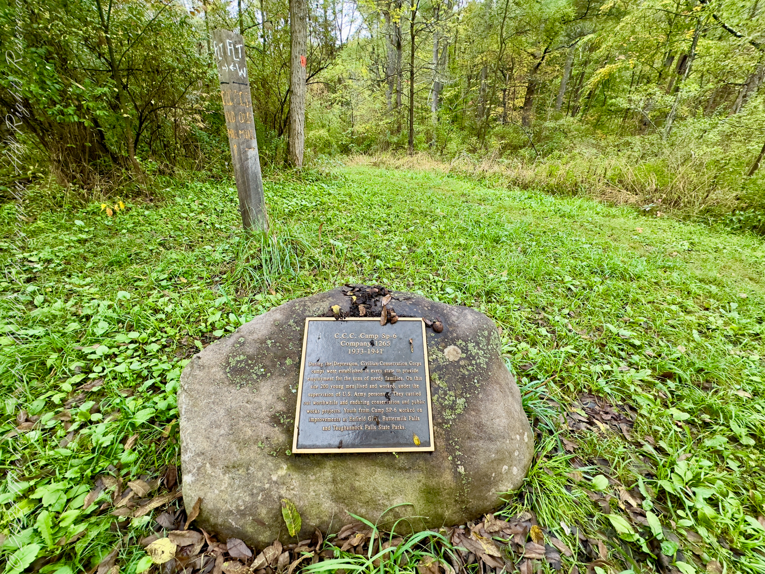
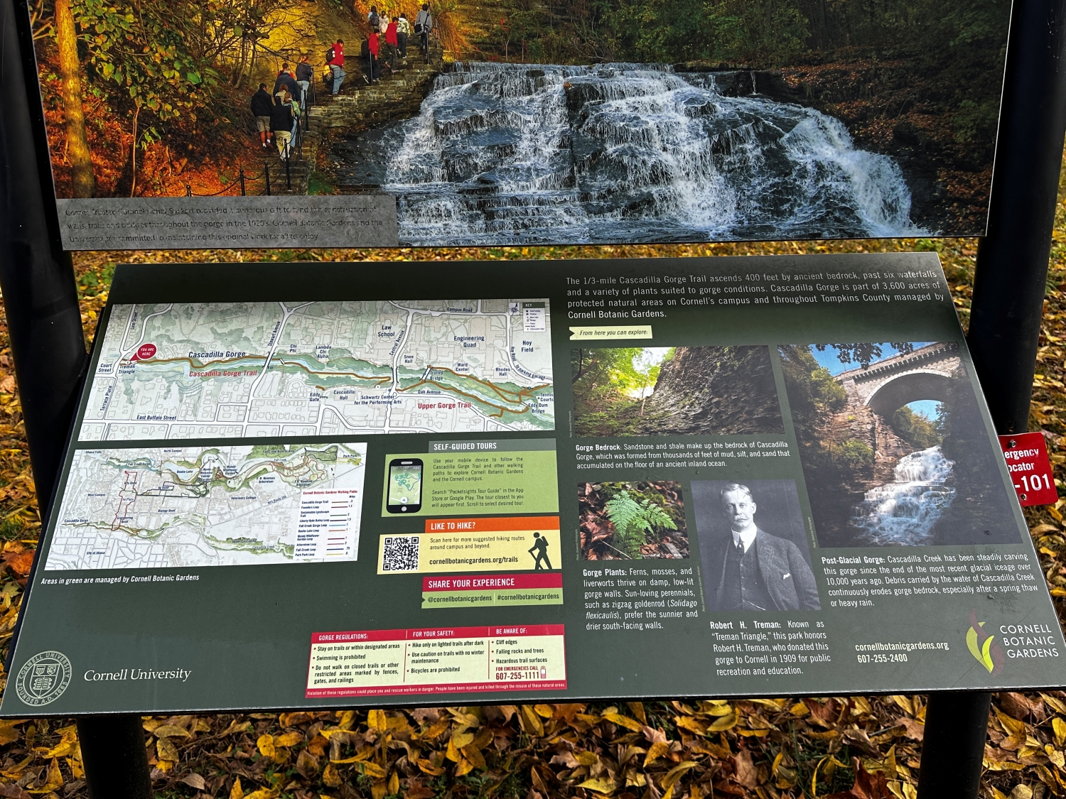
Along the way, I come across an interpretive sign provided by the Cornell Botanical Gardens. They tell the story of Cascadilla Gorge, how it was formed from the bedrock of sandstone and shale that eroded from mountains to the east, in the Devonian era when an ancient inland sea covered the region. The signs also introduce Robert H. Treman, a philanthropist who saw the beauty and educational value of the gorge. Thanks to him and the efforts of many, this natural wonder is preserved for all to experience. Knowing this adds depth to my walk; it’s a reminder that places like this exist not only by chance but because people cared enough to protect them.

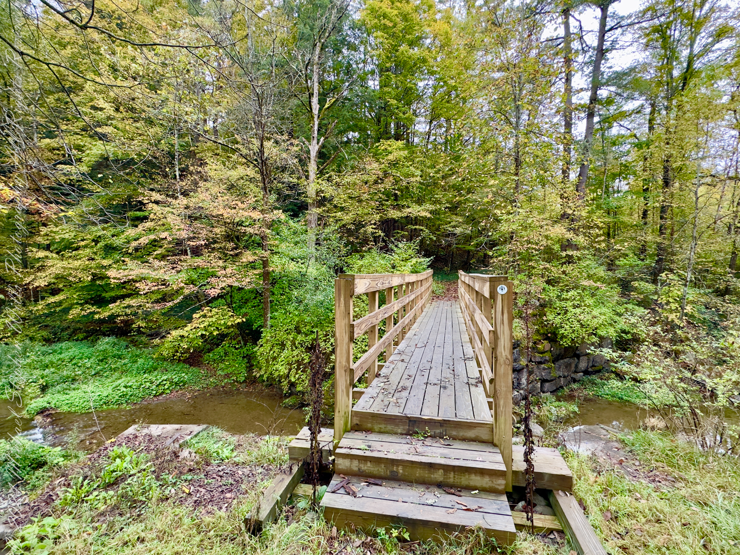
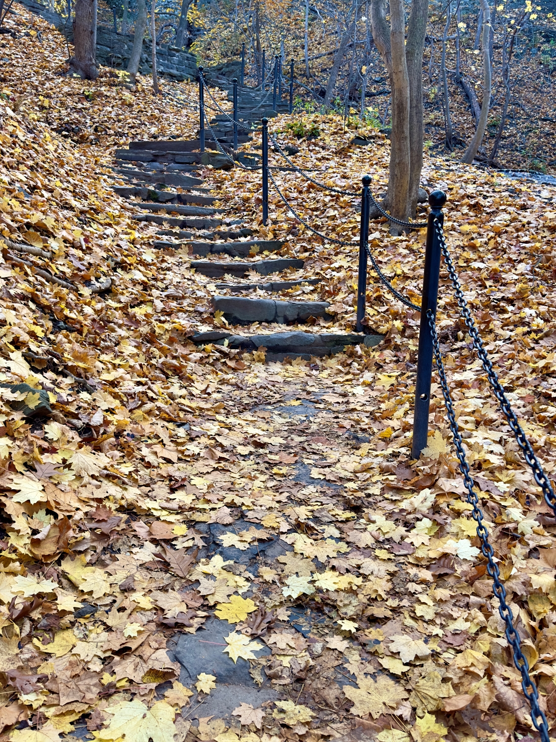
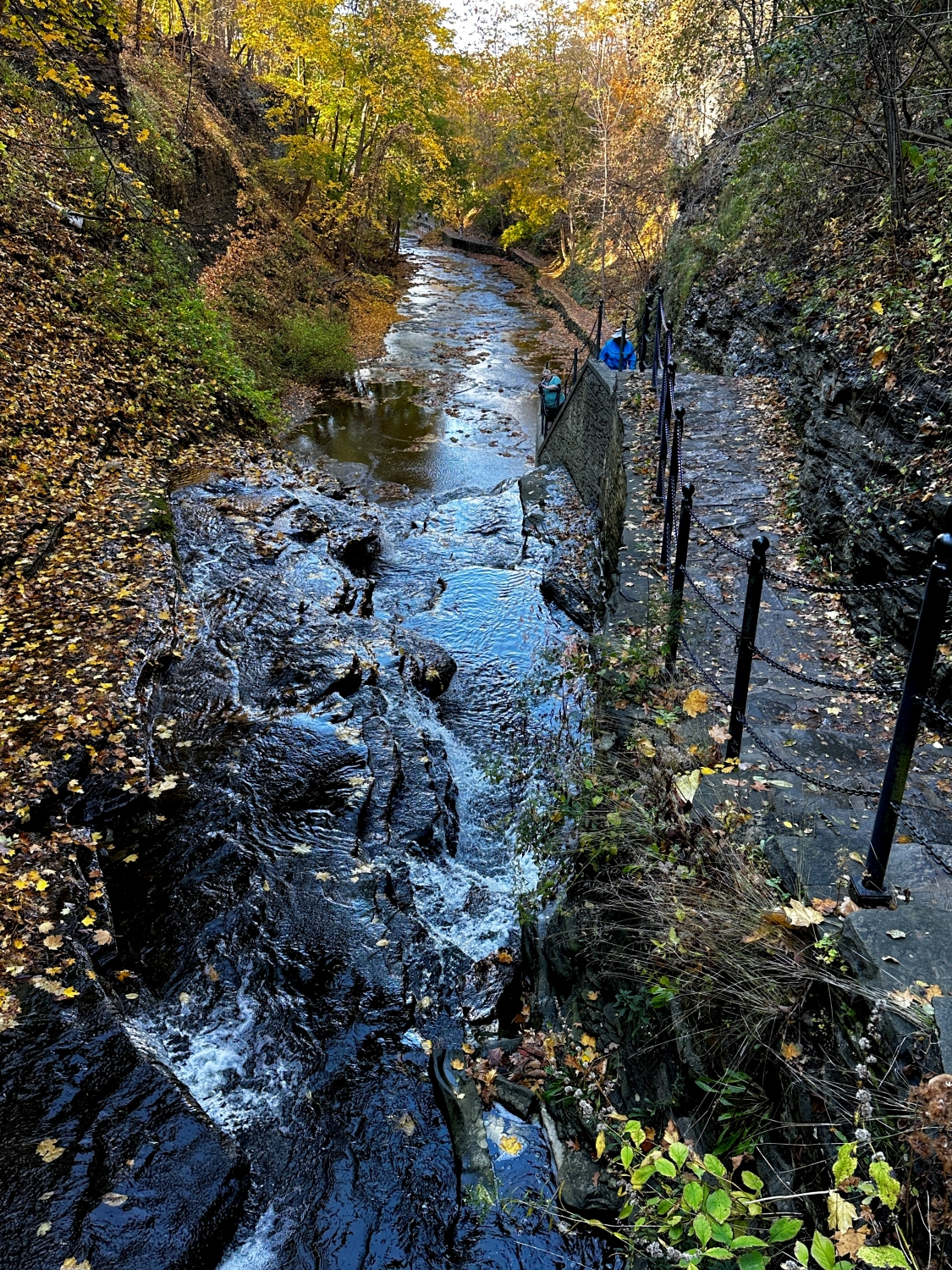
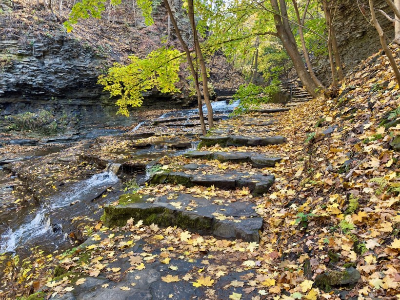
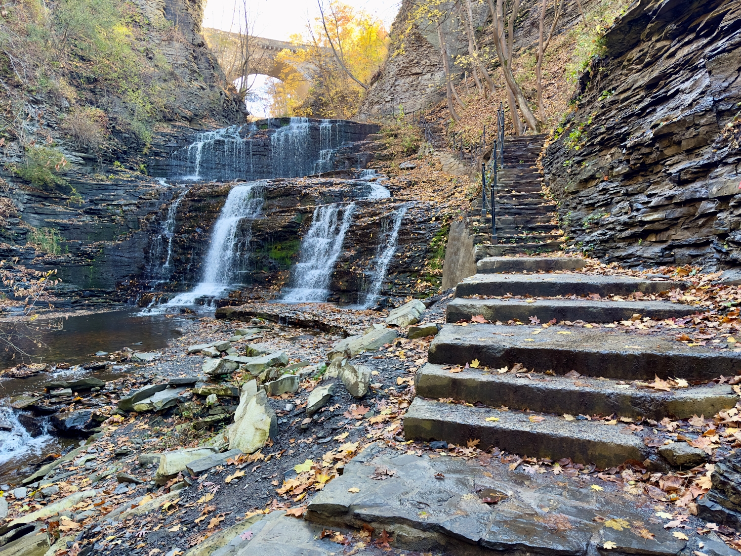
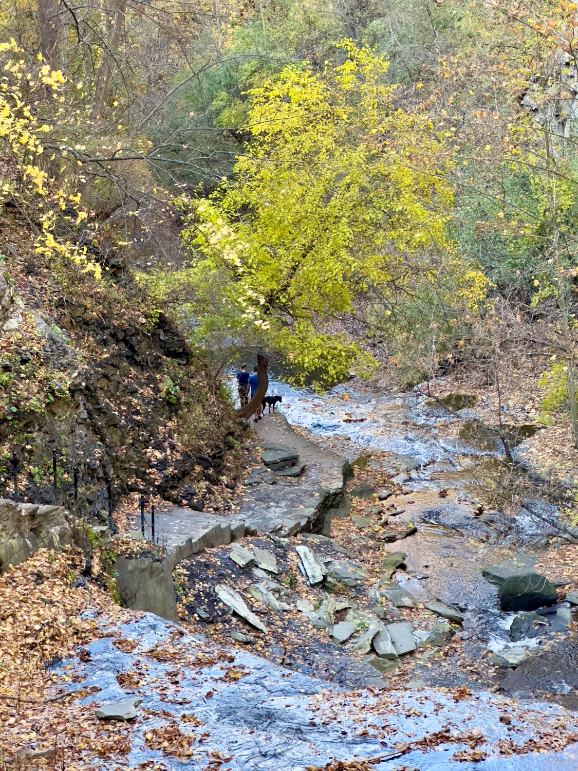
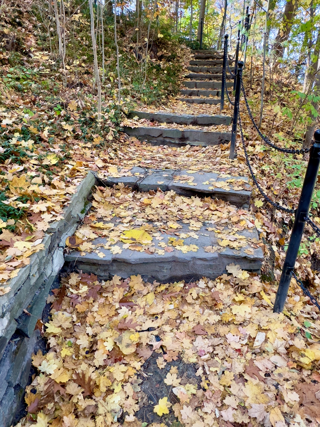
The sandstone staircases along the trail are a marvel in themselves. Some sections are steep, winding up the gorge in a series of steps that seem to have been placed with precision, blending seamlessly into the natural landscape. The steps are covered with leaves now, making each ascent feel a bit like climbing through a fairy-tale forest. The chains along the path provide a comforting grip, especially as I climb higher. I look back and see how far I’ve come, the creek below winding its way over rocks and around bends, each step a small journey of its own.

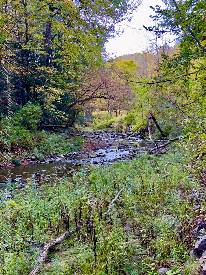
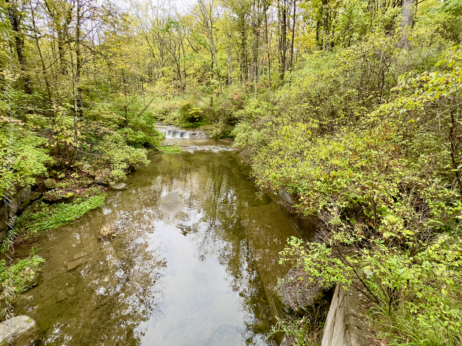
I pass several small waterfalls, each one unique in its character. Some are gentle trickles, while others pour over the rocks with more force, their sound reverberating off the gorge walls. I stop frequently, entranced by the way the water carves its path, eternally moving, adapting, wearing down even the hardest stone. Leaves float down from above, landing in the creek and swirling in miniature whirlpools before being carried downstream. It’s mesmerizing to watch nature at work in such a quiet, persistent way.

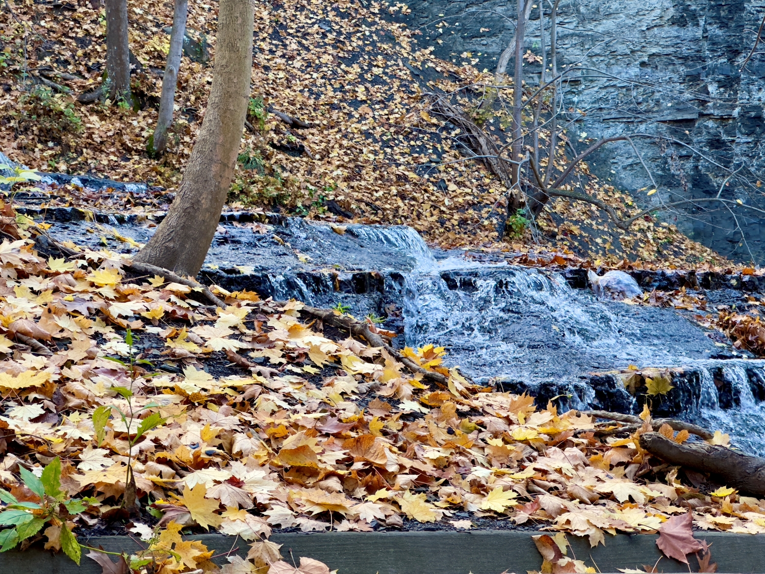
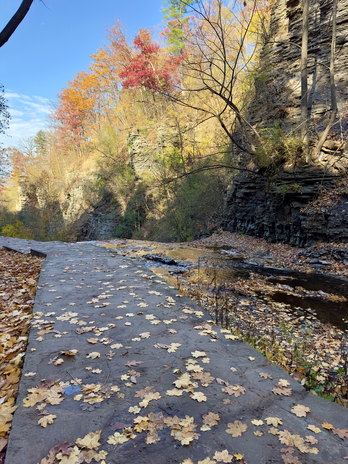
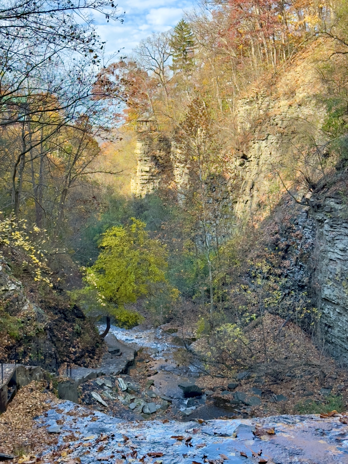
Further up the gorge, the views open up, and I can see the layers of rock descending in terraces, each level a little cascade of its own. I watch as the water flows across these steps, catching the light as it moves—a silvery ribbon winding through the golden autumn landscape. The tranquility of the scene is meditative. Around me, the trees stand as silent witnesses, their branches bare in places but still adorned with clusters of leaves clinging through the last days of fall.

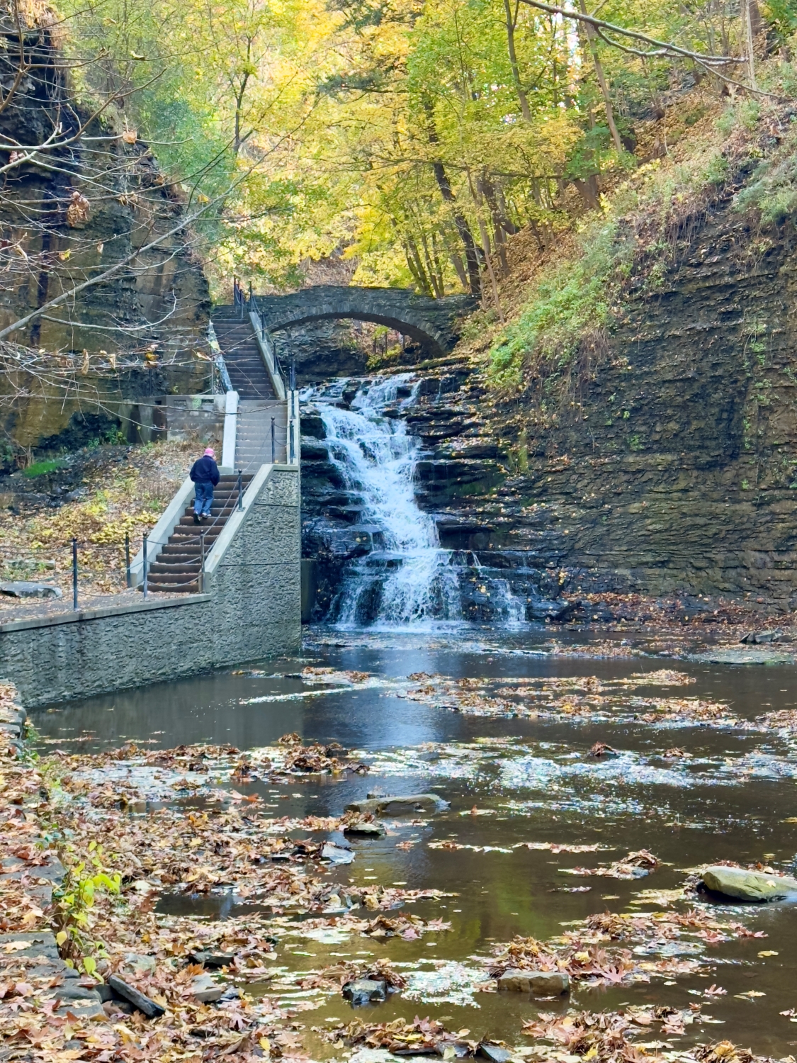
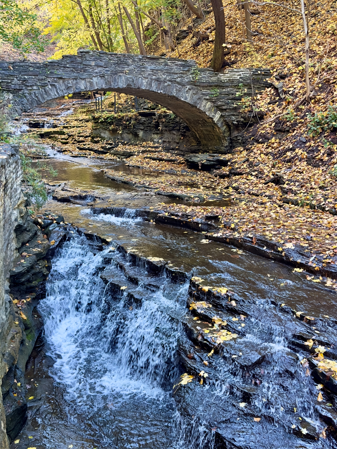
Finally, I reach one of the larger waterfalls, framed by a graceful stone arch bridge that crosses high above. The scene is something out of a painting. Water pours over the rocks, gathering in pools below before spilling onward. I pause on the bridge, looking down at the gorge below and the trail I’ve followed, grateful for the journey.

Along the way, artists are positioned along the path, each lost in the beauty of Cascadilla Gorge. They stand or sit in quiet reverie, brushes or pencils in hand, capturing the gorge’s unique character. Some focus on the play of light over the water’s surface, while others seem intent on the rugged details of the rock formations. Their presence adds a contemplative depth to the scene; it’s as if each artist has uncovered a hidden aspect of the gorge that I have overlooked in my journey upward.

I slow my pace to take it all in, appreciating how the artists interpret this natural wonder through their own eyes. Their canvases reveal layers of colors that shift as the sun filters through the leaves, casting vibrant golds and subtle greens on the cascading water. The scene feels almost collaborative—nature and human hand creating art together, each reflection of the gorge as unique as the individual capturing it. I’m tempted to pause beside them, to see how they choose to frame the towering walls, the stone bridge arching above the water, and the gentle curves of the creek as it meanders downstream. I can imagine each artist’s work holding a different piece of this place, like fragments of a memory.

Bridge View looking up Cascadilla Creek
Bridge View looking back the way I came

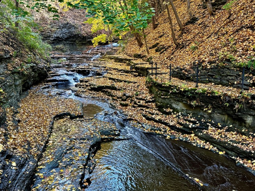
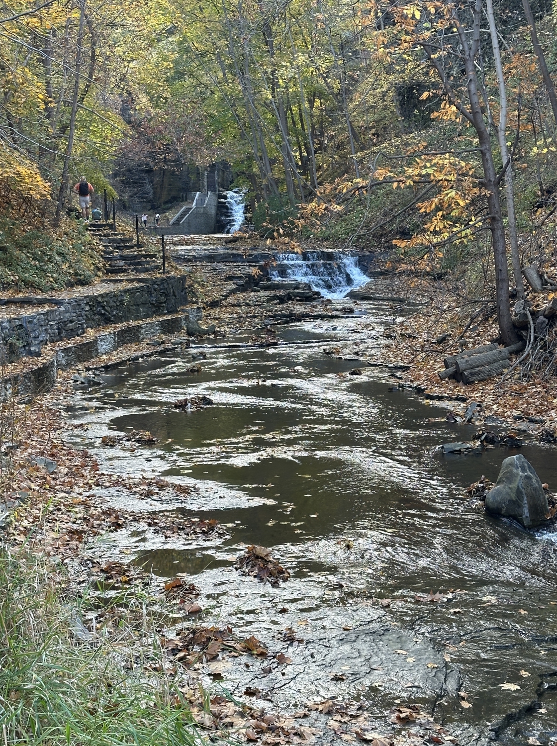
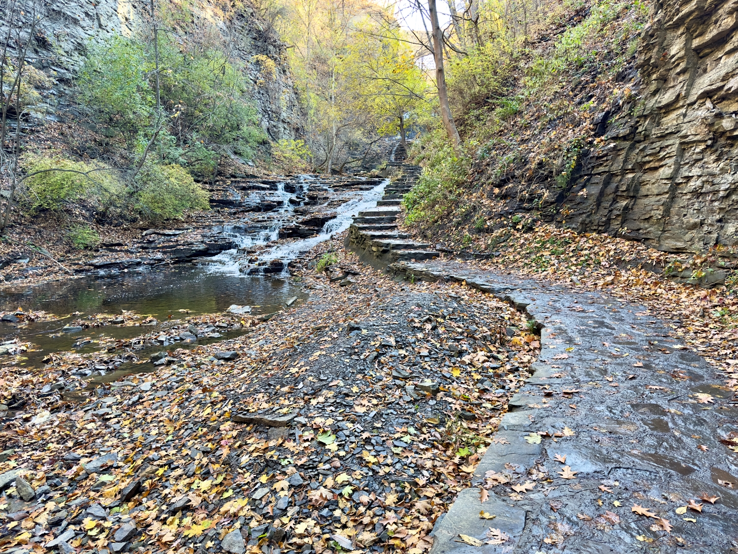
As I continue, the sound of rushing water grows louder, drawing me towards another cascade that tumbles in steps down the gorge. The rocks are layered in angular formations, giving the water a zigzagging path to follow. Leaves are scattered across the stones, their colors—yellows, browns, and the occasional splash of red—standing out against the dark, wet rock. There’s a timelessness here, a feeling that this scene has remained unchanged for centuries, save for the shifting leaves and the ever-present flow of the creek. The thought makes me feel like a small part of something much larger, a guest in an ancient place shaped by nature’s slow, steady hand.

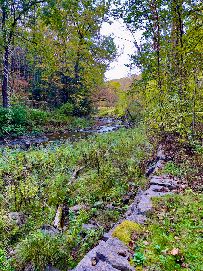
The path narrows again, following the edge of the creek where the water has worn smooth channels into the stone.

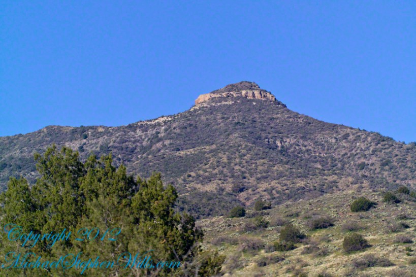
Moving forward, the trail climbs steeply, and I find myself surrounded by tall rock faces on either side. The walls are layered and weathered, a geological history book open to the forces that shaped this land. It’s humbling to see how this place puts everything into perspective, how it reminds us of our place in the natural world.

Columns of sedimentary rock

Ahead, the path becomes more rugged, the air feels cooler here, shaded by the gorge’s high walls, and the sounds of the city are long gone, replaced by the steady rhythm of water and the drift of leaves. The layers of ancient limestone that form these towering walls give shape to our landscape and ecosystem. As rainwater falls and seeps through the porous rock, the limestone raises the pH of the water, neutralizing its natural acidity. This subtle alchemy nurtures the flora and fauna, fostering a unique biome that thrives in the gorge. The artists fade from view as I move further into the solitude of the trail, but their presence lingers in my mind. Each turn of the path reveals another scene worthy of capturing, another moment that seems to call out for remembrance.

Looking back toward the way I came

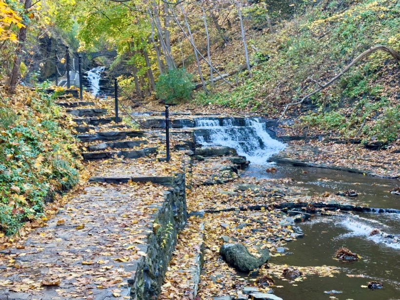
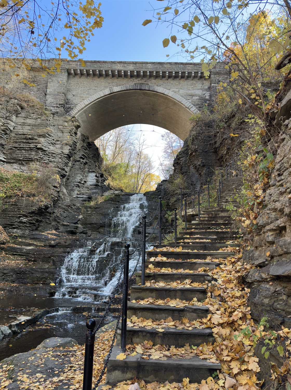
The trail steepens, and I press onward, the sound of the water intensifying as I near a grand waterfall framed by the impressive stone steps leading up to the College Avenue Stone Arch. Each step is littered with leaves, their colors vivid against the worn stone—golds, russets, and the occasional brilliant red, like embers scattered along my path. The waterfall beside me spills down in steady streams, each cascade creating rivulets that catch the light as they flow downward.

The gorge walls rise sharply on either side, embracing the path in rugged layers that tell stories of geological time. I feel as if I’m climbing a passage through history itself. These rocks, these trees, the very water carving its way through the stone—all have been here far longer than I can fathom, shaped by forces beyond my understanding. There’s a certain thrill in being among such enduring elements, a reminder of how small and fleeting we are in the face of nature’s grandeur.

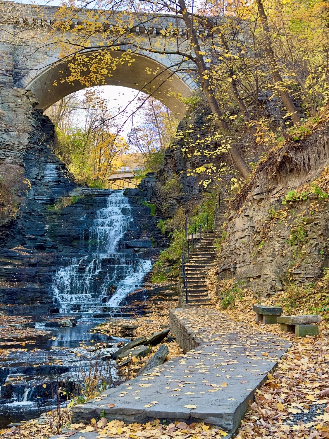
Reaching the next tier of the trail, I pause to take in the sight of the massive stone arch spanning the gorge above. The bridge is a striking feature, its wide arch perfectly framing the sky and the last vibrant colors of autumn. It feels like a gateway, a fitting culmination to the journey. Standing beneath it, I’m struck by how well it harmonizes with the gorge, the careful craftsmanship of its stonework complementing the rough beauty of the surrounding cliffs.

The sunlight flows around the arch, illuminating the leaves that cling to the branches above, casting a warm glow over the scene. I feel a sense of reverence here, a quiet acknowledgment of both human artistry and the relentless beauty of nature.

I paused to capture this video of the moment.

Sights and Sounds of Autumn

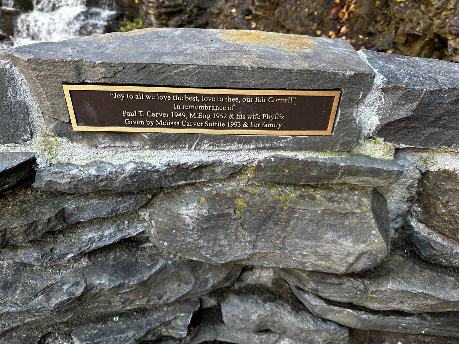
The final ascent is graced by a bench where a stone plaque catches my eye. It’s a tribute, etched with words that resonate in this place: “Joy to all we love the best, love to thee, our fair Cornell.” A gift from a family whose lives intertwined with Cornell, it serves as a reminder of the deep connections people have to this landscape, to the university, and to the memories rooted in these trails and gorges. I pause, reflecting on my own connection to this path, which has taken me through an ever-unfolding tapestry of nature and history.

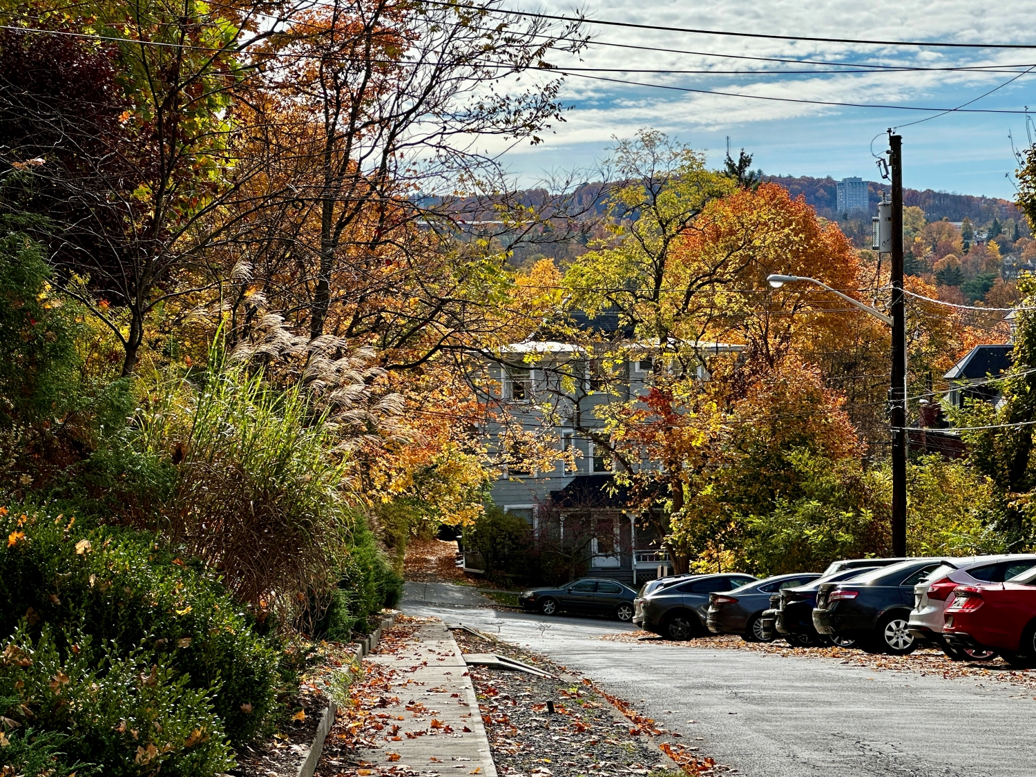
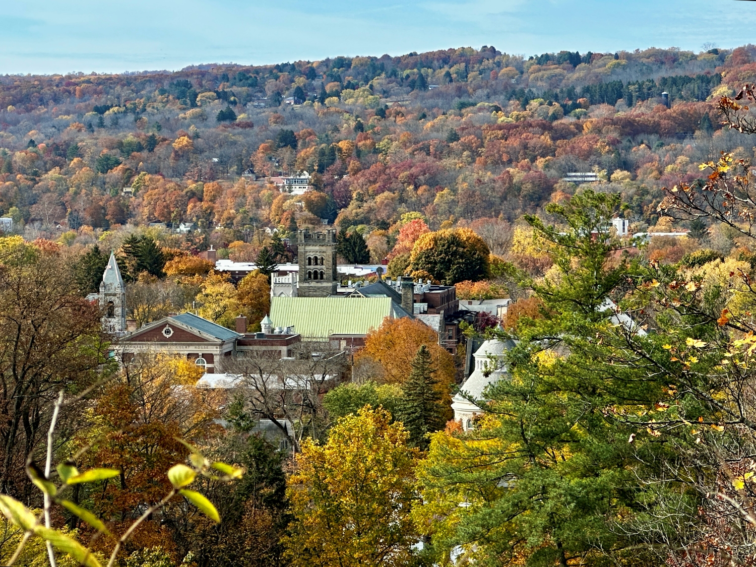
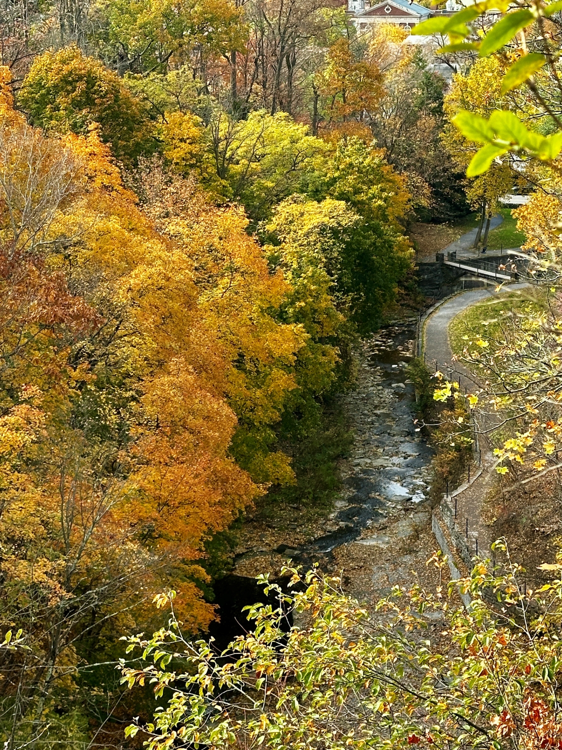
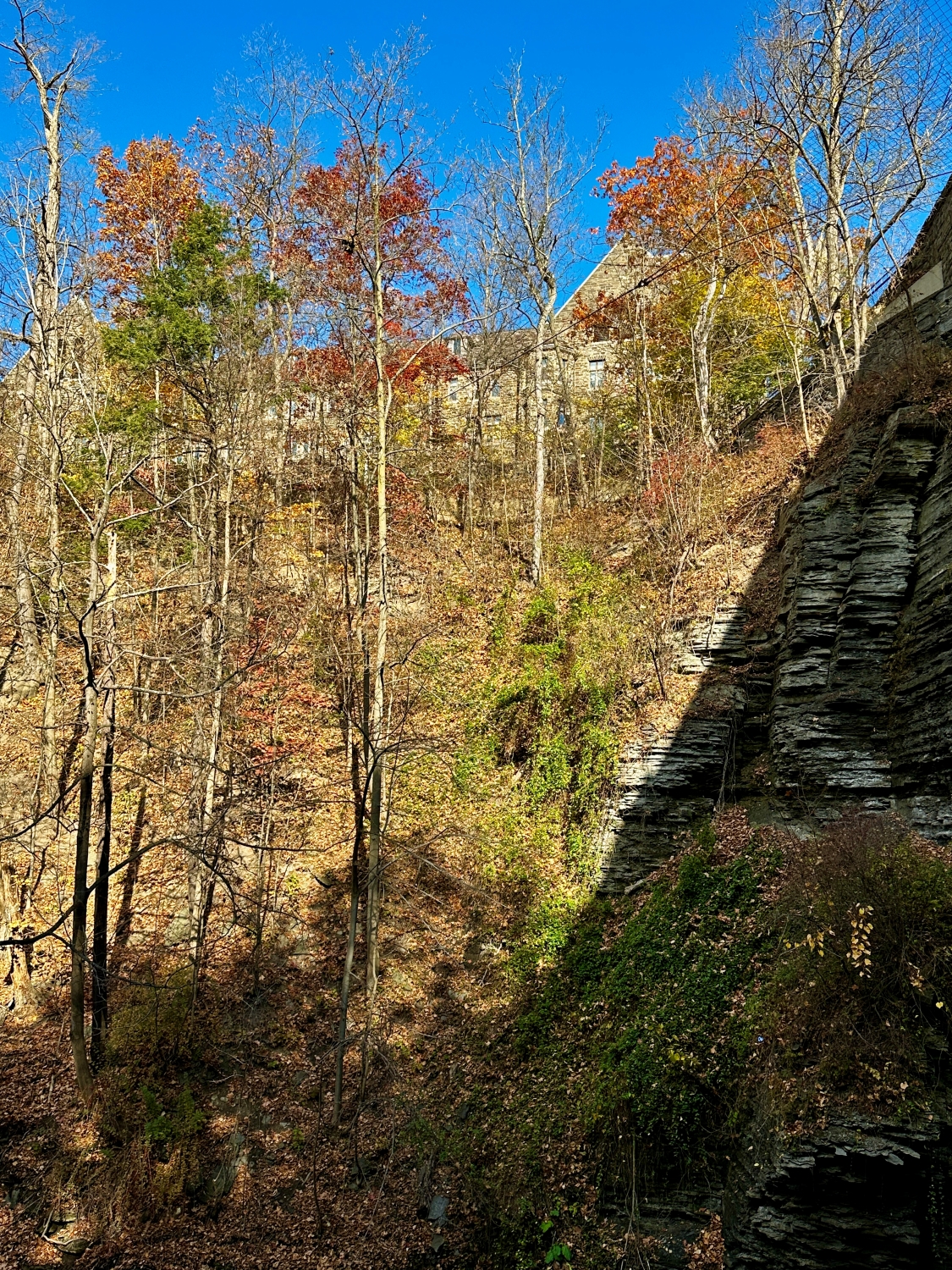
The last stretch of steps is leaf blanketed, their shapes and colors a beautiful final mosaic before I emerge from the shaded coolness of the gorge. The sun filters down through the thinning trees, illuminating the stone buildings of the Cornell campus that peek through the branches ahead. With each step, I feel the transition, moving from the curated wildness of Cascadilla Gorge and its trail to the structured beauty of the university grounds.

Myron Taylor Hall, Cornell Law School from the gorge.

As I reach the top, the Schwartz Center for the Performing Arts comes into view, its modern architecture a contrast to the ancient rocks I’ve left behind. Here, in this space where art, education, and nature converge, I take a last look back into the gorge and a journey, a gem in the heart of the Finger Lakes, a place that holds stories, both old and new, and invites every visitor to become a part of them.

Enter your email to receive notification of future postings. I will not sell or share your email address.

The Enchantment of Autumn Over Cascadilla Gorge

Join me for a serene autumn walk in Ithaca, appreciating nature’s beauty, impermanence, and the calming rhythms of life.

A few days before Halloween, I found myself on the rim of Cascadilla Gorge, Ithaca’s autumnal crown jewel. The air had that crisp October quality, each breath carrying a hint of the colder days to come yet still tempered by the lingering warmth of early fall. A breeze carried a scent of damp earth and decaying leaves, a rich, organic aroma that signaled the turning of the seasons. The path beneath my feet was a tapestry of fallen leaves—russet, gold, and burnt orange—a natural carpet leading me through a world suspended between vibrancy and rest.

Golden Canopy over Buffalo Street Sidewalk

Continuing up Buffalo Street, I marveled at the trees, their branches thick with yellow and gold leaves, creating a canopy above. The leaves shivered with every gust, whispering the ancient secrets of the forest. The air was infused with the sweet, woody fragrance of maple and oak, mingling with the faint scent of chimney smoke from nearby houses. The sunlight filtered through, casting a dappled pattern on the sidewalk, a fleeting mosaic as the leaves danced in the wind. A sense of impermanence struck me; soon, these leaves would be gone, leaving bare branches silhouetted against a winter sky.

Scene from Dewitt Place toward South Hill and Ithaca College

Crossing the Stewart Avenue bridge, the Cascadilla Gorge came into view, a steep wall of stratified rock layers standing guard over the gently flowing stream below. The contrast between stone and foliage was breathtaking—the hard, unyielding rock juxtaposed with the softness of leaves in full autumnal bloom. The earthy scent of wet stone mixed with the crisp aroma of the flowing water, creating a sensory tapestry unique to the gorge. The colors seemed to intensify against the gray and brown of the cliff, each leaf like a brushstroke on nature’s canvas, celebrating the season’s final flourish before surrendering to winter.

Below footpath along the gorge rim, the creek wound through, its banks littered with leaves that had completed their journey from branch to earth. They floated on the water’s surface, spinning gently in the current as though reluctant to leave this last dance. The sound of the water was a steady undercurrent, soothing and rhythmic, as it tumbled over stones and carved its way through the gorge. I paused to watch, entranced by the way water and rock, ephemeral and eternal, seemed to coexist in a kind of harmony.

I stopped at a lookout point and surveyed the town sprawled out below, nestled amidst the fiery colors of the surrounding hills. The architecture of Ithaca’s buildings peeked through the trees, each roof and spire framed by the season’s palette. This was a town embraced by nature; its rhythm dictated as much by the seasons as by human hands. The sight stirred a sense of gratitude within me; here was a place that reminded you to slow down and observe, to notice the subtle shifts in light, in color, in the way a single gust of wind could change a landscape.

I continued along the rim, passing a small waterfall that spilled over the rocks with a quiet insistence. The water had carved smooth pathways in the stone, evidence of its long journey and persistent power. The sunlight hit the spray just right, casting a fleeting rainbow that shimmered and then disappeared as I moved. I felt a sense of companionship with the water—both of us moving forward, shaped by the paths we traverse, yet always adapting to whatever lay ahead.

The last part of the trail led me through a dense thicket of trees, their branches hanging low, forming a natural archway. The air was heavy with the musky scent of fallen leaves and the spicy aroma of pine needles underfoot. Here, the light was softer, muted by the thick canopy overhead. The quietness enveloped me, broken only by the occasional rustle of a squirrel in the leaves or the distant caw of a crow. It was the kind of silence that feels sacred, where each sound, no matter how small, becomes profound.

Entering Cascadilla Gorge from Linn Street

Emerging from the shaded path, I took one last look back at the gorge. The scene was both familiar and new—a blend of natural beauty and the nostalgia of seasons past. I felt a sense of peace, grounded by the cycles of the earth, by the ebb and flow of life around me. In this moment, on the brink of Halloween, the world felt both hauntingly beautiful and reassuringly steadfast, a reminder that even as the leaves fall and the days grow shorter, there is a promise of renewal in the quiet persistence of nature.

Enter your email to receive notification of future postings. I will not sell or share your email address.

Nature’s Role in Recovery: October at Treman Park

Pam’s recovery from hip replacement unfolds in Upper Robert H. Treman State Park, intertwining personal resilience with nature’s healing beauty.

On a crisp October afternoon, October 3, 2024, Pam and I reveled in Upper Robert H. Treman State Park, a serene oasis nestled in Tompkins County. This visit was particularly special for us, a step in Pam’s recovery from her August hip replacement. I remember the sound of her hiking pole tapping the ground as we walked together, feeling grateful for her progress since surgery. The air was cool, and the leaves, turning gold and orange, whispered in the breeze, providing the perfect backdrop for our outing that day.

Our path followed the creek, the same creek that winds through the heart of the park, framed by layers of stone and lush vegetation. In one of the first photos I took that day, you can see the creek reflecting the soft autumn light, its bed dotted with rocks and fallen branches. The vibrant greens of the undergrowth juxtaposed with the golden leaves made the scene feel timeless, as though nature itself was participating in Pam’s recovery, offering healing in its quiet, enduring beauty.

The view upstream just before the creek enters The Gallery. Robert H. Treman State Park, Enfield, Tompkins County, Finger Lakes Region, New York State.

We paused to take in the quiet hum of life around us. There was a sense of history in the park that seemed to blend with our personal story. As we wandered deeper, we reached the foundation of the old Budd House, its stone blocks now barely a shadow of the past but still carrying echoes of life lived long ago. The placard described Charles Budd, a village blacksmith and postmaster, and his wife, Deborah, who continued to serve the community after his passing. Standing there, I reflected on how these stones, much like Pam’s journey, represented resilience and the passage of time.

Site 2: The Budd House The stone blocks set in the lawn here outline the subsurface remains of the home of Charles Budd and his family. Budd was the village blacksmith and postmaster. Before the Industrial Revolution introduced cheap, mass-produced goods, blacksmiths crafted all manner of metal implements, re-shoed horses, and repaired carriages. Below to the left is a photo of a blacksmith shop in Tompkins County. As the Enfield Falls postmaster, Charles Budd ran the post office out of the parlor (similar to a living room) of his house. He held this position until his death in 1896. His wife, Deborah Budd, then faithfully served as postmaster until the post office closed in 1902. Did you know? Step into the foundation outline. The size of the Budd House is typical for a 19th century middle-class house. How many rooms of your home would fit in the footprint of the Budd’s entire house? In the 19th century, rural community members picked up their mail once a week at post offices like Budd’s. These post offices were closed with the United States Postal Service’s transition to “rural delivery”—the nationwide delivery of mail directly to everyone’s doorstep. We still enjoy this service over 100 years later. In the 19th century, voluminous mail-order catalogues by companies like Sears & Roebuck and Montgomery Ward sold everything from clothing to home and farm supplies to buyers across the nation. Packages took days or weeks to arrive, and customers would have eagerly checked with postmasters to see if their order had been delivered. This excitement and anticipation are reflected in the musical number “The Wells Fargo Wagon” in the Broadway musical The Music Man set in 1912 Iowa. A free walking tour brochure, Archaeology in the Park, is available on the main floor of the Old Mill. Upper Treman. Robert H. Treman State Park, Enfield, Tompkins County, Finger Lakes Region, New York State.

As we stood by the foundation, we met another couple. The woman shared her own story of recovery, a tale of resilience that resonated deeply with us. She had fallen and suffered a spinal injury, becoming paralyzed from the neck down, while traveling. Thanks to surgery and rehabilitation, she regained full mobility. There was a moment of understanding and connection between us. We offered to take a photo of them, and they returned the favor, capturing the two of us—Pam leaning lightly on her cane, smiling, surrounded by trees whose leaves were beginning to fall. That picture, one of my favorites from the day, symbolizes not just Pam’s strength but also the support and shared experiences that come with recovery.

We are taking a walk through upper Treman Park during Pam’s recovery from hip replacement. This was taken by a couple we met.

The park offered us a space for reflection and a sense of continuity. The trees, some towering over us with roots gripping the earth, had seen many seasons of change, and now they watched over us as we walked beneath them. In the clearing where picnic tables stood, we sat for a while, simply absorbing the moment. The afternoon light filtered through the branches, casting long shadows on the grass.

One of the final photos I took that day captures the creek from another angle. The water, calm and clear, reflects the yellow hues of the trees, while the rocks and roots along the bank seem frozen in time. It’s a peaceful image, one that reminds me of the quiet strength that Pam has shown throughout her recovery.

Here Fish Creek, a tributary of Enfield Creek joins the flow just below the pavilion of Upper Treman.

We left the park that day feeling both uplifted and grounded, the layers of history and personal resilience blending seamlessly into the natural landscape. Upper Robert H. Treman had become had become a part of Pam’s recovery story, a testament to the healing power of both nature and community.

Enter your email to receive notification of future postings. I will not sell or share your email address.

Exploring Autumn’s Beauty on the Finger Lakes Trail

The hike through Robert H. Treman State Park reflects nature’s cycles of life, decay, and renewal, intertwined with human history.

The wind is cool, carrying the first real bite of autumn as I step onto the Finger Lakes Trail from Woodard Road, entering Robert H. Treman State Park. The sounds of rustling leaves underfoot remind me that the season is in full swing, and soon, this vibrant foliage will be a memory. But today, the trees still hold their colors—greens tinged with yellow, brown, and red—forming a canopy that seems to glow in the soft morning light.

The trail is quiet, save for the occasional chirping of birds and the subtle creaking of the trees as they sway in the wind. It’s a perfect time for reflection, and with each step, I feel myself sinking deeper into the peace of this place. Ahead of me, a fallen tree lies on the slope, now part of the earth, slowly being reclaimed by the forest. The log, dotted with moss and fungi, seems like a work of art created by time and nature. I stop to admire it, my fingers grazing the rough bark, now softened with age and decay. It’s a reminder that everything in nature moves in cycles—growth, death, and rebirth.

A few steps further and I find something even more intricate—another log, this one completely overtaken by a delicate layering of lichens and shelf fungi. The growth covers the bark like an elaborate tapestry of greens, grays, and soft whites. It’s beautiful in its own quiet way, and I take a moment to kneel beside it, studying the intricate patterns. Nature has a way of turning even decay into something stunning. I wonder how long it took for these fungi to establish their hold, slowly breaking down the wood, contributing to the endless cycle of life in the forest.

Moving onward, I come across a tall stump—remnants of a once-majestic tree, now shattered. The splintered wood reaches upward like jagged teeth, still sturdy despite the obvious trauma it endured. The raw power of nature is always humbling; trees like this seem so strong and permanent, yet even they can be brought down in an instant. It’s a reminder of life’s fragility, and I feel a sense of reverence standing in its presence, imagining the forces that felled it.

Continuing along the trail, I soon reach a clearing. There, nestled in the grass, is a plaque mounted on a large stone. It marks the site of the Civilian Conservation Corps (C.C.C.) Camp SP-6, Company 1253, which operated here from 1933 to 1935. I pause to read the inscription, which commemorates the young men who lived and worked in this camp during the Great Depression. They carried out public works projects, including improvements to Enfield Glen, Buttermilk Falls, and Taughannock Falls. I imagine the sense of purpose and camaraderie these workers must have felt, building something that would outlast them, even in the midst of hardship.

C.C.C. Camp SP-6, Company 1253, 1933-1935 During the Depression, Civilian Conservation Corps camps were established across America to provide employment for the relief of needy families. On this site, 200 young men lived and worked under the supervision of U.S. Army personnel. They carried out camp-wide and nearby construction and public works projects. Youth from Camp SP-6 worked on improvements in Enfield Glen, Buttermilk Falls, and Taughannock Falls State Park.

The plaque is a poignant reminder of the connection between humans and nature. Just as the trees here are part of a larger cycle, so too were the men of the C.C.C. They left their mark on this land, shaping the trails and structures we now take for granted. And yet, like everything in nature, their work is being slowly reclaimed by the forest. The wooden signs marking distances and directions are weathered, moss creeping up their bases, as if the forest itself is gently pulling them back into the earth.

As I cross a small wooden footbridge, recently replaced on the Finger Lakes Trail, I stop to look down at the creek below. The water moves steadily, reflecting the gold and green hues of the trees above. Small waterfalls tumble over rocks, their gentle rush filling the air with a peaceful sound. I watch the water for a while, feeling the pull of time and nature’s persistence.

View from the bridge, upstream Fish Creek

Standing there, I’m struck by how everything I’ve encountered today, from the fallen trees to the CCC plaque, tells the same story—nature’s quiet persistence, its ability to adapt, reclaim, and renew. I breathe deeply, knowing that while time moves forward and everything changes, the beauty and wisdom of places like this will always remain, if we just take the time to notice.


View from the bridge, downstream Fish Creek

Enter your email to receive notification of future postings. I will not sell or share your email address.

Reavis Canyon Camp

below the Falls

Here is an overview of my route through Cedar Basin on the way to Reavis Falls.  There are two paths in the following image from Google Earth.  The red path brings you into Cedar Basin and straight up a ridge and down to the campsite.  The red path is incorrect in the approach to the ridge and, rather than repaint the path, I created the green path as the gradual and accurate description of how I climbed to the ridge point where I captured the photographs Hoodoos on the Descent to Reavis Falls.

No Path to Reavis Falls

You need to understand there is NO path through this terrain.  It is necessary to follow a faint trail marked out by the footsteps of those before you and an occasional rock cairn placed at the most difficult points.  The following image is misleading in that what looks like a road next to my green path is actually a creek bed from the Lime Mountain spring.

Huge Boulders

What looks like a road is the resting place of huge boulders fallen from the surrounding mountains. Since there is water, thick brush and trees grow everywhere in cracks and spaces between the boulders and rocks.  Getting through the creek bed with an 80 pound pack and not getting lost is close to impossible. The solution is to hug the ridge slope, following the contours and navigate around boulders.

Reavis Canyon below the falls is filled with boulders of this size held in place by friction.

View of Reavis Canyon and Campsite

From the ridge small portions of Reavis Canyon were visible.  I even spotted a campsite.

The mouth of Reavis Canyon below the falls opens into a sandy bottom. This camp, surronded by house-size boulders fallen from the slopes above, has a patch of grass bright green and fresh.

This camp, 1,636 feet below Lime Mountain peak, surrounded by house-size boulders fallen from the slopes above, has a patch of grass bright green and fresh to the right.  In the center of the photograph is a tree trunk on rocks to serve as a bench next to a fireplace. With an 80 pound pack on my back, I was still an hour or so away from this spot.  It was March, so sunset was around 6 pm, enough time to find a way down before darkness to overtook me.

Looking down from a ridge above the canyon that holds Reavis Creek and the falls.

This is an overview of my progress, with the Lime Mountain and Reavis Canyon campsites marked. Landforms are marked on the left: the Prominent Cliff , in the background it says “White Formation on Cliff.”

Copyright 2023 Michael Stephen Wills All Rights Reserved

Cedar Basin Hoodoos

Hoodoos and Young Saguaros

In my previous posting “Hoodoos on the Descent to Reavis Falls” I describe how I came to find these strange rock formations during a solo expedition to Reavis Falls in the remote eastern Superstition Wilderness.

Here I present several photographs captured from my tripod mounted Kodak DCS pro slr/c and a Canon EF 200 mm f2.8 L telephoto lens.  These provide a better understanding of the strange, wonderful and possibly frightening impressions these formations make when discovered in a deserted location such as Cedar Basin.

Here is the highest point of the ridge….

Hoodoo Ridge

…..and from a portion of the ridge that projects closer to my observation point above the canyon mouth of Reavis Falls. The numerous green poles are young Saguaro cactus. In the distance are mature Saguaros with lateral arms.

Hoodoos of Cedar Basin

..and even closer than this were the rocks standing around me.   This specimen I captured with the 50 mm 1.4 Canon lens.  I believe it is a different rock type than the above, rounded, hoodoos.  Those look like rock from ash of a volcanic eruption.  This rock seems to be igneous, formed deep inside the earth.

Cedar Basin Rock Closeup

My next posting will describe the surroundings of the campsite from which I explored the canyon and Reavis Falls.

Copyright 2023 Michael Stephen Wills All Rights Reserved

Hoodoos on the Descent to Reavis Falls

layers of stone weathered over eons by water, wind, sun and cold

My previous post, “Dry Juniper Descent” had me above the ridge of the featured photograph.

I interrupted my descent to Reavis Falls to stop on a ridge overlooking Reavis Creek, the same ridge that forms the western wall of the canyon.  By this time it was late afternoon on a March Day with the angle of the sun being perfect for capturing rock formations.  Notice the effect of the light on the distant mountains.

This is the North / Northeast view of the opposite ridge above a flow from multiple springs on Lime Mountain.

This photograph was created from multiple images using tripod-mounted Kodak DCS ProSlr/c with a 50mm, 1.4 Canon lens.

Cedar Basin hoodoos on the slopes of Lime Mountain
Click Me for my Online Gallery

Hoodoos

The ridge and slopes are covered with a rock formation named Hoodoos for the fantastic shapes taken on by layers of stone weathered over eons by water, wind, sun and cold.  These hoodoos are enormous, some precisely balanced and carved into elaborate shapes.  The word “Hoodoo” derives from the name of the practice of sorcery or folk magic.  You can image the effect on ancient people of coming upon these formations and believing them created by malevolent beings (djinns, goblins, demons) in their leisure time, when not causing problems, and worse, for humans.  These beings are especially active in desert places, such as this, which has the comforting name of Cedar Basin.

The hoodoos cast a spell on me.  I had never heard of Cedar Basin, but knew, as the sun was low in the west, I needed to unload my 70 pound pack, set up the tripod and camera to spend over an hour of precious time to capture the images of this blog.

Ancient Village

Cedar Basin forms on one side from the ridge of this photograph. On the other side of the ridge, the mountain slope levels out to a site settled by ancient people we call Sin Agua.  There is nothing but a few stones left of their village and way of life.

Cedar Basin

Looking to the left of the Hoodoo Panorama photograph and into Cedar Basin, you see more of that same rock type that formed the hoodoos to the right on this same ridge.  This is also the lower slopes of Lime Mountain, as you can see from the color of the upper ridge.

The Slopes of Cedar Basin

This and the following photographs were created using a tripod-mounted Kodak DCS ProSlr/c with a 200mm, 1.4 Canon L type lens.

Another side of the basin is formed by the ridge I am on.  This side is across from the canyon of Reavis Creek and Falls.  The trail leads down switchbacks from the Dry Juniper of my previous post to a dry draw.  You can see the way I came in the following two photographs.  I captured Castle Dome, then panned to the right for the rest of the ridge.  You can see the trail to Reavis Ranch carved into the slopes of Castle Dome.

Castle Dome Ridge and Reavis Ranch Trail

Cedar Basin and Castle Dome

I then panned one more time to the right to capture the ridge above Cedar Basin and the start of the hoodoos.  It was an army spread across the entire ridge!!

Cedar Basin and Castle Dome

My next posting will feature close-up of the most interesting hoodoos from the panorama, using a 200 mm telephoto lens.

Copyright 2023 Michael Stephen Wills All Rights Reserved

Dry Juniper Descent

One-seed Juniper

On my fourth morning, after I awoke to am immense silence, my first photography subject was the lone dry juniper you see below.

Then the dawn lit up the far mountains.  You can view a larger image these mountains at dawn in my previous blog, “Superstition Wilderness Dawn.”

A Lone Dry Juniper

This is a photograph of that juniper tree, dryer than most, being dead.  I take it to be a One-seed Juniper from the thick growth of branches and the strong rounded aspect of the crown.  I captured this photograph from a tripod mount using a Kodak DCS slr/c with a Canon EF 50mm f/1.4 USM lens.

Looking into Reavis Creek Canyon from Lime Mountain

I used the tripod to bracket this shot on the left and right for the following panorama.

The Reavis Creek Canyon from Lime Mountain while still in shadow, morning

The Spirit of Elisha Reavis

From this vantage you can see my route into Reavis Creek Canyon and Reavis Falls taken on the first afternoon of the expedition.  That first morning I loaded up 65 pounds of food, supplies and photography equipment and headed out from the Reavis Trailhead on the Reavis Ranch Trail.  This was one of the trailed used by Elisha Reavis to ride a favorite burro and a string of 8 to 15 burros loaded with vegetables he sold to various communities throughout central Arizona.  See my blogs “A Ride to Reavis Ranch” and “Apple Orchard in the Wilderness“for views of the paradise (as of the early 21st century) where Elisha Reavis, lived and prospered in the latter part of the 19th century where he lived his 70’s.

This his mountain valley, using a perennial creek, Reavis cultivated and irrigated about fifteen acres of land by himself with chickens, turkeys, hogs, burros, two horses and several dogs.   The horses, teamed together, pulled a shear plow, disc and leveler.  On April 9, 1896 Reavis was preparing of another trip to Mesa, to buy seed potatoes, and was found by a friend a month later on what is now the Reavis Ranch trail, to the south and west of his valley, near what is now called Grave Canyon were friends buried him.

Past the Dry Juniper and Down

102 years later, I headed up the Reavis Ranch Trail, over the ridge of Lime Mountain and past this dry juniper in the same spirit as Elisha Reavis if for a different purpose.

Reference

An excellent article on Elisha Reavis by Tom Kollenborn, author of “Lost Dutchman Gold” and “Circlestone”.

Copyright 2023 Michael Stephen Wills All Rights Reserved

Superstition Wilderness Dawn

on the slopes of Lime Mountain

Pre-dawn on the fourth morning of my solo expedition to Reavis Falls, before the last posting “Among the Desert Wildflowers“, on the slopes of Lime Mountain, as the eastern sky became slightly less dark, I woke to an unusual sensation:  total silence.  The air was absolutely still, no insects trilled, the birds were still asleep.  Lying very still, the ringing of my ears announced the silence.

In that silence I set up for this panorama taken from a tripod-mounted Kodak DCS ProSLR/c mounted with a Canon EF 200mm f/2.8L II USM telephoto lens.  It is 5 image files combined.  The source file is about 300 MB.

That is Pinyon Mountain in the center distance.  The Arizona Trail traverses that terrain, though it is not visible from this distance (it is about 3 miles away).

Lime Mountain is truly a light green, as you can see from the foreground ledge.  From there, a cliff runs round where on a south-facing site there are cliff dwelling ruins.  The trail to Reavis Falls runs to the right, along a ridge broken by a narrow canyon with access to Cedar Basin, also at the foot of these cliffs.

Copyright 2023 Michael Stephen Wills All Rights Reserved

Evening on Two Bar Mountain

Shadows rising on the canyon walls

Another blog from my four day solo expedition to Reavis Falls in the remote eastern Superstition Wilderness. Here we will descend briefly to the canyon of Reavis Creek, below the Reavis Falls.

My previous blog Two Bar Mountain View featured this same landscape. 

Shadows rising on the canyon walls are from Lime Mountain and Castle Dome.  In the far canyon, below Two Bar Mountain, is a shadow from the notable cliff and prominence to the right, that rises above Reavis Falls, fall below and out of sight in the canyon.

Here is that prominence from that same day, late afternoon when the sun is just starting to be low enough to throw the cliff into relief. This is a single shot with a canon 200 mm lens. This day I had climbed out of Reavis Creek, up to to this point on the slopes of Lime Mountain. Here I enjoyed an afternoon, evening, night and early morning of the following day.

The second day of the solo expedition, I hiked into the canyon of Reavis Falls from a camp at the canyon mouth. Looking up from the creek this same cliff was prominant against the sky.

Copyright 2023 Michael Stephen Wills All Rights Reserved